climate Maps
81 geographic visualizations tagged with "climate"
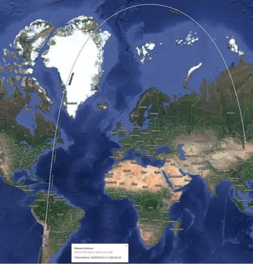
Shortest Route Map from Santiago, Chile to Ulaanbaatar, Mongolia
This map illustrates the shortest route from Santiago, Chile, to Ulaanbaatar, Mongolia, providing a visual representatio...
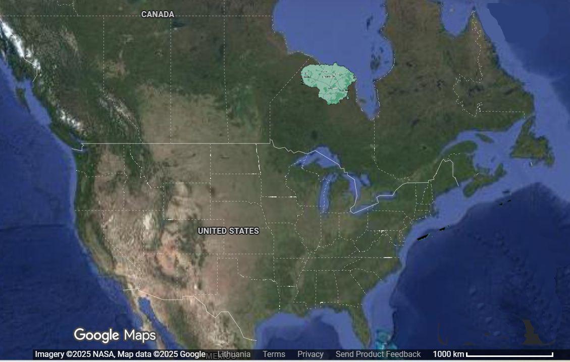
Lithuania Relocation 6000km West Map
This visualization intriguingly displays the geographical consequences of relocating Lithuania approximately 6,000 kilom...
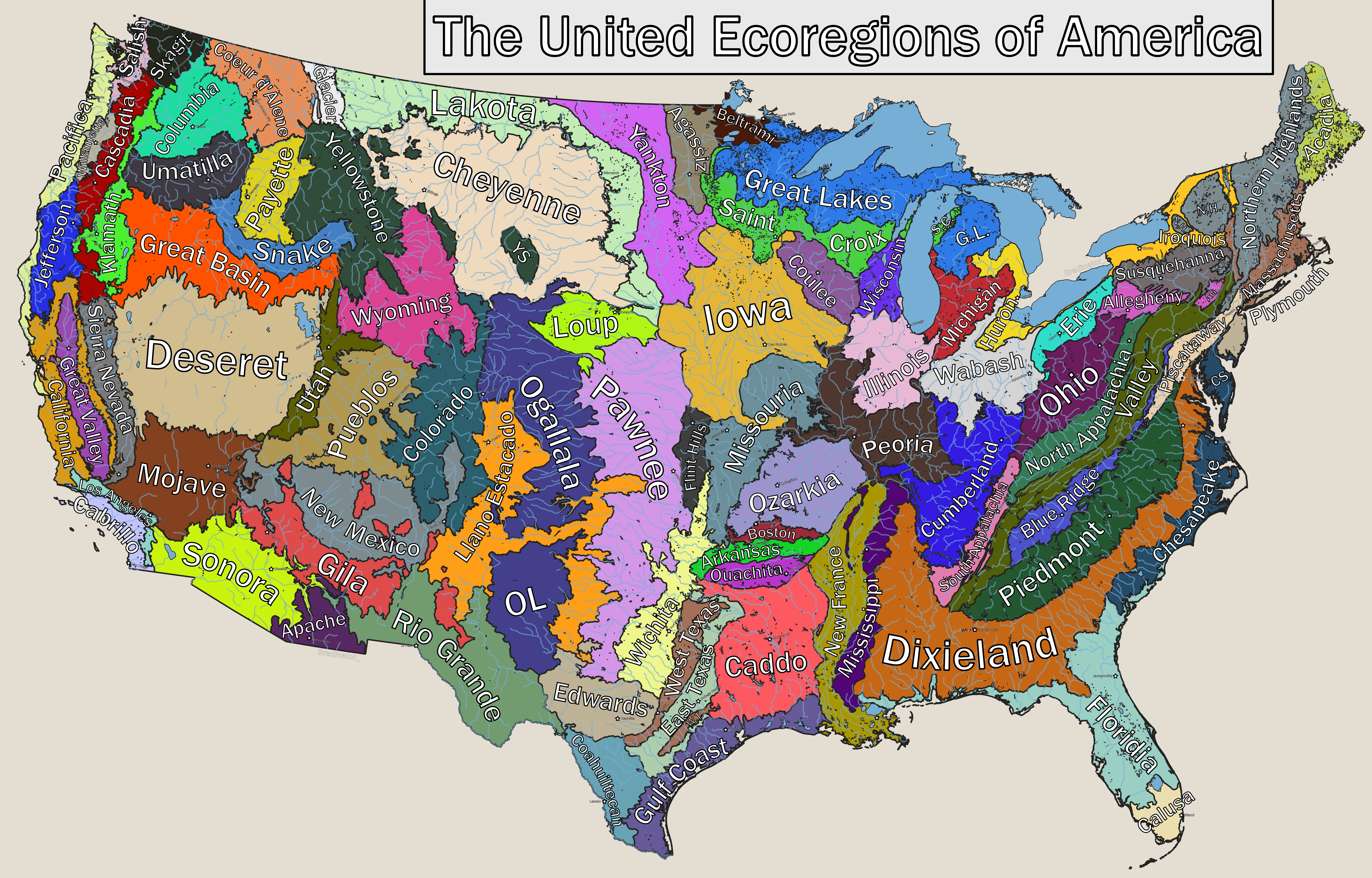
Ecoregions of America Map
...
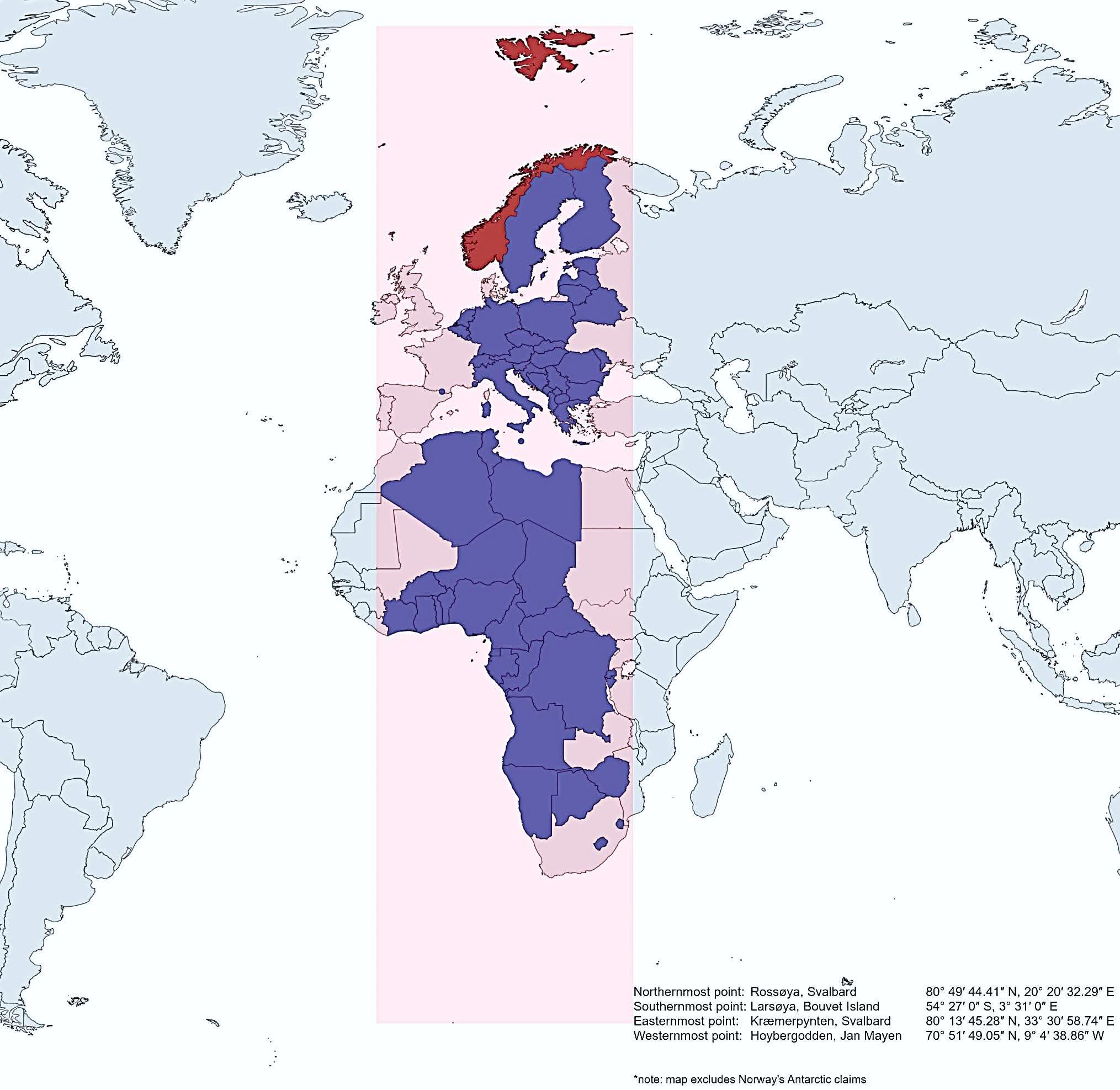
Map of Norway's Geographic Extent Compared to Other Countries
This map vividly illustrates how Norway extends further north, south, east, and west than several other countries, showc...
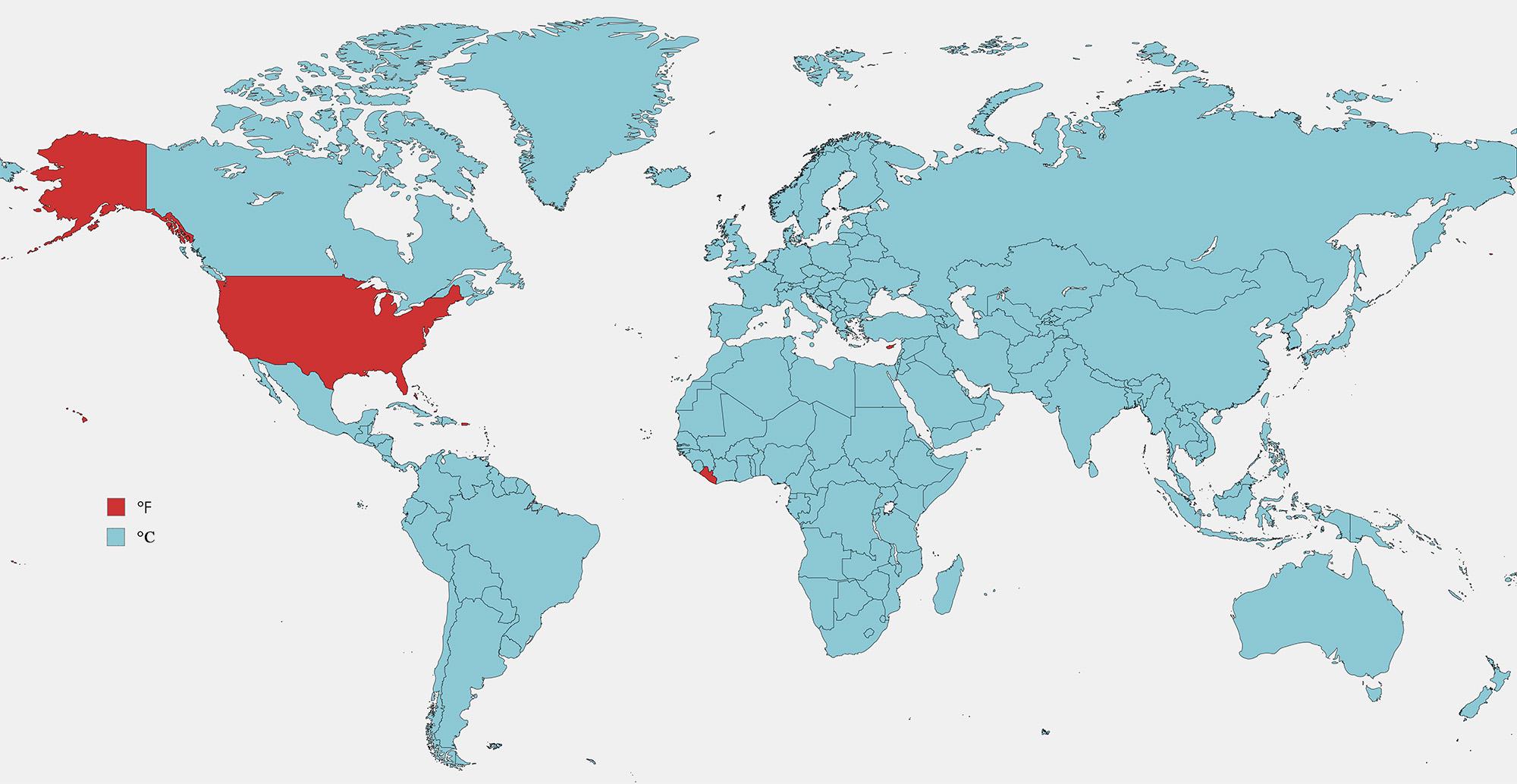
Fahrenheit vs Celsius Usage Map by Country
The visualization titled "Countries that Use Fahrenheit vs Celsius" provides a clear depiction of the global temperature...
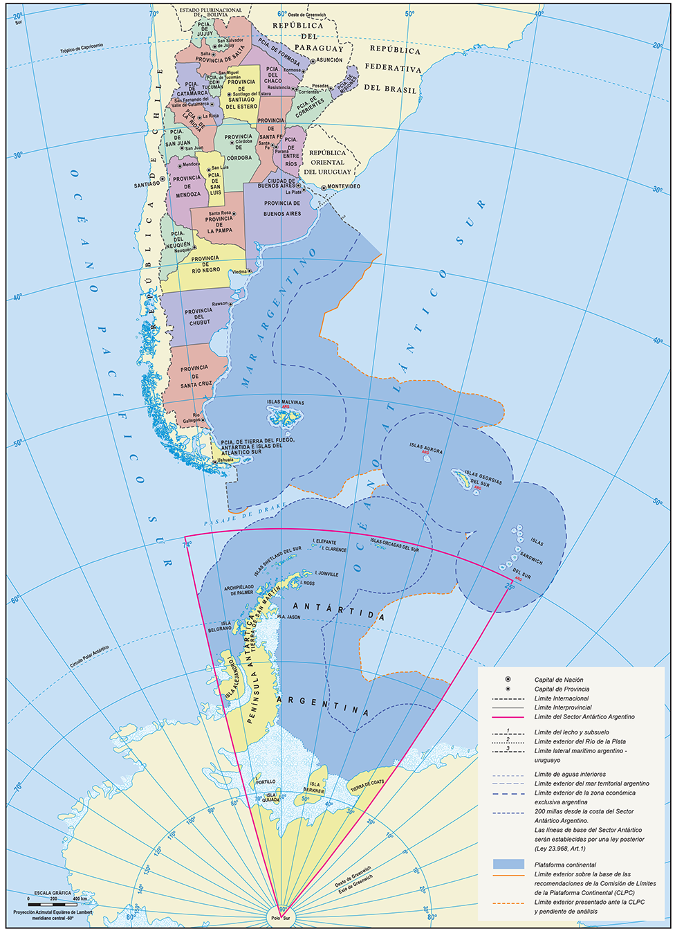
Official Map of the Argentine Republic
The official map of the Argentine Republic provides a comprehensive representation of the country's geographical feature...
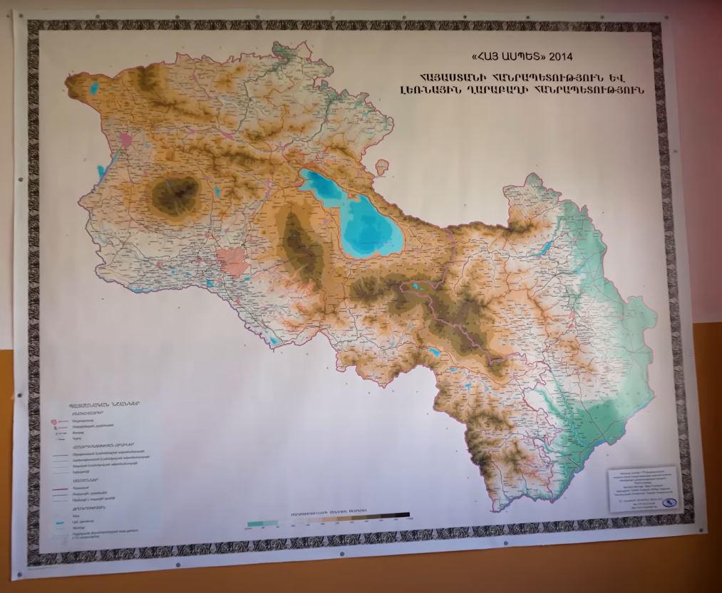
Map of Armenia in an Armenian School
This map provides a detailed overview of Armenia, highlighting its geographical features, political boundaries, and sign...
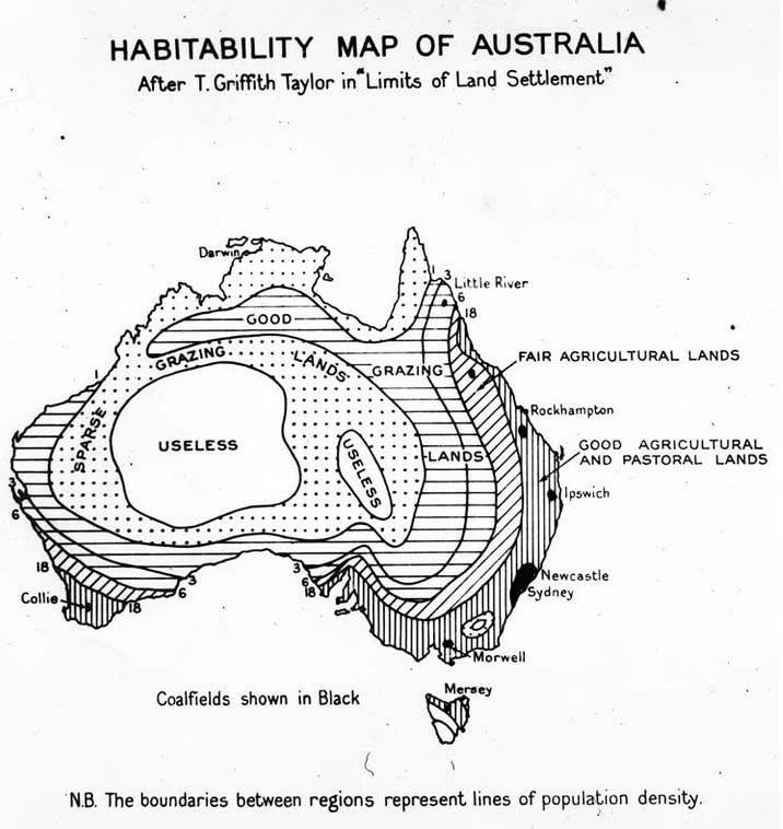
1946 Habitability Map of Australia
The 1946 Map of Australia that coded the "habitability" of the land presents a fascinating visual representation of the ...

Elevation Map of North America
The elevation map of North America provides a detailed visual representation of the continent's topography, showcasing t...
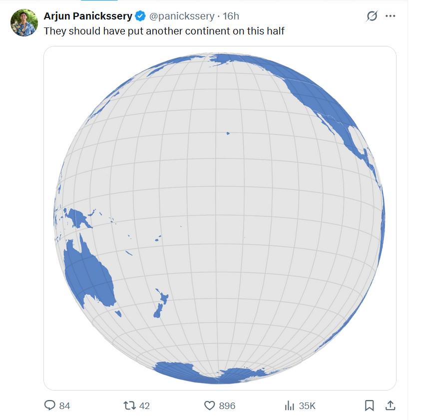
Continents Placement Map Analysis
Interestingly, the current configuration of the continents has been influenced by a myriad of factors, including plate t...
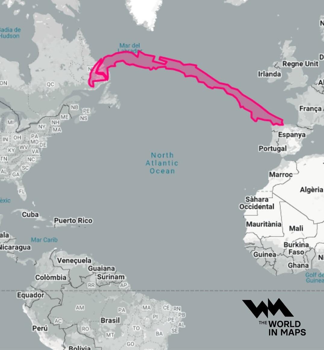
Geographical Length of Chile Map
The northern region of Chile is known for the Atacama Desert, one of the driest places on Earth, where annual rainfall i...
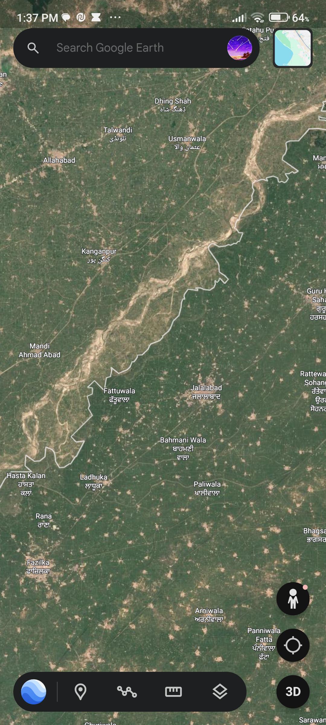
Greener Areas Near India-Pakistan Border Map
The visualization titled "Why is the grass greener on this side?" illustrates the stark contrast in vegetation along the...
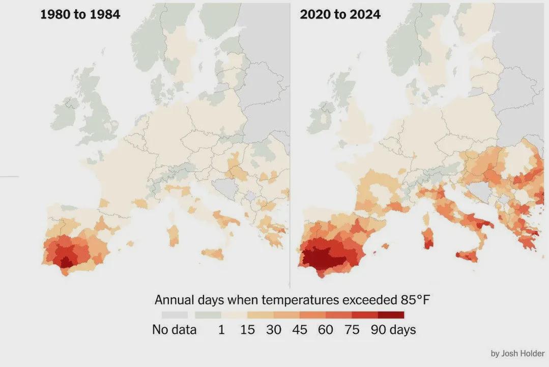
Days Over 30ºC in Europe Map
The visualization titled "Number of Days per Year When Temperatures Exceeded 30ºC (85°F) in Europe" provides a comprehen...
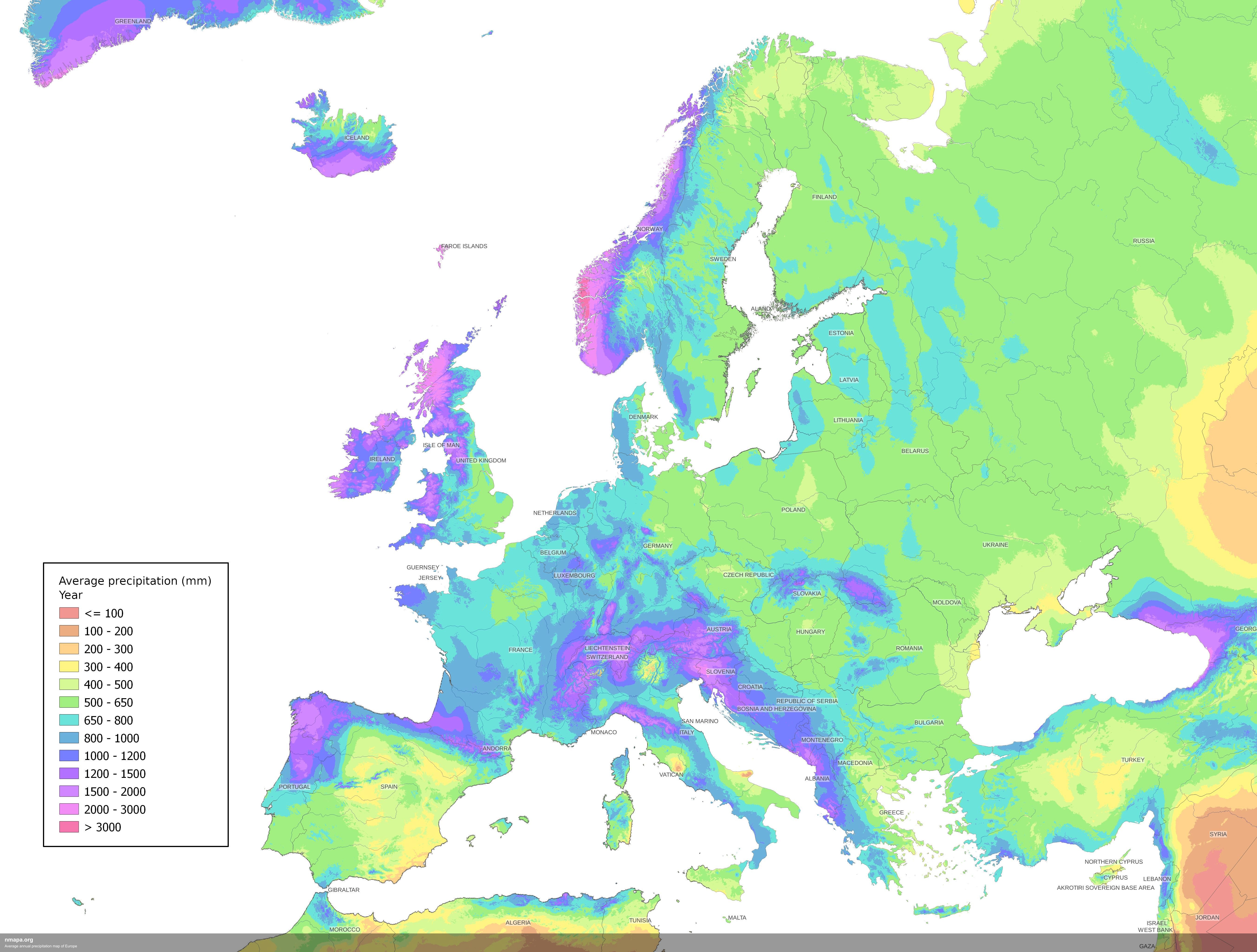
Average Annual Precipitation Map of Europe
The Average Annual Precipitation Map of Europe offers a detailed visualization of rainfall patterns across the continent...
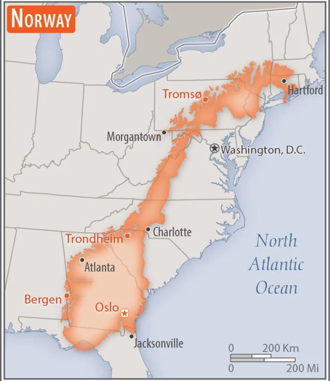
Norway Overlaid on the US Map
This intriguing map overlays the geographical boundaries of Norway onto the continental United States, providing a uniqu...
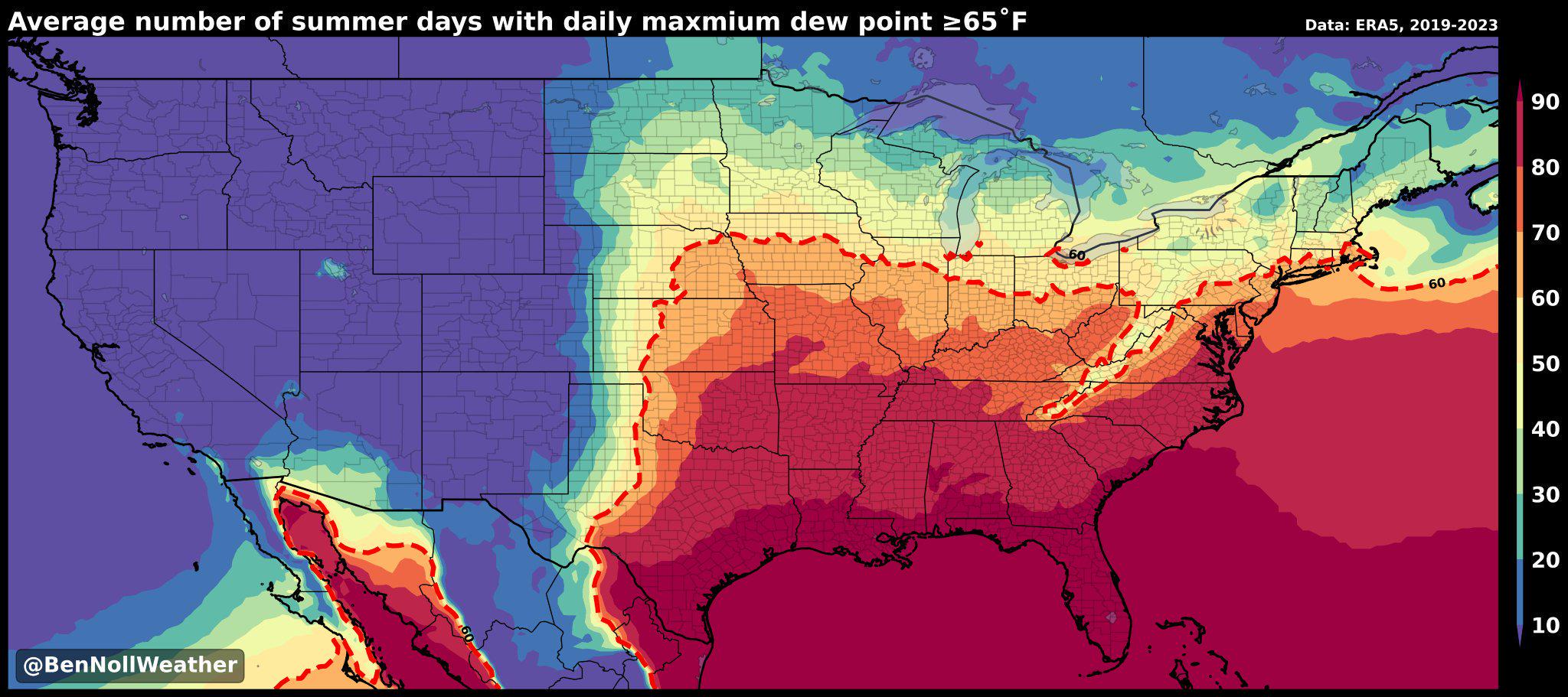
Humidity Belt Map of America
The "America's Humidity Belt" map visually represents the regions of the United States characterized by high humidity le...
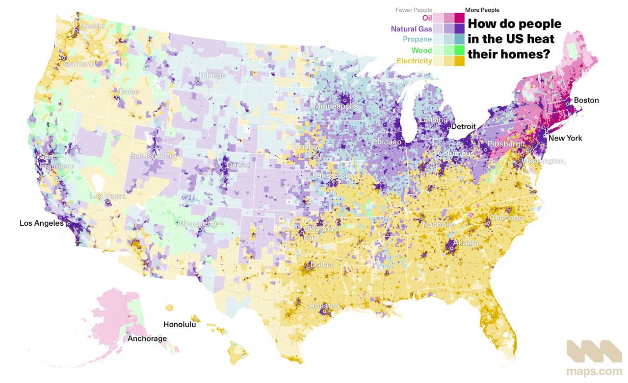
Home Heating Methods Across the United States Map
The visualization titled \...
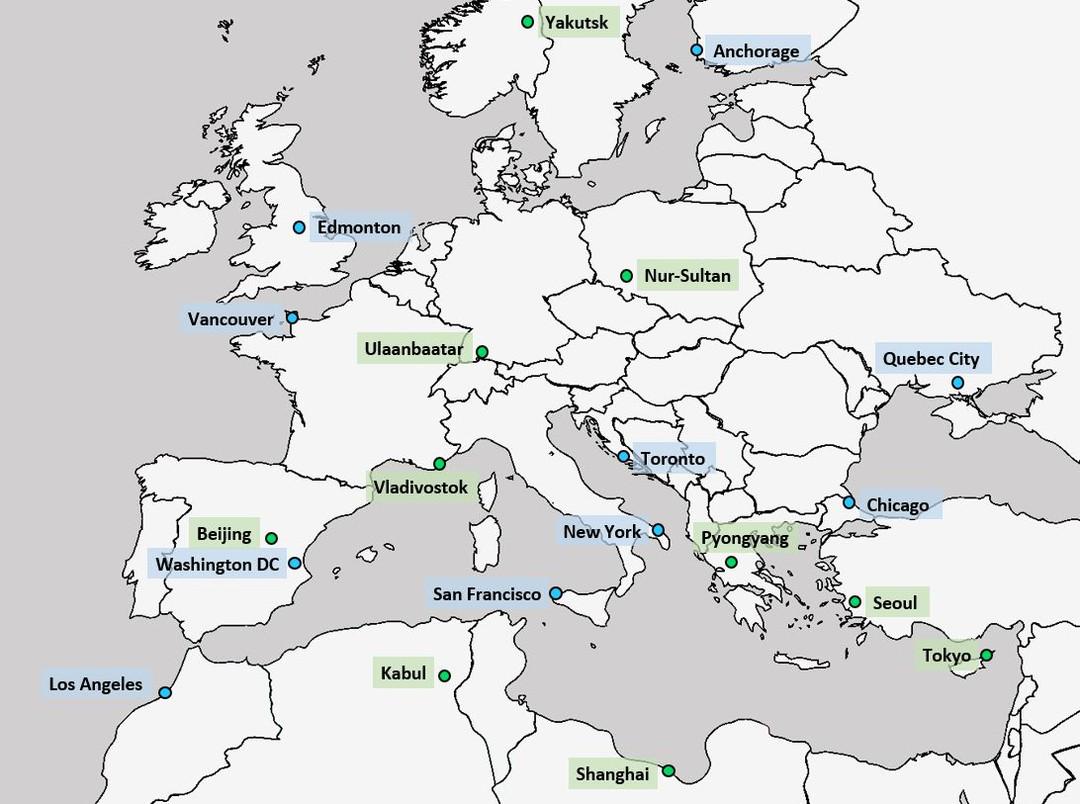
Latitude Comparison Map of Major World Cities
The latitude comparison map of major world cities with Europe illustrates the geographical positioning of various promin...
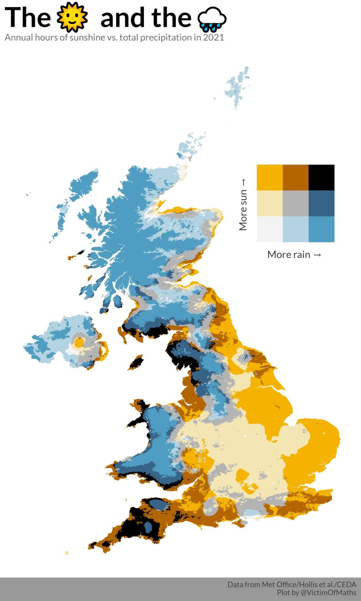
Sunshine Hours vs Rain in the UK Map
...
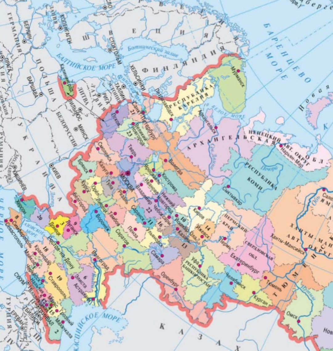
Geographical Features Map of Russia
This map serves as a comprehensive overview of the geographical features of Russia, highlighting its vast landscapes, fr...
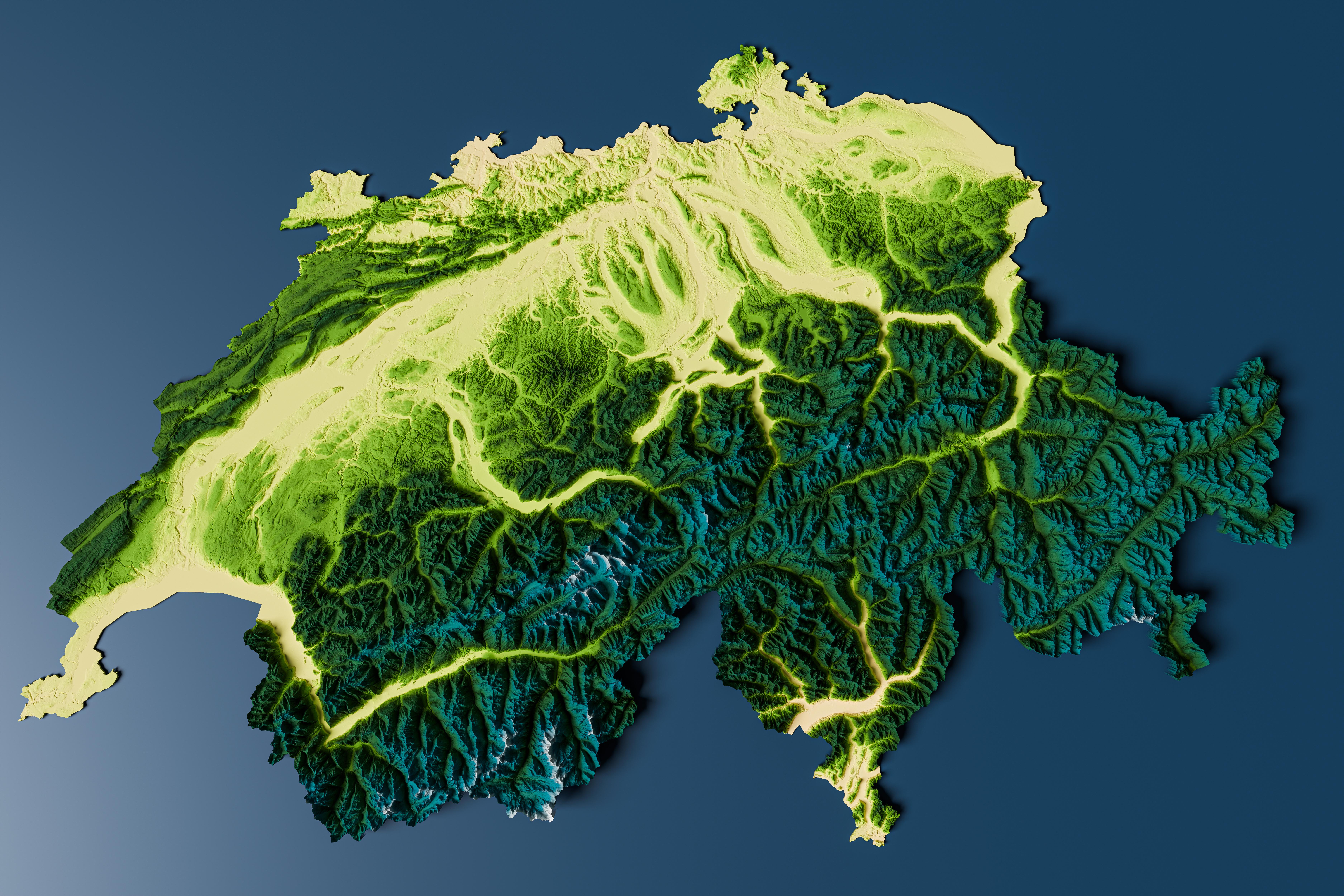
Topographic Relief Map of Switzerland
Interestingly, the topographical variation influences climate, biodiversity, and human settlement patterns. The highest ...
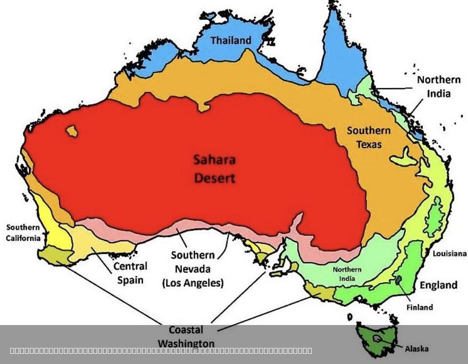
Climate Comparison Map of Australia and the World
The visualization titled "The Climate in Australia Compared to Other Places in the World" presents a comprehensive overv...
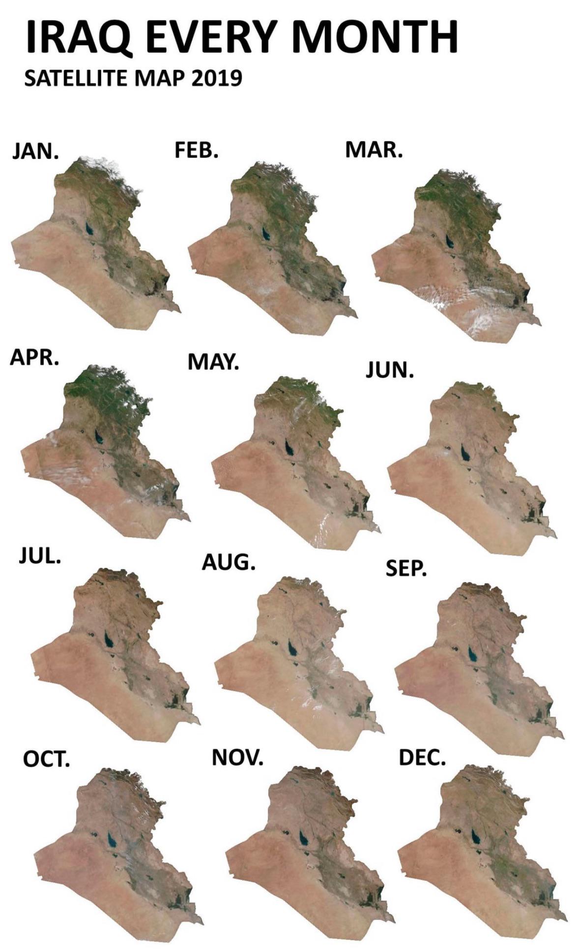
Iraq Seasonal Greenery Changes Map
This map visualizes how Iraq’s greenery fluctuates throughout the seasons, particularly focusing on satellite imagery ca...
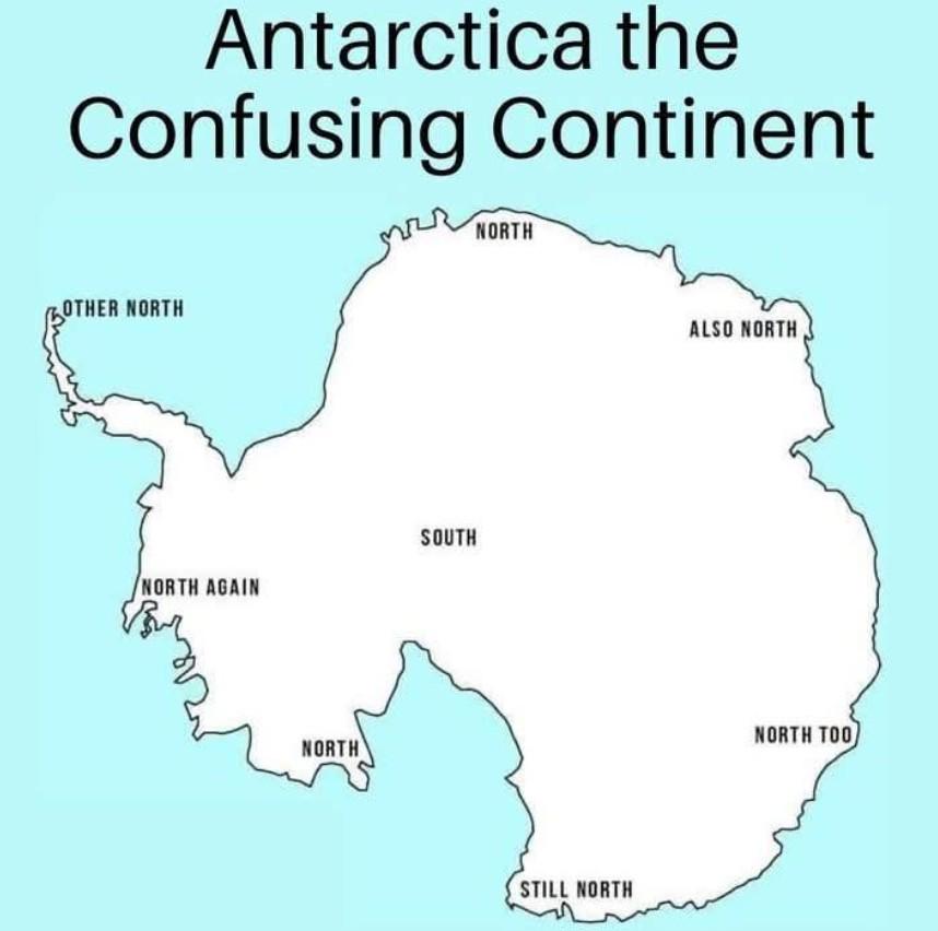
Western United States Geographic Features Map
The "Let's go west 😀" visualization provides a detailed overview of the geographic features of the Western United State...
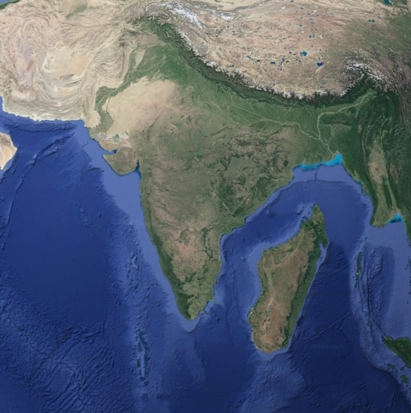
Geographical Map of Madagascar Next to India
The map titled "Geographical Map of Madagascar Next to India" provides a clear visual representation of the spatial rela...
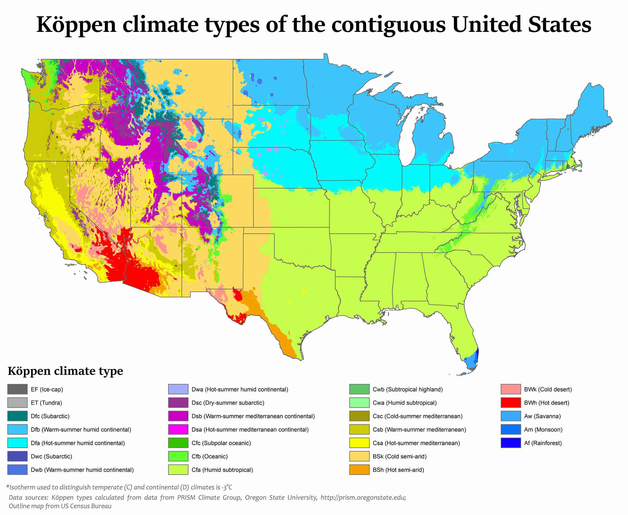
Köppen Climate Types Map of the USA
The map titled "USA is the most climatically diverse country in the world" presents a fascinating overview of the variou...
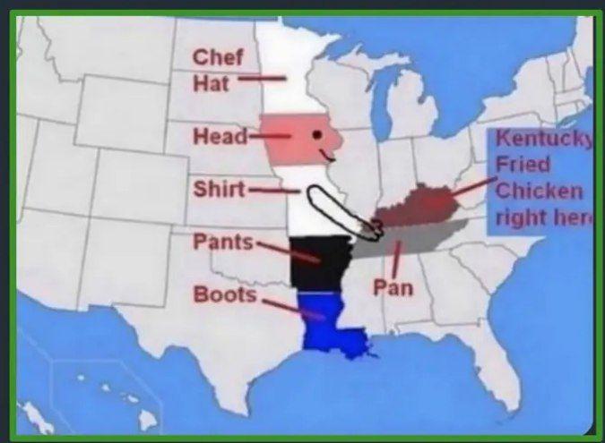
Kentucky Location Map
The Kentucky Location Map provides a clear and concise visual representation of the state of Kentucky within the United ...
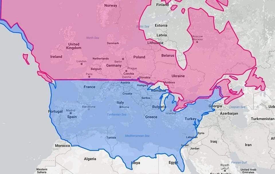
Latitude Map of United States, Canada, and Europe
The visualization titled "United States & Canada in same latitude w/ Europe" highlights the parallels of latitude that c...
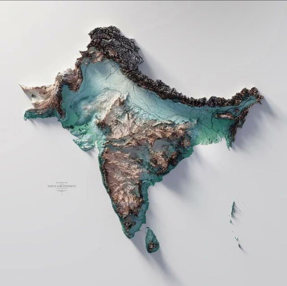
Geographical Map of the Indian Subcontinent
The Indo-Gangetic Plain, one of the most densely populated regions in the world, is another striking feature of the subc...
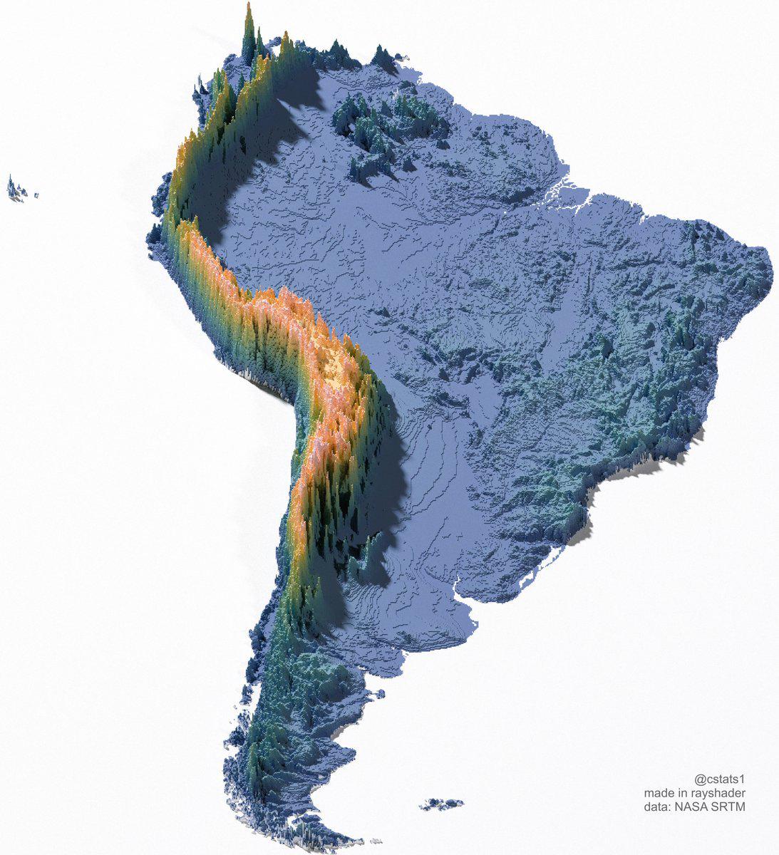
Great Wall of South America Map
The "Great Wall of South America" map visualizes a unique geographical phenomenon, showcasing the extensive network of n...
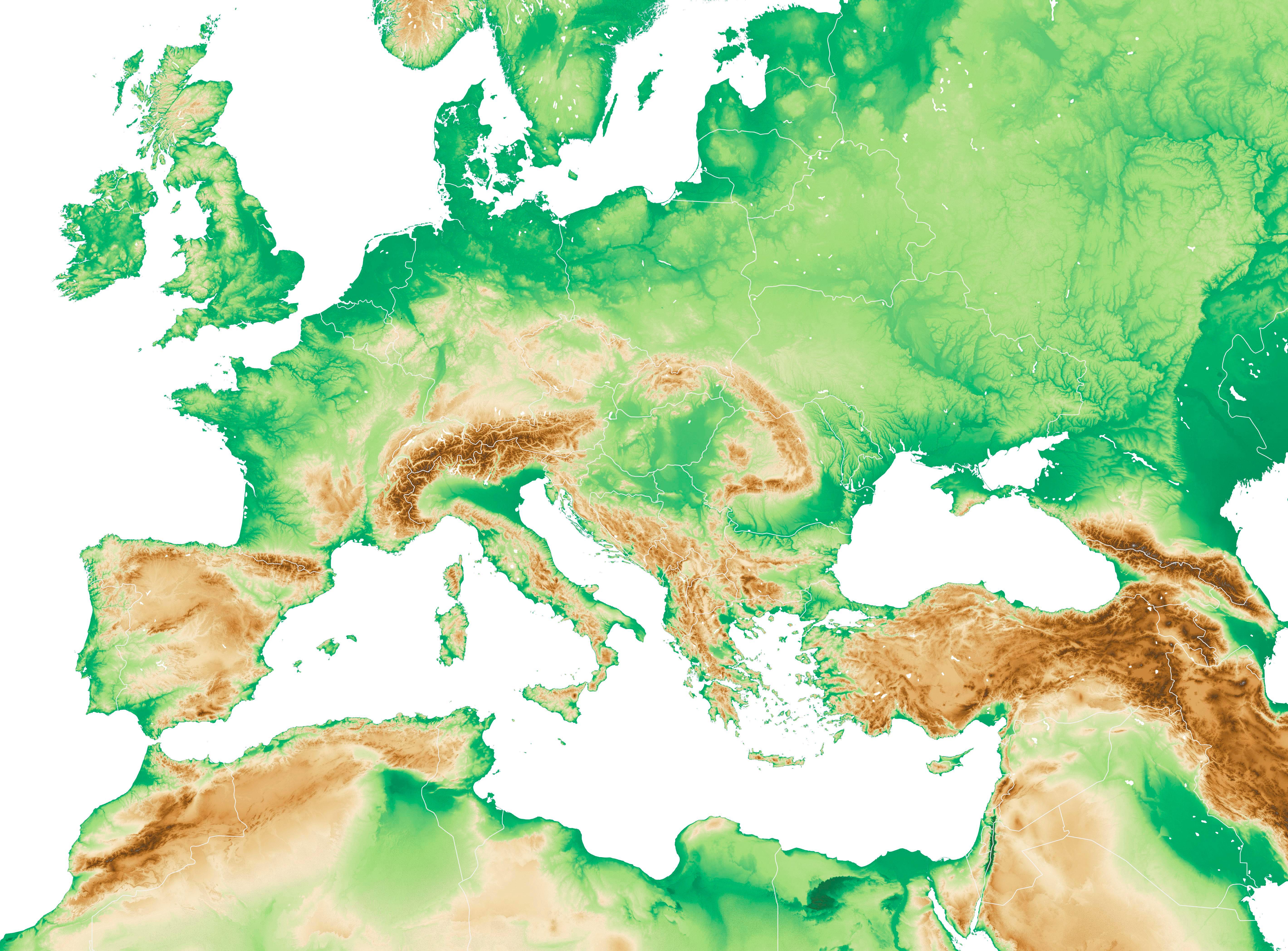
Physical Map of Western Europe and the Mediterranean Region
The physical map of Western Europe and the Mediterranean region provides a detailed representation of the diverse geogra...
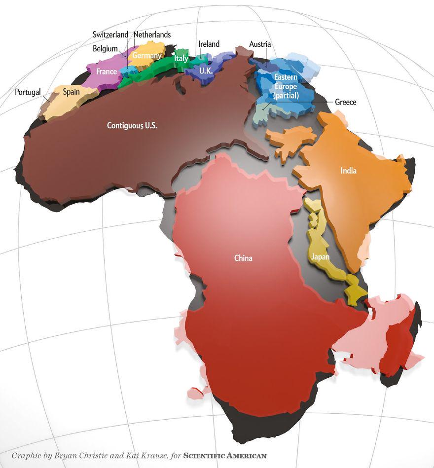
Actual Size of Africa Map
The 'Actual Size of Africa Map' presents a striking visual representation that highlights the continent’s true dimension...
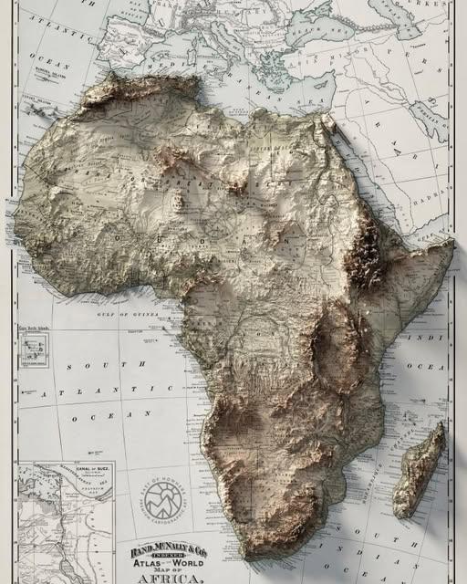
Topographic Map of Africa
The topographic map of Africa is a fascinating representation of the continent's varied landscapes, showcasing its mount...
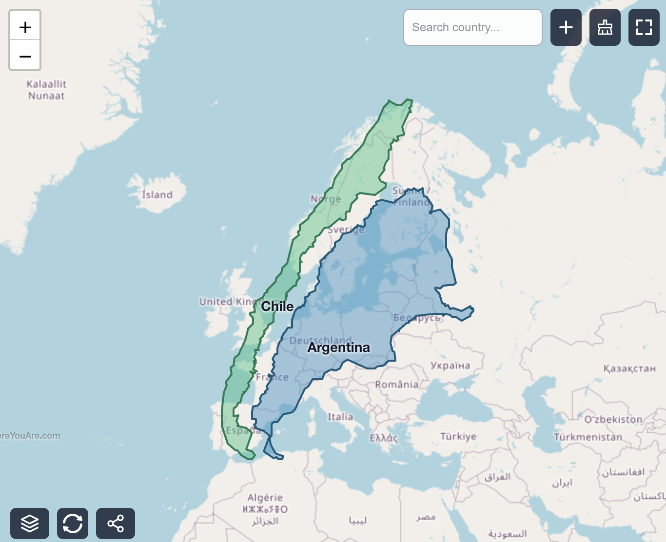
Chile and Argentina Size Comparison Map
This map provides a striking visualization of the sheer size of Chile and Argentina by overlaying them onto Europe. At f...
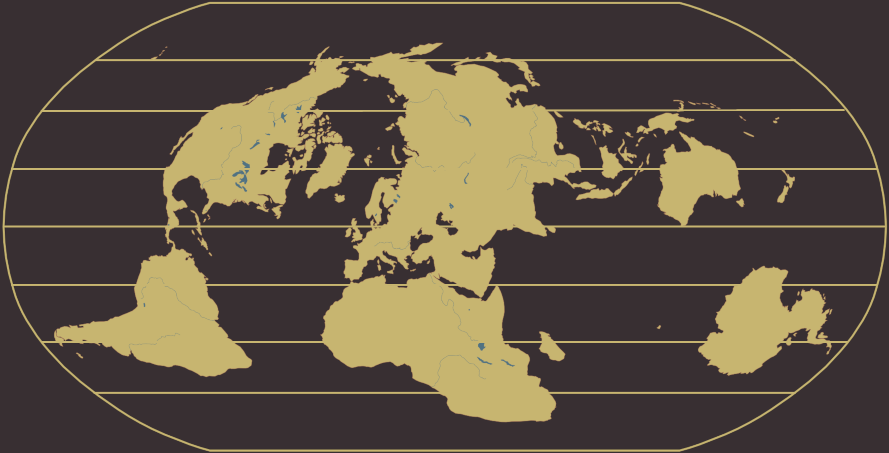
Robinson Projection Map with Europe at the Equator
The equatorial region is known for its hot and humid climate, with little seasonal variation. Rainforests thrive in thes...
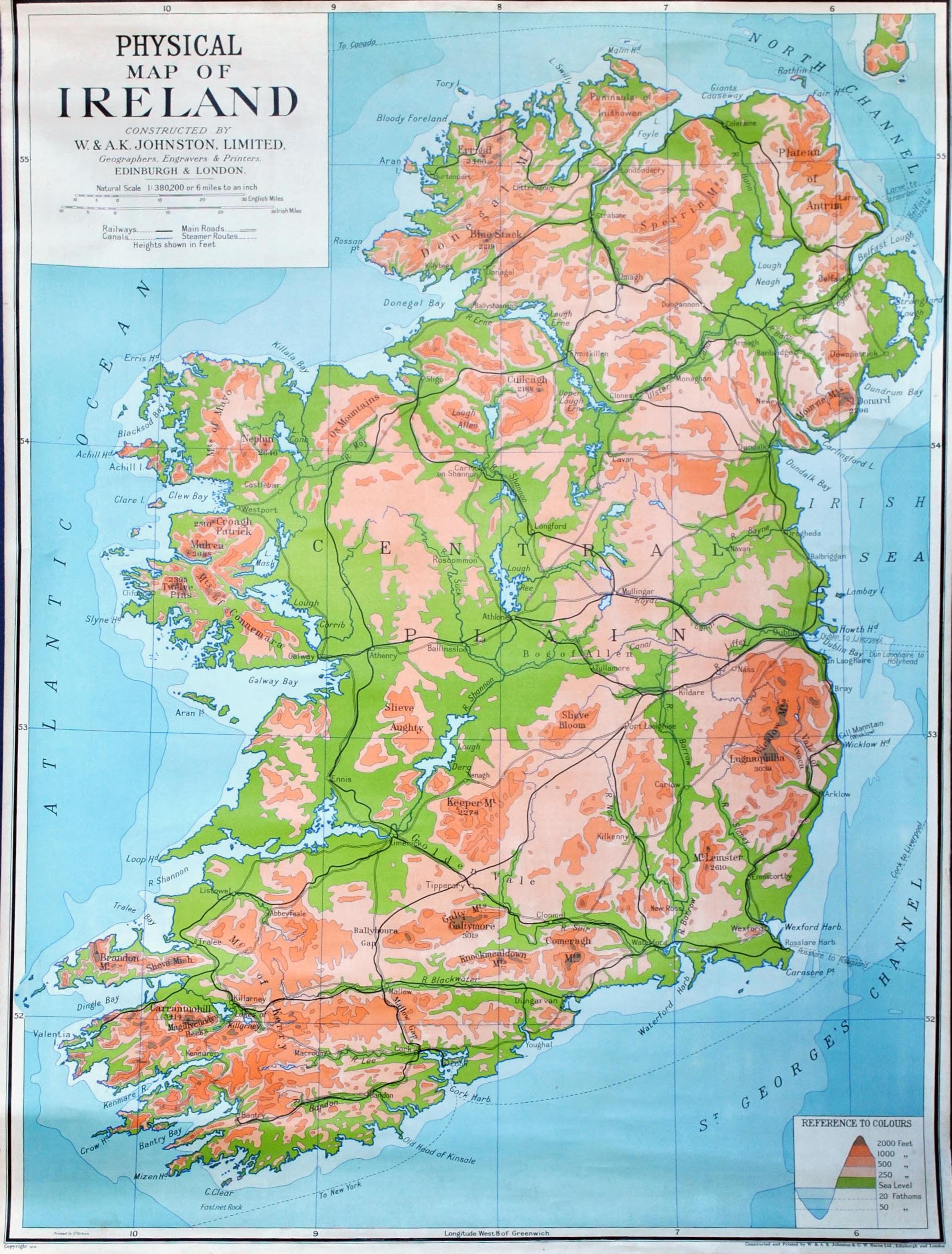
Physical Map of Ireland
The country’s rivers, such as the River Shannon—the longest river in Ireland—play a crucial role in both the ecology and...
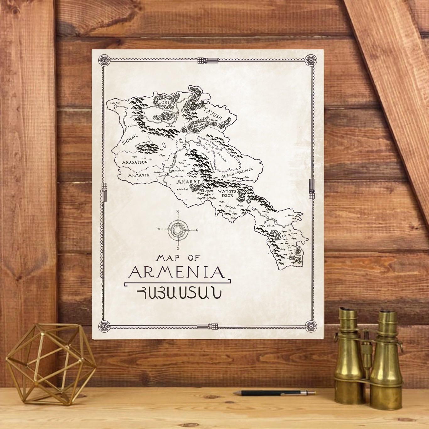
Hand-Drawn Map of Armenia in Tolkien Style
This hand-drawn map of Armenia, inspired by the intricate style of J.R.R. Tolkien, presents a whimsical yet accurate por...
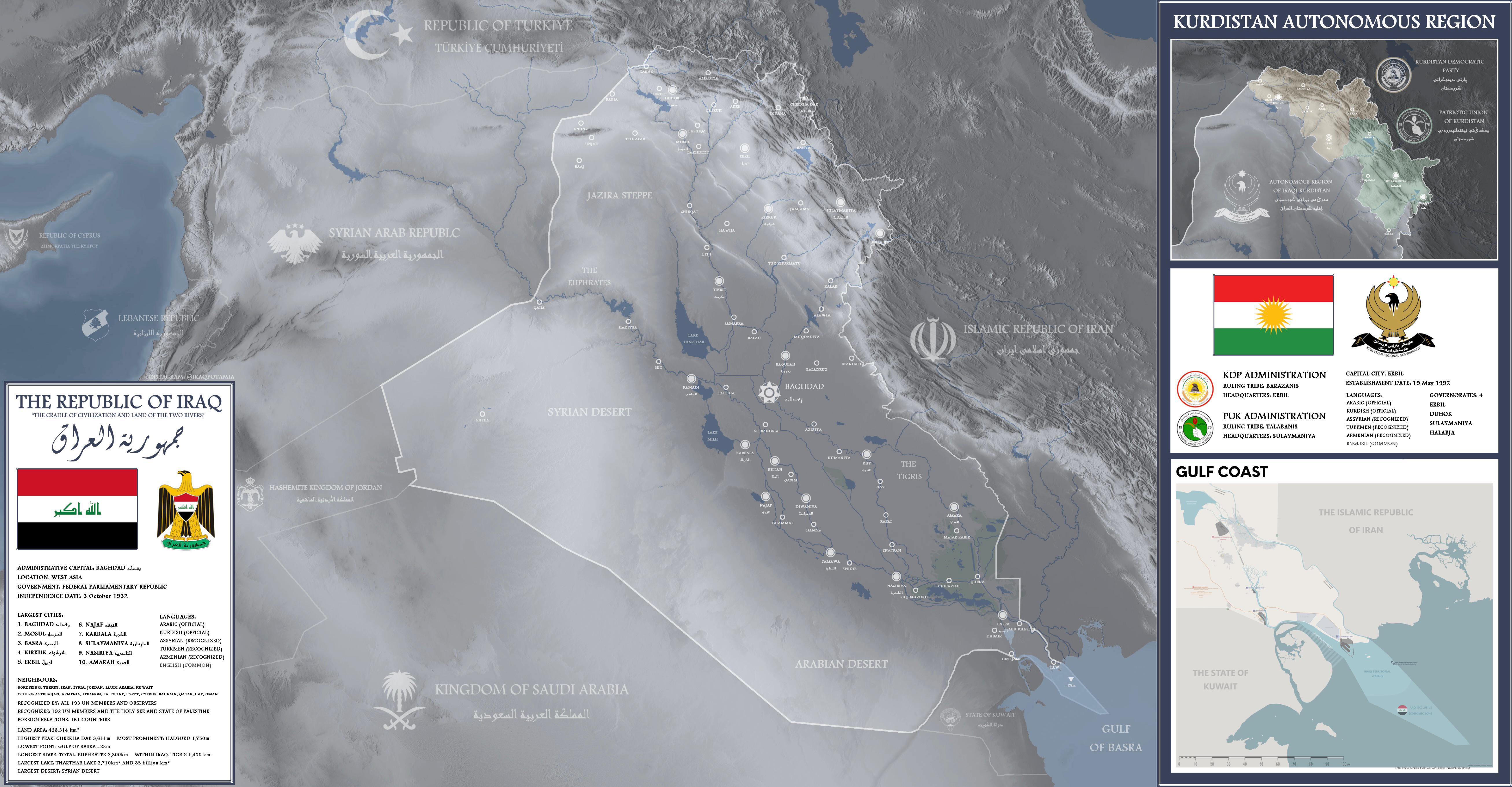
Detailed Map of Iraq
This detailed map of Iraq provides a comprehensive overview of the country's geographical features, including major citi...
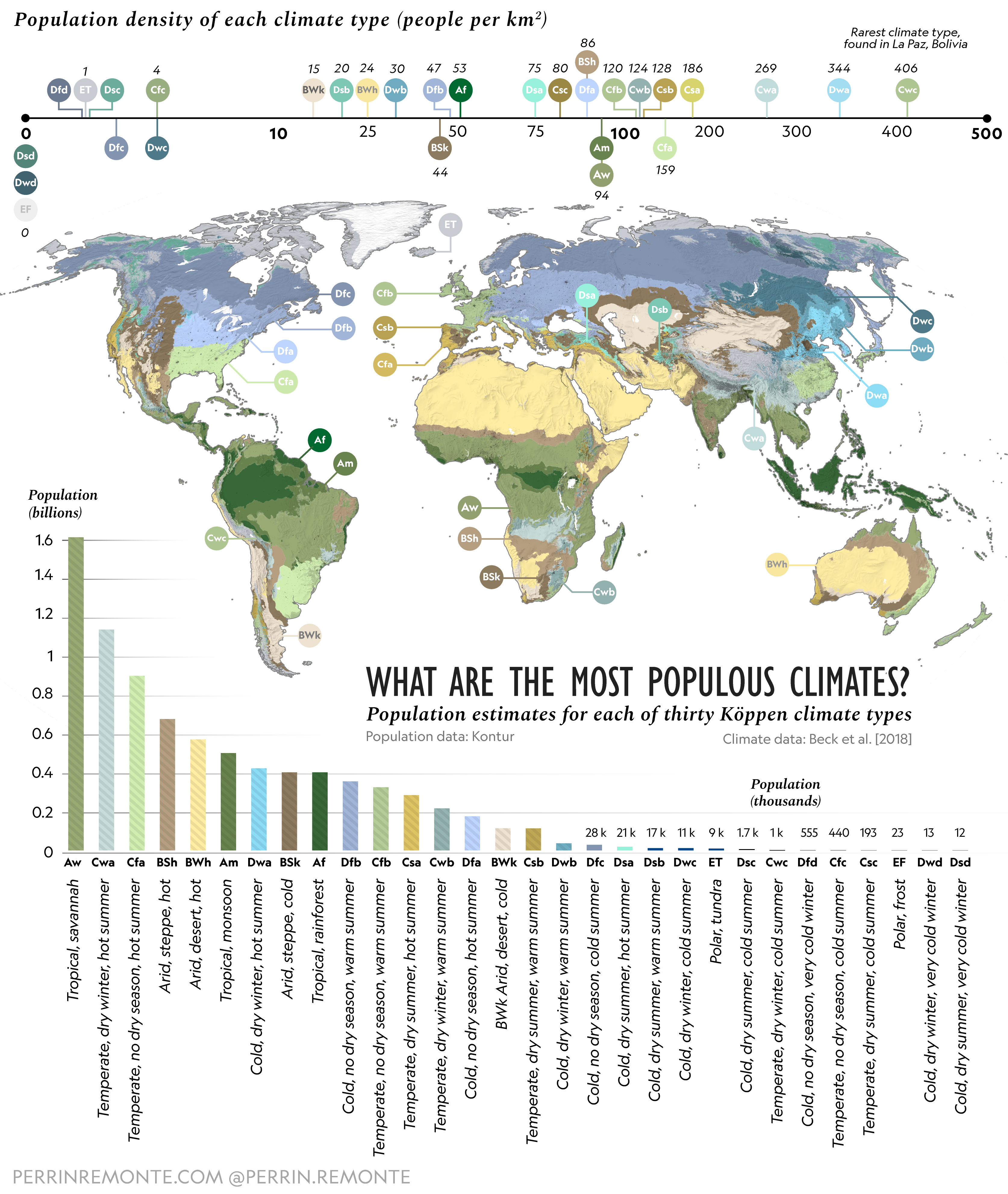
Most Populous Climates on Earth Map
This map provides an updated visualization of the most populous climates on Earth, highlighting the regions where human ...
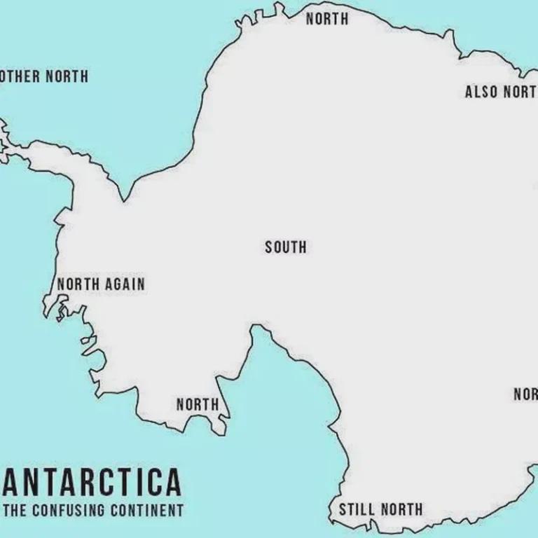
Map of Misleading Geographic Information
The visualization titled "Not so false?" reveals the prevalence of misleading geographic information across various regi...
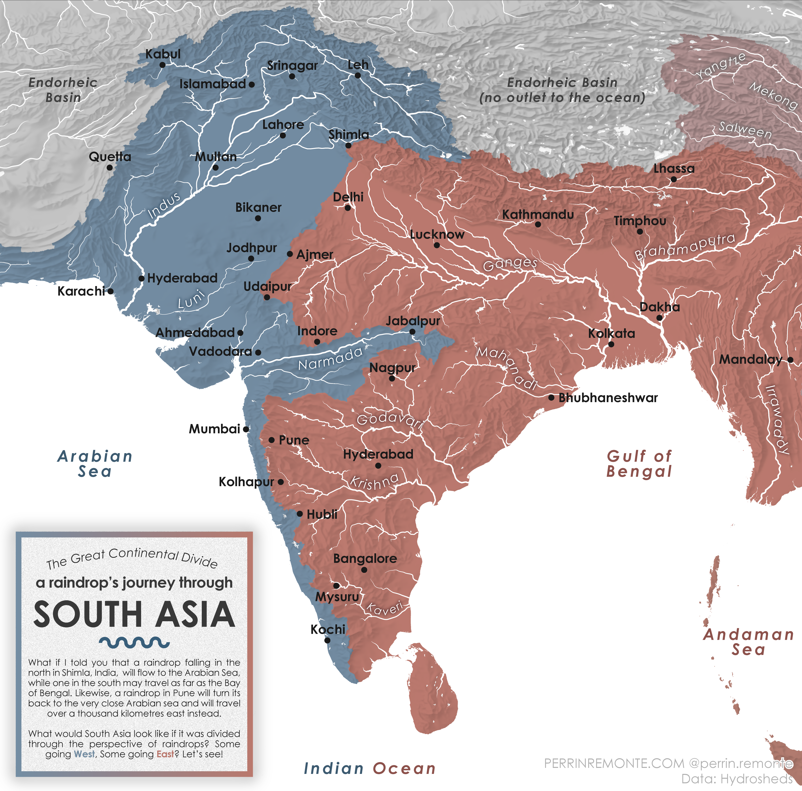
Water Cycle Journey Map of South Asia
The visualization titled "A Raindrop's Journey through South Asia" provides an intriguing look at the water cycle within...
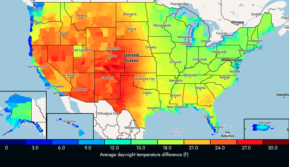
US Average Day-Night Temperature Change Map
The visualization titled "US Average Day-Night Temperature Change in F" illustrates the differences between daytime and ...
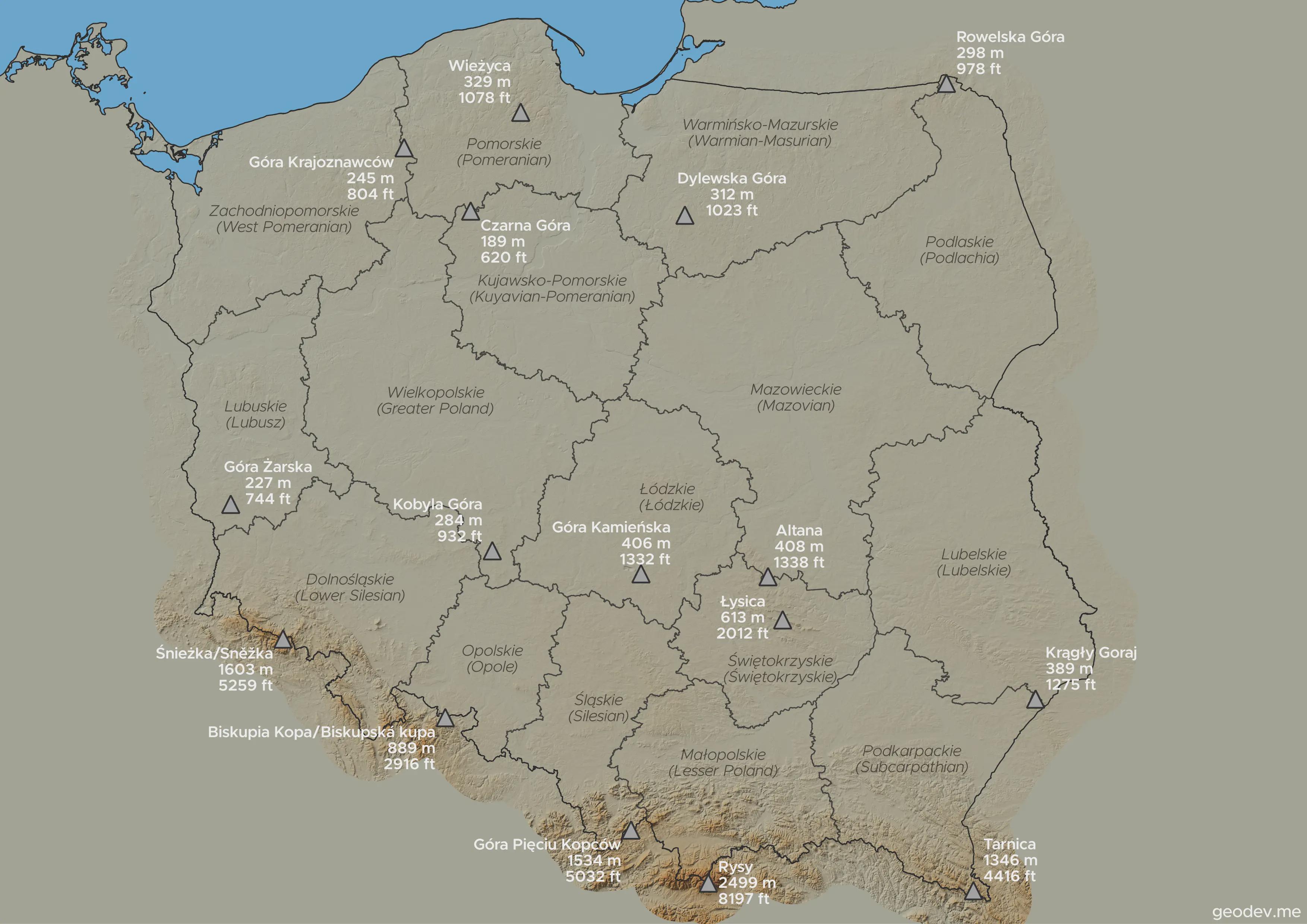
Highest Points in Each Voivodeship Map
This visualization highlights the highest points in every voivodeship in Poland, showcasing the diverse topography acros...
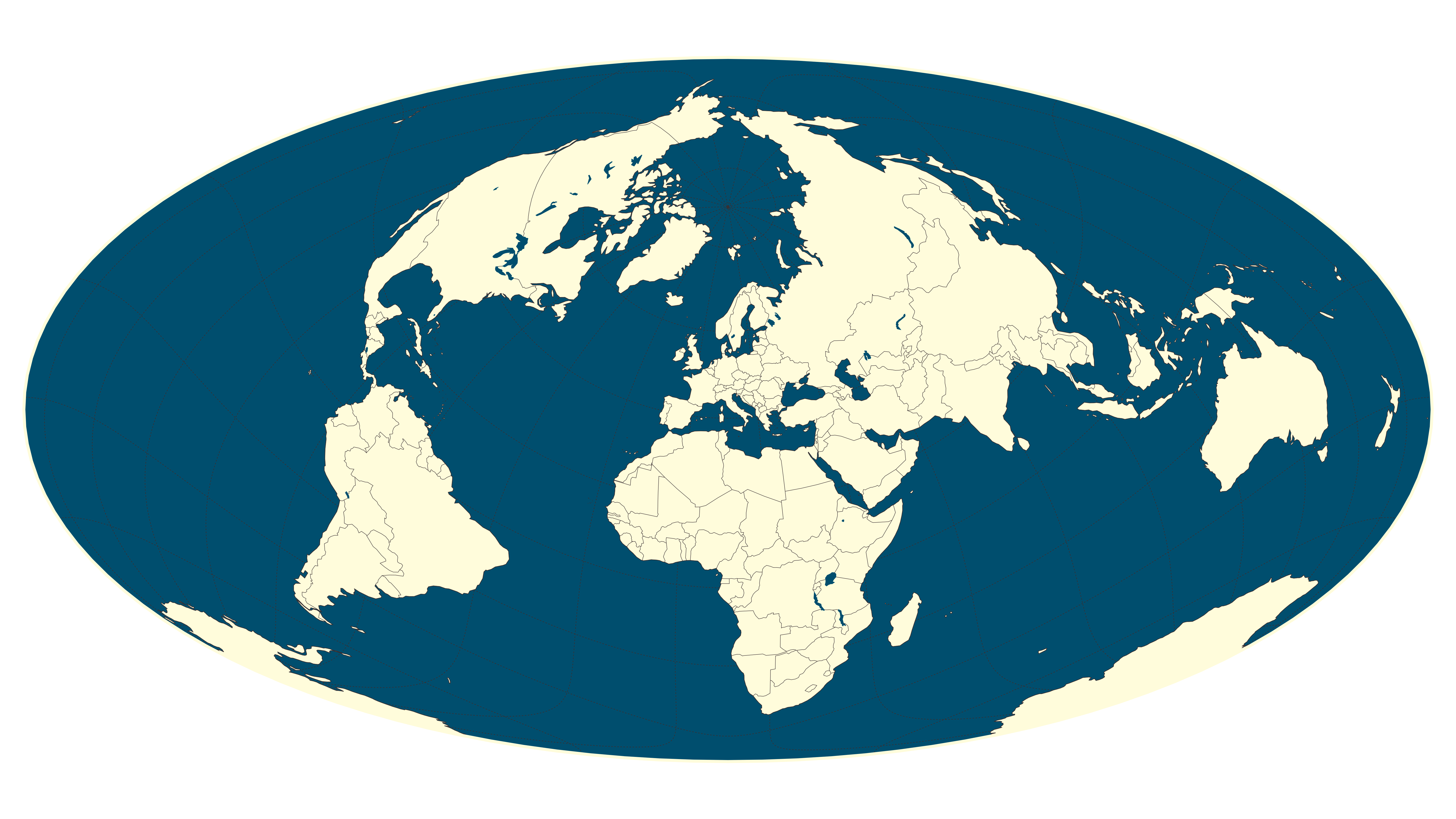
Hammer Projection Equal-Area Map of Europe
The Hammer projection is an equal-area map that provides a unique perspective of Europe, centering on the continent whil...
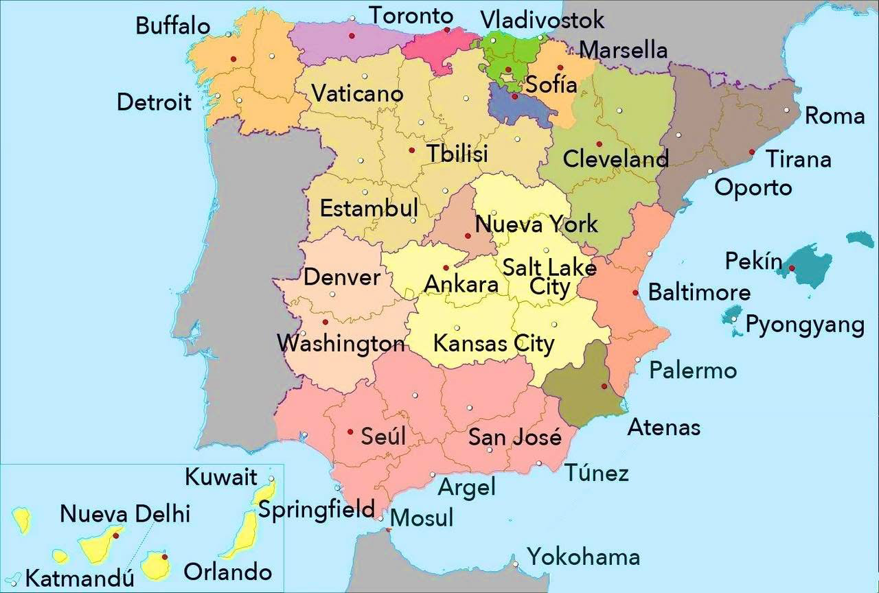
World Cities with Similar Latitude to Spanish Cities Map
This map presents a fascinating comparison of various world cities that share similar latitudes with cities in Spain. Ea...
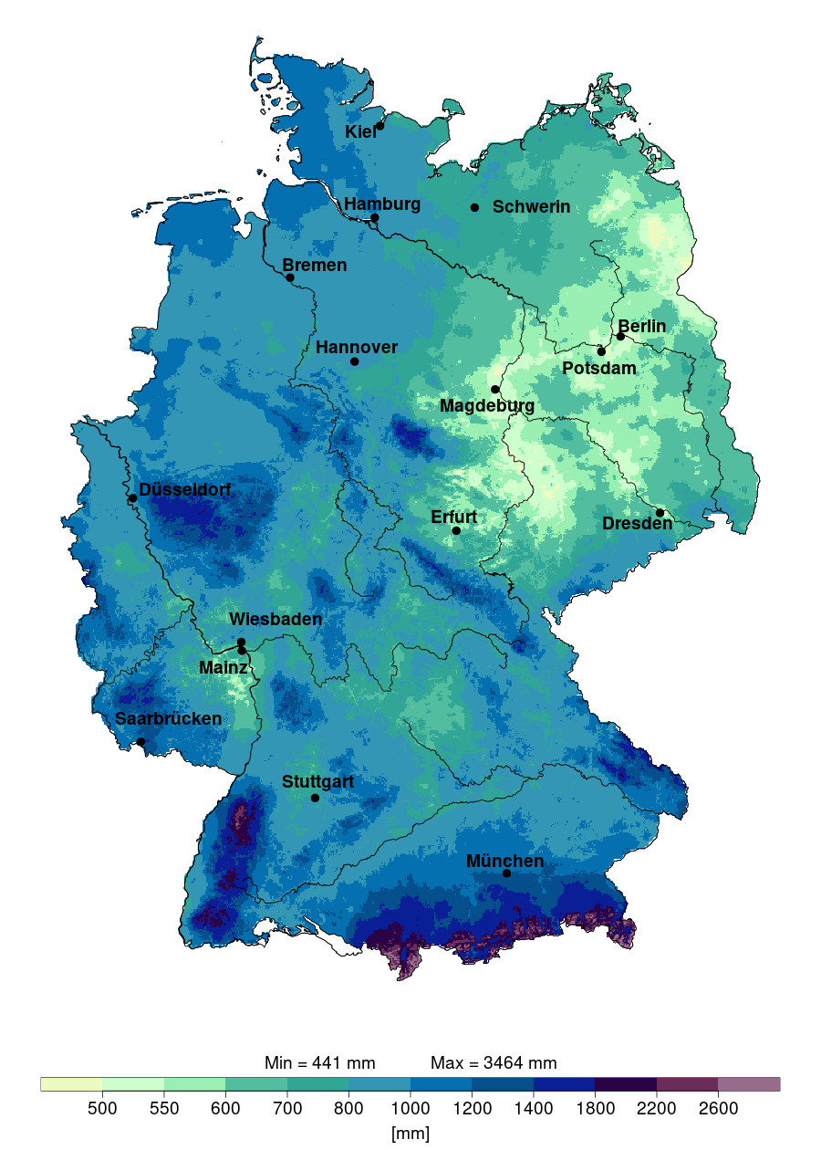
Annual Precipitation Map of Germany 2024
The "Annual Precipitation in Germany in 2024" map provides a detailed visualization of the expected rainfall distributio...

North Korea Map Projection and Geography Overview
The visualization titled "The World Map projection in North Korea. You are not Western anymore!" presents a unique persp...
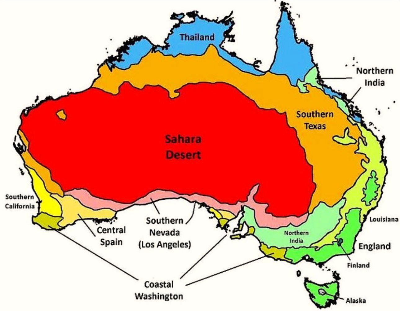
Australia’s Climate Compared to Other Countries Map
The map titled "Australia’s Climate Compared to Other Countries" provides a detailed look at how Australia's climate sta...
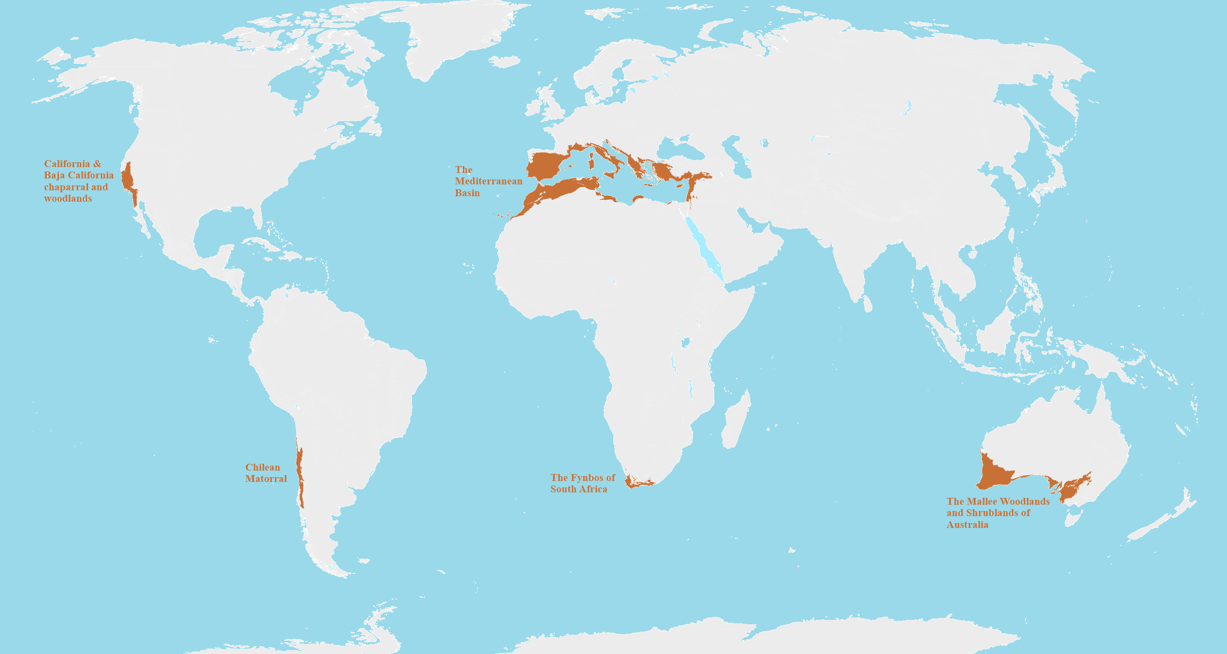
Mediterranean Biomes Around the World Map
This map provides a detailed visualization of Mediterranean biomes across the globe, highlighting regions that share sim...
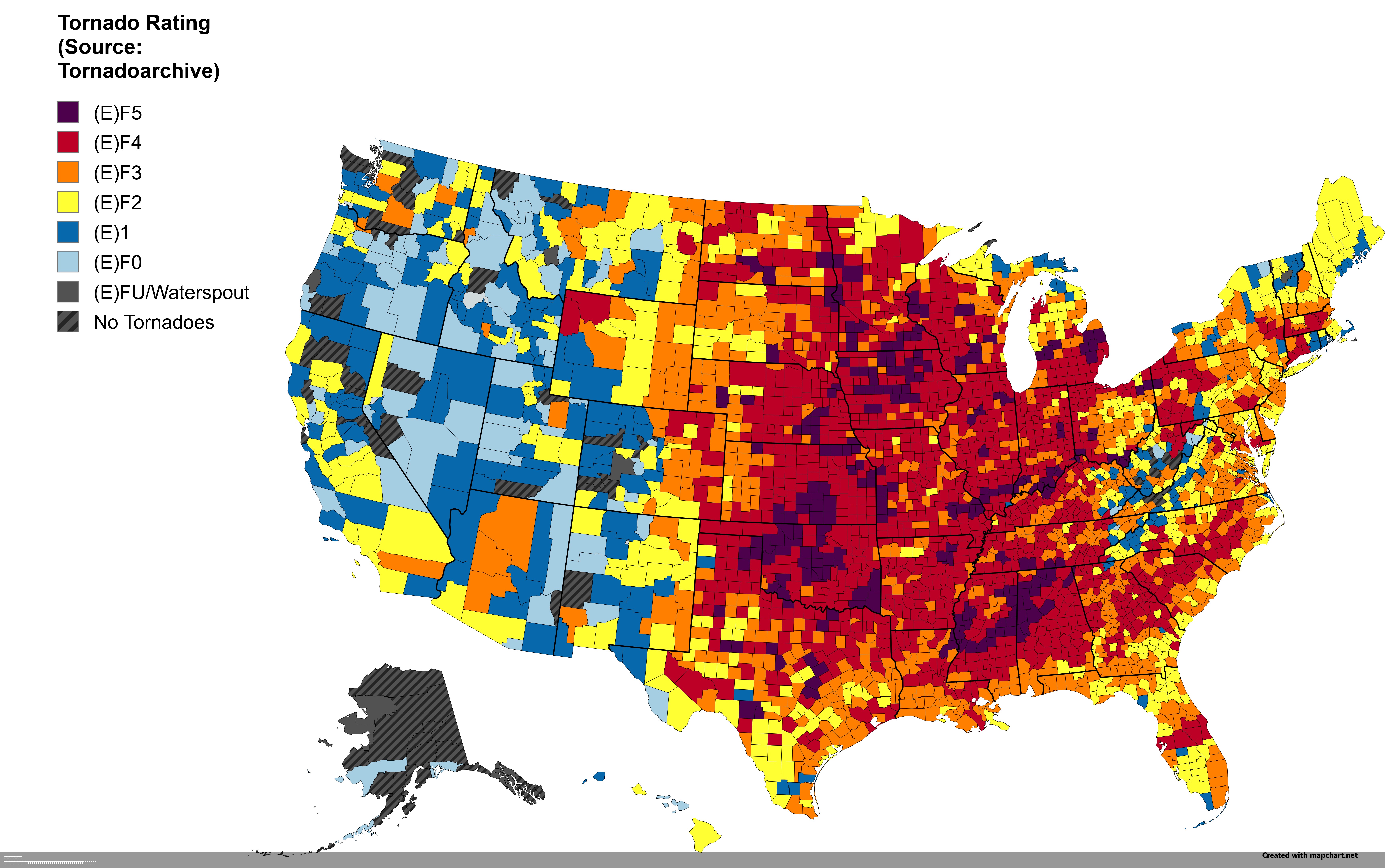
Strongest Tornado by US County Map
This intriguing visualization displays the strongest tornado recorded in each U.S. county. Tornadoes, nature's most viol...