Hand-Drawn Map of Armenia in Tolkien Style

Marcus Rodriguez
Historical Geography Expert
Marcus Rodriguez specializes in historical cartography and geographic data analysis. With a background in both history and geography, he brings unique...
Geographic Analysis
What This Map Shows
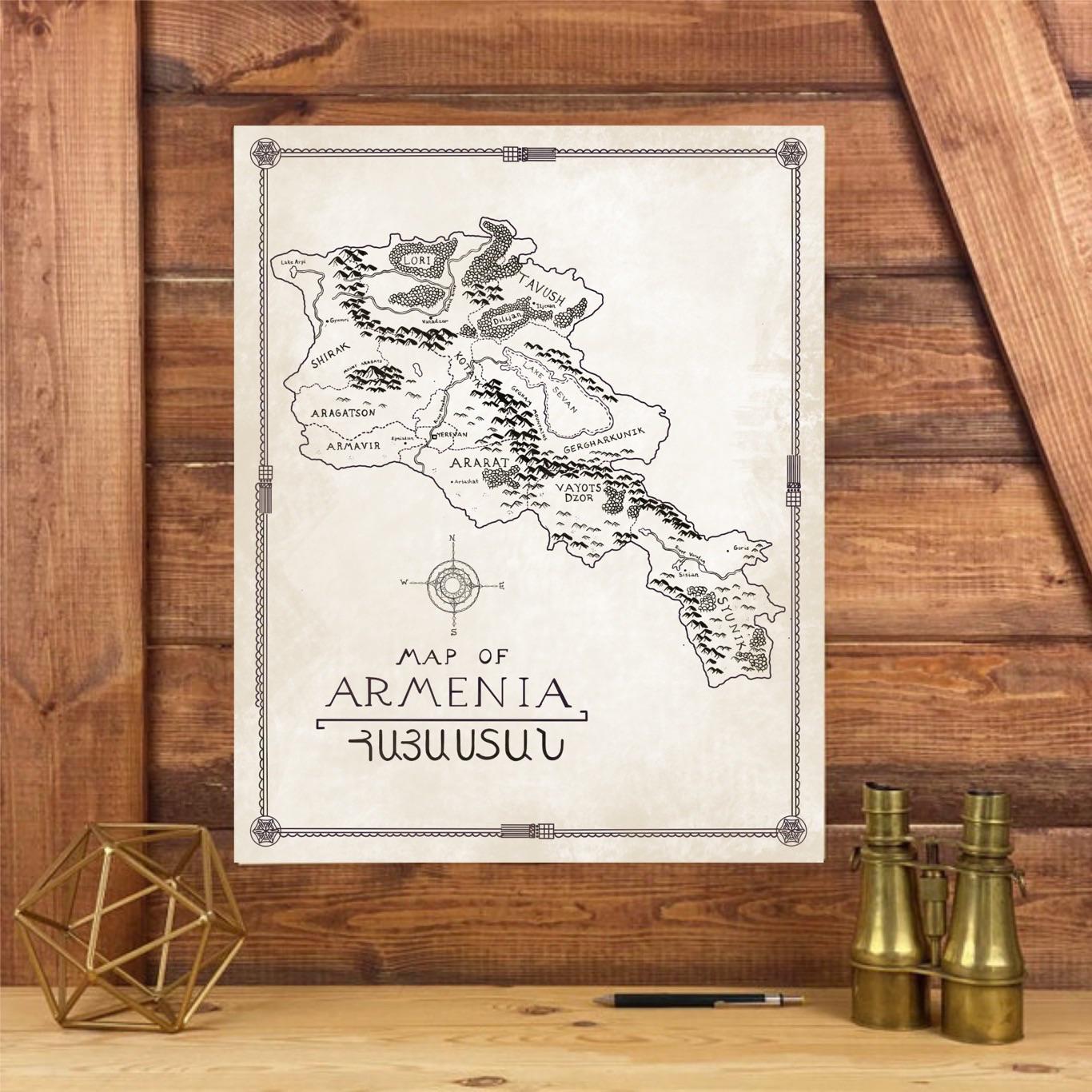
This hand-drawn map of Armenia, inspired by the intricate style of J.R.R. Tolkien, presents a whimsical yet accurate portrayal of the country's geographical features, cultural landmarks, and historical sites. The map illustrates Armenia's mountainous terrain, the flow of its rivers, and the locations of significant towns and cities, all rendered in a way that evokes the artistry of a fantasy world. However, beneath its fantastical aesthetics lies a rich tapestry of Armenia's real-world geography, which tells a story of a nation steeped in history and natural beauty.
Deep Dive into Armenia's Geography
Armenia is a landlocked country located in the South Caucasus region of Eurasia, bordered by Turkey, Georgia, Azerbaijan, and Iran. What’s fascinating is that despite its small size—approximately 29,743 square kilometers—Armenia boasts a diverse range of geographical features. The country is primarily mountainous, with the Lesser Caucasus mountains dominating the landscape. Mount Ararat, an iconic symbol of Armenia, rises majestically at 5,137 meters and is a significant cultural reference point, even though it is located across the border in Turkey.
Armenia's rivers, such as the Hrazdan and the Akhtsu, play a crucial role in its ecosystem. The Hrazdan, for instance, is a vital waterway that provides irrigation and supports agriculture in the Ararat Valley. Interestingly, the country's rivers are often seasonal, with flow patterns heavily influenced by snowmelt in the spring. The historical importance of these rivers cannot be overstated; they were essential for the development of early civilizations in the region.
The climate of Armenia varies significantly across its geography. The country experiences a continental climate, characterized by hot summers and cold winters. In the lowlands, temperatures can soar above 30°C in July, while the mountainous regions can see snow and freezing temperatures in winter. This climatic diversity supports a variety of flora and fauna, making Armenia's natural landscapes vibrant and rich. For instance, the Ararat Plain is known for its agricultural productivity, particularly in growing fruits like apricots, while the highlands support unique ecosystems of endemic species.
Regional Analysis
To understand Armenia's geography more deeply, we can break it down into distinct regions as represented on the map. The northern regions, such as Lori and Tavush, are known for their lush forests, waterfalls, and biodiversity. The city of Vanadzor, located in this area, is a hub for eco-tourism and offers stunning views of the surrounding mountains.
In contrast, the central region, particularly the Ararat Valley, is the agricultural heartland of Armenia. This area is famous for its fertile soil and is home to the majority of the country’s farms. Yerevan, the capital city, is situated here and serves as the cultural and economic center. The proximity to Mount Ararat adds to its historical significance.
Southern Armenia, including the Syunik province, is characterized by rugged mountains and deep gorges, such as the Vorotan Gorge. This region harbors the ancient Tatev Monastery, a UNESCO World Heritage site, and is a prime example of how geography shapes cultural heritage. Interestingly, the southern part of the country also borders Iran, creating a unique blend of cultural exchanges.
Significance and Impact
Understanding the geographical layout of Armenia is essential not only for appreciating its natural beauty but also for recognizing the socio-economic challenges the country faces. The mountainous terrain often poses difficulties in transportation and infrastructure development, impacting trade and accessibility. Furthermore, the historical significance of various sites, such as ancient monasteries and archaeological finds, underscores the importance of preserving these areas amid modern pressures.
As climate change continues to impact global weather patterns, Armenia is not immune. Fluctuations in water availability, especially in agricultural regions, could affect food security in the coming years. Thus, mapping and understanding the geography of Armenia is crucial for planning and implementing sustainable practices that can mitigate these challenges. With current trends indicating a shift towards increased eco-tourism, there is hope that the unique landscapes and cultural heritage of Armenia will attract visitors while promoting conservation efforts.
In conclusion, this hand-drawn map of Armenia, inspired by Tolkien's artistry, not only captures the imagination but also serves as a reminder of the importance of geographical awareness in understanding and preserving the beauty and complexity of this remarkable country.
Visualization Details
- Published
- August 25, 2025
- Views
- 148
Comments
Loading comments...