geography Maps
2008 geographic visualizations tagged with "geography"
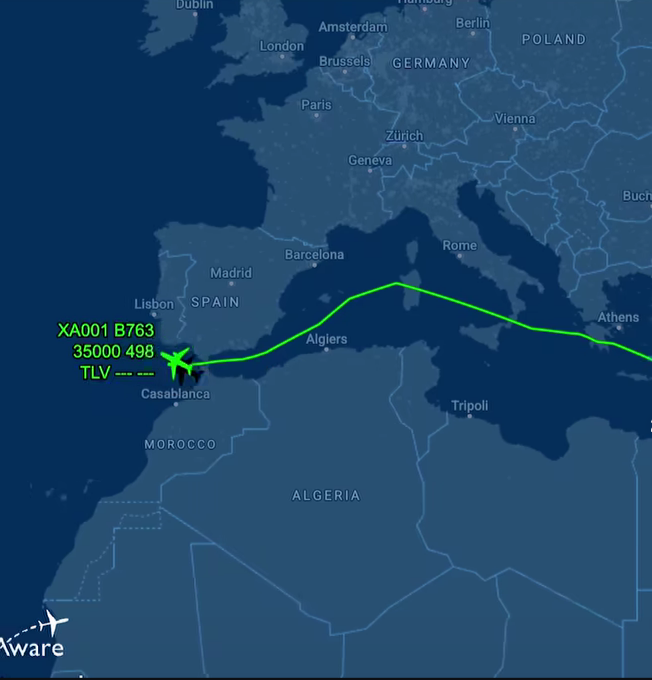
Netanyahu's Flight Path Avoidance Map
This map visualizes the flight path of Israeli Prime Minister Benjamin Netanyahu as he travels to the United States, hig...
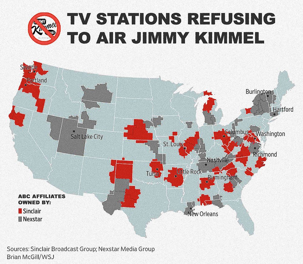
Map of TV Stations Not Airing Jimmy Kimmel Live!
This map illustrates the locations of television stations across the United States that will not be broadcasting "Jimmy ...
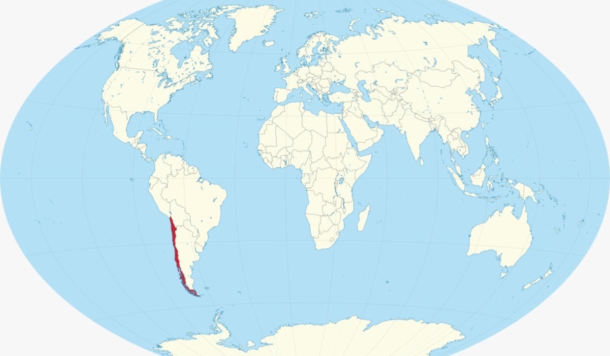
Visa-Free Access Map for USA, China, and Russia
This map highlights a unique geographical phenomenon: the only country that has visa-free access to the USA, China, and ...
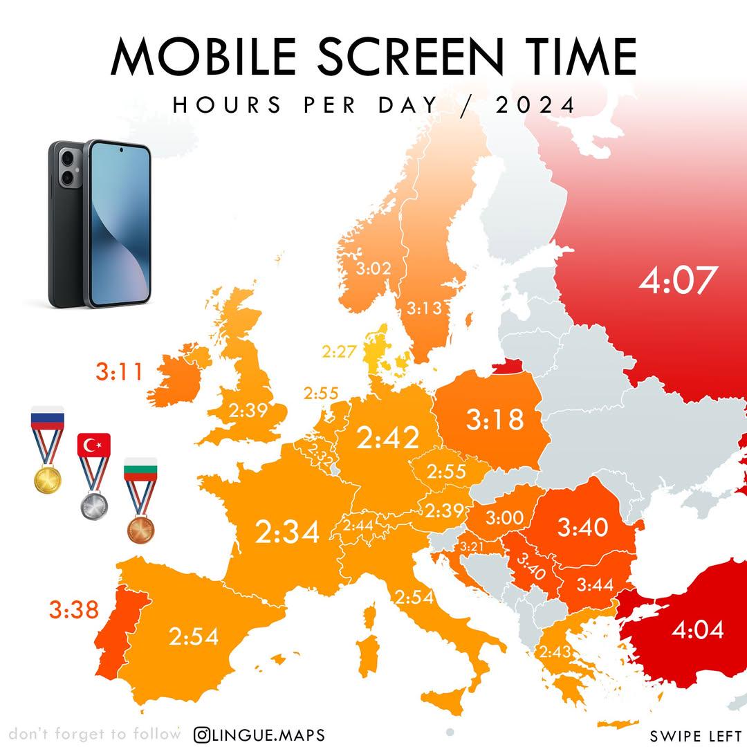
Mobile Screen Time in Hours per Day Map
The "Mobile Screen Time in Hours per Day (2024)" map visually represents the average daily hours individuals spend on th...
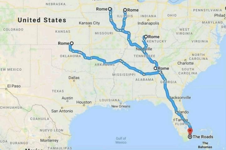
Road Networks Map of Ancient Rome
The visualization titled "All Roads Lead to Rome" illustrates the extensive network of roads constructed during the Roma...
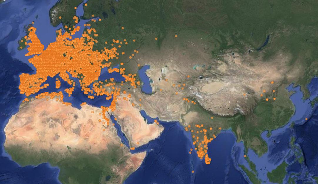
Map of Ancient Roman Coin Hoards Locations
This map provides a comprehensive visualization of every location where Ancient Roman coin hoards have been discovered a...
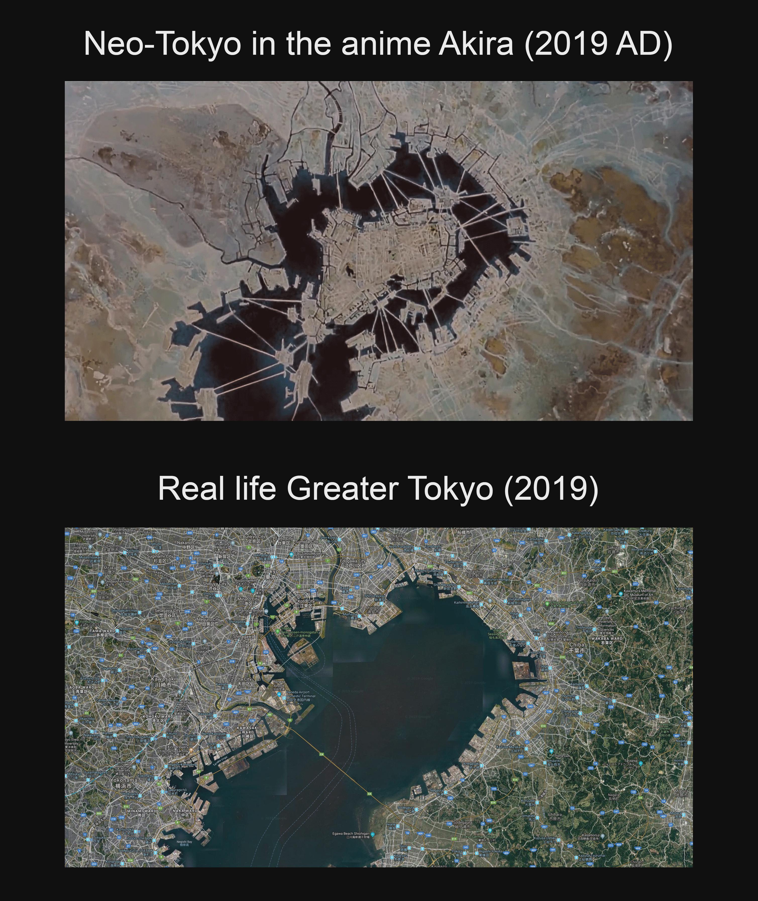
Neo-Tokyo Artificial Islands Map Compared to Tokyo Bay
This map visually compares the artificial islands depicted in the iconic anime film "Akira" to the real-life geography o...
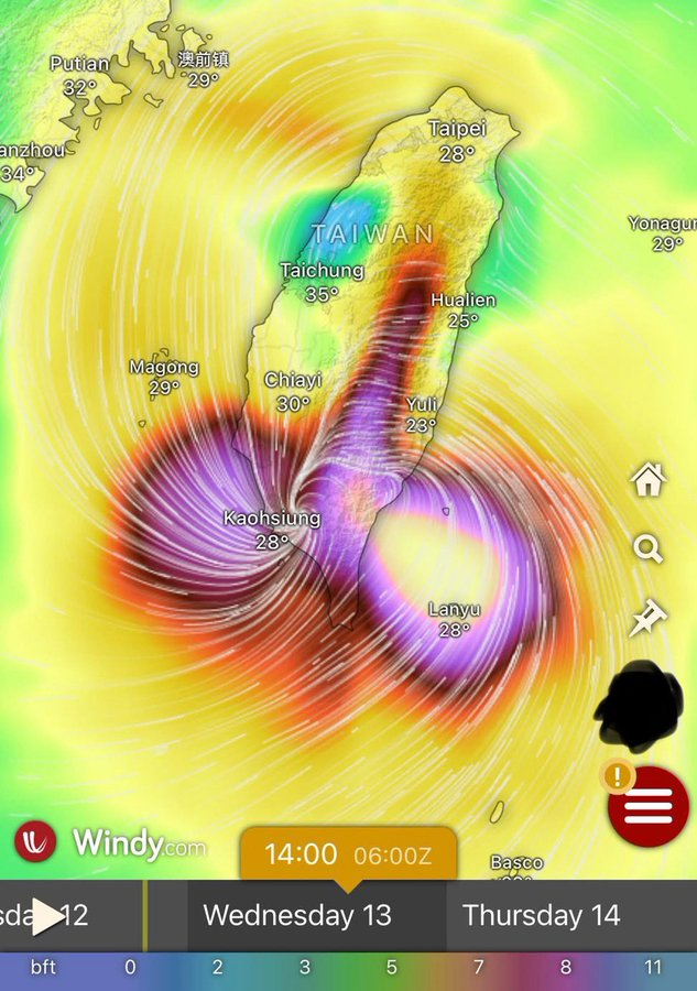
Typhoon Podul Atmospheric Map Over Taiwan and South China
Typhoon Podul, like many of its predecessors, has its origins in the western Pacific Ocean. As it moves towards Taiwan a...
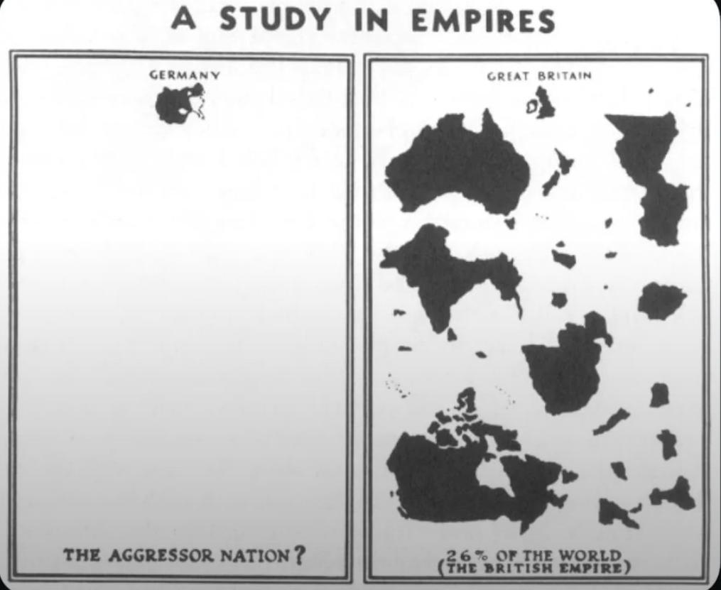
WWII Nazi Propaganda Map of Empires
The visualization titled "WWII Nazi Propaganda Map Comparing British and German Empires" serves as a striking representa...
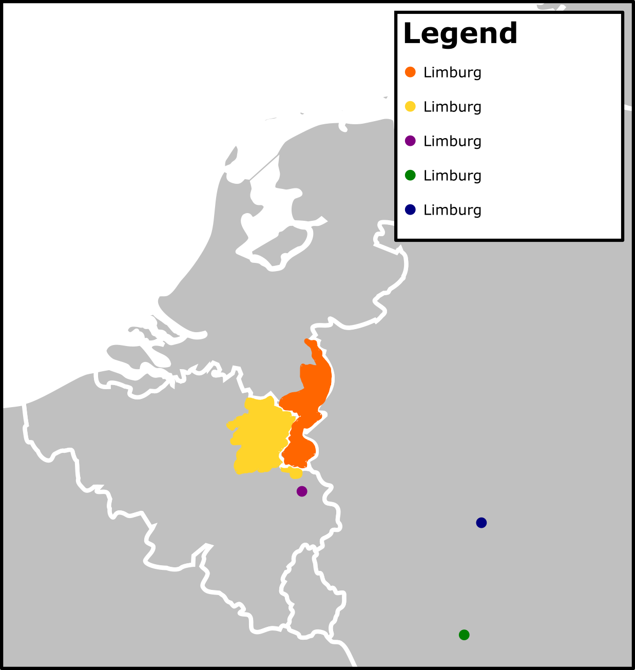
Limburg Population Density Map
This map presents the population density of Limburg, a province in the Netherlands. Through a visual representation of t...
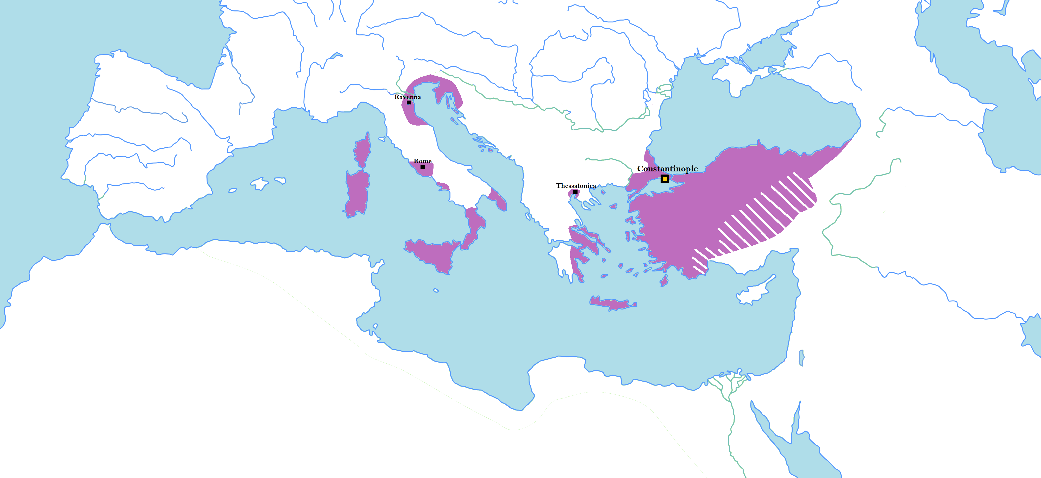
Map of Random Borders of Historical States
This map illustrates the unconventional and often perplexing borders of major historical states, highlighting areas wher...
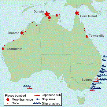
WW2 Attack Sites in Australia Map
The 'Sites in Australia Attacked in WW2' map provides a critical visual representation of the locations across Australia...
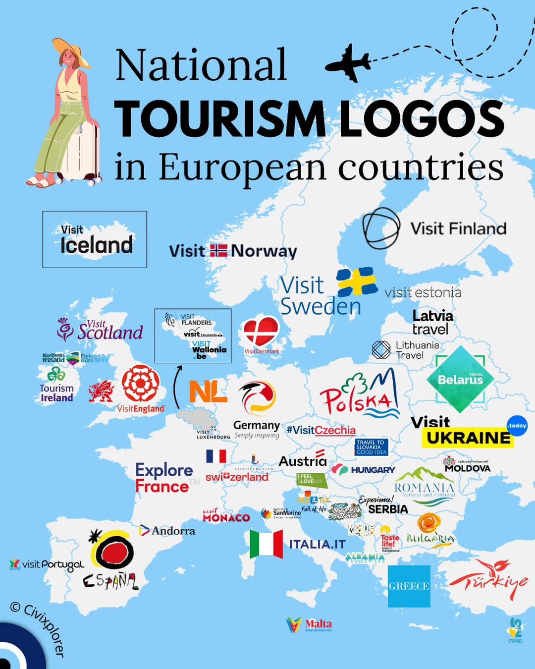
National Tourism Logos in European Countries Map
The "National Tourism Logos in European Countries Map" provides a visual representation of the distinct logos that repre...
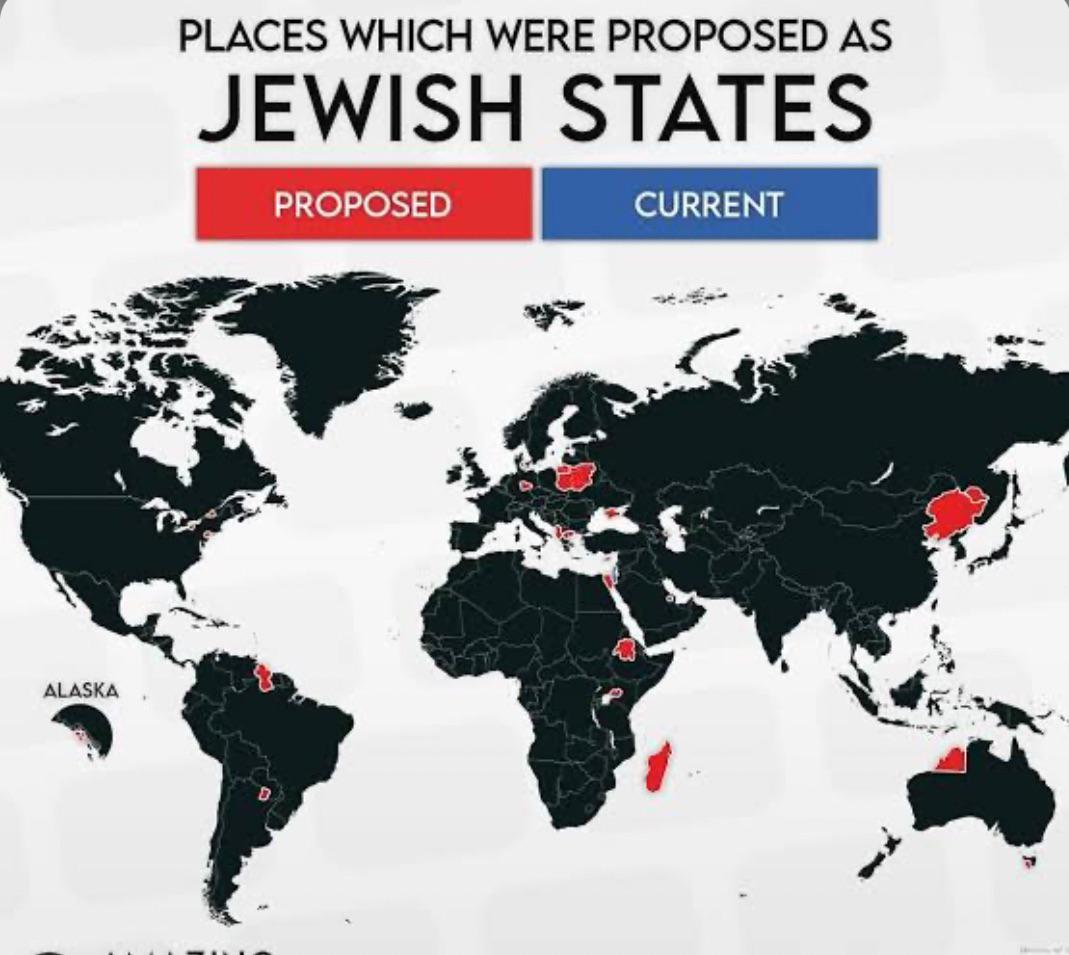
Map of Locations Proposed for Israel
This map visualizes various locations that have been proposed as potential sites for the establishment of the State of I...
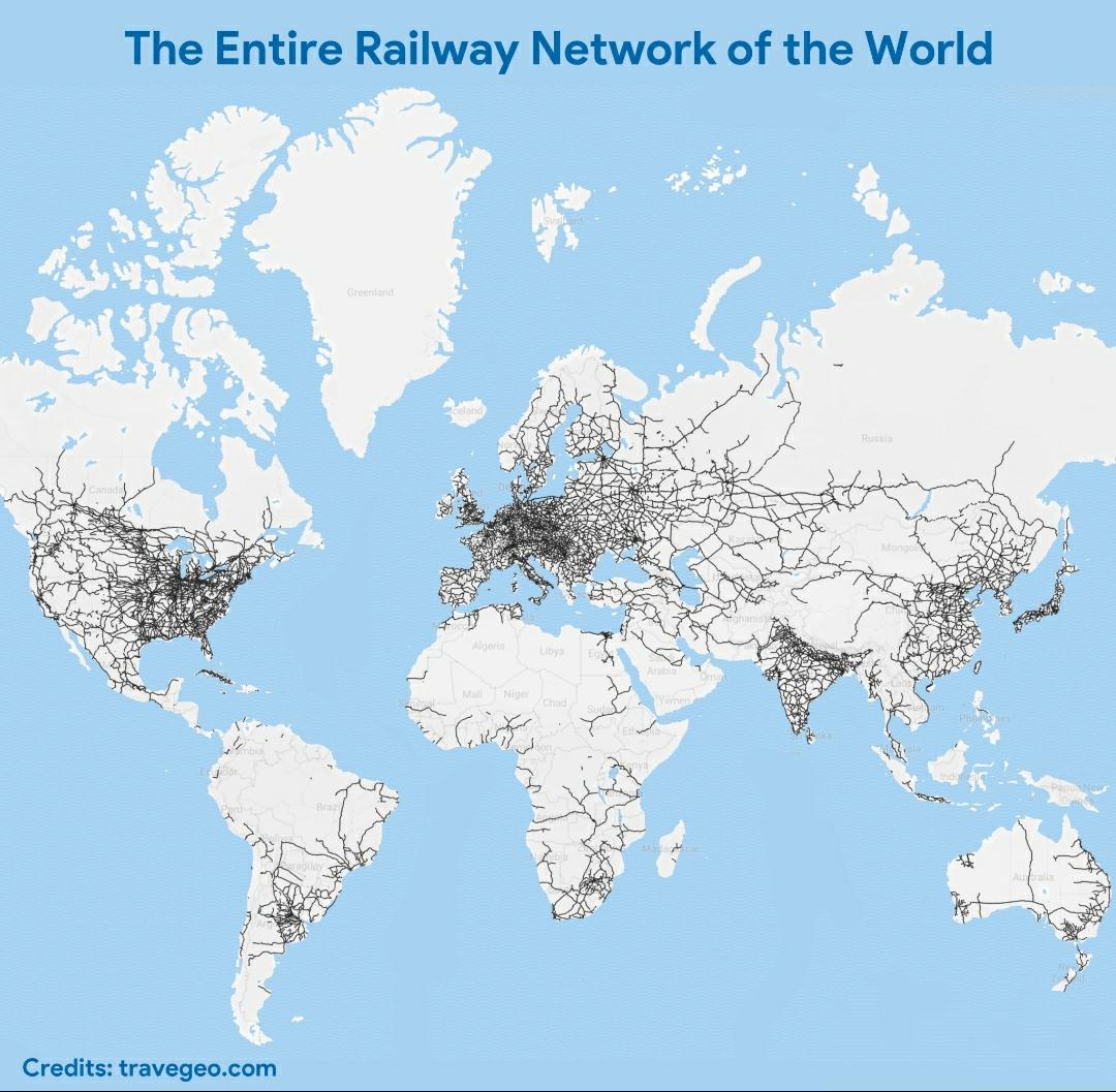
World Railway Network Map
The visualization titled "The Entire Railway Network of the World" offers a comprehensive look at the vast and intricate...
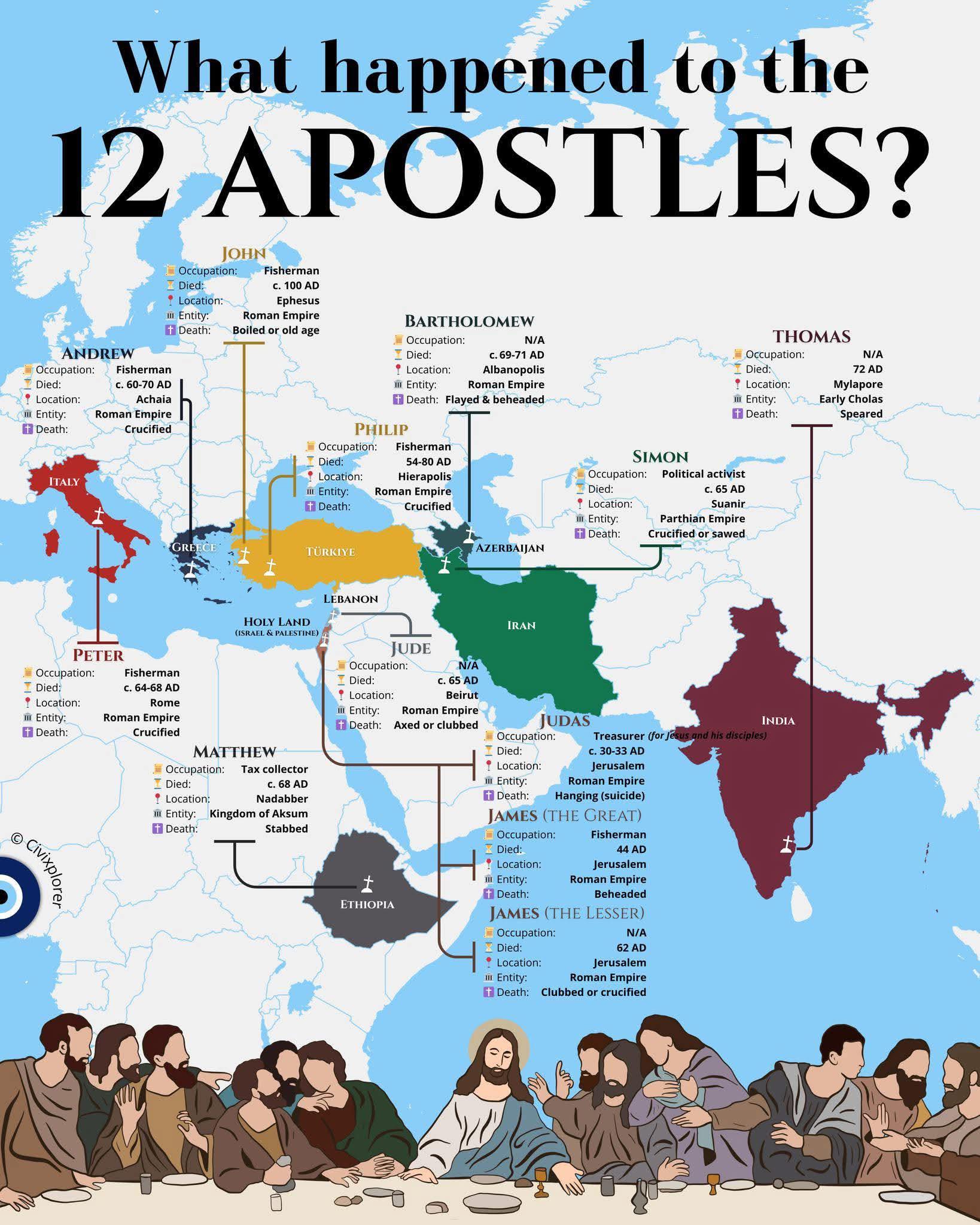
Map of the Journey of the 12 Apostles
The "Journey of the 12 Apostles" map visualizes the significant locations associated with the lives and missions of the ...
Cultural Characteristics Map of New England
The map titled "New Englanders be New Englanding" presents a fascinating look at the unique cultural characteristics and...
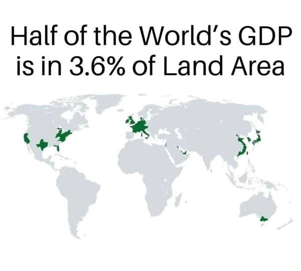
Global Economic Concentration Map
The "Global Economic Concentration Map" illustrates the distribution of economic activity across the globe, highlighting...
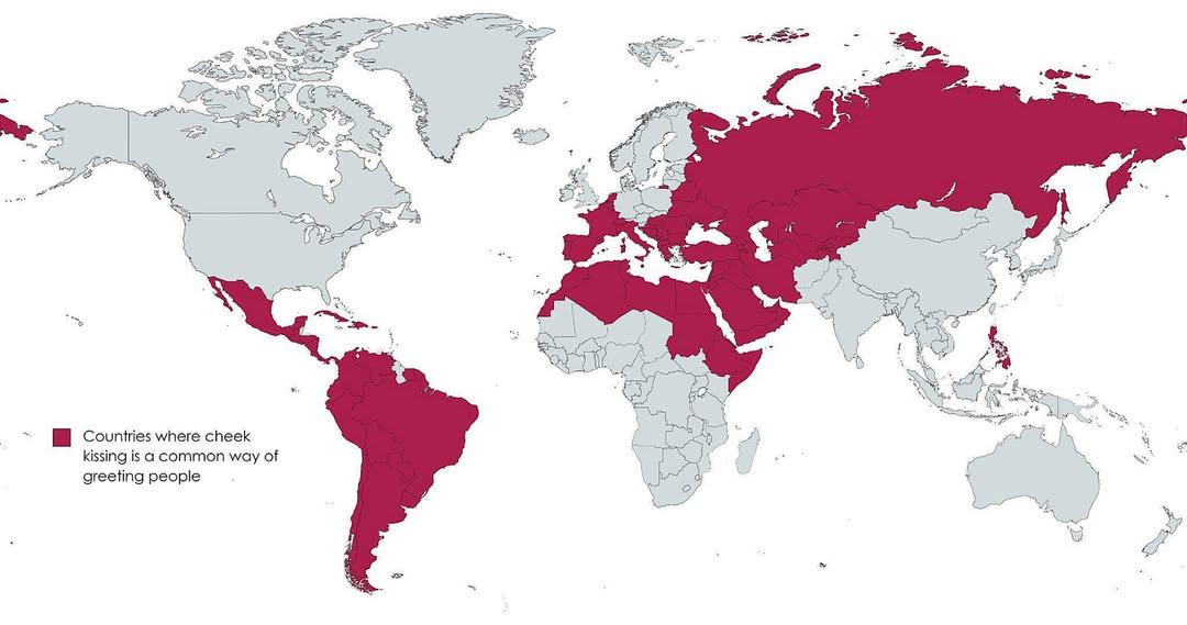
Map of Countries with Cheek Kissing Greetings
The map titled "Countries where cheek kissing is a customary greeting" visually represents global regions where cheek ki...
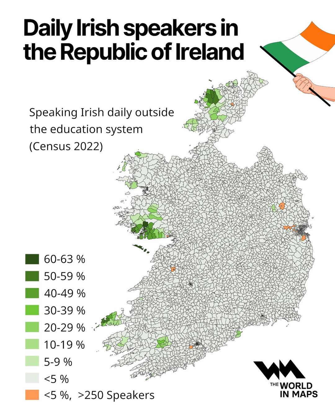
Daily Irish Speakers in the Republic of Ireland Map
The visualization titled "Daily Irish Speakers in the Republic of Ireland" provides a comprehensive overview of the dist...
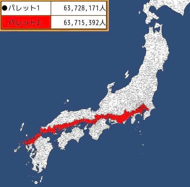
Japan Population Distribution Map
The map titled "Half of the Japanese population lives in the Red Line" visually illustrates the concentration of Japan's...
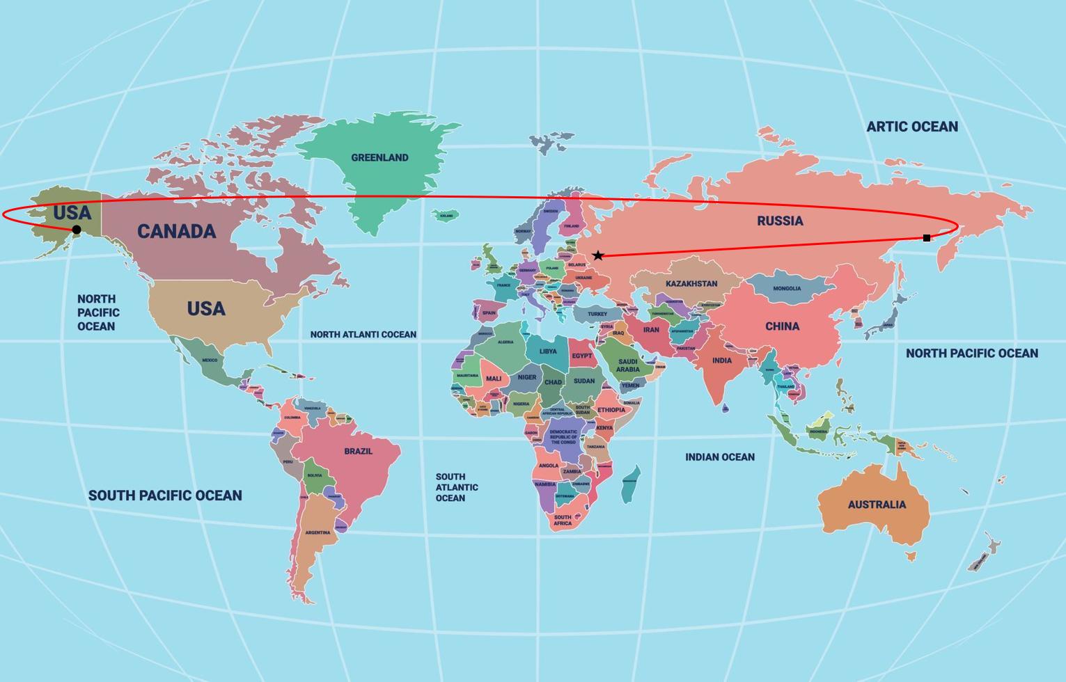
Putin Flight to Alaska According to Flat Earth Map
This intriguing map visualizes the hypothetical flight path of Russian President Vladimir Putin to Alaska, using a flat ...
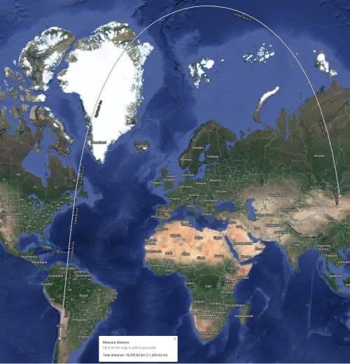
Shortest Route Map from Santiago, Chile to Ulaanbaatar, Mongolia
This map illustrates the shortest route from Santiago, Chile, to Ulaanbaatar, Mongolia, providing a visual representatio...

Iceland Population Distribution Map
This map illustrates a striking aspect of Iceland's population distribution: the red area represents only 1% of the coun...
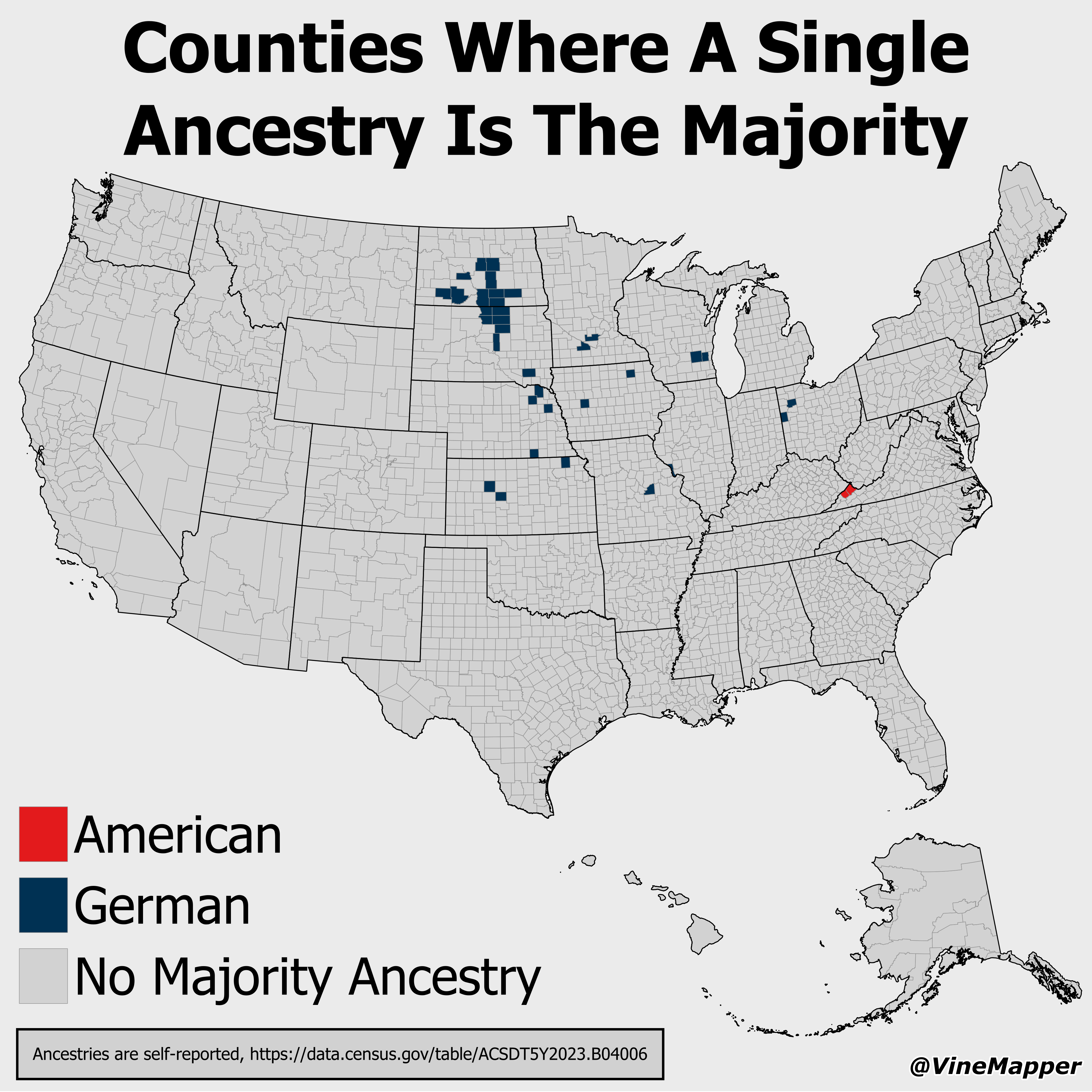
Counties Where A Single Ancestry Is The Majority Map
This map visualizes counties across the United States where one specific ancestry group constitutes the majority of the ...
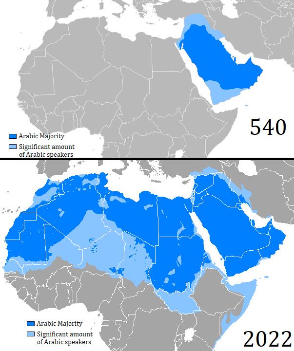
Map of Arabic Language Expansion from 540 to 2022
The map titled "Map of Arabic Language Expansion between 540 and 2022" visually illustrates the geographical spread of t...
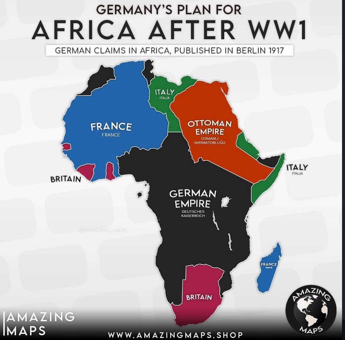
German Colonial Plans for Africa After WW1 Map
The map titled "German Colonial Plans for Africa After WW1" provides a visual representation of the territories that Ger...
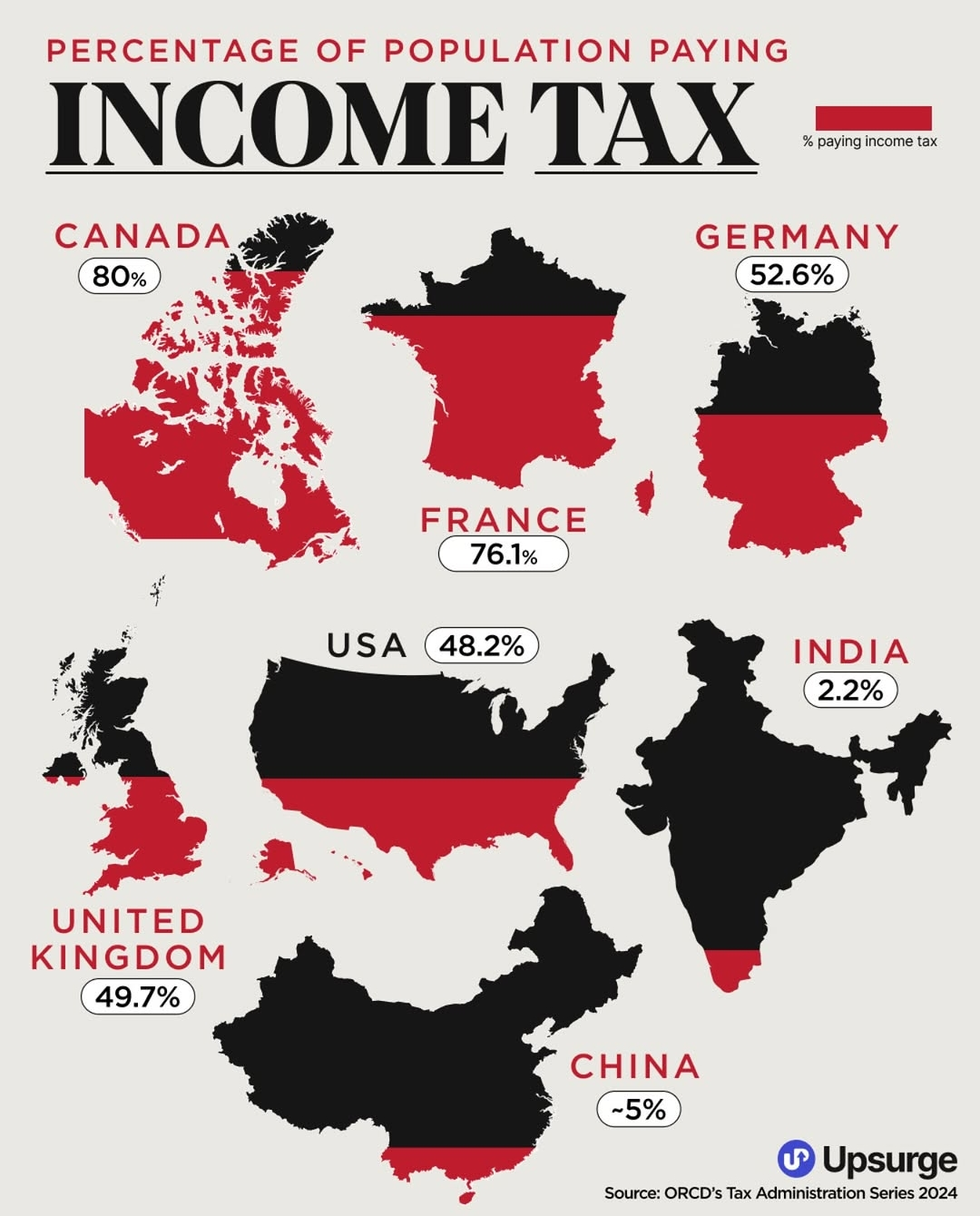
Income Tax Payment Percentage Map 2024
The "Percentage of Population Paying Income Tax Map 2024" offers a comprehensive overview of how many individuals in var...
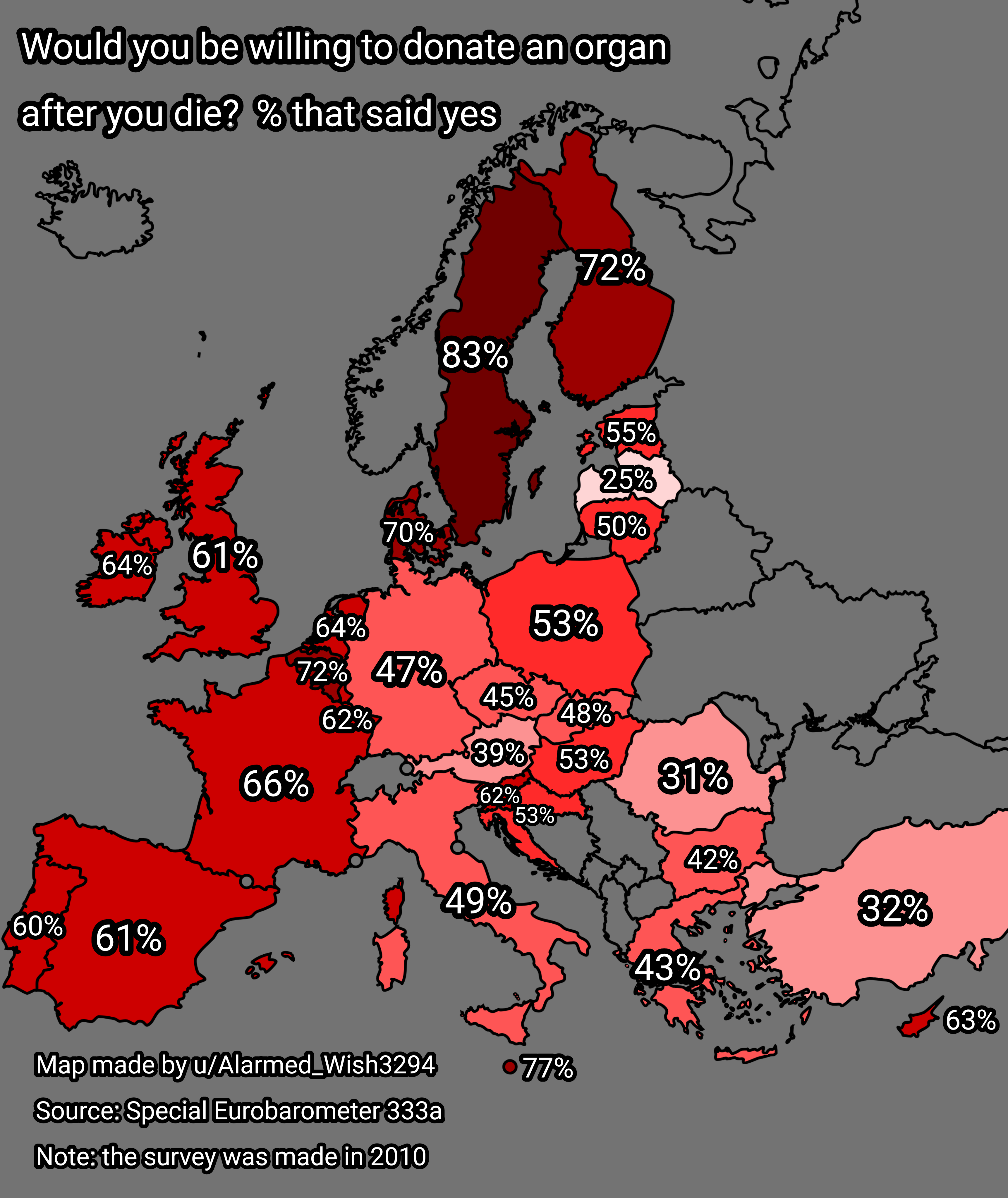
Organ Donation Willingness Map of Europe
The "Willingness to Donate an Organ After Death in Europe" map provides an insightful visualization of attitudes towards...
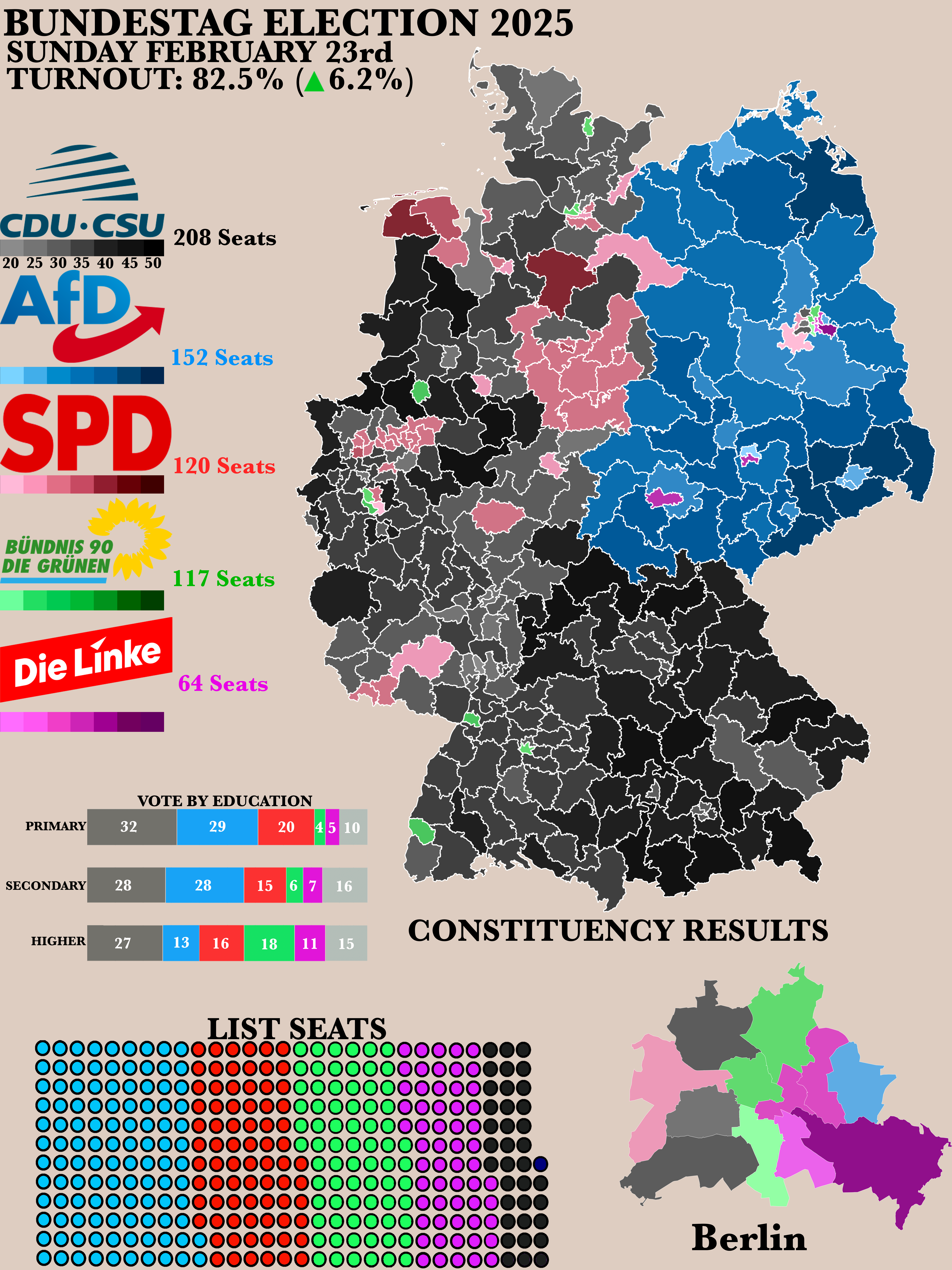
2025 German Bundestag Election Results Map
The "Poster of the 2025 German Bundestag Election Results" map provides a clear visual representation of the electoral o...
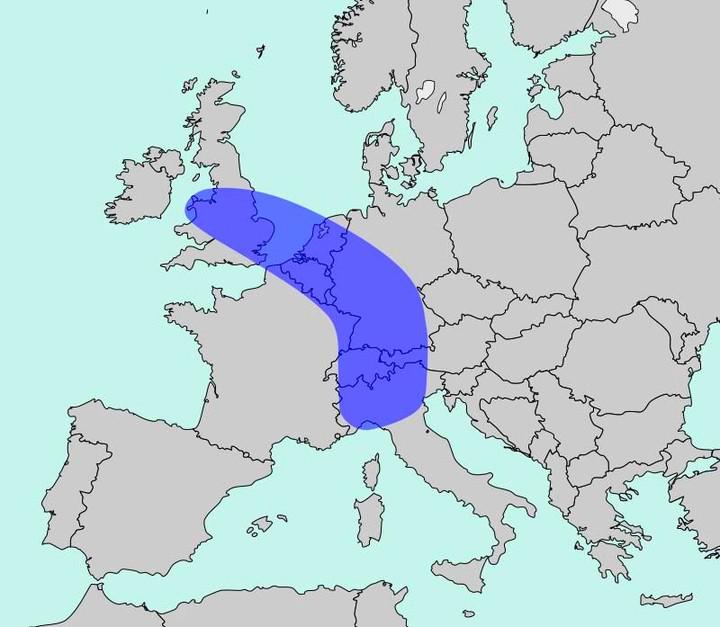
Population Density Map of Europe
The map titled "The Blue Banana" visualizes Europe’s most densely populated corridor, home to approximately 111 million ...
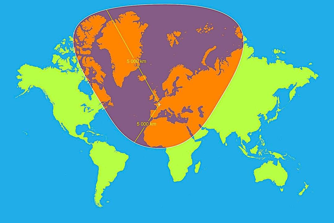
Map of 5,000km Radius from Paris
This map visualizes a circle with a 5,000 km radius centered on Paris, France. It highlights an extensive area that span...
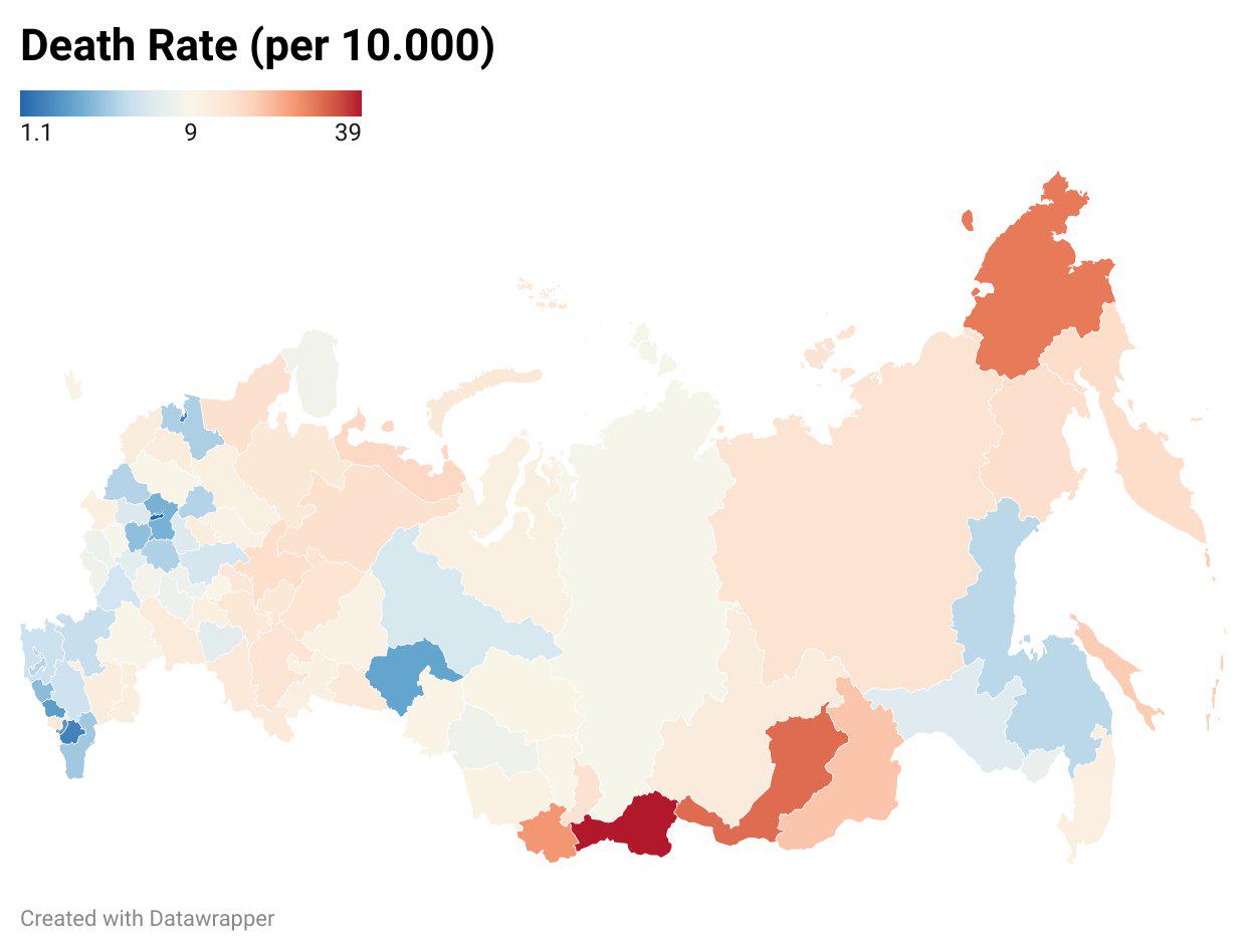
Death Toll in Russia Ukraine War by State Map
The "Death Toll in Russia's Ukraine War by State Map" provides a stark visualization of the human cost of the ongoing co...
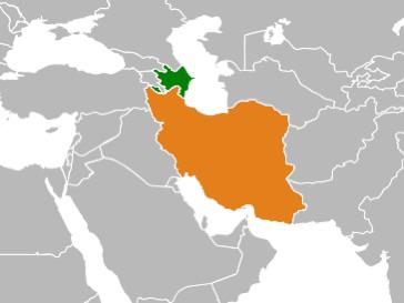
Map of Countries with Large Diasporas
This map highlights a fascinating demographic phenomenon: it illustrates countries where a significant portion of their ...
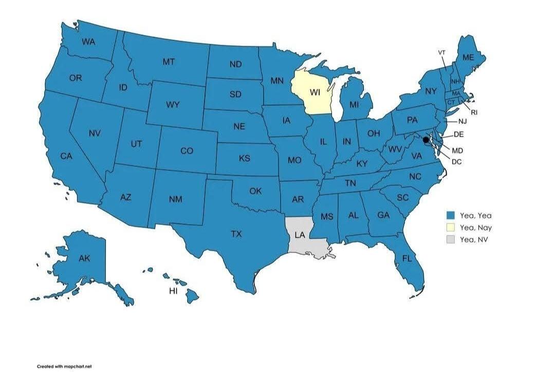
Senate Voting Map on the Patriot Act (2001)
This map illustrates the voting patterns of U.S. Senators regarding the Patriot Act, which was passed in October 2001 in...
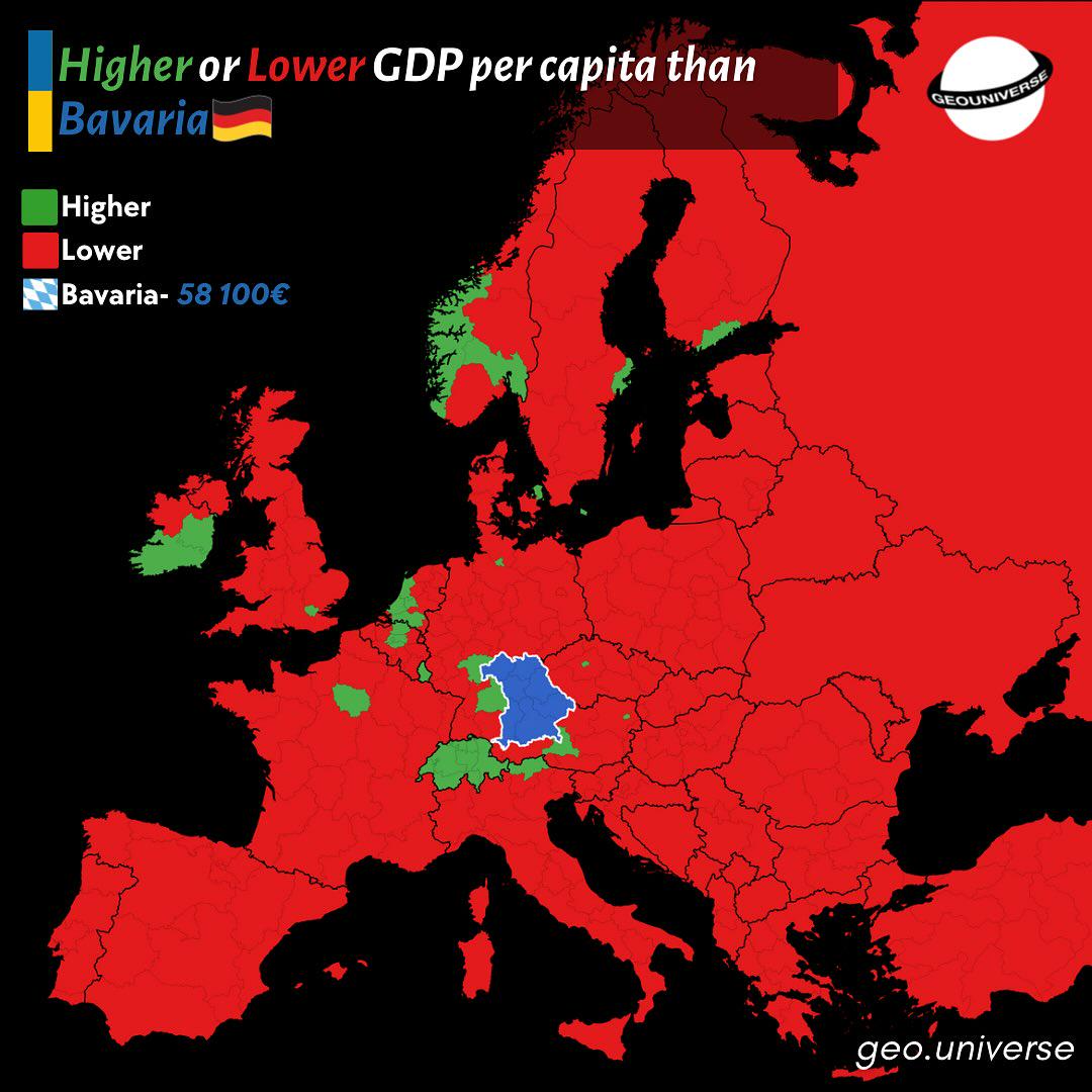
Bavaria Wealth Comparison Map to Europe
The "How Rich is Bavaria Compared to the Rest of Europe?" map provides a visual representation of the economic status of...
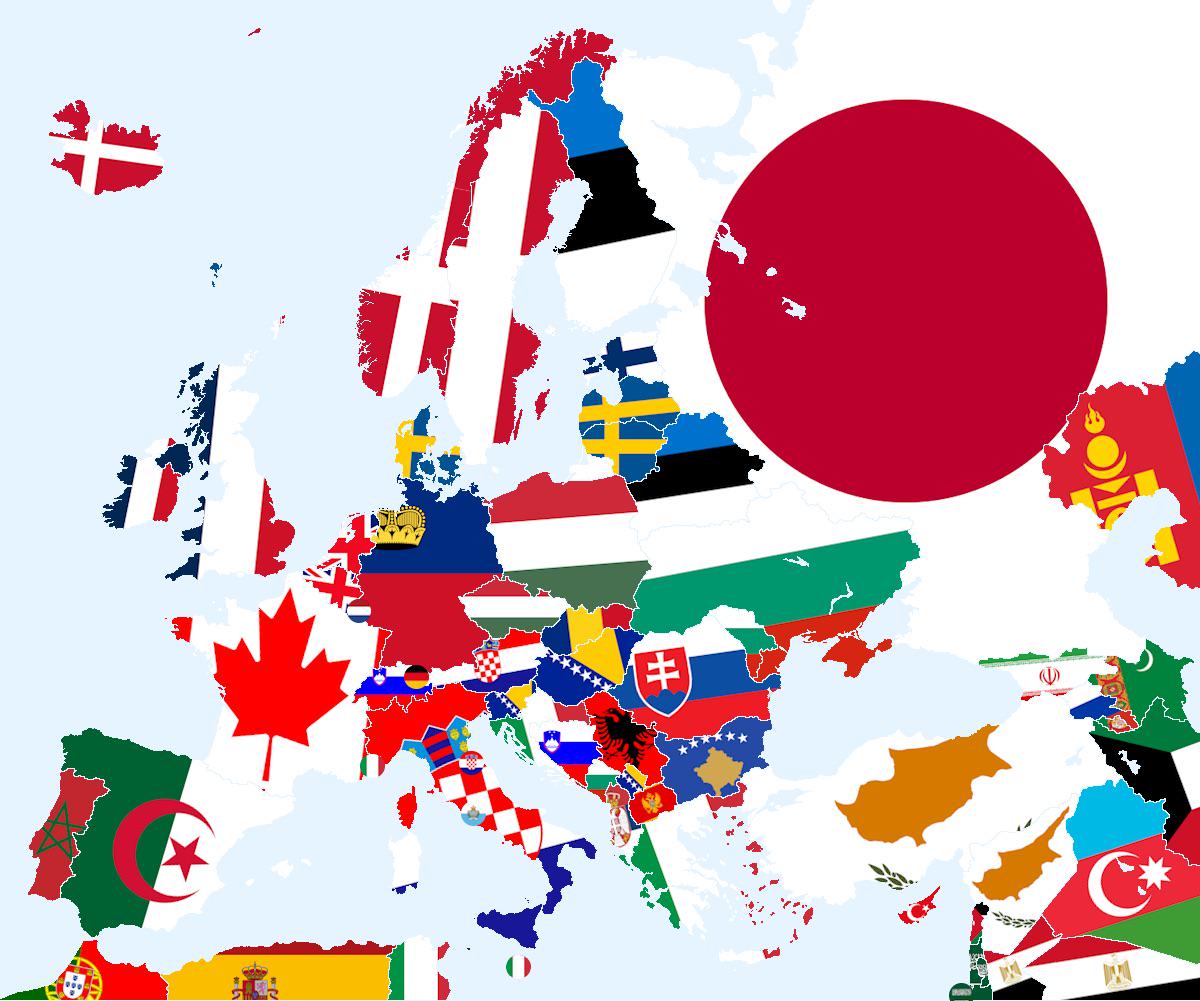
Closest Country That Doesn’t Share Land Border Map
The visualization titled \...
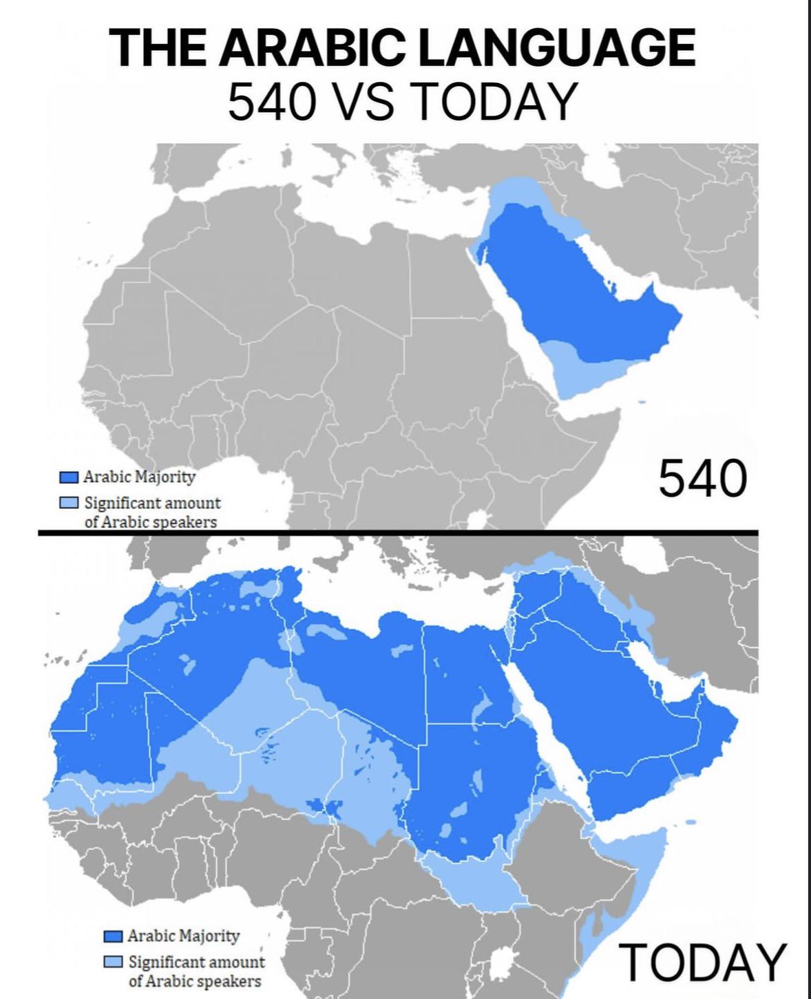
Arabic Language Distribution Map: 540 vs Today
The visualization titled "The Arabic Language: 540 vs Today" provides a compelling comparison of the geographical spread...
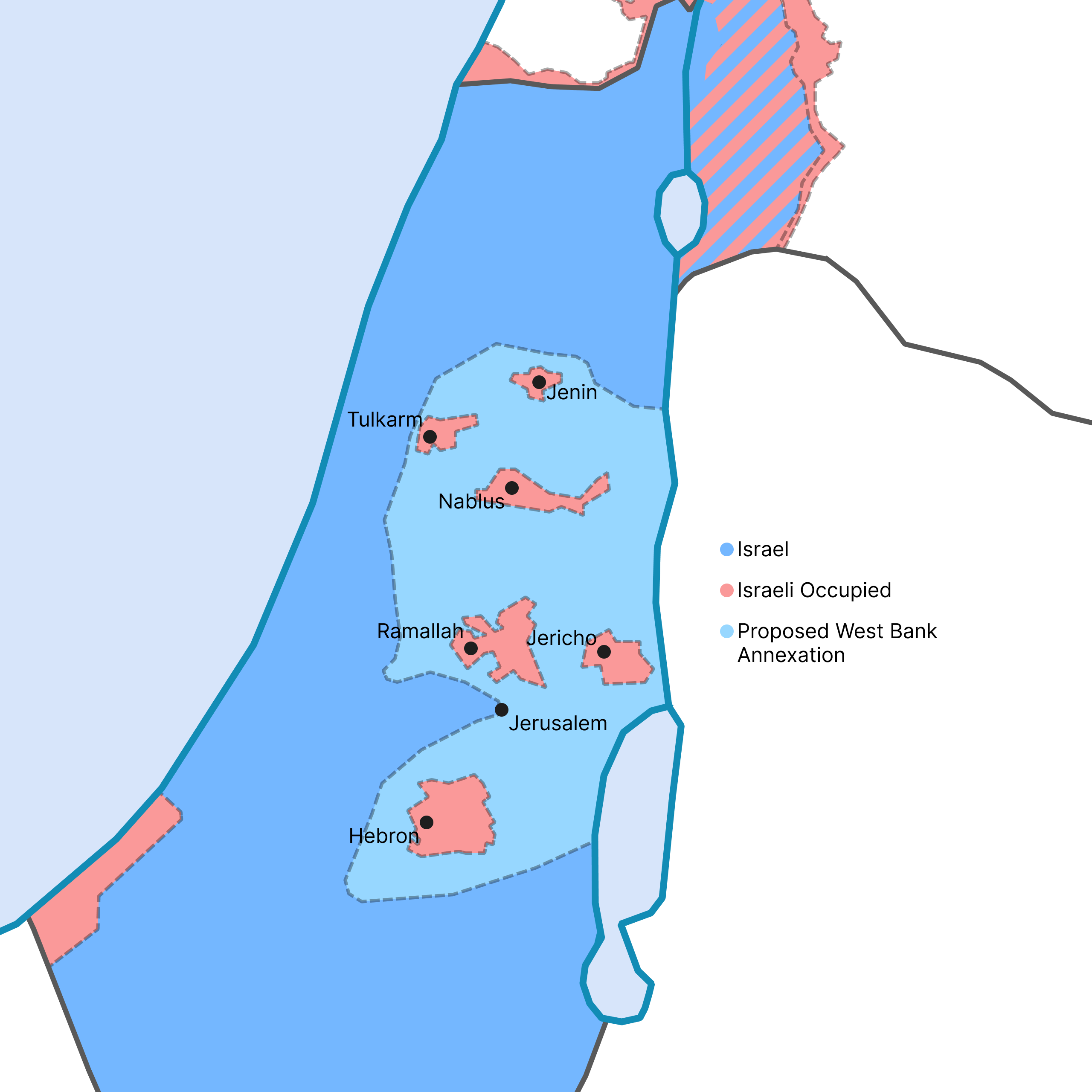
West Bank Annexation Proposal Map
This map visualizes the potential outcome of the Israeli government's recent proposal to annex a significant portion of ...
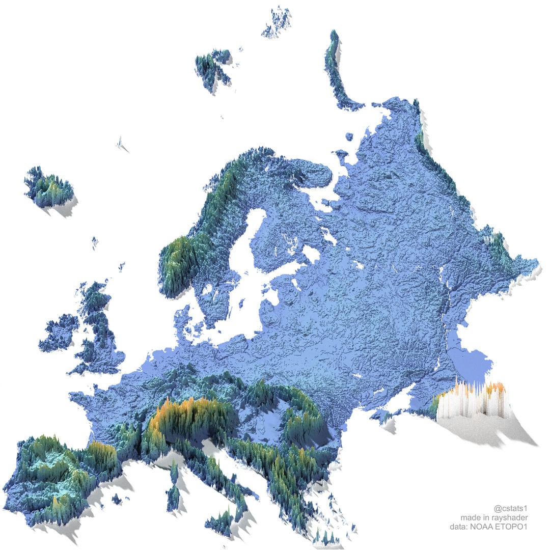
Elevation Map of Europe
The "Elevation Map of Europe" provides a visual representation of the varying altitudes across the continent. This map h...
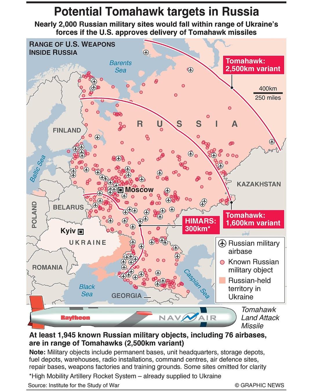
Potential Tomahawk Targets in Russia Map
The "Potential Tomahawk Targets in Russia" map provides a detailed visualization of strategic military locations across ...
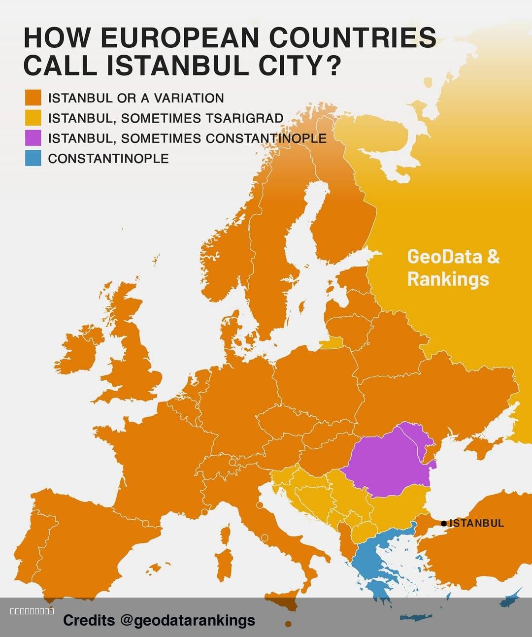
Map of How European Countries Call Istanbul
This map illustrates the various names that different European countries use to refer to the city of Istanbul, Turkey. W...
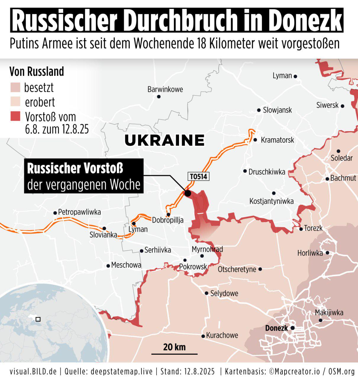
Russian Army Progress Map Over Past Week
The visualization titled "Progress of the Russian army over the past 7 days, according to the German outlet Bild" provid...
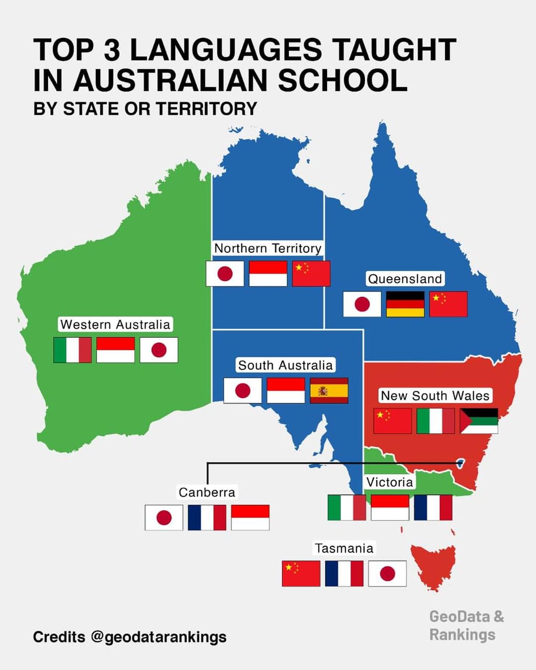
Top 3 Languages Taught in Australian Schools Map
This map provides a comprehensive overview of the top three languages taught in schools across various states and territ...
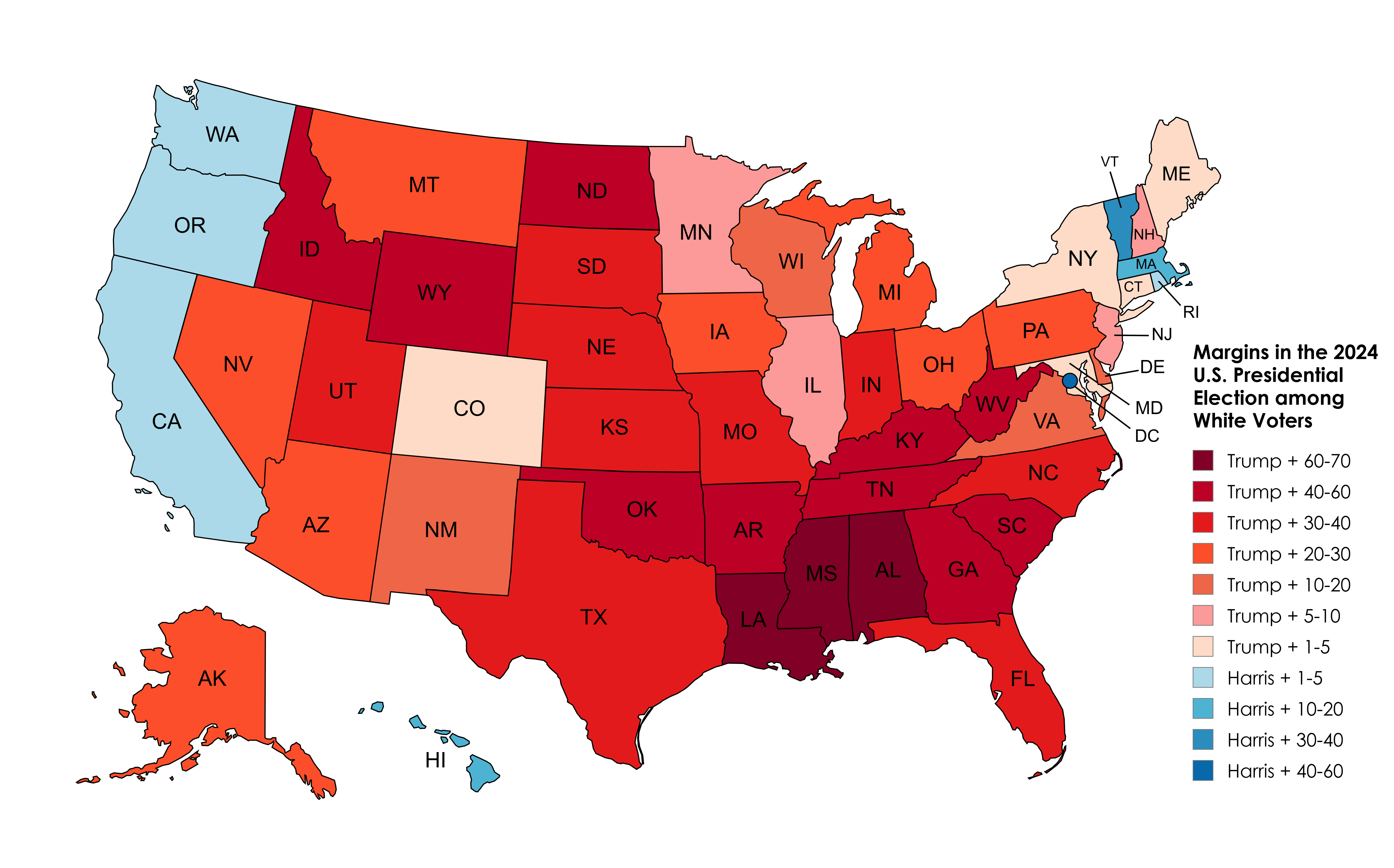
2024 Election Results Map Amongst White Voters
The 2024 Election Results Map Amongst White Voters offers a detailed representation of how this demographic voted across...
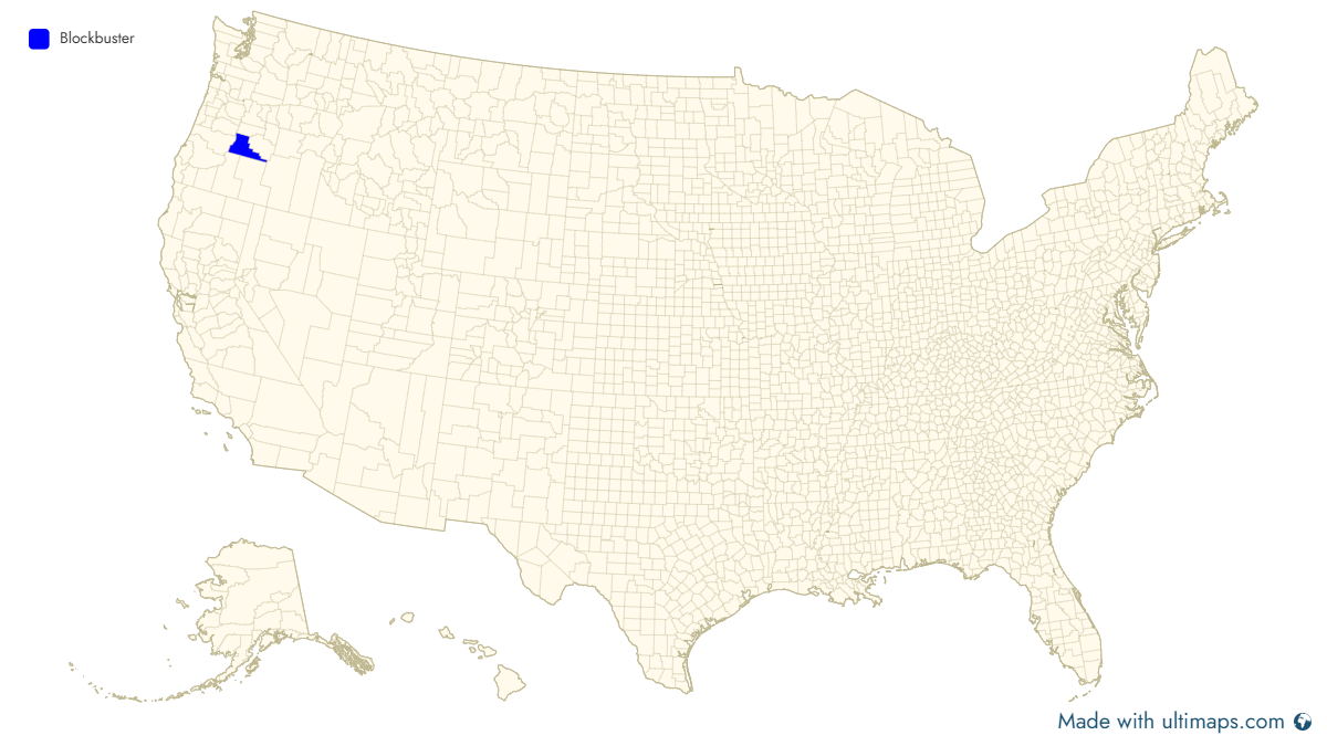
US Counties with Open Blockbuster Stores Map
This visualization provides a comprehensive overview of the counties in the United States that still have operational Bl...
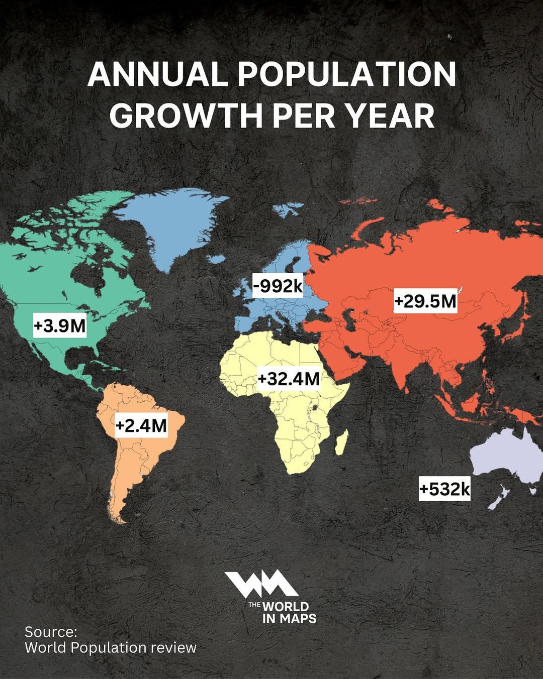
Annual Population Growth by Continent Map
The "Annual Population Growth by Continent Map" visually represents the trends in population increase across different c...
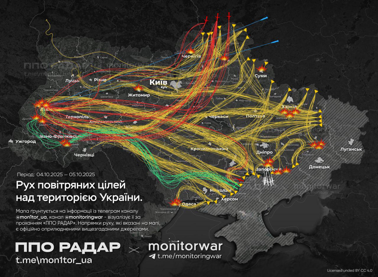
Air Attack on Ukraine Map
The map titled \...
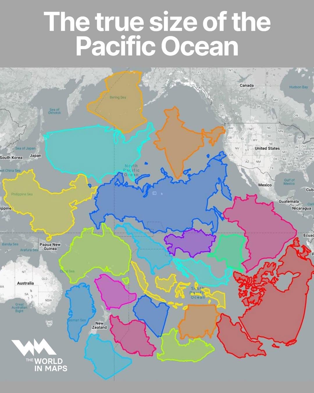
Map of the True Size of the Pacific Ocean
The visualization titled "The True Size of the Pacific Ocean" illustrates the vastness of the Pacific Ocean by accuratel...
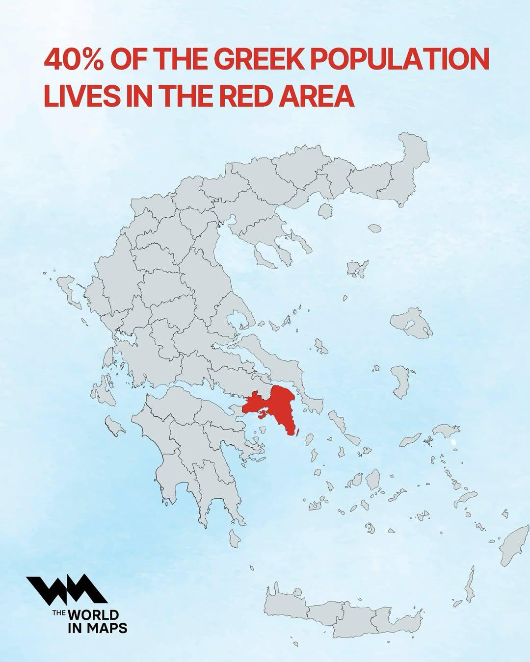
Population Distribution Map of Greece
This map illustrates a striking demographic trend in Greece: approximately 40% of the nation's population resides within...