cartography Maps
722 geographic visualizations tagged with "cartography"
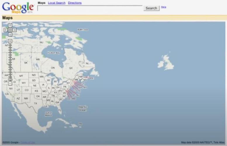
Google Maps Launch Day Features Map
This visualization captures the initial interface and feature set of Google Maps when it launched in 2005. It highlights...
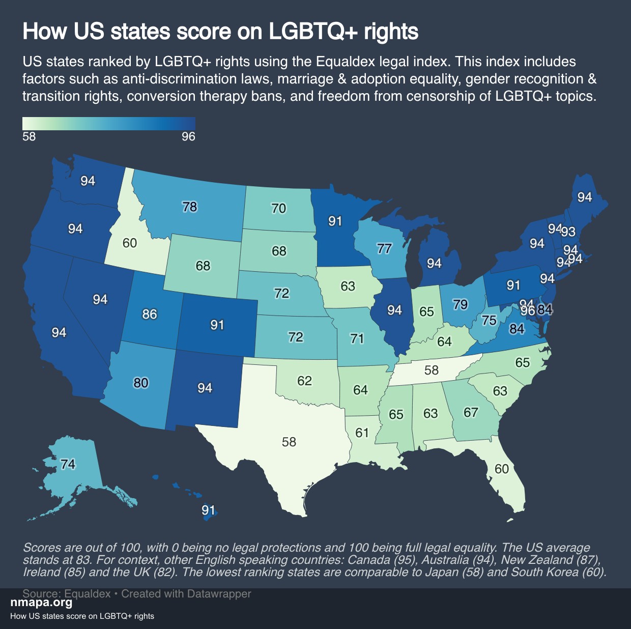
How US states score on LGBTQ+ rights Map
This map displays "How US states score on LGBTQ+ rights" and provides a clear visual representation of the geographic da...
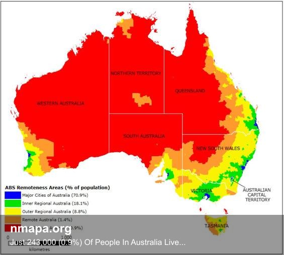
Just 243,000 (0.9%) Of People In Australia Live In The Red Area Map
This map displays "Just 243,000 (0.9%) Of People In Australia Live In The Red Area" and provides a clear visual represen...
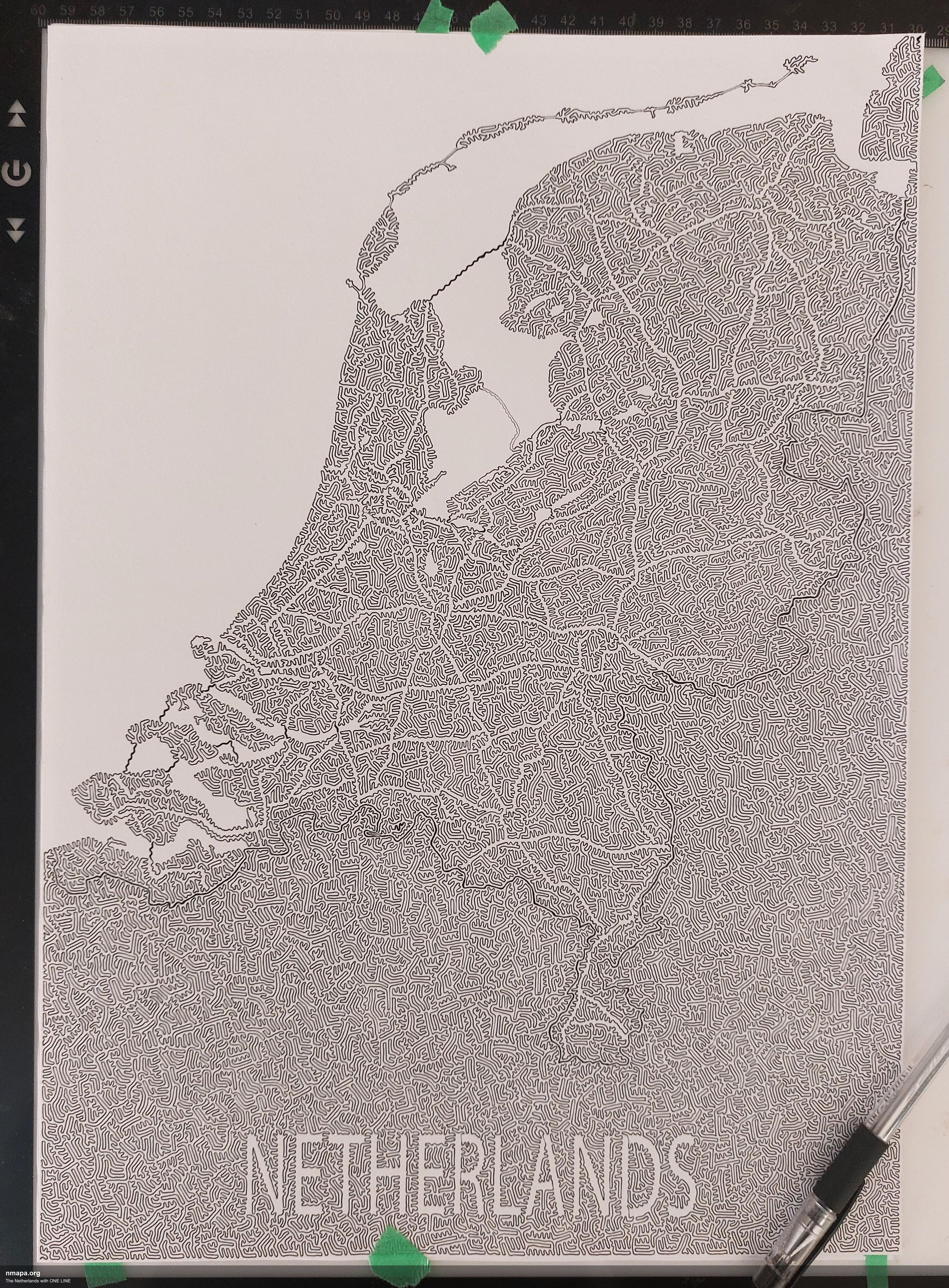
The Netherlands with ONE LINE Map
This map displays "The Netherlands with ONE LINE" and provides a clear visual representation of the geographic data. Thi...
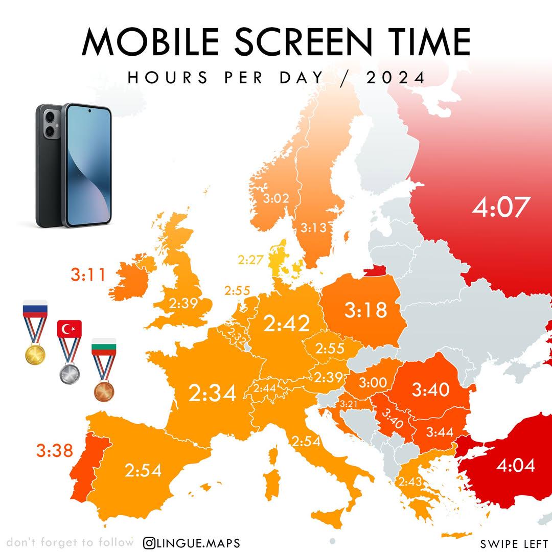
Mobile Screen Time in Hours per Day Map
The "Mobile Screen Time in Hours per Day (2024)" map visually represents the average daily hours individuals spend on th...
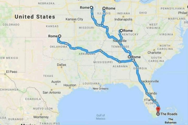
Road Networks Map of Ancient Rome
The visualization titled "All Roads Lead to Rome" illustrates the extensive network of roads constructed during the Roma...
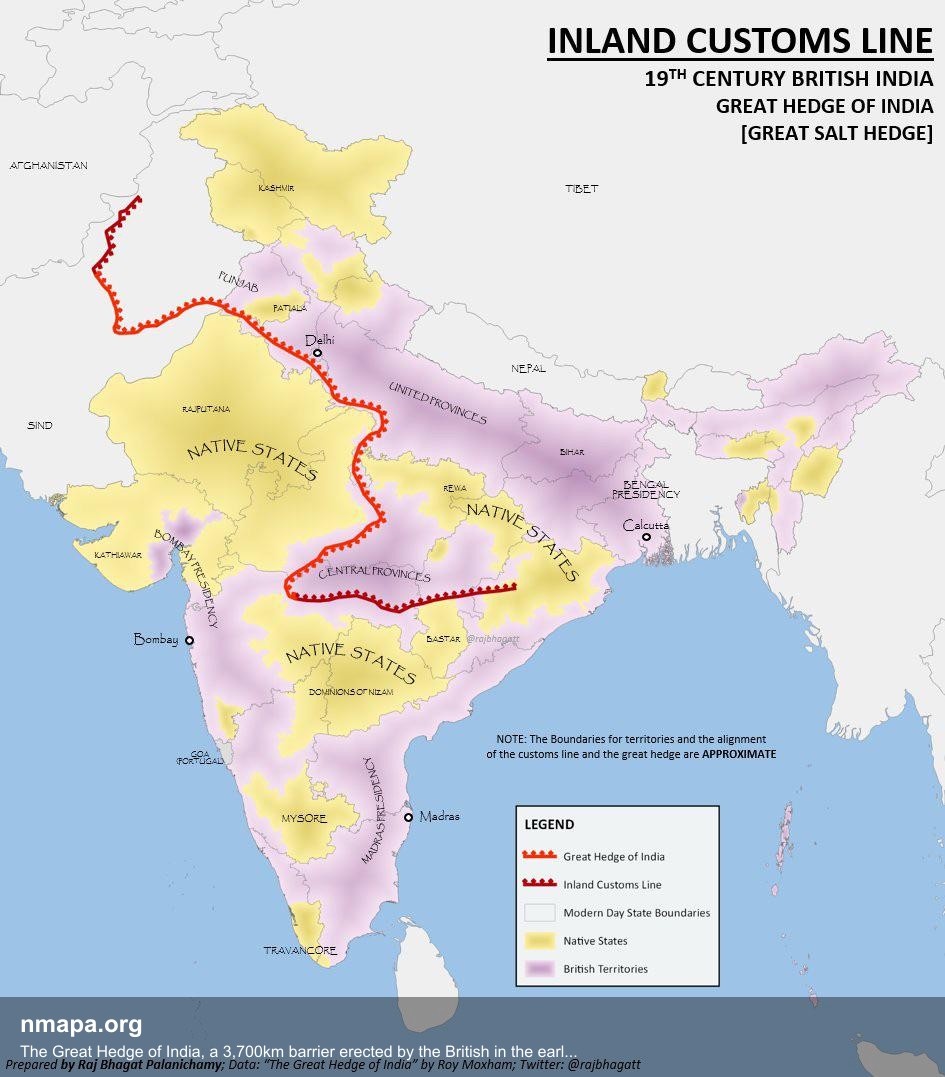
The Great Hedge of India, a 3,700km barrier erected by the British in the early 19th century to prevent people from illegally evading the salt tax by getting salt from the sea. Map
This geographical visualization presents "The Great Hedge of India, a 3,700km barrier erected by the British in the earl...
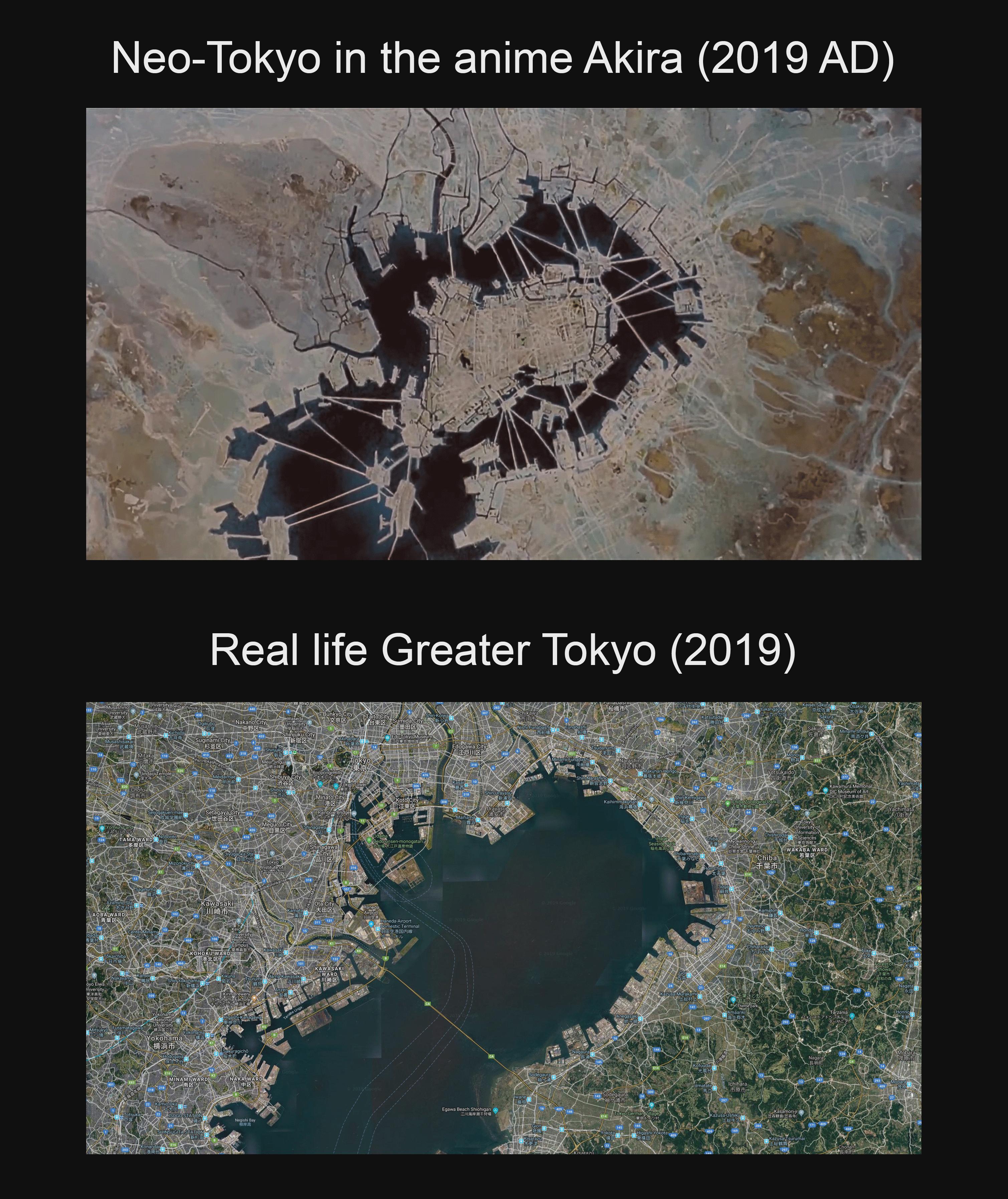
Neo-Tokyo Artificial Islands Map Compared to Tokyo Bay
This map visually compares the artificial islands depicted in the iconic anime film "Akira" to the real-life geography o...
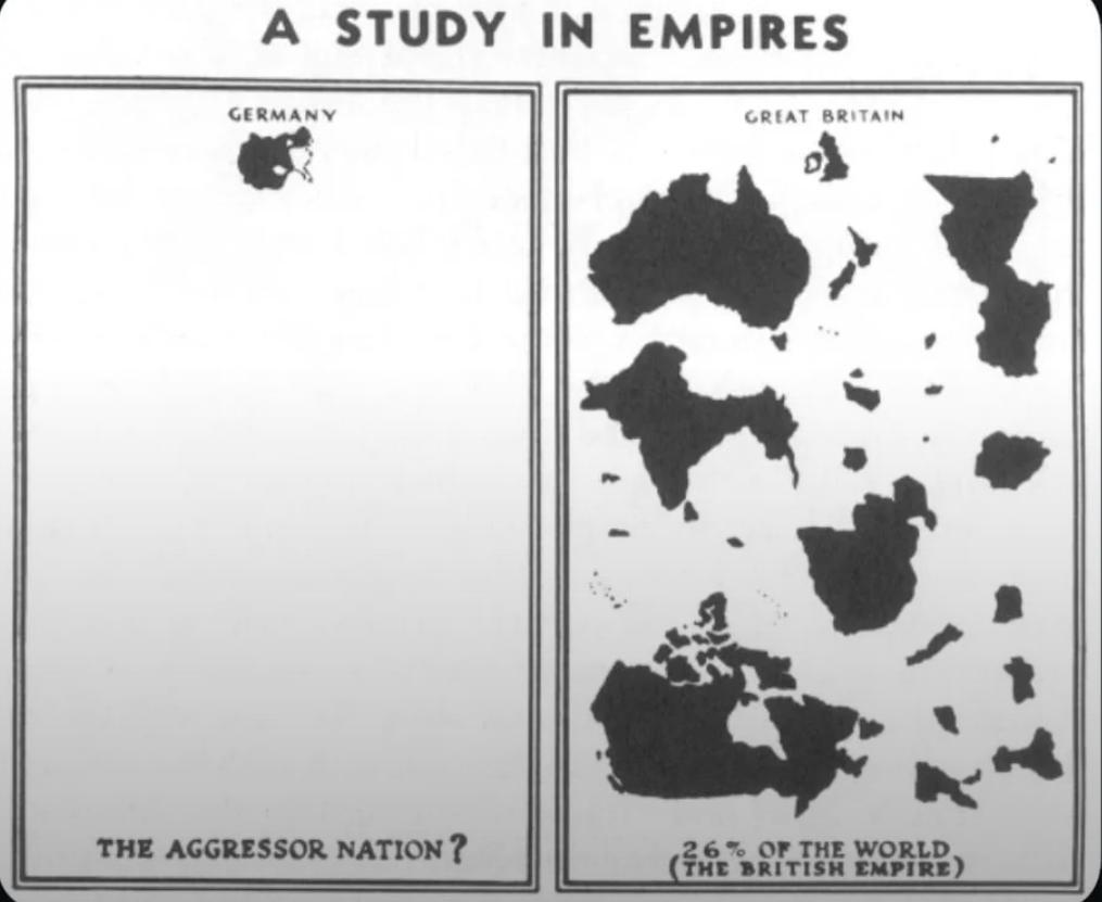
WWII Nazi Propaganda Map of Empires
The visualization titled "WWII Nazi Propaganda Map Comparing British and German Empires" serves as a striking representa...
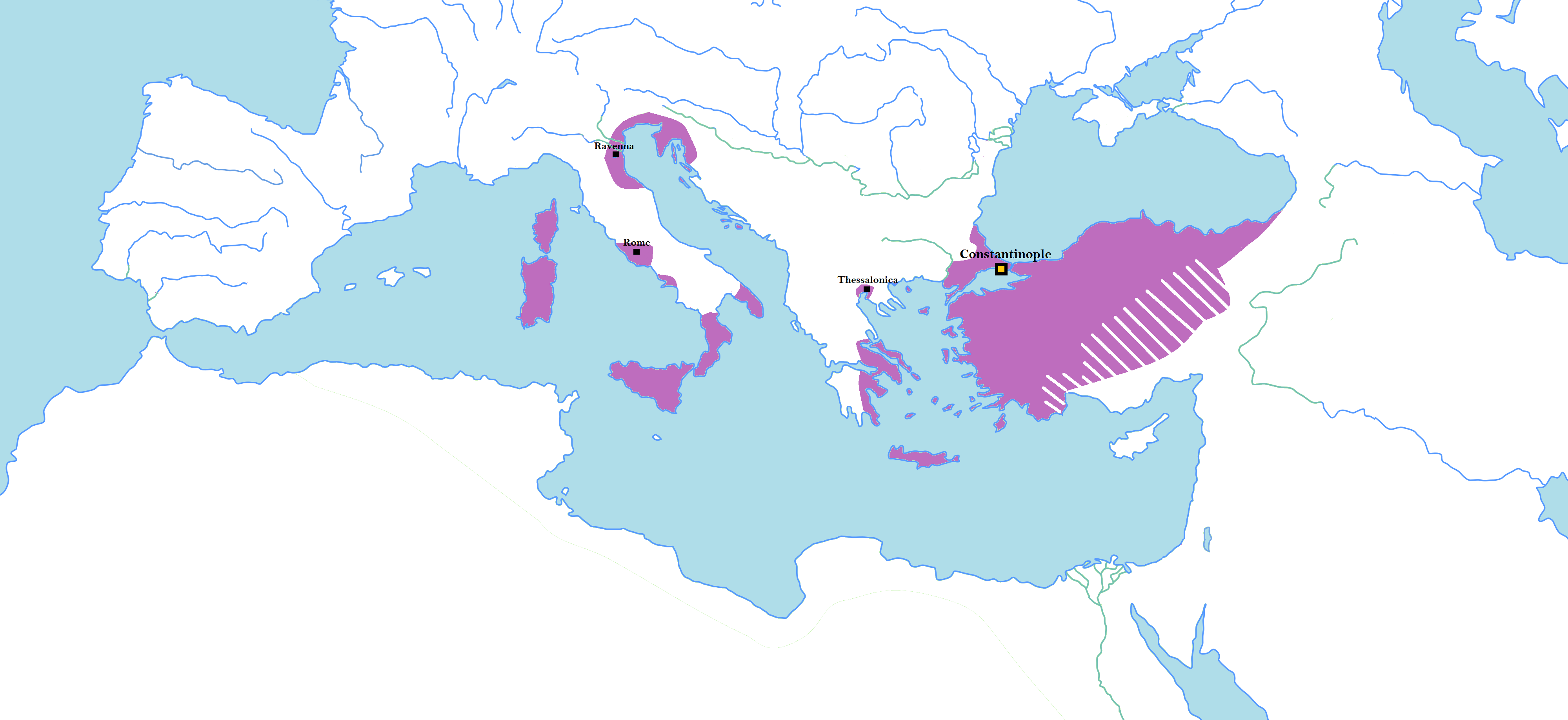
Map of Random Borders of Historical States
This map illustrates the unconventional and often perplexing borders of major historical states, highlighting areas wher...
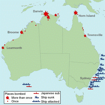
WW2 Attack Sites in Australia Map
The 'Sites in Australia Attacked in WW2' map provides a critical visual representation of the locations across Australia...
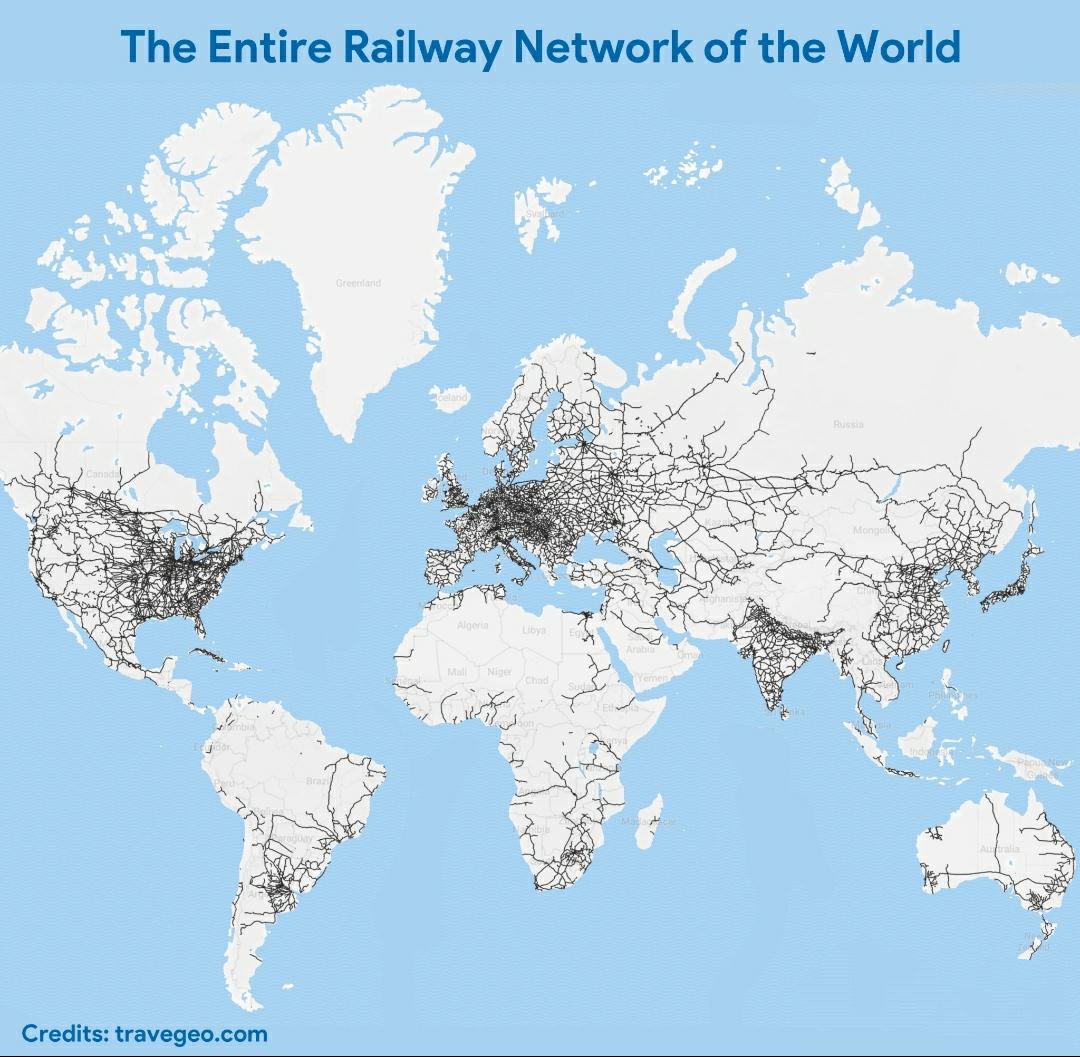
World Railway Network Map
The visualization titled "The Entire Railway Network of the World" offers a comprehensive look at the vast and intricate...
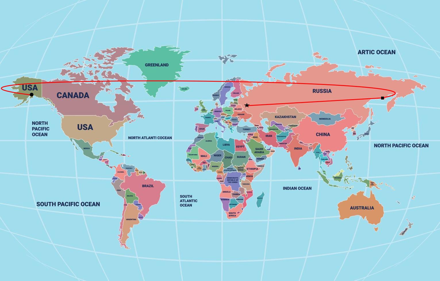
Putin Flight to Alaska According to Flat Earth Map
This intriguing map visualizes the hypothetical flight path of Russian President Vladimir Putin to Alaska, using a flat ...
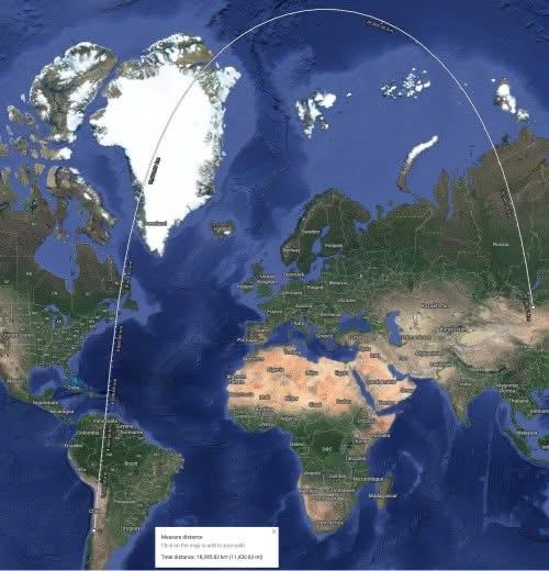
Shortest Route Map from Santiago, Chile to Ulaanbaatar, Mongolia
This map illustrates the shortest route from Santiago, Chile, to Ulaanbaatar, Mongolia, providing a visual representatio...
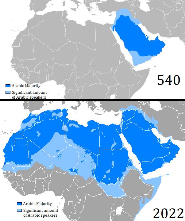
Map of Arabic Language Expansion from 540 to 2022
The map titled "Map of Arabic Language Expansion between 540 and 2022" visually illustrates the geographical spread of t...
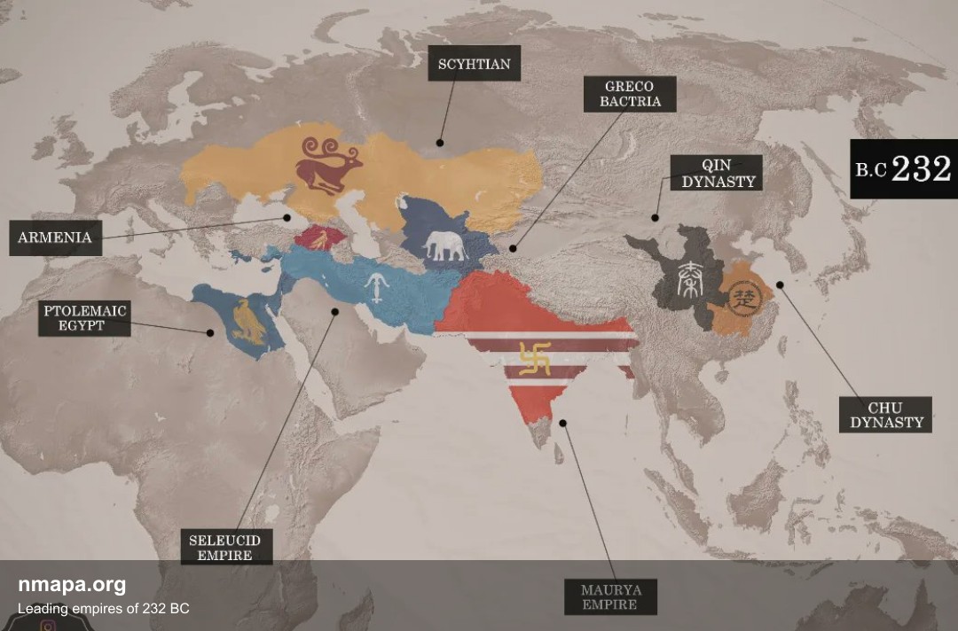
Leading empires of 232 BC Map
This geographical visualization presents "Leading empires of 232 BC" as a comprehensive map that displays spatial data p...
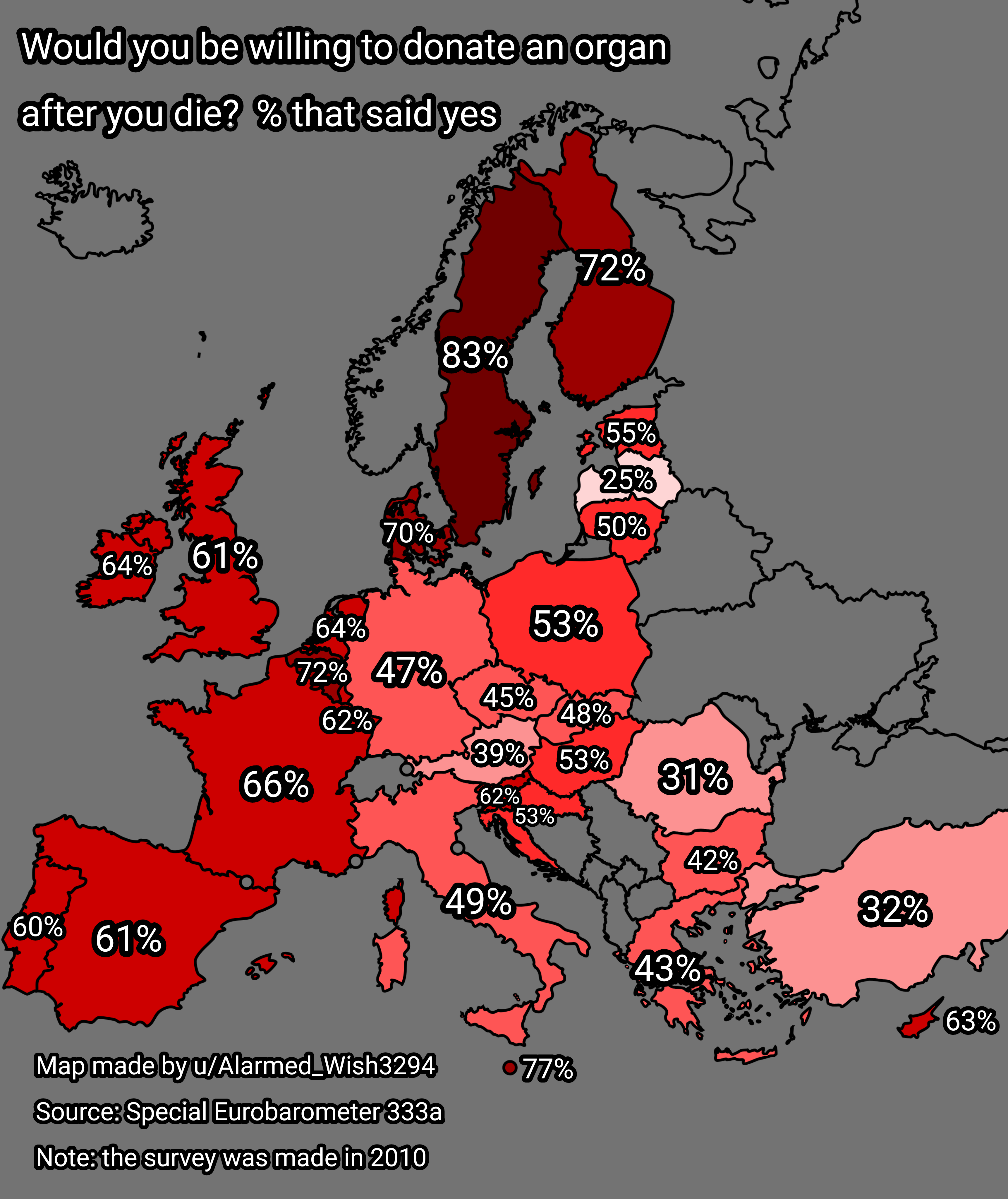
Organ Donation Willingness Map of Europe
The "Willingness to Donate an Organ After Death in Europe" map provides an insightful visualization of attitudes towards...
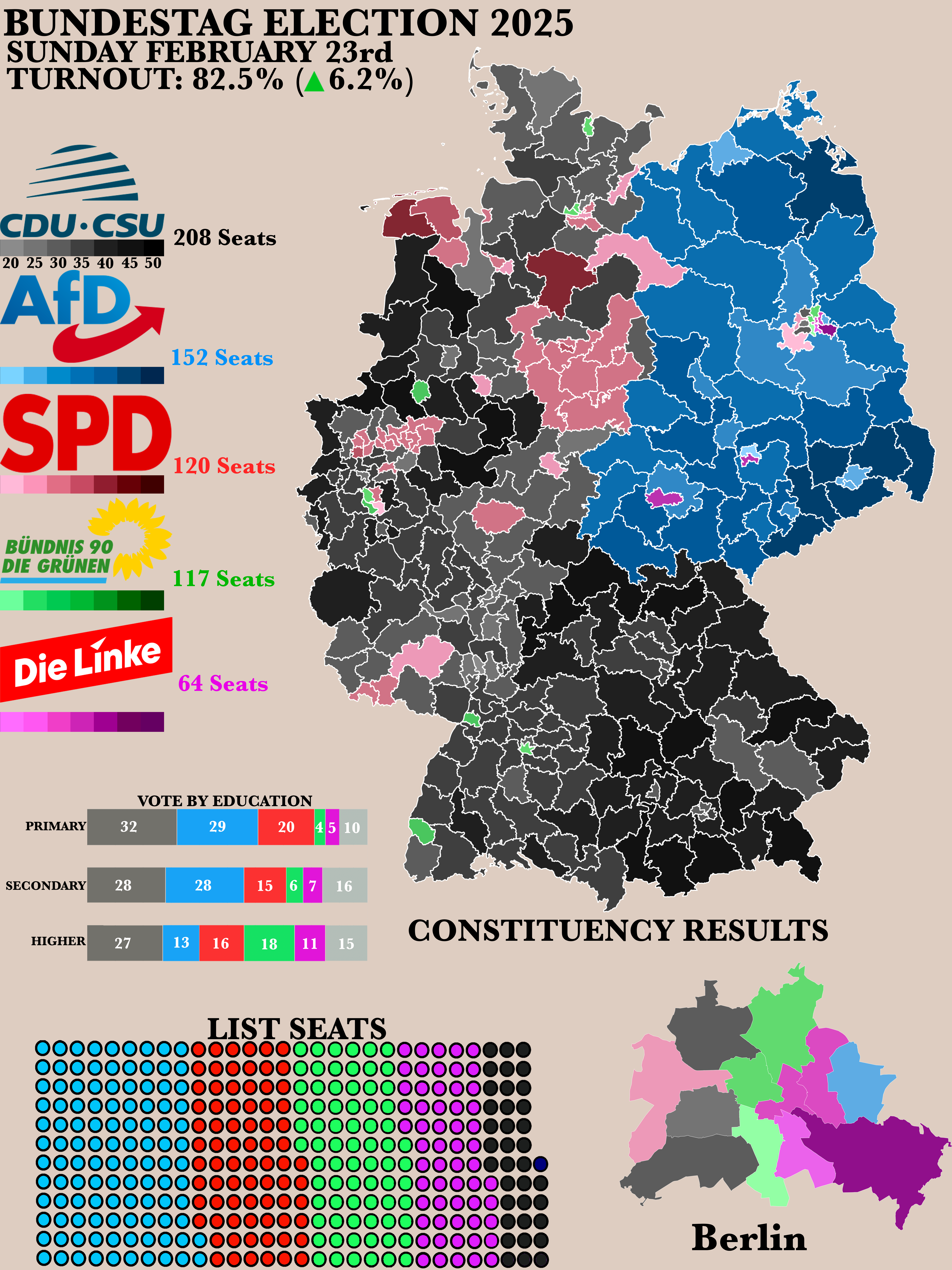
2025 German Bundestag Election Results Map
The "Poster of the 2025 German Bundestag Election Results" map provides a clear visual representation of the electoral o...
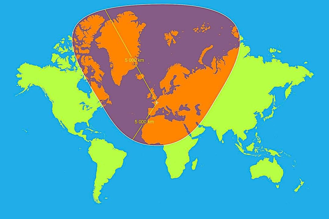
Map of 5,000km Radius from Paris
This map visualizes a circle with a 5,000 km radius centered on Paris, France. It highlights an extensive area that span...
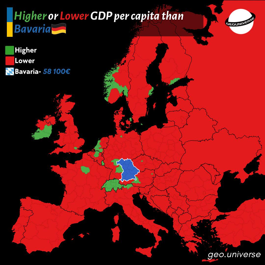
Bavaria Wealth Comparison Map to Europe
The "How Rich is Bavaria Compared to the Rest of Europe?" map provides a visual representation of the economic status of...
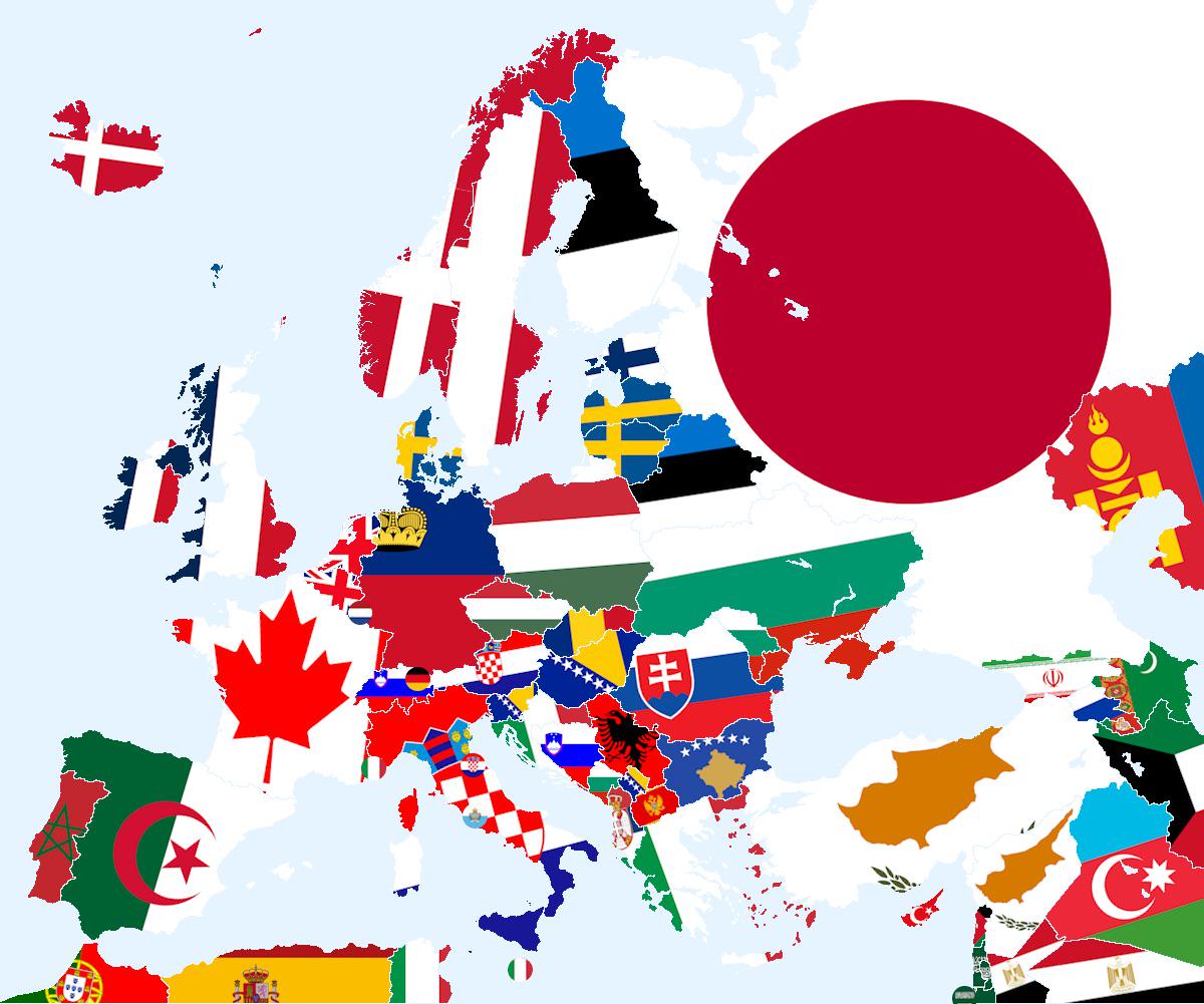
Closest Country That Doesn’t Share Land Border Map
The visualization titled \...
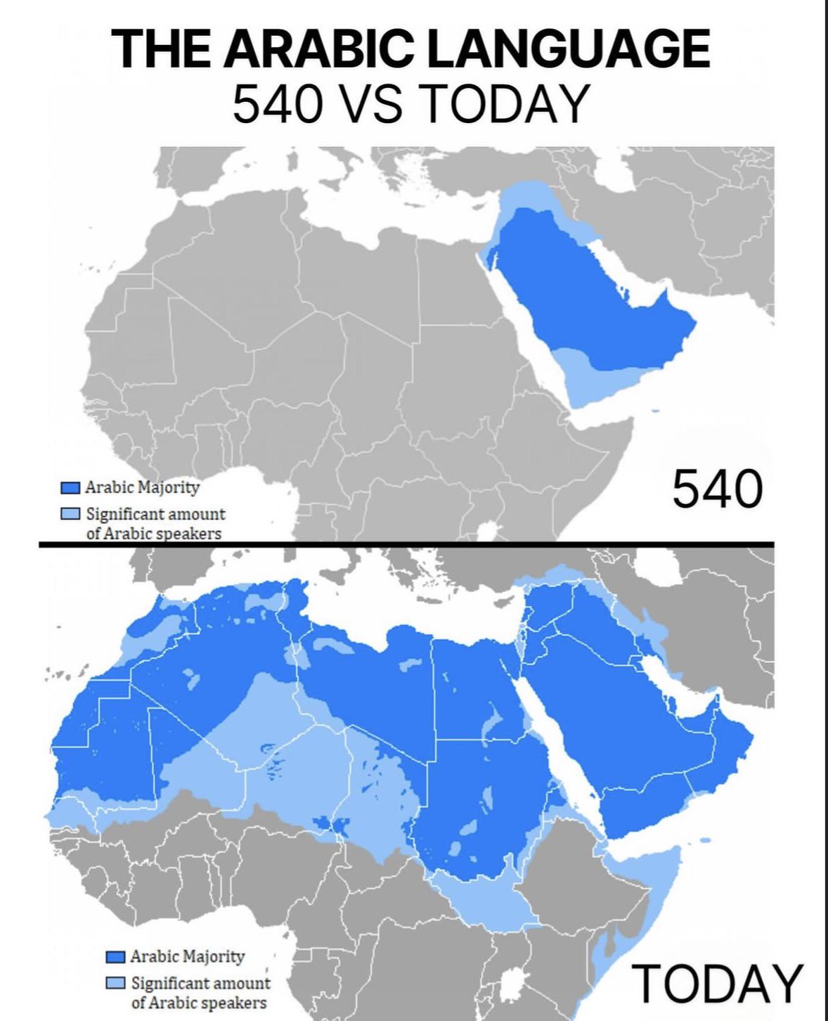
Arabic Language Distribution Map: 540 vs Today
The visualization titled "The Arabic Language: 540 vs Today" provides a compelling comparison of the geographical spread...
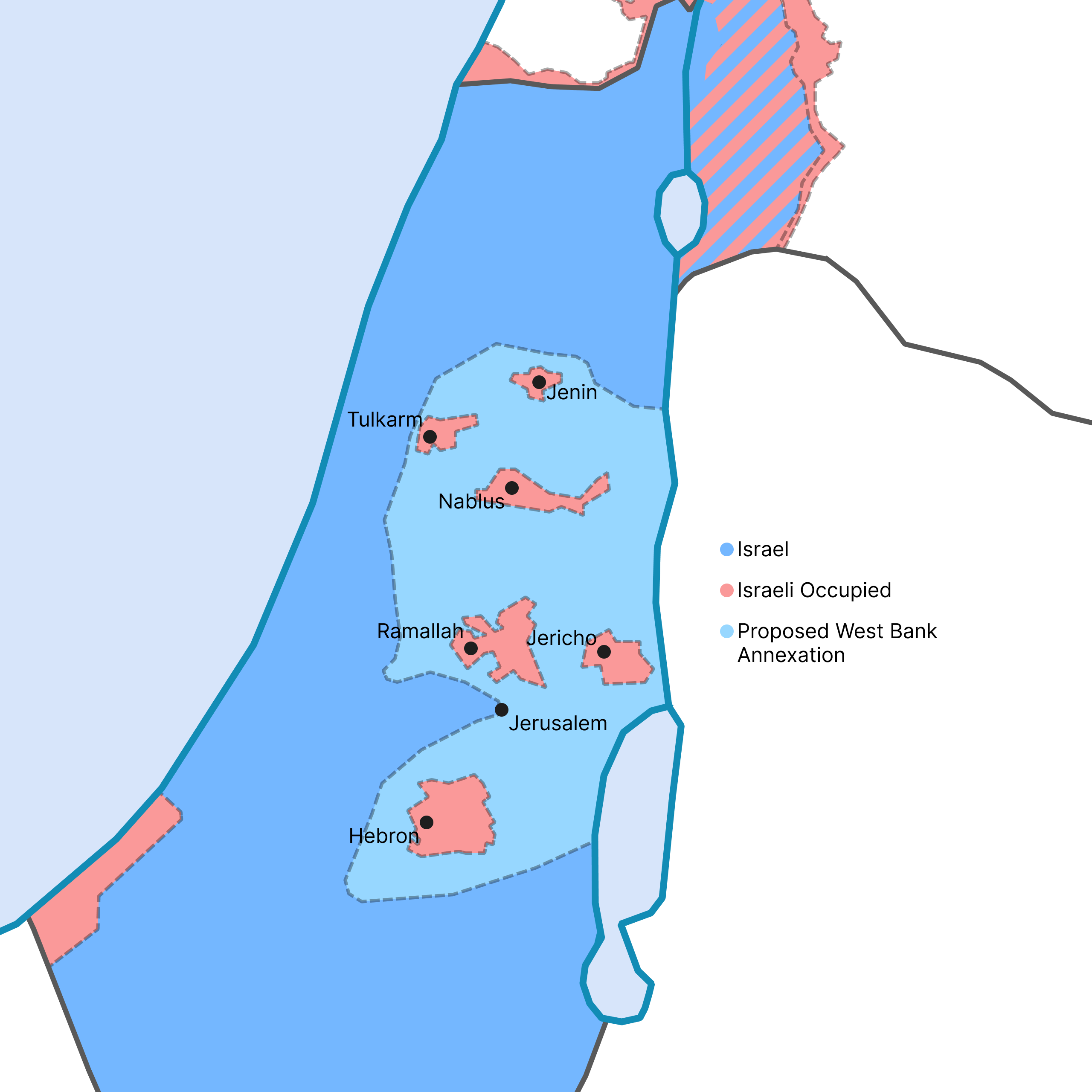
West Bank Annexation Proposal Map
This map visualizes the potential outcome of the Israeli government's recent proposal to annex a significant portion of ...
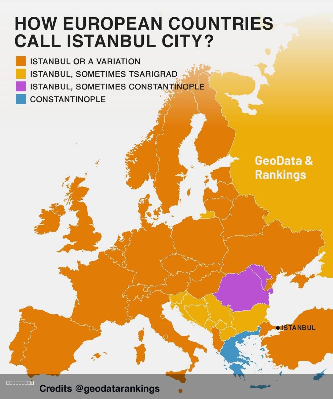
Map of How European Countries Call Istanbul
This map illustrates the various names that different European countries use to refer to the city of Istanbul, Turkey. W...
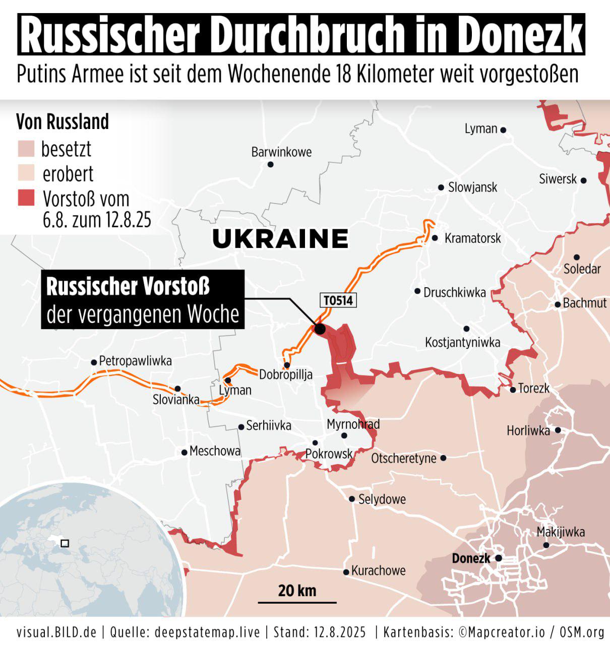
Russian Army Progress Map Over Past Week
The visualization titled "Progress of the Russian army over the past 7 days, according to the German outlet Bild" provid...
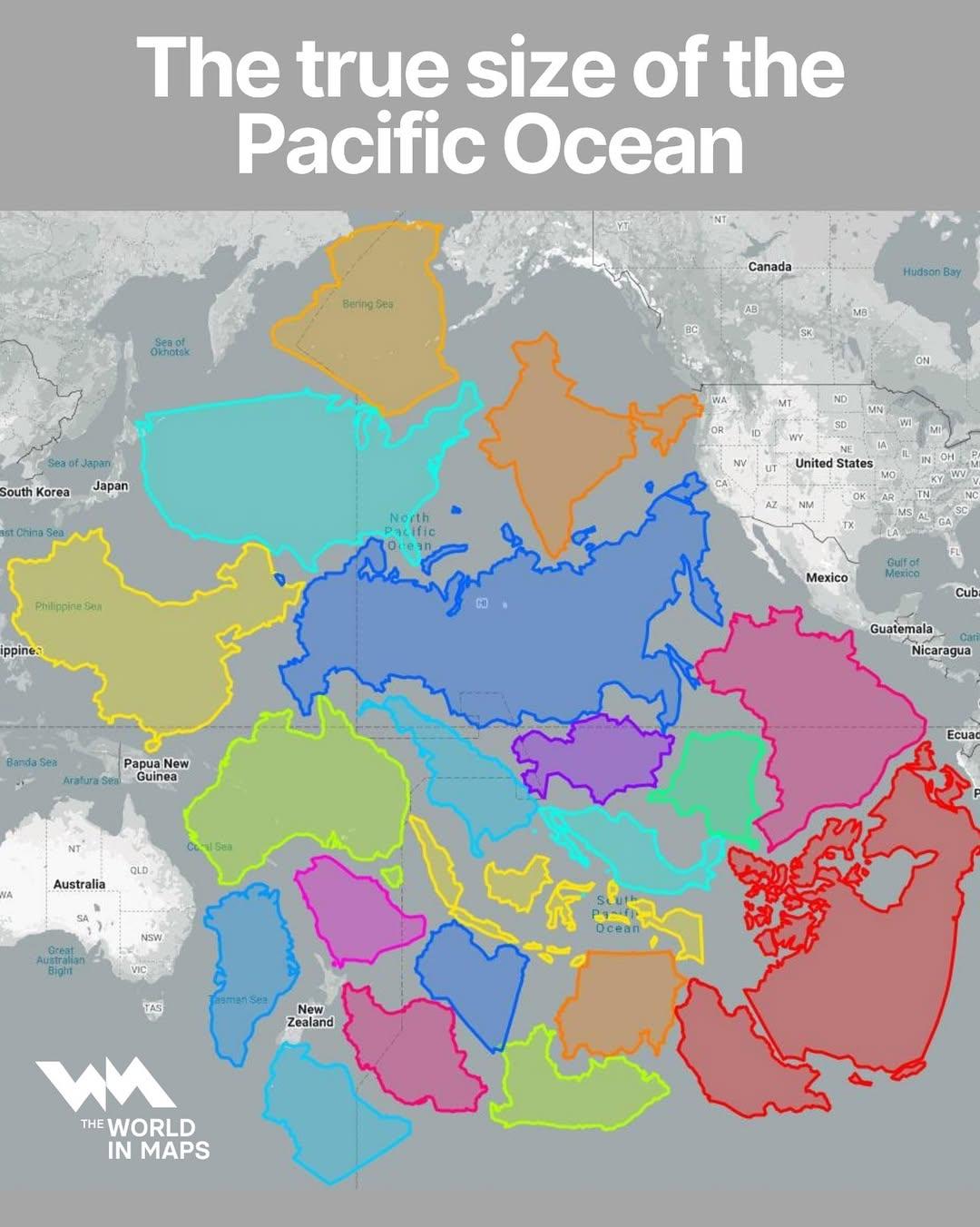
Map of the True Size of the Pacific Ocean
The visualization titled "The True Size of the Pacific Ocean" illustrates the vastness of the Pacific Ocean by accuratel...
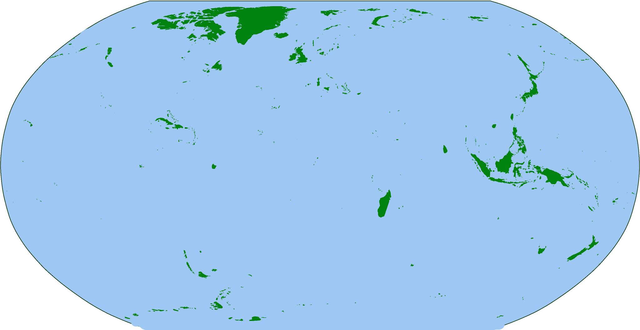
Map of the World's Islands
The visualization titled "The Earth... But Just Islands" presents a unique perspective on our planet by isolating and hi...
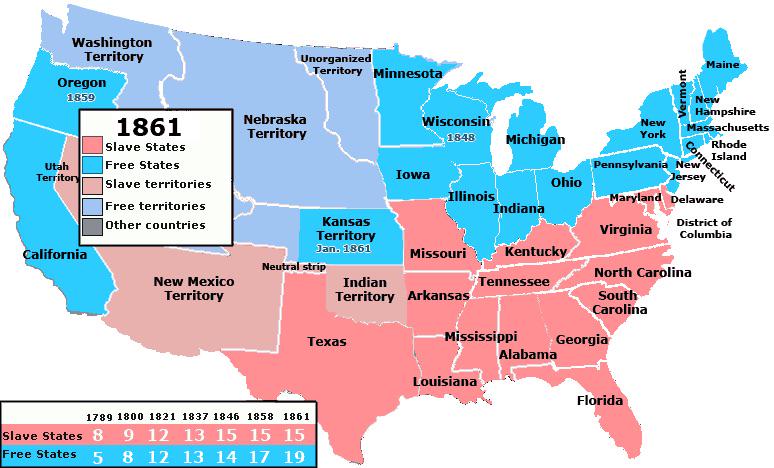
Free and Slave States at the Start of the Civil War Map
...
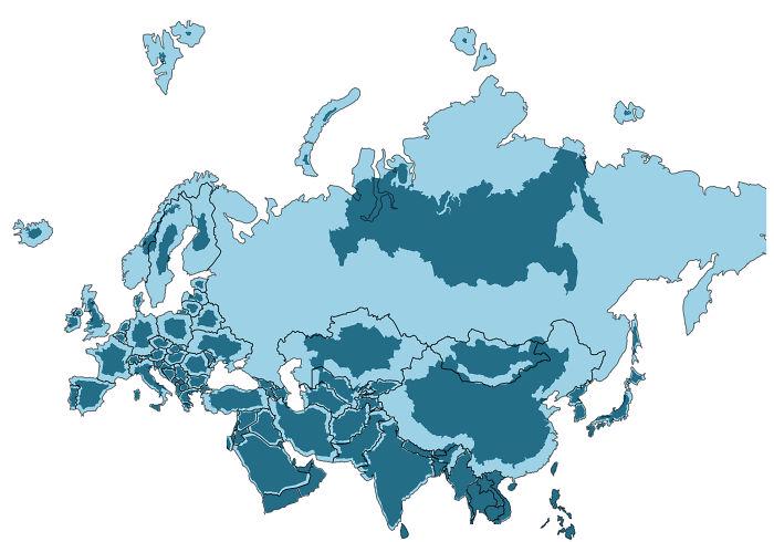
True Size of Every Country in Eurasia Map
The visualization titled "The True Size of Every Country in Eurasia" provides a unique perspective on the geographical s...
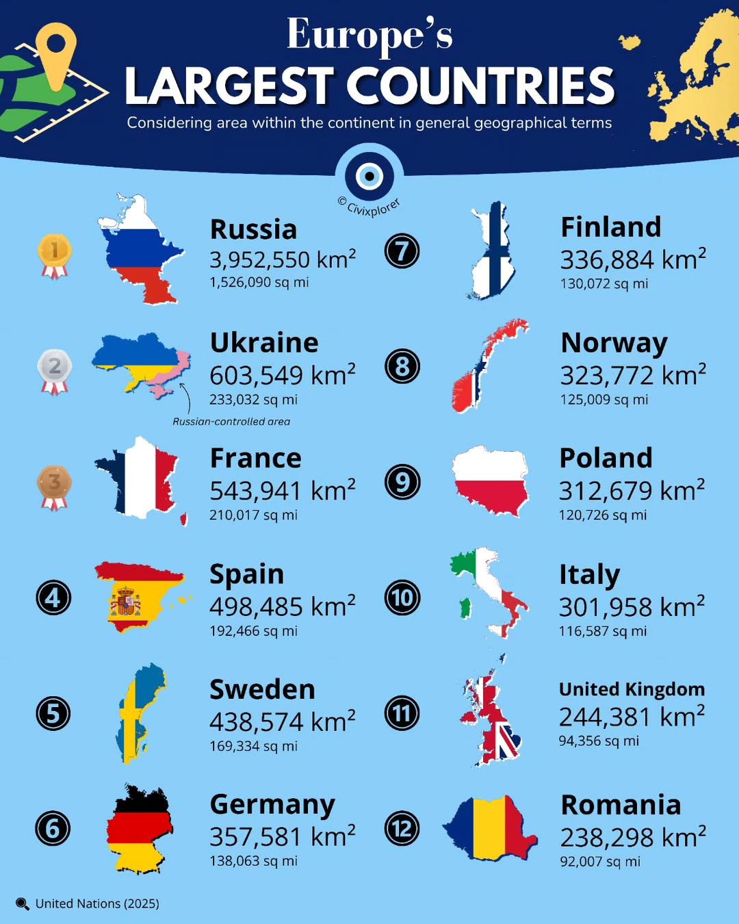
Largest Countries in Europe by Land Area Map
This map presents a clear visualization of the largest countries in Europe by land area, showcasing the vast differences...
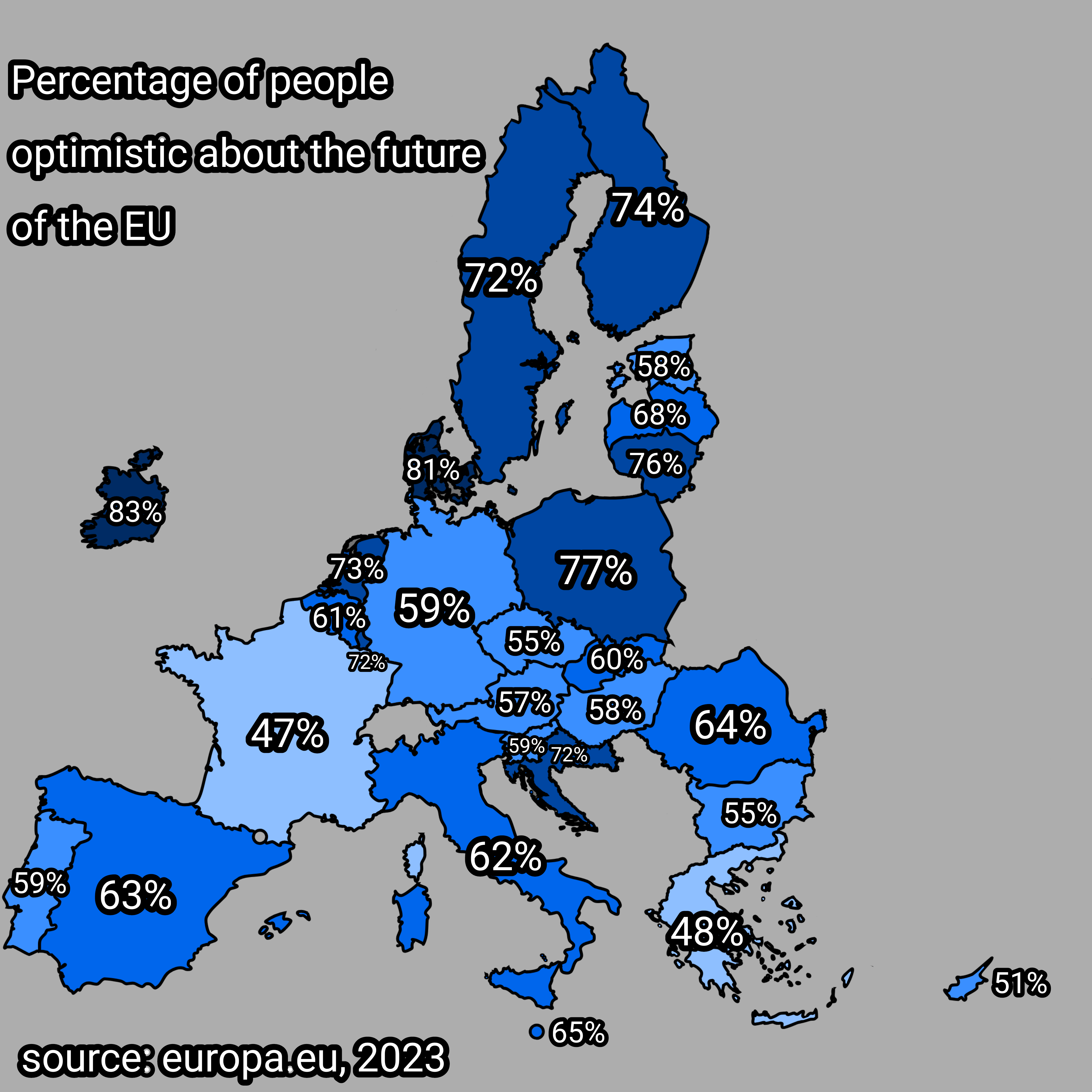
Optimism About the Future of the EU Map
The visualization titled "Percentage of People Optimistic About the Future of the EU" presents data on the varying level...
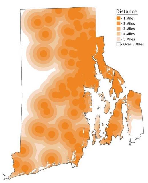
Distance to Farthest Dunkin' Location Map in Rhode Island
The map titled "Distance to Farthest Dunkin' Location in Rhode Island" provides a unique and engaging way to visualize t...
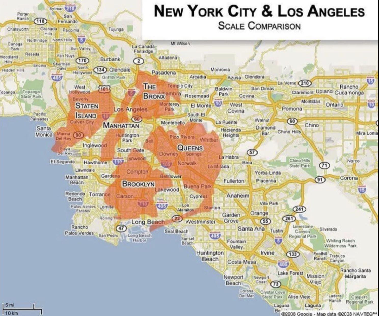
Population and Area Comparison Map of New York and Los Angeles
This map provides a clear visual comparison of the population and area of two of the most iconic cities in the United St...
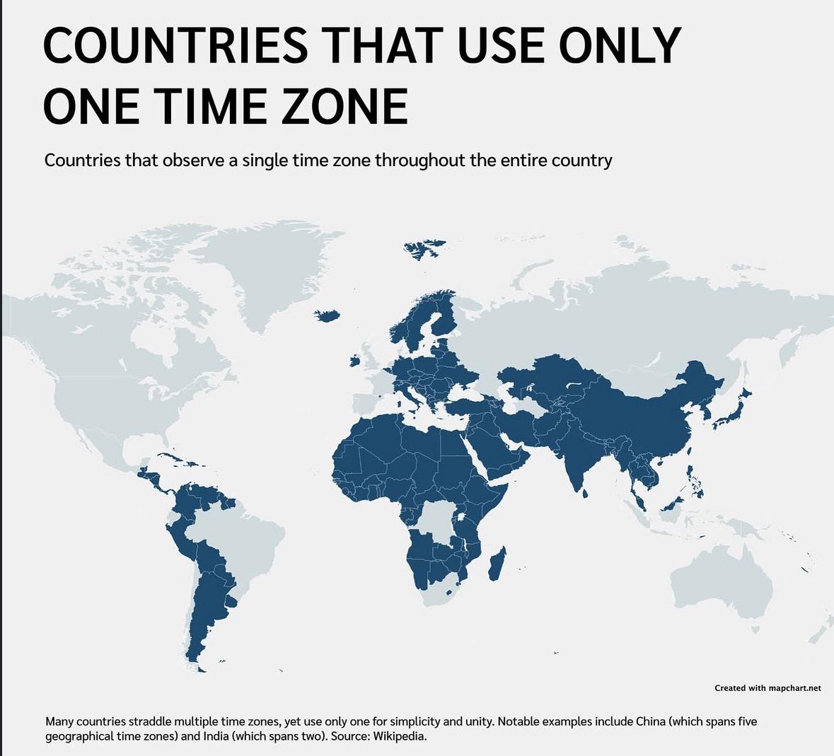
Countries That Use One Time Zone Map
This map visually represents the countries that operate within a single time zone. It highlights nations that, despite t...
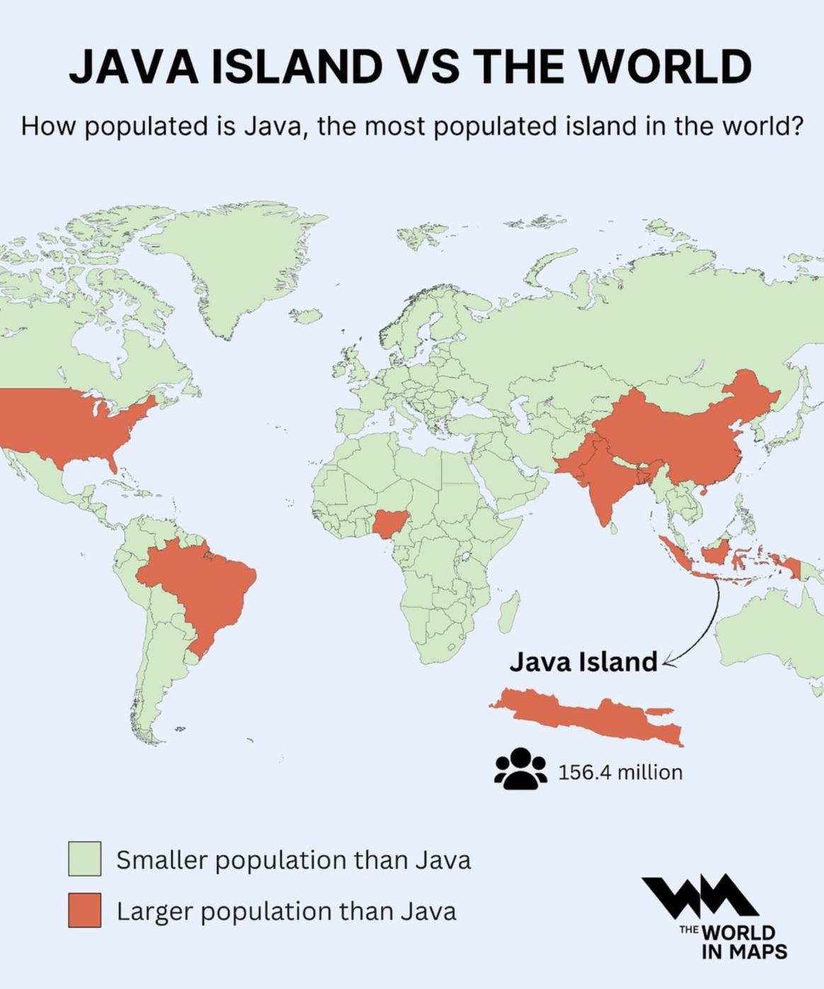
Population Density Map of Java Island
The visualization at hand provides a striking representation of Java Island, illustrating its status as the most populat...
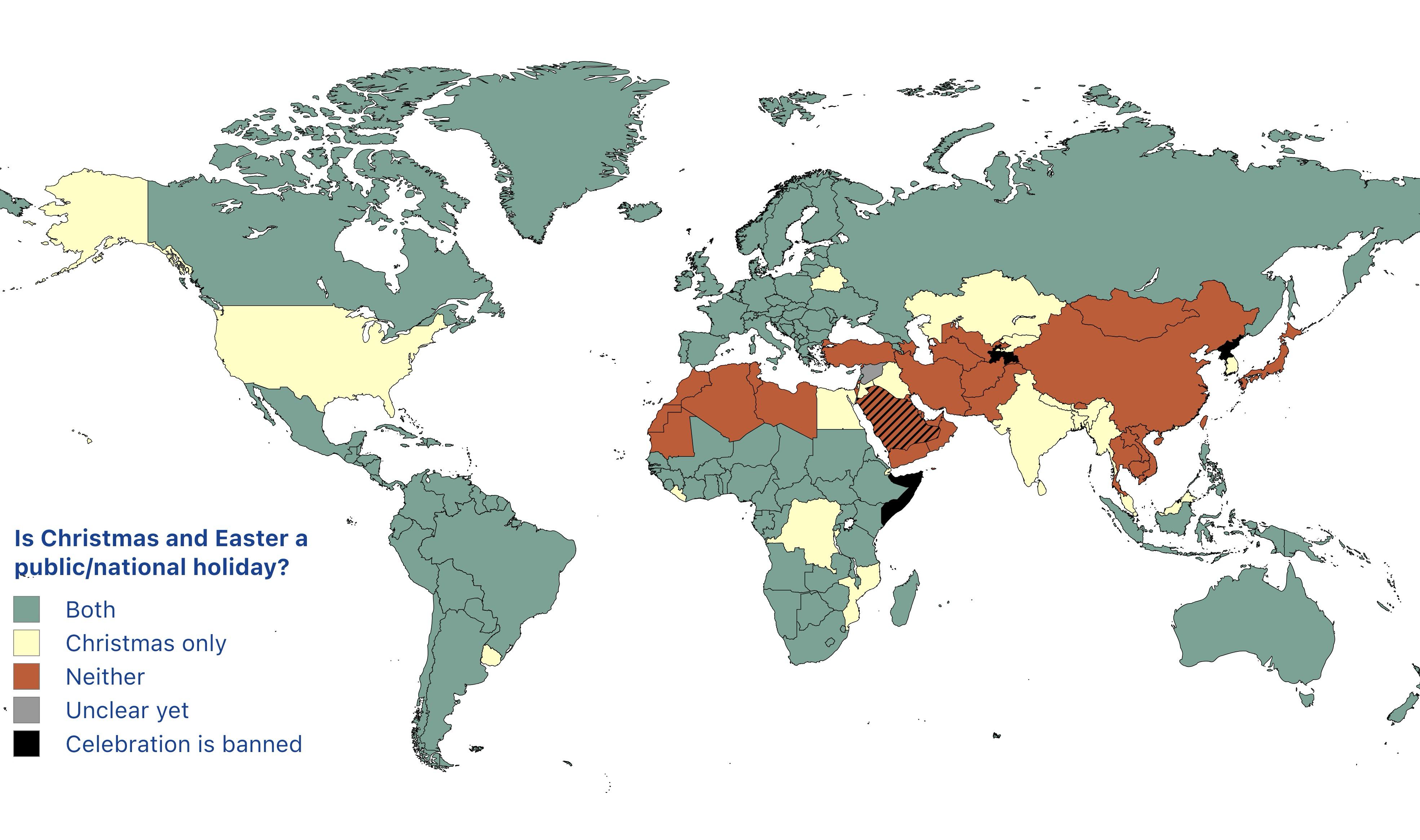
Public Holidays for Christmas and Easter Map
The map titled "Countries where Christmas or Easter are considered public holidays" illustrates the global landscape of ...
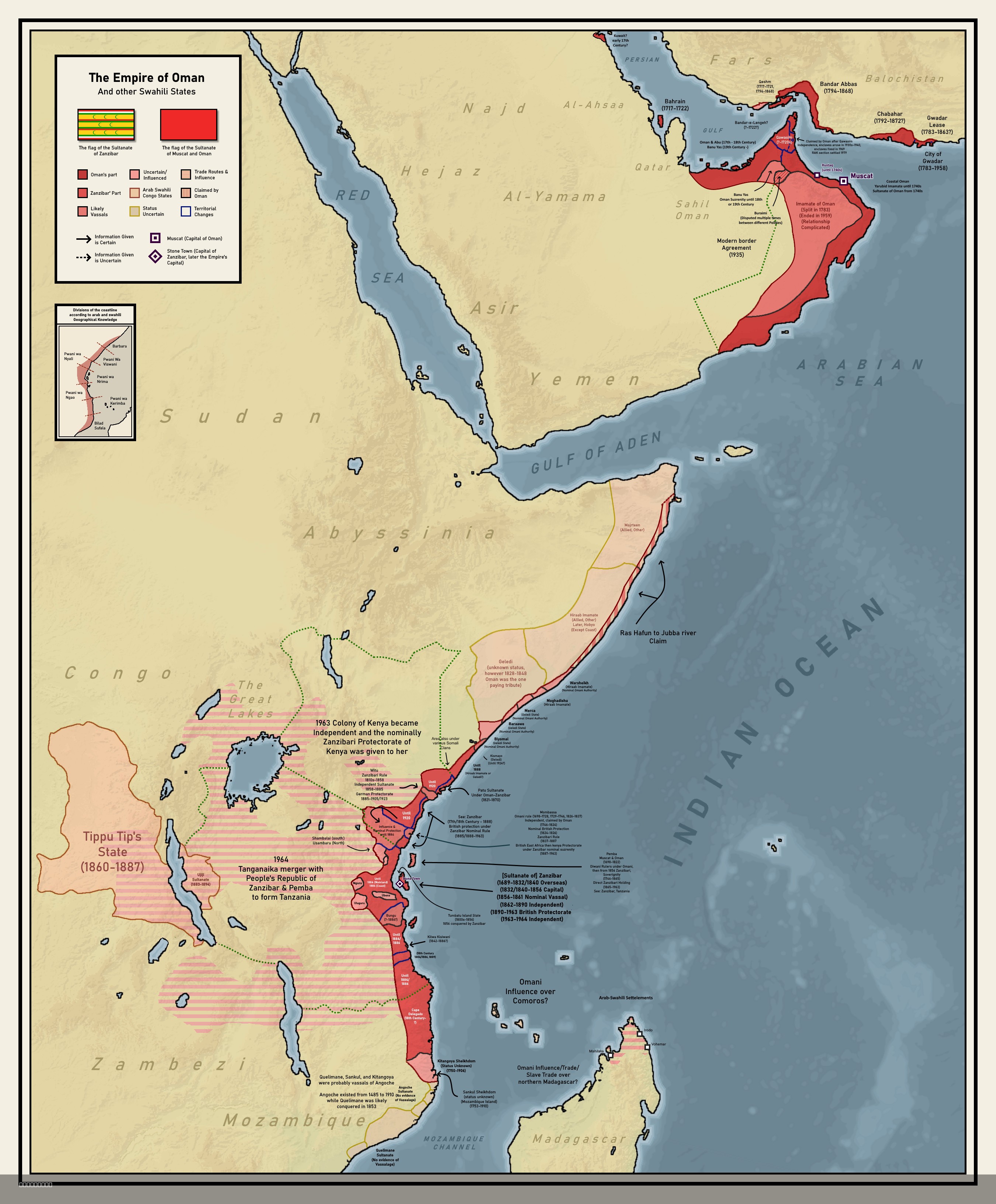
Colonial Empire of Oman Map 1696 to 1856
The map titled "Forgotten Colonial Empire of Oman from 1696 to 1856" illustrates the extensive territorial reach of the ...
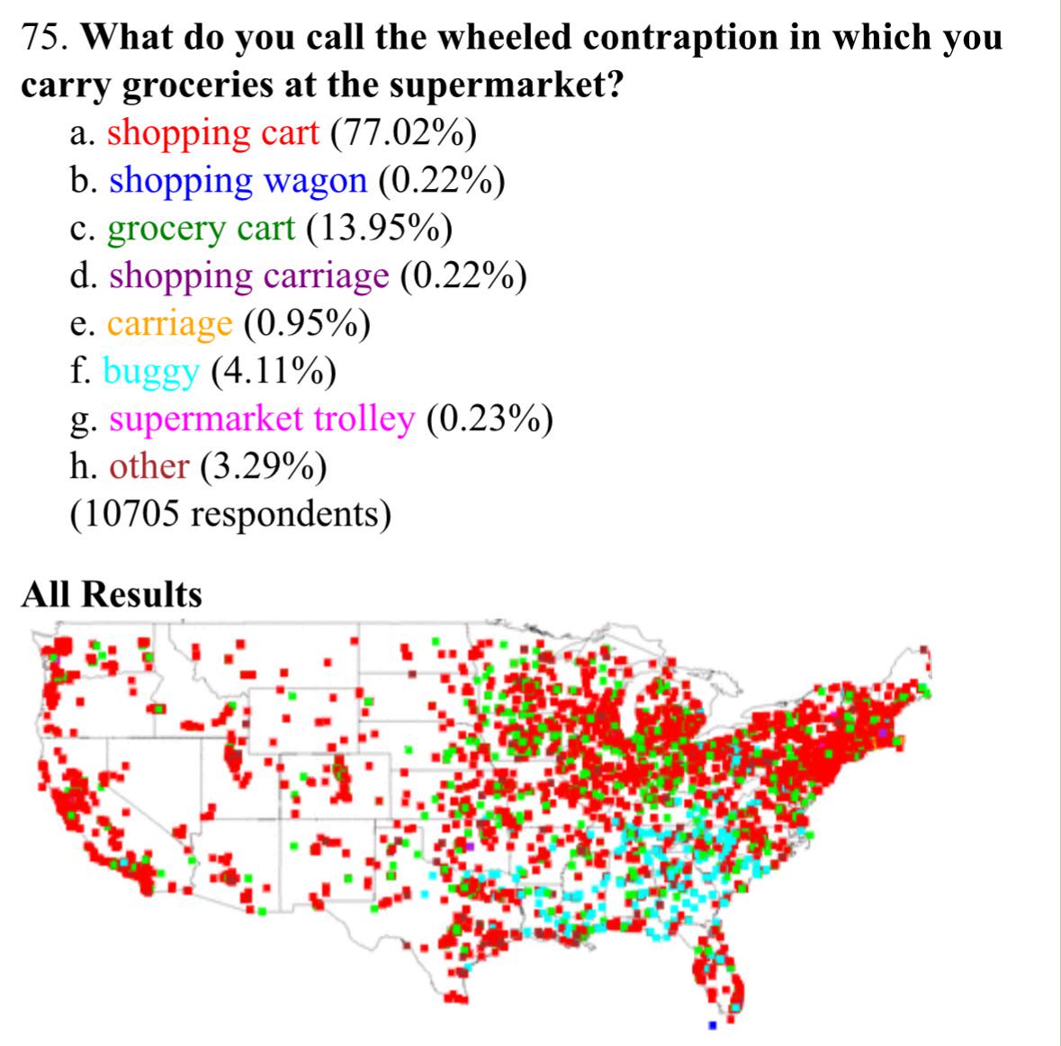
Shopping Cart Terminology in the United States Map
The visualization titled "What Americans Call Shopping Carts" provides an intriguing look into the regional variations o...
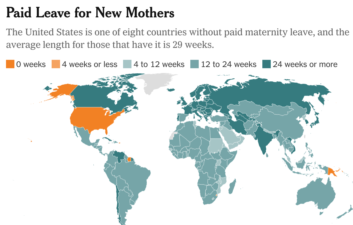
Global GDP Per Capita Map
This map provides a visual representation of Gross Domestic Product (GDP) per capita across countries worldwide. GDP per...
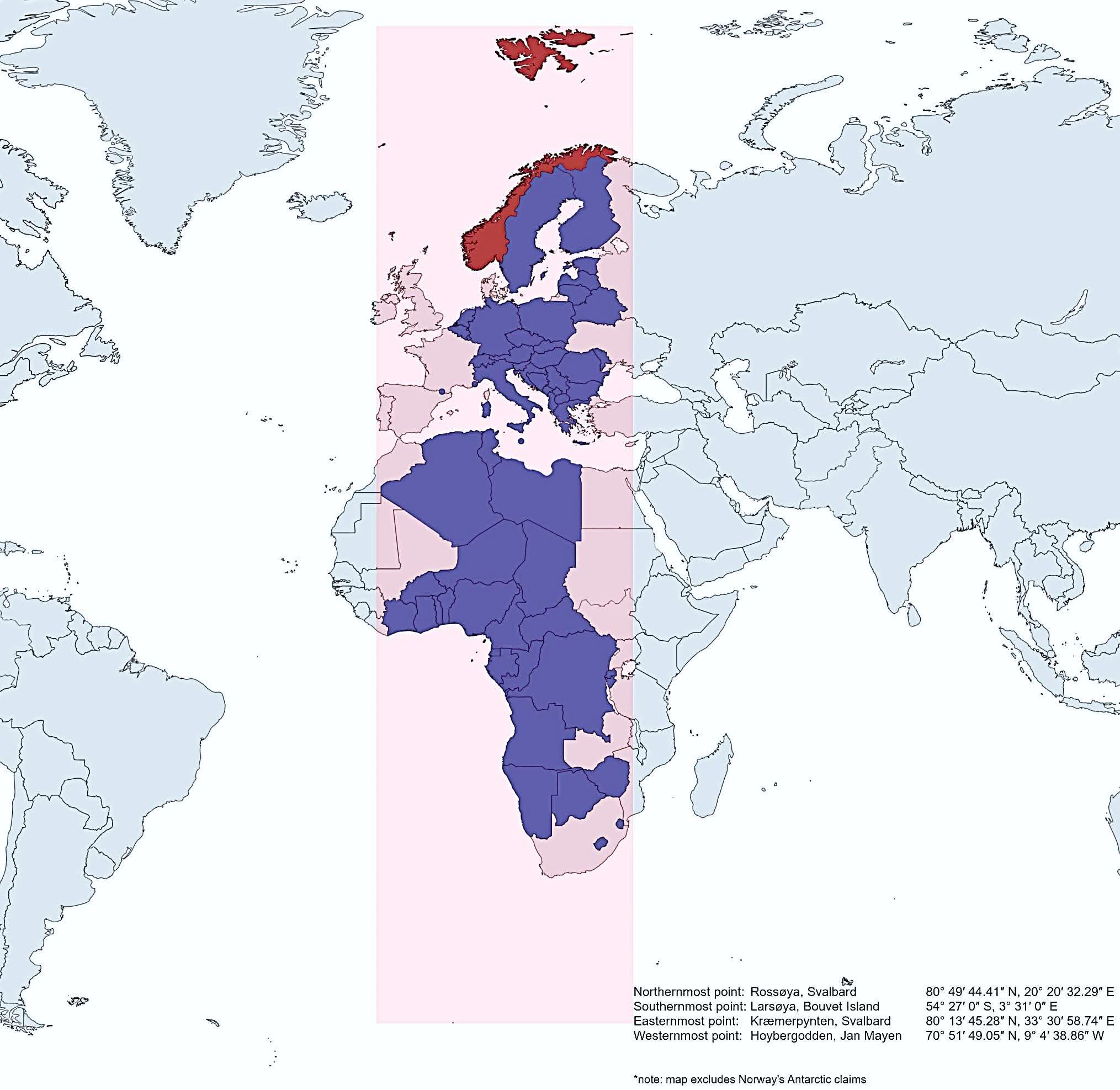
Map of Norway's Geographic Extent Compared to Other Countries
This map vividly illustrates how Norway extends further north, south, east, and west than several other countries, showc...
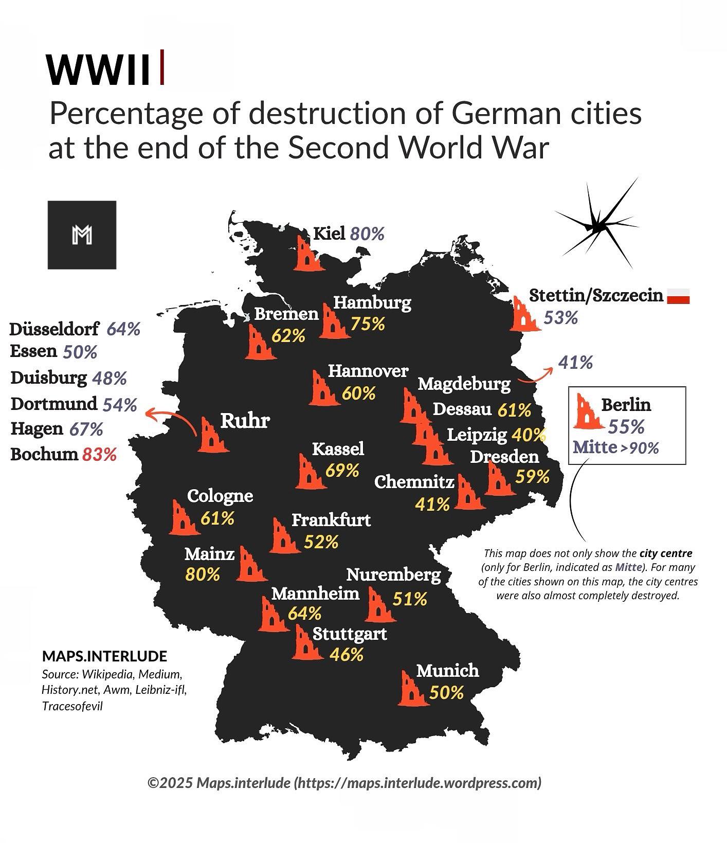
Map of Destruction of German Cities in WWII
The map titled "Percentage of Destruction of German Cities at the End of the Second World War" provides a striking visua...
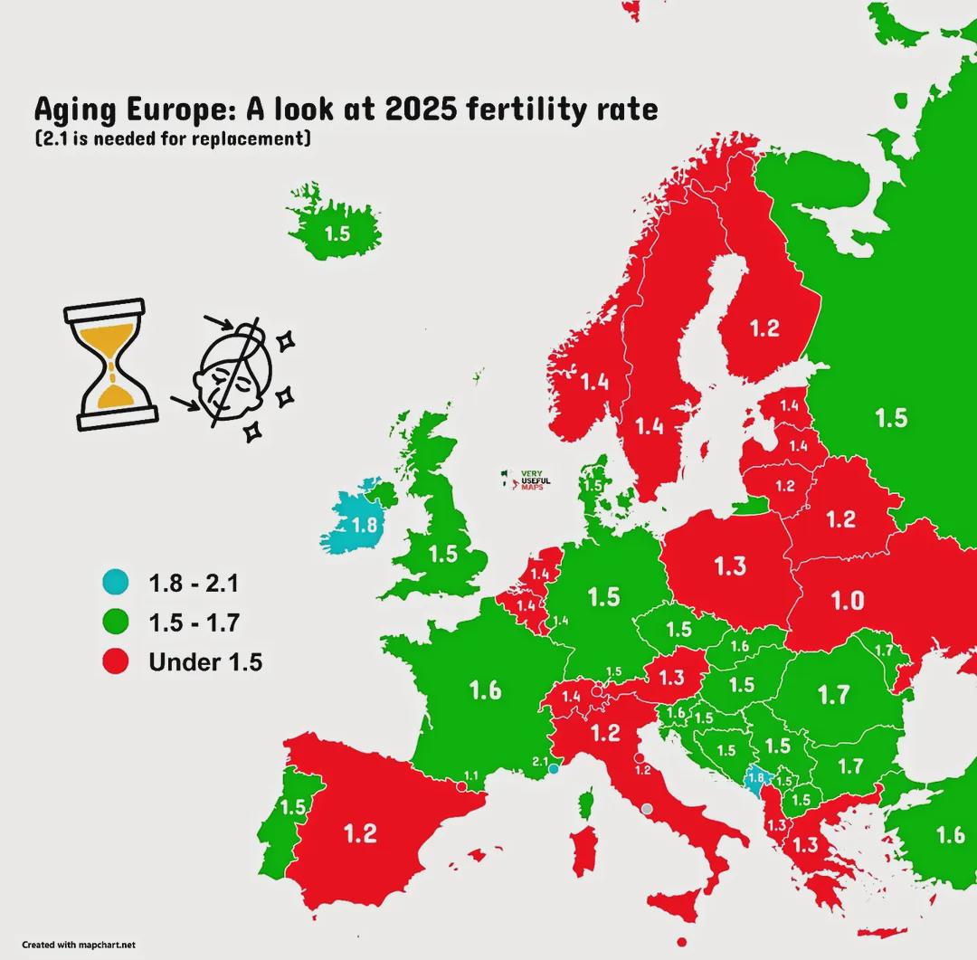
Ageing Population Map of Europe
The "Ageing Europe!" map provides a comprehensive visualization of the demographic shifts occurring across the continent...
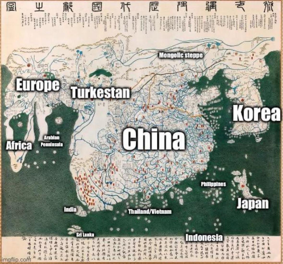
1402 World Map from Korea
...
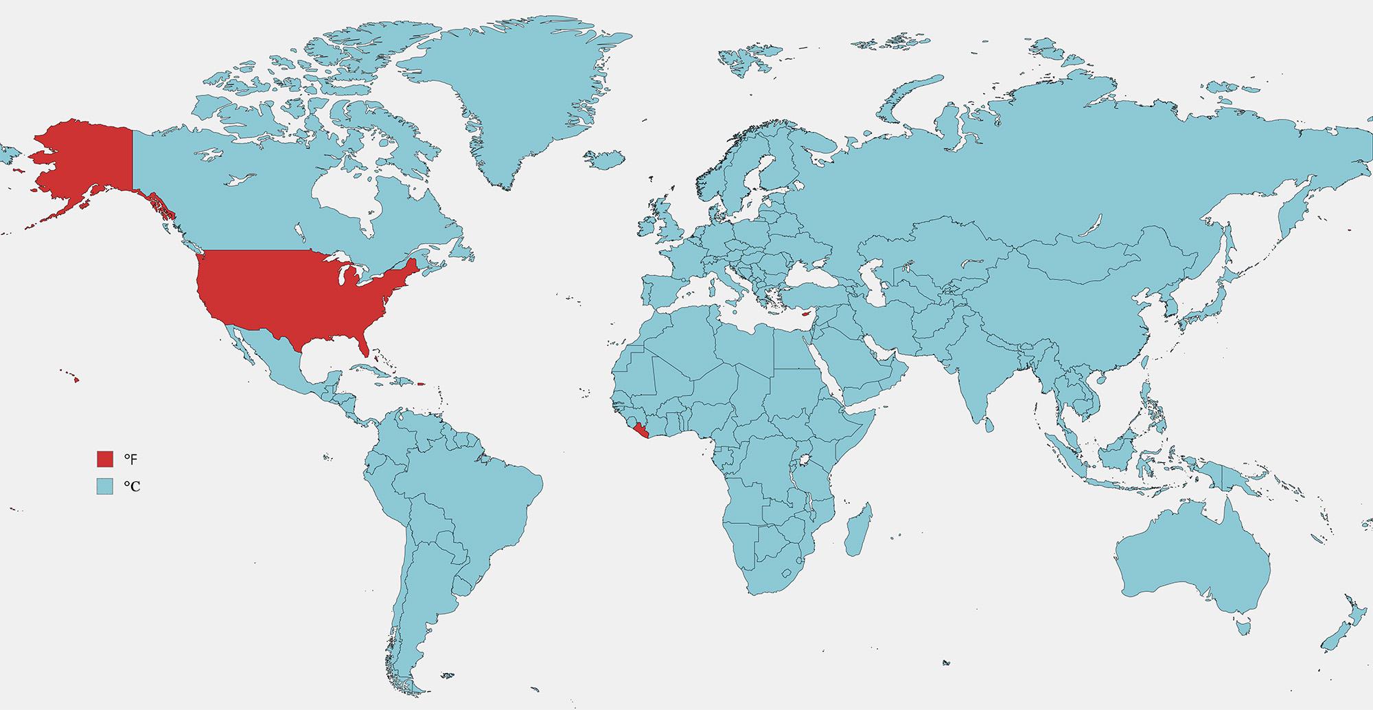
Fahrenheit vs Celsius Usage Map by Country
The visualization titled "Countries that Use Fahrenheit vs Celsius" provides a clear depiction of the global temperature...
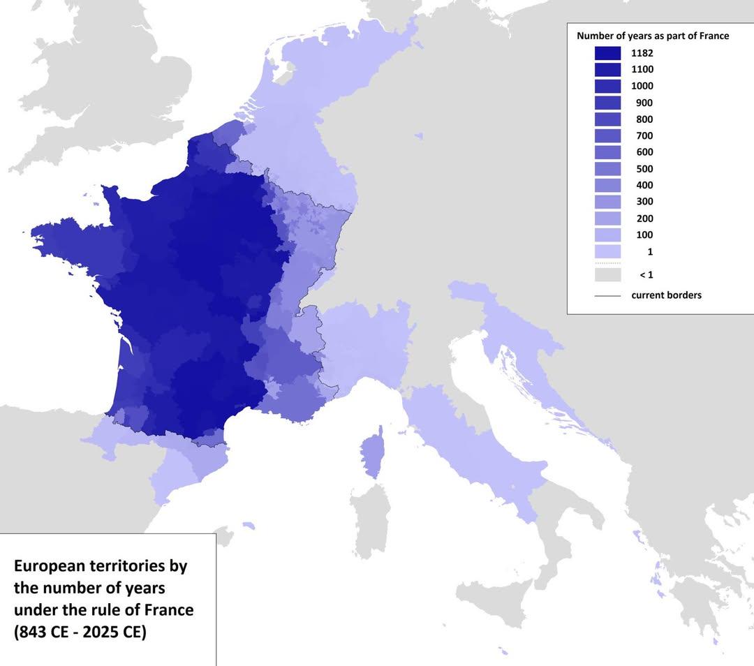
Map of European Territories By Years Under France
The visualization titled 'Map of European Territories By The Number of Years Spent Being Part of France' offers a compre...
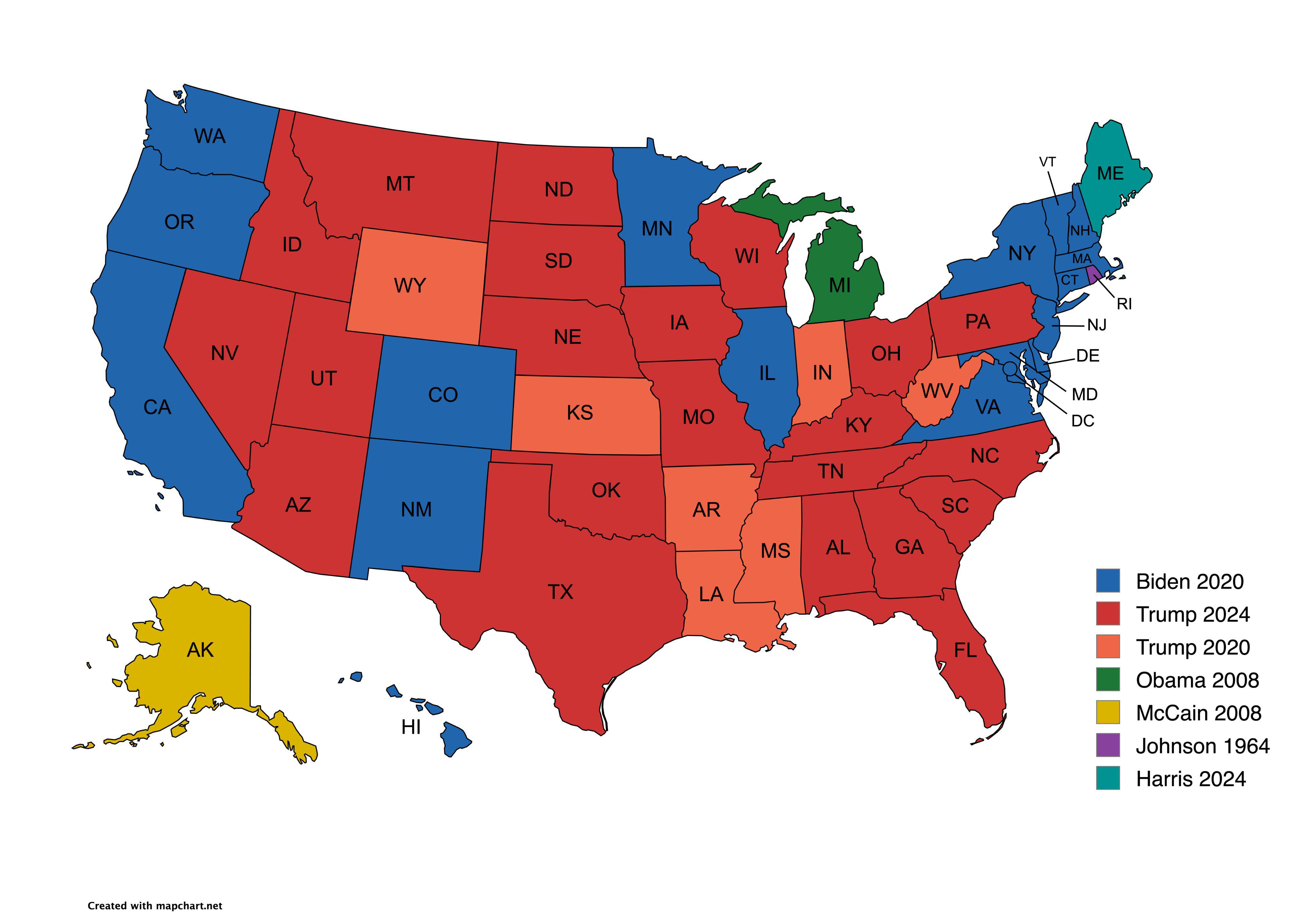
Presidential Candidate Vote Distribution by State Map
The map titled "Which Presidential Candidate Won The Largest Amount Of Votes In An Election By State" provides a visual ...
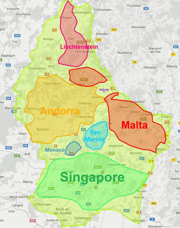
Luxembourg Size Comparison Map
The "Luxembourg is non so small" map presents a captivating visual that challenges common perceptions about the size of ...
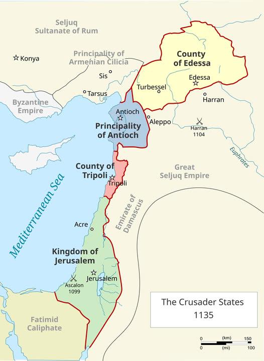
Map of the 4 Catholic Crusader States in 1135
The "Map of the 4 Catholic Crusader States in 1135" provides a snapshot of a pivotal period in medieval history, highlig...
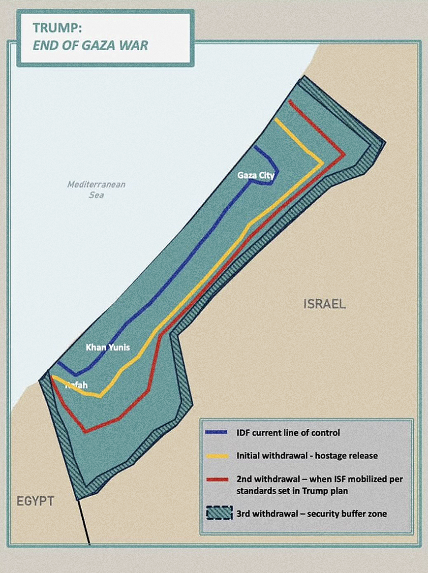
Trump's Gaza Withdrawal Map Analysis
The "Trump’s Gaza Withdrawal Map" published by the White House visualizes the proposed territorial changes and withdrawa...
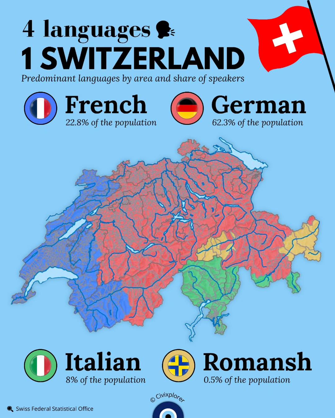
Predominant Languages in Switzerland by Area Map
This map provides a detailed visualization of the predominant languages spoken across different areas of Switzerland, sh...