Geographic Visualizations
Explore our curated collection of fascinating geographic visualizations and cartographic analyses. Discover detailed maps, data visualizations, and geographical insights from around the world.
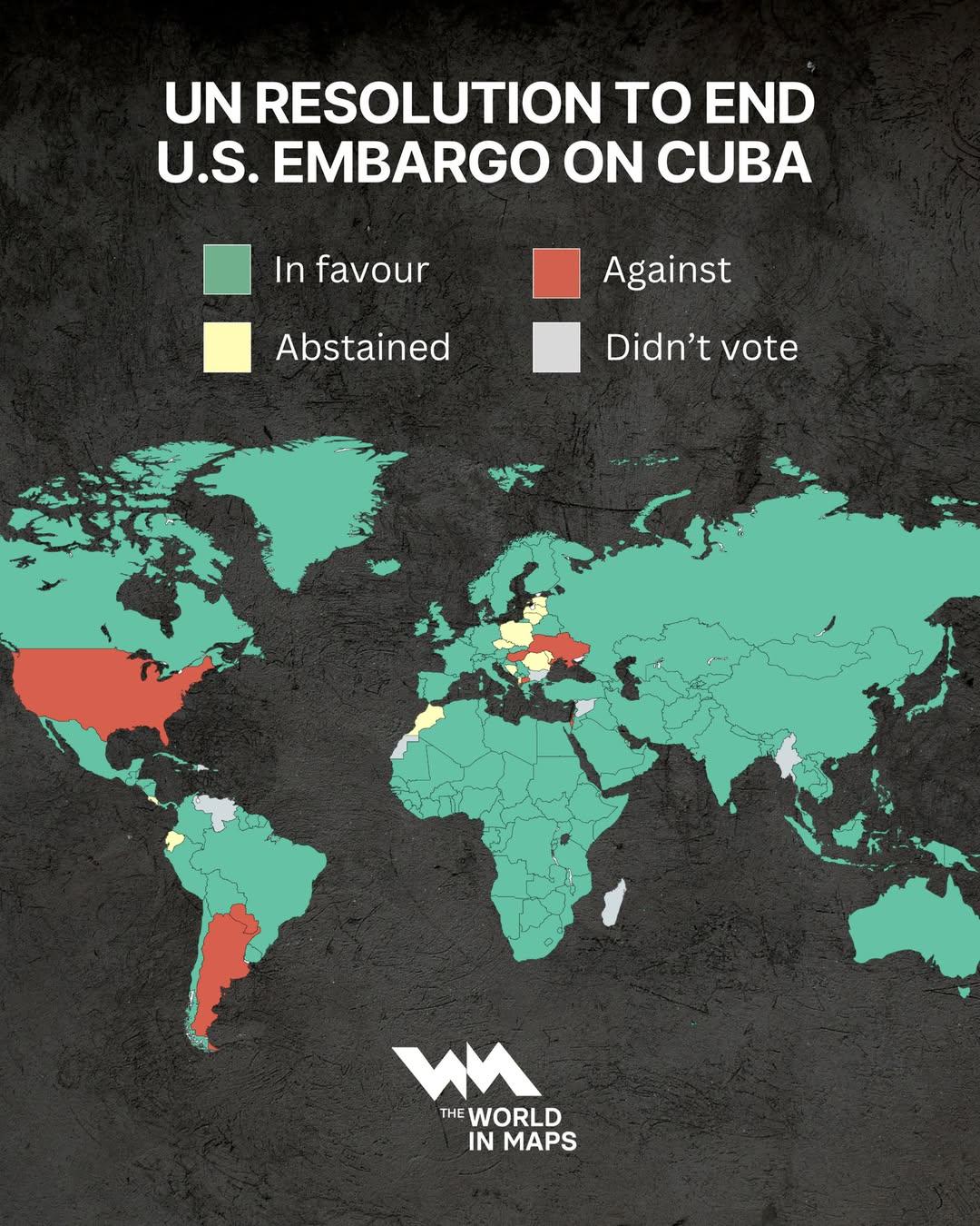
Map of UN Vote to End US Embargo Against Cuba
## What This Map Shows...
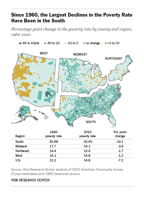
US Poverty Rate Decline Map 1960-2010
## What This Map Shows...
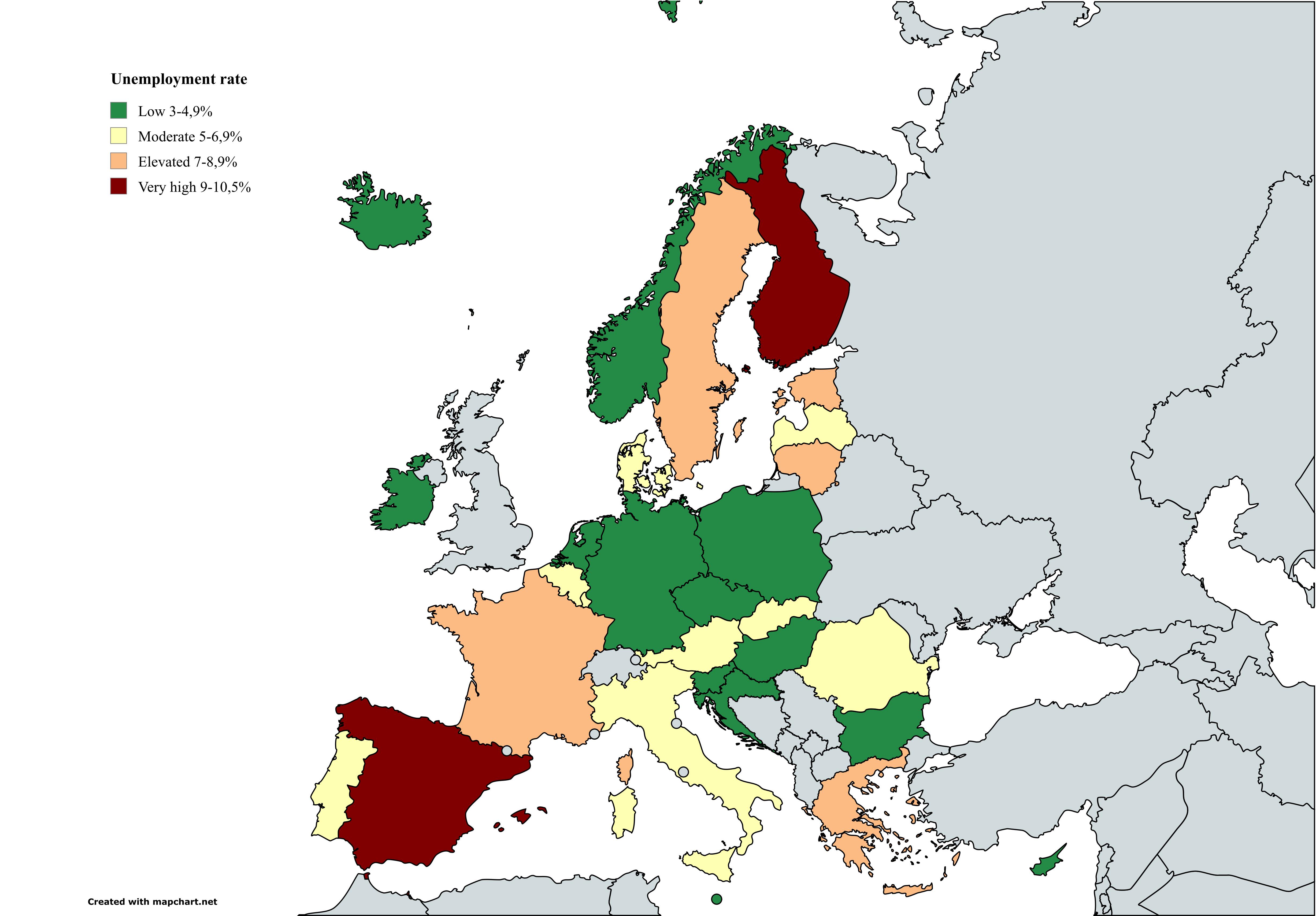
Unemployment Rate Map September 2025
## What This Map Shows...
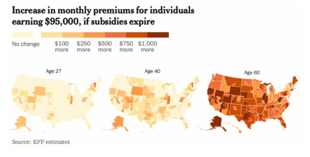
Healthcare Cost Increase Map Without Tax Subsidies
## What This Map Shows...
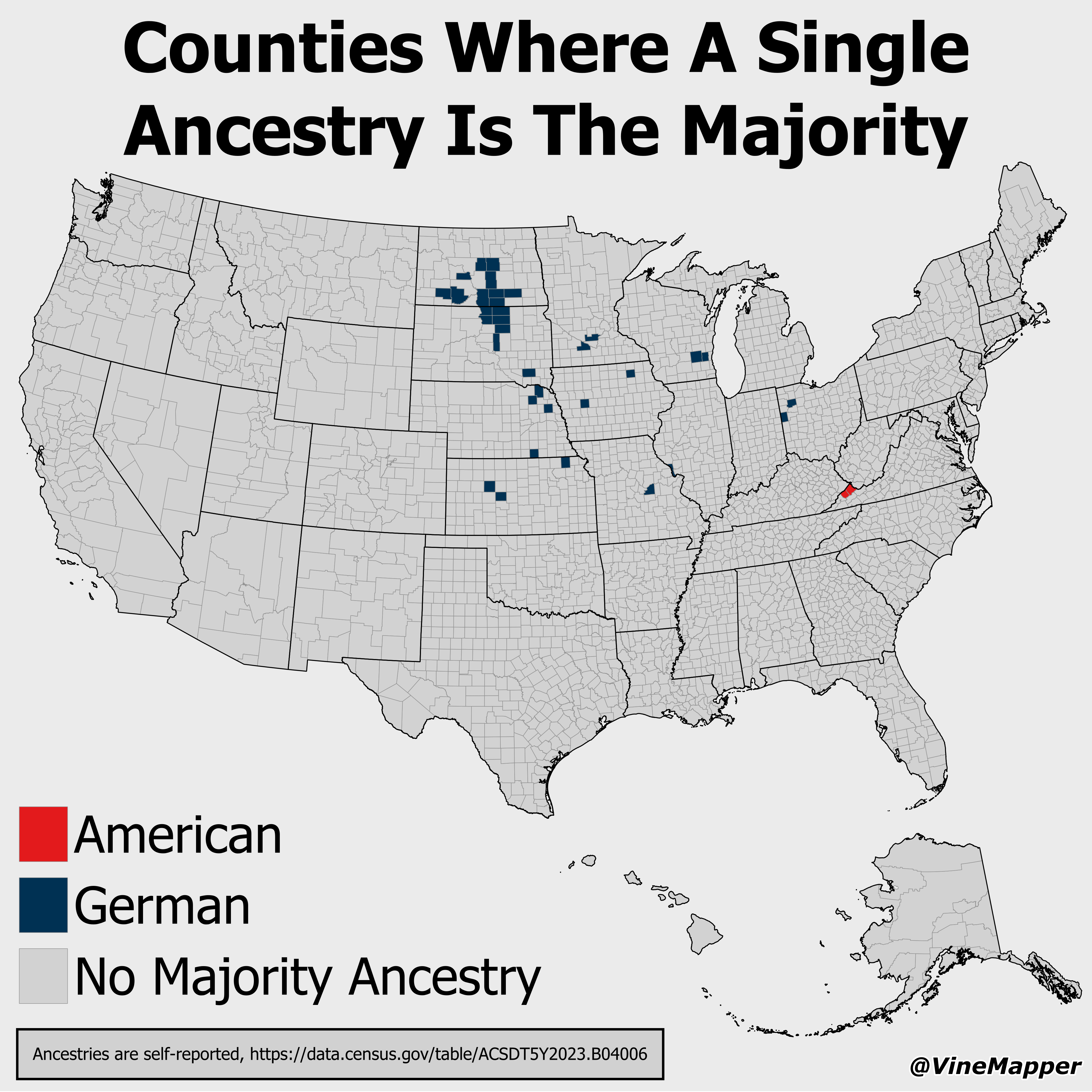
Counties Where A Single Ancestry Is The Majority Map
## What This Map Shows...
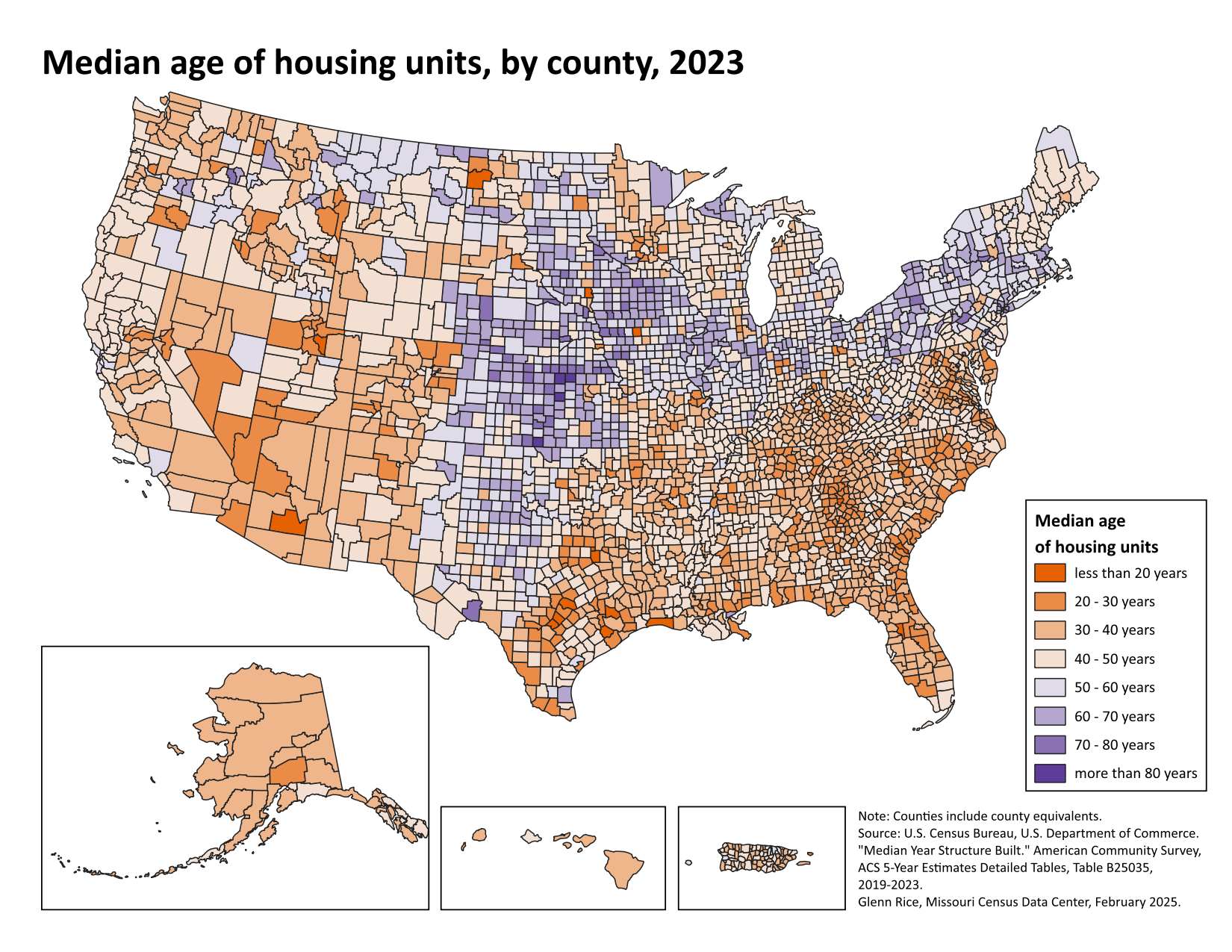
Median Age of Housing Units in USA Map
## What This Map Shows...
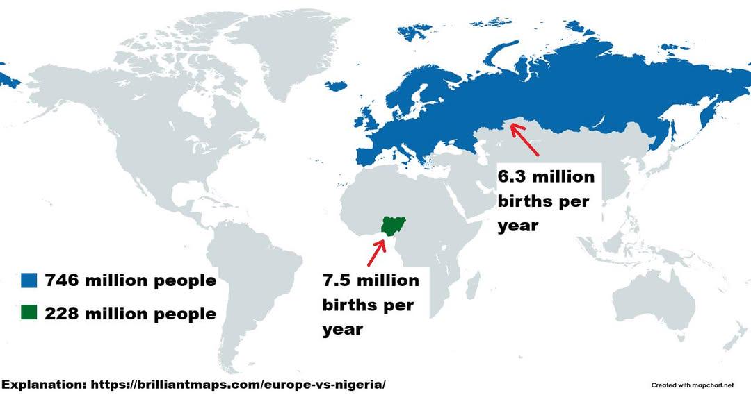
Birth Rates Comparison Map of Countries
## What This Map Shows...
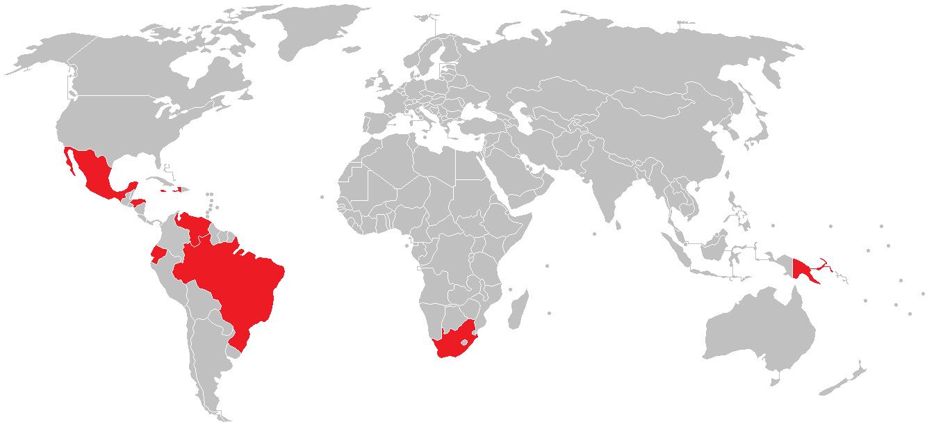
Map of Countries with Higher Violent Crime Rates Than Memphis
## What This Map Shows...
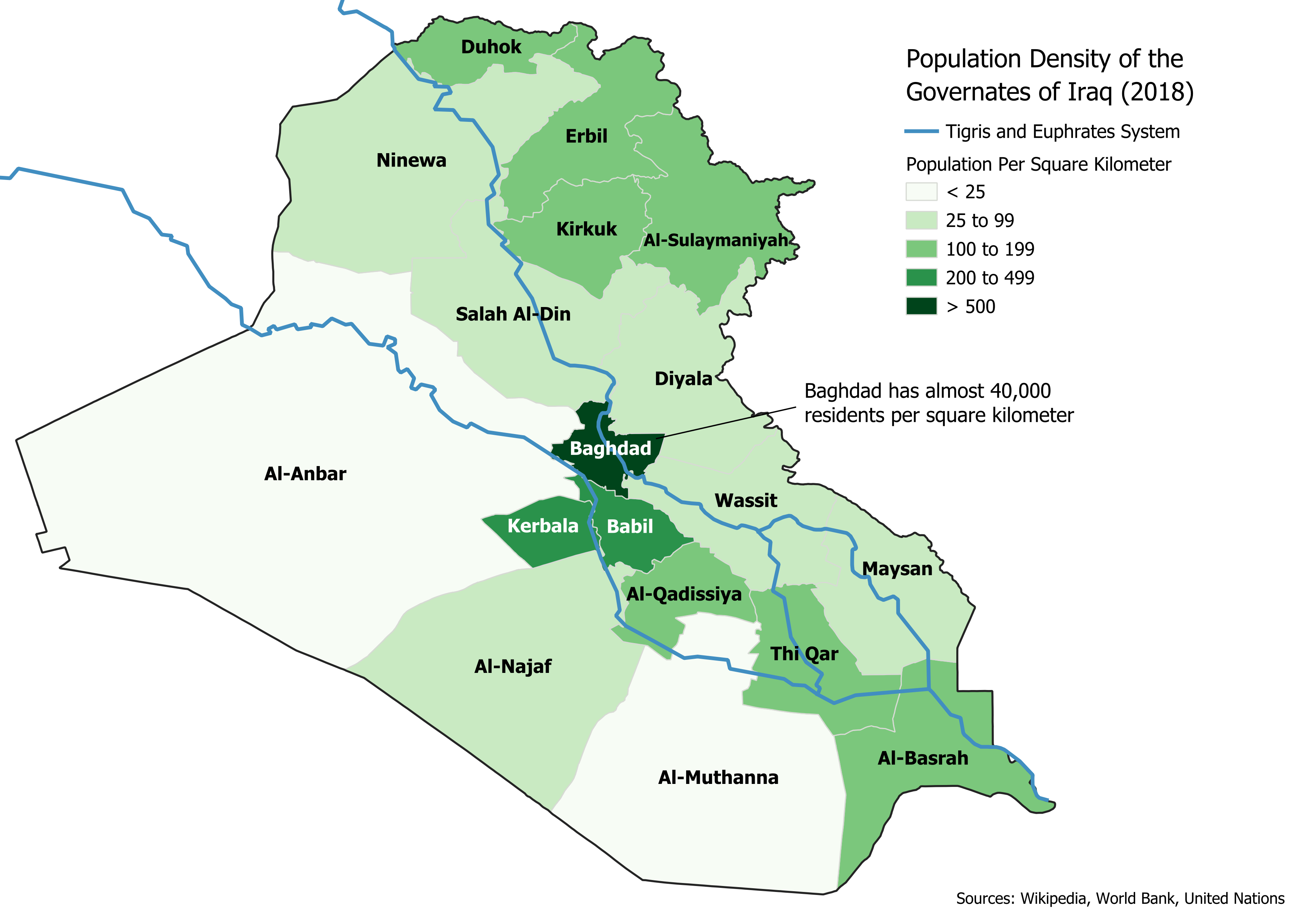
Population Density Map of Iraq
## What This Map Shows\nThe \...
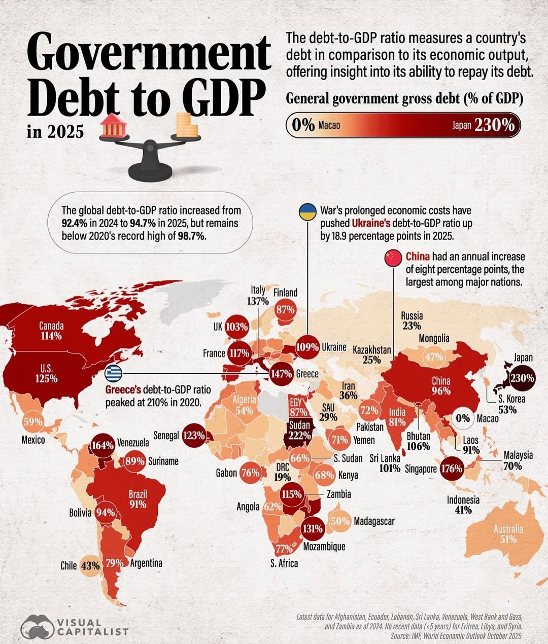
Government Debt to GDP in 2025 Map
## What This Map Shows...
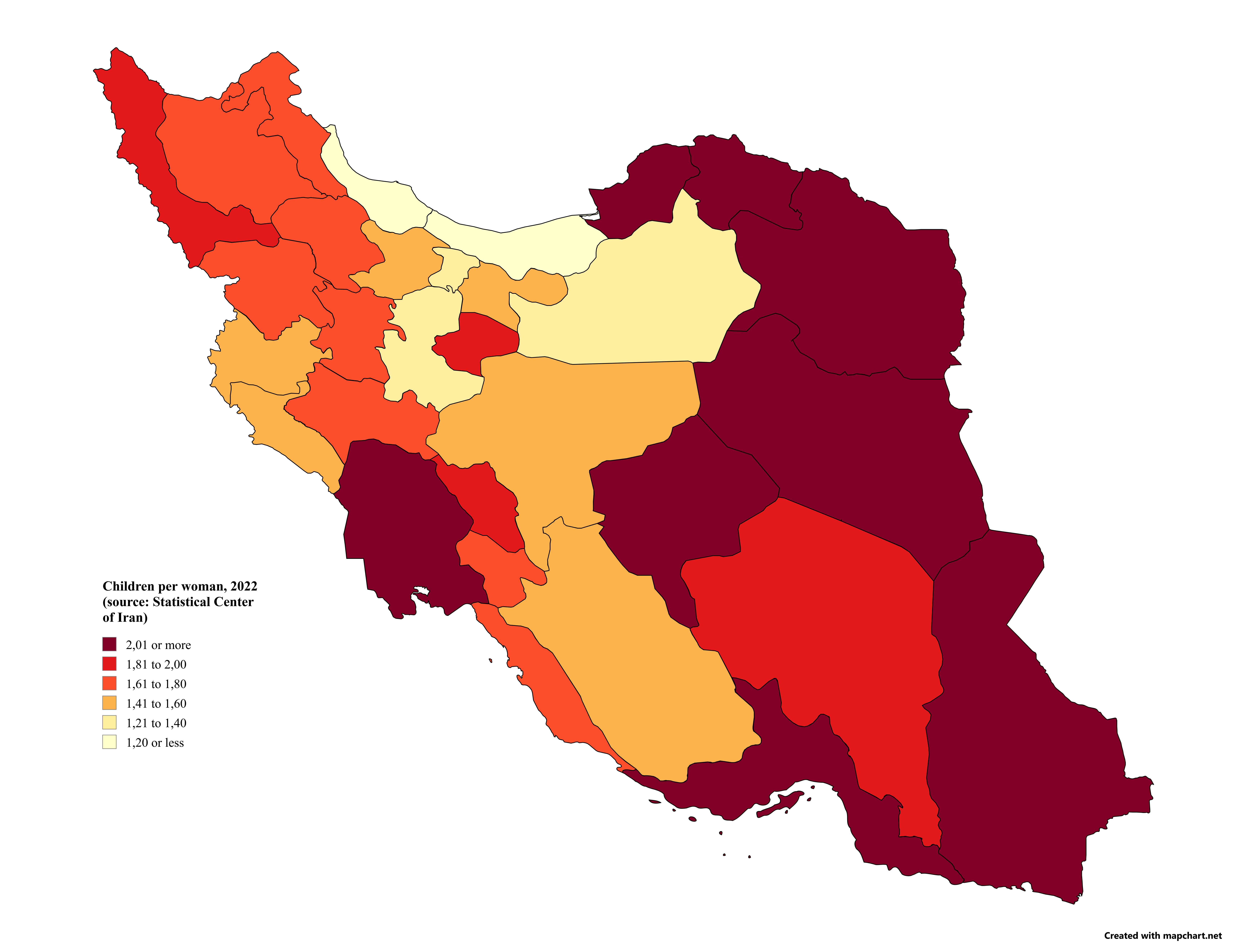
Children per Woman in Iran by Province Map
## What This Map Shows...
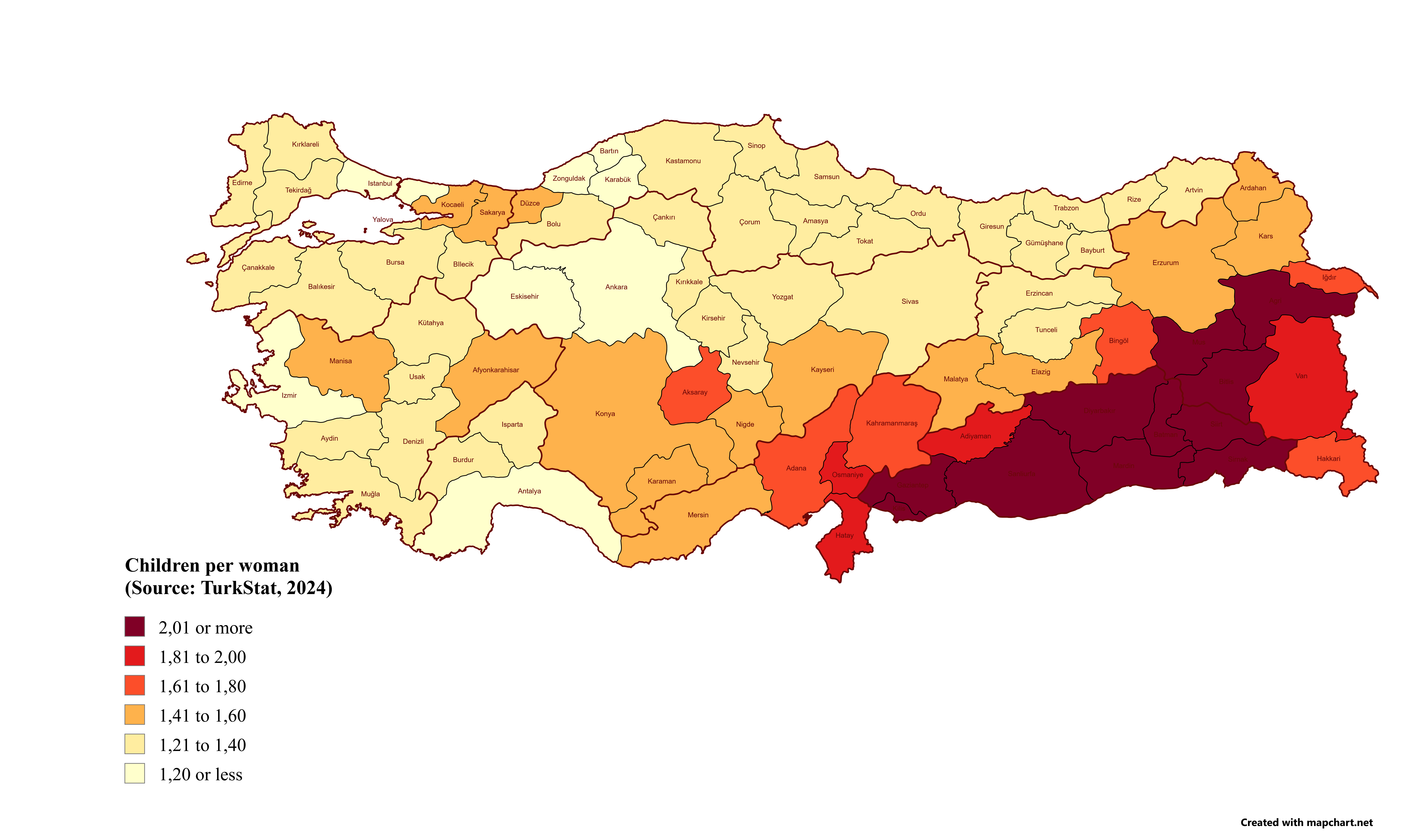
Children per Woman in Turkey by Province Map
## What This Map Shows...
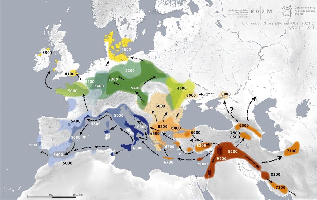
Map of Early Farming Spread in Europe (9000-3800 BC)
## What This Map Shows...
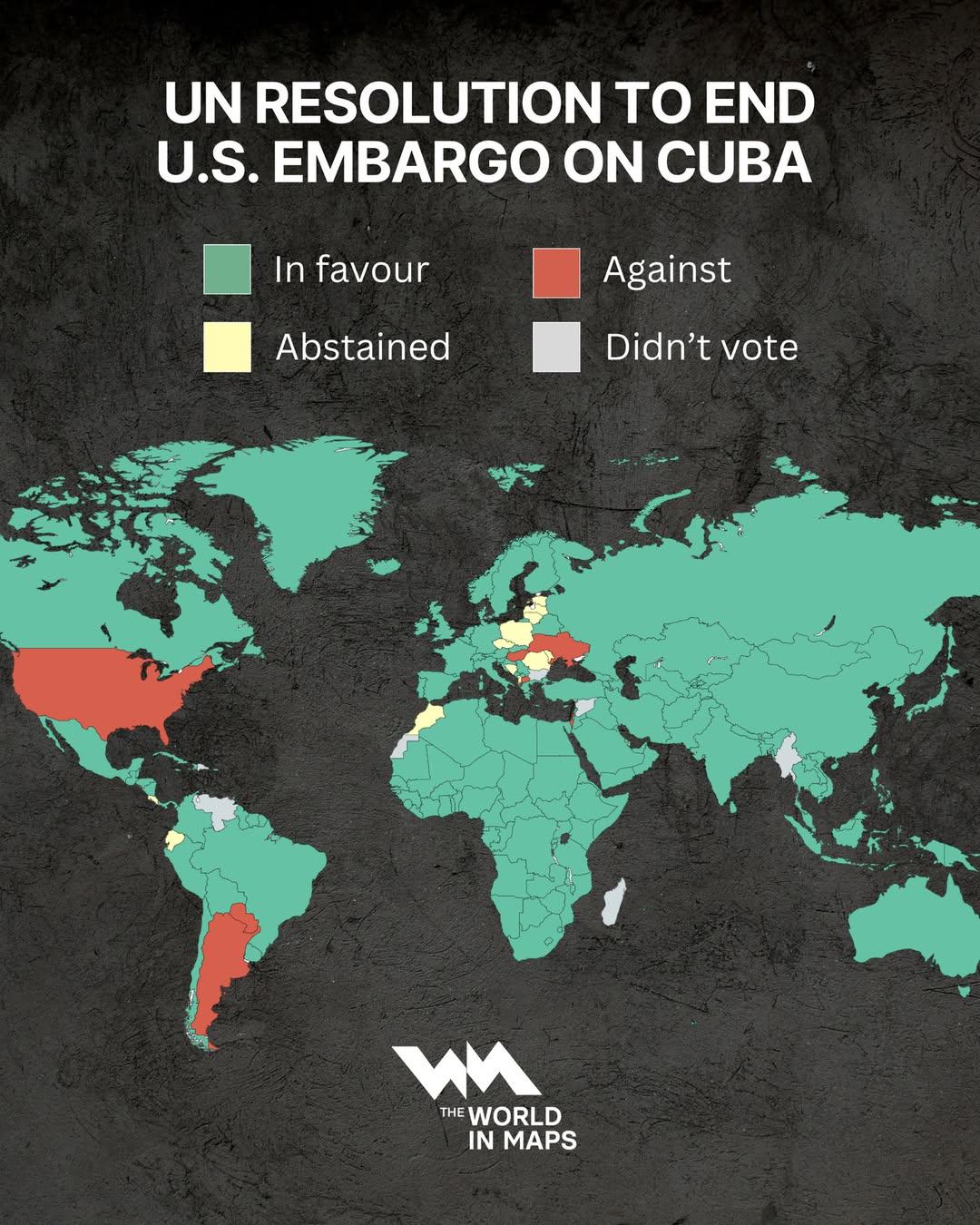
UN Resolution Map to End US Embargo on Cuba
## What This Map Shows\nThis map visualizes the United Nations resolution passed on October 29, 2025, advocating for the...
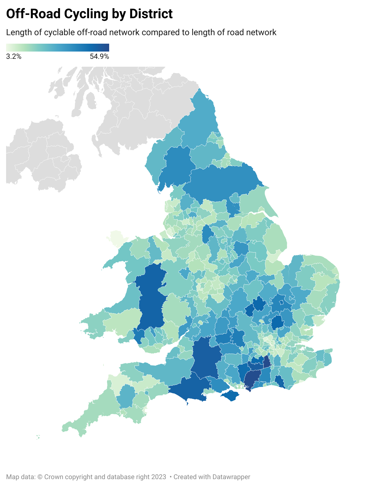
Off-Road Cycling Routes in England and Wales Map
## What This Map Shows...
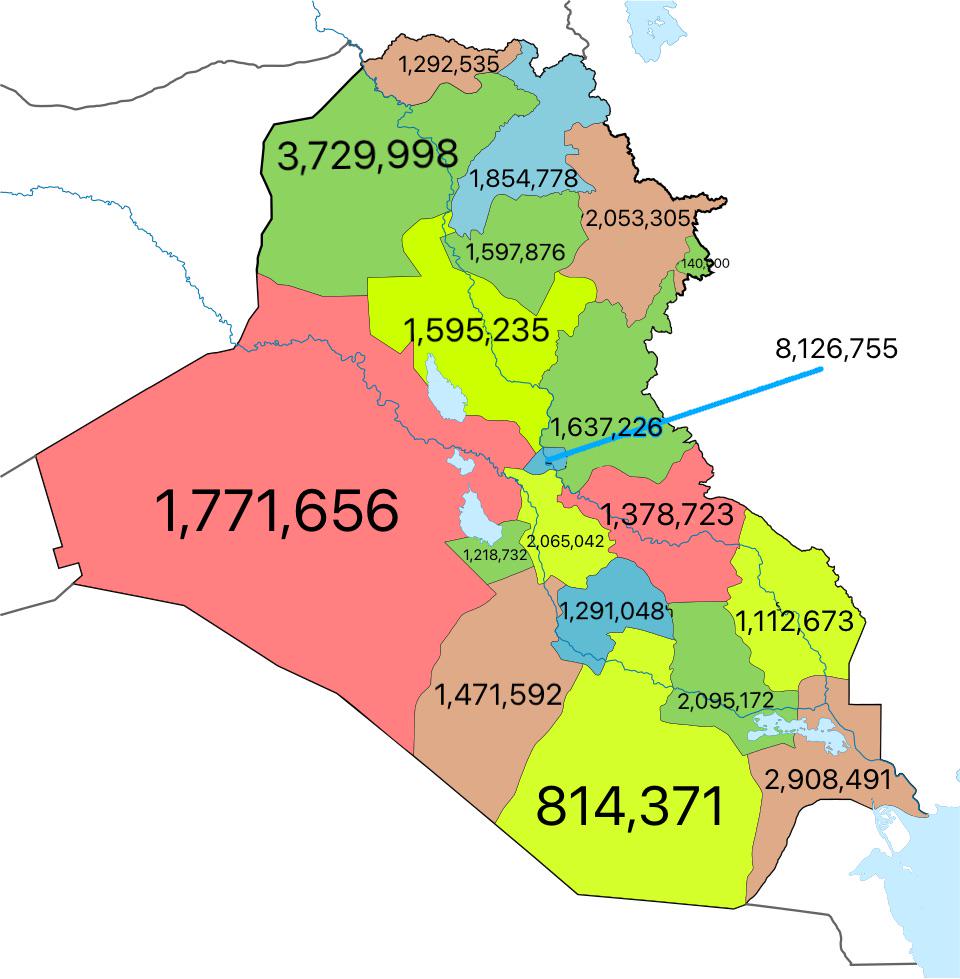
Iraq Population Map by Governorate
## What This Map Shows...
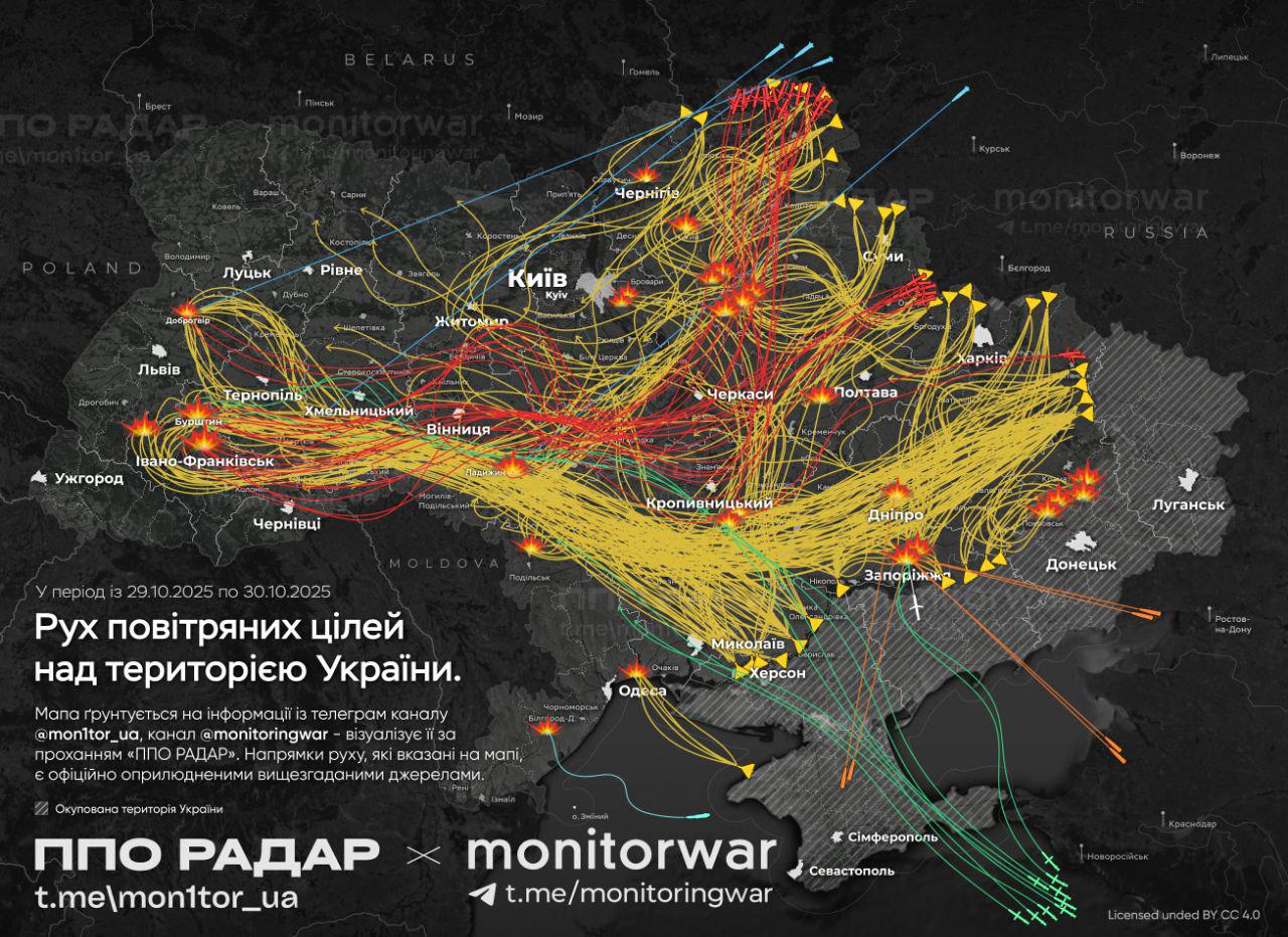
Russian Drone and Rocket Attack Trajectory Map
## What This Map Shows...
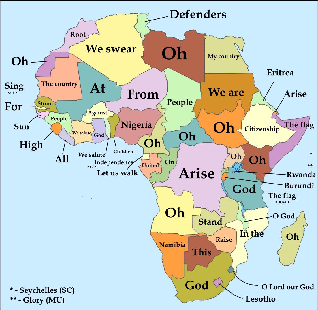
First Words of National Anthems of African Countries Map
## What This Map Shows...
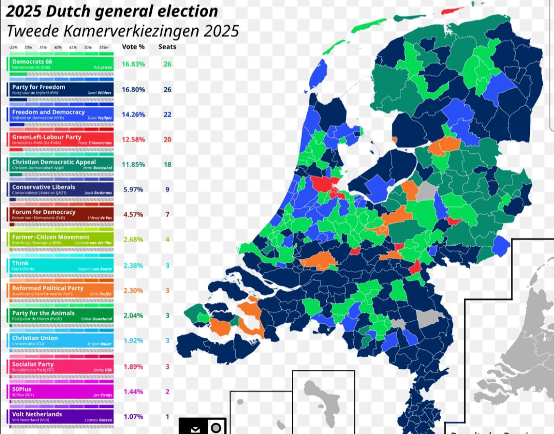
Dutch Election Results Map
## What This Map Shows\nThe \...
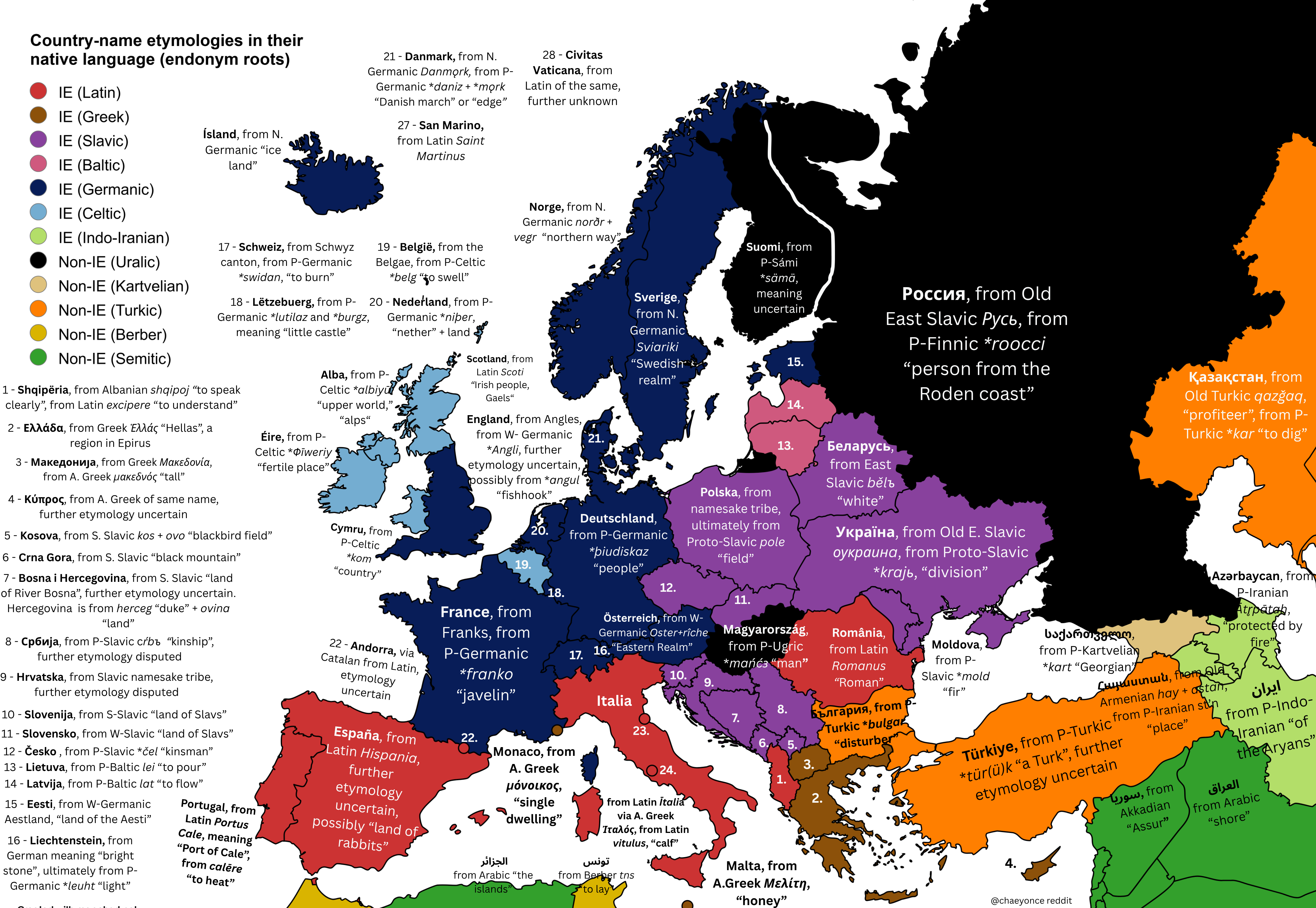
European Country Name Etymologies Map
## What This Map Shows...