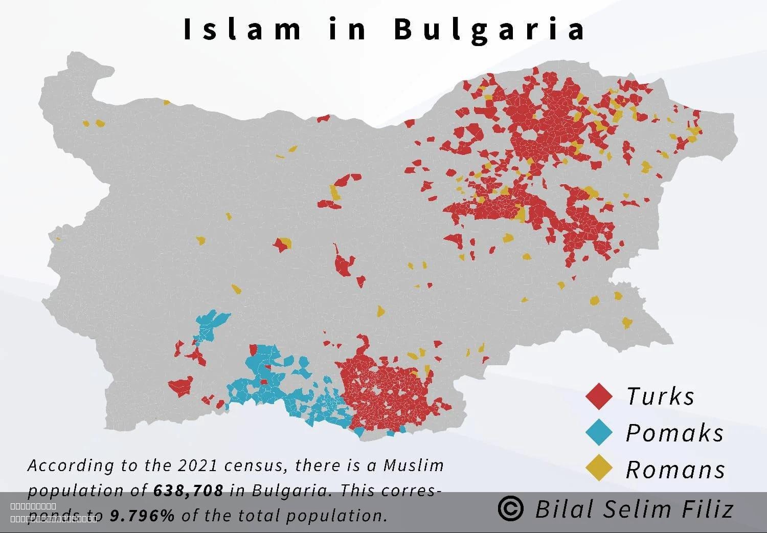
Geographic Visualizations
Explore our curated collection of fascinating geographic visualizations and cartographic analyses. Discover detailed maps, data visualizations, and geographical insights from around the world.
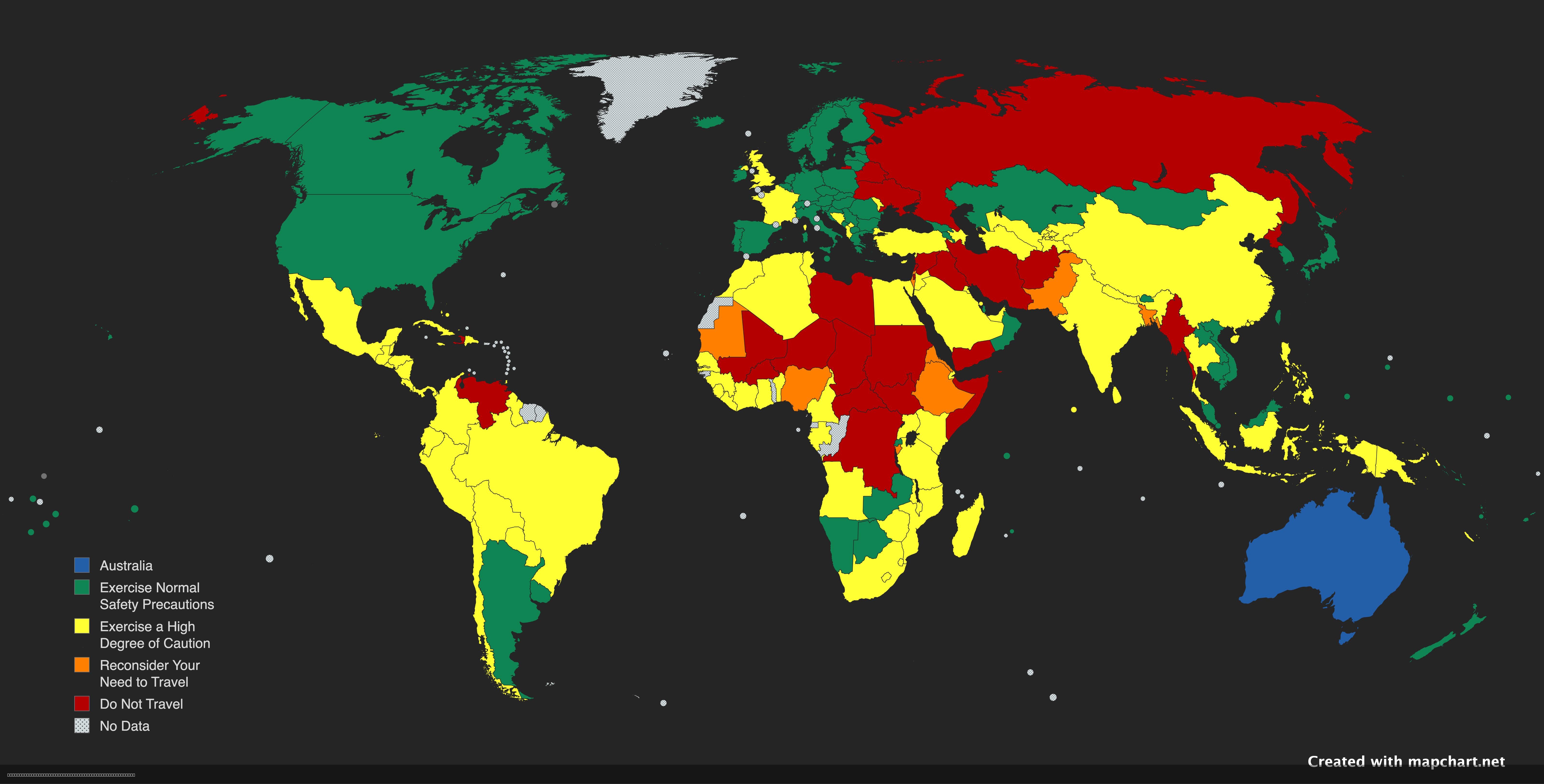
Travel Advice Map According to the Australian Government
## What This Map Shows...
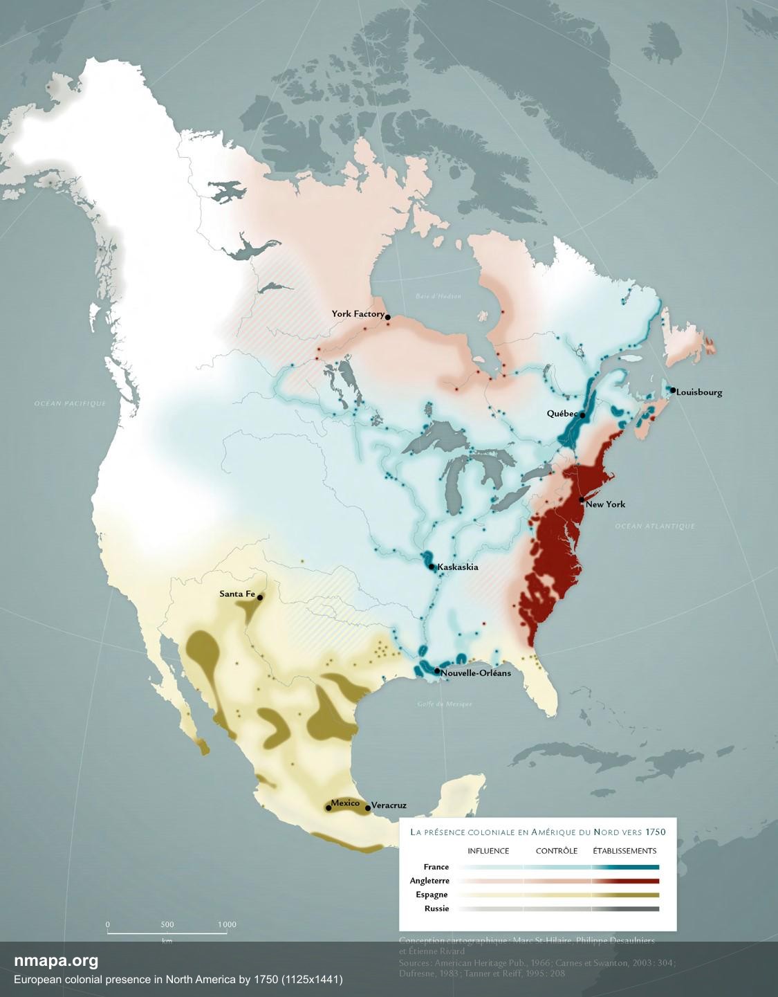
European Colonial Presence in North America Map
## What This Map Shows...
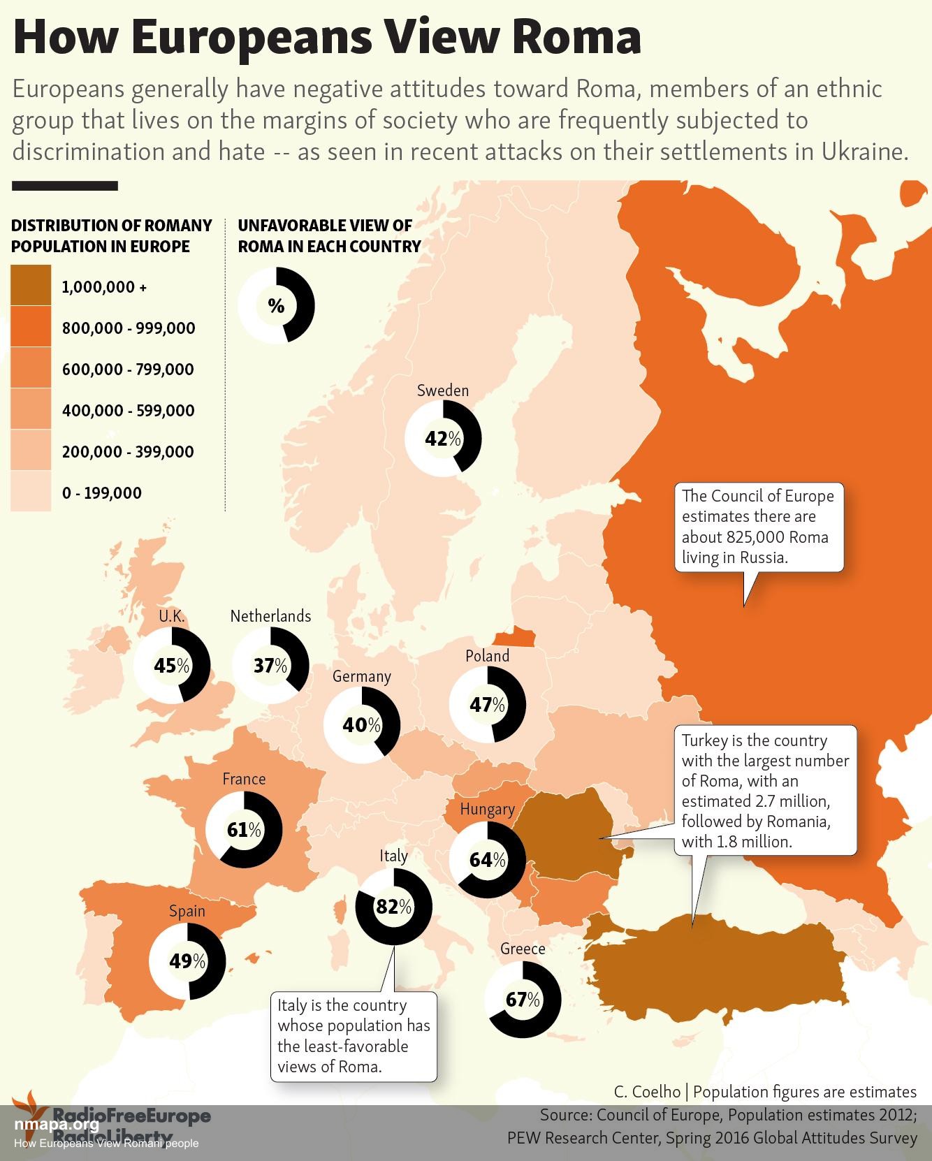
Map of European Views on Romani People
## What This Map Shows...
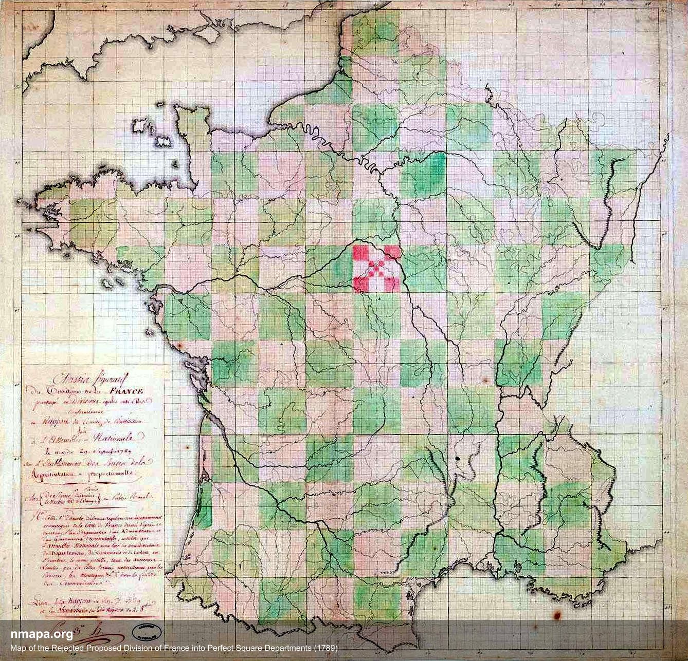
Map of the Rejected Proposed Division of France into Square Departments (1789)
## What This Map Shows...
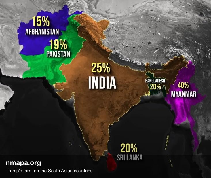
Tariff Rates Map of South Asian Countries
## What This Map Shows...
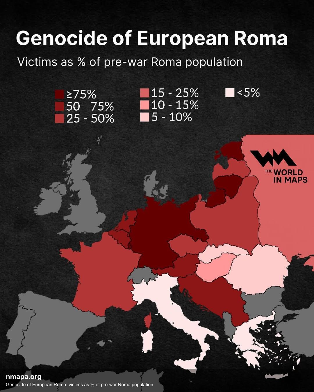
Genocide of European Roma Victims Map
## What This Map Shows...
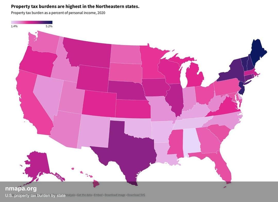
U.S. Property Tax Burden by State Map
## What This Map Shows...
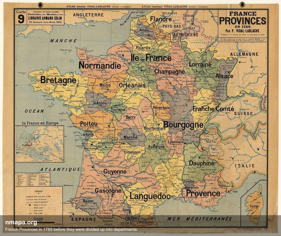
French Provinces Map of 1789
## What This Map Shows...
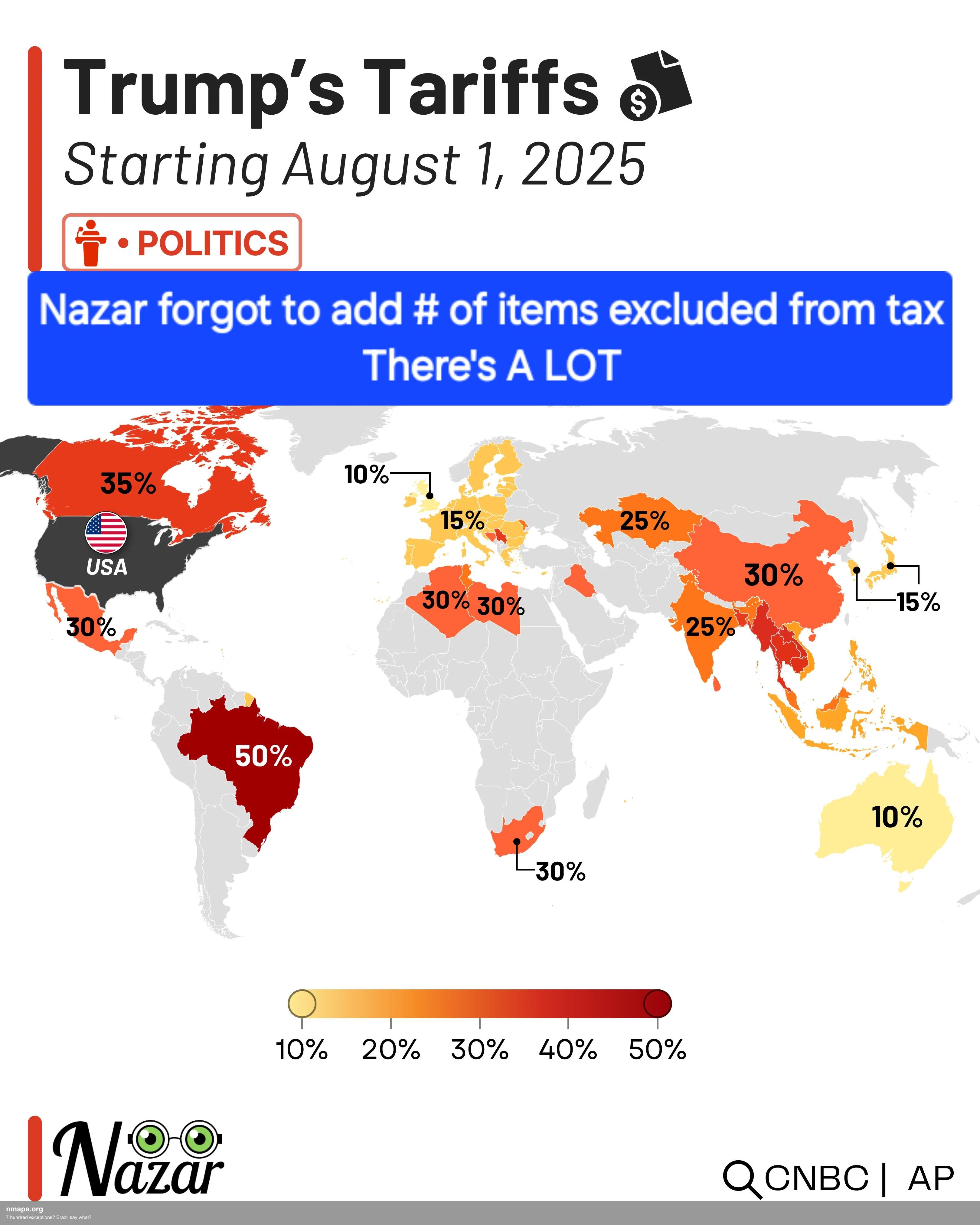
Brazil Exceptions Map: Understanding Unique Legalities
## What This Map Shows\nThe \...
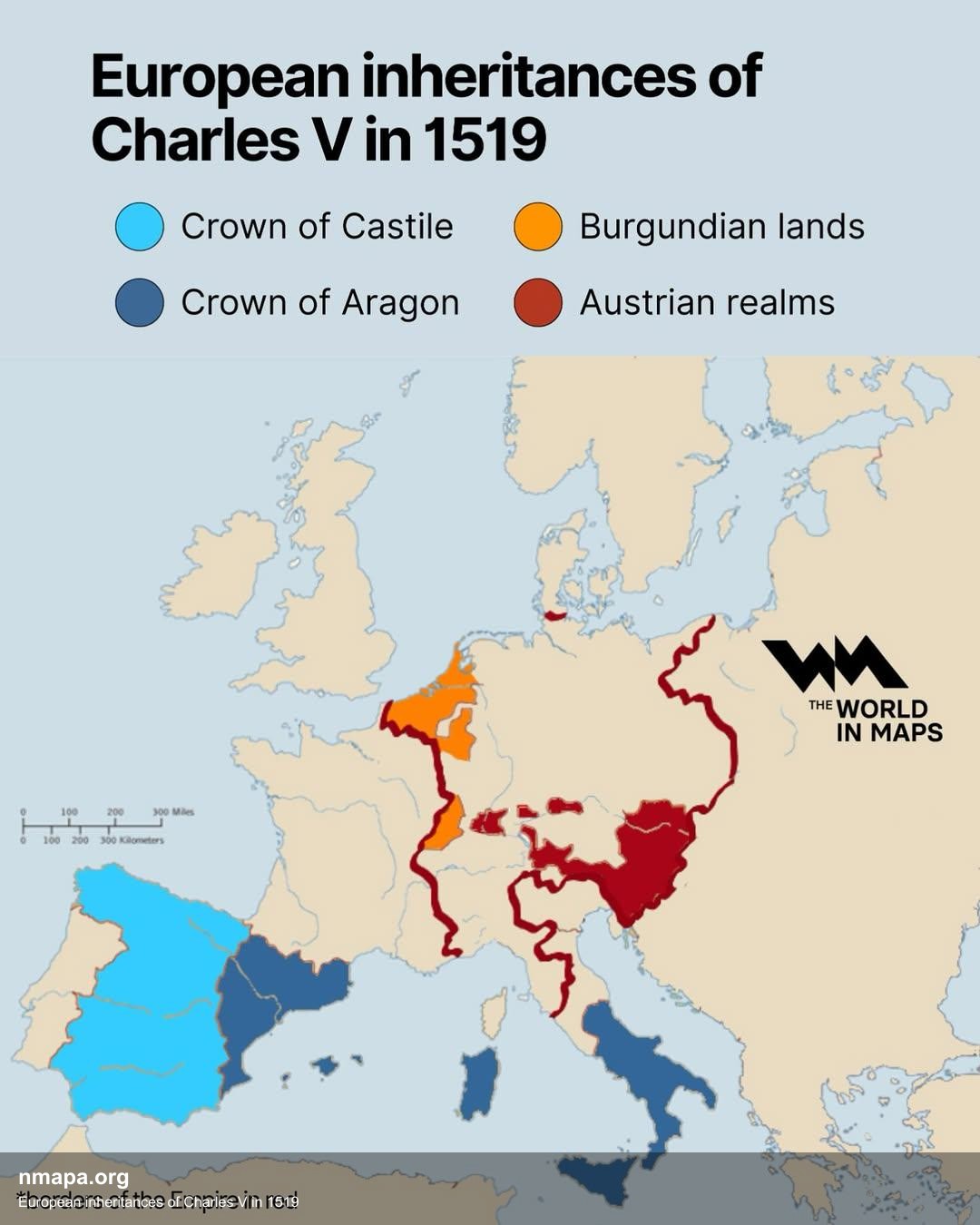
European Inheritances of Charles V in 1519 Map
## What This Map Shows...
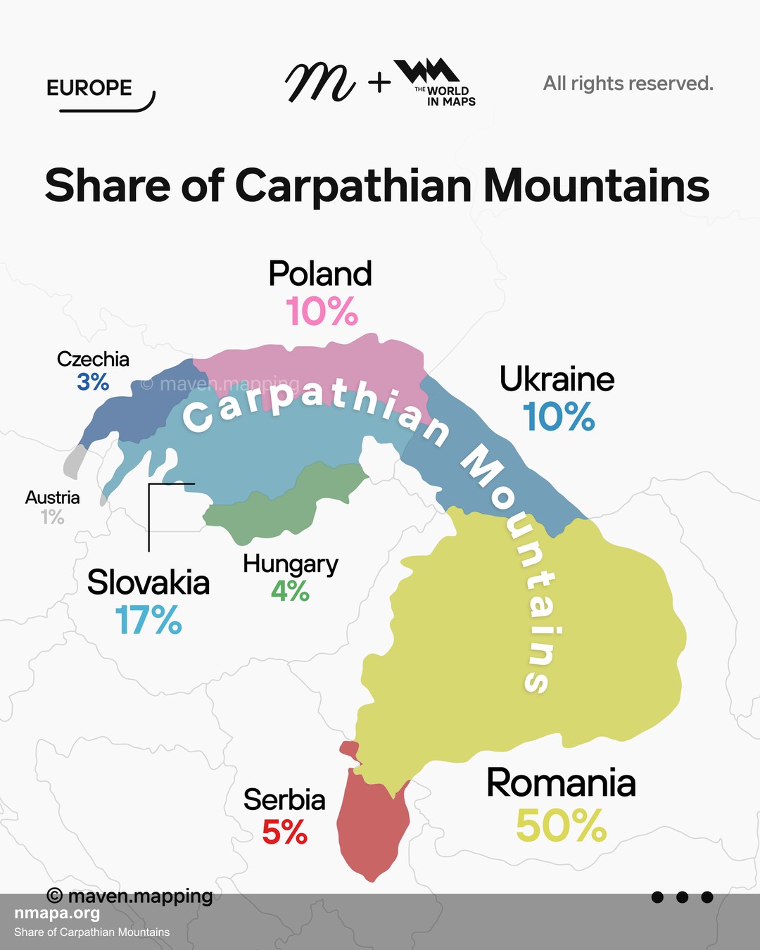
Share of Carpathian Mountains Map
## What This Map Shows...
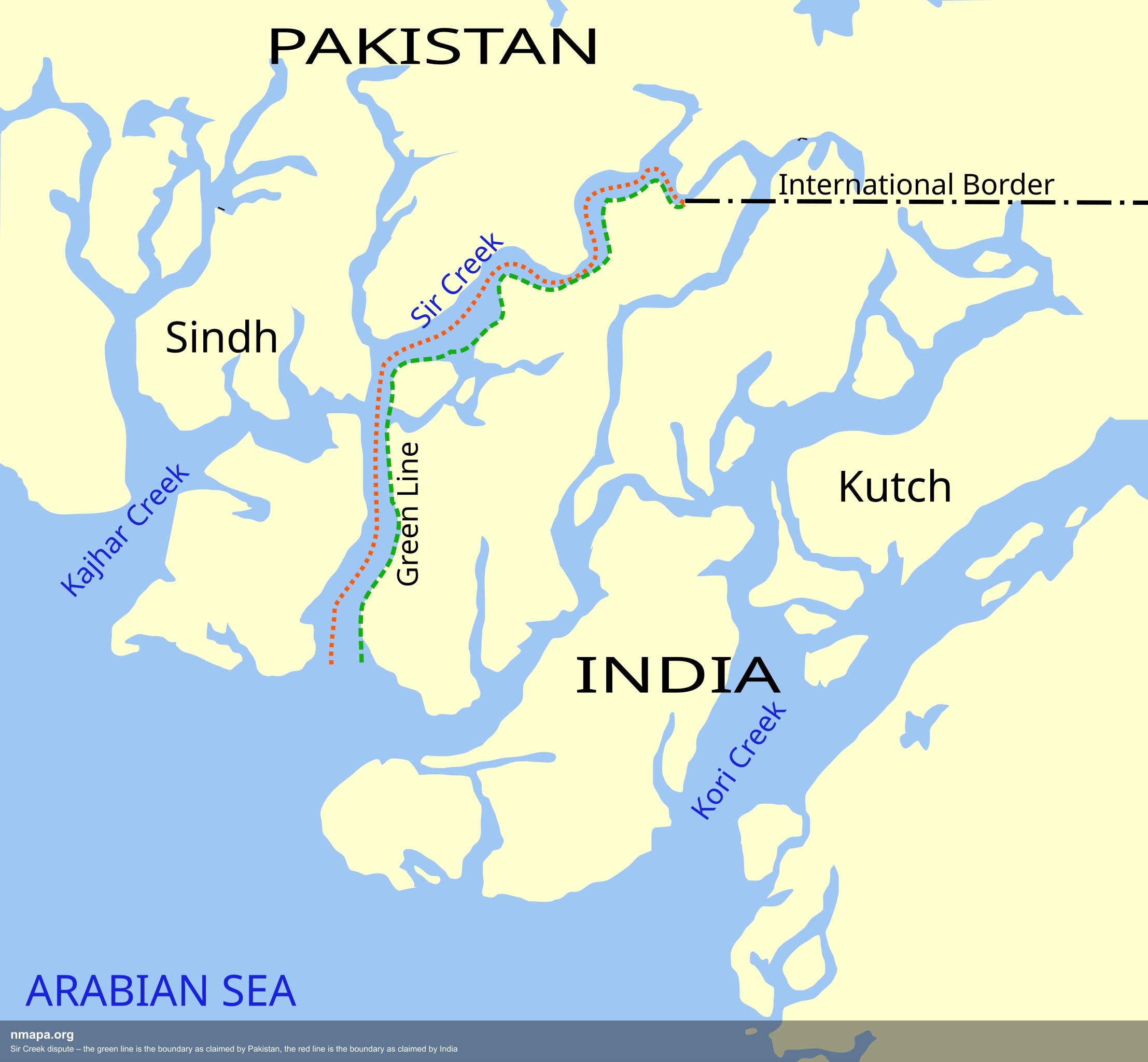
Sir Creek Dispute Boundary Map: Pakistan vs India
The Sir Creek dispute boundary map illustrates the contentious borders between Pakistan and India in the Sir Creek regio...
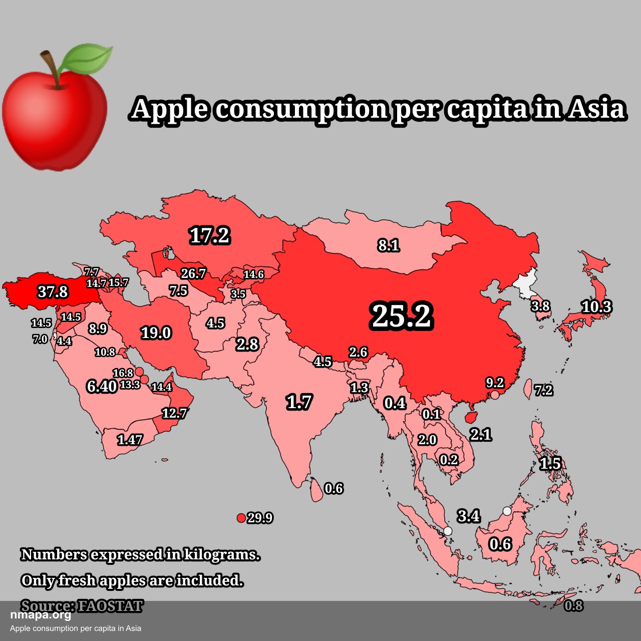
Apple Consumption Per Capita in Asia Map
The 'Apple Consumption Per Capita in Asia Map' presents a comprehensive visualization of apple consumption across variou...
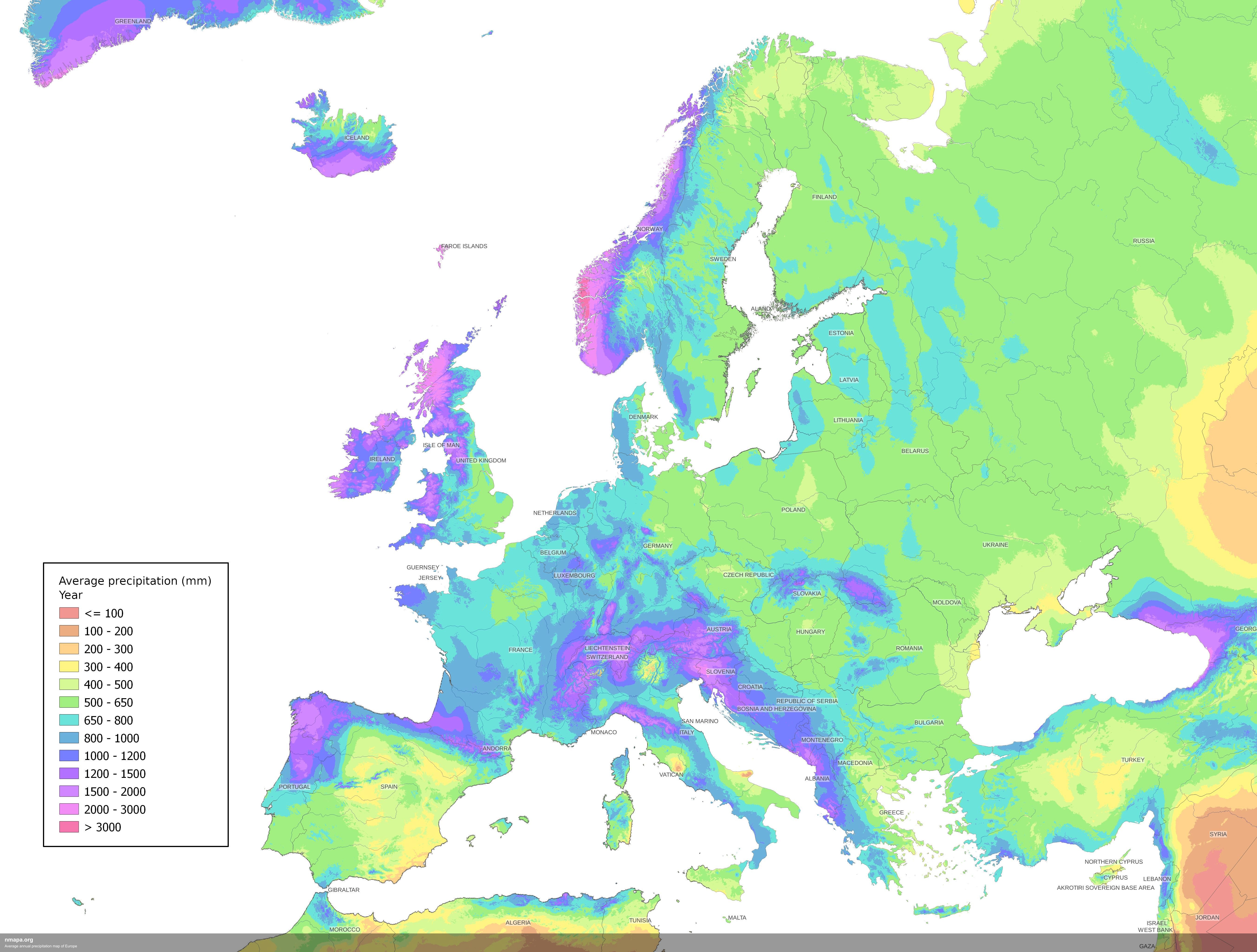
Average Annual Precipitation Map of Europe
The Average Annual Precipitation Map of Europe offers a detailed visualization of rainfall patterns across the continent...
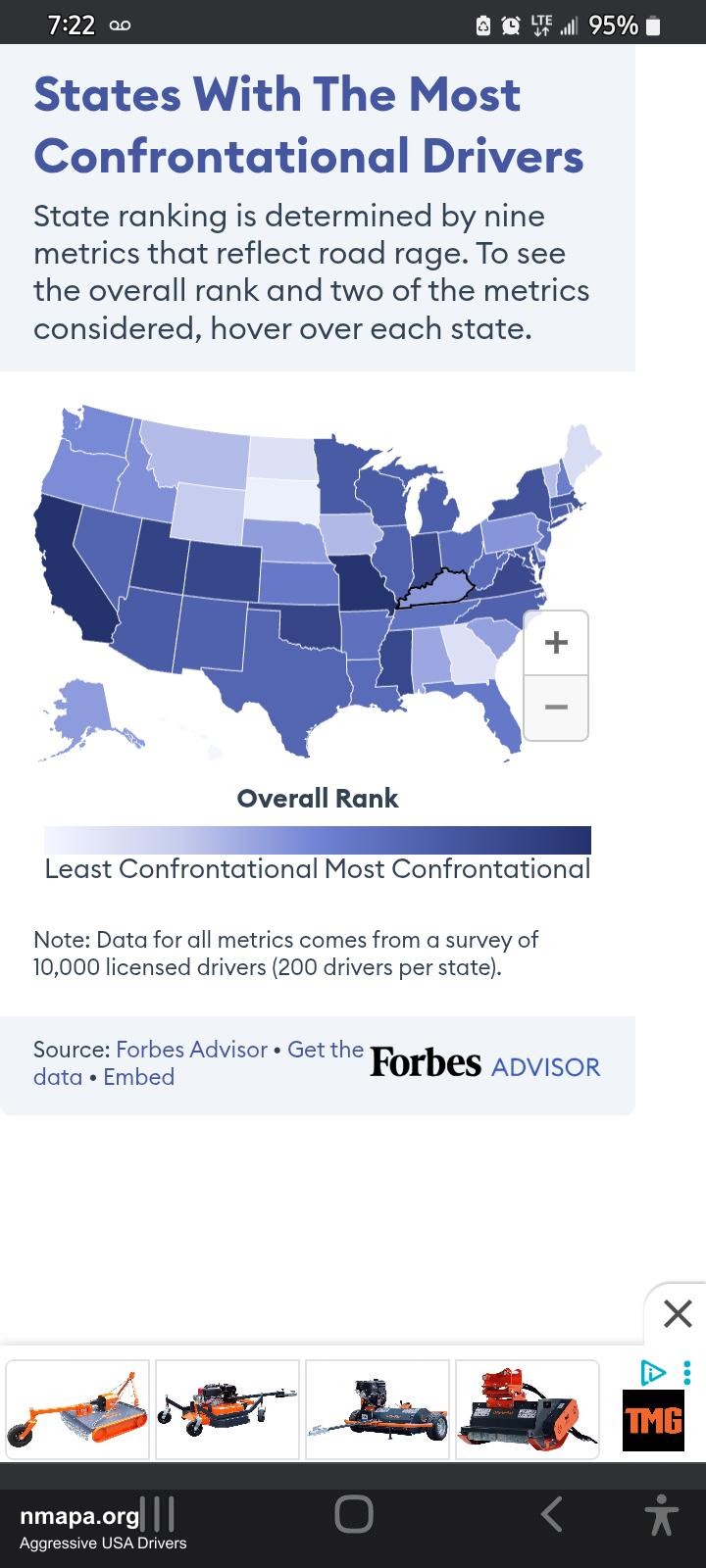
Aggressive Drivers Map of the USA
The "Aggressive Drivers Map of the USA" presents a striking visualization of driving behaviors across various states, hi...
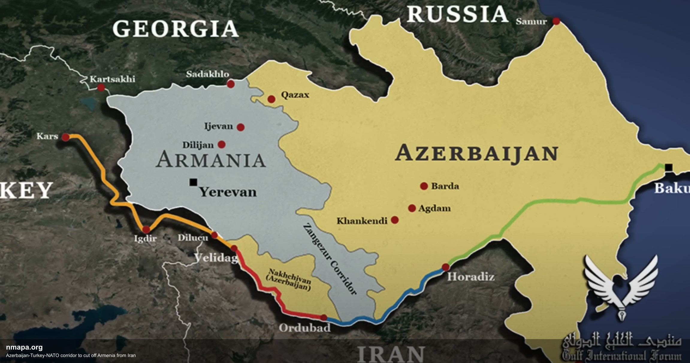
Azerbaijan-Turkey-NATO Corridor Map
The Azerbaijan-Turkey-NATO Corridor Map illustrates a strategic pathway intended to reinforce military and economic ties...
