Geographic Visualizations
Explore our curated collection of fascinating geographic visualizations and cartographic analyses. Discover detailed maps, data visualizations, and geographical insights from around the world.
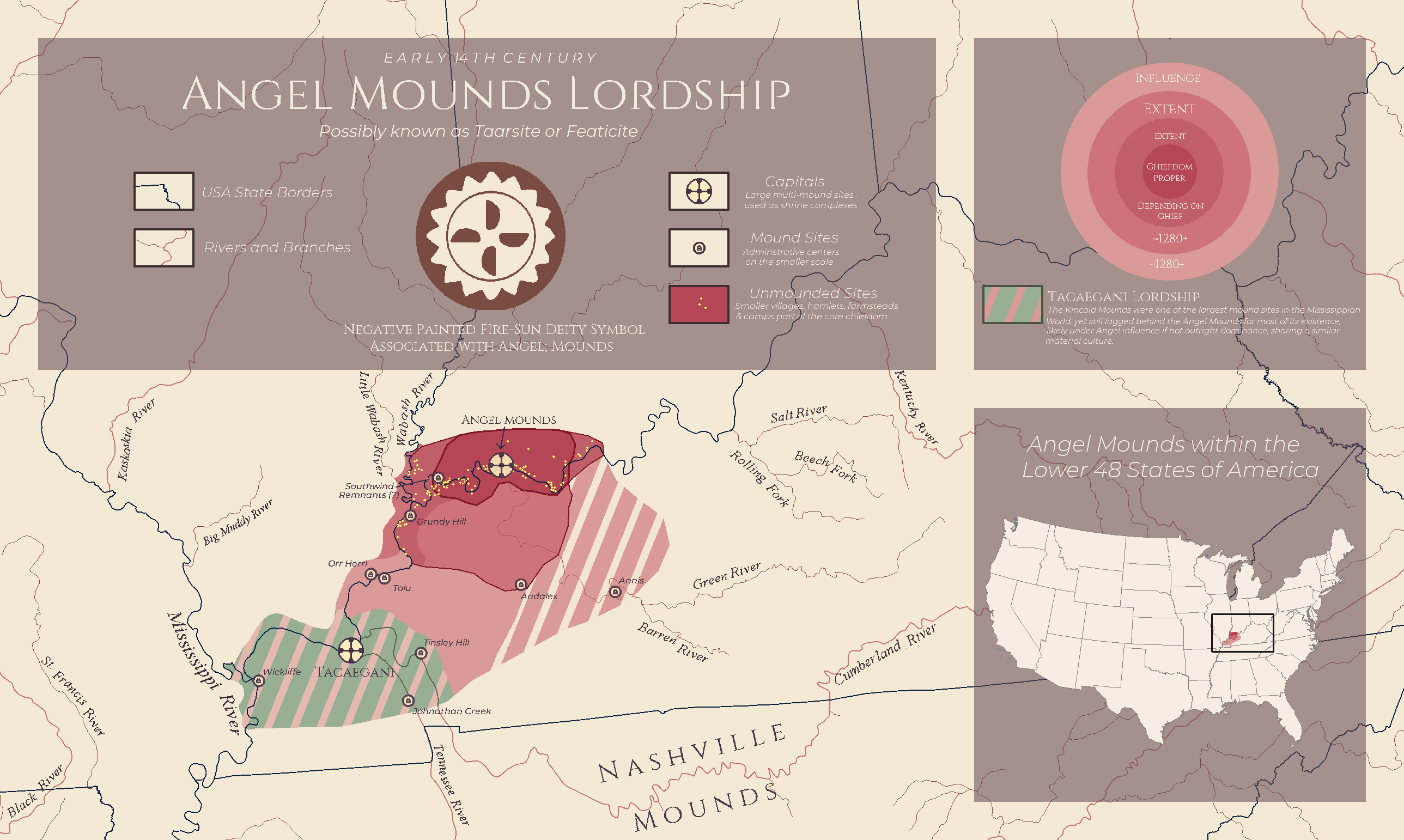
Angel Mounds Lordship Map of 14th Century Kentucky
## What This Map Shows...
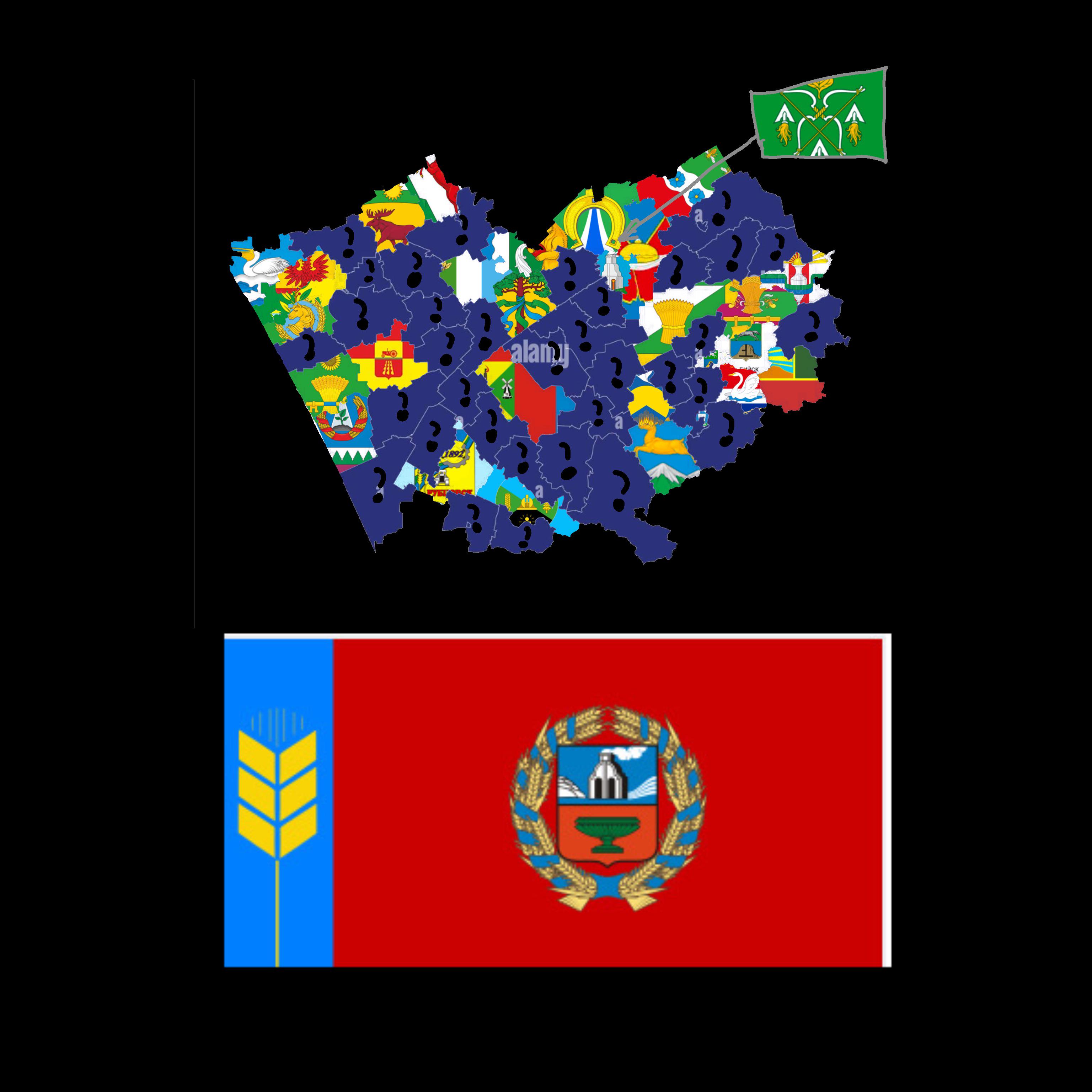
Altai Krai Districts and Cities Flag Map
## What This Map Shows...
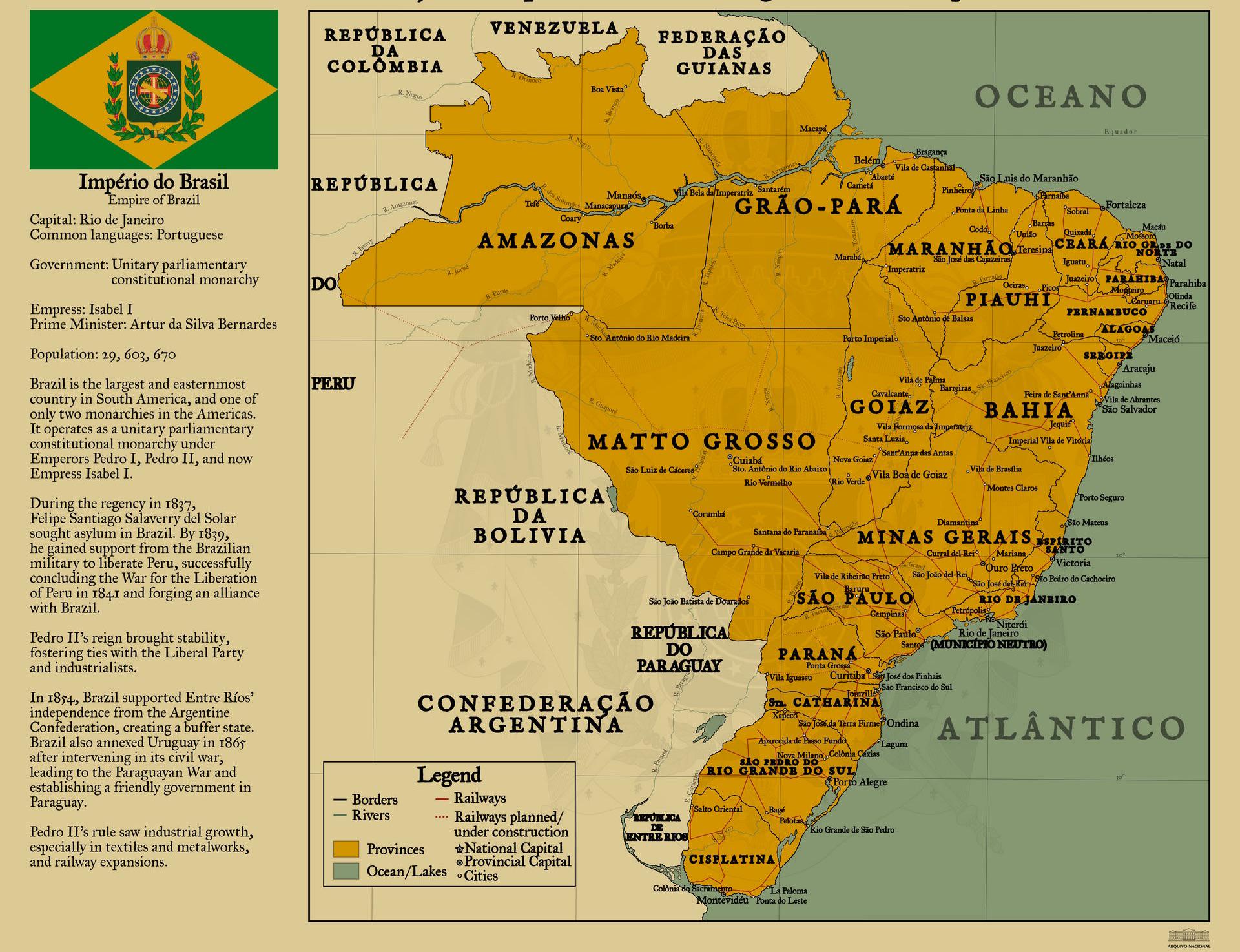
Empire of Brazil Map, Circa 1822
## What This Map Shows...
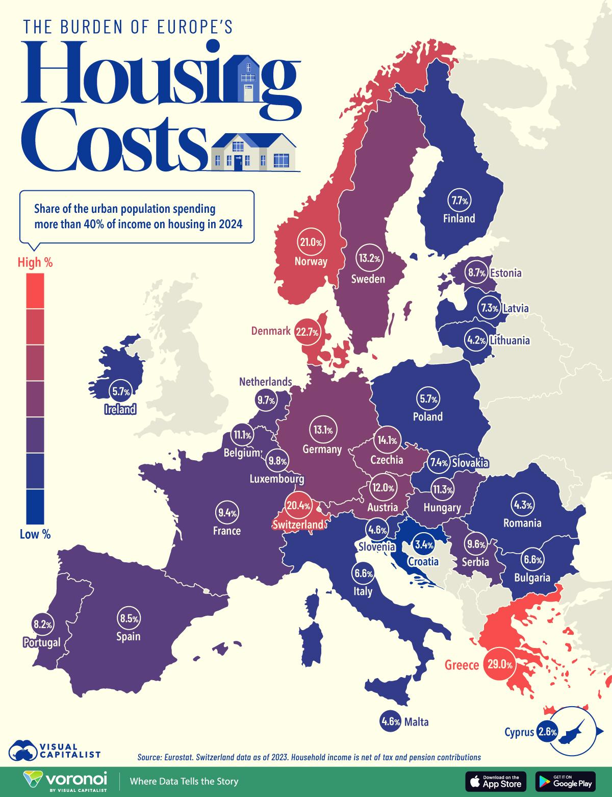
Europe’s Housing Cost Burden by Country Map
## What This Map Shows...
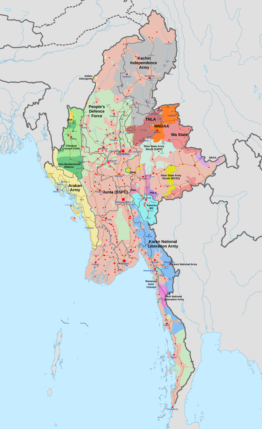
Myanmar Civil War Conflict Map
## What This Map Shows...
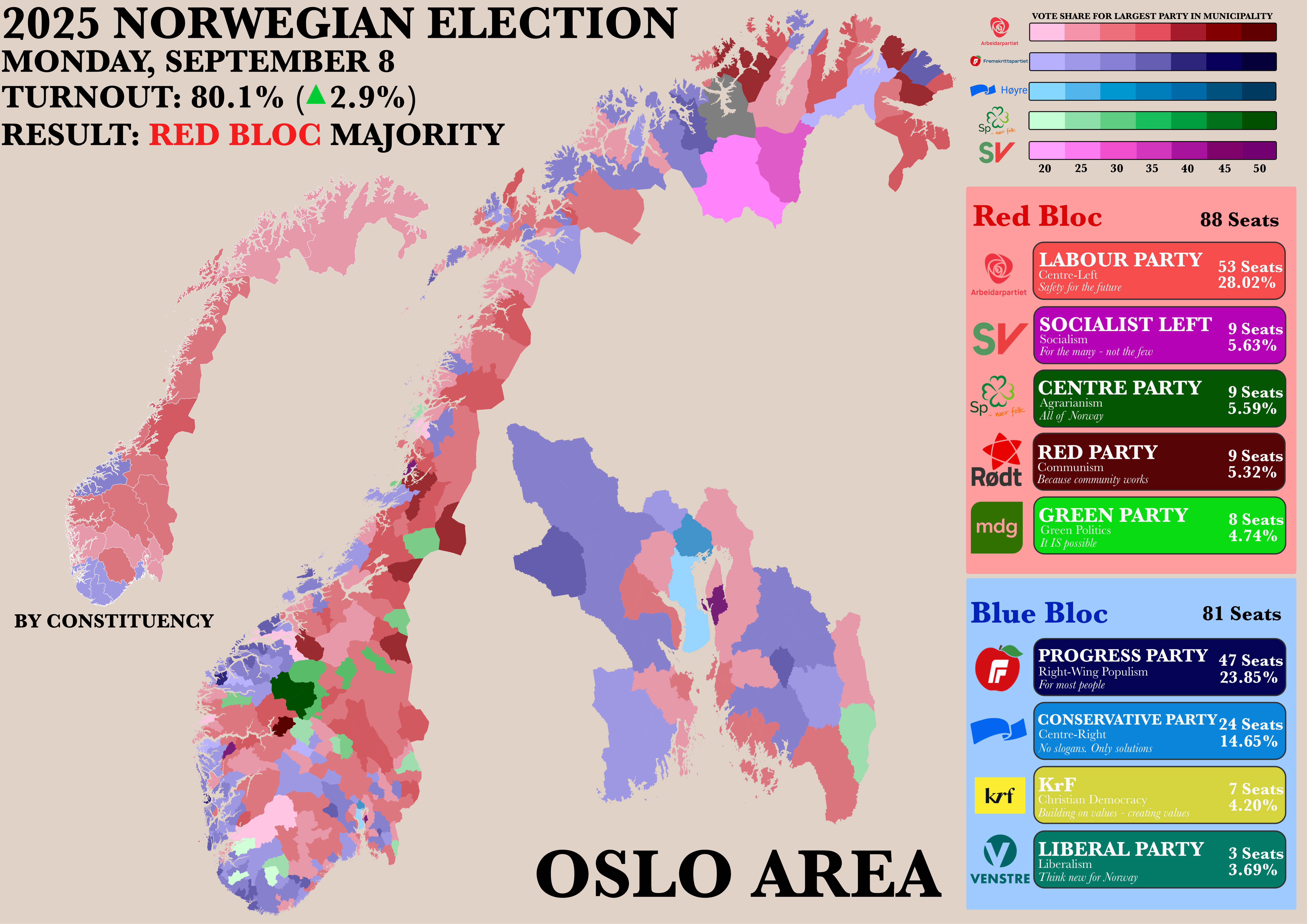
Norwegian Parliamentary Election Results by Municipality Map
## What This Map Shows...
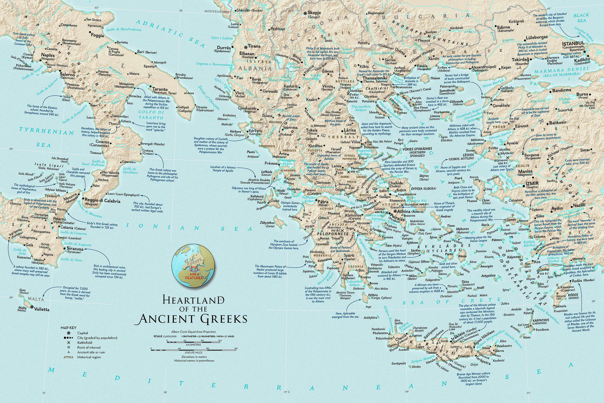
Map of the Heartland of the Ancient Greeks
## What This Map Shows...
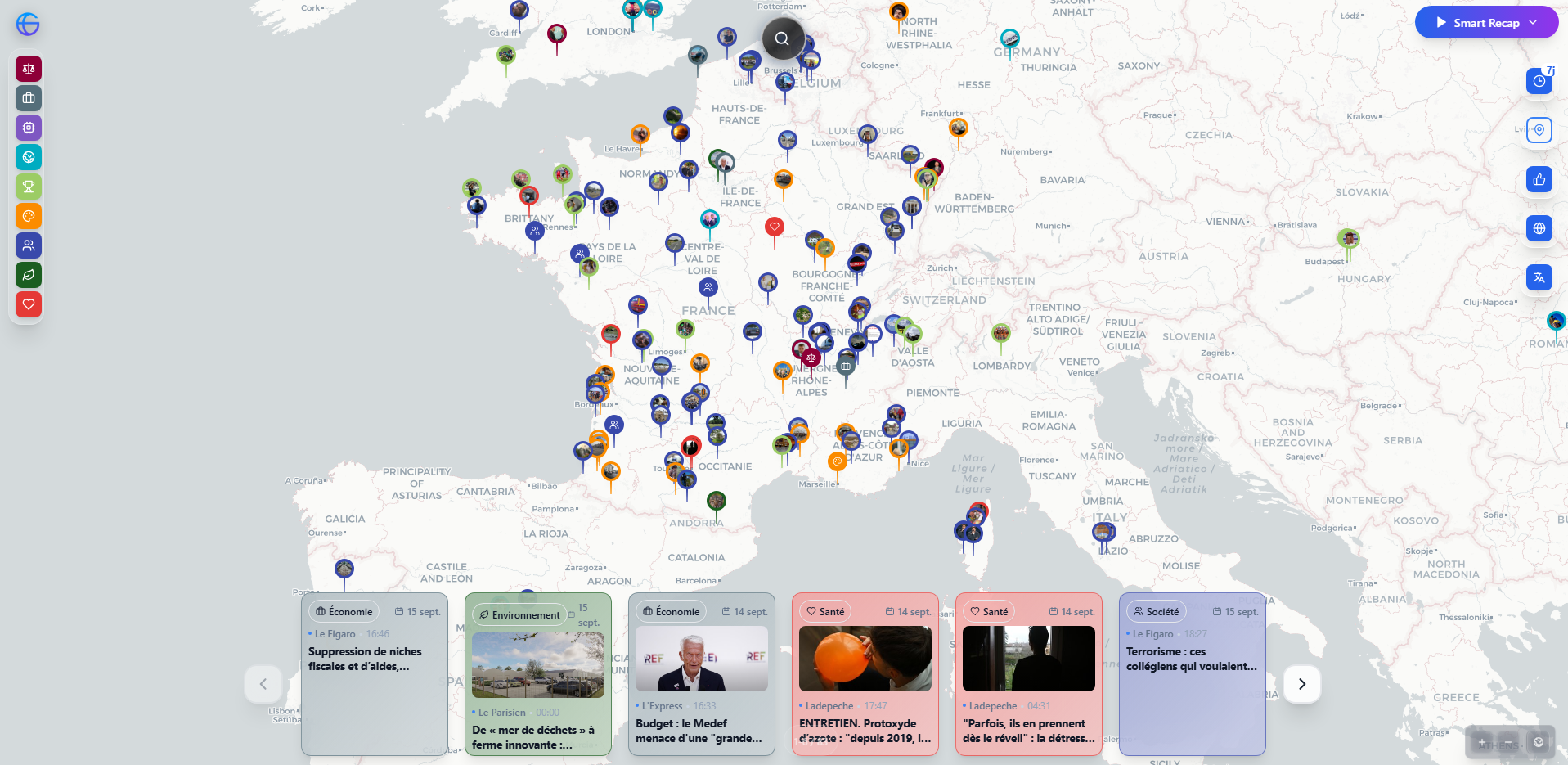
Global News Events Map by Region
## What This Map Shows\nThe visualization created by Globnews is a dynamic and interactive map that aggregates news stor...
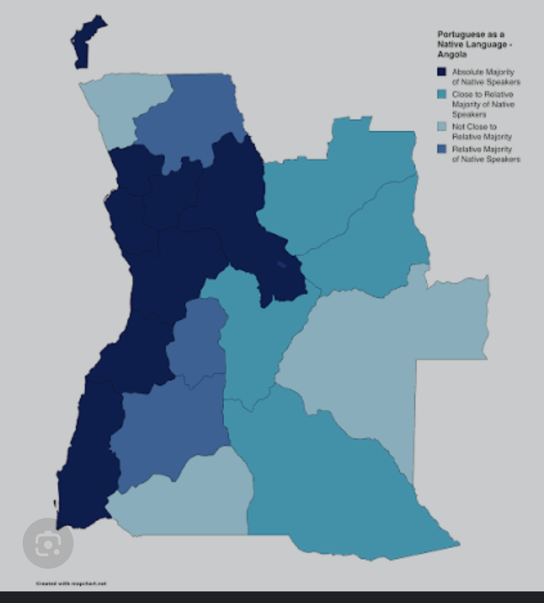
Portuguese Speakers in Western Angola Map
## What This Map Shows...

Mexico Border Election Trends Map 2016-2024
## What This Map Shows...
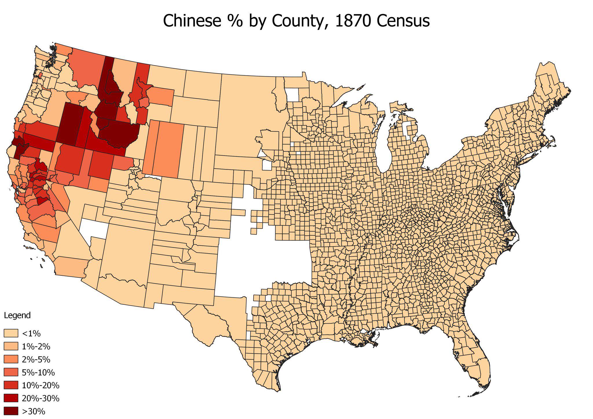
Chinese American Population by County Map, 1870
## What This Map Shows...

Most Common East Asian Group by State Map
## What This Map Shows...
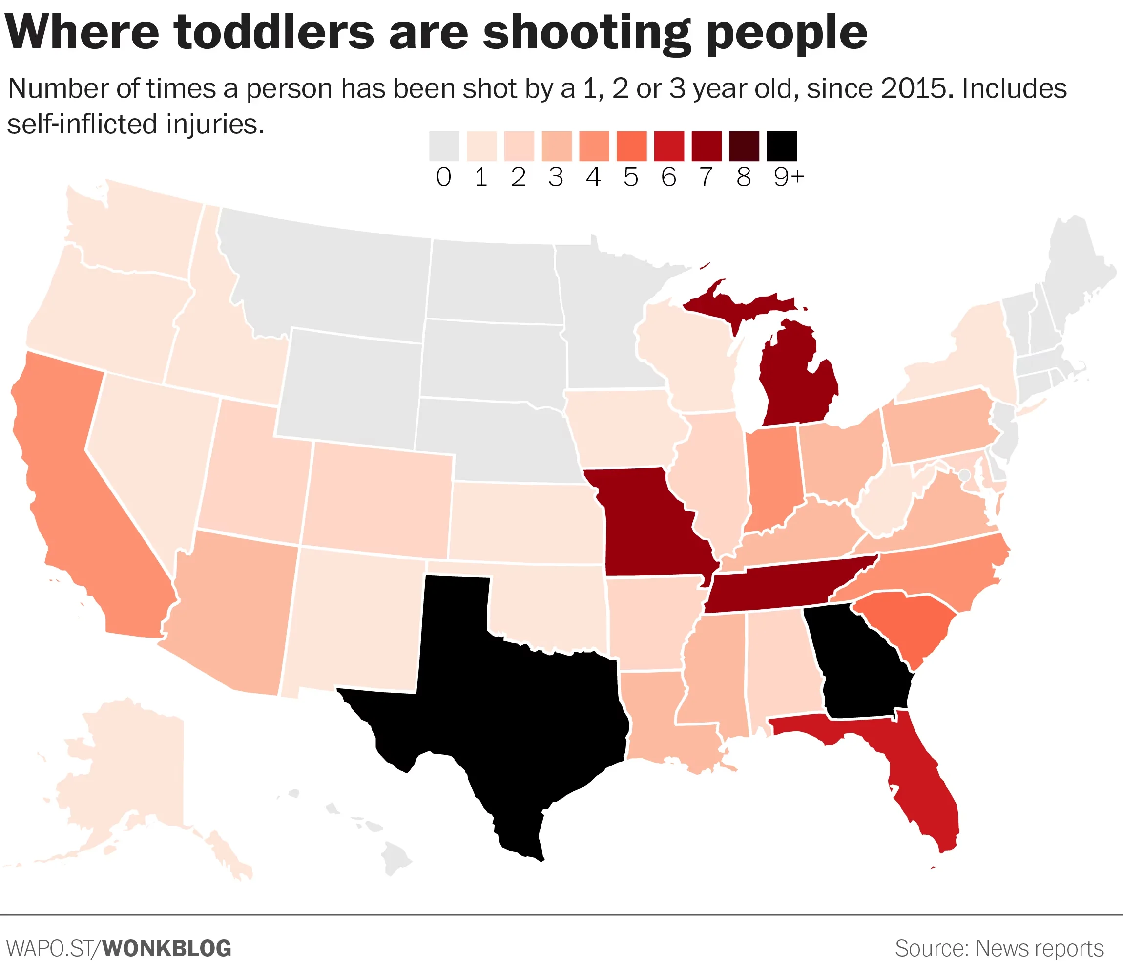
Gun Violence Map of the United States
## What This Map Shows...
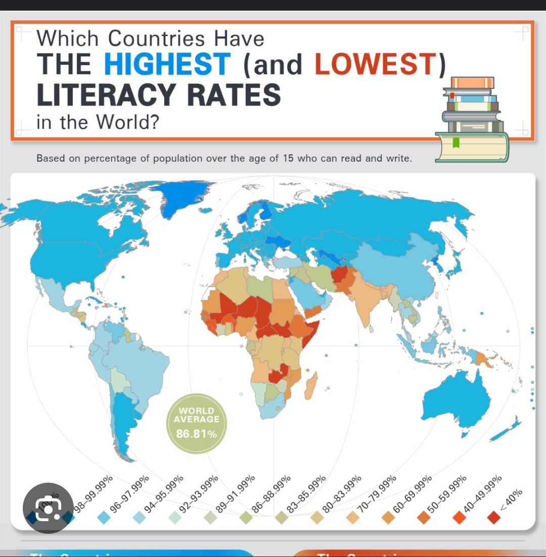
Global Literacy Rate Map Nearly 90%
## What This Map Shows...
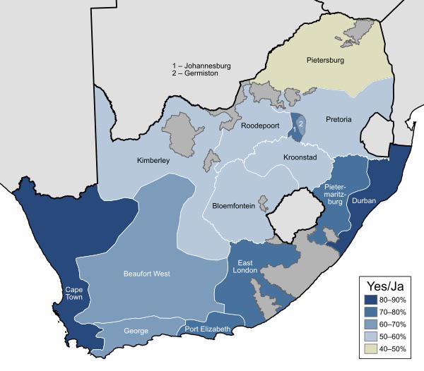
1992 South Africa Apartheid Referendum Map
## What This Map Shows\nThe 1992 South Africa Apartheid Referendum Map visually illustrates the results of the crucial r...
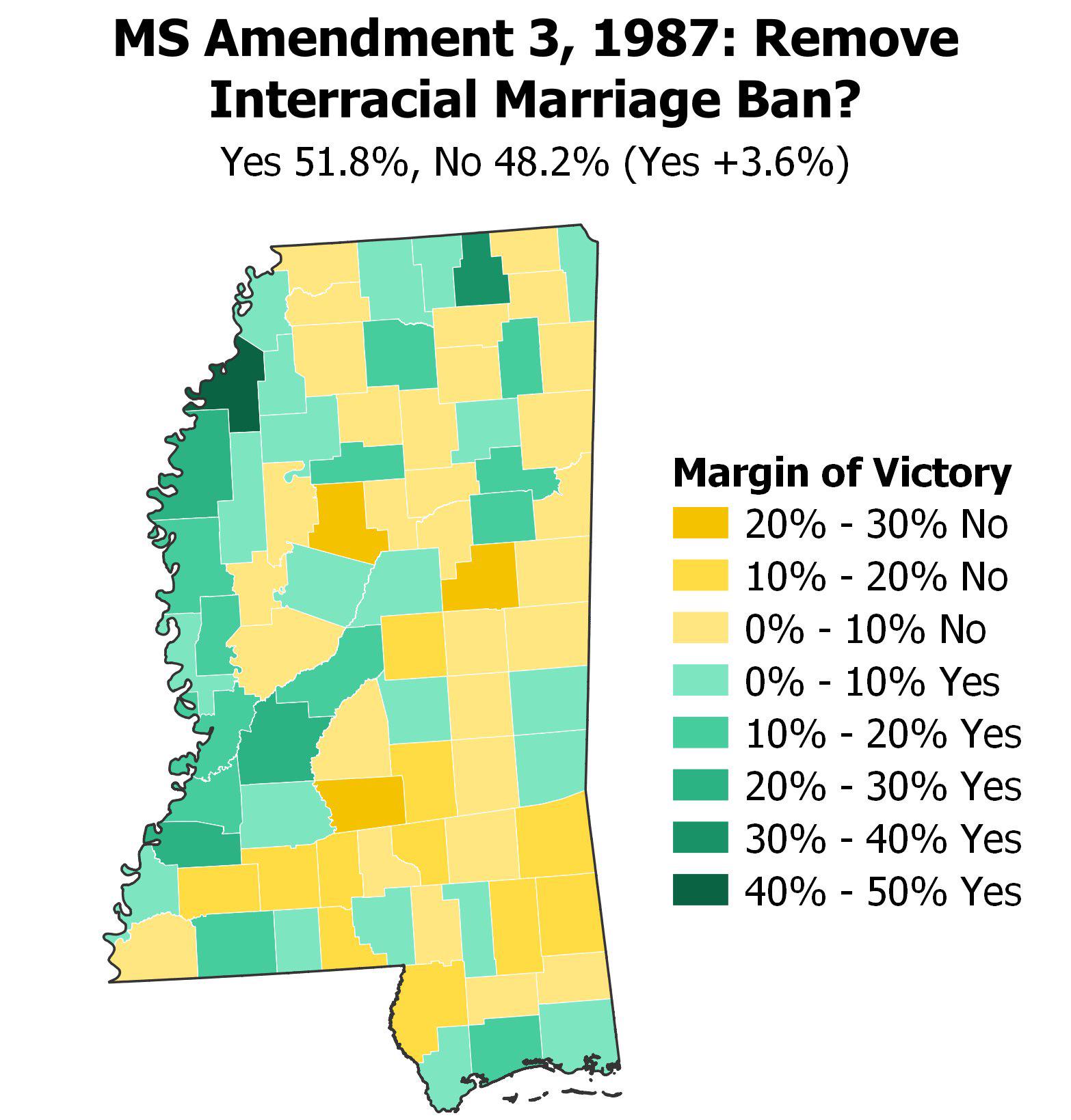
Map of Interracial Marriage Ban Removal in Mississippi
## What This Map Shows...
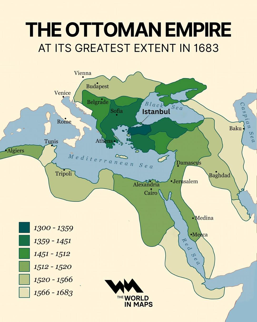
Ottoman Empire Map at Its Greatest Extent 1683
## What This Map Shows...
