1992 South Africa Apartheid Referendum Map

Marcus Rodriguez
Historical Geography Expert
Marcus Rodriguez specializes in historical cartography and geographic data analysis. With a background in both history and geography, he brings unique...
Historical CartographyDemographic AnalysisCultural Geography
Geographic Analysis
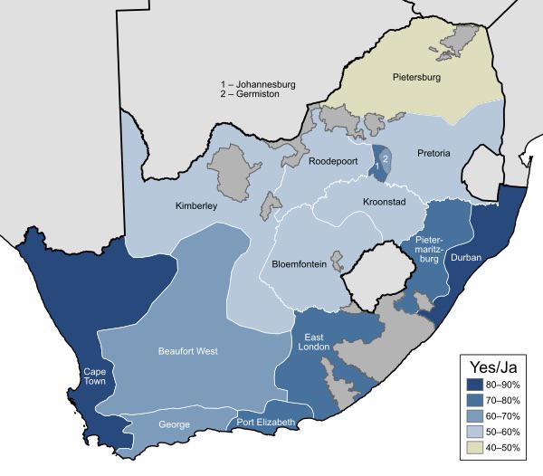
What This Map Shows\nThe 1992 South Africa Apartheid Referendum Map visually illustrates the results of the crucial referendum held on March 17, 1992, which sought to end apartheid in South Africa. This historic vote was a pivotal moment in the country’s journey towards democracy, allowing citizens to express their support for the negotiation process to dismantle the apartheid system. The map delineates the voting outcomes by region, highlighting areas of significant support for the transition towards a democratic government and those that opposed it.
Deep Dive into the Apartheid Era\nApartheid, a term meaning \
Visualization Details
- Published
- September 17, 2025
- Views
- 48
Comments
Loading comments...