south africa Maps
7 geographic visualizations tagged with "south africa"
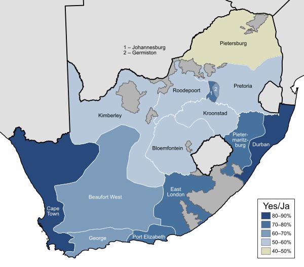
1992 South Africa Apartheid Referendum Map
...
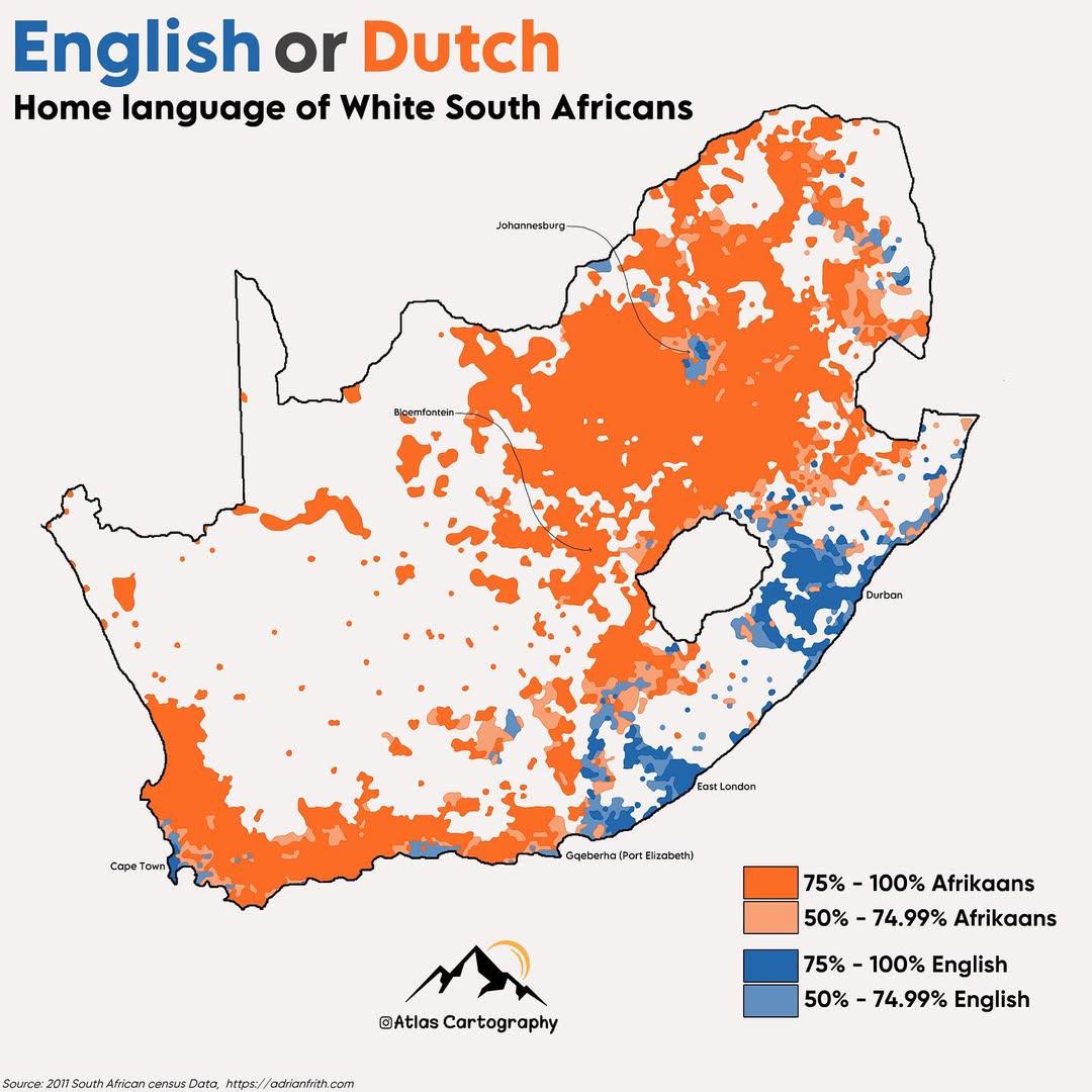
Home Language Map of White South Africans
The map titled "Home Language of White South Africans" visually represents the primary languages spoken at home by the W...

Map of Countries that Had Relations with Apartheid South Africa
This map provides a visual representation of the countries that maintained diplomatic, economic, or military relations w...
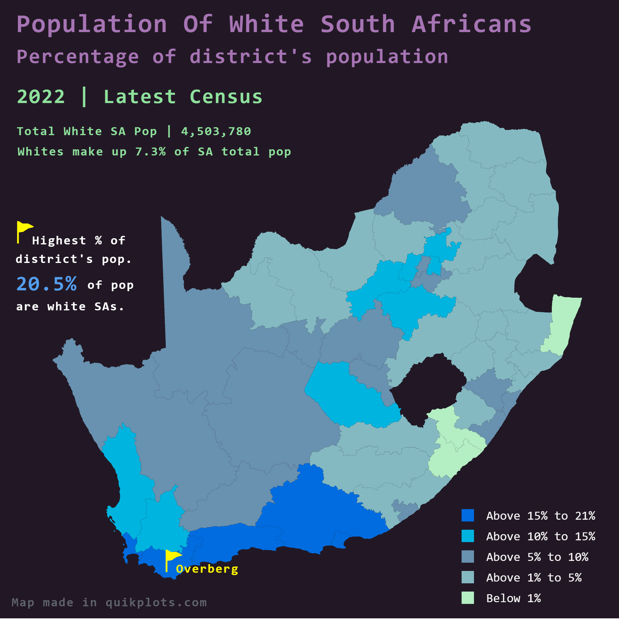
Percentage of Whites in South Africa Map
Interestingly, the map indicates significant regional variations, with some districts exhibiting much higher concentrati...
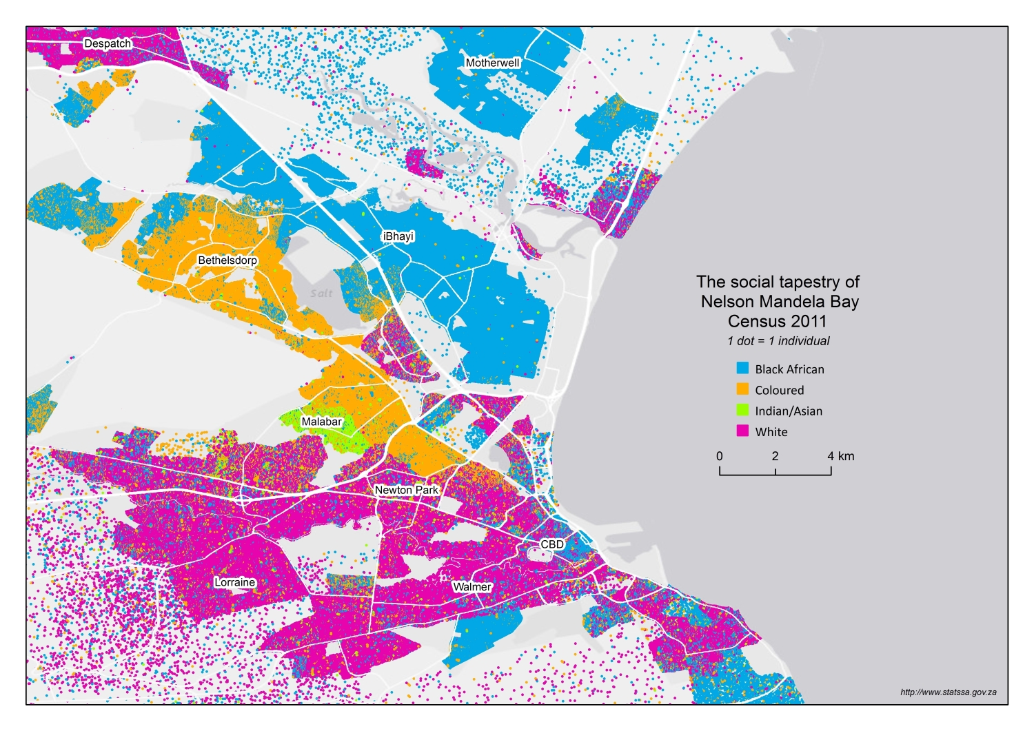
Racial Composition Map of Port Elizabeth
Interestingly, the city's racial demographics echo the complex history of South Africa itself, shaped by colonialism, ap...
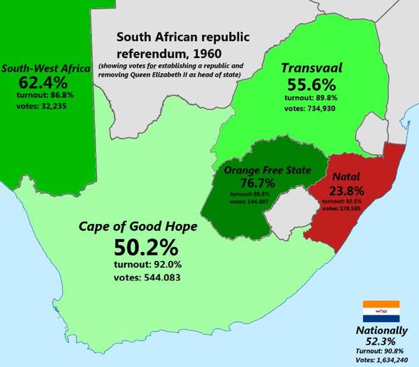
South African Republic Referendum 1960 Map
The "South African Republic Referendum 1960 Map" provides a visual representation of the regions in South Africa that pa...
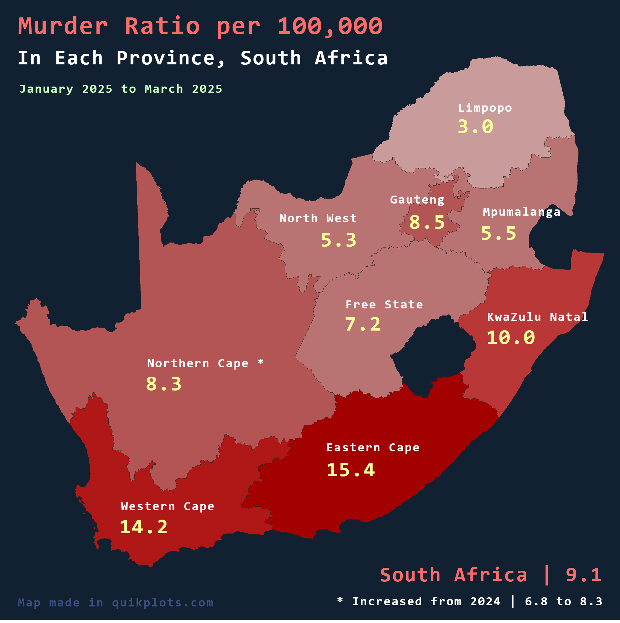
Murder Ratio per Province in South Africa Map
The "Murder Ratio per Province in South Africa" map for 2025 presents a critical overview of the murder rates across the...