history Maps
110 geographic visualizations tagged with "history"
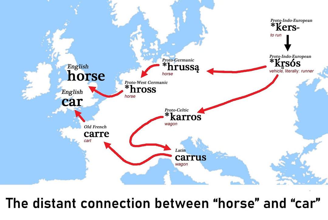
Etymology Map of Horse and Car
This visualization illustrates the linguistic connections between the words "horse" and "car," showcasing their distant ...
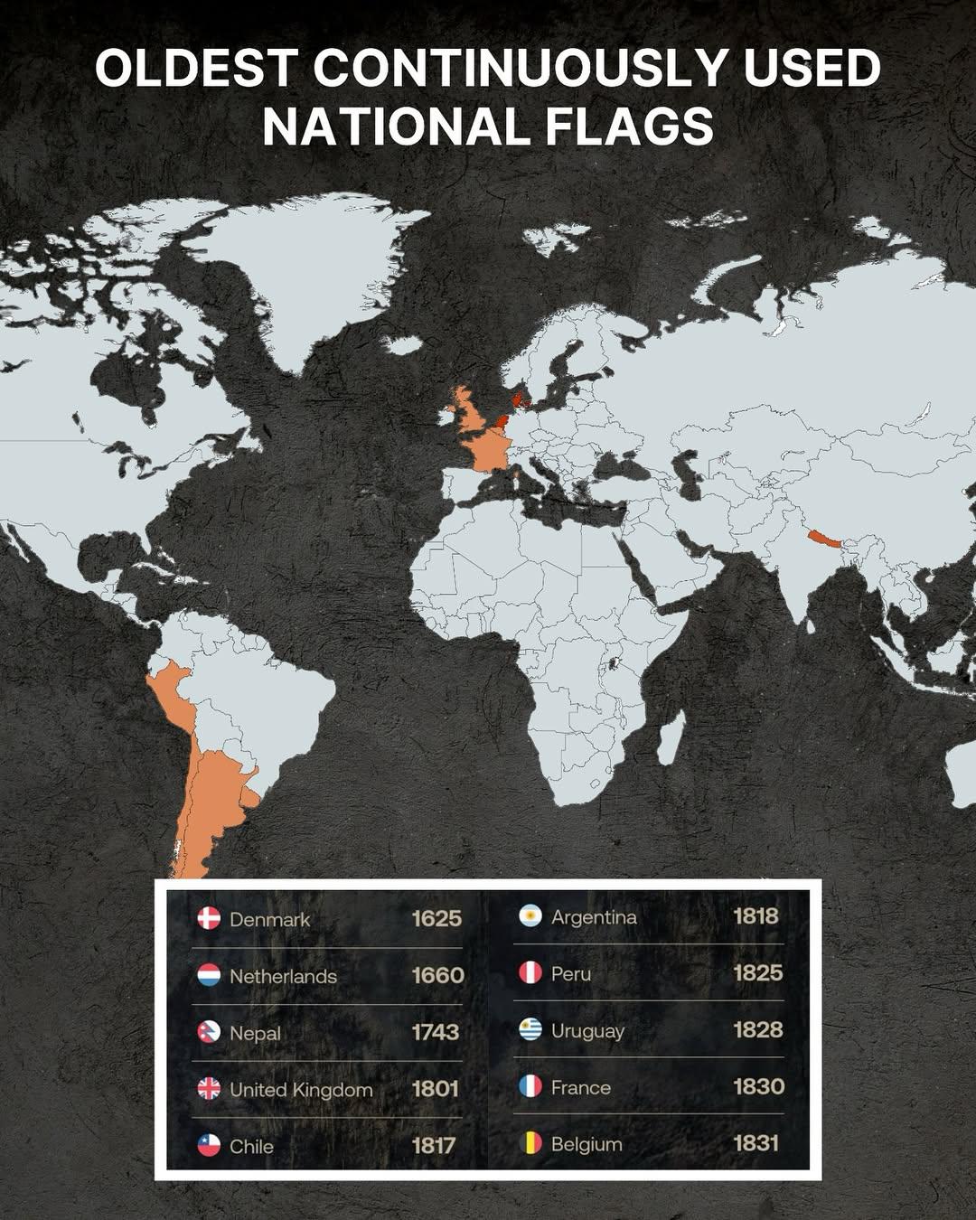
Oldest Continuously Used National Flags Map
This engaging map highlights the countries that boast the oldest continuously used national flags in the world. A nation...
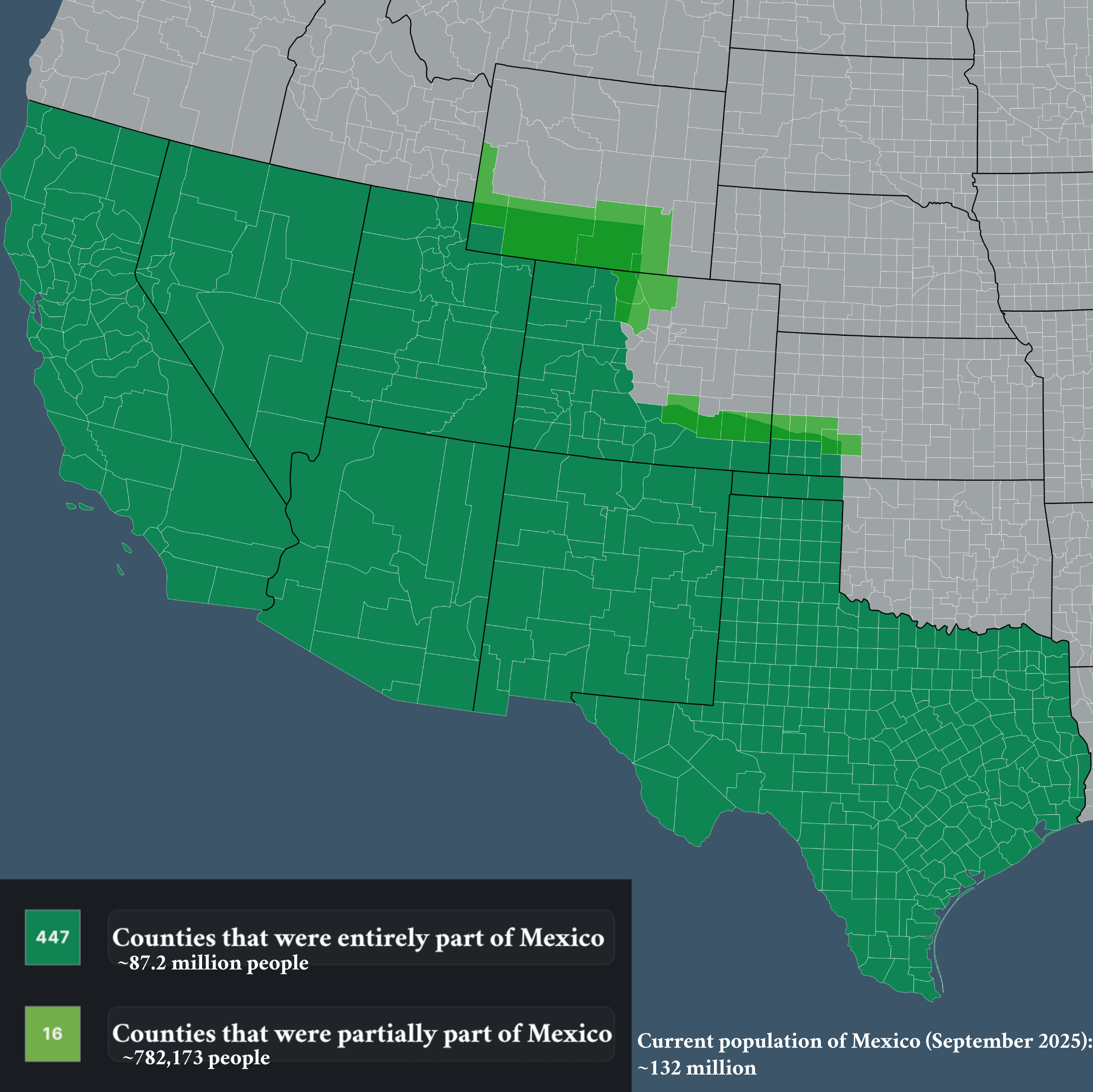
Map of Counties that Used to be Part of Mexico
The visualization titled "Counties that used to be part of Mexico" provides an insightful look into the historical terri...
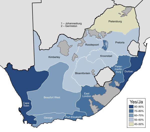
1992 South Africa Apartheid Referendum Map
...
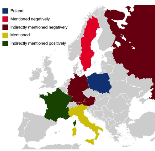
Countries Mentioned in the Polish National Anthem Map
The map titled "All The Countries Mentioned In The Polish National Anthem" provides a unique geographical insight into t...
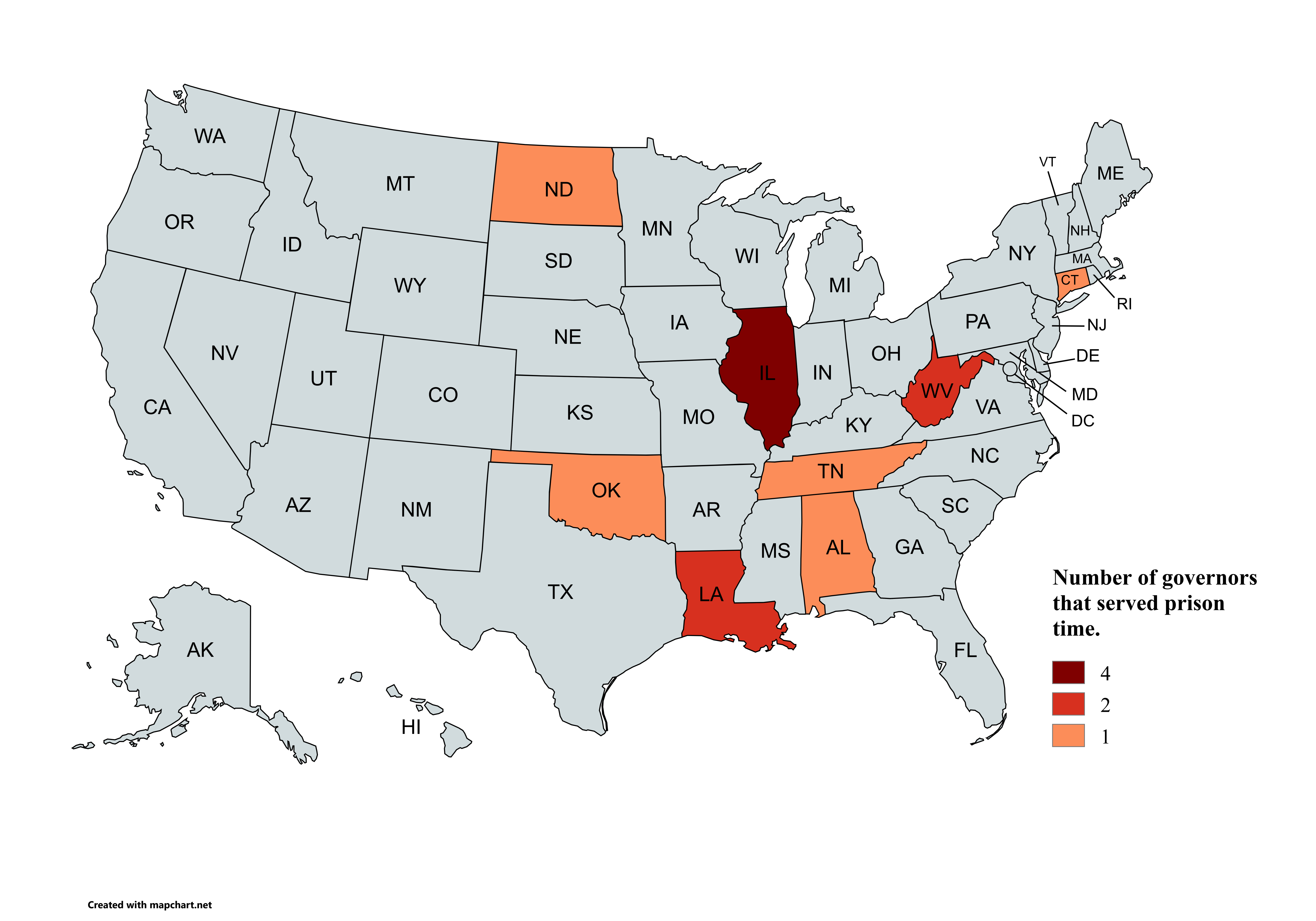
Map of Governors Who Served Prison Time
This map visualizes the sobering reality of political corruption in the United States by highlighting the governors who ...
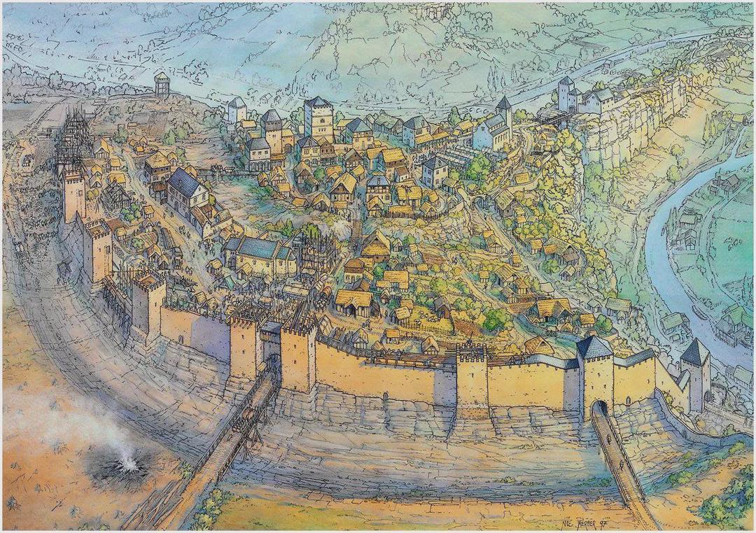
Map of Luxembourg in the 13th Century
This map vividly illustrates the town of Luxembourg as it existed in the 13th century, a period characterized by signifi...
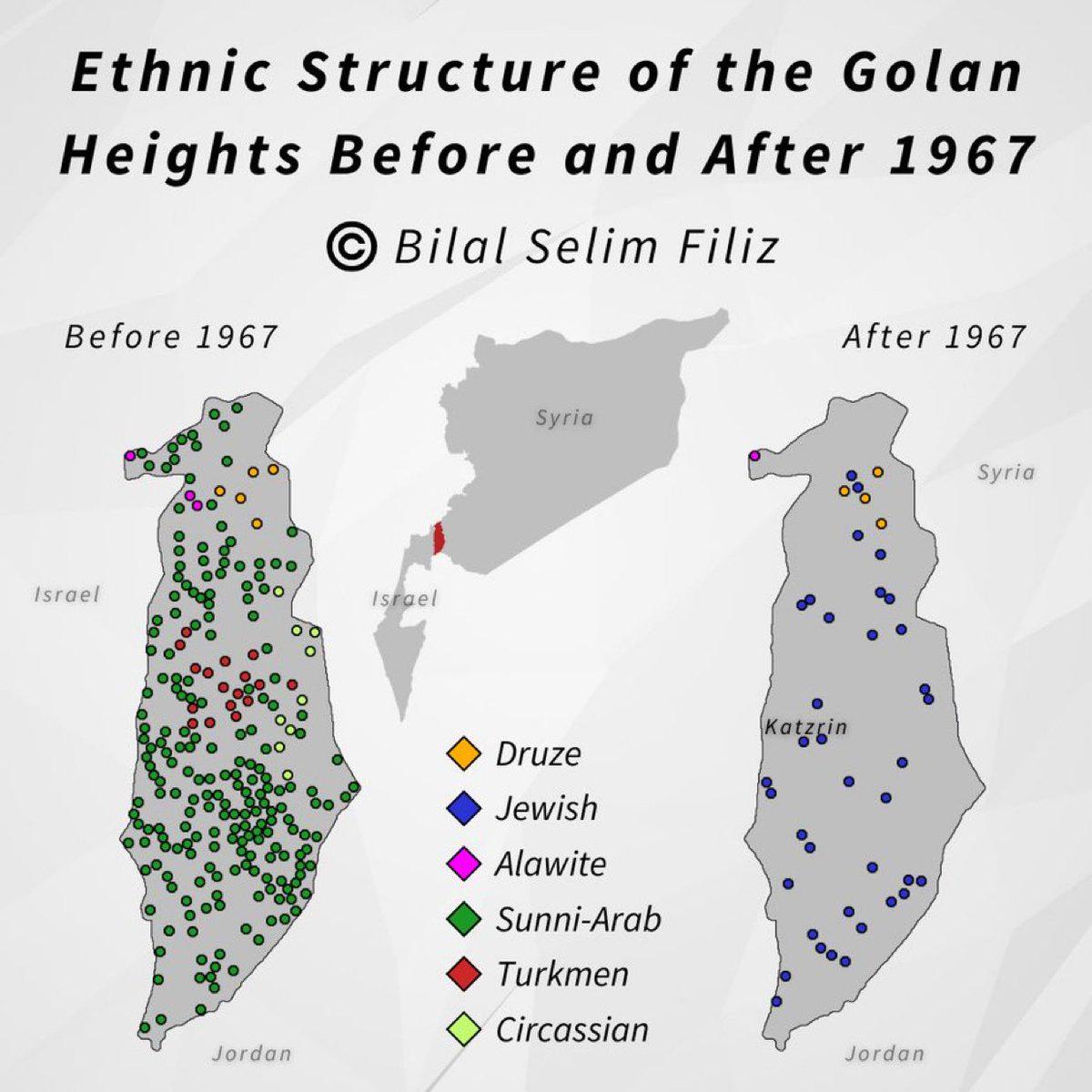
Golan Heights Historical Map Overview
The visualization titled "Golan Heights, then and now" presents a compelling comparison of the Golan Heights region, hig...
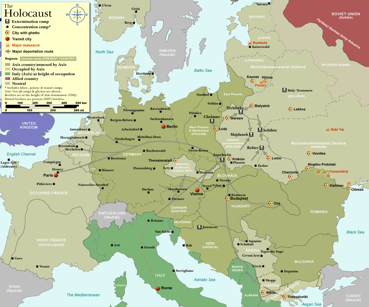
Concentration Camp and Execution Camp Map of Nazi Germany
The map titled "Concentration Camp and Execution Camp Map of Nazi Germany" illustrates the locations and distribution of...
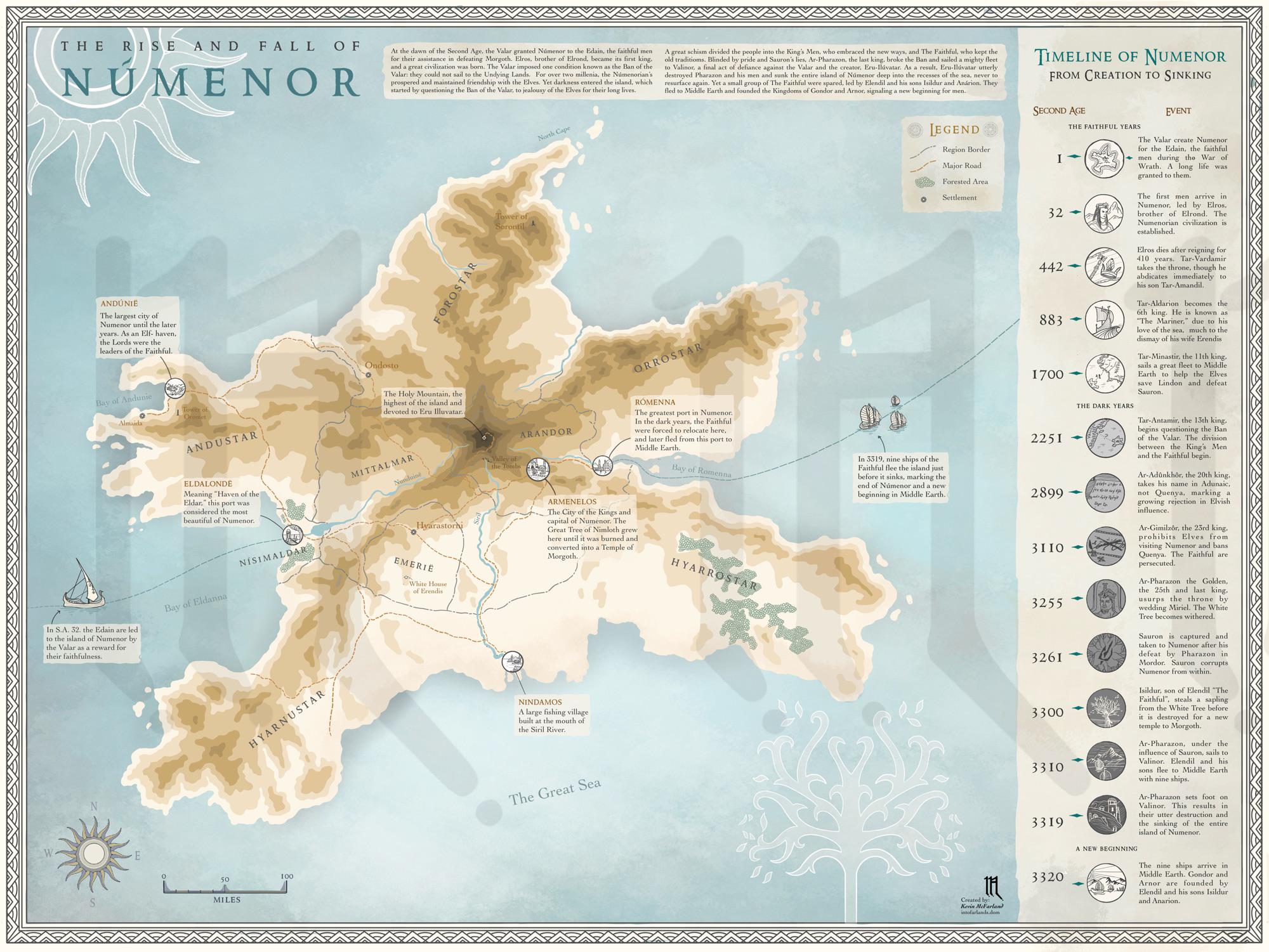
Númenor Geography Map and Historical Overview
This map visualizes the rise and fall of Númenor, a fictional island kingdom in J.R.R. Tolkien's Middle-earth. It highli...
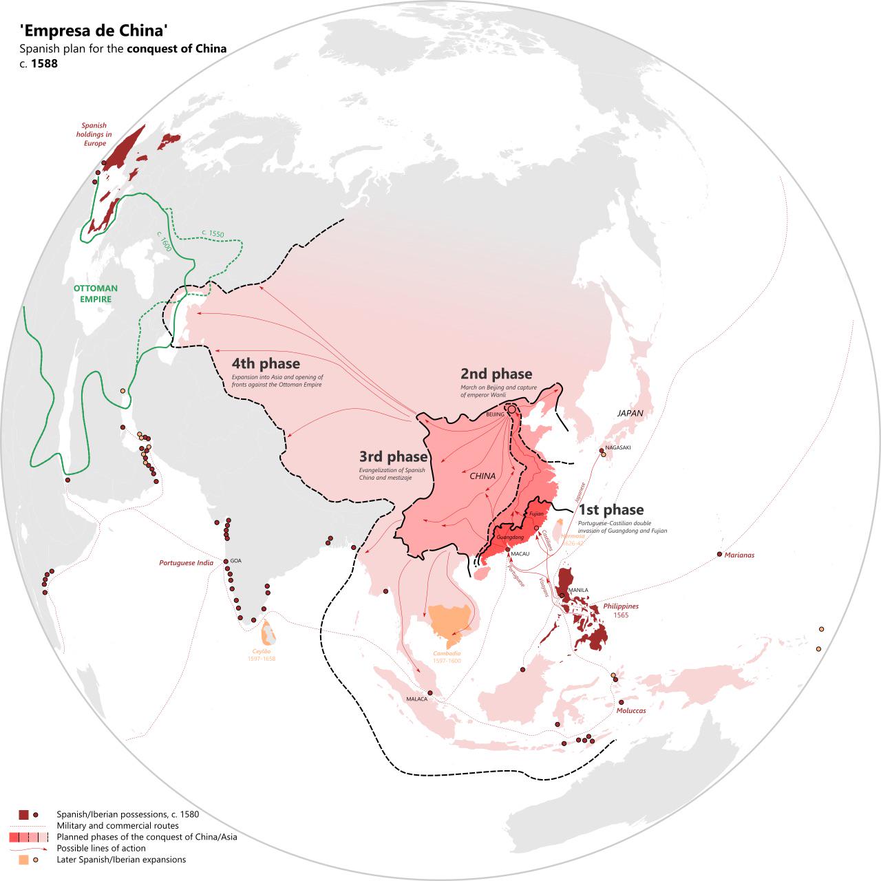
Spain's 1588 Map of Planned Attack on Ottoman Empire
This map provides a fascinating glimpse into the geopolitical ambitions of Spain in 1588, specifically highlighting its ...
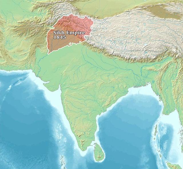
Sikh Empire 1845 Map
The "Sikh Empire 1845 Map" provides a detailed overview of the territorial expanse of the Sikh Empire at its zenith. Spa...
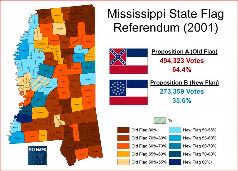
Mississippi Flag Vote 2001 Map
The "Mississippi Flag Vote 2001 Map" visualizes the results of a significant referendum held on November 7, 2001, where ...
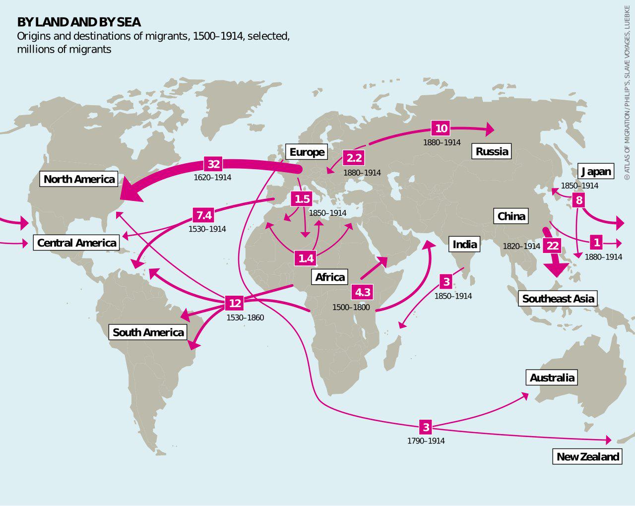
Early Modern Migrations 1500-1914 Map
The "Early Modern Migrations 1500-1914 Map" provides a detailed visualization of the massive movements of people across ...
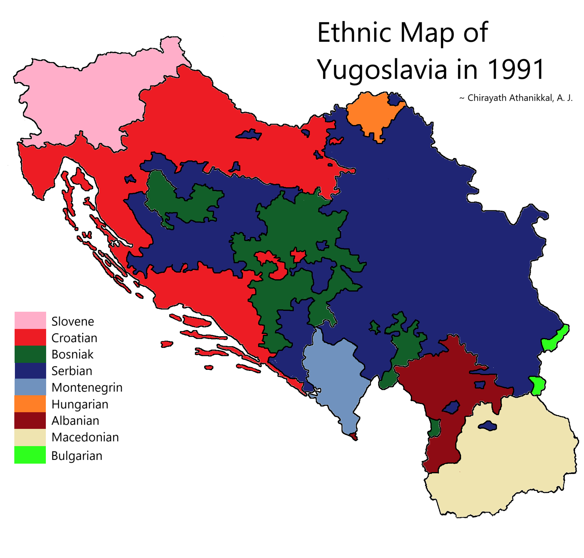
Ethnic Map of Yugoslavia in 1991
The "Ethnic Map of Yugoslavia in 1991" provides a detailed visualization of the diverse ethnic groups that populated the...
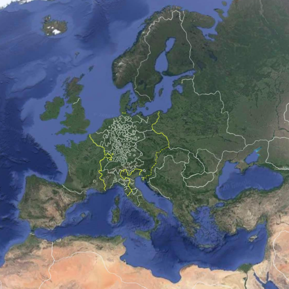
World Map of Trade Routes in 1600
This visualization, titled "Google Earth in 1600," provides an intriguing snapshot of the global trade routes that were ...
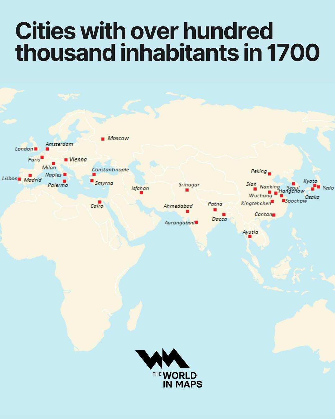
Cities with Over 100,000 Inhabitants in 1700 Map
The "Cities with Over 100,000 Inhabitants in 1700 Map" provides a fascinating glimpse into urbanization during the early...
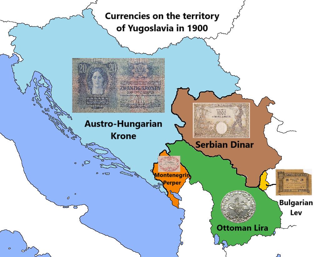
Currency Map of Yugoslavia in 1900
The map titled "Currencies on the territory of Yugoslavia in 1900" illustrates the various currencies that were in circu...
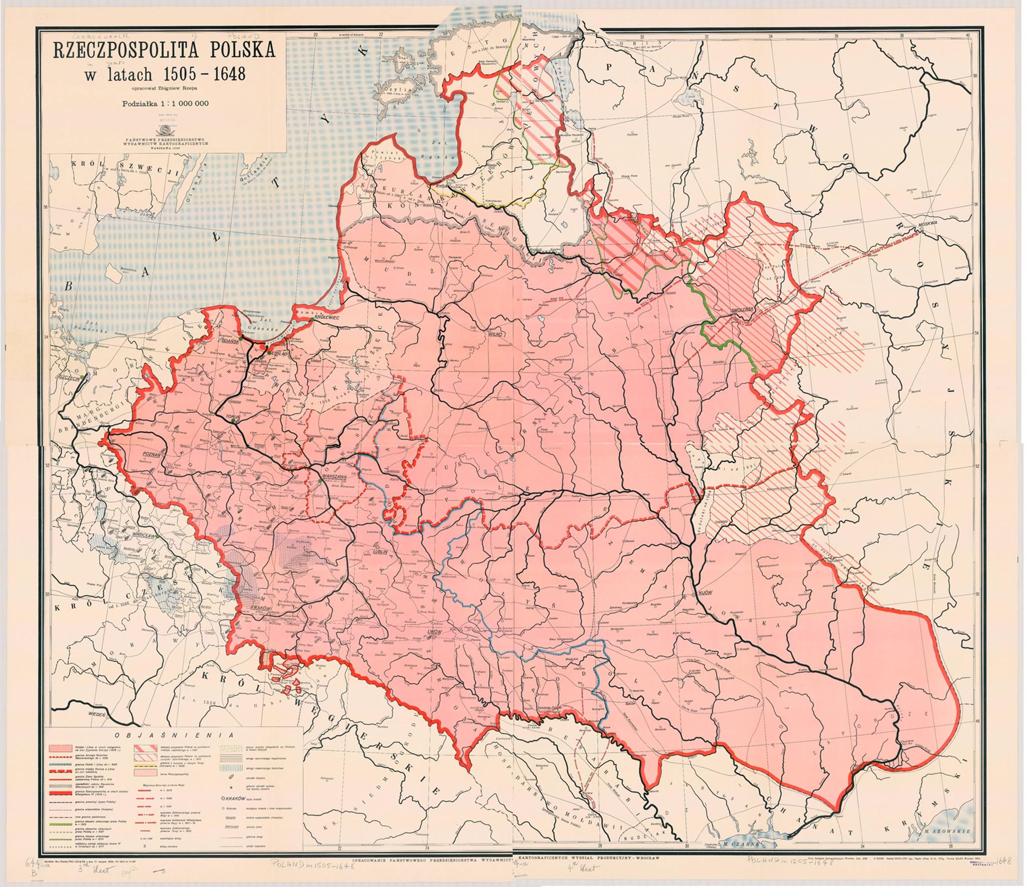
Map of the Commonwealth of Both Nations 1505-1648
The "Map of the Commonwealth of Both Nations 1505-1648" illustrates the geopolitical landscape of the Polish-Lithuanian ...
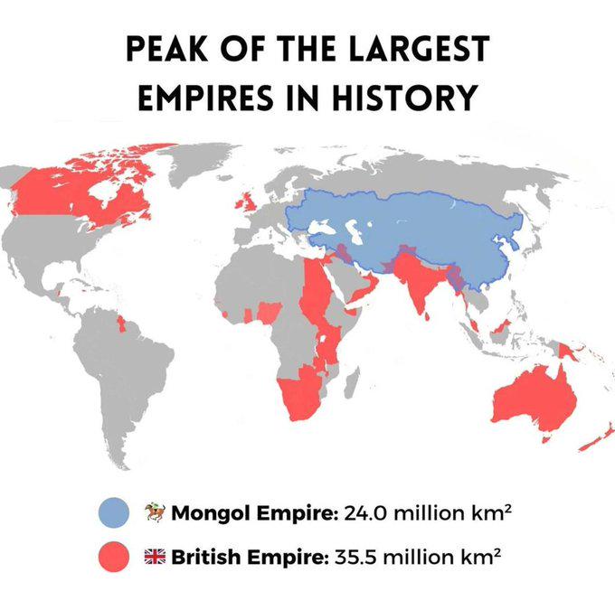
Biggest Empires in History Map
The "Biggest Empires in History Map" visually represents the vast territorial extents of the most significant empires th...
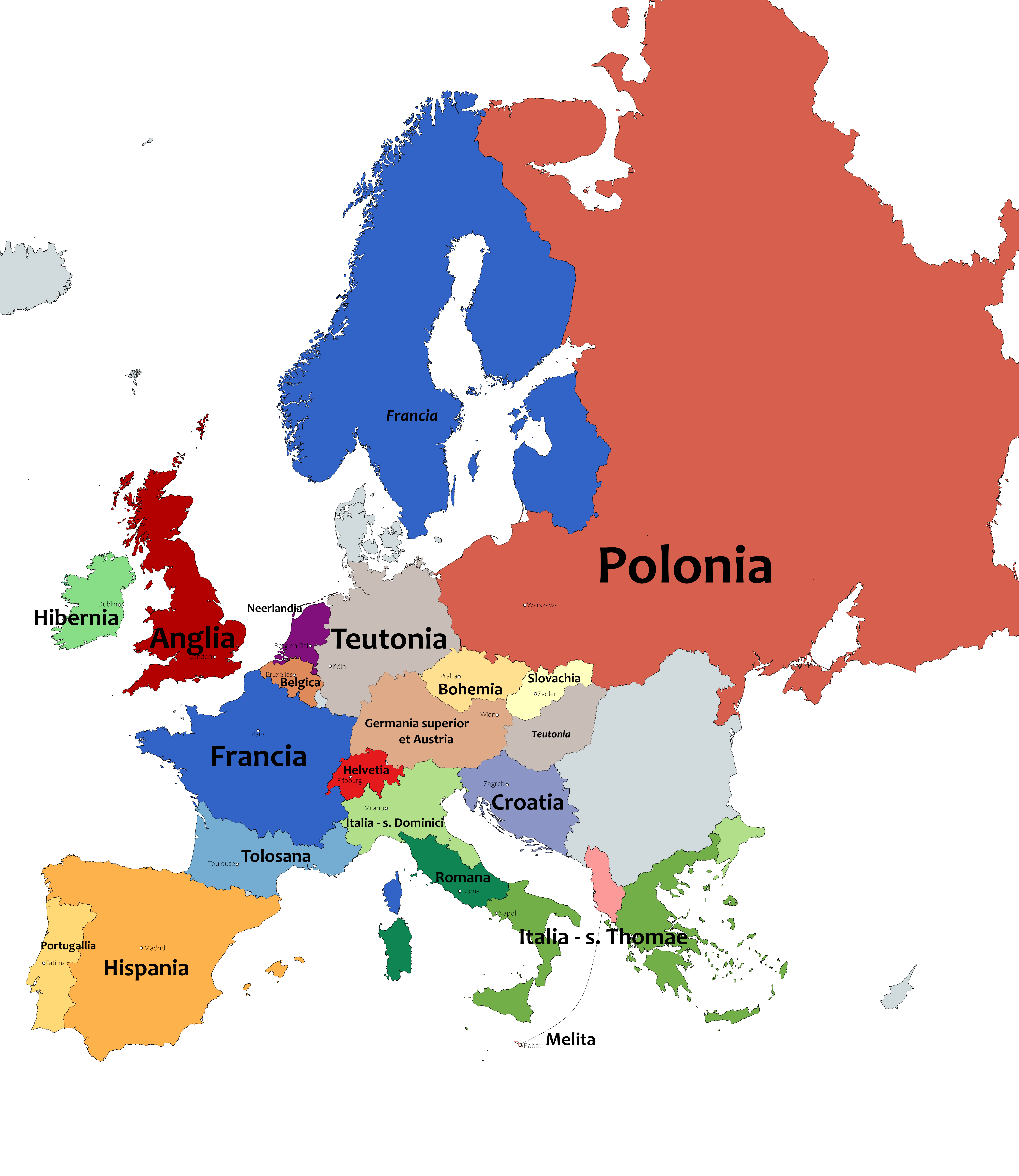
Provinces of the Dominican Order in Europe Map
This map outlines the provinces of the Dominican Order in Europe as of 2020, visually representing the geographical dist...
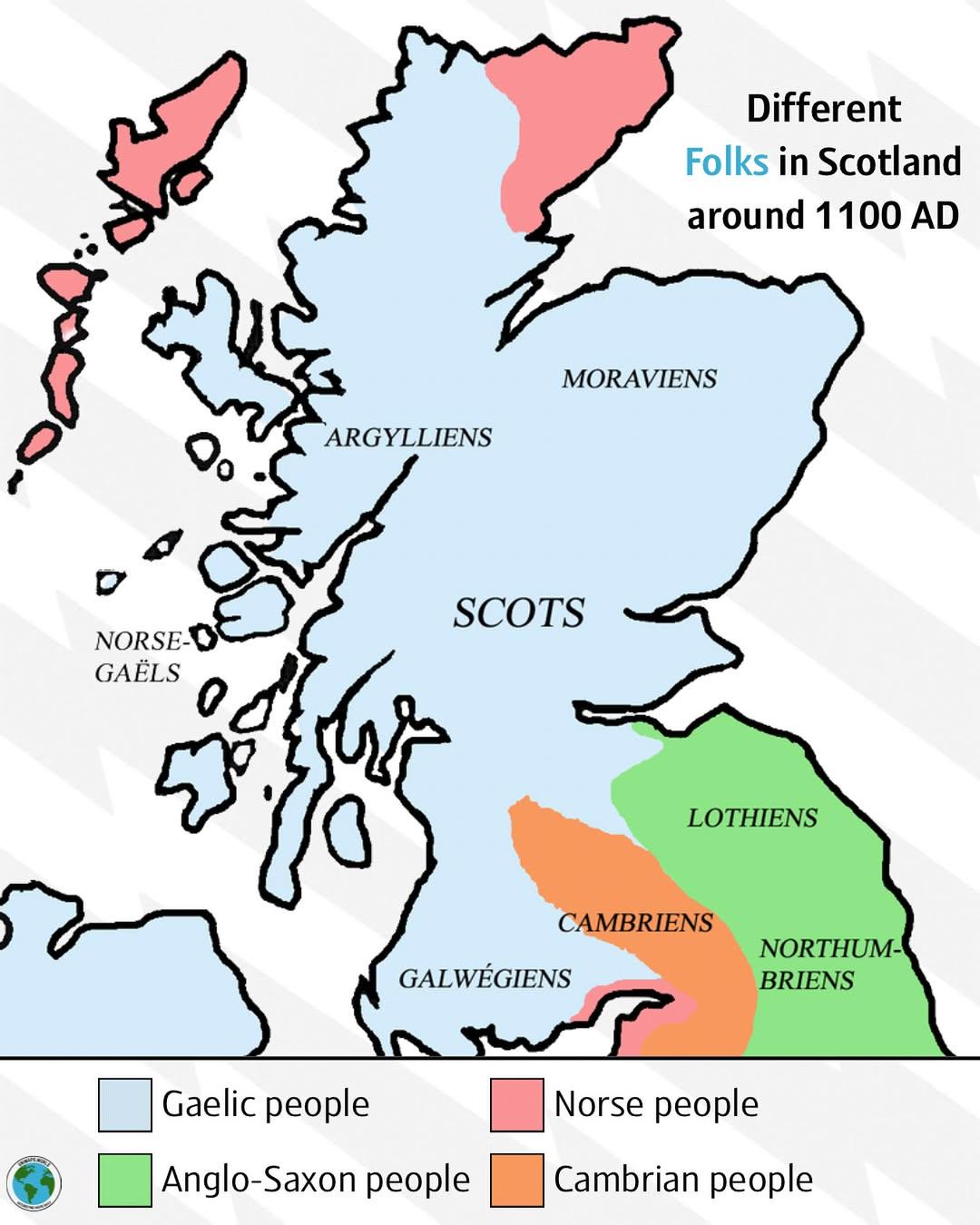
Cultural Map of Scotland around 1100 AD
The visualization titled "Different Folks in Scotland around 1100 AD" provides a detailed look at the various cultural a...
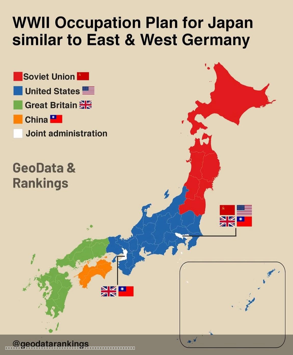
Japan Post-World War 2 Division Map
This map illustrates the proposed division of Japan after World War II, shedding light on the geopolitical landscape tha...
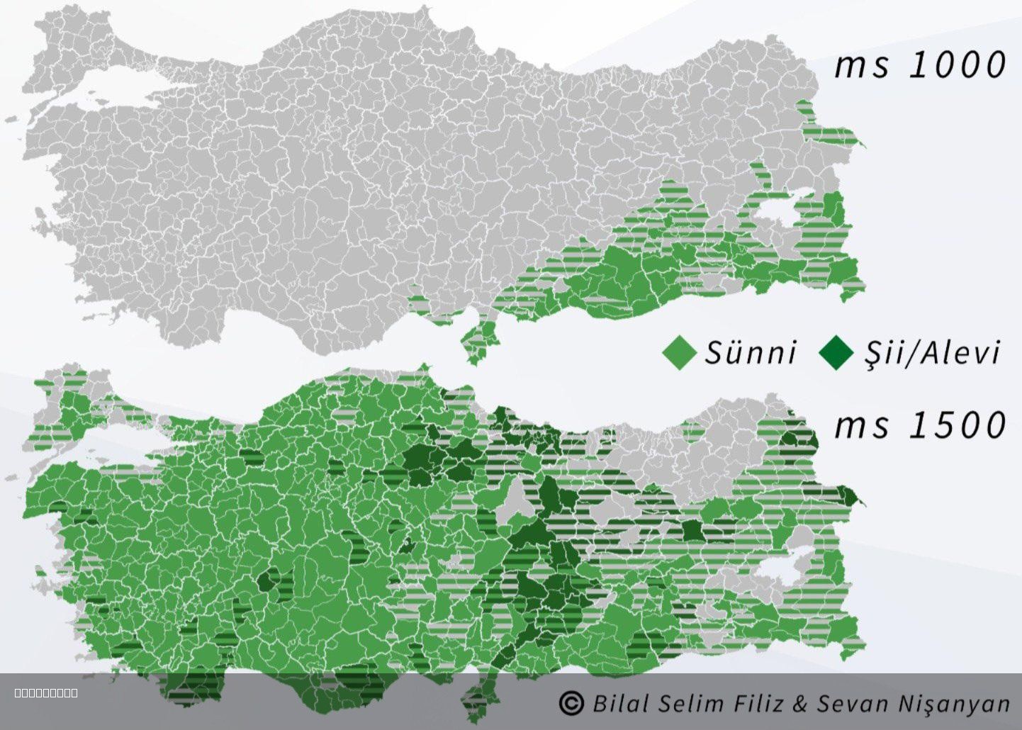
Islam in Turkey 1000 and 1500 Map
The "Islam in Turkey 1000 and 1500 Map" visually represents the spread and influence of Islam across the region of Turke...
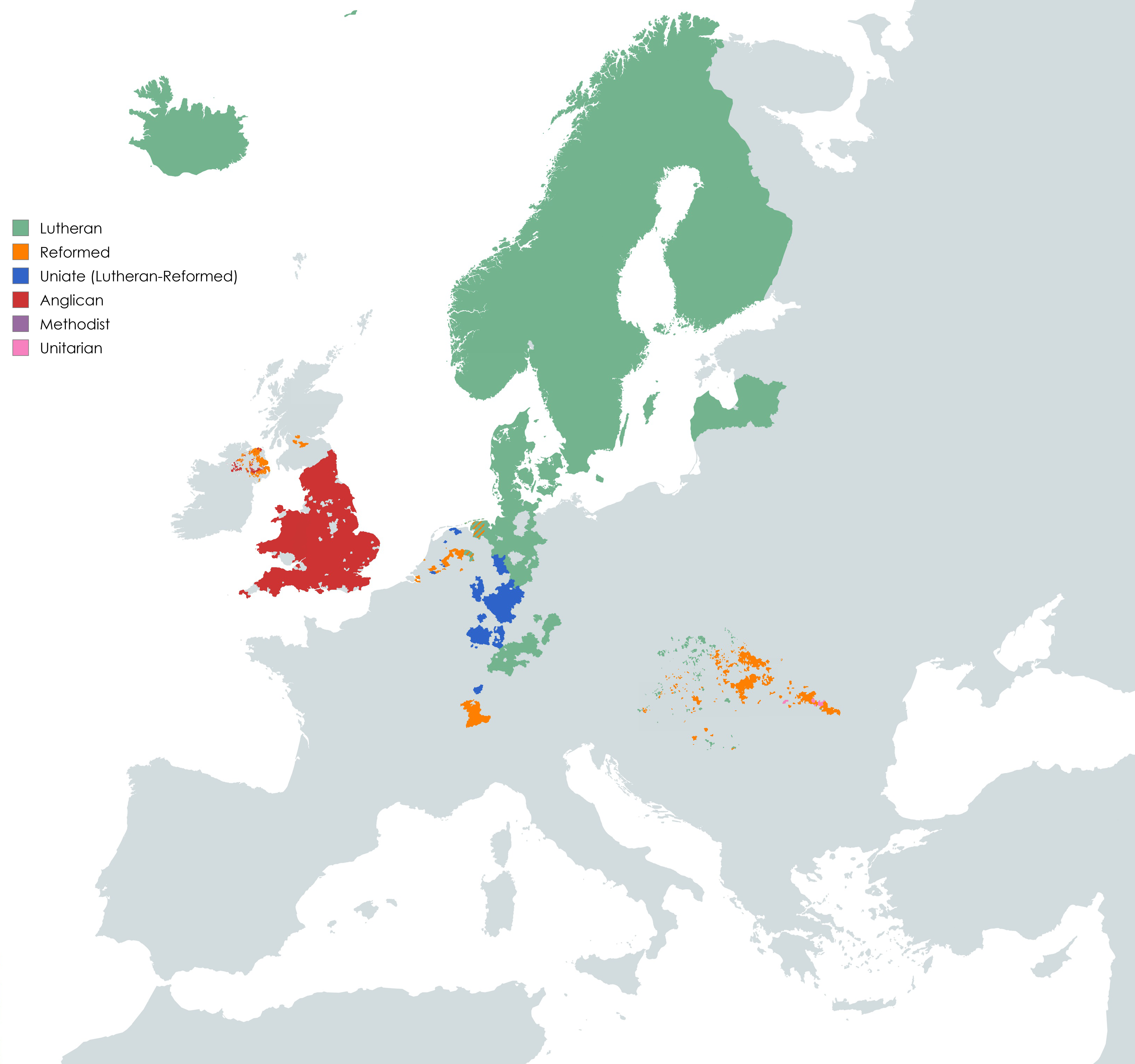
Protestantism in Europe Map
The "Protestantism in Europe Map" provides a visual representation of the distribution of Protestantism throughout vario...
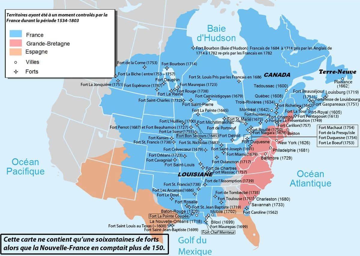
Map of North American Territories Once Controlled by France
This map provides a visual representation of the territories in North America that were once under French control. From ...
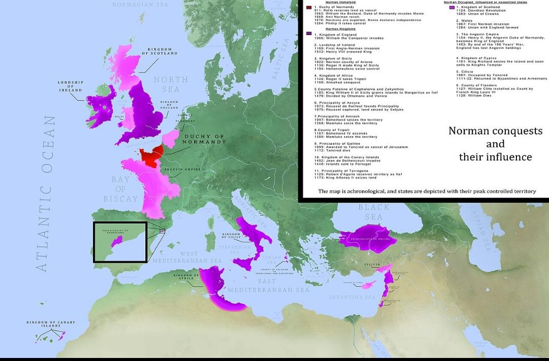
Map of Norman Conquests in History
This map illustrates the extensive territories conquered by the Normans throughout history, providing a visual represent...
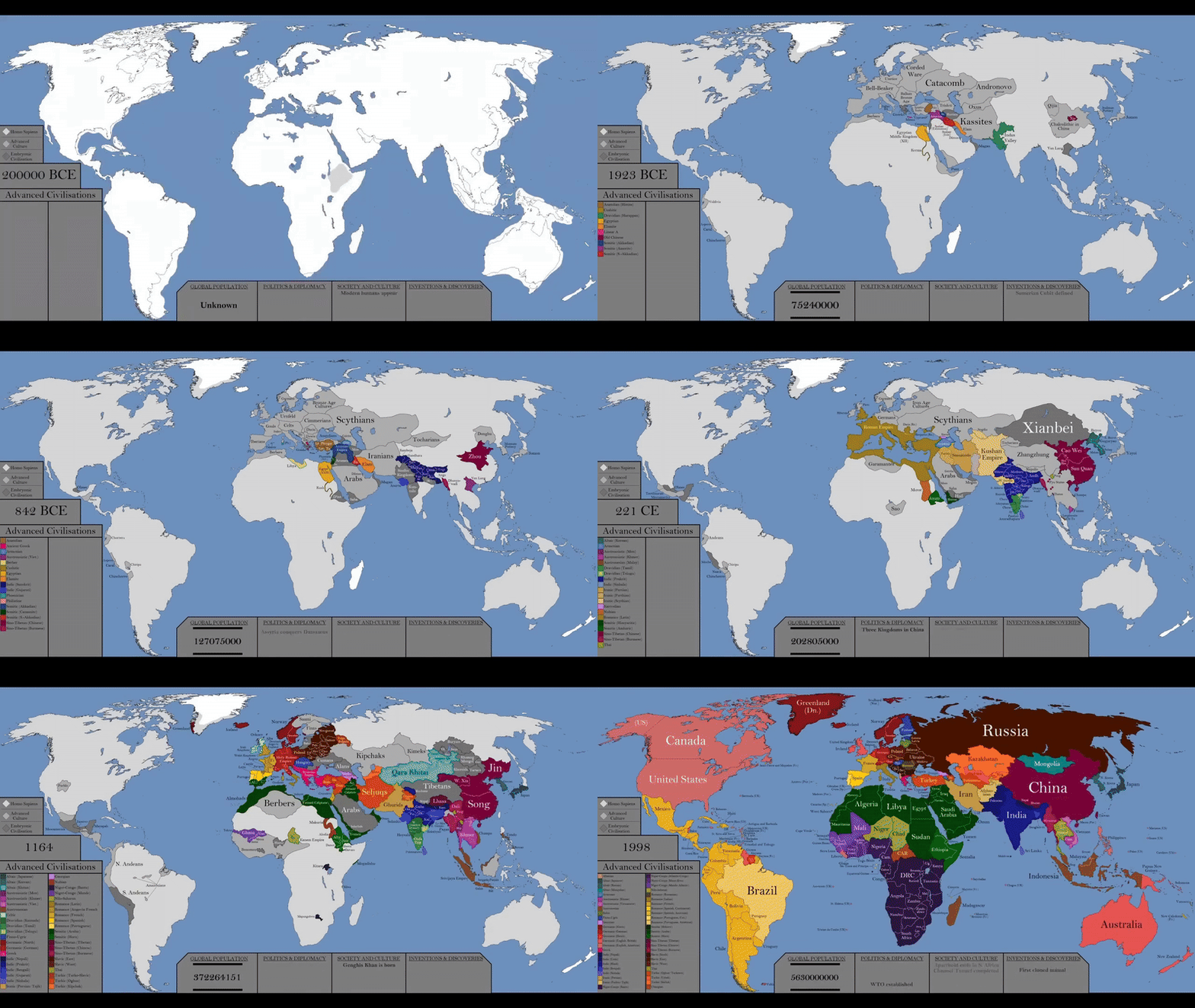
World History Timeline Map by Year
The visualization titled "The Entire History of the World Every Year In Just 30 Seconds" presents a remarkable timeline ...
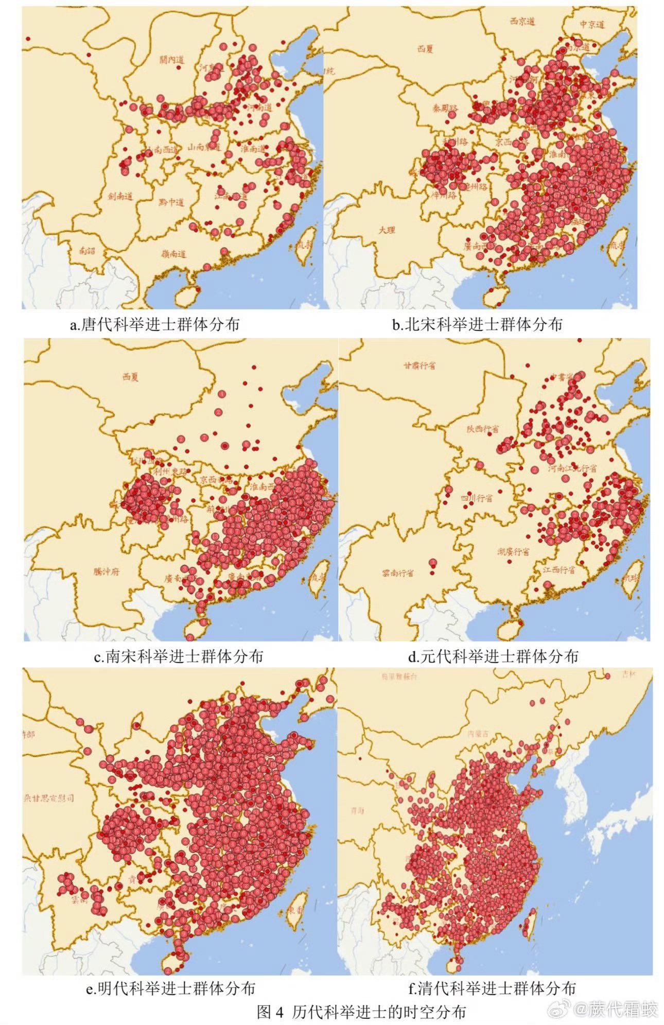
Map of No.1 Scholars in Chinese Civil Exams
Interestingly, the examinations evolved over the centuries, becoming more rigorous and extensive, with multiple levels i...
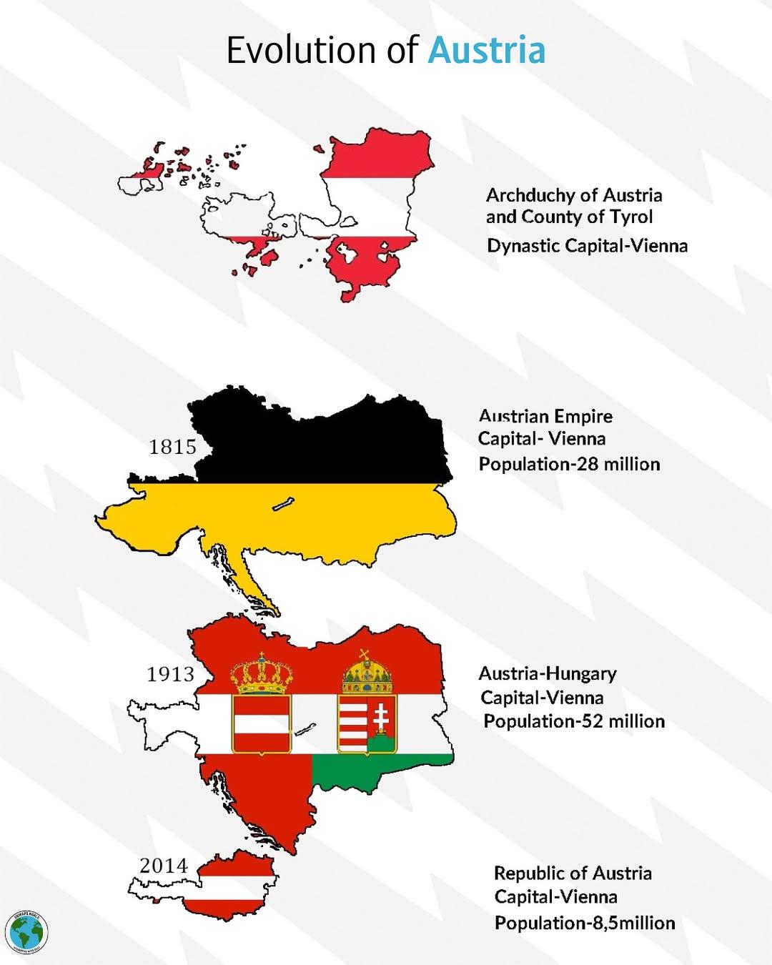
Historical Evolution of Austria Map
The "Historical Evolution of Austria" map provides a comprehensive overview of the territorial changes that Austria has ...
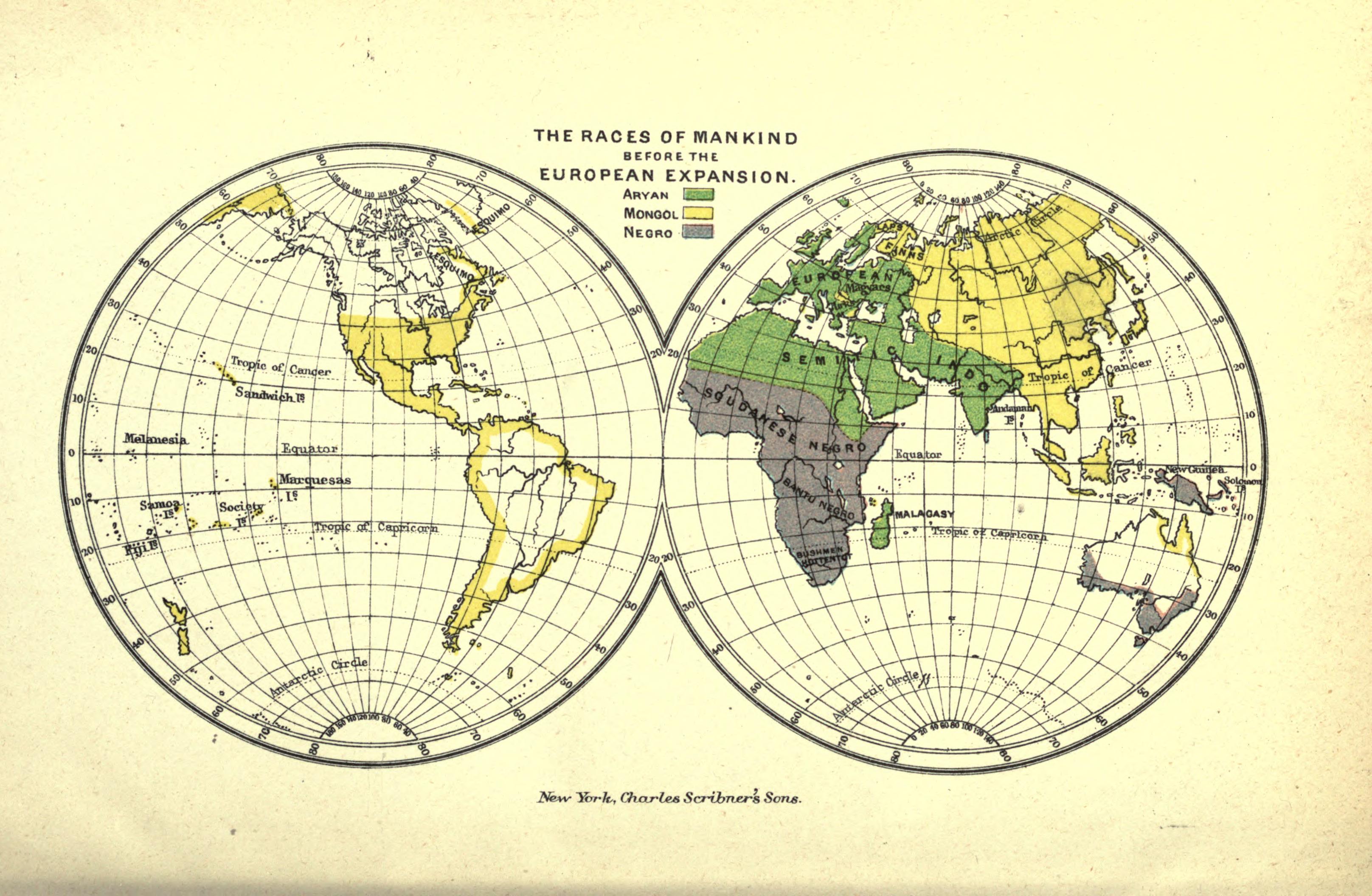
Races of Mankind Map Before European Expansion
The 1891 map titled "The Races of Mankind Before European Expansion" published by Charles Scribner's Sons provides a vis...
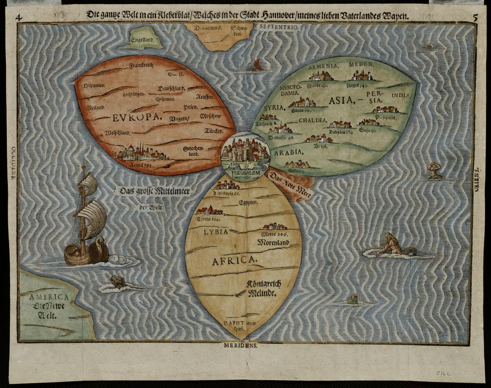
1581 Map of the Known World by Heinrich Bünting
The 1581 Map of the Known World by Heinrich Bünting presents a unique and whimsical depiction of the world, structured i...
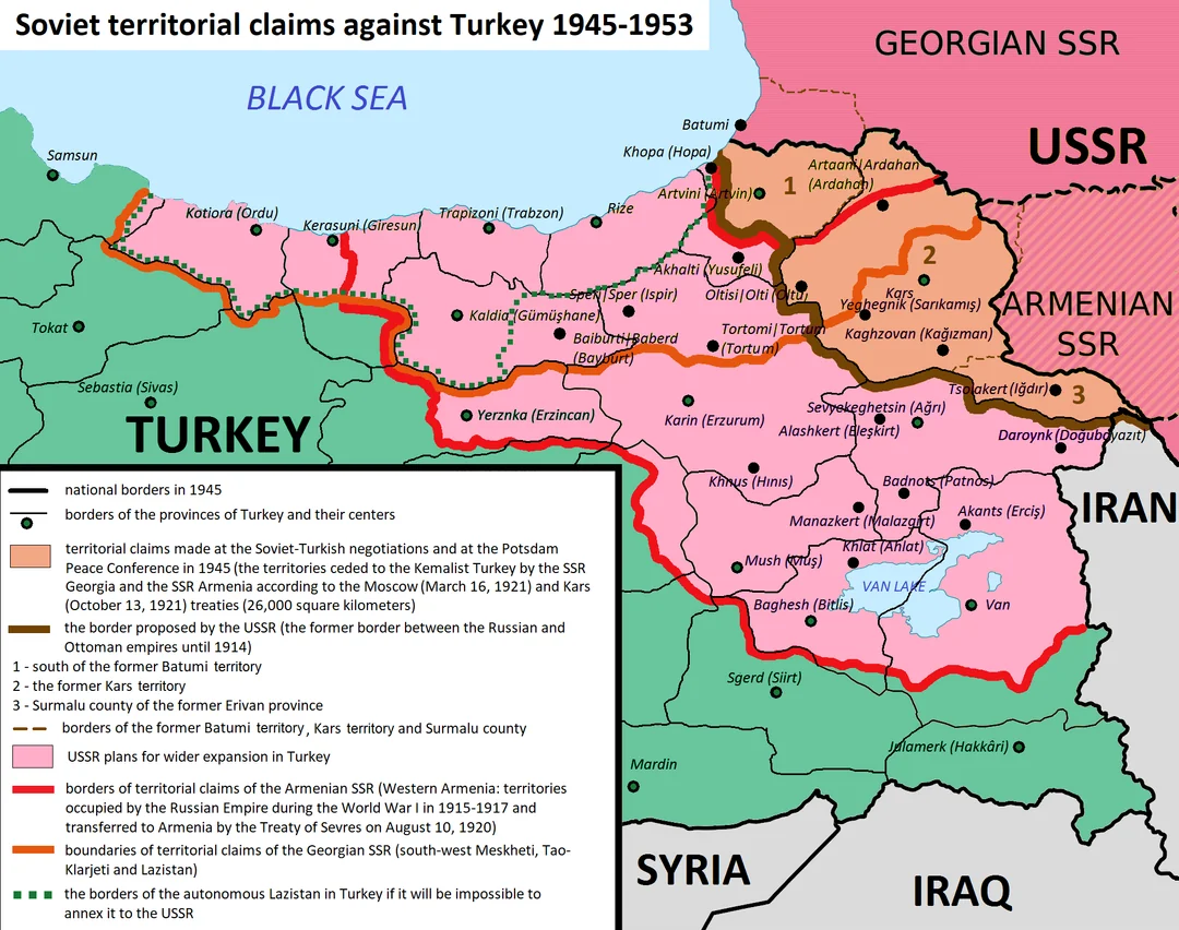
Soviet Union Territorial Claims Map from Türkiye
This map illustrates the territorial claims made by the Soviet Union regarding Türkiye during the Cold War. It details t...
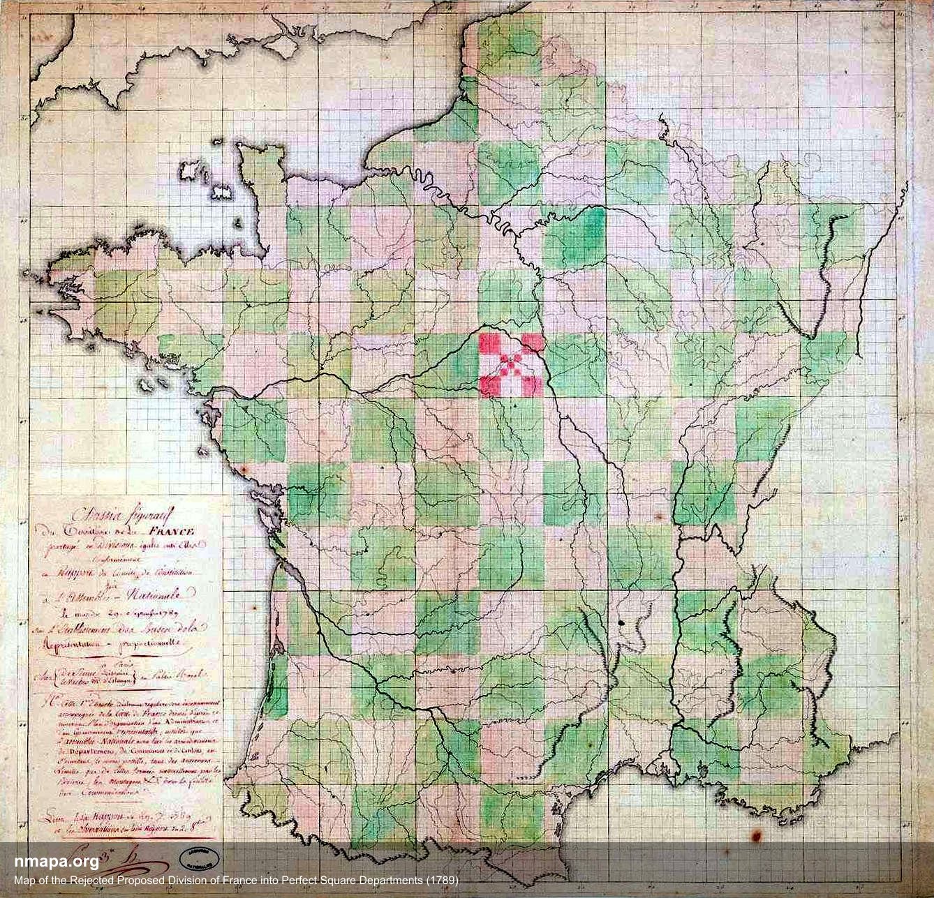
Map of the Rejected Proposed Division of France into Square Departments (1789)
This intriguing map illustrates the proposed division of France into square departments during the revolutionary period ...
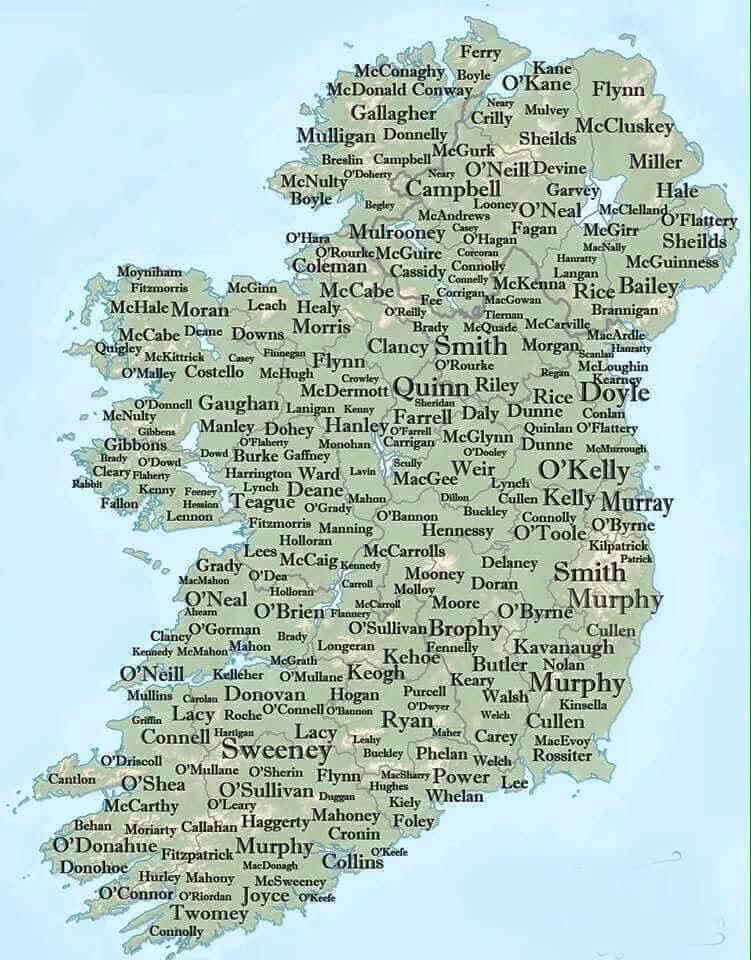
Map of Irish Surnames
The "Map of Irish Surnames" provides a captivating look at the distribution of family names across Ireland, revealing ho...
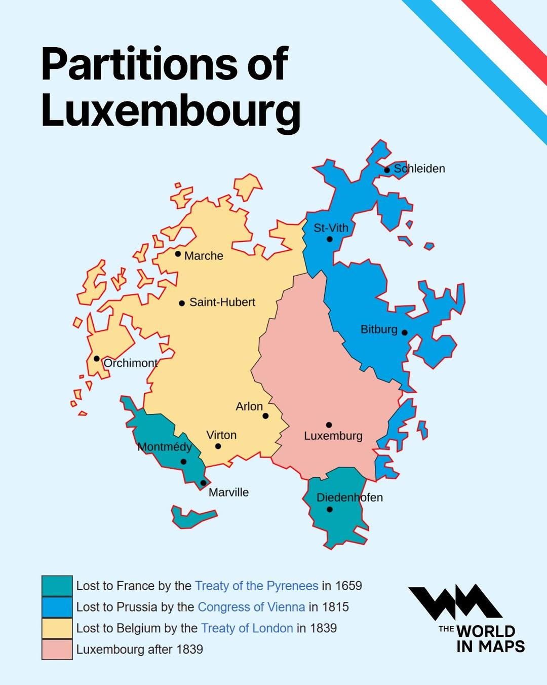
Partitions of Luxembourg Map
The "Partitions of Luxembourg Map" provides a clear depiction of the historical divisions and administrative changes tha...
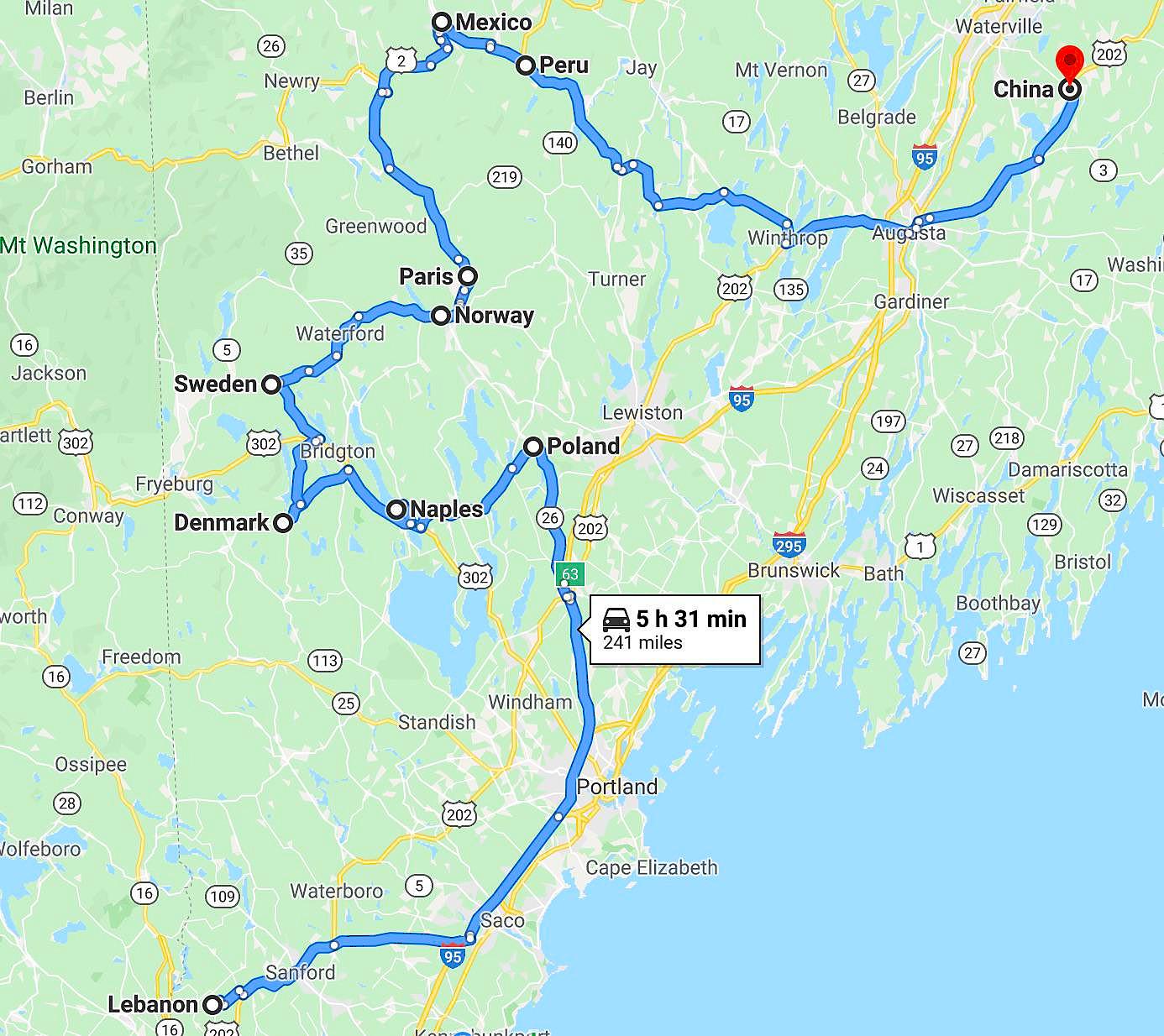
Cultural Landmarks Map of Maine
This map showcases a unique tour of the world through cultural landmarks located in Maine. It highlights various locatio...
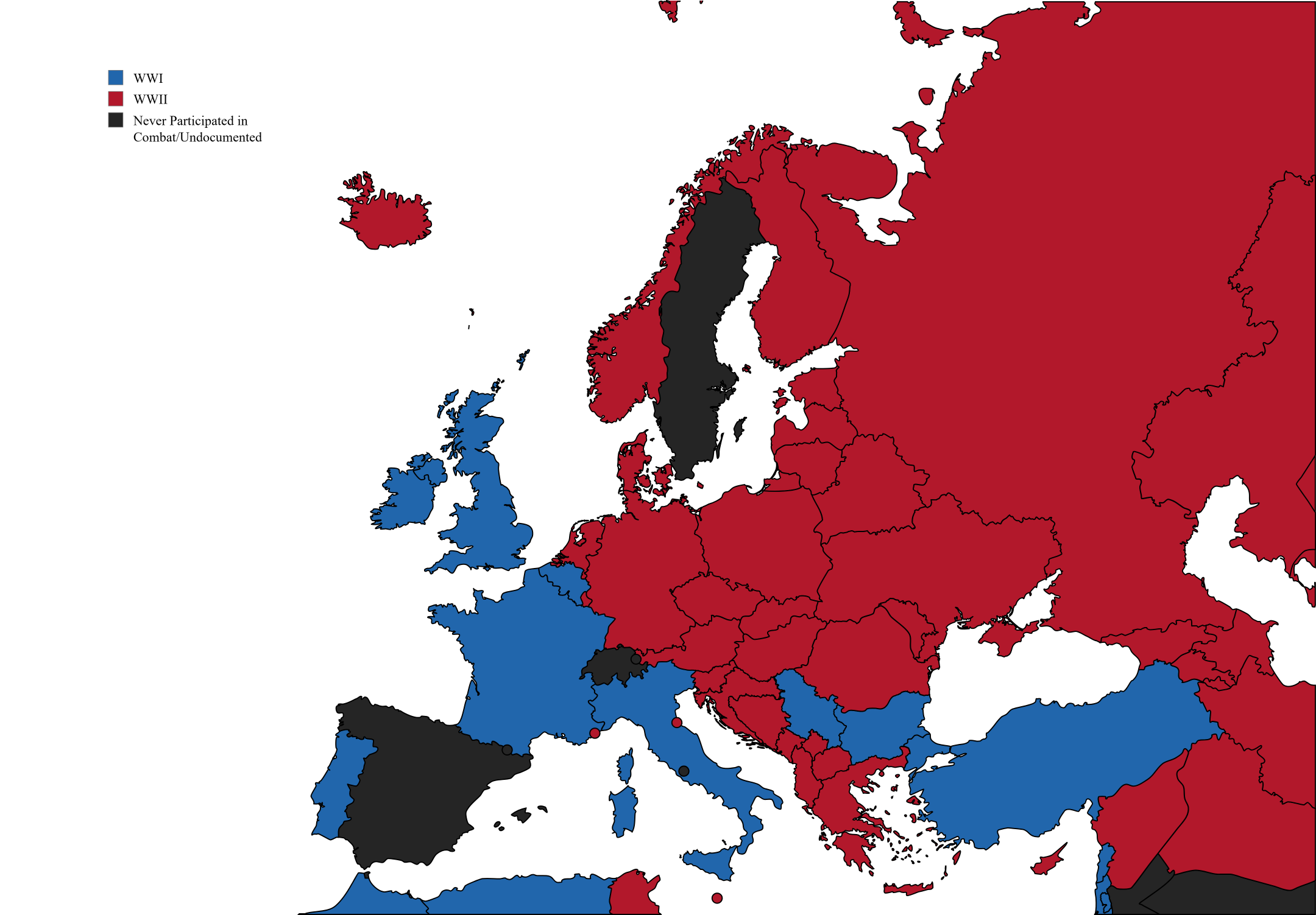
Deaths in Europe During World Wars Map
This map visually represents the estimated number of deaths in various European countries during both the First and Seco...
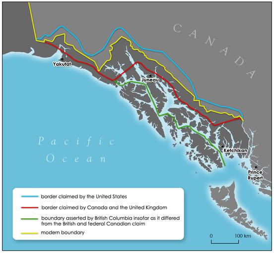
Alaska Panhandle Border History Map
The map titled "How the Alaska Panhandle border was drawn by different governments" visually represents the complex hist...
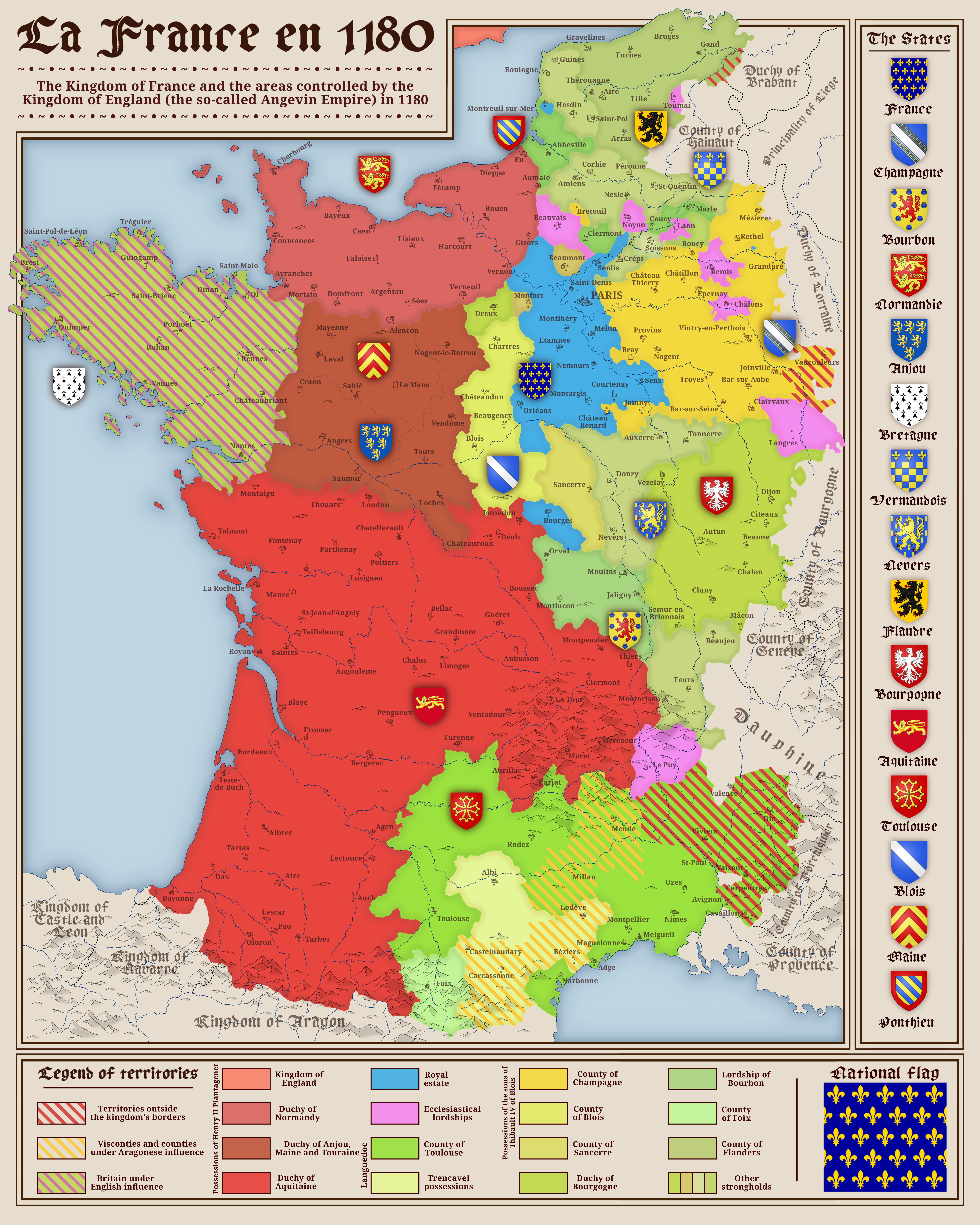
Political Map of France in 1180
The map titled "France in 1180" provides a detailed view of the political landscape of France during the late 12th centu...
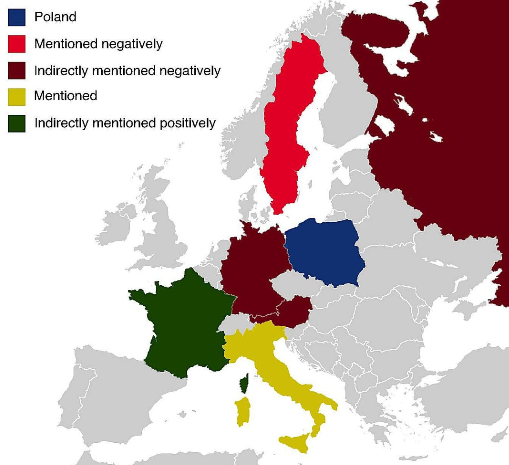
Countries Featured in Poland's Anthem Map
...
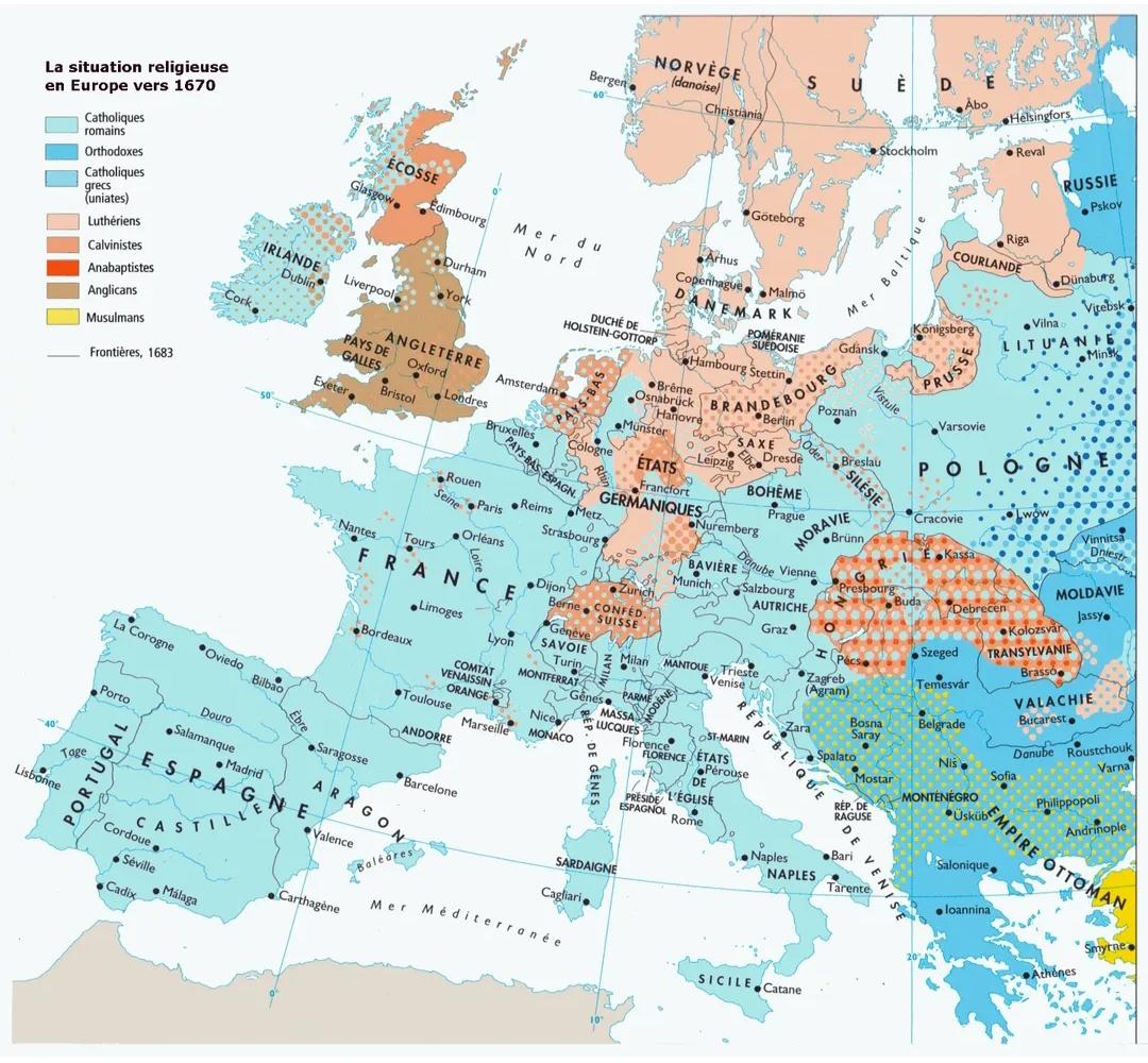
Religions in Europe around 1670 Map
The "Religions in Europe around 1670 Map" presents a visual representation of the religious landscape across the contine...
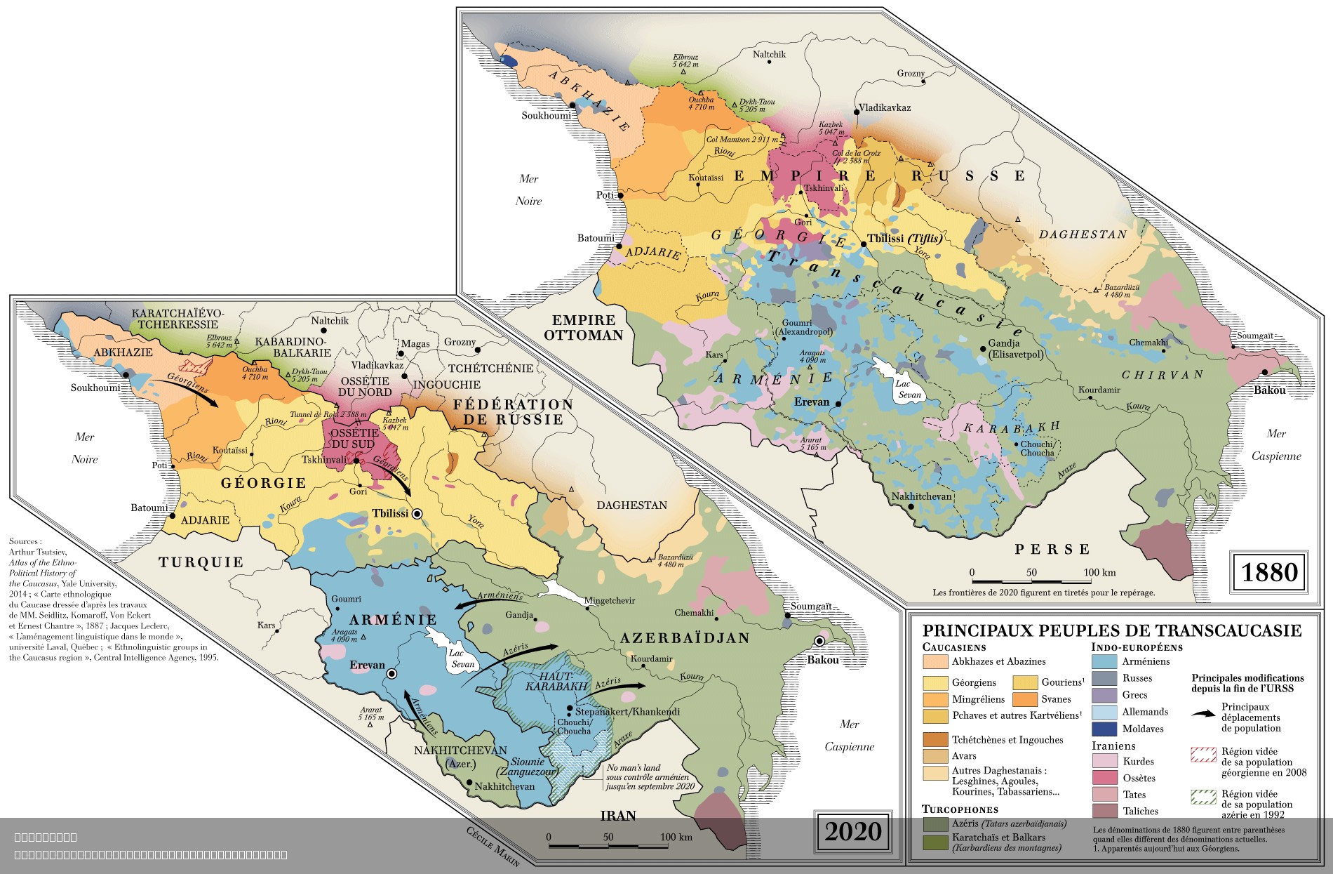
Ethnic Composition Map of Transcaucasia 1880-2020
The "Main Peoples of Transcaucasia 1880-2020" map provides a detailed visualization of the ethnic composition and distri...
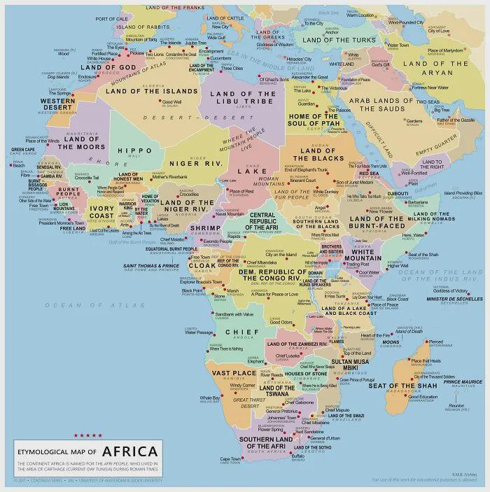
Literal Meaning of Every Country's Name in Africa Map
This map presents the literal meanings of every African country's name, providing a fascinating glimpse into the cultura...
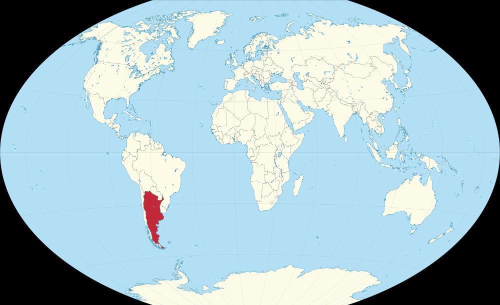
Countries with Laws Against Werewolves Map
The "Countries with Laws Against Werewolves" map presents a unique intersection of folklore, legal history, and cultural...
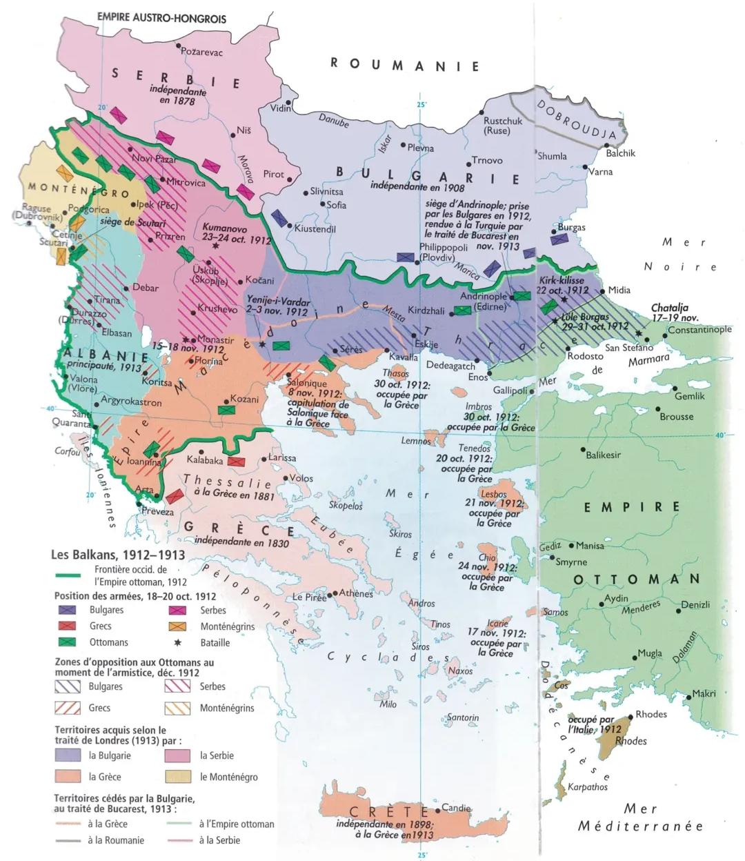
Balkan Wars 1912-1913 Map
The map titled "The Balkan Wars (1912-1913) Map" illustrates the territorial changes and military engagements that trans...
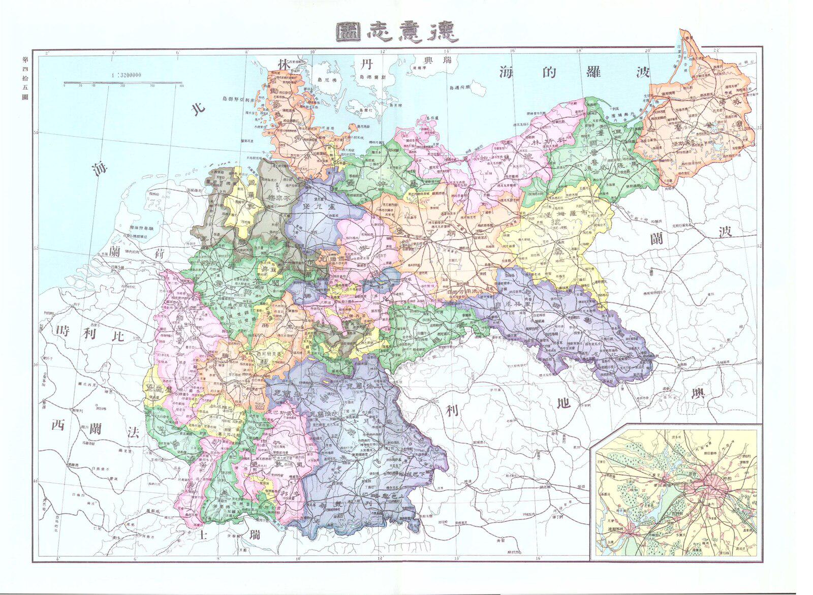
Chinese Map of Germany in 1906
...
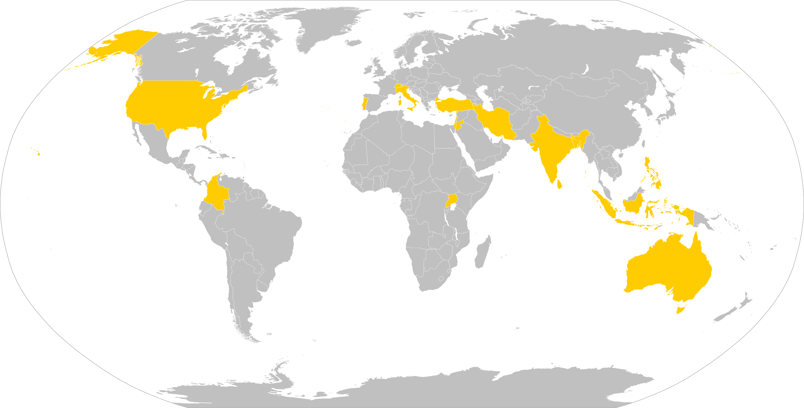
Countries Visited by Pope Paul VI Map
This visualization provides a detailed overview of the countries visited by Pope Paul VI during his papacy from 1963 to ...
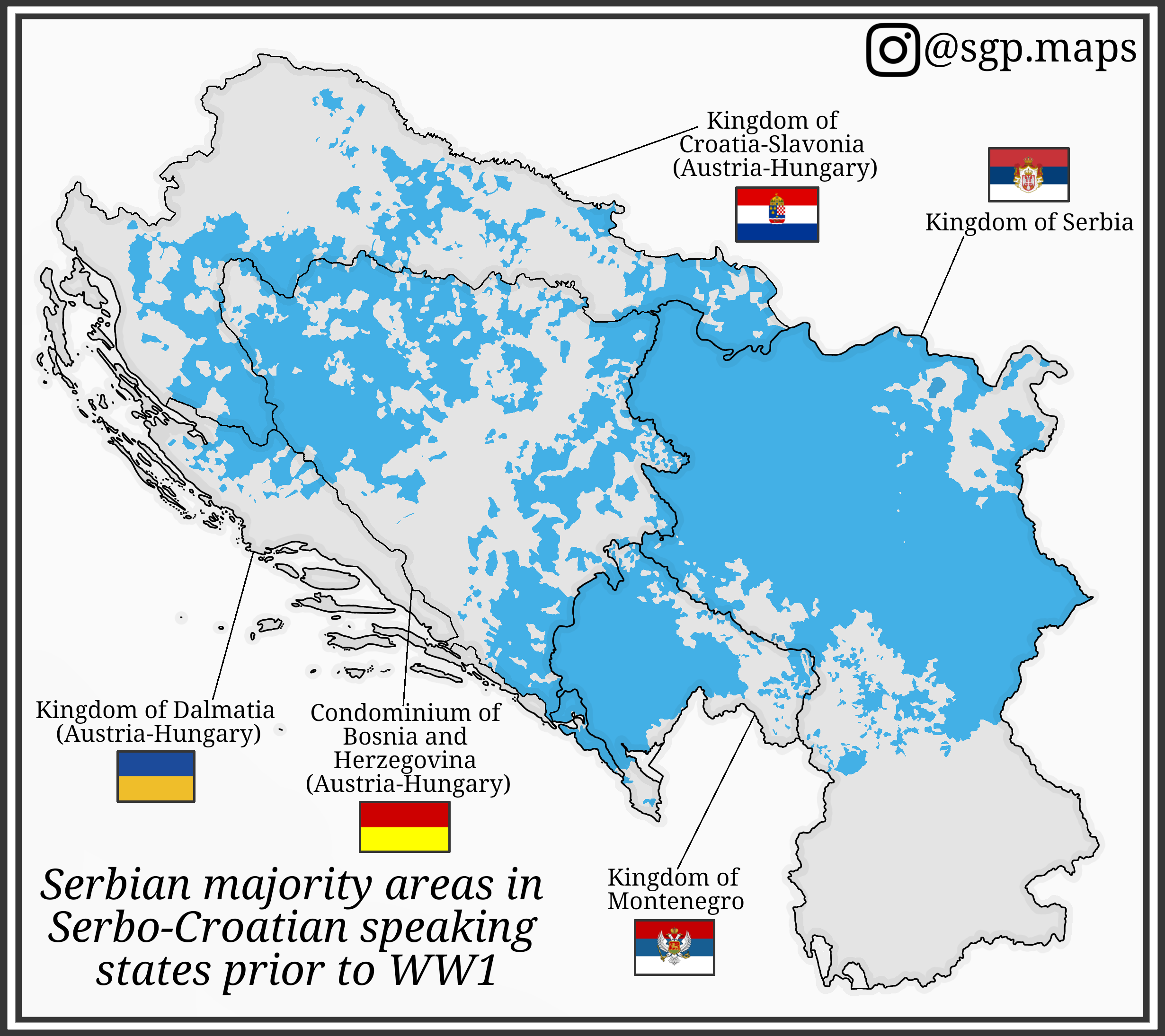
Serbian Majority Areas Map in Serbo-Croatian States Before WW1
This map illustrates the distribution of Serbian majority areas in the regions where Serbo-Croatian was spoken prior to ...
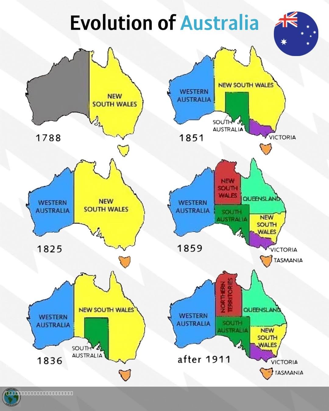
Evolution of Australia Map
...