politics Maps
39 geographic visualizations tagged with "politics"
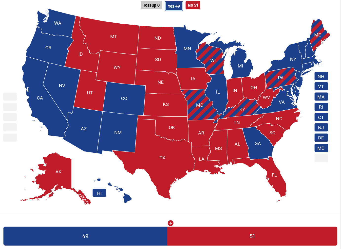
Senate Vote Impact on Epstein Files Map
This visualization illustrates the impact of each senator's vote on the measure to release the Epstein files. Senators v...
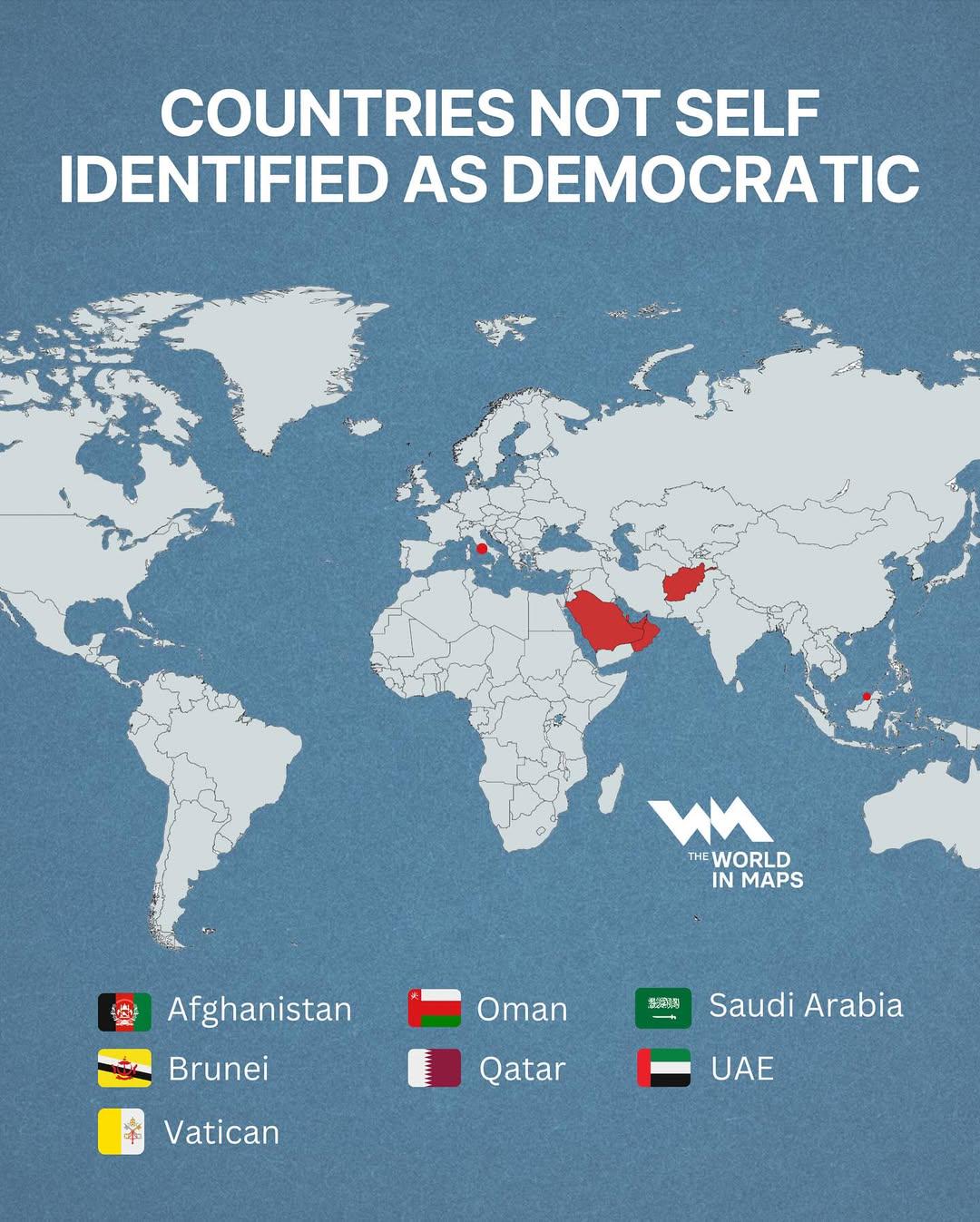
Countries Not Self Identified as Democratic Map
This map illustrates the countries that do not self-identify as democratic, highlighting the complex tapestry of governa...
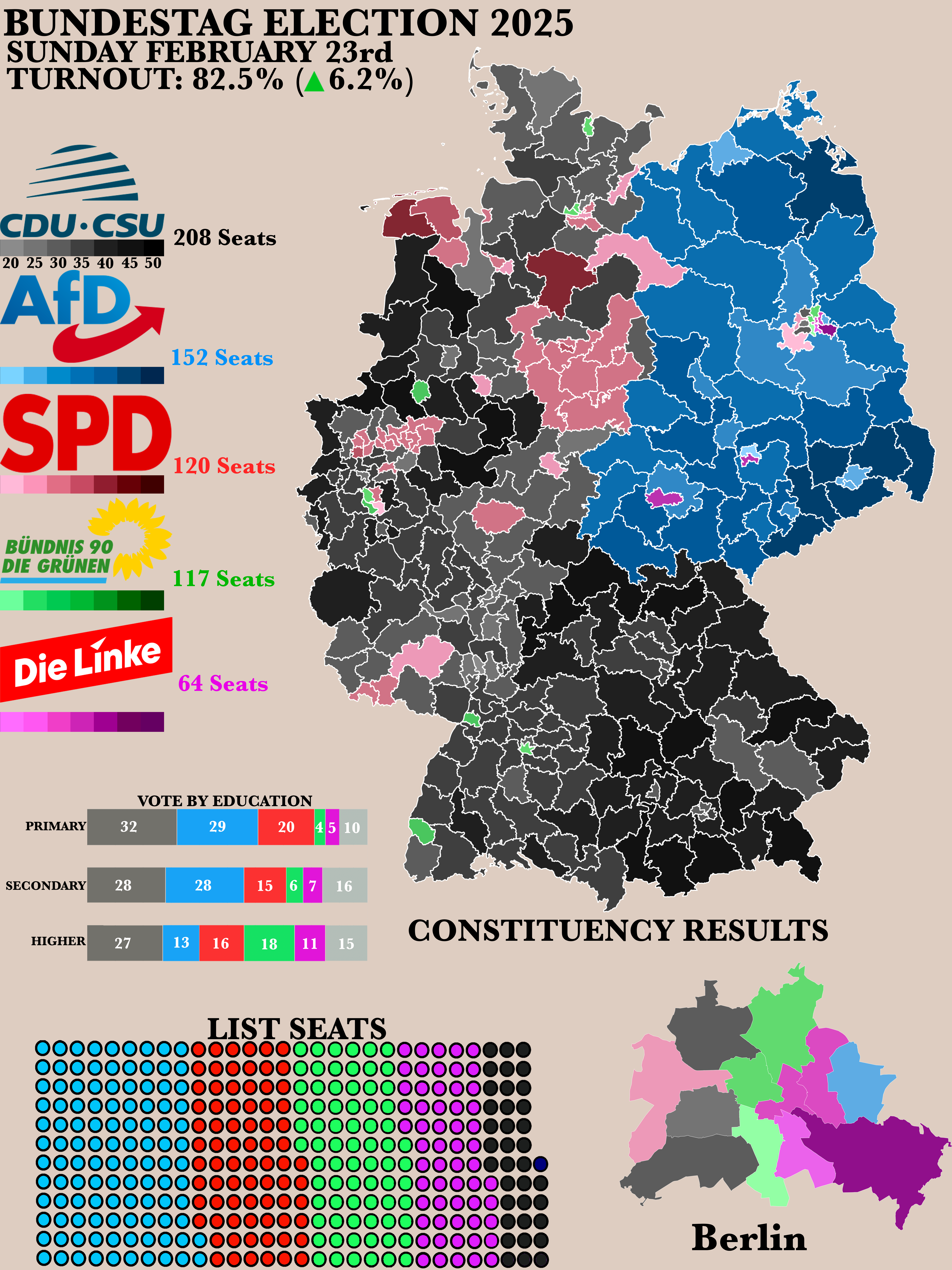
2025 German Bundestag Election Results Map
The "Poster of the 2025 German Bundestag Election Results" map provides a clear visual representation of the electoral o...
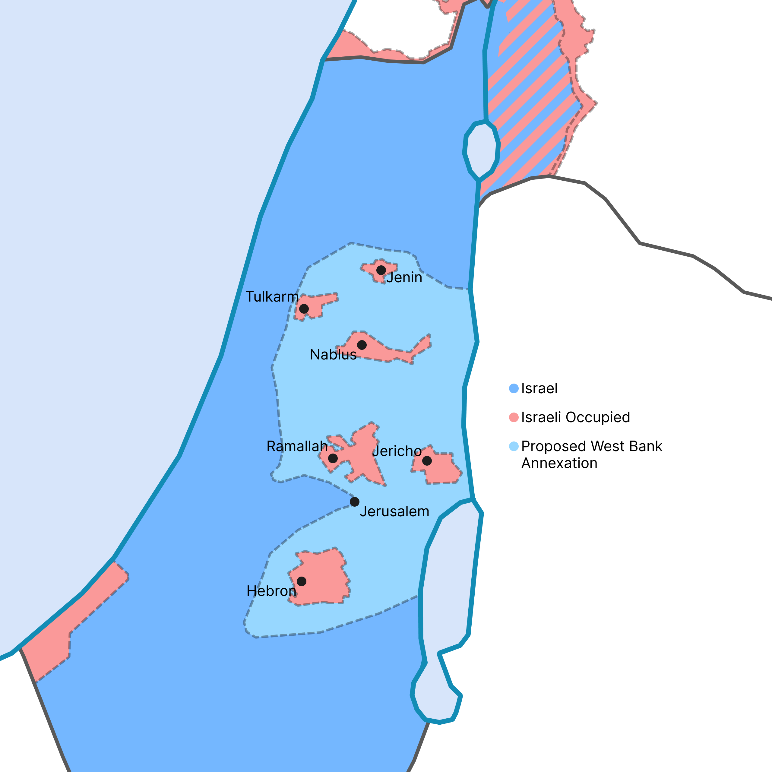
West Bank Annexation Proposal Map
This map visualizes the potential outcome of the Israeli government's recent proposal to annex a significant portion of ...
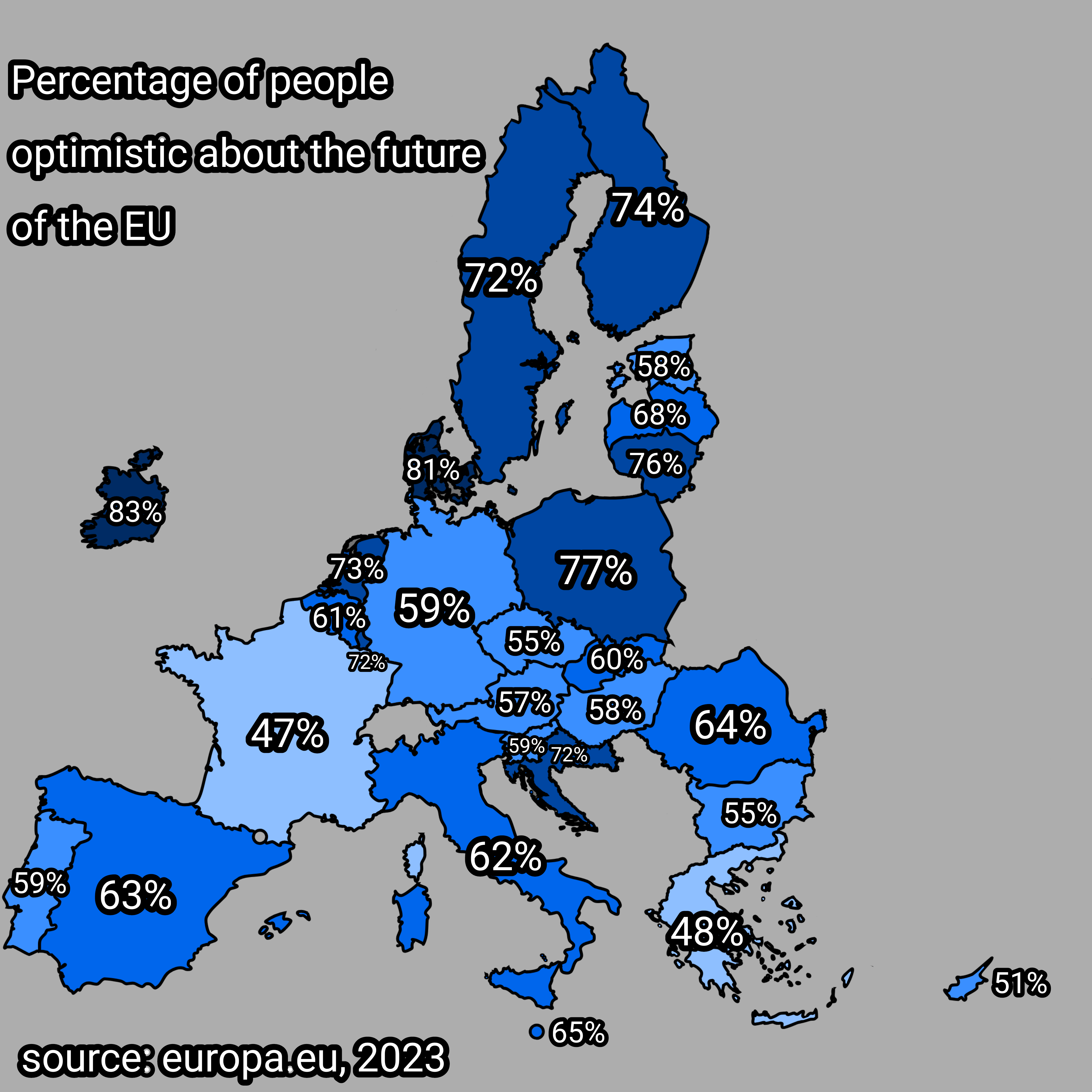
Optimism About the Future of the EU Map
The visualization titled "Percentage of People Optimistic About the Future of the EU" presents data on the varying level...
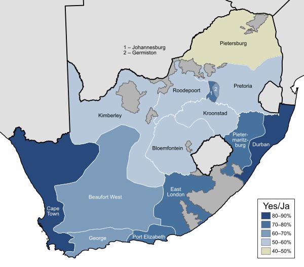
1992 South Africa Apartheid Referendum Map
...
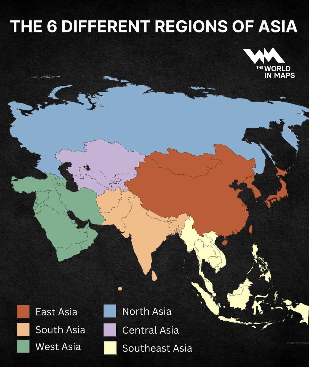
Regions of Asia Map
The "Regions of Asia Map" provides a comprehensive overview of the six distinct geographical regions that comprise the A...
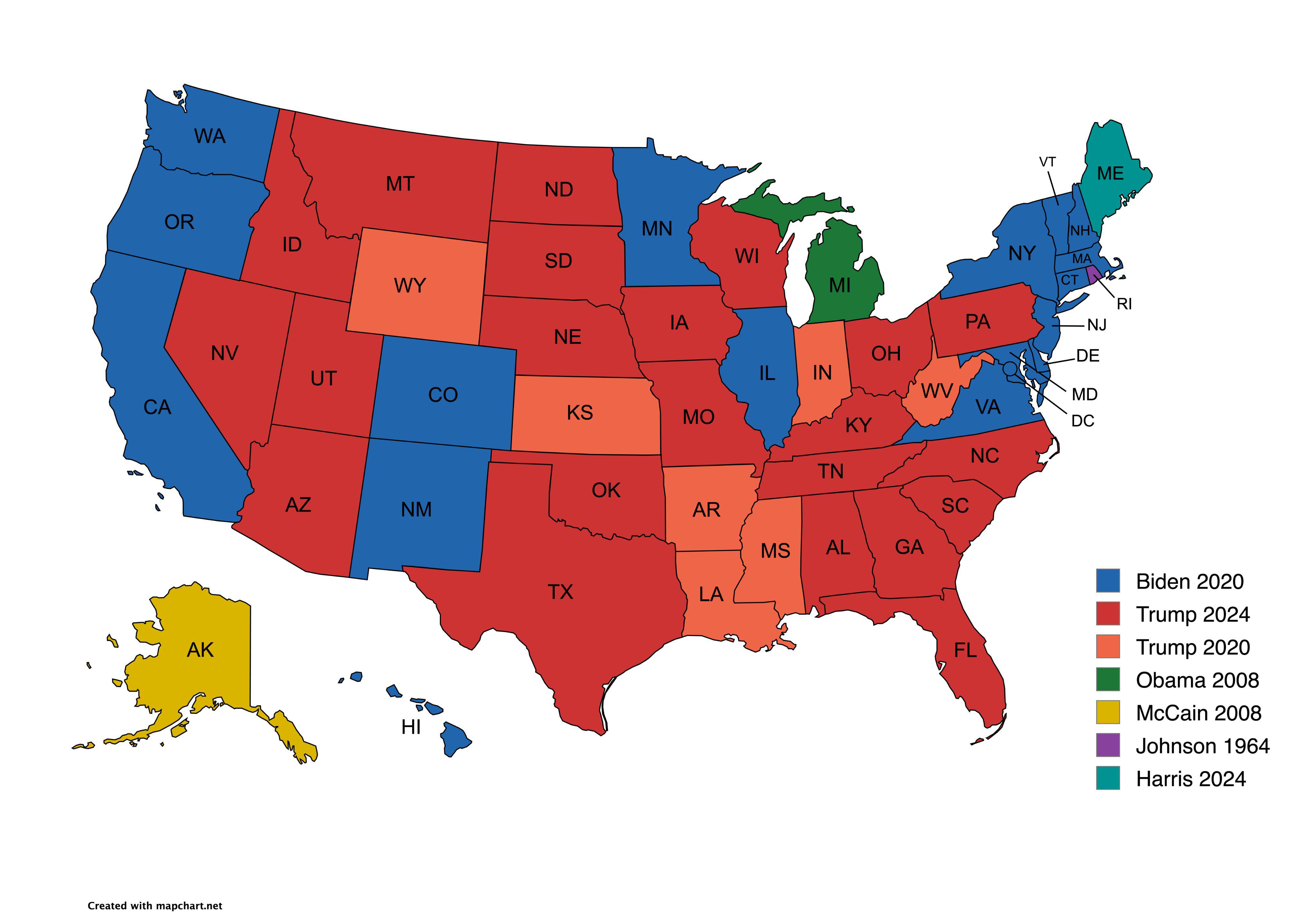
Presidential Candidate Vote Distribution by State Map
The map titled "Which Presidential Candidate Won The Largest Amount Of Votes In An Election By State" provides a visual ...
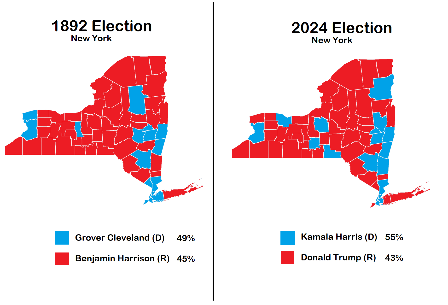
New York Election Map 1892 vs 2024
The visualization titled "Election in New York 1892 vs 2024" provides a compelling comparison of political landscapes ac...
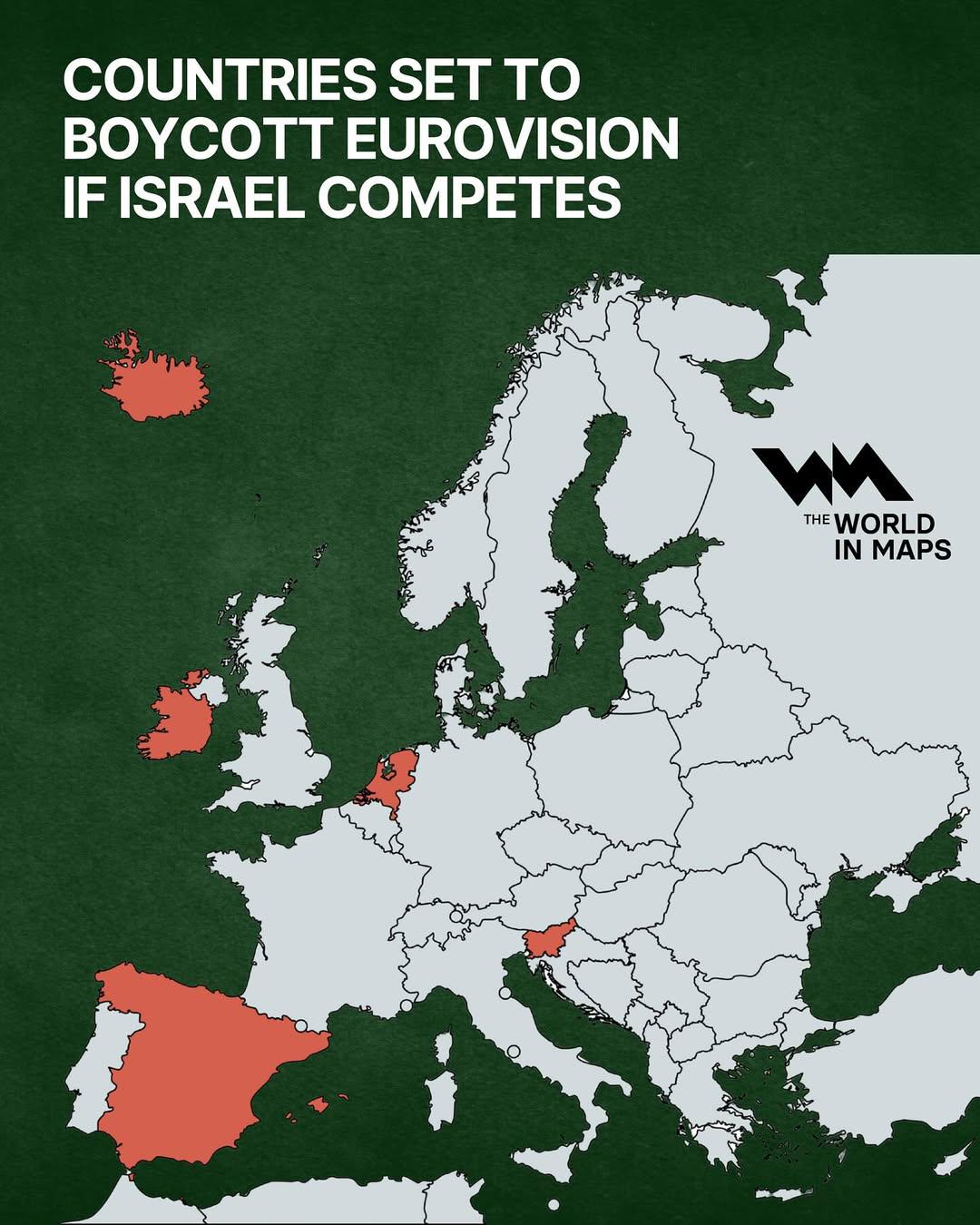
Boycotting Countries Map for Eurovision Israel
The visualization titled "Countries Set to Boycott Eurovision if Israel Competes" provides a geographical overview of th...
![Political Map: [OC] 2000 U.S. Presidential Election Results by margin of victory Political Map: [OC] 2000 U.S. Presidential Election Results by margin of victory](/api/images/reddit-maps/1mexkdz_1754068516240.jpg)
Political Map: [OC] 2000 U.S. Presidential Election Results by margin of victory
This comprehensive geographical visualization presents "[OC] 2000 U.S. Presidential Election Results by margin of victor...
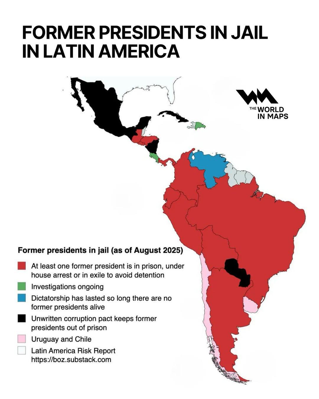
Map of Former Presidents in Jail in Latin America
This map visualizes the complex political landscape of Latin America, specifically focusing on the instances of former p...
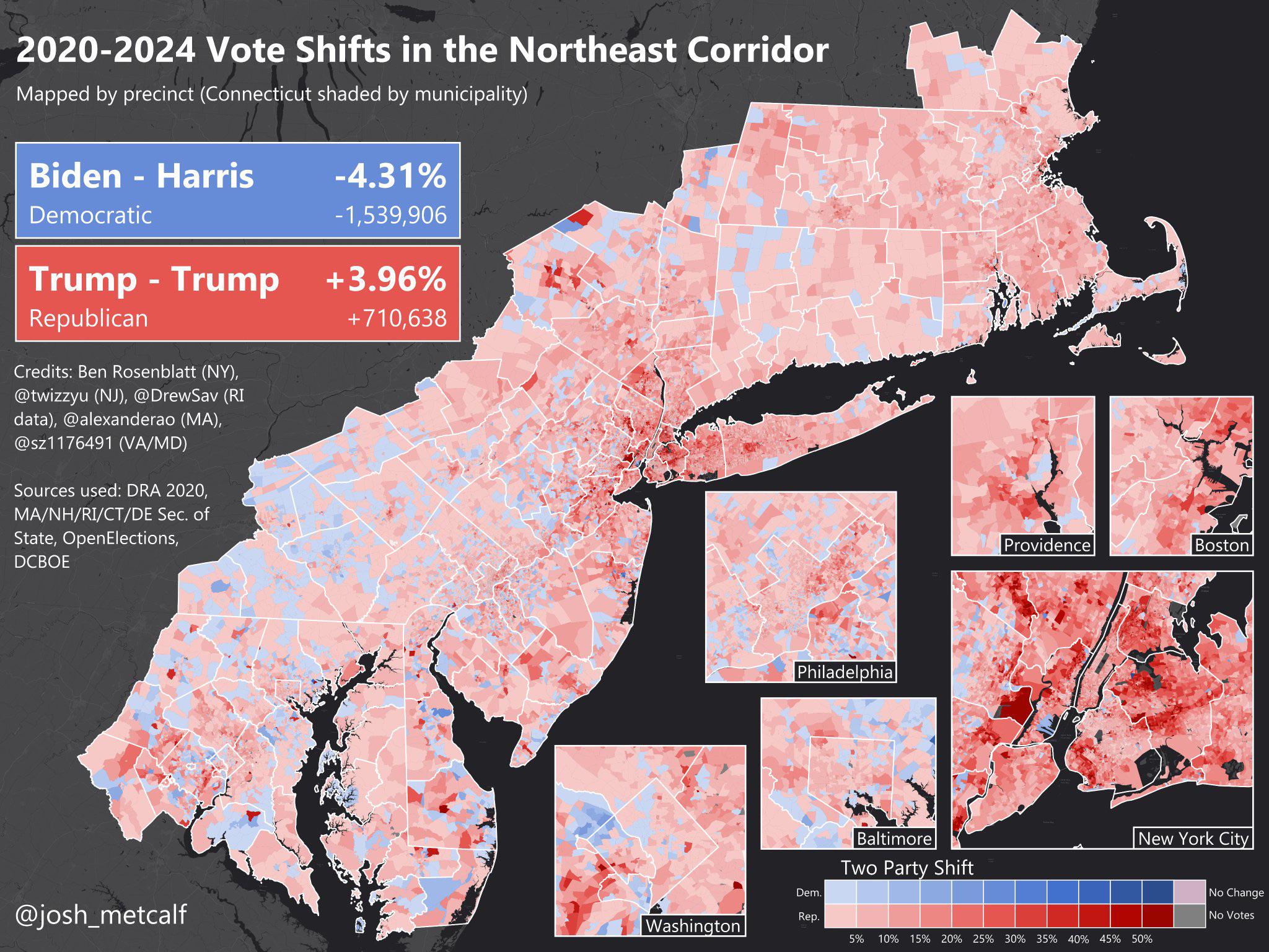
Vote Shifts Map in the Northeast Corridor 2020 to 2024
The visualization titled "Vote Shifts in the Northeast Corridor between the 2020 and 2024 elections" illustrates the cha...
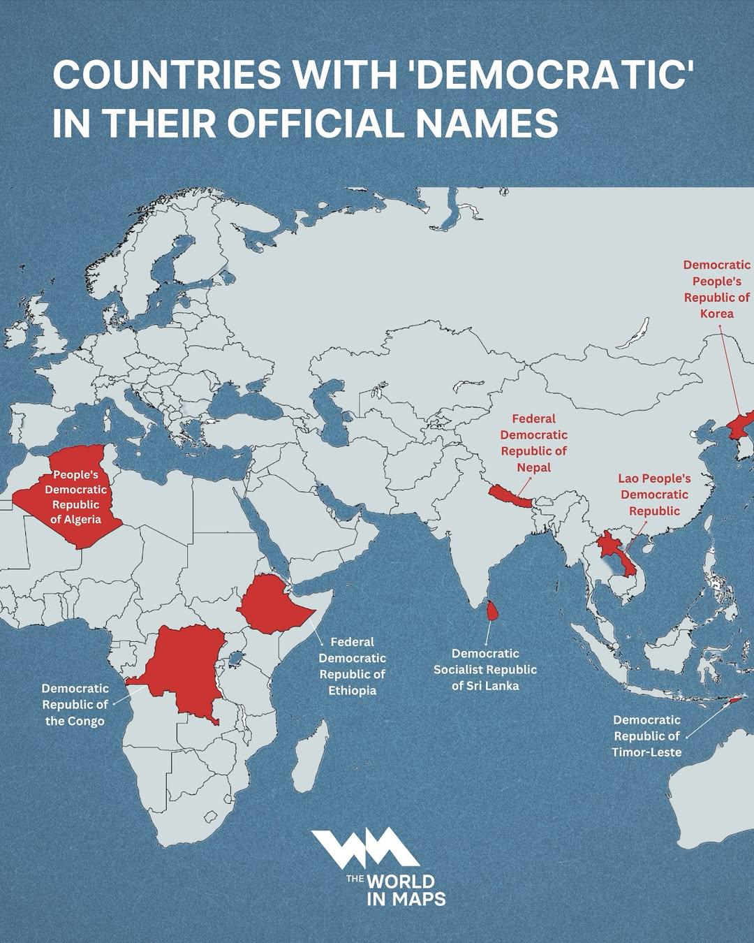
Map of Countries with 'Democratic' in Their Names
...

Mexico Border Election Trends Map 2016-2024
The "Mexico Border Election Trends Map 2016-2024" provides a comprehensive visualization of voting patterns along the U....
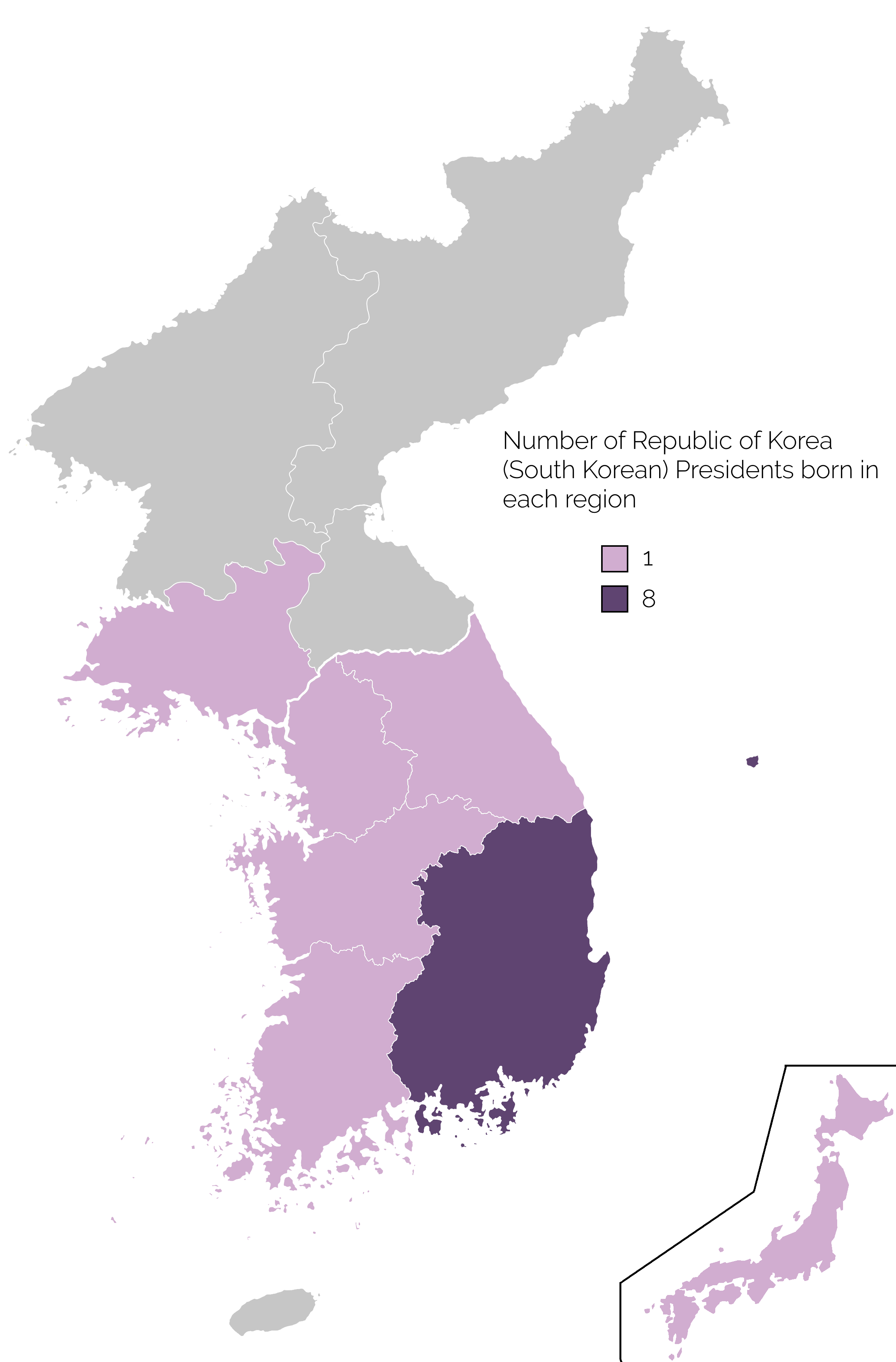
Map of Birthplaces of South Korean Presidents
The map titled 'Birthplace of South Korean Presidents' provides a visual representation of the geographic origins of the...
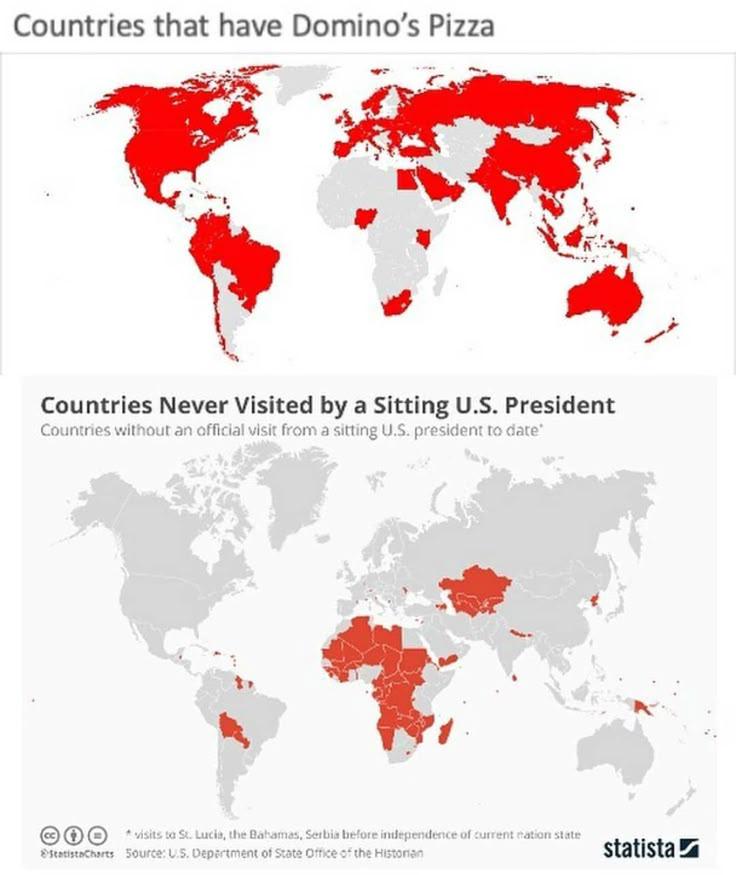
Pizza Politics Map
...
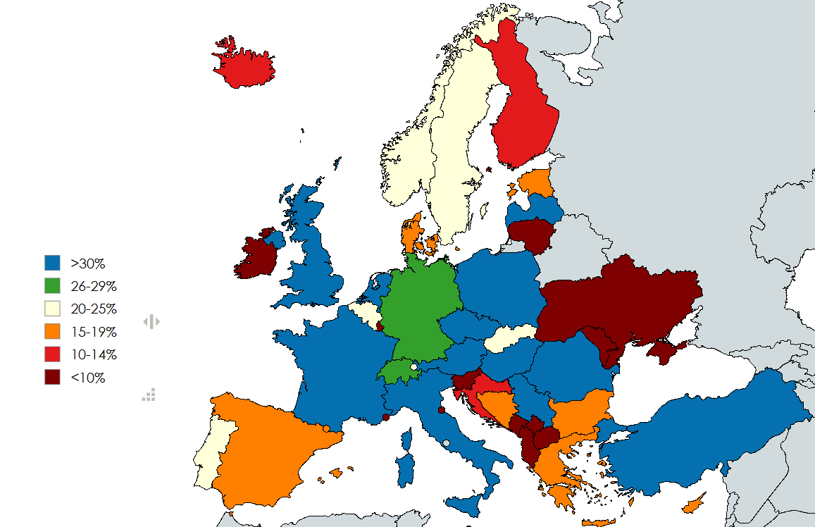
Right Wing Populist Parties Support Rate Map in Europe
This map visualizes the current collective support rate of right-wing populist parties across Europe, based on various p...
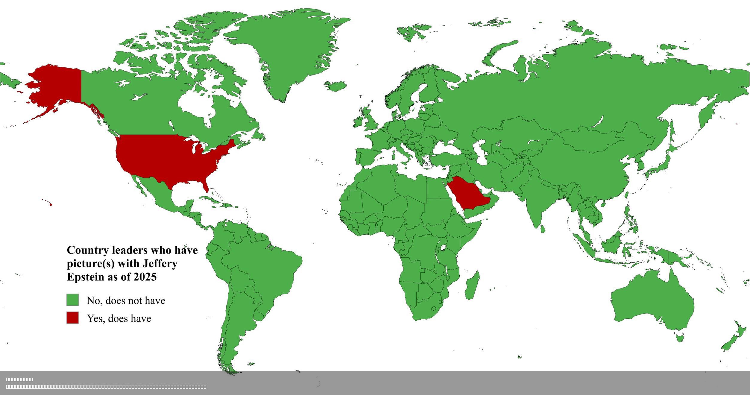
Map of Country Leaders with Jeffery Epstein Photos
The map titled "Country Leaders with Pictures of Jeffrey Epstein" presents a visualization of political figures who have...
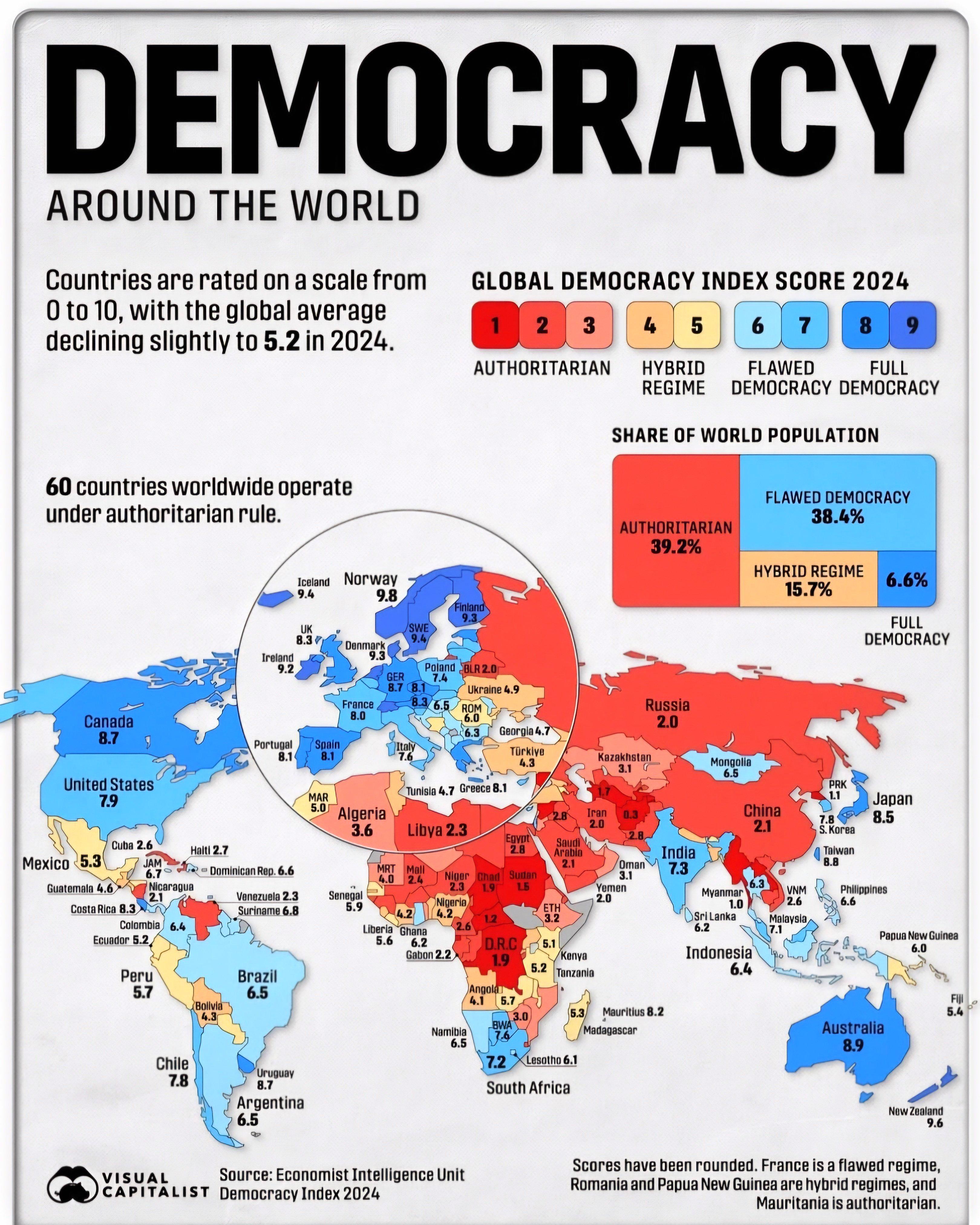
Democracy in the World Map
The "Democracy in the World" map visually represents the state of democratic governance across various countries. It uti...
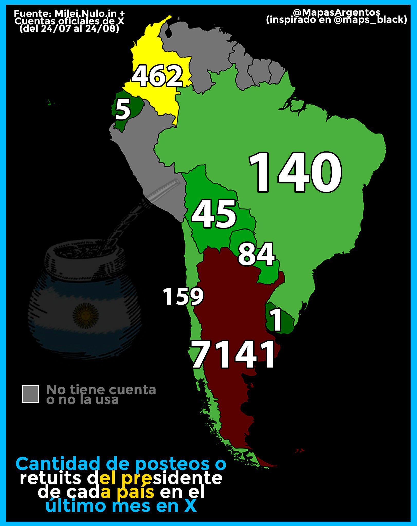
Map of Tweets and Retweets by South American Presidents
The visualization titled "Amount of tweets and retweets last month by the President of each South American country" prov...
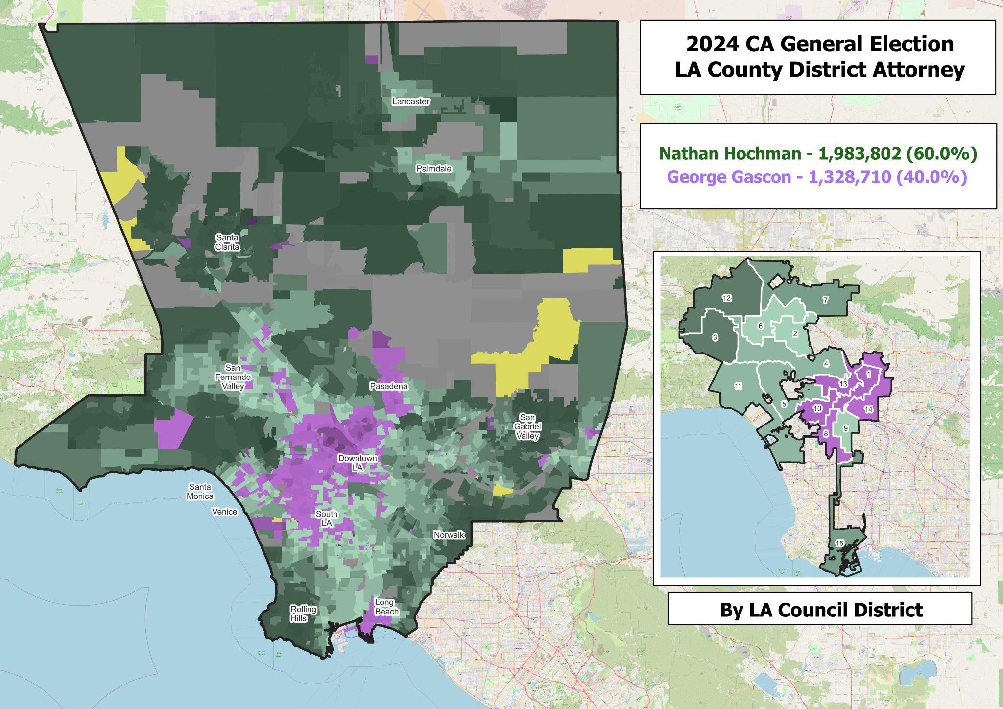
Election Map of Nathan Hochman vs. George Gascón
Interestingly, voter turnout in this election was significant, with a noticeable shift in demographics participating in ...
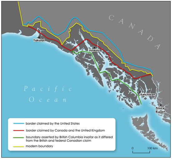
Alaska Panhandle Border History Map
The map titled "How the Alaska Panhandle border was drawn by different governments" visually represents the complex hist...
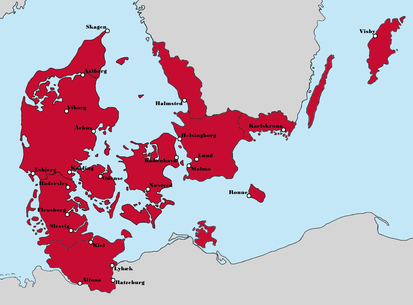
Aesthetic Map of Denmark's Political Landscape
The map titled "Politics aside, this version of Denmark looks really nice aesthetically" presents a unique visualization...
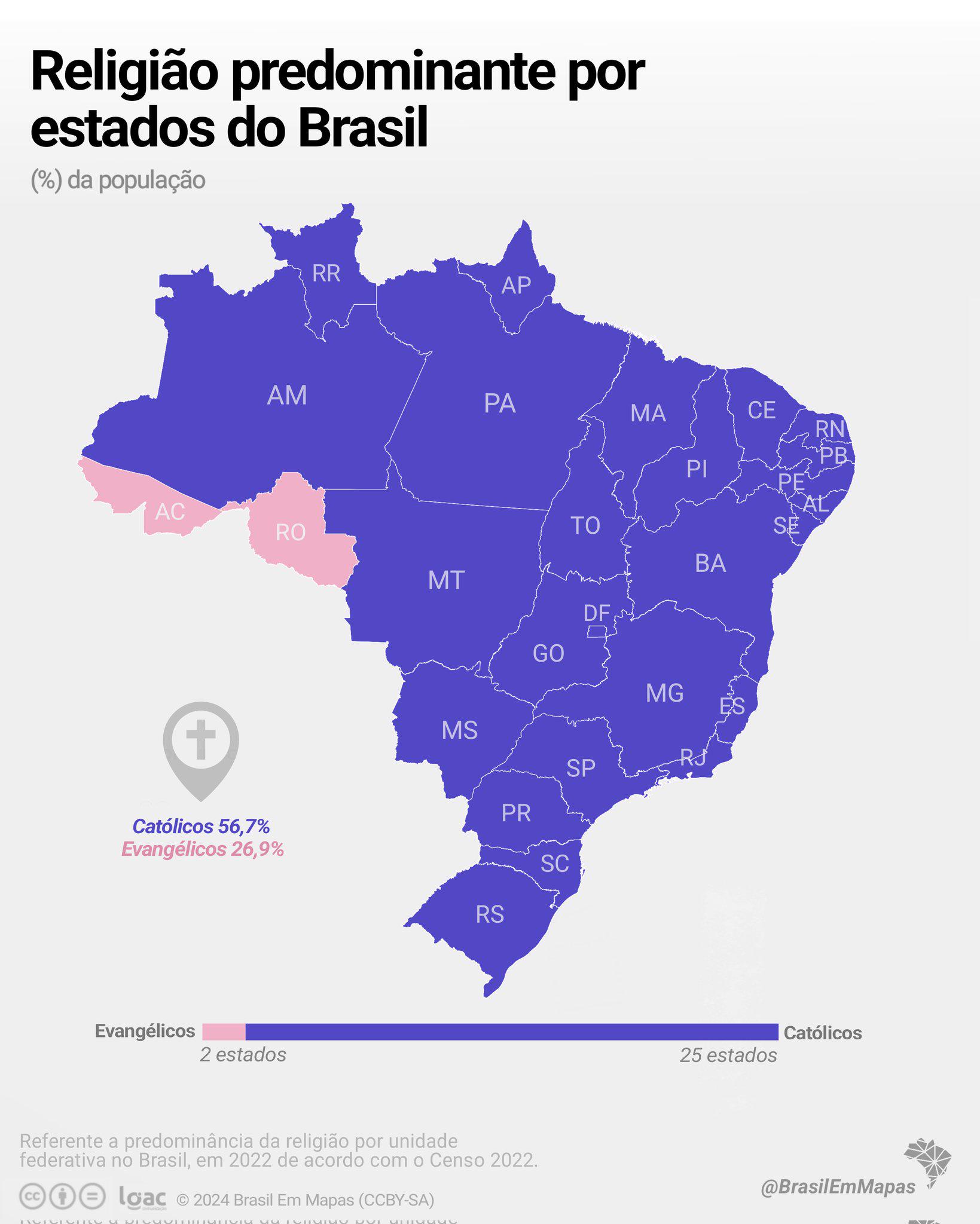
Predominant Religion in Brazilian States Map
The visualization titled "Predominant Religion in each Brazilian state + Percentage of population adherent nation-wide" ...
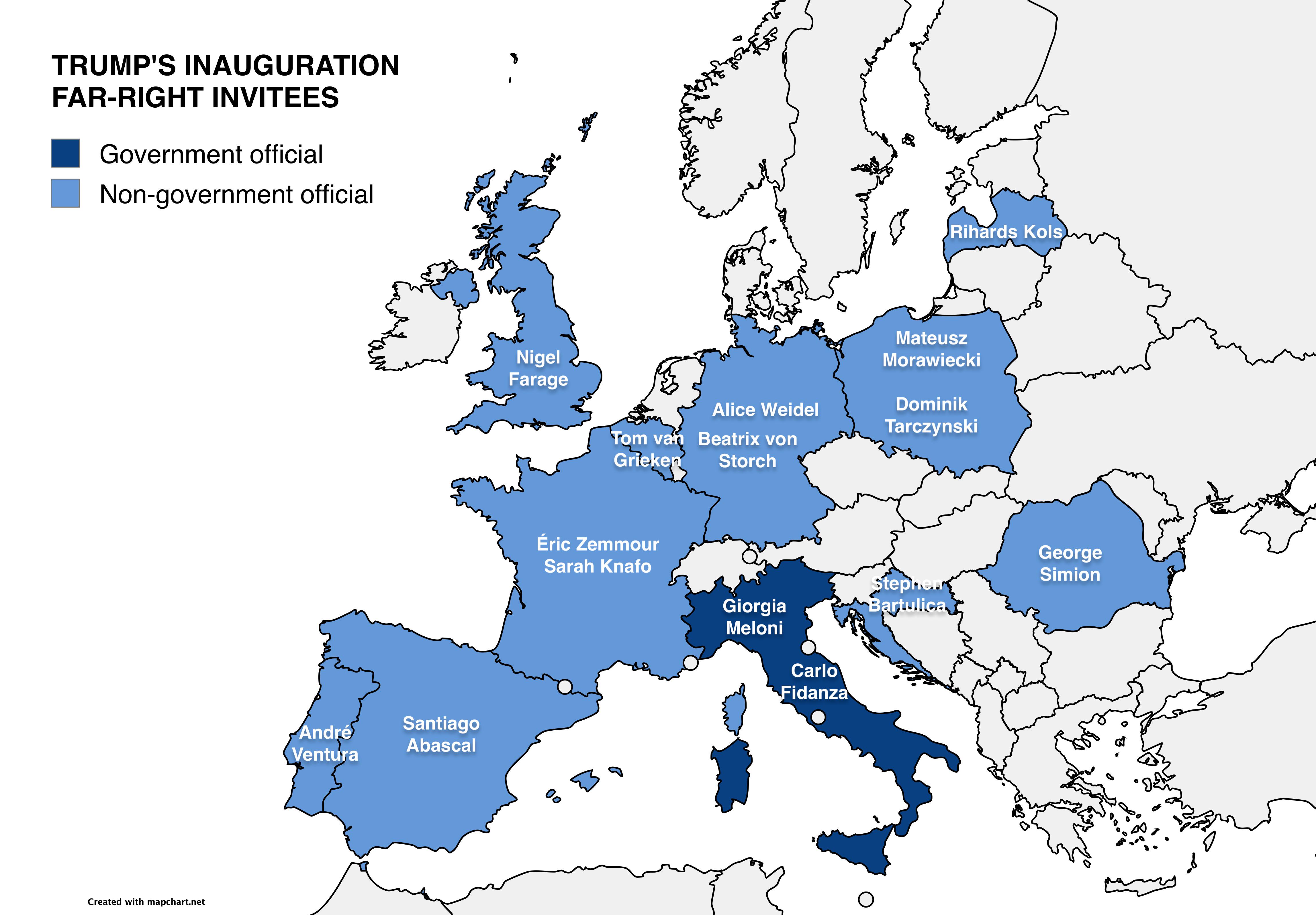
Map of Far-Right European Officials at Trump’s Inauguration
This map visually represents the various far-right European officials who received invitations to Donald Trump's second ...
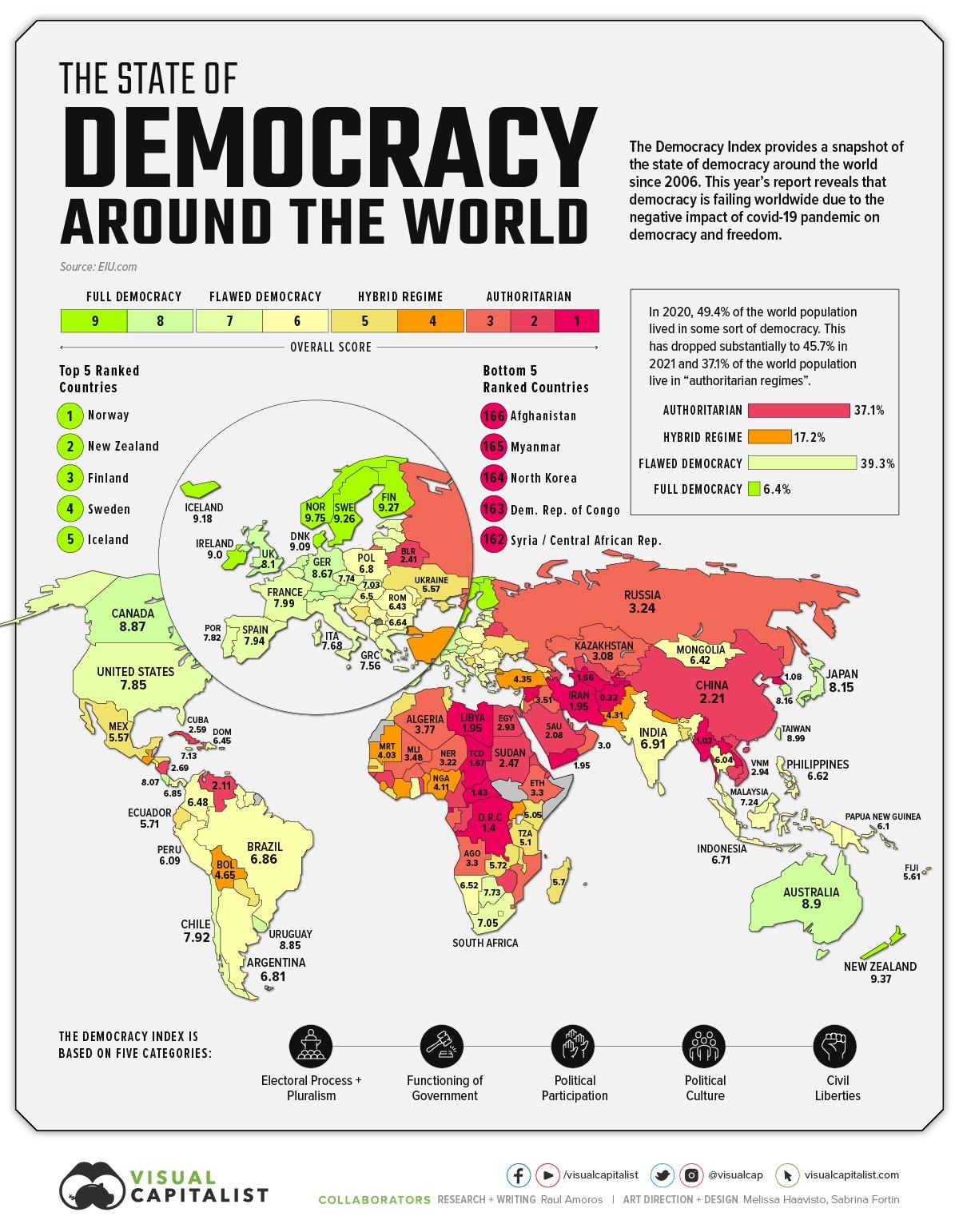
World Democracy Ranking Map
The "World Democracy Ranking Map" provides a visual representation of the state of democracy across various nations, sho...
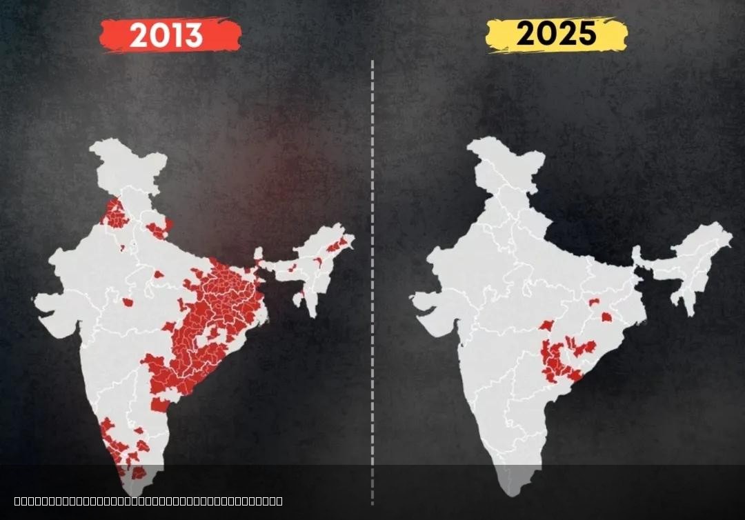
Decline of Left Wing Extremism in India Map
The "Decline of Left Wing Extremism in India Map" visually represents the reduction of left-wing extremist activities ac...
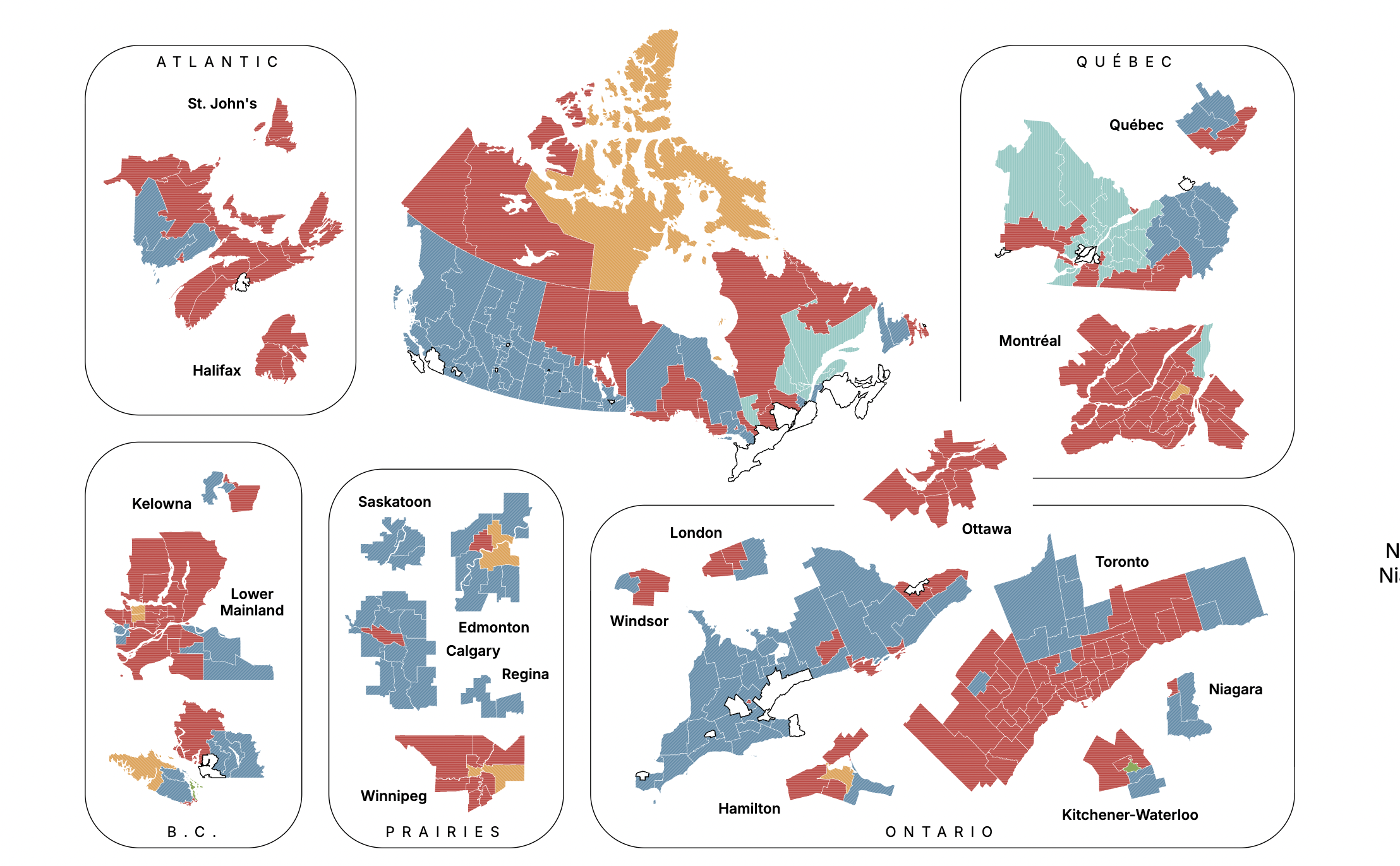
Canadian Federal Election Projection Map September 2025
The "Canadian Federal Election Projection - September 14, 2025" map provides a detailed forecast of the anticipated outc...
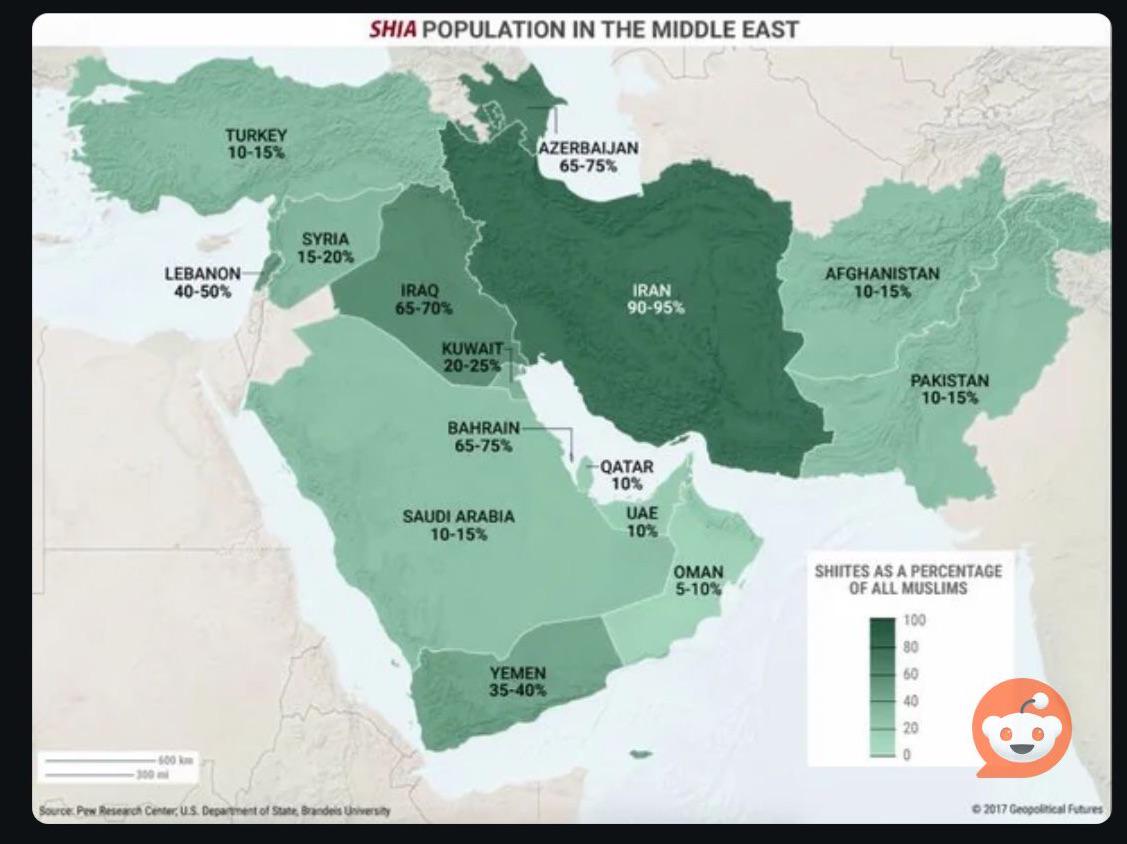
% of Shia Muslims in Middle East Countries Map
The visual representation titled \...
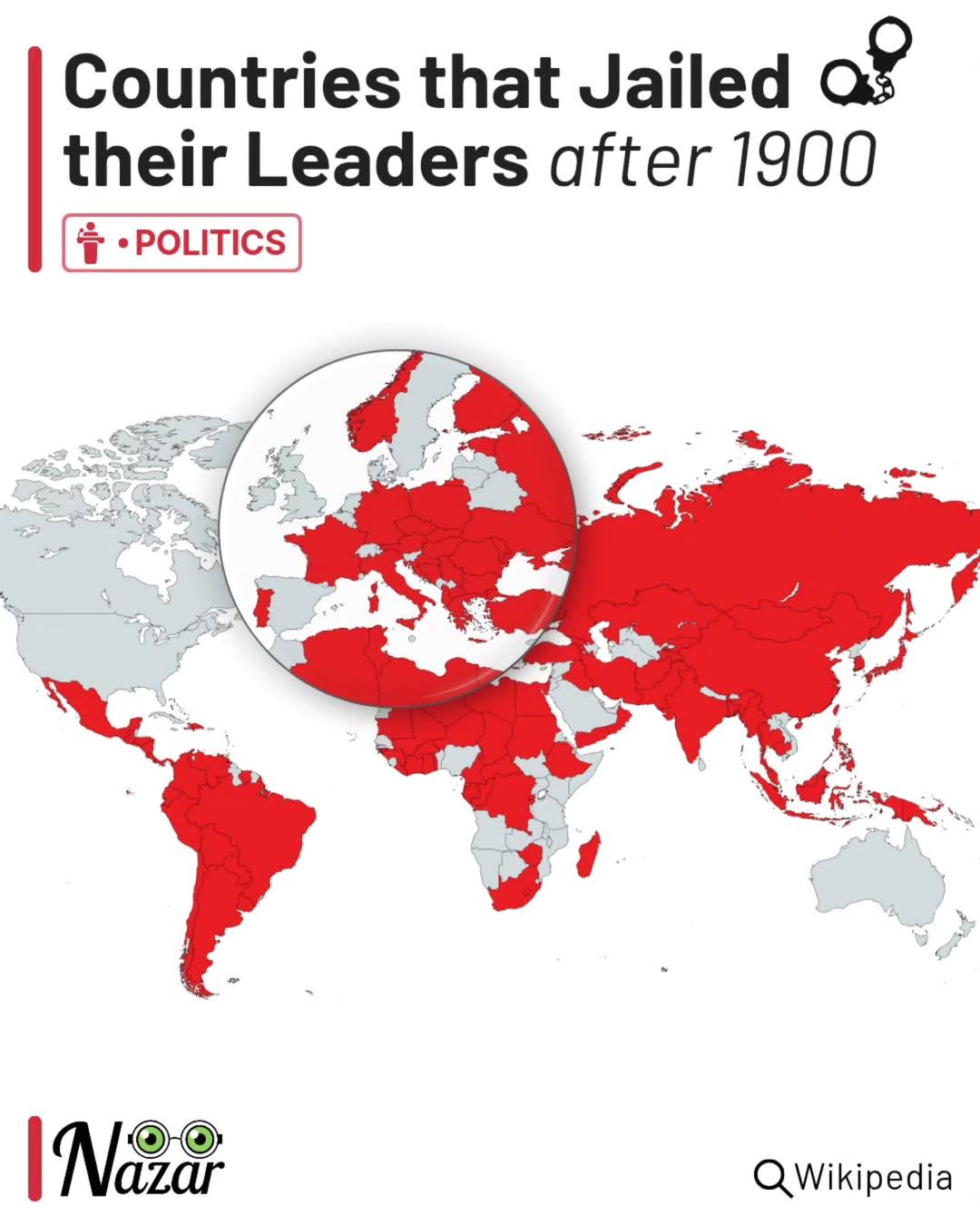
Map of Countries That Jailed Their Leaders Post-1900
The map titled "Countries that jailed their leaders (after 1900)" visually represents various nations around the world t...
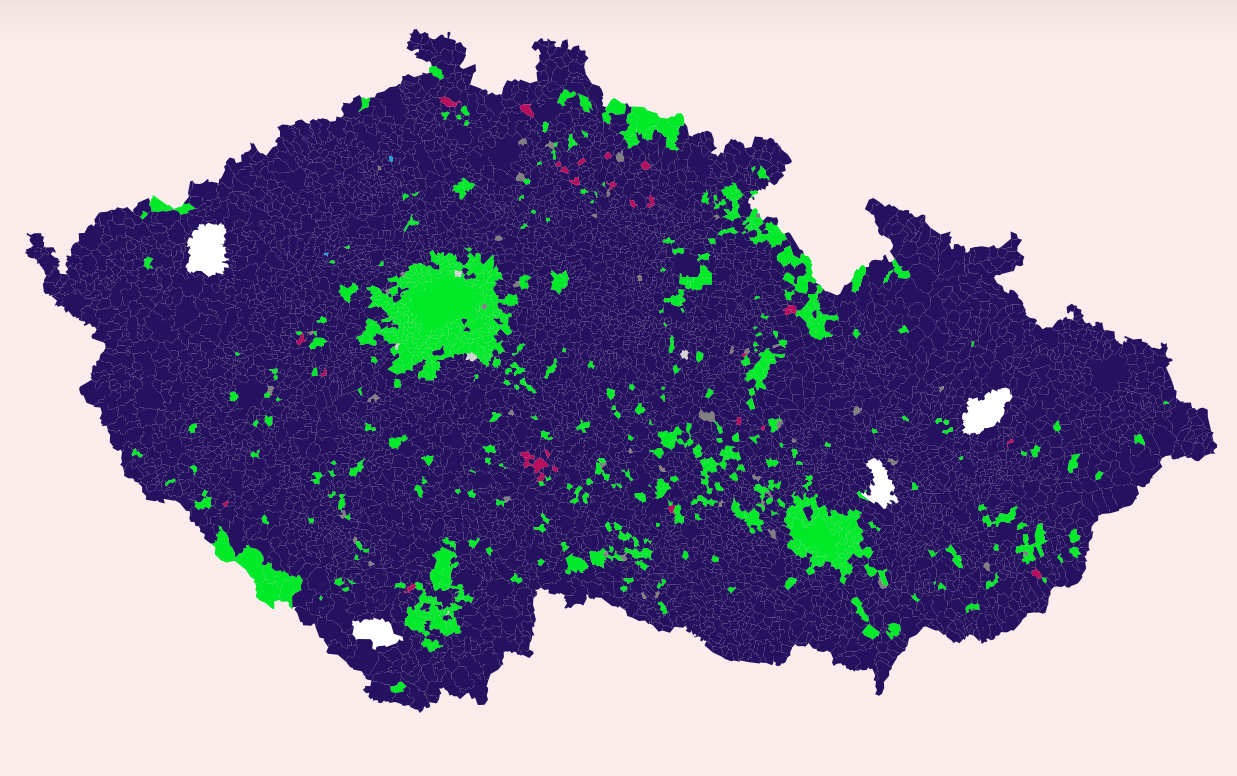
Czech Parliamentary Elections Voting Map
The map visualizes the voting patterns from the recent Czech Parliamentary elections held on Friday and today. It highli...
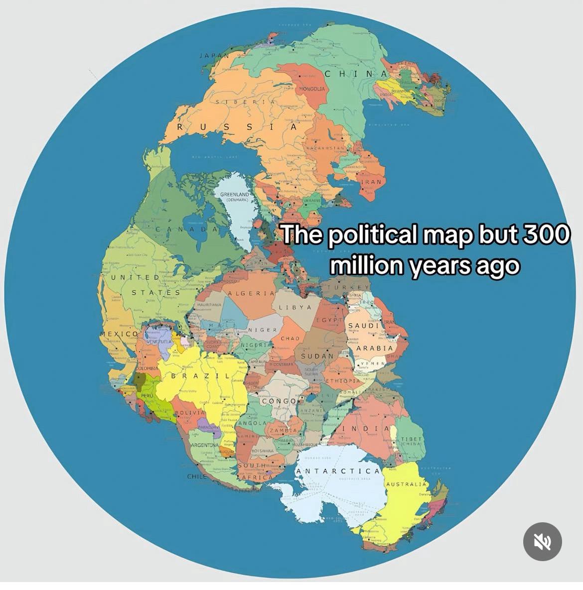
Supercontinent Map and Its Political Implications
The "Supercontinent" map visualizes a hypothetical world where all current continents have merged into a single landmass...
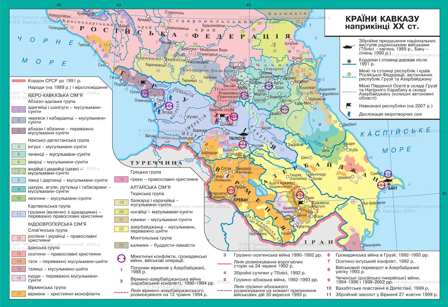
Ethnic and Political Map of the Caucasus Region
The ethnic and political map of the Caucasus region at the end of the 20th century offers a detailed snapshot of the com...
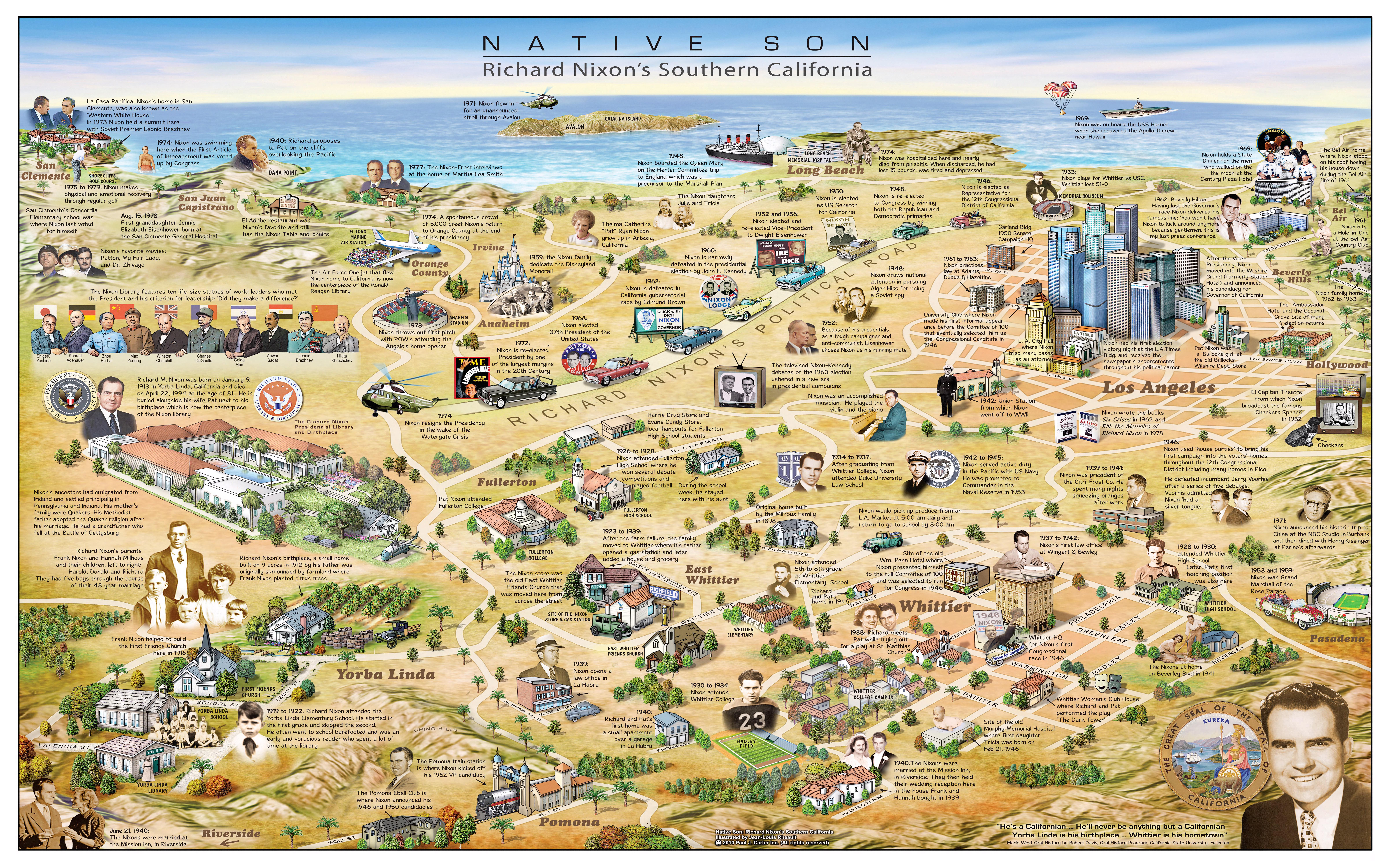
Richard Nixon's Southern California Map
The map titled "Native Son - Richard Nixon's Southern California" by Paul Carter and Jean-Louis Rheault provides a detai...
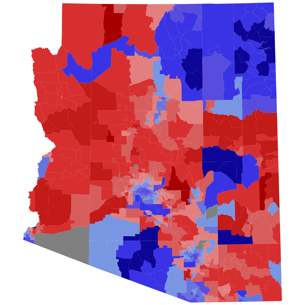
2022 Arizona Attorney General Election Precinct Map
The precinct map of the 2022 Arizona Attorney General election visually represents the voting patterns across the state,...
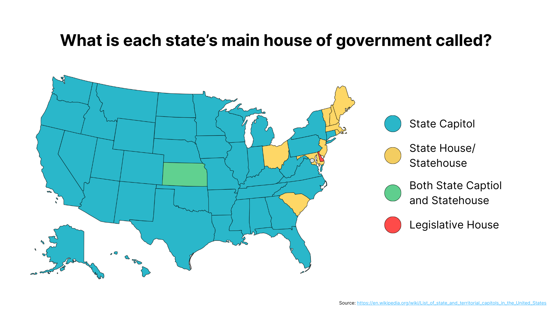
Main Houses of Government by State Map
This map provides a clear and informative overview of the main houses of government across the United States, detailing ...
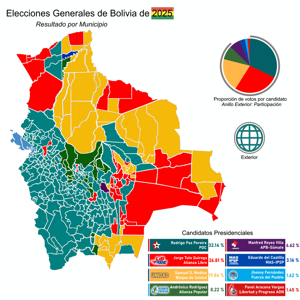
2025 Bolivian General Election Results by Municipality Map
The "Results of the 2025 Bolivian General Election by Municipalities" map provides a detailed visualization of how vario...
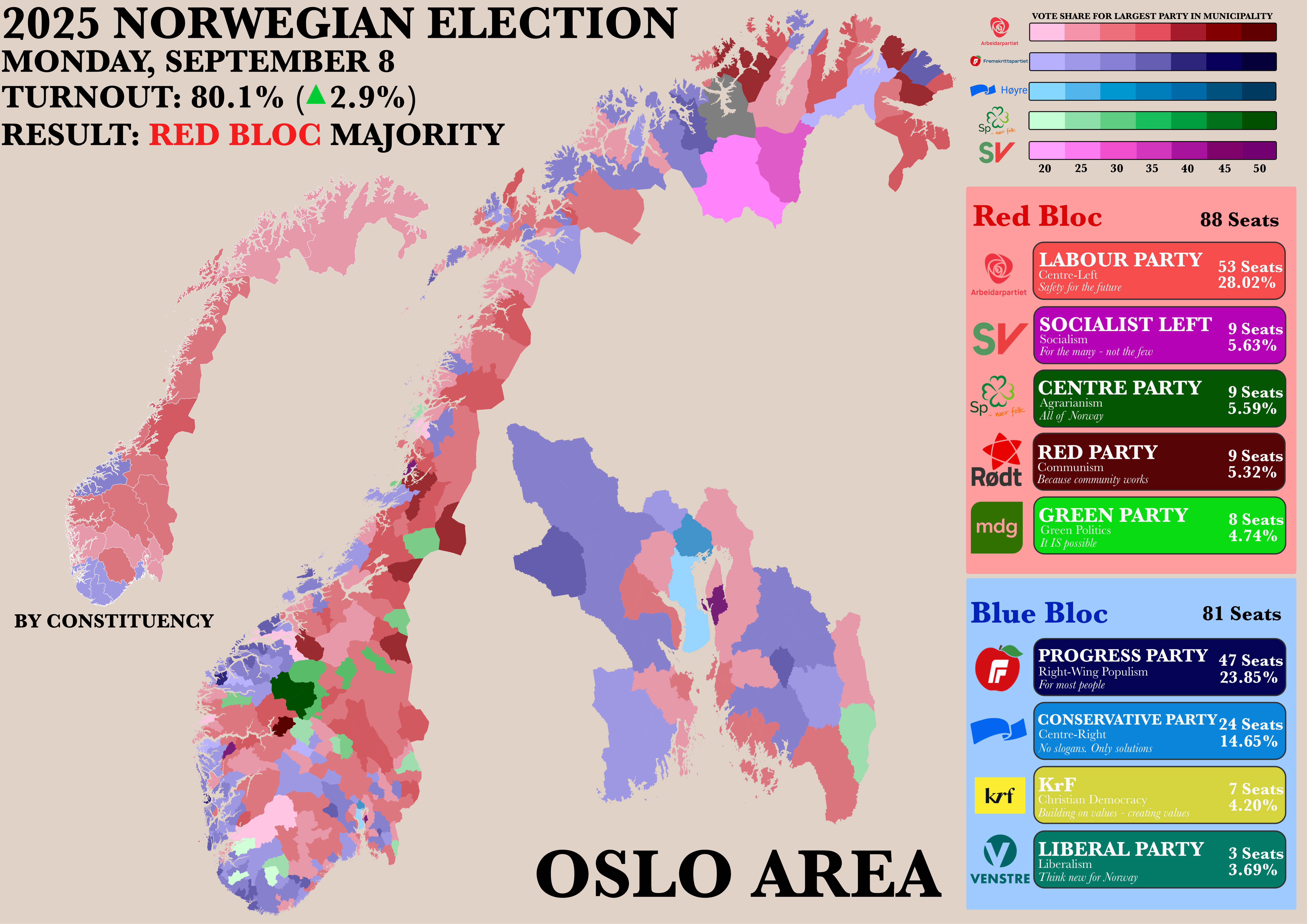
Norwegian Parliamentary Election Results by Municipality Map
The "Poster of the Recent Norwegian Parliamentary Election by Municipality" map provides a detailed visualization of the...