Geographic Visualizations
Explore our curated collection of fascinating geographic visualizations and cartographic analyses. Discover detailed maps, data visualizations, and geographical insights from around the world.
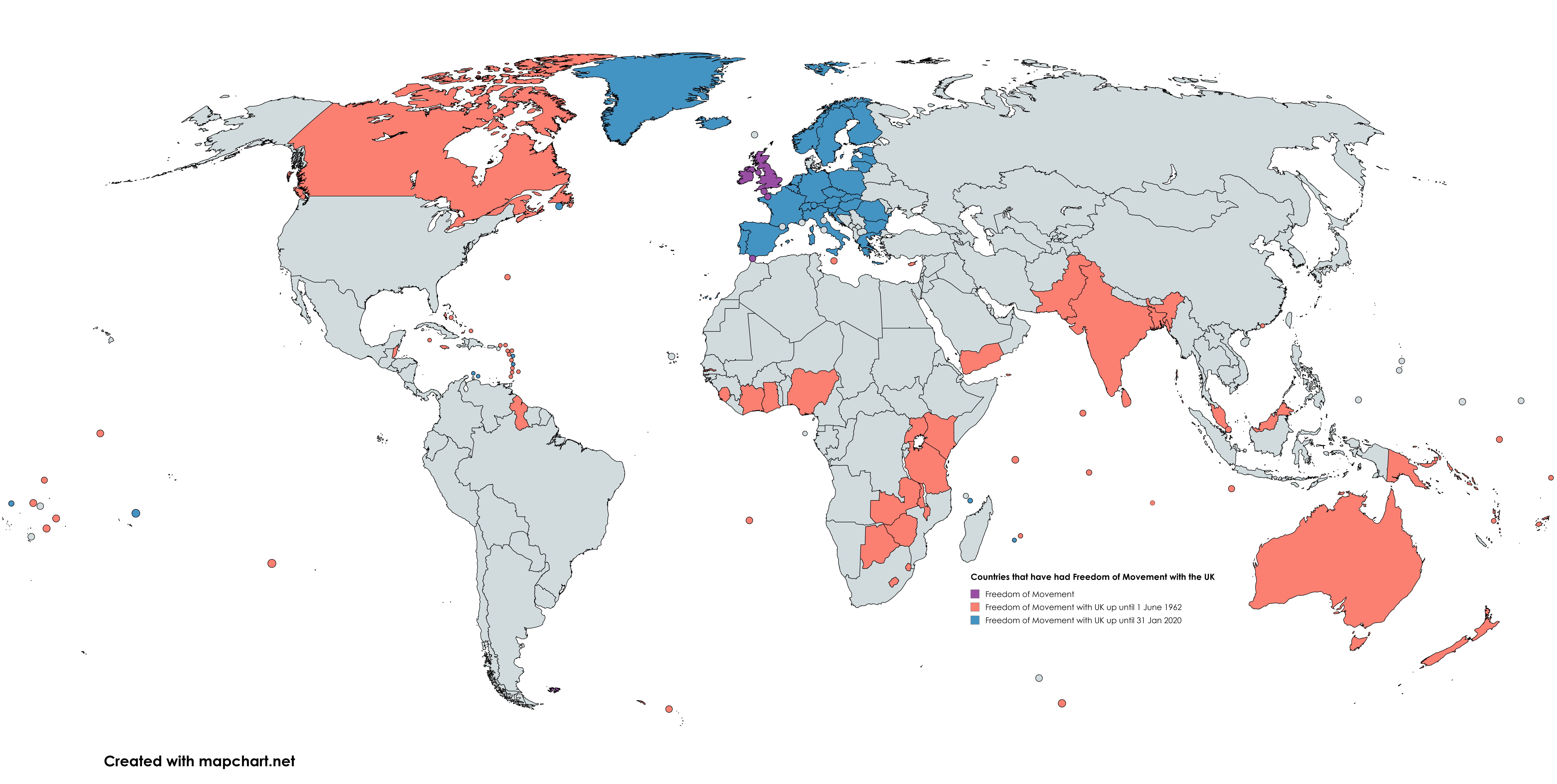
UK Historical Freedom of Movement Regimes Map
Geographic Analysis9/18/2025
## What This Map Shows...
4 viewsRead More →
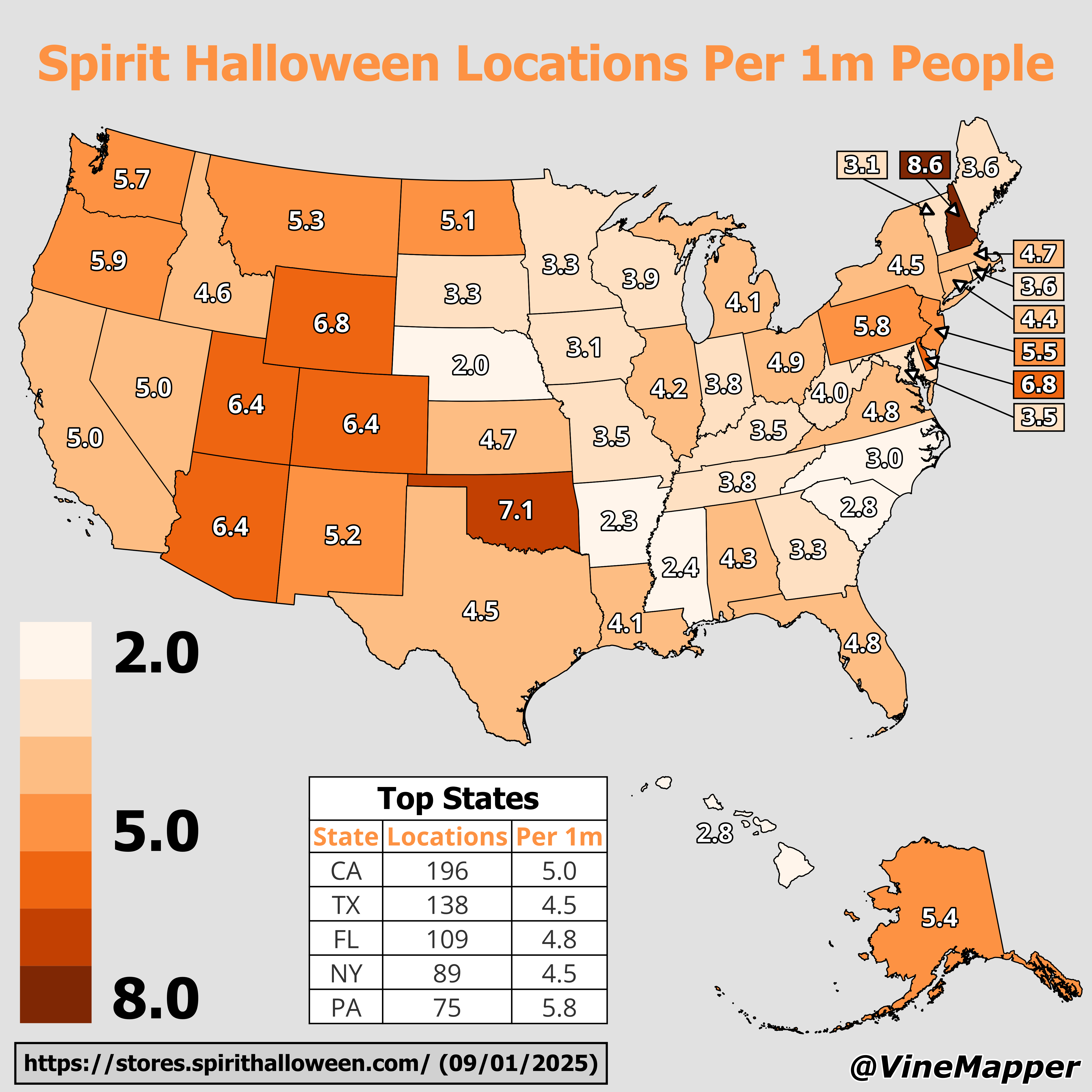
Spirit Halloween Locations Per 1 Million People Map
Geographic Analysis9/18/2025
## What This Map Shows...
8 viewsRead More →
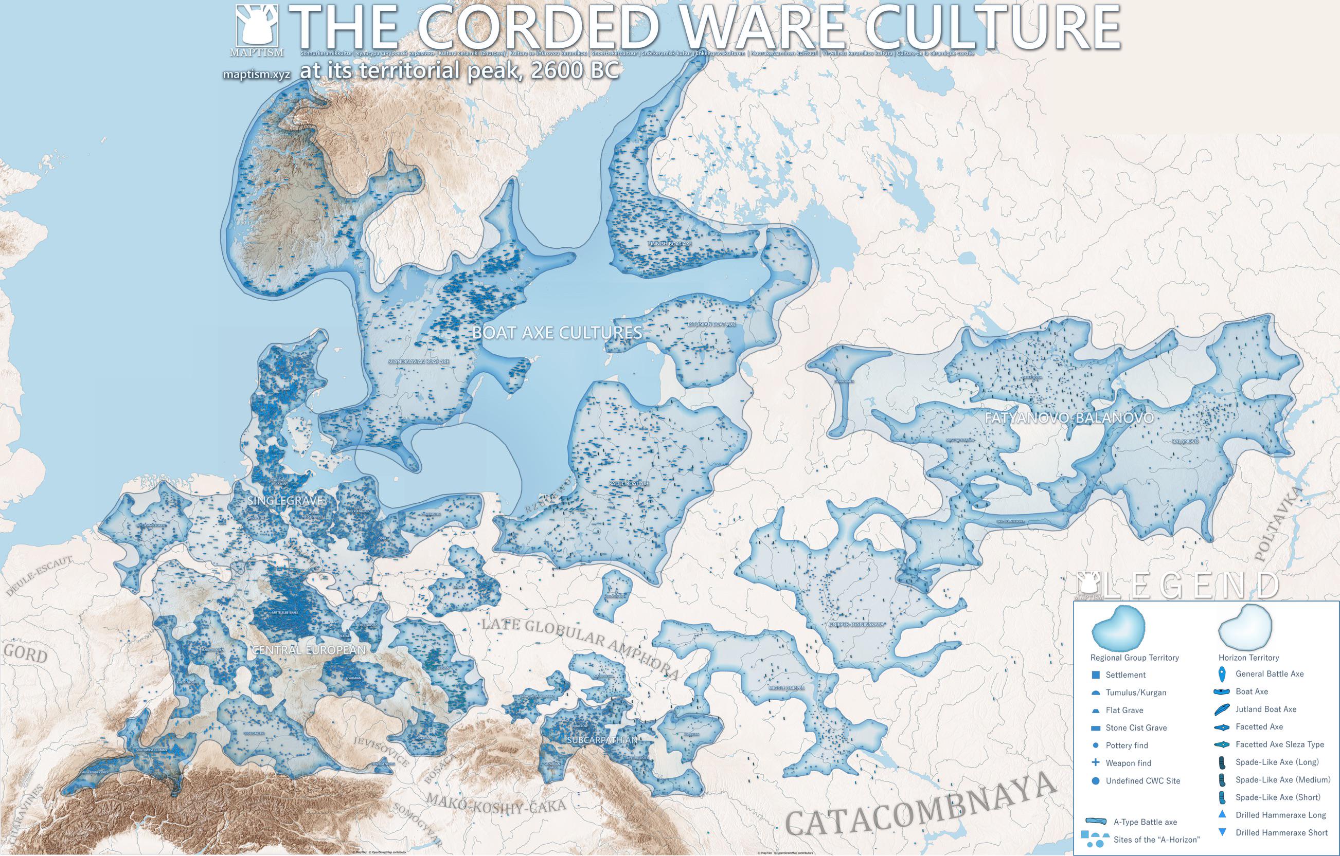
Map of the Corded Ware Culture Circa 2600 BC
Geographic Analysis9/18/2025
## What This Map Shows...
2 viewsRead More →
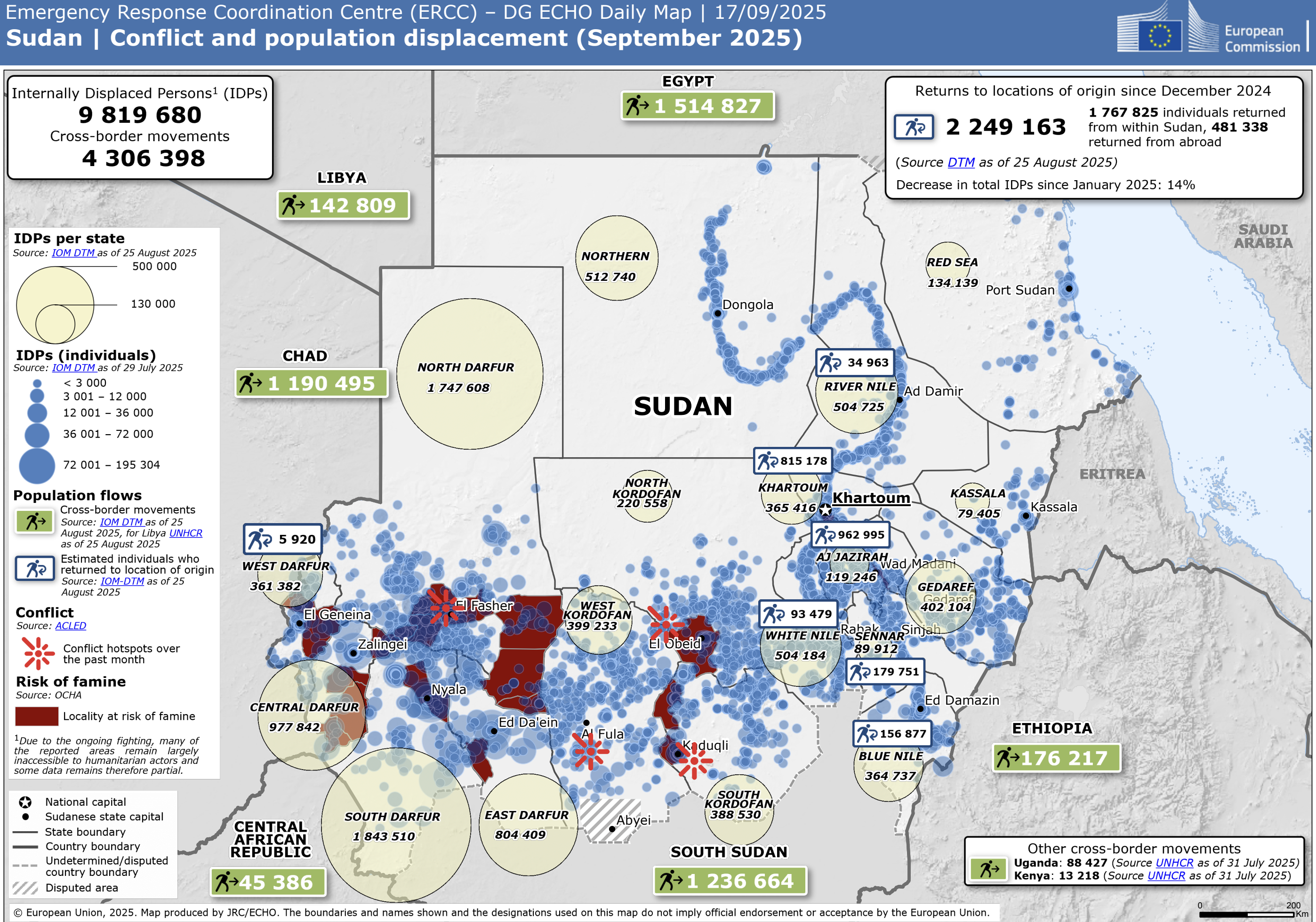
Sudan Conflict Population Displacement Map
Geographic Analysis9/18/2025
## What This Map Shows...
6 viewsRead More →
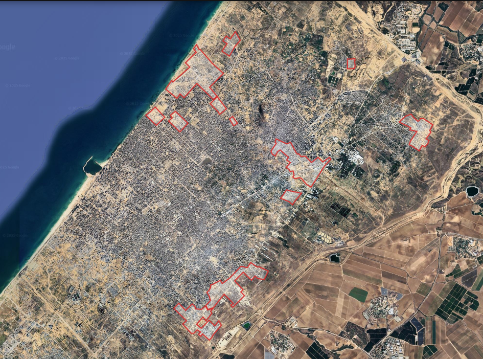
Gaza City Destruction Map of Completely Destroyed Areas
Geographic Analysis9/18/2025
## What This Map Shows...
4 viewsRead More →
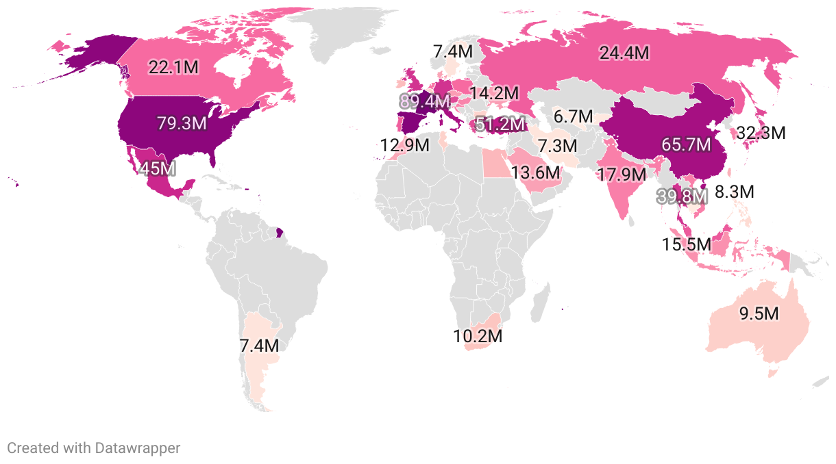
Tourism Numbers per Country Map 2025
Geographic Analysis9/18/2025
## What This Map Shows...
10 viewsRead More →
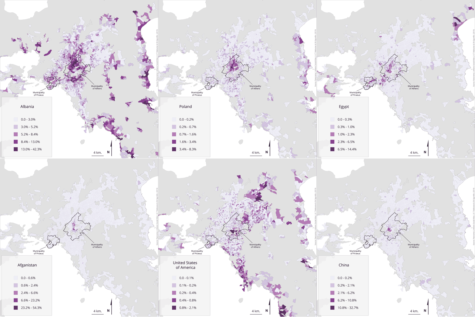
Population Distribution by Citizenship Map in Attica, Greece
Geographic Analysis9/18/2025
## What This Map Shows ...
8 viewsRead More →
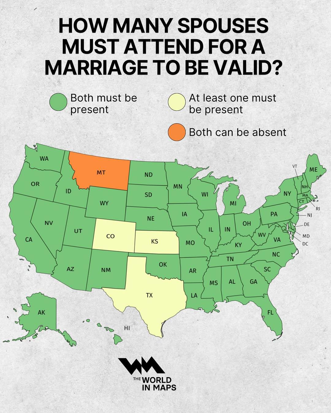
Marriage Validity Attendance Requirements Map
Geographic Analysis9/18/2025
## What This Map Shows...
14 viewsRead More →

Most Common Nationality of Foreigners in Europe Map
Geographic Analysis9/18/2025
## What This Map Shows...
12 viewsRead More →

Elevation Map of North America
Geographic Analysis9/18/2025
## What This Map Shows...
4 viewsRead More →
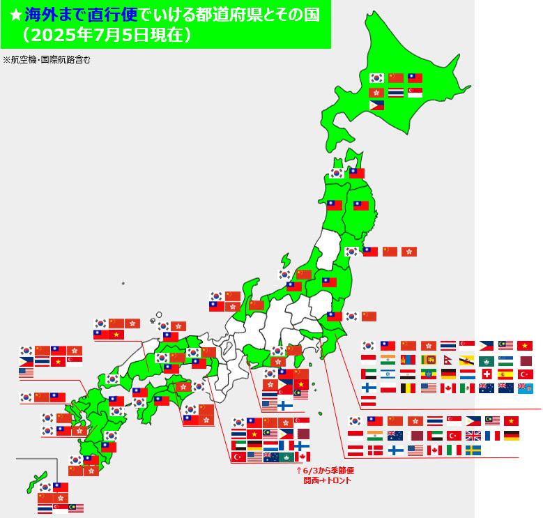
Map of International Direct Flights to Japan Prefecture
Geographic Analysis9/18/2025
## What This Map Shows...
8 viewsRead More →
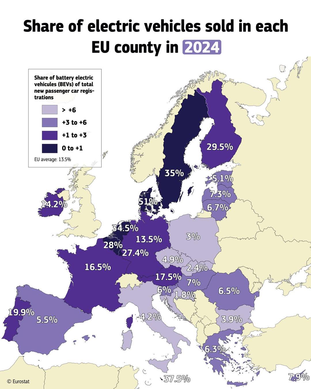
Electric Vehicle Sales Share by EU Country Map
Geographic Analysis9/18/2025
## What This Map Shows...
6 viewsRead More →
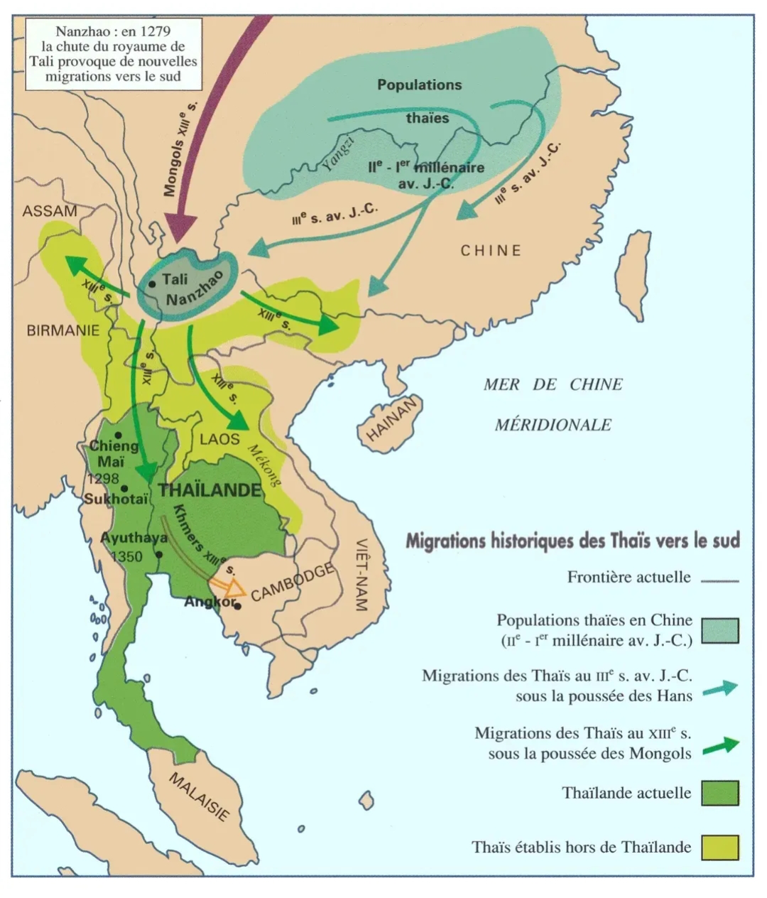
Migration of Thai People to the South Map
Geographic Analysis9/18/2025
## What This Map Shows...
4 viewsRead More →
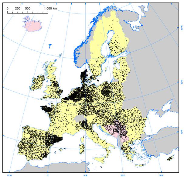
Pig Farm Density Map of Europe
Geographic Analysis9/18/2025
## What This Map Shows...
6 viewsRead More →
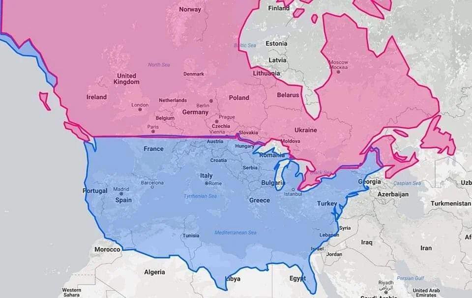
Latitude Map of United States, Canada, and Europe
Geographic Analysis9/18/2025
## What This Map Shows...
14 viewsRead More →
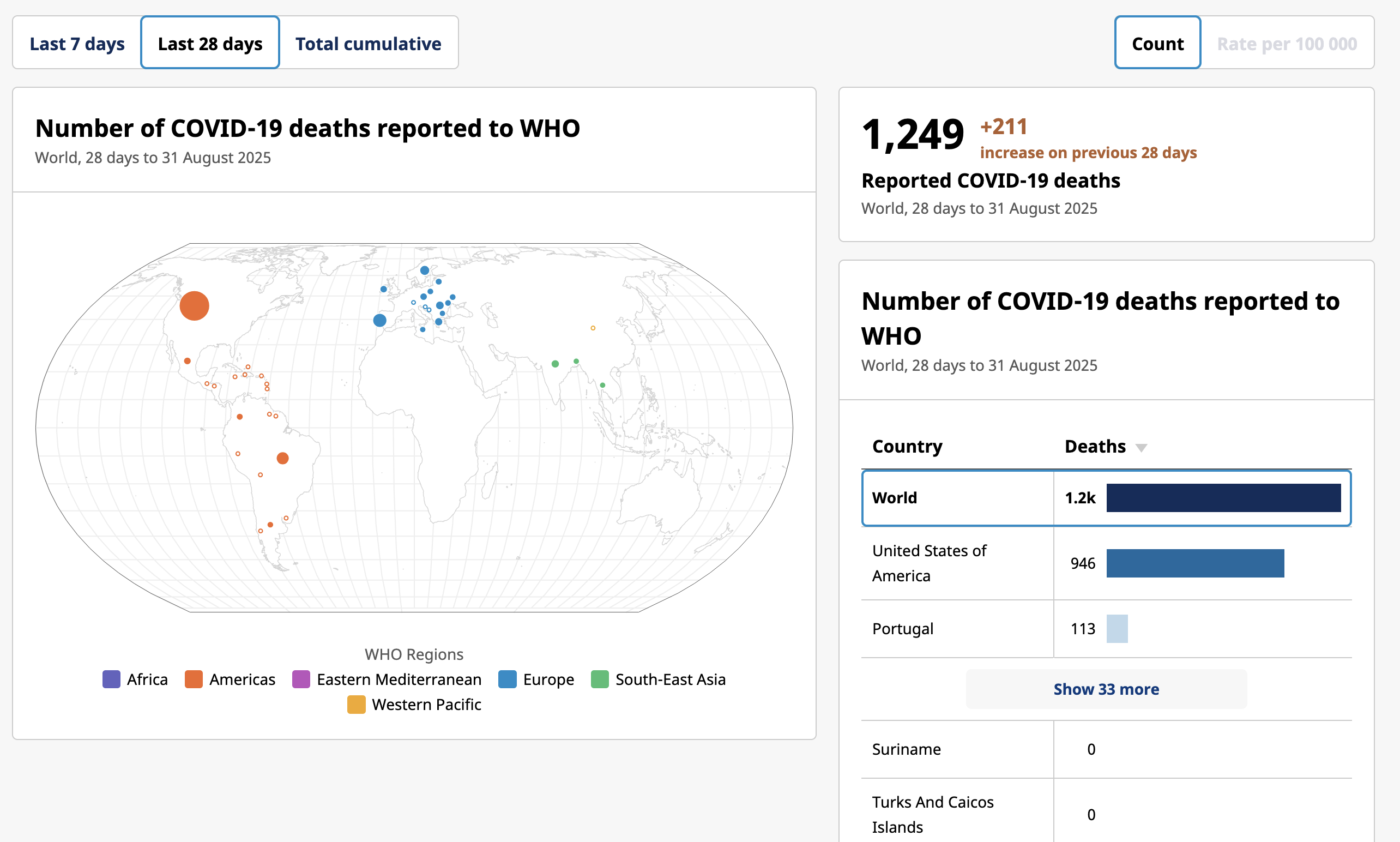
COVID-19 Deaths Worldwide Reported Map
Geographic Analysis9/18/2025
## What This Map Shows...
6 viewsRead More →
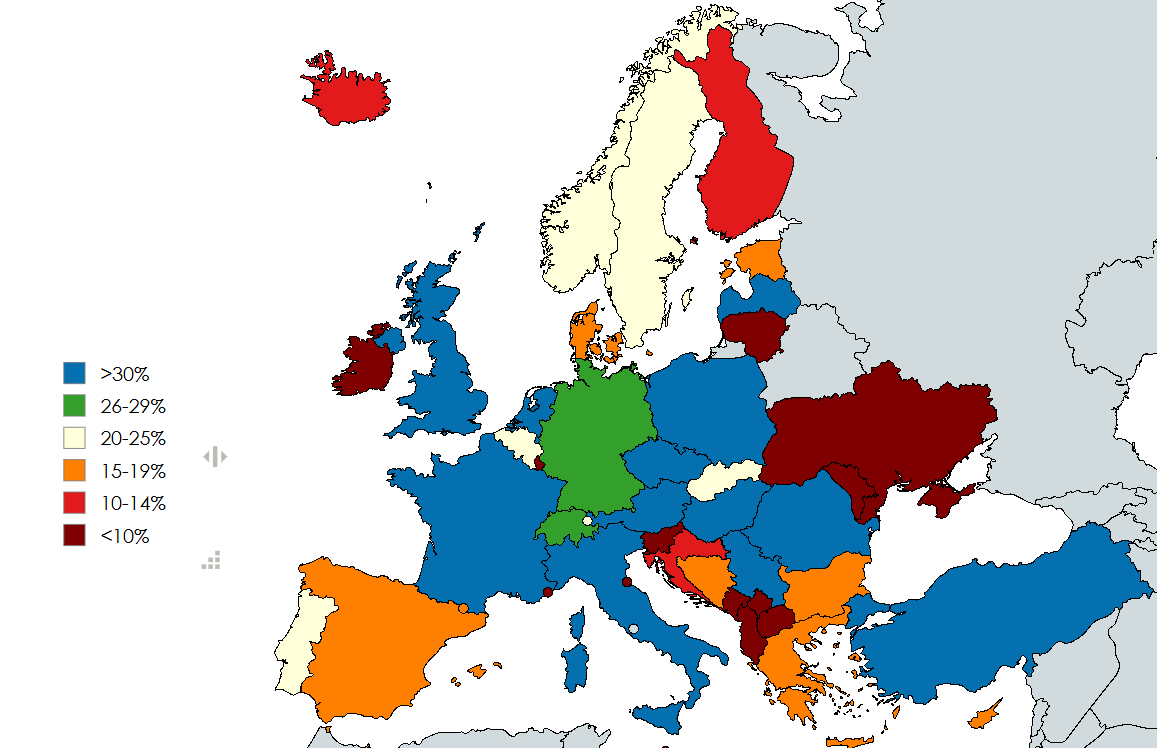
Right Wing Populist Parties Support Rate Map in Europe
Geographic Analysis9/18/2025
## What This Map Shows...
12 viewsRead More →
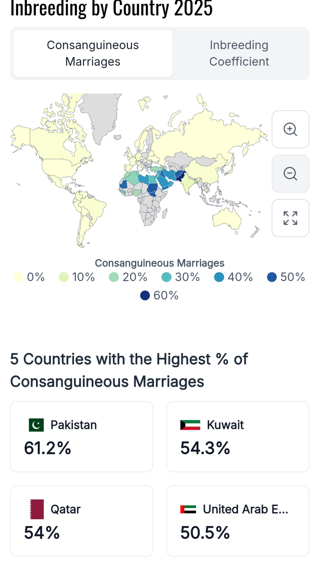
Consanguinity Rates by Country Map
Geographic Analysis9/18/2025
## What This Map Shows...
14 viewsRead More →
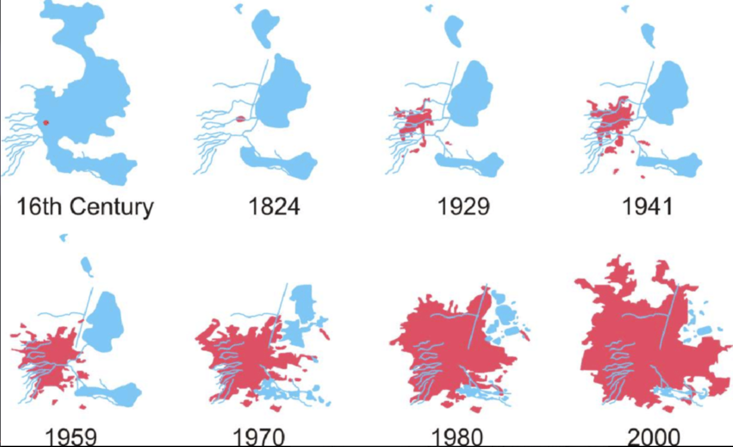
Mexico City Lake Texcoco Development Map
Geographic Analysis9/18/2025
## What This Map Shows\nThe visualization titled \...
14 viewsRead More →
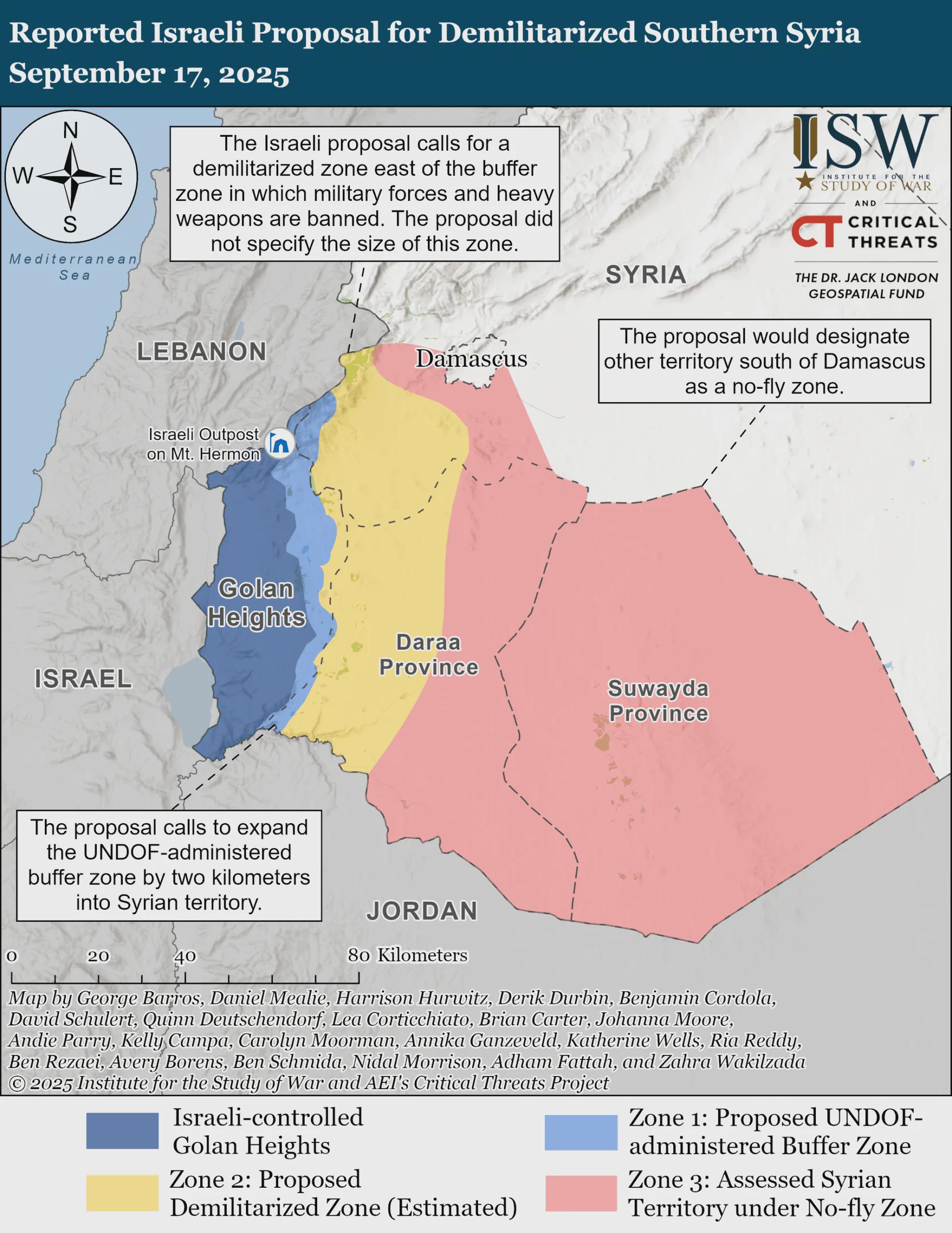
Demilitarized Southern Syria Proposal Map
Geographic Analysis9/18/2025
## What This Map Shows...
10 viewsRead More →