population density Maps
69 geographic visualizations tagged with "population density"
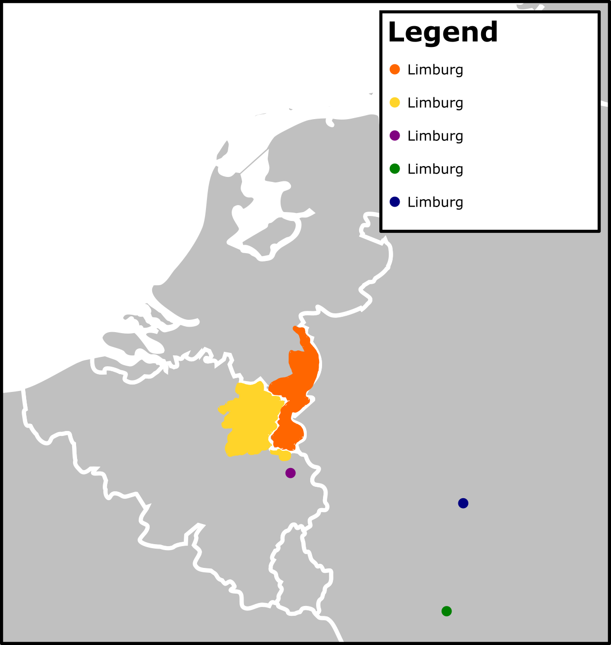
Limburg Population Density Map
This map presents the population density of Limburg, a province in the Netherlands. Through a visual representation of t...
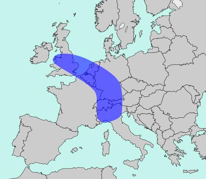
Population Density Map of Europe
The map titled "The Blue Banana" visualizes Europe’s most densely populated corridor, home to approximately 111 million ...
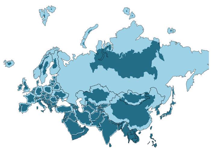
True Size of Every Country in Eurasia Map
The visualization titled "The True Size of Every Country in Eurasia" provides a unique perspective on the geographical s...
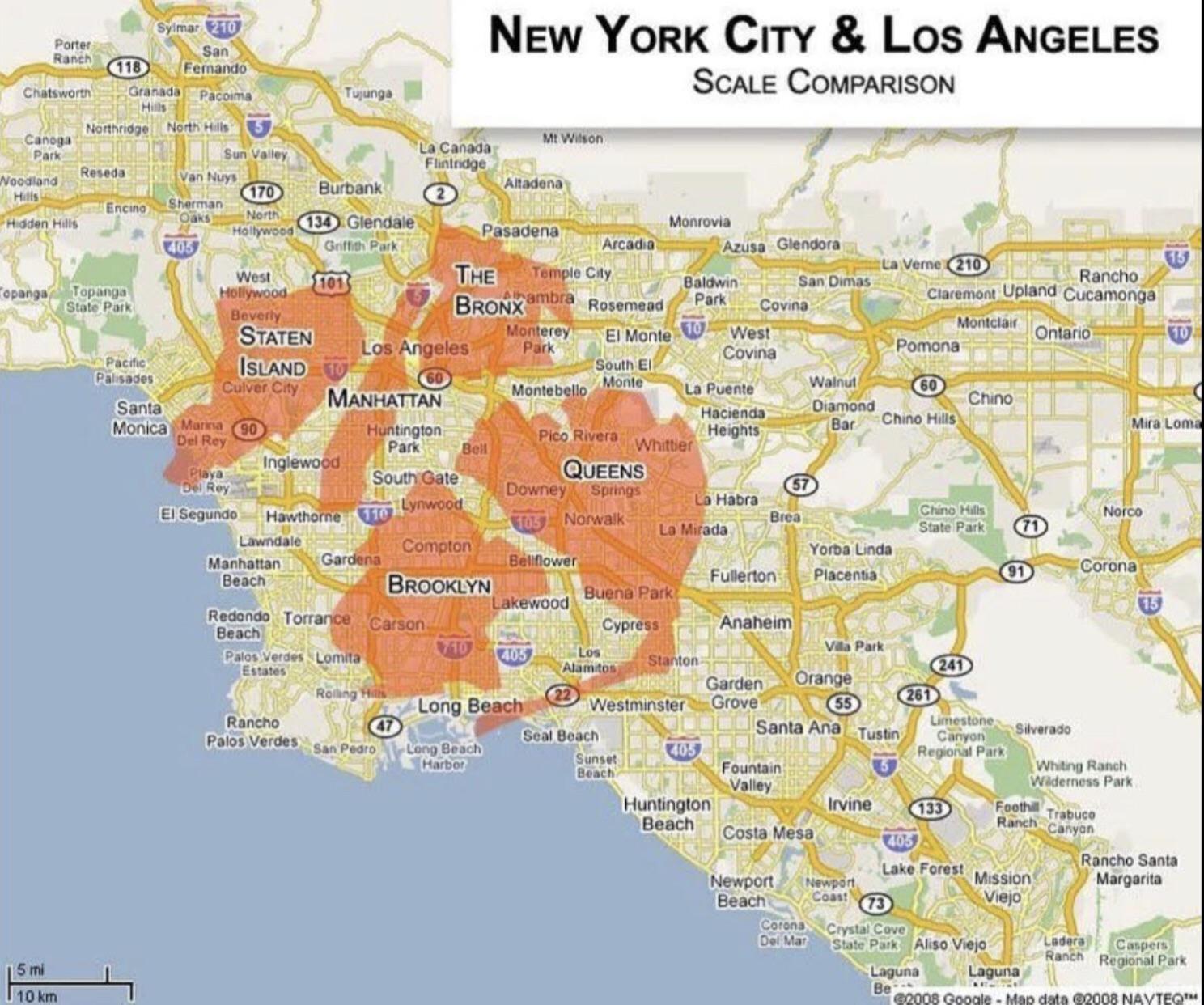
Population and Area Comparison Map of New York and Los Angeles
This map provides a clear visual comparison of the population and area of two of the most iconic cities in the United St...
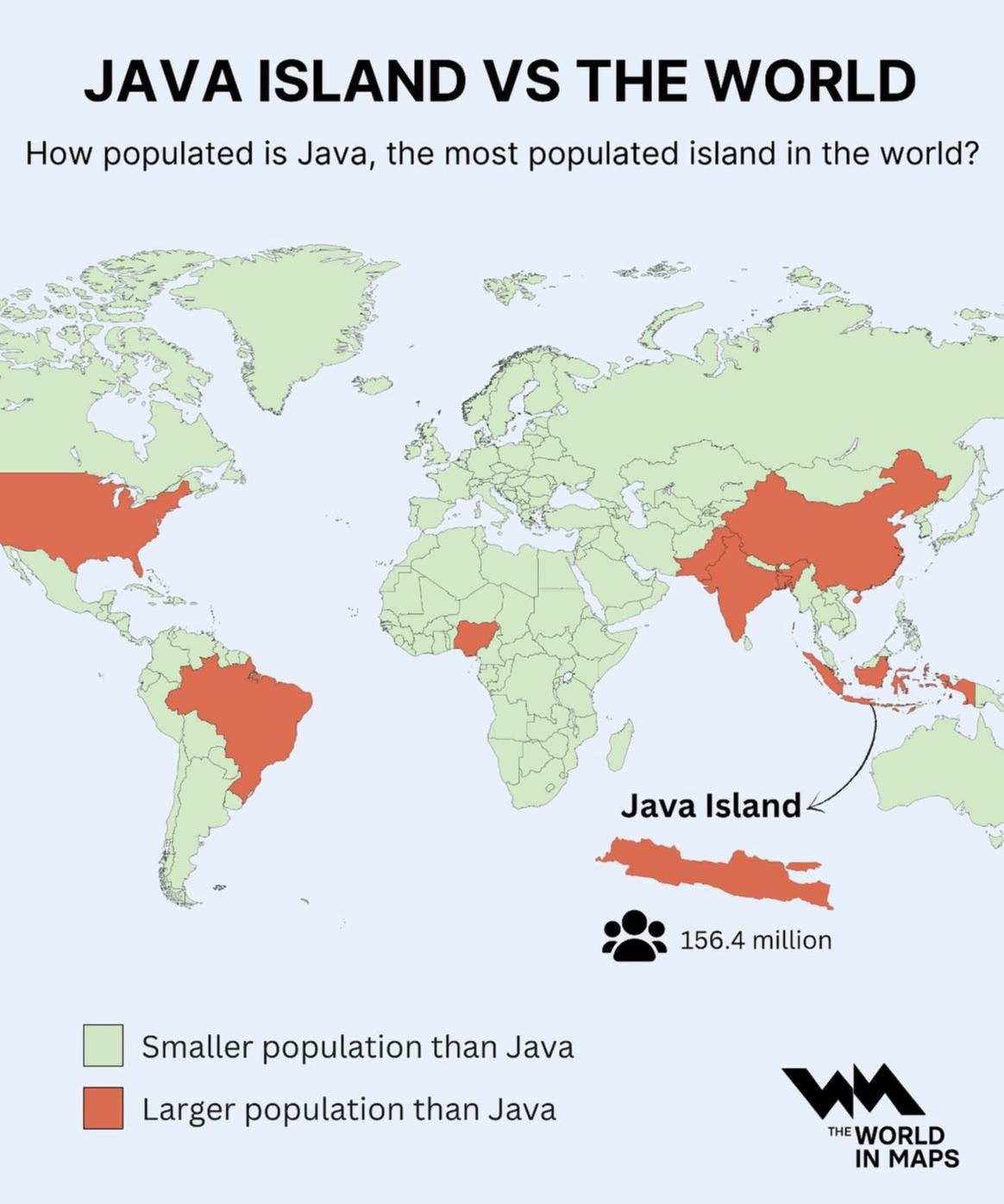
Population Density Map of Java Island
The visualization at hand provides a striking representation of Java Island, illustrating its status as the most populat...
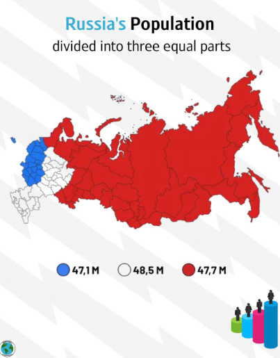
Equally Populated Areas of Russia Map
Russia’s overall population is approximately 144 million, but this number is not evenly spread. Much of the population i...
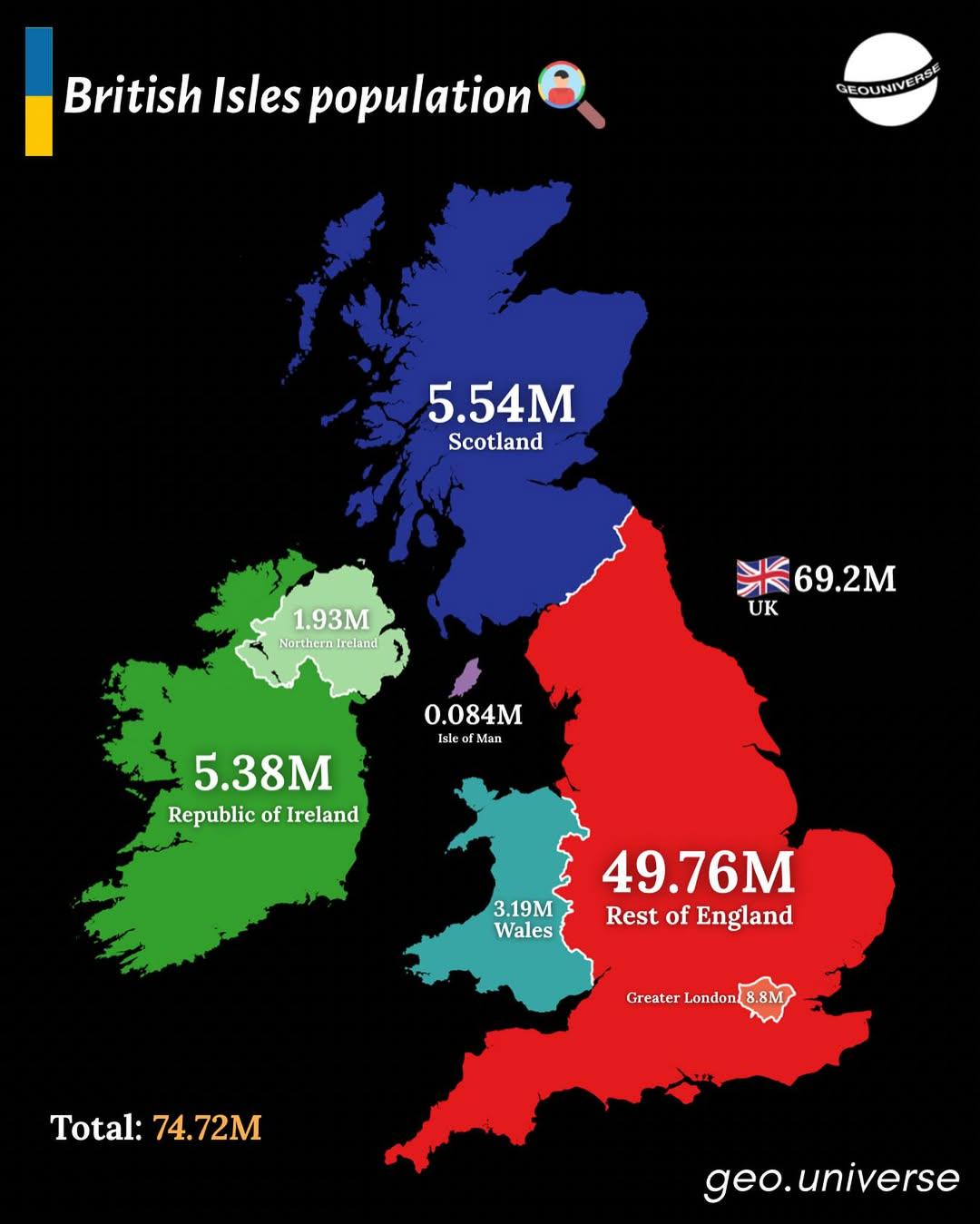
Population Distribution Map of the British Isles
The "British Isles by Population" map presents a detailed visualization of the population distribution across the Britis...
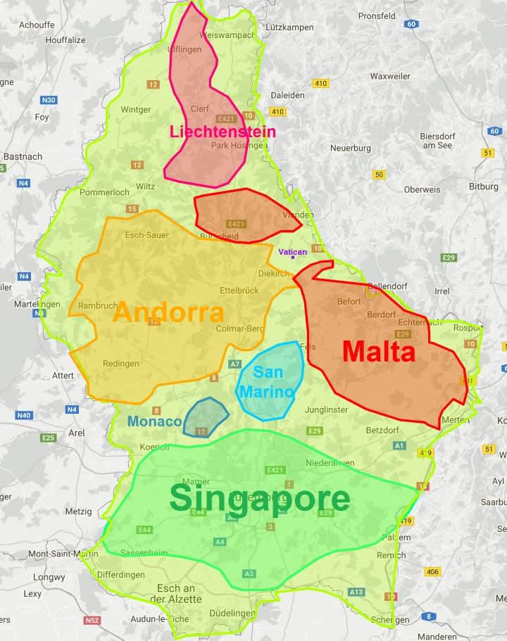
Luxembourg Size Comparison Map
The "Luxembourg is non so small" map presents a captivating visual that challenges common perceptions about the size of ...
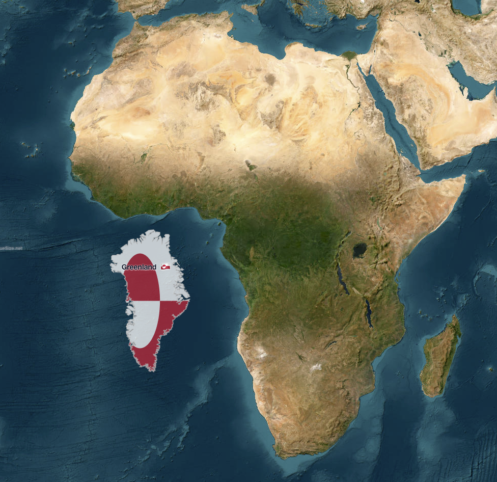
Greenland vs. Africa Size Comparison Map
The map titled "Greenland vs. Africa — the real scale" provides a striking visual comparison of the land areas of Greenl...
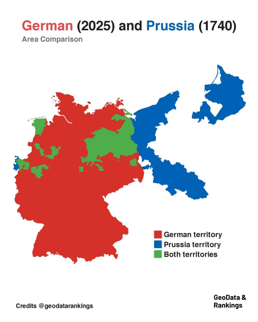
Germany and Prussia Area Comparison Map
The map titled "Germany in 2025 and Prussia in 1740 area comparison" visually represents the territorial extent of moder...
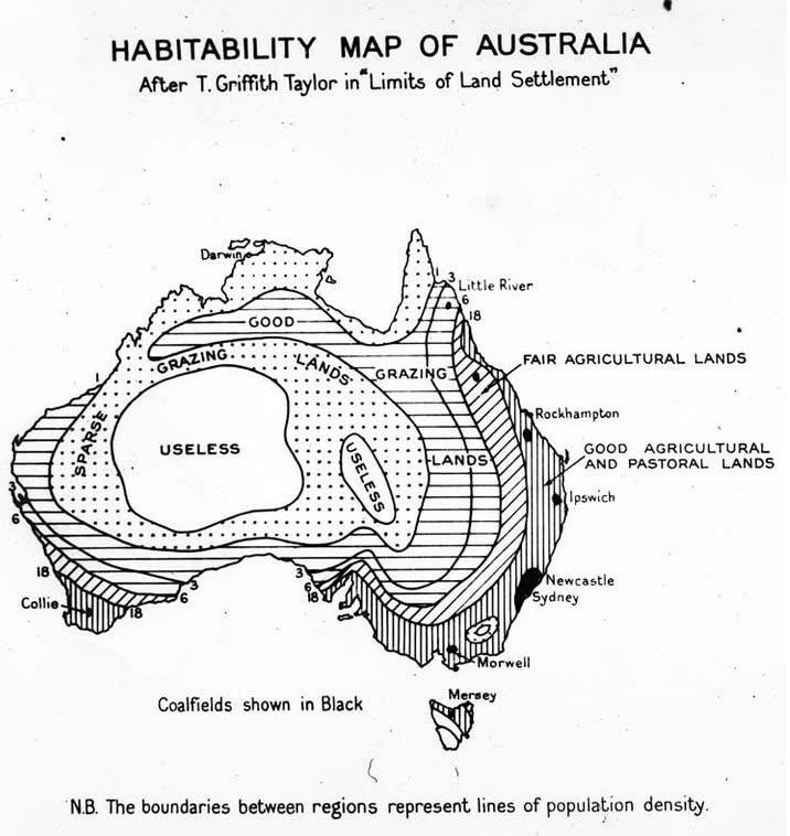
1946 Habitability Map of Australia
The 1946 Map of Australia that coded the "habitability" of the land presents a fascinating visual representation of the ...
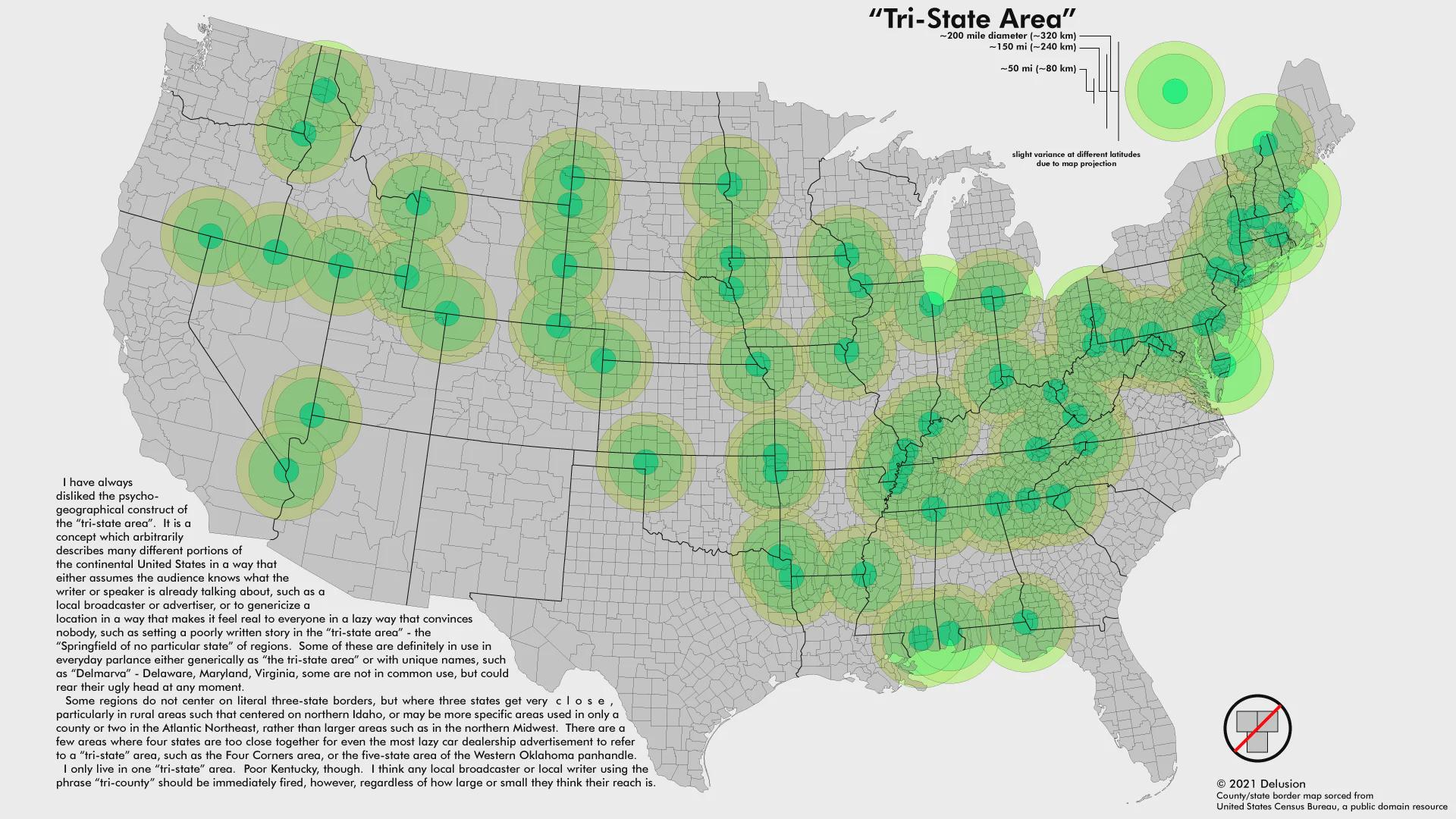
Tri-state Areas Map
The "Map of Tri-state Areas" provides a clear visual representation of the regions in the United States where three stat...
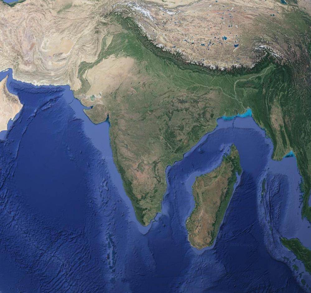
Geographical Comparison Map of Madagascar and India
This map provides a comparative geographical overview of Madagascar and India, two distinct nations that share a fascina...
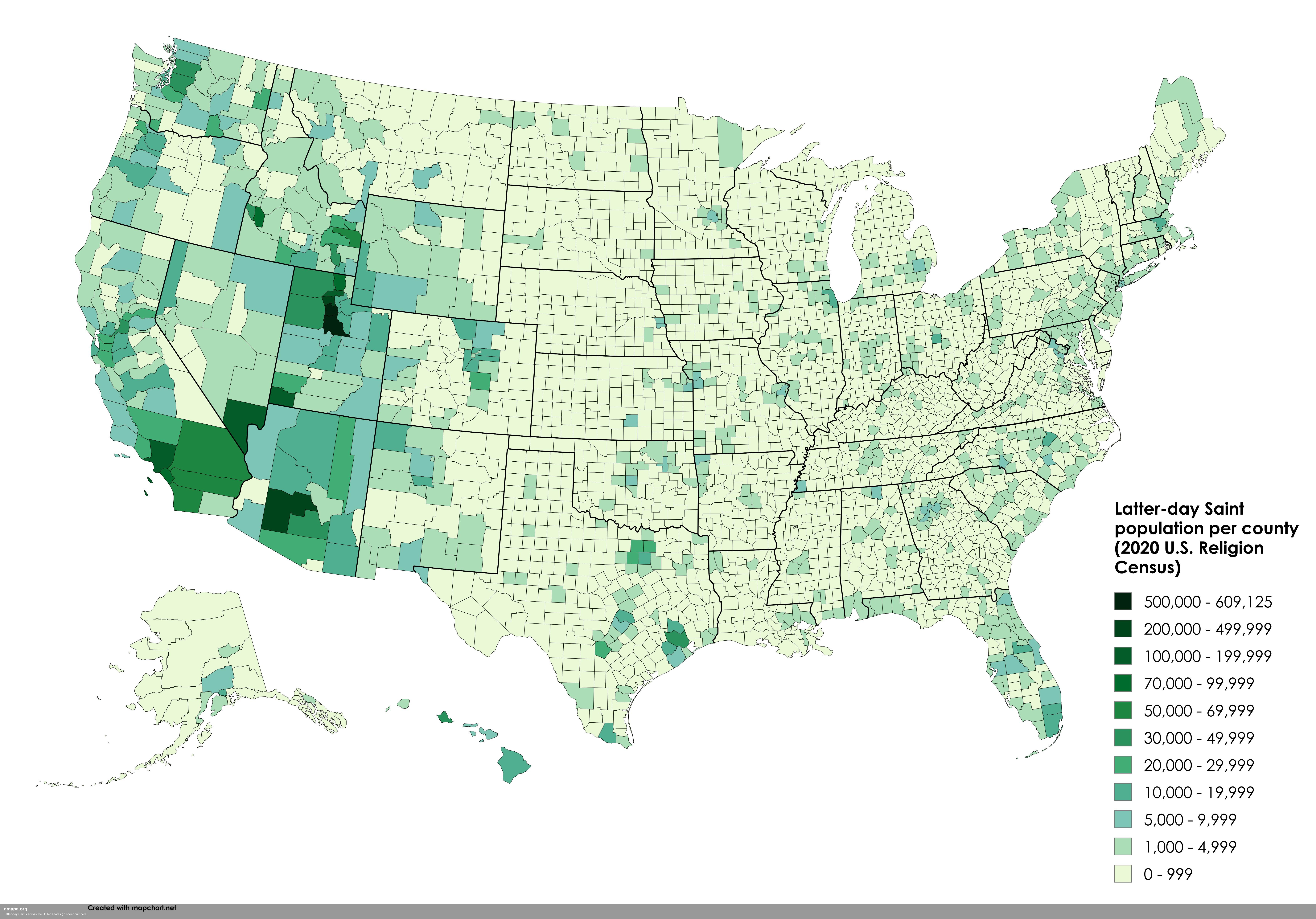
Visualizing Faith: The Latter-day Saints Map of America
In recent years, the Church of Jesus Christ of Latter-day Saints (LDS) has experienced a remarkable surge in growth, evi...
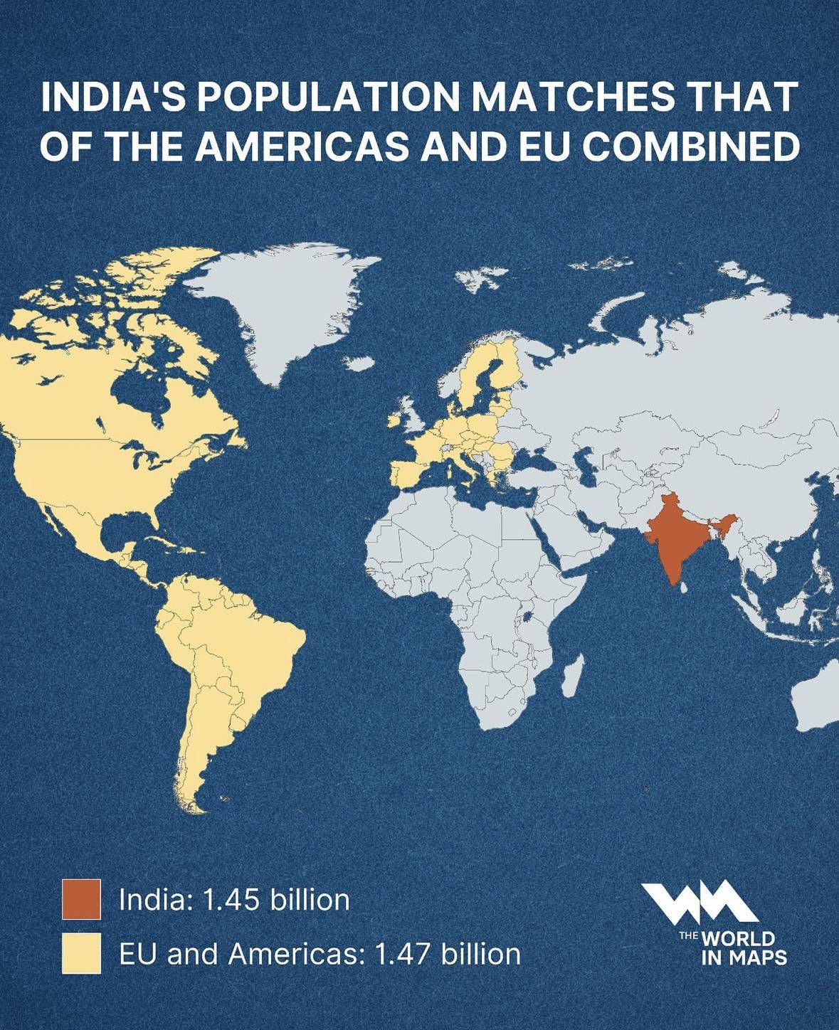
India Population Compared to Americas & EU Map
This map illustrates a striking demographic milestone: India’s population, standing at approximately 1.45 billion, now n...
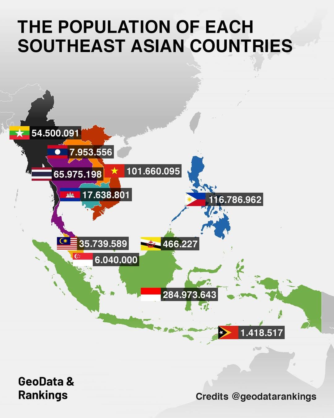
Population Map of Southeast Asian Countries
The "Population Map of Southeast Asian Countries" provides a clear visual representation of the population distribution ...
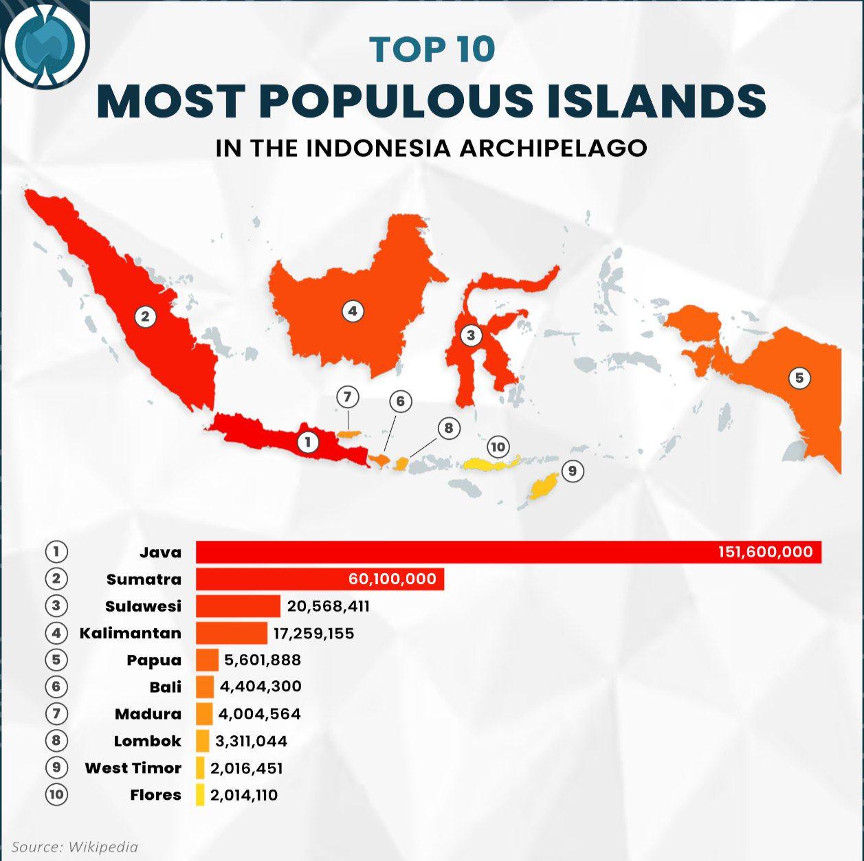
Population Map of Indonesia's Most Populous Islands
The visualization titled "Top 10 Most Populous Islands in the Indonesia Archipelago" provides a clear representation of ...
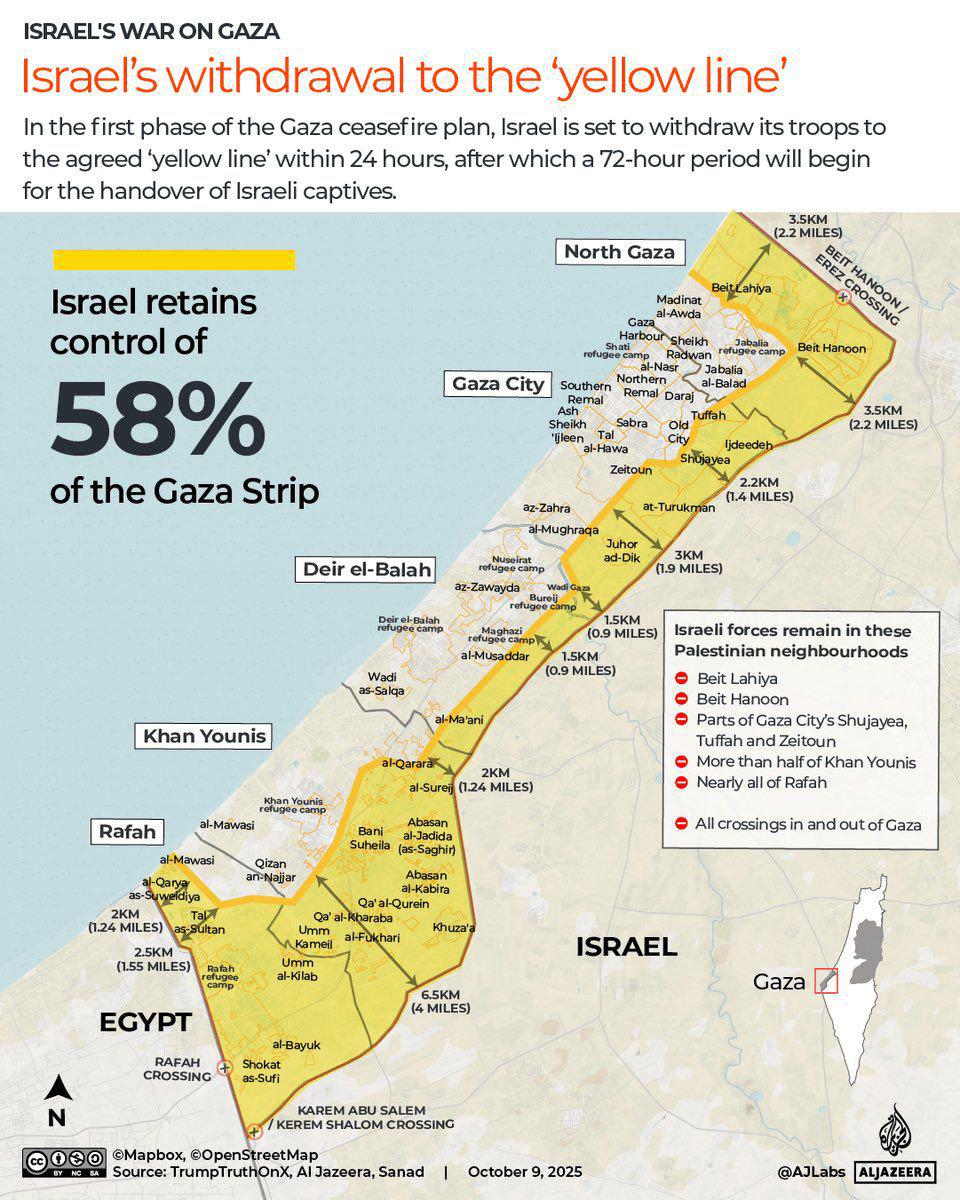
Gaza Withdrawal to Yellow Line Map
This map illustrates the geographical implications of Israel's withdrawal from the Gaza Strip, highlighting the yellow l...
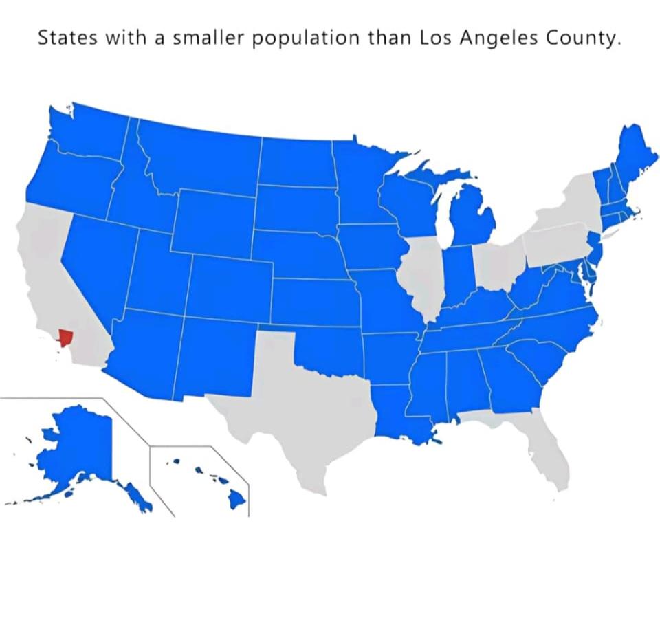
World Population Distribution Map
The "World Population Distribution Map" visualizes where people live across the globe, highlighting the density of popul...
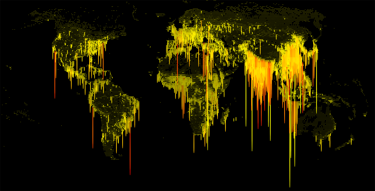
World Population Density Map
This visualization displays the population density of various regions across the globe, illustrating how many people inh...
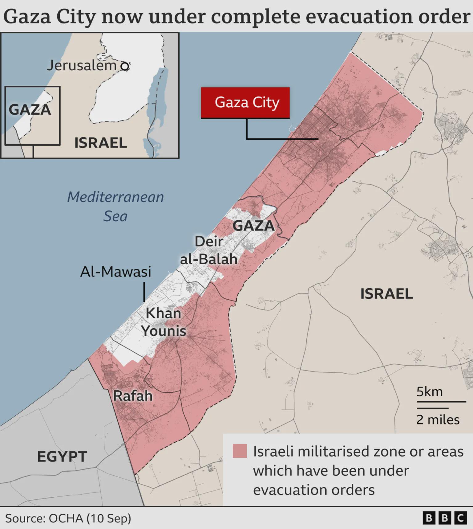
Gaza Evacuation Order Map
Interestingly, Gaza's geography plays a significant role in its challenges. The narrow strip of land is bordered by the ...
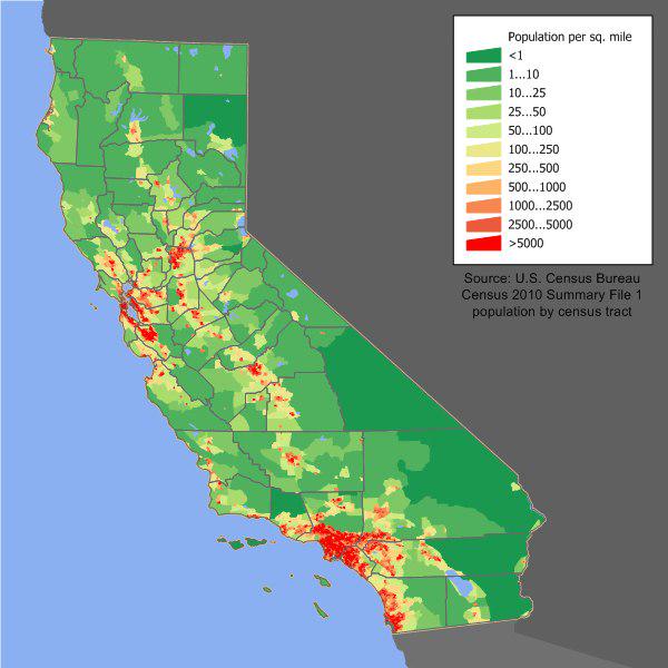
California Population Density Map
The California Population Density Map provides a clear visual representation of the distribution of people across the st...
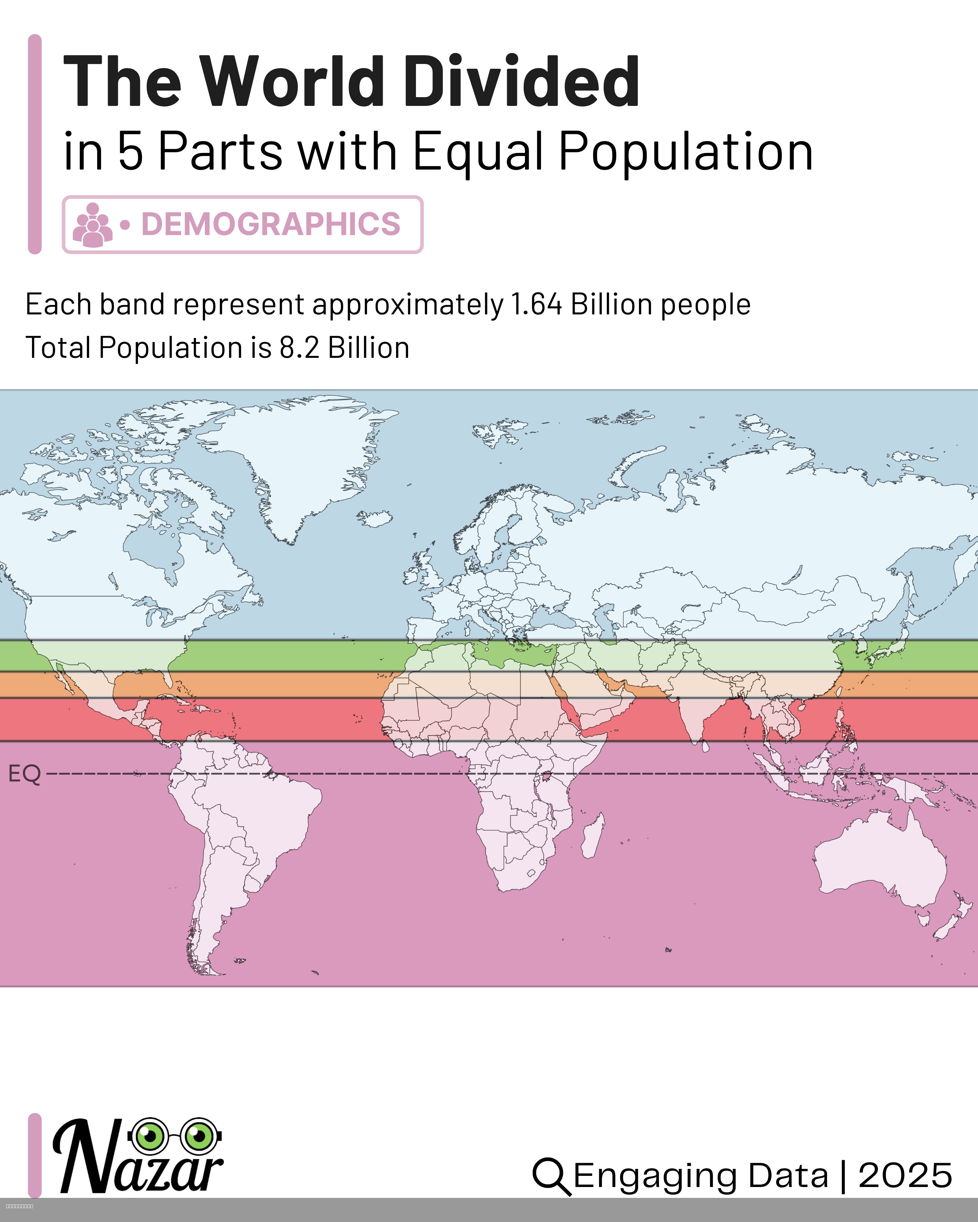
World Population Distribution Map by Equal Parts
This map visualizes the world’s population divided into five horizontal bands, each containing approximately 1.64 billio...
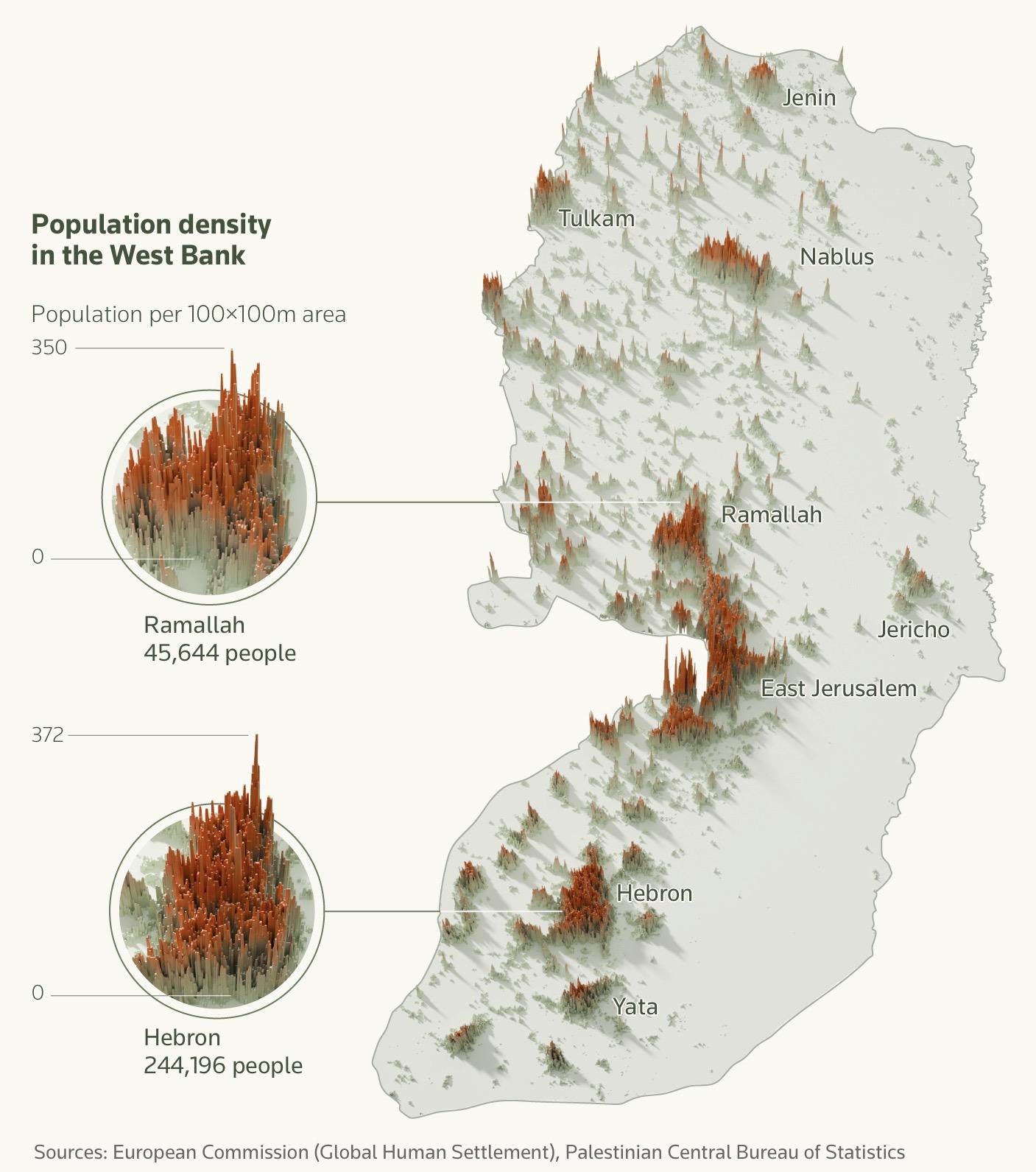
Population Density Map of the West Bank
The "Population Density Map of the West Bank" provides a detailed visualization of the distribution of people across thi...
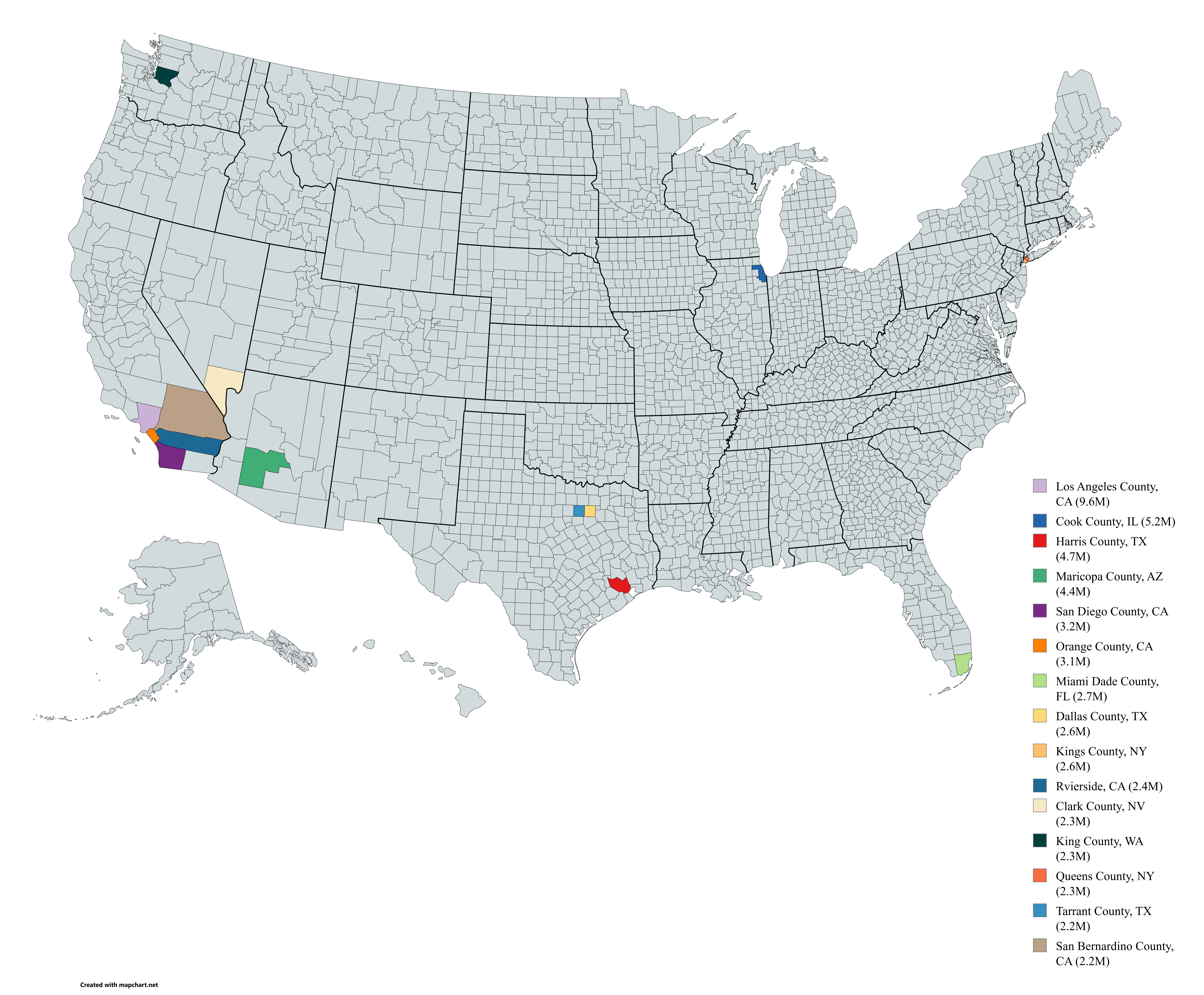
Most Populated US Counties Map
Interestingly, the top counties are often those that experience the highest rates of internal migration. In recent years...
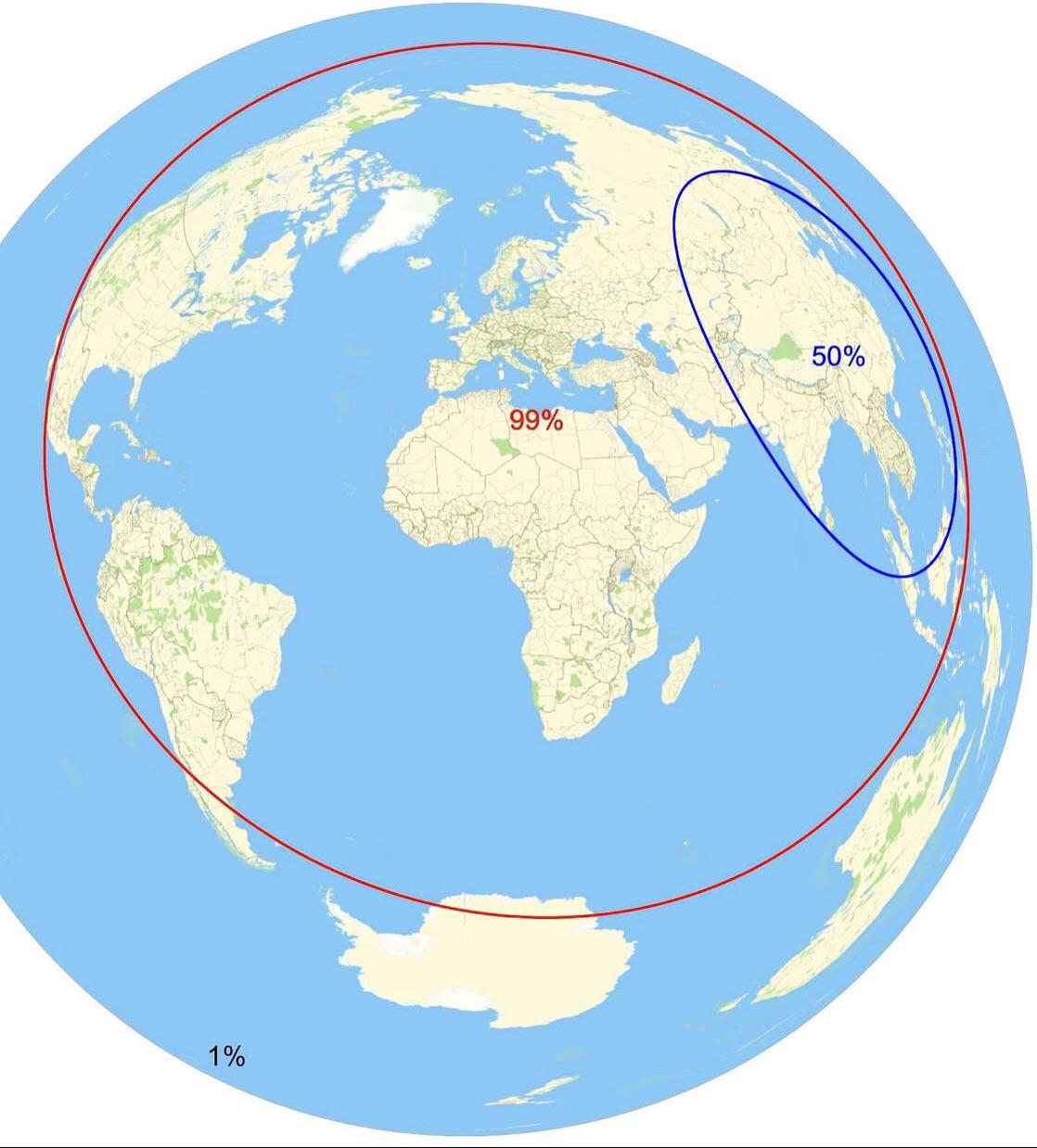
Population Distribution and Area Map
This map illustrates the percentage of the population and the area of distribution across various regions. It provides a...
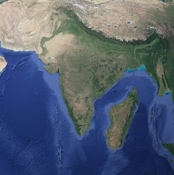
Geographical Map of Madagascar Next to India
The map titled "Geographical Map of Madagascar Next to India" provides a clear visual representation of the spatial rela...

Aggressive Drivers Map of the USA
The "Aggressive Drivers Map of the USA" presents a striking visualization of driving behaviors across various states, hi...
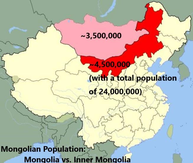
Population Map of Mongolia and Inner Mongolia
This map provides a visual representation of the population distribution between Mongolia and Inner Mongolia, a region o...
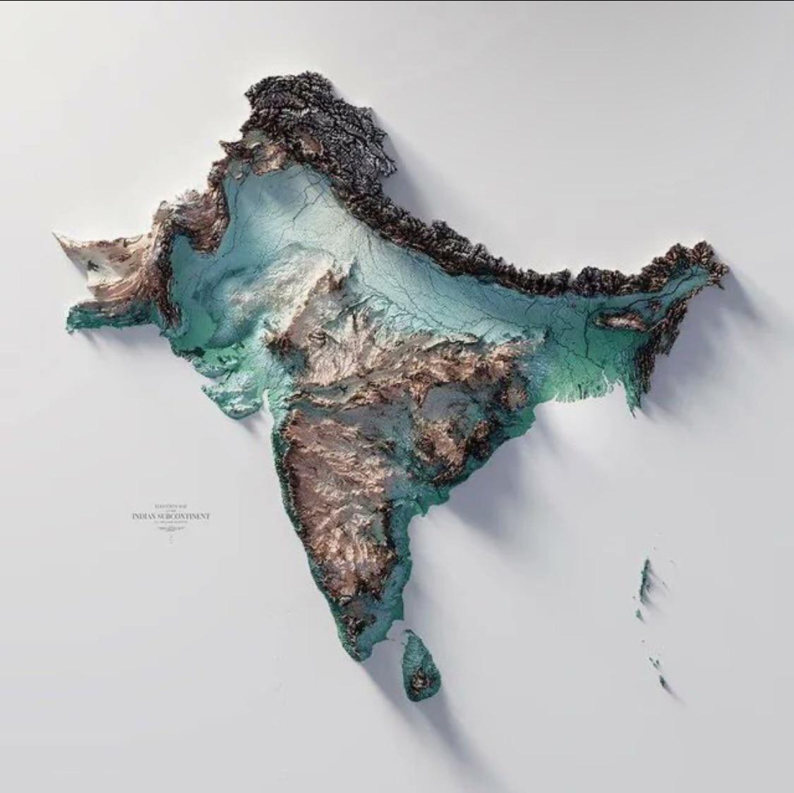
Geographical Map of the Indian Subcontinent
The Indo-Gangetic Plain, one of the most densely populated regions in the world, is another striking feature of the subc...
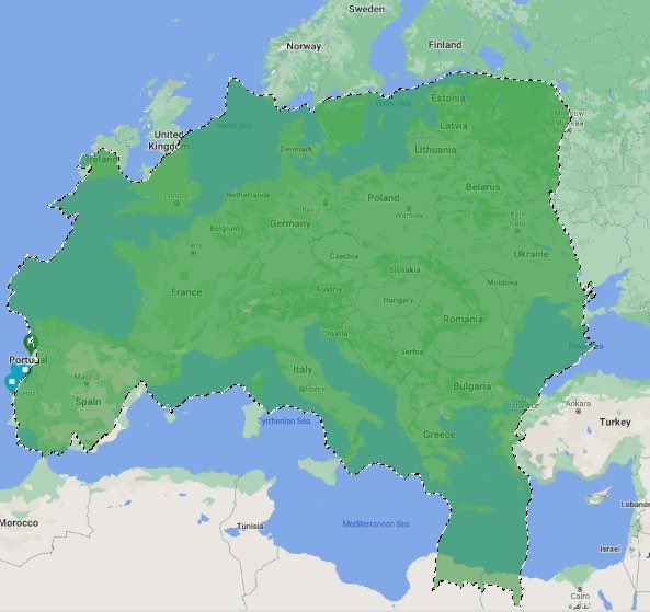
Geographical Map of Brazil in Europe
The "Brazil on Europe" map provides a unique visualization that illustrates how the land area of Brazil would fit within...
Detailed Population Density Map of the World
This incredibly detailed map showcases global population density, illustrating where people live in relation to the tota...
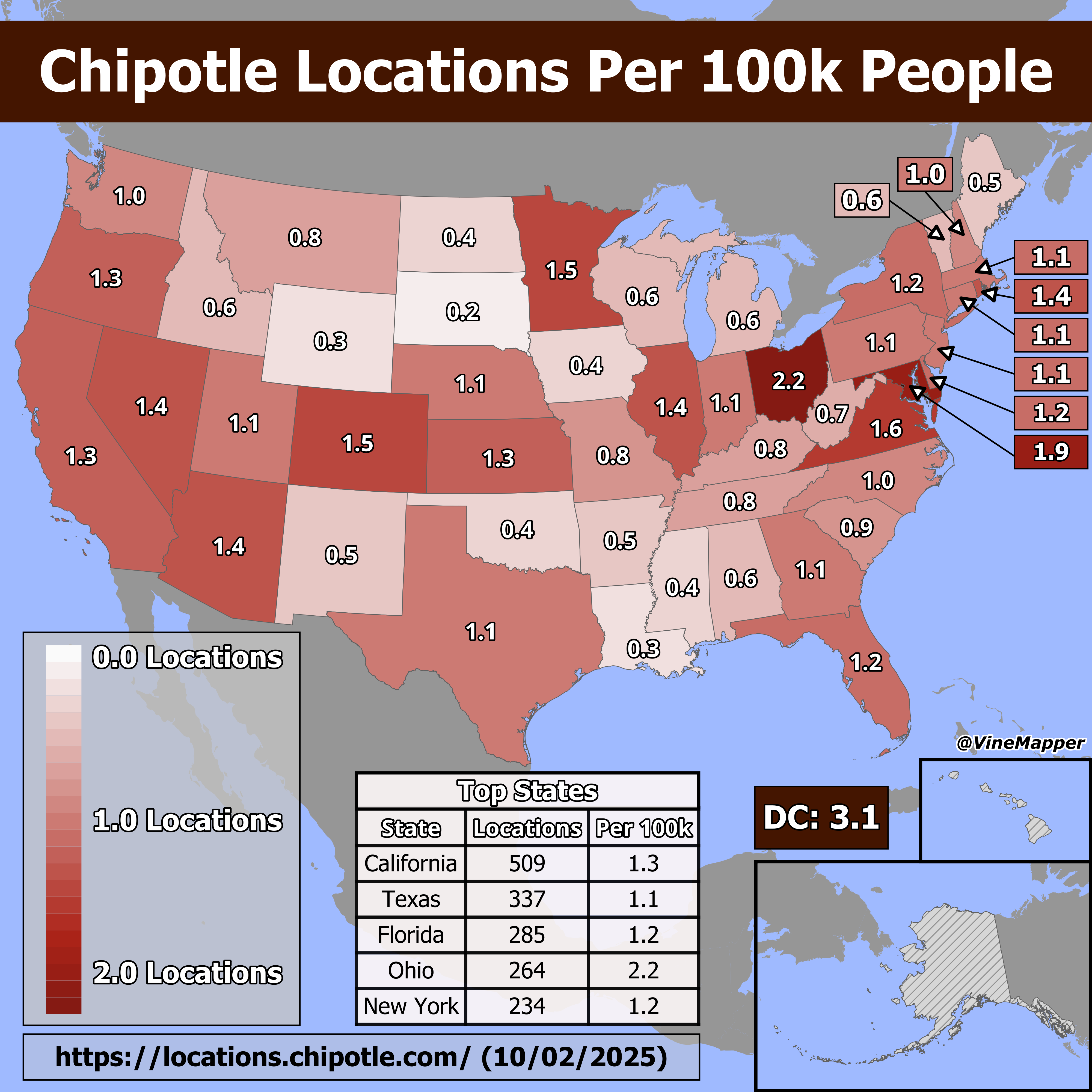
Chipotle Locations Per 100k People Map
The "Chipotle Locations Per 100k People" map provides a visual representation of how many Chipotle restaurants are avail...
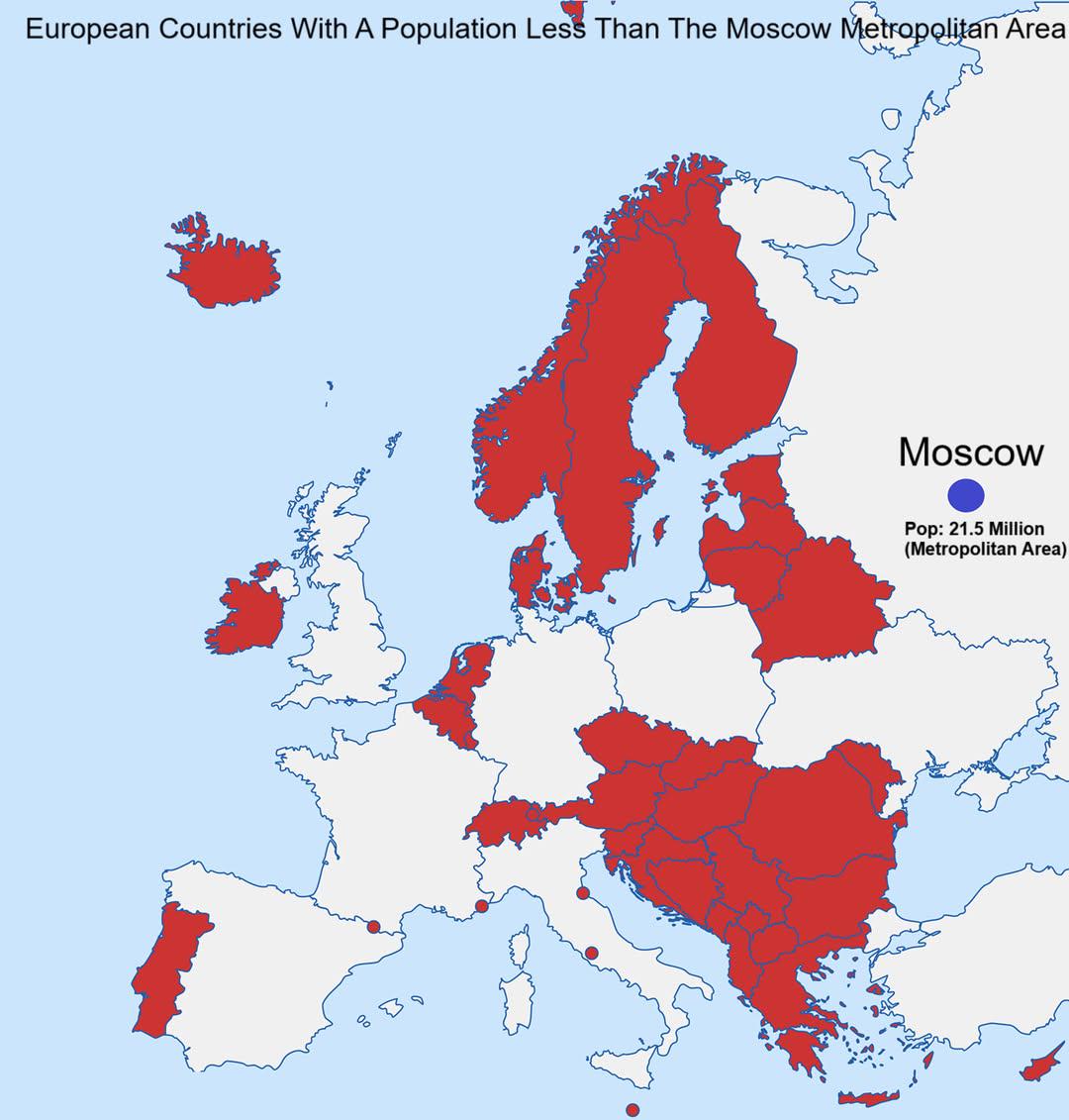
European Countries With Population Less Than Moscow Map
This map visualizes the European countries whose populations are smaller than that of the Moscow metropolitan area, whic...
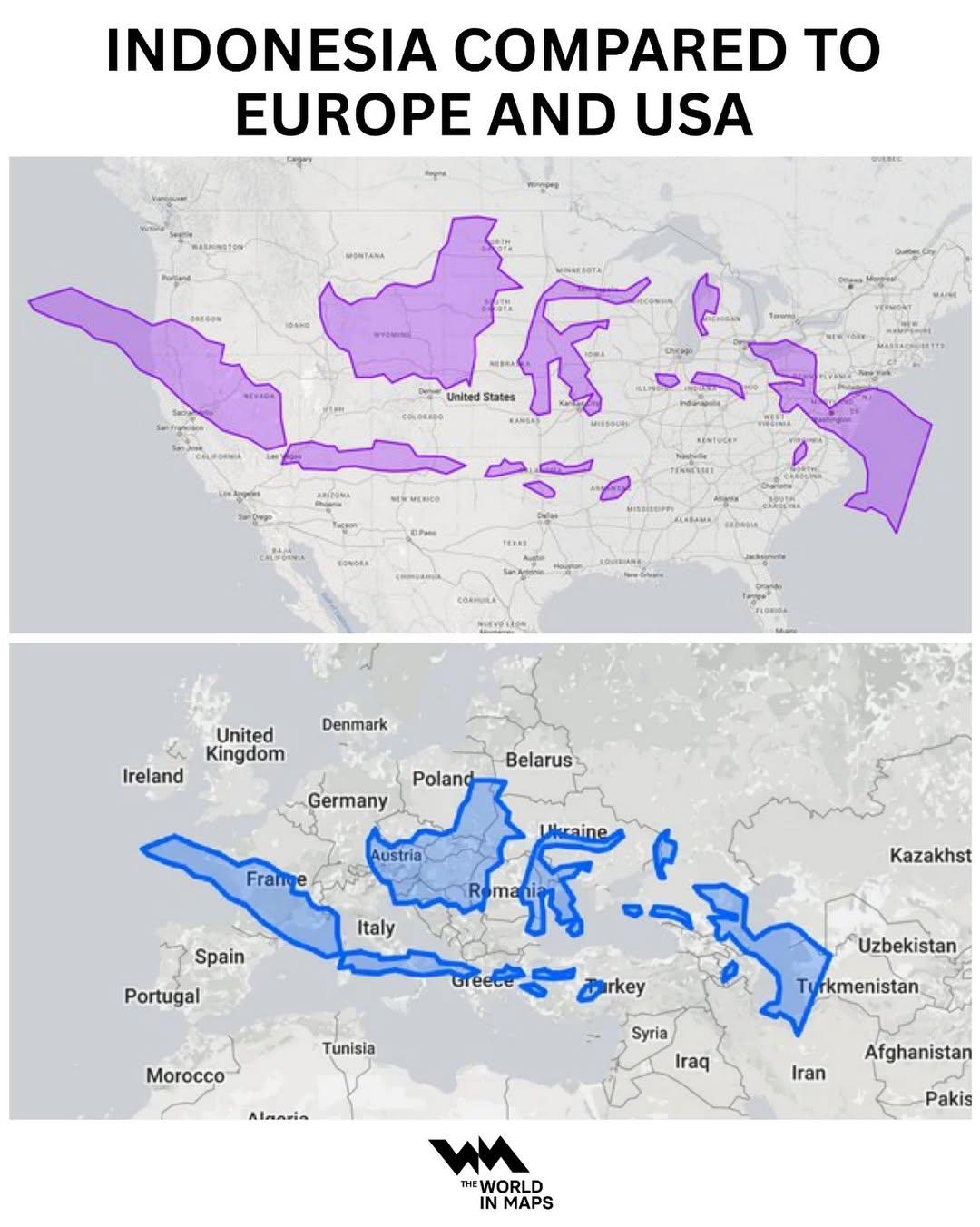
Indonesia Population Density Map Compared to Europe and USA
This map provides a comparative visualization of population density in Indonesia relative to Europe and the USA. By illu...
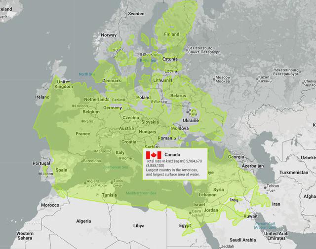
Canada vs Europe Map Comparison
Interestingly, Canada is home to the longest coastline in the world, measuring over 202,080 kilometers. This extensive c...
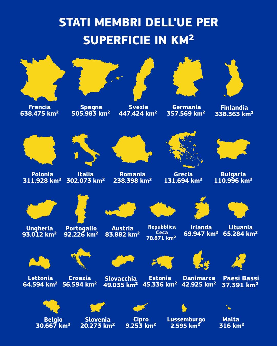
EU Member States by Surface Area Map
The "EU Member States by Surface Area Map" provides a clear and informative visualization of the total land area of each...
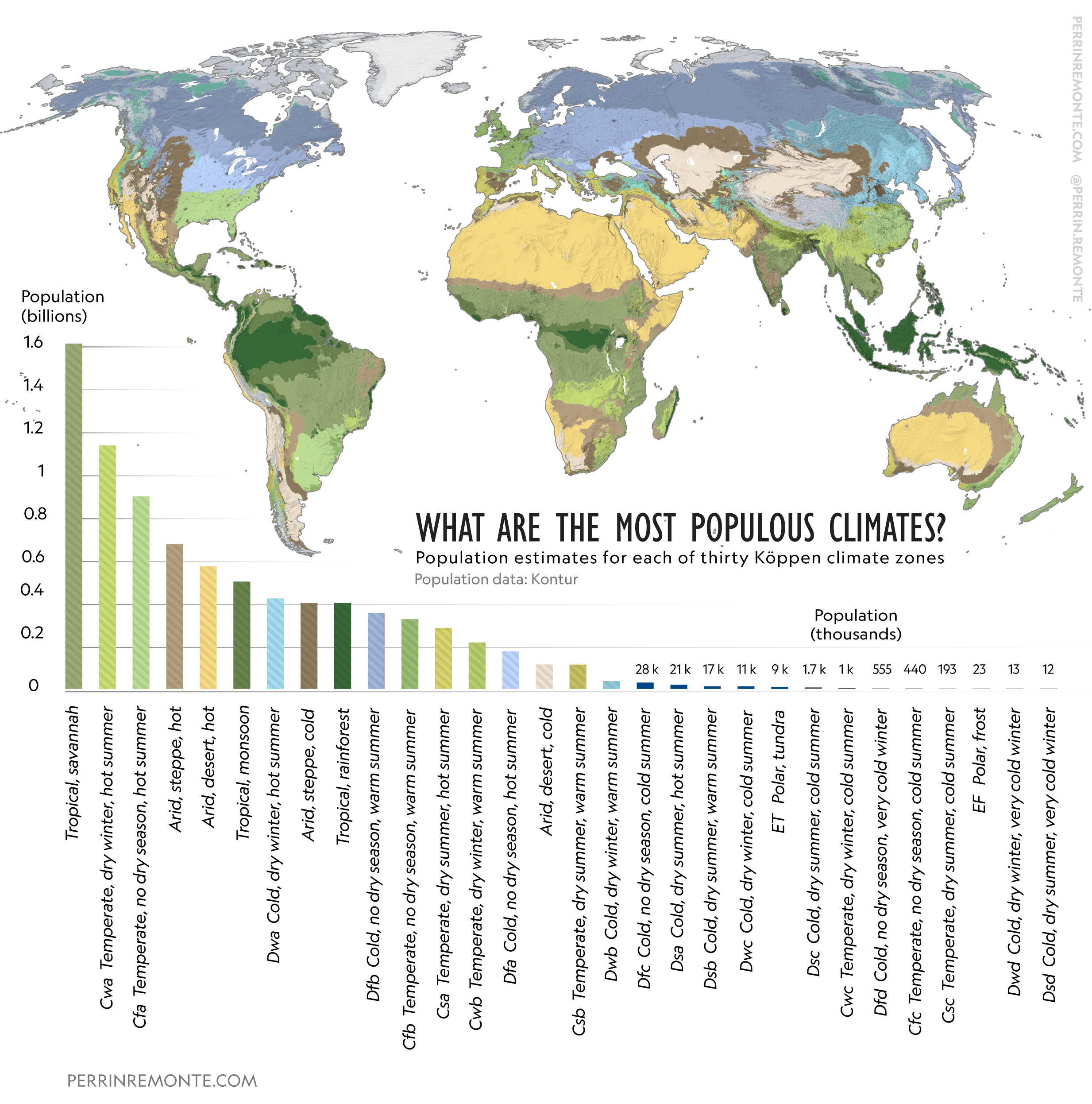
Map of Most Populous Climates
This visualization presents a fascinating overview of the world's most populous climates, illustrating how different cli...
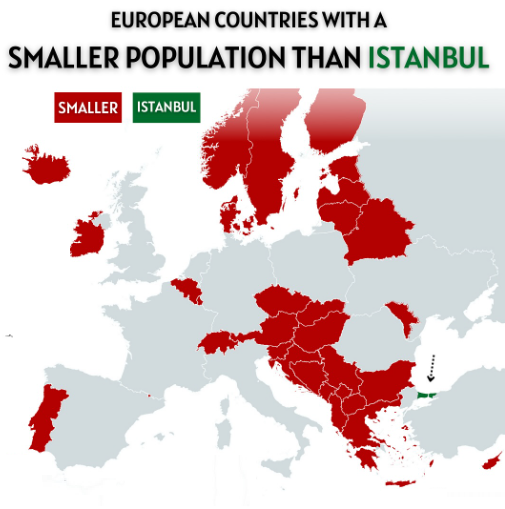
European Countries with Smaller Population than Istanbul Map
The visualization titled "European Countries with a Smaller Population than Istanbul" presents a striking comparison bet...
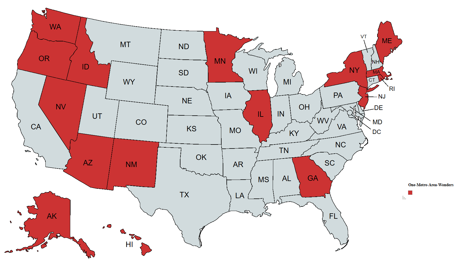
Metro Areas Population Comparison Map
This map visualizes an intriguing demographic phenomenon: it highlights the states with a metropolitan area that boasts ...
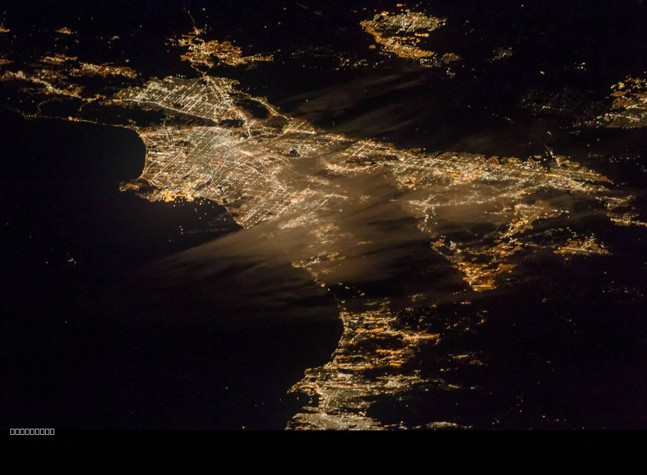
Southern California Urban Nightscape Map
The "Urban Expanse of Southern California at Night" map showcases the sprawling metropolitan areas of Southern Californi...
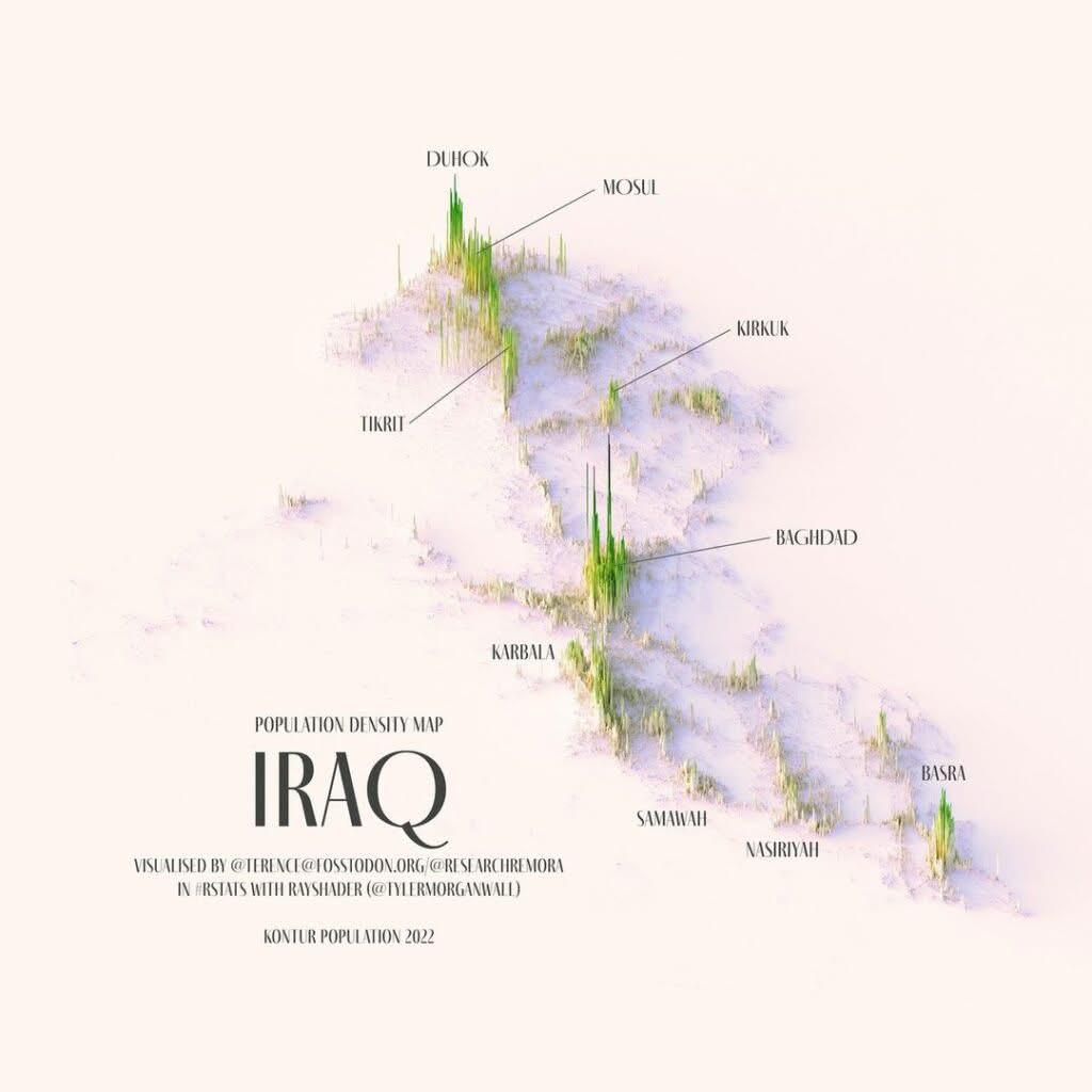
Relief Population Density Map of Iraq
Baghdad, with a population of approximately 8 million, is not just the capital but also the largest city in the country,...
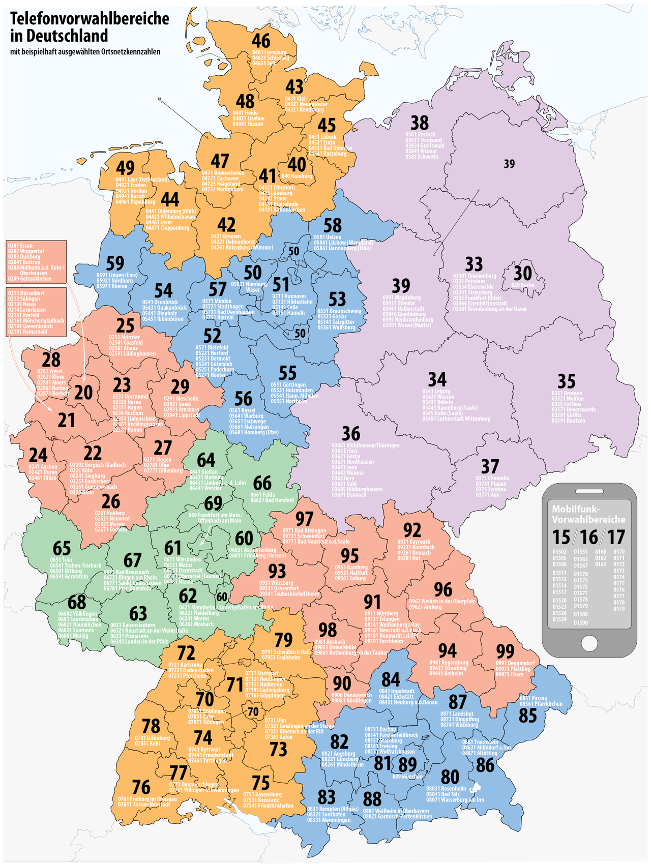
Telephone Number Area Codes in Germany Map
The "Telephone Number Area Codes in Germany Map" provides a comprehensive visual representation of the various area code...
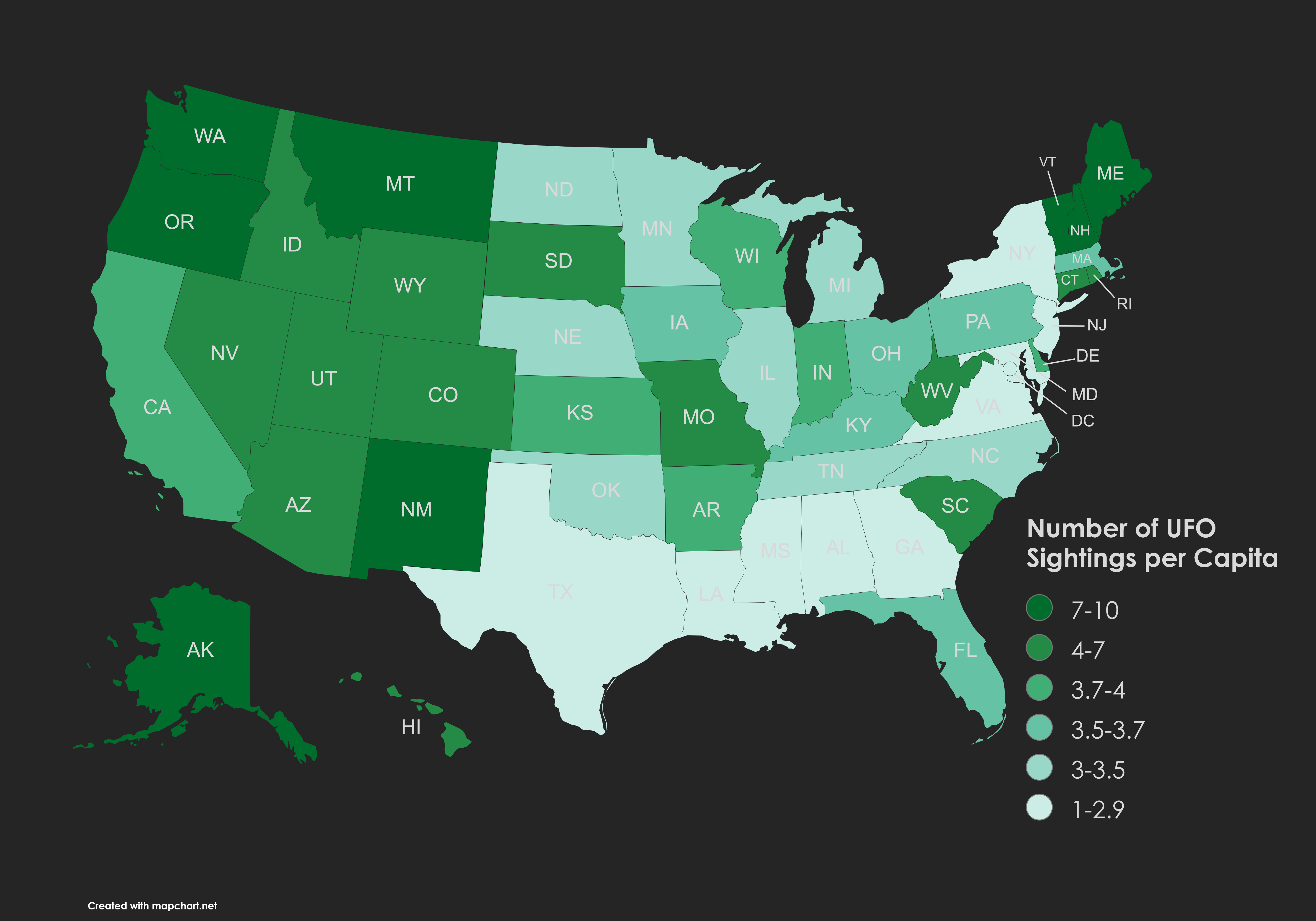
UFO Sightings Map per 10,000 People
The visualization titled "UFO Sightings per 10,000 People" based on data from the National UFO Reporting Center provides...
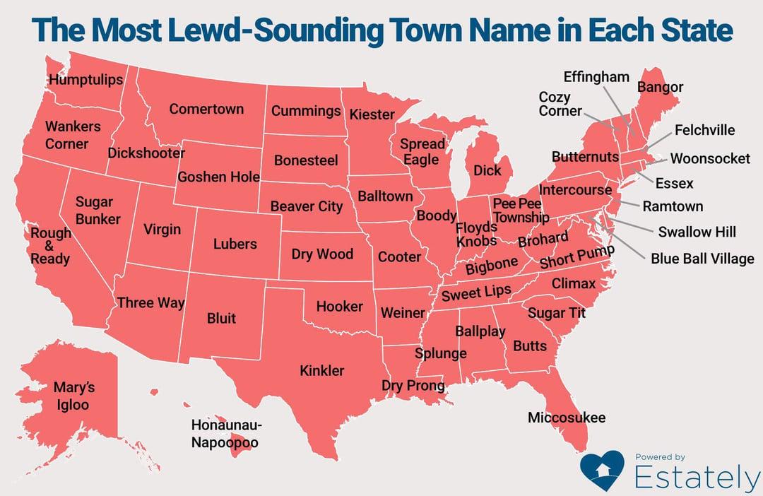
Global Population Density Map
Interestingly, the highest population densities can be found in small geographic areas, such as city-states and urban ag...
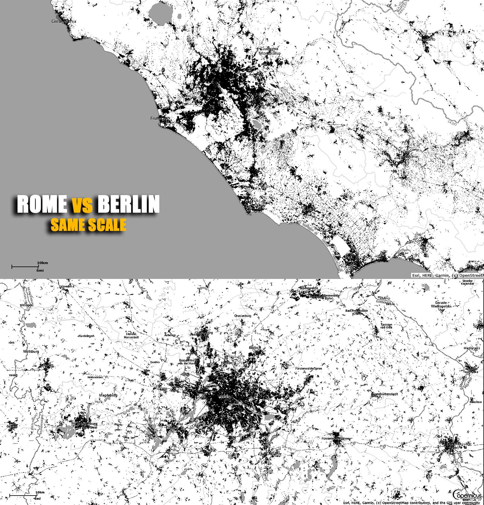
Rome vs Berlin City Size Comparison Map
This visualization provides a direct size comparison between two iconic European cities: Rome and Berlin, displayed on t...
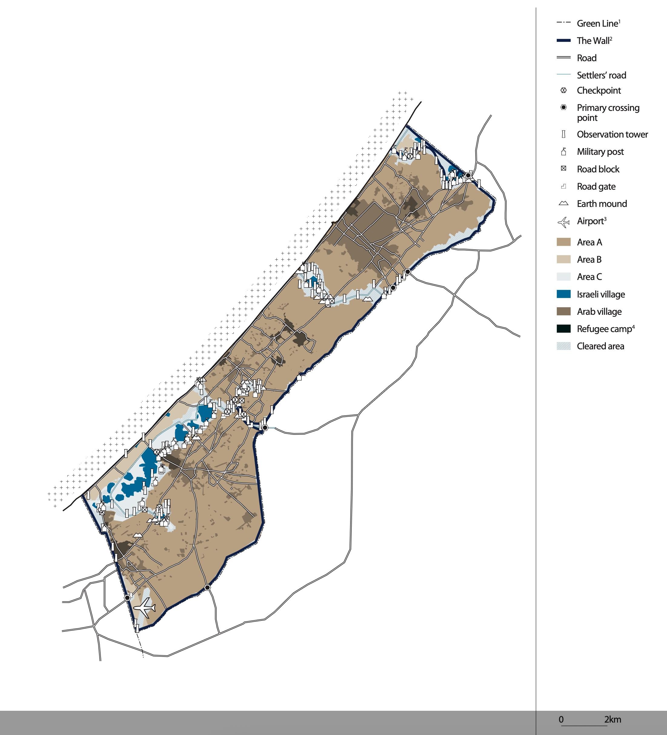
Gaza Strip Map Before Israeli Disengagement 2005
This map provides a detailed visual representation of the Gaza Strip prior to Israel's disengagement in 2005. It highlig...
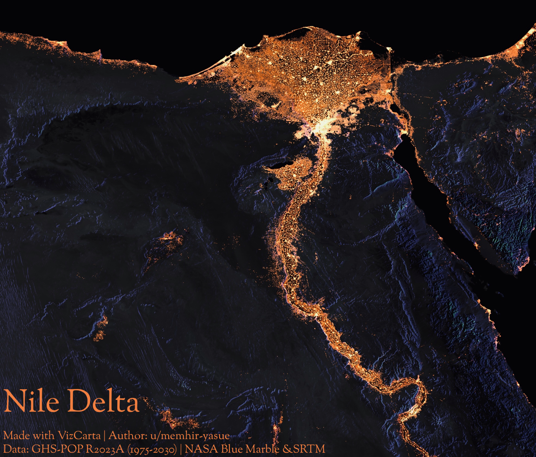
Nile Delta Night Lights Map
...
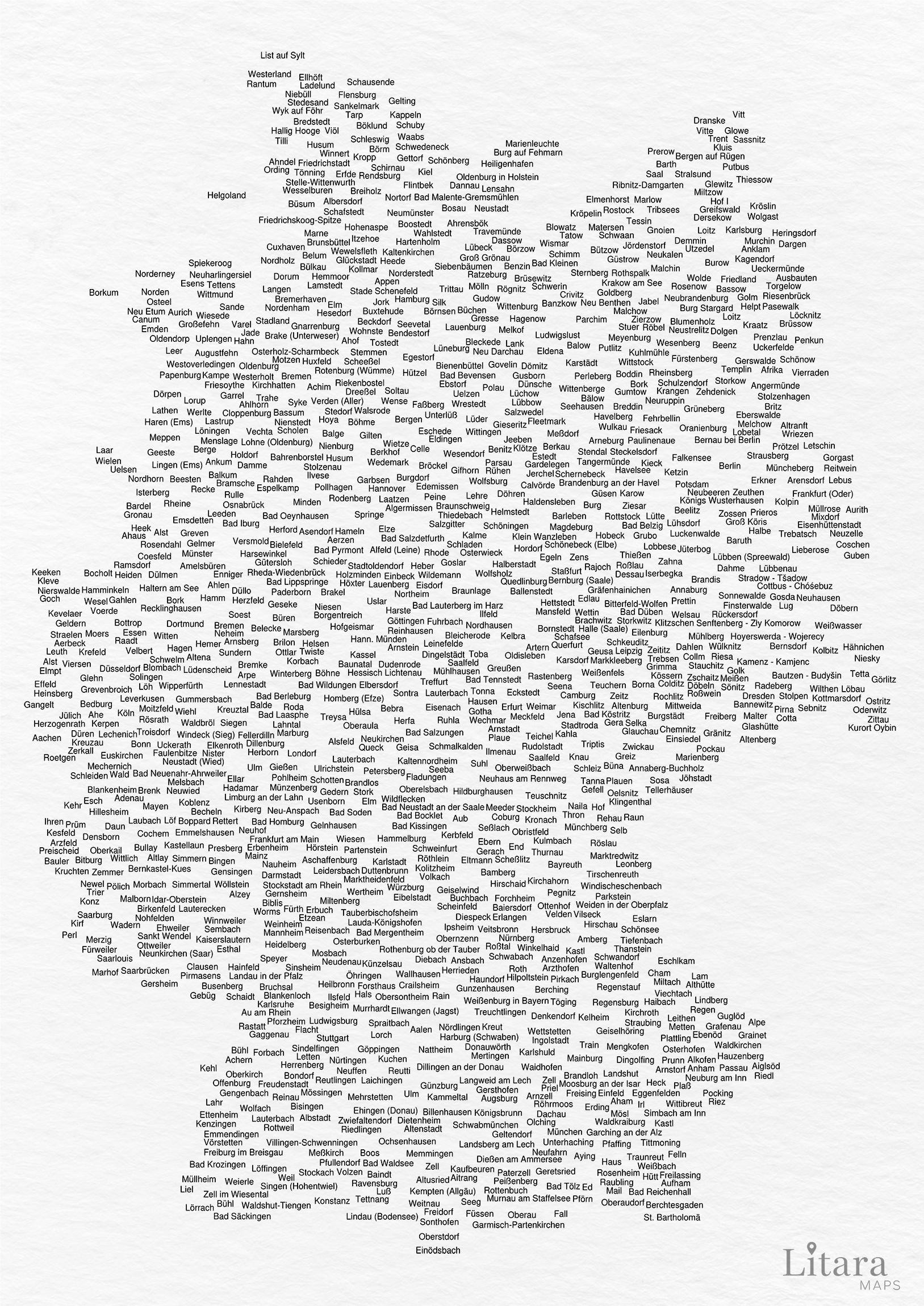
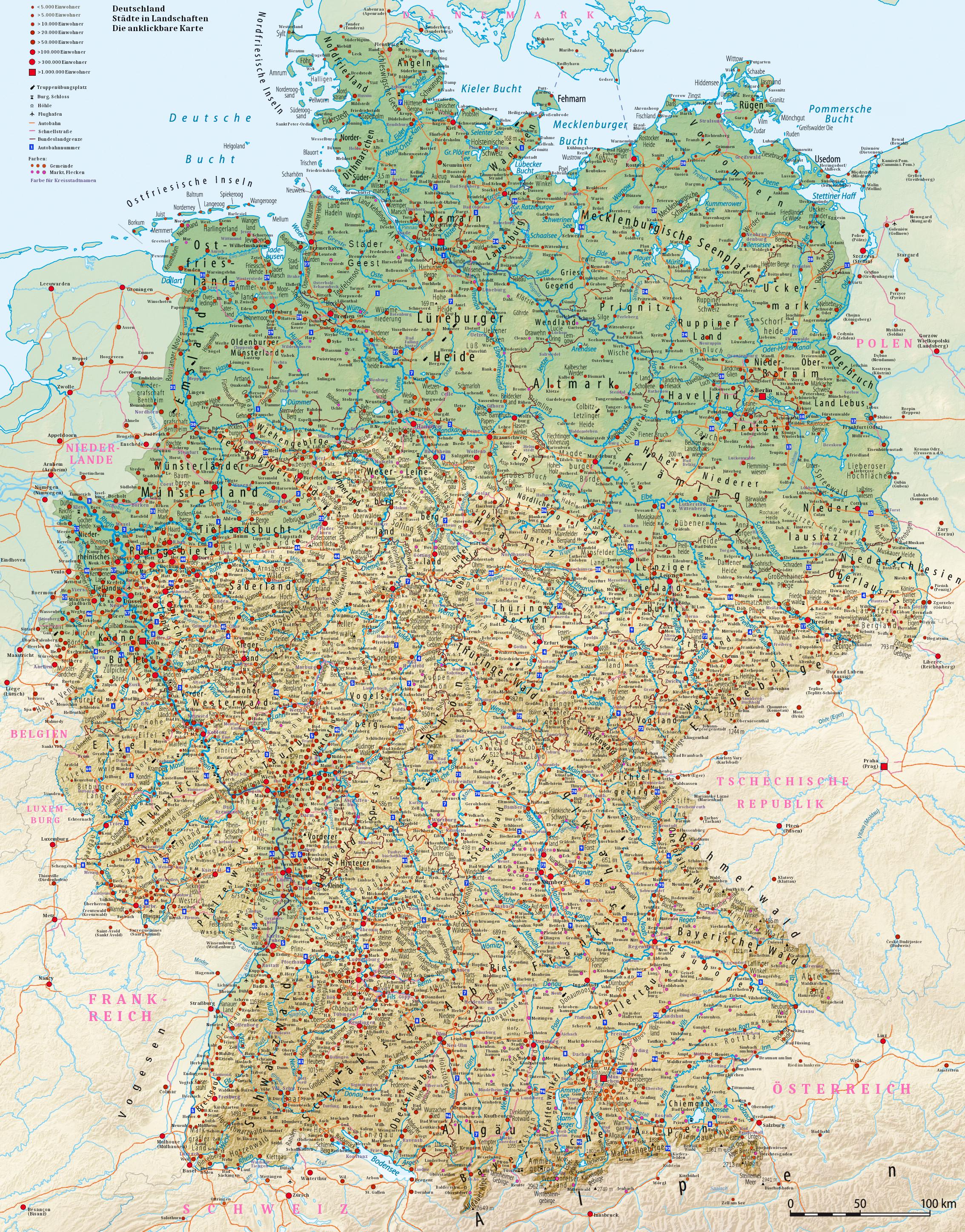
Population Density Map of Germany
The "Mapporn Germany" visualization provides an insightful overview of the population density across Germany. By display...
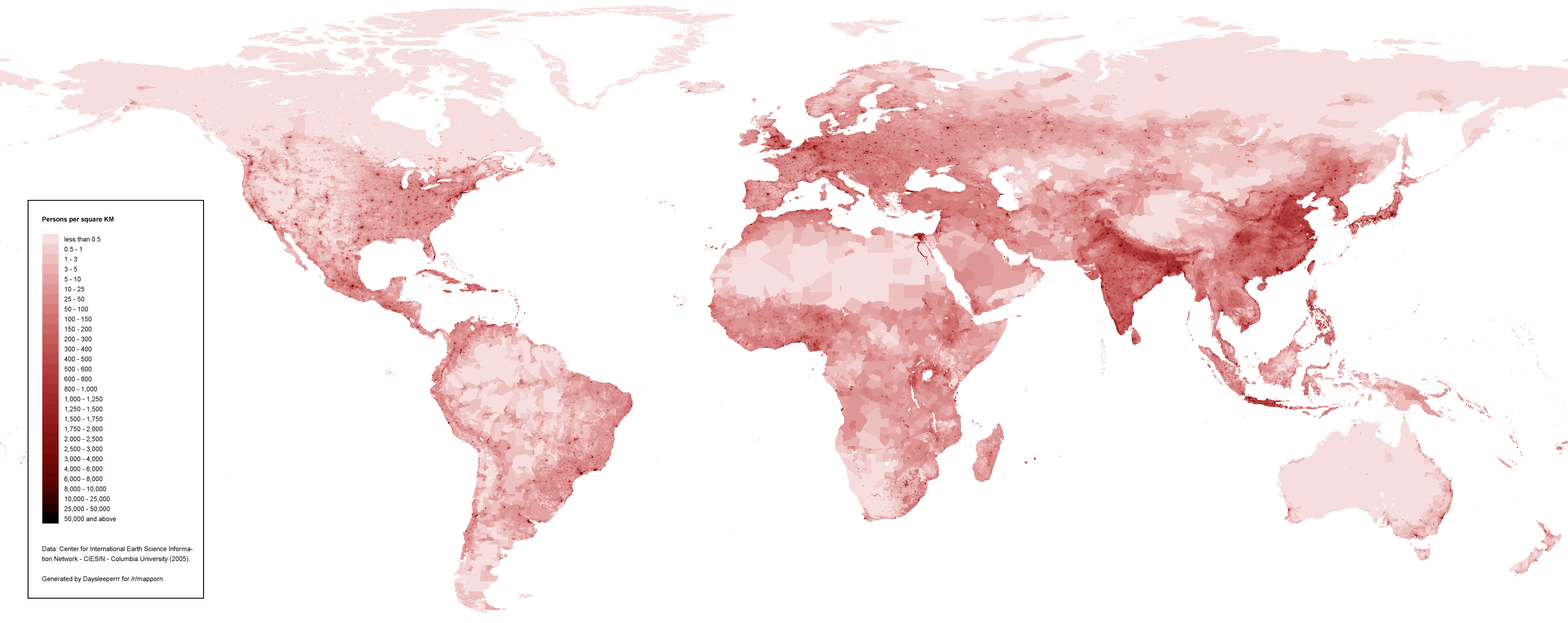
Population Density Map of the World
The "Population Density Map of the World" provides a visual representation of how many people inhabit various regions ac...