urbanization Maps
127 geographic visualizations tagged with "urbanization"
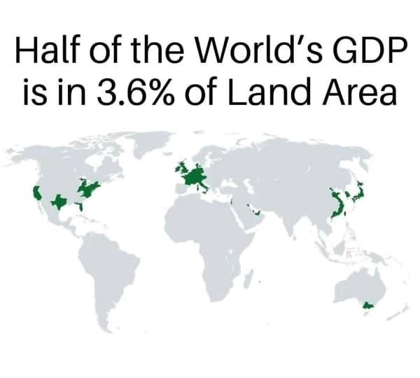
Global Economic Concentration Map
The "Global Economic Concentration Map" illustrates the distribution of economic activity across the globe, highlighting...

Iceland Population Distribution Map
This map illustrates a striking aspect of Iceland's population distribution: the red area represents only 1% of the coun...
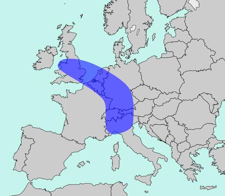
Population Density Map of Europe
The map titled "The Blue Banana" visualizes Europe’s most densely populated corridor, home to approximately 111 million ...
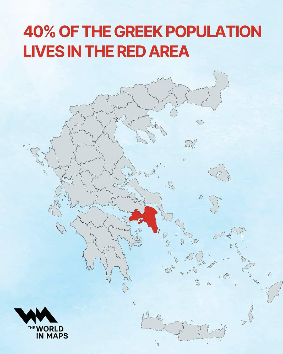
Population Distribution Map of Greece
This map illustrates a striking demographic trend in Greece: approximately 40% of the nation's population resides within...
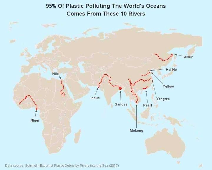
Map of Rivers Contributing to Ocean Plastic
The map titled "95% of Ocean Plastic Originates from These 10 Rivers" highlights the critical role that certain river sy...
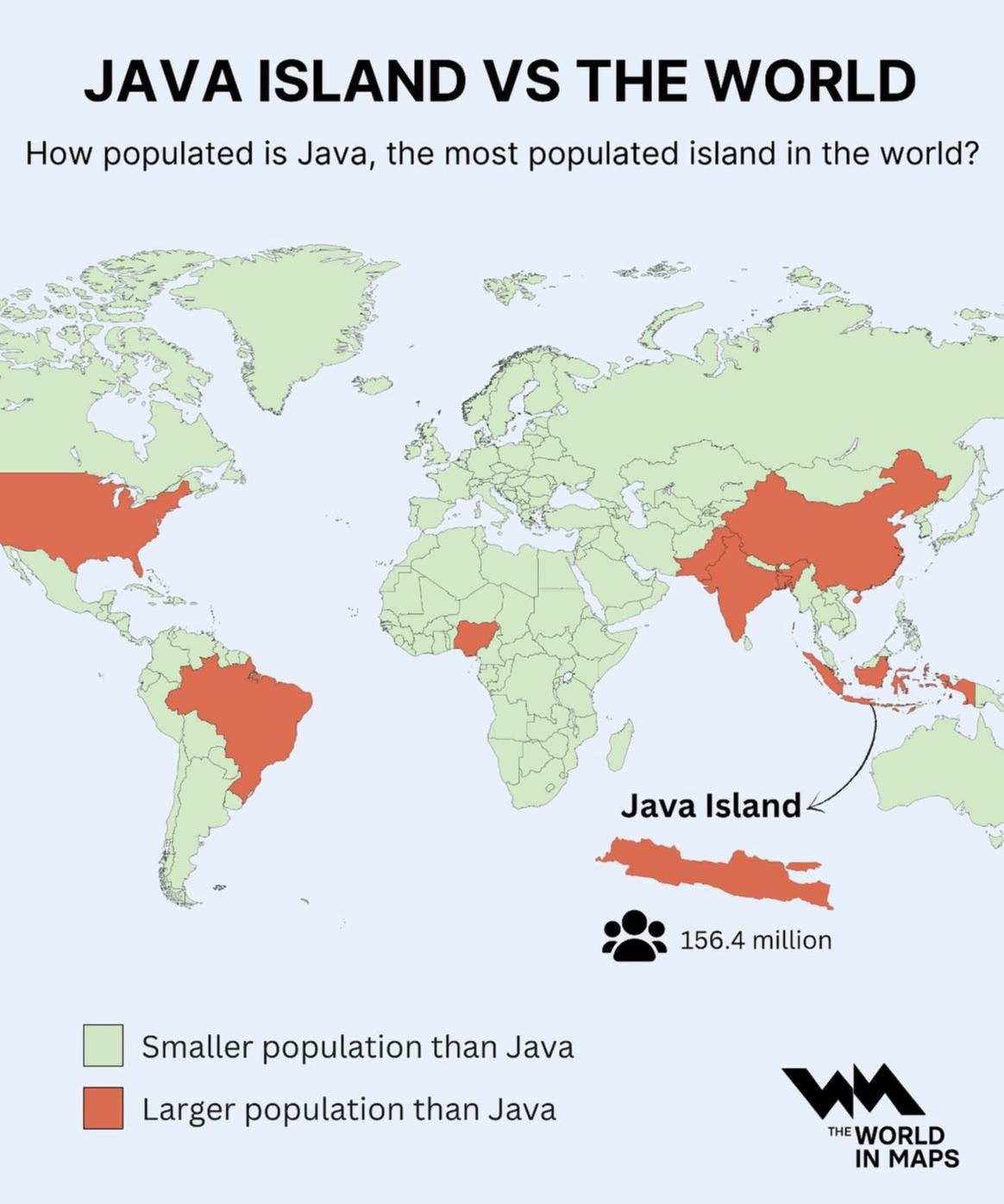
Population Density Map of Java Island
The visualization at hand provides a striking representation of Java Island, illustrating its status as the most populat...
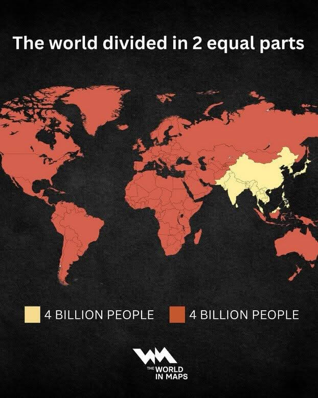
World Population Distribution Map
The 'World Population Distribution Map' effectively visualizes how the global population is divided into two equal parts...
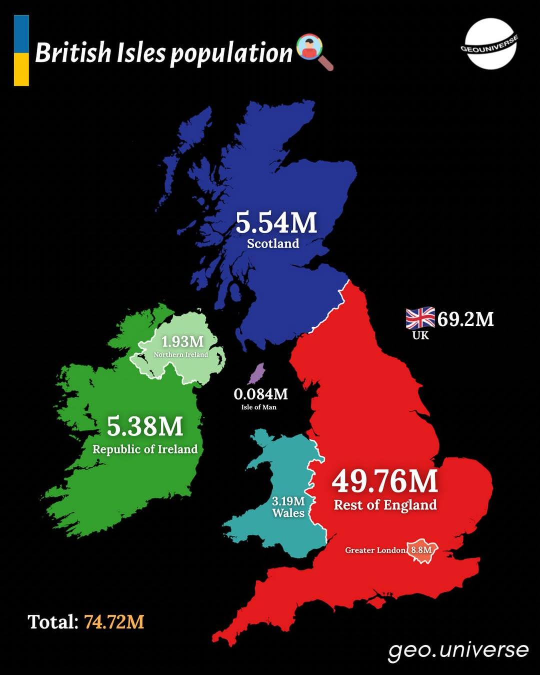
Population Distribution Map of the British Isles
The "British Isles by Population" map presents a detailed visualization of the population distribution across the Britis...
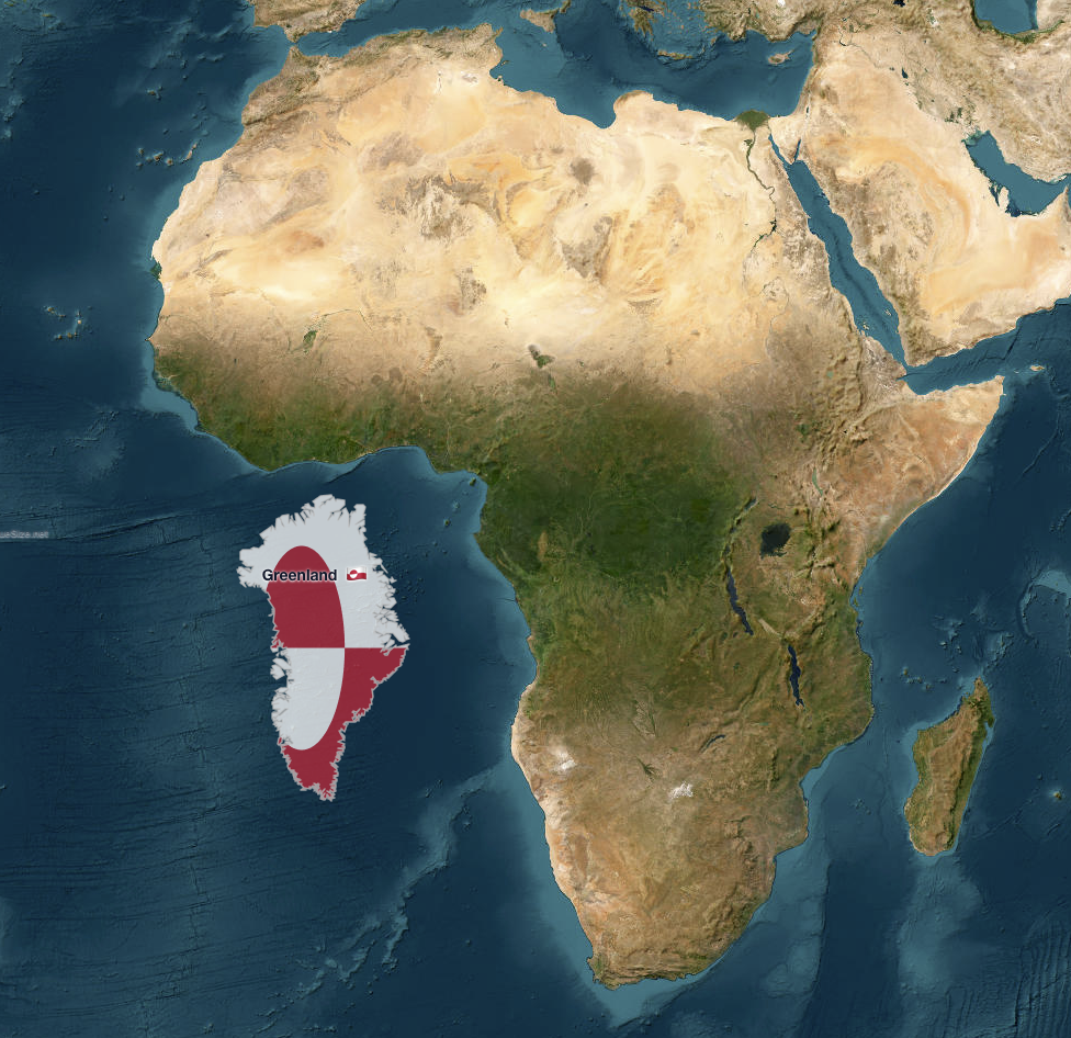
Greenland vs. Africa Size Comparison Map
The map titled "Greenland vs. Africa — the real scale" provides a striking visual comparison of the land areas of Greenl...
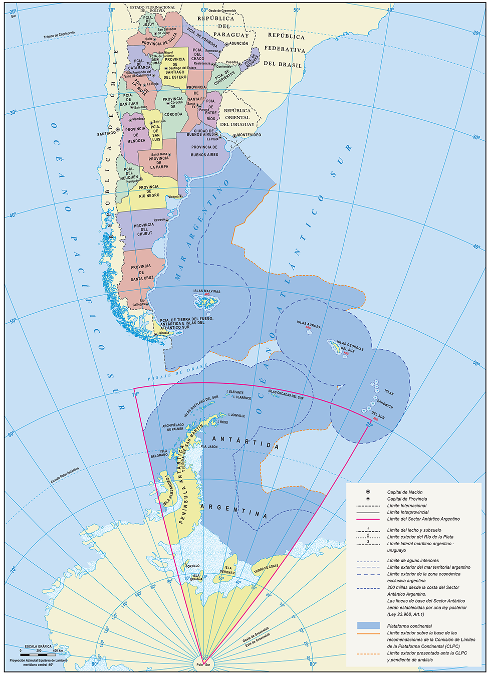
Official Map of the Argentine Republic
The official map of the Argentine Republic provides a comprehensive representation of the country's geographical feature...
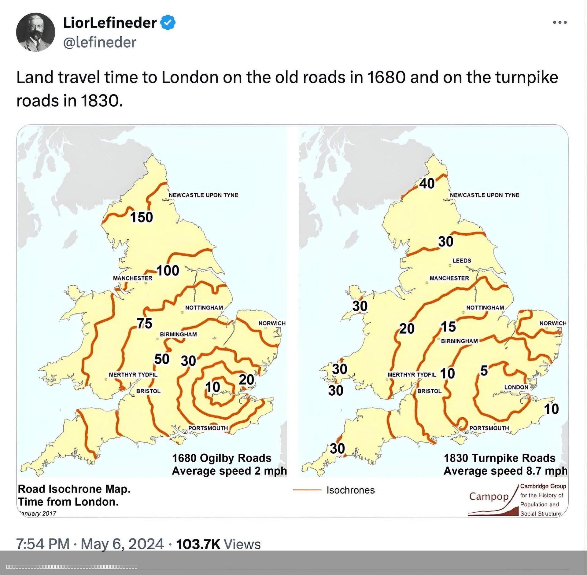
Travel Time to London 1680 vs 1830 Map
The visualization titled "Travel Time to London 1680 vs 1830 Map" illustrates the varying travel times from different re...
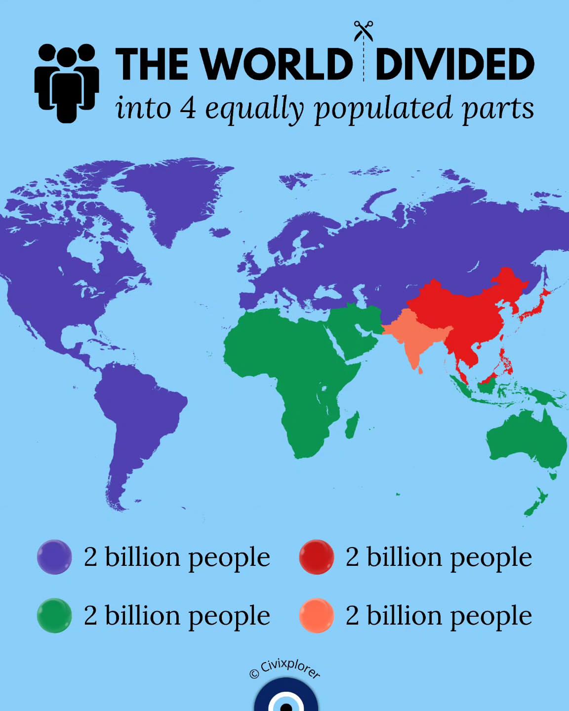
World Population Distribution Map
This map illustrates a fascinating concept: the world divided into four equally populated parts. It visualizes how Earth...
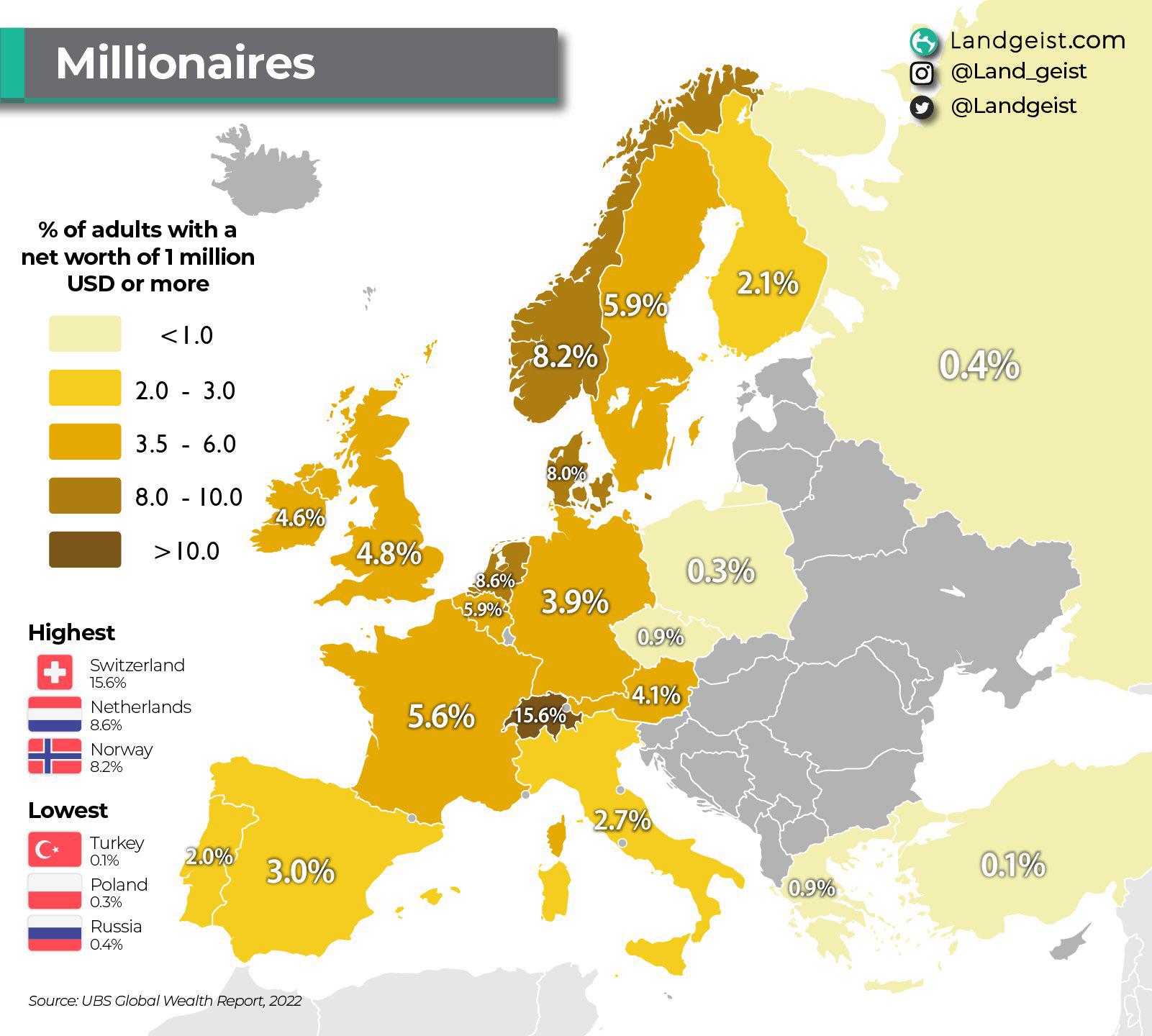
Millionaire Population Percentage Map of Europe
This map visualizes the percentage of millionaires within various European countries, offering a clear perspective on we...
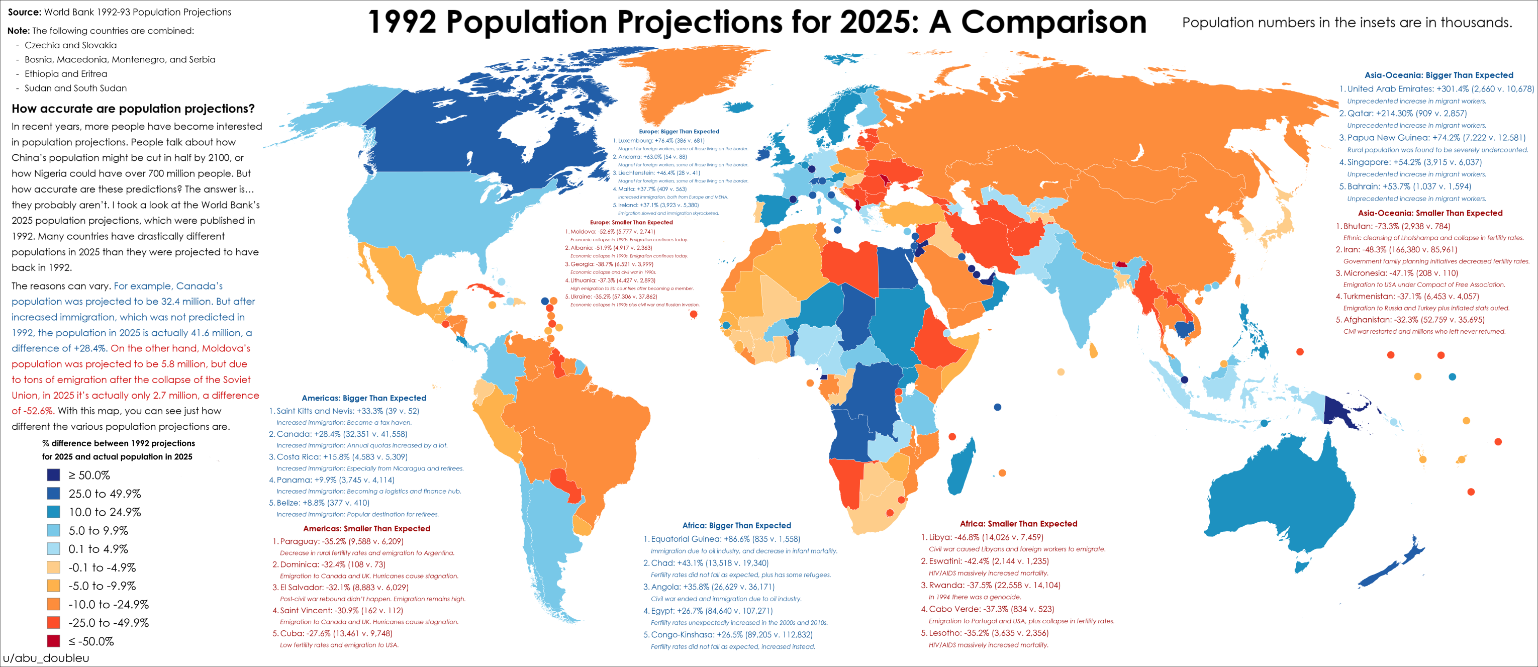
2025 Population Projections Accuracy Map
The map titled "How accurate were 2025 population projections from 1992?" provides a striking visual representation of t...
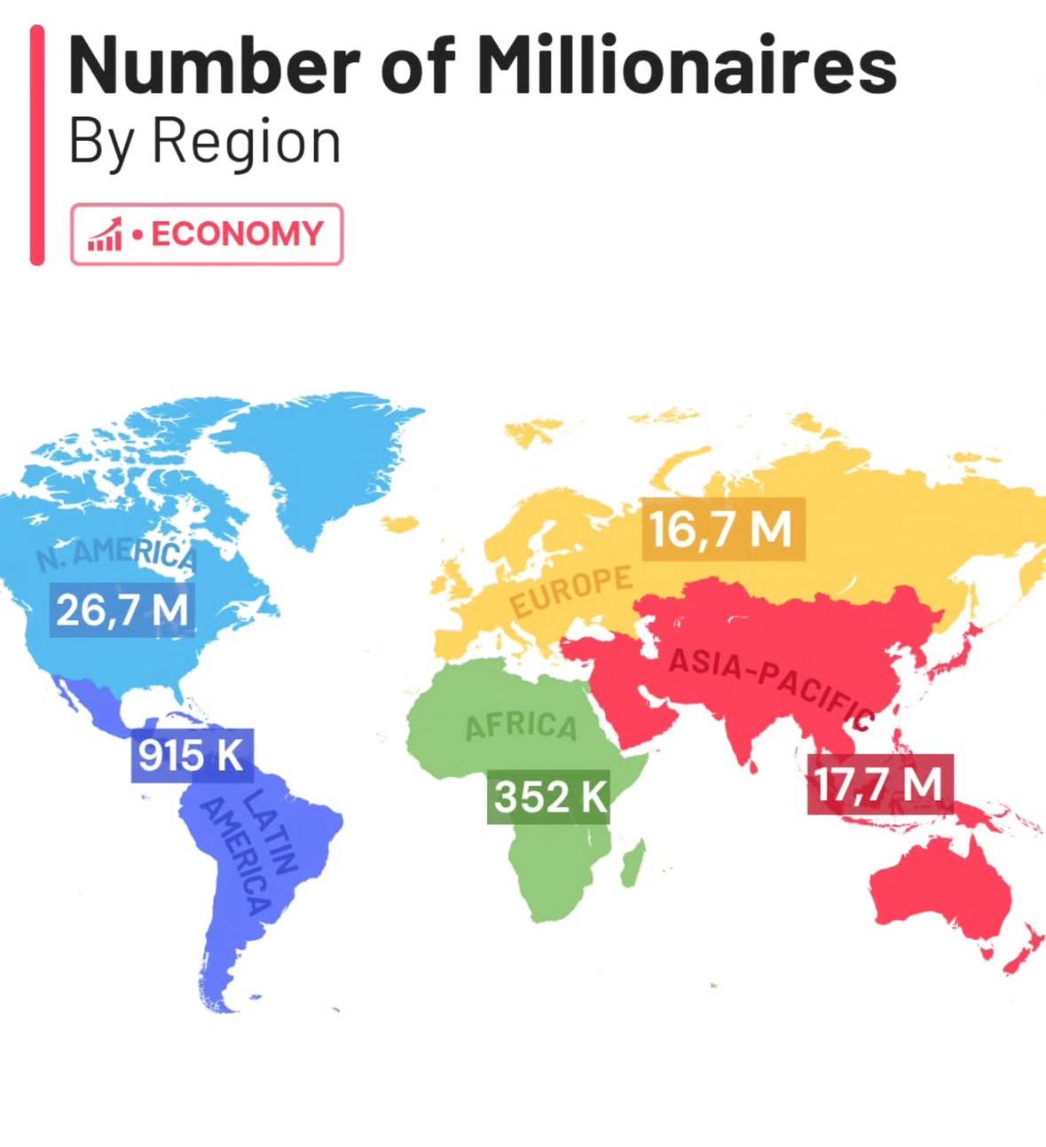
Millionaires by Region Map
The "Millionaires by Region Map" visualizes the distribution of millionaires across various global regions, providing in...
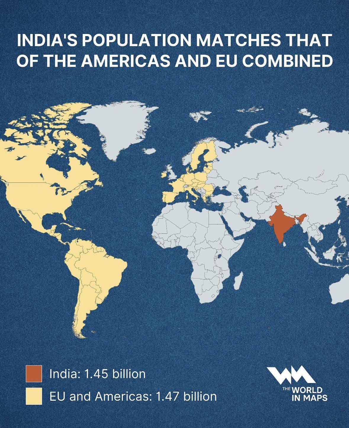
India Population Compared to Americas & EU Map
This map illustrates a striking demographic milestone: India’s population, standing at approximately 1.45 billion, now n...
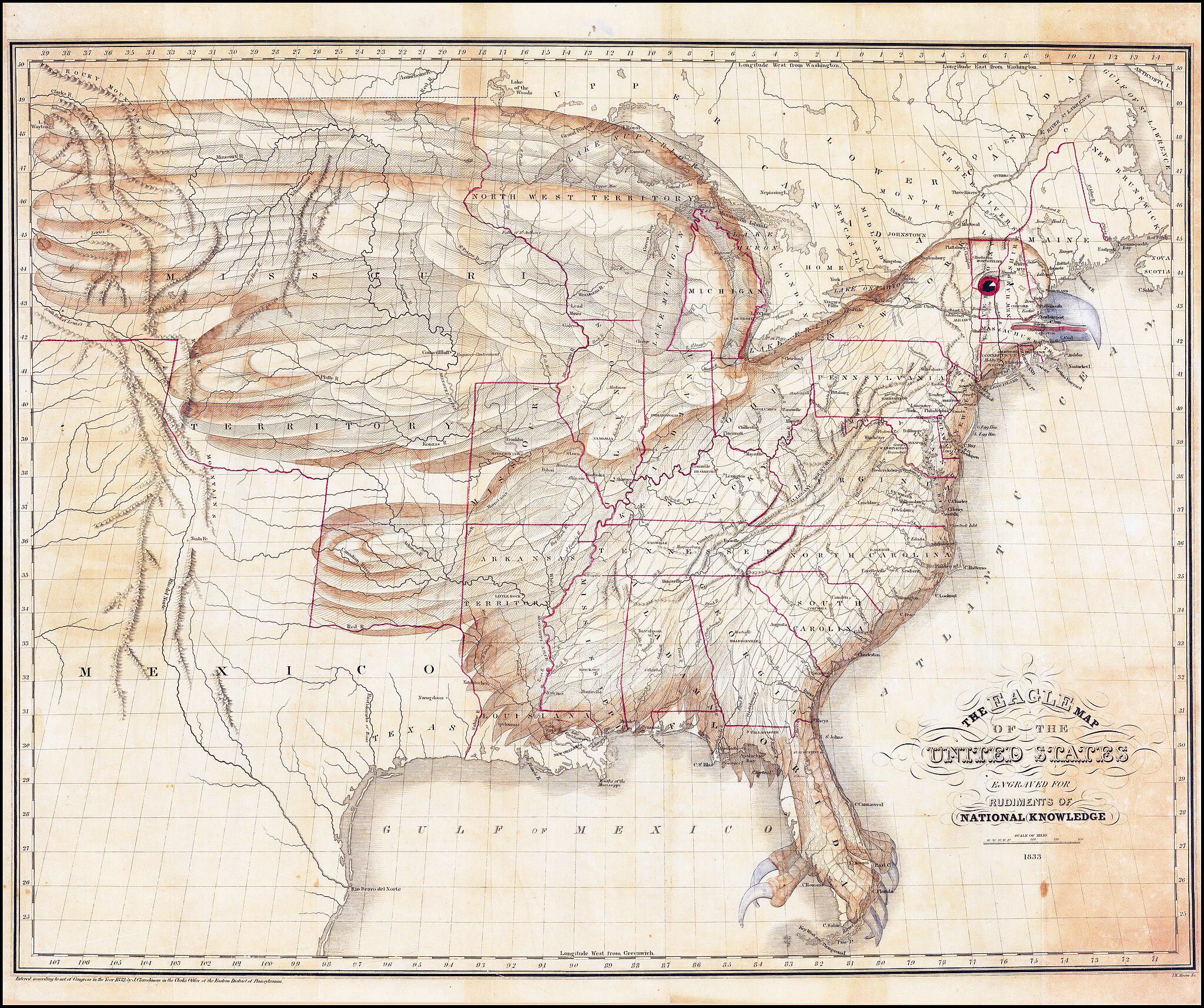
Map of the United States as an Eagle (1833)
The \...
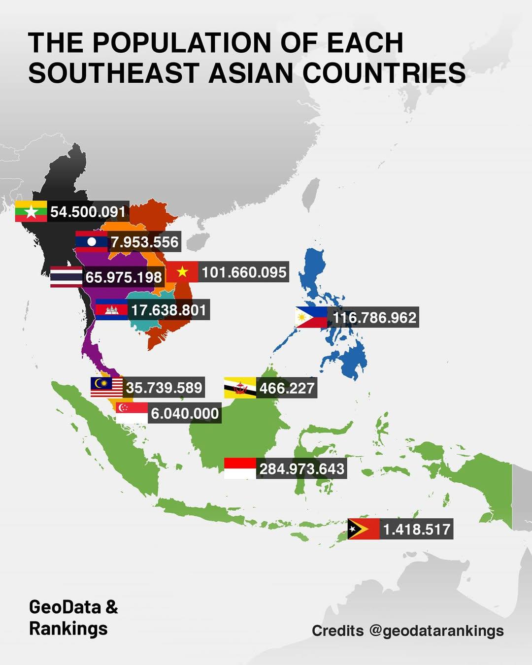
Population Map of Southeast Asian Countries
The "Population Map of Southeast Asian Countries" provides a clear visual representation of the population distribution ...
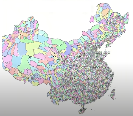
All Counties in China Map
The "All Counties in China Map" provides a comprehensive view of the administrative divisions within the country. It hig...
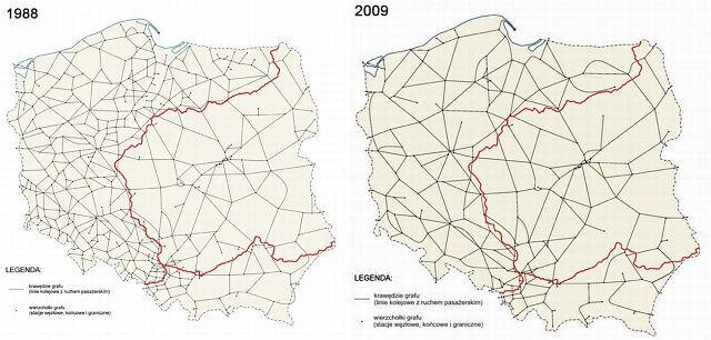
Downgrade of Polish Railway System Map
The "Downgrade of Polish Railway System Map" provides a stark visual representation of the decline in railway infrastruc...
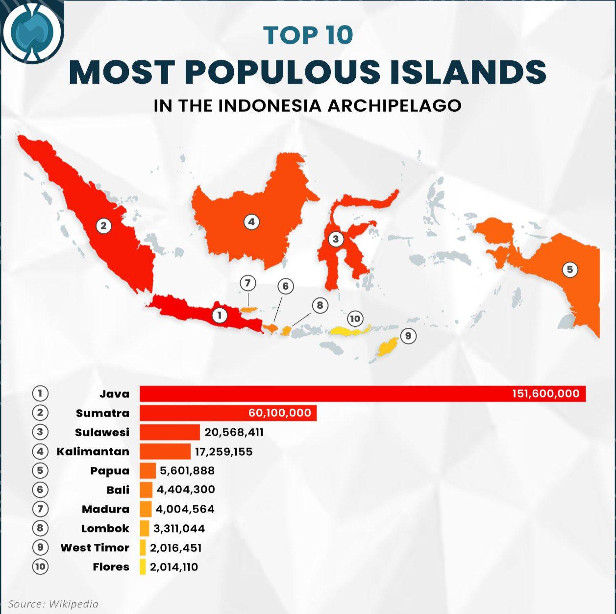
Population Map of Indonesia's Most Populous Islands
The visualization titled "Top 10 Most Populous Islands in the Indonesia Archipelago" provides a clear representation of ...
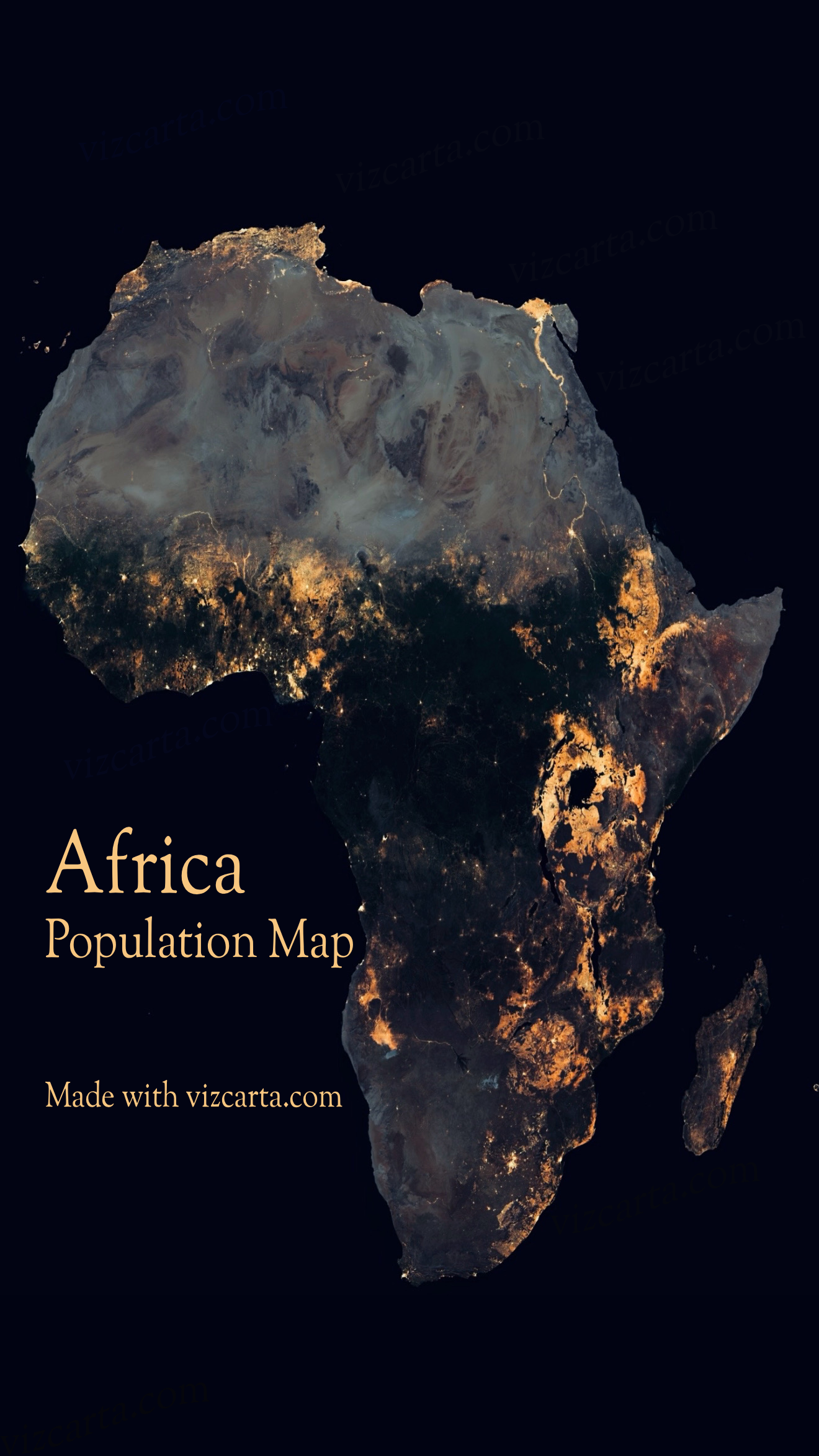
Africa Population Map
The Africa Population Map provides a visual representation of the demographic distribution across the continent. It illu...
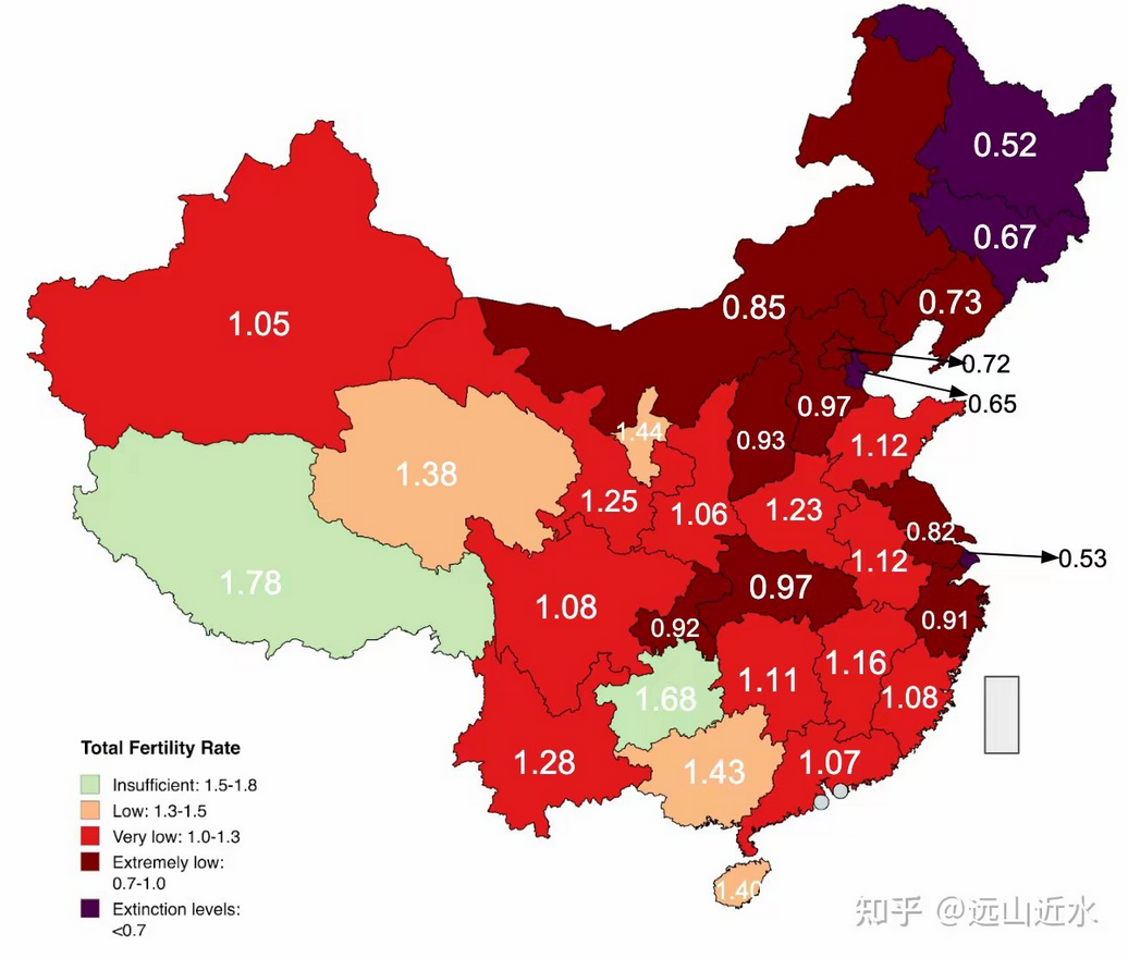
Children per Woman in Chinese Provinces Map
This map visualizes the average number of children born per woman across various provinces in China as of 2023. It provi...
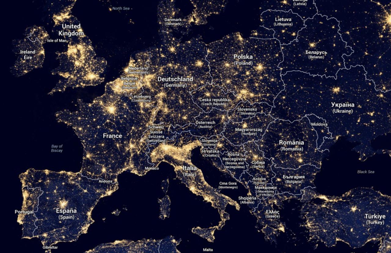
Light Map of Europe
The 'Light Map of Europe' provides a stunning visual representation of nighttime illumination levels across the continen...
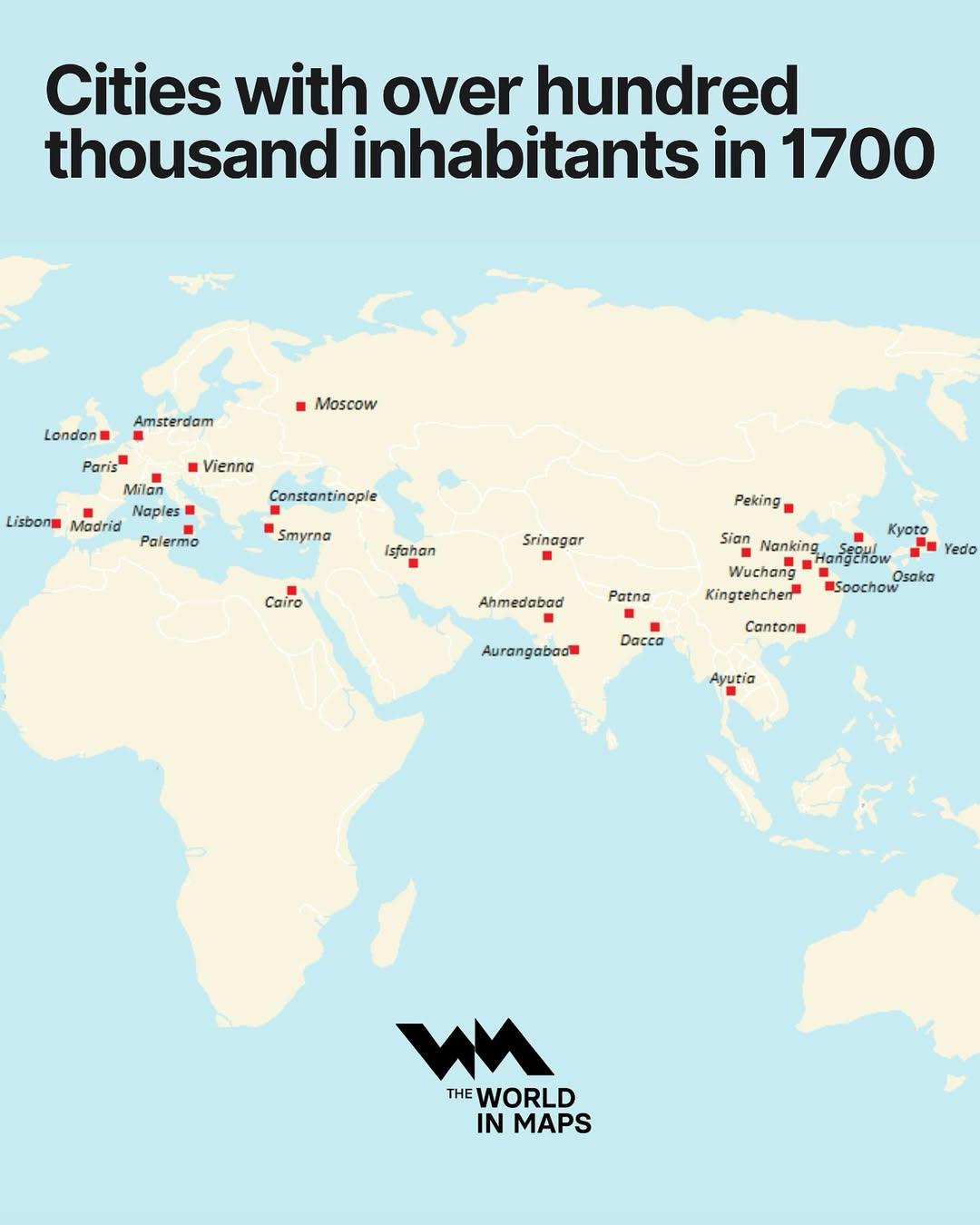
Cities with Over 100,000 Inhabitants in 1700 Map
The "Cities with Over 100,000 Inhabitants in 1700 Map" provides a fascinating glimpse into urbanization during the early...
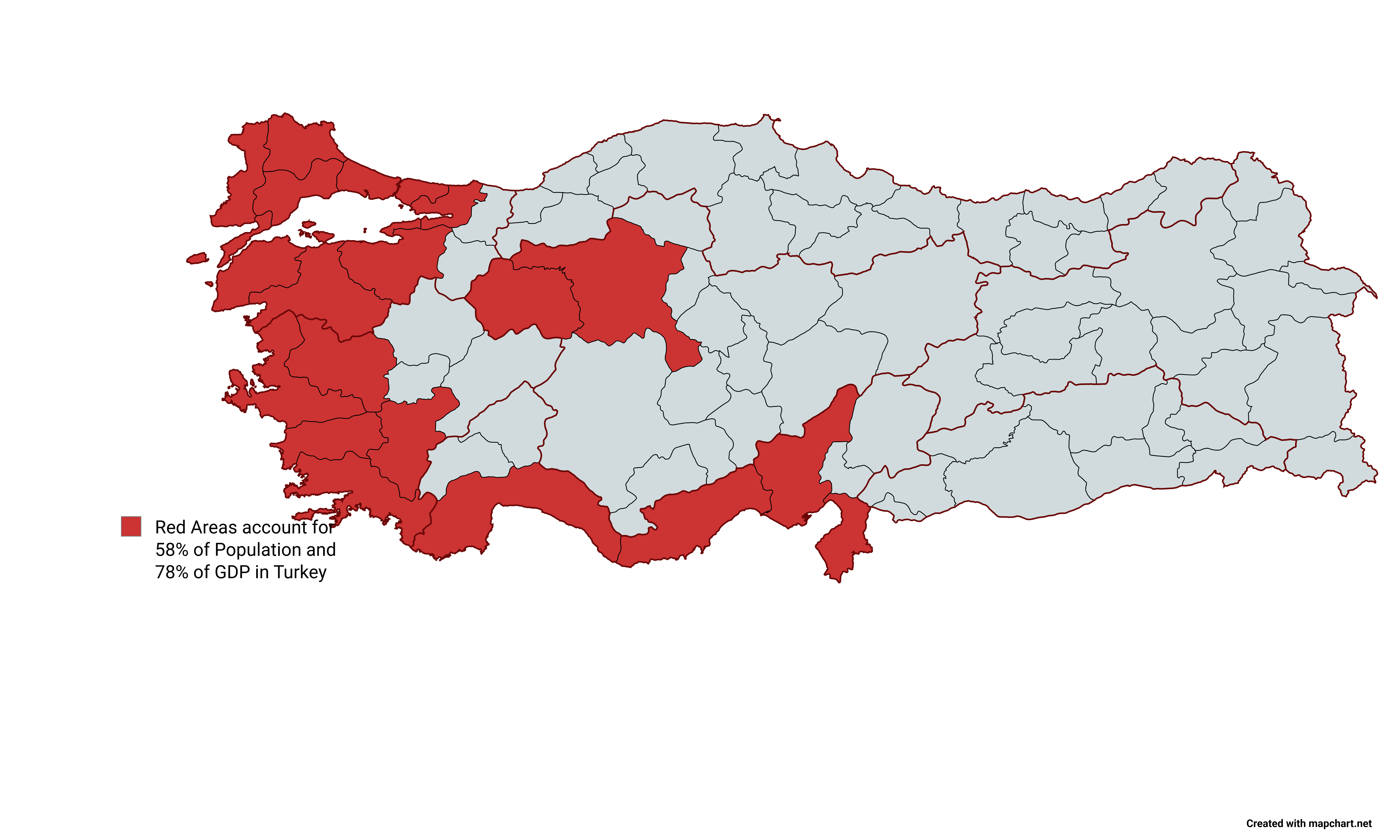
Turkey Population and GDP Distribution Map
The map titled "Red Areas Accounts for 58% of Population and 78% of GDP in Turkey" visually represents the distribution ...
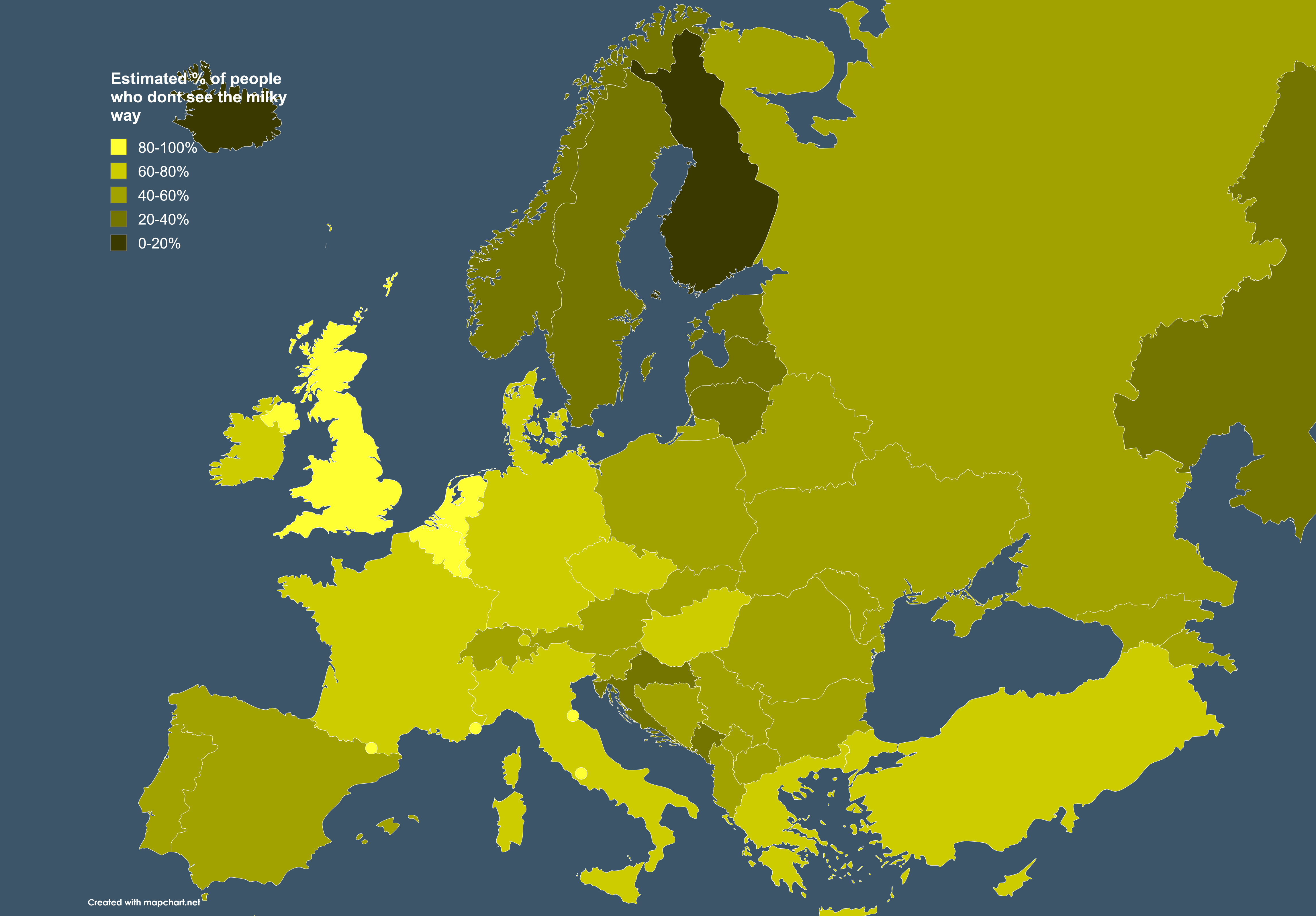
Map of Estimated % of People Who Don't See the Milky Way
Research indicates that about 80% of the world's population lives in areas with significant light pollution, making it n...
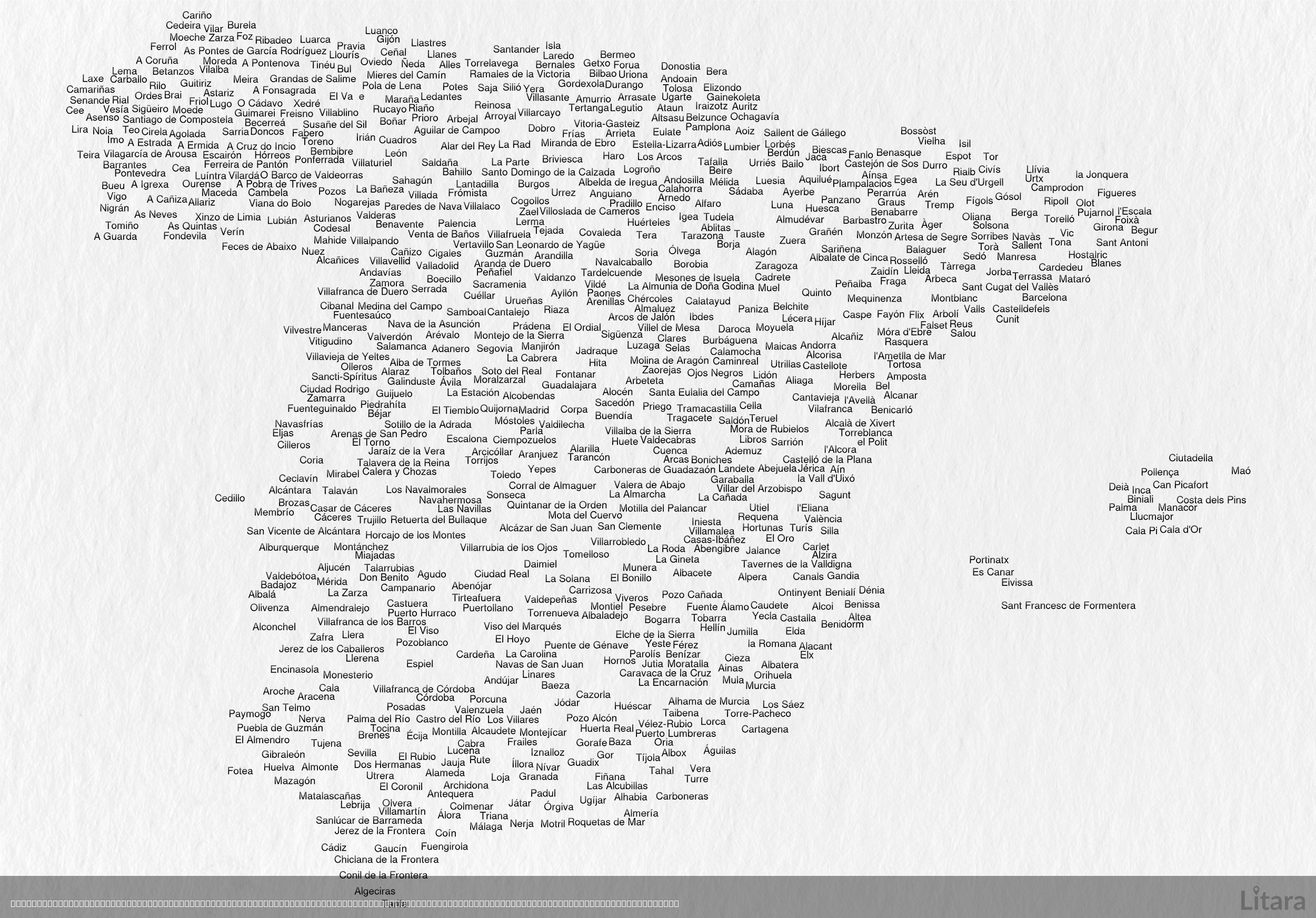
Typographic Map of Spain's Cities and Towns
This intriguing typographic map of Spain creatively illustrates the country's geographic shape using the names of hundre...
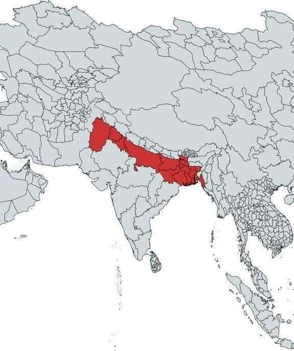
Global Population Distribution Map
The map highlights a significant area in red, representing approximately 890 million people, which is about 11% of the w...
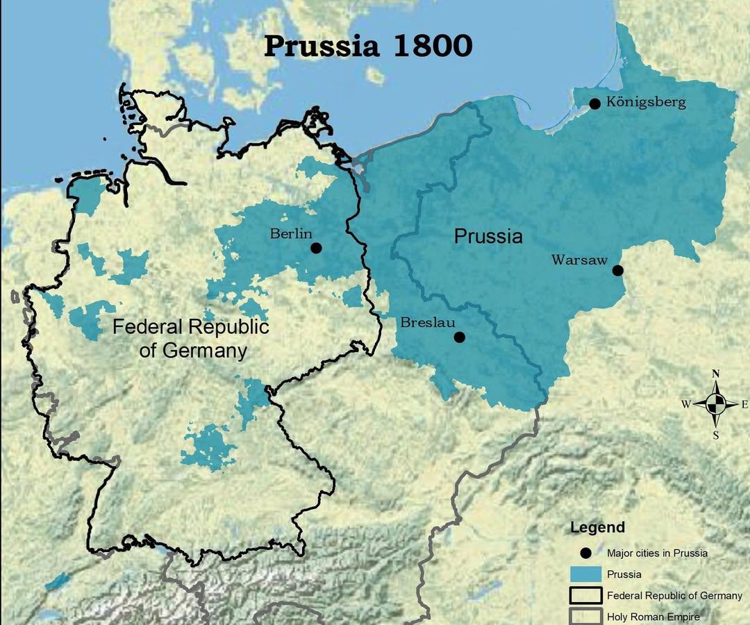
Map of Prussia in 1800 Compared to Modern Germany
The visualization titled "The Kingdom of Prussia in 1800 vs Modern Germany" presents a compelling juxtaposition of histo...
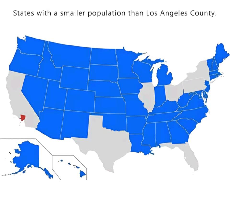
World Population Distribution Map
The "World Population Distribution Map" visualizes where people live across the globe, highlighting the density of popul...
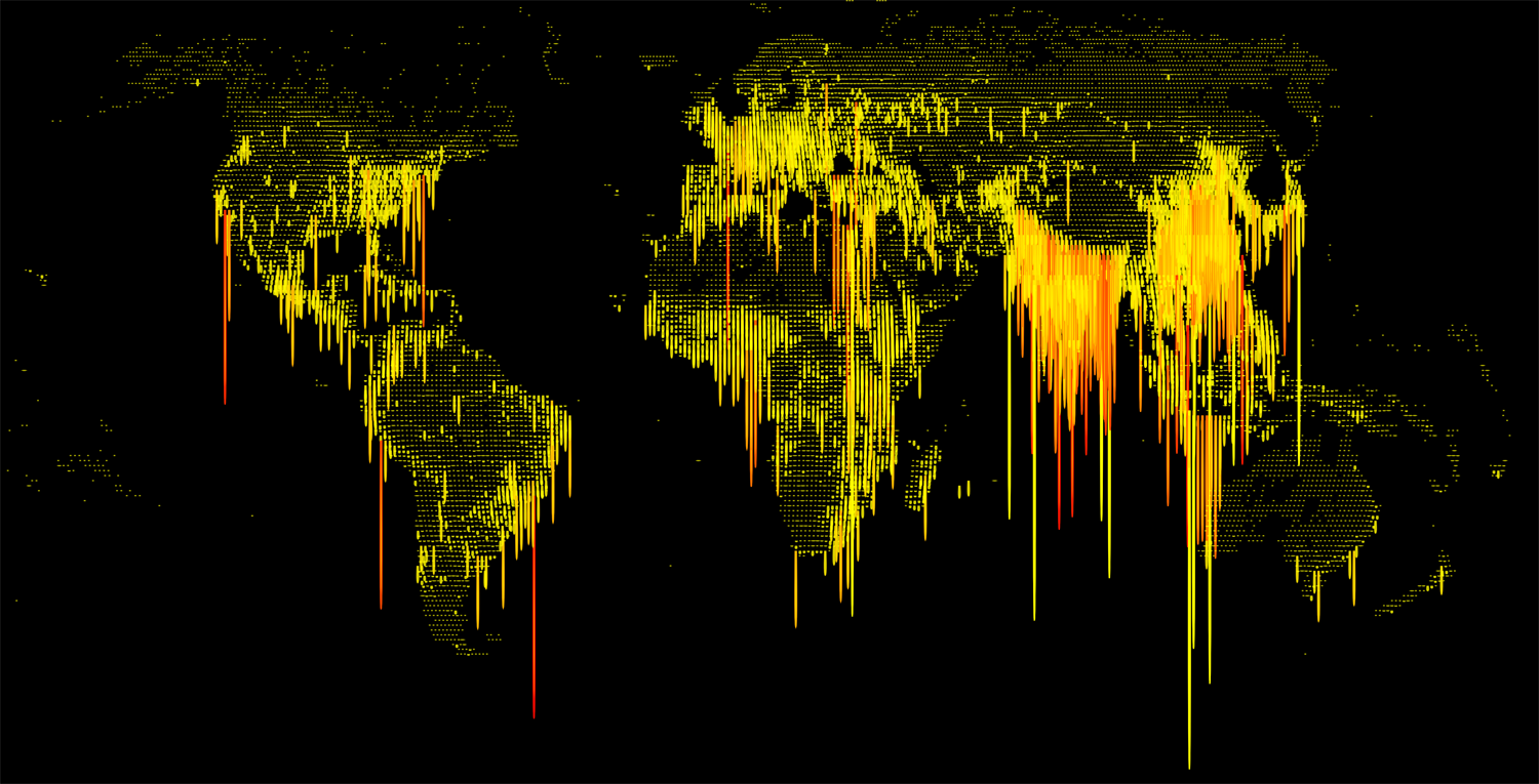
World Population Density Map
This visualization displays the population density of various regions across the globe, illustrating how many people inh...
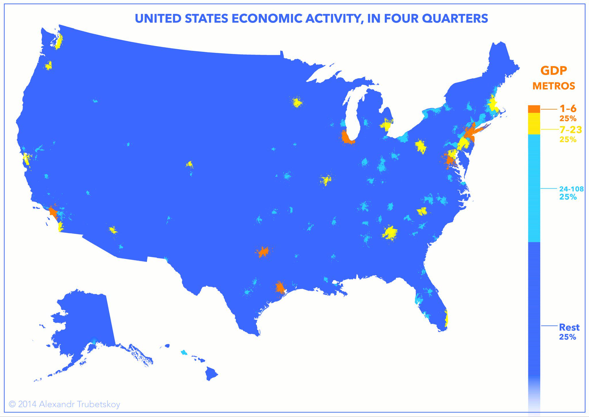
Economic Activity in Cities Map
The "Economies Live in Cities" map provides a visual representation of economic activity concentrated within urban areas...
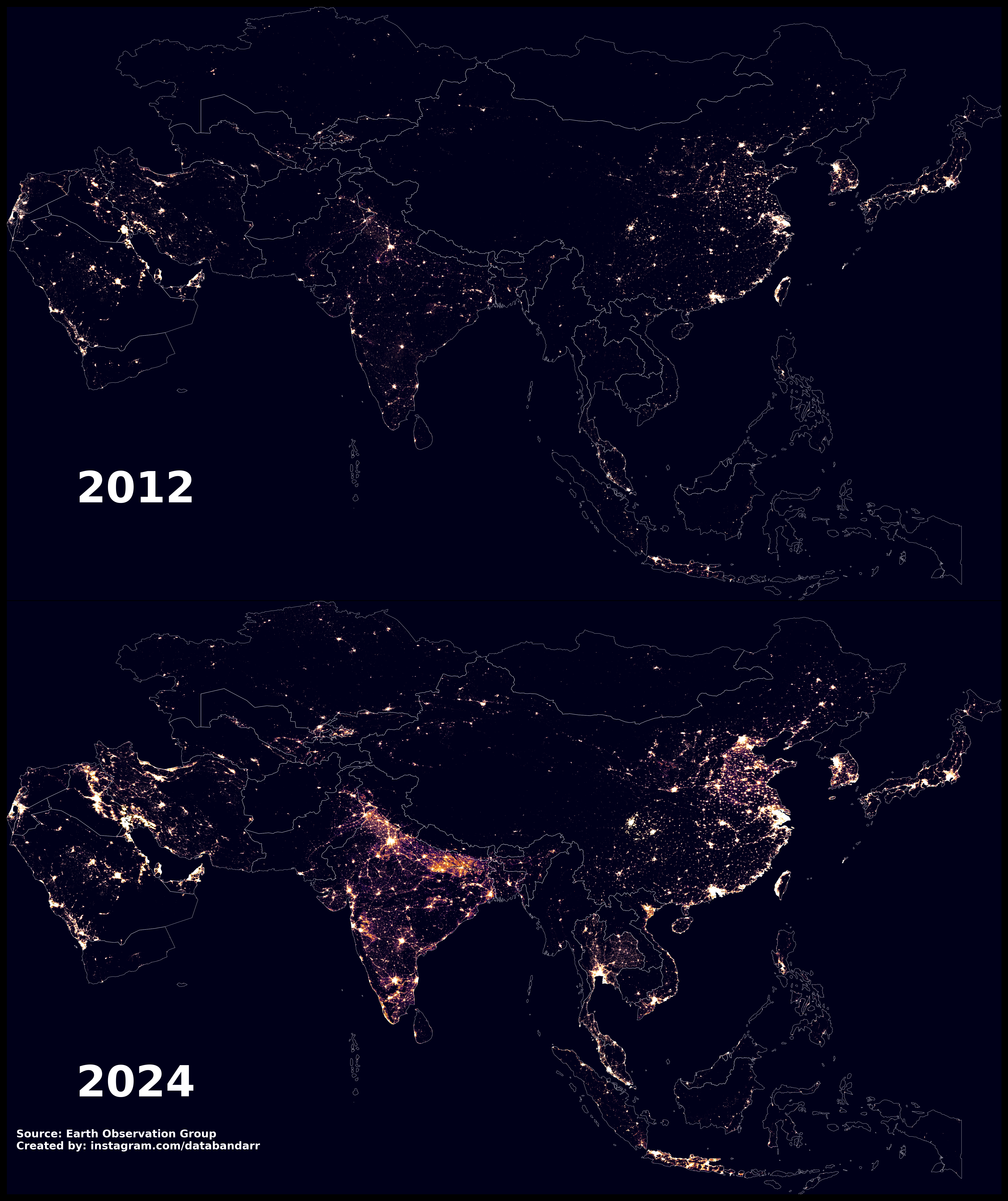
Night-time Light Map of Asia 2012 vs 2024
The "Night-time Light in Asia, 2012 vs 2024" map presents a striking visual comparison of light emissions across various...
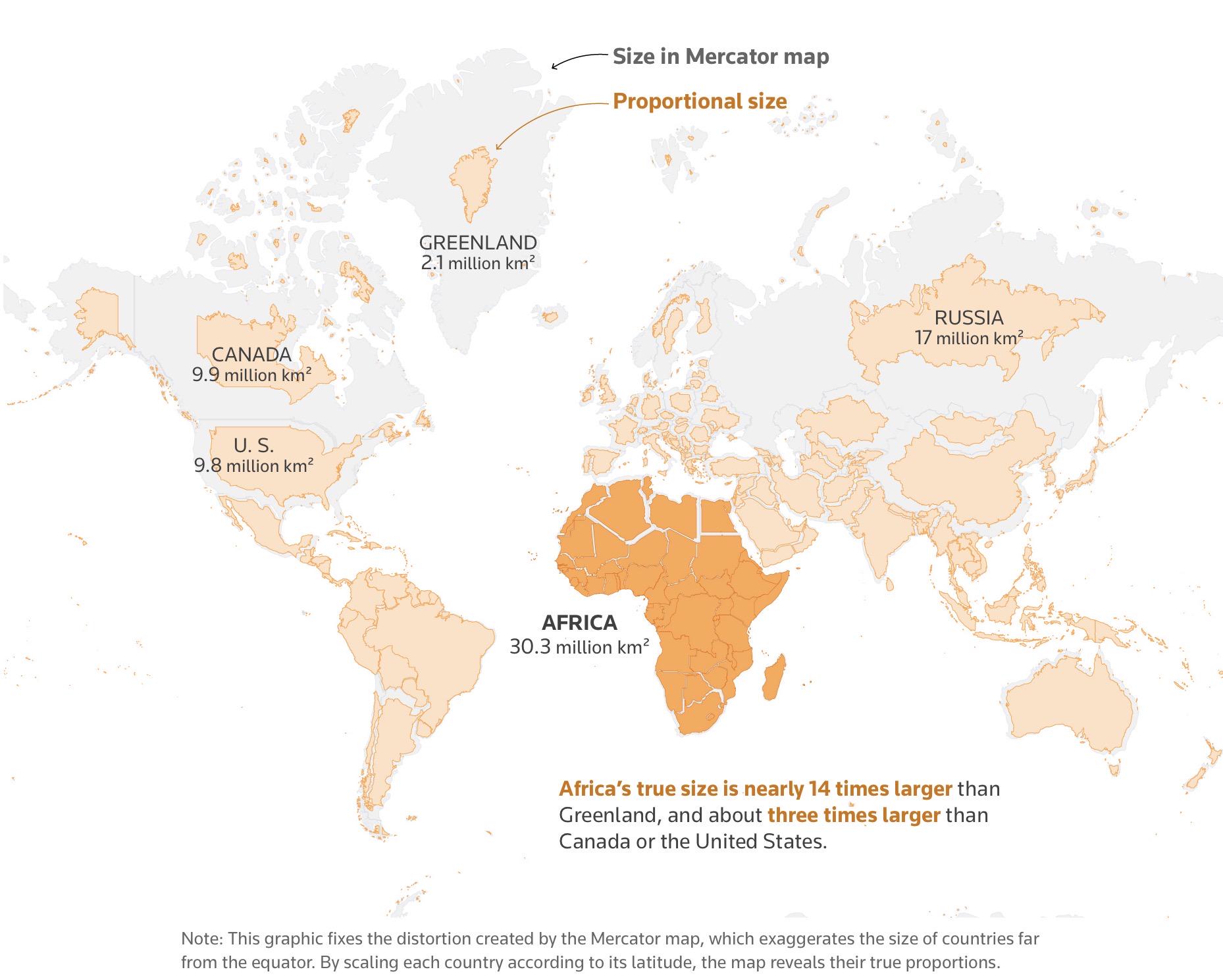
The True Size of Africa Map
The visualization titled "The True Size of Africa" challenges common misconceptions about the size of Africa relative to...
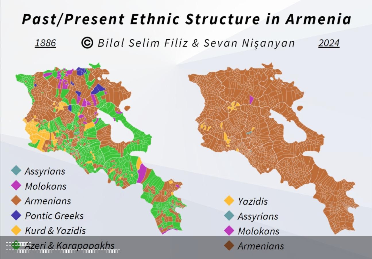
Past Present Ethnic Structure in Armenia Map
The "Past/Present Ethnic Structure in Armenia" Map provides an insightful visualization of the ethnic composition of Arm...
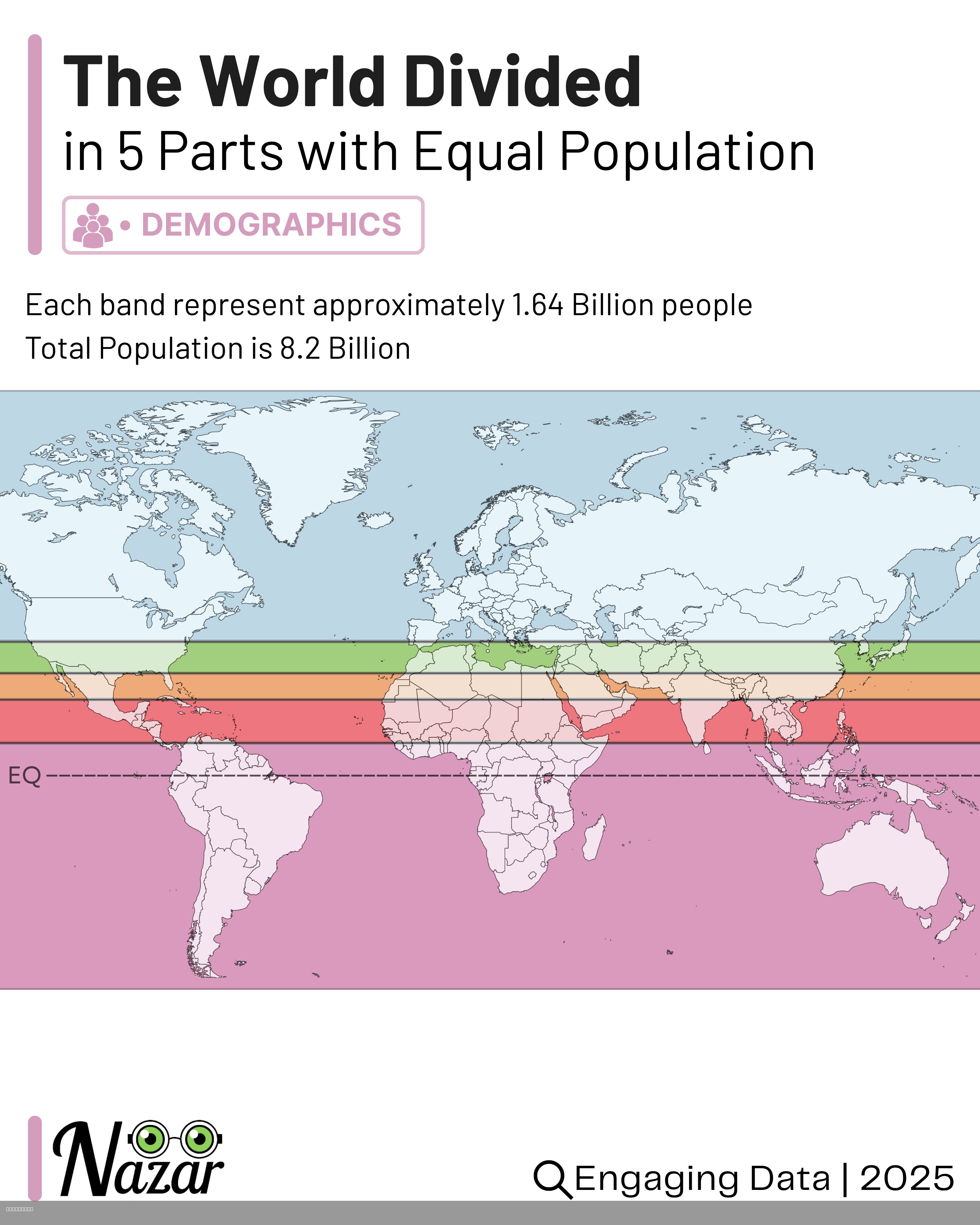
World Population Distribution Map by Equal Parts
This map visualizes the world’s population divided into five horizontal bands, each containing approximately 1.64 billio...
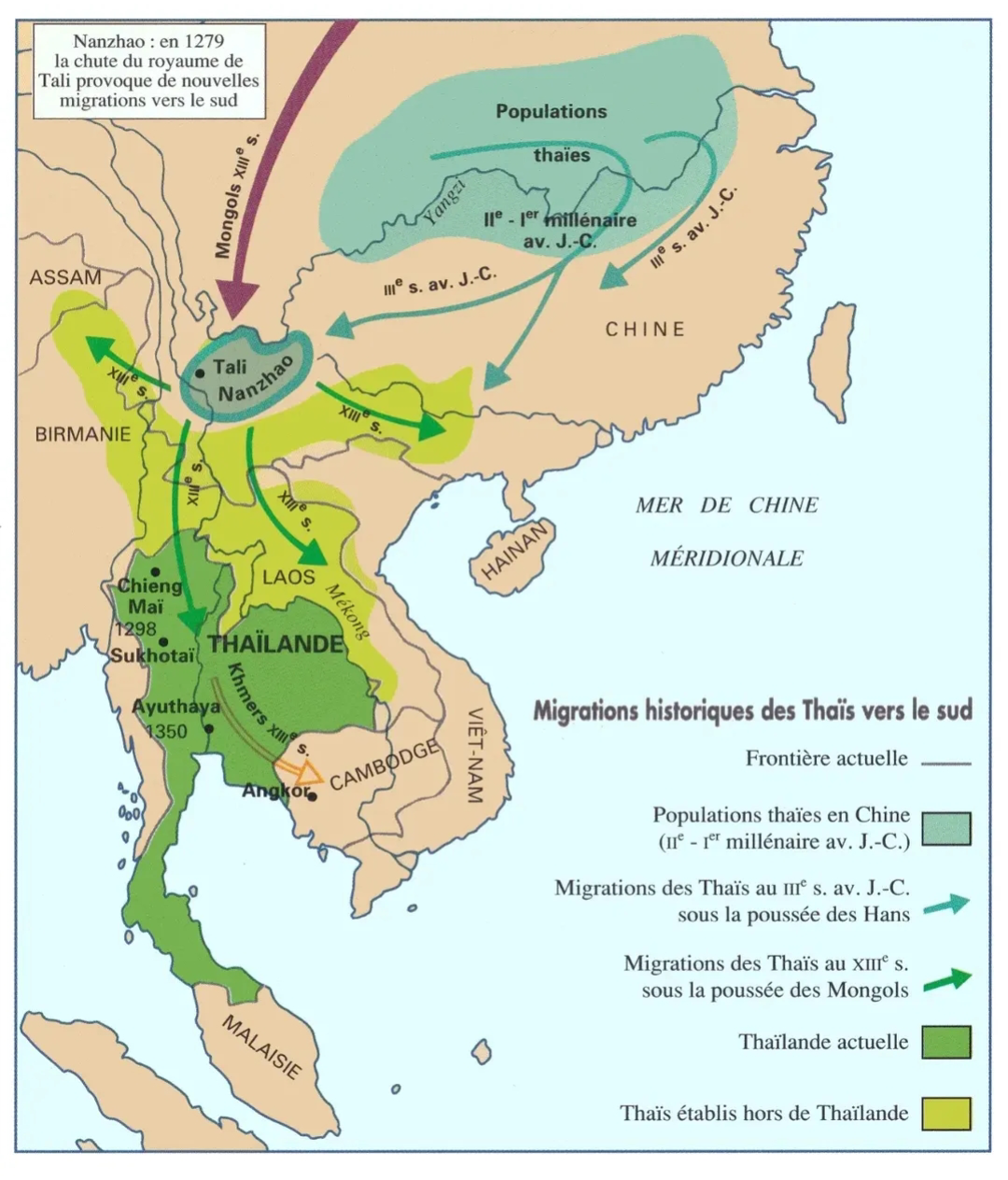
Migration of Thai People to the South Map
This map illustrates the migration patterns of the Thai people towards the southern regions of Thailand. It highlights k...
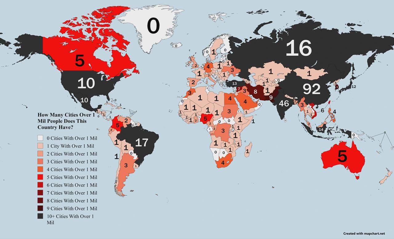
Countries Ranked by Cities with 1M+ Population Map
The visualization titled "Countries Ranked by Number of Cities with 1M+ Population Map" provides a clear representation ...
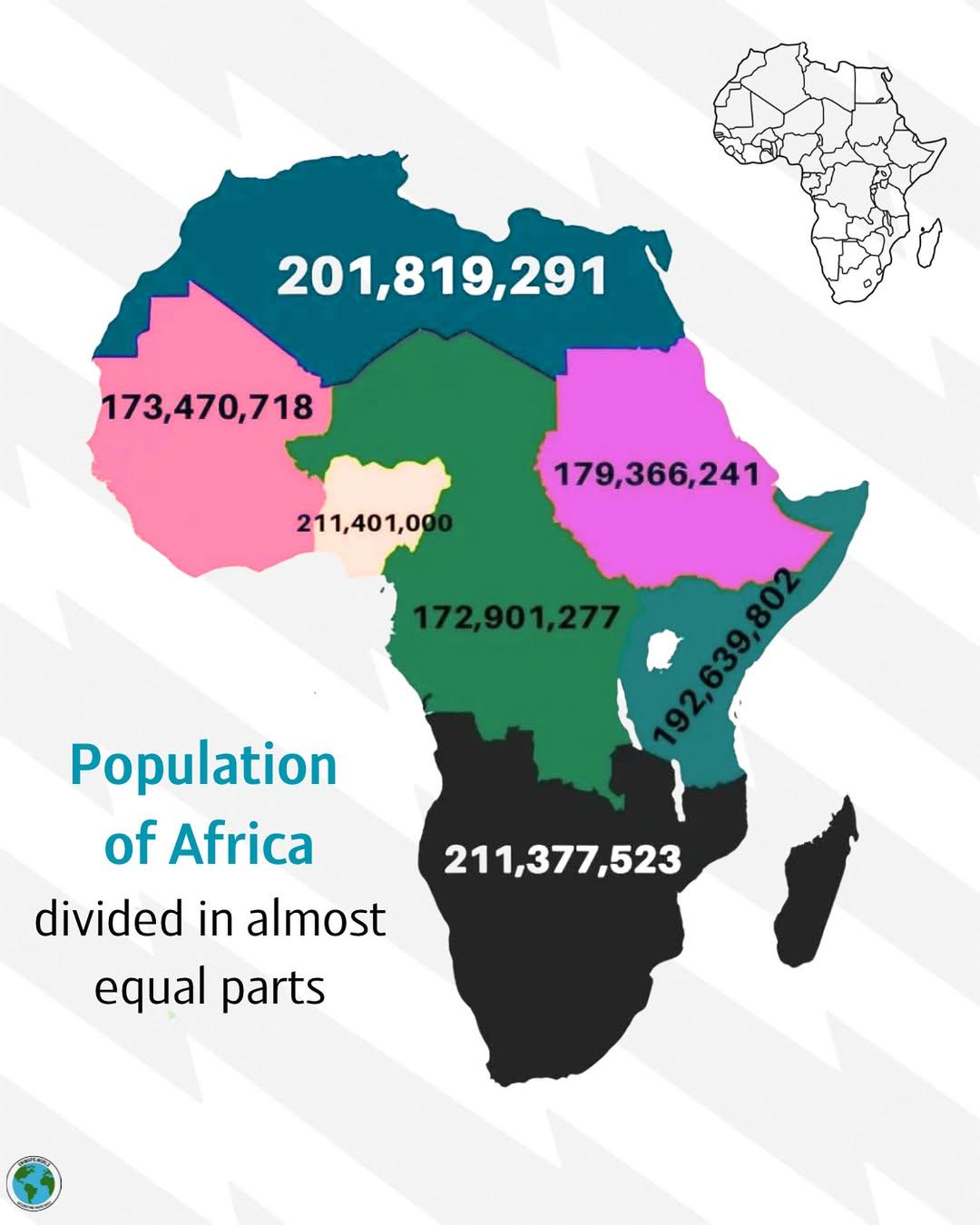
Population Distribution Map of Africa
The visualization titled \...
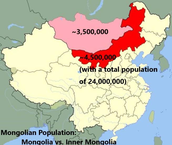
Population Map of Mongolia and Inner Mongolia
This map provides a visual representation of the population distribution between Mongolia and Inner Mongolia, a region o...
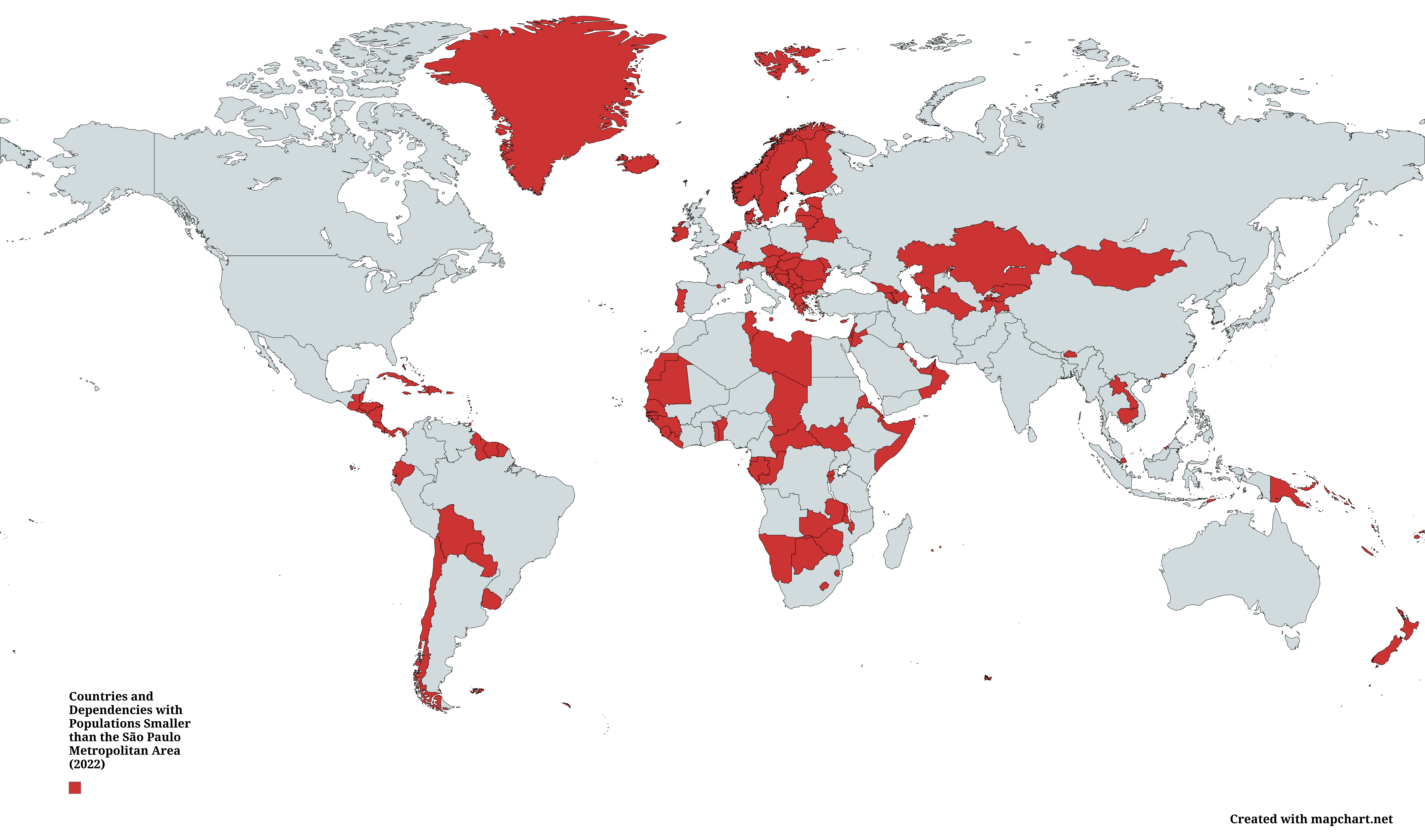
Countries with Populations Smaller than São Paulo Map
This map illustrates a fascinating comparison of countries and dependent territories whose total populations were smalle...
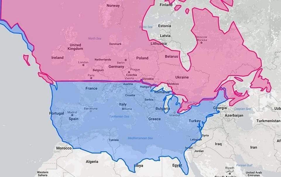
Latitude Map of United States, Canada, and Europe
The visualization titled "United States & Canada in same latitude w/ Europe" highlights the parallels of latitude that c...
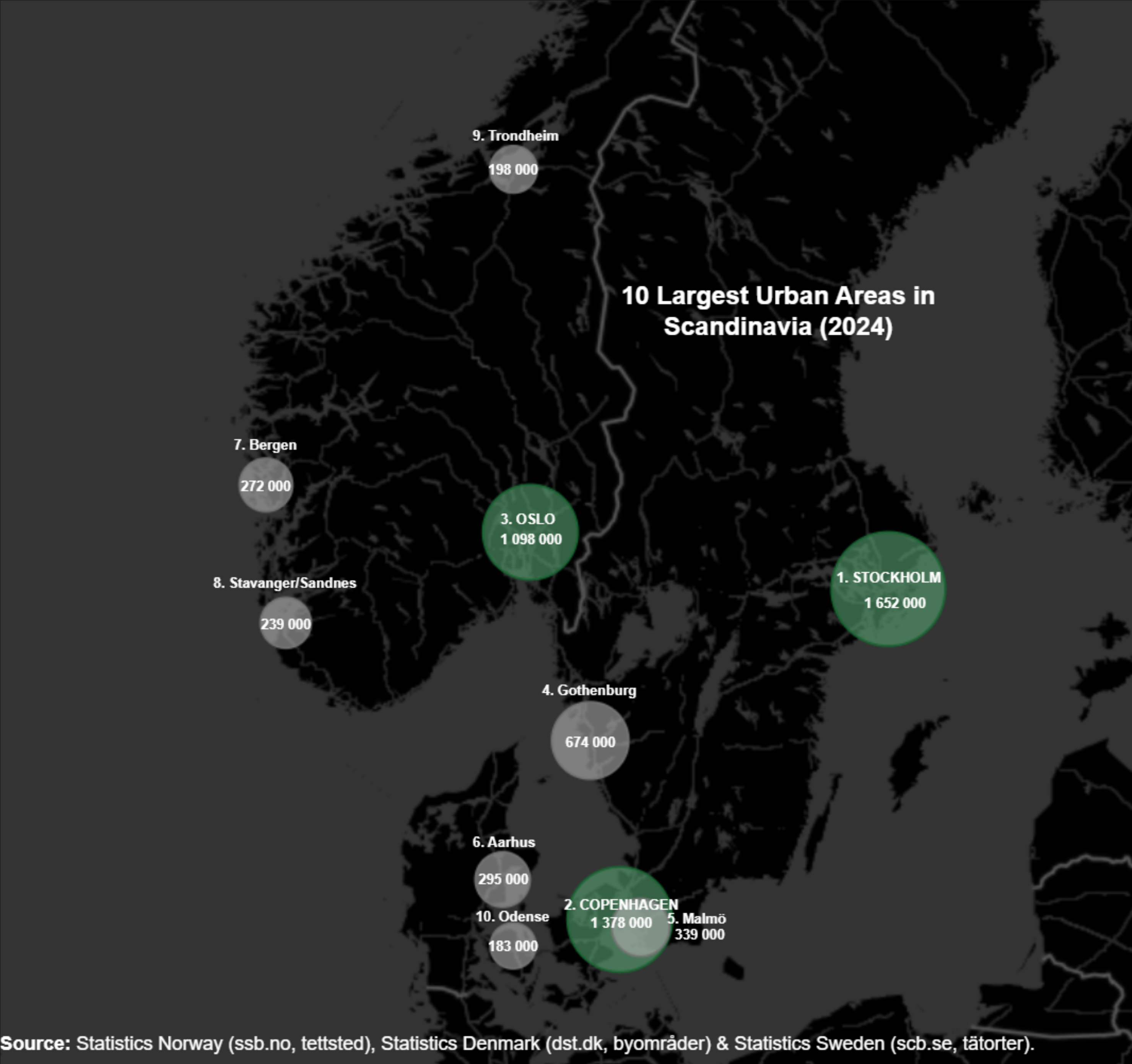
Largest Cities in Scandinavia Map
Scandinavia has experienced a steady increase in urban population over the past few decades. For instance, Stockholm, th...
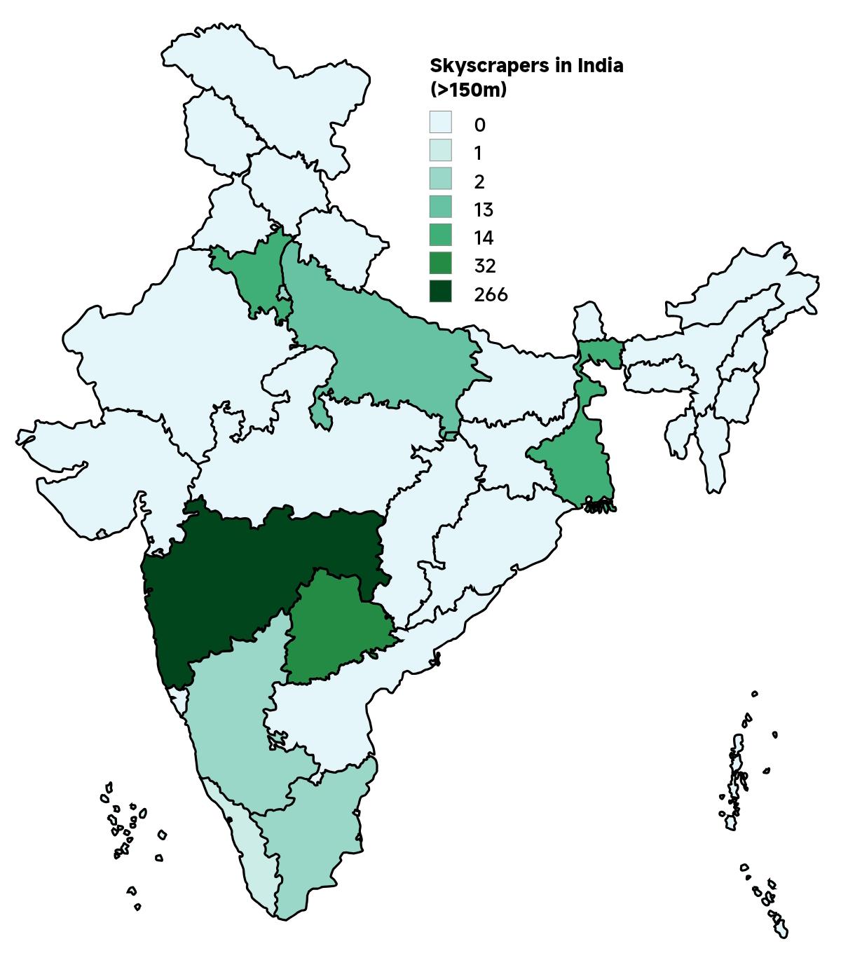
Skyscrapers in India Map 2025
The "Skyscrapers in India Map 2025" provides a comprehensive visualization of the country's towering architectural achie...
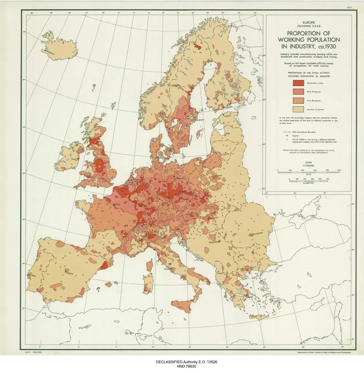
Map of Working Population in Industry in 1930s Europe
The map titled "Proportion of the Working Population Working in Industry in Europe in the 1930s" offers a fascinating gl...
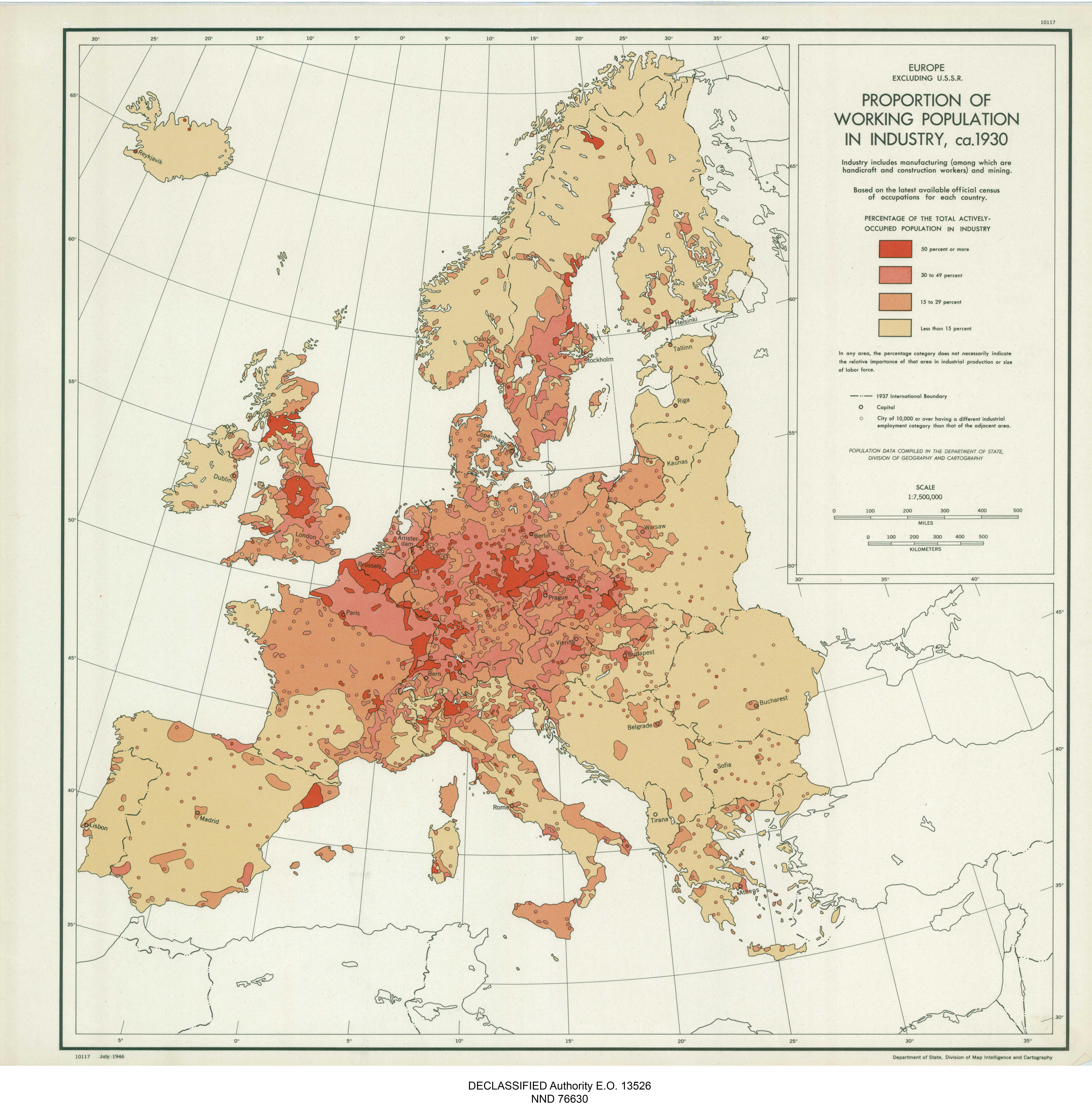
Europe Working Population in Industry Map
The map titled "Europe Proportion of Working Population in Industry, ca. 1930" offers a fascinating glimpse into the ind...
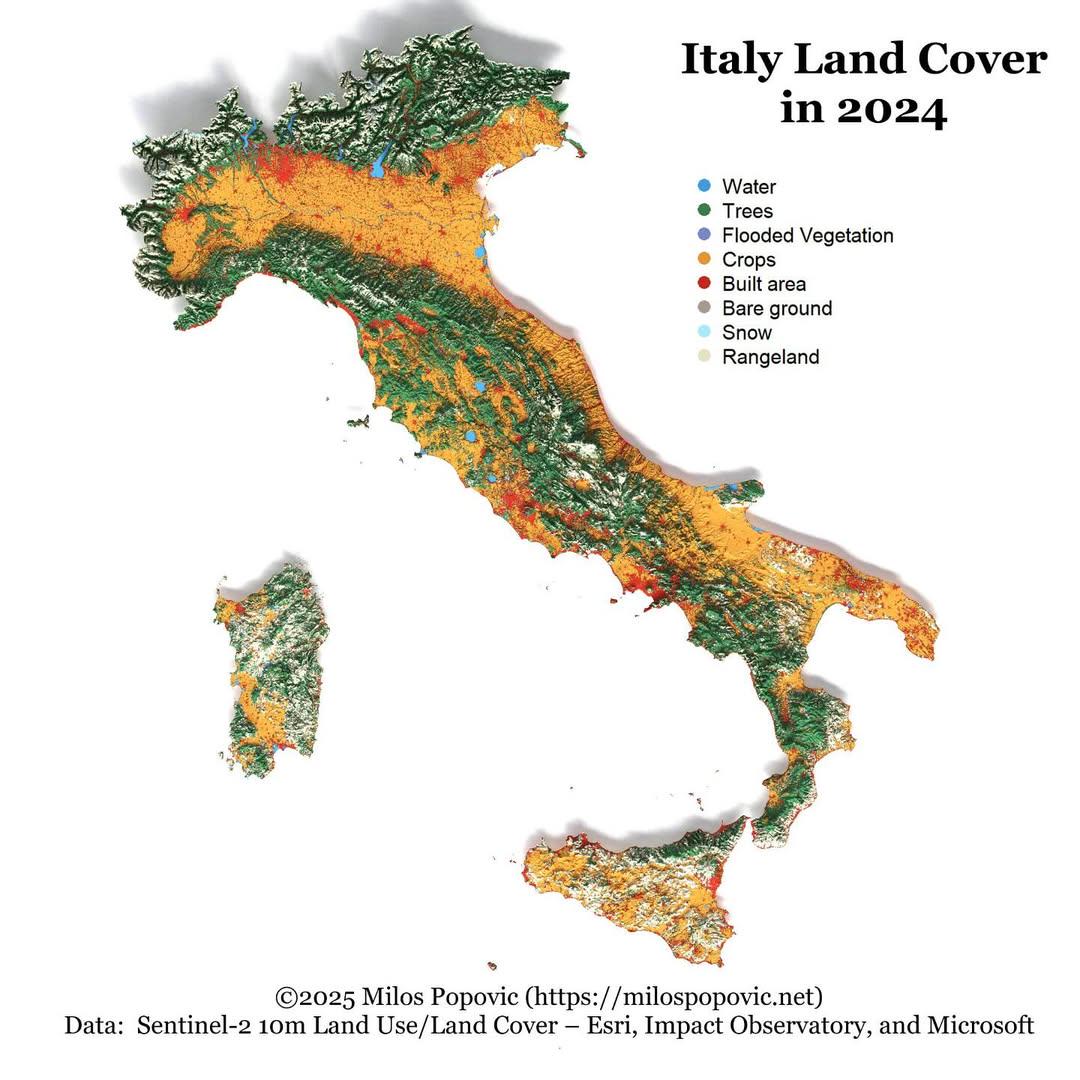
Italy Land Cover Map 2024
The "Italy Land Cover Map 2024" provides a comprehensive visualization of the various land cover types across Italy, ill...
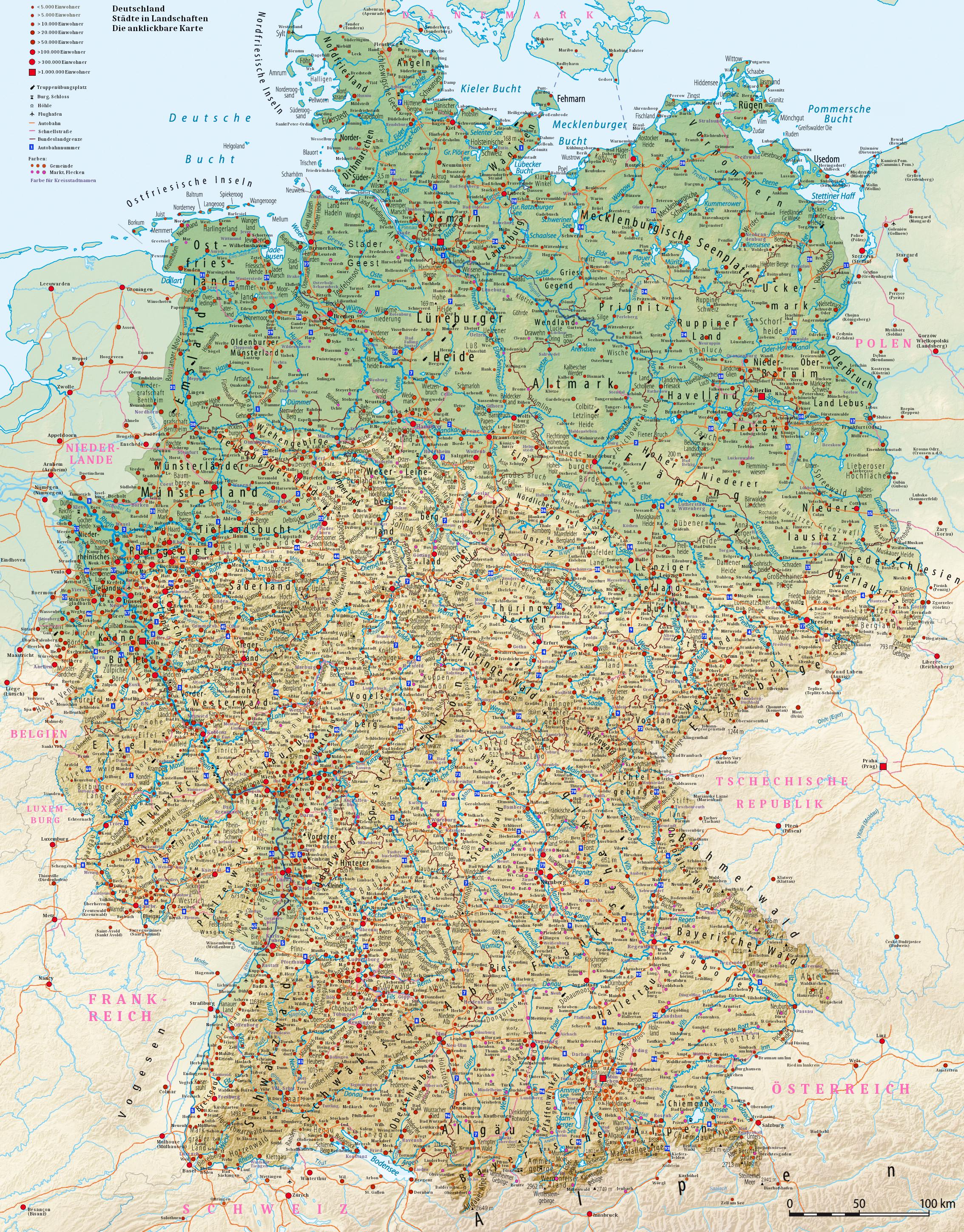
Detailed Population Density Map of the World
This incredibly detailed map showcases global population density, illustrating where people live in relation to the tota...
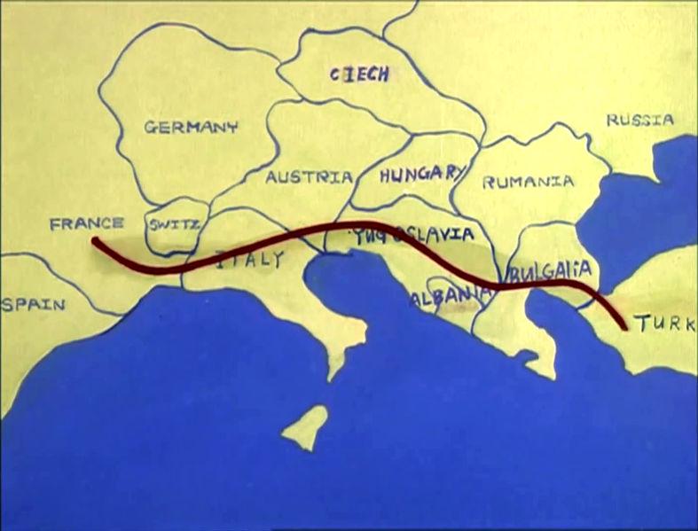
Map of Europe c. 1985 in The Transformers
...