environment Maps
74 geographic visualizations tagged with "environment"
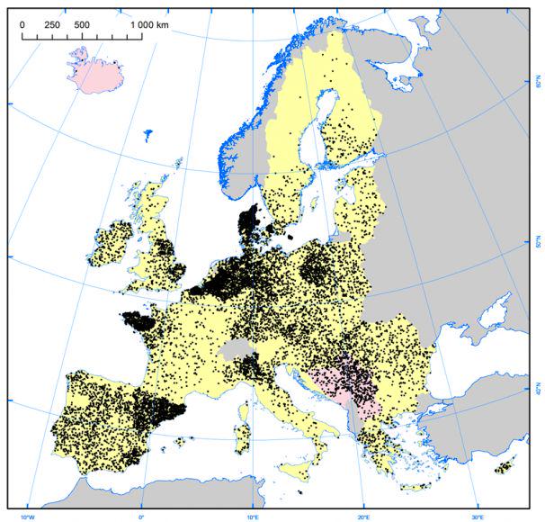
Pig Farm Density Map of Europe
The "Density of Pig Farms across Europe" map highlights the geographical distribution of pig farming throughout the cont...
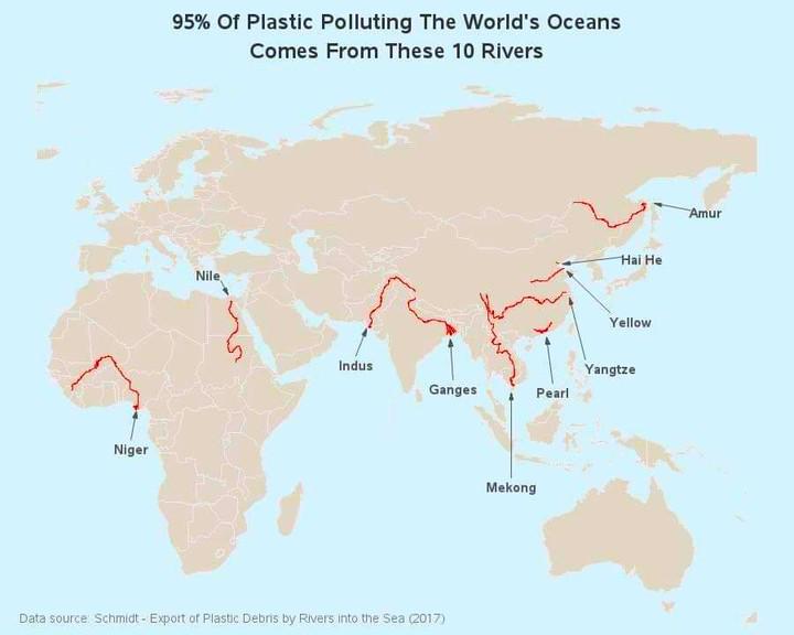
Map of Rivers Contributing to Ocean Plastic
The map titled "95% of Ocean Plastic Originates from These 10 Rivers" highlights the critical role that certain river sy...
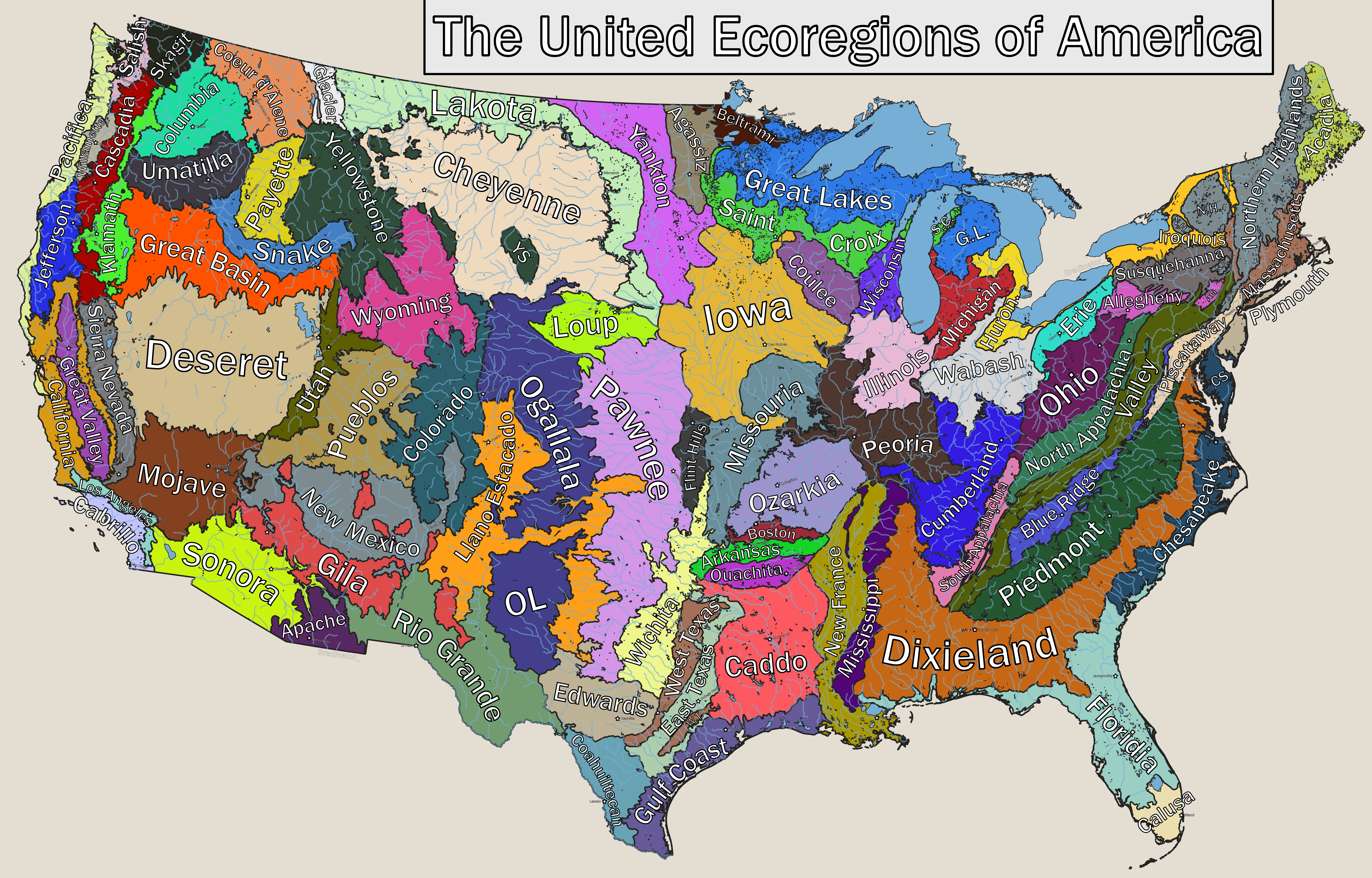
Ecoregions of America Map
...
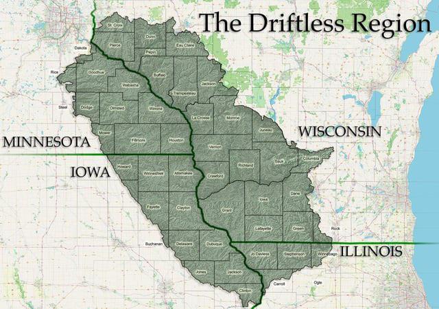
Driftless Area Geographical Features Map
The "Driftless Area Geographical Features Map" highlights a unique geological and ecological region in the Midwestern Un...
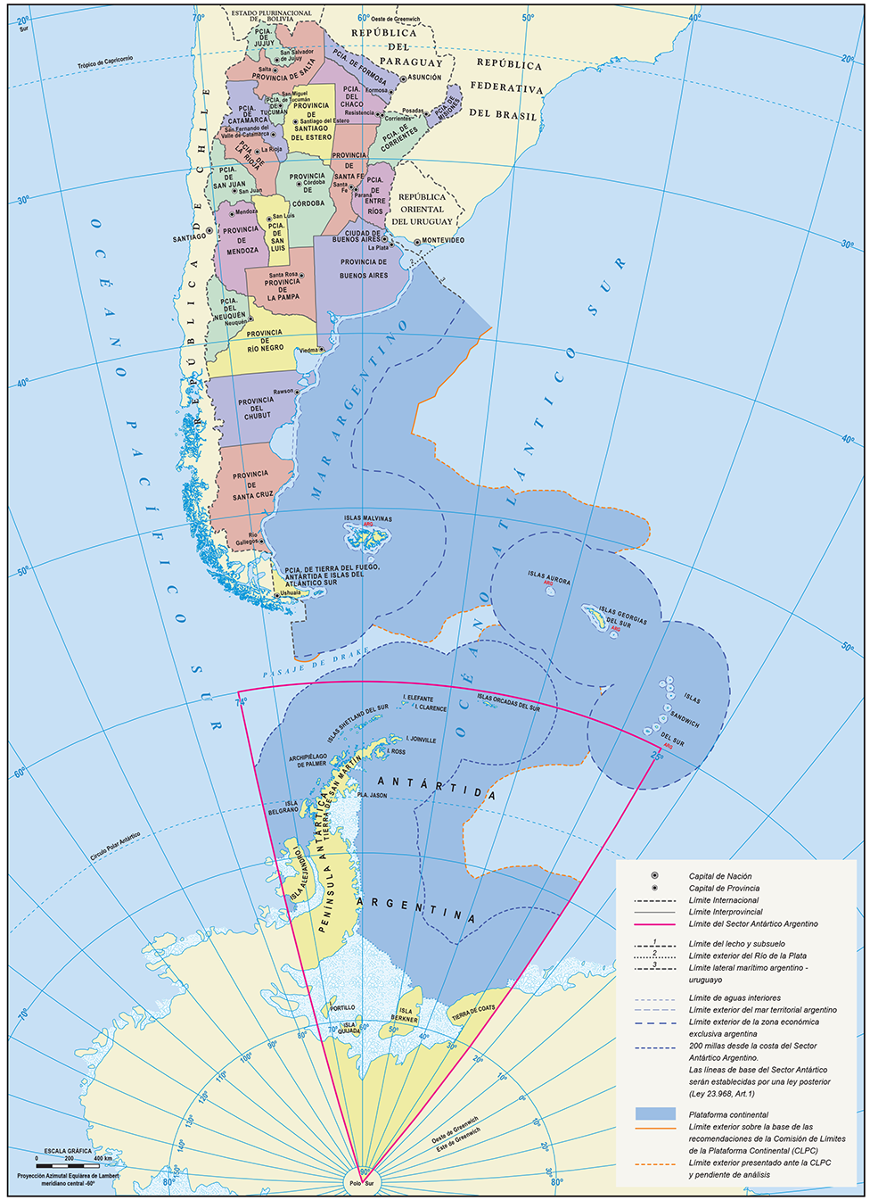
Official Map of the Argentine Republic
The official map of the Argentine Republic provides a comprehensive representation of the country's geographical feature...
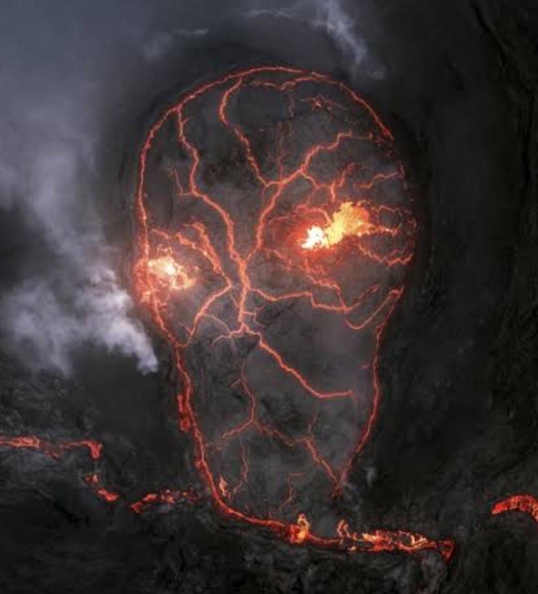
Erupting Volcano Map of Iceland
This visualization presents a detailed aerial view of an erupting volcano in Iceland, capturing the dynamic and ever-cha...

Elevation Map of North America
The elevation map of North America provides a detailed visual representation of the continent's topography, showcasing t...
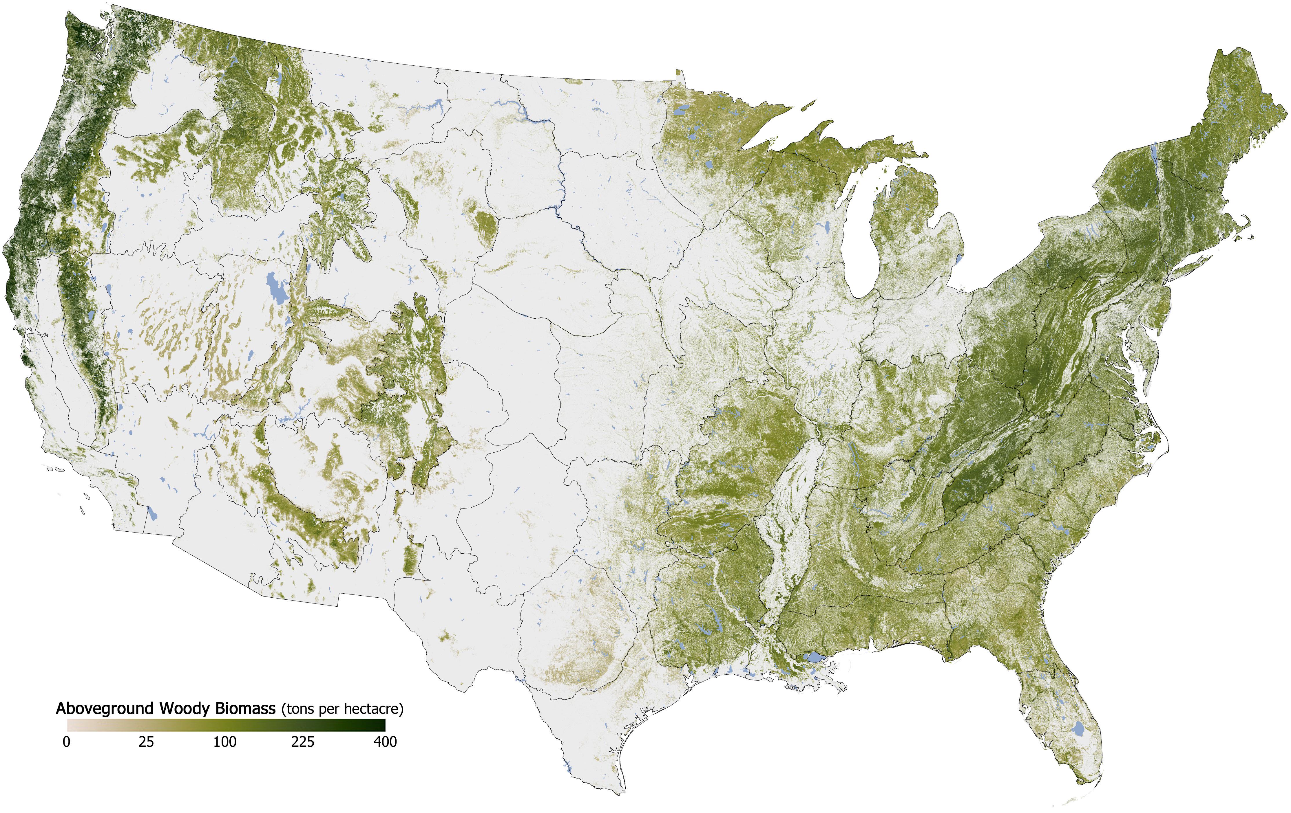
Forest Cover in the U.S. Map
The "Forest Cover in the U.S. Map" provides a detailed visualization of the distribution and density of forested areas a...

Best and Worst US States by Overall Well-Being Map
This map provides a comprehensive overview of the overall well-being of each U.S. state, ranking them based on various f...
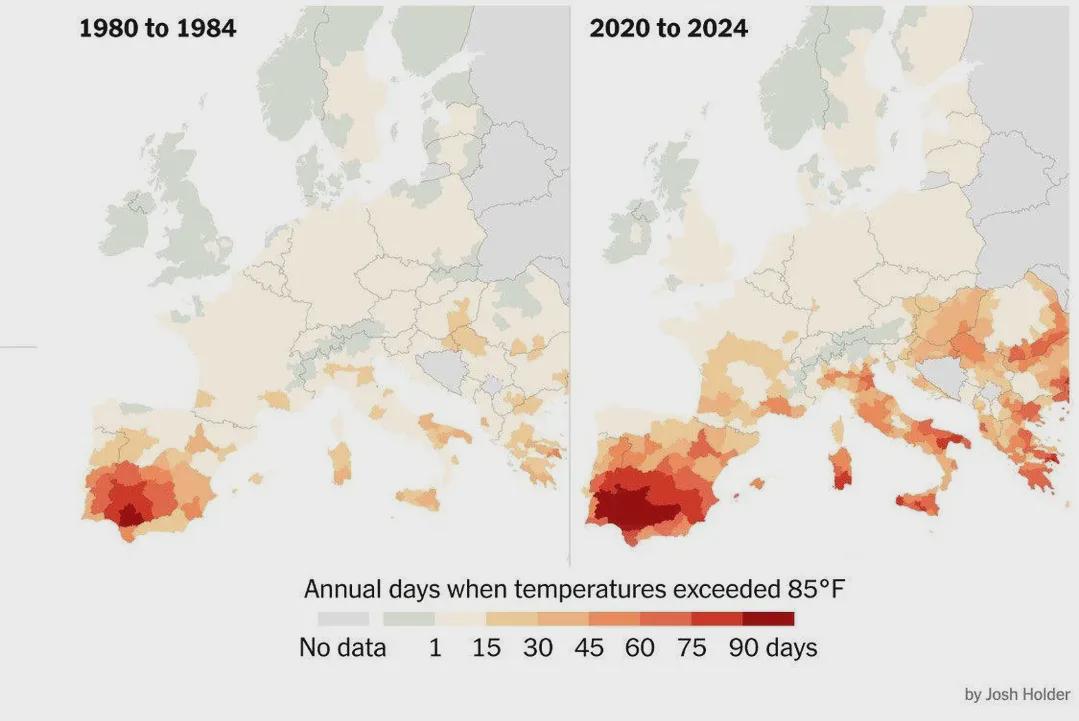
Days Over 30ºC in Europe Map
The visualization titled "Number of Days per Year When Temperatures Exceeded 30ºC (85°F) in Europe" provides a comprehen...
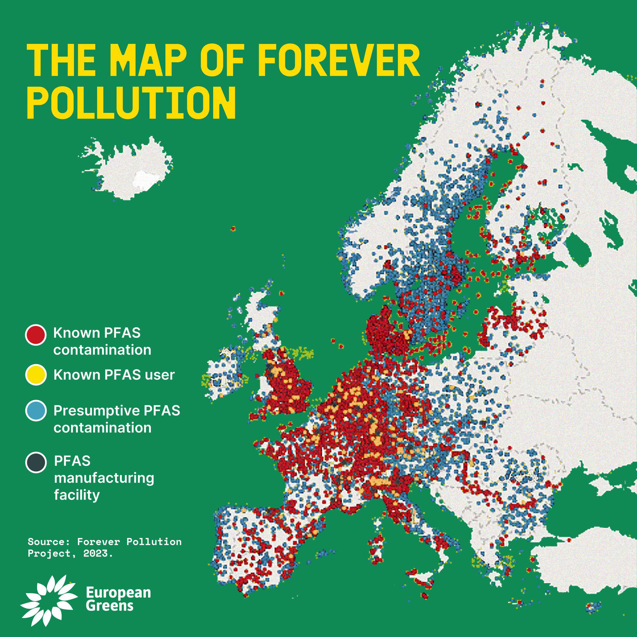
PFAS Contamination Map
The PFAS Contamination Map provides a comprehensive overview of areas affected by per- and polyfluoroalkyl substances (P...
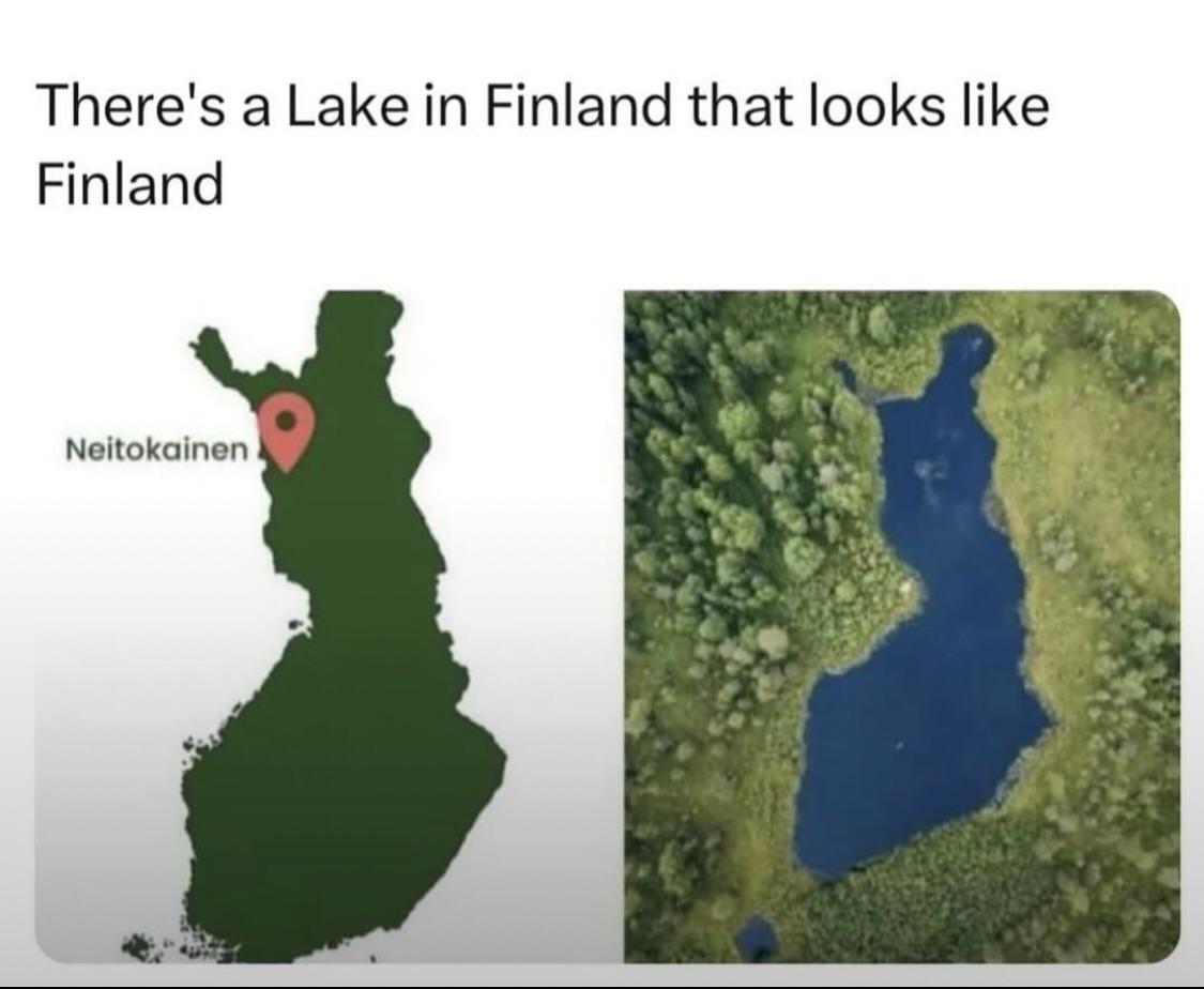
Finlake Water Quality Monitoring Map
The "Finlake Water Quality Monitoring Map" provides a detailed overview of water quality metrics across various sites in...
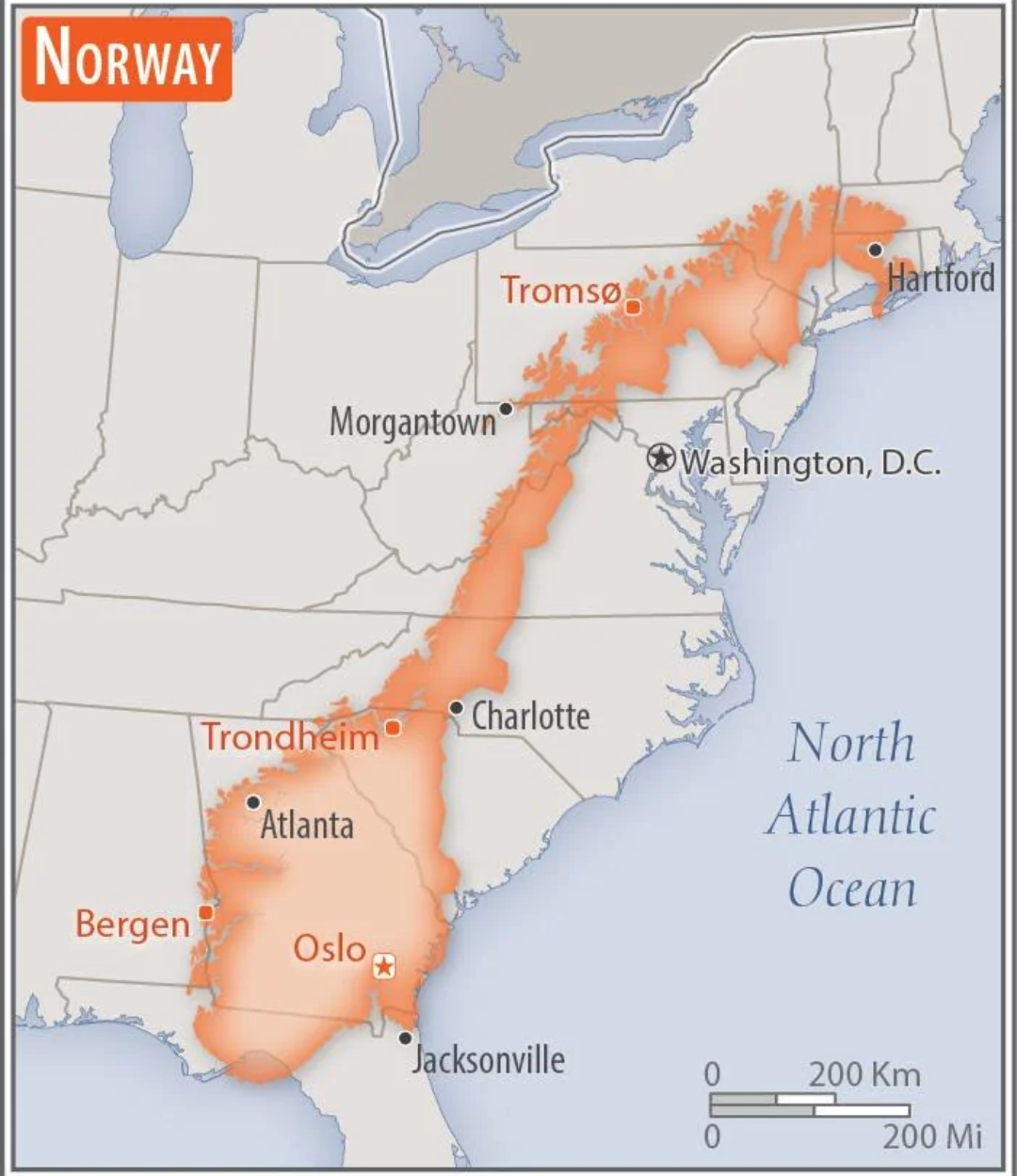
Norway Overlaid on the US Map
This intriguing map overlays the geographical boundaries of Norway onto the continental United States, providing a uniqu...
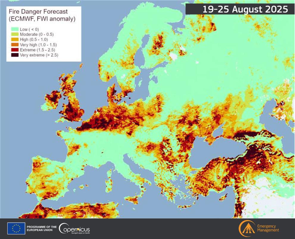
Fire Danger Map of Current Europe
The "Fire Danger Map of Current Europe" provides a crucial snapshot of fire risk levels across various regions in Europe...
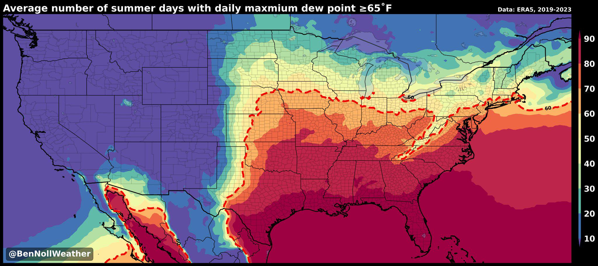
Humidity Belt Map of America
The "America's Humidity Belt" map visually represents the regions of the United States characterized by high humidity le...
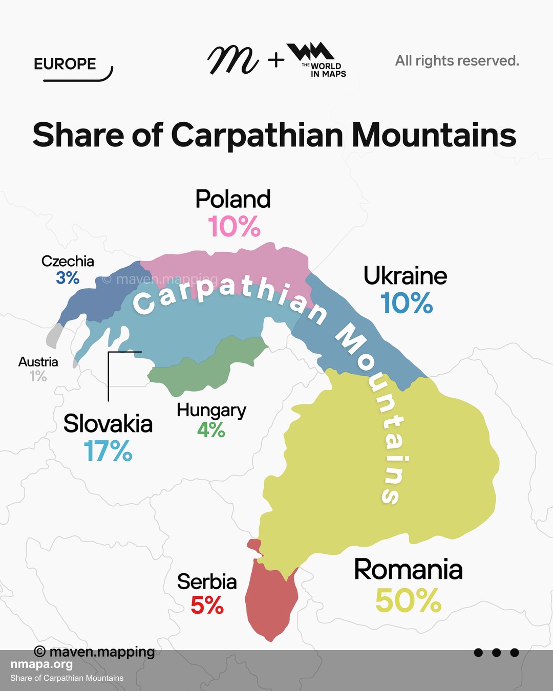
Share of Carpathian Mountains Map
The "Share of Carpathian Mountains Map" visually represents the distribution and extent of the Carpathian Mountain range...
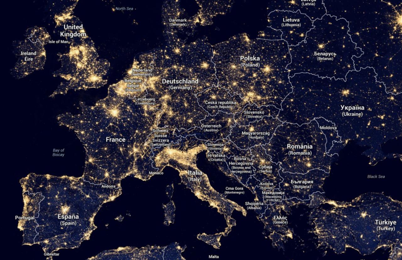
Light Map of Europe
The 'Light Map of Europe' provides a stunning visual representation of nighttime illumination levels across the continen...
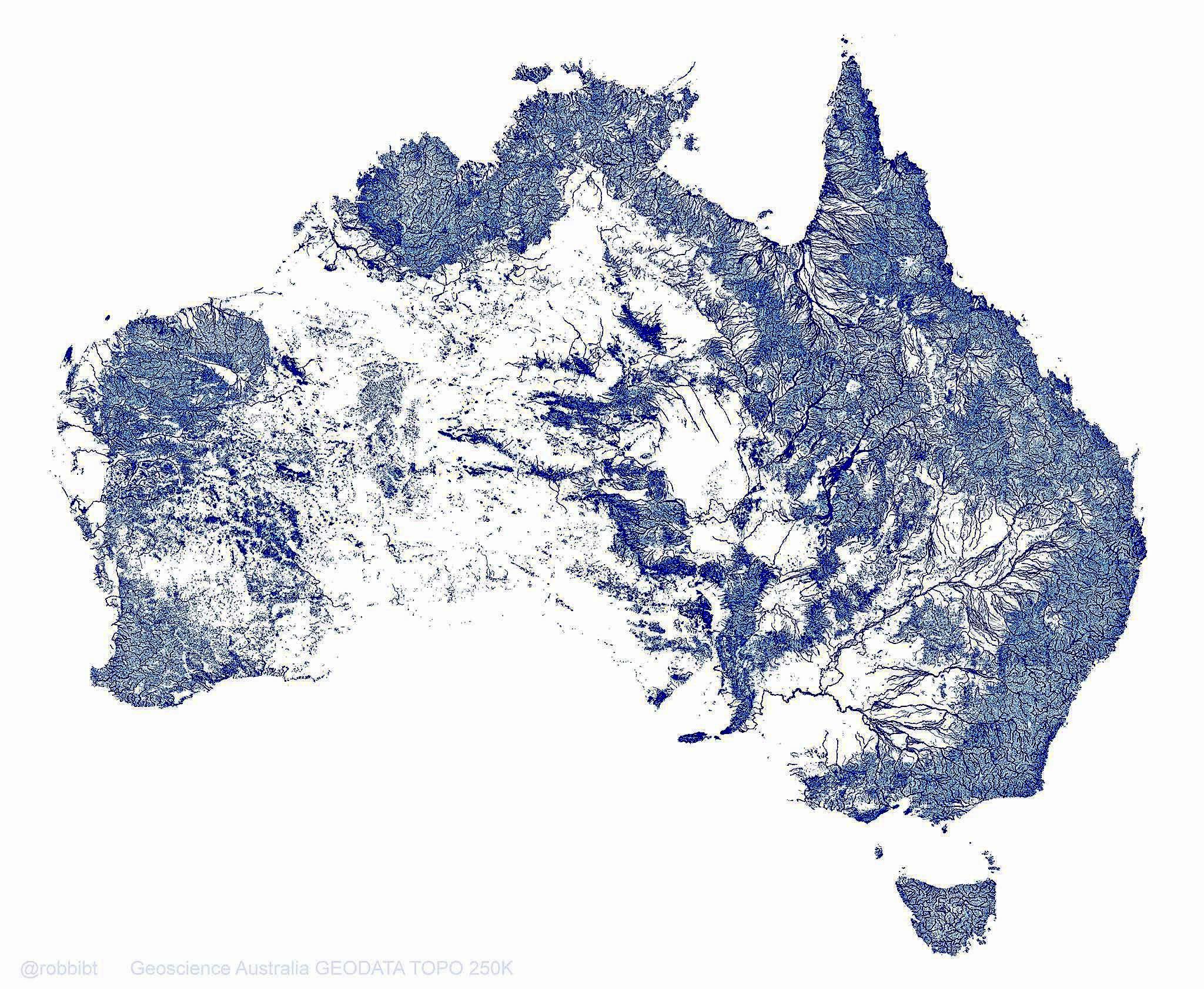
Australia Rivers Map: 1.3 Million Waterways
This map vividly illustrates Australia's extensive network of 1.3 million rivers, streams, and tributaries, which togeth...
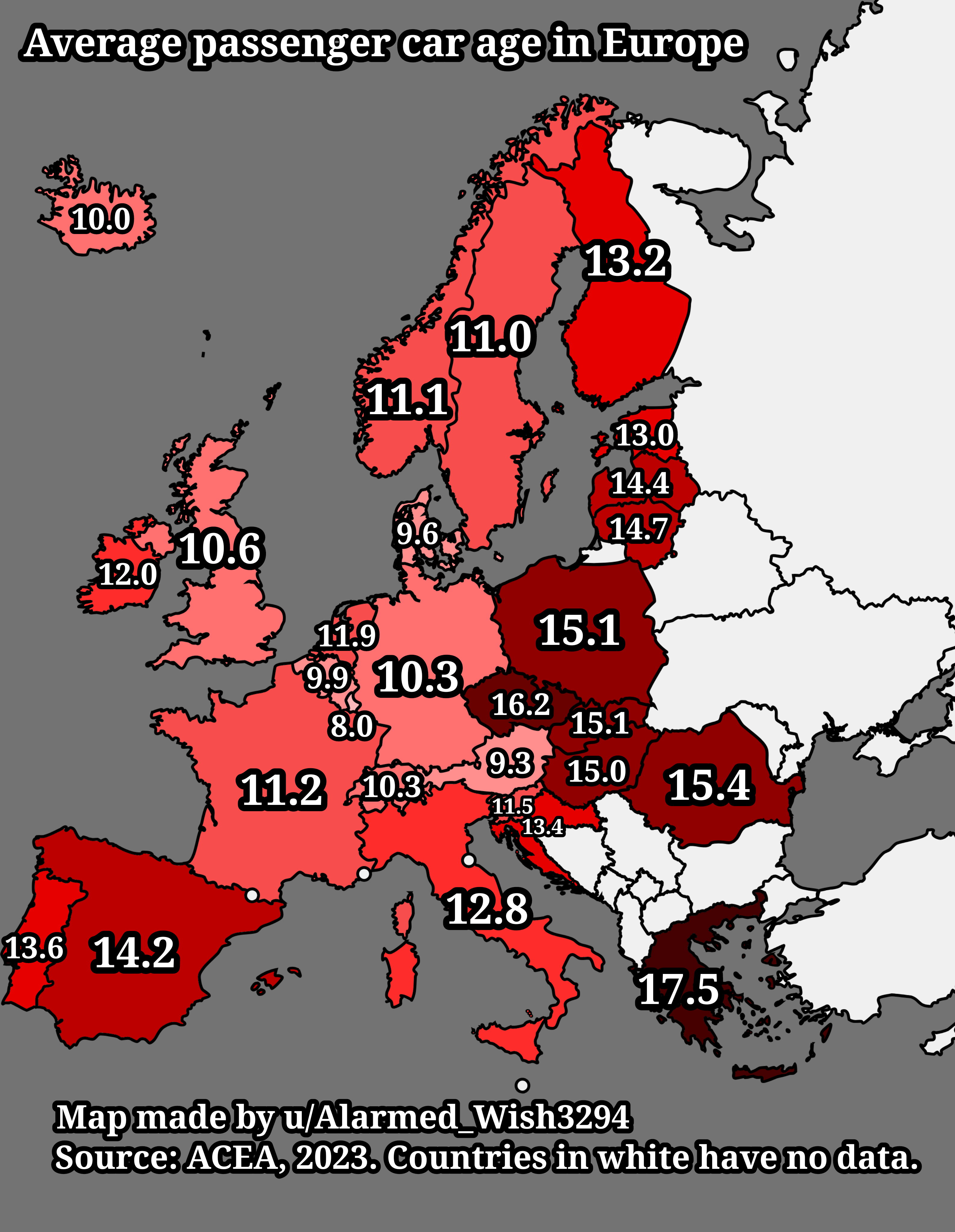
Average Passenger Car Age in Europe Map
The "Average Passenger Car Age in Europe Map" provides a visual representation of the average age of passenger vehicles ...
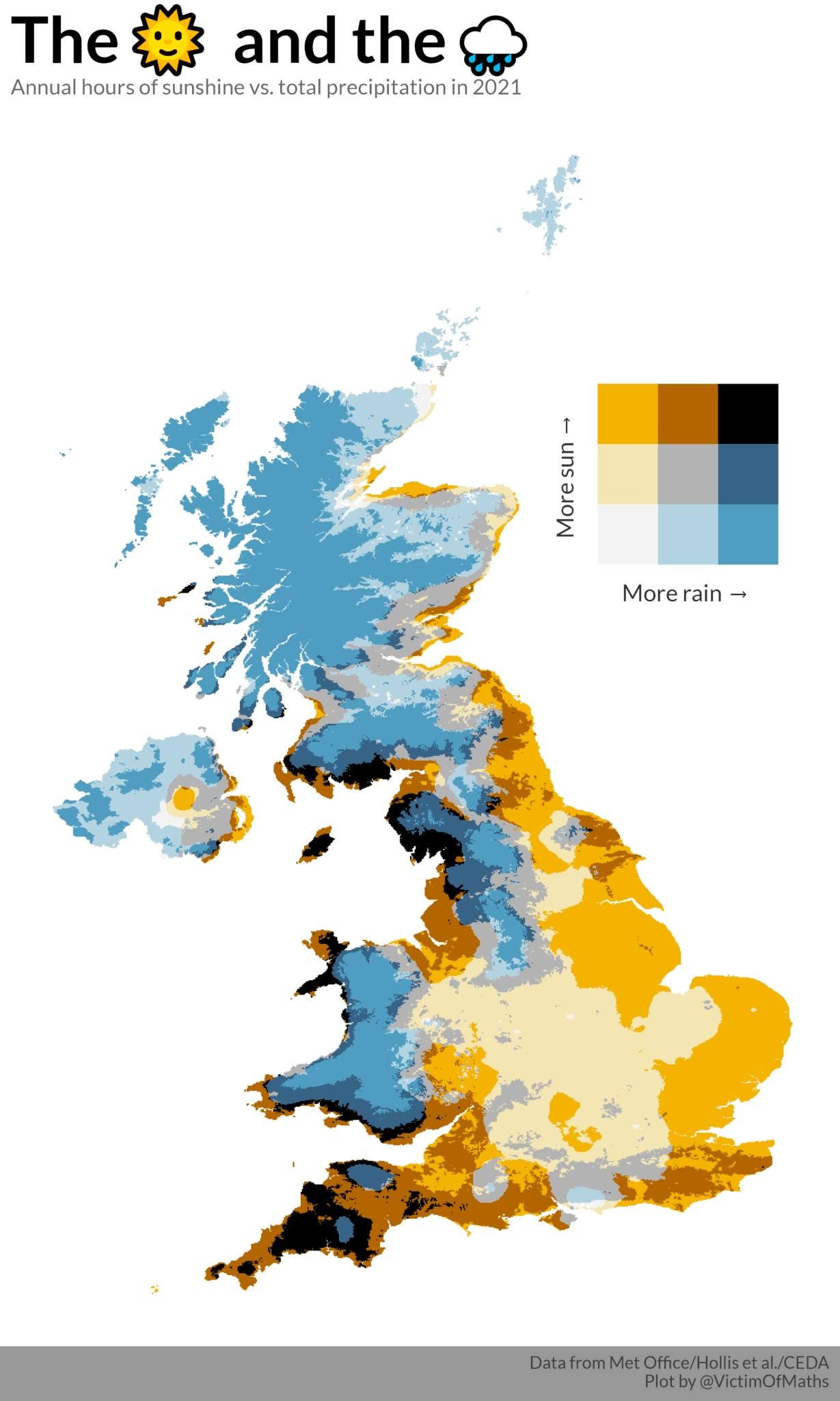
Sunshine Hours vs Rain in the UK Map
...
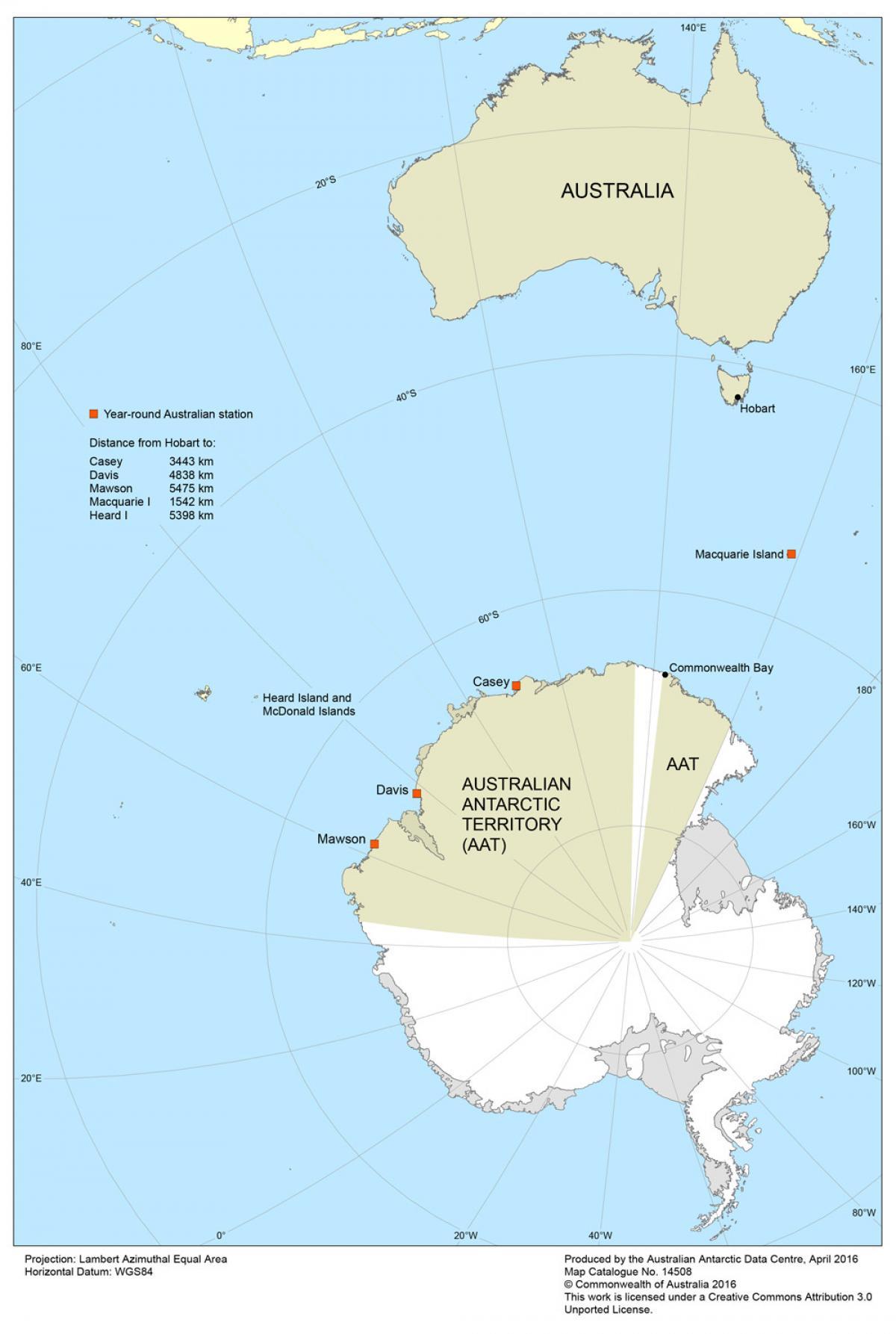
Map of Australia's Climate Zones
The "Map of Australia's Climate Zones" provides a comprehensive overview of the diverse climatic regions across the cont...
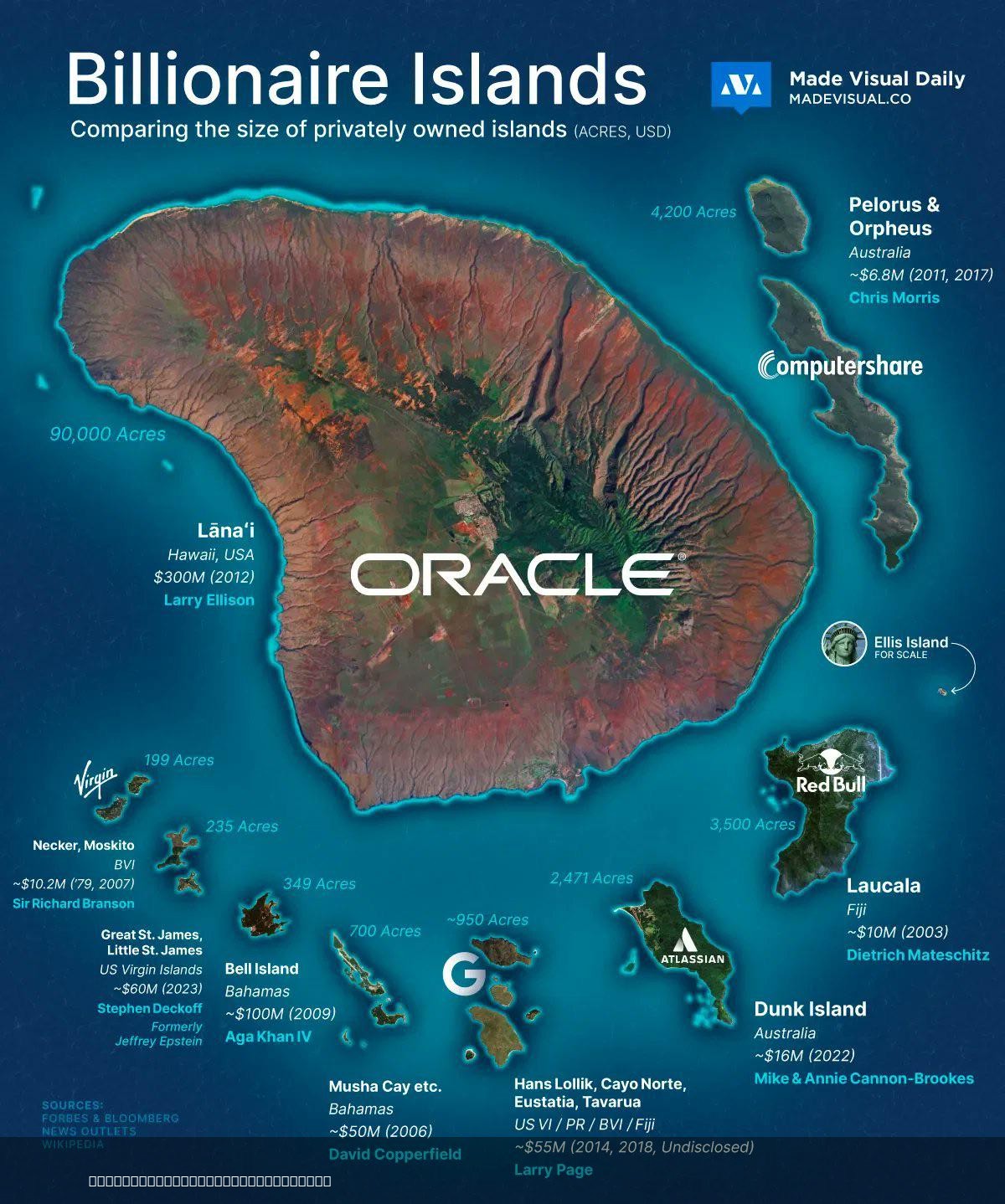
Islands Owned By Billionaires Map
This map provides a clear visualization of islands owned by billionaires around the globe. It highlights the remarkable ...
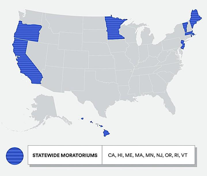
Map of U.S. States with Nuclear Power Plant Bans
This map visually represents the U.S. states that have enacted bans or restrictions on the construction of nuclear power...
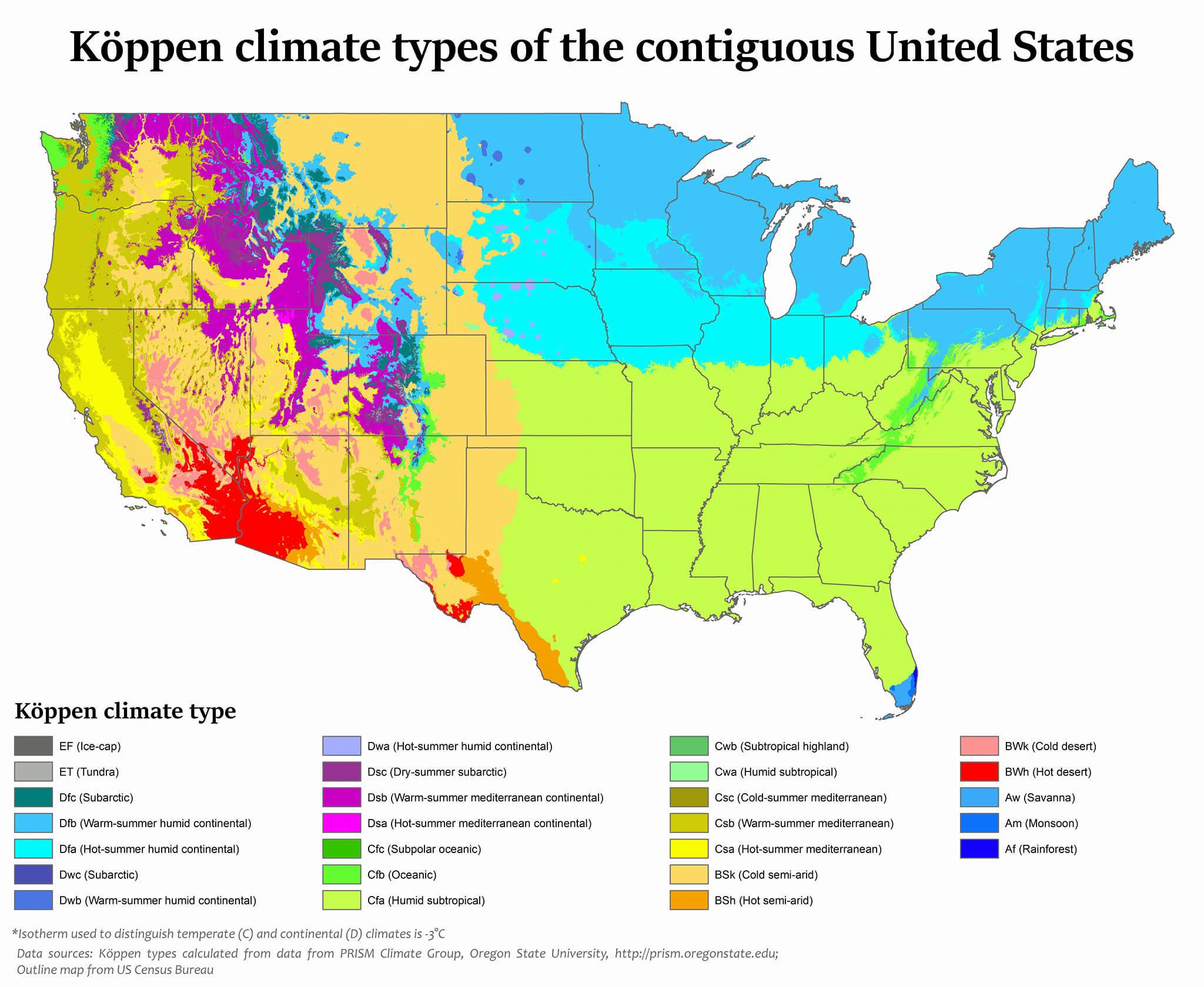
Köppen Climate Types Map of the USA
The map titled "USA is the most climatically diverse country in the world" presents a fascinating overview of the variou...
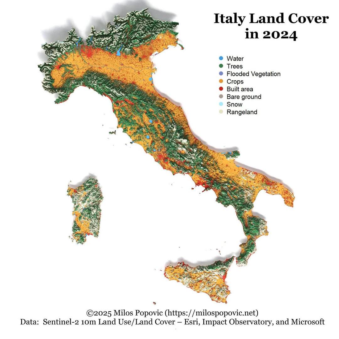
Italy Land Cover Map 2024
The "Italy Land Cover Map 2024" provides a comprehensive visualization of the various land cover types across Italy, ill...
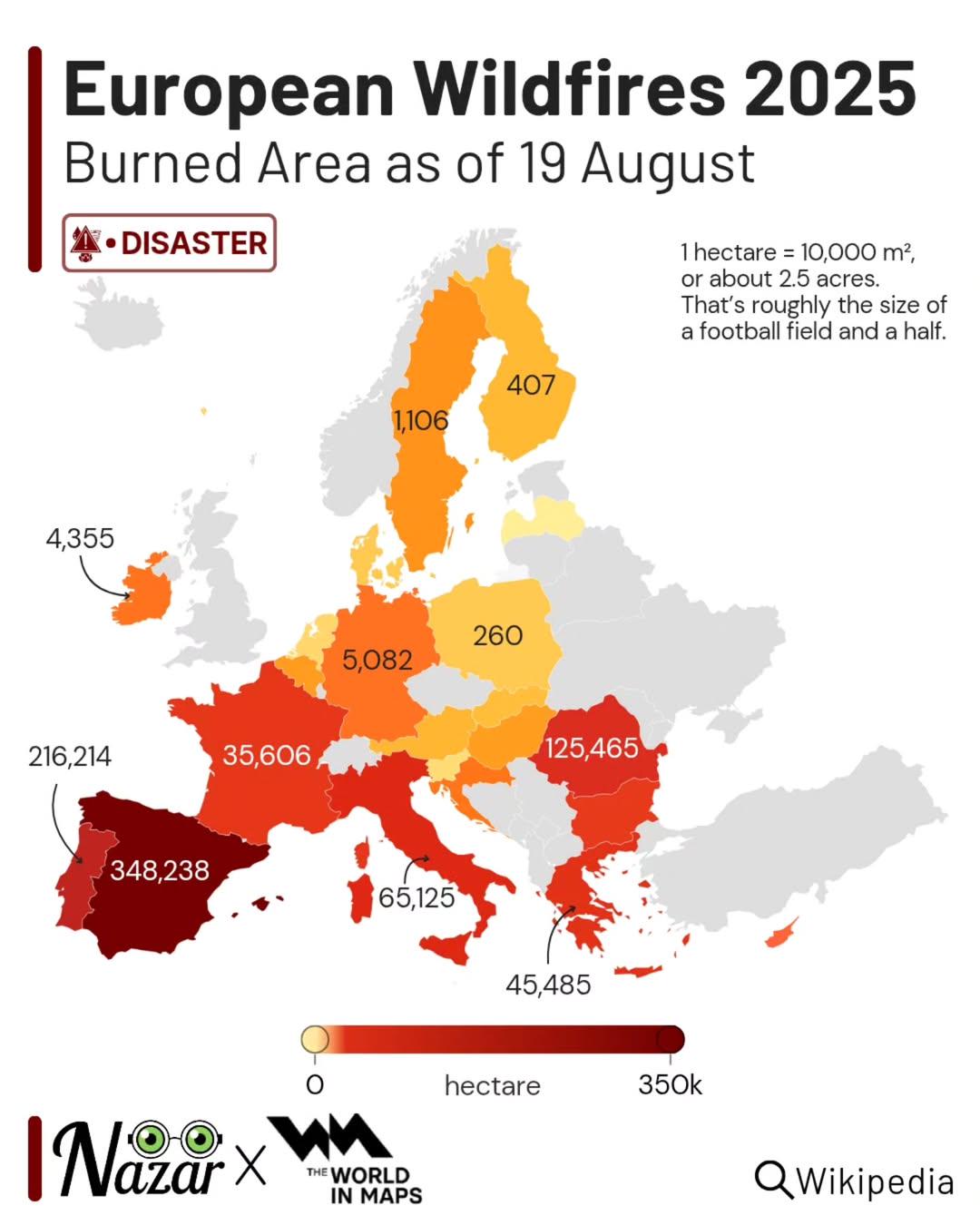
European Wildfires 2025 Map
The "European Wildfires 2025 Map" provides a comprehensive visualization of projected wildfire occurrences throughout Eu...
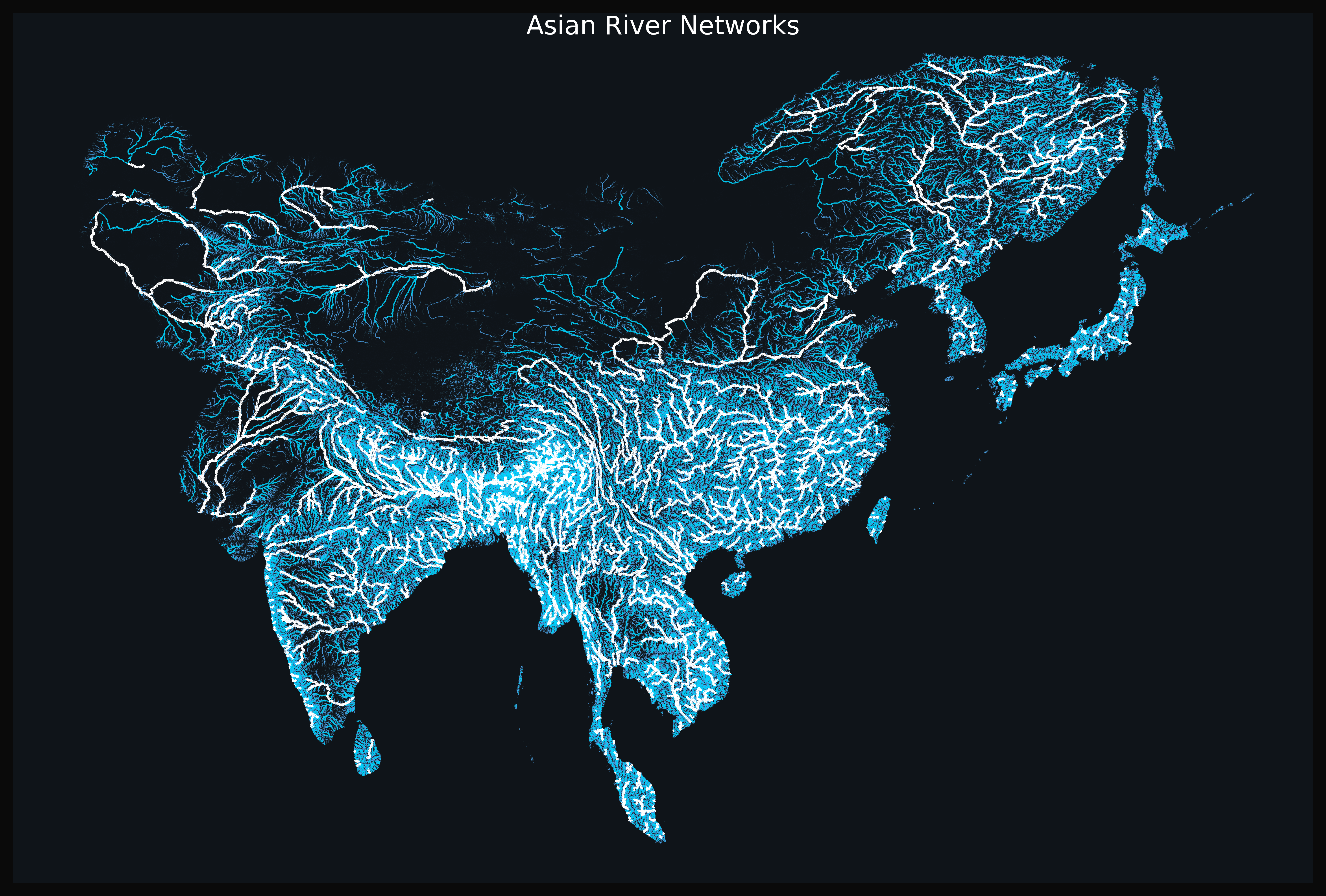
Asian River Networks Map
The "Asian River Networks Map" provides a detailed visualization of the intricate web of river systems across the contin...
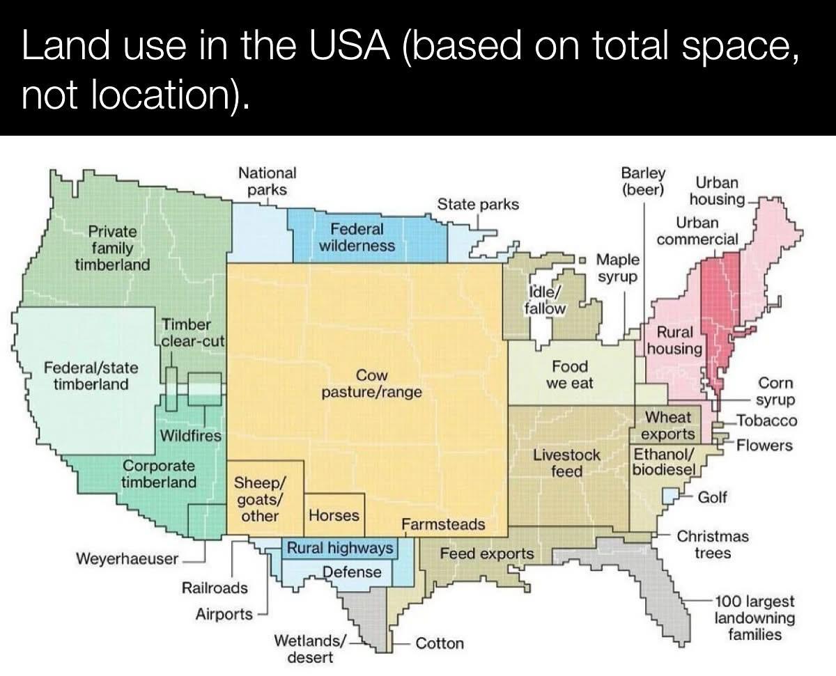
Land Use Map of the USA
The \...
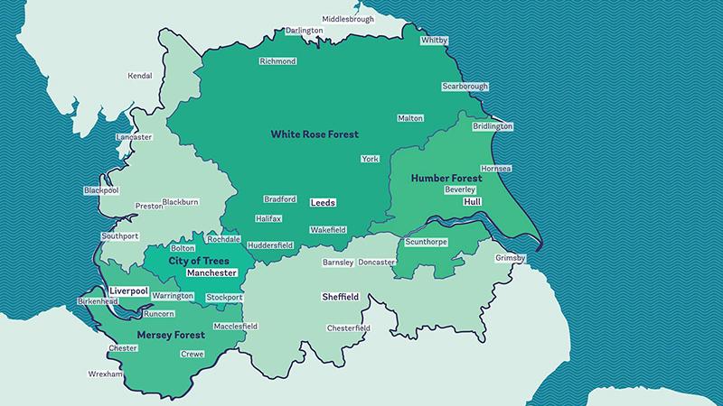
Reforesting Britain Map – The Northern Forest Map
The "Reforesting Britain Map – The Northern Forest" focuses on a significant environmental initiative launched in 2018. ...
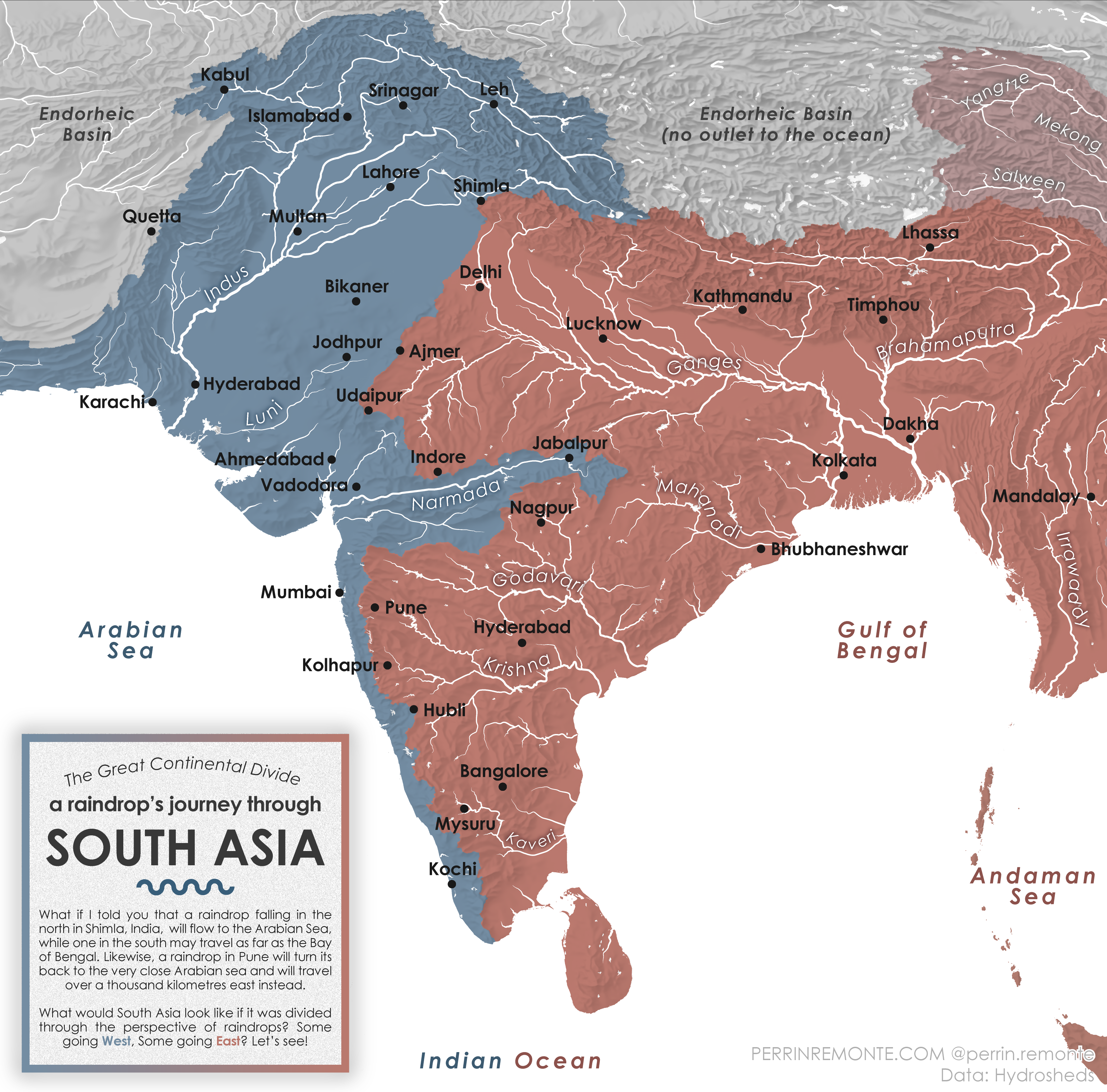
Water Cycle Journey Map of South Asia
The visualization titled "A Raindrop's Journey through South Asia" provides an intriguing look at the water cycle within...
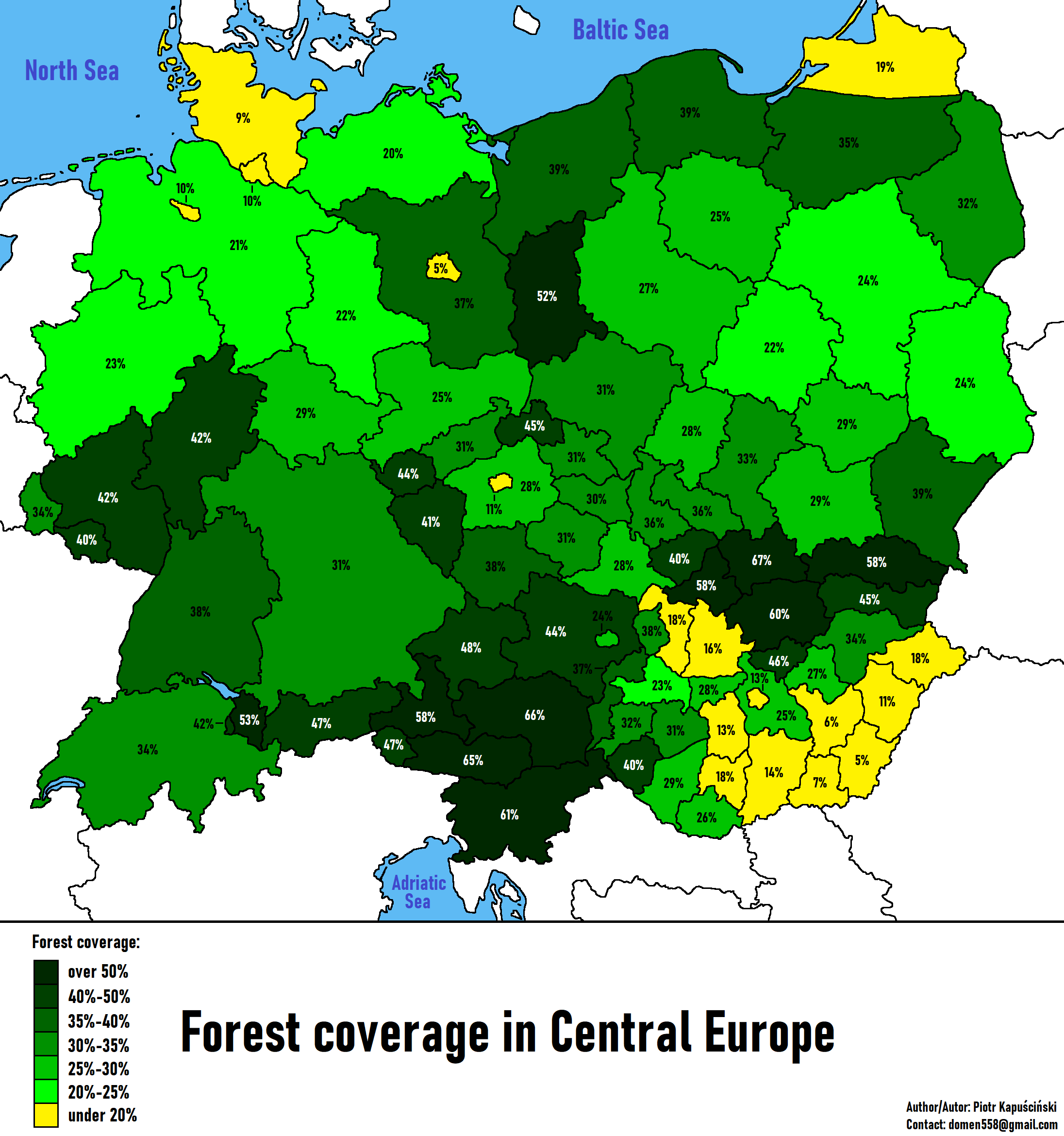
Forest Coverage in Central Europe Map
The "Forest Coverage in Central Europe Map" provides a comprehensive overview of the forested areas across several key c...
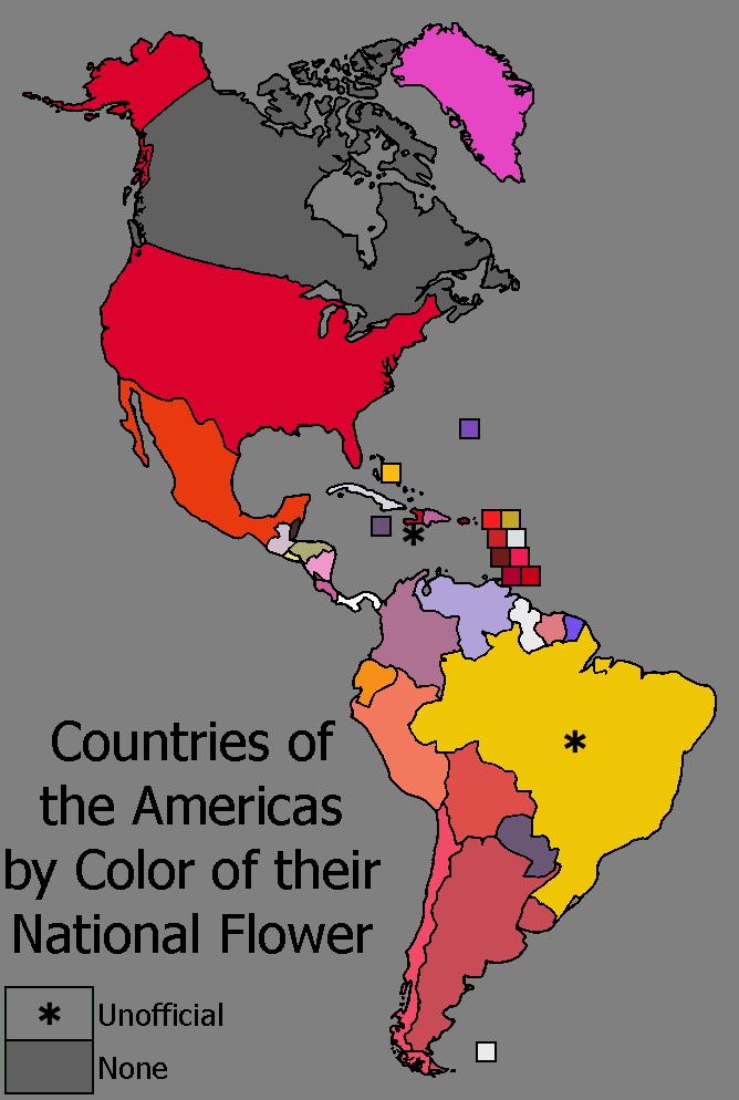
National Flower Colors Map of the Americas
The "Countries of the Americas by Color of their National Flower" map is a vibrant and playful visualization that displa...
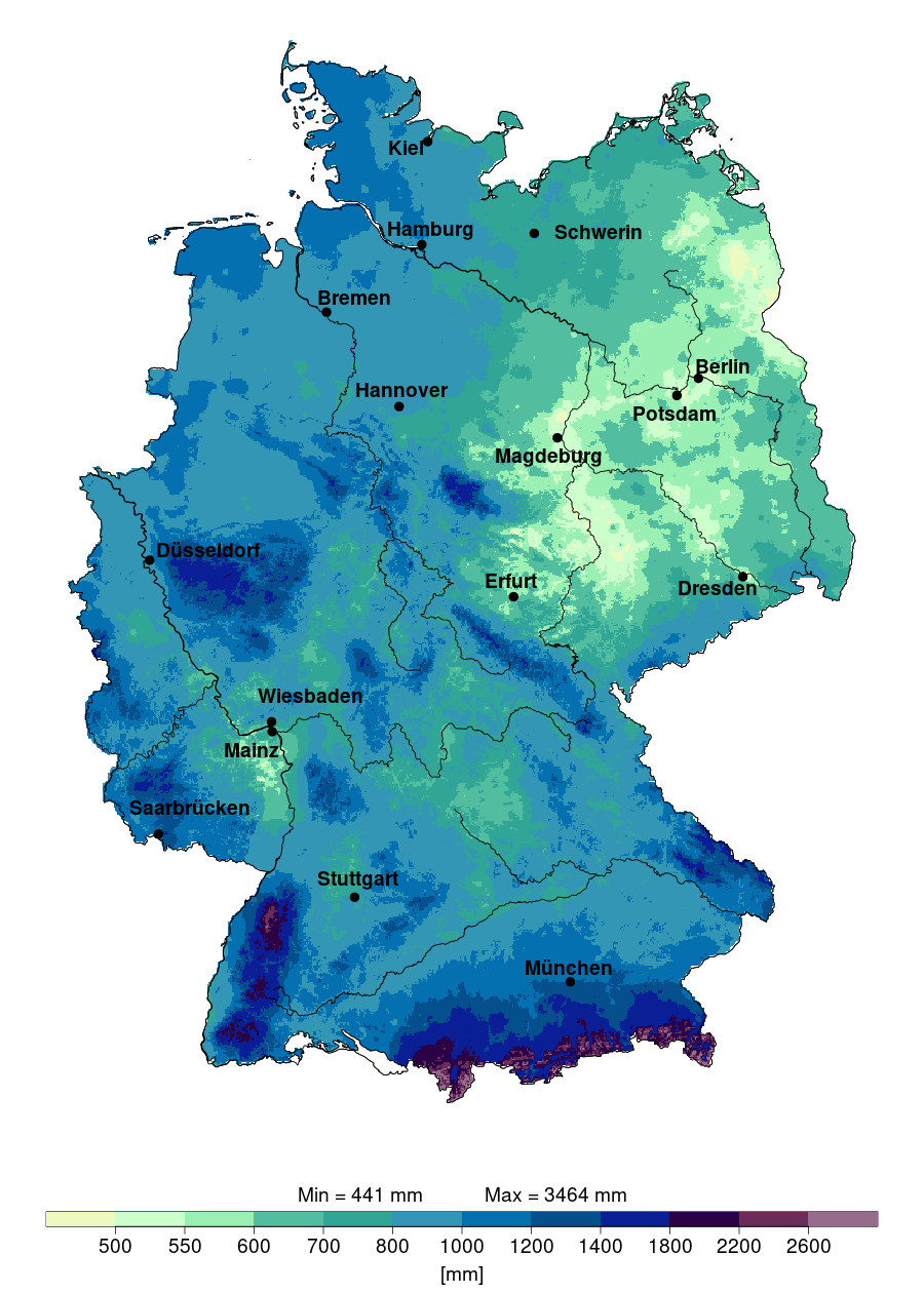
Annual Precipitation Map of Germany 2024
The "Annual Precipitation in Germany in 2024" map provides a detailed visualization of the expected rainfall distributio...
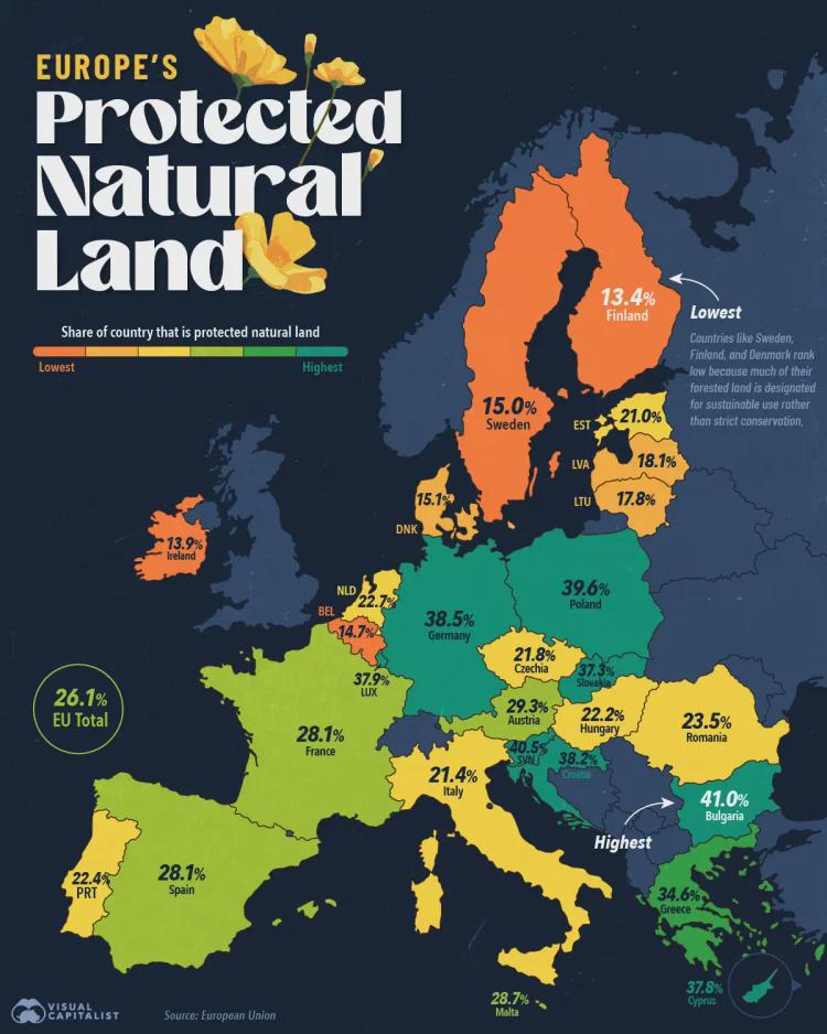
Map of European Union's Protected Natural Land
This visualization illustrates the extent of protected natural land across the European Union. It highlights regions des...
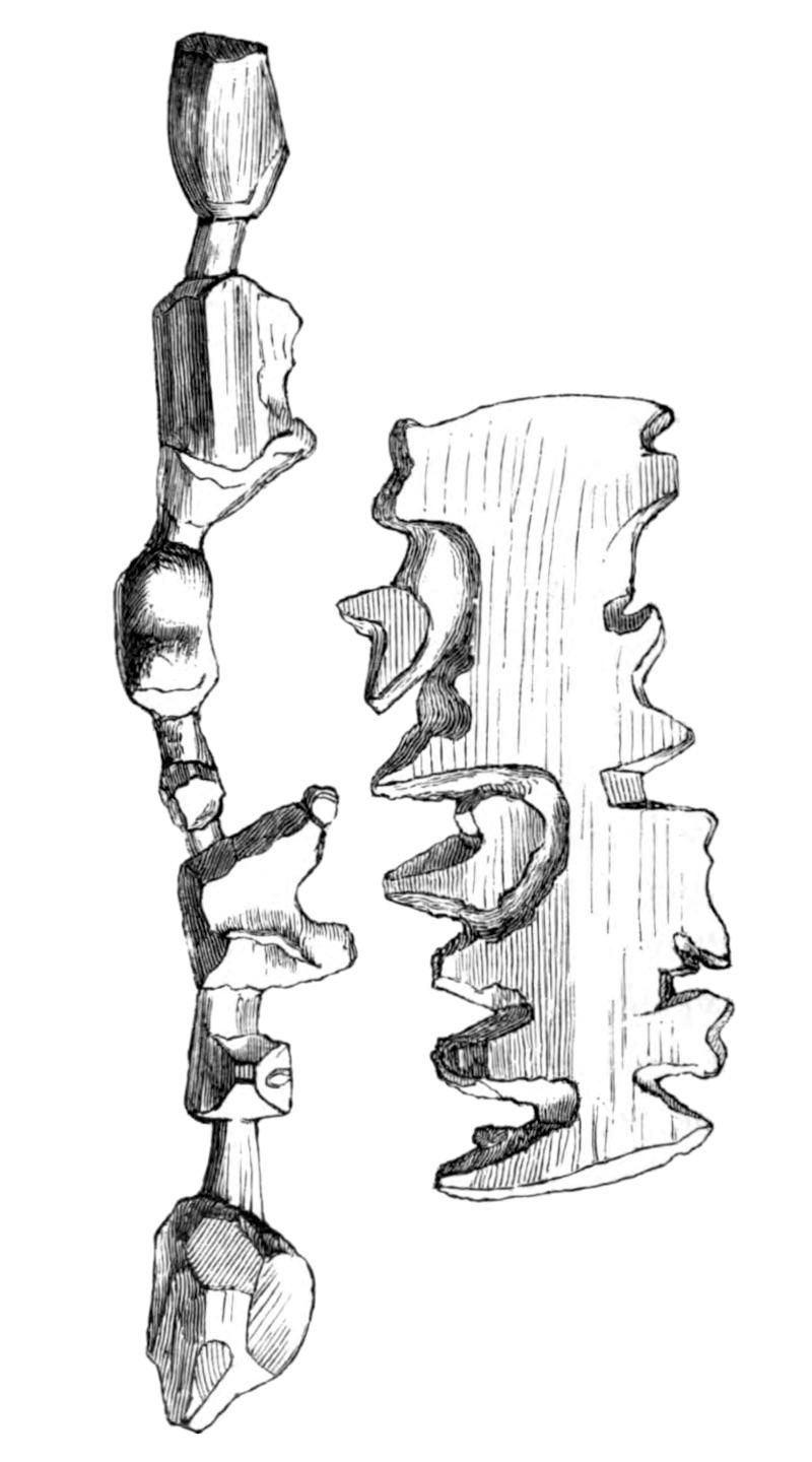
Ammassalik Wooden Maps of Greenland
The Ammassalik wooden maps are intricate, tactile representations of the Greenlandic coastlines, primarily depicting the...
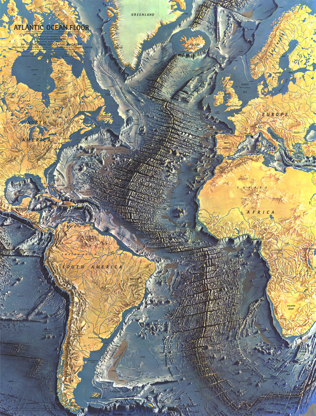
Atlantic Ocean Floor Map
However, this map does more than just depict the ocean floor; it invites us to explore the intricate systems that govern...

Paraíba River Valley Geography Map
The map of the Paraíba River Valley in Brazil provides a visual representation of this significant geographical feature,...
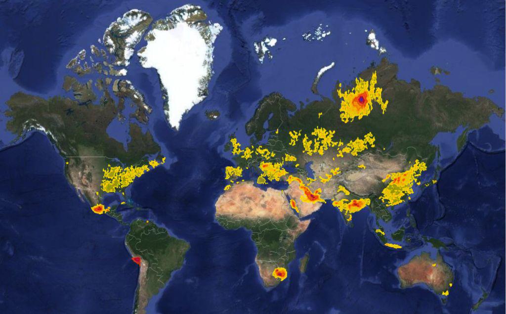
Sulphur Dioxide Pollution Worldwide Map
The "Sulphur Dioxide Pollution Worldwide Map" provides a comprehensive visualization of sulphur dioxide (SO2) emissions ...
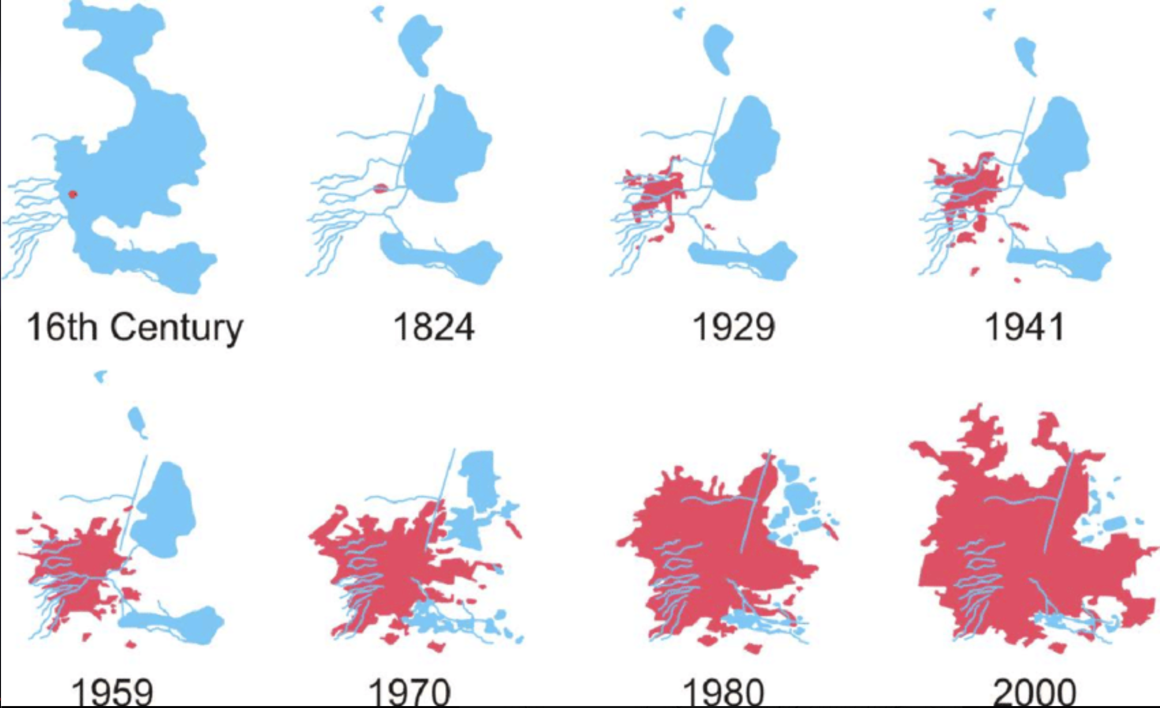
Mexico City Lake Texcoco Development Map
...
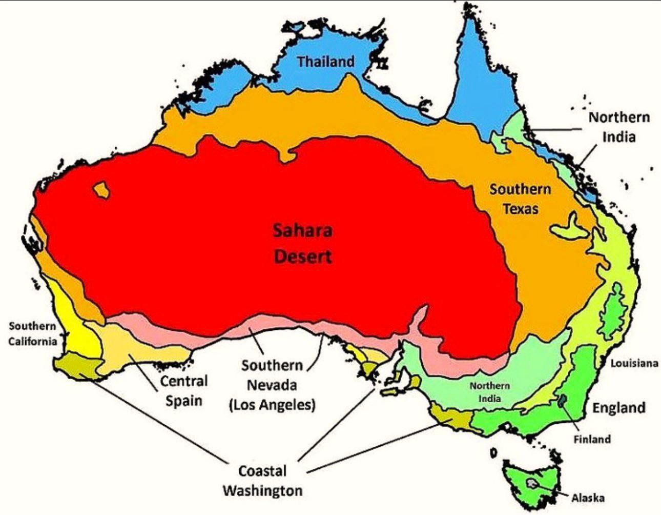
Australia’s Climate Compared to Other Countries Map
The map titled "Australia’s Climate Compared to Other Countries" provides a detailed look at how Australia's climate sta...
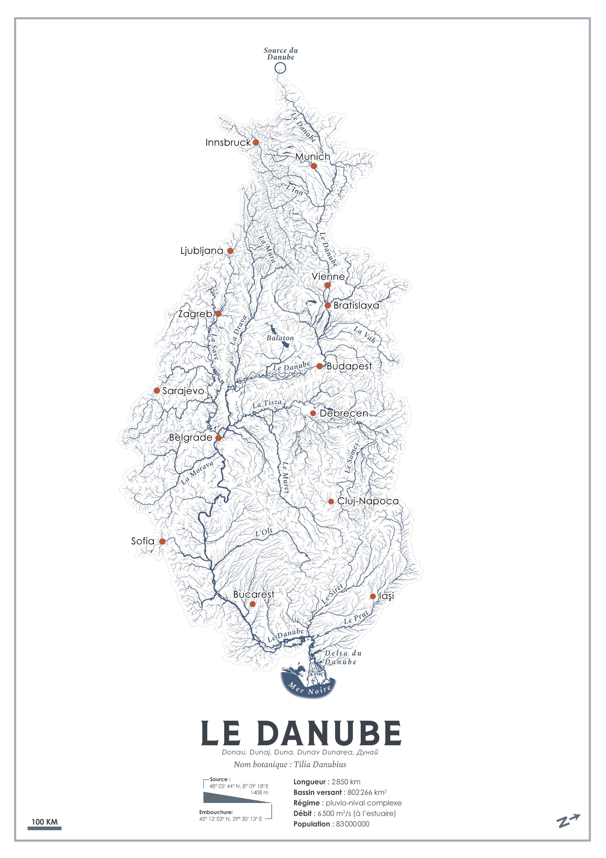
Danube River Tree Transformation Map
This intriguing visualization titled "What if rivers turned into trees?" presents a unique and imaginative take on the D...
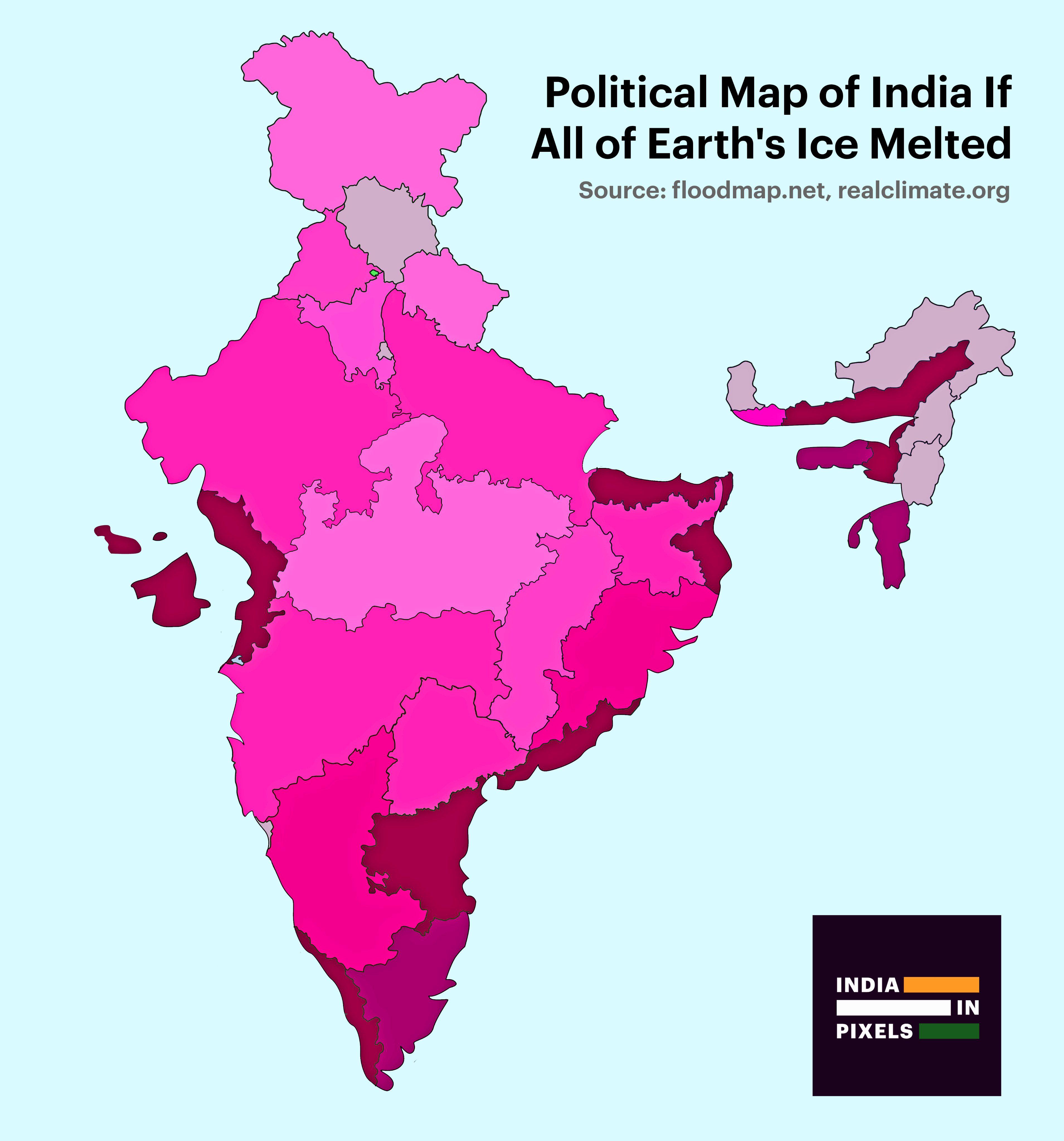
Political Map of India If All Ice Melted Map
This visualization presents a striking political map of India under the hypothetical scenario of complete ice melt acros...
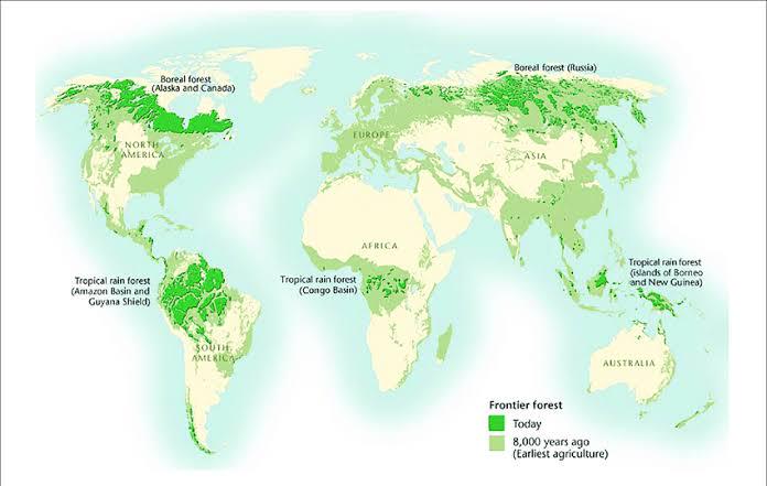
Map of Countries with Largest Forest Coverage 2025
The newly released map visualizes global forest distribution in 2025, spotlighting countries with the largest percentage...
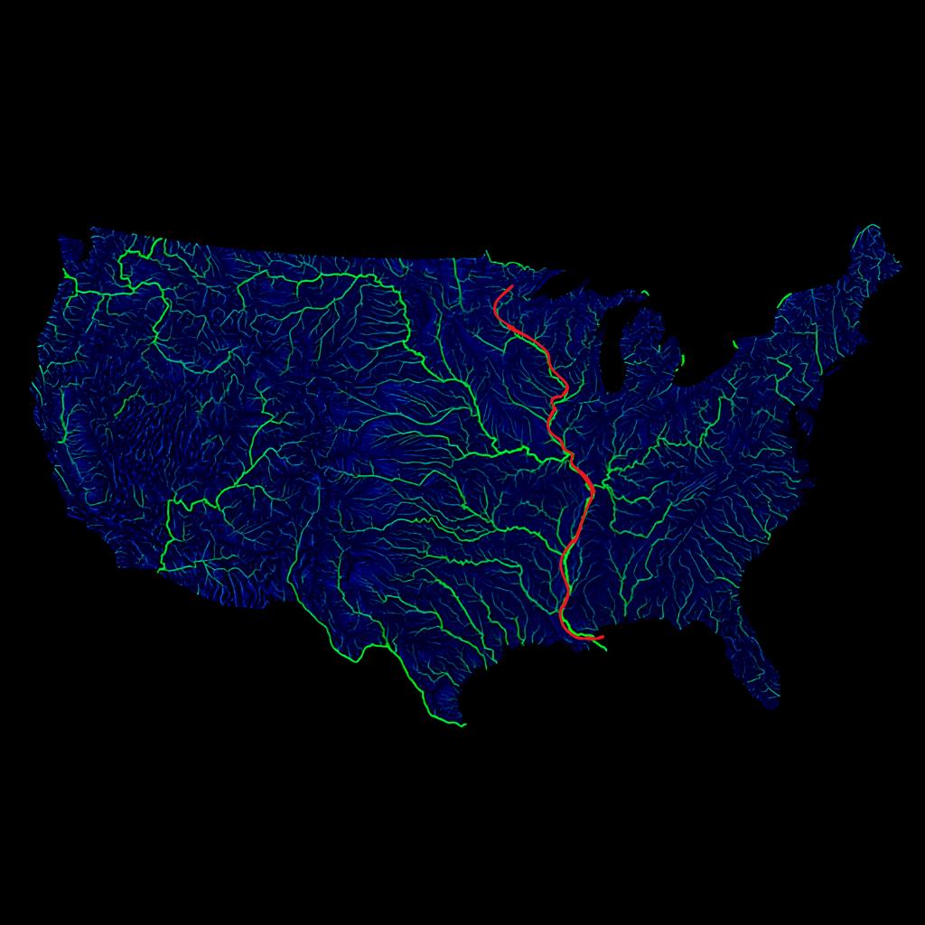
Mississippi River Main Channel Map
The visualization displays the main channel of the Mississippi River prominently highlighted in red, set against a backd...
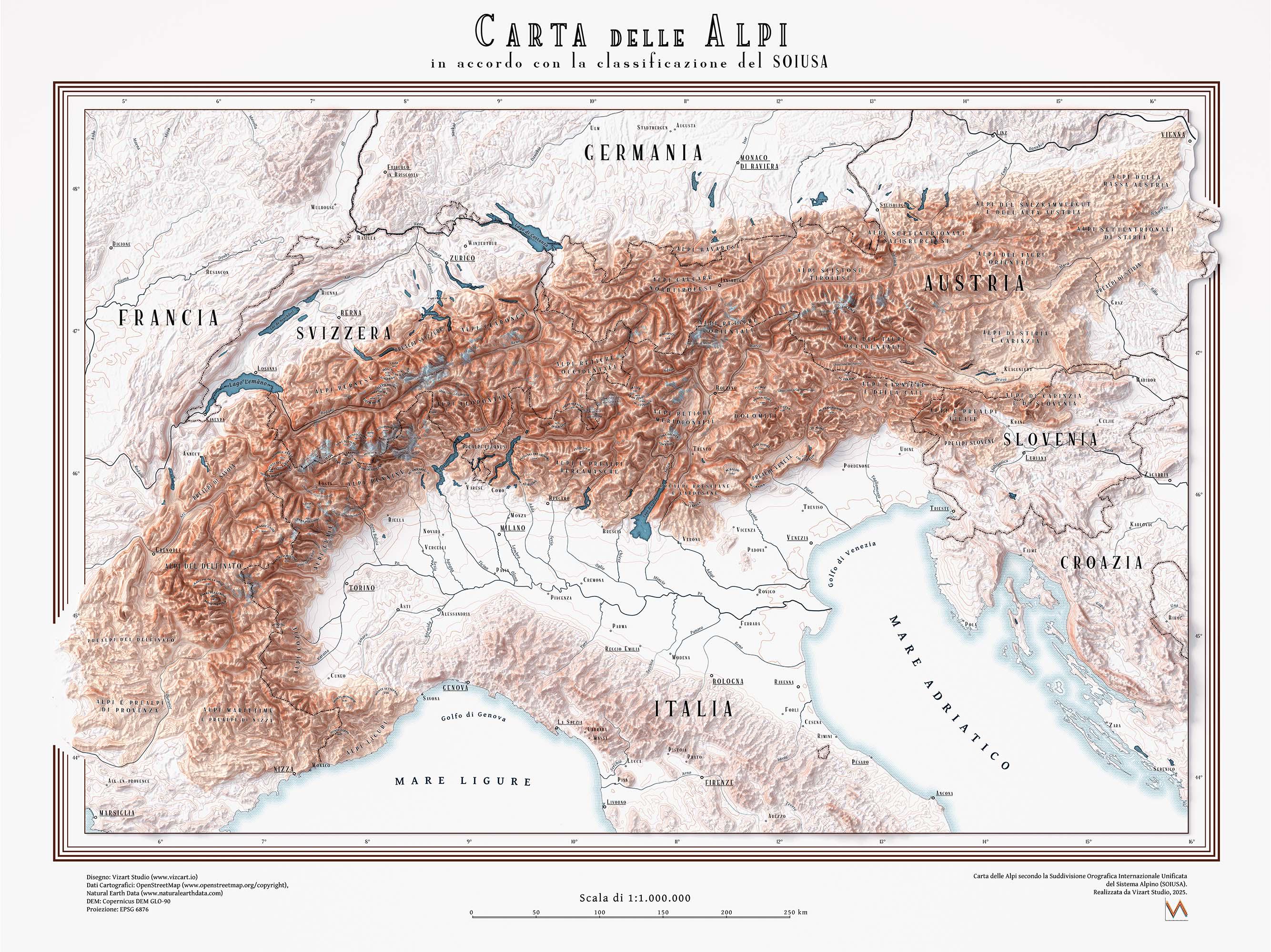
Map of Alps According to SOIUSA Classification
The "Map of Alps according to the SOIUSA classification" visualizes the Alpine mountain range and its subdivisions based...
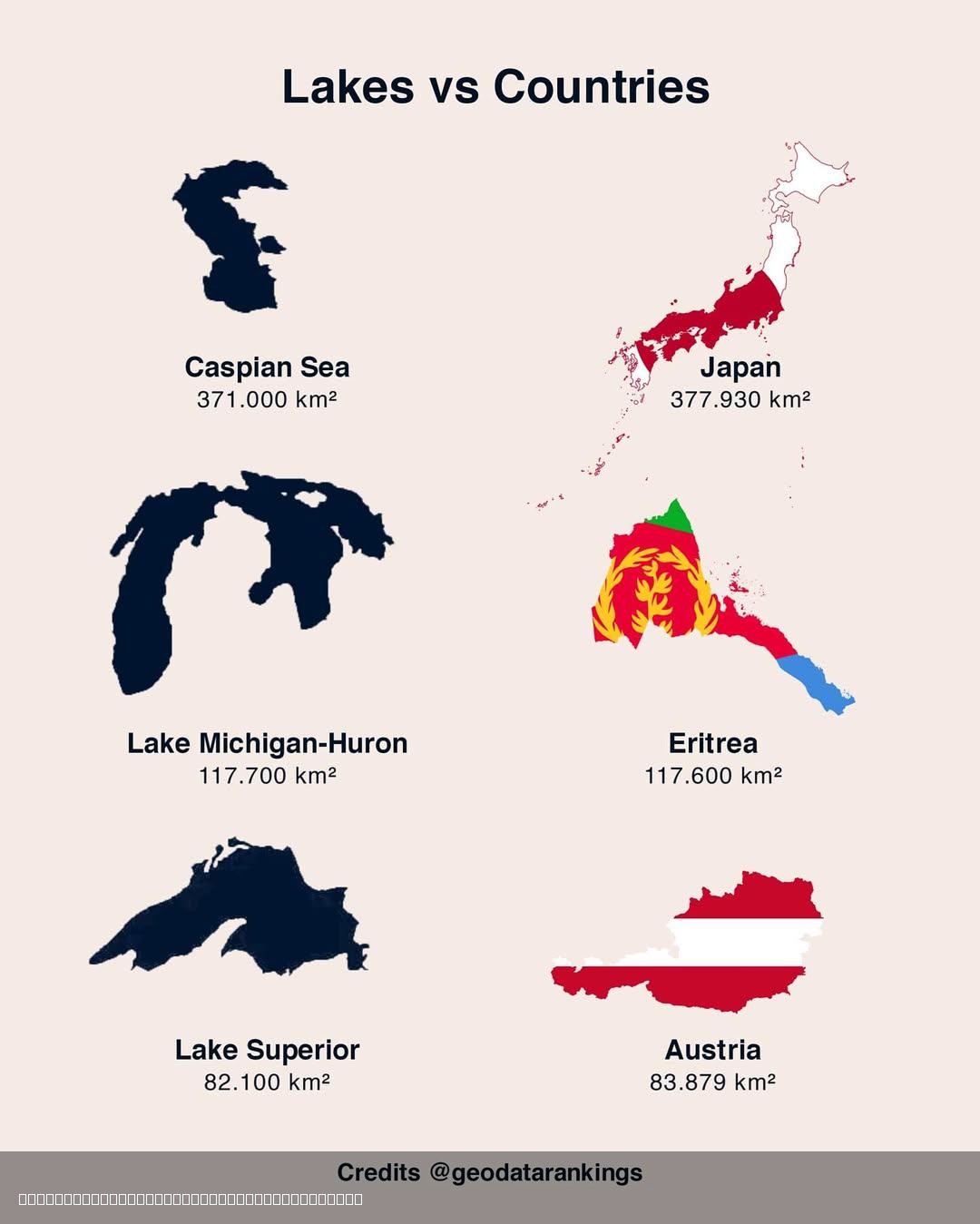
Lakes and Countries Size Comparison Map
The "3 Lakes vs 3 Countries Size Comparison Map" offers a compelling visual representation that juxtaposes the sizes of ...
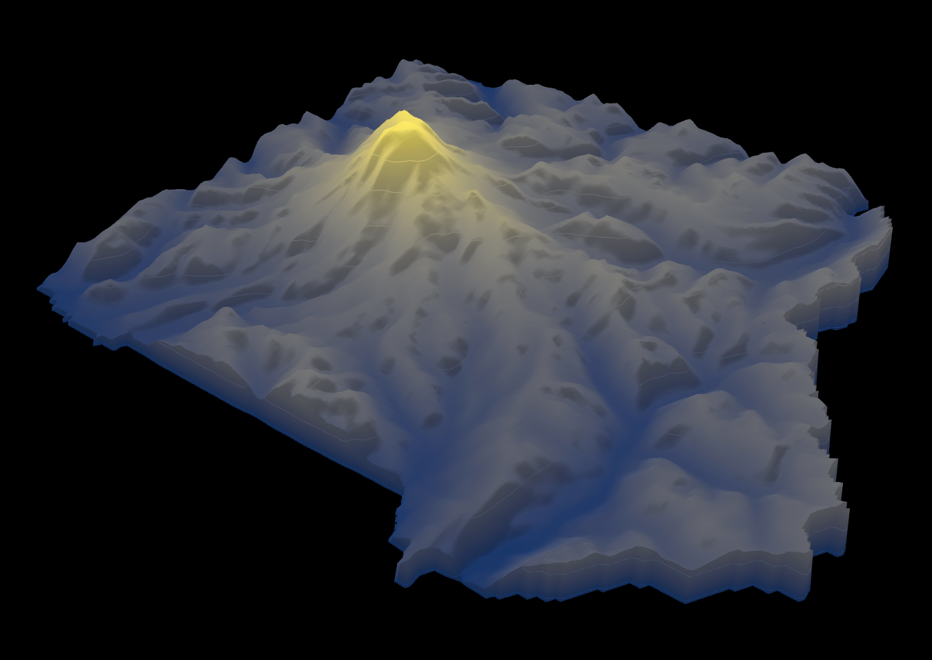
Height Map of Mount Rainier National Park
The height map of Mount Rainier National Park provides a detailed visualization of the elevation changes within this ico...
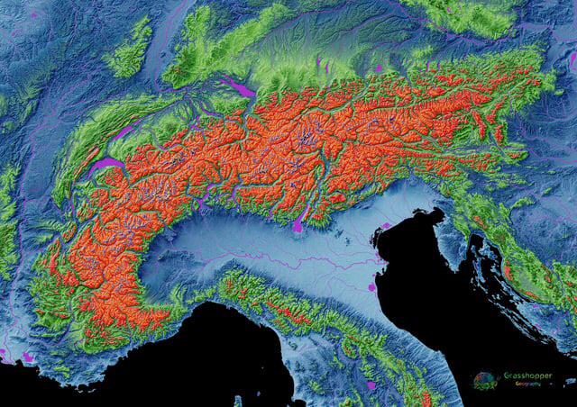
Elevation Map of the Alps
The elevation map of the Alps provides a stunning visual representation of the mountain range's topography, showcasing t...
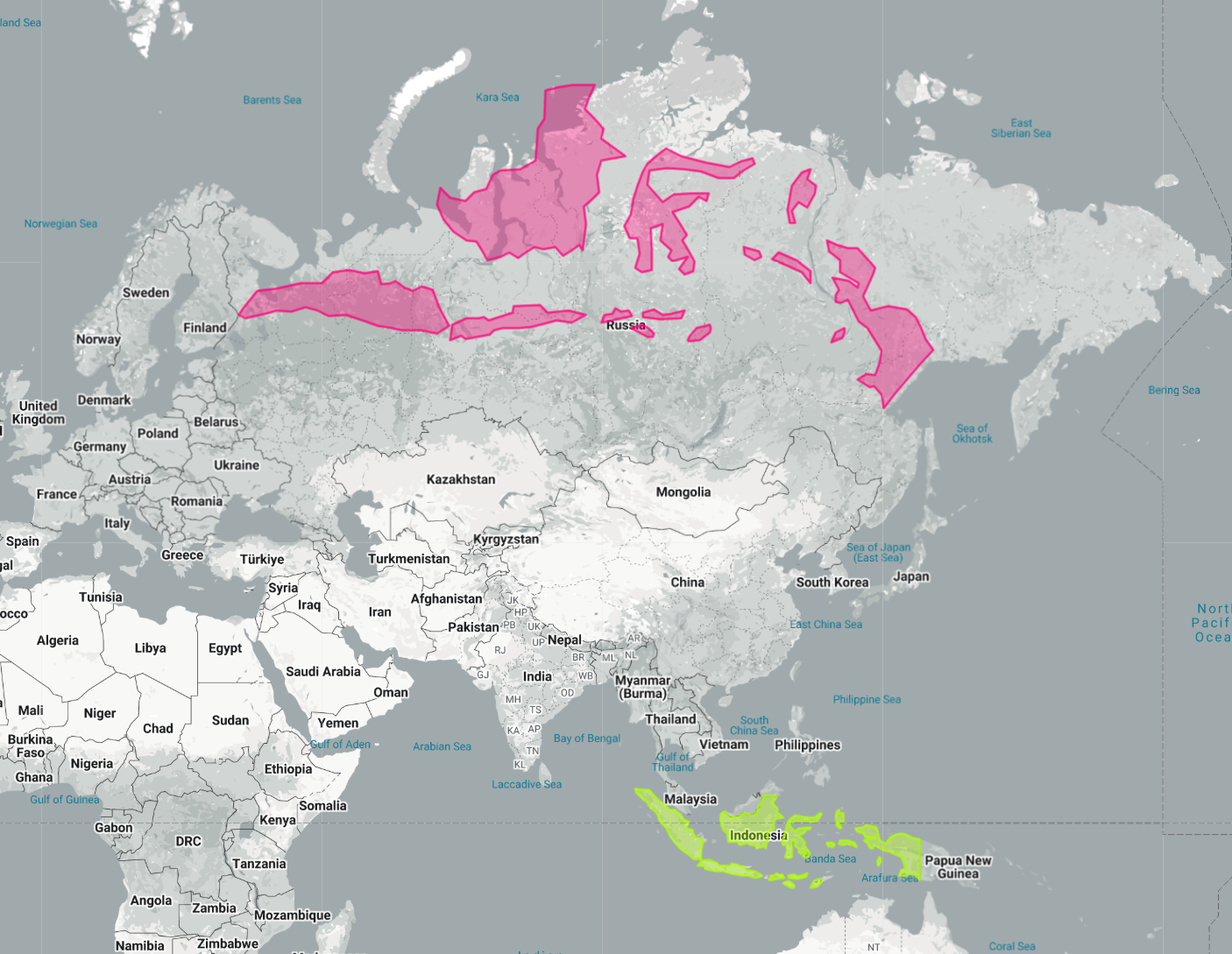
Indonesia Laid Out Over Russia Map
The map titled "Indonesia Laid Out Over Russia" provides a striking visual representation by superimposing the vast arch...
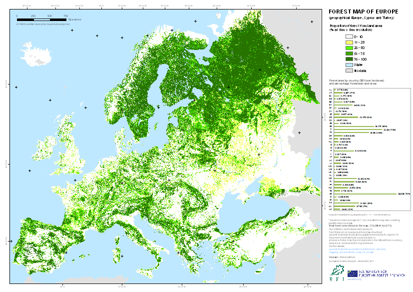
Forest Map of Europe
The "Forest Map of Europe" provides a comprehensive visualization of forest coverage across the continent. It highlights...