PFAS Contamination Map

Alex Cartwright
Senior Cartographer & GIS Specialist
Alex Cartwright is a renowned cartographer and geographic information systems specialist with over 15 years of experience in spatial analysis and data...
CartographyGIS AnalysisSpatial Data Visualization
Geographic Analysis
What This Map Shows
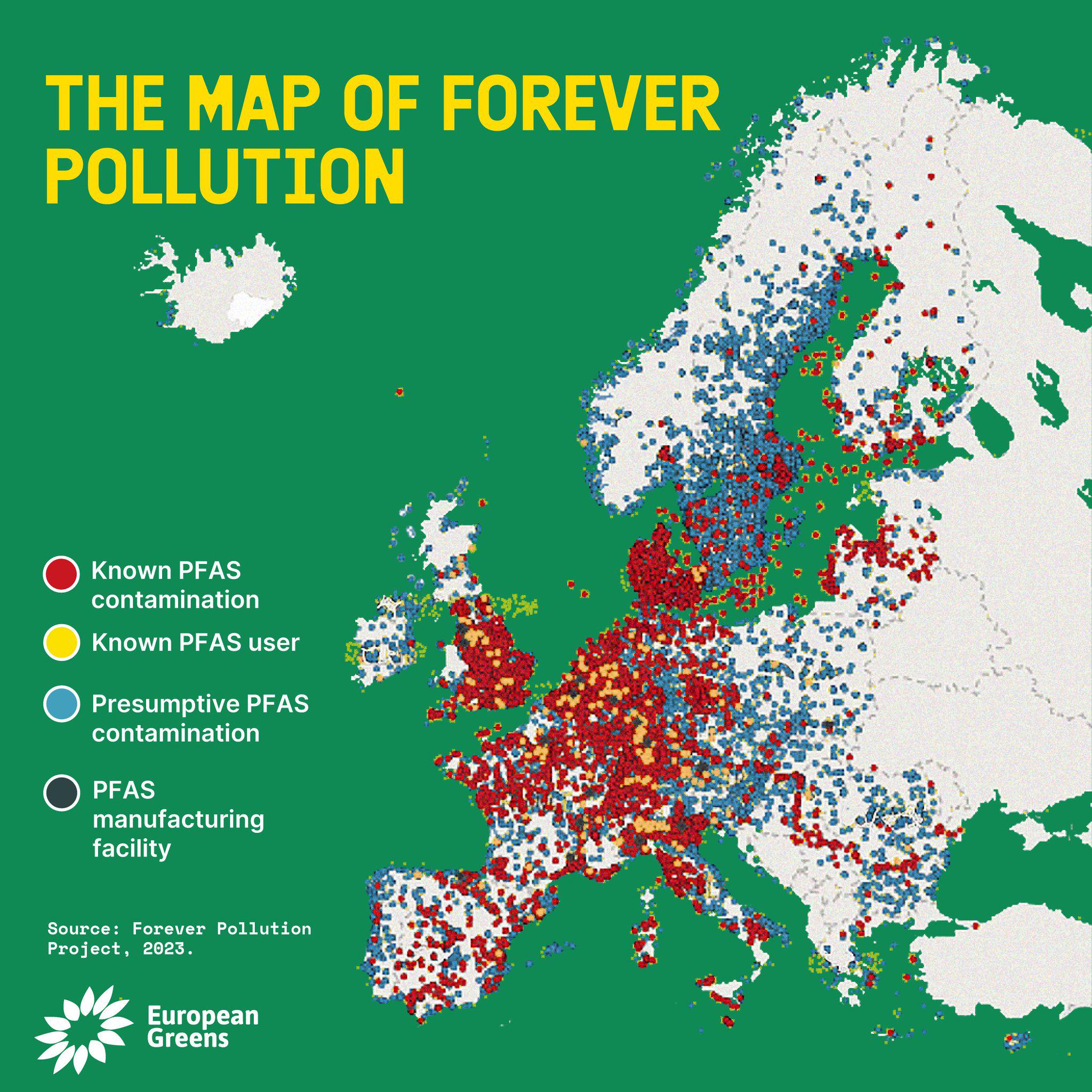
The PFAS Contamination Map provides a comprehensive overview of areas affected by per- and polyfluoroalkyl substances (PFAS), highlighting regions where contamination has been detected in water supplies, soil, and even wildlife. This visualization serves as a crucial tool for understanding the scope of PFAS pollution across the United States and beyond, shedding light on how widespread these chemical compounds are and the potential risks they pose to human health and the environment.
PFAS, often dubbed \
Visualization Details
- Published
- October 9, 2025
- Views
- 40
Comments
Loading comments...