environmental science Maps
17 geographic visualizations tagged with "environmental science"
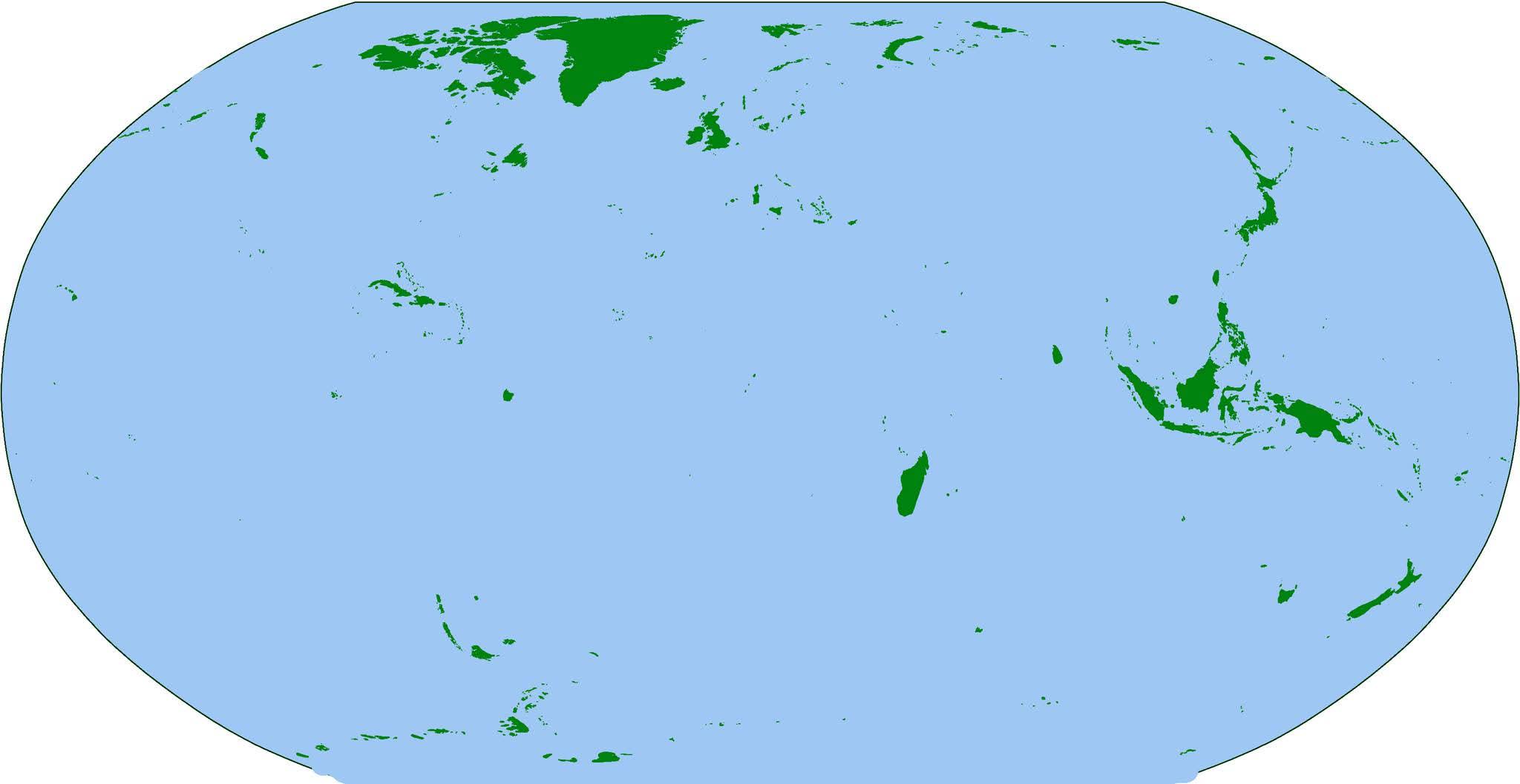
Map of the World's Islands
The visualization titled "The Earth... But Just Islands" presents a unique perspective on our planet by isolating and hi...
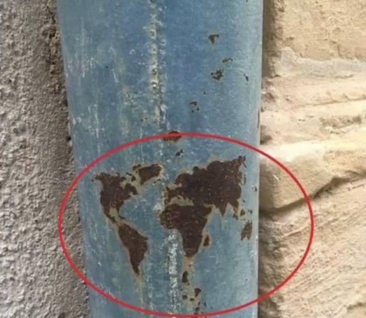
Pole Map of Earth's Geographic Poles
This map provides a detailed visualization of Earth's geographic poles, specifically highlighting the North and South Po...
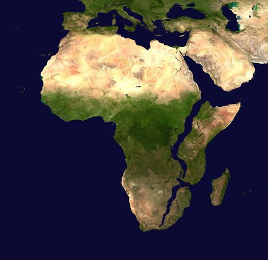
Map of Africa in 10 Million Years
This intriguing map titled "What Africa Might Look Like In 10 Million Years" presents a speculative visualization of the...
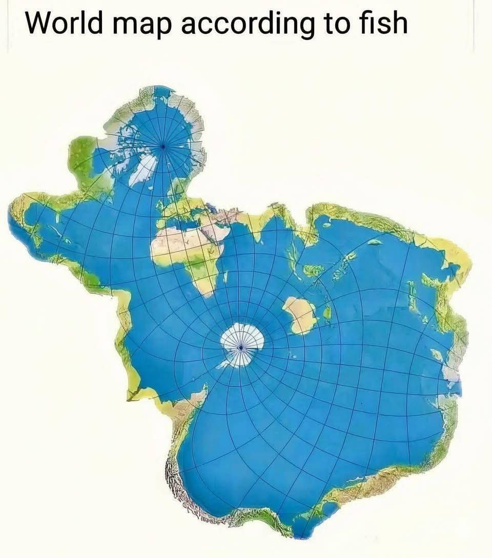
Global Fish Distribution Map
The visualization titled "The World Map If We Were Fish" creatively portrays the global distribution of fish species acr...
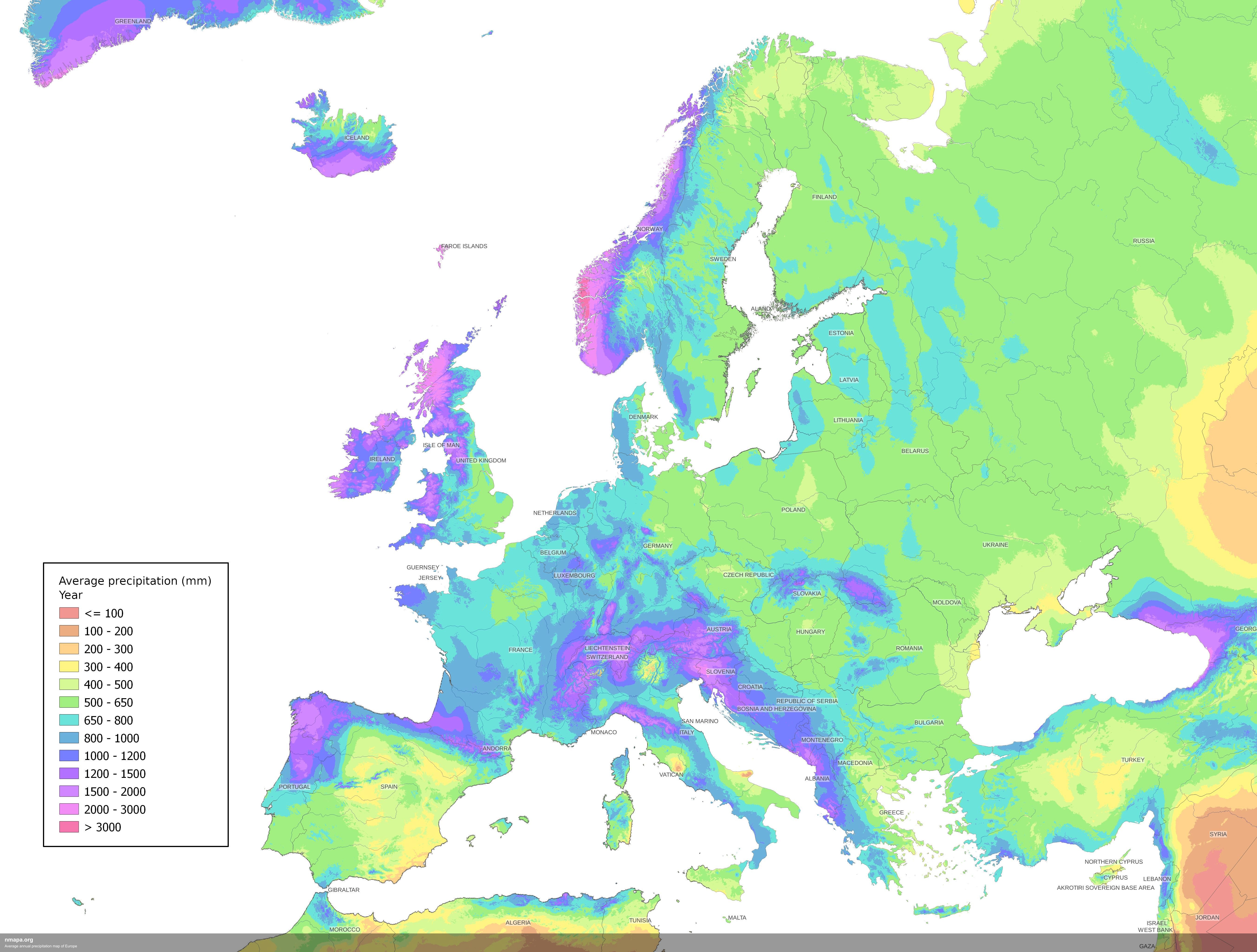
Average Annual Precipitation Map of Europe
The Average Annual Precipitation Map of Europe offers a detailed visualization of rainfall patterns across the continent...
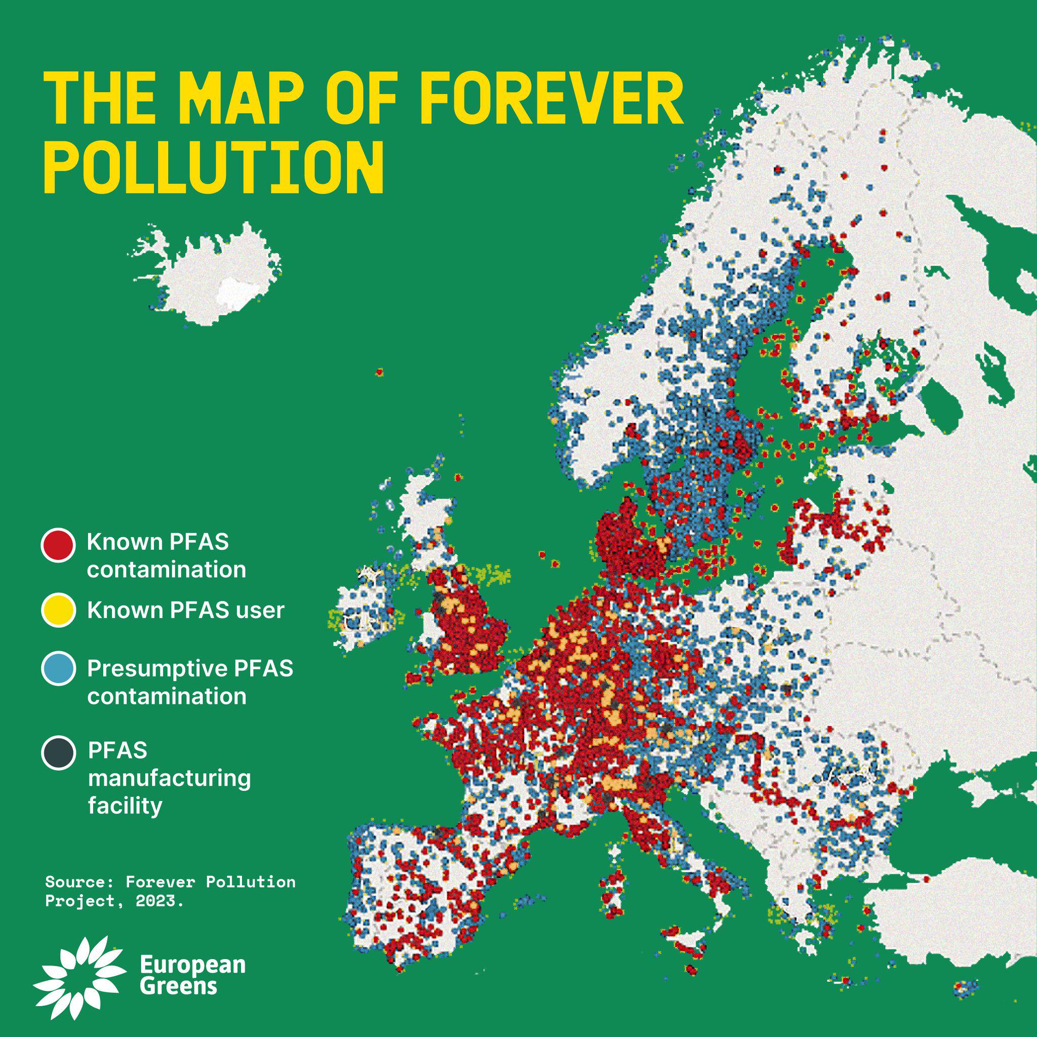
PFAS Contamination Map
The PFAS Contamination Map provides a comprehensive overview of areas affected by per- and polyfluoroalkyl substances (P...
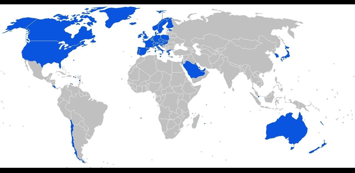
Tap Water Safety by Country Map
The "Tap Water Safety by Country Map" vividly illustrates which countries around the world have potable tap water, indic...
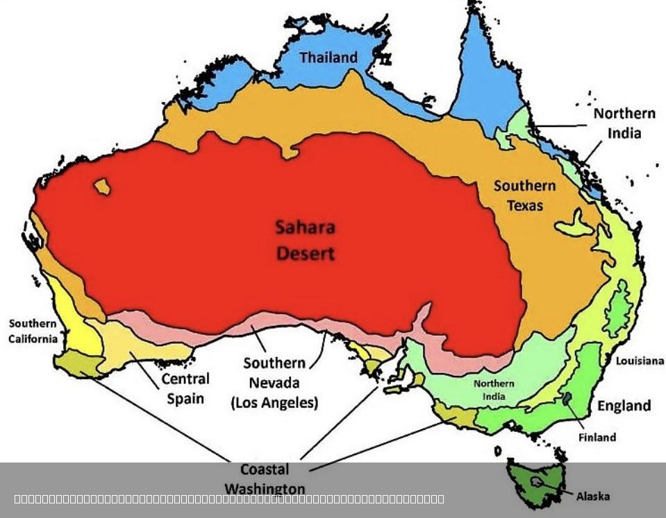
Climate Comparison Map of Australia and the World
The visualization titled "The Climate in Australia Compared to Other Places in the World" presents a comprehensive overv...
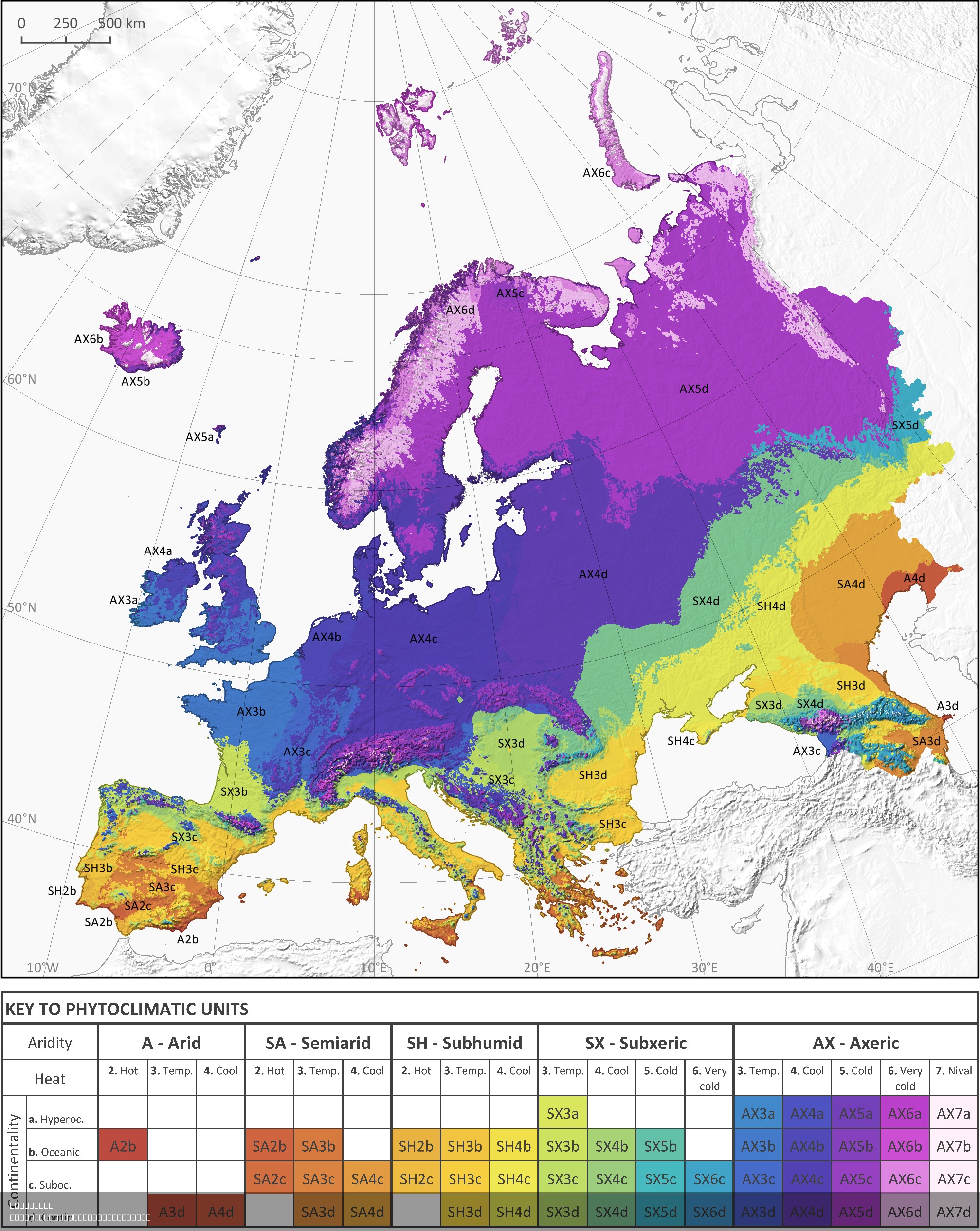
Phytoclimatic Map of Europe
The phytoclimatic map of Europe is a detailed visualization that illustrates the distribution of different plant communi...
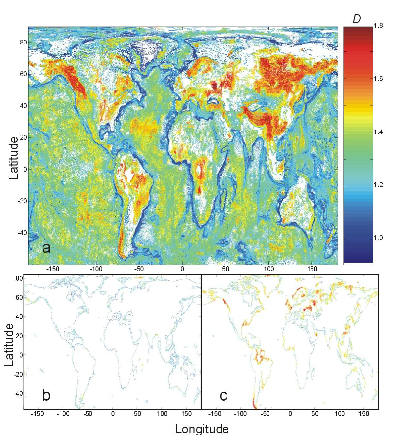
Fractal Dimension of Isolines Map
This visualization titled "Map of Fractal Dimension of Isolines" reveals the fractal dimensions of isolines across the g...
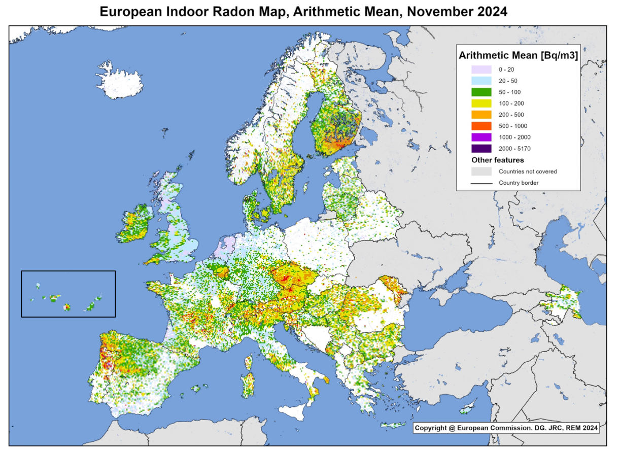
European Indoor Radon Levels Map
The European Indoor Radon Levels Map provides a comprehensive visualization of radon concentration levels across various...
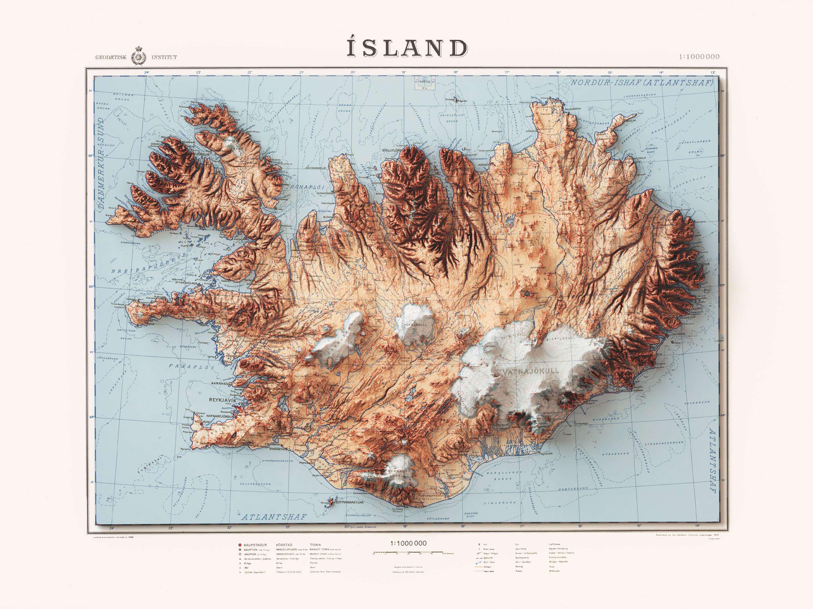
Iceland 1963 Map with Shaded Relief
The shaded relief on this map highlights the elevation changes across the island. For instance, the central highlands, w...
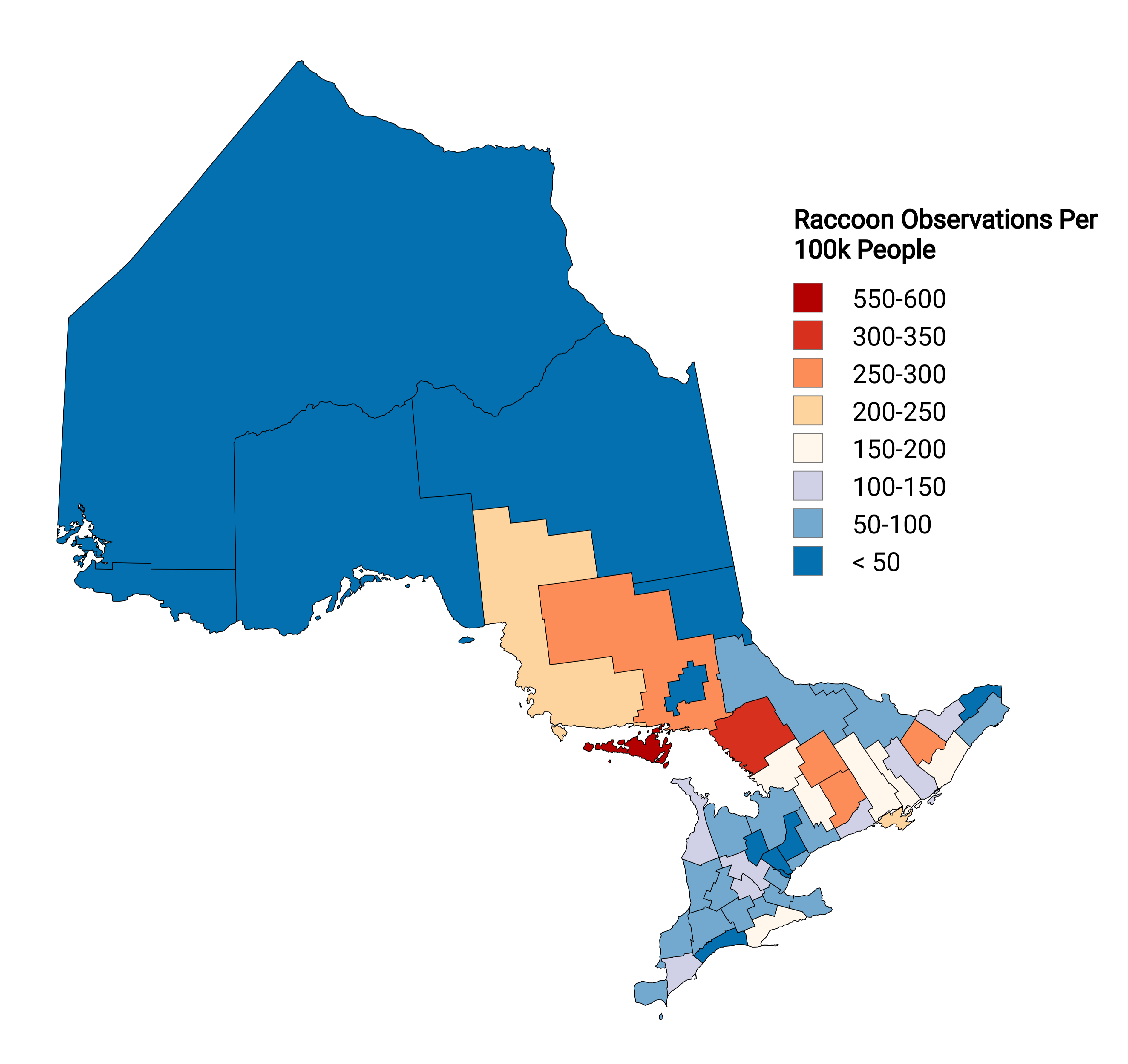
Raccoon Observations Per Capita Map Ontario
The "Raccoon Observations in Ontario Per Capita Map" visualizes the density of raccoon sightings across various regions ...
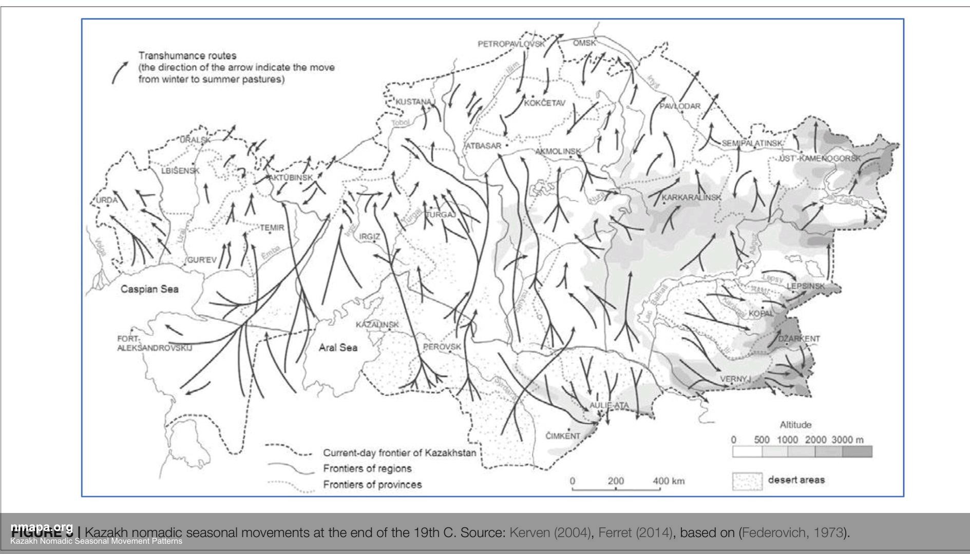
Exploring the Kazakh Nomadic Seasonal Movement Patterns Map
The Kazakh Nomadic Seasonal Movement Patterns Map is a captivating geographical visualization that illustrates the intri...
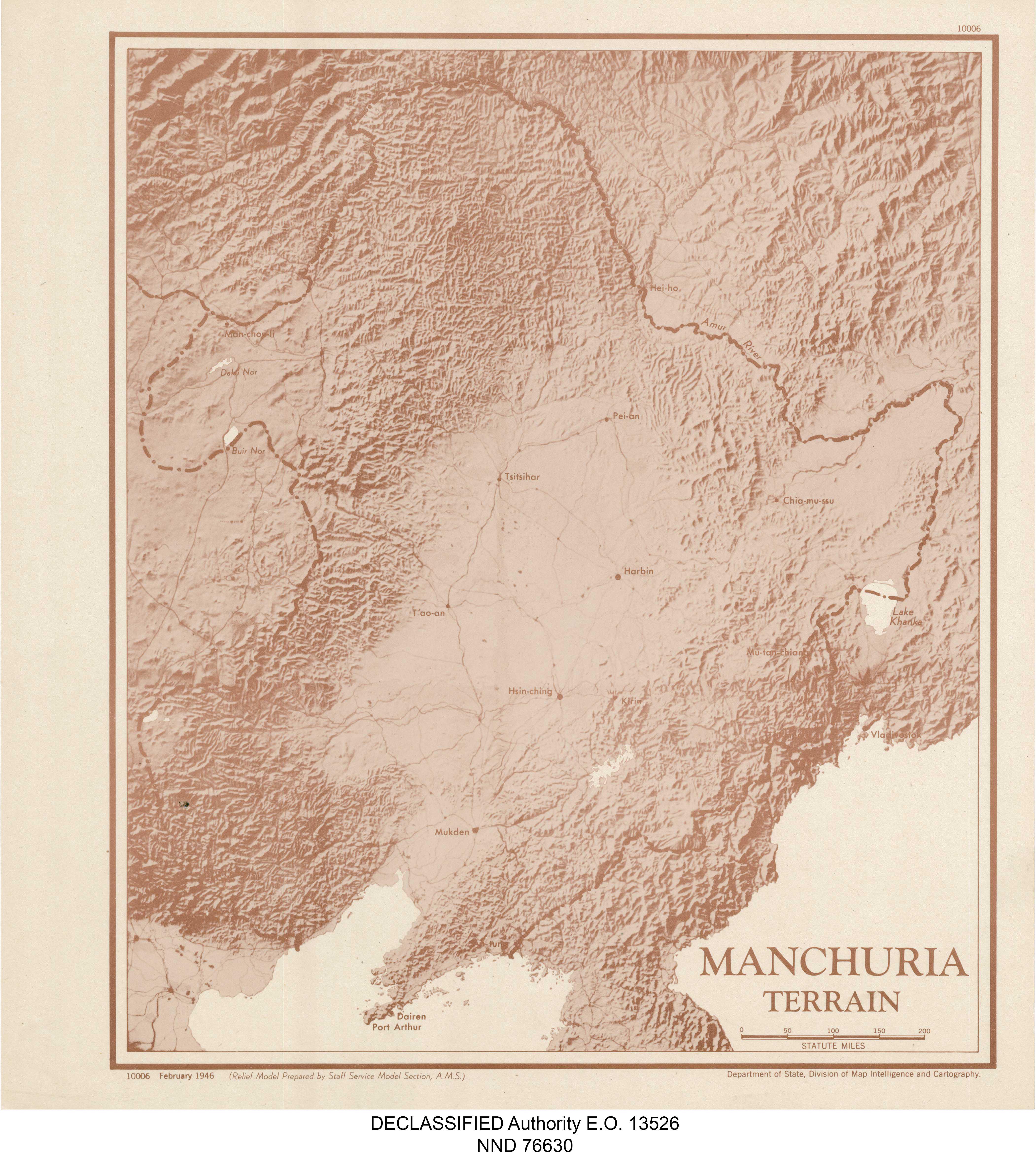
Manchuria Terrain Map
The "Manchuria Terrain Map" provides a detailed visualization of the topographical features of the Manchuria region, whi...
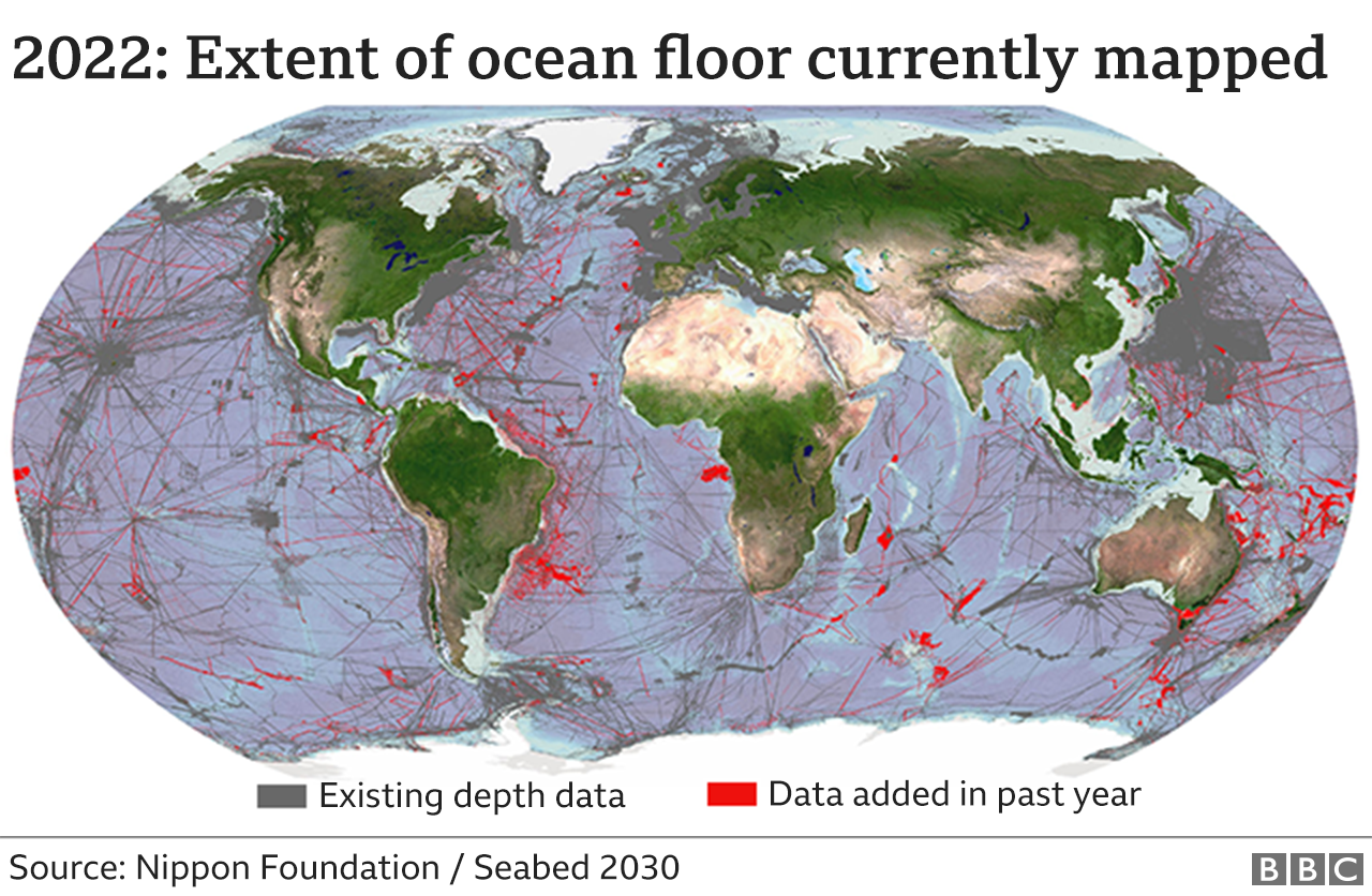
Seabed Mapping Coverage Map 2022
The Nipon Foundation / Seabed 2030 map from 2022 visually represents the total area of the seabed that has been accurate...
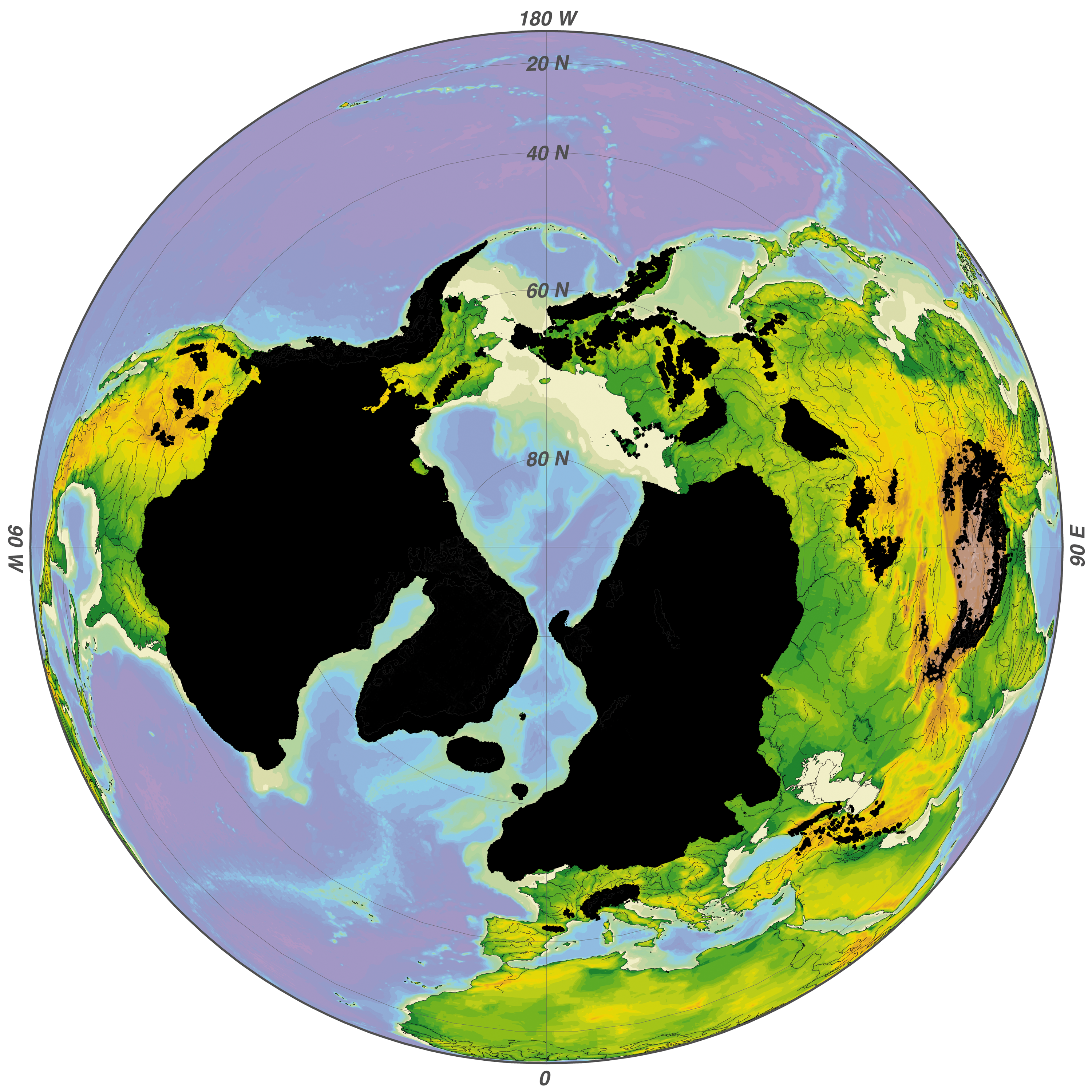
Maximum Extent of Glaciers During the Ice Age Map
The 'Maximum Extent of Glaciers During the Ice Age' map illustrates the farthest reach of glacial ice during the last Ic...