Maximum Extent of Glaciers During the Ice Age Map

Alex Cartwright
Senior Cartographer & GIS Specialist
Alex Cartwright is a renowned cartographer and geographic information systems specialist with over 15 years of experience in spatial analysis and data...
Geographic Analysis
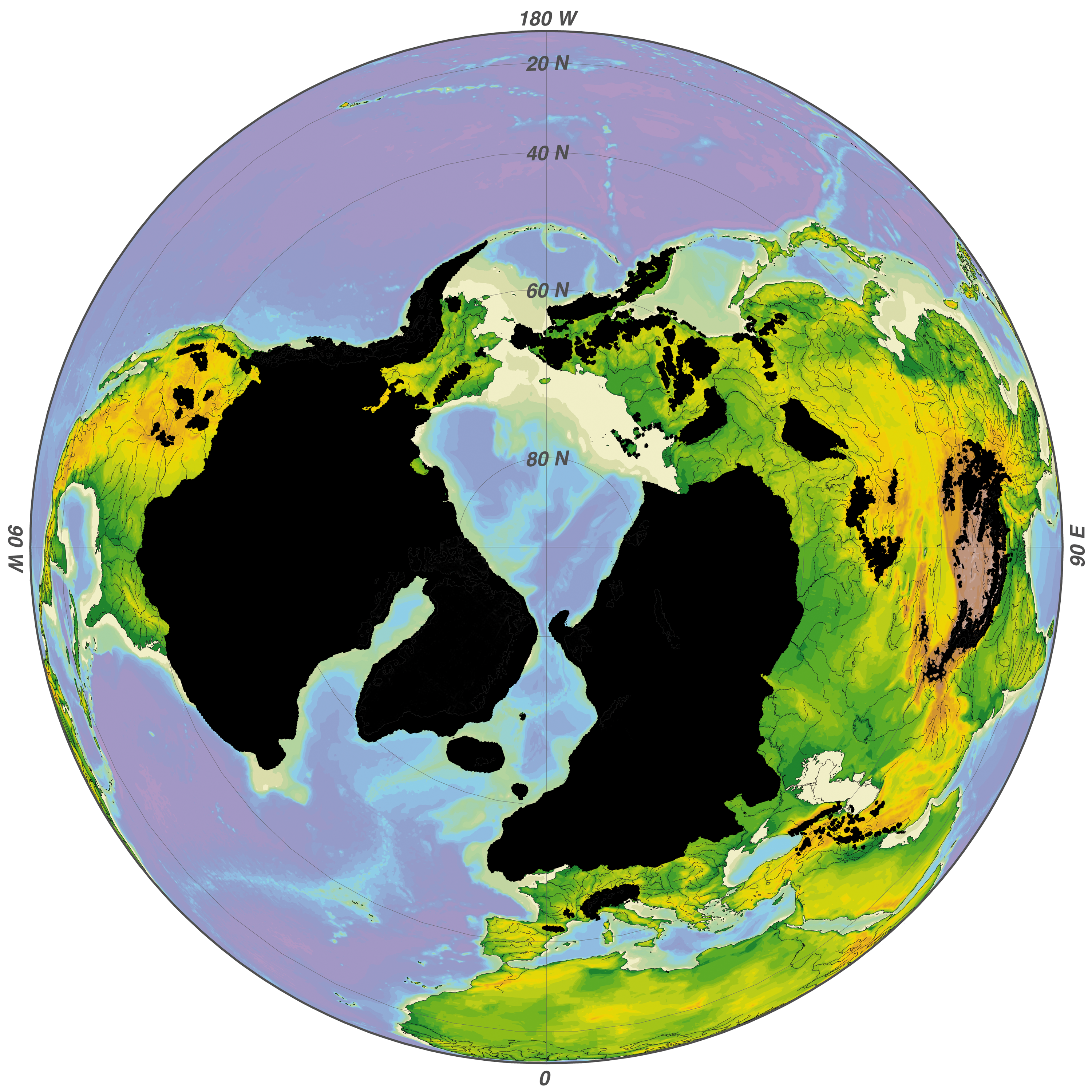
What This Map Shows
The 'Maximum Extent of Glaciers During the Ice Age' map illustrates the farthest reach of glacial ice during the last Ice Age, approximately 20,000 years ago. This visualization highlights how vast areas of North America, Europe, and parts of Asia were covered by thick ice sheets, shaping the landscape and ecosystems we see today. This powerful imagery offers insights into the climatic conditions of the Earth during this period, helping us understand the historical context of our planet's climate.
Deep Dive into Ice Ages
The Ice Age, or more accurately, the Pleistocene Epoch, was characterized by a series of glacial periods interspersed with warmer interglacial periods. The last glacial maximum (LGM) occurred around 20,000 years ago when glaciers expanded to their furthest extent. This was a time when the Earth was significantly cooler, and massive ice sheets, sometimes over a mile thick, covered vast regions.
Interestingly, during the LGM, much of Canada and parts of the northern United States were engulfed by the Laurentide Ice Sheet. This ice sheet extended down to the northern Midwest, leaving a lasting geological imprint on the landscape. Glacial features like moraines, drumlins, and kettle lakes can still be observed today, revealing the dynamic processes of glaciation.
The impact of these glaciers was not limited to North America. In Europe, the Scandinavian Ice Sheet dominated the landscape, stretching across present-day Scandinavia and into the British Isles. This glaciation transformed the terrain, leading to the formation of fjords and numerous lakes, and significantly influencing human migration patterns. Have you ever wondered how these glacial movements shaped human civilization? The areas once covered by ice were often the first to be settled as the climate warmed and landscapes became more hospitable.
The climatic conditions during the Ice Age were primarily driven by variations in Earth's orbit and axial tilt, known as Milankovitch cycles. These natural phenomena influence solar radiation distribution, creating cycles of glacial and interglacial periods. As temperatures fluctuated, so did the extent of glacial coverage. The end of the last Ice Age, roughly 11,700 years ago, marked the beginning of the Holocene epoch, leading to significant changes in flora, fauna, and human societies.
Regional Analysis
Examining the map, we can break down the maximum glacial extents by region. In North America, the Laurentide Ice Sheet was the most significant feature, covering almost all of Canada and parts of the northern United States. The retreat of this ice sheet not only shaped the Great Lakes but also created fertile regions that would later support agriculture and urban development.
In contrast, the Cordilleran Ice Sheet, which covered the western mountains of North America, presented a different geological profile. Its impact was more localized, affecting the mountainous terrain and leading to the development of unique ecosystems within the Rocky Mountains. The interaction between glacial and interglacial periods in these regions offers a fascinating study of ecological succession and adaptation.
Moving across the Atlantic, the Scandinavian Ice Sheet played a pivotal role in shaping Northern Europe. Its retreat led to the exposure of land that facilitated the migration of human populations. Interestingly, the areas that were once covered by ice, such as modern-day Norway and Sweden, are now characterized by rich biodiversity and unique geological formations resulting from glacial erosion.
Significance and Impact
Understanding the maximum extent of glaciers during the Ice Age is crucial for multiple reasons. First, it provides insights into how our planet's climate has changed over millennia, helping scientists predict future climate scenarios. For instance, as global temperatures rise due to anthropogenic factors, understanding past glacial movements can aid in predicting how current ice sheets, like those in Greenland and Antarctica, may respond.
Moreover, the study of glacial extents informs us about sea-level rise. As glaciers melt, they contribute to rising sea levels, which can have severe implications for coastal communities worldwide. Current trends indicate that the Greenland ice sheet is losing mass at an accelerating rate, a phenomenon scientists are closely monitoring.
In conclusion, the 'Maximum Extent of Glaciers During the Ice Age' map does more than just illustrate where ice once thrived; it invites us to reflect on our planet's climatic past and its implications for our future. The lessons learned from the Ice Age can help guide our understanding of climate change and its potential impacts on the Earth and its inhabitants in the years to come.
Visualization Details
- Published
- August 30, 2025
- Views
- 96
Comments
Loading comments...