Ammassalik Wooden Maps of Greenland

Marcus Rodriguez
Historical Geography Expert
Marcus Rodriguez specializes in historical cartography and geographic data analysis. With a background in both history and geography, he brings unique...
Geographic Analysis
What This Map Shows
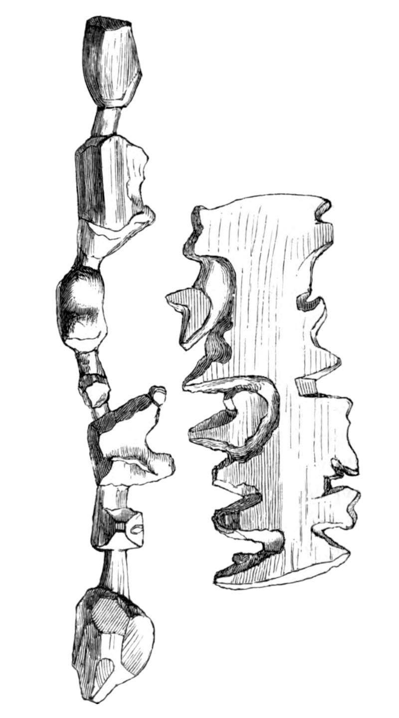
The Ammassalik wooden maps are intricate, tactile representations of the Greenlandic coastlines, primarily depicting the eastern coastal regions of Greenland. These maps, carved from wood, serve not only as navigational aids but also as cultural artifacts that highlight the unique geographical features of this remote area. The maps showcase significant landmarks, including fjords, islands, and coastal settlements, reflecting the landscape's complexity and the deep connection Inuit communities have with the land.
Deep Dive into Greenland's Coastal Geography
Greenland's coastline is a marvel of natural beauty and geographical diversity. Stretching over 44,000 kilometers, it features deep fjords, towering cliffs, and a myriad of islands that create a stunning visual tapestry. The Ammassalik region, in particular, is renowned for its dramatic landscapes shaped by glaciation and erosion. Interestingly, the fjords in this area are some of the deepest in the world, carved by ancient glaciers that once flowed down from the ice sheet that covers much of the island.
The coastline is not just a physical boundary; it’s a lifeline for the communities that inhabit it. The Inuit people have lived in harmony with this environment for thousands of years, relying on the sea for sustenance. The Ammassalik wooden maps, therefore, are not merely navigational tools; they are embodiments of traditional knowledge that detail fishing grounds, hunting paths, and seasonal migration routes. Ever wondered how the Inuit have managed to adapt to such a harsh environment? Their understanding of the geography has been passed down through generations, making these maps vital for survival.
What's fascinating is the interdependence of the geographical features and the climate in this region. The Greenlandic coast experiences extreme weather conditions, including harsh winters and relatively mild summers. The Gulf Stream affects the eastern coast, bringing warmer waters that support a rich marine ecosystem. This has implications for local fisheries and biodiversity. Statistical data indicates that the waters off the Ammassalik coast are home to various marine species, including cod, halibut, and shrimp, which are crucial for local economies.
Regional Analysis
Breaking down the Ammassalik wooden maps by specific regions reveals a wealth of information about the diverse geographical features and cultural significance. For instance, the southern part of the Ammassalik area is characterized by steep cliffs and narrow fjords, such as the famous Sermilik Fjord, known for its stunning icebergs and rich marine life. In contrast, the northern regions feature more gentle slopes and wider inlets, allowing for easier access to the sea.
Interestingly, the settlement patterns along the coast reflect these geographical variations. The town of Tasiilaq, situated in the southern part of the Ammassalik region, is the largest settlement and serves as a central hub for trade and cultural exchange. The town’s location provides access to both land and sea resources, making it an ideal spot for the Inuit community.
In terms of cultural geography, the use of the Ammassalik wooden maps showcases how the Inuit have adapted to their environment. These maps highlight not just physical geography but also the cultural landscapes that have developed around resource use, traditional practices, and social structures. The tactile nature of the maps allows for a unique interaction, making them accessible to individuals regardless of literacy skills, thereby preserving traditional knowledge.
Significance and Impact
The significance of the Ammassalik wooden maps extends beyond their physical representation of geography. They symbolize a deep-rooted connection to the land and serve as a reminder of the importance of indigenous knowledge systems in understanding and navigating our world. In an age where climate change poses significant threats to coastal regions, these maps remind us of the resilience and adaptability of the Inuit people.
Current trends indicate that as climate change accelerates, the Greenlandic coastal regions are experiencing rising sea levels and changing ecosystems. This has profound implications for local communities that rely on traditional fishing and hunting practices. Mapping these changes is vital for adaptation strategies and sustainable development in the region. The Ammassalik wooden maps stand as a testament to the past while also offering insights into the future, bridging the gap between traditional knowledge and modern environmental challenges.
In conclusion, the Ammassalik wooden maps are not just artistic representations but crucial cultural artifacts that embody the essence of Greenland’s coastal geography. They provide valuable insights into how geography, climate, and culture intertwine to shape the lives of the Inuit people, making them an essential focus for both scholars and enthusiasts alike.
Visualization Details
- Published
- August 24, 2025
- Views
- 272
Comments
Loading comments...