historical maps Maps
89 geographic visualizations tagged with "historical maps"
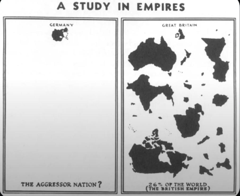
WWII Nazi Propaganda Map of Empires
The visualization titled "WWII Nazi Propaganda Map Comparing British and German Empires" serves as a striking representa...
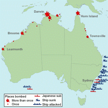
WW2 Attack Sites in Australia Map
The 'Sites in Australia Attacked in WW2' map provides a critical visual representation of the locations across Australia...
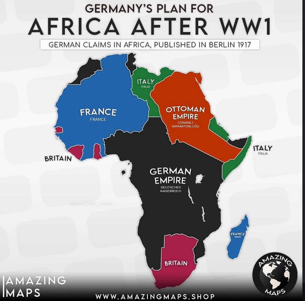
German Colonial Plans for Africa After WW1 Map
The map titled "German Colonial Plans for Africa After WW1" provides a visual representation of the territories that Ger...
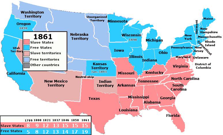
Free and Slave States at the Start of the Civil War Map
...
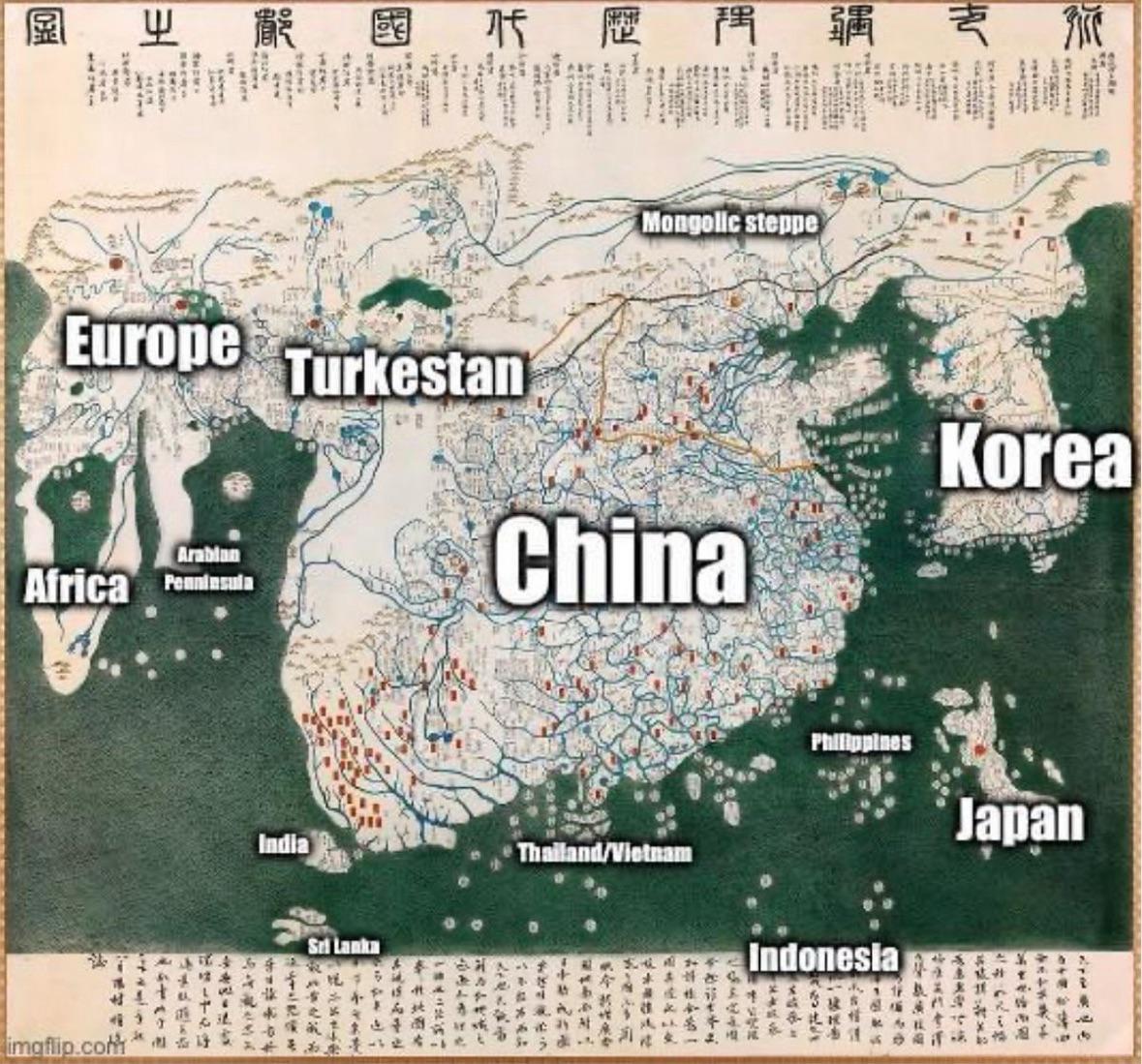
1402 World Map from Korea
...
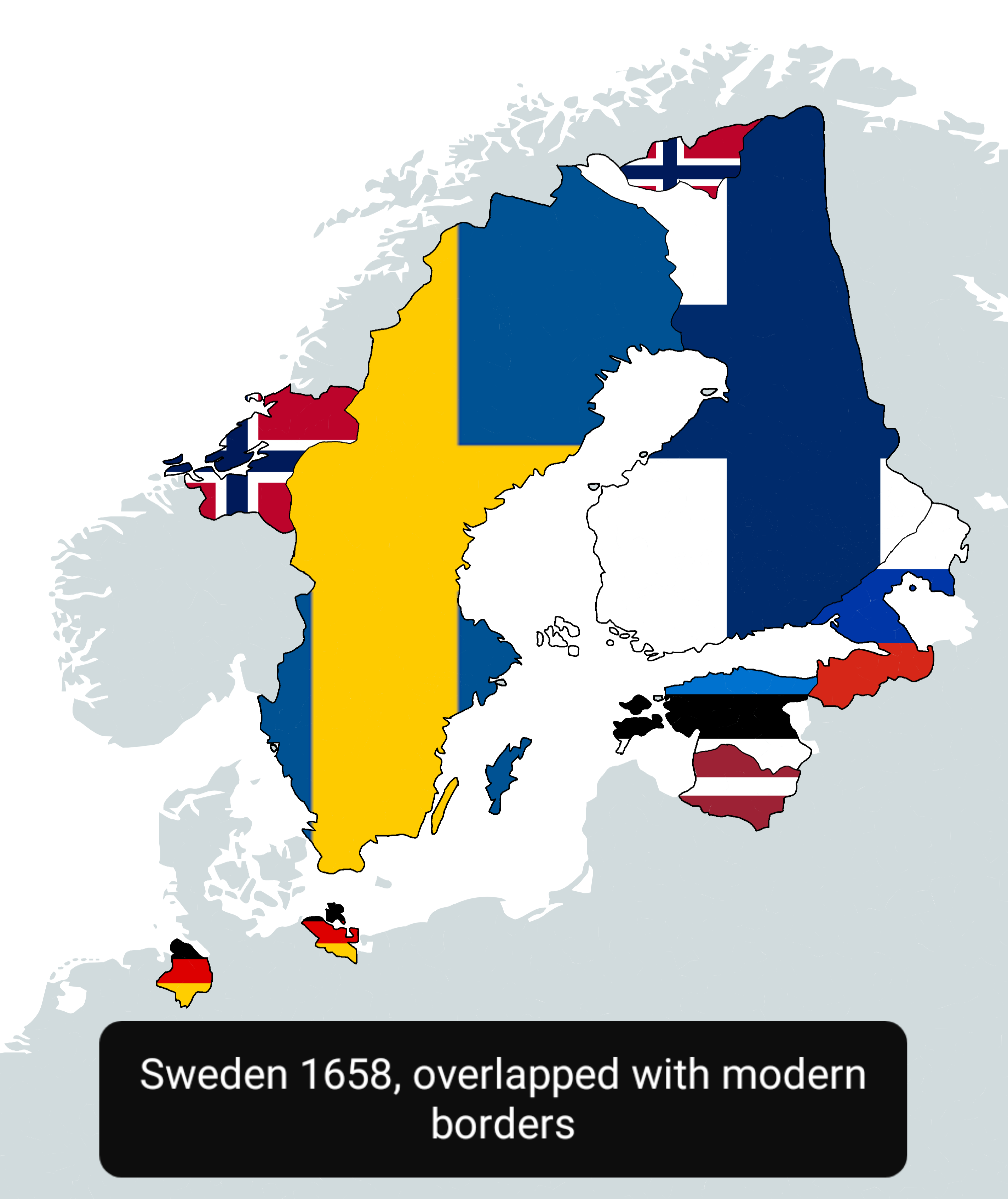
Sweden in 1658 Map Overlapped with Modern Countries
This map visually represents Sweden as it was in 1658, overlapped with the boundaries of modern countries. It allows us ...

New York Election Map 1892 vs 2024
The visualization titled "Election in New York 1892 vs 2024" provides a compelling comparison of political landscapes ac...
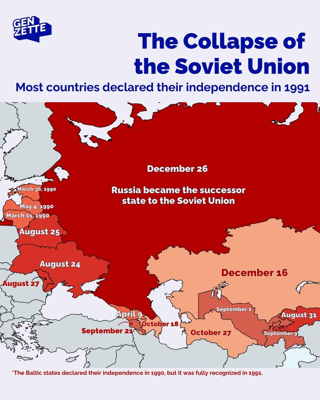
Countries Declaring Independence in 1991 Map
The map titled "Countries Declaring Independence in 1991" visualizes the significant geopolitical changes that occurred ...
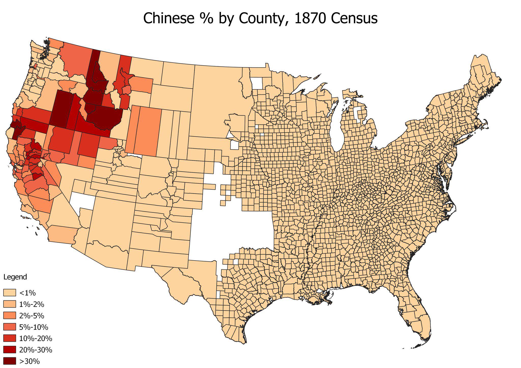
Chinese American Population by County Map, 1870
The "Chinese American Population by County, 1870" map provides a detailed visualization of the distribution of Chinese i...
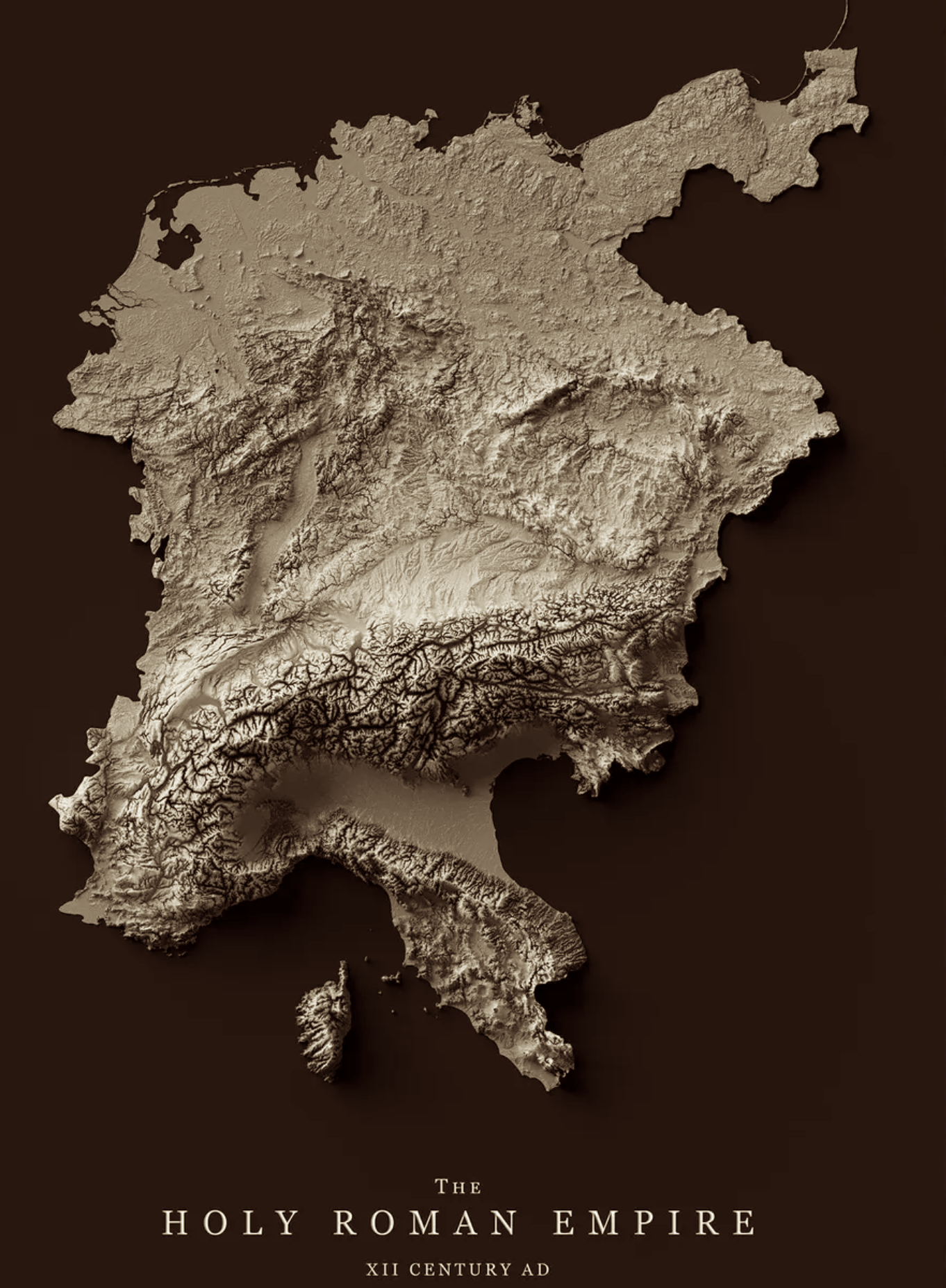
Relief Map of the Holy Roman Empire 12th Century
The relief map of the Holy Roman Empire in the 12th century provides a vivid representation of the geographical features...
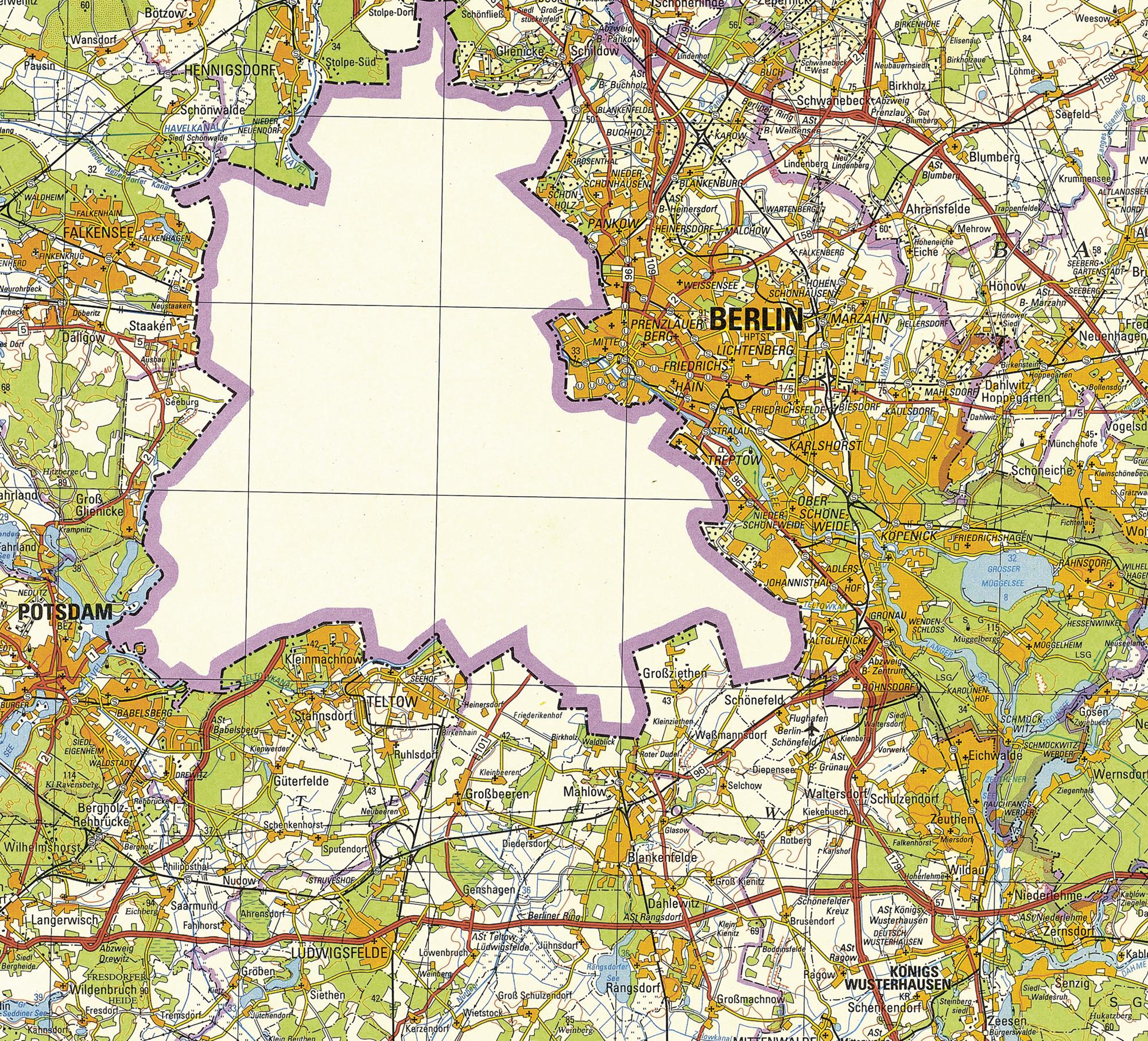
1988 East German Map of Berlin
The 1988 East German map of Berlin vividly illustrates a unique historical moment in a divided city. Notably, this visua...
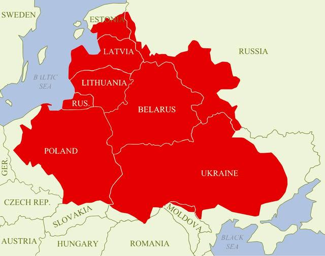
Polish–Lithuanian Commonwealth Maximum Extent Map
The visualization titled "Polish–Lithuanian Commonwealth at its maximum extent over modern borders" depicts the historic...
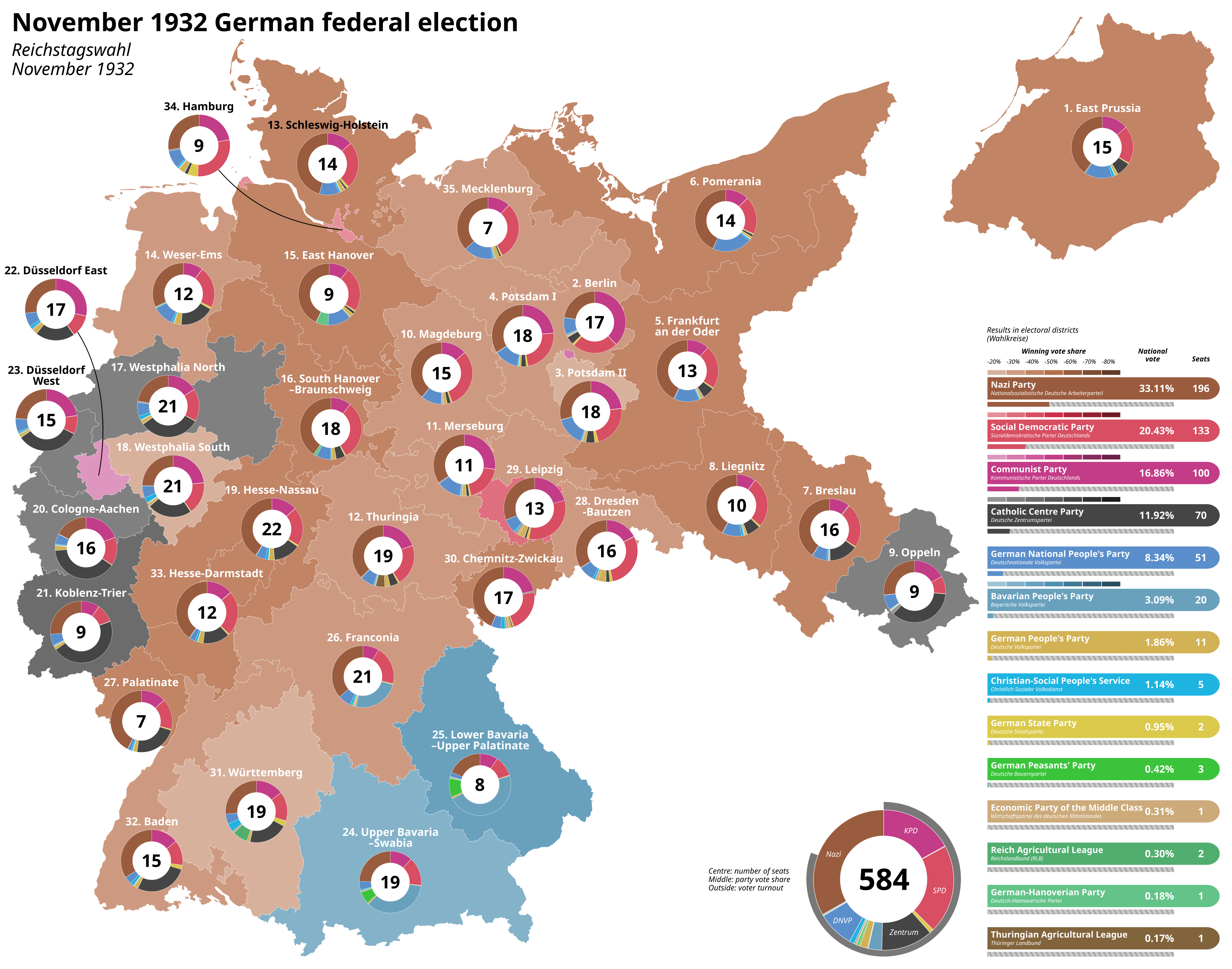
Last Free German Election of the Weimar Period Map
The "Last Free German Election of the Weimar Period Map" vividly illustrates the political landscape of Germany during t...
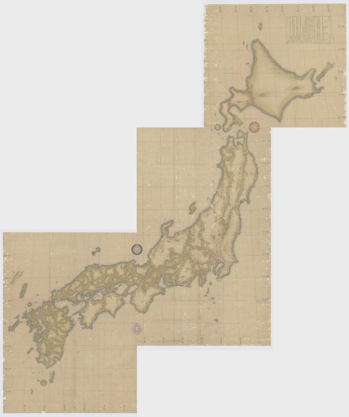
Japanese Topographical Map by Inō Tadataka
The map created by Inō Tadataka in 1821 represents a detailed topographical outline of Japan, showcasing the country's m...
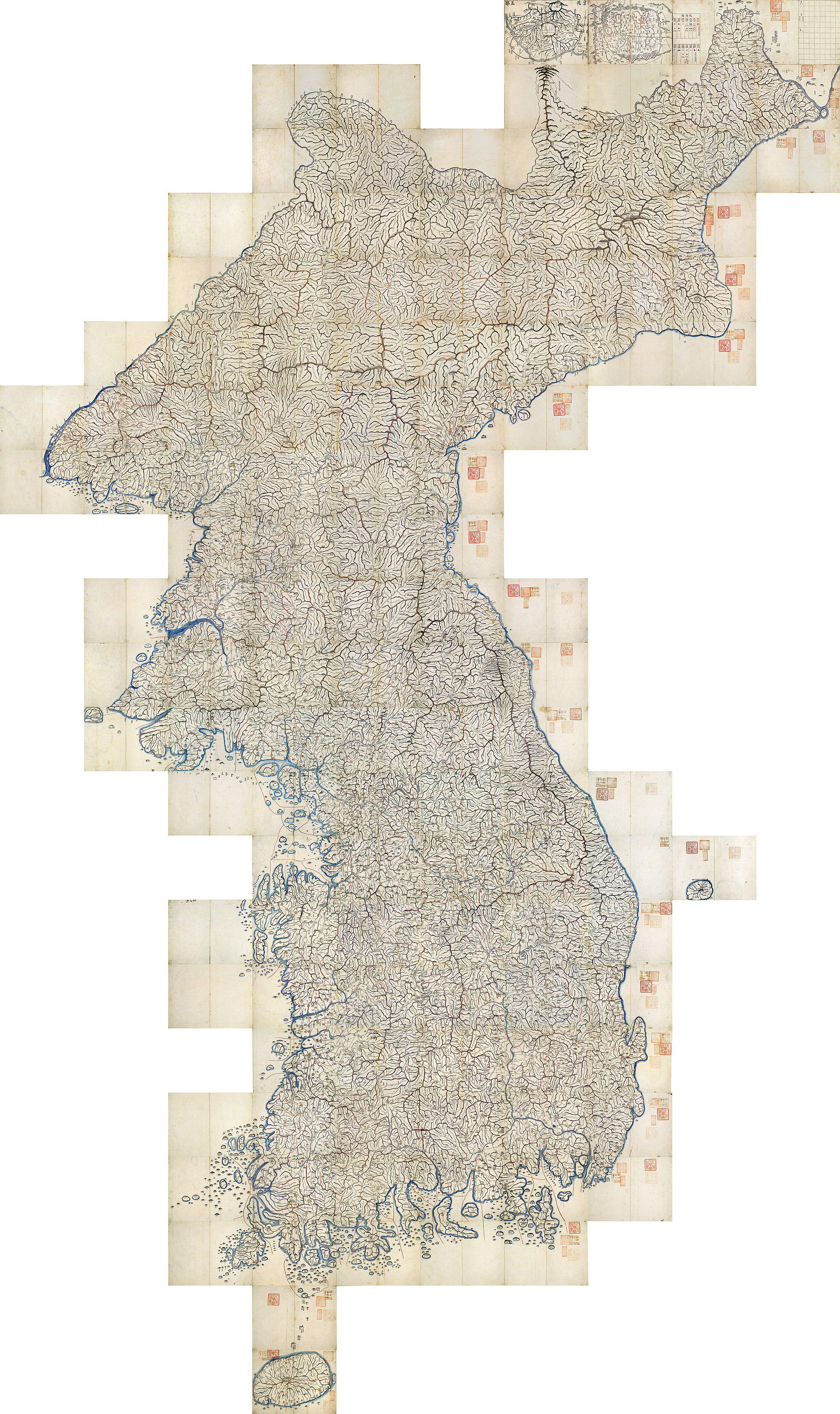
1861 Map of Korea Overview
The 1861 map of Korea presents a snapshot of the Korean Peninsula during a pivotal time in its history, before the adven...
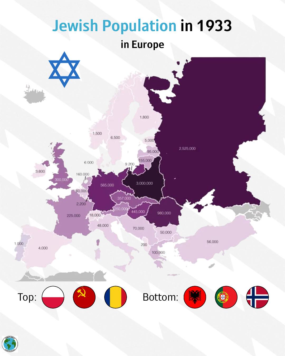
Jewish Population Distribution Map in Europe 1933
The \...
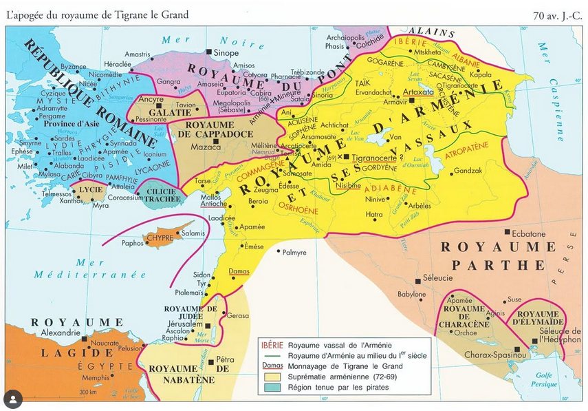
Map of the Kingdom of Armenia in 70 BC
The "Map of the Kingdom of Armenia in 70 BC" provides a detailed visual representation of Armenia during a pivotal perio...
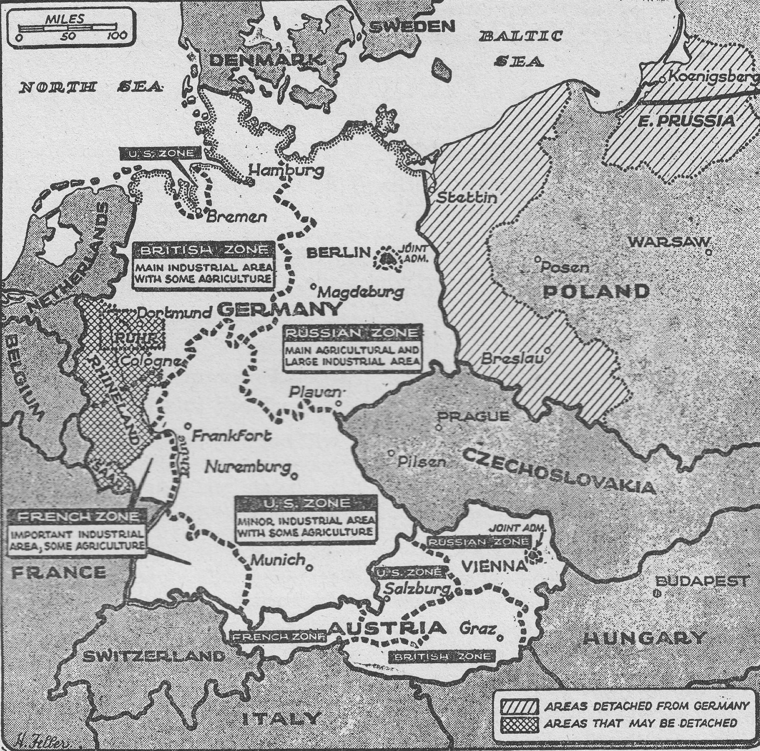
Post-War Occupation Division of Germany Map
The "Post-War Occupation Division of Germany (1948) Map" vividly illustrates the geographical demarcation of Germany int...
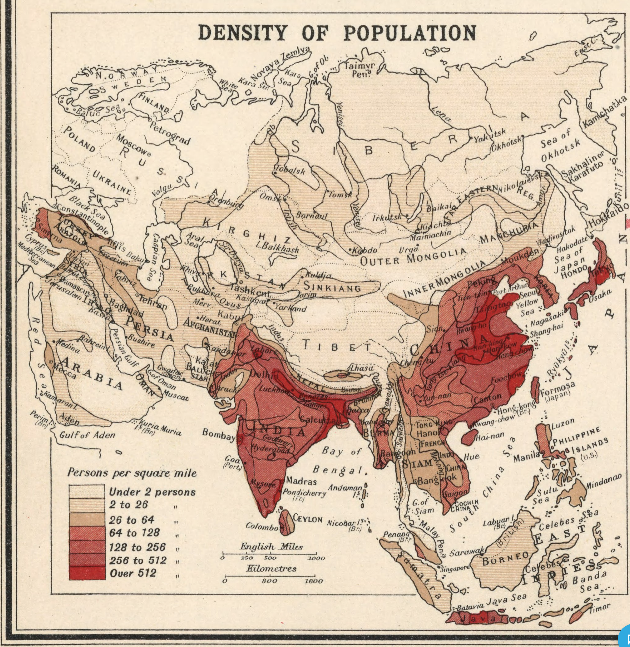
Population Density Map of Asia in 1923
The "Population Density in Asia in 1923" map offers a captivating glimpse into the demographic landscape of Asia during ...
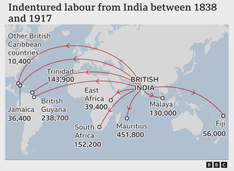
Indian Indentured Labor Map 1838–1917
This map showcases the complex and often harrowing journey of Indian indentured laborers under British rule from 1838 to...
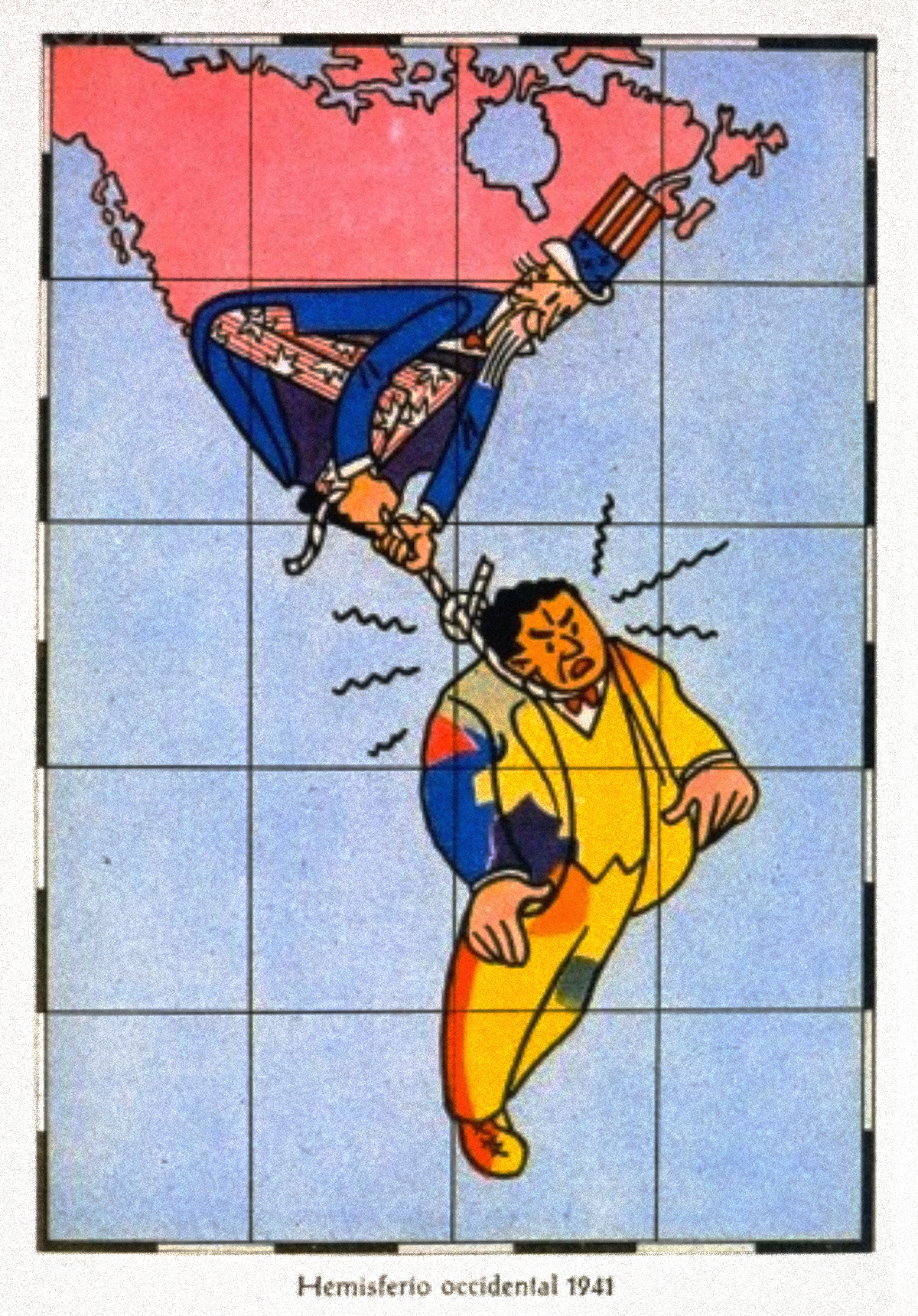
Satirical Map of the Western Hemisphere, c. 1941
The satirical map of the Western Hemisphere from around 1941 presents a unique and humorous perspective on the political...
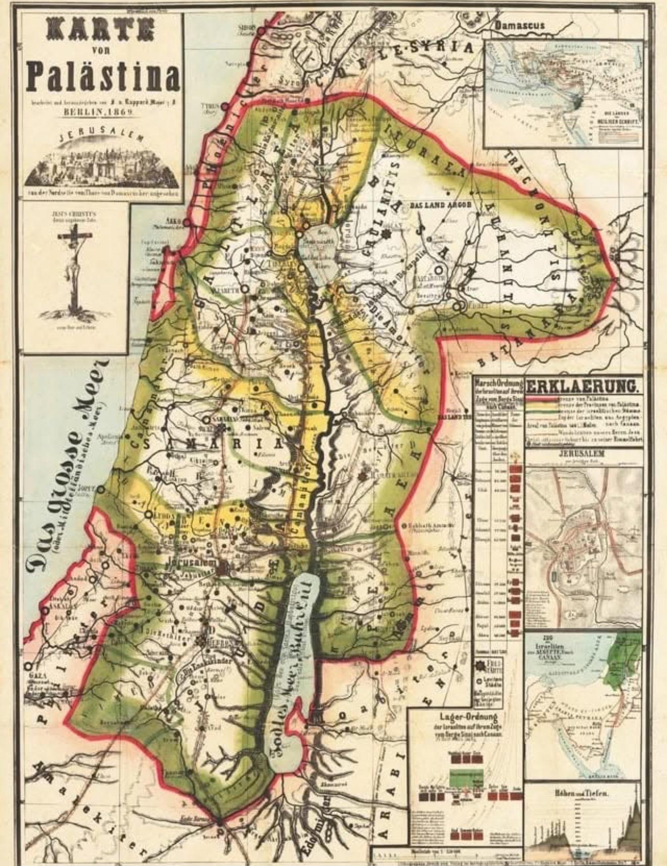
German Map of Palestine in Berlin 1869
The "German Map of Palestine in Berlin in 1869" offers a detailed glimpse into the geographical and political landscape ...
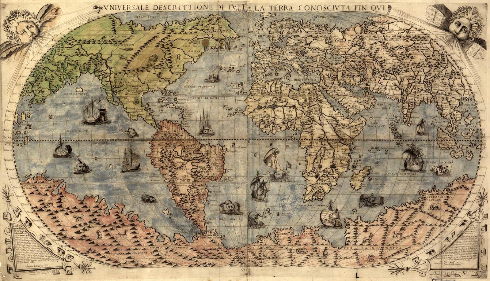
World Map of 1565
...
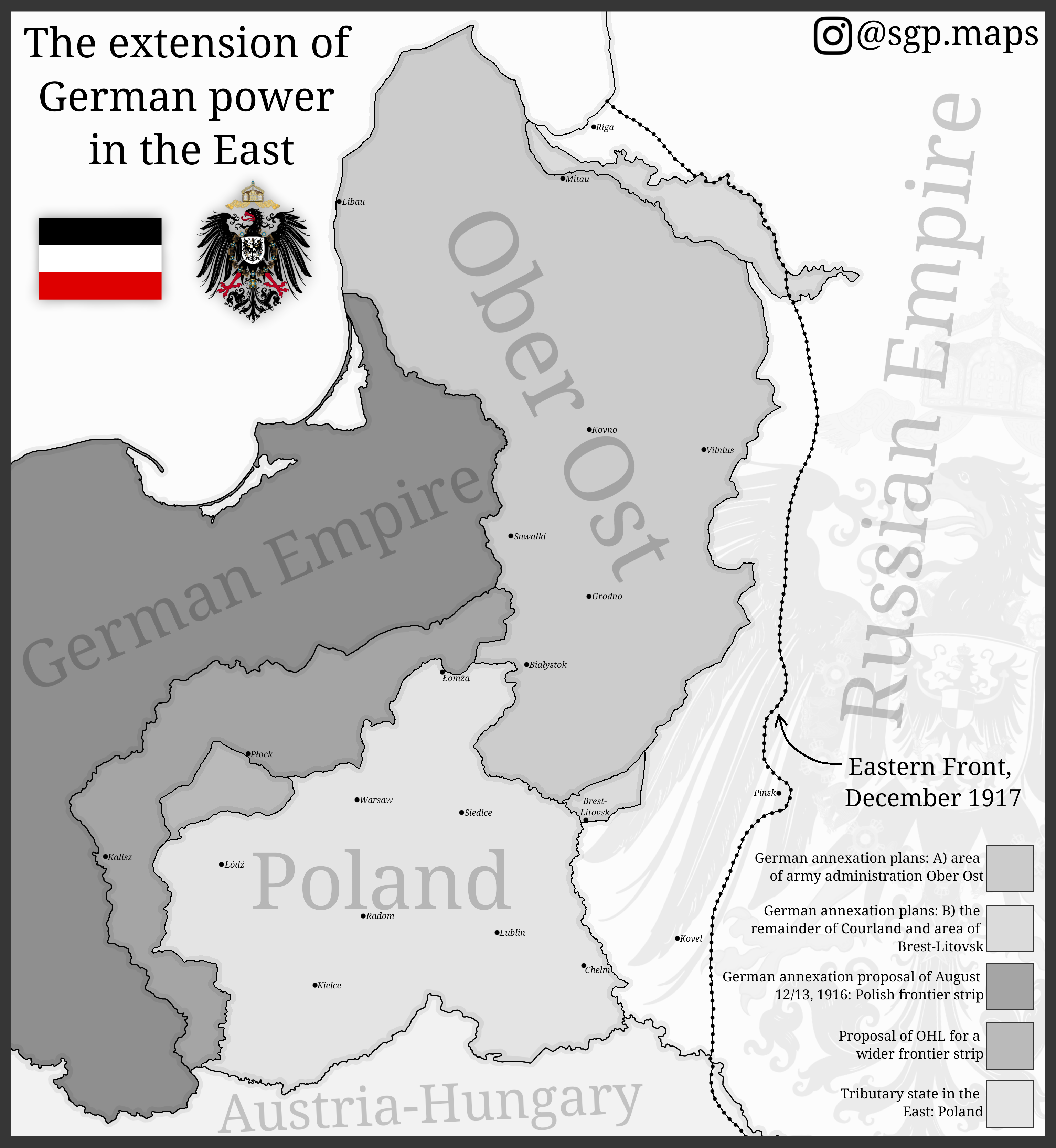
Map of German Expansion in Eastern Europe
The map titled "The Extension of German Power in the East" illustrates the territorial ambitions of Germany during World...
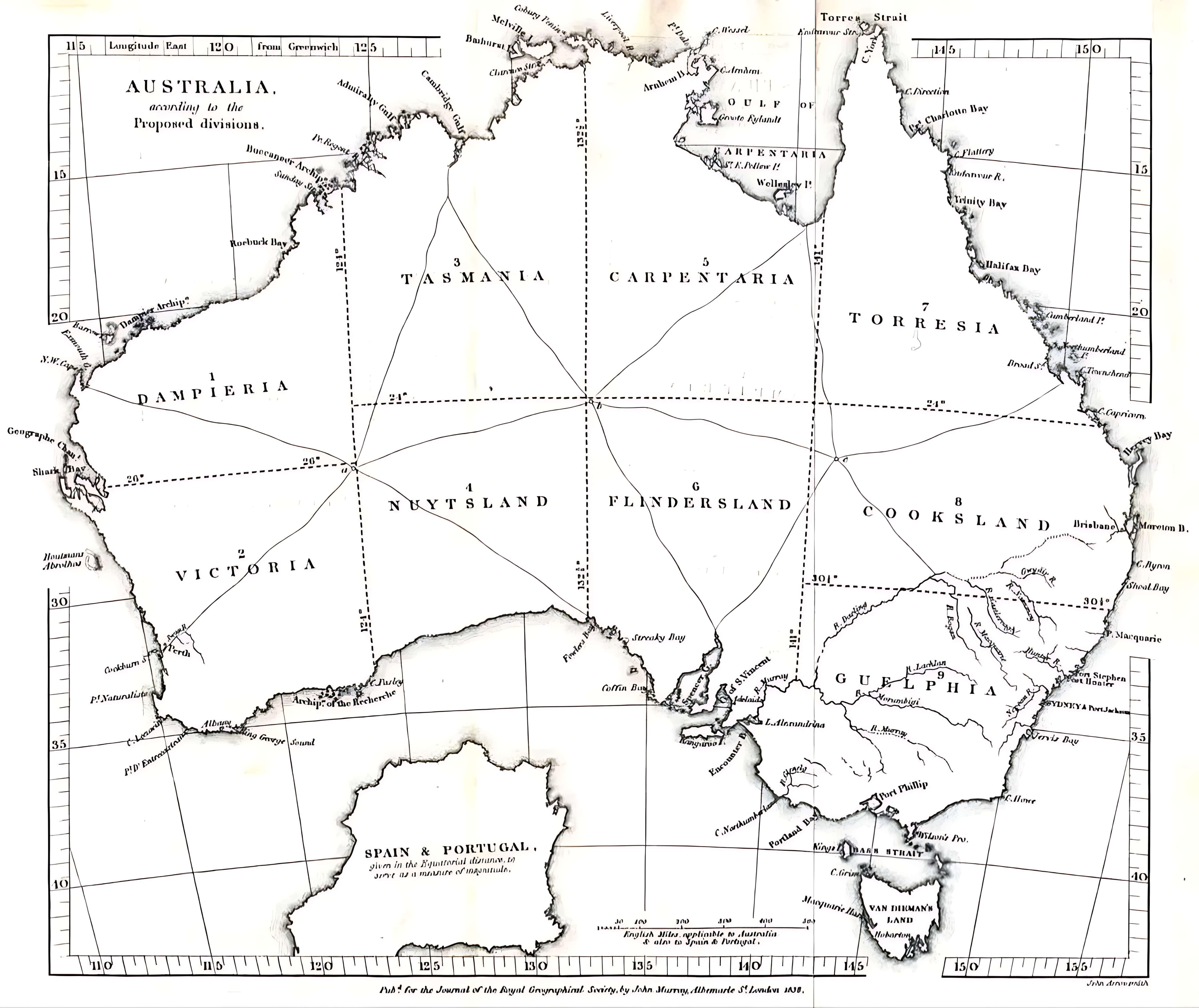
1838 Australia Division Plan Map Analysis
This map visualizes the proposed division of Australia as suggested in 1838, illustrating a radical restructuring of sta...
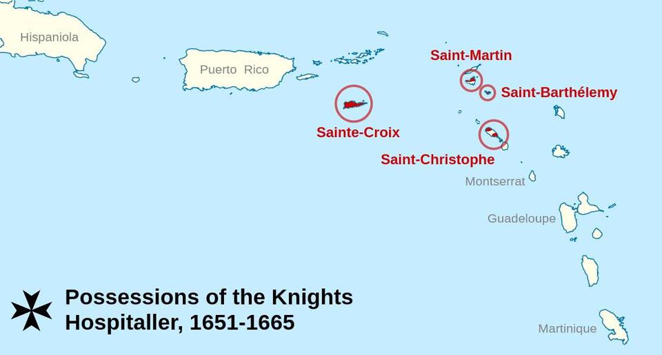
Map of Short-Lived Caribbean Colonies of the Knights of Malta
This map highlights the brief yet impactful presence of the Knights of Malta in the Caribbean during the 17th and 18th c...
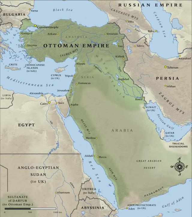
Ottoman Empire Territorial Map 1914
The "Map of the Ottoman Empire in 1914" vividly illustrates the territorial expanse of one of history's most influential...
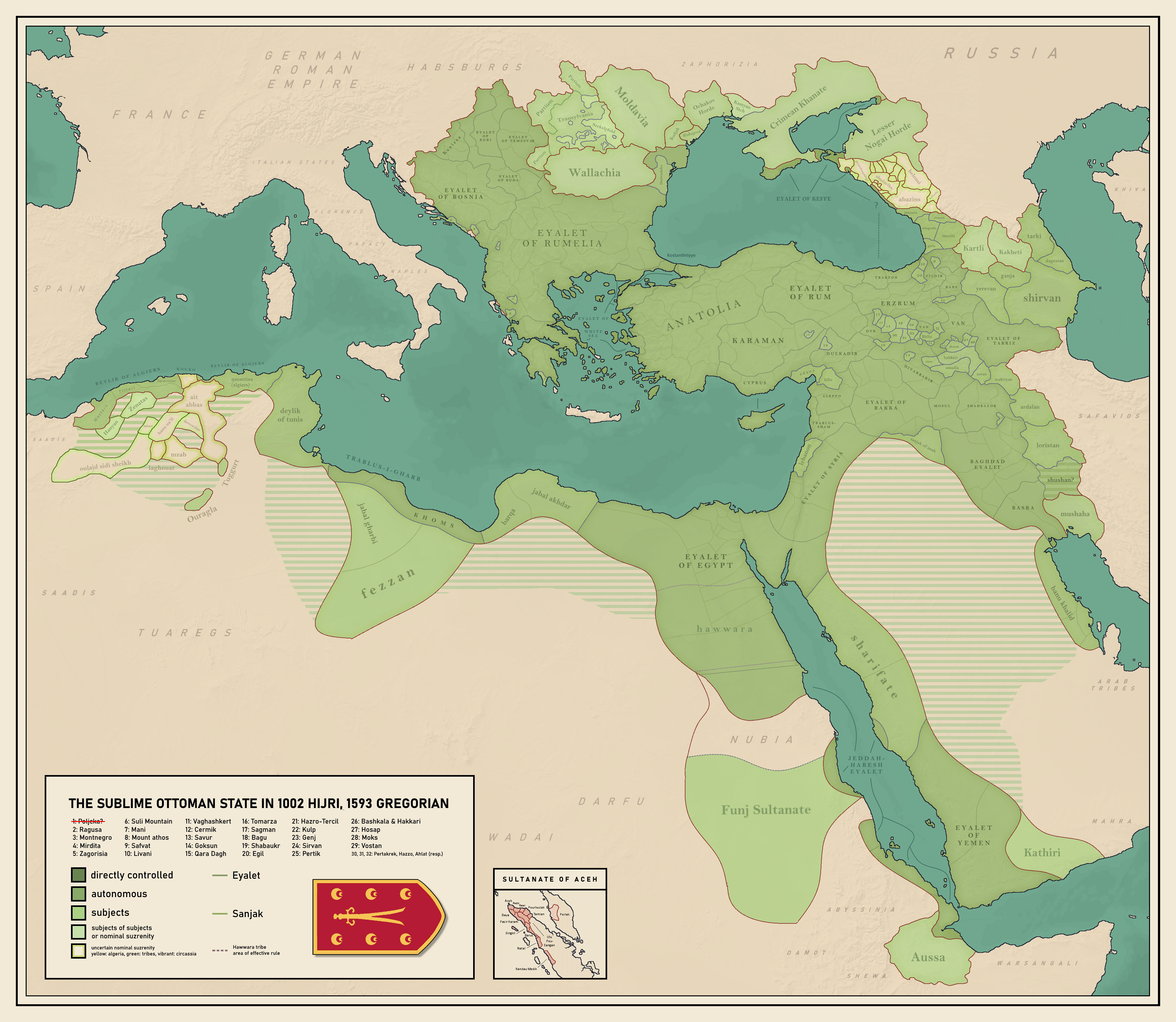
Ottoman Empire Map of 1593
...
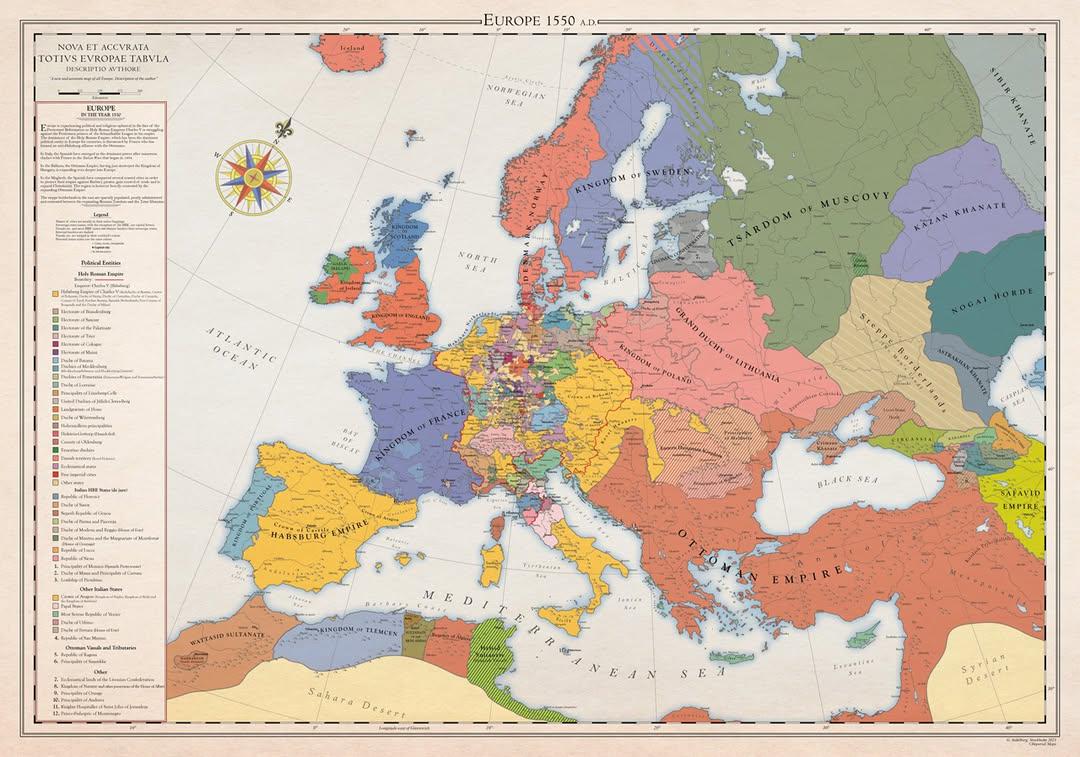
Historical Map of Europe in 1550
This historical map of Europe in 1550 provides a snapshot of the continent at a pivotal moment in its history—the onset ...
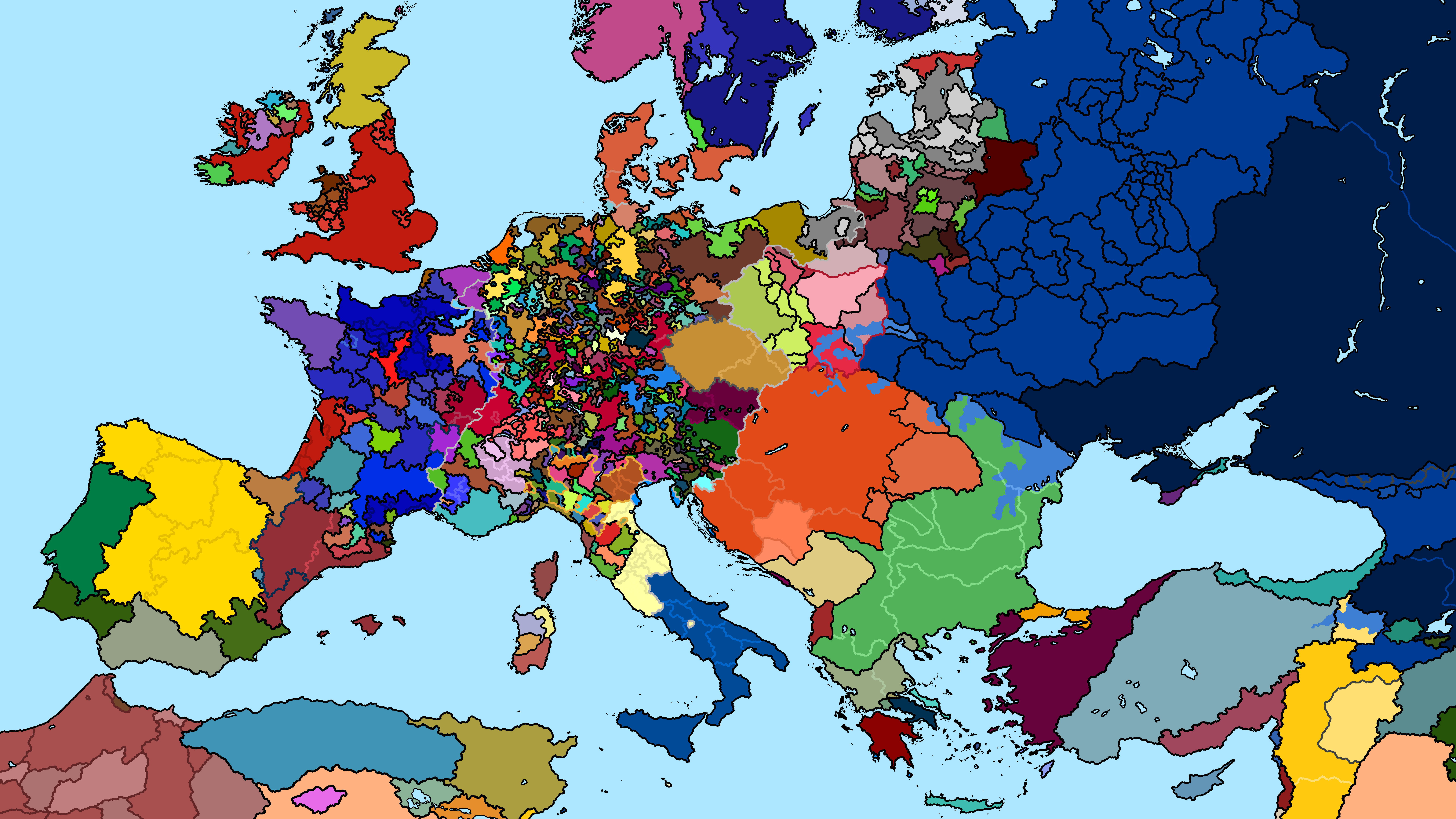
Political Map of Europe 1240 AD
The "Map of Europe 1240 AD" presents a snapshot of the political landscape in medieval Europe. During this time, the con...
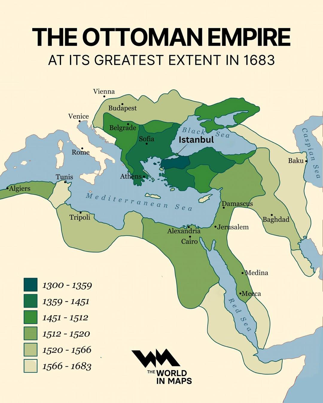
Ottoman Empire Map at Its Greatest Extent 1683
The map titled "The Ottoman Empire at its Greatest Extent in 1683" visually represents the vast territories controlled b...
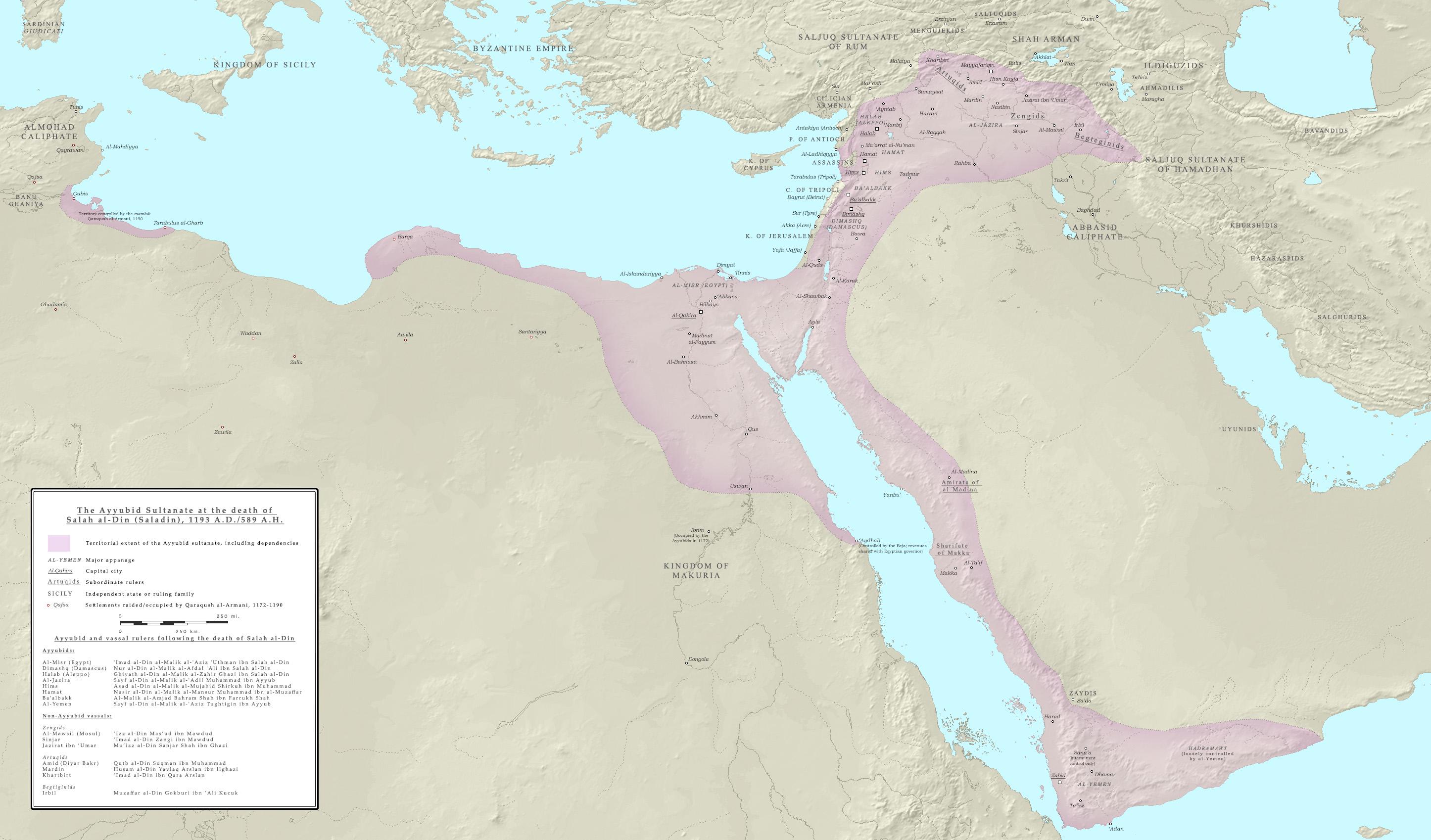
Ayyubid Sultanate Extent Map by 1193
This map illustrates the geographical extent of the Ayyubid Sultanate at the time of Saladin’s death in 1193. Spanning a...
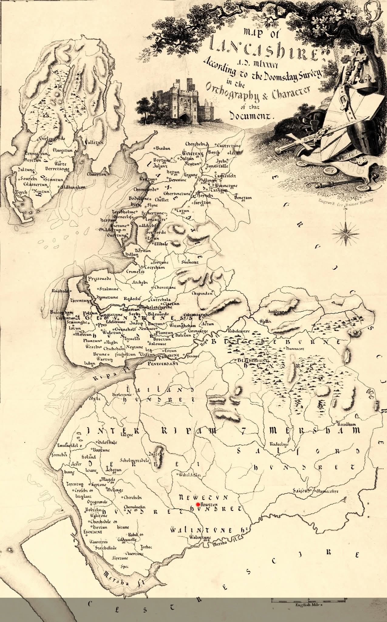
Map of Lancashire, England, from the 1086 Domesday Survey
The "Map of Lancashire, England, according to the 1086 Domesday Survey" presents a fascinating glimpse into the socio-ec...
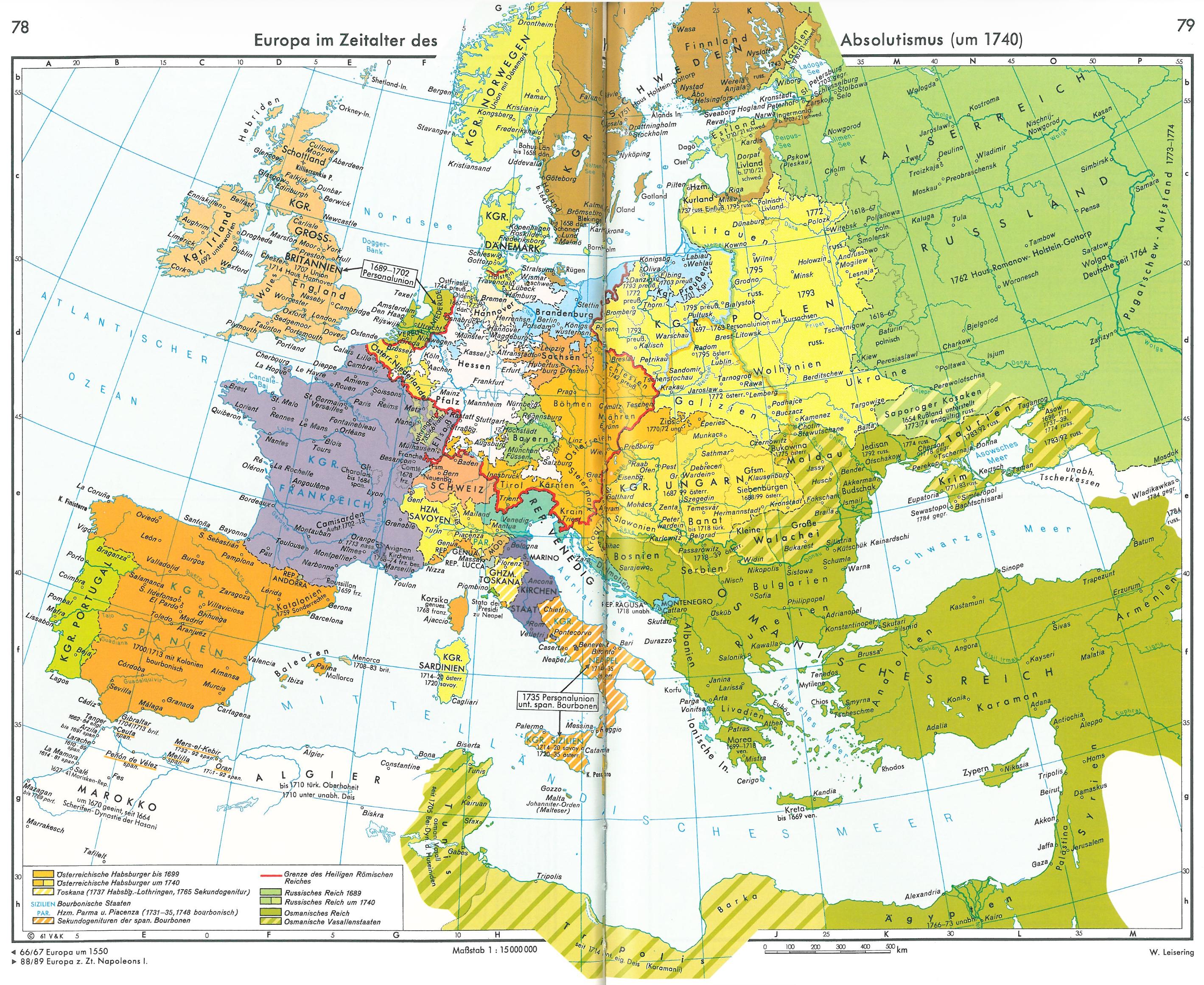
Europe in the Age of Absolutism Map
This visualization presents a detailed look at Europe as it existed in 1740, a pivotal period during the Age of Absoluti...
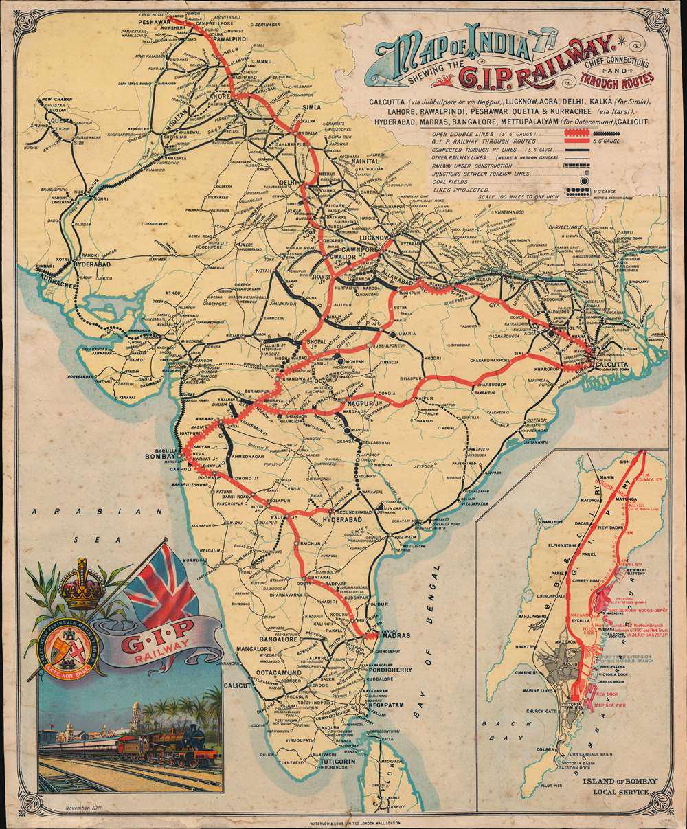
Railway Map of British India in 1911
This visualization presents the railway network of British India as it stood in 1911, reflecting a significant period du...
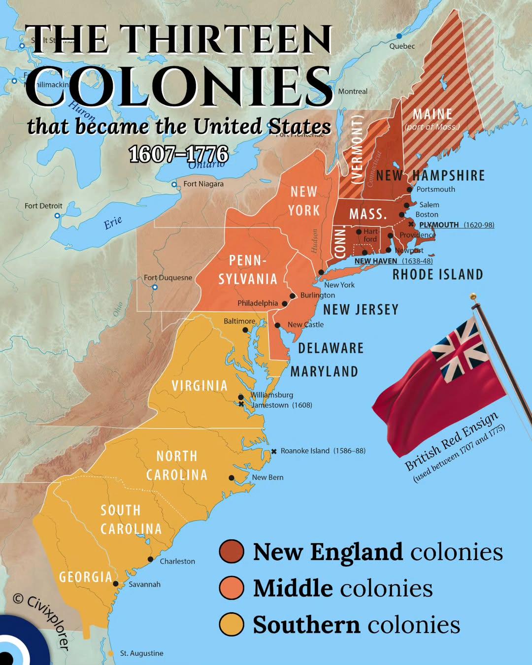
Thirteen Colonies Map of the United States
This map illustrates the geographic distribution of the thirteen colonies that ultimately formed the United States of Am...
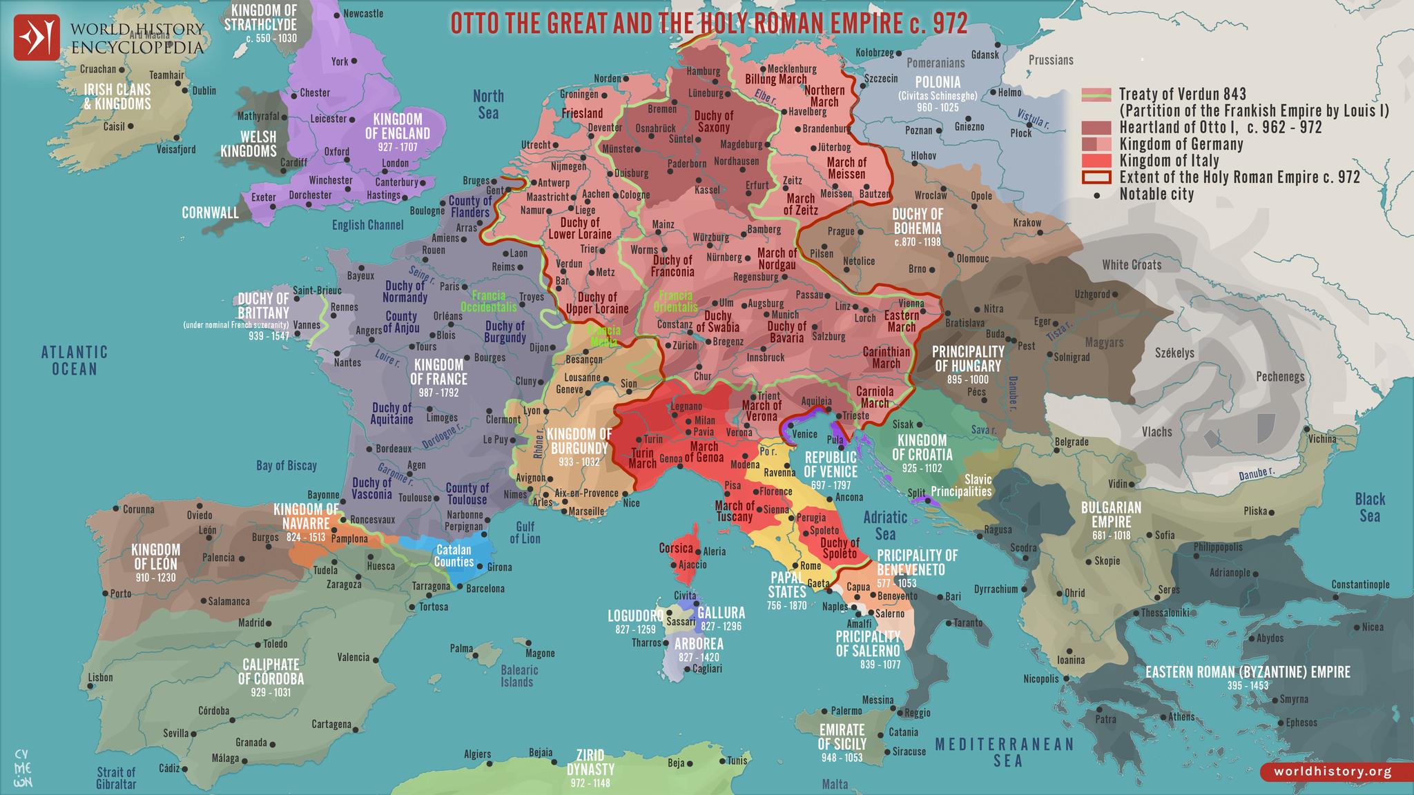
Political Map of Europe in 972
The "Map of Europe in 972" provides a fascinating glimpse into the political landscape of medieval Europe, depicting the...
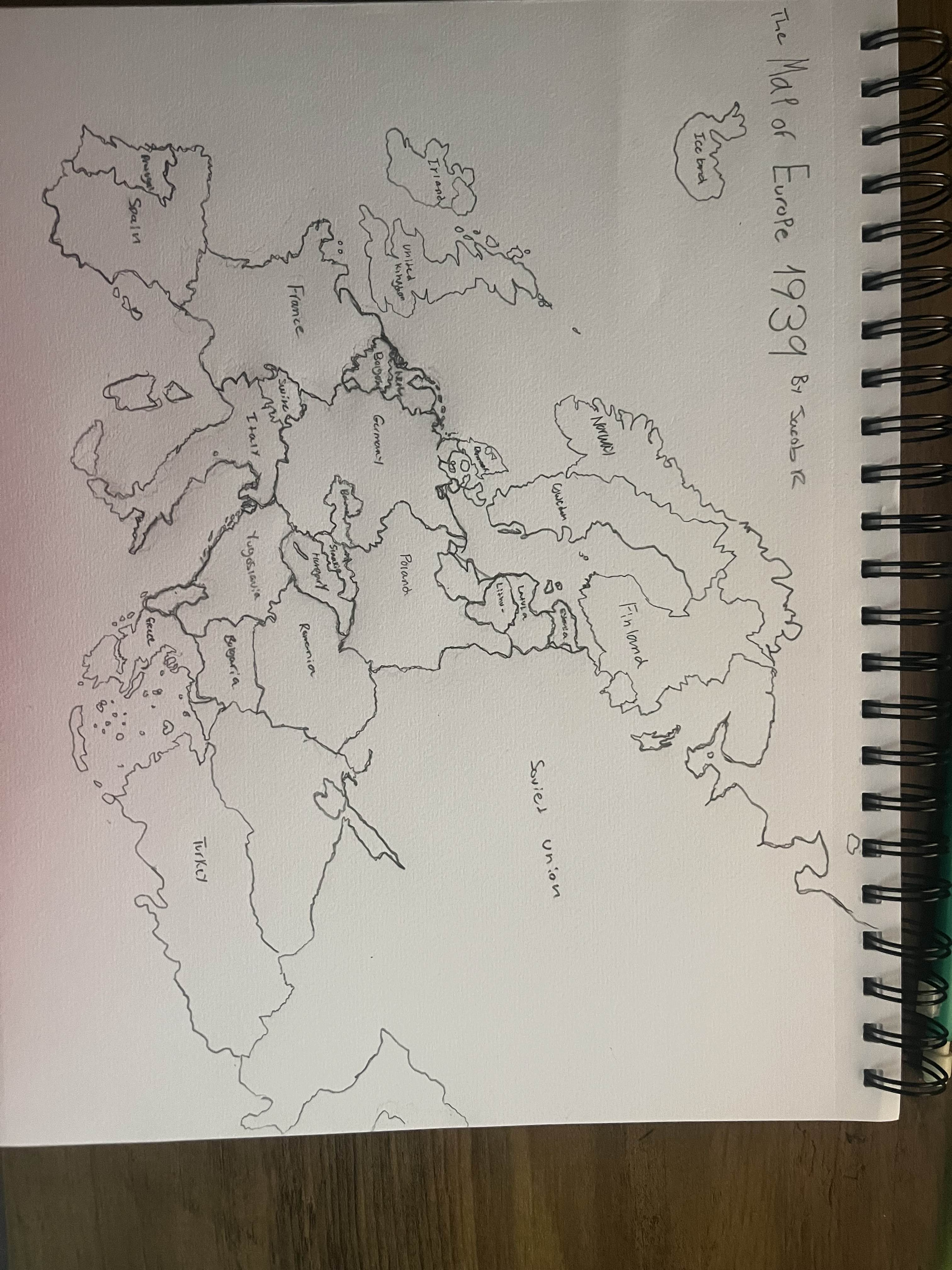
Hand Drawn Map of Europe in 1939
This hand-drawn map of Europe in 1939 visually captures the geopolitical landscape just before one of the most significa...
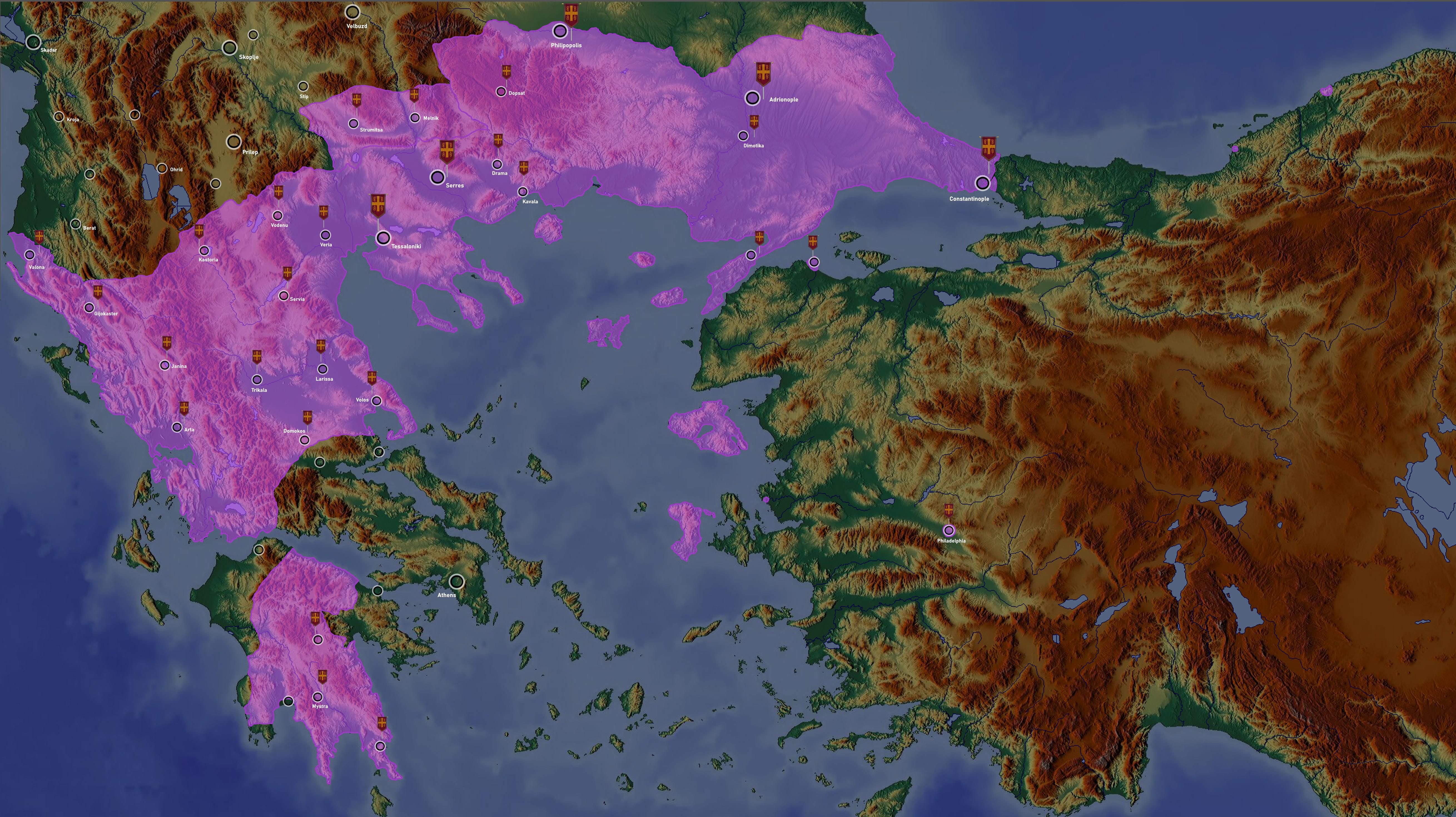
Eastern Roman Empire Map in 1341
The map titled "Eastern Roman Empire in 1341 (at death of Andronikos III)" illustrates the territorial expanse of the By...
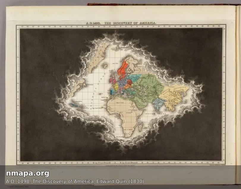
Map of America in A.D. 1498 by Edward Quin
The map titled "A.D. 1498. The Discovery of America, Edward Quin (1830)" serves as a historical snapshot of the geograph...
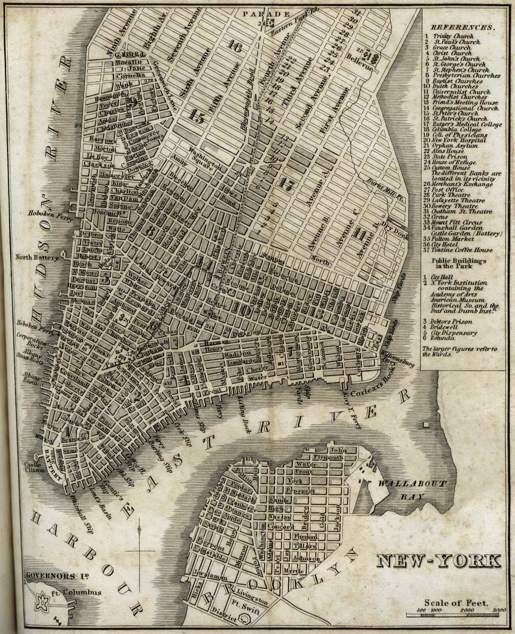
Map of New York City in 1842
The "New-York" map from 1842 by H.S. Tanner provides a detailed depiction of New York City during a transformative perio...
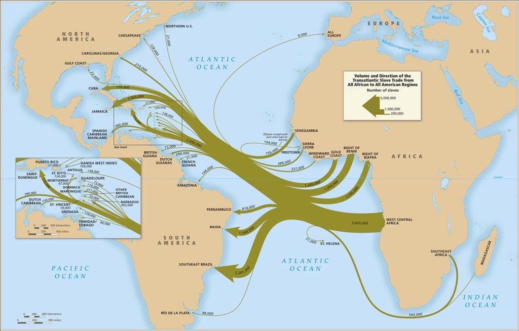
African Slave Trade Map
The African Slave Trade Map highlights the routes and regions involved in the transatlantic slave trade from the 16th to...
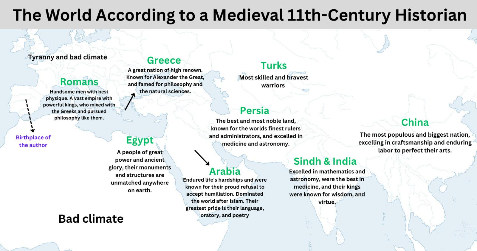
Medieval World Map by Historian Said al-Andalusi
...
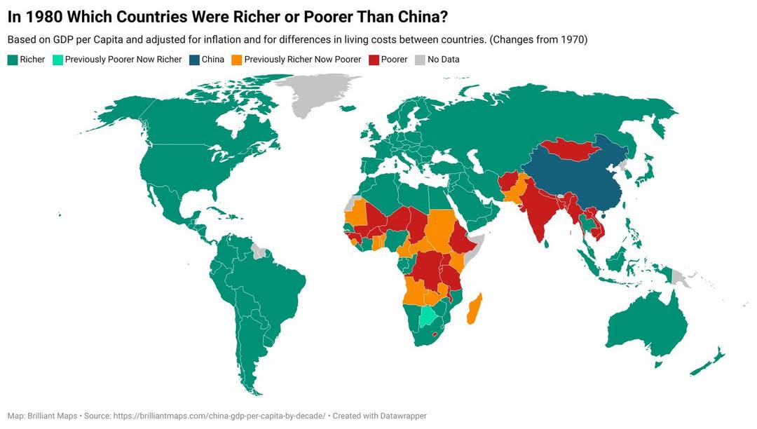
1980 GDP Comparison Map: Countries Richer or Poorer Than China
This visualization displays the GDP per capita of various countries in 1980, allowing us to see which nations were riche...
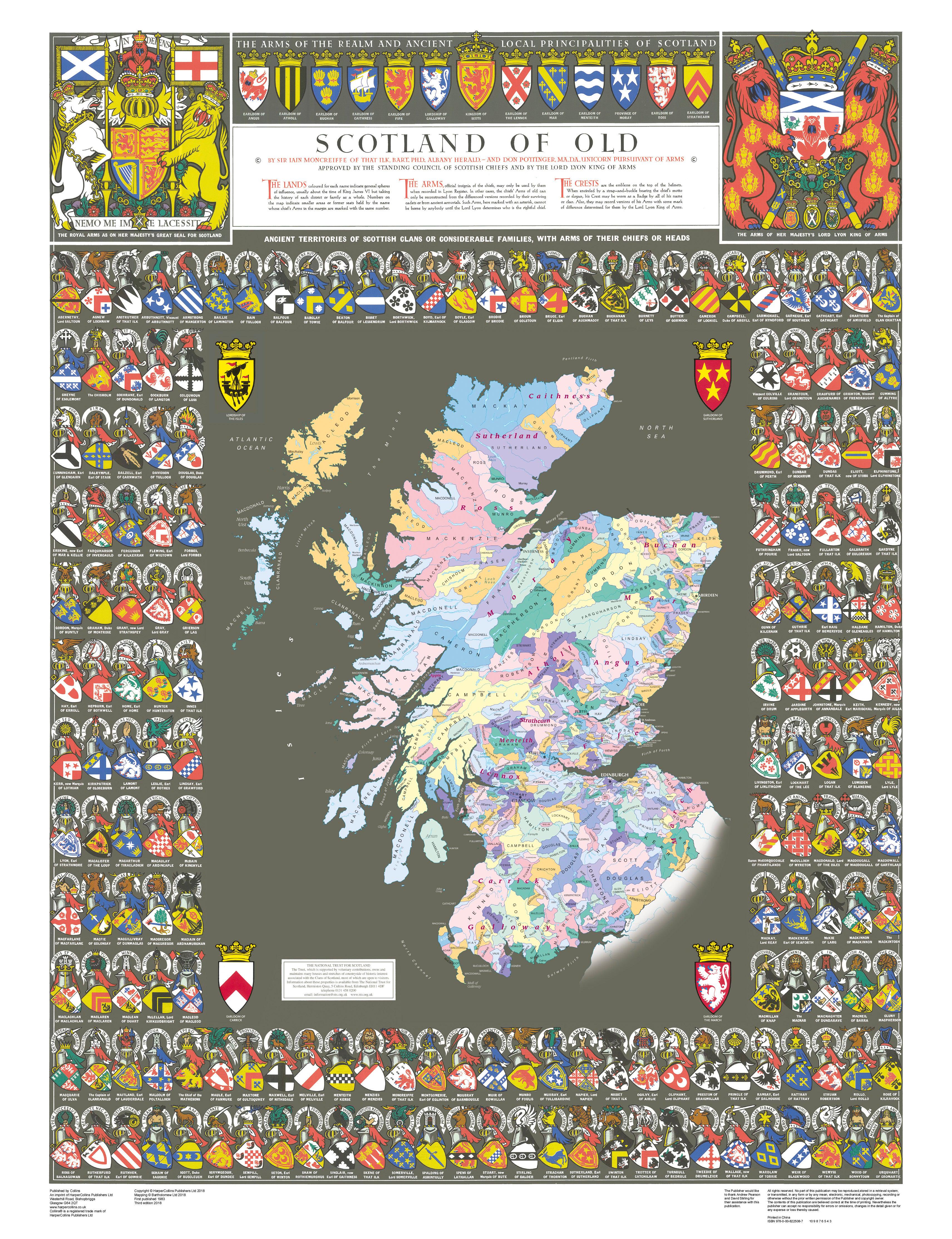
Historical Clan Map of Medieval Scotland
This high-resolution Historical Clan Map of Medieval Scotland visually represents the territorial divisions and influenc...
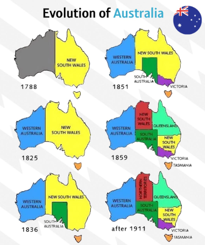
Evolution of Australia Map
...
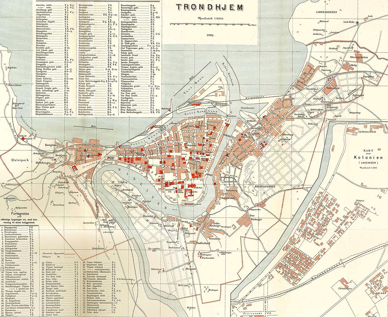
Map of Trondheim Norway from 1898
Interestingly, Trondheim’s location by the Trondheim Fjord had a profound impact on its development. The fjord provided ...
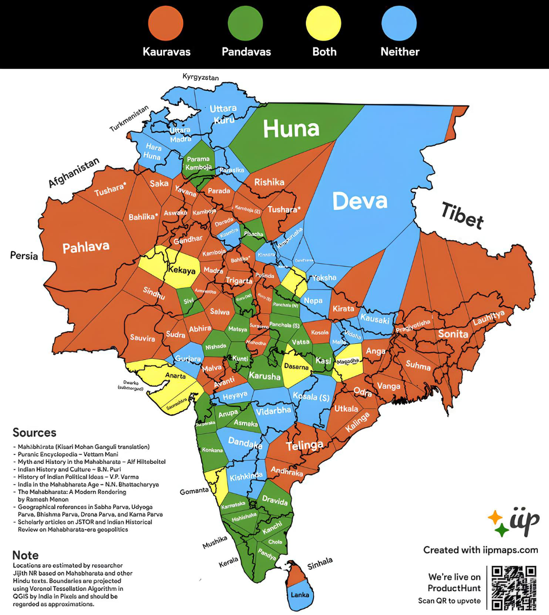
Map of Allies and Opponents in the Mahabharata War
The visualization titled "Who Supported Whom in the Mahabharata War" provides a comprehensive overview of the allegiance...
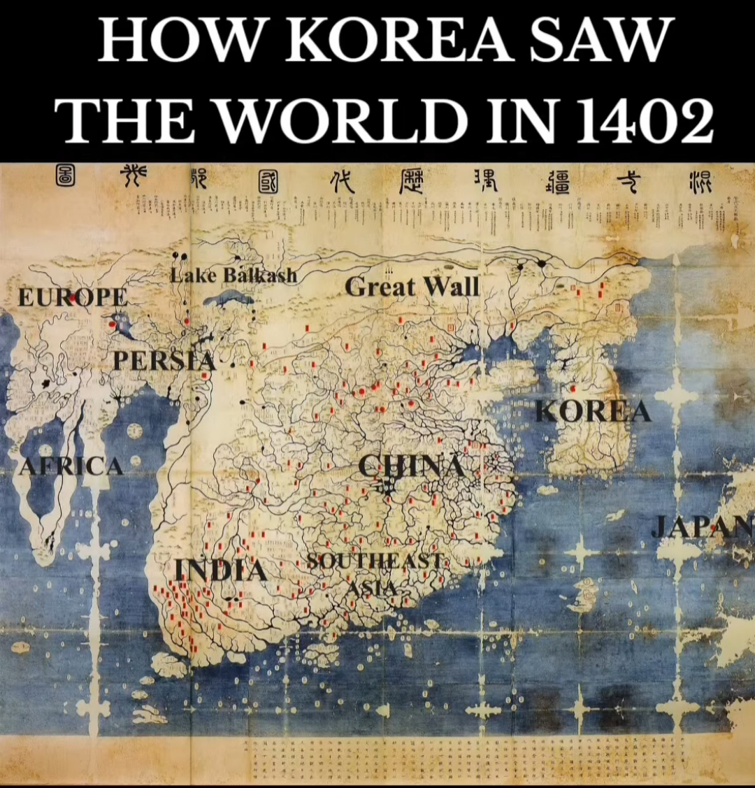
Historical Map of the World from 1402
The map in question, purportedly from the year 1402, invites both intrigue and skepticism. It showcases a medieval repre...
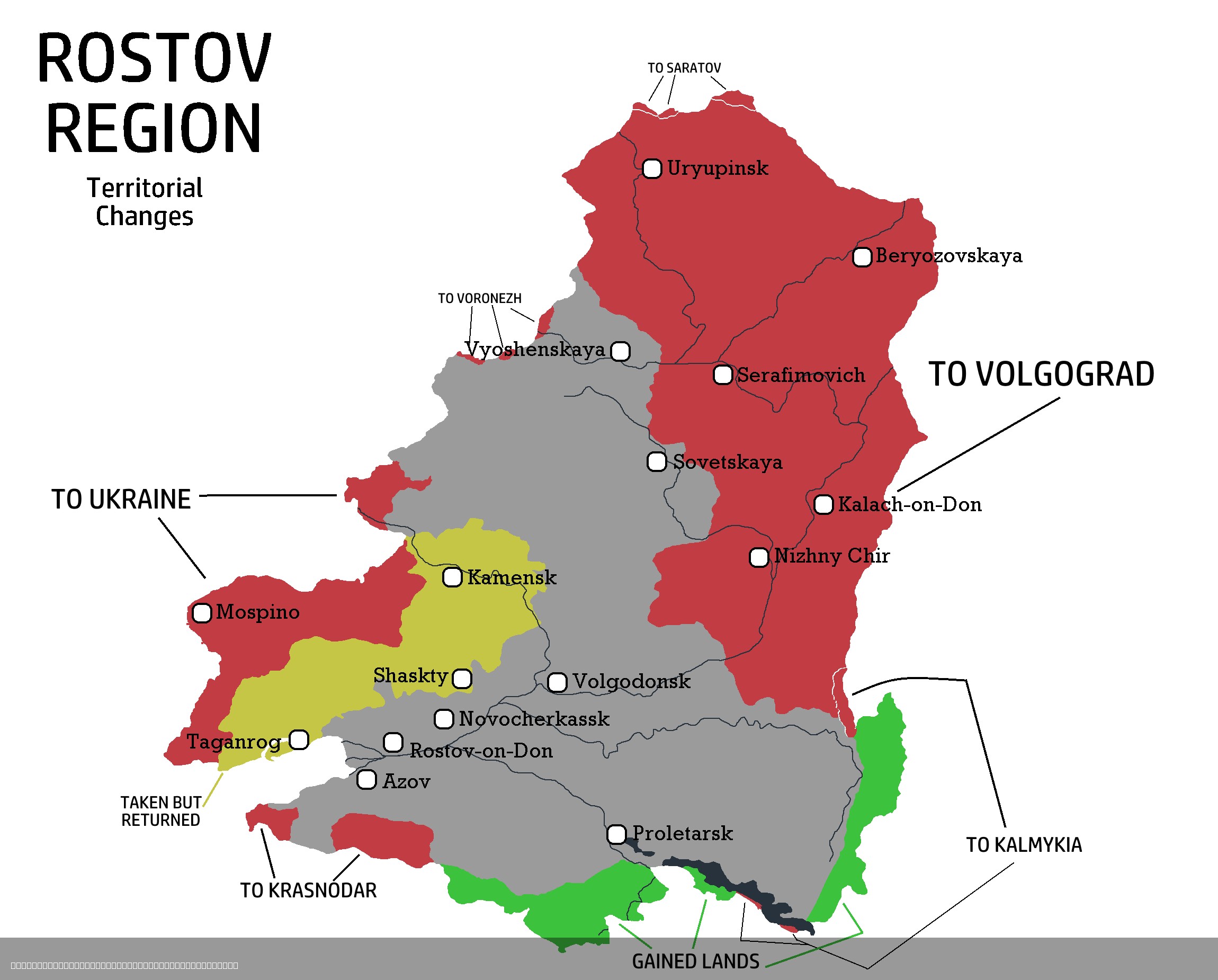
Rostov Region Territorial Changes Map 1917-2025
The "Rostov Region Territorial Changes Map 1917-2025" provides a comprehensive visual representation of the territorial ...