Historical Map of Europe in 1550

David Chen
Data Visualization Specialist
David Chen is an expert in transforming complex geographic datasets into compelling visual narratives. He combines his background in computer science ...
Geographic Analysis
What This Map Shows
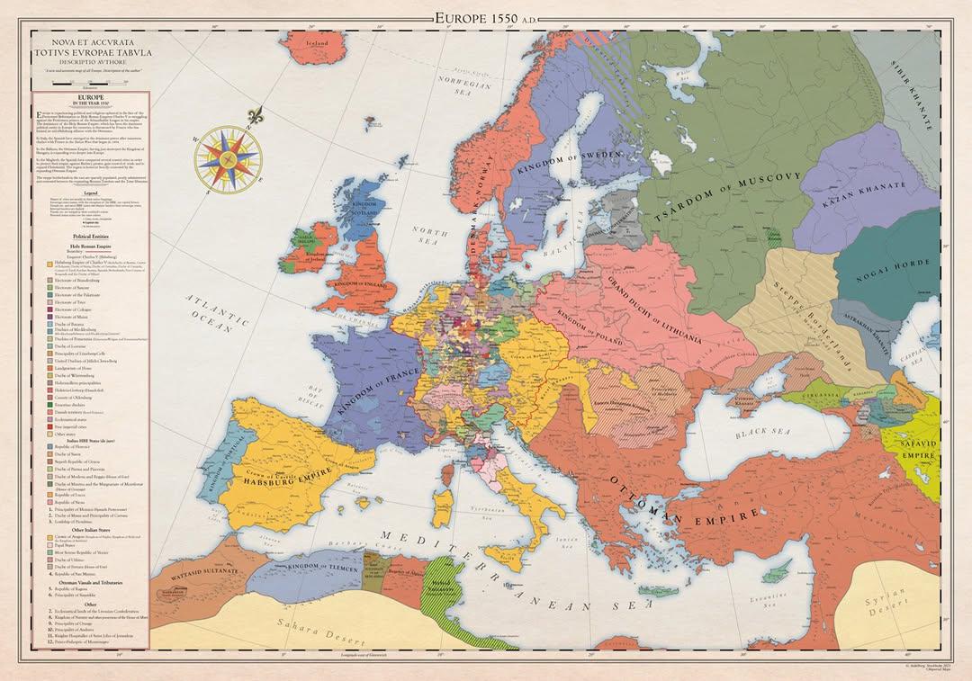
This historical map of Europe in 1550 provides a snapshot of the continent at a pivotal moment in its history—the onset of the Protestant Reformation. The map illustrates the political boundaries, territories, and significant regions during a time when religious upheaval was reshaping Europe. It highlights the various kingdoms, principalities, and city-states, encapsulating a landscape that was not only diverse in governance but also rich in cultural and religious identities. As we delve deeper into this historical context, we'll uncover the geographical and societal factors that were at play during this transformative era.
Deep Dive into the Protestant Reformation
The Protestant Reformation, which began around 1517 with Martin Luther's Ninety-Five Theses, set the stage for significant changes across Europe. The map showcases regions that were predominantly Catholic, such as Spain, France, and Italy, alongside areas that were embracing Protestant ideas, particularly in northern Europe, including parts of Germany, Switzerland, and the Scandinavian countries.
Interestingly, the geographical spread of Protestantism can be attributed to various factors, including trade routes, the influence of local leaders, and the printing press's ability to disseminate reformist literature. The Holy Roman Empire, depicted on the map, was a patchwork of principalities where rulers had significant autonomy. Some local leaders, influenced by Reformation ideas, began to break away from the Pope's authority, which had vast implications for governance and power dynamics.
What’s fascinating is how the map reflects not just political boundaries but also the cultural and linguistic diversity of the period. Regions like the Low Countries (modern-day Belgium and the Netherlands) became hotbeds for Protestant thought, leading to tensions with their Catholic rulers. These tensions often resulted in conflicts that would shape the region for centuries to come. The map serves as a visual representation of how these ideological divides were beginning to take form, creating a complex mosaic of religious affiliations across Europe.
Regional Analysis
When we examine the map regionally, some clear patterns emerge. In the northwest, the Netherlands and parts of Germany were rapidly adopting Protestant reforms, thanks largely to influential figures like John Calvin. In contrast, southern Europe remained predominantly Catholic, with Spain and Italy staunchly loyal to the Papacy. This regional disparity reflects not only theological differences but also economic ones; the wealth generated from trade in the north contrasted sharply with the agrarian economies of the south.
Looking closer at the German territories, the map shows how divided they were. While some regions, like Saxony, became strongholds for Lutheranism, neighboring areas remained loyal to Catholicism. This division would eventually lead to the Thirty Years' War, a devastating conflict that would reshape the political landscape of Europe.
In Eastern Europe, the map indicates the influence of the Ottoman Empire in the Balkans, which posed a different kind of challenge to Christian Europe, adding another layer of complexity to the religious landscape. The presence of the Ottomans would eventually lead to a different type of religious and cultural exchange, further complicating the narrative of the Reformation.
Significance and Impact
Understanding the religious and political landscape of Europe in 1550 is crucial for grasping the long-term implications of the Protestant Reformation. This map not only marks the beginning of significant changes in religious belief but also foreshadows the socio-political upheavals that would follow. The Reformation led to the rise of nation-states, as local rulers sought to assert their independence from the Church and the Holy Roman Empire.
Today, the legacy of the Reformation is still felt across Europe and beyond. The map serves as a reminder of how geography can influence ideology, governance, and identity. The religious conflicts sparked during this period laid the groundwork for modern secular states and the diverse religious landscape we see in Europe today. Interestingly, as we look at current trends, the map also invites us to consider how historical grievances and divisions can still resonate in contemporary society, making this exploration of a 16th-century map relevant to our understanding of today's geopolitical climate.
This historical map of Europe in 1550 is not just a depiction of a moment in time; it is a window into the forces that shaped our modern world. As we reflect on this period, we gain insights into the intricate relationship between geography, politics, and religion that continues to influence our lives today.
Visualization Details
- Published
- October 14, 2025
- Views
- 34
Comments
Loading comments...