political boundaries Maps
14 geographic visualizations tagged with "political boundaries"
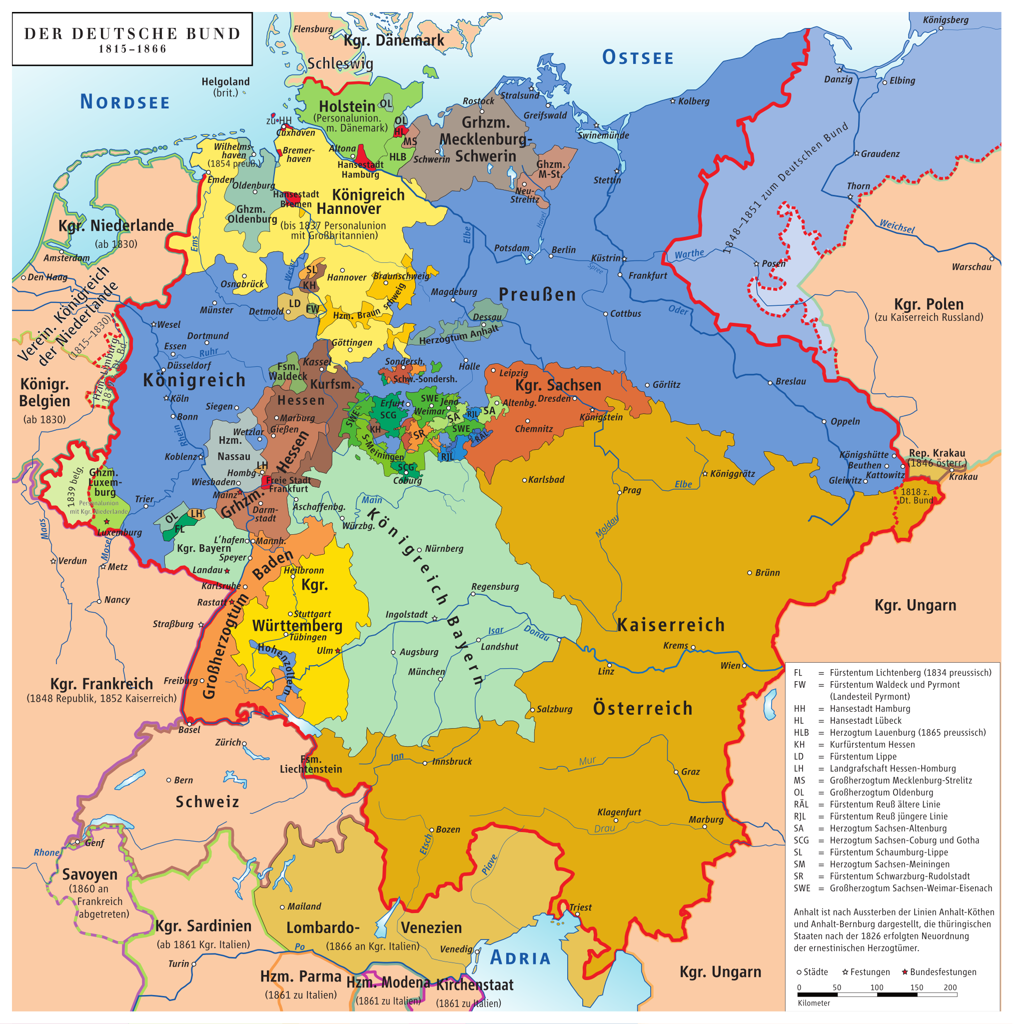
Map of Germany Before Unification (1815-1866)
This map titled "Germany Before Being Germany (1815-1866)" provides a detailed visualization of the political landscape ...
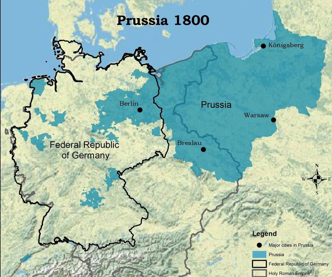
Map of Prussia in 1800 Compared to Modern Germany
The visualization titled "The Kingdom of Prussia in 1800 vs Modern Germany" presents a compelling juxtaposition of histo...
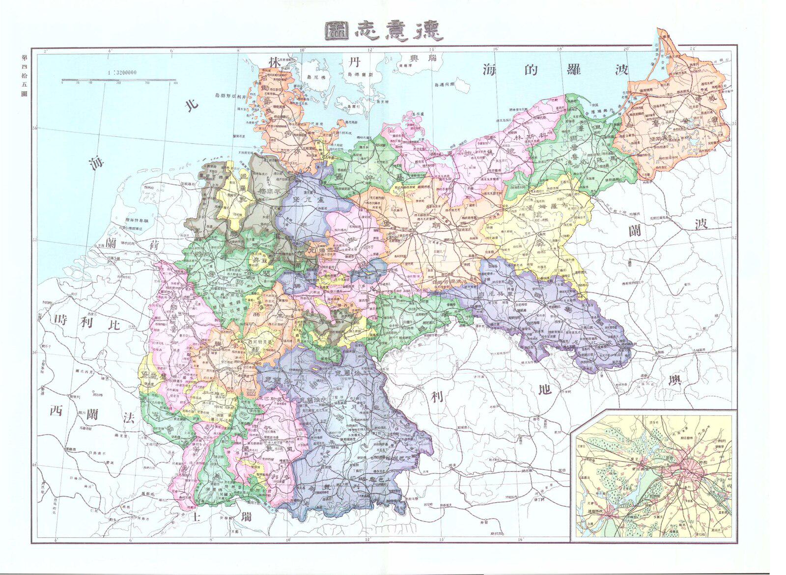
Chinese Map of Germany in 1906
...
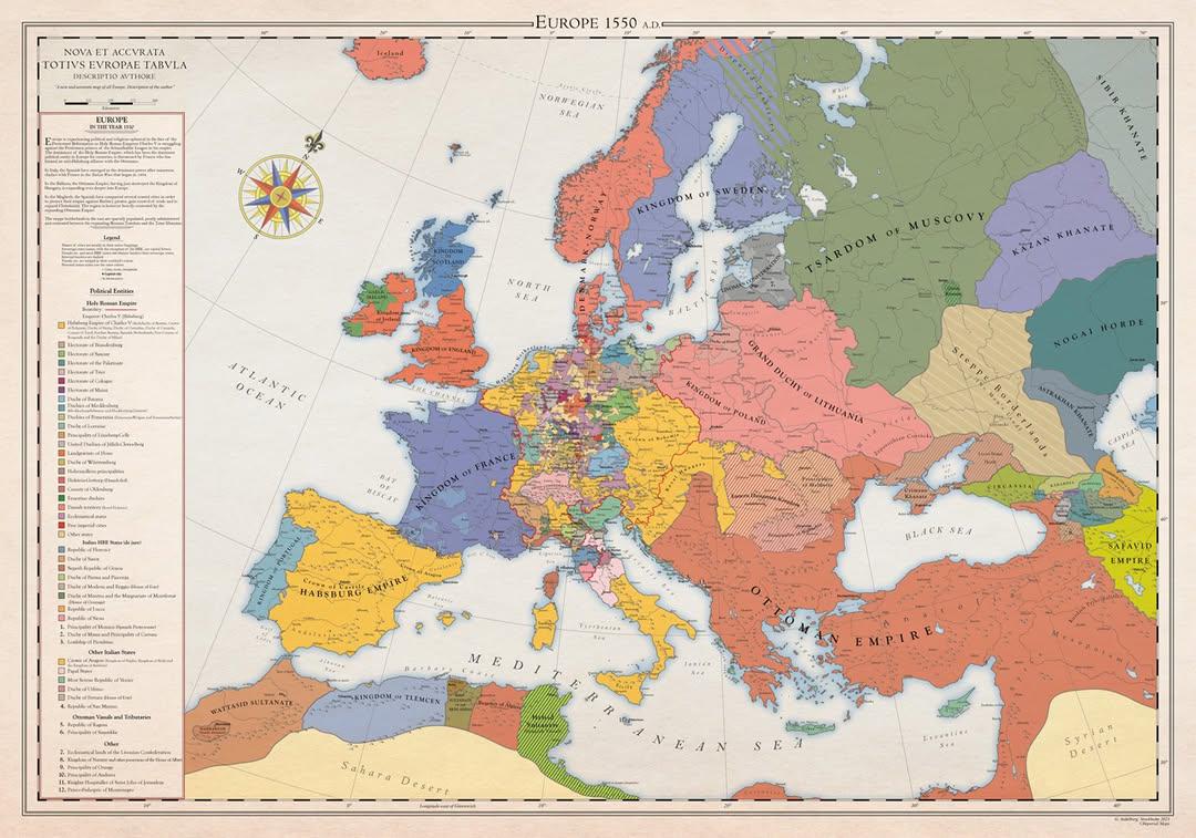
Historical Map of Europe in 1550
This historical map of Europe in 1550 provides a snapshot of the continent at a pivotal moment in its history—the onset ...
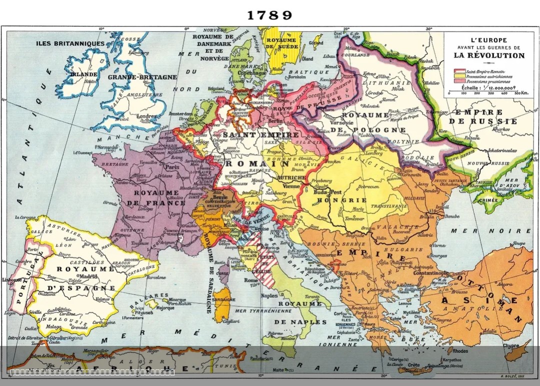
1915 French Map of Europe in 1789
The 1915 French map of Europe in 1789 offers a historical perspective on the political landscape of Europe just before t...
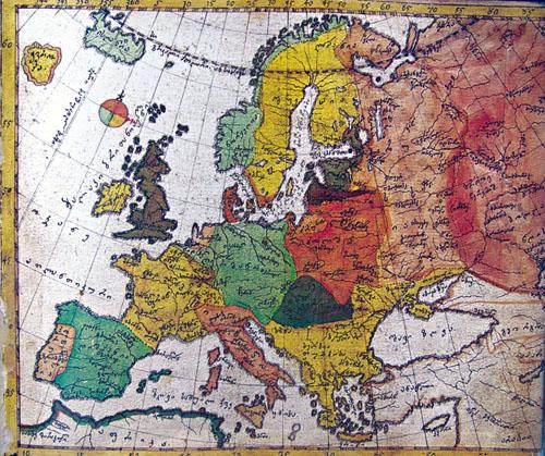
1752 Map of Europe by Vakhushti Bagrationi
The 1752 map of Europe by Georgian prince Vakhushti Bagrationi is a historical cartographic work that captures the geopo...
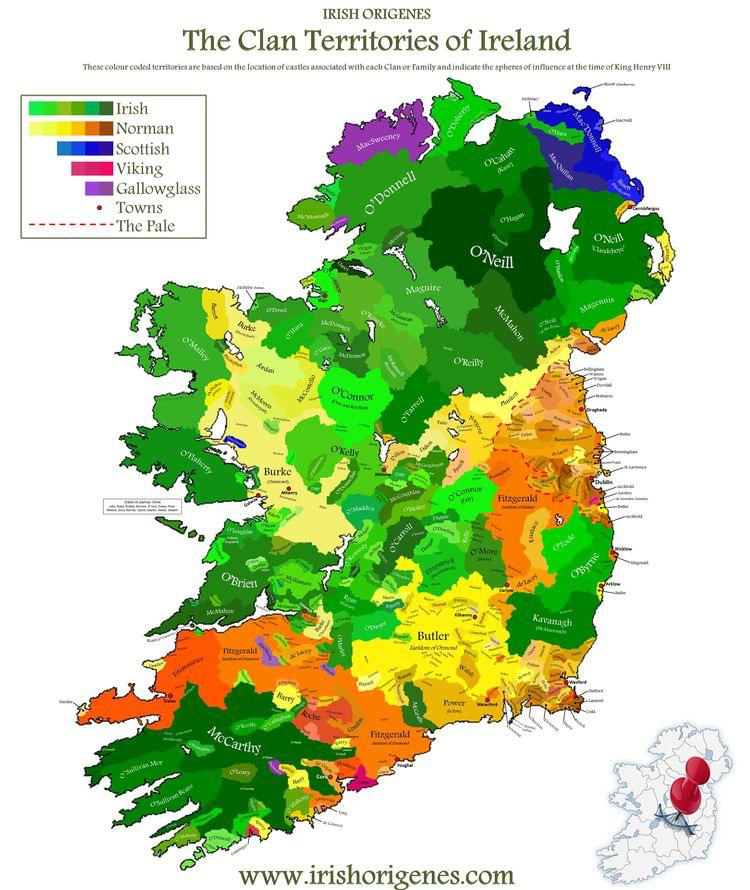
Historical Map of World Borders
This map provides a visual representation of world borders at a specific point in time, highlighting the geopolitical la...
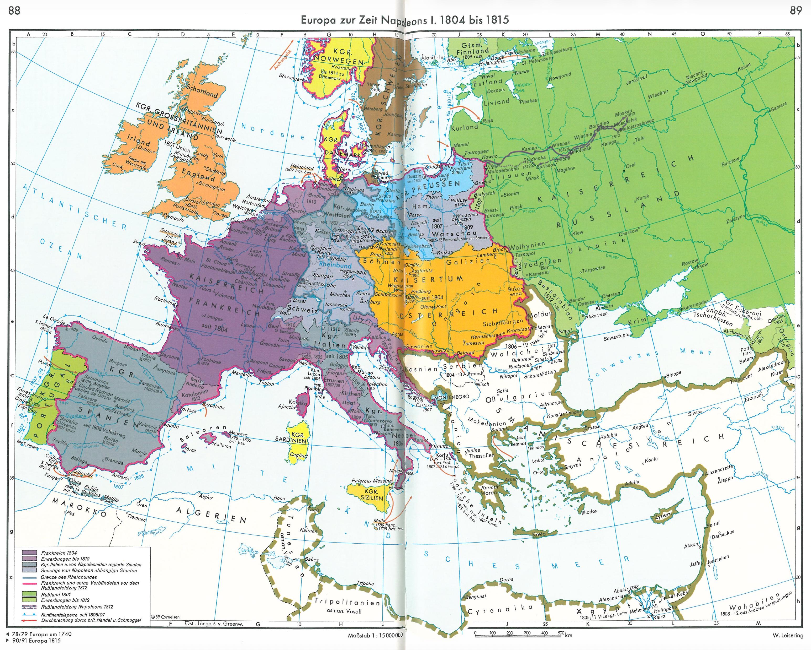
Europe Map on the Eve of Napoleon’s Russian Campaign (1812)
This map provides a detailed snapshot of Europe in 1812, just before Napoleon Bonaparte embarked on his fateful campaign...
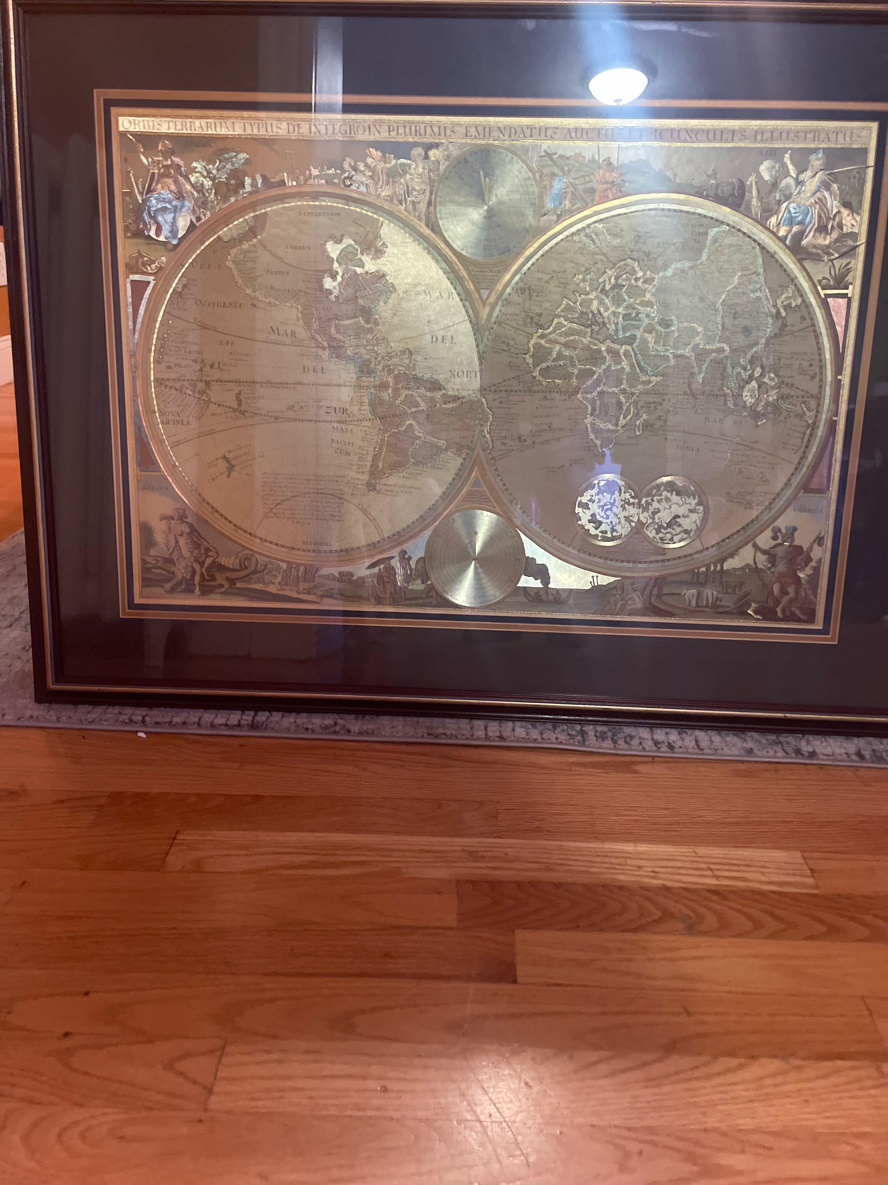
Historical Map of Unidentified Regions
Have you ever wondered why certain regions on old maps are marked as 'unexplored' or 'unknown'? This is a reflection of ...
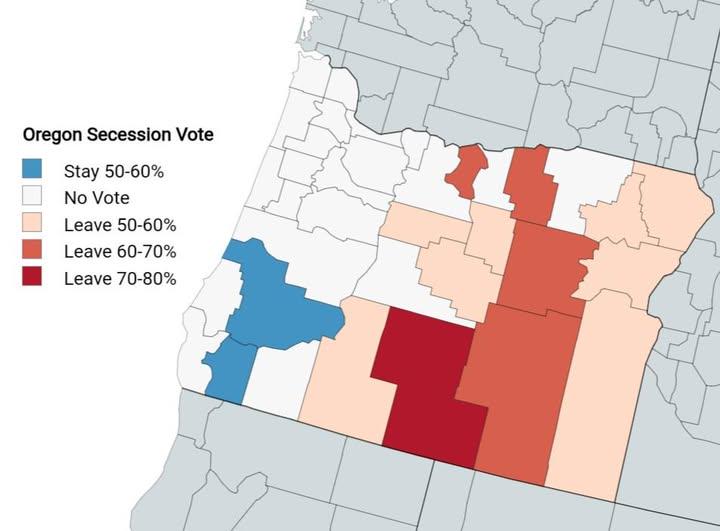
Oregon Counties Voted to Join Idaho Map
This map visually represents the counties in Oregon that have expressed a desire to leave the state and join Idaho betwe...
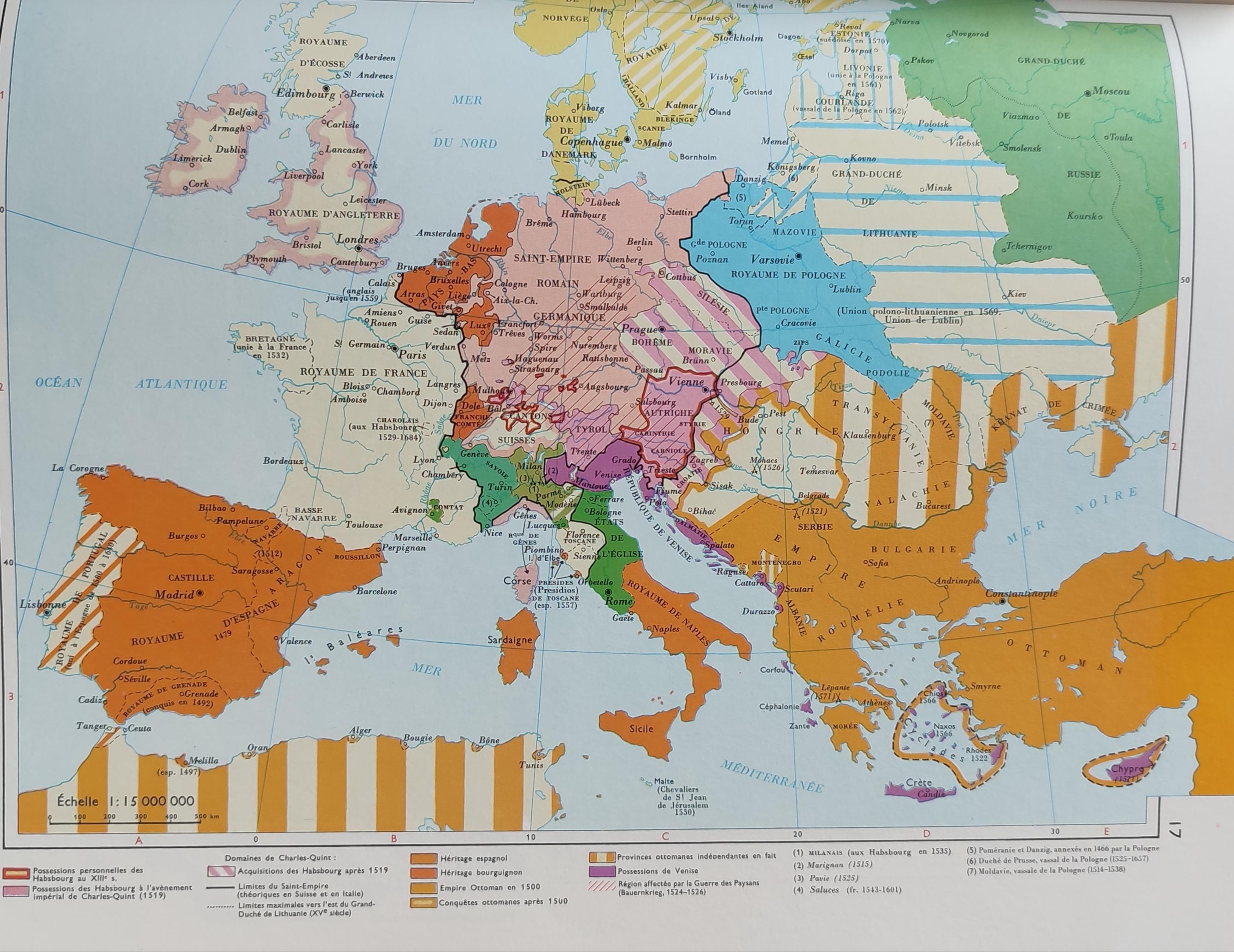
Simplified Map of Europe in the 16th Century
The 'Very Simplified Map of Europe in the 16th Century' presents a bird's-eye view of a continent in the midst of profou...
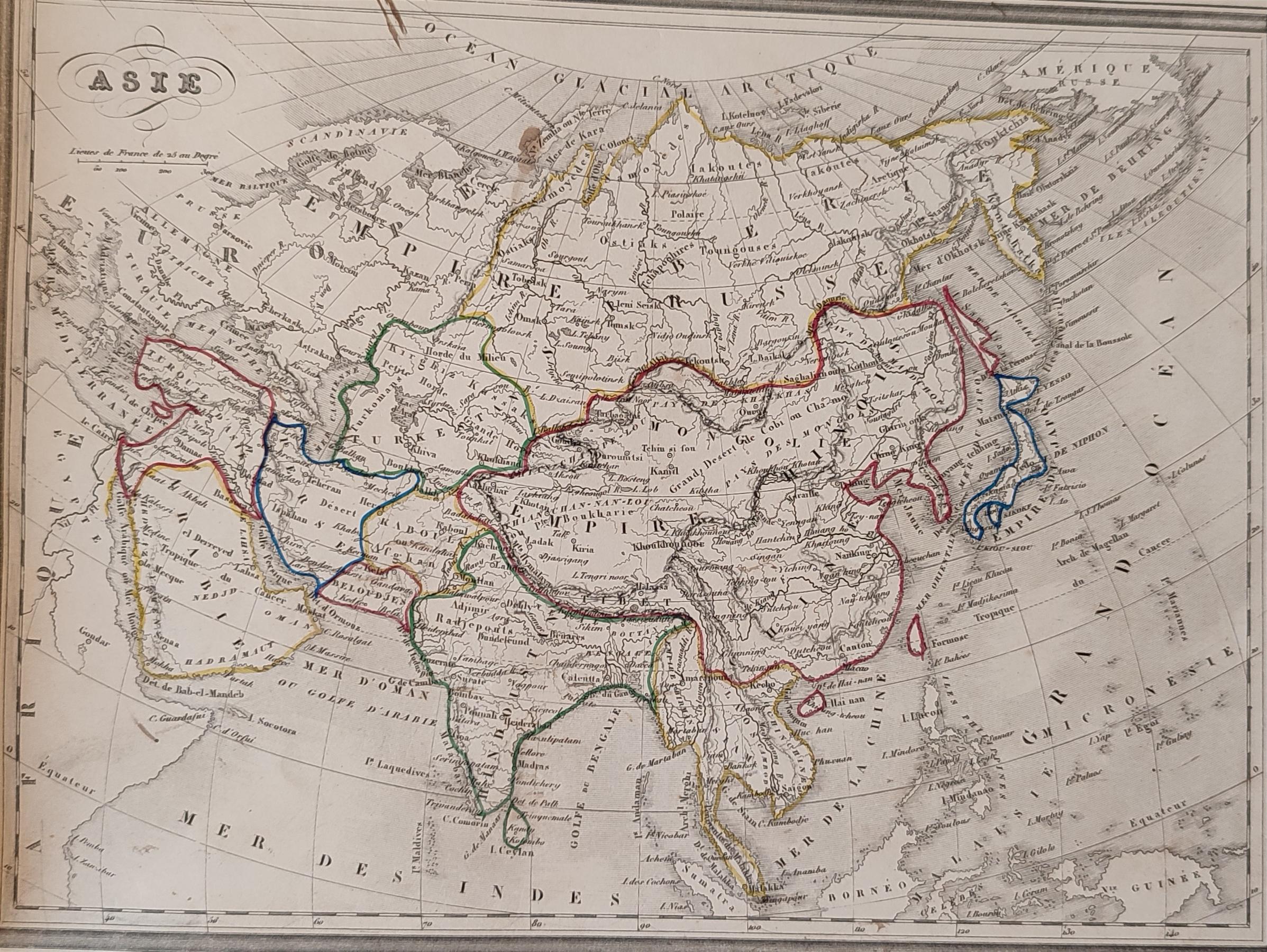
1843 French Map of Asia Analysis
The 1843 French map of Asia is a historical representation that provides insight into the geographical understanding of ...
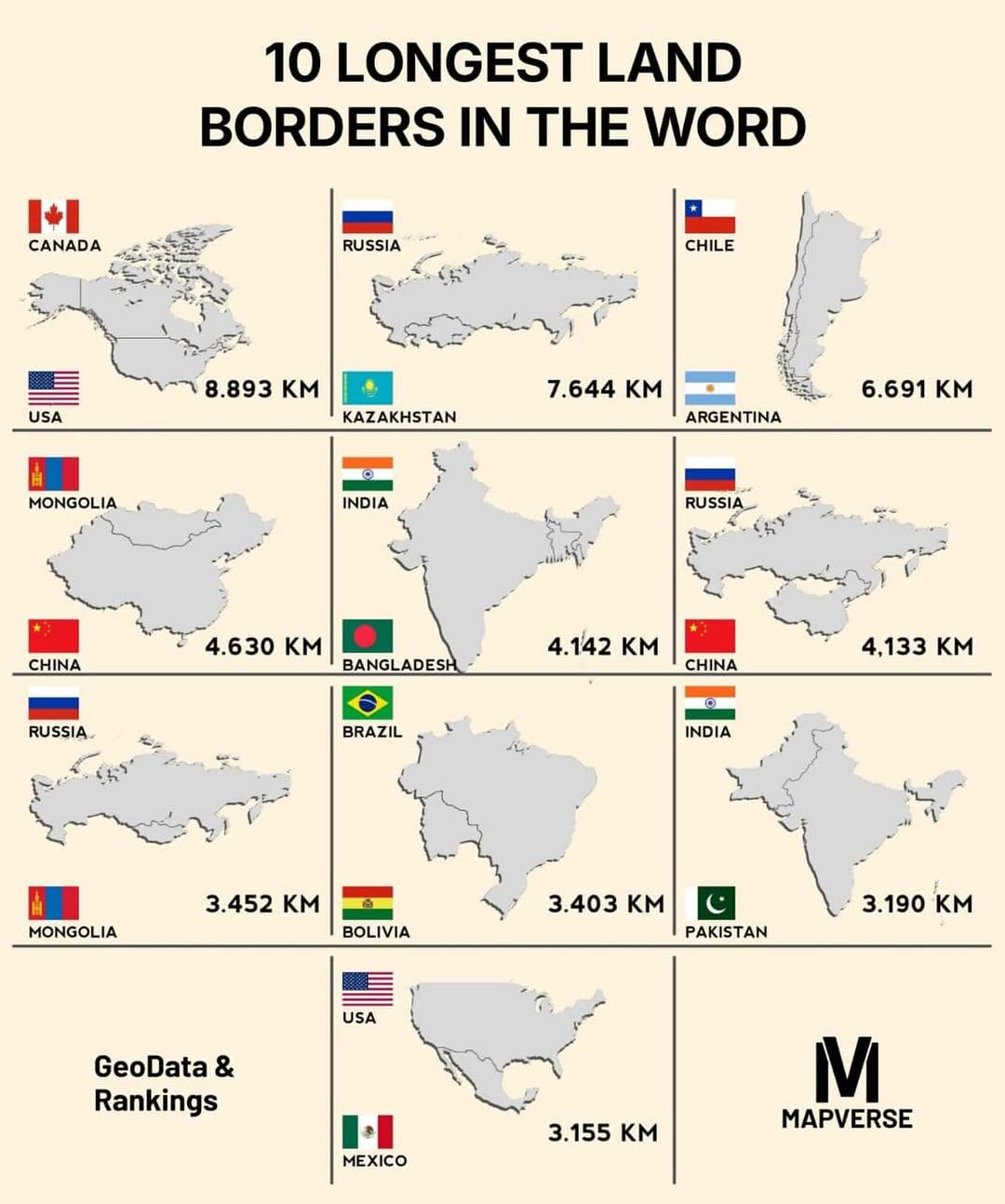
Top 10 Longest Land Borders Map
The "Top 10 Longest Land Borders Map" provides a clear visualization of the world's most extensive land borders. It high...