1843 French Map of Asia Analysis

Alex Cartwright
Senior Cartographer & GIS Specialist
Alex Cartwright is a renowned cartographer and geographic information systems specialist with over 15 years of experience in spatial analysis and data...
Geographic Analysis
What This Map Shows
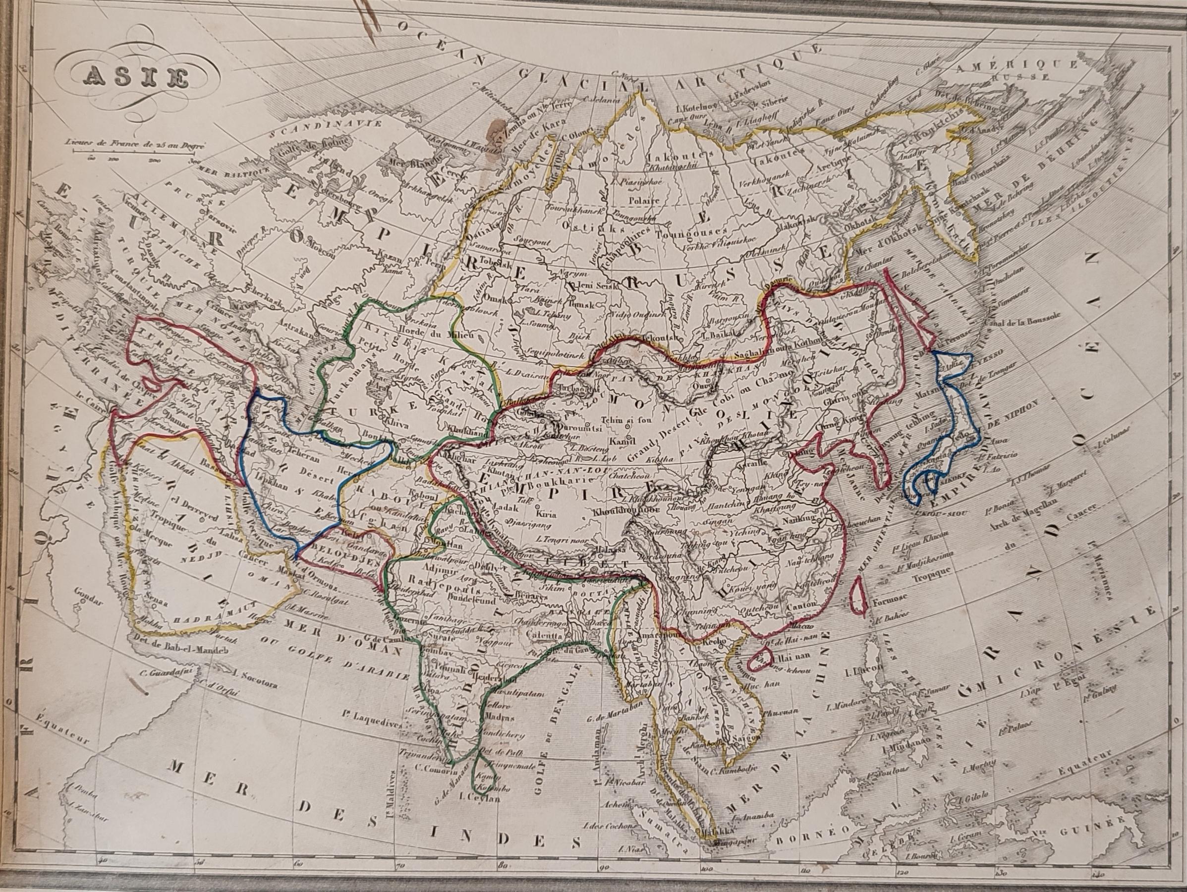
The 1843 French map of Asia is a historical representation that provides insight into the geographical understanding of Asia during the early 19th century. This map showcases the diverse topographies, political boundaries, and cultural regions that existed at the time, including the vast expanses of the Russian Empire in the north, the British territories in India, and the numerous kingdoms of Southeast Asia. The visualization also highlights significant geographical features such as mountain ranges, rivers, and deserts, offering a snapshot of the continent's physical landscape as perceived by French cartographers.
Deep Dive into Political Boundaries and Influence
One of the most intriguing aspects of the 1843 French map of Asia is its reflection of the political dynamics of the era. During the early 19th century, Asia was a complex tapestry of empires and territories, each vying for power and influence. The map delineates the various colonial holdings, particularly focusing on the British presence in India and the French influence in Indochina. This was a time marked by imperial competition and the scramble for resources, trade routes, and strategic military positioning.
Interestingly, this map does not just show borders; it also illuminates the cultural diversity within these regions. For example, the delineation of kingdoms such as Siam (modern-day Thailand) and the various princely states of India reveals a rich mosaic of ethnicities and languages. The French cartographers made efforts to indicate not only political borders but also the geographical nuances that defined these cultures.
Furthermore, the map presents significant geographical features, such as the Himalayas, which serve as a natural barrier between the Indian subcontinent and the Tibetan Plateau. This mountain range is not only a geographical marvel but also a cultural and spiritual one, influencing the traditions and lifestyles of the people living in its shadow. Have you ever wondered how geography shapes culture? The Himalayas have been pivotal in the development of both Indian and Tibetan civilizations, impacting everything from trade routes to religious practices.
Additionally, the rivers shown on this map, like the Ganges and the Yangtze, are vital lifelines for the populations they traverse. These waterways have historically supported agriculture and trade, making them crucial for the economic development of various regions. The Ganges, for instance, is not only a vital resource but also holds immense religious significance, being considered sacred by millions of Hindus.
Regional Analysis
When we break down the map by regions, we can see distinct differences in how land was utilized and governed. In the northern parts of Asia, the vast expanses of Siberia are sparsely populated, reflecting the harsh climate and challenging living conditions. In contrast, southern Asia, particularly in India and Southeast Asia, exhibits dense populations and thriving trade networks.
For instance, the coastal areas of Southeast Asia were bustling with trade due to their strategic positions along maritime routes. The Malay Peninsula, marked by its intricate network of islands, was a critical hub for trade between Asia and the rest of the world. The map hints at the rich cultural exchanges that would occur here, driven by commerce and colonization.
In Central Asia, the steppes are depicted as expansive and largely ungoverned territories, home to nomadic tribes. The lack of defined political boundaries in this region signifies the fluidity of power and control, highlighting how geography can influence governance and societal structures. In contrast, the Indian subcontinent displays an intricate patchwork of princely states and colonial territories, revealing a high level of administrative complexity.
Significance and Impact
The significance of the 1843 French map of Asia extends beyond mere historical curiosity; it serves as a crucial reminder of how geography influences politics, culture, and economics. Understanding the political boundaries of that era can help us grasp current geopolitical tensions in the region. For instance, the historical influence of colonial powers can still be felt today, as countries navigate their identities and relationships with former colonial rulers.
Moreover, the representation of natural features such as rivers and mountains on the map underscores the importance of geography in shaping human civilization. Current trends in environmental science and urban planning emphasize the need to consider geographical factors in development and conservation efforts. The rivers that once served as trade routes are now central to discussions about sustainable water management and ecological preservation.
In conclusion, the 1843 French map of Asia is not just a relic of the past; it is a lens through which we can examine the intricate relationships between geography, culture, and politics that shaped the continent. As we move forward, understanding these historical contexts will be essential in addressing the challenges and opportunities that lie ahead.
Visualization Details
- Published
- August 13, 2025
- Views
- 118
Comments
Loading comments...