colonialism Maps
17 geographic visualizations tagged with "colonialism"
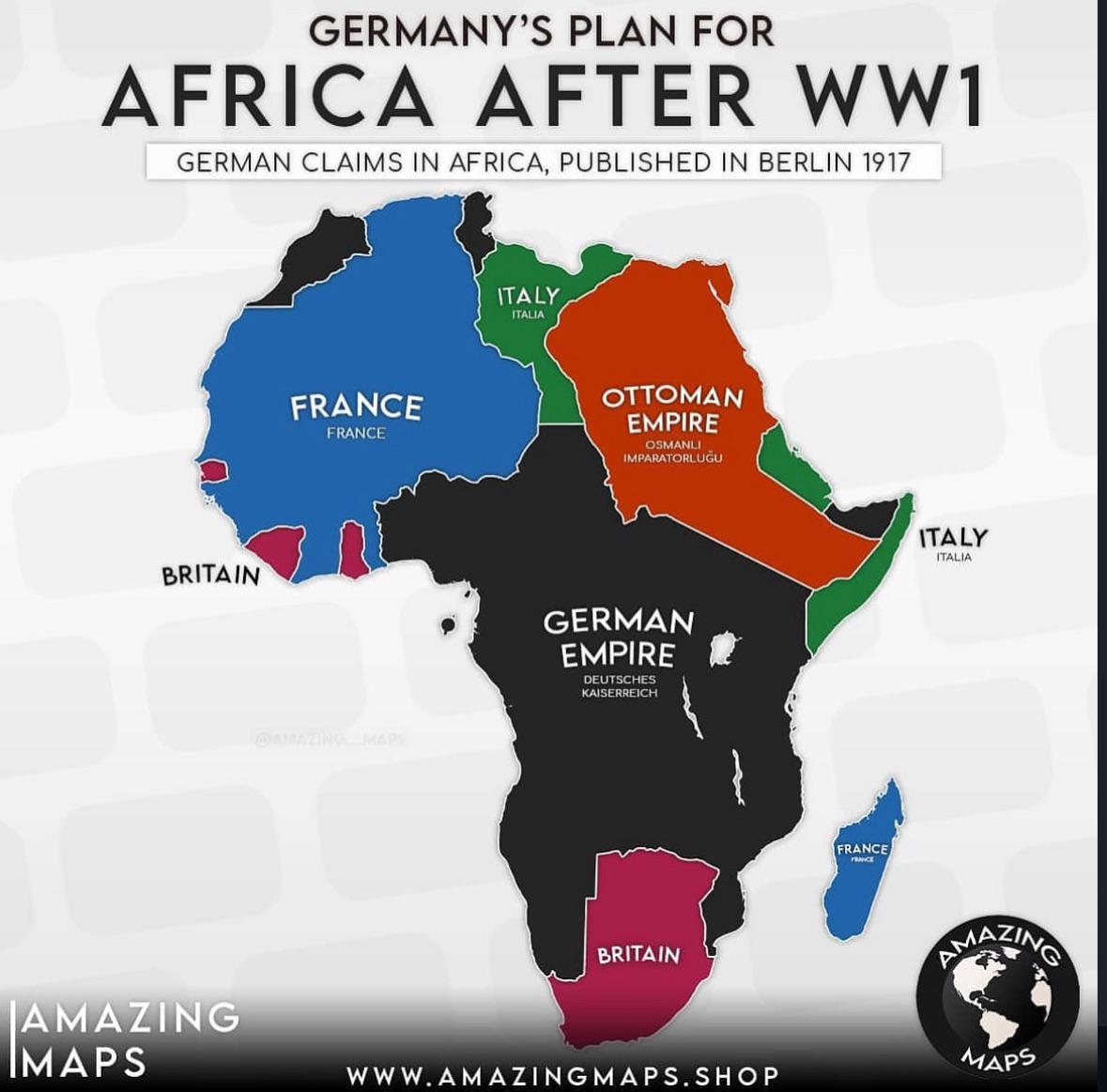
German Colonial Plans for Africa After WW1 Map
The map titled "German Colonial Plans for Africa After WW1" provides a visual representation of the territories that Ger...
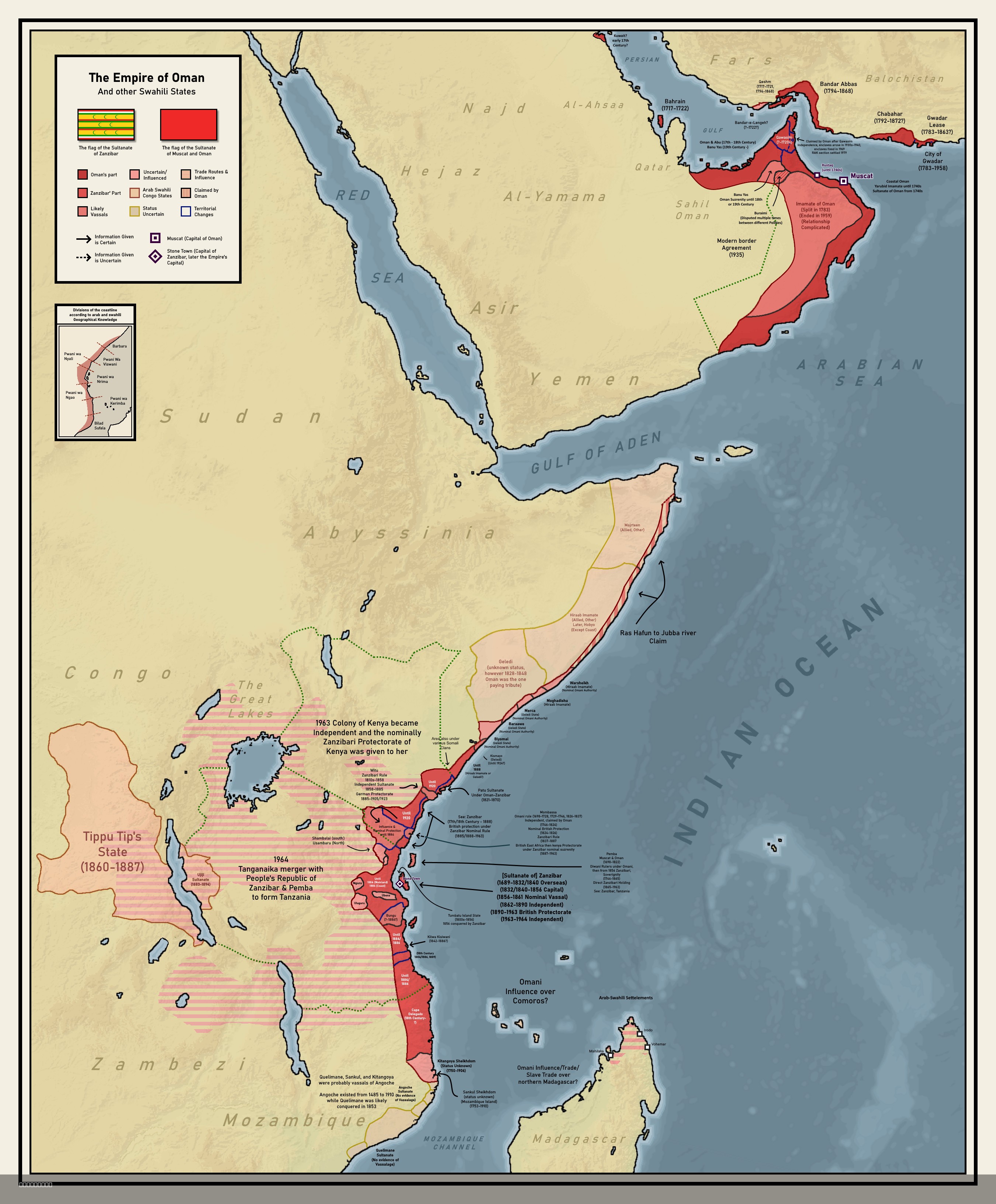
Colonial Empire of Oman Map 1696 to 1856
The map titled "Forgotten Colonial Empire of Oman from 1696 to 1856" illustrates the extensive territorial reach of the ...
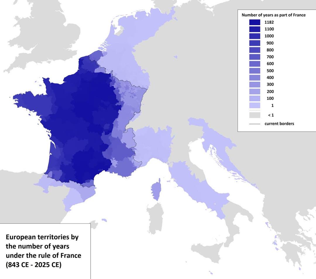
Map of European Territories By Years Under France
The visualization titled 'Map of European Territories By The Number of Years Spent Being Part of France' offers a compre...
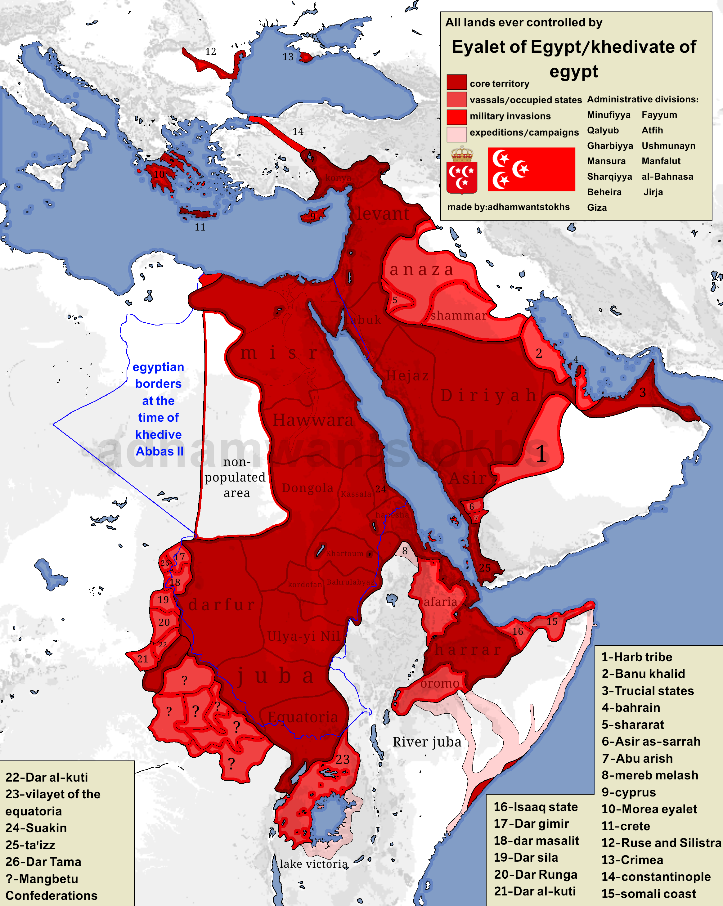
Map of Territories Ruled by Eyalet of Egypt
Egypt's colonial ambitions were pronounced, especially during the reign of Ismail Pasha, who ruled from 1863 to 1879. Un...
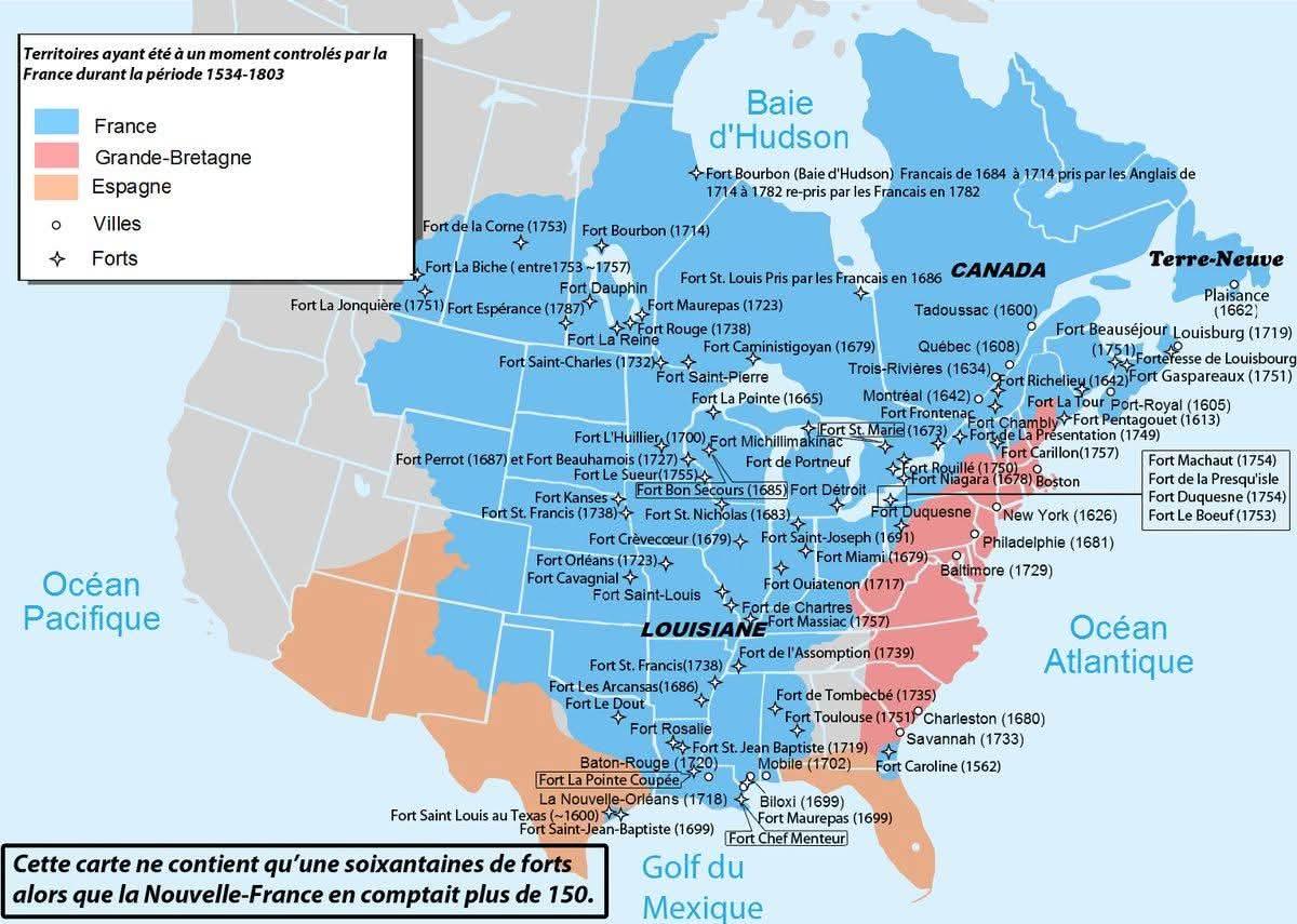
Map of North American Territories Once Controlled by France
This map provides a visual representation of the territories in North America that were once under French control. From ...
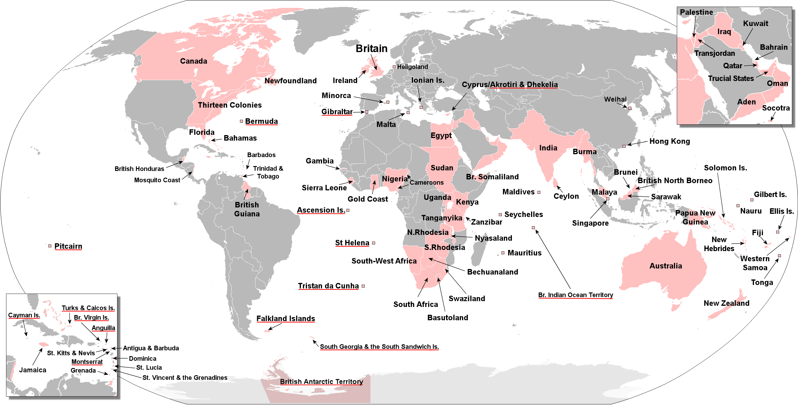
Map of Territories Ever Held by the British Empire
This visualization presents an anachronous map detailing the vast territories once held by the British Empire at various...
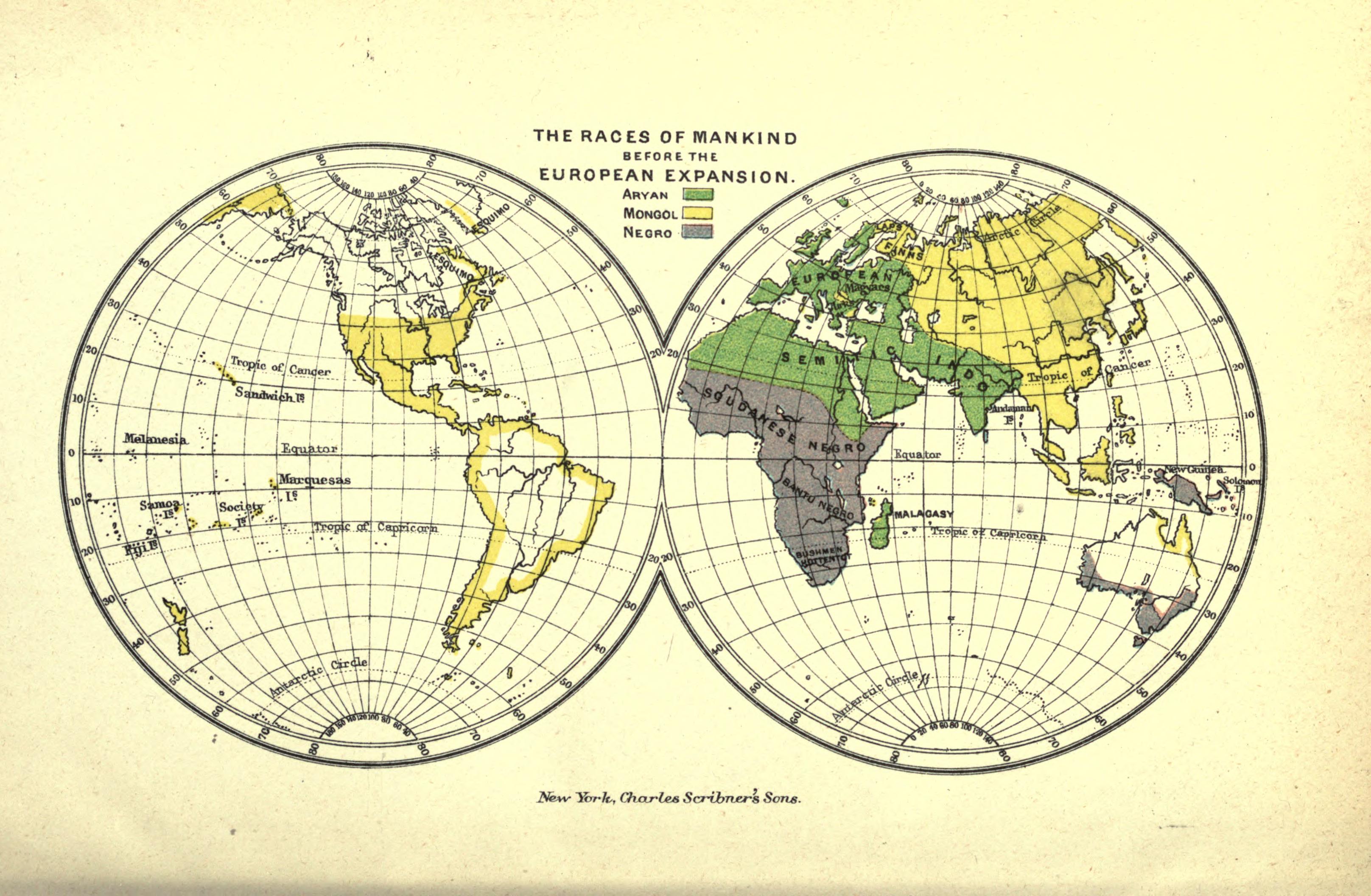
Races of Mankind Map Before European Expansion
The 1891 map titled "The Races of Mankind Before European Expansion" published by Charles Scribner's Sons provides a vis...
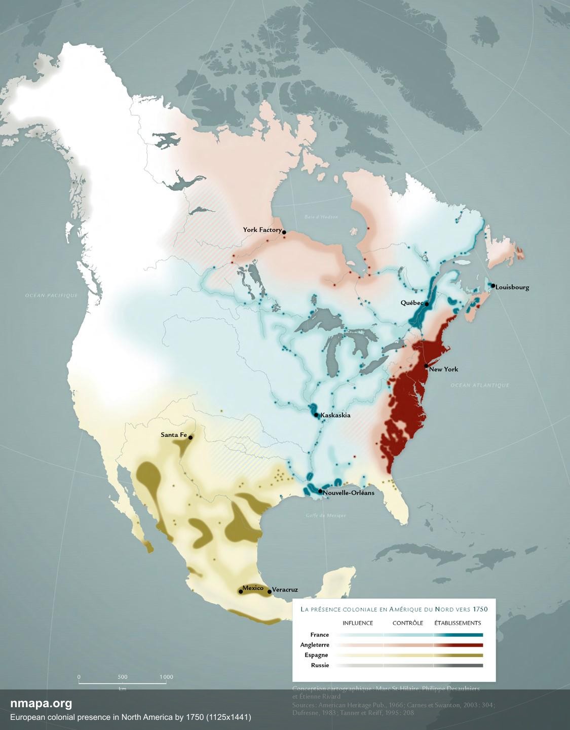
European Colonial Presence in North America Map
This map provides a detailed visualization of European colonial presence in North America by the year 1750, focusing par...
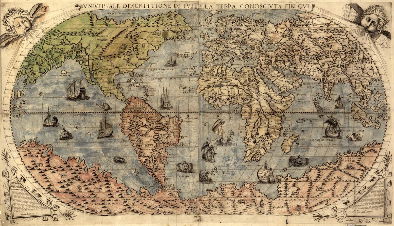
World Map of 1565
...
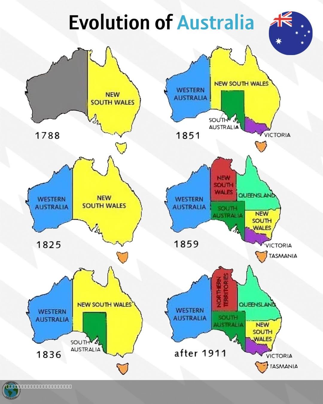
Evolution of Australia Map
...
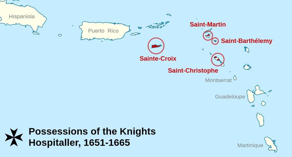
Map of Short-Lived Caribbean Colonies of the Knights of Malta
This map highlights the brief yet impactful presence of the Knights of Malta in the Caribbean during the 17th and 18th c...
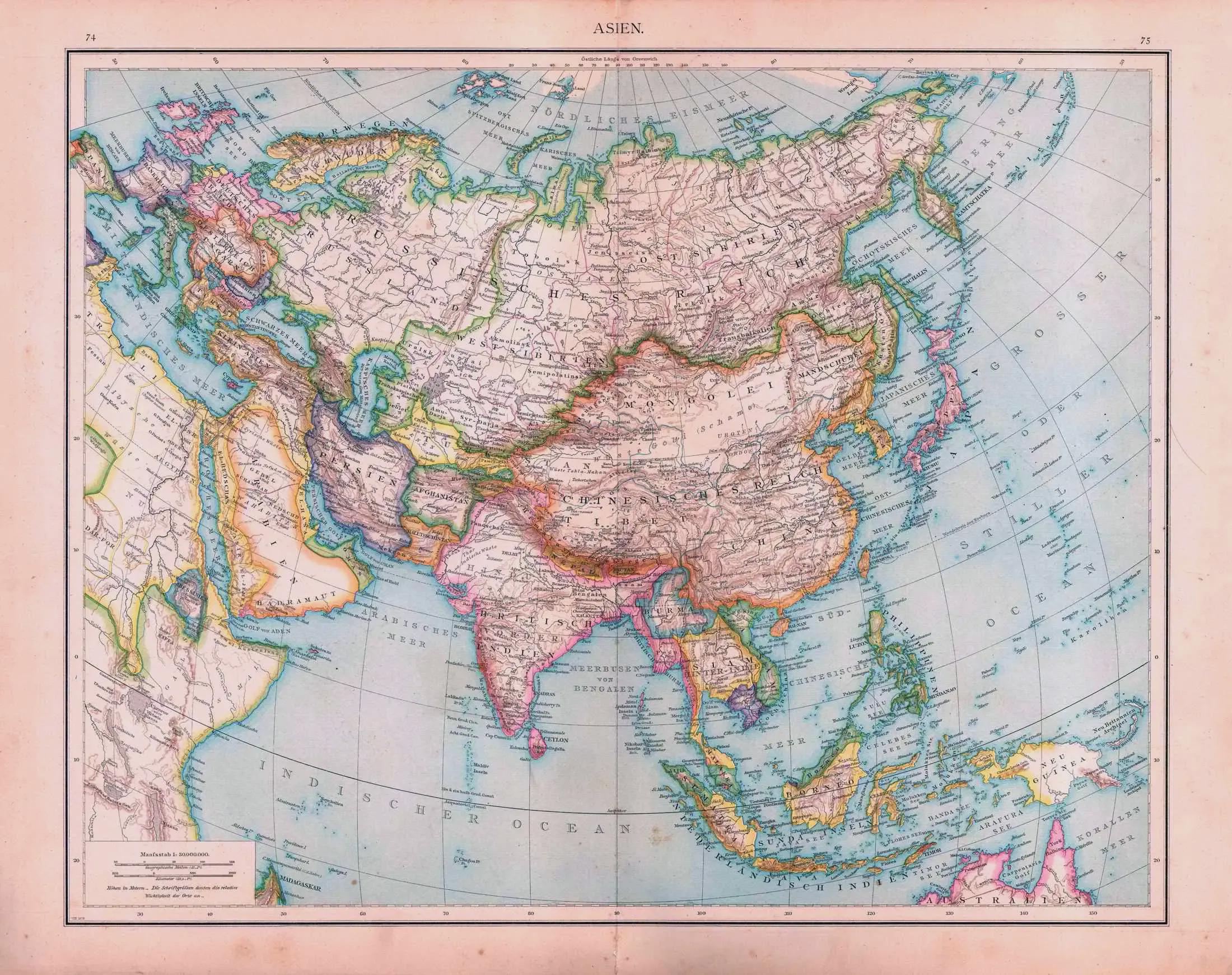
Political Map of Asia 1879
The "Asia (1879 political map)" offers a window into the geopolitical landscape of Asia during the late 19th century. Th...
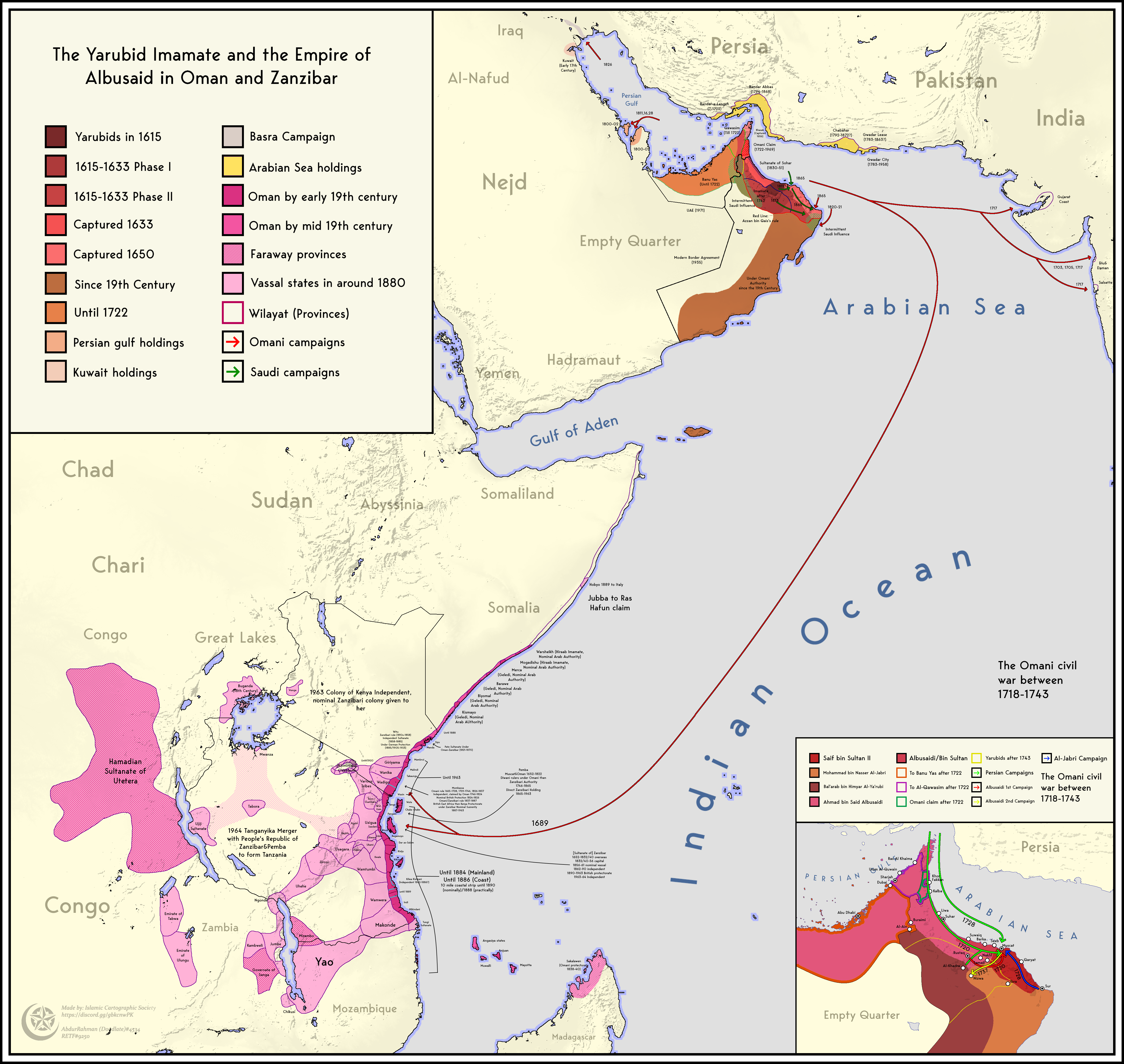
Territorial Expansion and Contraction Map of Oman and Zanzibar
The map titled "Territorial Expansion and Contraction of the Empire of Oman and Zanzibar (1615-1964)" visually represent...
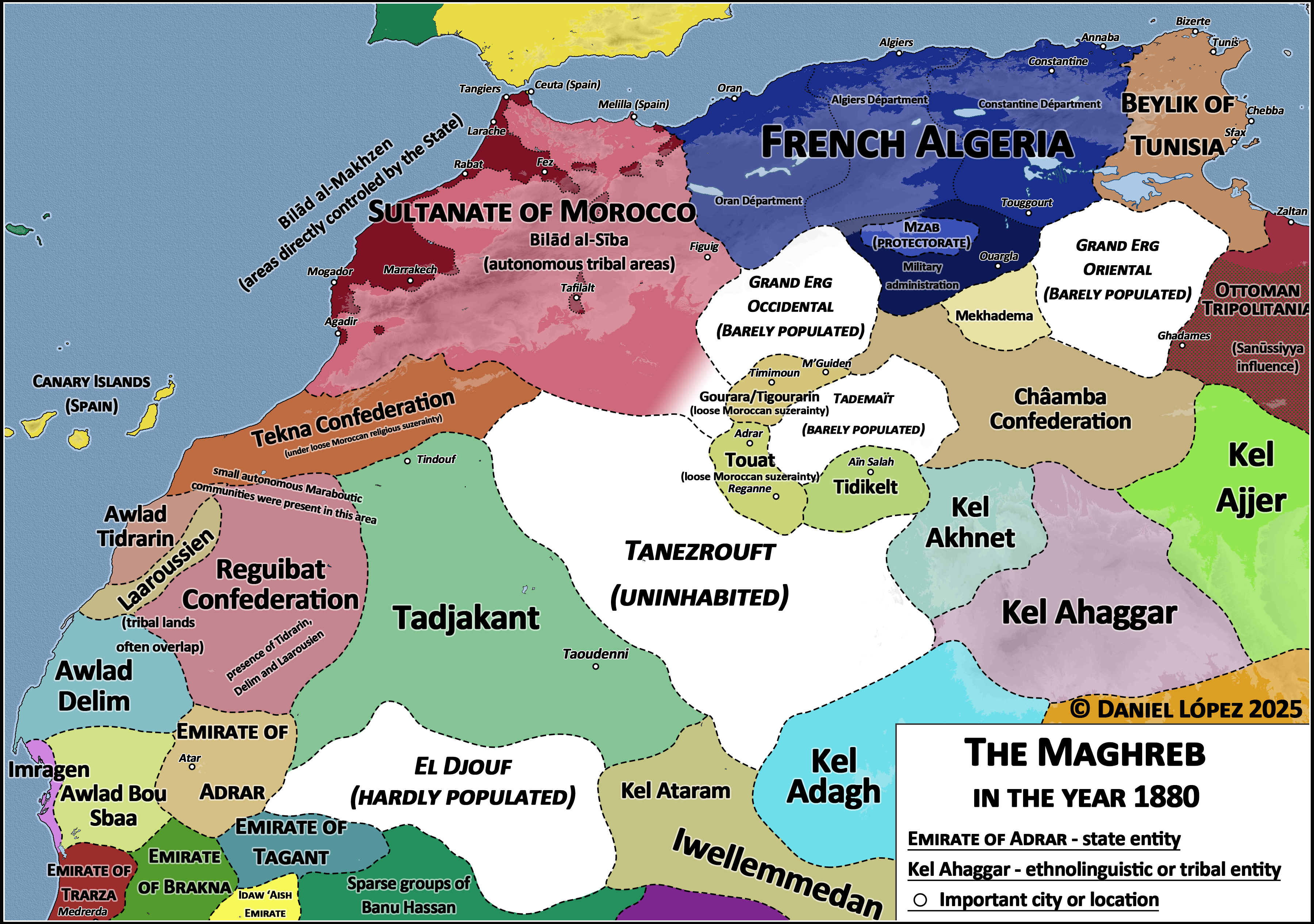
The Maghreb Map in the Year 1880
This map of the Maghreb region in the year 1880 provides a compelling visual representation of North Africa during a tim...
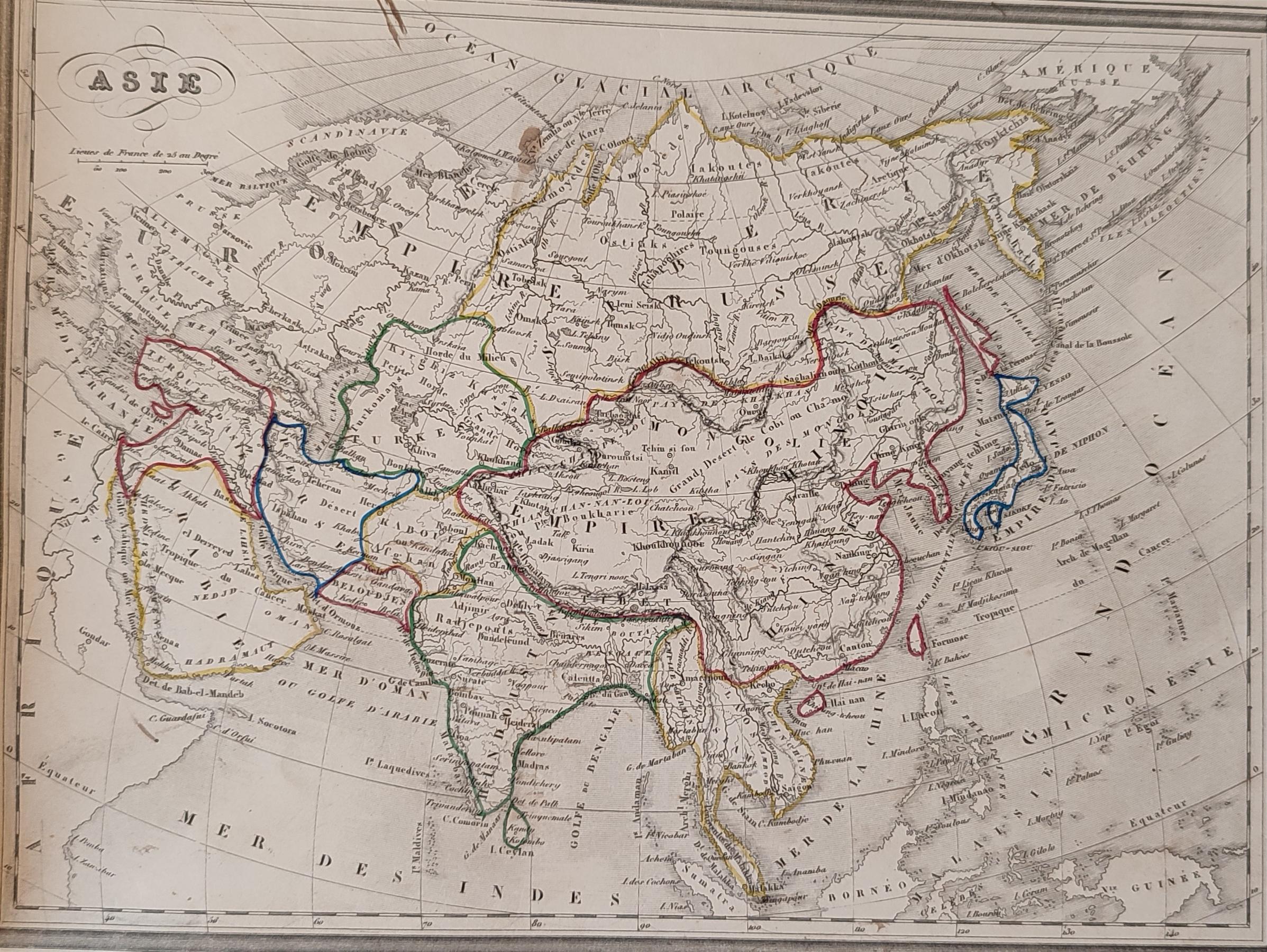
1843 French Map of Asia Analysis
The 1843 French map of Asia is a historical representation that provides insight into the geographical understanding of ...
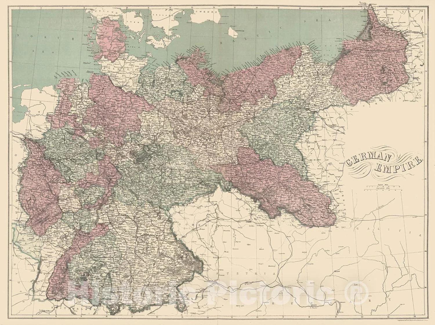
German Empire Territorial Map 1911
The map titled "German Empire at Its Peak in 1911" illustrates the territorial extent and political boundaries of German...
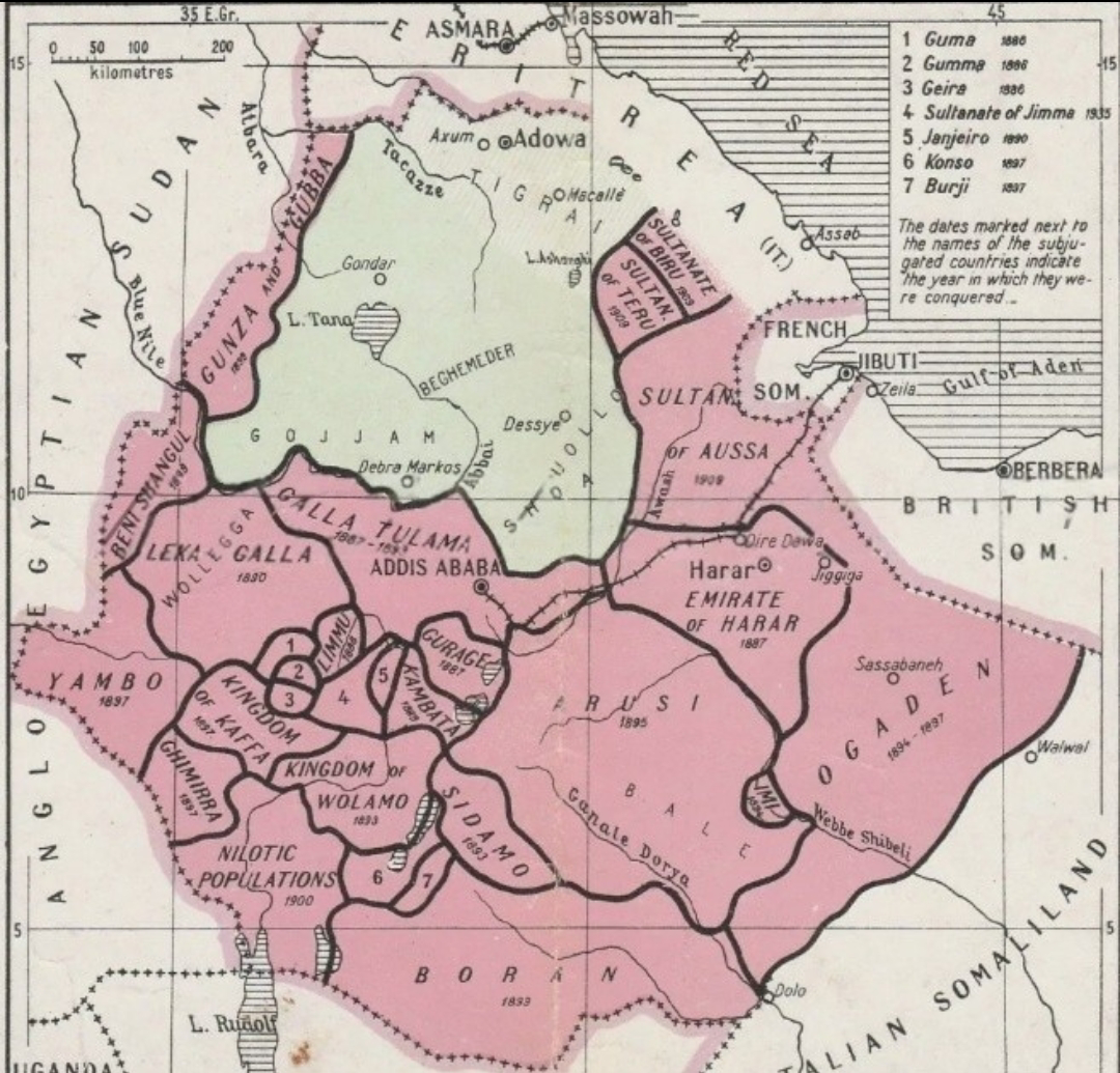
Map of Menelik II's Ethiopia Pre and Post Conquest
...