German Empire Territorial Map 1911

Marcus Rodriguez
Historical Geography Expert
Marcus Rodriguez specializes in historical cartography and geographic data analysis. With a background in both history and geography, he brings unique...
Geographic Analysis
What This Map Shows
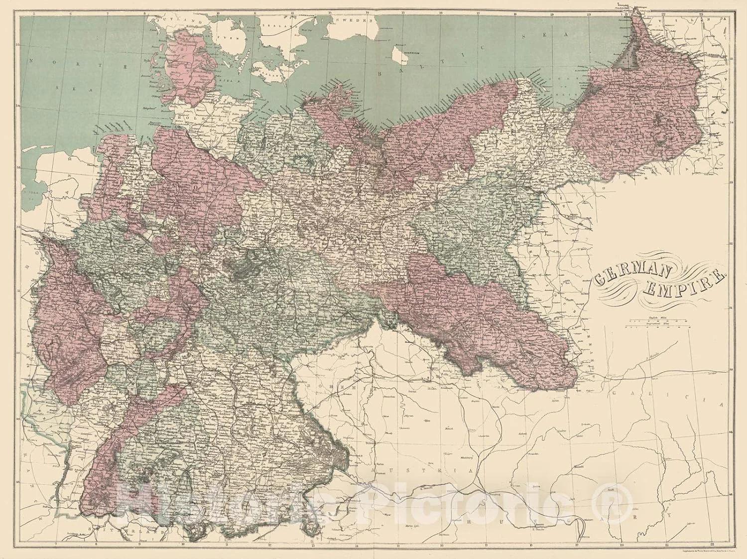
The map titled "German Empire at Its Peak in 1911" illustrates the territorial extent and political boundaries of Germany just before the outbreak of World War I. This visualization provides a snapshot of the German Empire's dominion, showcasing not only the core territories of modern Germany but also its colonies and influence across Europe and beyond. It’s a significant historical reference point that highlights the geopolitical landscape of early 20th-century Europe.
Deep Dive into the German Empire
The German Empire, established in 1871, unified various German states under a single imperial authority. By 1911, it reached its zenith both in territorial scope and industrial power. This empire was characterized by a complex mix of cultures, languages, and economies, which contributed to its dynamic yet tumultuous nature.
The German Empire's economy was one of the most advanced in Europe. Its rapid industrialization during the late 19th century transformed it into a manufacturing powerhouse, leading in sectors such as coal and steel production. Interestingly, by 1913, Germany produced about 60% of the world’s electrical machinery and was a leader in chemical production. This economic might, however, was accompanied by significant social changes, including urbanization and the rise of a working-class movement that would later influence political dynamics.
Moreover, the German Empire’s expansionist policies and colonial ambitions were evident during this period. The map delineates the empire's overseas territories, including parts of modern-day Namibia, Tanzania, and Cameroon. These colonies were integral to Germany’s quest for resources and markets but also marked the empire's engagement in the global imperialist competition of the time. The legacy of these colonial endeavors continues to influence relations between Germany and its former colonies today.
What’s fascinating is that the empire was not just a homogeneous entity; it was composed of various ethnic groups, including Poles, Alsatians, and Danes, each contributing to the cultural tapestry of the empire. This diversity, while enriching, also posed challenges in terms of national identity and governance, leading to tensions that would echo throughout German history.
Regional Analysis
Examining the different regions within the German Empire reveals significant variations in economic activities, cultural practices, and political affiliations. For instance, Prussia, the largest and most influential state within the empire, was the epicenter of political power and economic development. Its capital, Berlin, became a hub of culture and innovation, attracting a diverse population that fueled its growth.
Conversely, regions like Bavaria maintained distinct cultural identities, with strong local traditions and a degree of autonomy. This regional diversity was not limited to cultural aspects; it also extended to economic practices. The industrial heartland in the Ruhr area contrasted sharply with the agricultural landscapes of the eastern provinces, highlighting the empire's economic disparities.
Additionally, the empire's colonial territories presented a different set of challenges and opportunities. For instance, German East Africa not only served as a source of raw materials but also demonstrated the empire's strategic interests in expanding its influence in Africa. The socio-political implications of these colonial ventures are still felt today, as they have shaped historical narratives and international relations.
Significance and Impact
Understanding the German Empire’s territorial extent in 1911 is crucial for several reasons. First, it sets the stage for the political conflicts that would lead to World War I, as the empire’s ambitions clashed with those of other European powers. The militaristic and nationalistic fervor of the time, fueled by a desire for greater influence, played a significant role in shaping the events that followed.
Moreover, the repercussions of the empire's collapse post-World War I had long-lasting effects on the geopolitical landscape of Europe. The Treaty of Versailles redrew the map of Europe, leading to the creation of new nations and sowing the seeds of future conflicts, including World War II. The legacy of the German Empire continues to resonate, as issues of national identity, territorial disputes, and historical memory remain pertinent in contemporary discussions.
In conclusion, the map of the German Empire at its peak in 1911 not only serves as a historical artifact but also invites us to ponder the intricate web of economic, cultural, and political threads that shaped early 20th-century Europe. The lessons learned from this period remind us of the complexities of empire-building and its enduring impacts on global history.
Visualization Details
- Published
- September 13, 2025
- Views
- 90
Comments
Loading comments...