german empire Maps
5 geographic visualizations tagged with "german empire"
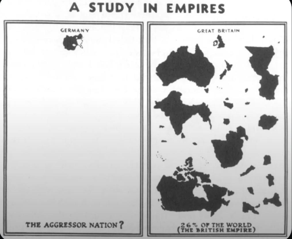
WWII Nazi Propaganda Map of Empires
The visualization titled "WWII Nazi Propaganda Map Comparing British and German Empires" serves as a striking representa...
👁 40📅 9/25/2025
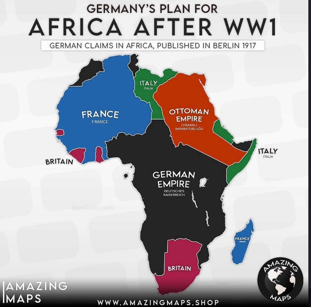
German Colonial Plans for Africa After WW1 Map
The map titled "German Colonial Plans for Africa After WW1" provides a visual representation of the territories that Ger...
👁 218📅 8/15/2025
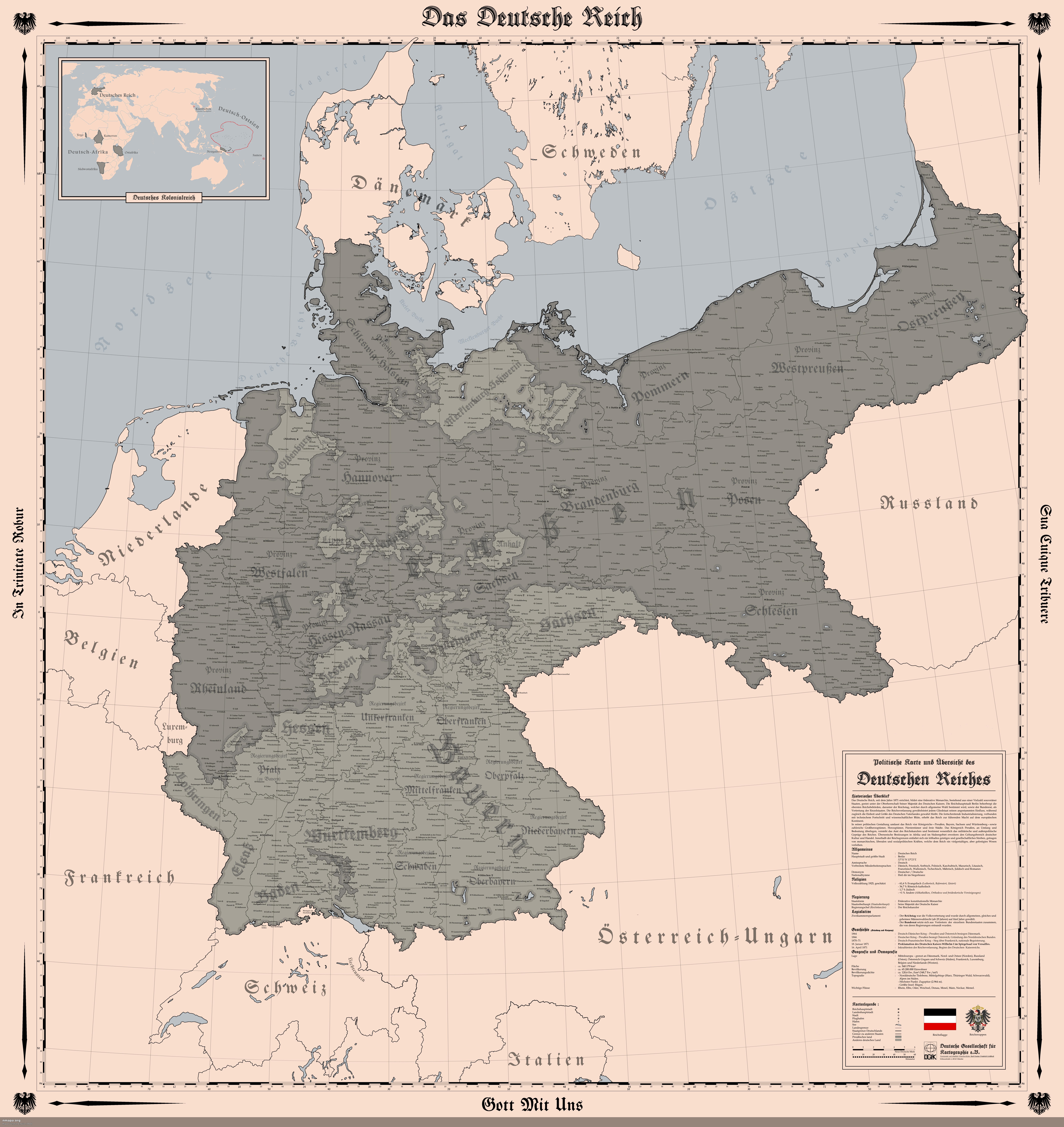
Map of the German Empire in 1914
The "Map of the German Empire (1914)" provides a detailed representation of the territorial boundaries, cities, and infr...
👁 148📅 8/5/2025
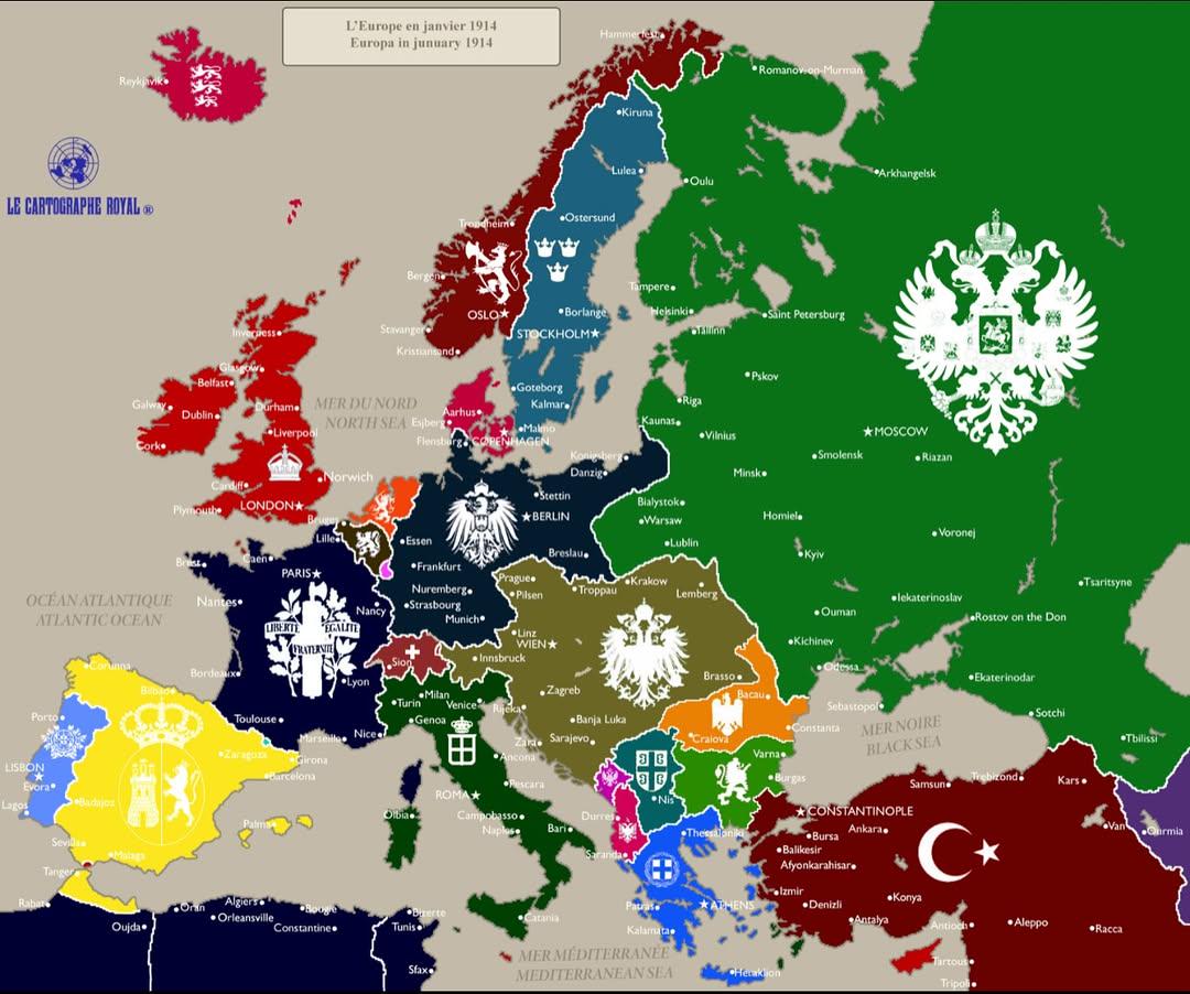
Political Map of Europe January 1914
The "Europe in January 1914" map provides a snapshot of the political landscape of Europe just months before the outbrea...
👁 8📅 10/19/2025
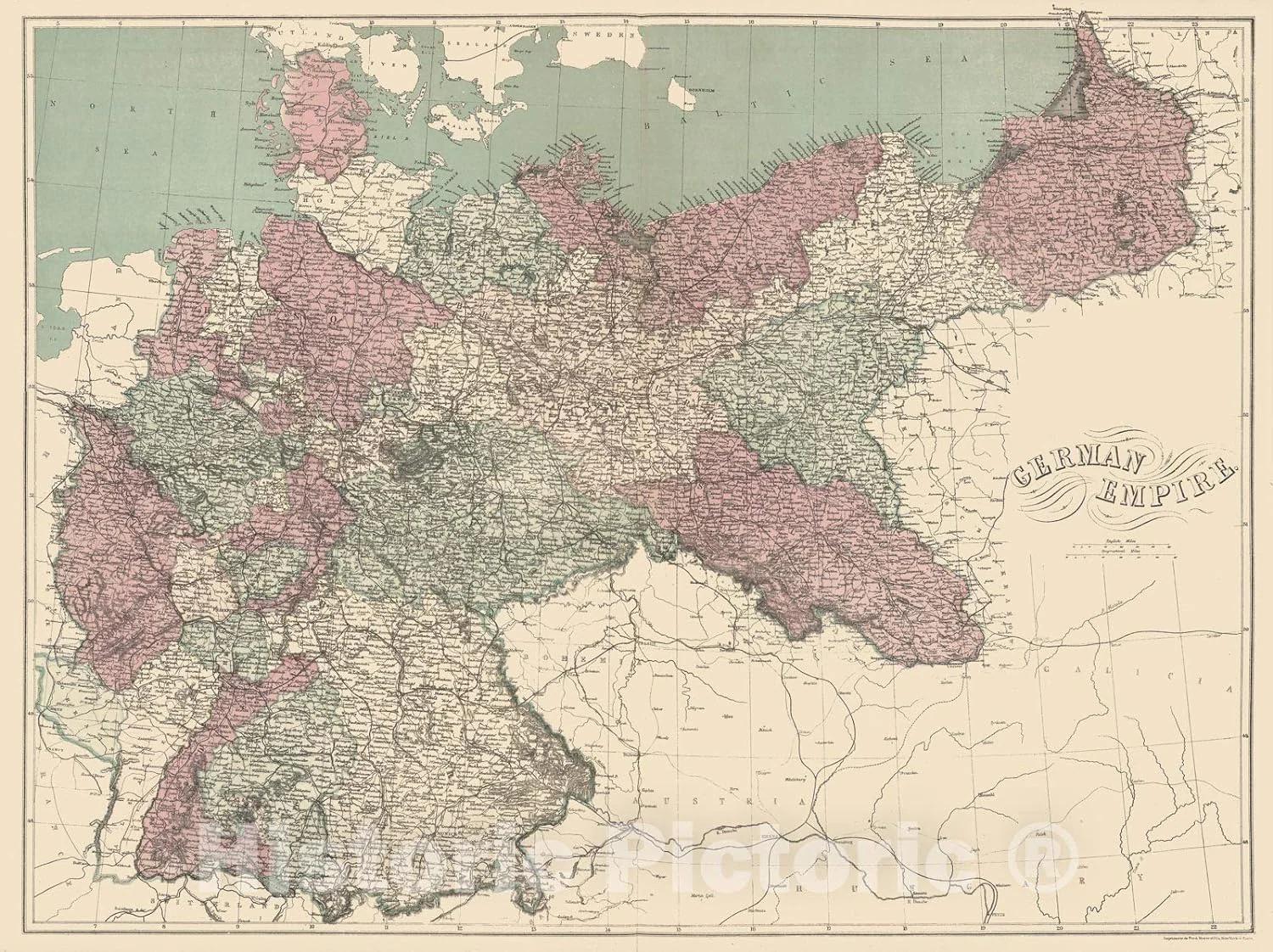
German Empire Territorial Map 1911
The map titled "German Empire at Its Peak in 1911" illustrates the territorial extent and political boundaries of German...
👁 68📅 9/13/2025