cultural geography Maps
59 geographic visualizations tagged with "cultural geography"
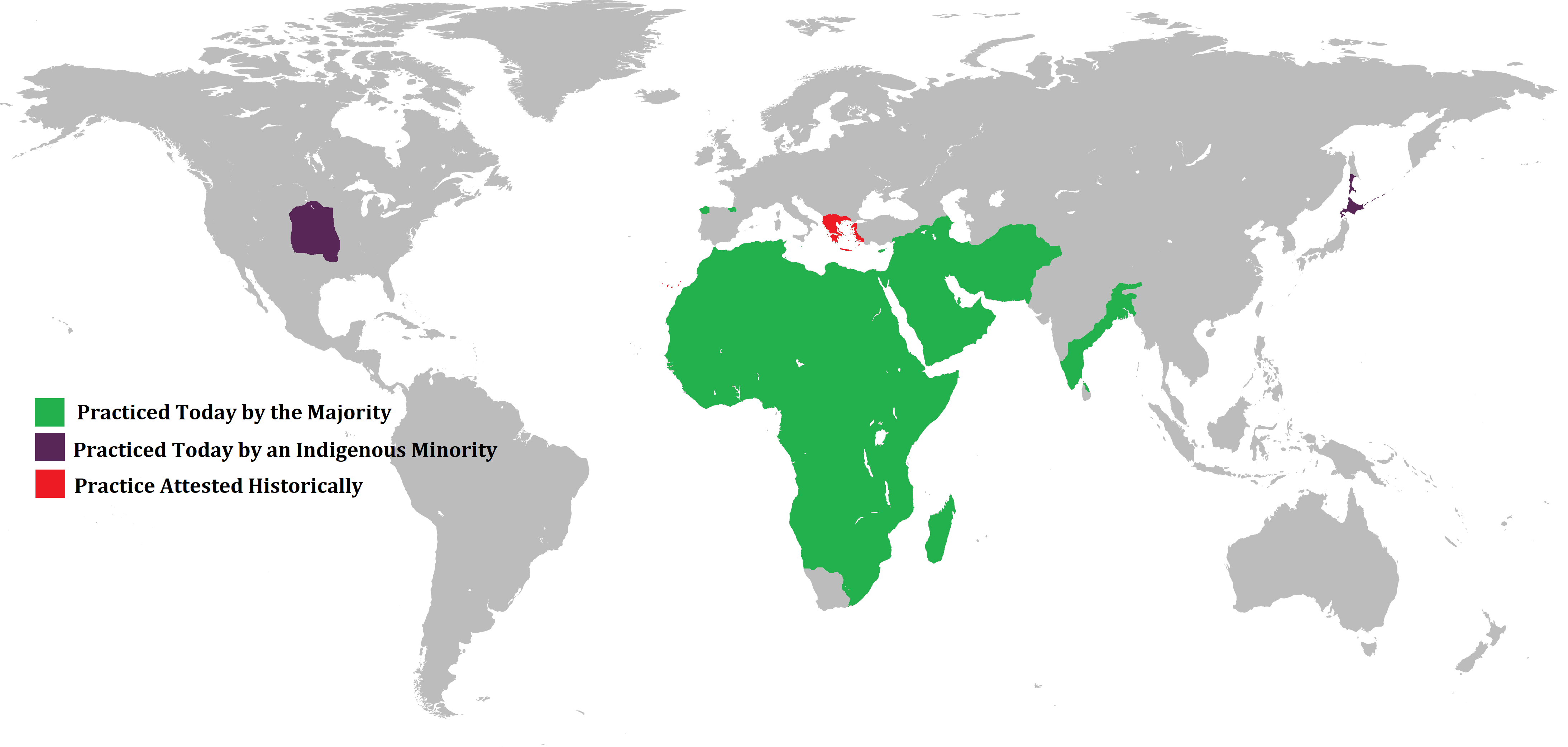
Ululation Practices Around the World Map
The visualization titled "The global spread of the practice of ululation" illustrates the geographical distribution of u...
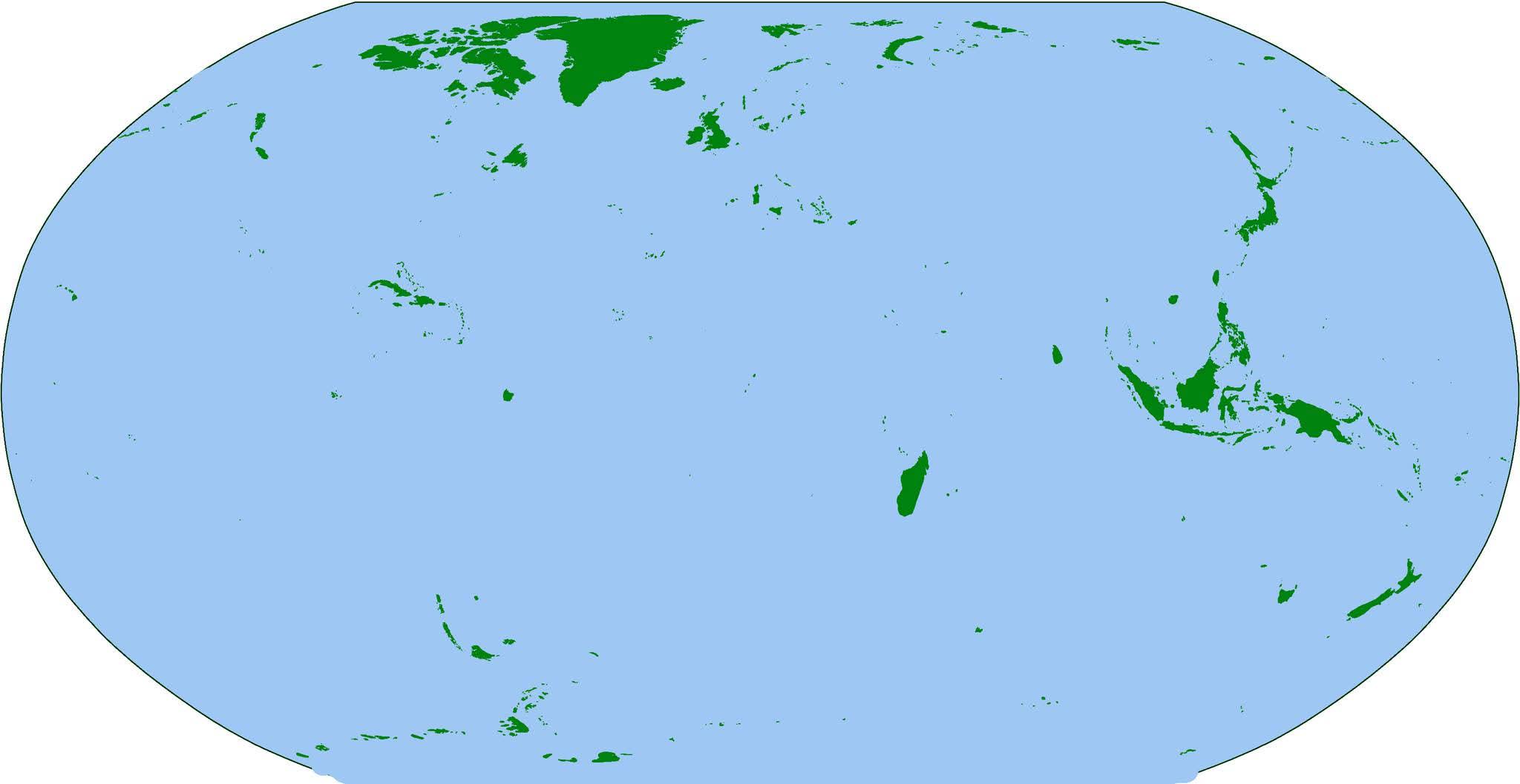
Map of the World's Islands
The visualization titled "The Earth... But Just Islands" presents a unique perspective on our planet by isolating and hi...
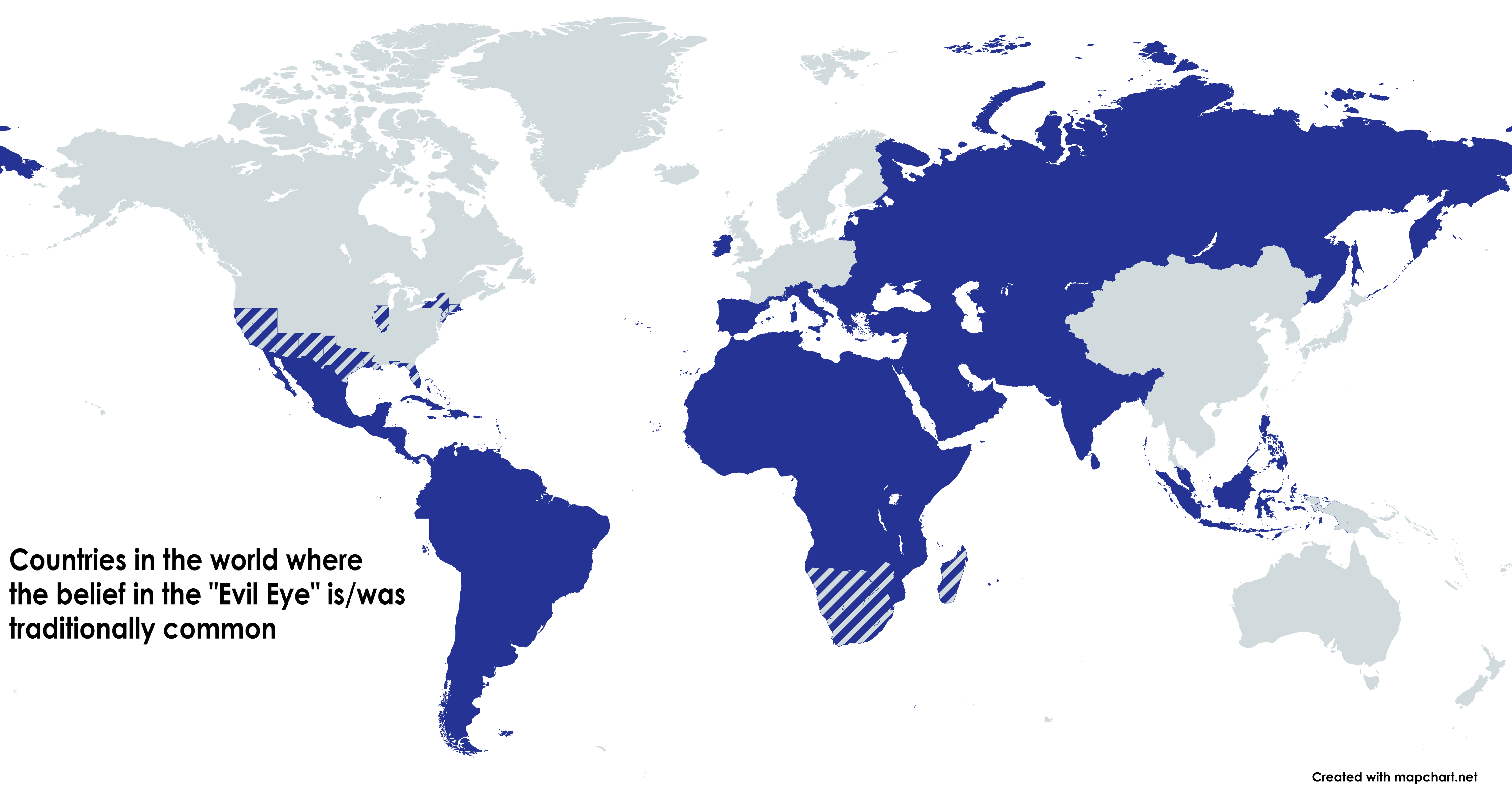
Evil Eye Belief Regions Map
This map illustrates the geographical spread of the folk belief in the "Evil Eye," a cultural phenomenon that has been p...
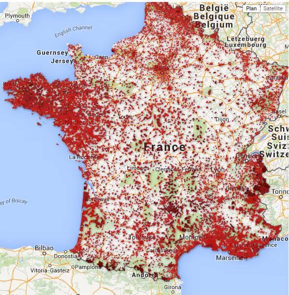
Map of Bars in France Serving Alcohol
This map provides a comprehensive overview of all bars across France that primarily serve alcohol. It visually represent...
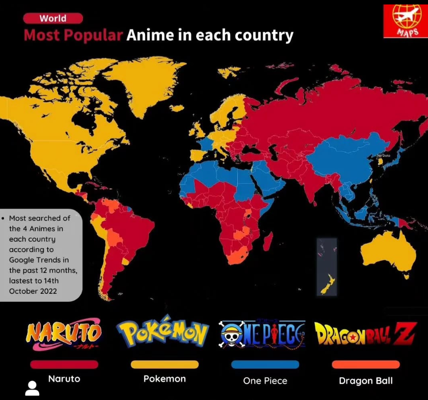
Most Popular Anime by Country Map
The "Most Popular Anime by Country Map" provides an intriguing overview of anime preferences across various nations. Eac...
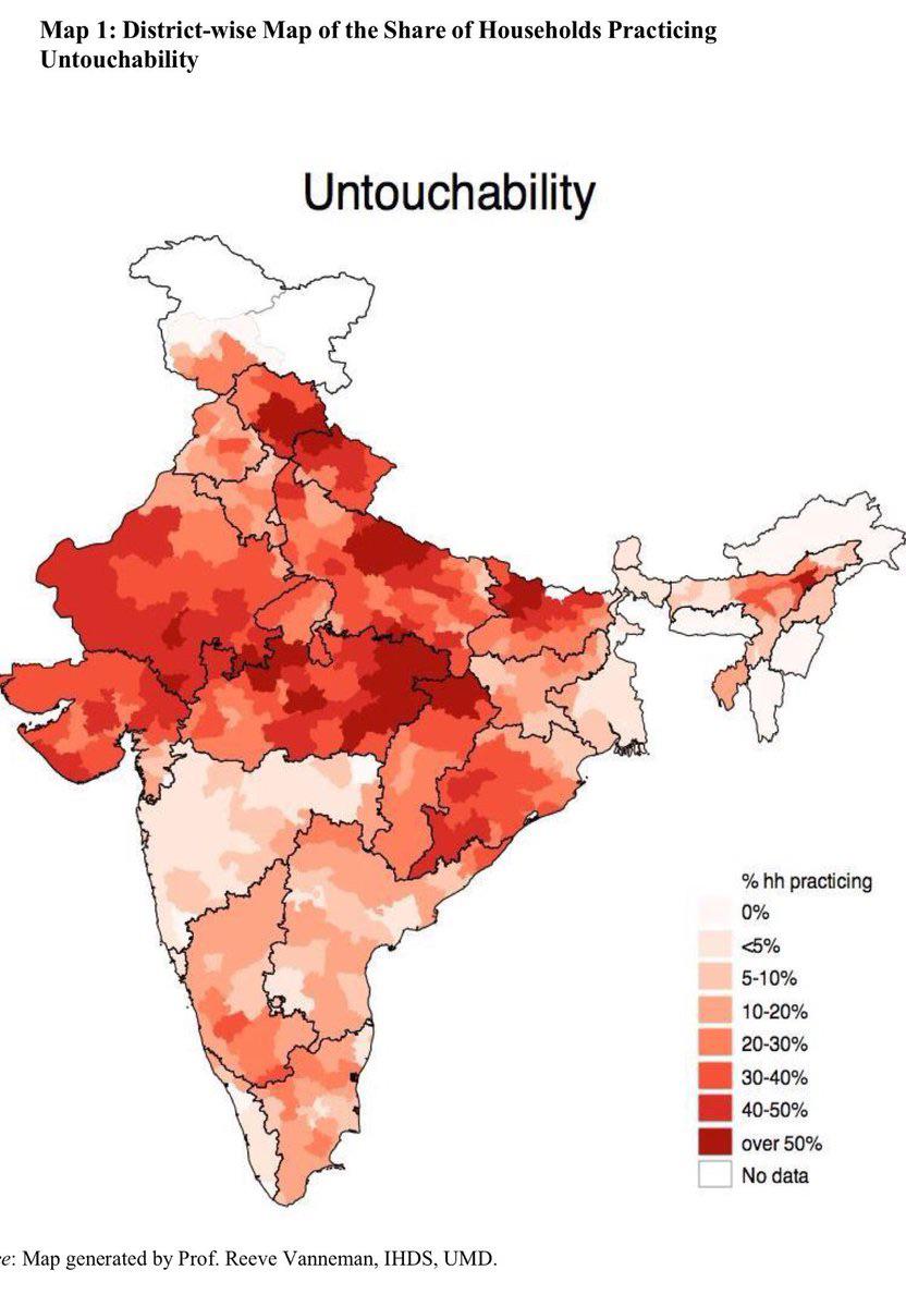
Map of Indian Households' Beliefs on Caste
This map illustrates a sensitive and complex social issue in India: the percentage of households that believe they becom...
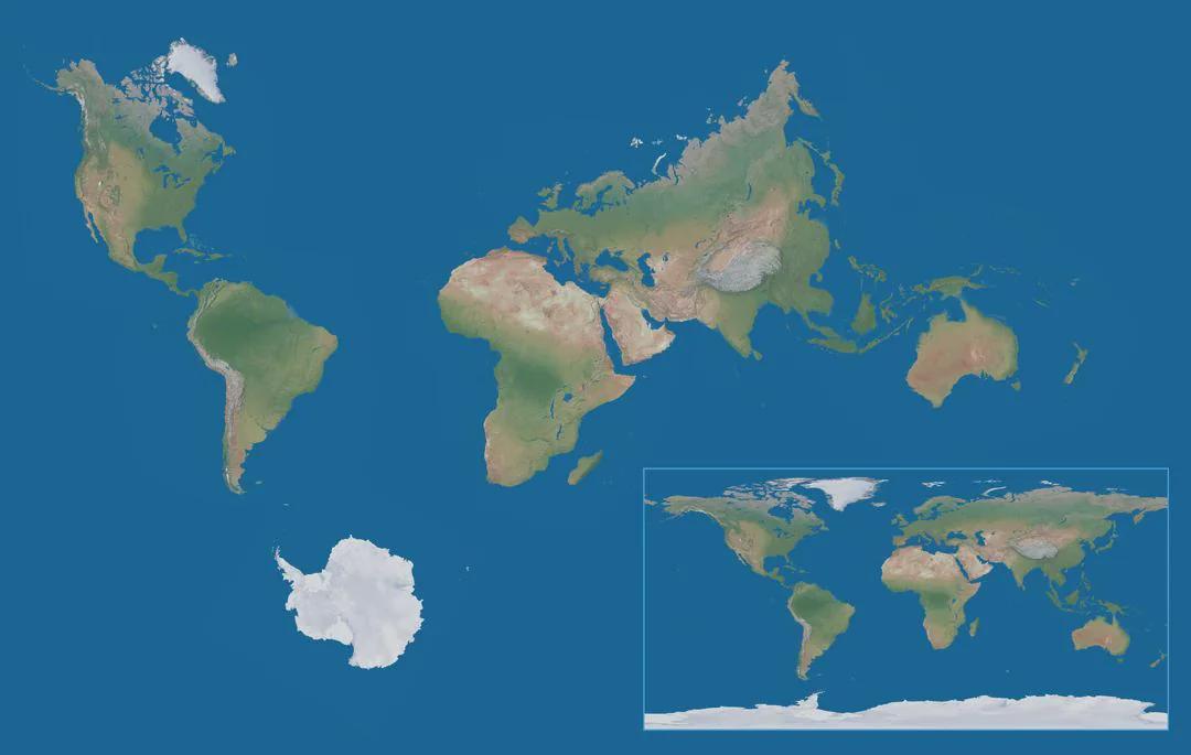
True World Map with Correct Proportions of Continents
The 'True World Map with Correct Proportions of Continents' presents a fascinating and accurate depiction of our planet'...
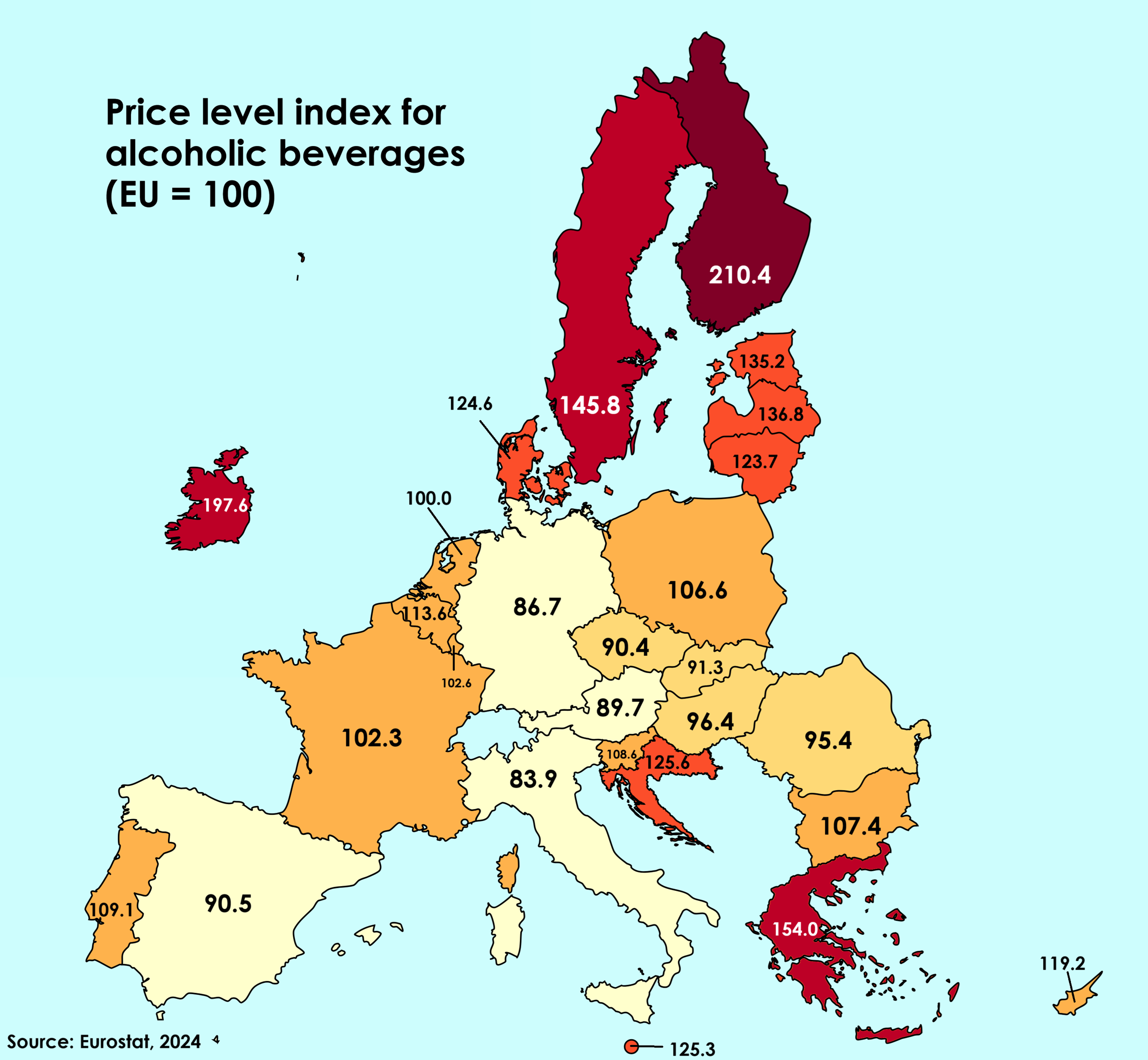
Alcohol Beverage Prices Compared to EU Average Map
This map visualizes the price of alcoholic beverages across various European countries in relation to the European Union...
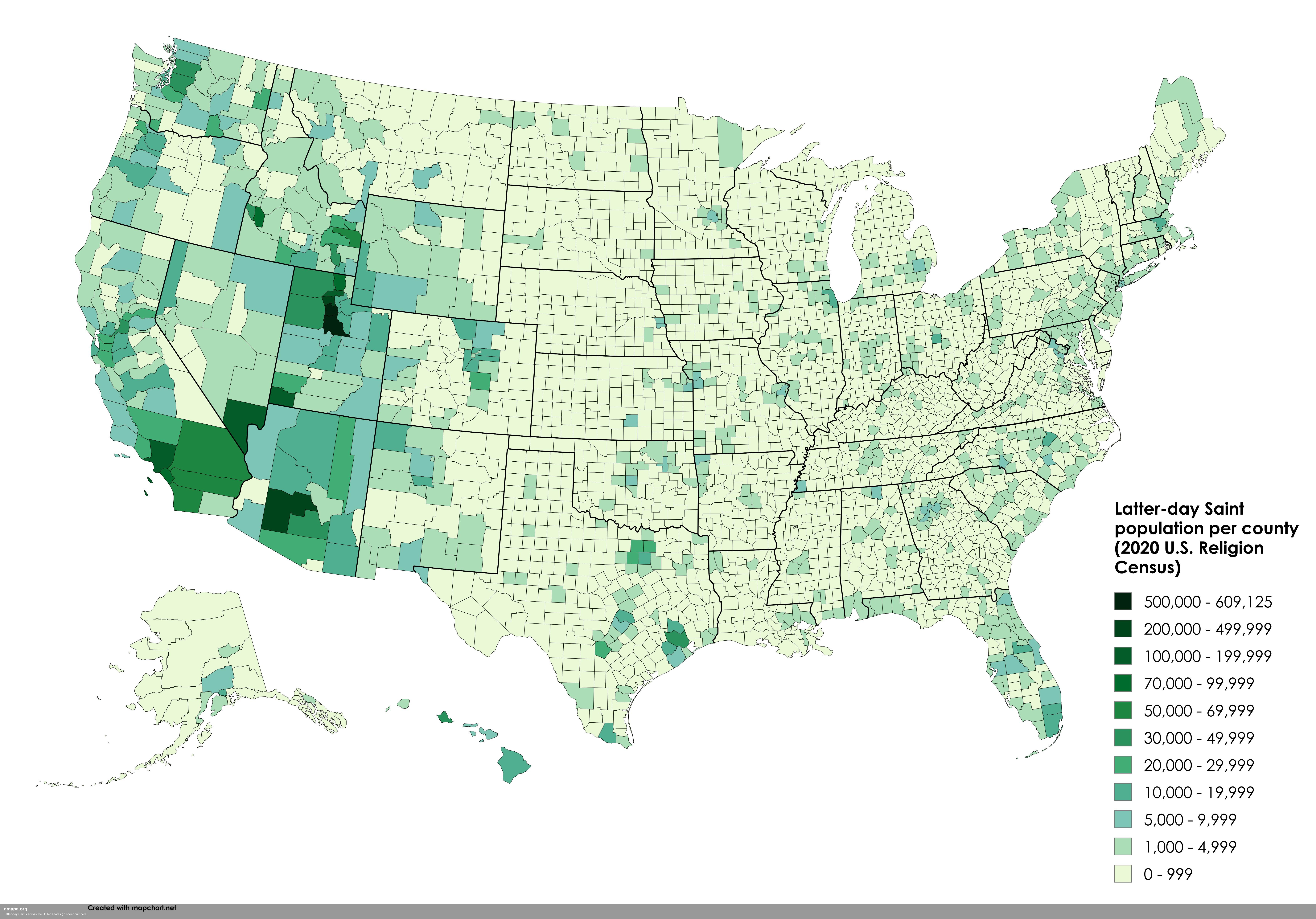
Visualizing Faith: The Latter-day Saints Map of America
In recent years, the Church of Jesus Christ of Latter-day Saints (LDS) has experienced a remarkable surge in growth, evi...
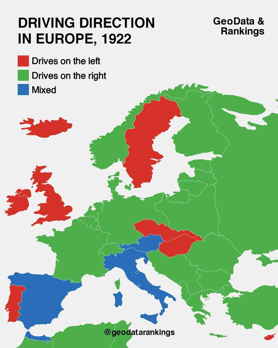
Driving Direction Map in Europe, 1922
The "Driving Direction Map in Europe, 1922" is a fascinating historical document that reveals the driving conventions an...
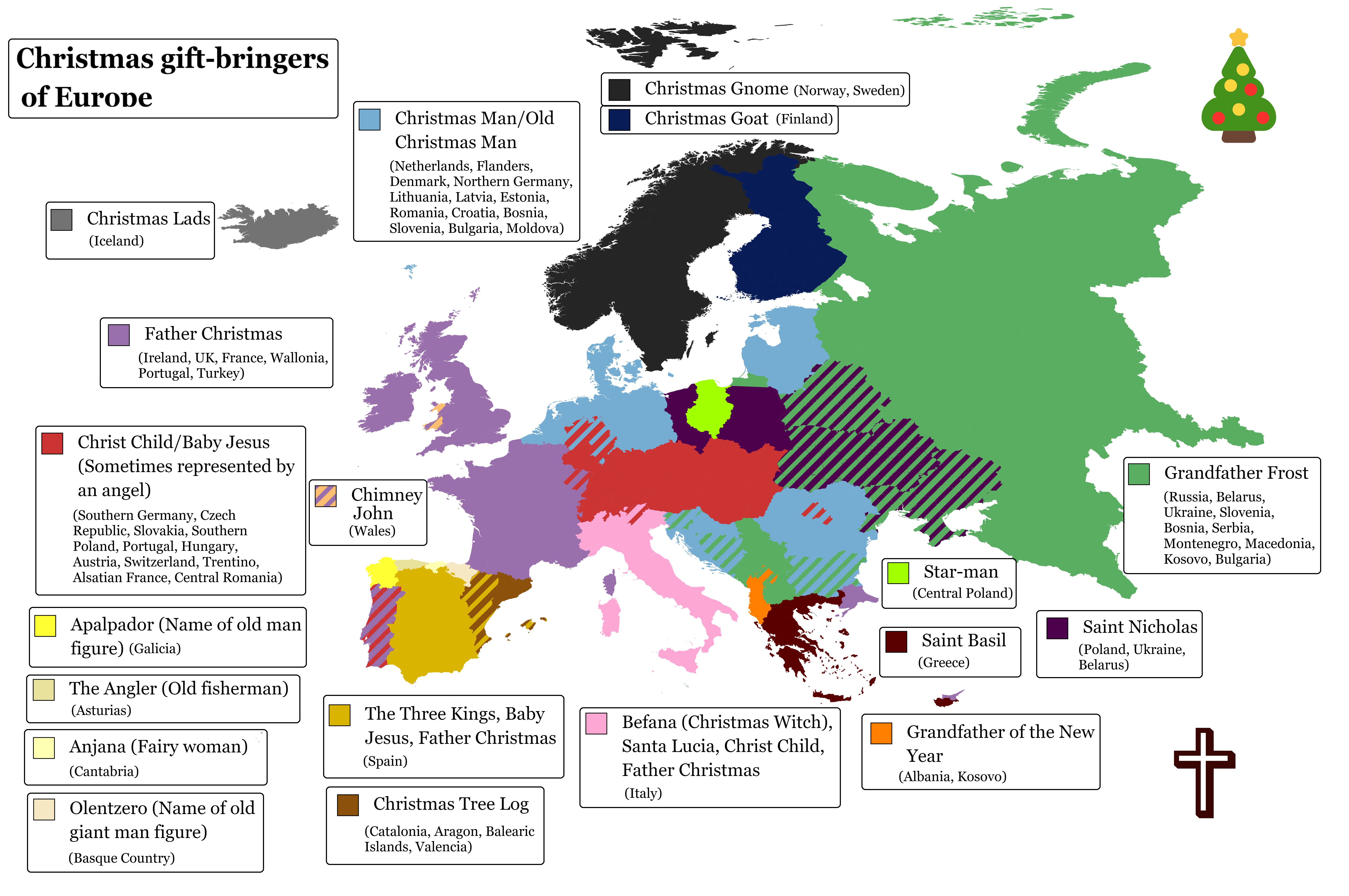
Christmas Gift-Bringers of Europe Map
This visualization highlights the various Christmas gift-bringers across Europe, showcasing regional traditions and cult...
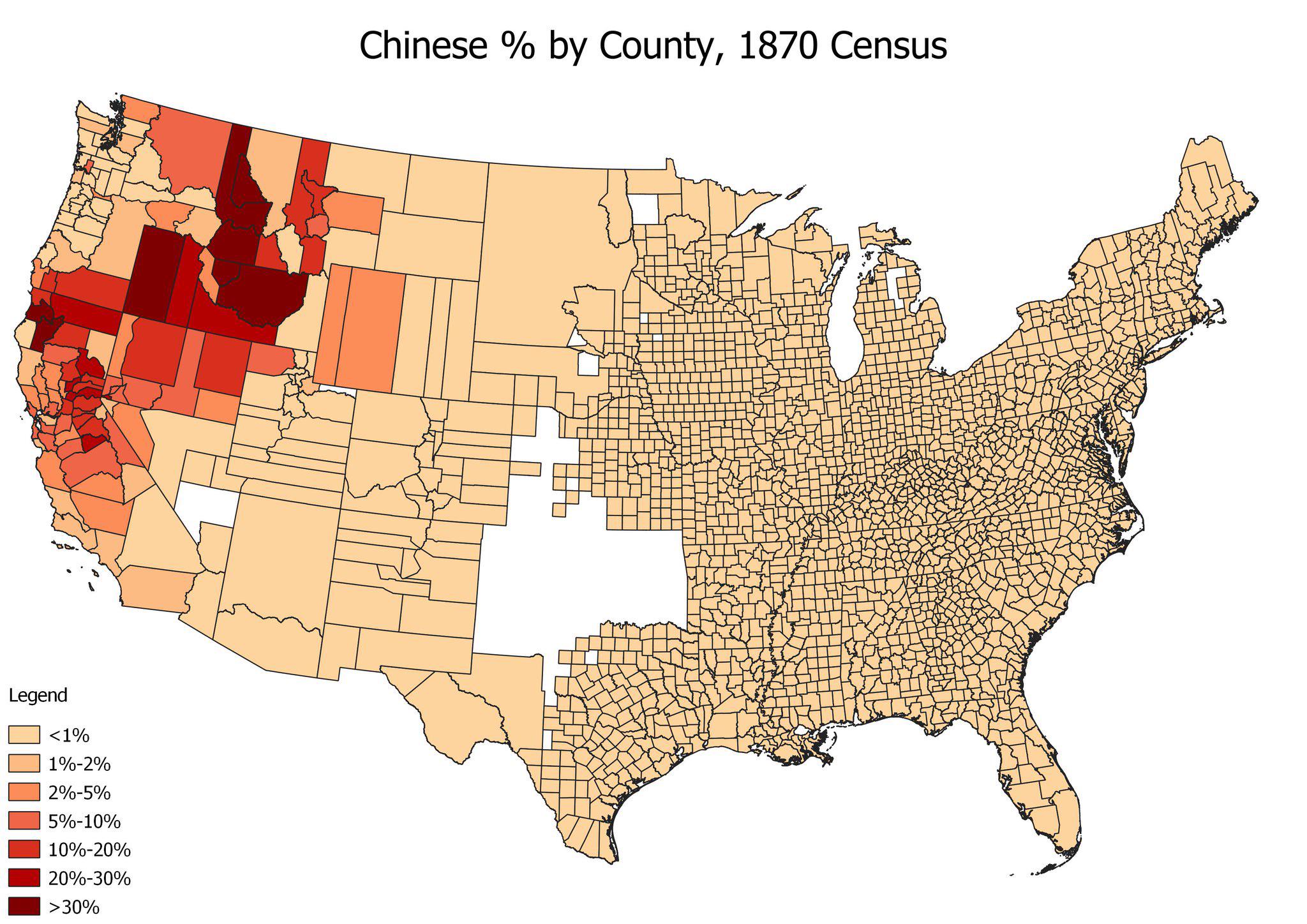
Chinese American Population by County Map, 1870
The "Chinese American Population by County, 1870" map provides a detailed visualization of the distribution of Chinese i...
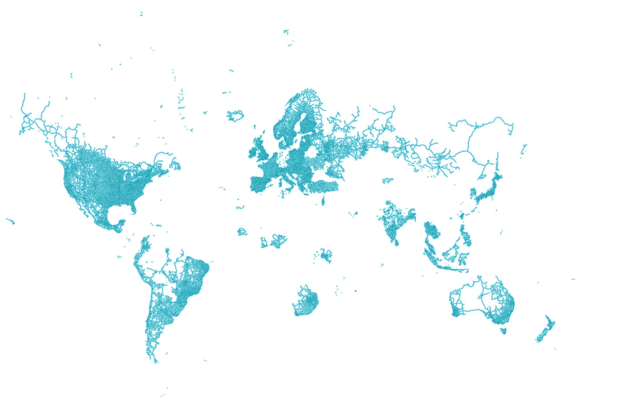
World Map According to Google Street View
The world map according to Google Street View offers a unique perspective on our planet by visualizing the locations tha...
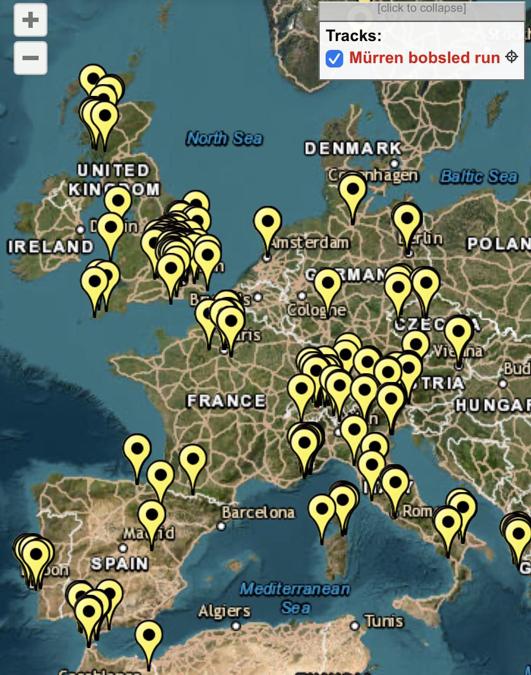
James Bond Filming Locations in Europe Map
This map provides a comprehensive overview of every filming location used in the James Bond film franchise throughout Eu...
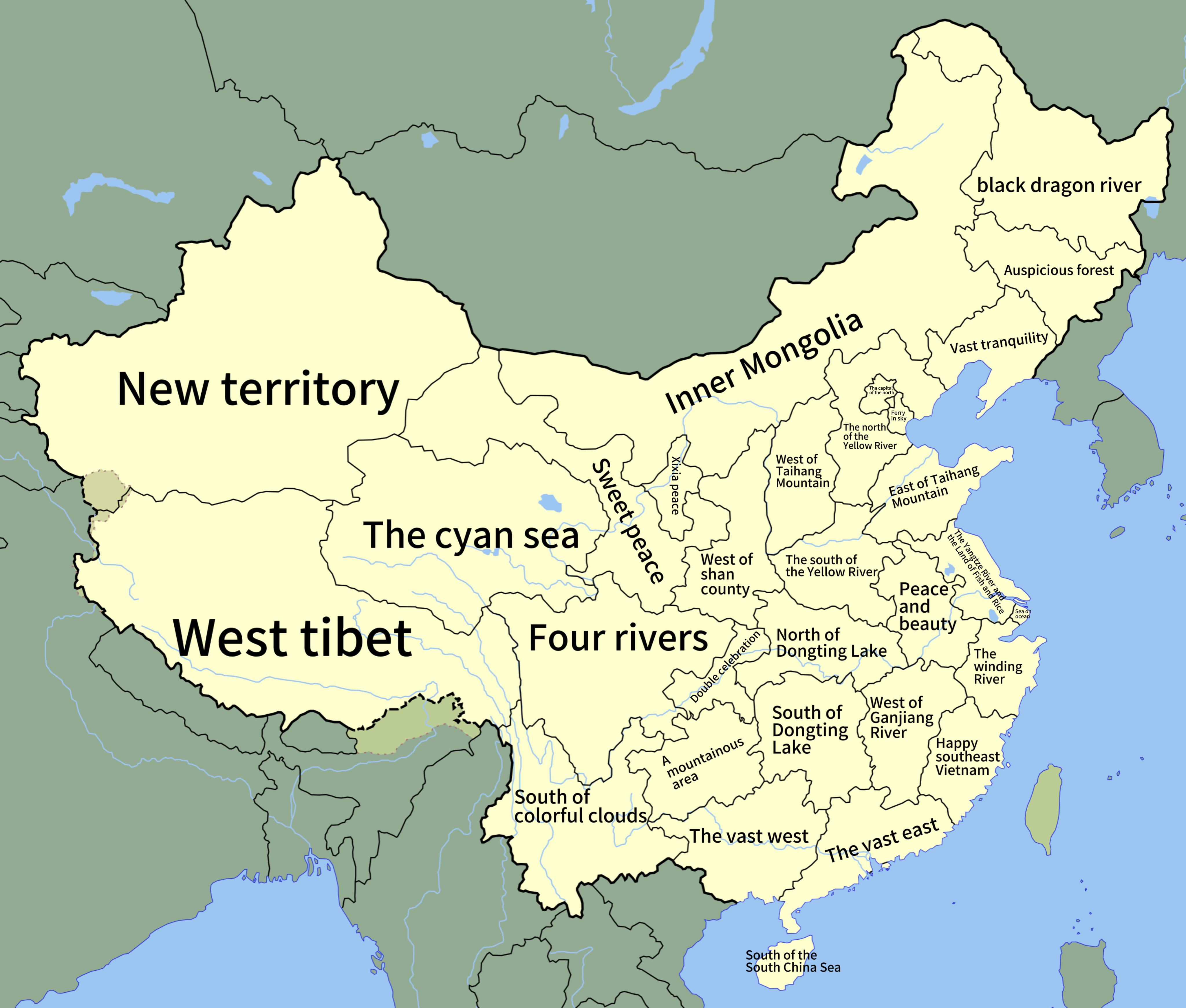
Literal Translations of Chinese Provinces Map
This map presents a fascinating look at the literal translations of the names of every province in China. From the spraw...
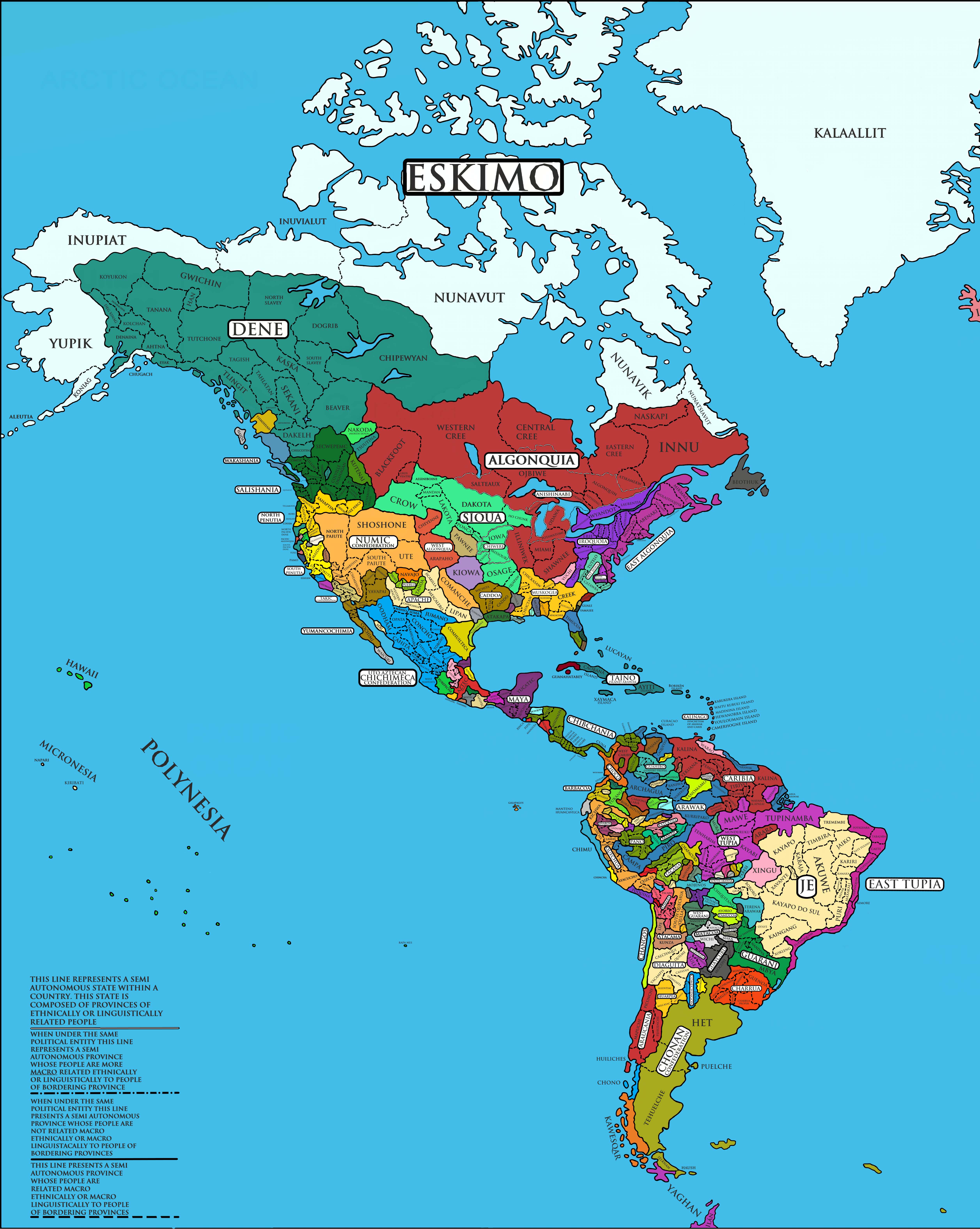
Indigenous Peoples of the Americas Map
The "Americas Native 1.7" map provides a detailed geographical visualization of the distribution of indigenous peoples a...
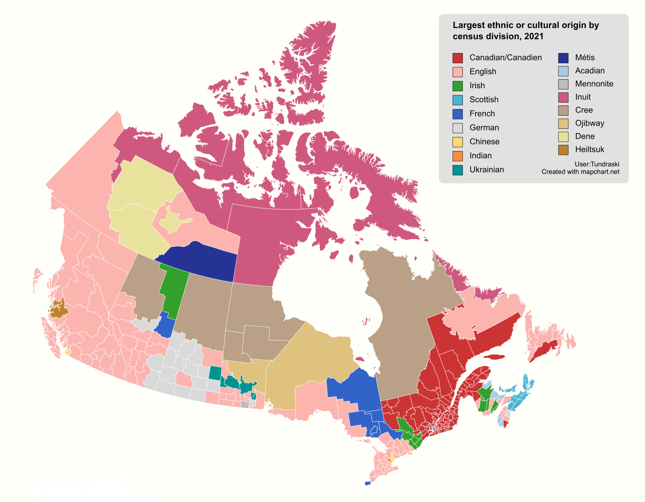
Ethnic Diversity Map of Canada
The "Ethnic Diversity Map of Canada" provides a stunning visual representation of the rich tapestry of cultures and ethn...
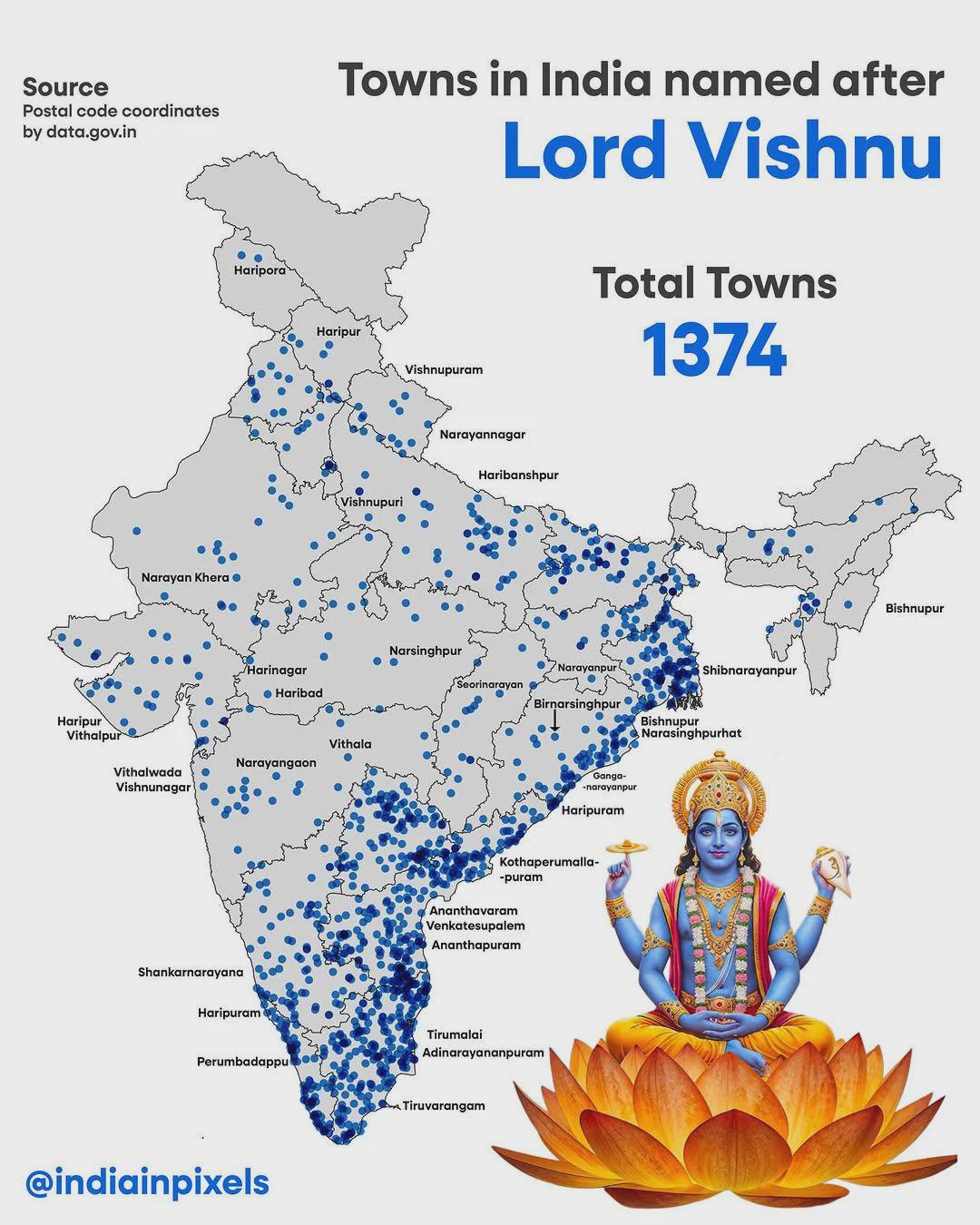
Map of Indian Cities Named After Lord Vishnu
The map titled \...
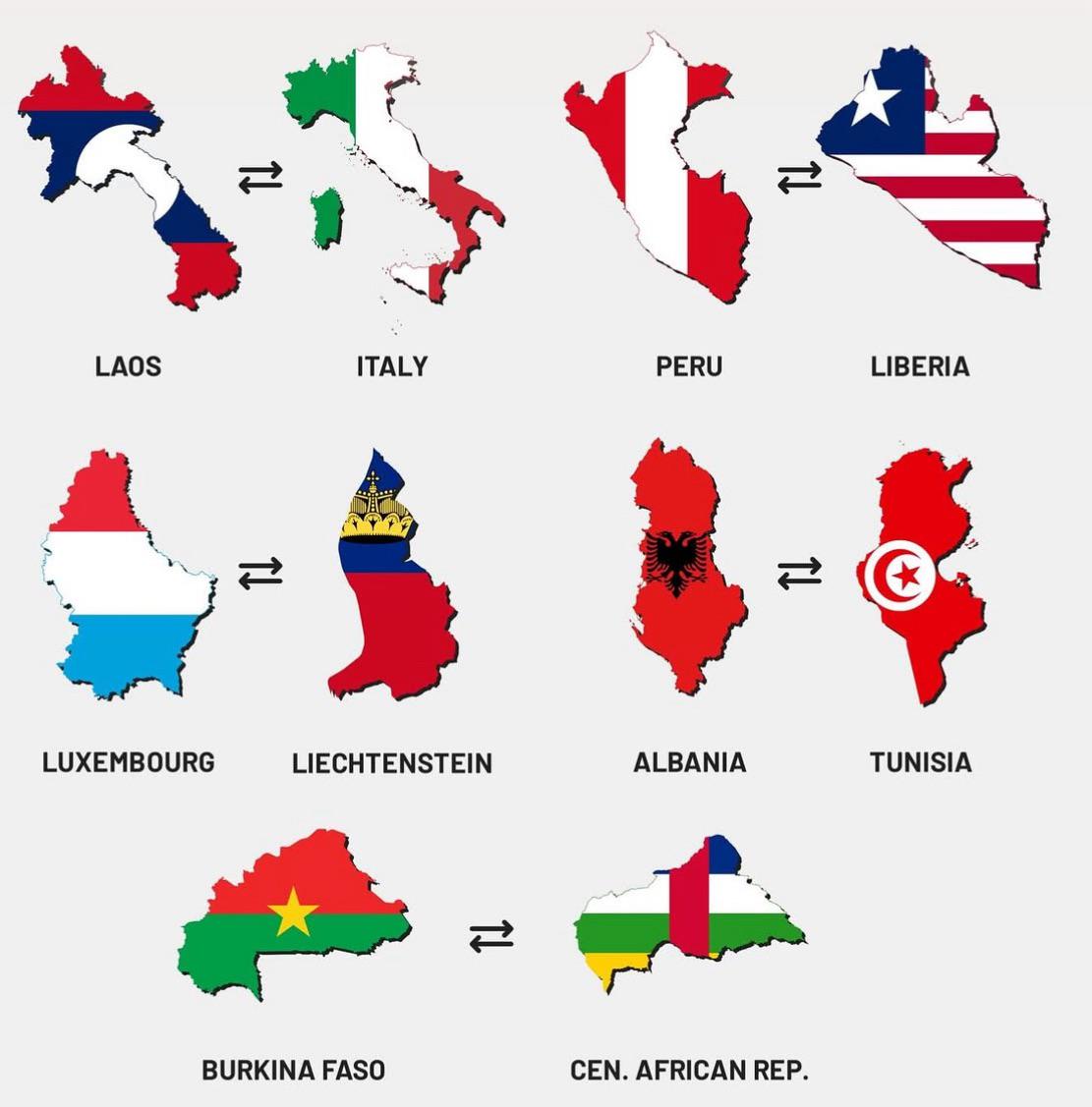
Map of Similarly Shaped Countries
This map visualizes a unique geographical phenomenon: countries around the world that share similar shapes. While many n...
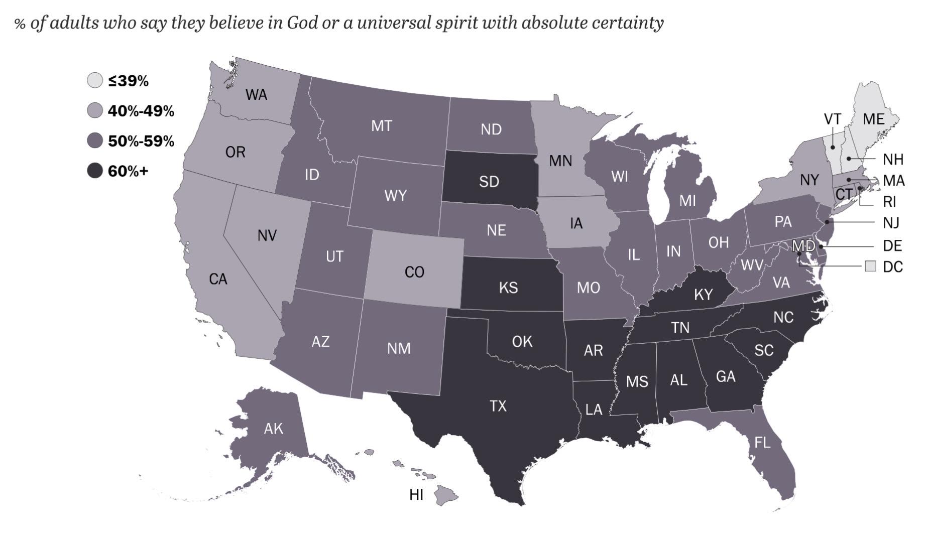
Map of U.S. Adults Believing in God (2023/2024)
This map visualizes the percentage of U.S. adults who claim to believe in God or a universal spirit with absolute certai...
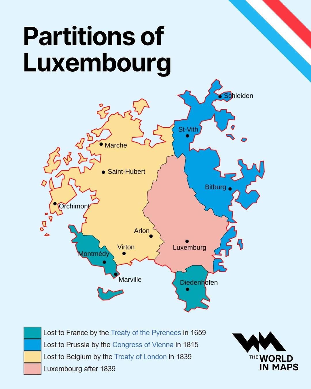
Partitions of Luxembourg Map
The "Partitions of Luxembourg Map" provides a clear depiction of the historical divisions and administrative changes tha...
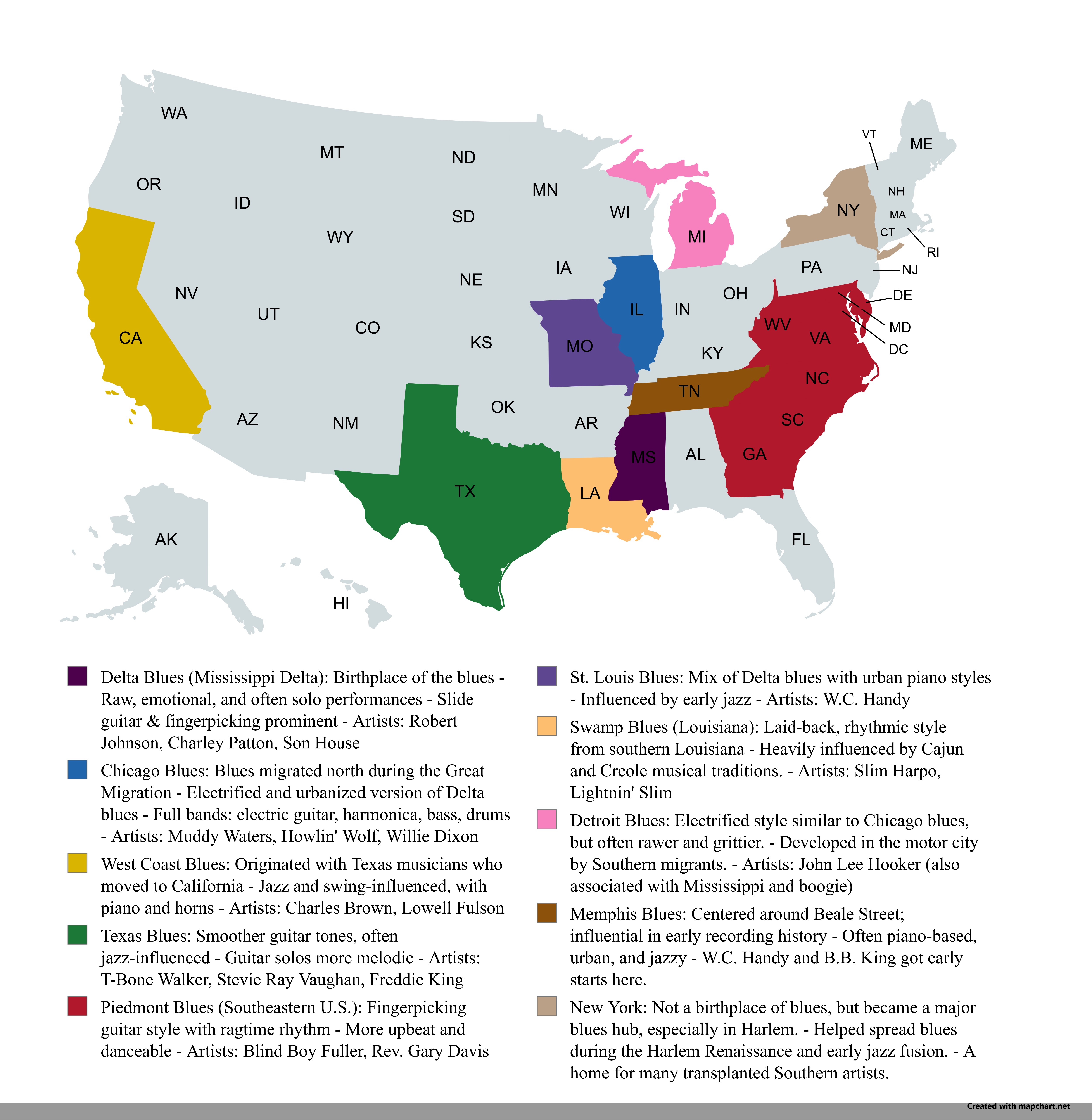
Regional Blues Music Map of the USA
The "Regional Blues Music Map of the USA" provides a vibrant overview of the geographical distribution of blues music ac...
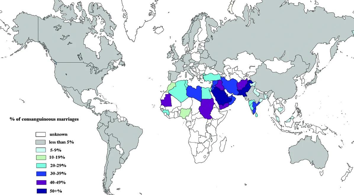
Consanguineous Marriage Rates by Country Map
The "Global Consanguineous Marriage Rates by Country" map provides a compelling visual representation of the prevalence ...
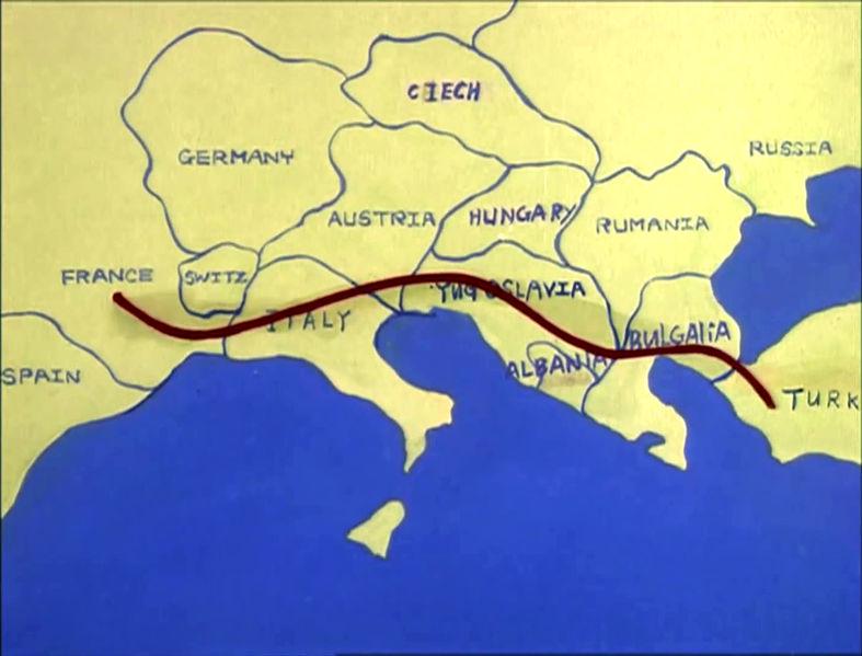
Map of Europe c. 1985 in The Transformers
...
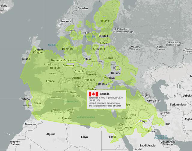
Canada vs Europe Map Comparison
Interestingly, Canada is home to the longest coastline in the world, measuring over 202,080 kilometers. This extensive c...
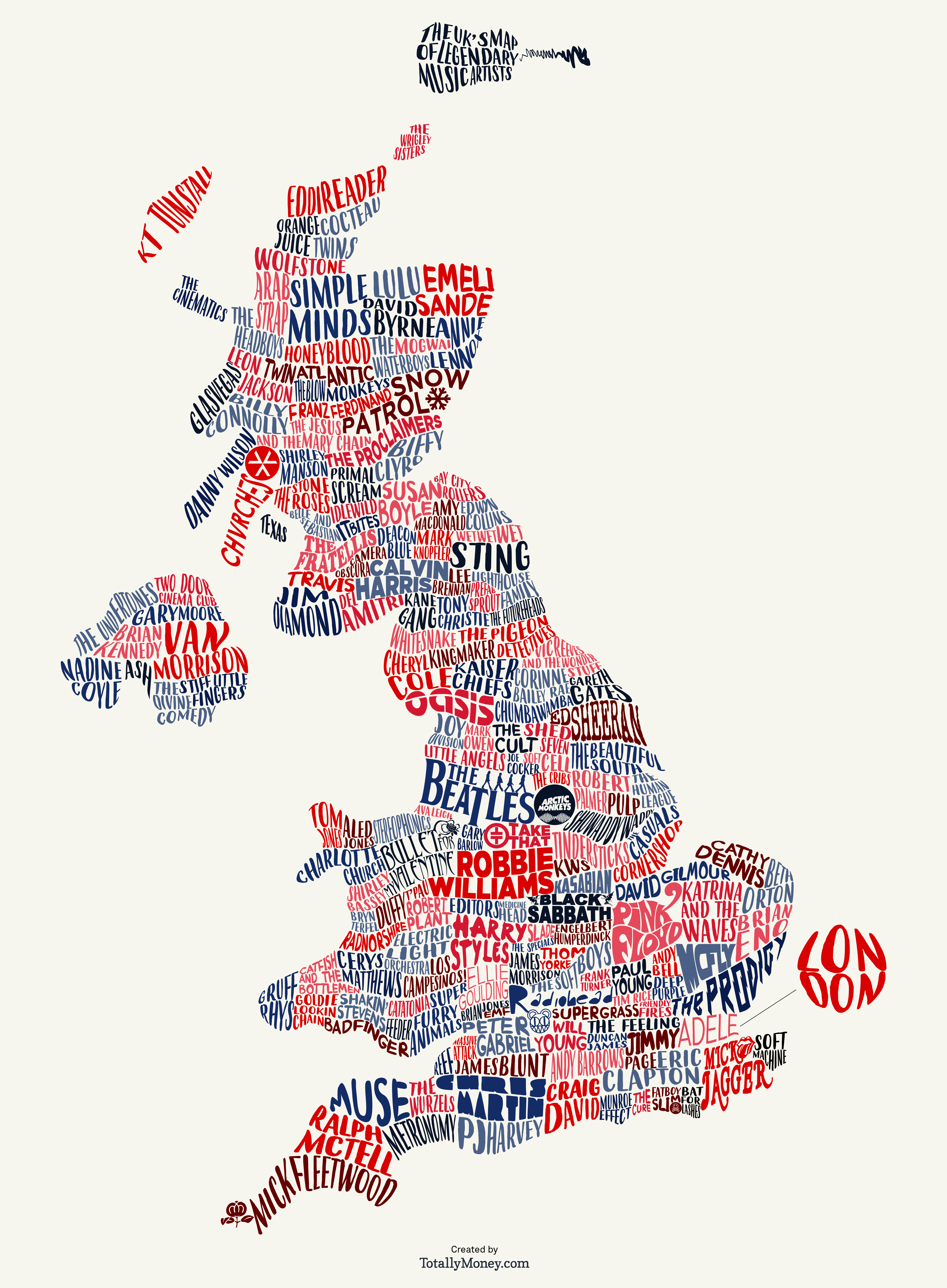
Map of British Bands and Artists Origins
This map provides a detailed geographical representation of the origins of some of the most renowned British bands and a...
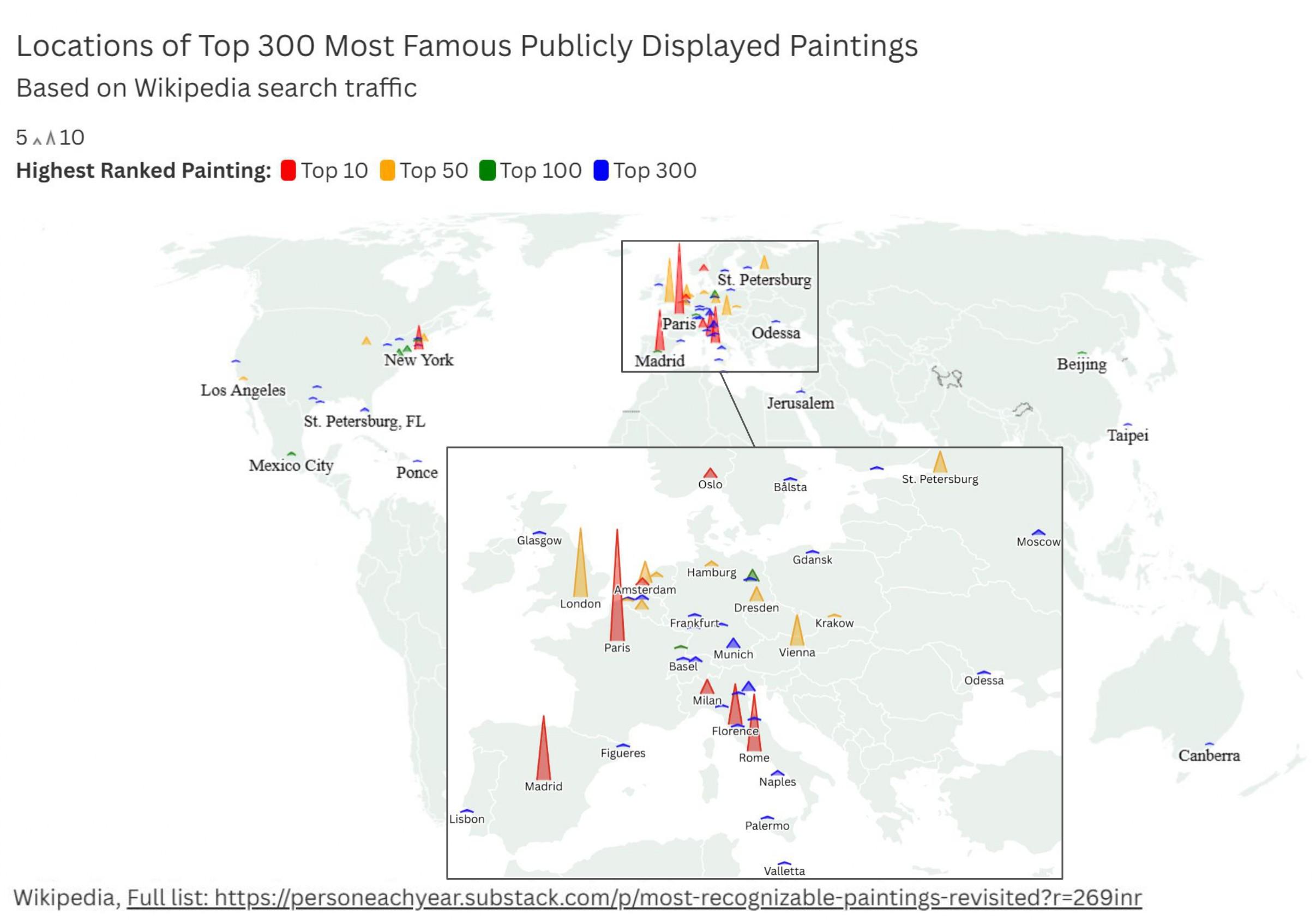
Map of Where World's Most Famous Paintings are Displayed
The visualization titled "Where World's Most Famous Paintings are Displayed" provides a detailed overview of the locatio...
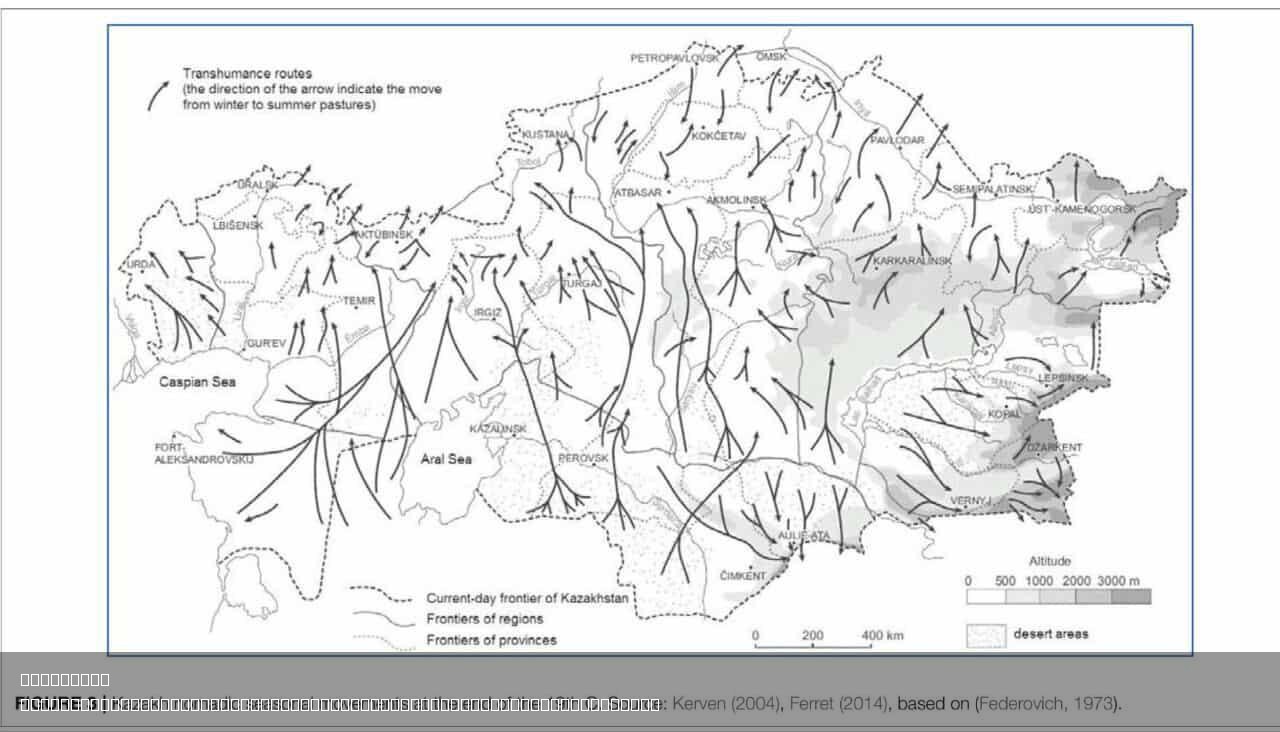
Kazakh Nomadic Seasonal Movements Map
The "Kazakh Nomadic Seasonal Movements Map" provides a detailed visualization of the migratory patterns of Kazakh nomads...
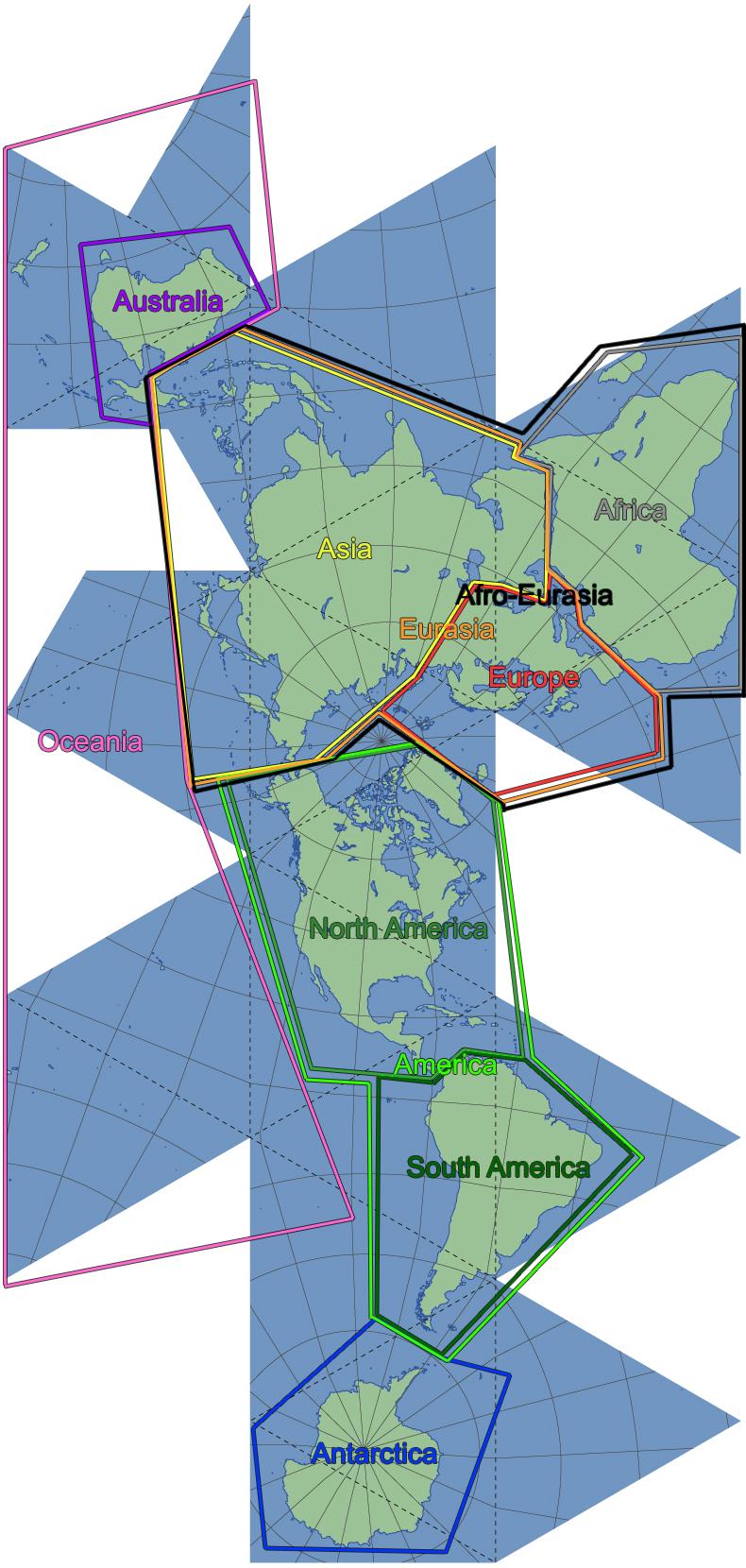
Continents of the World Map by Various Definitions
This map provides a comprehensive overview of how the continents of the world can be categorized according to various de...
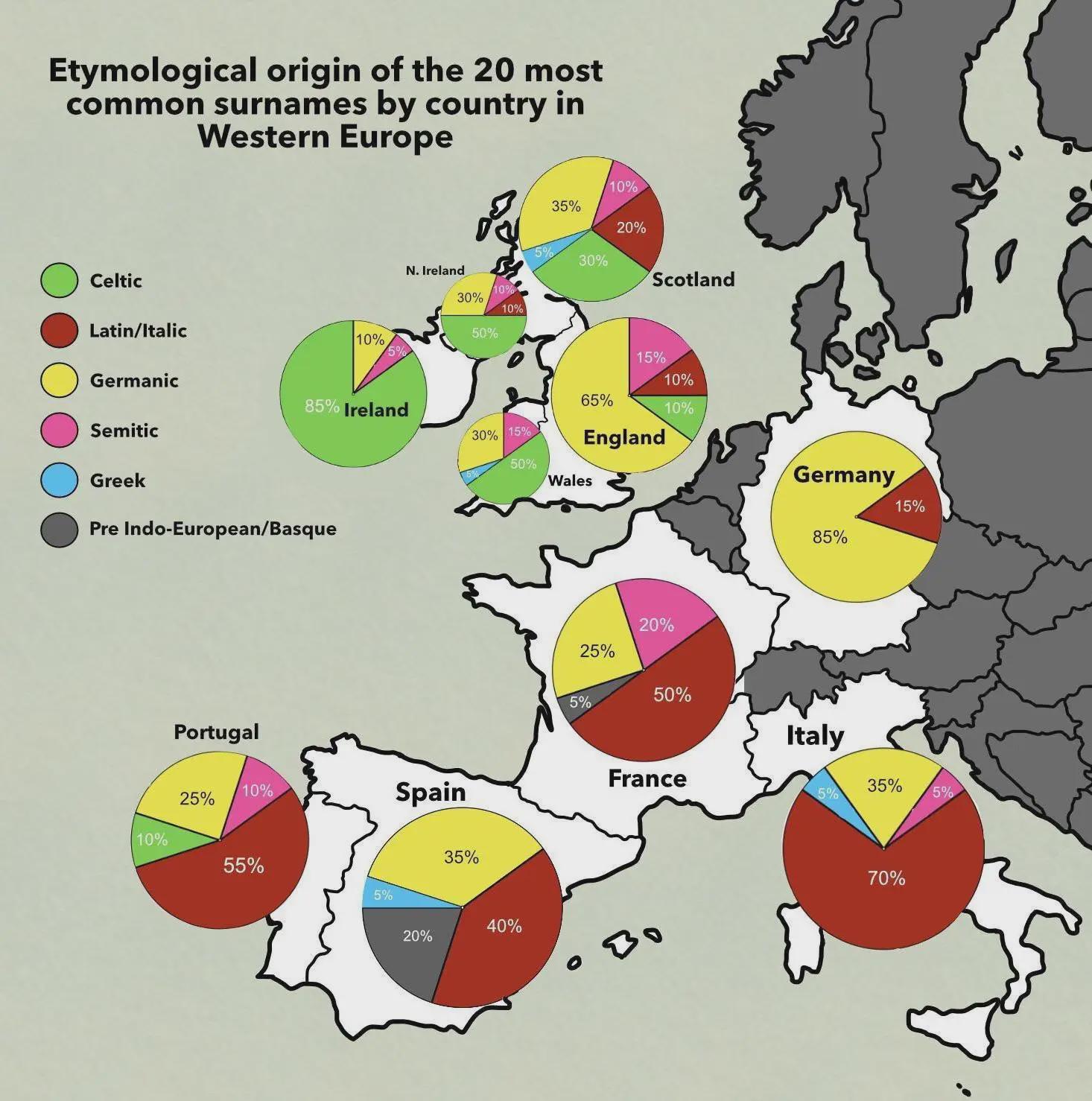
Etymological Origin of Common Surnames Map
The "Etymological Origin of the 20 Most Common Surnames by Country in Western Europe" map provides an intriguing glimpse...
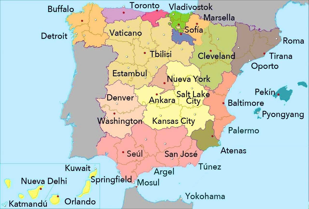
World Cities with Similar Latitude to Spanish Cities Map
This map presents a fascinating comparison of various world cities that share similar latitudes with cities in Spain. Ea...
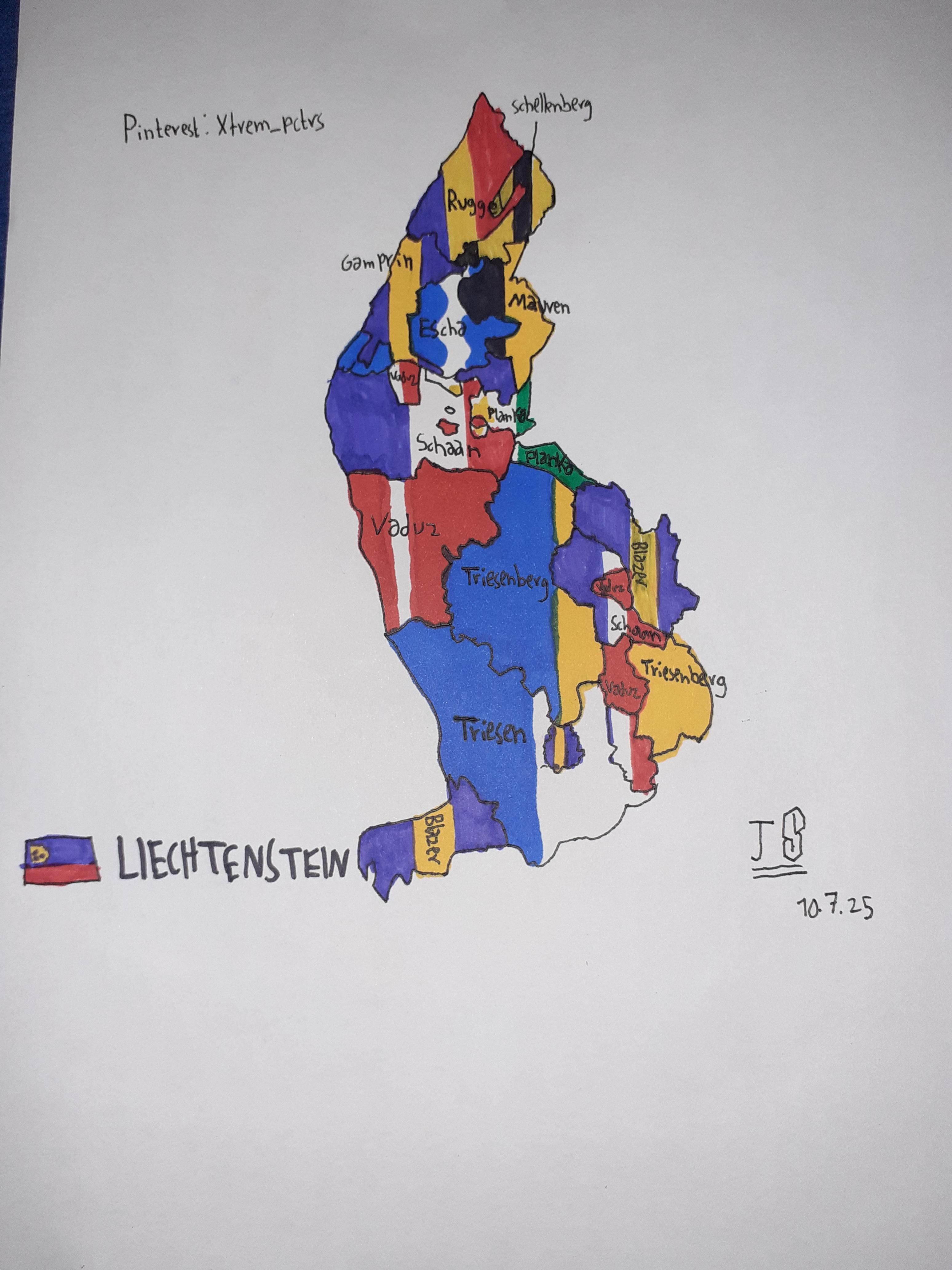
Self-Drawn Flag Map of Liechtenstein States
The visualization titled "Self-Drawn Flag Map of Liechtenstein States" presents a unique and artistic representation of ...
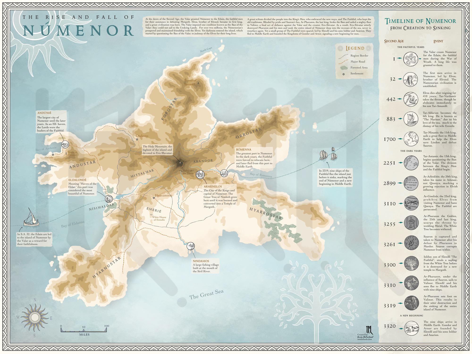
Map of Tolkien's Númenor
This map of Tolkien's Númenor provides a detailed view of the fictional island kingdom that plays a pivotal role in J.R....
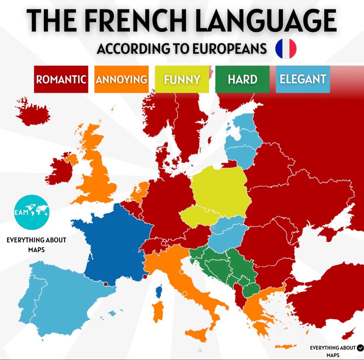
French Language Distribution Map
This map visually represents the distribution of the French language across the globe, highlighting regions where French...
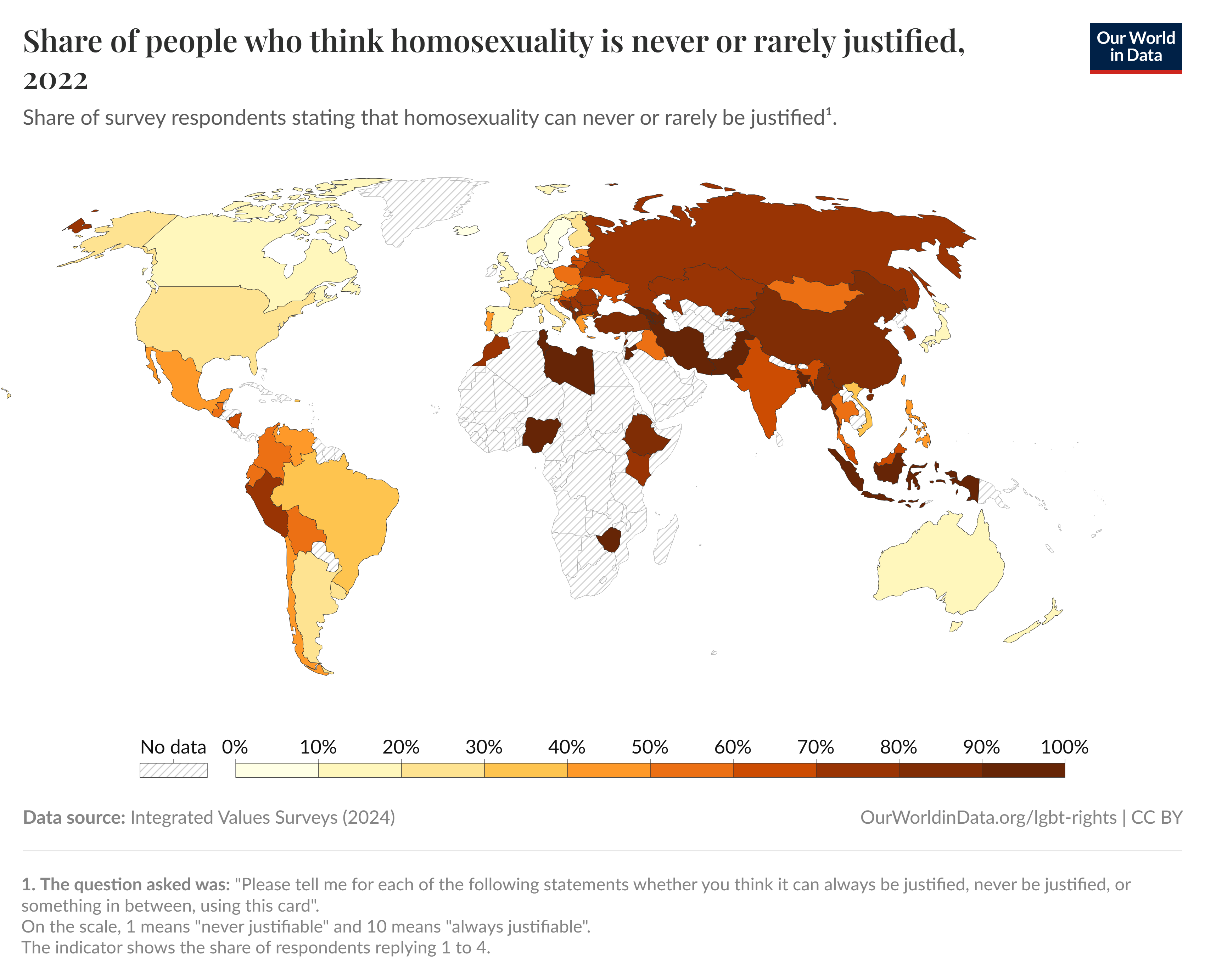
Map of Attitudes Toward Homosexuality, 2022
The map titled "Share of people who think homosexuality is never or rarely justified, 2022" provides a visual representa...
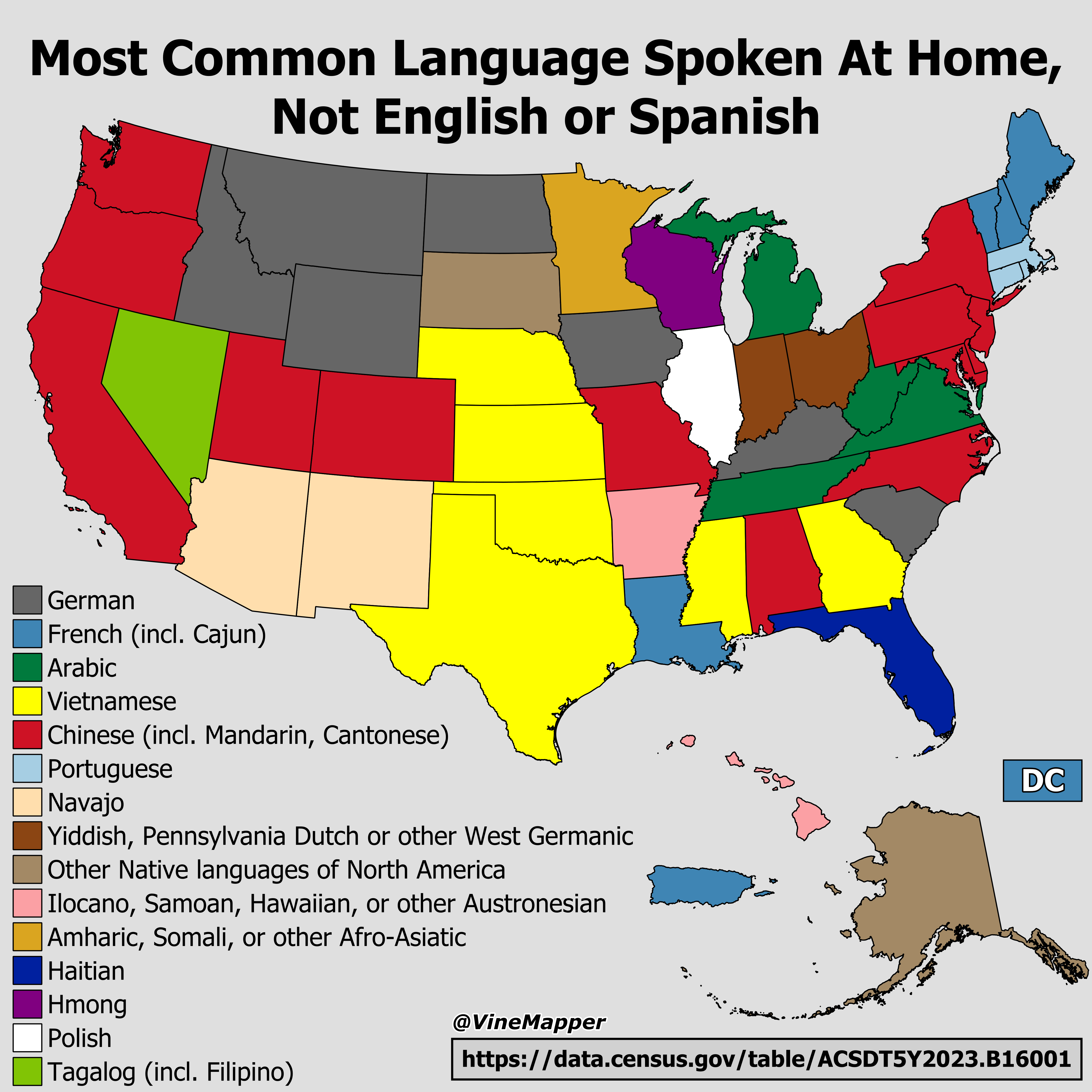
Most Common Language Spoken at Home Map
This map illustrates the most common languages spoken at home in various regions across the United States, excluding Eng...
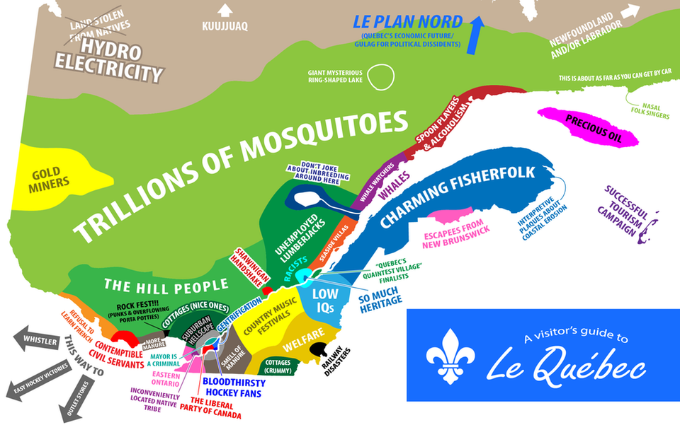
Regions of Québec and Their Stereotypes Map
The "Regions of Québec and Their Stereotypes Map" presents a visual representation of the diverse regions within Québec,...
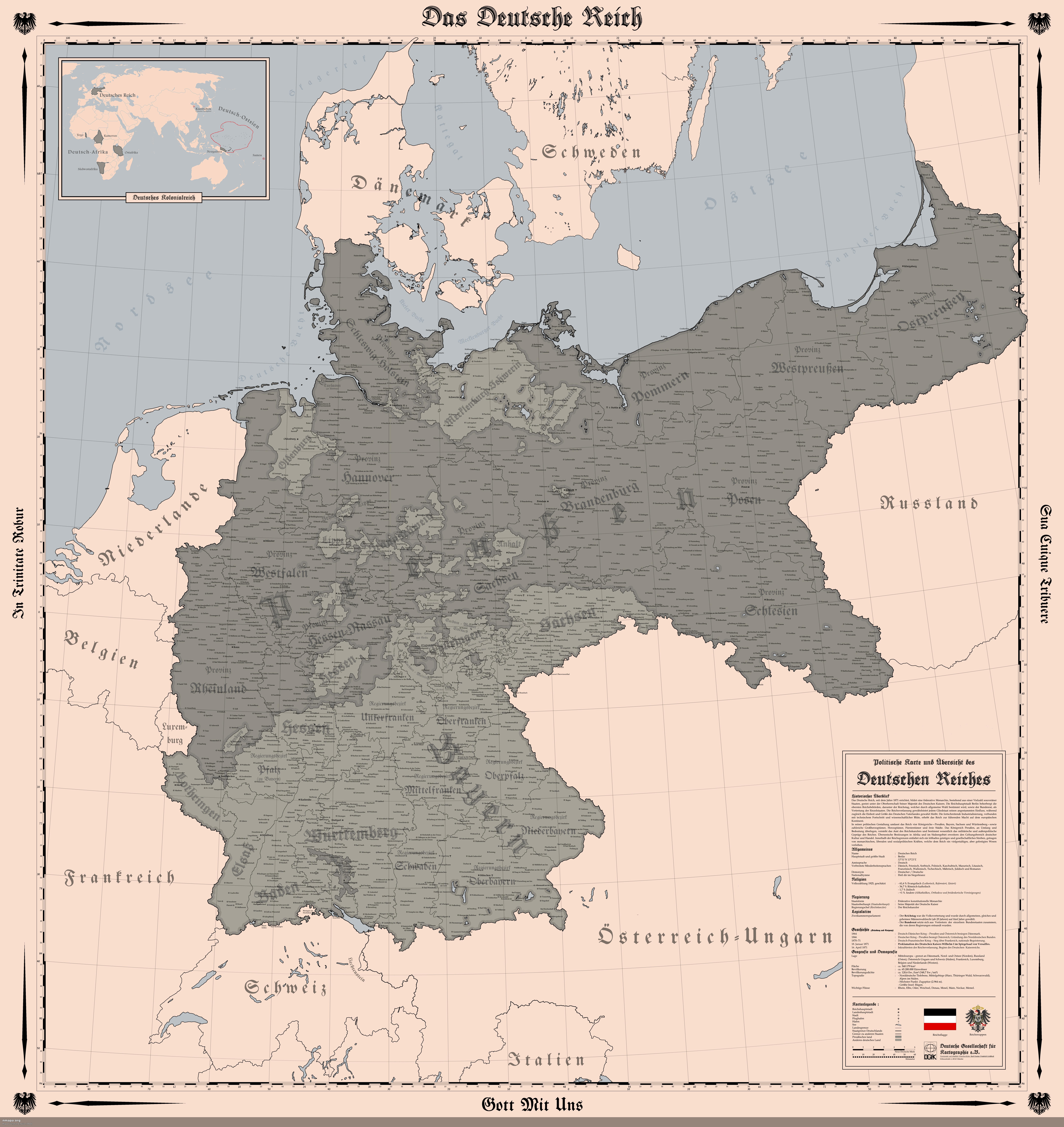
Map of the German Empire in 1914
The "Map of the German Empire (1914)" provides a detailed representation of the territorial boundaries, cities, and infr...
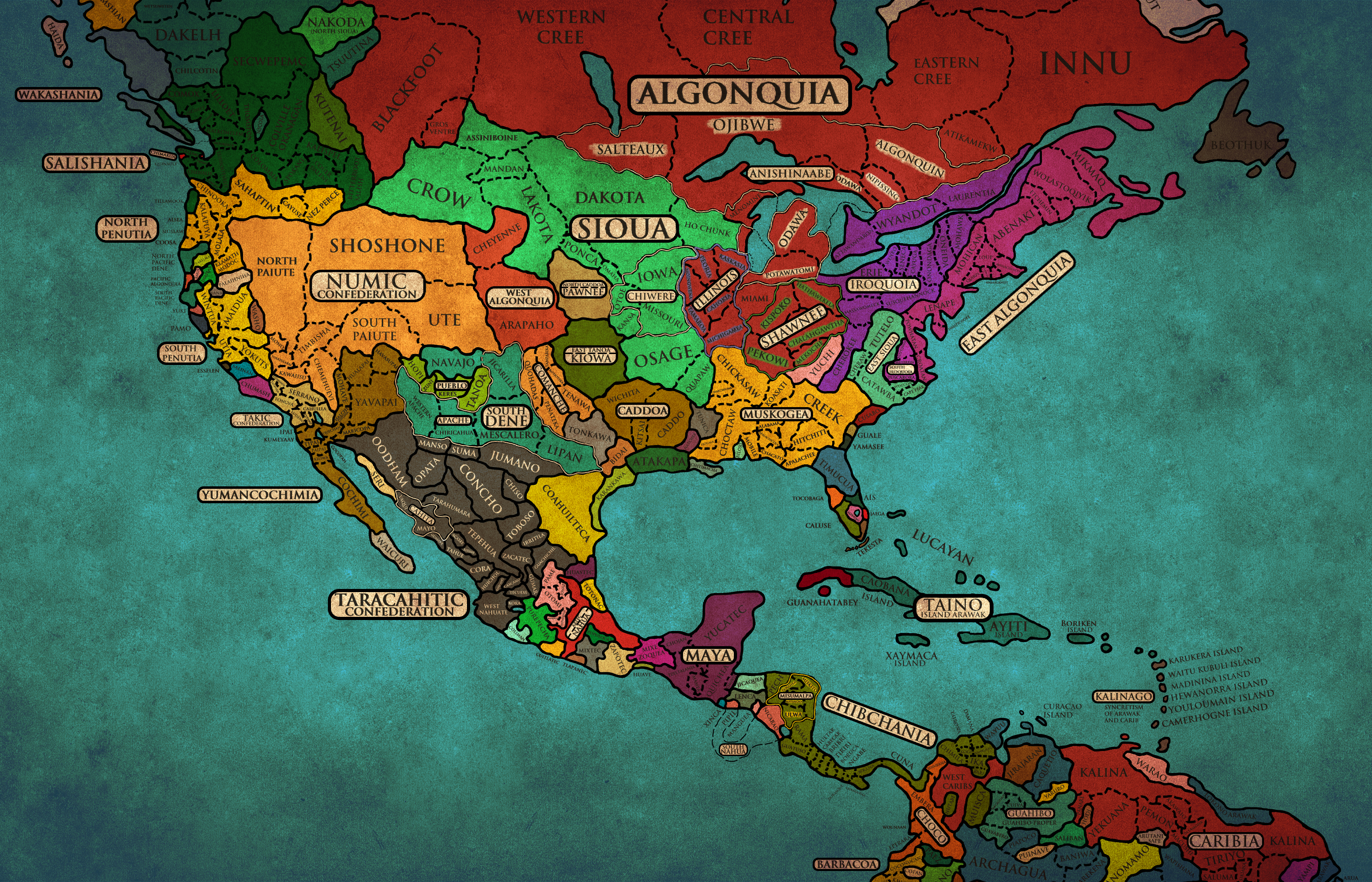
Map of Amerindian Nations as European Countries
This map visualizes contemporary interpretations of historical Amerindian nations, reimagining them as European-style co...
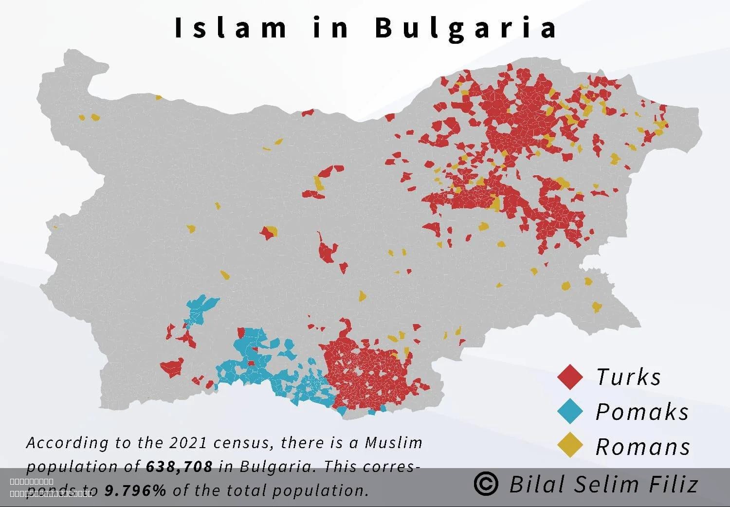
Islam in Bulgaria Map
The "Islam in Bulgaria Map" provides a detailed visualization of the distribution and density of the Muslim population a...
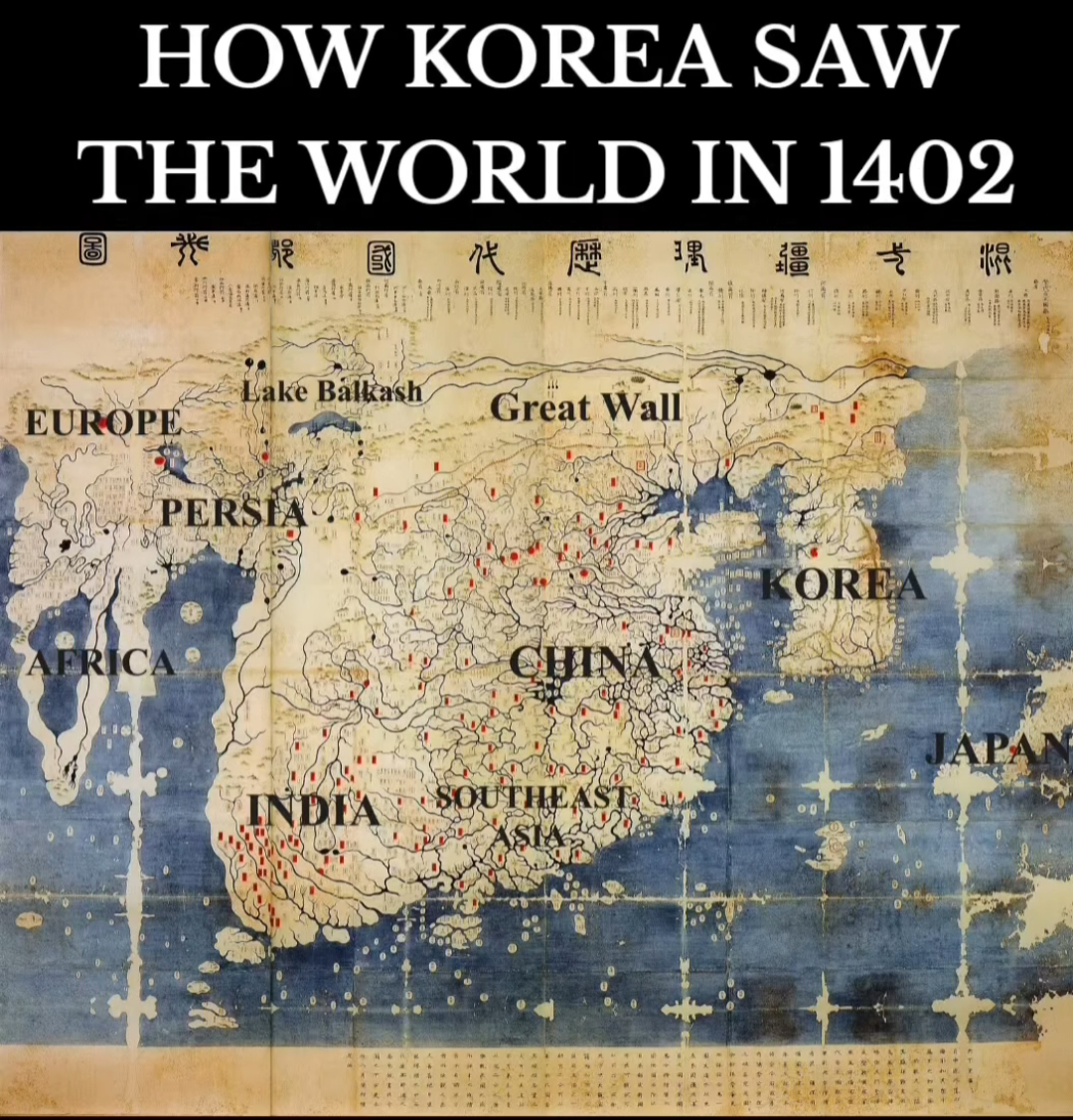
Historical Map of the World from 1402
The map in question, purportedly from the year 1402, invites both intrigue and skepticism. It showcases a medieval repre...
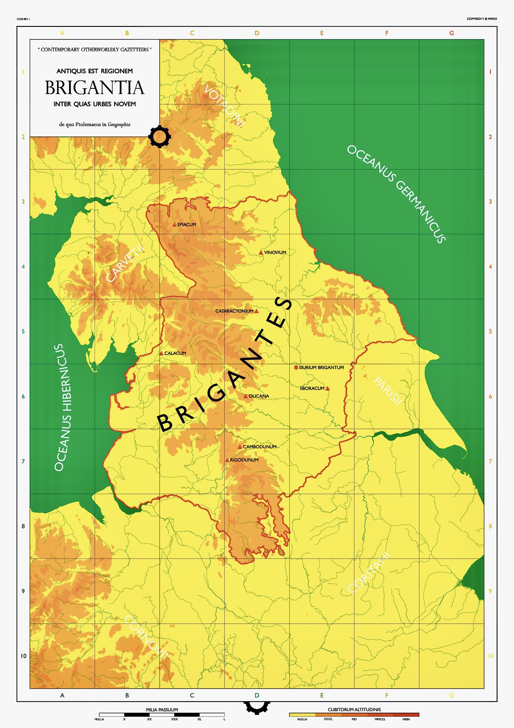
Map of the Brigantes Territory in Northern England
This map illustrates the territory of the Brigantes, an ancient British tribe that inhabited Northern England during the...
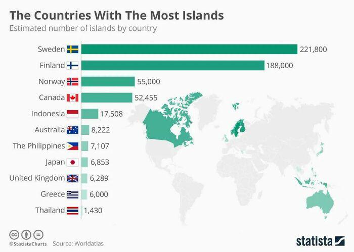
Countries with Most Islands Map
This map highlights the countries that boast the highest number of islands, providing a visual representation of these l...
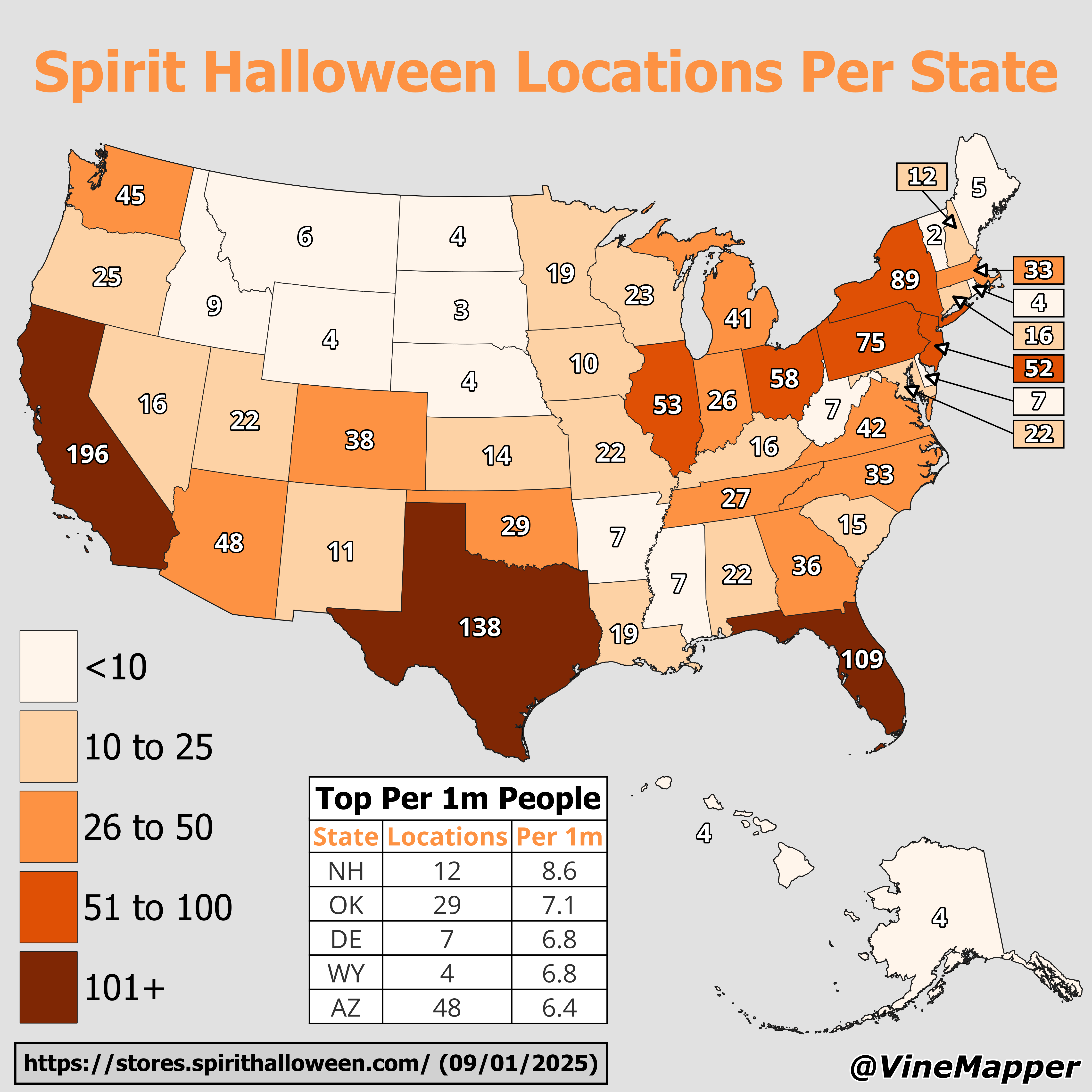
Spirit Halloween Locations Per State Map
This geographical visualization reveals the distribution of Spirit Halloween store locations across the United States, m...
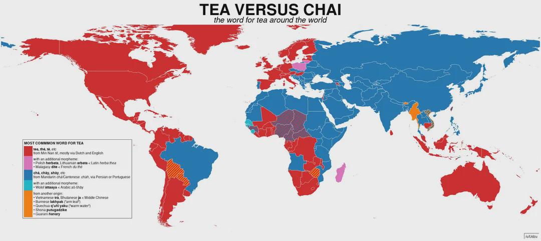
How Countries Say 'Tea' Map
This visualization presents a fascinating linguistic exploration of how different countries around the world refer to th...
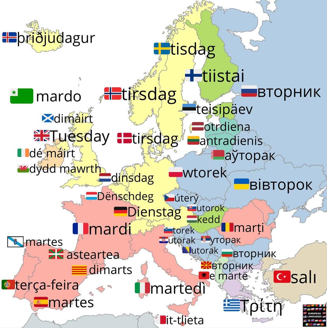
How to Say Tuesday in Various Languages Map
This visualization presents how the word "Tuesday" is expressed across different languages around the world. Through thi...
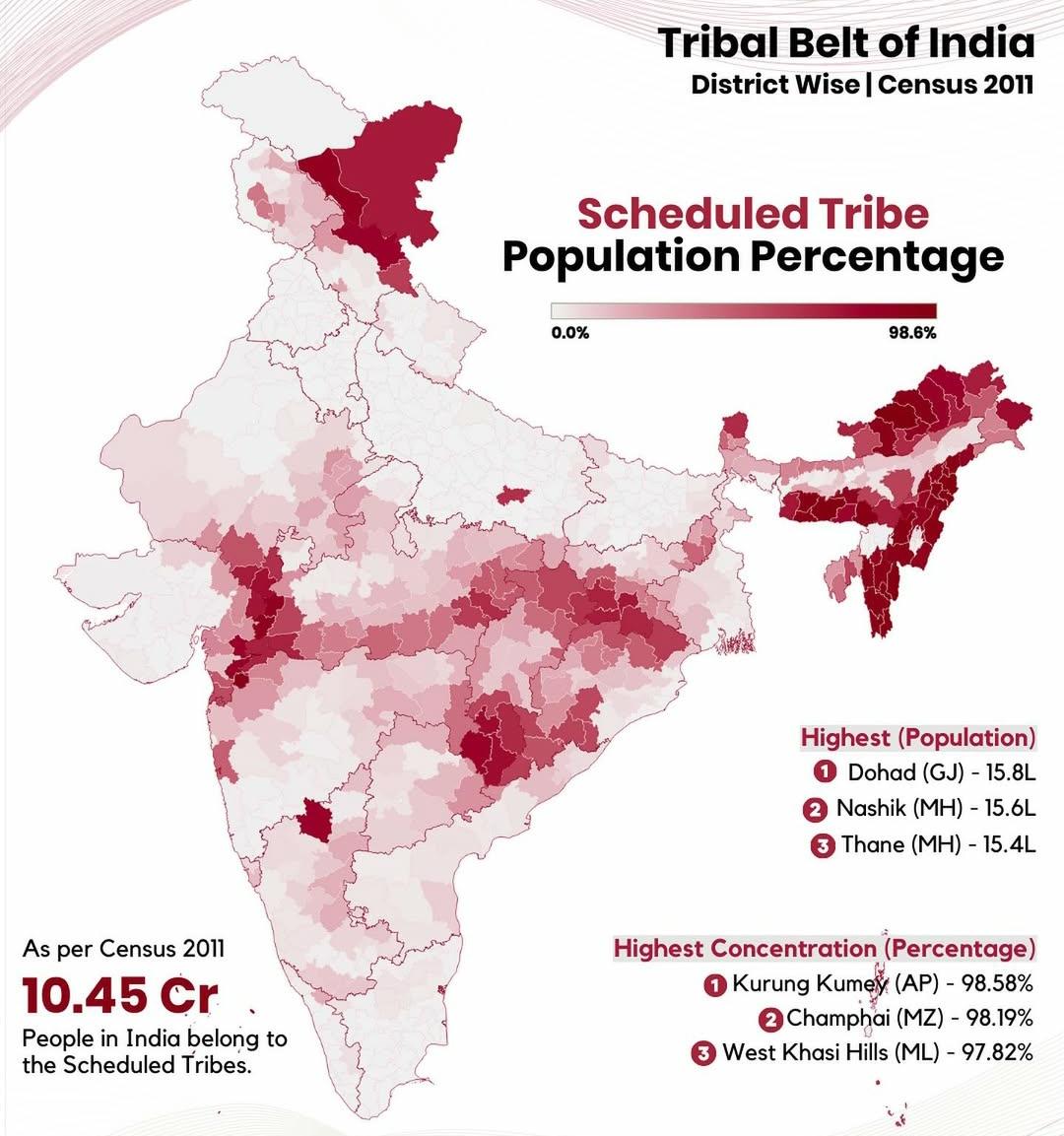
Tribal Population in India Map
Interestingly, the tribal population is not evenly distributed across India. The highest concentrations can be found in ...
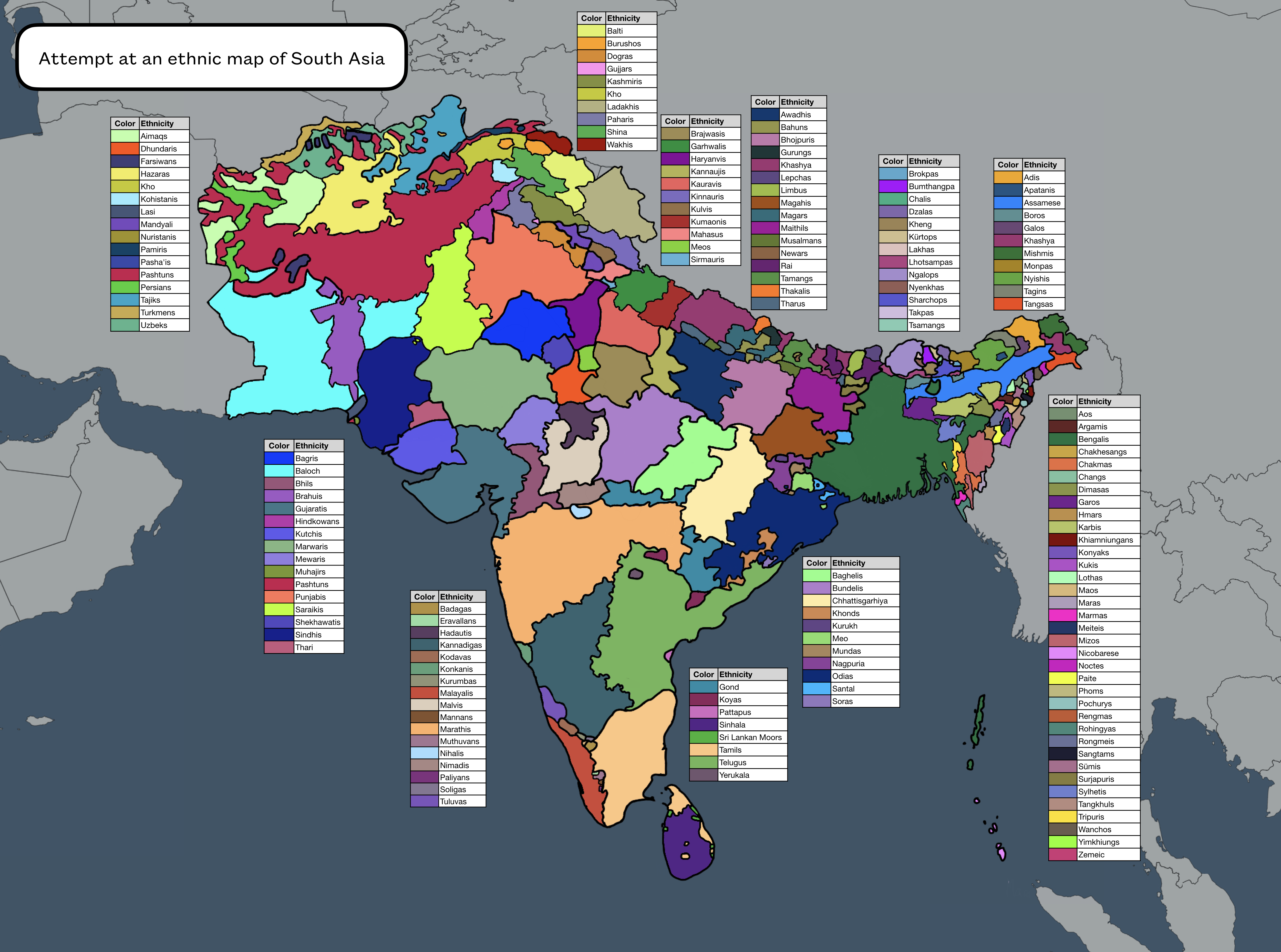
Ethnic Map of South Asia
This ethnic map of South Asia provides a visual representation of the diverse cultural and ethnic groups inhabiting the ...
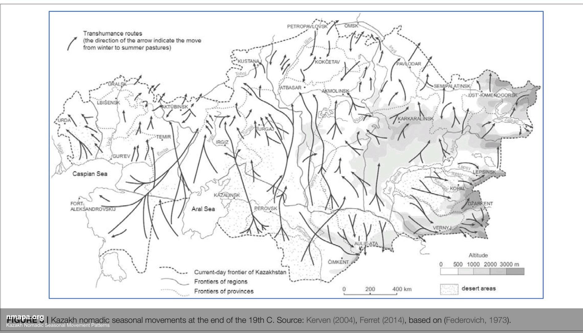
Exploring the Kazakh Nomadic Seasonal Movement Patterns Map
The Kazakh Nomadic Seasonal Movement Patterns Map is a captivating geographical visualization that illustrates the intri...
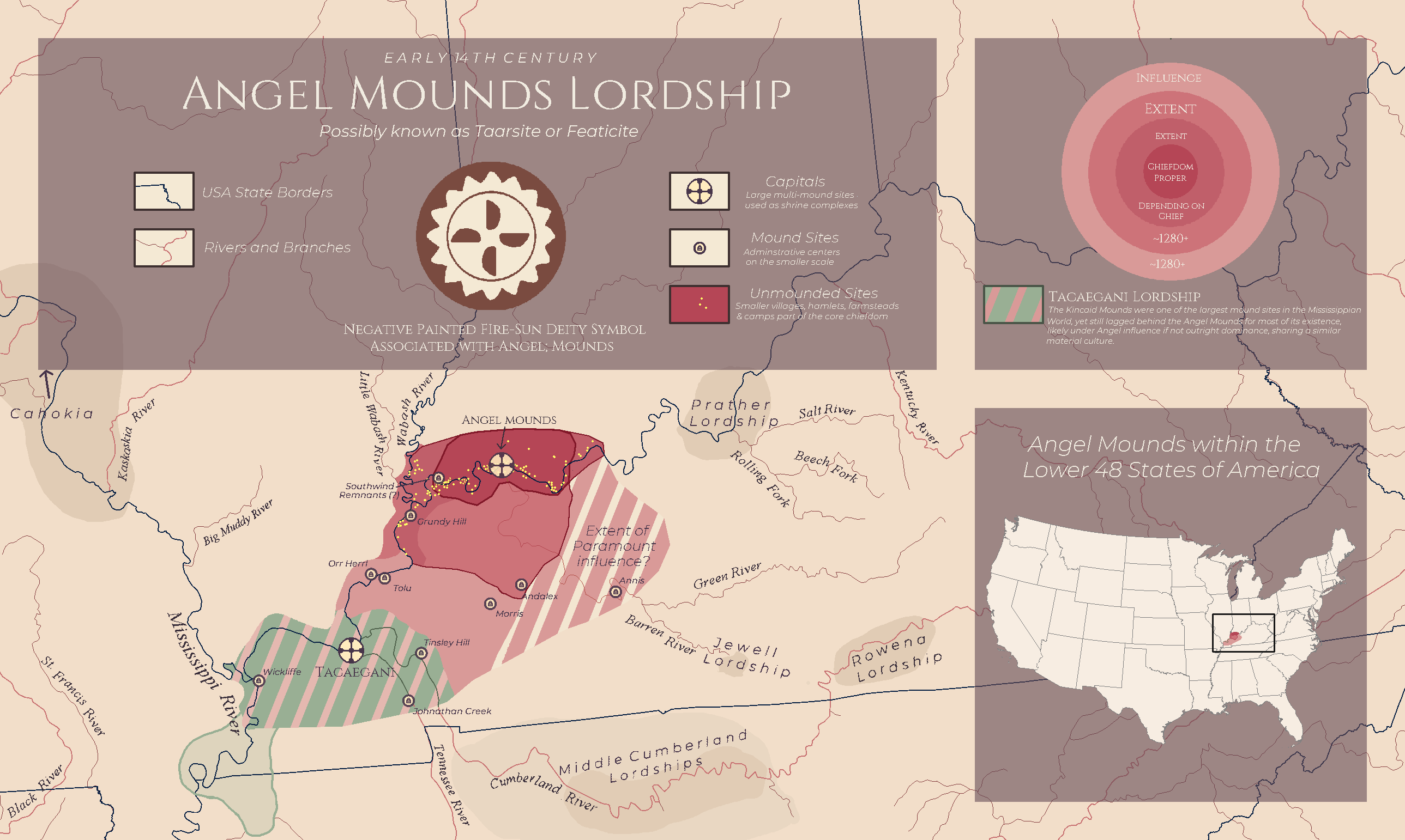
Mississippian Culture Map of Western Kentucky
The "Angel Mounds Lordship: Mississippians in Western Kentucky" map provides a detailed visualization of the cultural an...