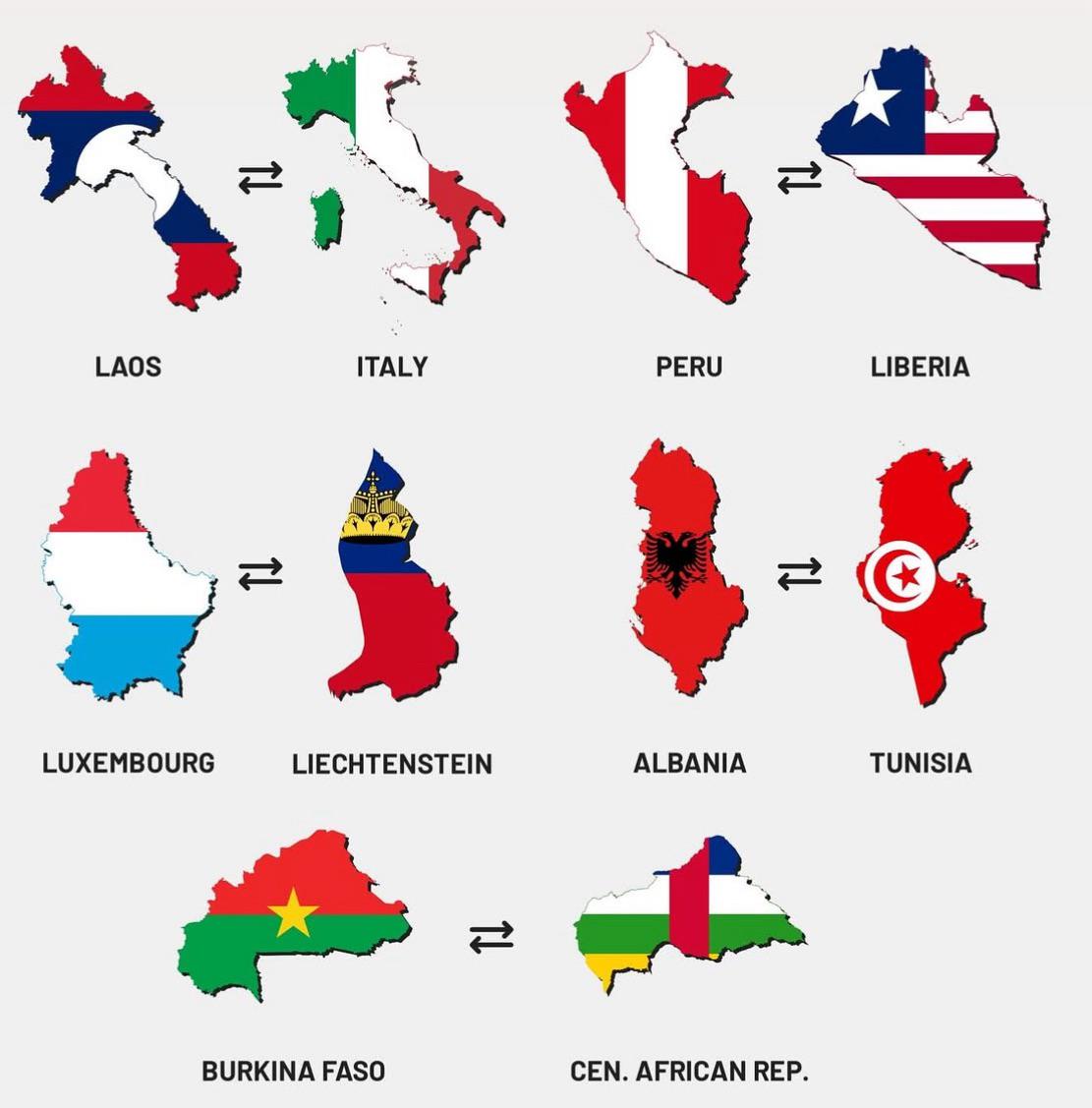
Map of Similarly Shaped Countries

David Chen
Data Visualization Specialist
David Chen is an expert in transforming complex geographic datasets into compelling visual narratives. He combines his background in computer science ...
Geographic Analysis
What This Map Shows
This map visualizes a unique geographical phenomenon: countries around the world that share similar shapes. While many nations are instantly recognizable by their outlines, the map highlights those lesser-known countries that might not come to mind at first glance. Understanding these similarities in shape can reveal interesting historical, cultural, and geographical connections between nations.
Deep Dive into Similarly Shaped Countries
Have you ever noticed how some countries look strikingly similar to each other? This phenomenon is not just a coincidence; it reflects a combination of geographical factors, historical boundaries, and even cultural exchanges. The shapes of countries are influenced by natural features such as rivers, mountain ranges, and coastlines, as well as political decisions made throughout history.
For example, consider the shapes of Italy and Chile. Both countries are long and narrow, but while Italy is shaped like a boot, Chile resembles a ribbon stretching along the western edge of South America. Their similarities lie in their elongated forms, which have developed in response to their geographical contexts. Italy's unique form has been shaped by the Apennine Mountains and its coastal borders, while Chile’s shape is a result of the Andes mountain range to the east and the Pacific Ocean to the west.
Interestingly, countries like Namibia and Italy also share a resemblance, albeit in different dimensions. Namibia's outline features a distinctive protrusion on its western coast, while Italy's boot is known for its distinctive heel and toe. These shapes might seem arbitrary, but they often tell stories about the land and the people who inhabit them. In fact, many of these shapes have been crucial in defining cultural identities and political boundaries.
Moreover, shapes can also affect a nation's economic and social dynamics. Countries with elongated shapes, like Norway and Chile, often experience challenges related to transportation and communication across their territories. Conversely, countries with more compact shapes tend to have more centralized governance and infrastructure development. Ever wondered why some countries seem to be more developed than others? Their geographical shape can play a significant role in that development.
Regional Analysis
When analyzing regions based on the shapes of their countries, we can see some fascinating patterns. In Europe, for instance, countries like Portugal and Greece both feature irregular coastlines that contribute to their unique outlines. Portugal's shape is often compared to a rectangular form with a jagged edge, while Greece resembles a collection of islands nestled together.
In Africa, the comparison between countries like Niger and Chad highlights how similar shapes can lead to different climatic conditions and resource distributions. Both nations share a somewhat rectangular outline, but Niger is predominantly desert, while Chad has a mix of desert and savanna. This difference in environmental features significantly impacts their economies and ways of life.
Another interesting comparison can be made between countries in the Caribbean. Take Cuba and Jamaica, for instance. Both islands have elongated shapes, yet their cultural landscapes and histories are quite distinct. Cuba's long, narrow form has influenced its political and economic structures, whereas Jamaica's smaller, more rounded shape has fostered a different cultural identity.
Significance and Impact
Understanding the shapes of countries and their geographical implications goes beyond mere aesthetics. It can impact national identity, economic development, and even international relations. For instance, countries with similar shapes may be more likely to form alliances or share cultural practices due to their geographical similarities. Additionally, recognizing the influence of geography on human behavior can help policymakers address issues like transportation, resource distribution, and infrastructure development more effectively.
What's fascinating is that as we move into an era of globalization, these geographical shapes continue to play crucial roles in how countries interact on the world stage. Countries with similar shapes may find it easier to collaborate on issues such as climate change, trade, and cultural exchange. As we study the relationships between these similarly shaped nations, we can gain deeper insights into how geography influences our world today and what it may look like in the future.
In conclusion, the map of similarly shaped countries is more than just a visual representation; it is a window into understanding how geography can shape our lives, our cultures, and our interactions on a global scale.
Visualization Details
- Published
- August 17, 2025
- Views
- 102
Comments
Loading comments...