political geography Maps
56 geographic visualizations tagged with "political geography"
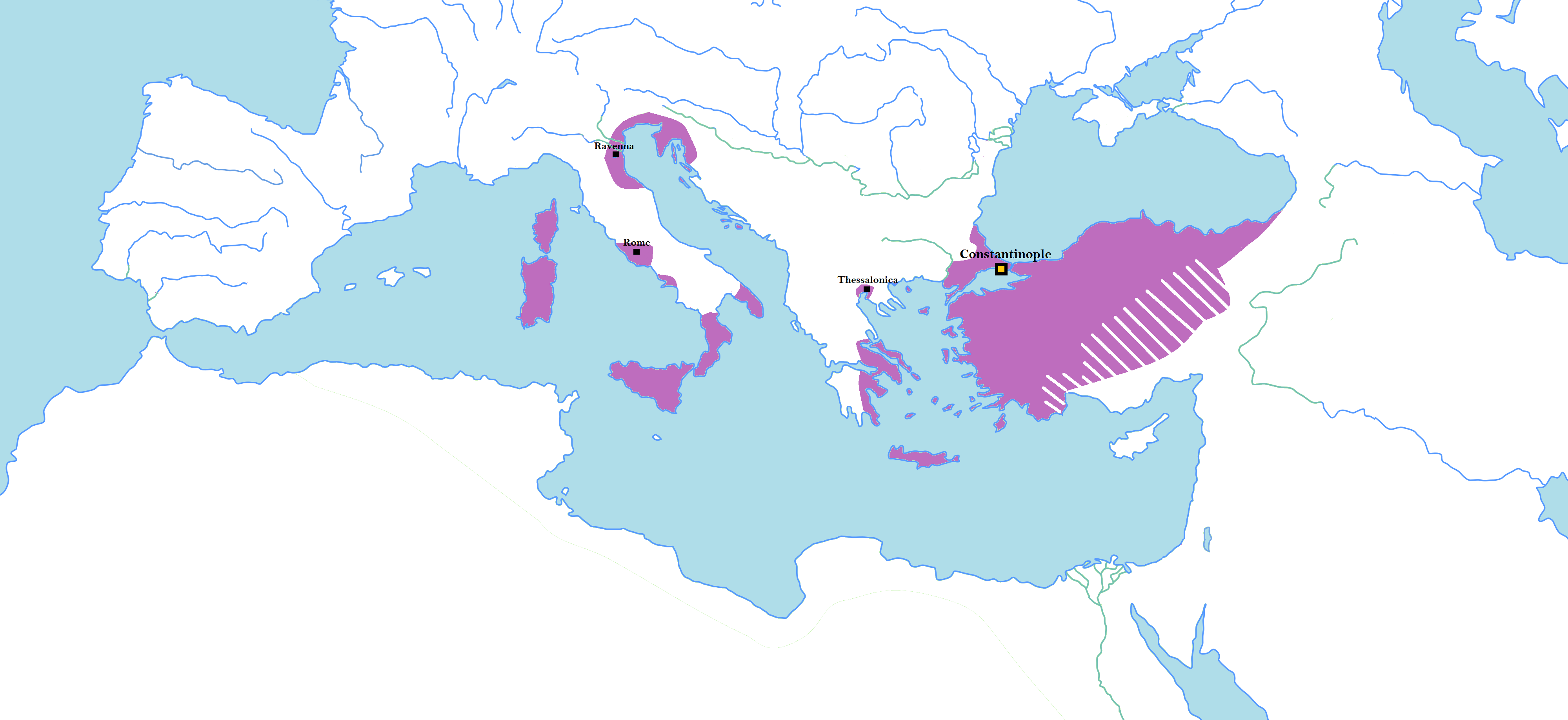
Map of Random Borders of Historical States
This map illustrates the unconventional and often perplexing borders of major historical states, highlighting areas wher...
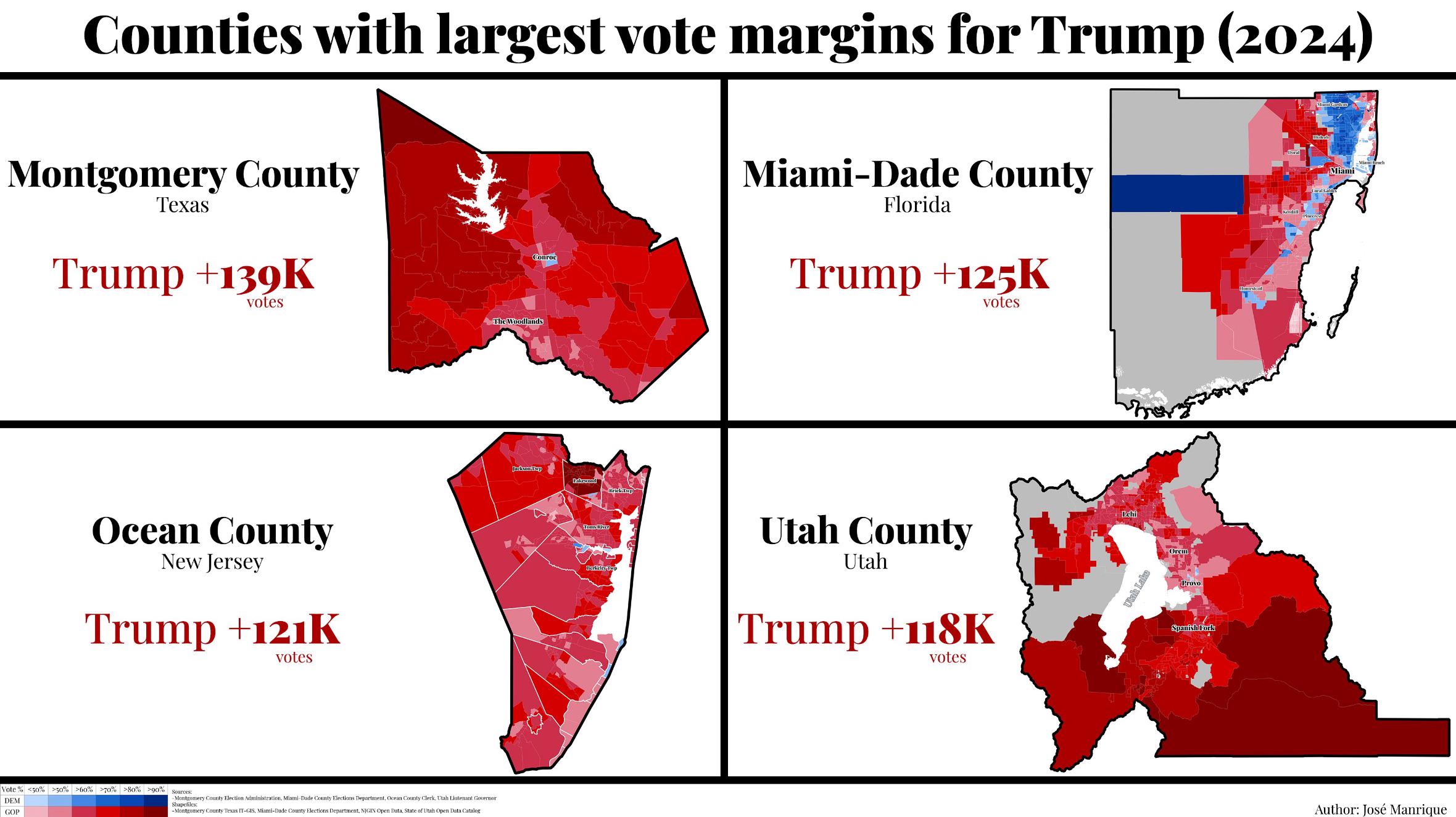
Trump's Largest Margin Counties in 2024 Election Map
The visualization titled "The 4 Counties That Gave Trump His Largest Margin in the 2024 Election" provides a detailed lo...
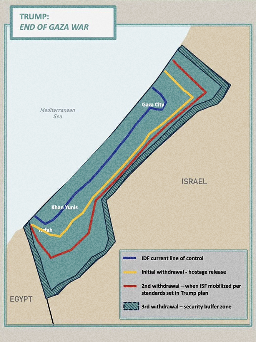
Trump's Gaza Withdrawal Map Analysis
The "Trump’s Gaza Withdrawal Map" published by the White House visualizes the proposed territorial changes and withdrawa...
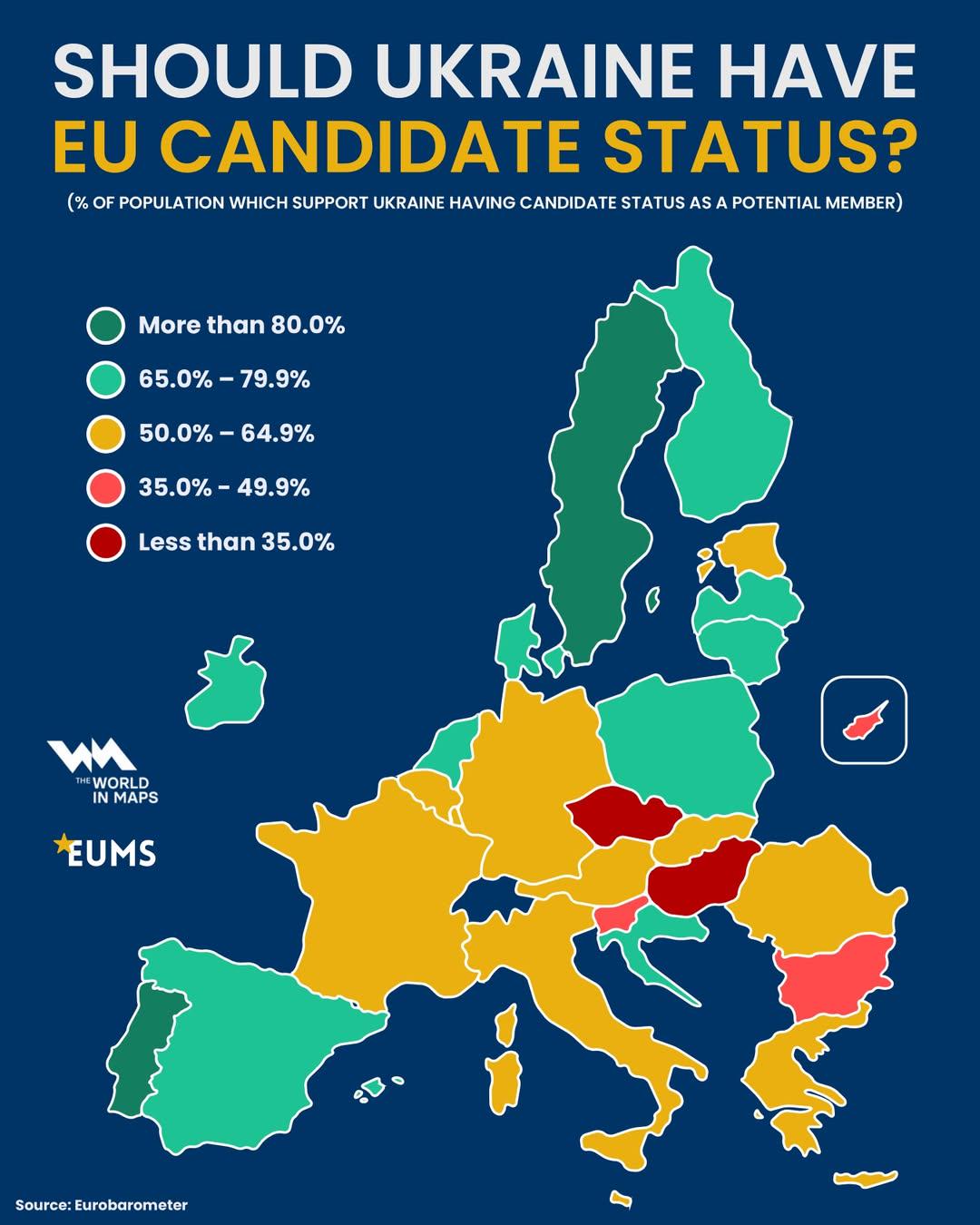
Map of Ukraine's EU Candidate Status
This map visually represents the current status of Ukraine's candidacy for European Union (EU) membership, highlighting ...
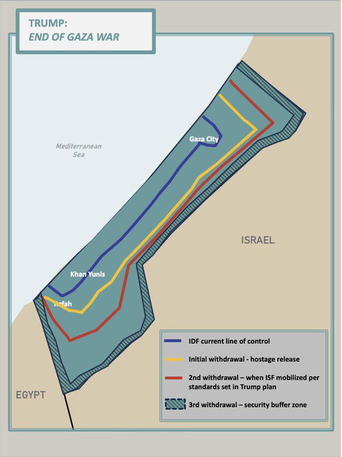
2025 Trump Peace Plan for Gaza Map
The "2025 Trump Peace Plan for Gaza Map" visualizes the proposed territorial divisions and administrative changes sugges...
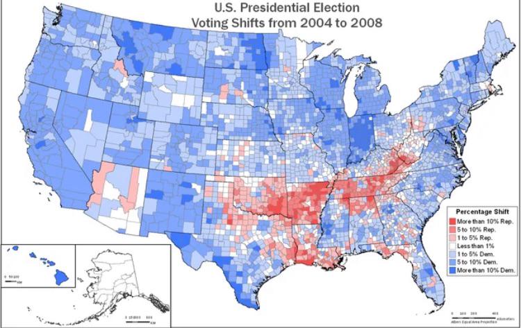
Voting Margin Shift Map from 2004 to 2008
The visualization titled "Shift in Voting Margins across Counties in the US from the 2004 election to the 2008 election"...
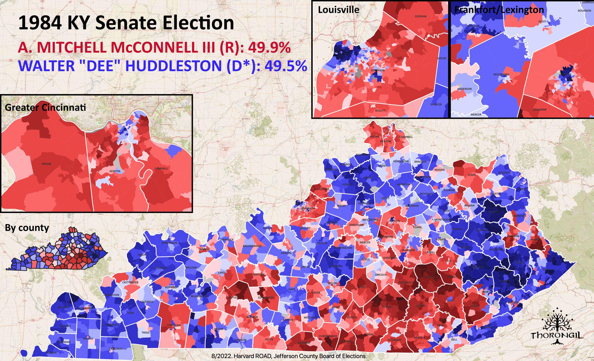
Map of Mitch McConnell's Senate Election
This map details the electoral landscape during the election in which Mitch McConnell first secured his seat in the U.S....
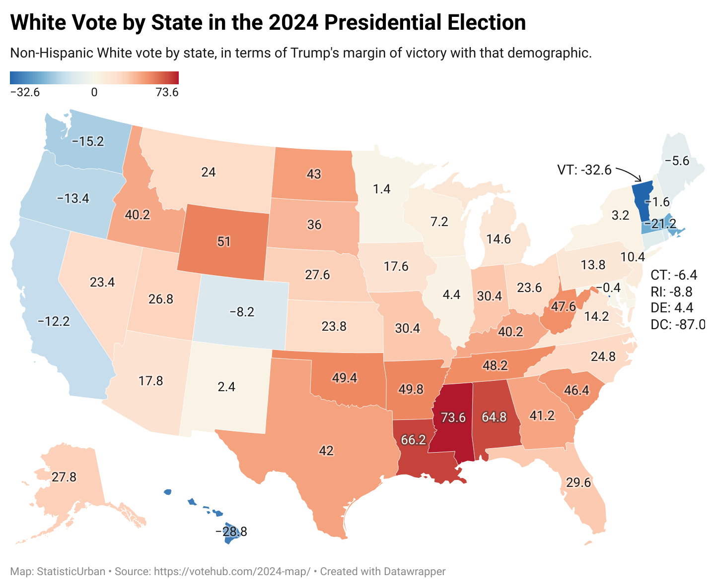
Voting Patterns Map of White Americans 2024
The map titled "How White Americans Voted in 2024" provides a detailed visual representation of voting behaviors among W...
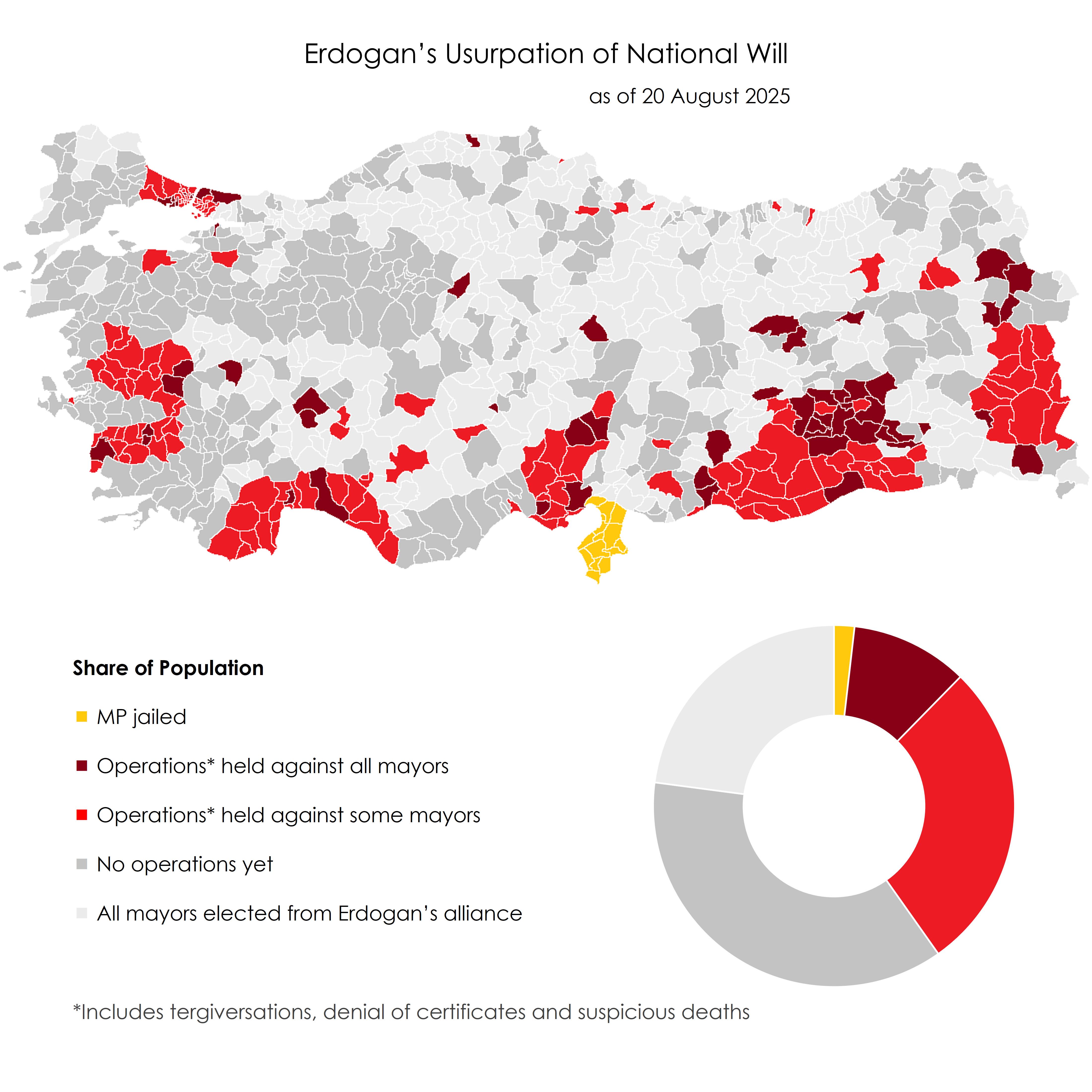
Erdogan's Usurpation of National Will Map
The visualization titled \...
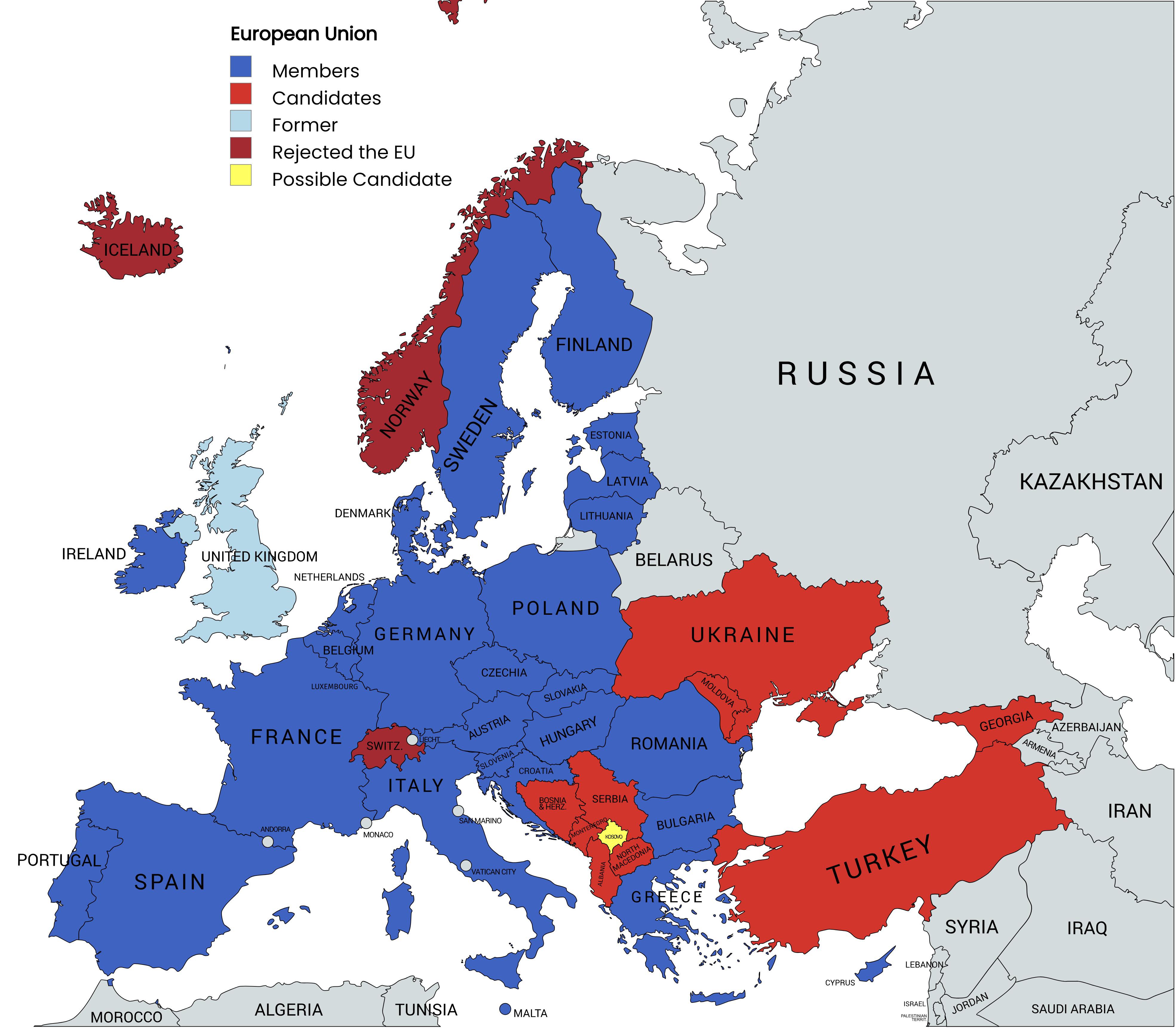
Map of the European Union Member Countries
The "Map of the European Union Member Countries" provides a clear visual representation of the countries that are part o...
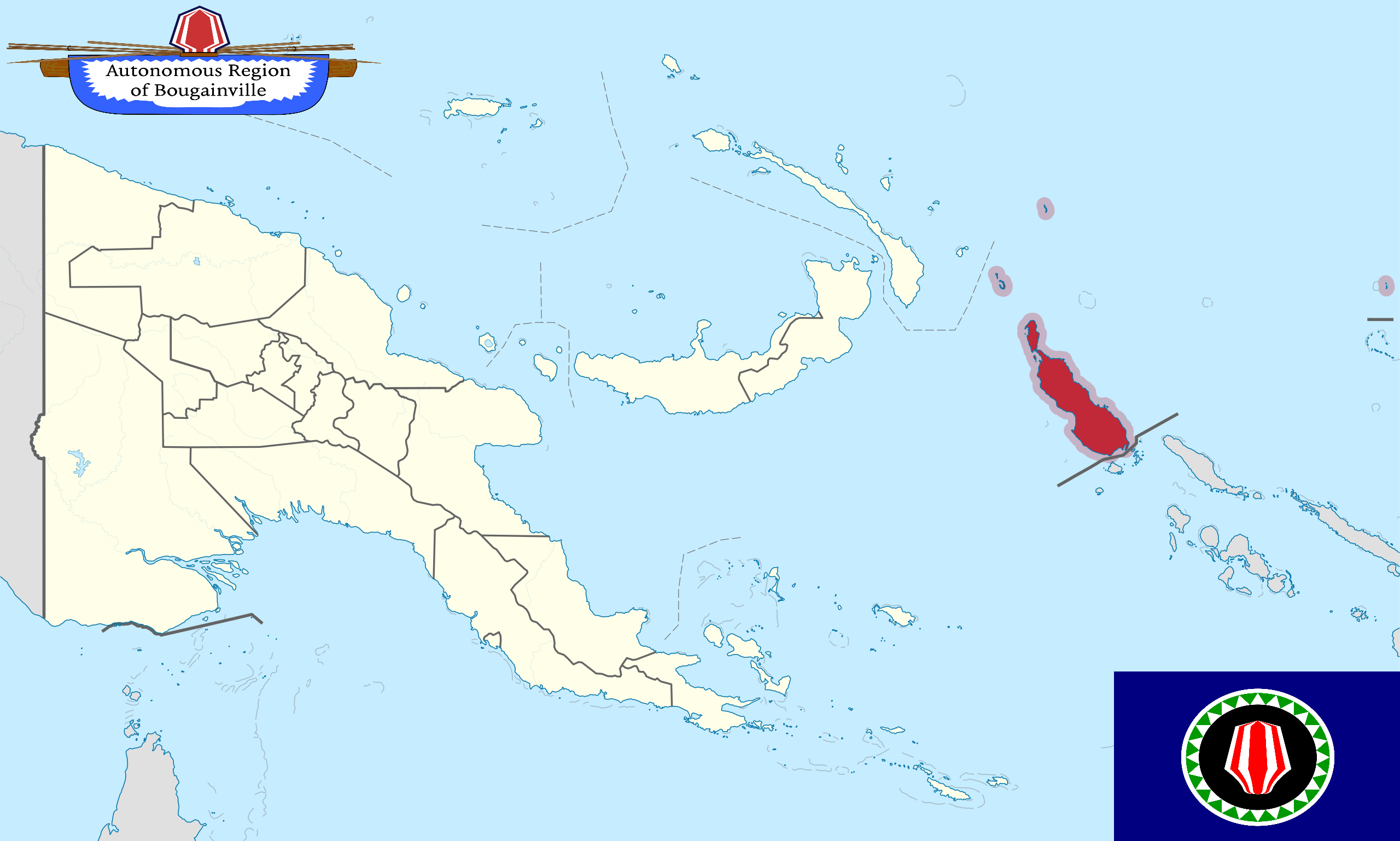
Bougainville Independence Map and Future Nation Status
This map provides a detailed visualization of Bougainville, an autonomous region of Papua New Guinea, which is on the ve...
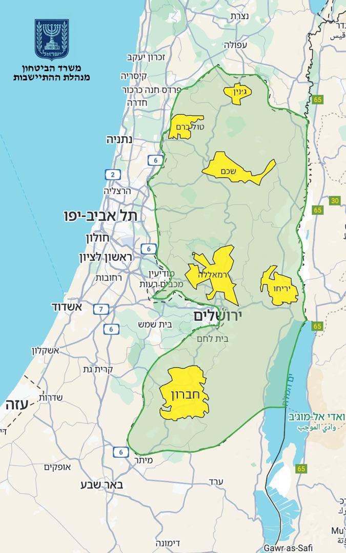
Israel Annexation Map of 82% West Bank
The map presented by Finance Minister Bezalel Smotrich highlights a proposed annexation plan that seeks to incorporate 8...
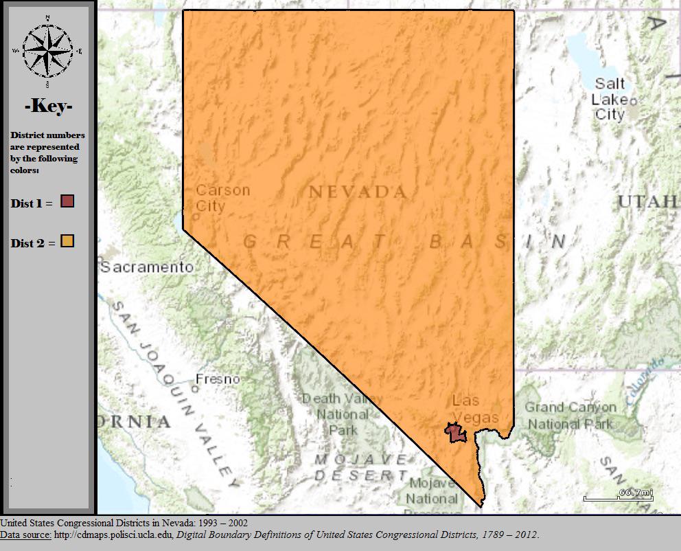
Nevada Congressional Districts Map 2000
The visualization titled 'Nevada’s Congressional Map In 2000' showcases the state's congressional district boundaries as...
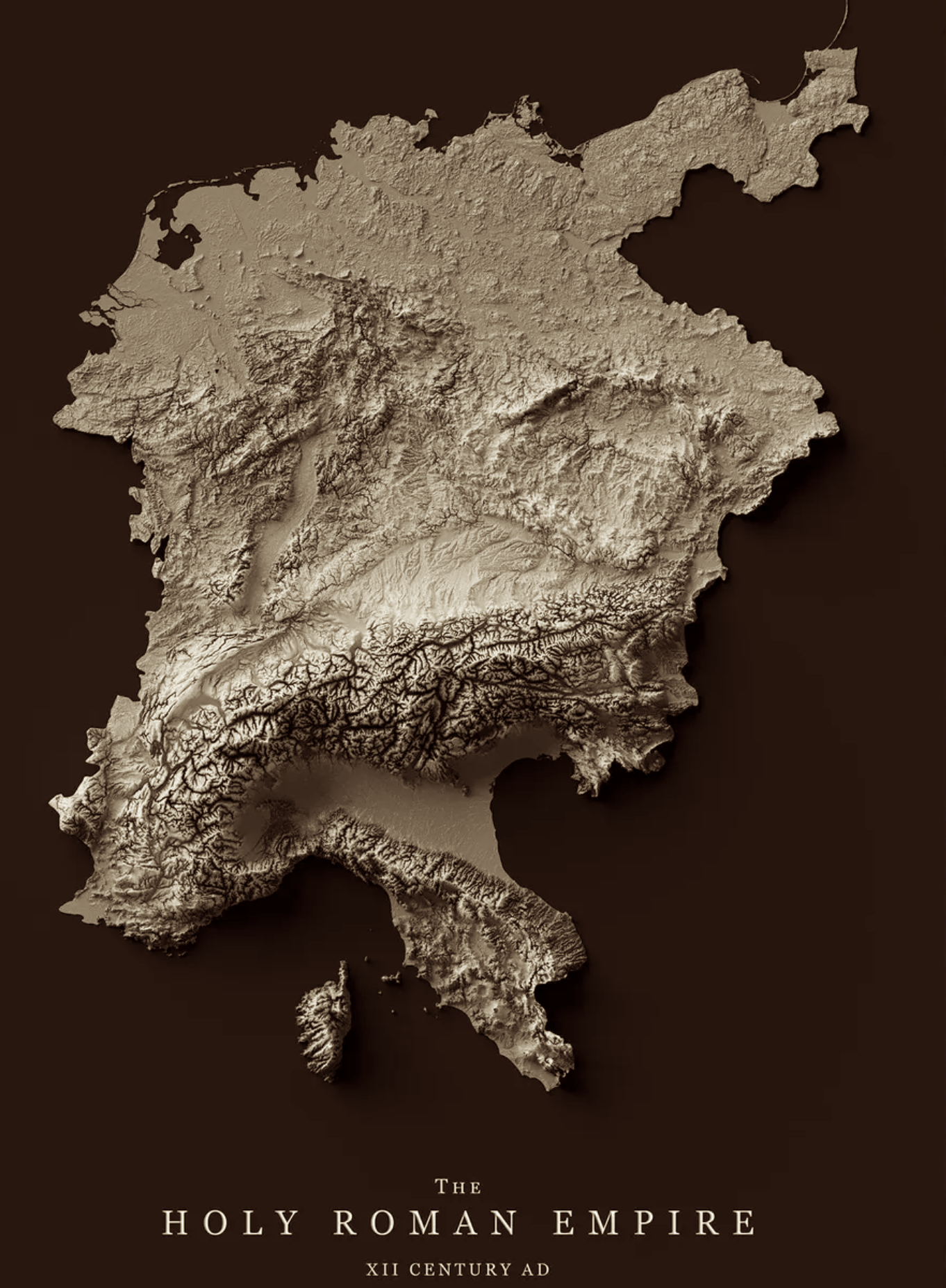
Relief Map of the Holy Roman Empire 12th Century
The relief map of the Holy Roman Empire in the 12th century provides a vivid representation of the geographical features...
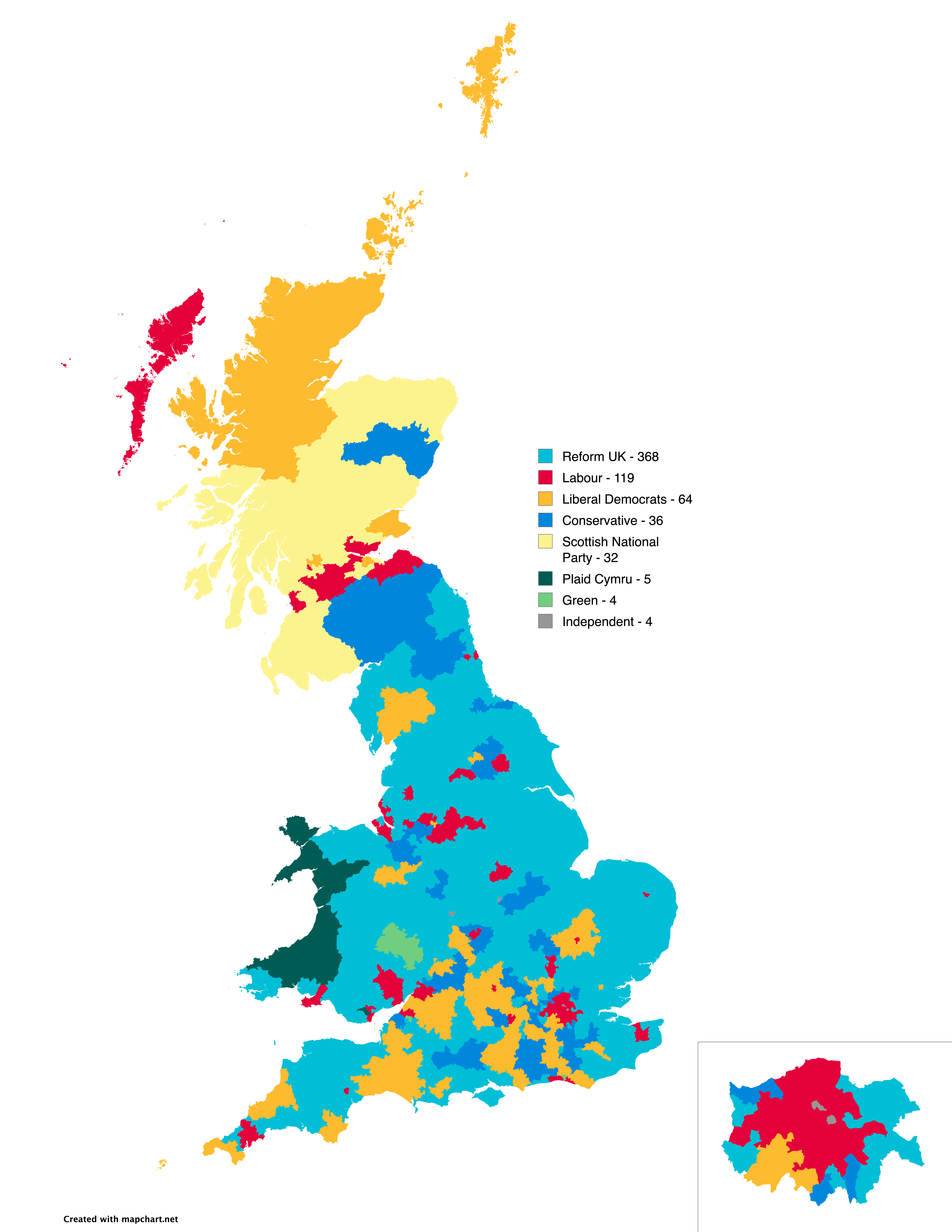
UK Election Prediction Map by Electoral Calculus
The "Predicted outcome of next UK election according to Electoral Calculus (NI excluded)" map offers a visual representa...
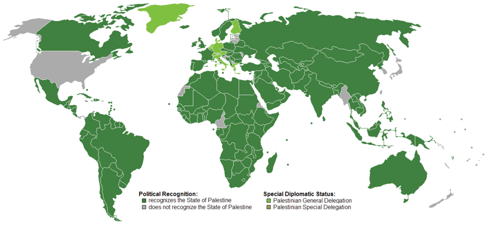
Recognition of the State of Palestine Map
Interestingly, the Palestinian territories comprise two main areas: the West Bank and Gaza Strip. The West Bank is under...
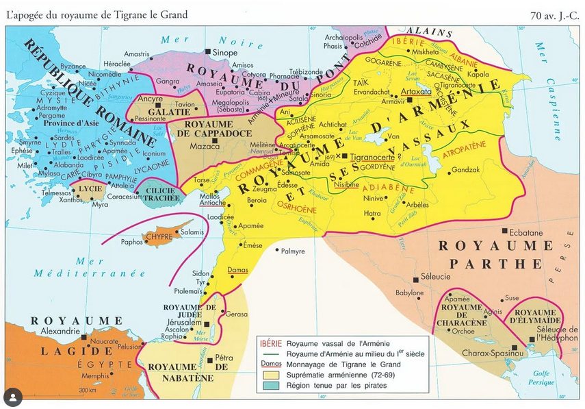
Map of the Kingdom of Armenia in 70 BC
The "Map of the Kingdom of Armenia in 70 BC" provides a detailed visual representation of Armenia during a pivotal perio...
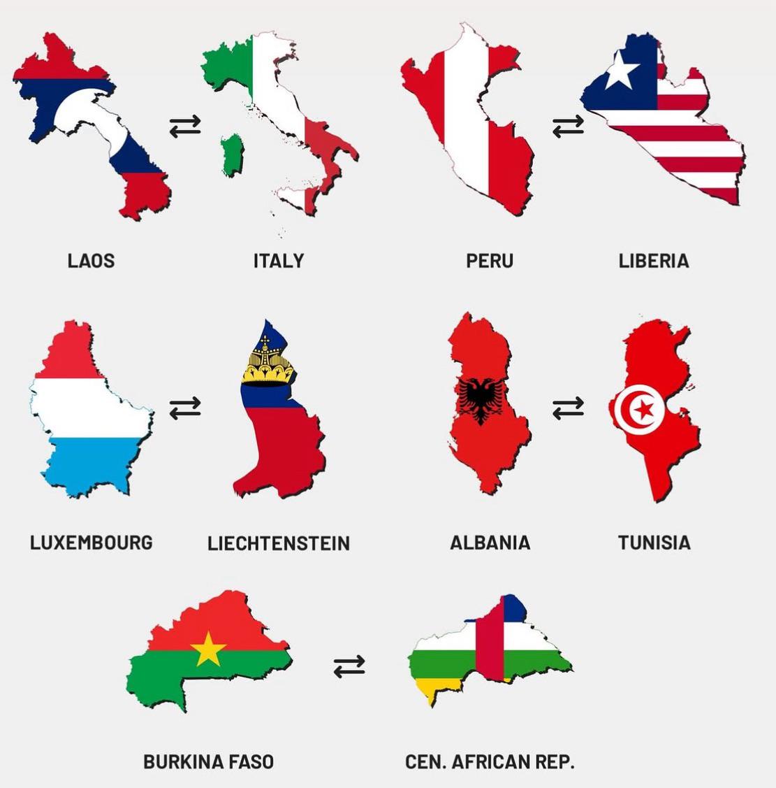
Map of Similarly Shaped Countries
This map visualizes a unique geographical phenomenon: countries around the world that share similar shapes. While many n...
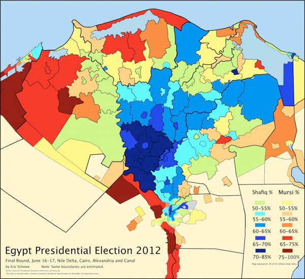
Egypt's 2012 Presidential Election Map
The "Egypt's 2012 Presidential Election Map" provides a visual representation of the electoral outcomes across the count...
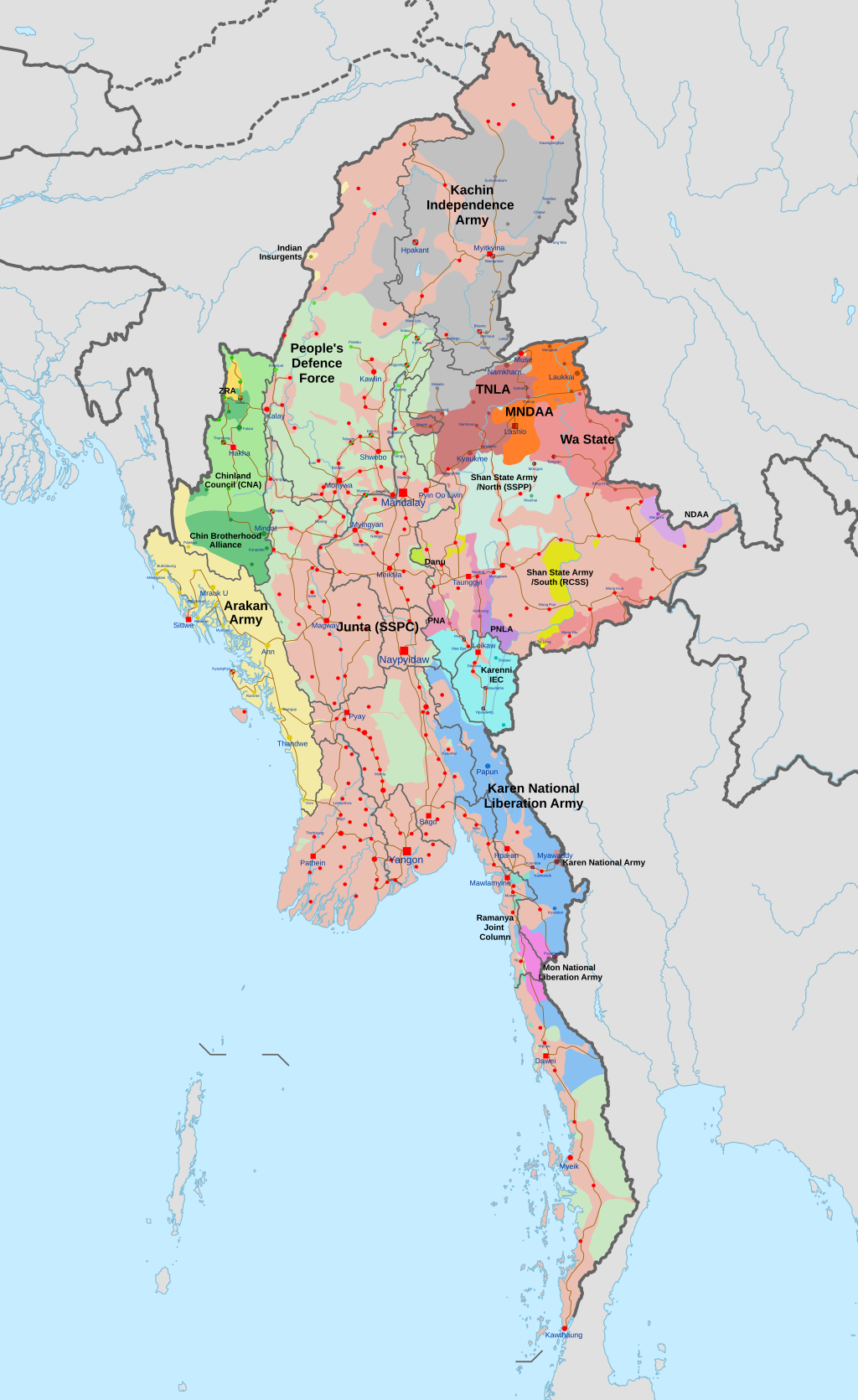
Myanmar Civil War Conflict Map
The "Map of the Myanmar Civil War, accurate as of 5 September 2025" provides a comprehensive visualization of the ongoin...
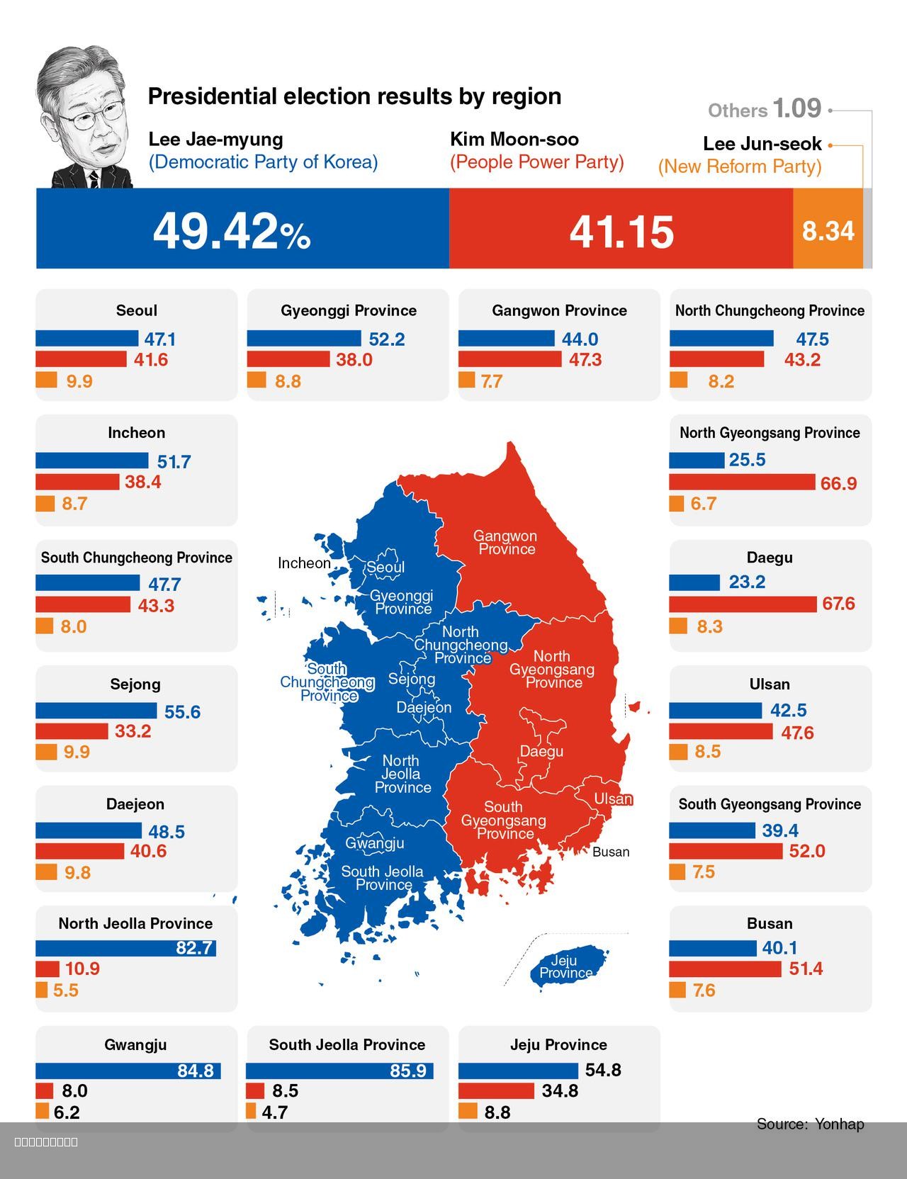
2025 South Korea Presidential Election Map
The 2025 South Korea Presidential Election Map illustrates the election results, focusing on the stark contrast between ...
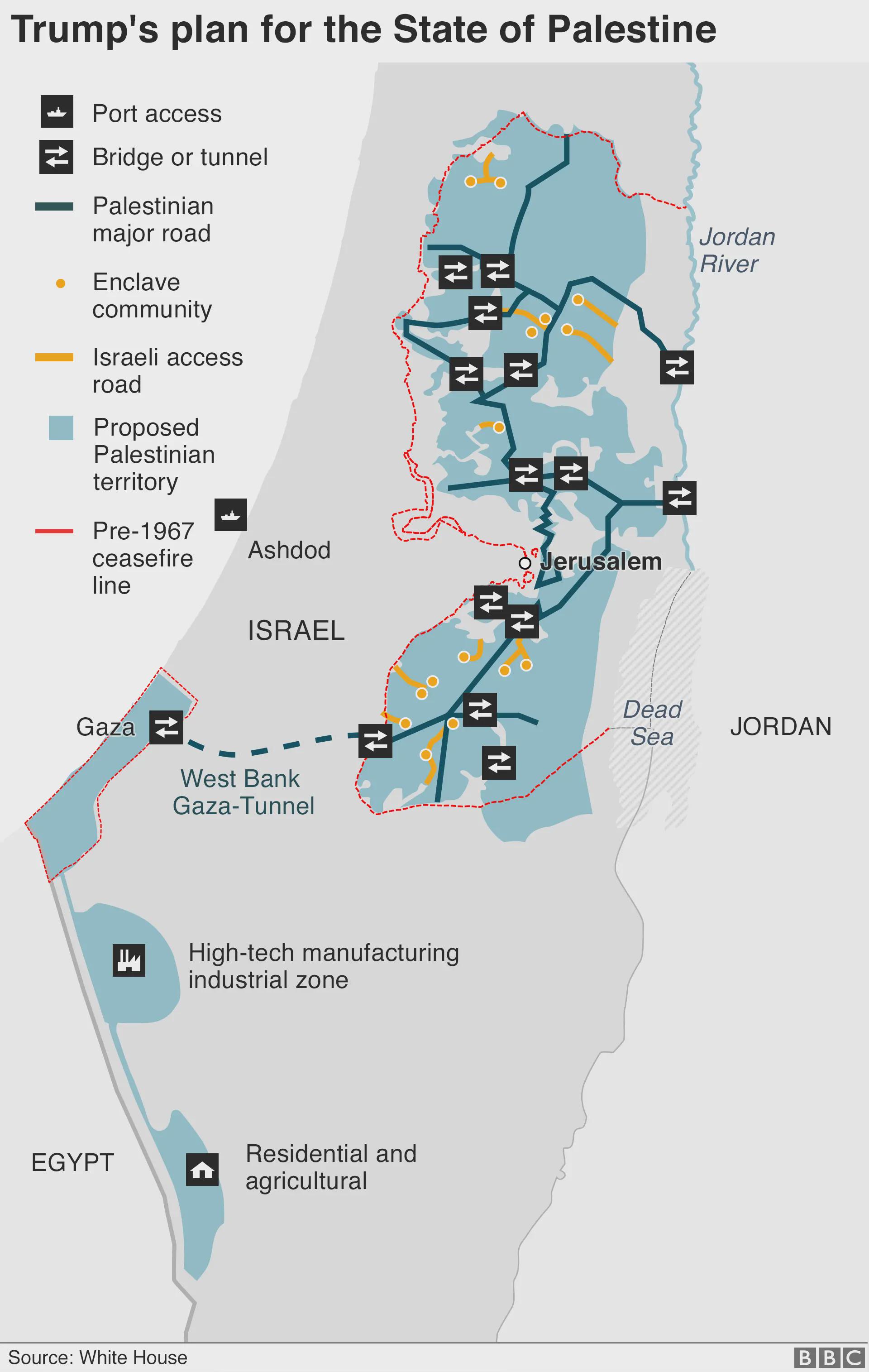
Trump's Plan for the State of Palestine Map
The map titled "Trump's Plan for the State of Palestine 2020" presents a proposed framework for the future of Palestine ...
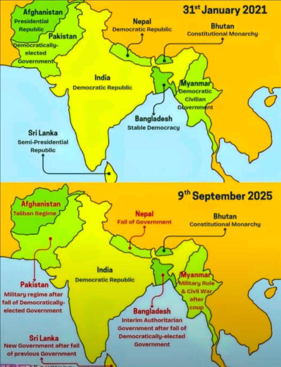
South Asia Polity Map
The "South Asia Polity Map" provides a detailed visualization of the political boundaries and governance structures acro...
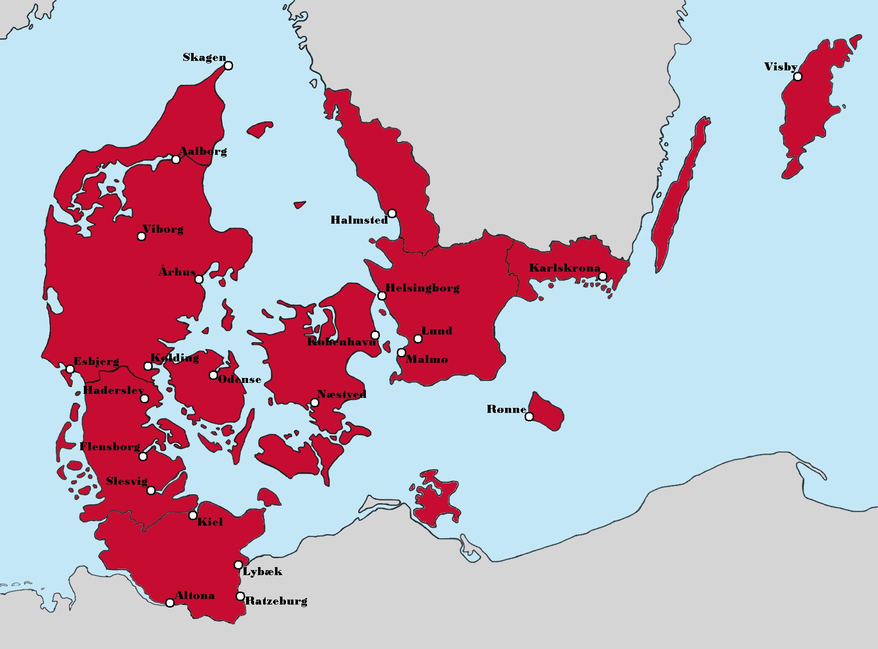
Aesthetic Map of Denmark's Political Landscape
The map titled "Politics aside, this version of Denmark looks really nice aesthetically" presents a unique visualization...
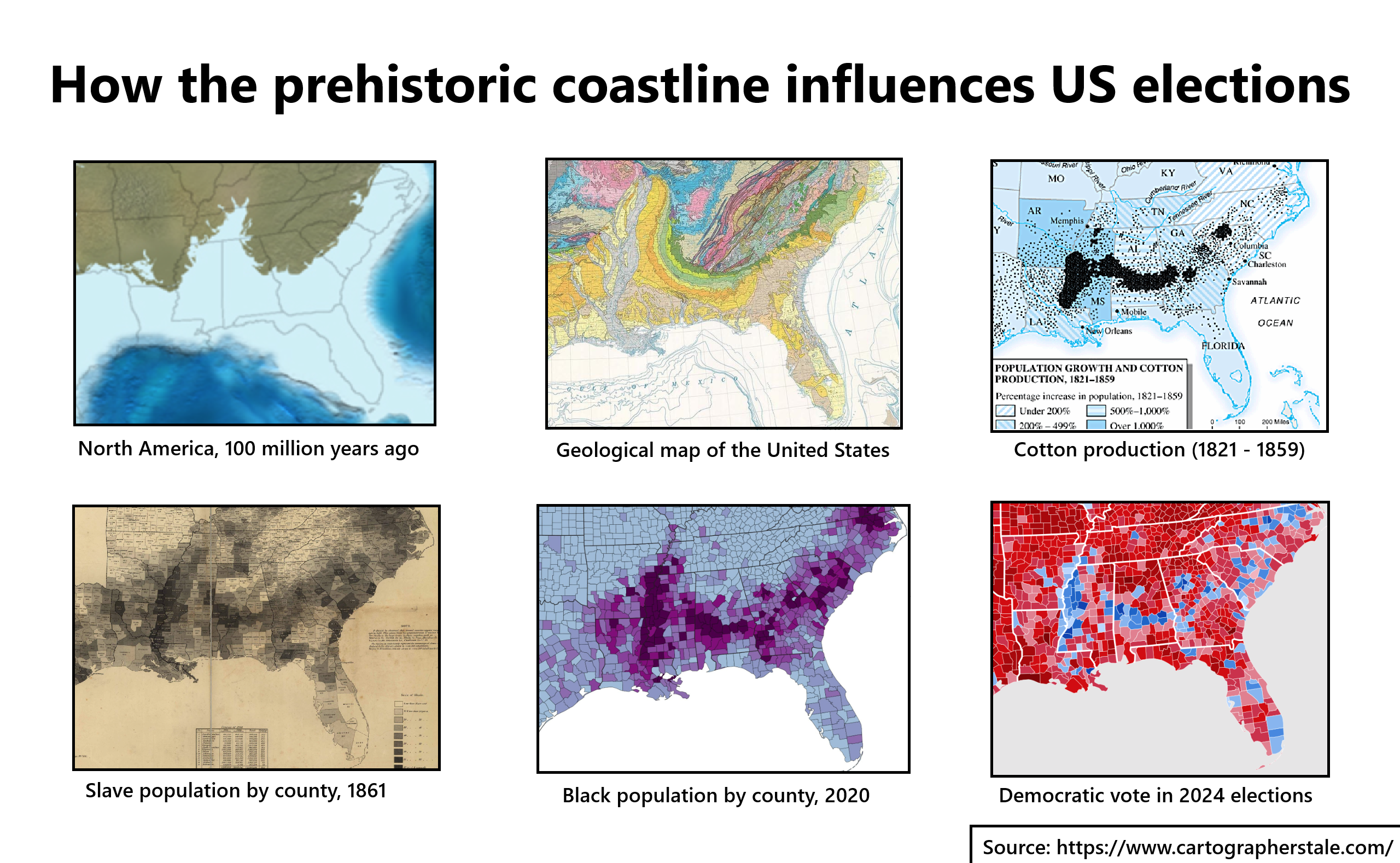
Prehistoric Coastline Influence on US Elections Map
The map titled "How the Prehistoric Coastline Influences US Elections" provides a fascinating visual representation of h...
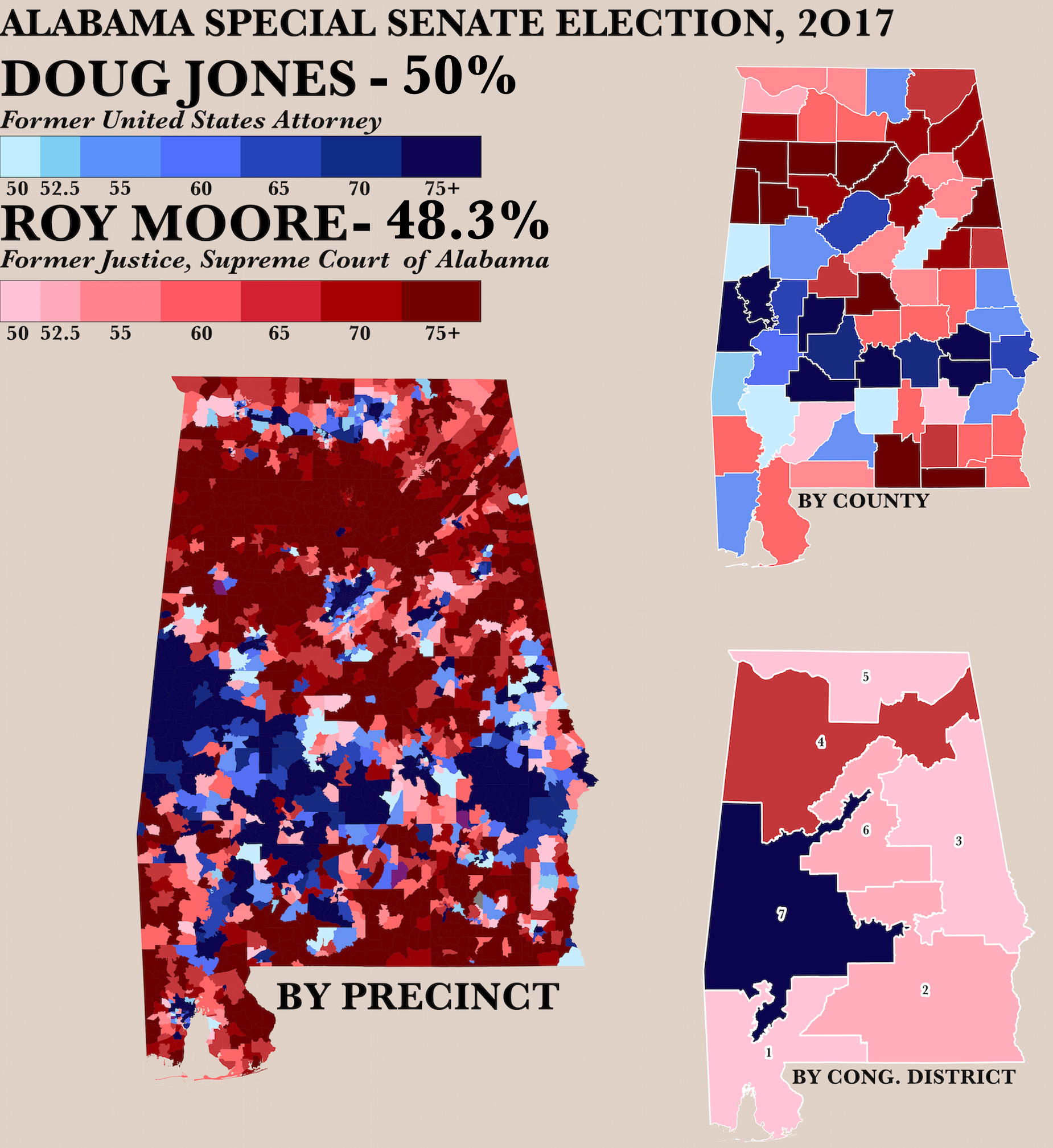
2017 Alabama Senate Race by Precinct Map
The "Poster of the 2017 Alabama Senate Race by Precinct Map" visually represents the voting patterns across various prec...

Map of Countries Refusing Access to Kosovo Citizens
This map highlights the countries that currently refuse access to citizens of Kosovo. Marked in distinct colors, it clea...
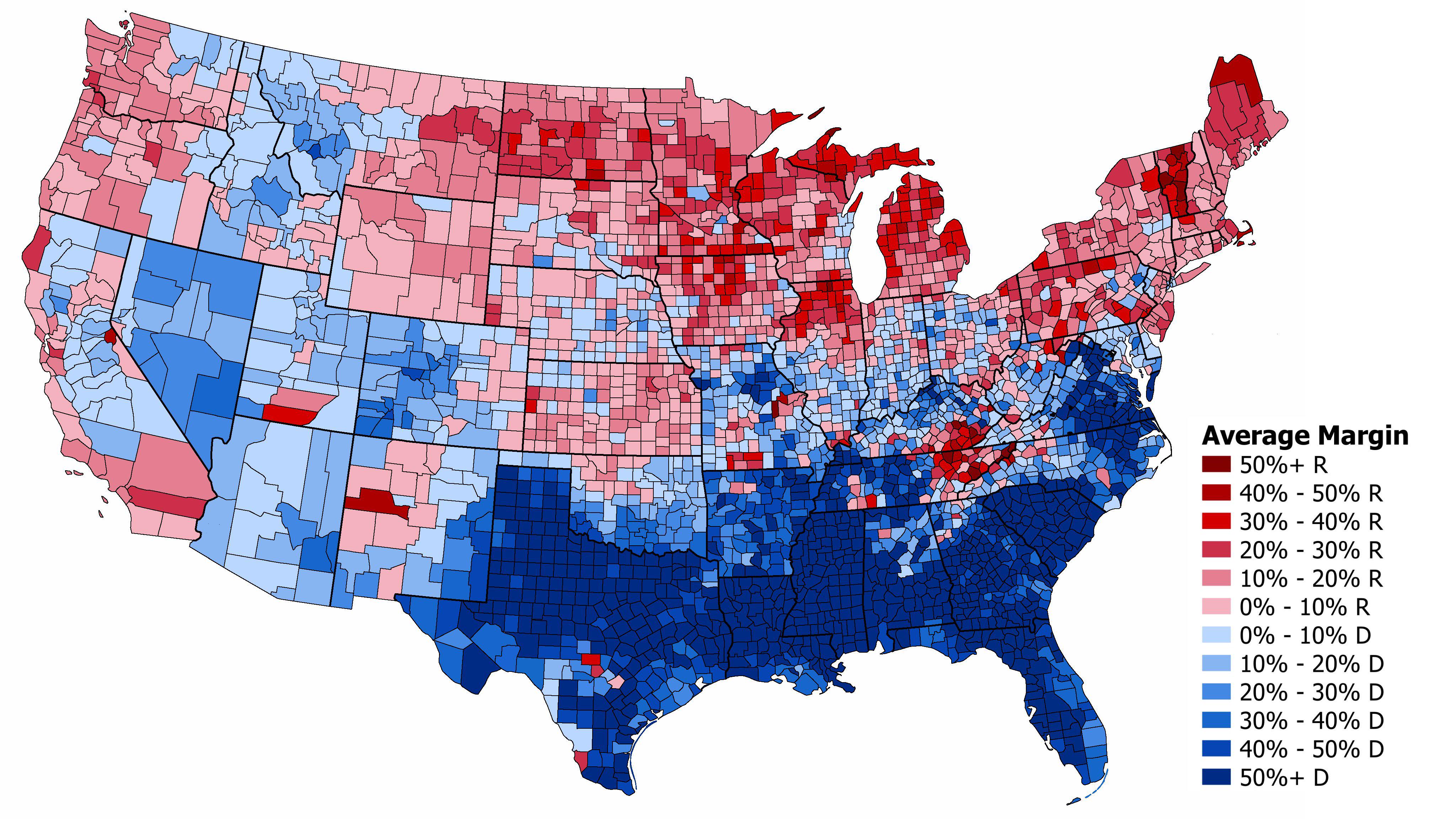
Average Partisan Lean of Counties Map (1896-1928)
This visualization presents the average partisan lean of counties in the United States during the Progressive Era, spann...
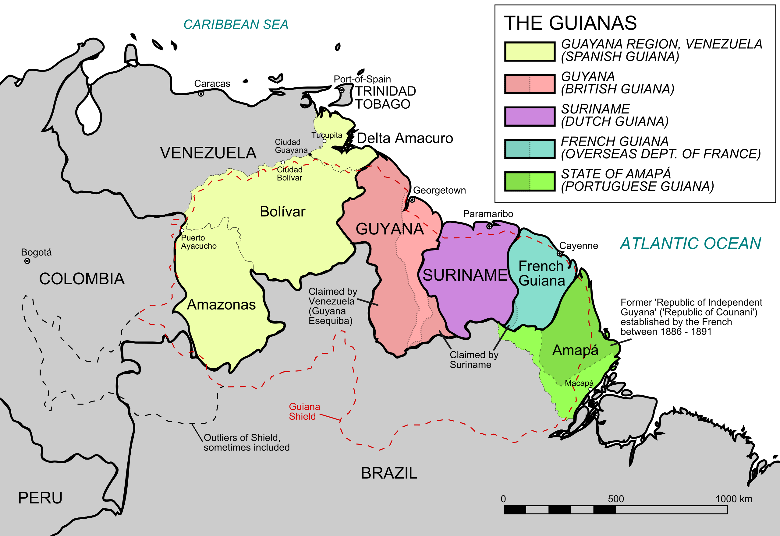
Geography Map of the Five Guianas
The map titled "The Five Guianas" highlights the unique geographical features and political borders of a region in north...
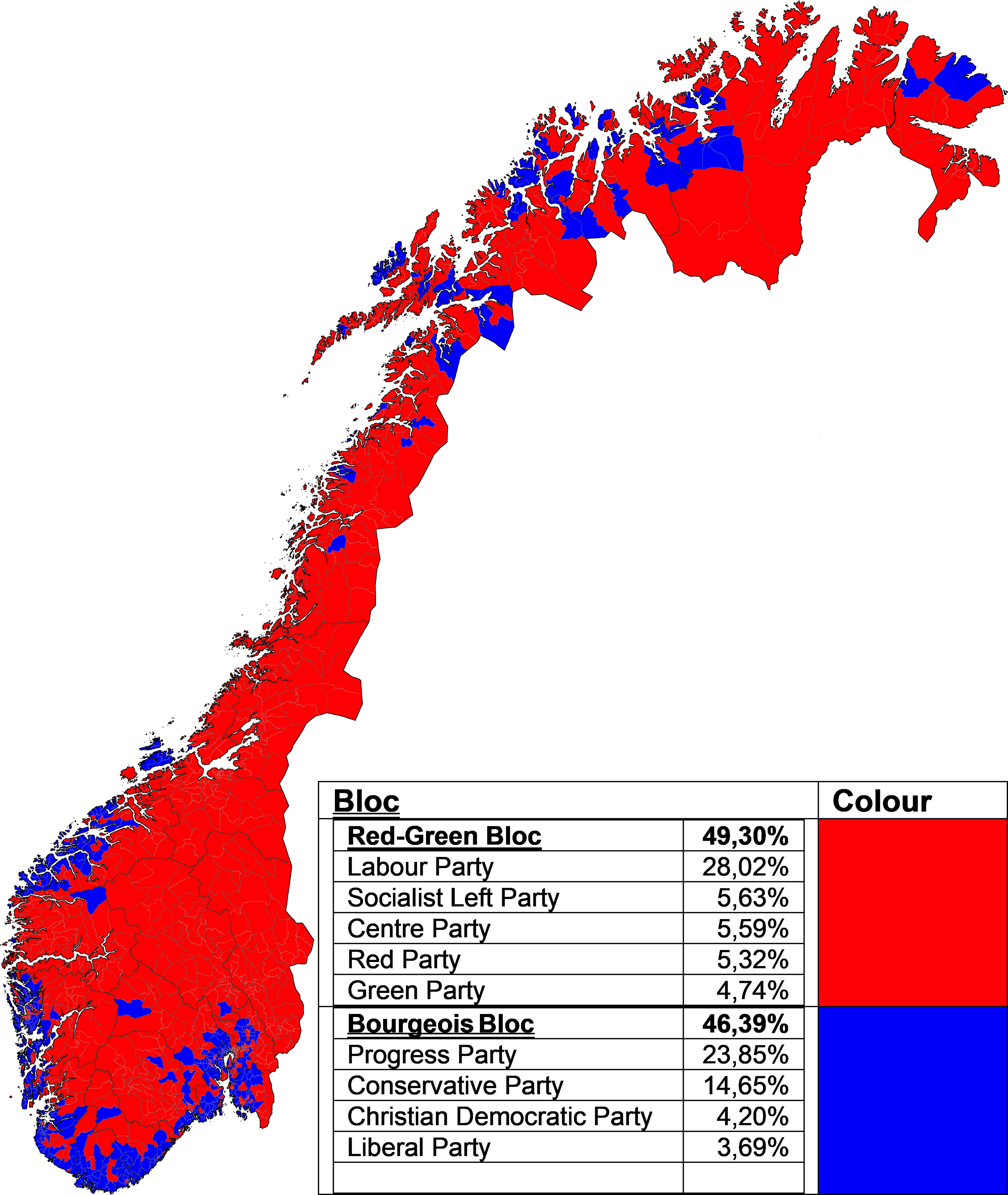
Largest Bloc in Each Precinct Map of Norway 2025
The visualization titled "Largest bloc in each precinct in the 2025 Norwegian parliamentary election" presents a clear r...
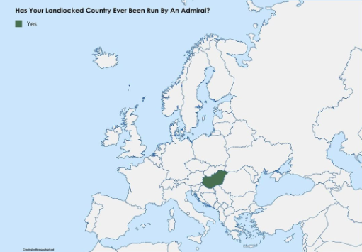
Map of Landlocked Countries Led by Admirals
This map visualizes an intriguing political intersection: the landlocked nations that have been led by admirals. While i...
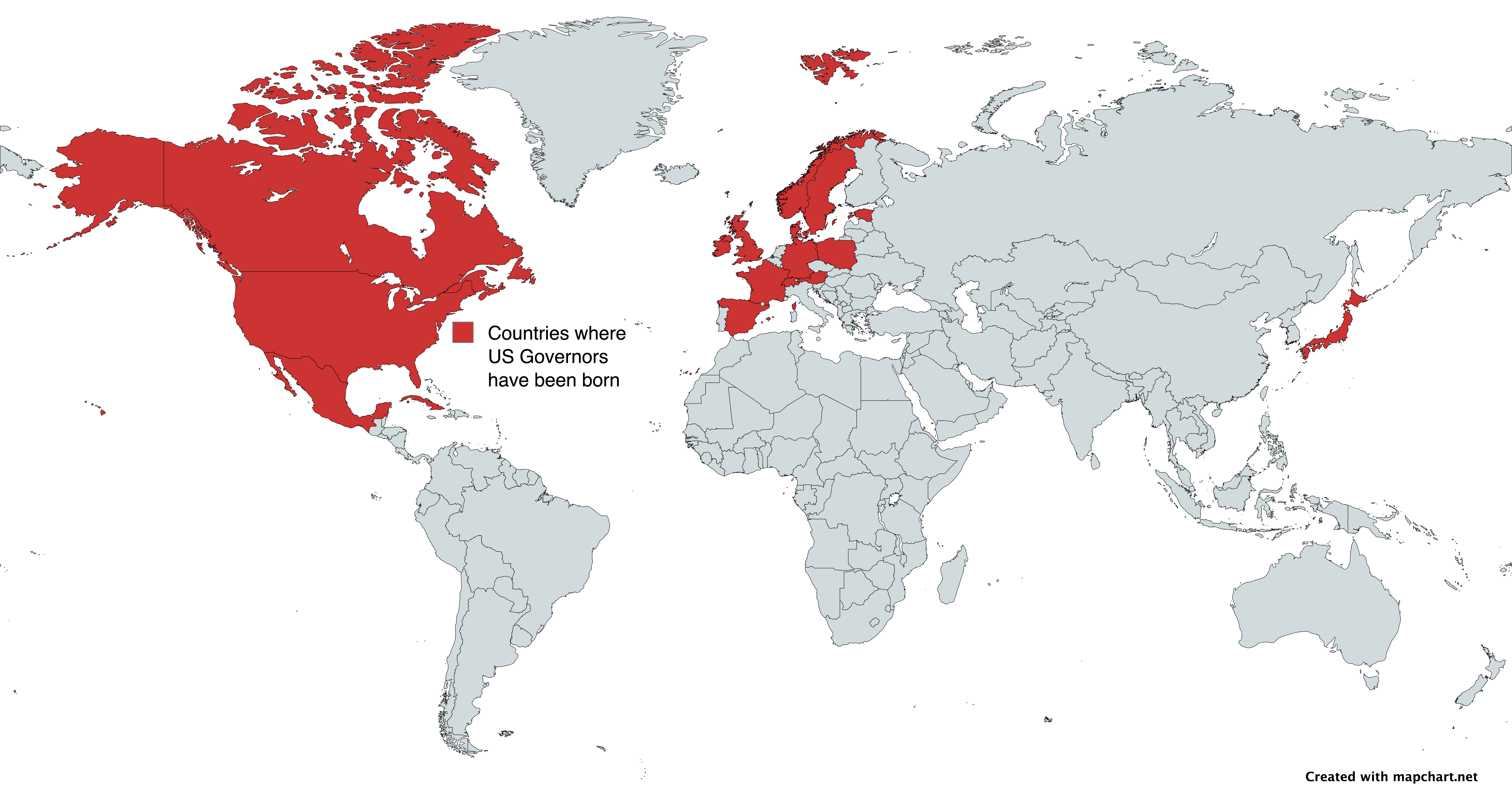
Map of Countries Where USA State Governors Were Born
This map vividly illustrates the countries of birth for state governors in the United States, offering a unique perspect...

North Korea Map Projection and Geography Overview
The visualization titled "The World Map projection in North Korea. You are not Western anymore!" presents a unique persp...
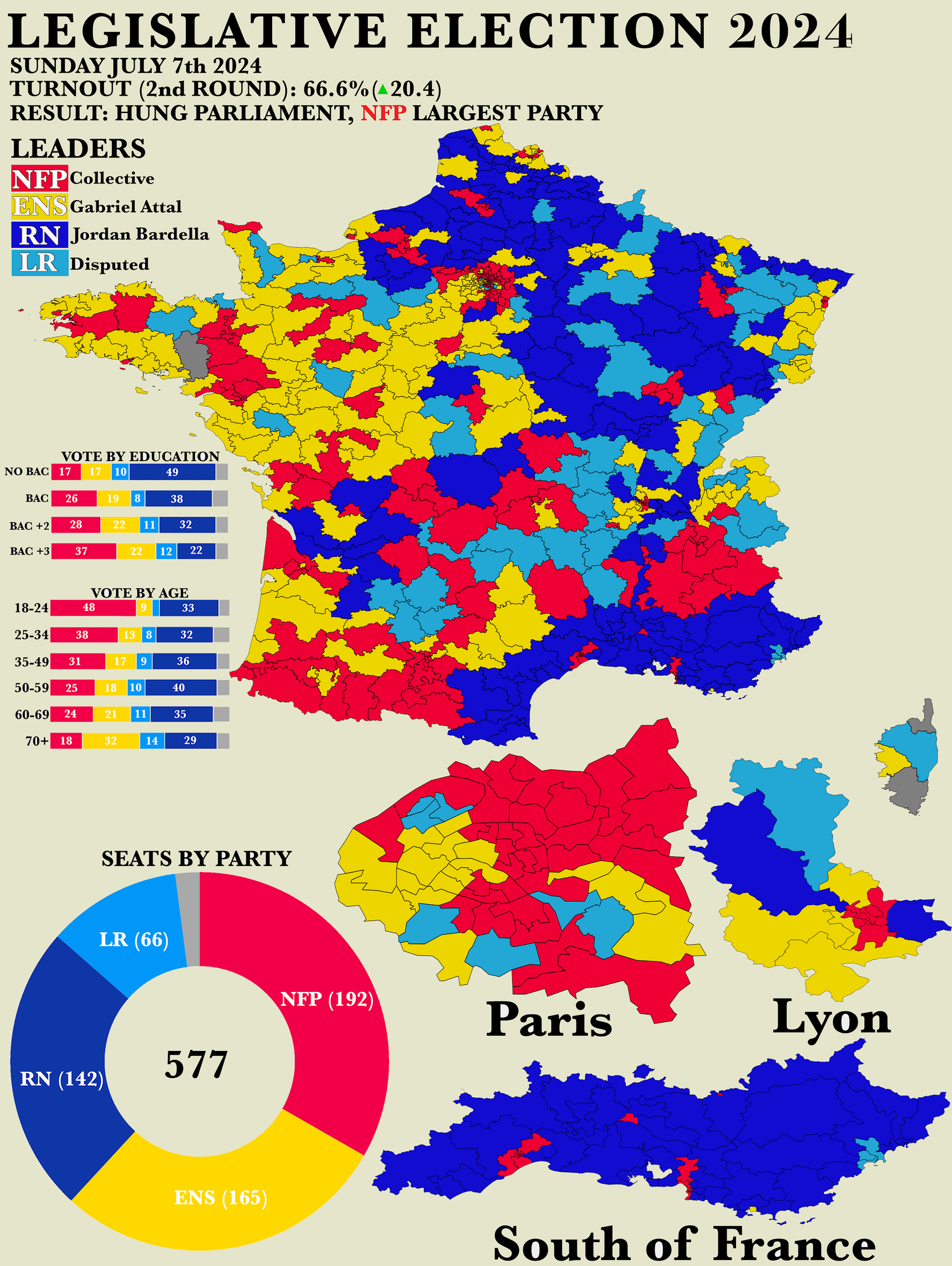
2024 French Legislative Election Results Map
The "Poster of the 2024 French Legislative Election Results" map presents a detailed overview of the electoral outcomes ...
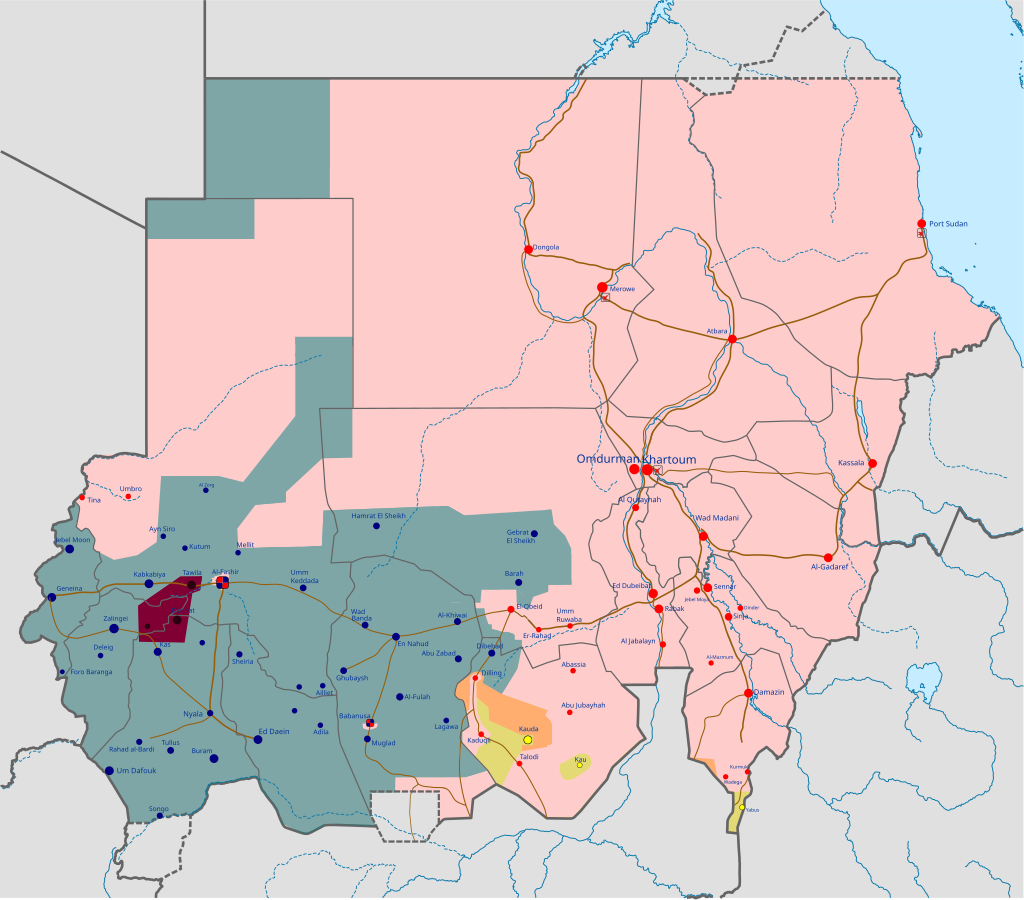
Military Situation Map of the Sudanese Civil War on July 31, 2025
The visualization titled "Military Situation of the Sudanese Civil War on 31 July 2025" presents a detailed geographical...
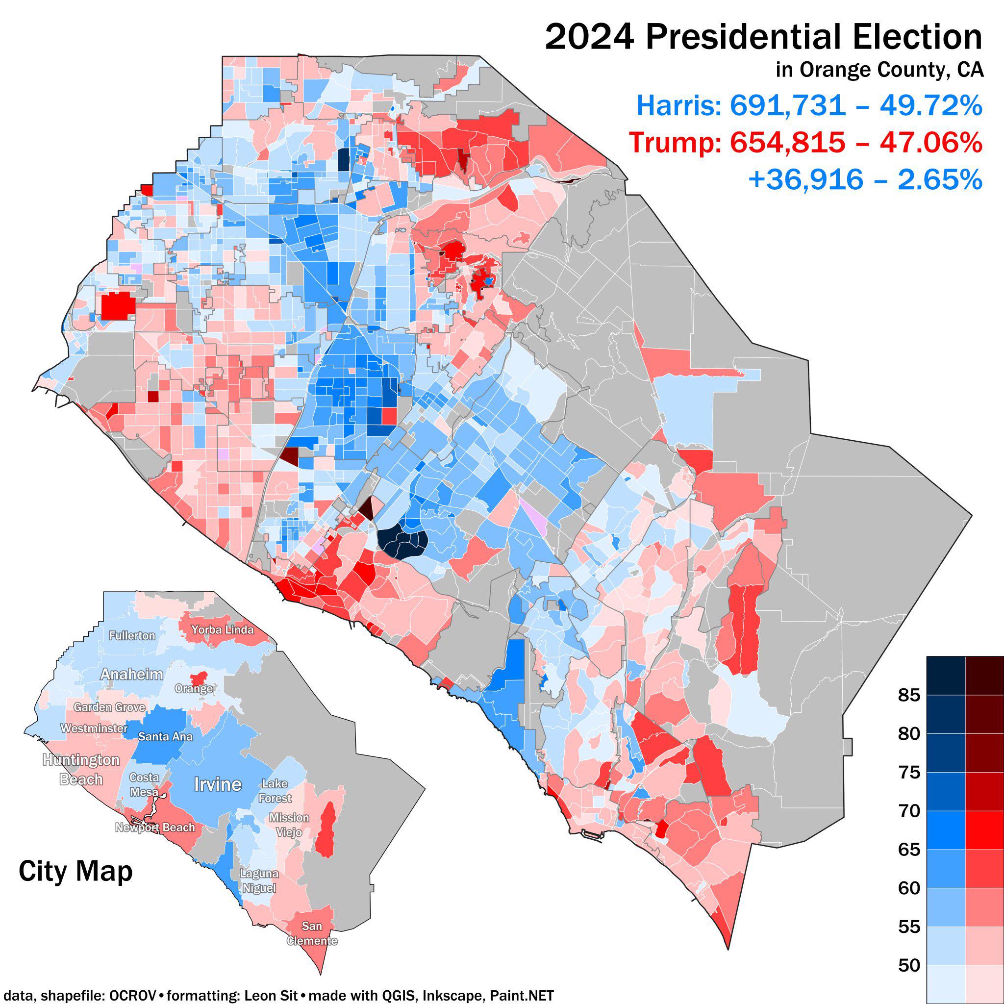
2024 Presidential Election Results Map Orange County CA
The 2024 Presidential Election Results Map for Orange County, CA, provides a detailed visualization of how residents in ...
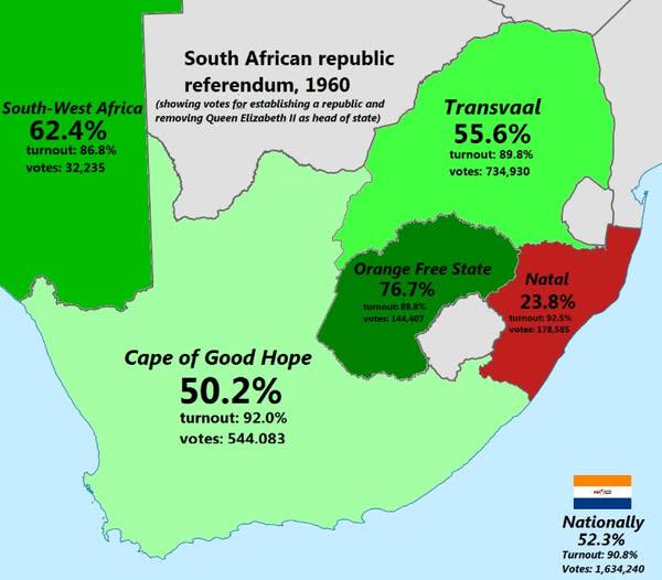
South African Republic Referendum 1960 Map
The "South African Republic Referendum 1960 Map" provides a visual representation of the regions in South Africa that pa...
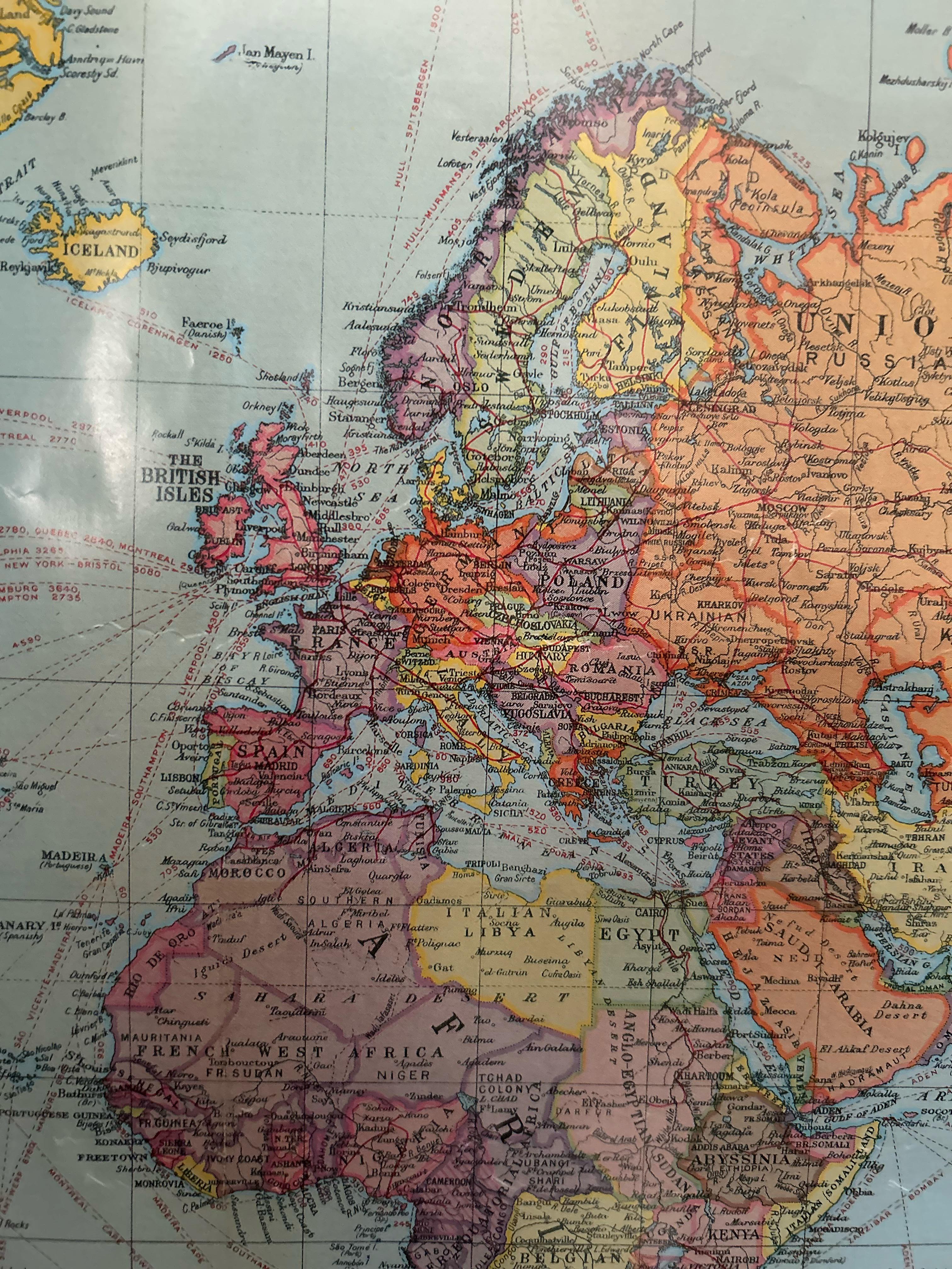
European Political Map from the 1920s
In this period, countries like Poland regained their independence after over a century of partition, while others like H...
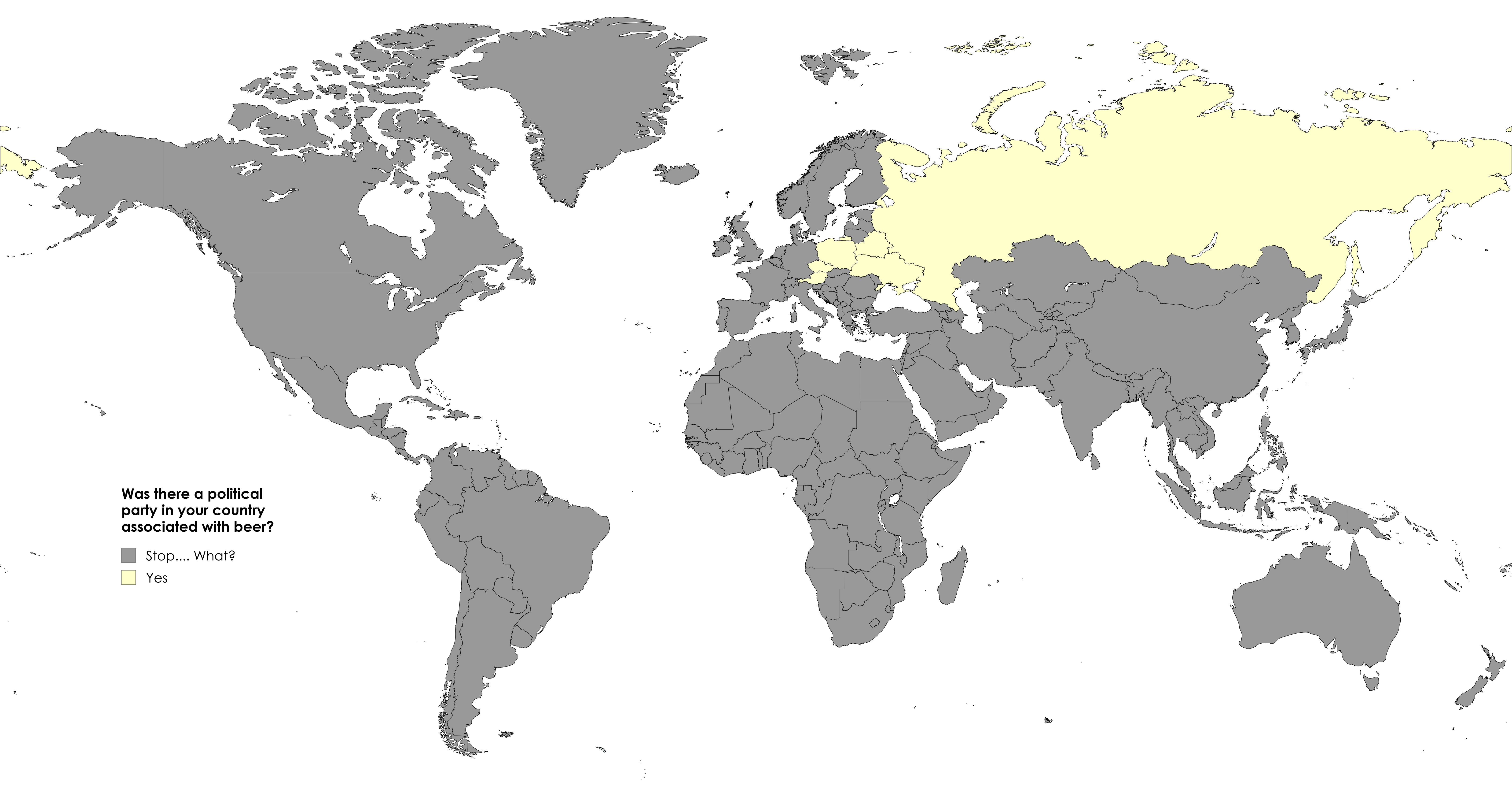
Map of Political Parties Associated with Beer
This map displays countries that have had political parties specifically associated with beer. From Austria to Ukraine, ...
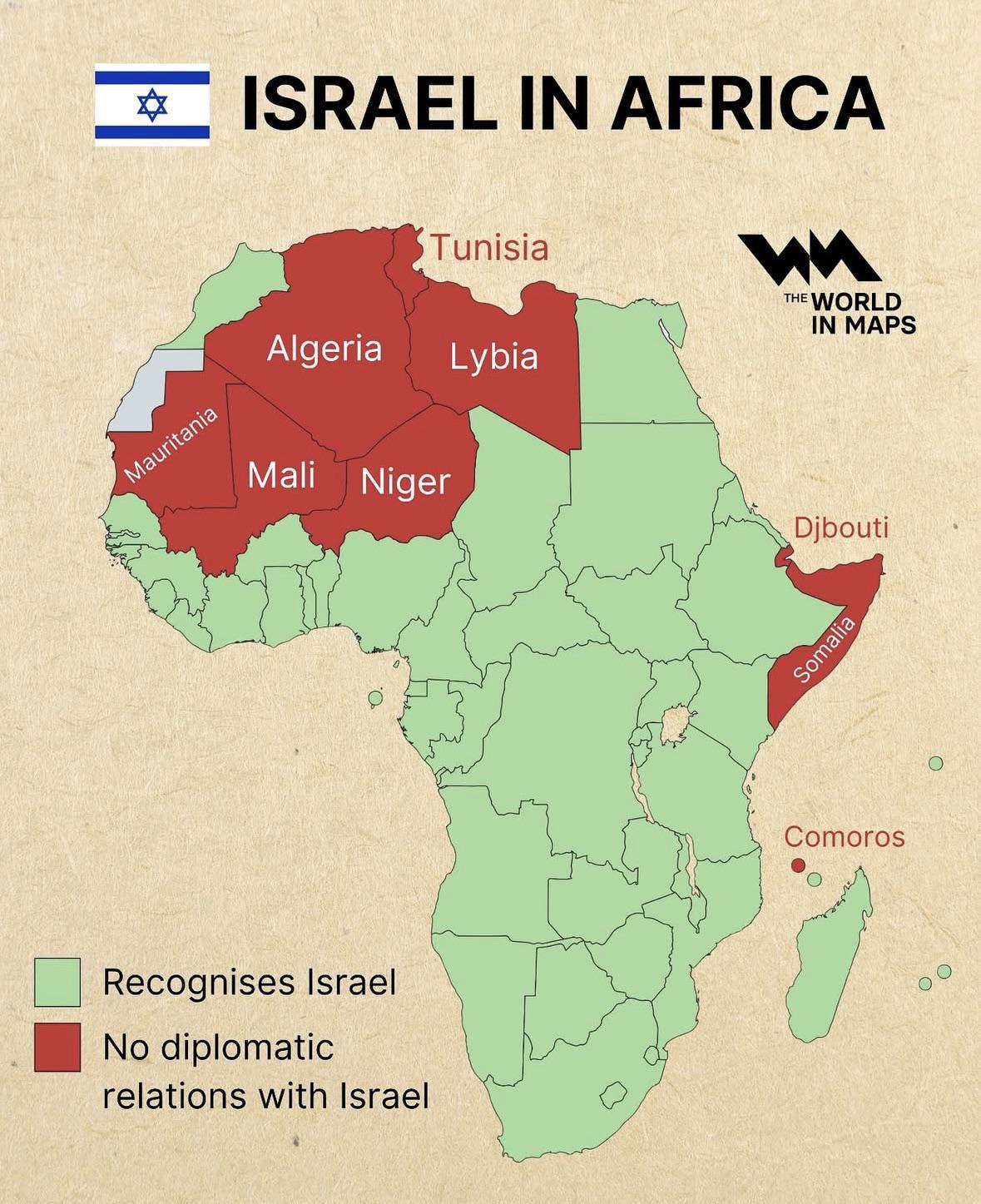
Diplomatic Relations of Israel in Africa Map
The "Diplomatic Relations of Israel in Africa Map" visually represents the complex web of diplomatic ties that Israel ma...
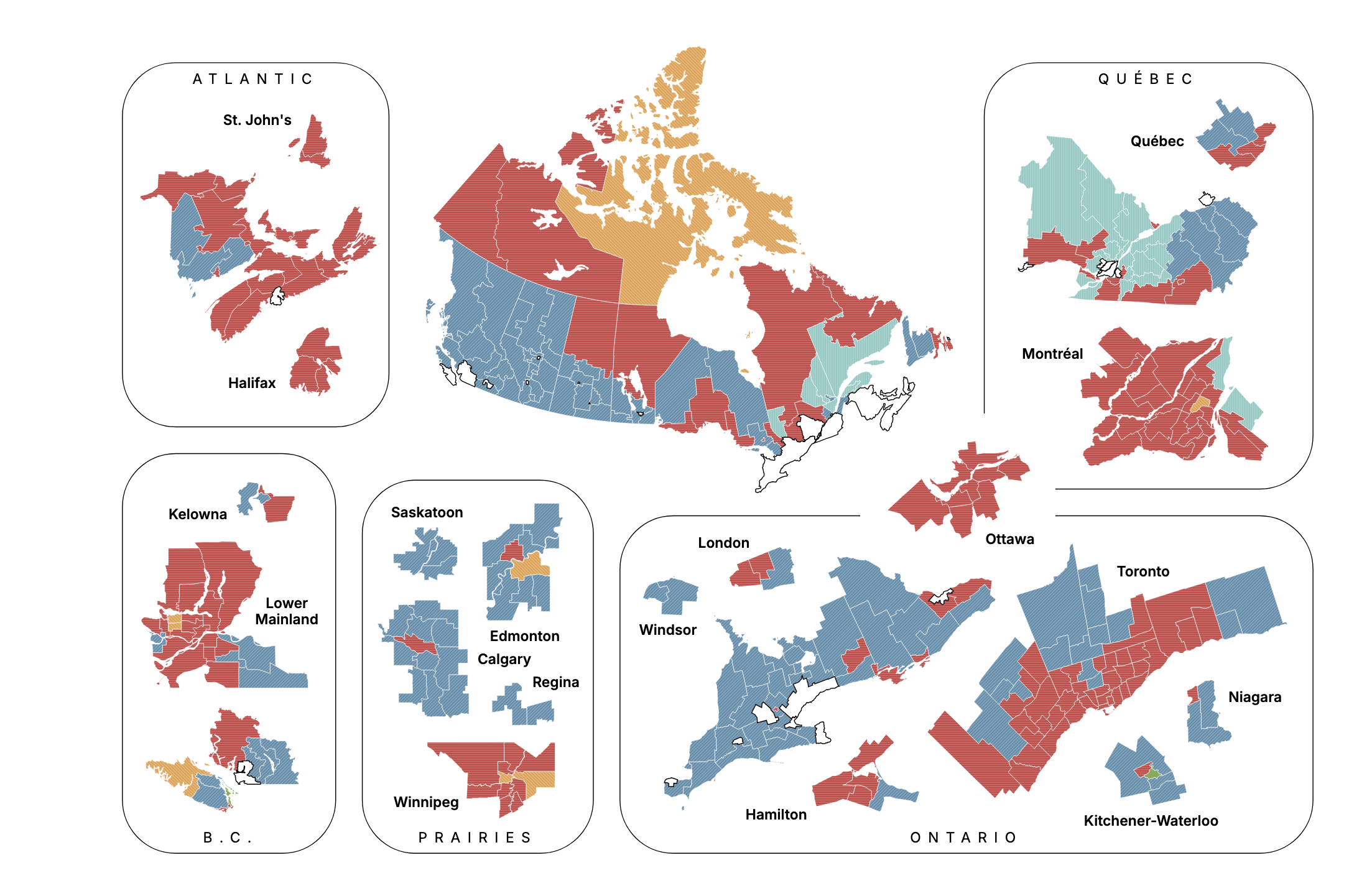
Canadian Election Projection Map September 2025
The "Canadian Election Projection - September 28, 2025" map provides a visual representation of the anticipated results ...
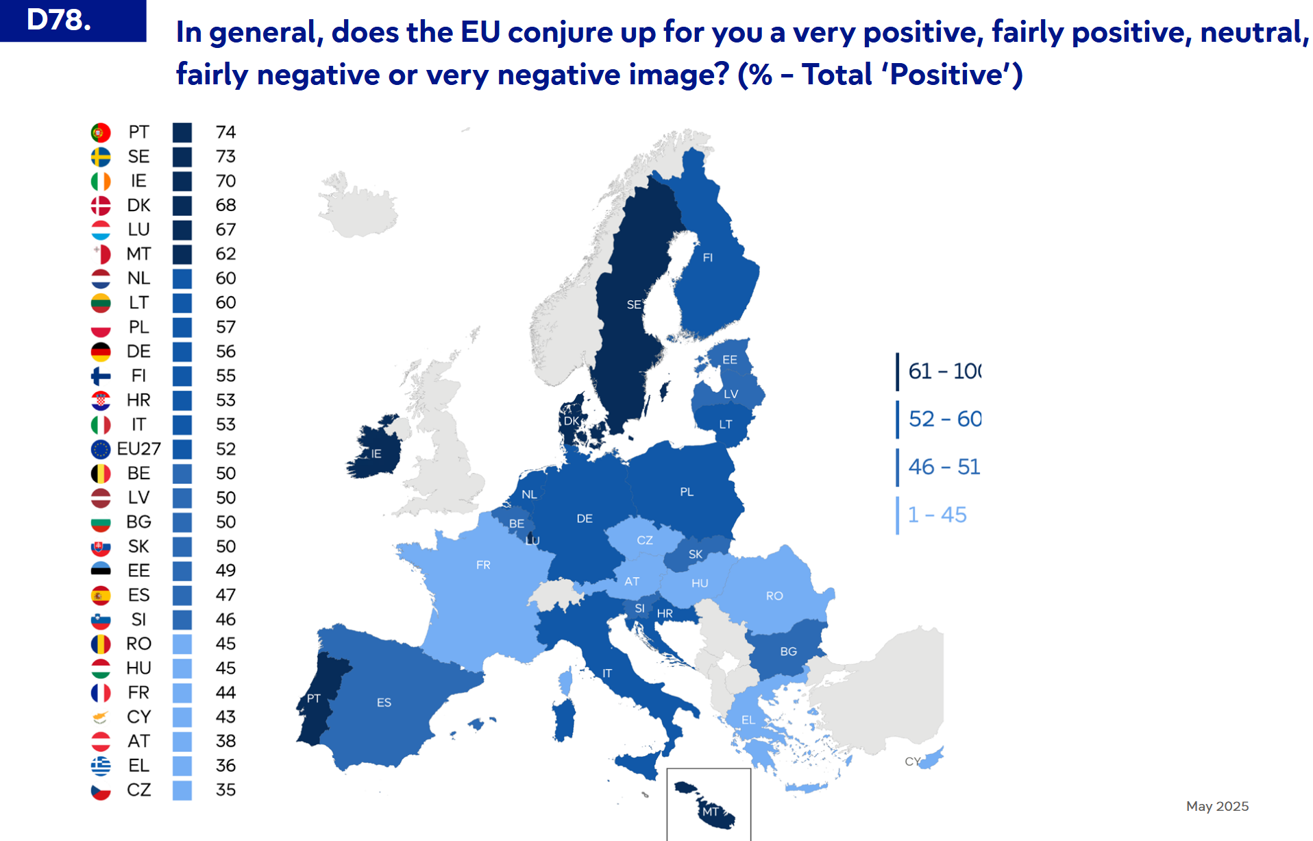
EU Attitude Map by Member States 2025
The recently released Eurobarometer 2025 visualization outlines the attitudes towards the European Union across its memb...
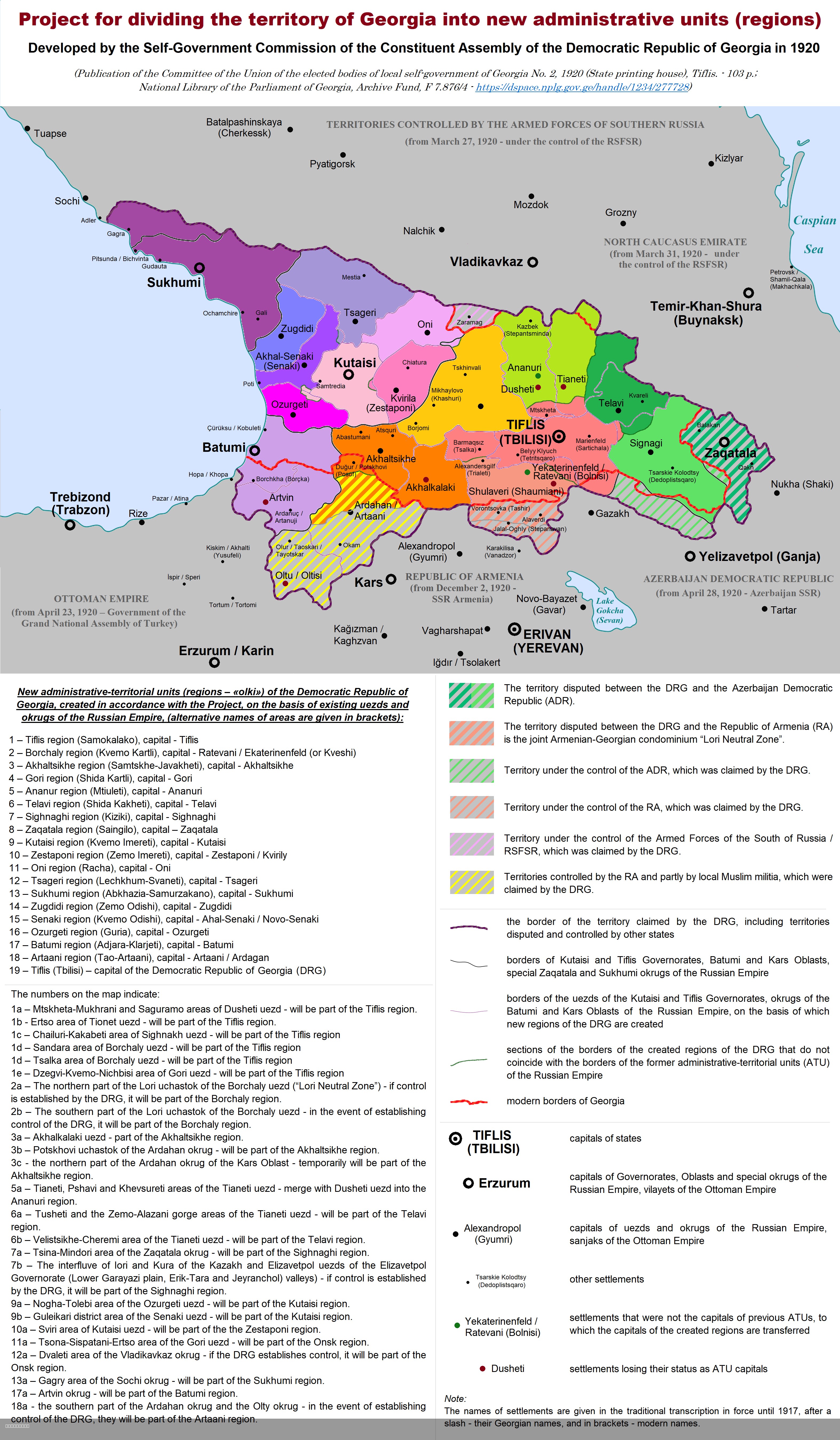
Administrative Divisions of Democratic Republic of Georgia Map
This map illustrates the division of the territory of the Democratic Republic of Georgia (DRG) into new administrative u...
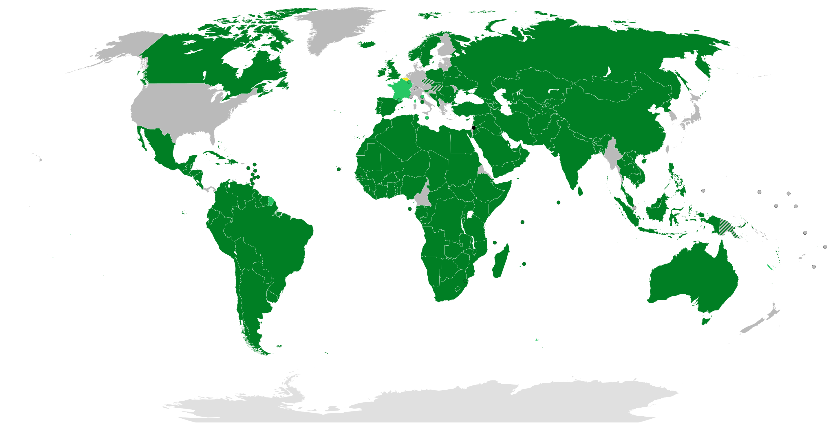
State of Palestine Recognition Status Map
The "State of Palestine Recognition Status (21st September 2025)" map visually illustrates the global recognition of Pal...
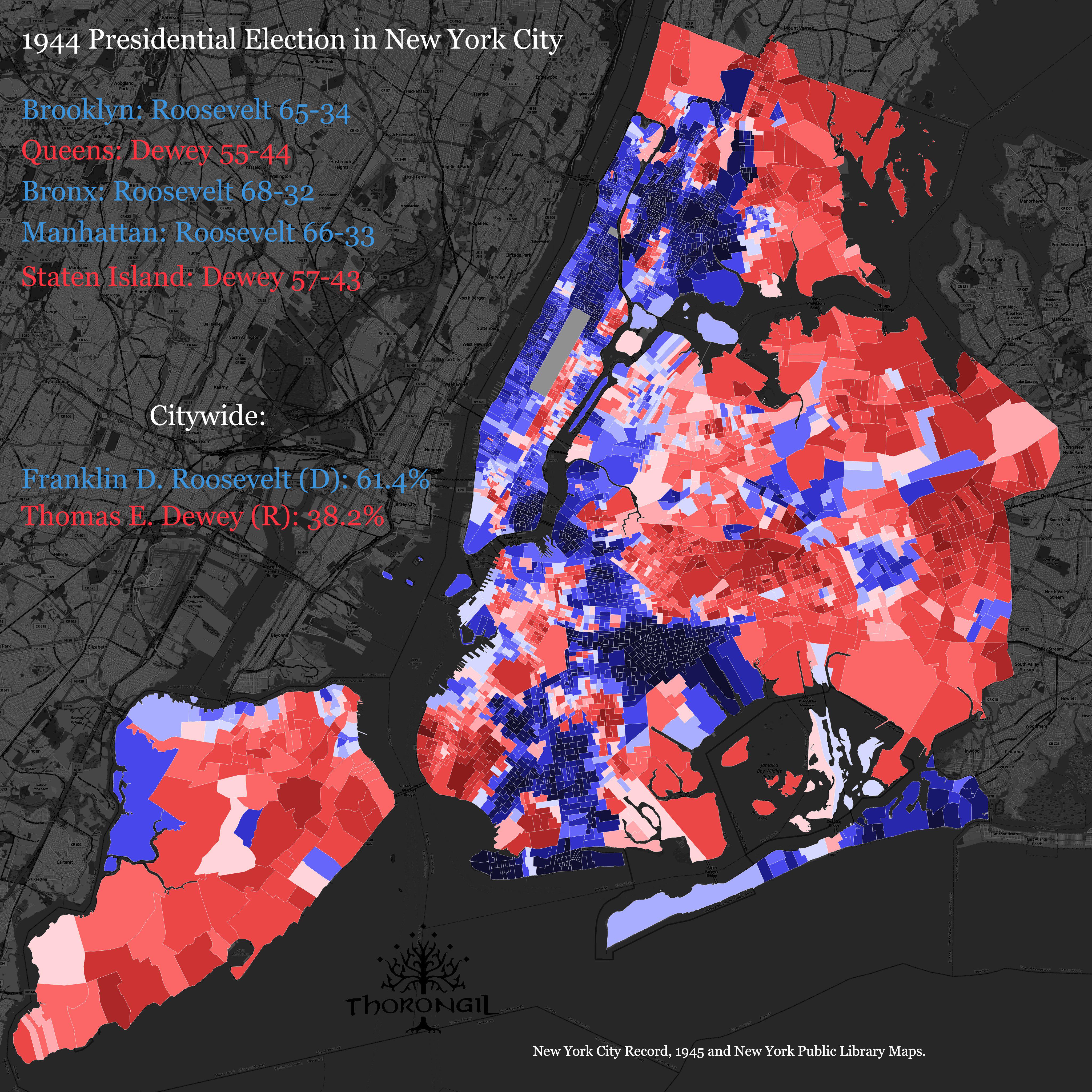
1944 Presidential Election Results Map of NYC
The "1944 Presidential Election Results Map of NYC" provides a visualization of how different neighborhoods and boroughs...
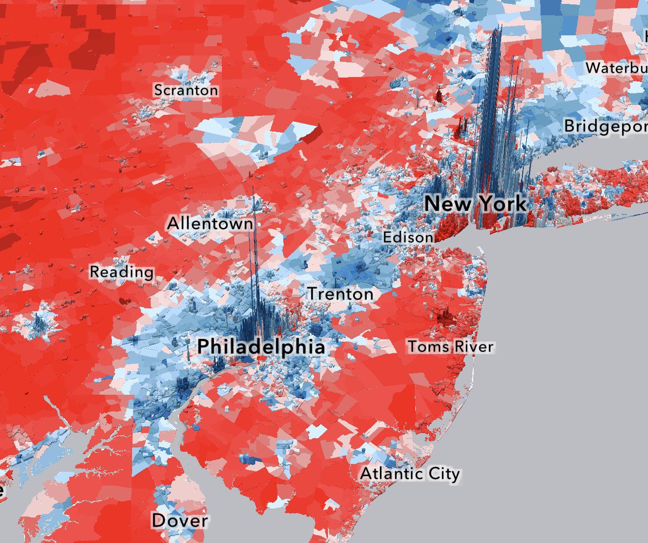
2024 Presidential Election Demographics Map
Race also plays a pivotal role in electoral dynamics. The map indicates that neighborhoods with significant populations ...
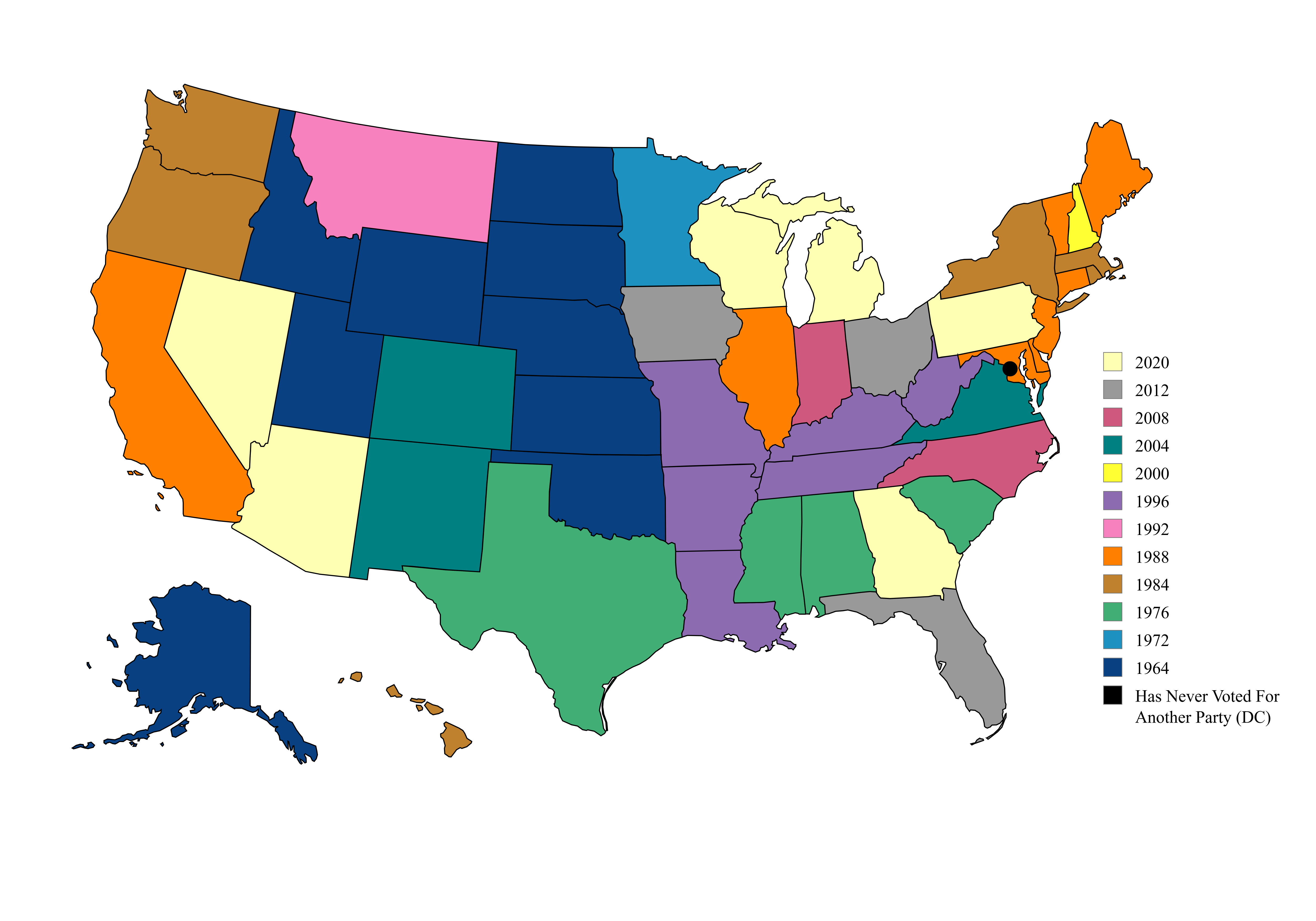
Map of US Presidential Election Party Switches
This map illustrates a fascinating political phenomenon in the United States: the last presidential election in which ea...
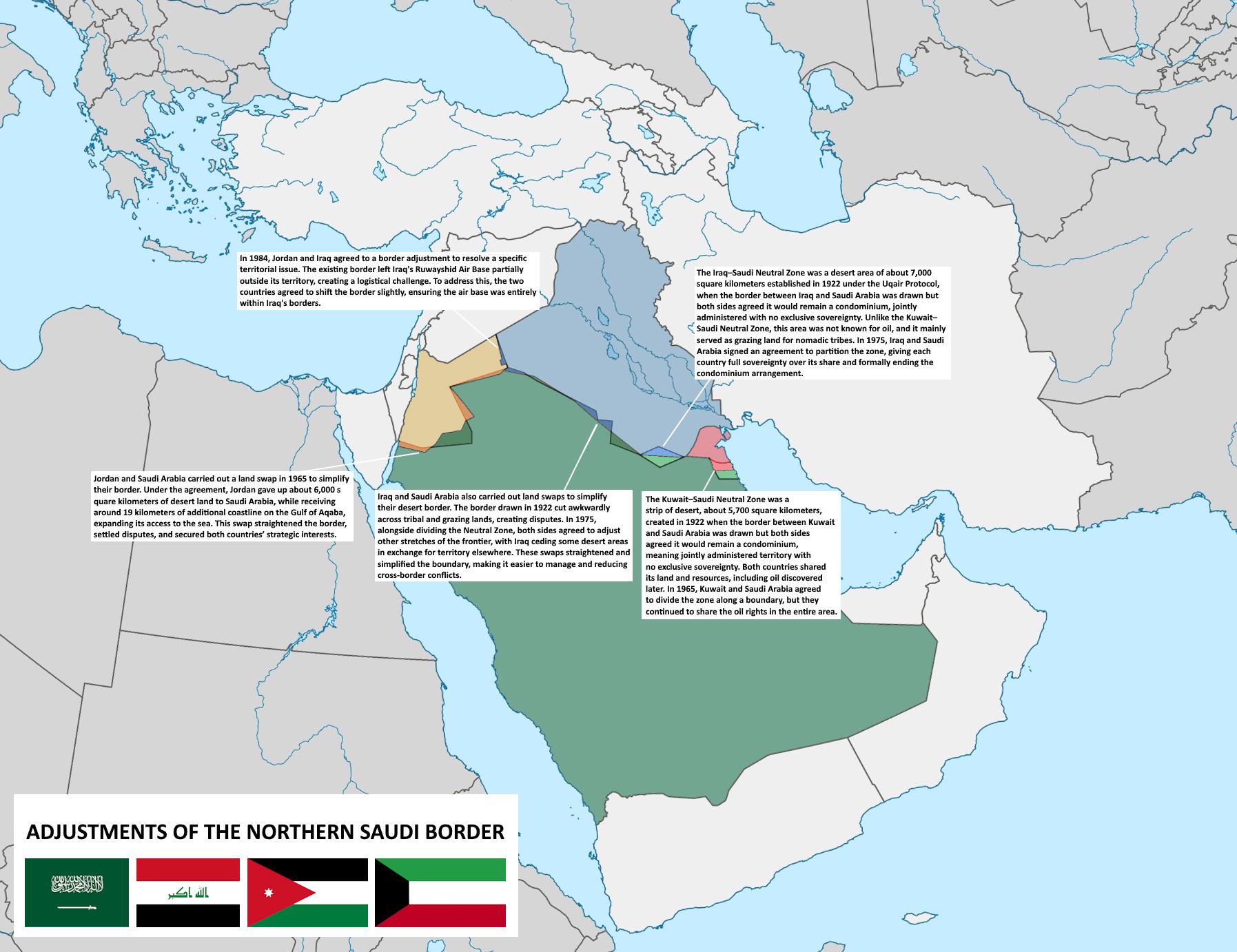
Map of Adjustments to Northern Saudi Borders
The map titled \...
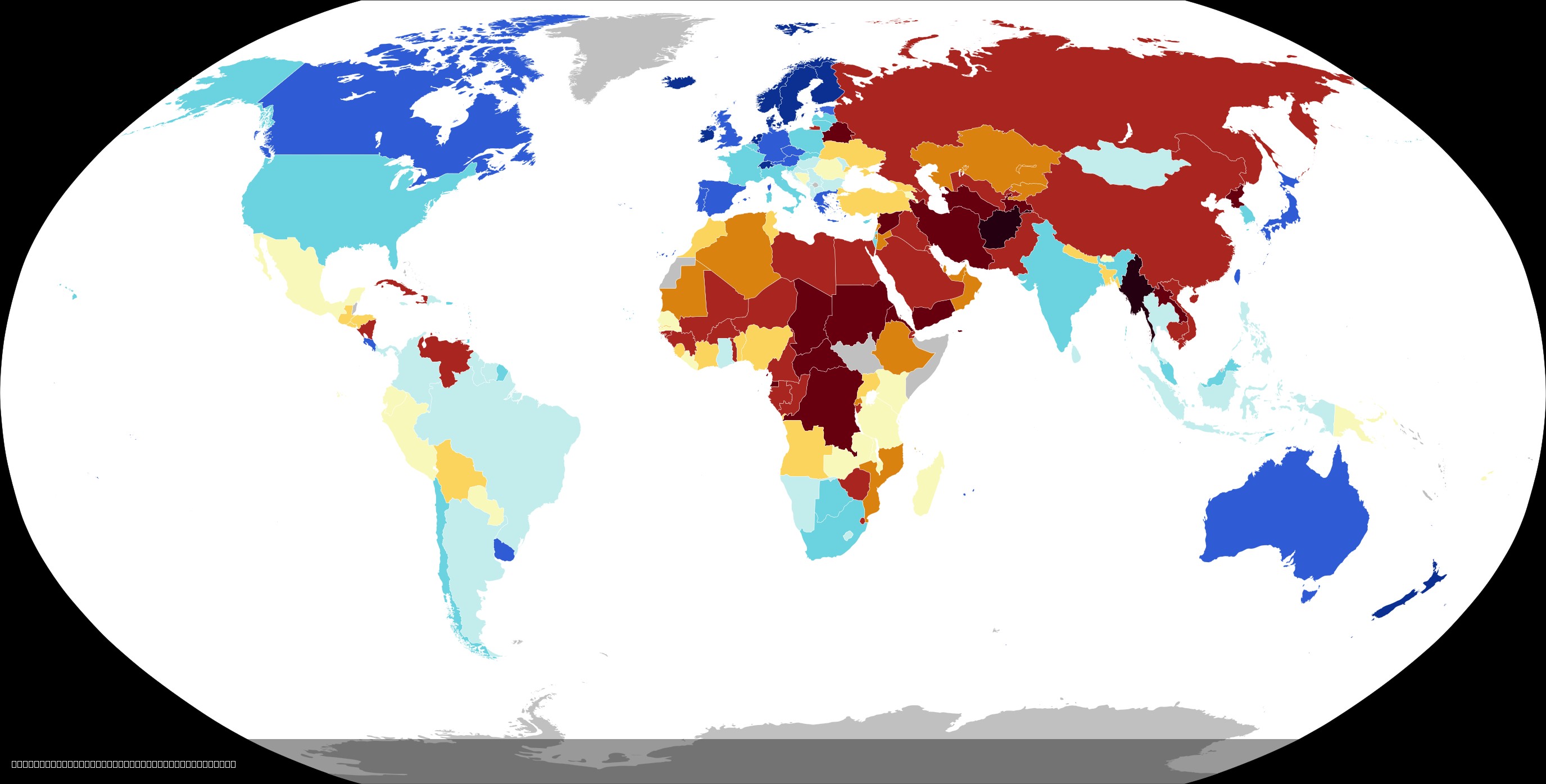
2024 Democracy Index Map by Country
The 2024 Economist Intelligence Unit Democracy Index map provides a comprehensive overview of the state of democracy aro...
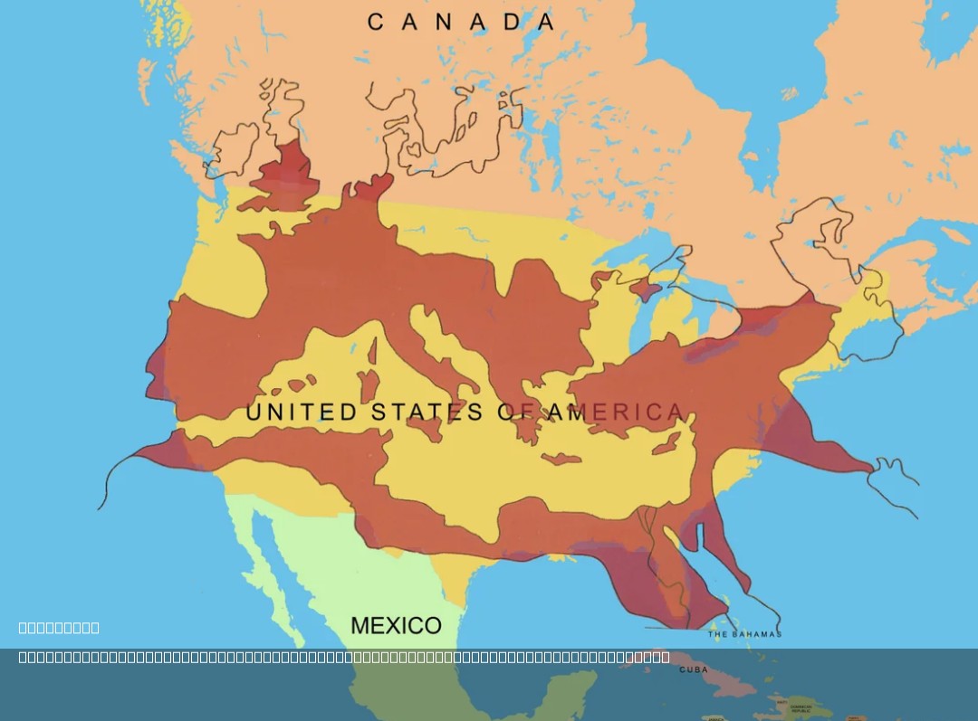
Roman Empire Size Comparison Map with USA
The map titled "The Size of the Roman Empire at Its Height Compared to the United States" visually compares the vast ter...