European Political Map from the 1920s

David Chen
Data Visualization Specialist
David Chen is an expert in transforming complex geographic datasets into compelling visual narratives. He combines his background in computer science ...
Geographic Analysis
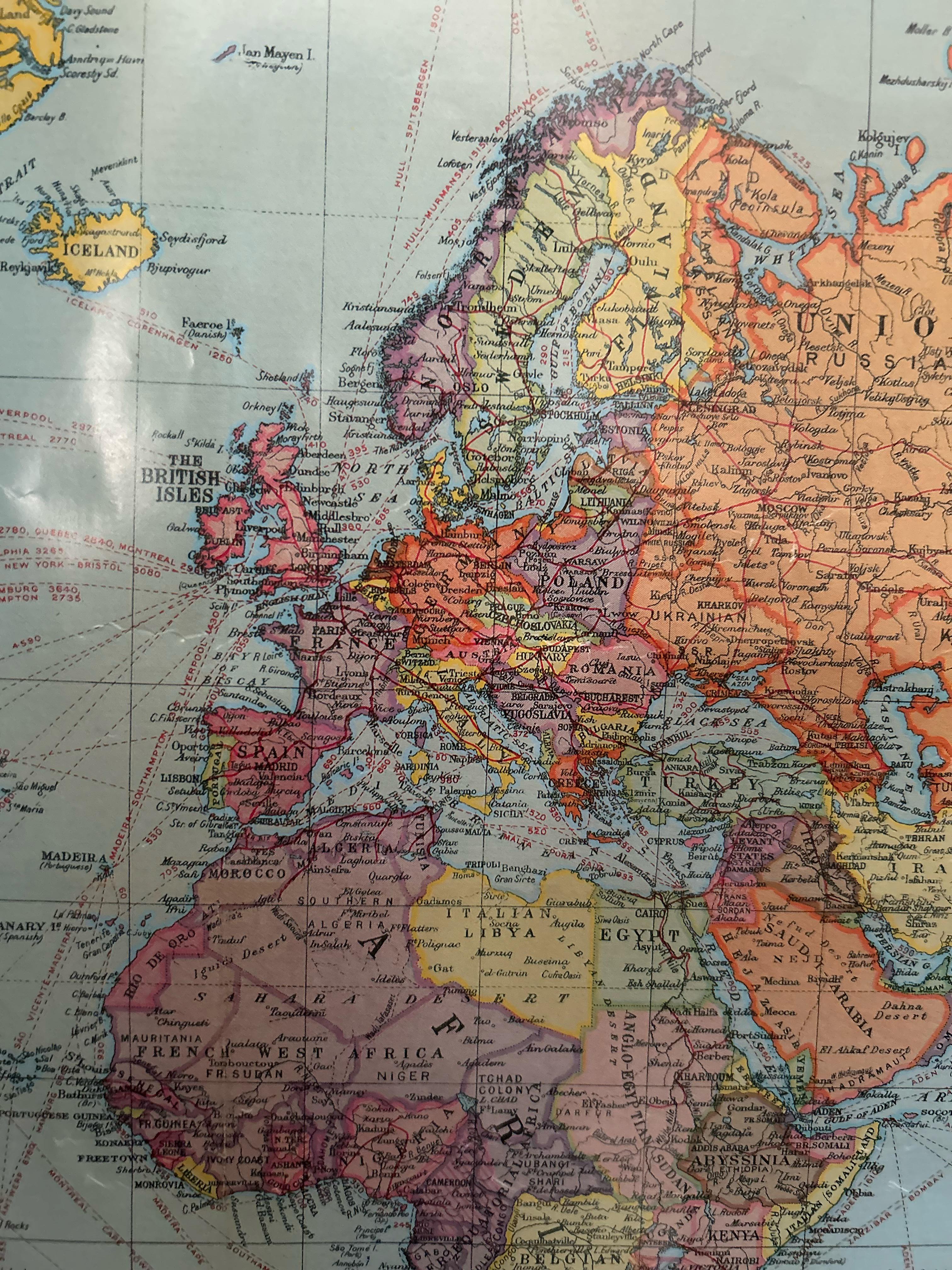
What This Map Shows\nThis visualization presents a political map of Europe from the 1920s, likely around 1925, capturing a crucial period in the continent's history. We can see the boundaries of countries as they were shortly after World War I, as well as the emerging political dynamics that would shape Europe in the decades to come. Notably, the map includes significant cities like Leningrad, now known as Saint Petersburg, which hints at the shifting political landscape following the Russian Revolution. At the same time, Ireland's status as part of the British Empire reflects the colonial realities of the time.
Deep Dive into European Political Changes in the 1920s\nThe decade of the 1920s was marked by significant political transitions across Europe, with the aftermath of World War I creating a landscape of new nations, shifting borders, and various forms of governance. The Treaty of Versailles in 1919 led to the disintegration of empires, such as the Austro-Hungarian and Ottoman Empires, paving the way for new states like Czechoslovakia and Yugoslavia. Interestingly, the map illustrates the complexities of national identity and territorial claims that arose from these changes.
In this period, countries like Poland regained their independence after over a century of partition, while others like Hungary were left with significantly reduced territories. The League of Nations was established in 1920 with the hope of preventing further conflicts, and this map serves as a snapshot of the nations involved in this new international organization.
Moreover, the political landscape was not merely about territorial boundaries; it was also about the ideologies that were on the rise. Fascism began to take root in Italy under Mussolini, while Bolshevism was asserting its influence in Russia. The ideological divide would later become a defining feature of European politics, setting the stage for World War II.
This era also witnessed the rise of nationalism, where many ethnic groups sought self-determination. For instance, the map indicates regions with significant ethnic minorities, such as the Hungarians in Transylvania and the Czechs and Slovaks in Czechoslovakia, leading to tensions that would eventually erupt into conflicts.
Regional Analysis\nWhen examining different regions depicted in the map, we can observe varying political climates and national sentiments. For instance, Western Europe, including countries like France and the UK, was relatively stable, enjoying economic recovery and a return to normalcy after the war. The map shows these nations as firmly established with clear borders, yet emerging tensions were brewing in the East.
Central and Eastern Europe reveal a patchwork of new nation-states, each grappling with identity and governance. The map highlights the newly formed nations and their often precarious positions. Countries like Latvia and Lithuania emerged from the shadows of the Russian Empire, but their viability was constantly threatened by larger powers seeking to dominate the region.
In the Balkans, the map delineates the complex mosaic of ethnic groups, and the formation of Yugoslavia aimed to unify these groups under a single national identity. However, underlying ethnic tensions foreshadowed future conflicts, as seen during the Yugoslav Wars in the 1990s.
Interestingly, Ireland’s depiction as part of the British Empire in the 1920s contrasts sharply with its later independence following the Anglo-Irish Treaty of 1921. This highlights the ongoing struggle for self-determination that characterized many regions during this time.
Significance and Impact\nUnderstanding the political map of Europe in the 1920s is crucial as it lays the foundation for many of the conflicts and alliances that would shape the 20th century. The ideological battles that emerged from this period—between democracy, fascism, and communism—set the stage for further global conflicts, including World War II and the Cold War.
Moreover, the map serves as a reminder of the fragility of national boundaries and the complexities of ethnic identities. In today's context, many of the issues surrounding nationalism, ethnic conflict, and territorial disputes can be traced back to the political decisions made in the aftermath of World War I. As we witness ongoing debates about national sovereignty and self-determination in various parts of the world, reflecting on the lessons from this historical map becomes increasingly relevant.
In summary, the political map of Europe from the 1920s not only depicts geographical outlines but also encapsulates the tumultuous socio-political currents of the time. It encourages us to ask how history informs our present and shapes our future as nations navigate the challenges of identity, governance, and cooperation.
Visualization Details
- Published
- September 27, 2025
- Views
- 52
Comments
Loading comments...