european history Maps
38 geographic visualizations tagged with "european history"
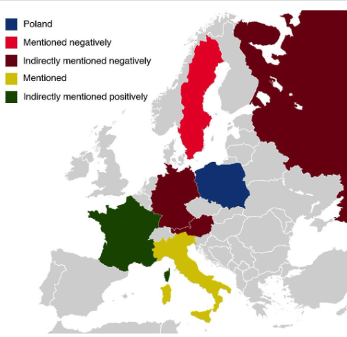
Countries Mentioned in the Polish National Anthem Map
The map titled "All The Countries Mentioned In The Polish National Anthem" provides a unique geographical insight into t...
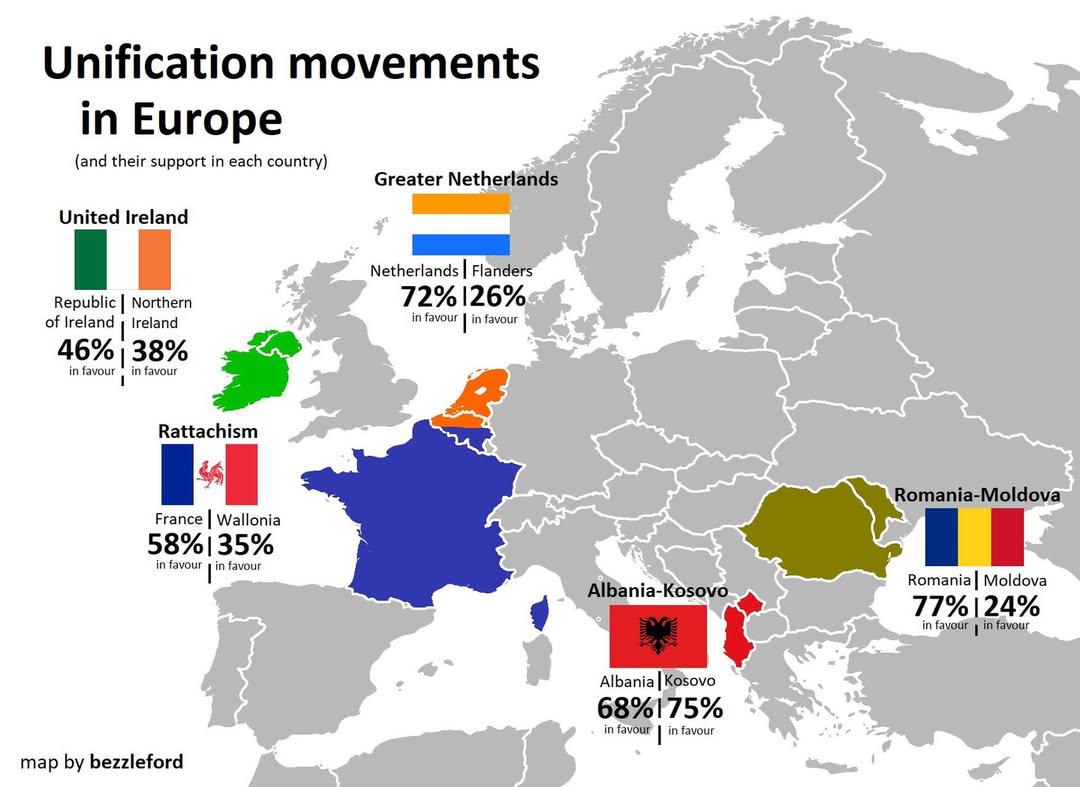
European Unification Movements Map
The "European Unification Movements Map" provides a visual representation of the various movements advocating for the po...
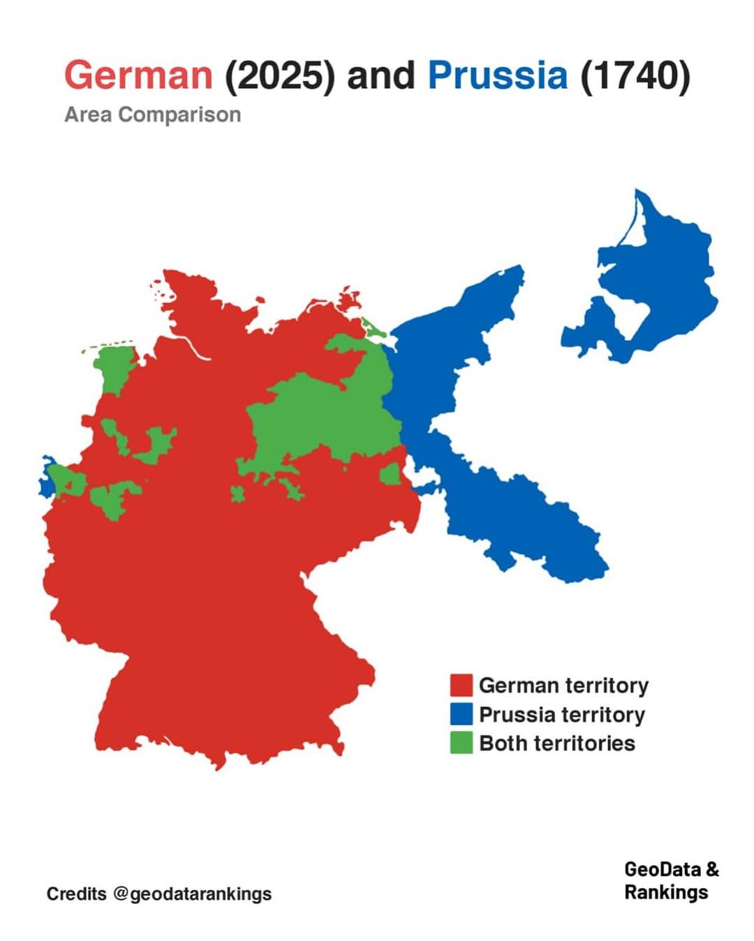
Germany and Prussia Area Comparison Map
The map titled "Germany in 2025 and Prussia in 1740 area comparison" visually represents the territorial extent of moder...
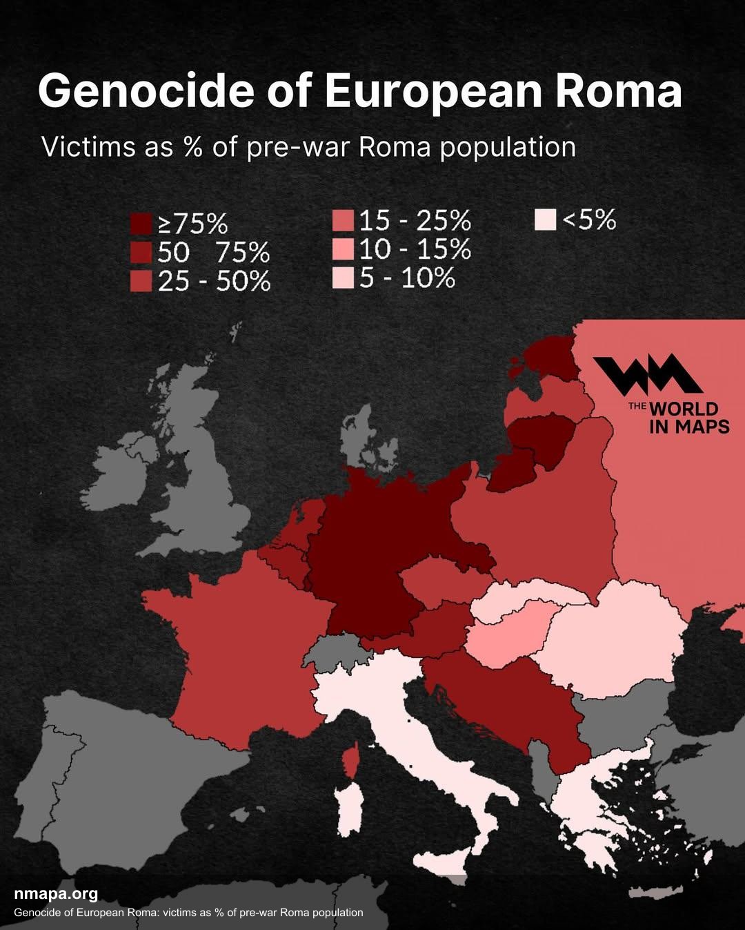
Genocide of European Roma Victims Map
The "Genocide of European Roma: Victims as % of Pre-war Roma Population" map provides a stark visual representation of t...
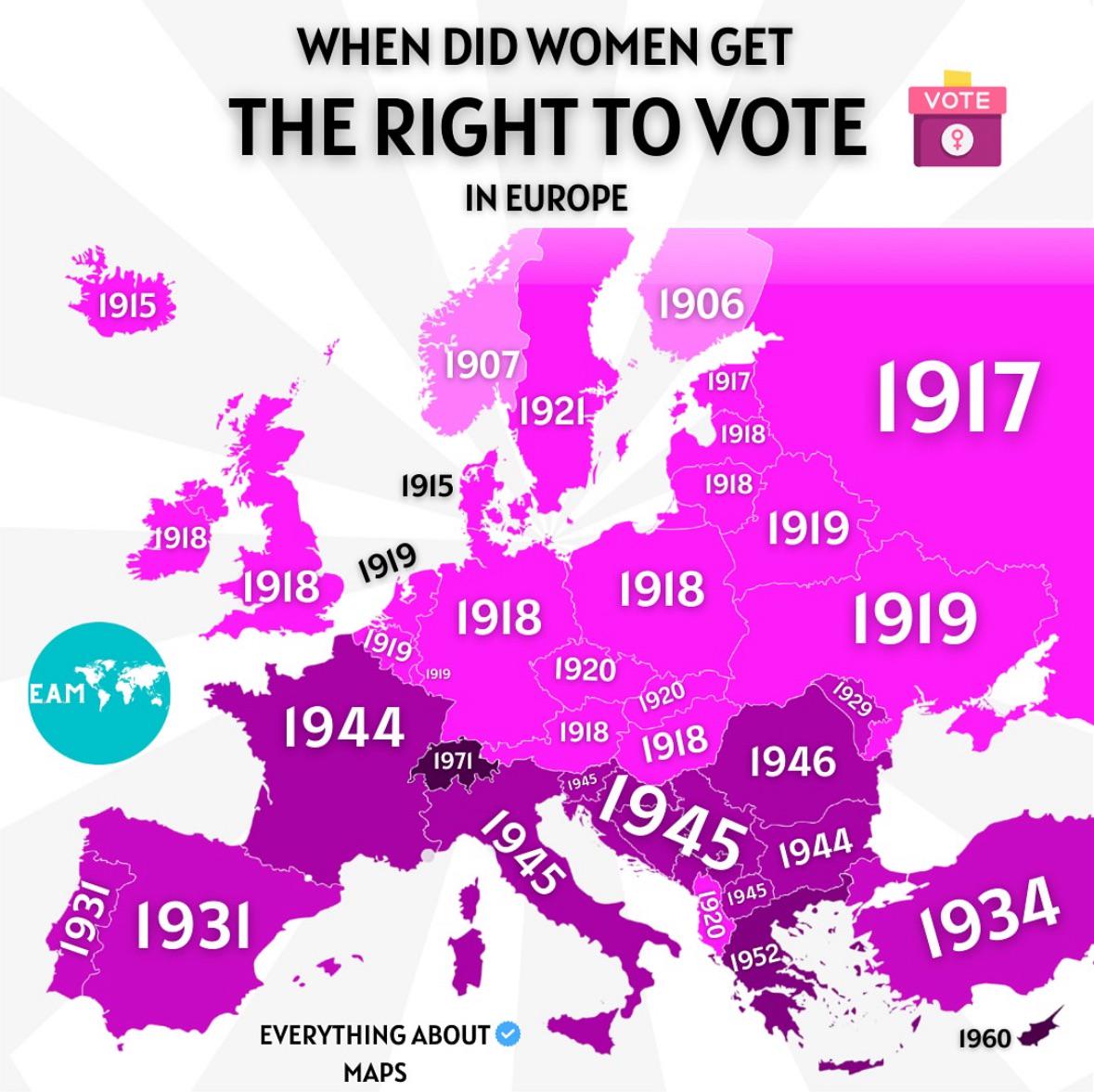
Voting Rights for Women in Europe Map
The map titled "When Did Women Get The Right To Vote in Europe" provides a comprehensive overview of the timeline of wom...
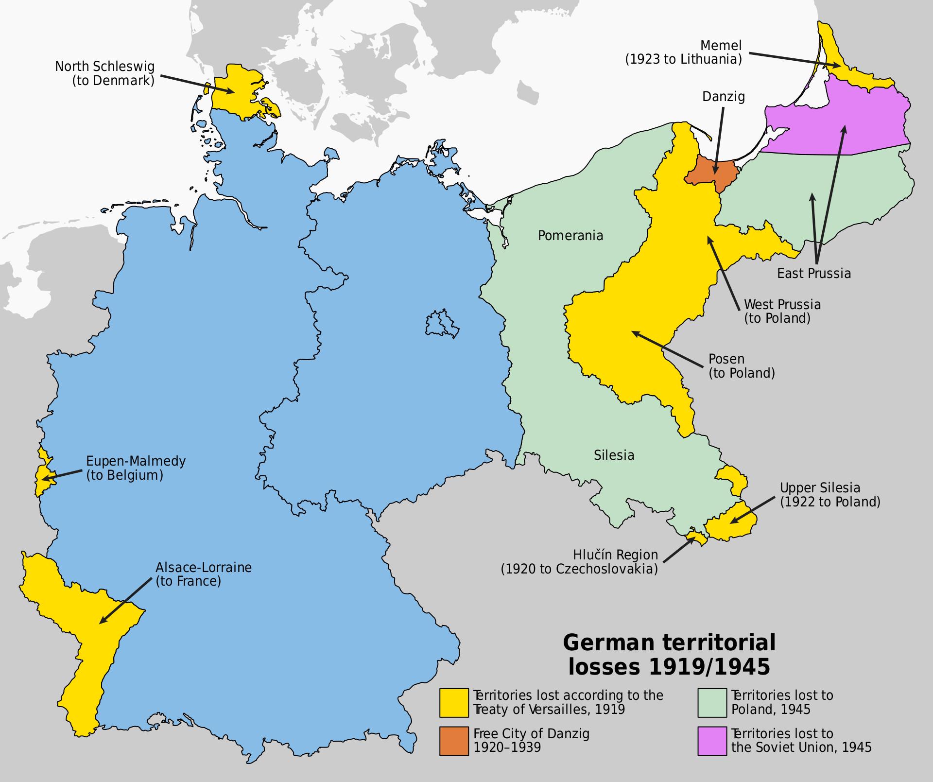
Map of Germany's Territorial Losses After World War Defeats
This map illustrates the significant territorial losses Germany faced following its defeats in both World War I and Worl...
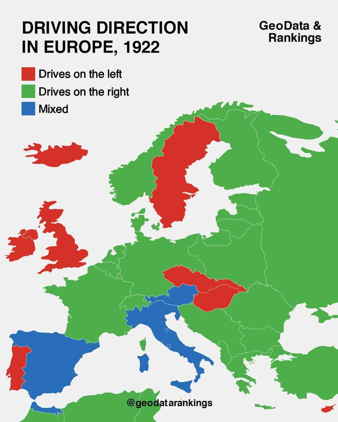
Driving Direction Map in Europe, 1922
The "Driving Direction Map in Europe, 1922" is a fascinating historical document that reveals the driving conventions an...
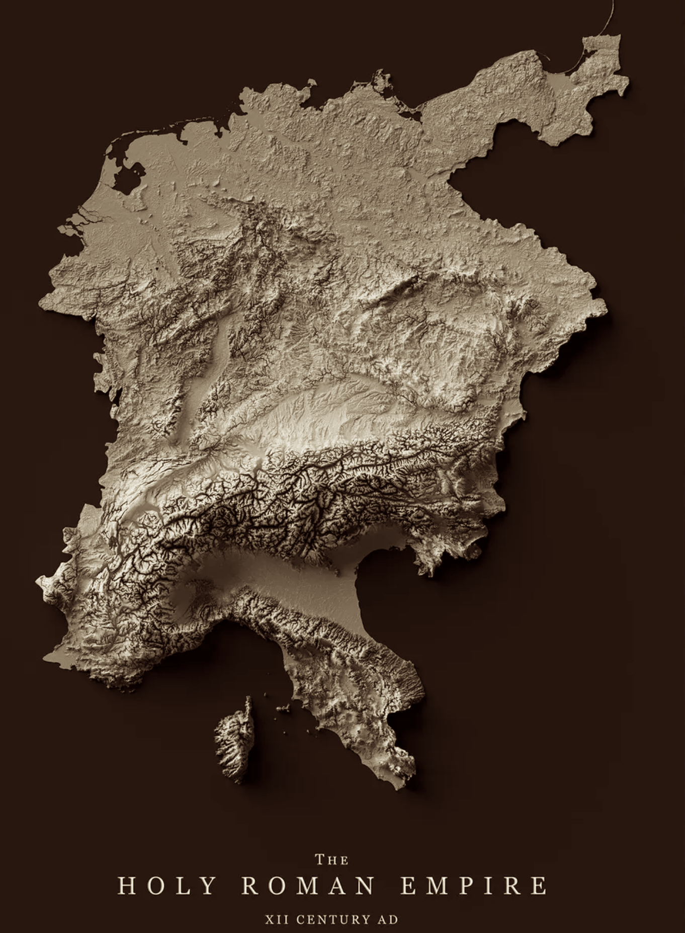
Relief Map of the Holy Roman Empire 12th Century
The relief map of the Holy Roman Empire in the 12th century provides a vivid representation of the geographical features...
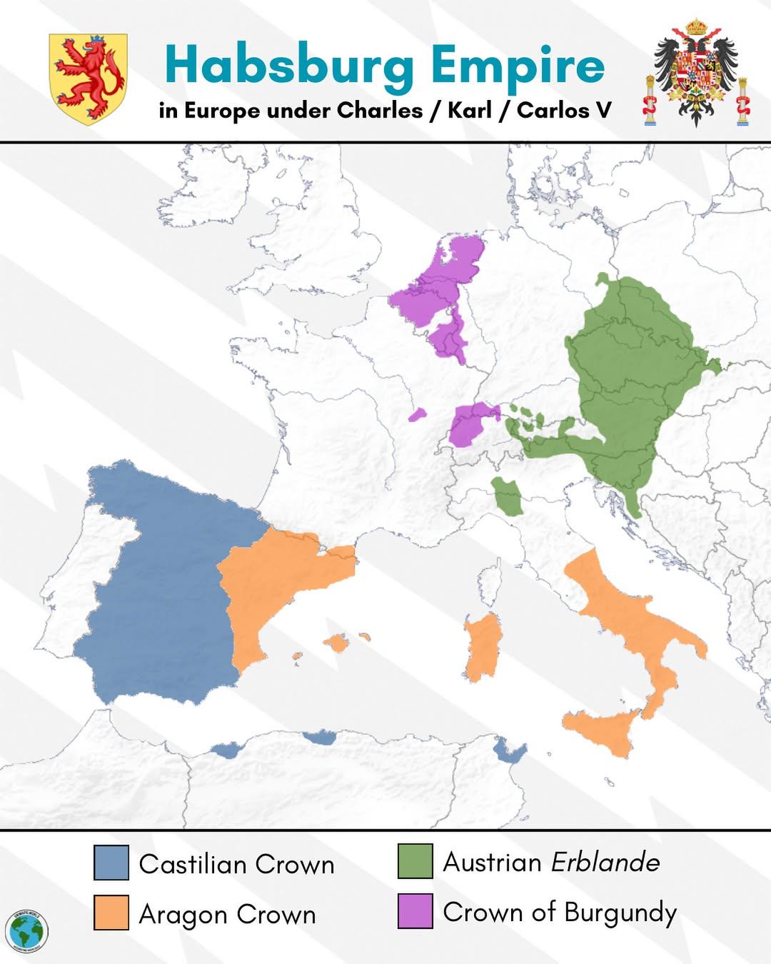
Habsburg Empire Map of Europe under Charles V
The map titled "The Habsburg Empire in Europe under Charles V" provides a detailed visualization of the vast territories...
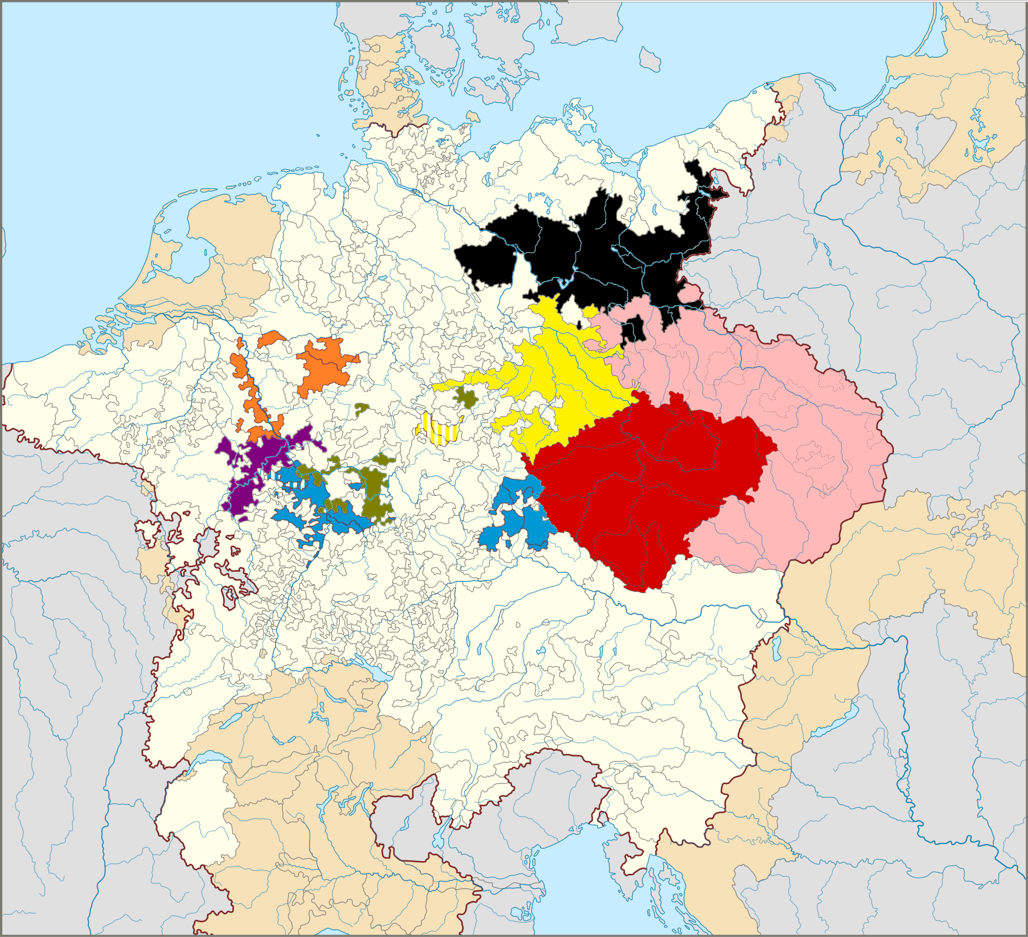
Map of The Seven Prince Electors in Germany
This map illustrates the territories of the Seven Prince Electors, who played a crucial role in the election of the Empe...
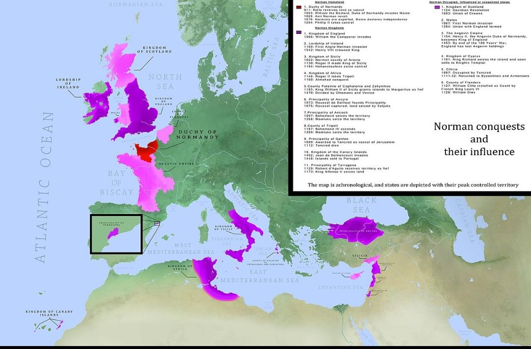
Map of Norman Conquests in History
This map illustrates the extensive territories conquered by the Normans throughout history, providing a visual represent...
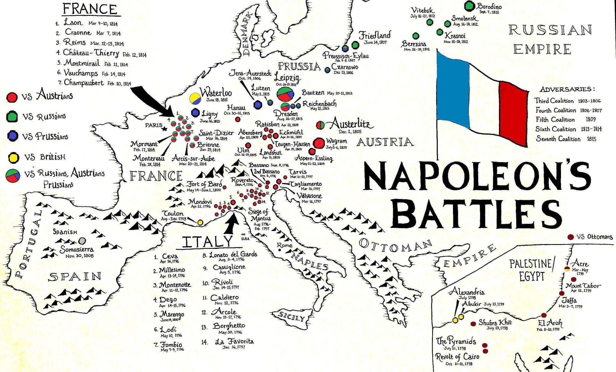
Napoleon's Battles Map
The "Napoleon's Battles Map" provides a comprehensive overview of the key military engagements led by Napoleon Bonaparte...
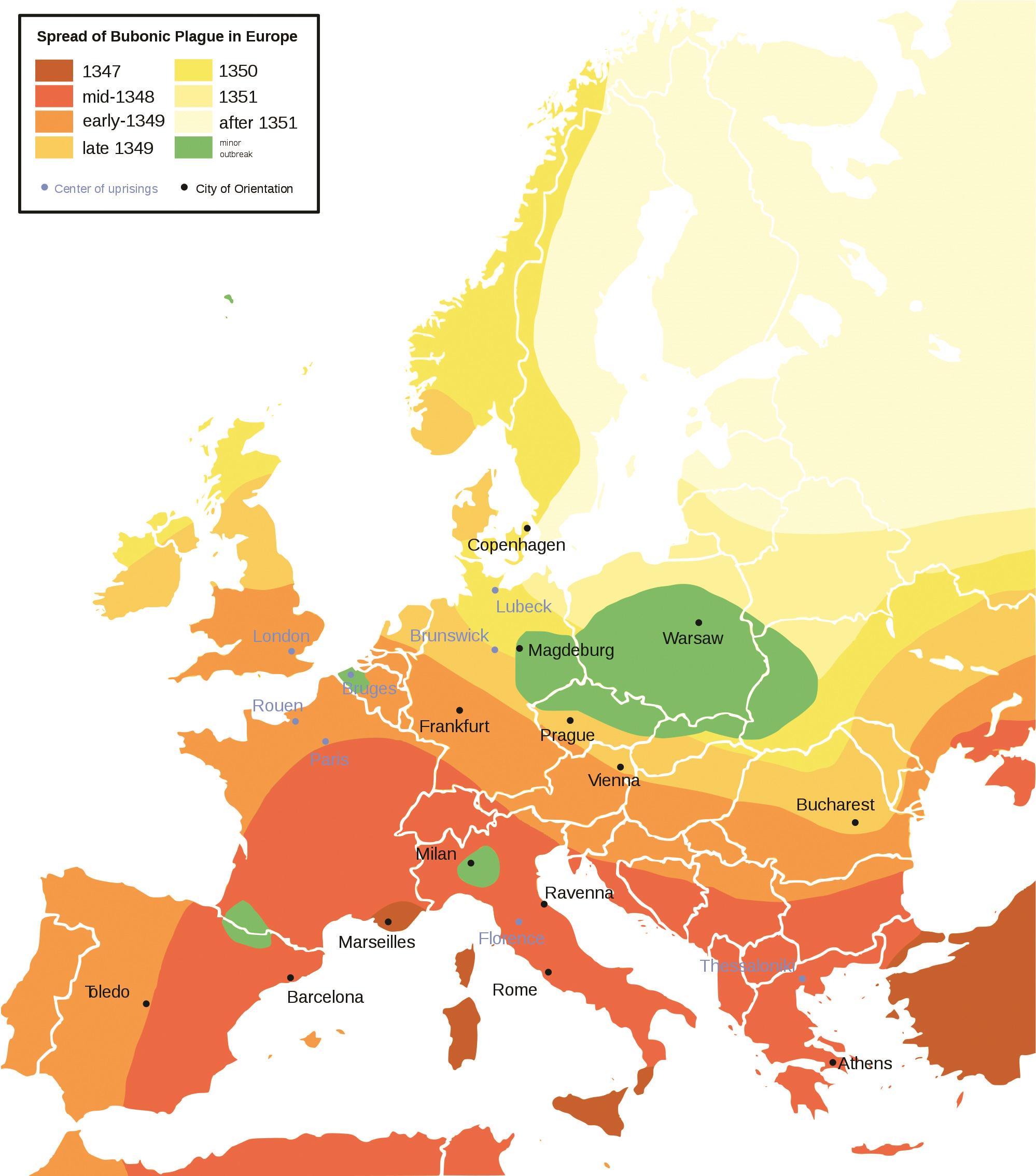
Spread of the Bubonic Plague in Europe Map
This map visually represents the spread of the Bubonic Plague across Europe during the 14th century, specifically highli...
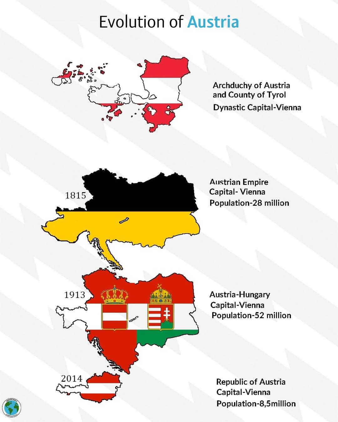
Historical Evolution of Austria Map
The "Historical Evolution of Austria" map provides a comprehensive overview of the territorial changes that Austria has ...
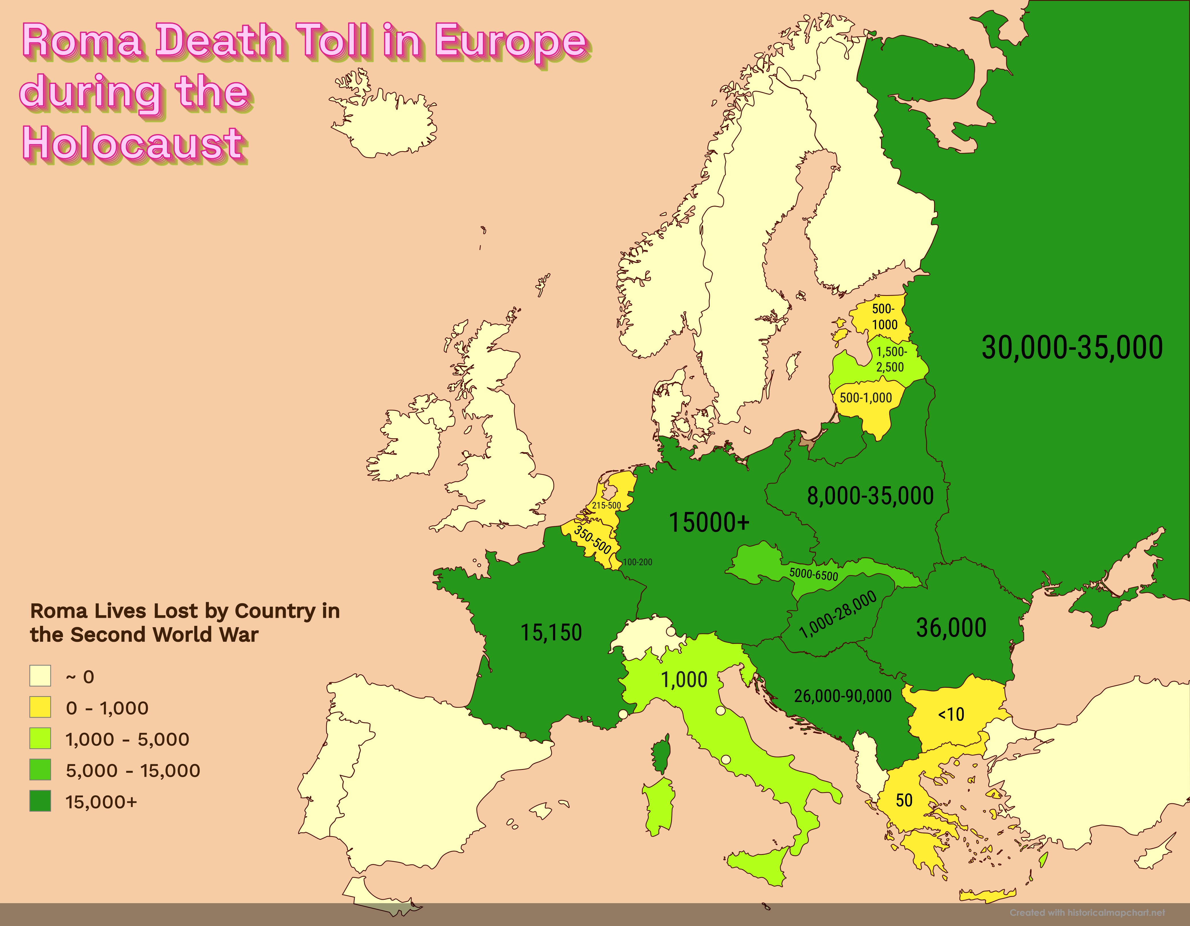
Roma Death Toll in Europe during the Holocaust Map
This powerful visualization highlights the estimated death toll of Roma people across various European countries during ...
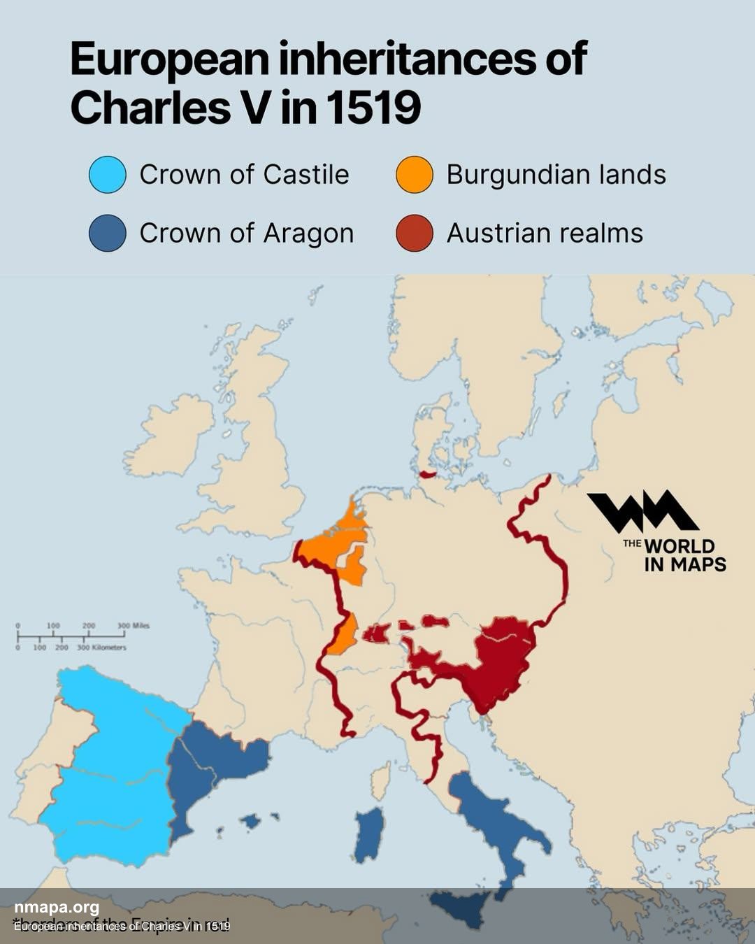
European Inheritances of Charles V in 1519 Map
This map illustrates the vast and complex territories inherited by Charles V in 1519, depicting the extensive European d...
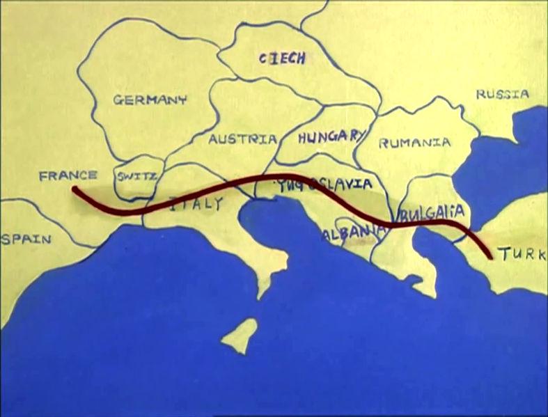
Map of Europe c. 1985 in The Transformers
...
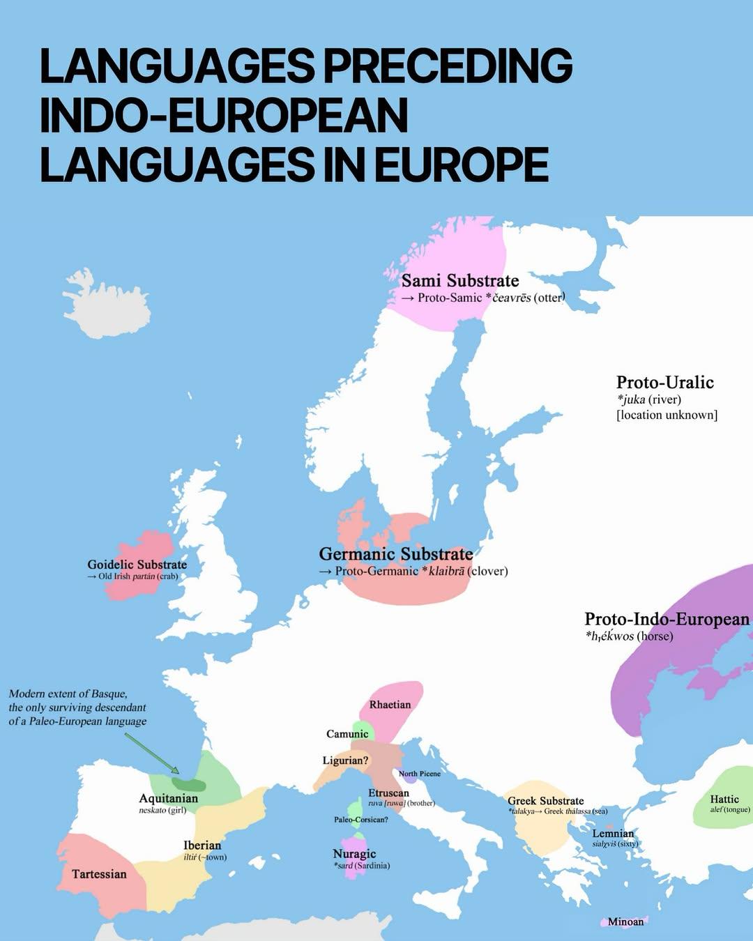
Map of Pre-Indo-European Languages in Europe
This map provides a visual representation of the various languages that existed in Europe before the arrival of Indo-Eur...
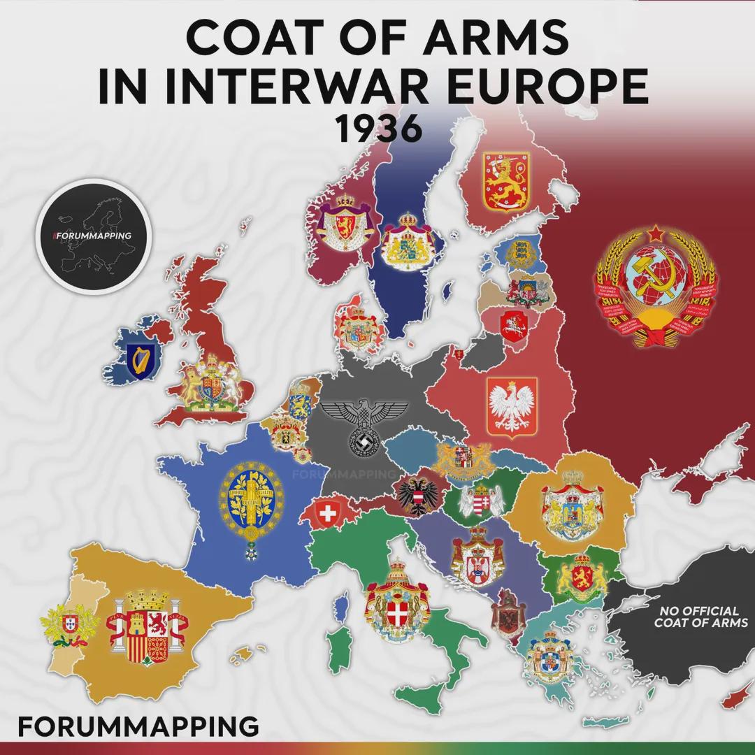
Coat of Arms in Interwar Europe Map
The visualization titled "Coat of Arms in Interwar Europe, 1936" presents a unique snapshot of European heraldry during ...
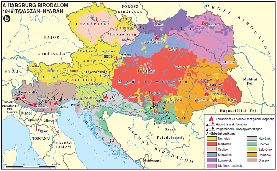
Ethnic Composition Map of the Austrian Empire 1848
The map titled "The Ethnic Make-up of the Austrian Empire in 1848" visualizes the complex tapestry of ethnic groups that...
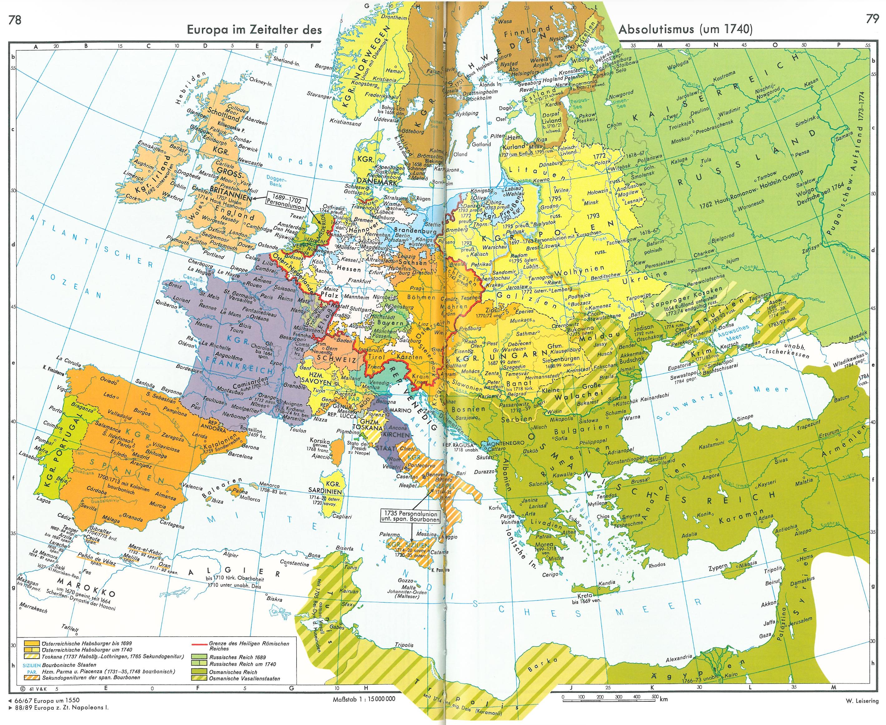
Europe in the Age of Absolutism Map
This visualization presents a detailed look at Europe as it existed in 1740, a pivotal period during the Age of Absoluti...
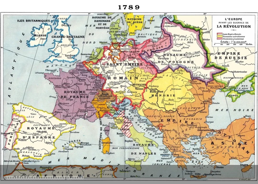
1915 French Map of Europe in 1789
The 1915 French map of Europe in 1789 offers a historical perspective on the political landscape of Europe just before t...
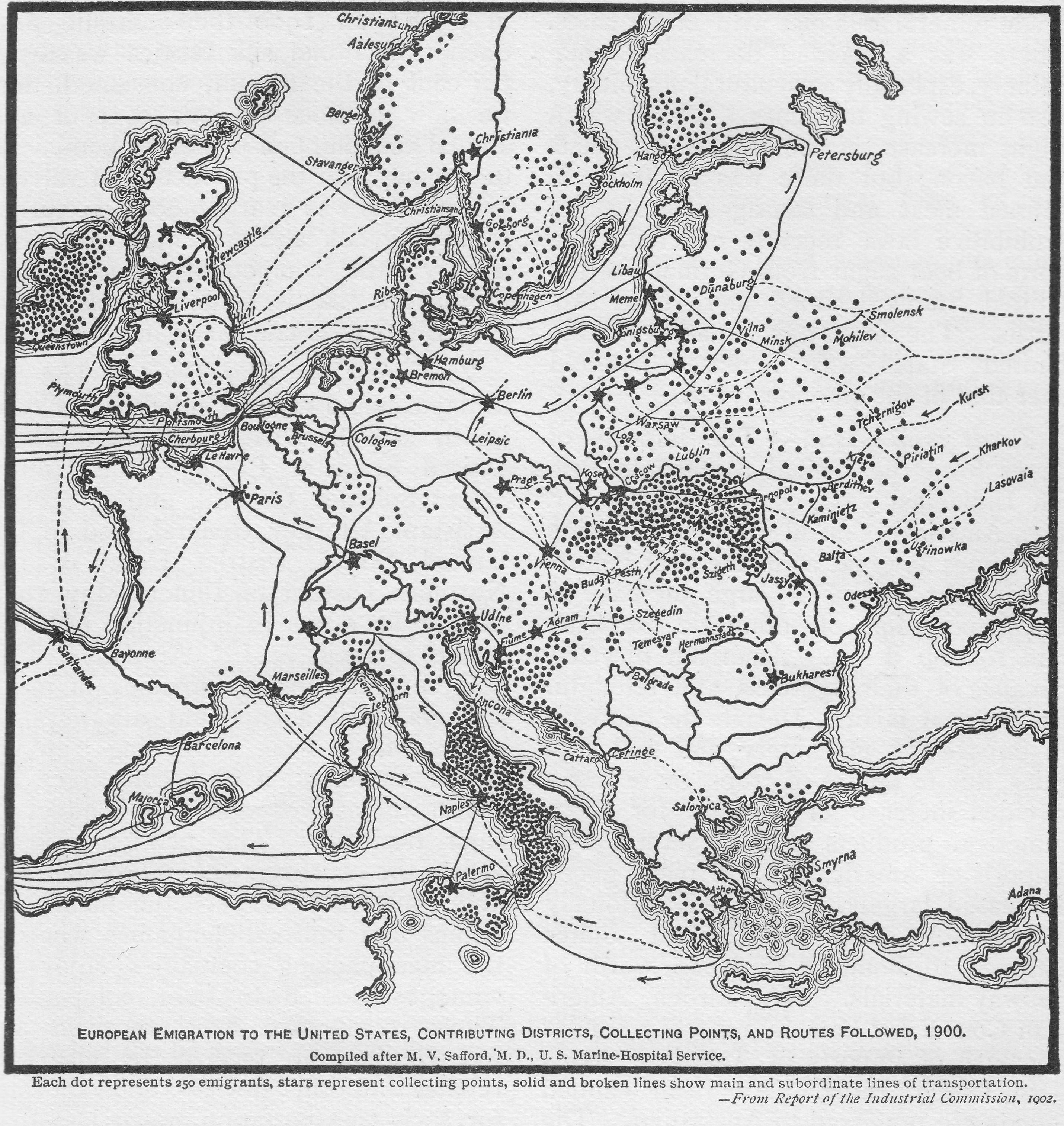
European Emigration to the USA Map
The map titled "European Emigration to the USA, 1900" provides a visual representation of the migration patterns from va...
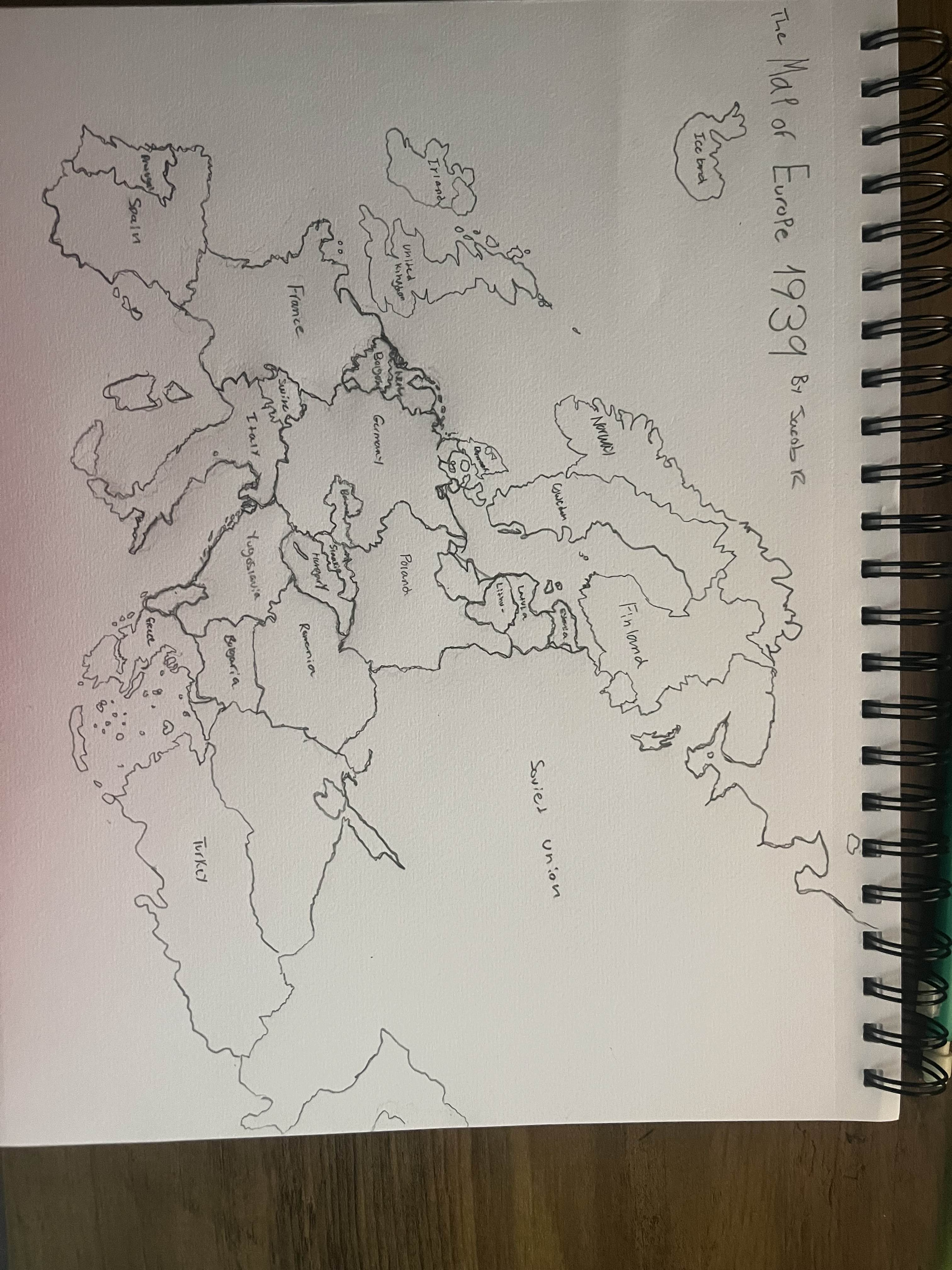
Hand Drawn Map of Europe in 1939
This hand-drawn map of Europe in 1939 visually captures the geopolitical landscape just before one of the most significa...
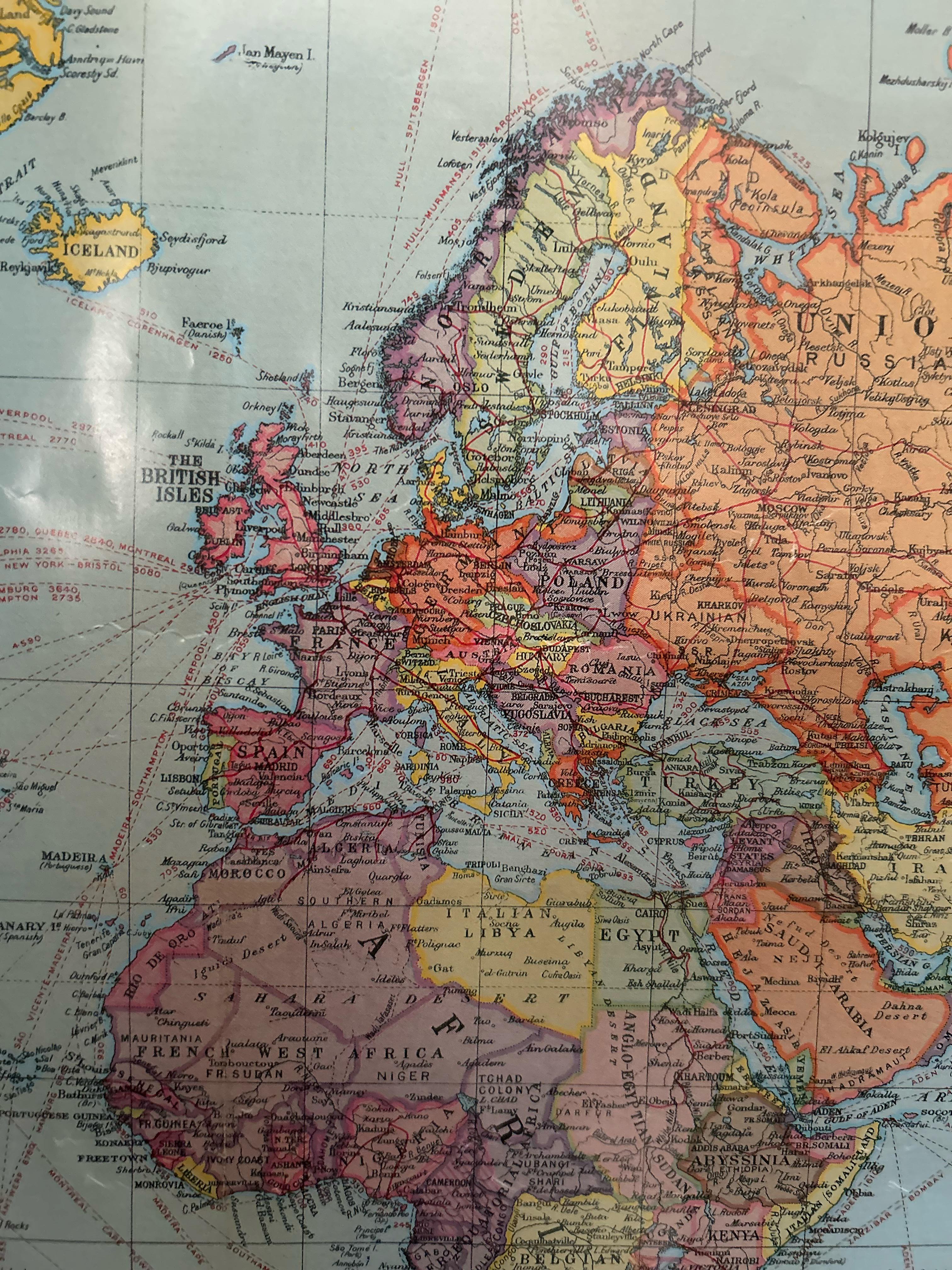
European Political Map from the 1920s
In this period, countries like Poland regained their independence after over a century of partition, while others like H...
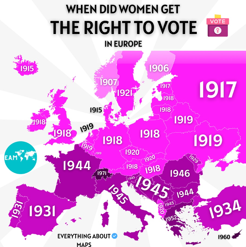
Women's Voting Rights Timeline Map in Europe
The map titled "When did women get the right to vote in Europe" provides a chronological overview of when women gained s...
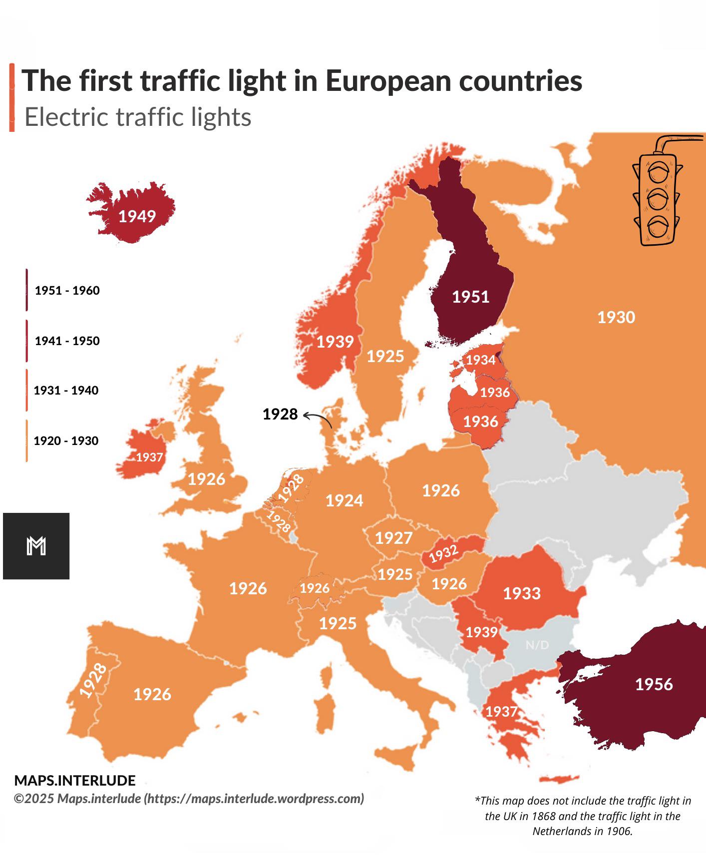
First Traffic Light Locations Map in Europe
This map outlines the locations of the first traffic lights installed in various European countries, providing a fascina...
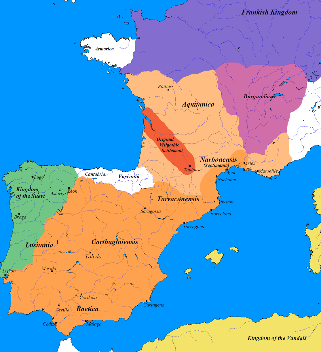
Germanic Tribes Map of France and Iberia (500 AD)
The map titled "Germanic France and Iberia (500 AD)" provides a fascinating glimpse into the landscape of post-Roman Eur...
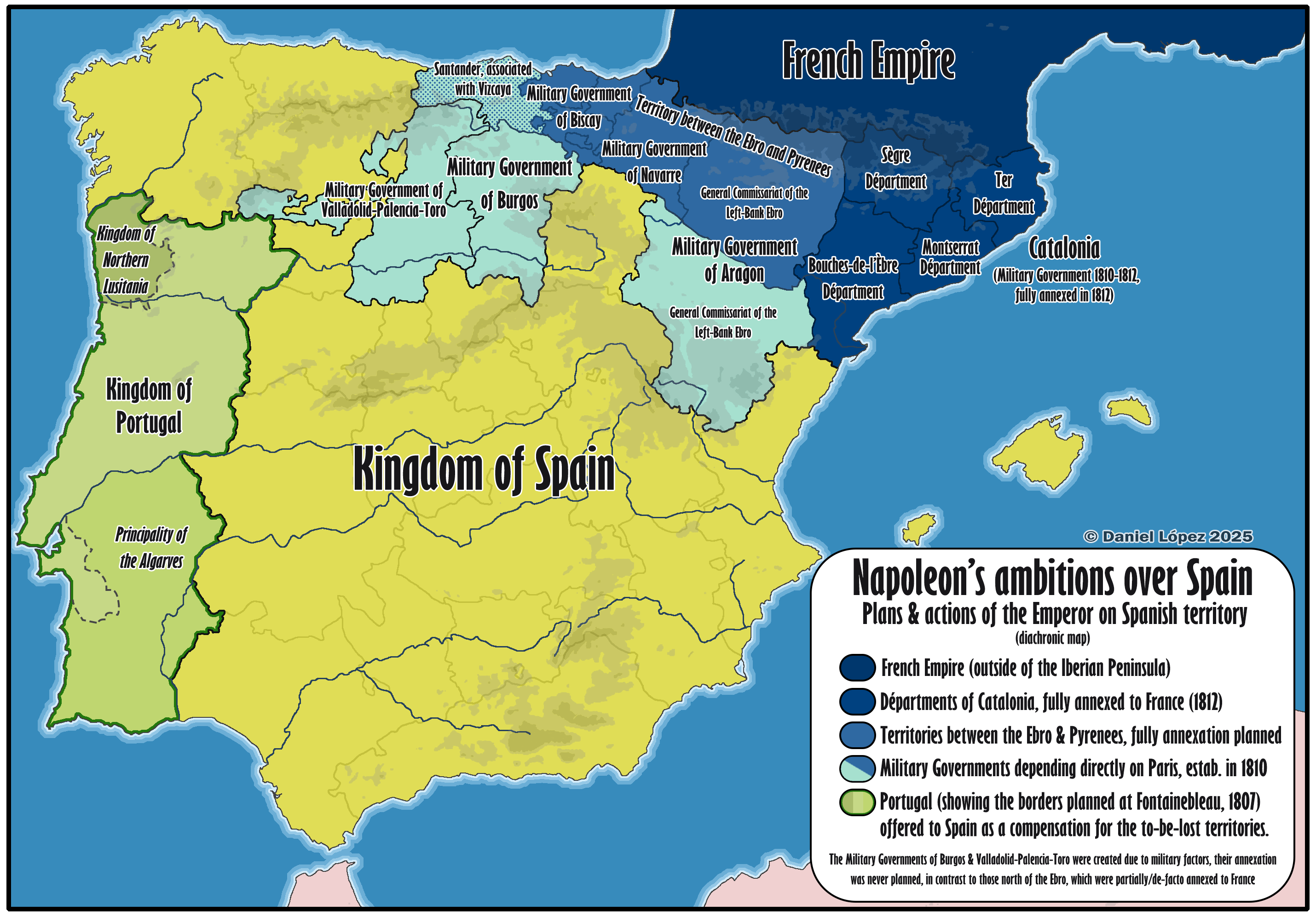
Map of Napoleon's Territorial Ambitions in Spain
...
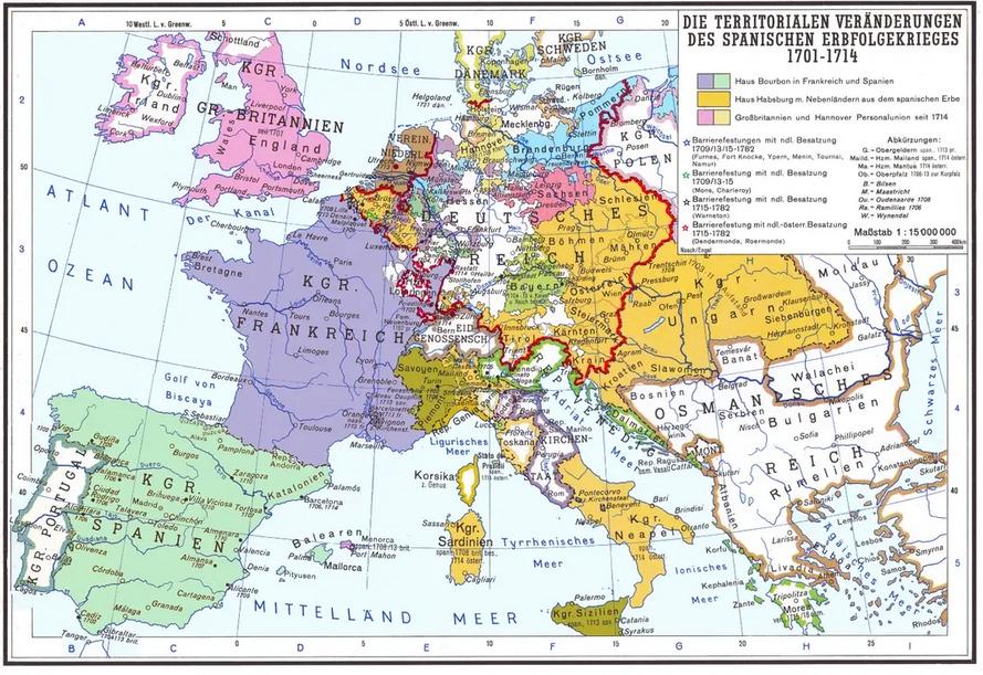
Territorial Changes After the War of Spanish Succession Map
One of the most significant results of the war was the cession of territories from Spain to various European powers. For...
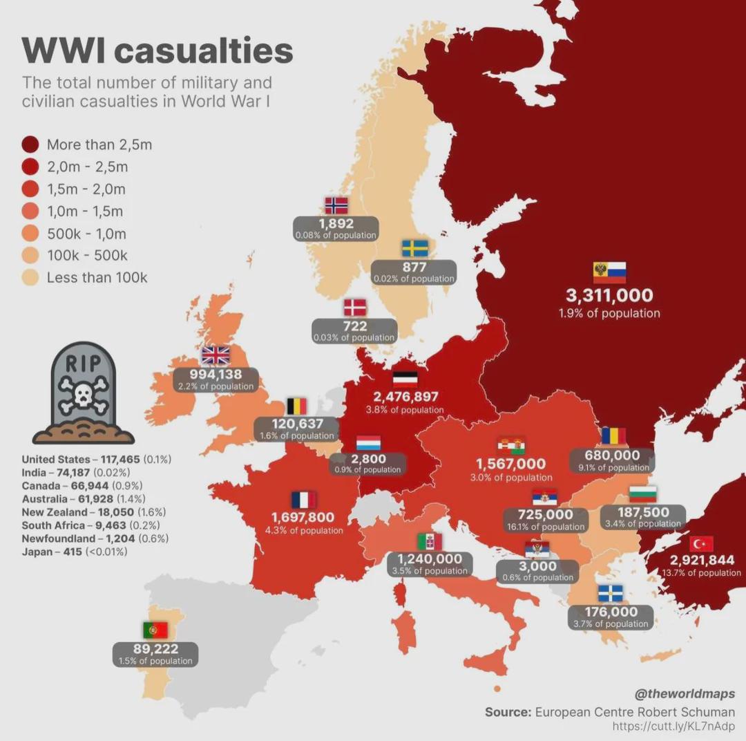
First World War Casualties Mapped
The "First World War Casualties Mapped" visualization provides a comprehensive overview of military and civilian casualt...
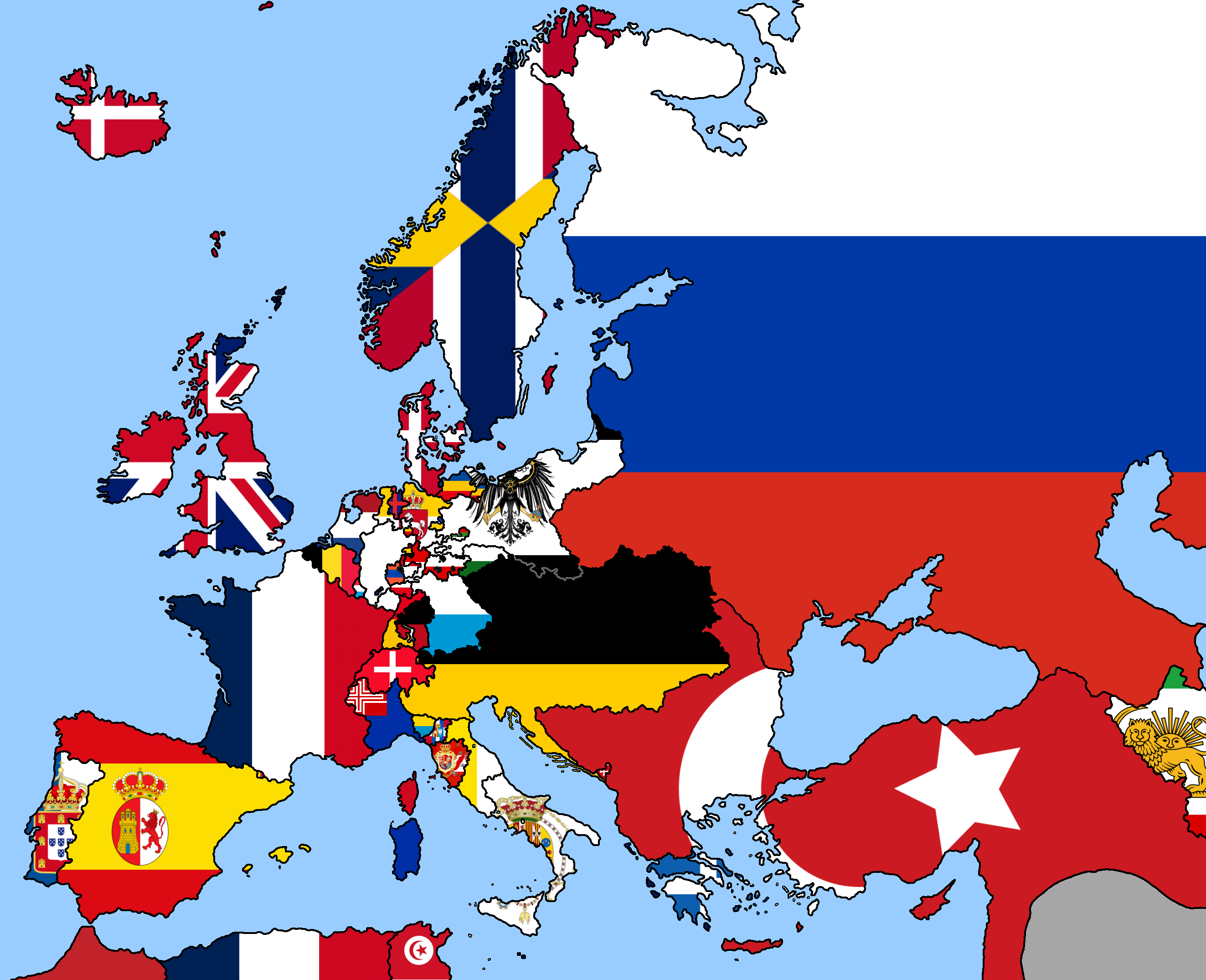
1849 Europe Political Map
The 1849 Europe political map is a fascinating snapshot of a continent undergoing significant changes in the wake of rev...
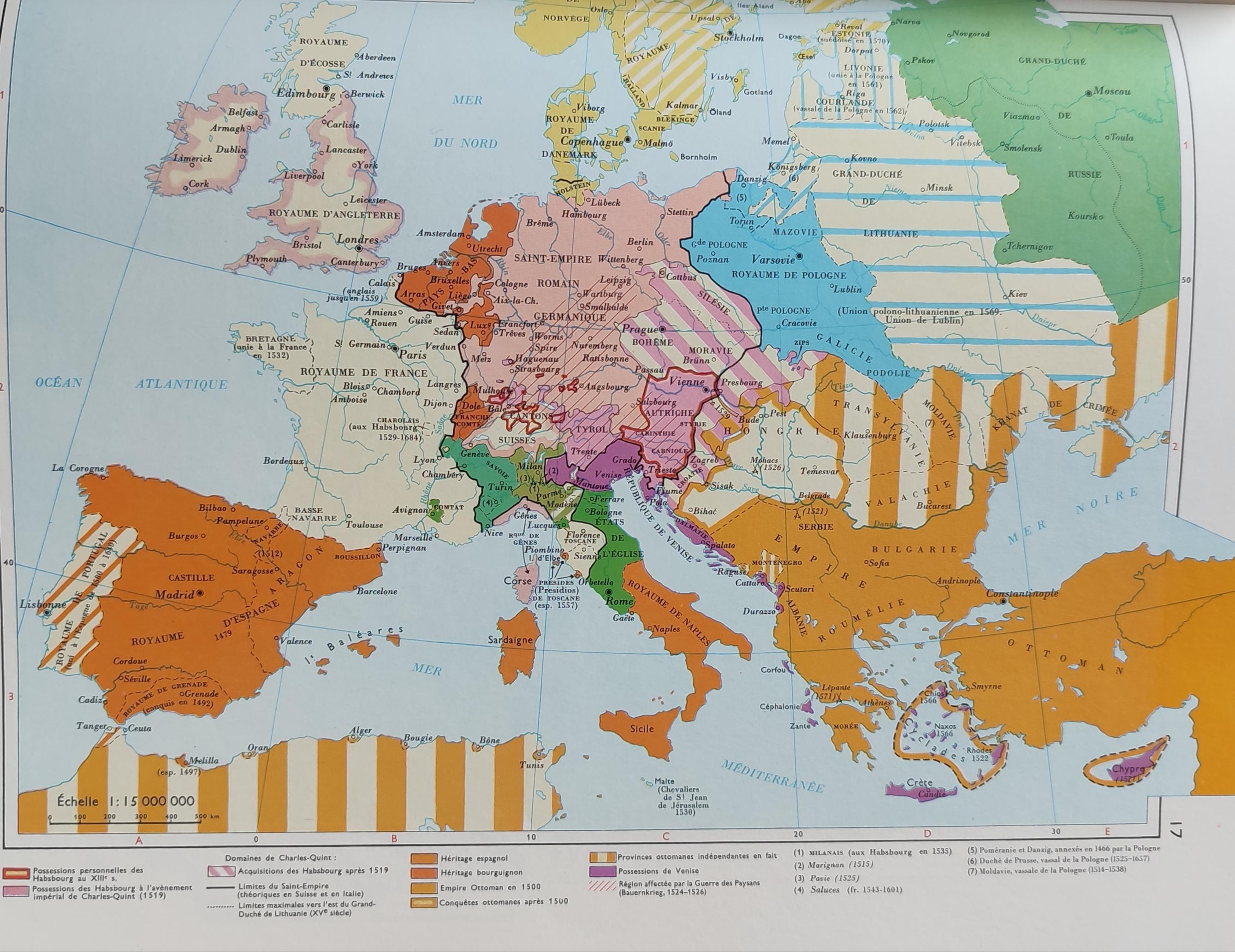
Simplified Map of Europe in the 16th Century
The 'Very Simplified Map of Europe in the 16th Century' presents a bird's-eye view of a continent in the midst of profou...
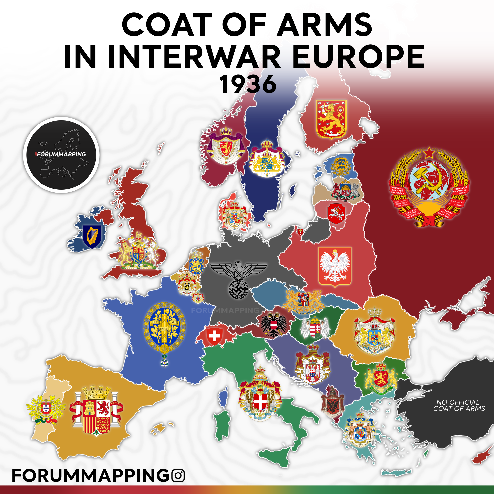
Coat of Arms in Interwar Europe Map
The visualization titled "Coat of Arms in Interwar Europe, 1936" showcases the heraldic symbols representing various nat...
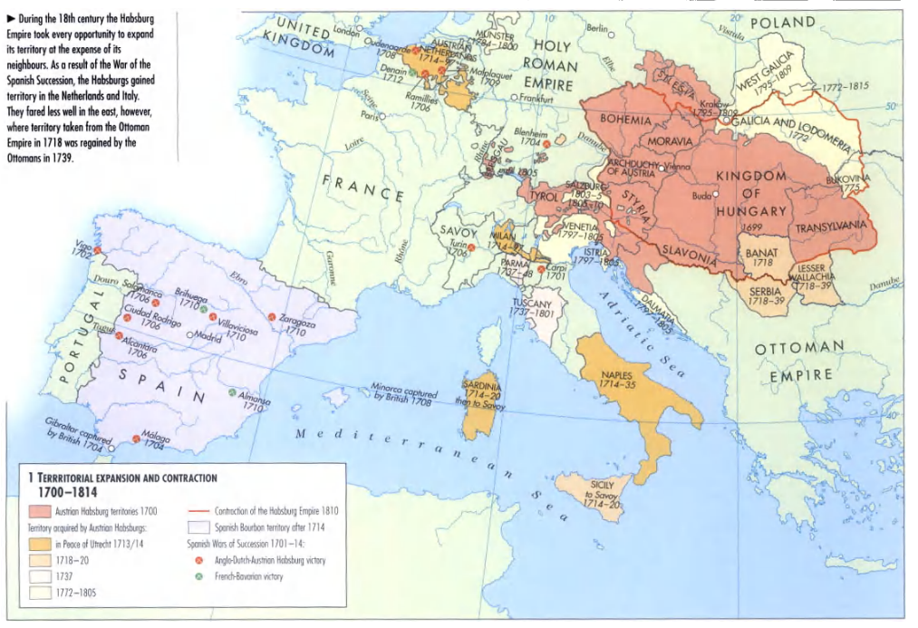
Habsburg Territories Map 1700-1814
The "Habsburg Territories Map 1700-1814" presents a detailed visualization of the extensive lands held by the Habsburg d...
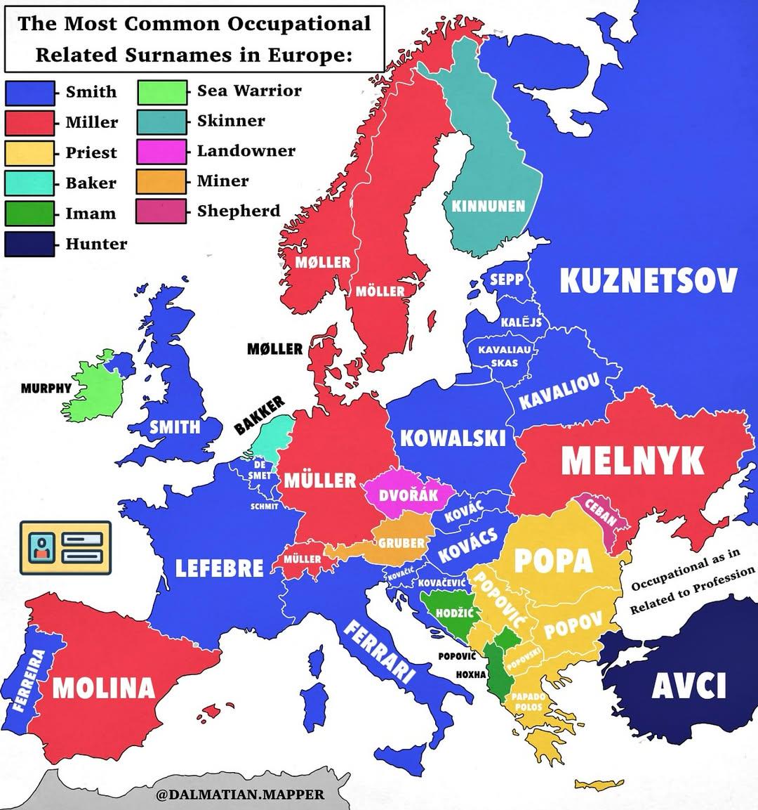
Map of Common Occupational Surnames in Europe
The visualization titled "The Most Common Occupational Related Surnames in Europe" provides an intriguing glimpse into t...
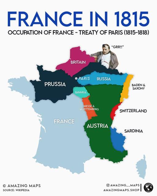
Zones of Occupation Map of France 1815-1818
The visualization titled "Zones of Occupation of France From June 1815 to November 1818 Following Napoleon’s Defeat" pro...
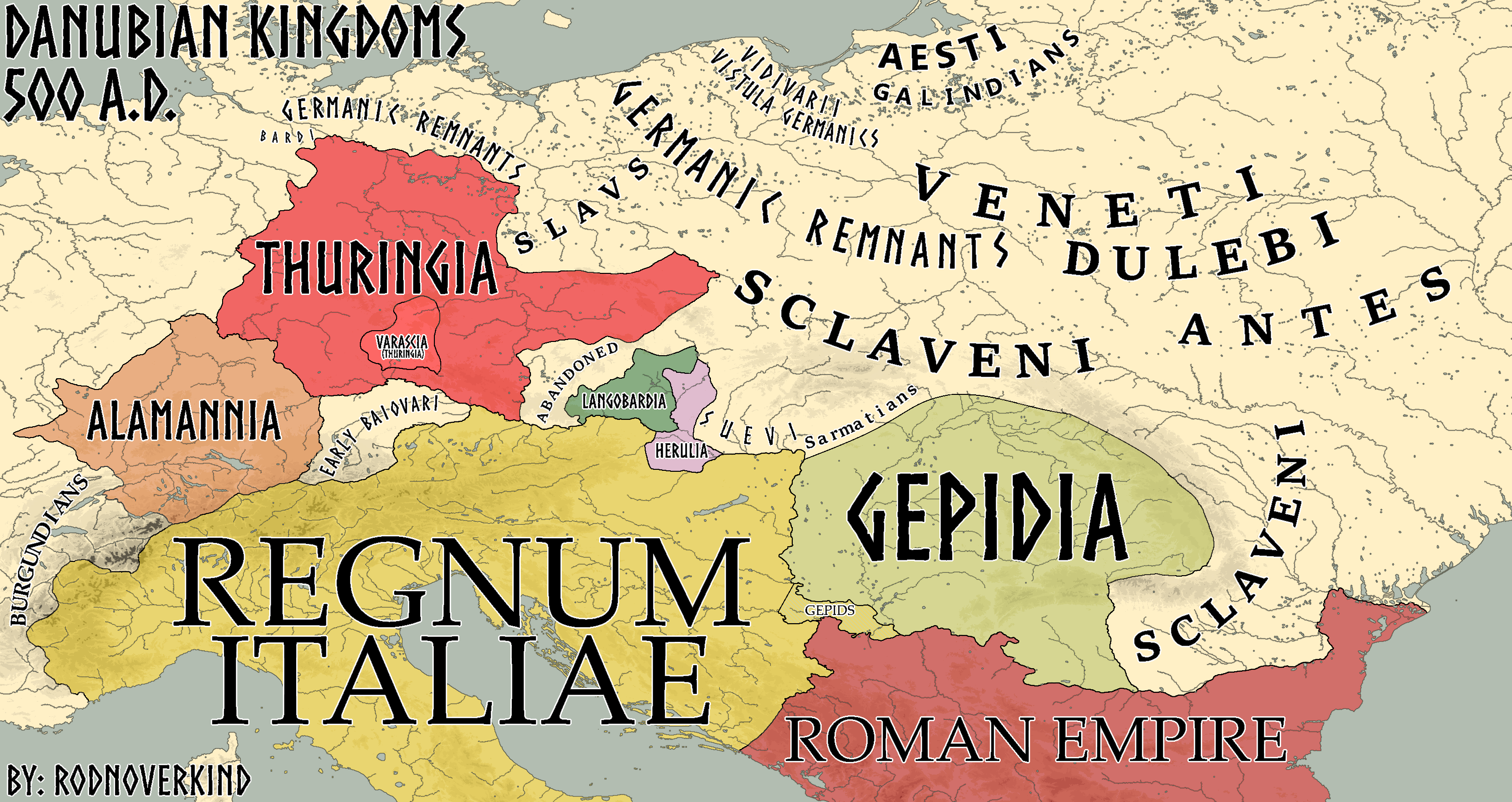
Map of the Kingdoms of the Danube AD 500
The visualization titled \...