map analysis Maps
22 geographic visualizations tagged with "map analysis"
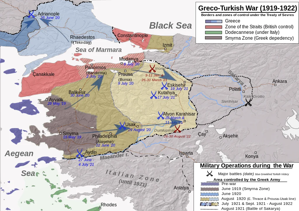
Greco-Turkish War Map and Analysis
This map visualizes the geographical context of the Greco-Turkish War, highlighting key battle sites, territorial change...
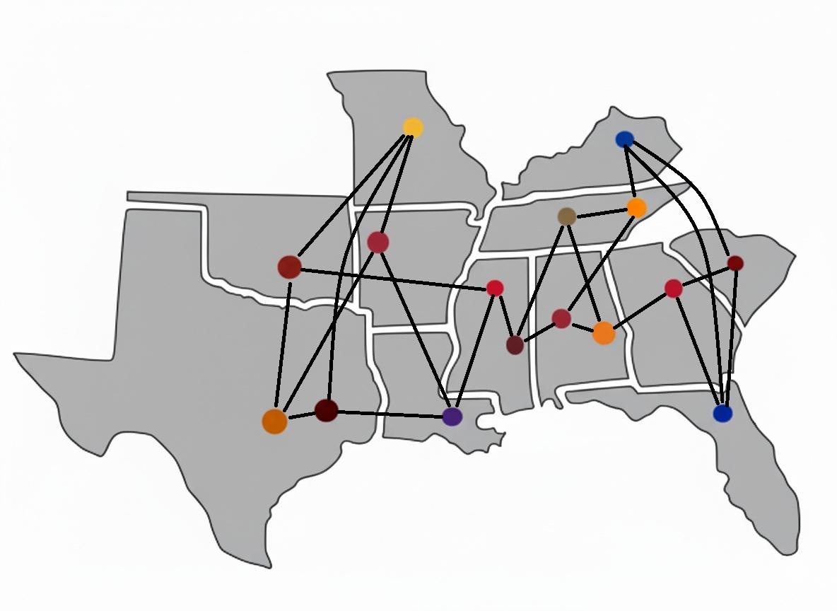
SEC Annual Opponents Map
The SEC Annual Opponents Map provides a visual representation of the teams that each member of the Southeastern Conferen...
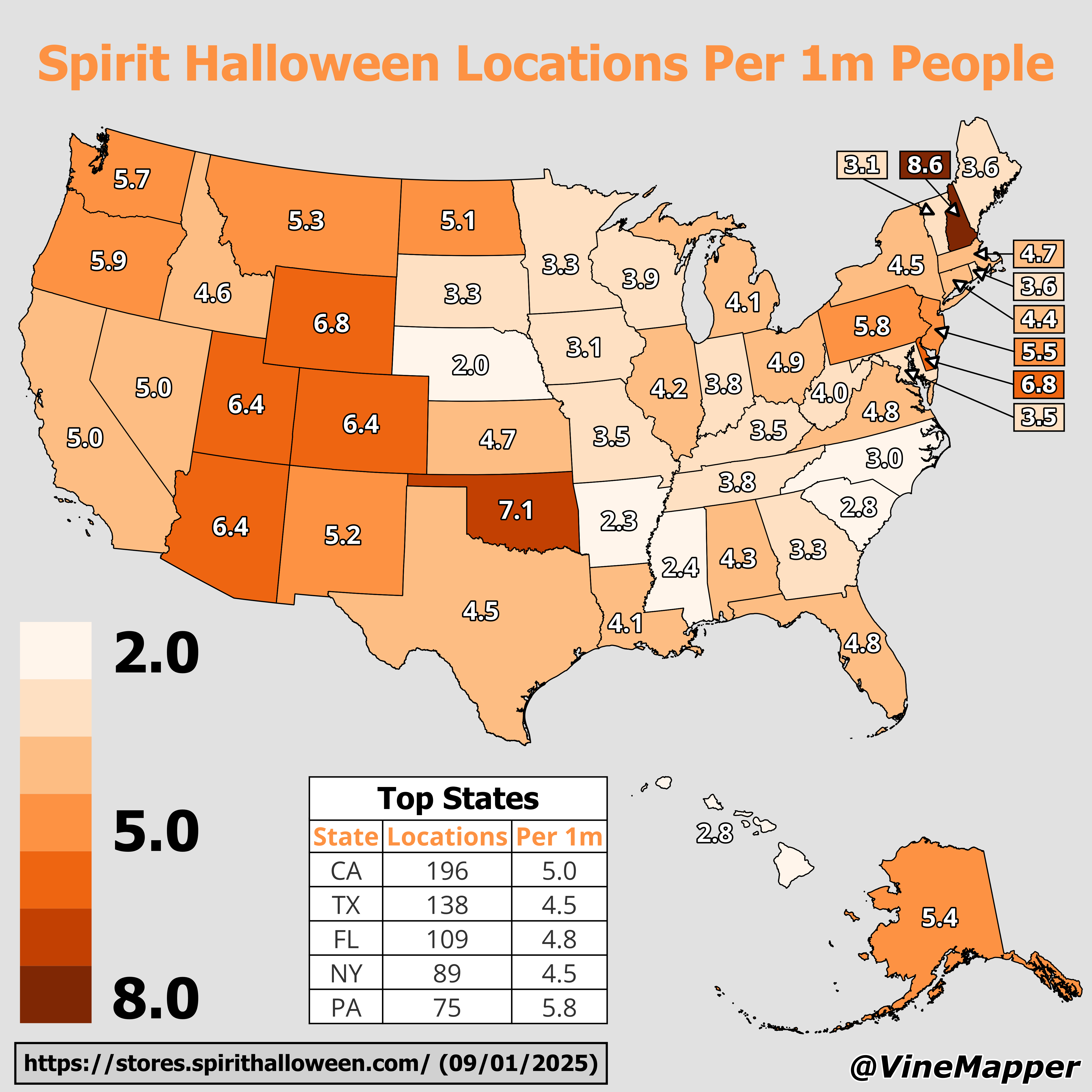
Spirit Halloween Locations Per 1 Million People Map
This map provides a visual representation of the distribution of Spirit Halloween locations across the United States, ad...
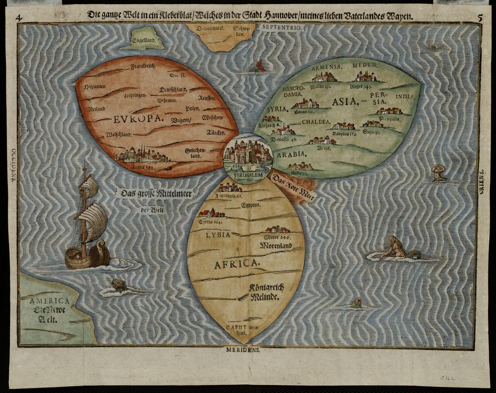
1581 Map of the Known World by Heinrich Bünting
The 1581 Map of the Known World by Heinrich Bünting presents a unique and whimsical depiction of the world, structured i...
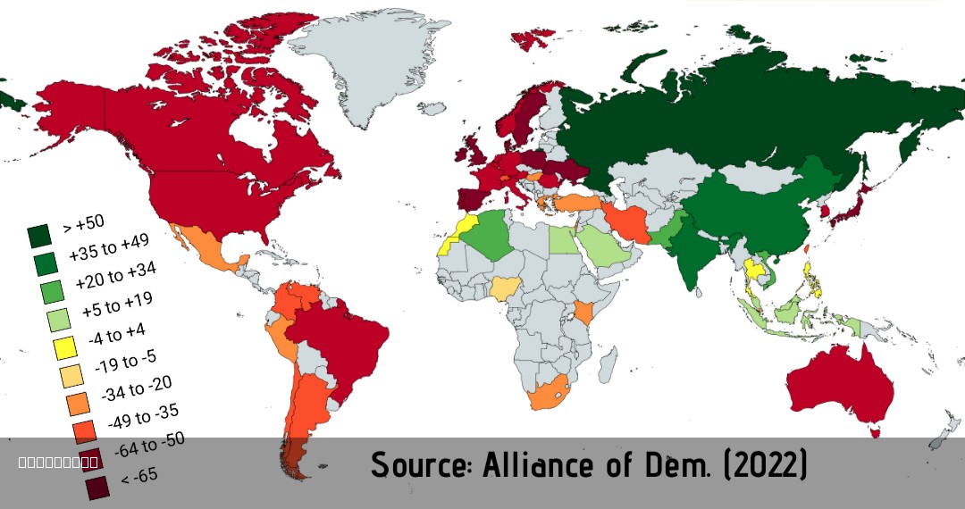
Public Opinion on Russia 2022 Map
This map visualizes public opinion on Russia in 2022, illustrating how sentiments varied across different countries and ...
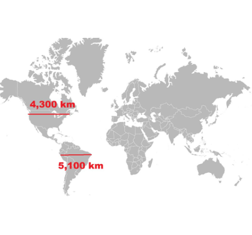
Length of North vs South America Map
The visualization titled "Length of North vs South America" presents a comparative analysis of the geographical extents ...
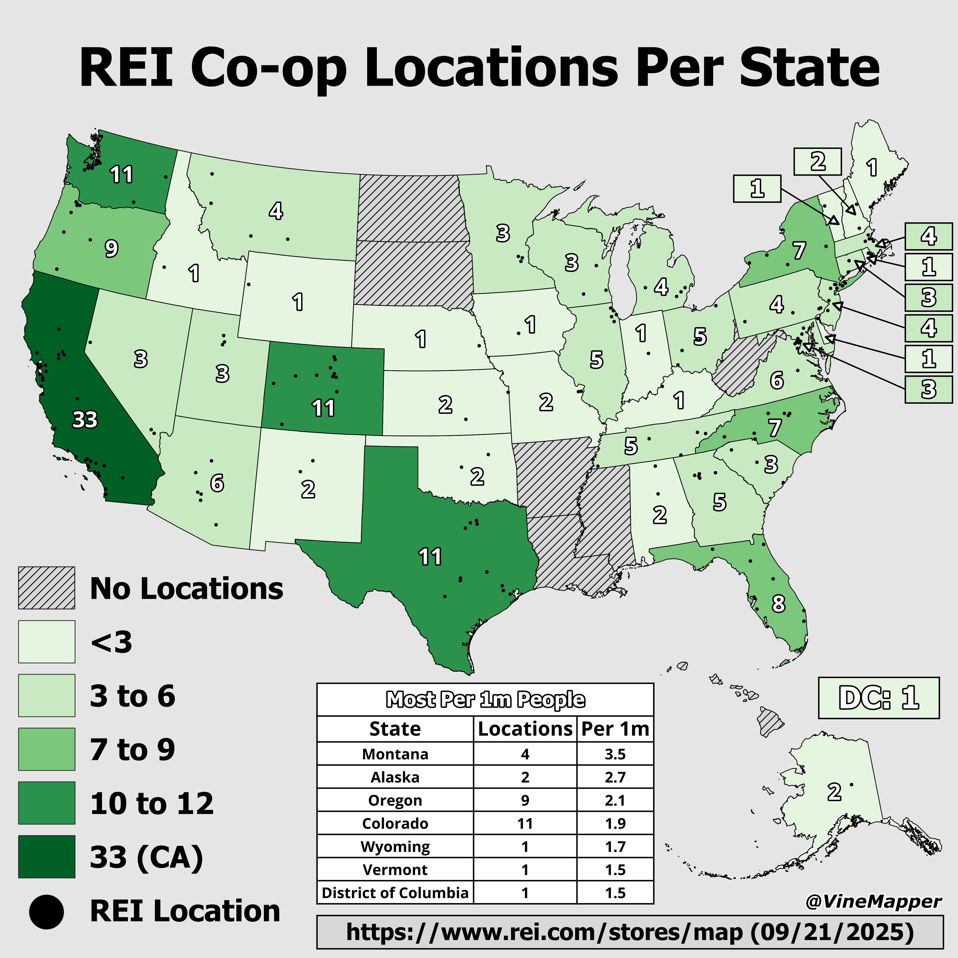
REI Co-op Locations by State Map
The "REI Co-op Locations by State Map" provides a clear visual representation of the distribution of REI retail location...

EU Countries Map for Chat Control Regulation
The "EU Countries Map for Chat Control Regulation" provides a visual representation of the European Union member states ...
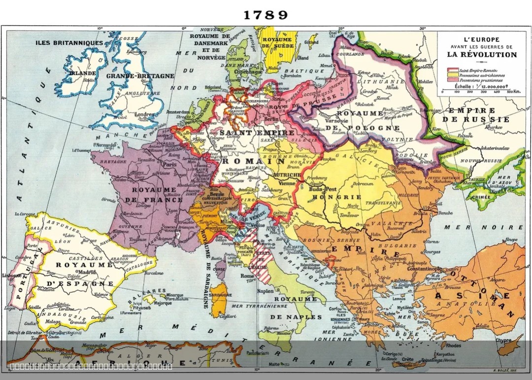
1915 French Map of Europe in 1789
The 1915 French map of Europe in 1789 offers a historical perspective on the political landscape of Europe just before t...
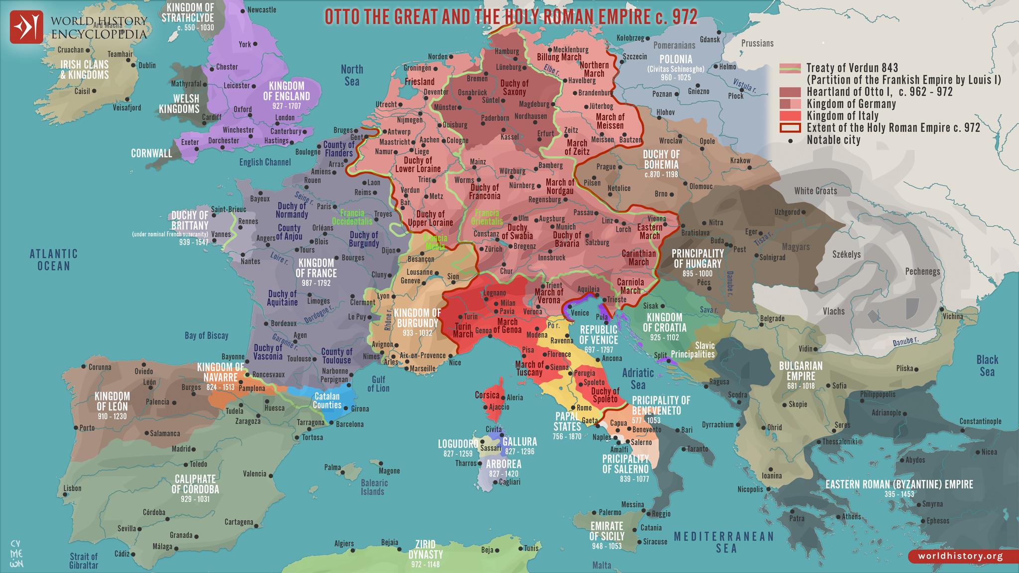
Political Map of Europe in 972
The "Map of Europe in 972" provides a fascinating glimpse into the political landscape of medieval Europe, depicting the...

Salary Needed to Afford a Home Map
Interestingly, the map illustrates how salaries vary dramatically across different regions, affecting home affordability...
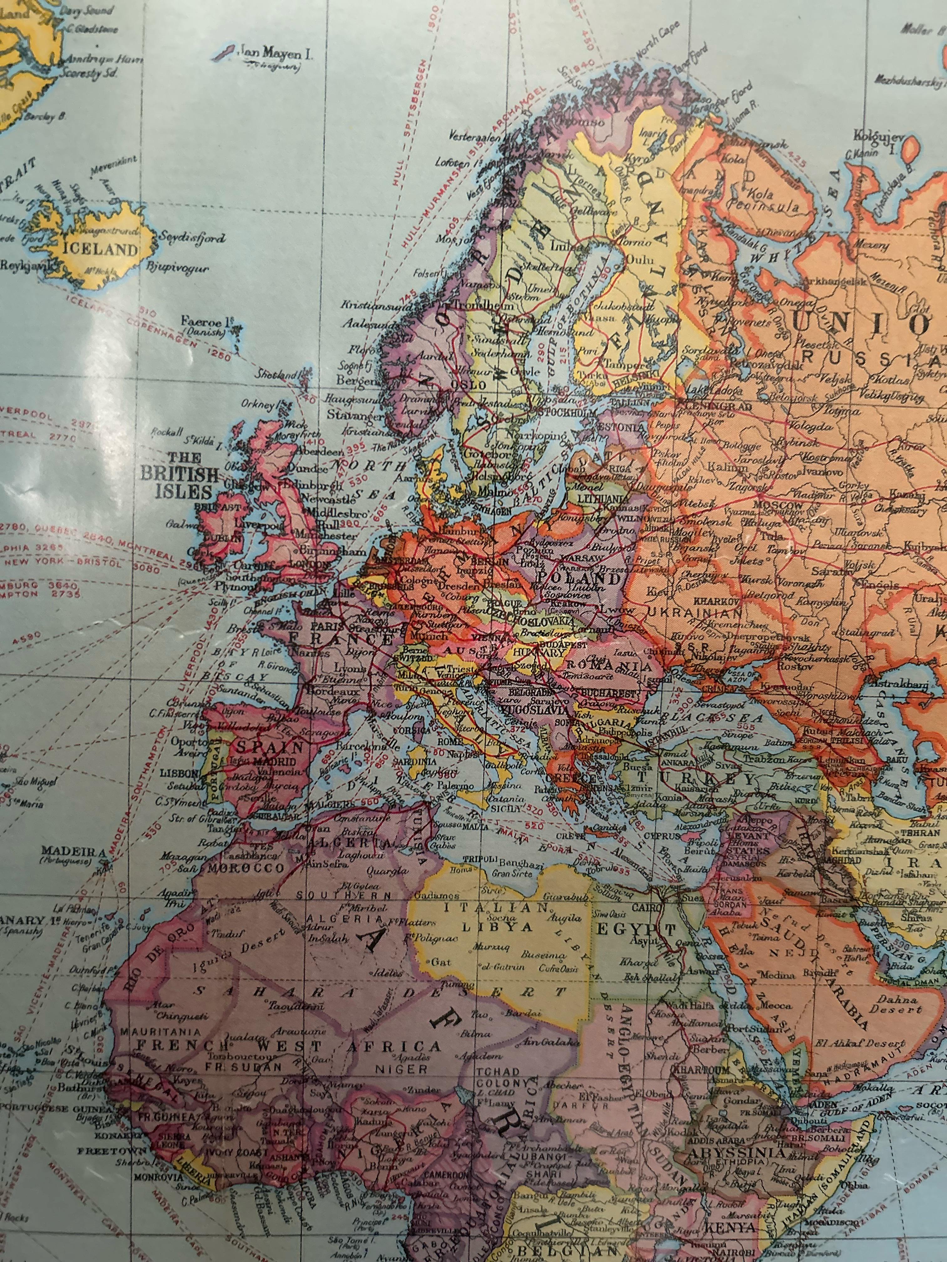
European Political Map from the 1920s
In this period, countries like Poland regained their independence after over a century of partition, while others like H...
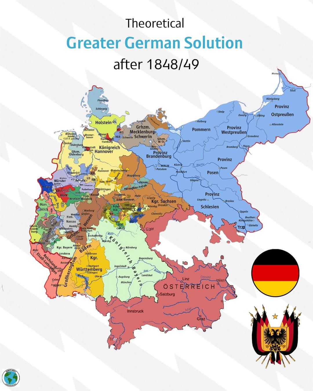
Greater German Solution Map 1848-1849
...
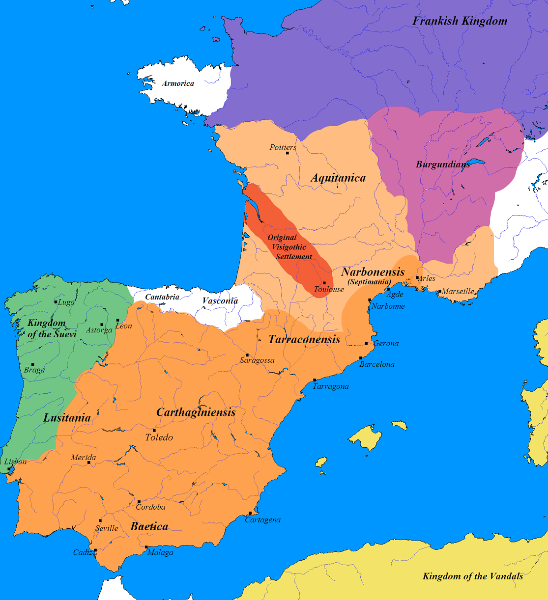
Germanic Tribes Map of France and Iberia (500 AD)
The map titled "Germanic France and Iberia (500 AD)" provides a fascinating glimpse into the landscape of post-Roman Eur...
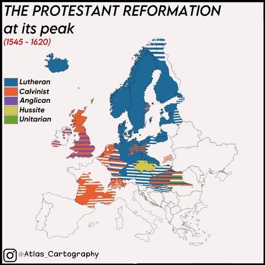
Protestant Reformation Map of Europe 1545-1620
The map titled "The Protestant Reformation In Europe At Its Peak (1545-1620)" provides a visual representation of the re...
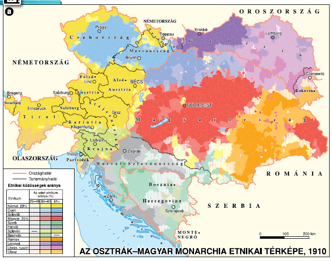
Ethnic Composition Map of Austria-Hungary 1910
The ethnic composition map of Austria-Hungary around 1910 provides a vivid snapshot of the diverse nationalities that in...

Proximity Map of Budapest and Bucharest
However, this isn't just about determining which city is nearer; it opens the door to a deeper understanding of the hist...
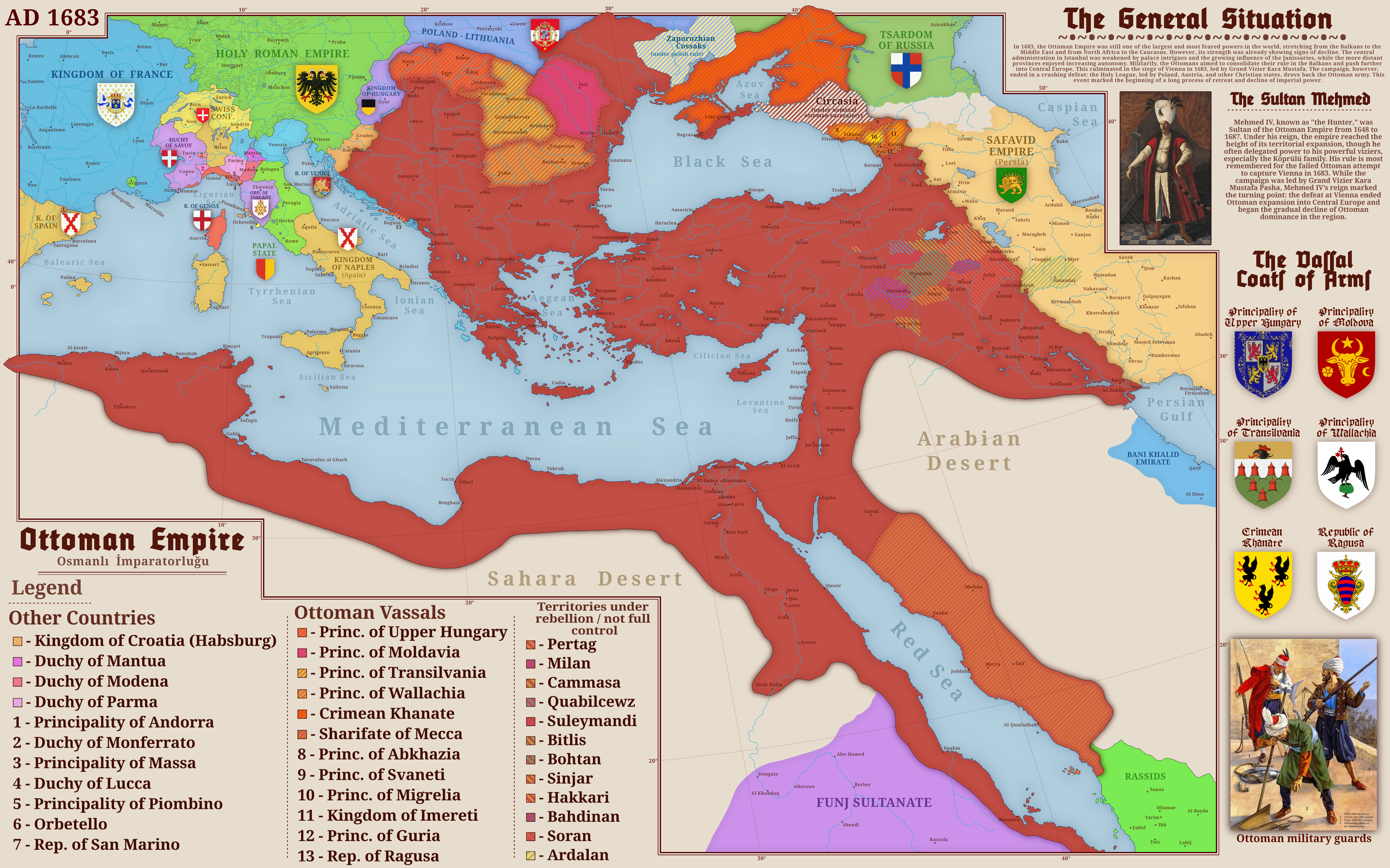
Ottoman Empire Map of 1683
The map titled "The Ottoman Empire in 1683" provides a visual representation of the territorial expanse of the Ottoman E...
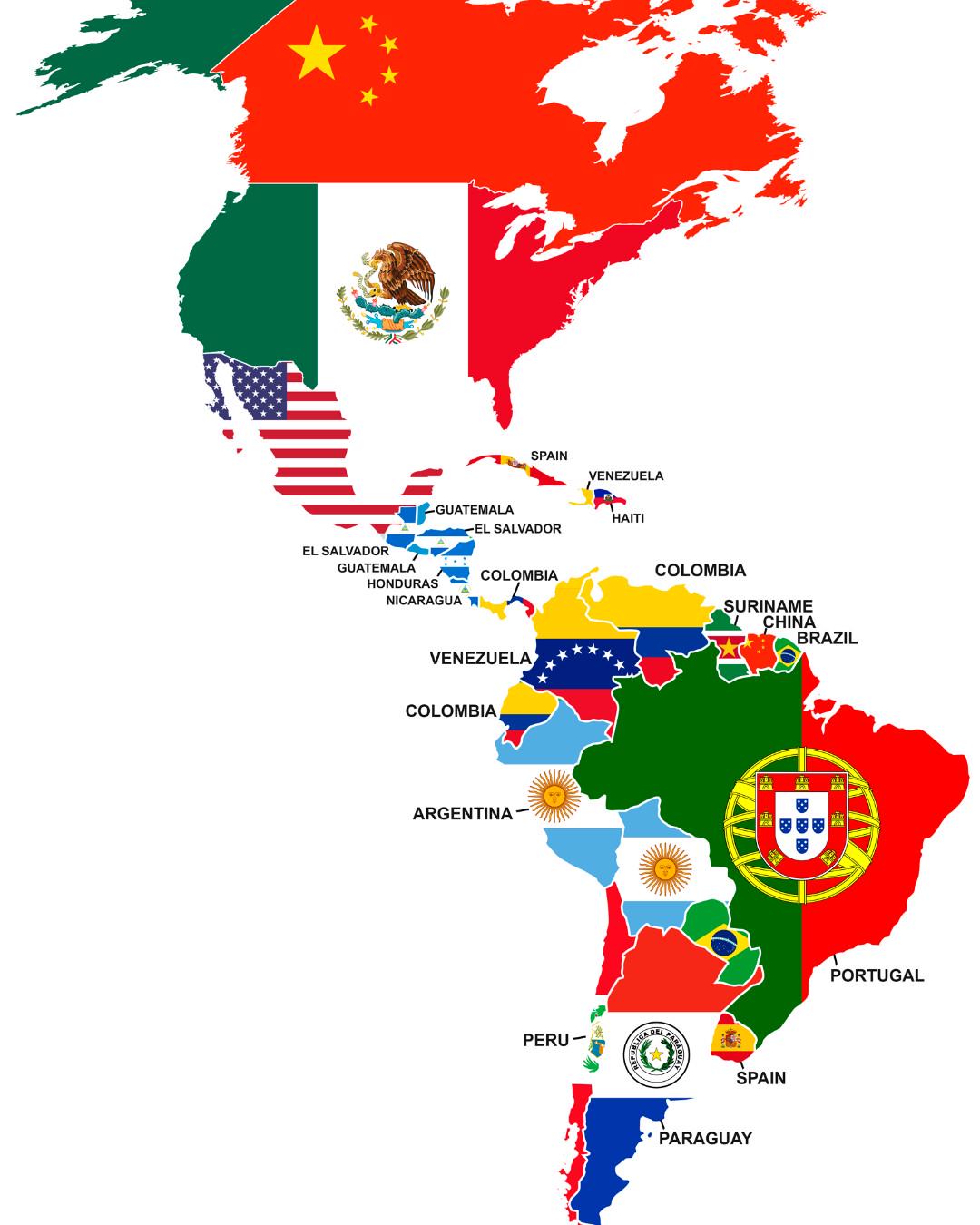
Largest Foreign Nationality in Each American Country Map
This map presents an intriguing look at the largest foreign nationality in each American country, highlighting the diver...
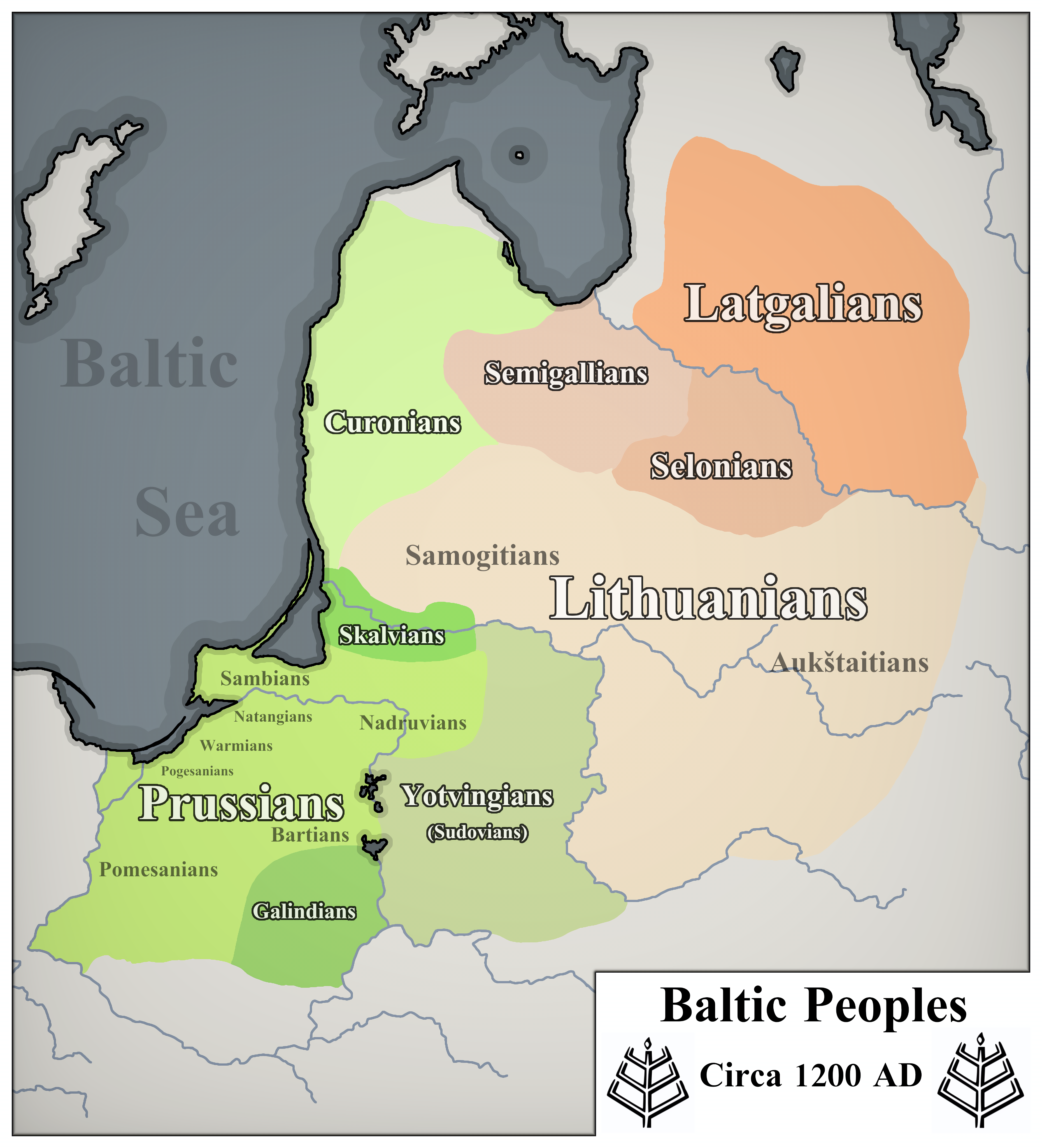
Map of Baltic Peoples Circa 1200 AD
The visualization titled 'Baltic Peoples Circa 1200 AD' intricately details the distribution of various ethnic groups in...
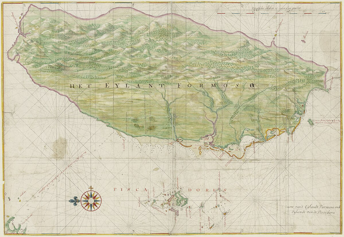
Map of Taiwan 1640 After Dutch City Tainan Establishment
Interestingly, the Dutch recognized the potential of Taiwan’s fertile land, particularly in rice cultivation. They intro...
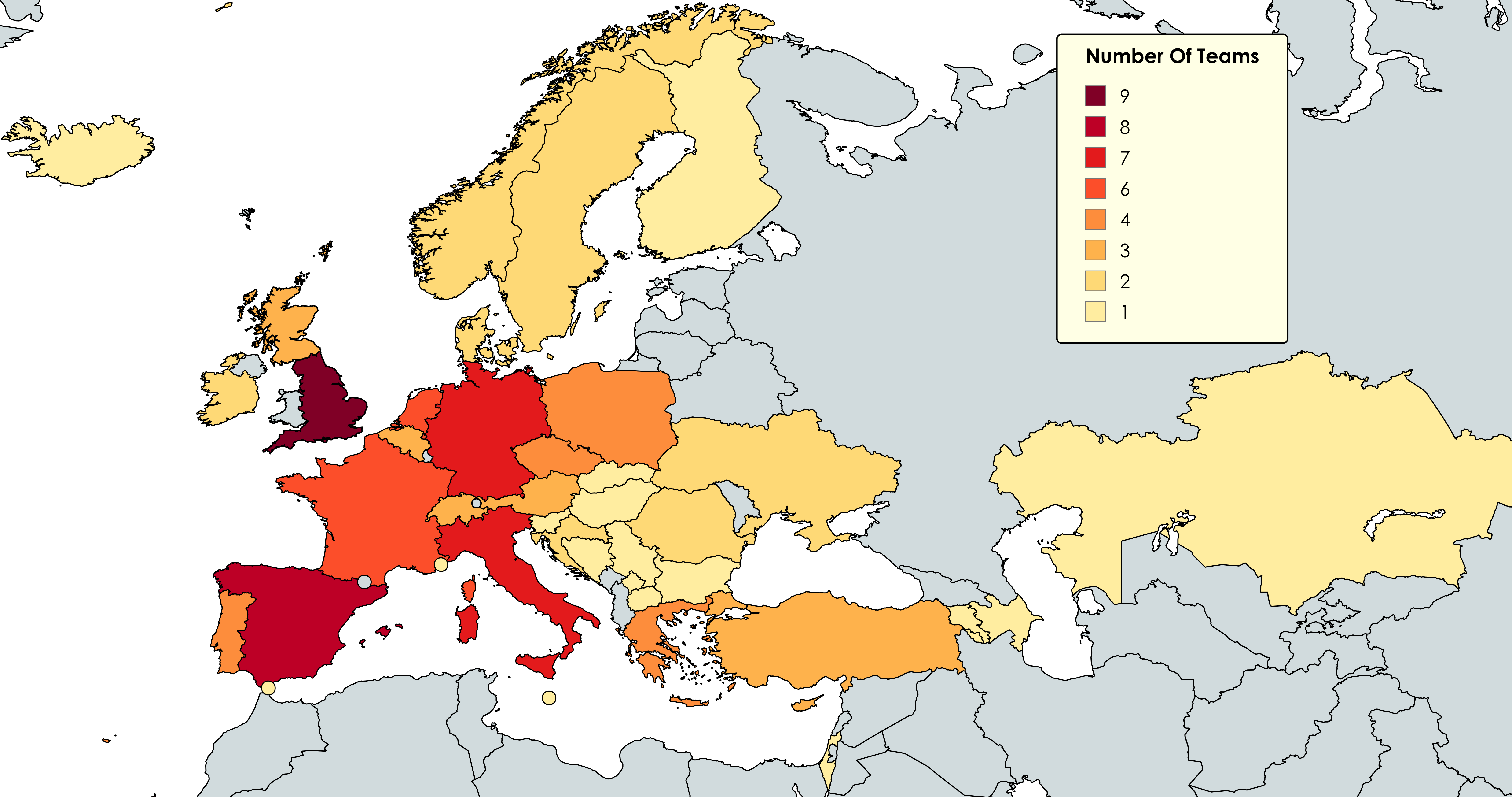
Map of Countries with Teams in All UEFA Competitions 2025-26
The map titled "Countries with Teams in All UEFA Club Competitions for the 2025-26 Season" illustrates the nations that ...