world war i Maps
13 geographic visualizations tagged with "world war i"
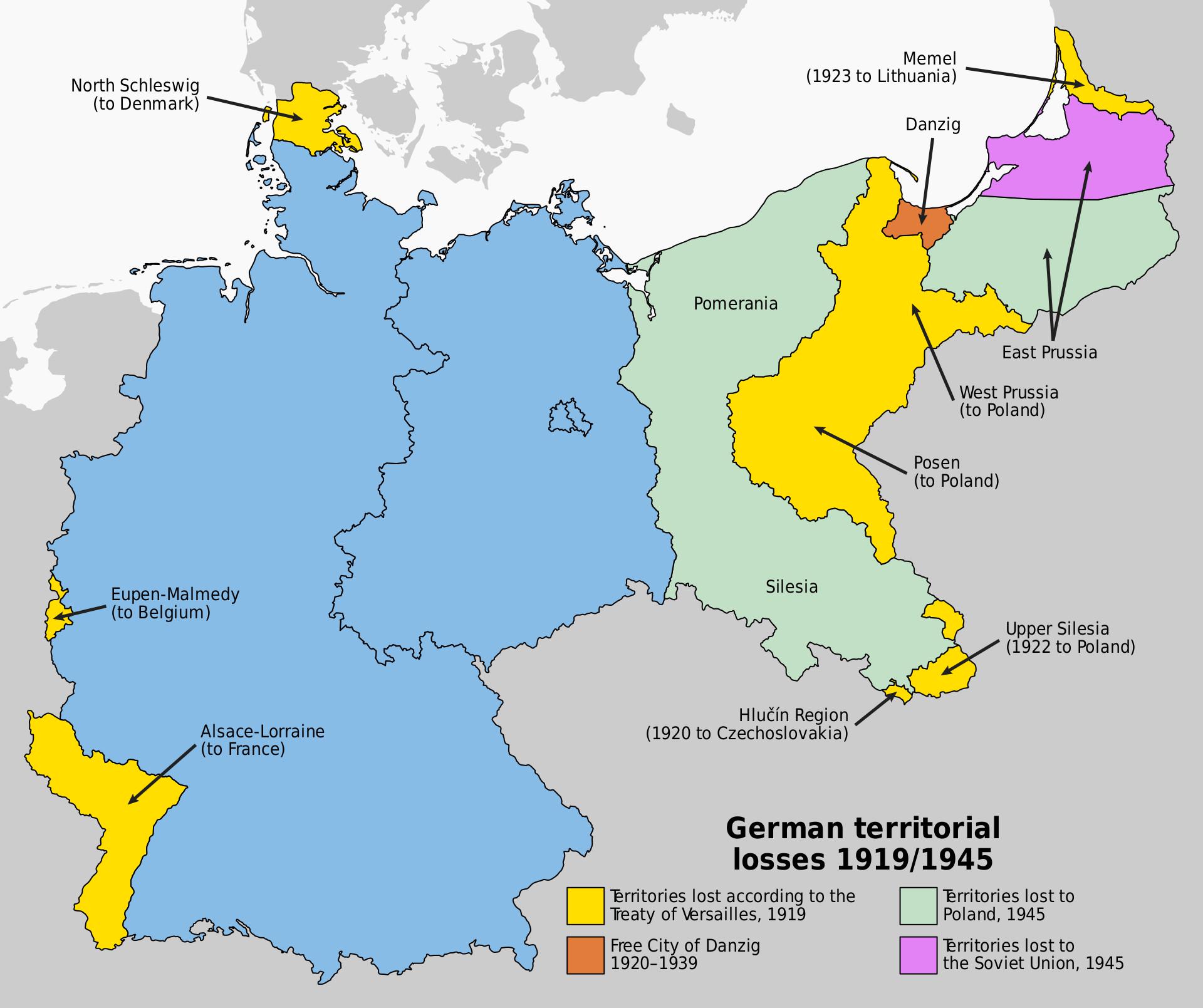
Map of Germany's Territorial Losses After World War Defeats
This map illustrates the significant territorial losses Germany faced following its defeats in both World War I and Worl...
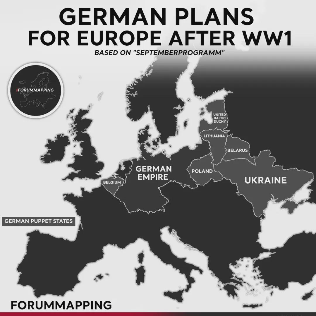
German Plans for Europe After WW1 Map
The map titled "German Plans for Europe After WW1" provides a visual representation of Germany's geopolitical ambitions ...
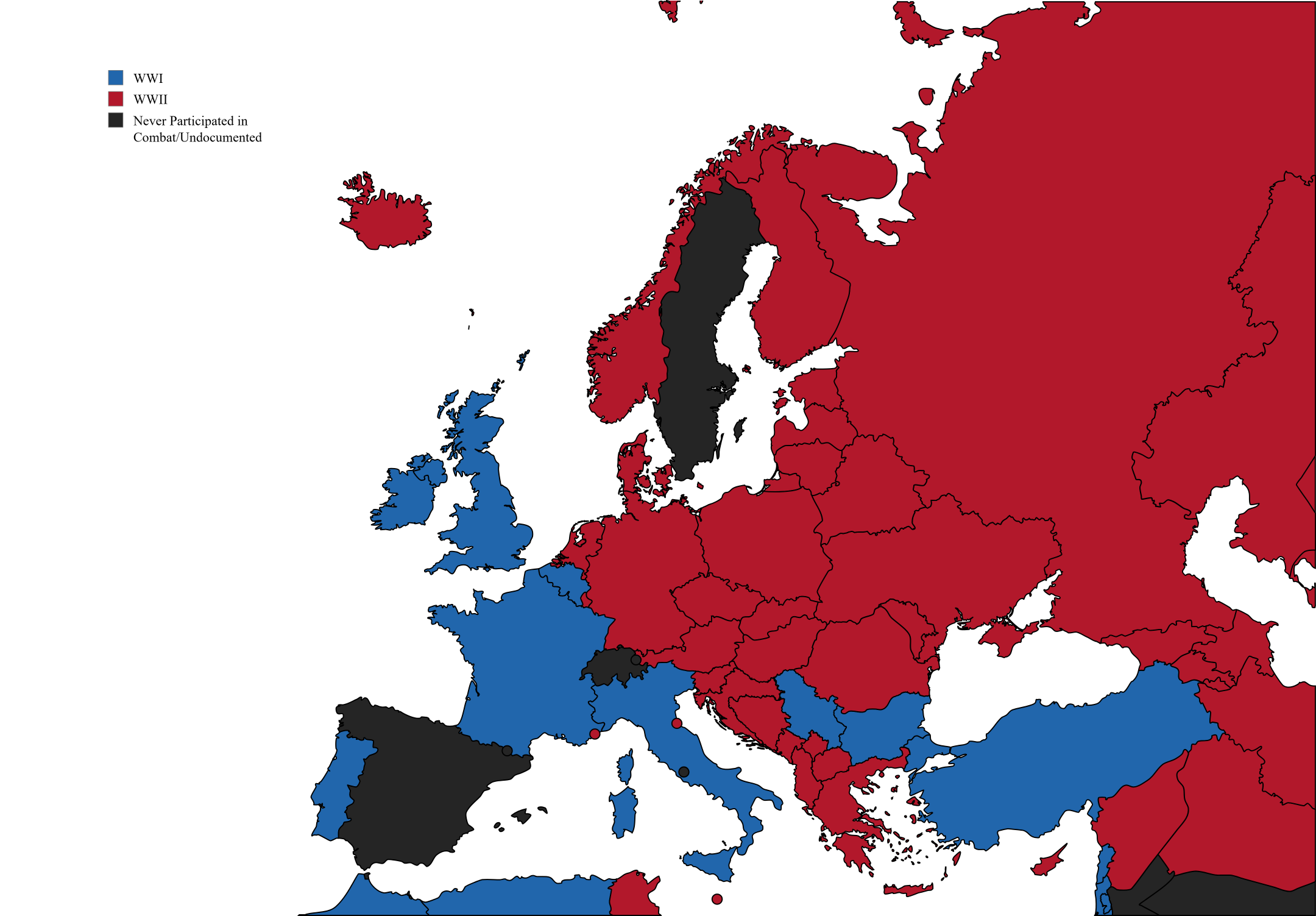
Deaths in Europe During World Wars Map
This map visually represents the estimated number of deaths in various European countries during both the First and Seco...
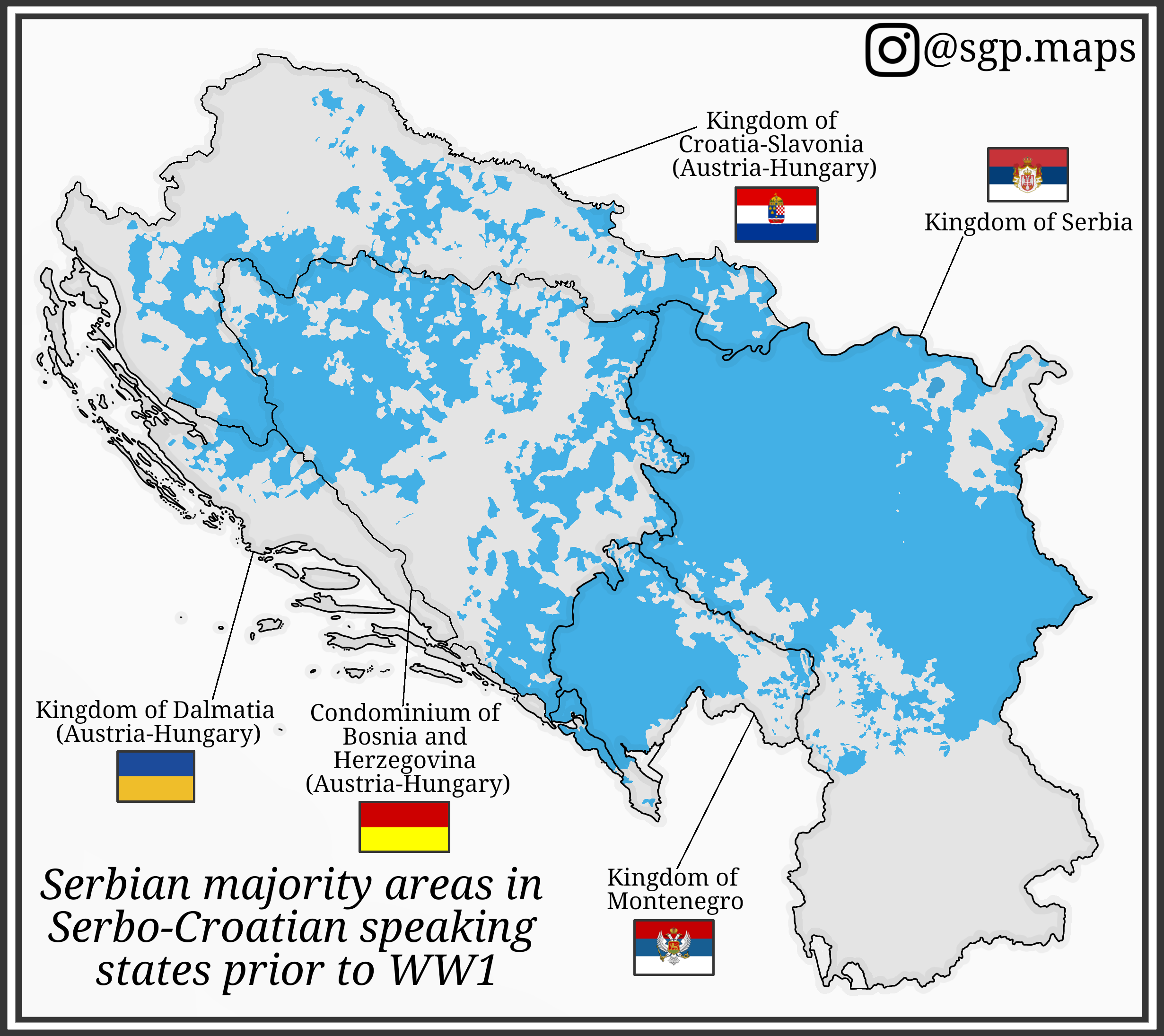
Serbian Majority Areas Map in Serbo-Croatian States Before WW1
This map illustrates the distribution of Serbian majority areas in the regions where Serbo-Croatian was spoken prior to ...
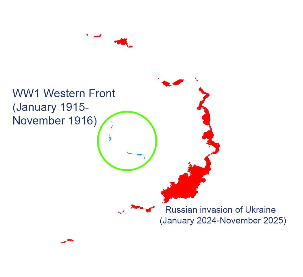
Territorial Changes Map: Ukraine War vs WW1 Western Front
The map titled "A Comparison in Territorial Changes between the Ukraine War and the Western Front of WW1" provides a vis...
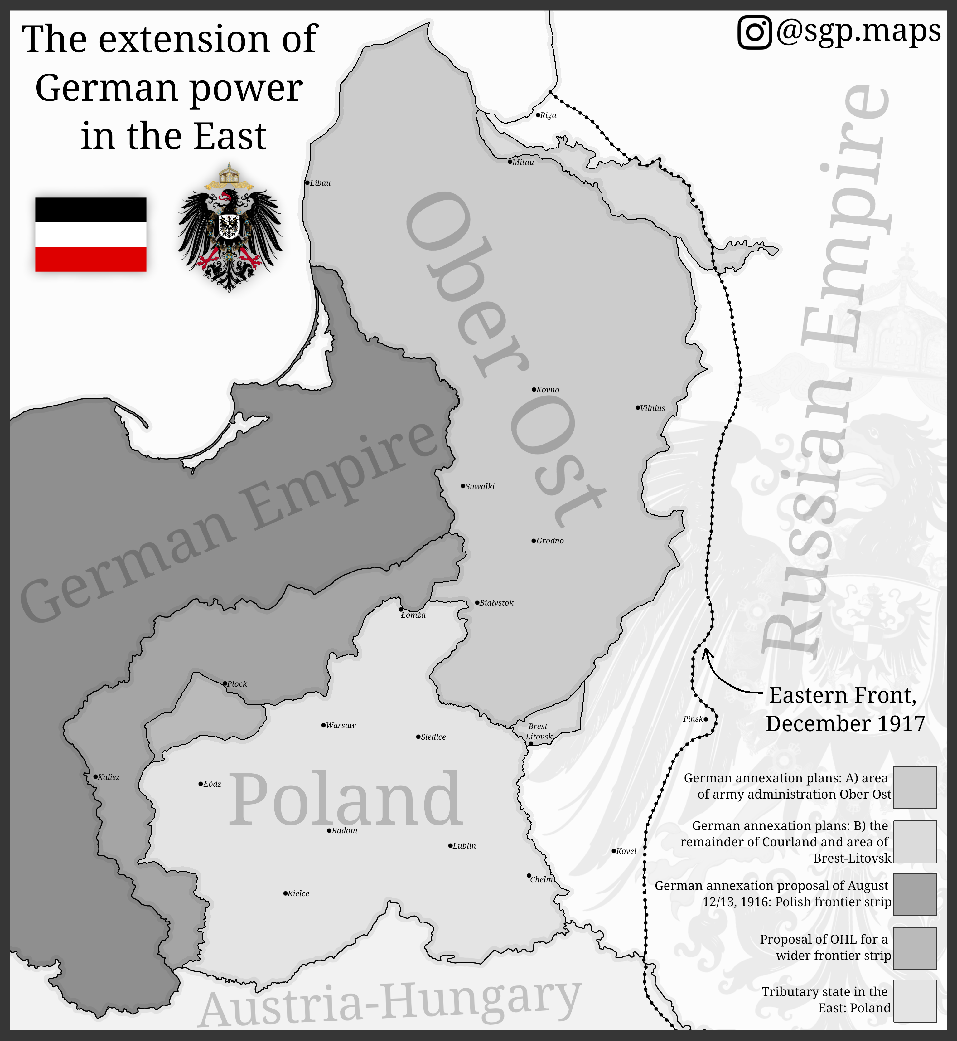
Map of German Expansion in Eastern Europe
The map titled "The Extension of German Power in the East" illustrates the territorial ambitions of Germany during World...
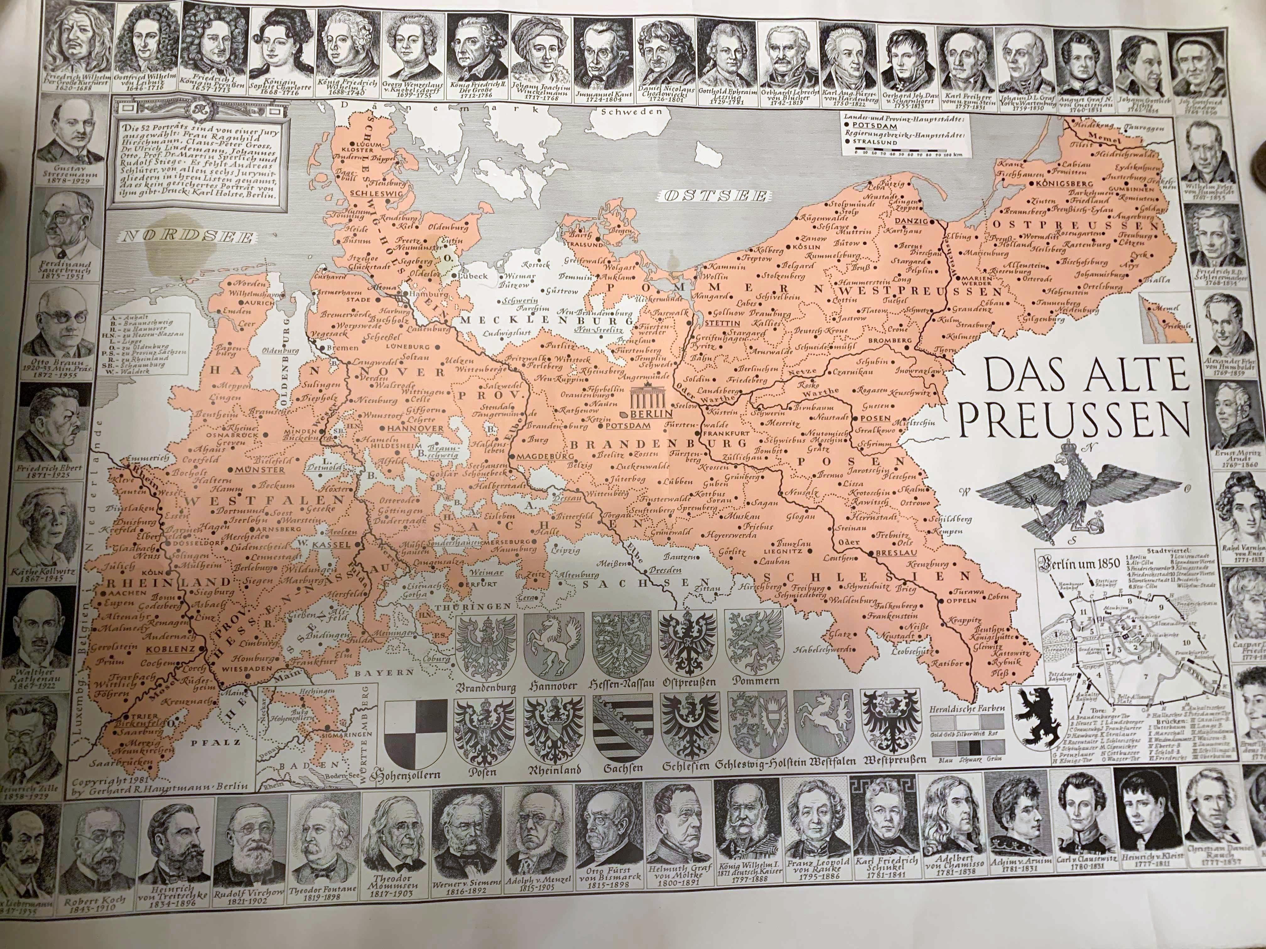
Map of Old Prussia Before World War I
This illustrated map of Prussia, created in the 1980s, depicts the historical boundaries and territories of Prussia befo...
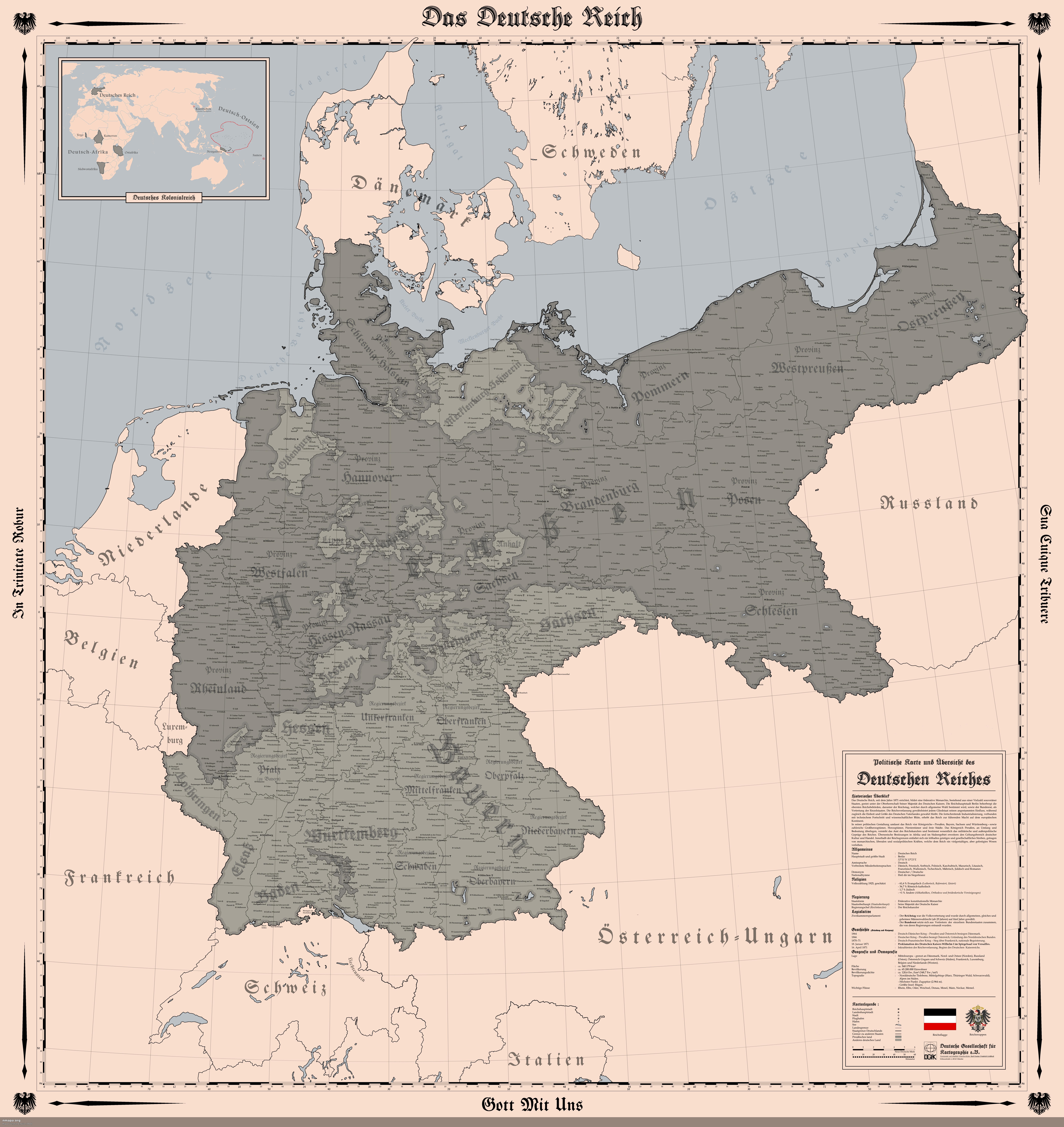
Map of the German Empire in 1914
The "Map of the German Empire (1914)" provides a detailed representation of the territorial boundaries, cities, and infr...
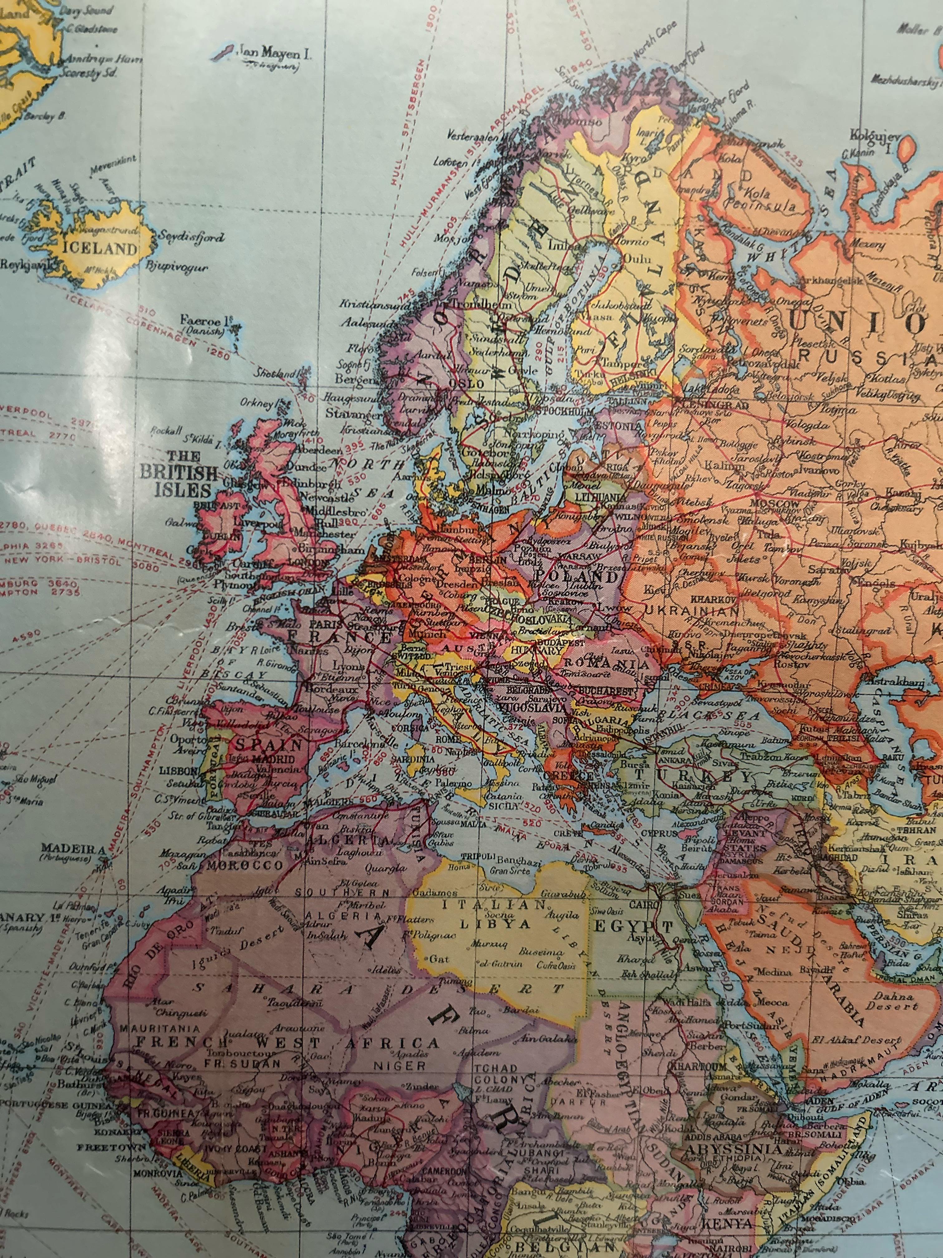
European Political Map from the 1920s
In this period, countries like Poland regained their independence after over a century of partition, while others like H...
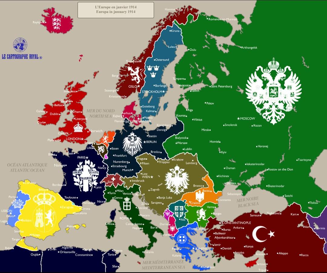
Political Map of Europe January 1914
The "Europe in January 1914" map provides a snapshot of the political landscape of Europe just months before the outbrea...
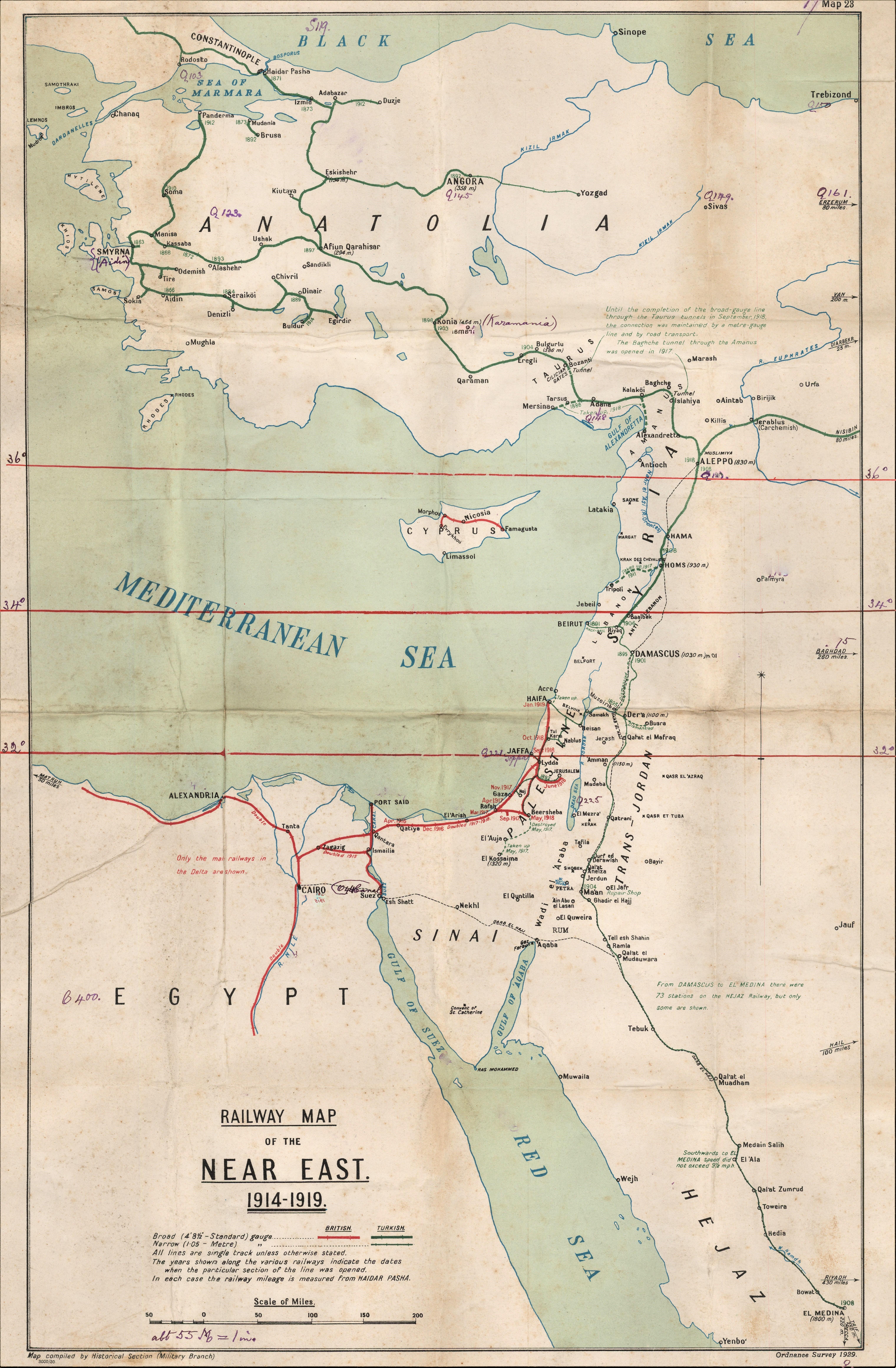
Railway Map of the Near East 1914-1919
...
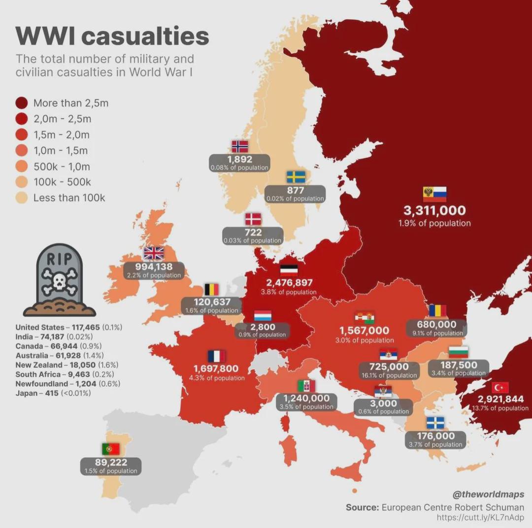
First World War Casualties Mapped
The "First World War Casualties Mapped" visualization provides a comprehensive overview of military and civilian casualt...
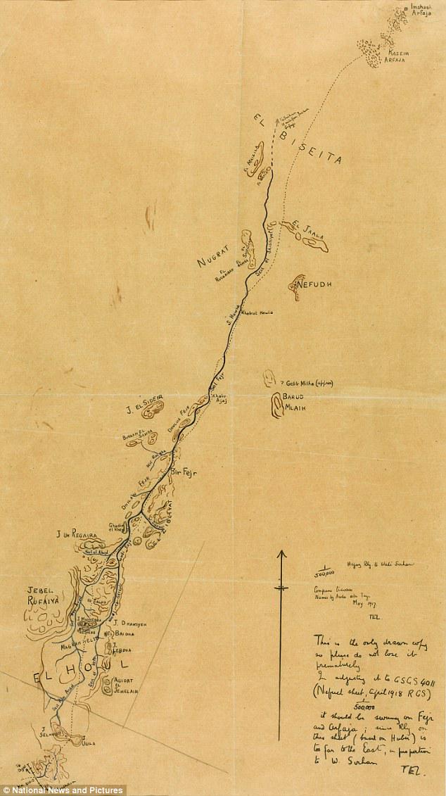
Map of Colonel TE Lawrence's Route in Hejaz
This hand-drawn map by Colonel T.E. Lawrence, famously known as Lawrence of Arabia, outlines the proposed route taken by...