nationalism Maps
22 geographic visualizations tagged with "nationalism"
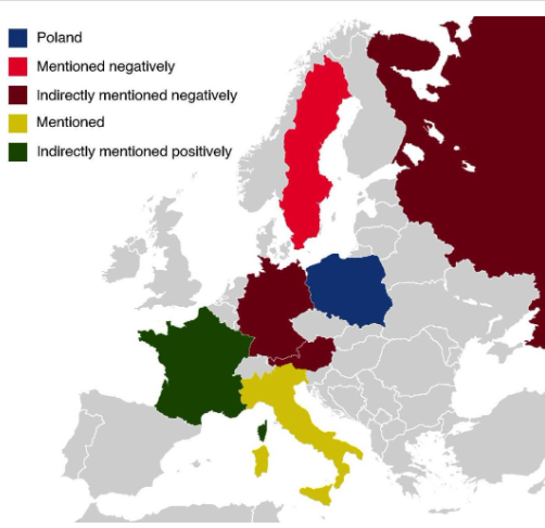
Countries Mentioned in the Polish National Anthem Map
The map titled "All The Countries Mentioned In The Polish National Anthem" provides a unique geographical insight into t...
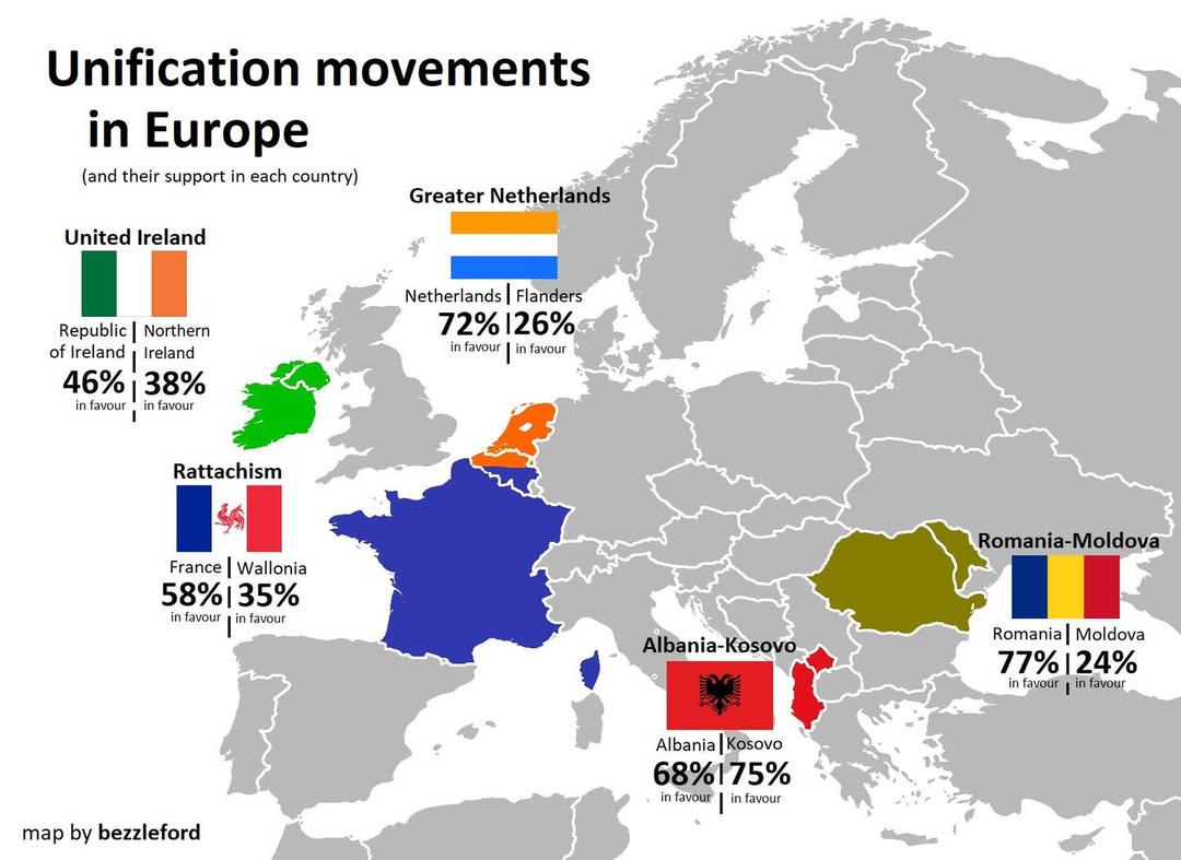
European Unification Movements Map
The "European Unification Movements Map" provides a visual representation of the various movements advocating for the po...
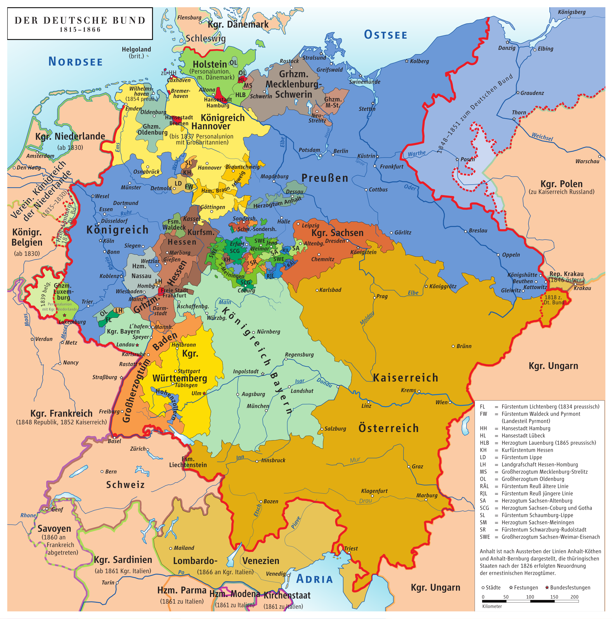
Map of Germany Before Unification (1815-1866)
This map titled "Germany Before Being Germany (1815-1866)" provides a detailed visualization of the political landscape ...
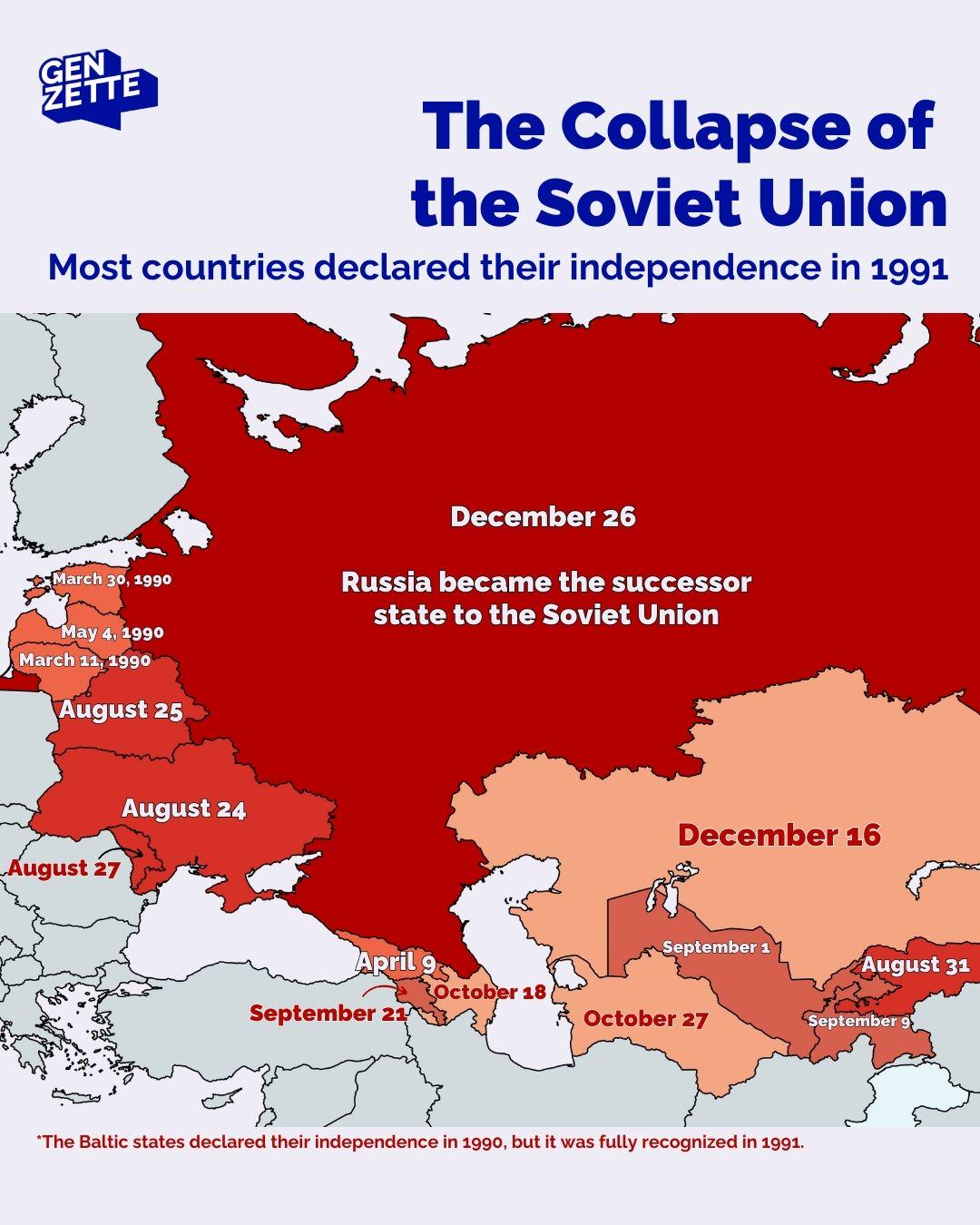
Countries Declaring Independence in 1991 Map
The map titled "Countries Declaring Independence in 1991" visualizes the significant geopolitical changes that occurred ...
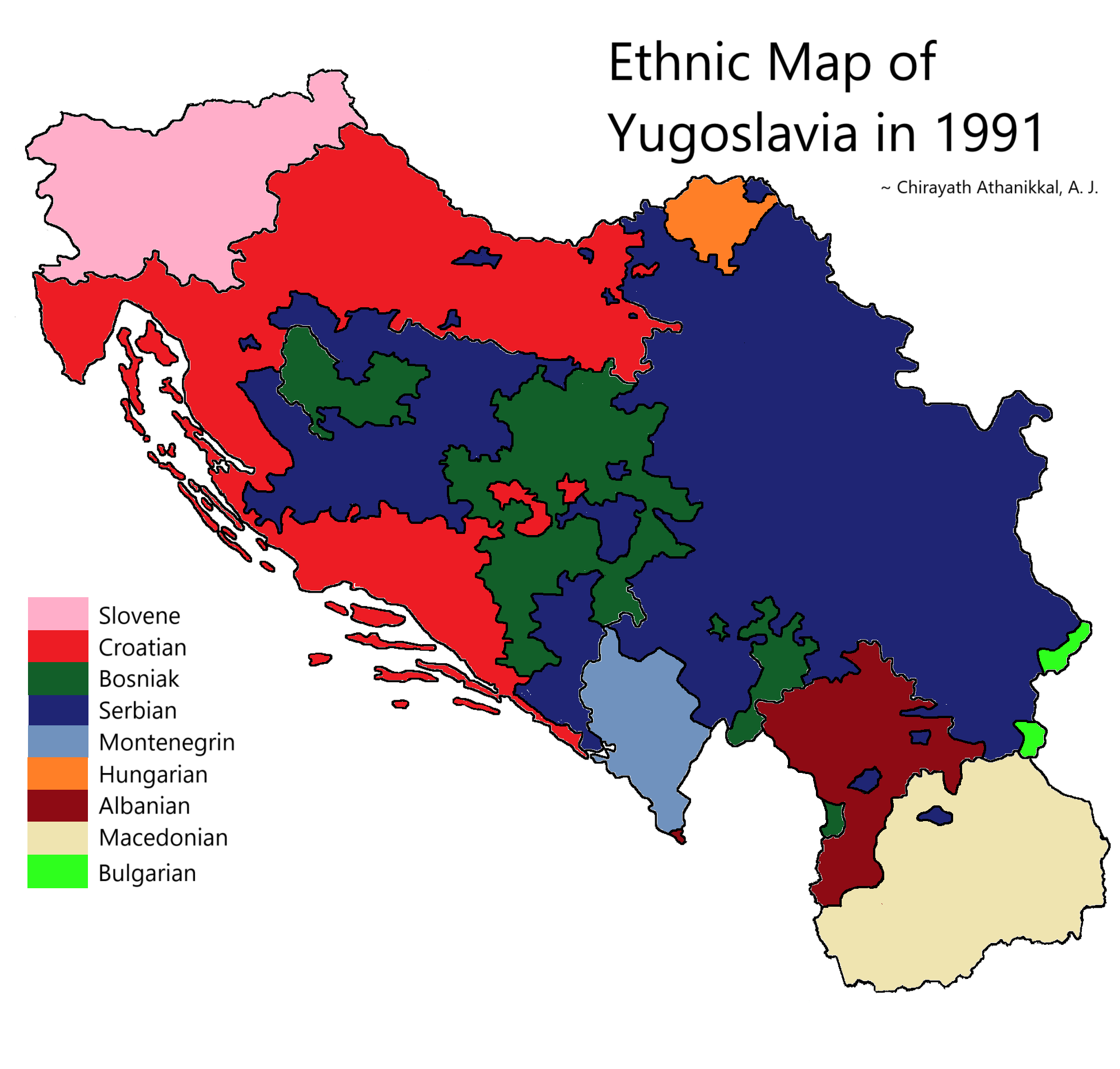
Ethnic Map of Yugoslavia in 1991
The "Ethnic Map of Yugoslavia in 1991" provides a detailed visualization of the diverse ethnic groups that populated the...
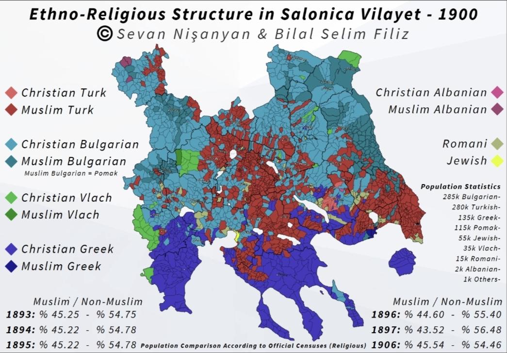
Ethno-Religious Structure Map of Salonica Vilayet 1900
...
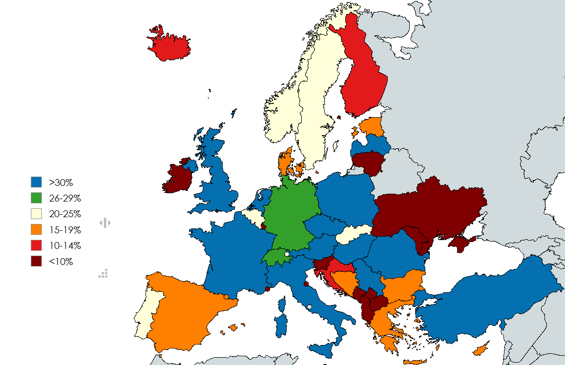
Right Wing Populist Parties Support Rate Map in Europe
This map visualizes the current collective support rate of right-wing populist parties across Europe, based on various p...
Map of the First Balkan War (1912)
...
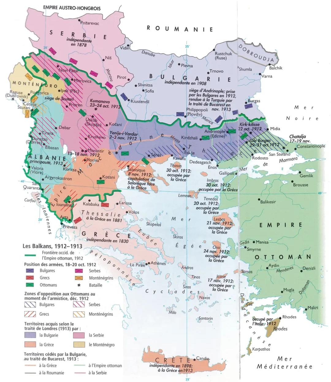
Balkan Wars 1912-1913 Map
The map titled "The Balkan Wars (1912-1913) Map" illustrates the territorial changes and military engagements that trans...
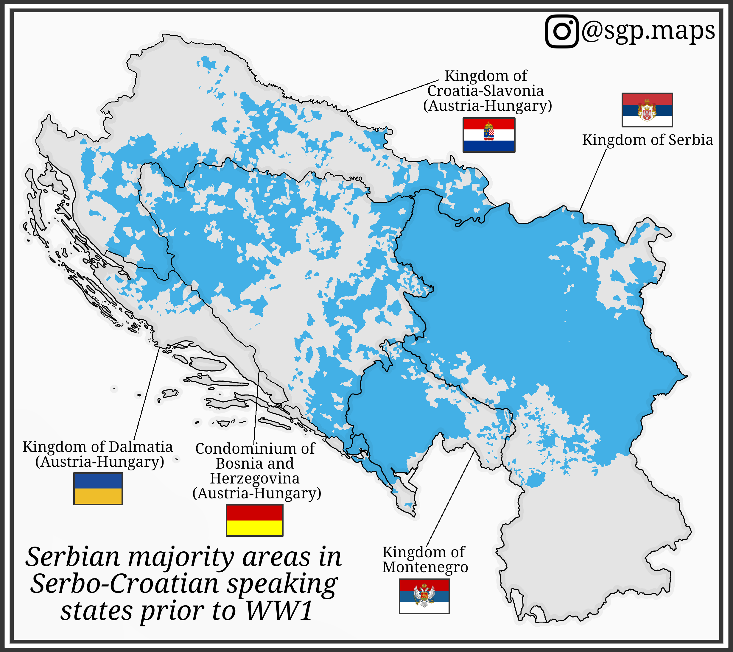
Serbian Majority Areas Map in Serbo-Croatian States Before WW1
This map illustrates the distribution of Serbian majority areas in the regions where Serbo-Croatian was spoken prior to ...
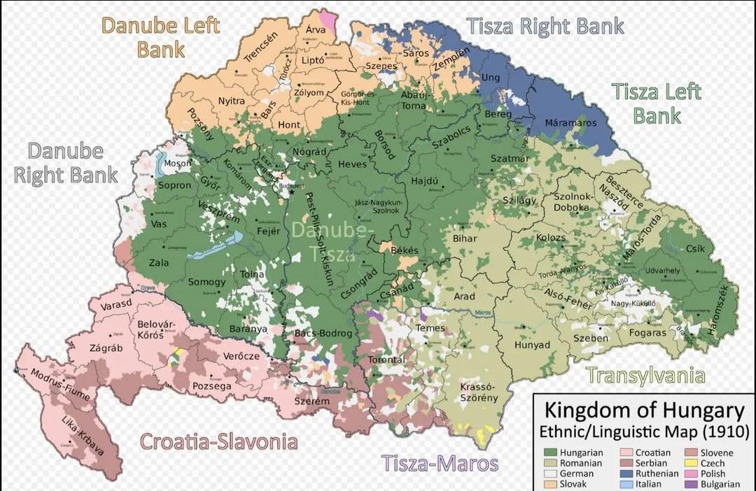
Ethnic Map of the Kingdom of Hungary in 1910
The "Ethnic Map of the Kingdom of Hungary in 1910" provides a vivid representation of the diverse ethnic landscape of Hu...
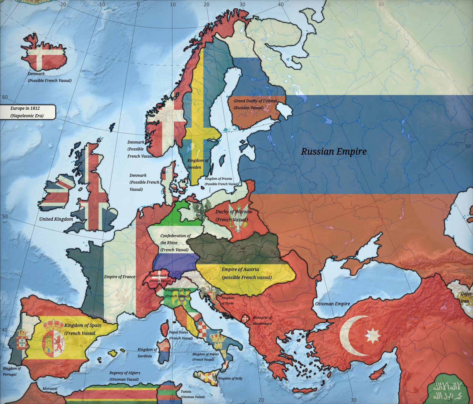
Political Map of Europe in 1812
The map titled "Europe in 1812" provides a detailed political landscape of Europe during a pivotal moment in history. It...
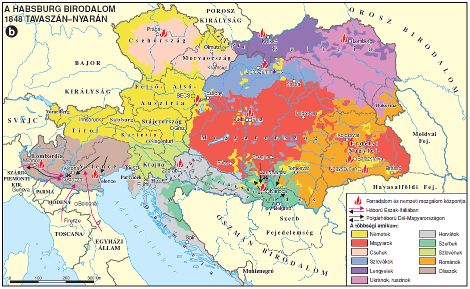
Ethnic Composition Map of the Austrian Empire 1848
The map titled "The Ethnic Make-up of the Austrian Empire in 1848" visualizes the complex tapestry of ethnic groups that...
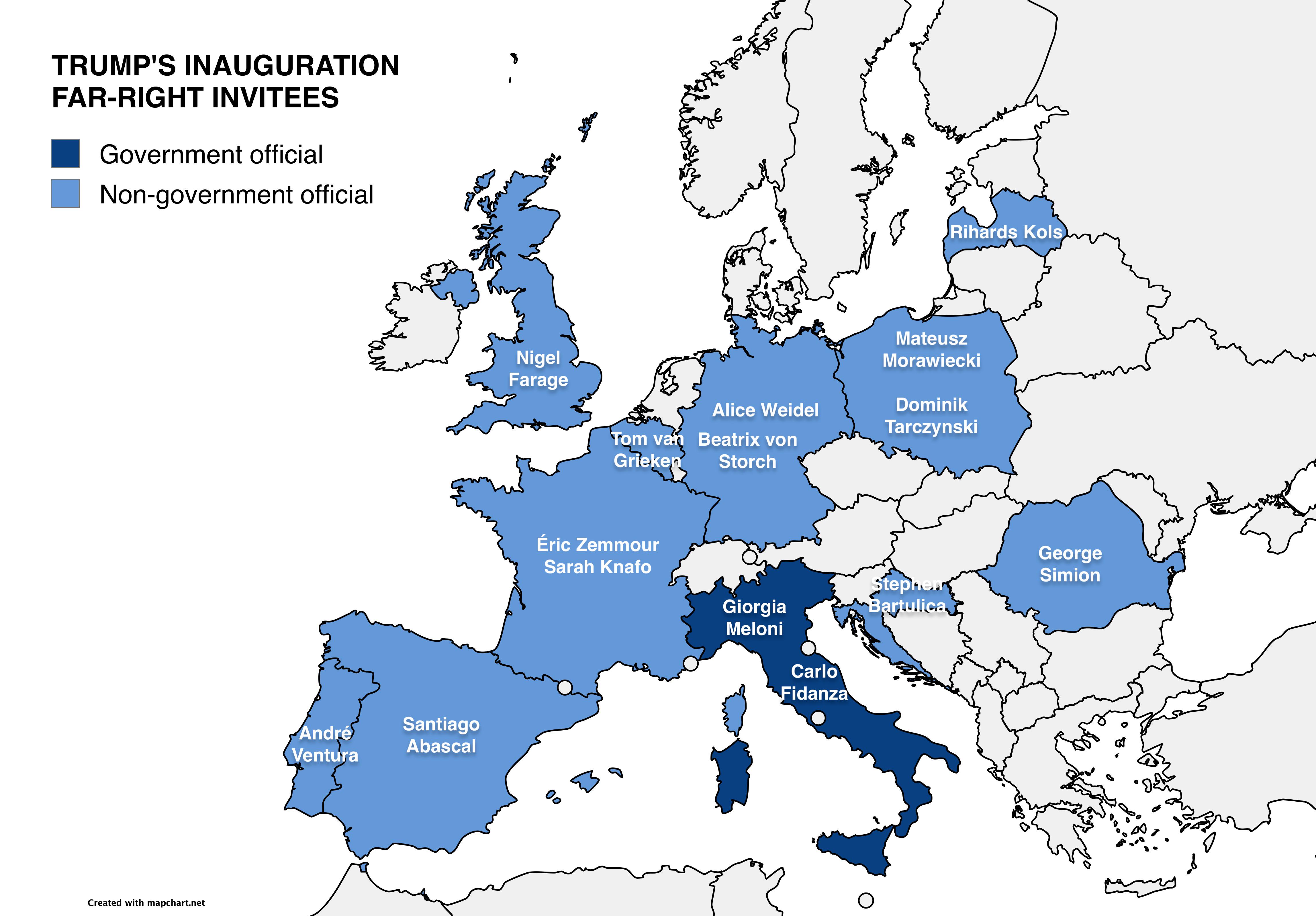
Map of Far-Right European Officials at Trump’s Inauguration
This map visually represents the various far-right European officials who received invitations to Donald Trump's second ...
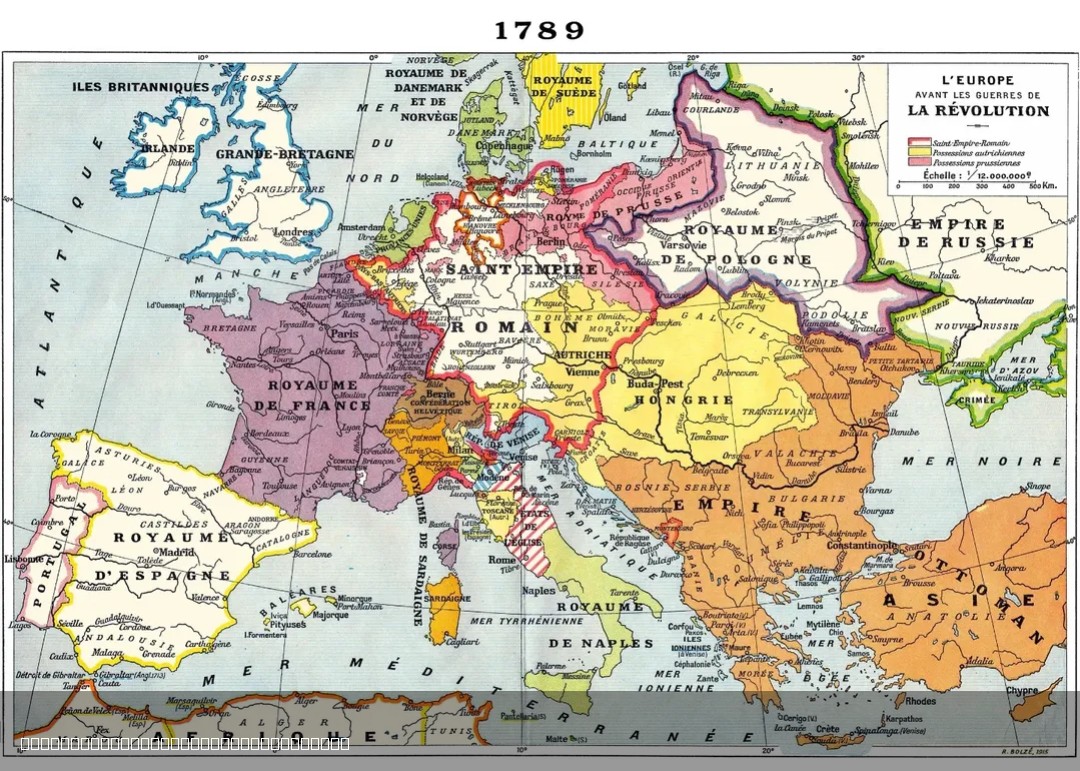
1915 French Map of Europe in 1789
The 1915 French map of Europe in 1789 offers a historical perspective on the political landscape of Europe just before t...
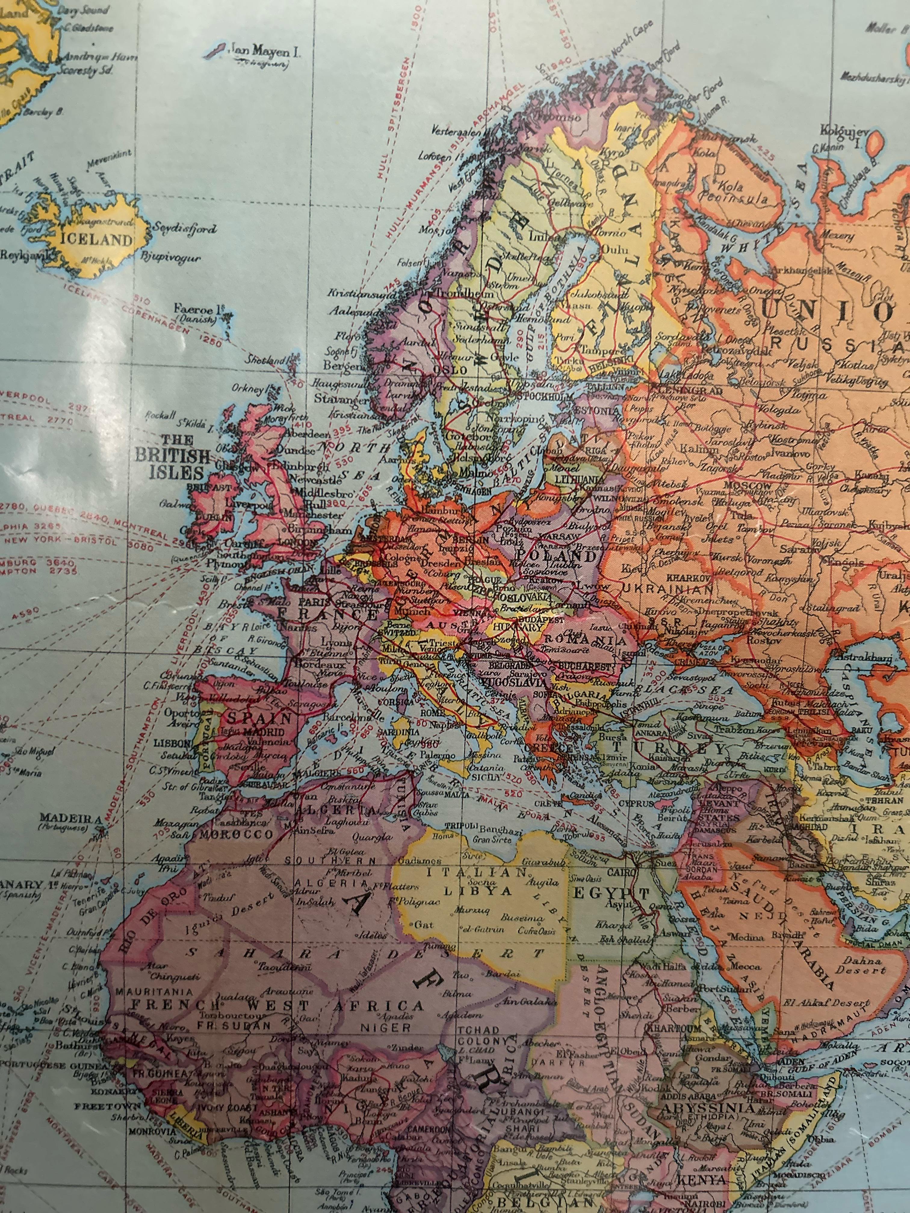
European Political Map from the 1920s
In this period, countries like Poland regained their independence after over a century of partition, while others like H...
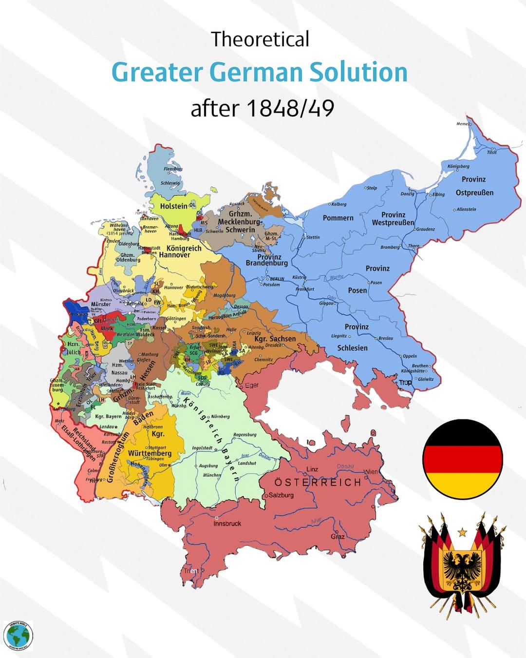
Greater German Solution Map 1848-1849
...
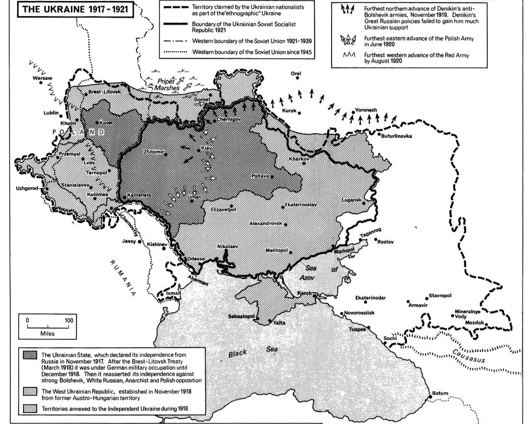
Ukrainian Boundaries Evolution Map 1917-1921
The "Evolution of Ukrainian Boundaries, 1917-1921" map illustrates a tumultuous period in Ukraine's history, showcasing ...
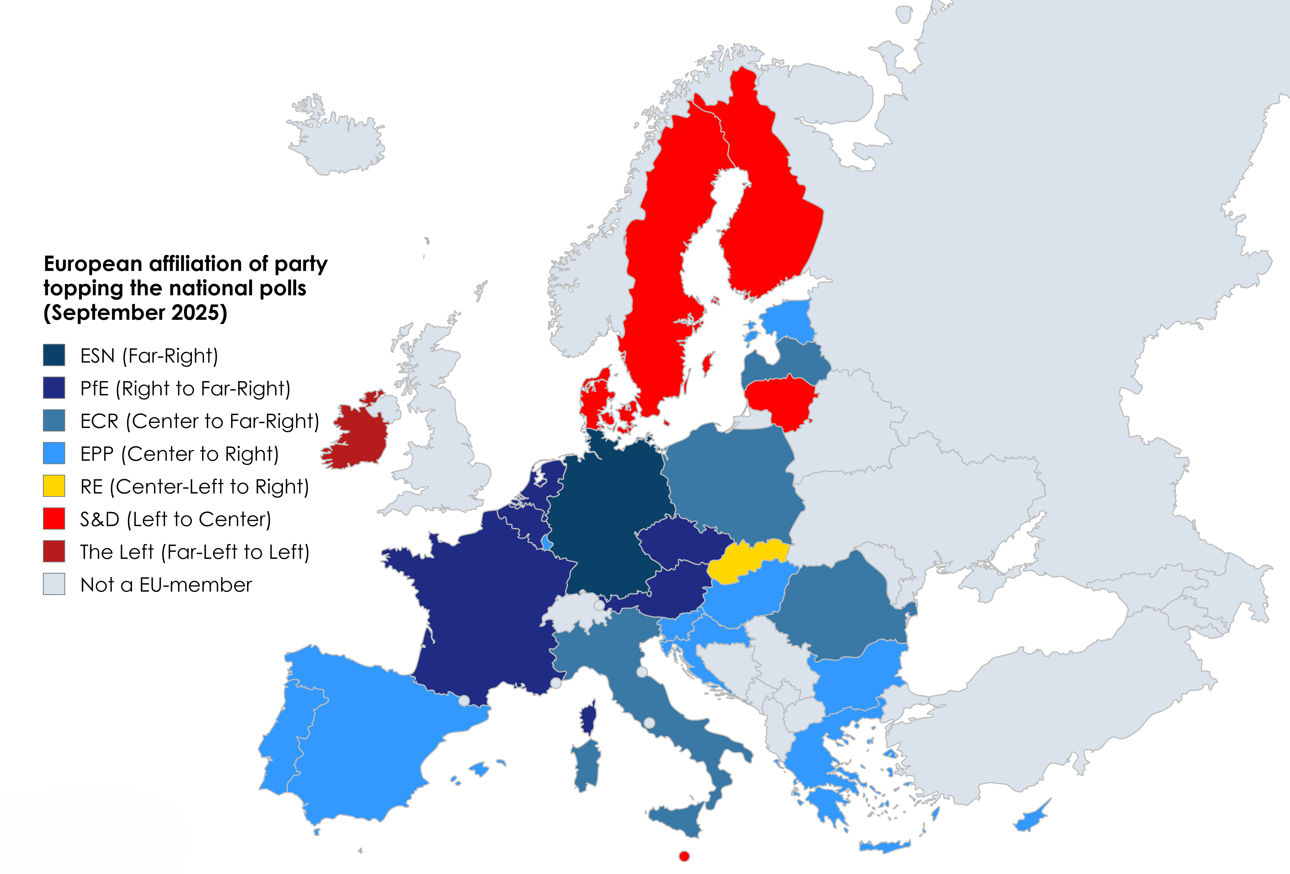
EU National Polls by Party Map
This map provides a clear visualization of the current political landscape in the European Union by displaying which pol...
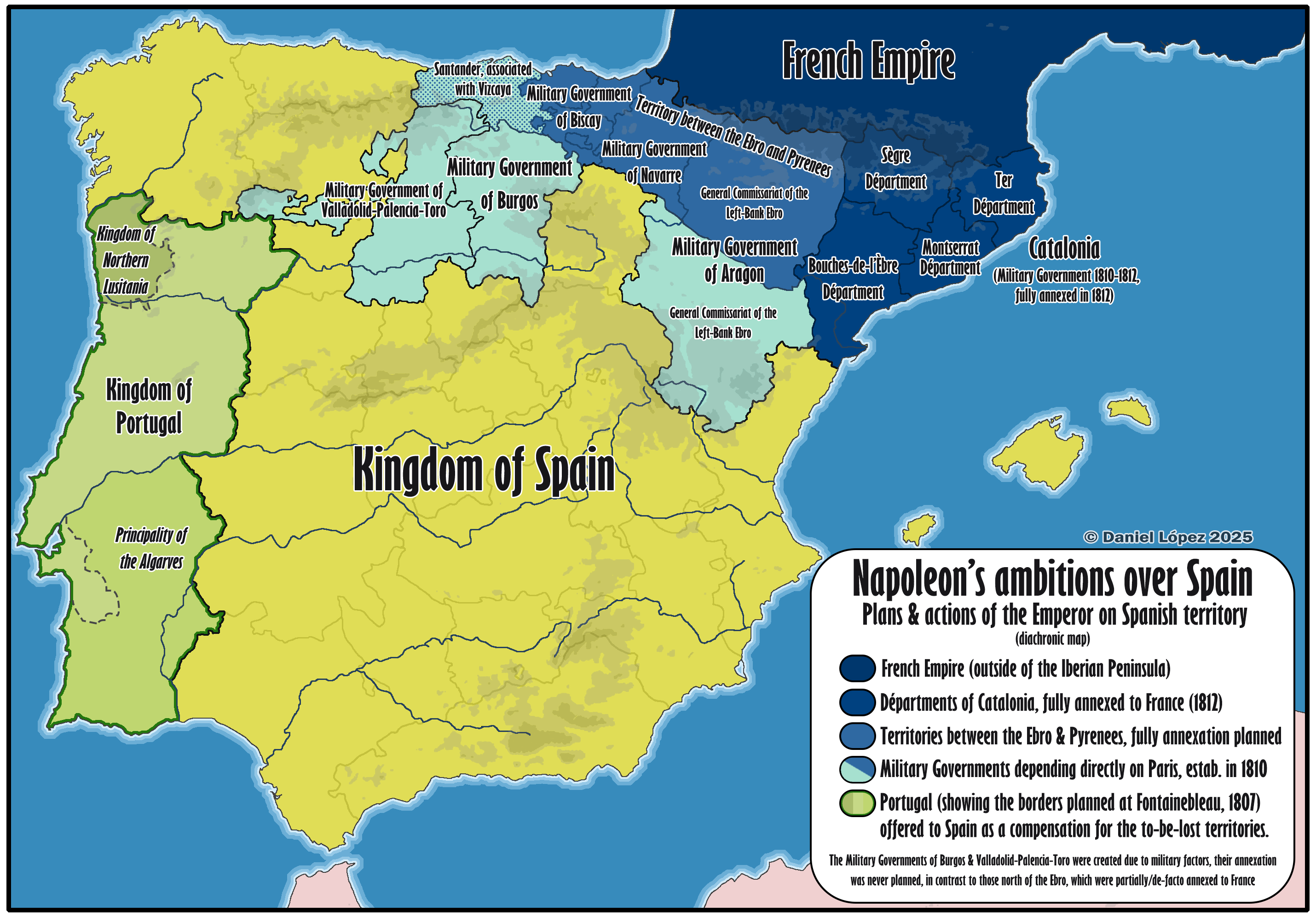
Map of Napoleon's Territorial Ambitions in Spain
...
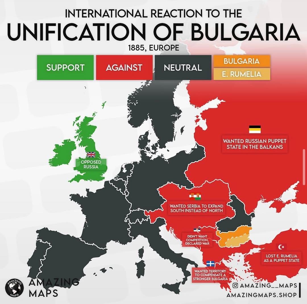
International Reaction to the Unification of Bulgaria Map
...
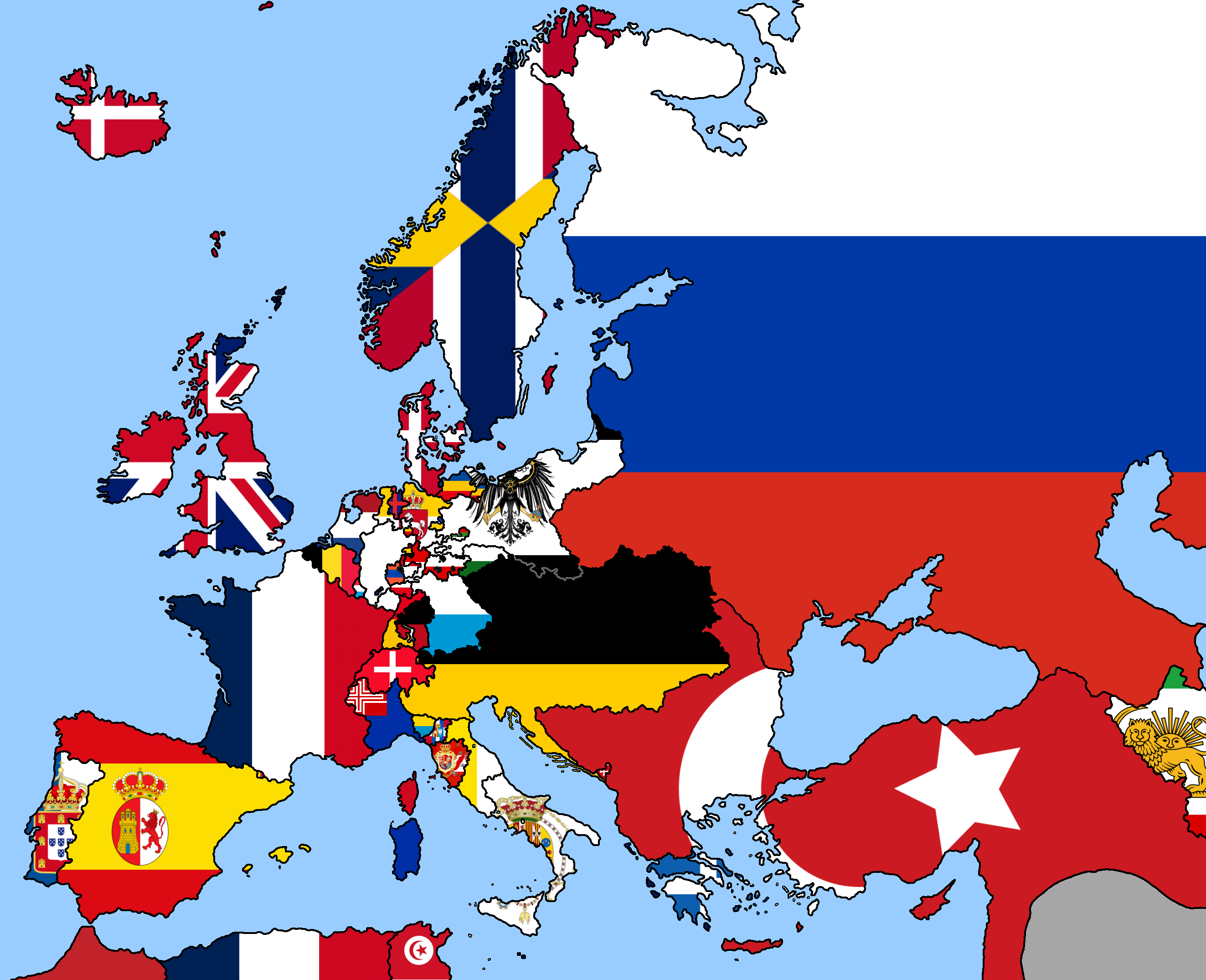
1849 Europe Political Map
The 1849 Europe political map is a fascinating snapshot of a continent undergoing significant changes in the wake of rev...