Bougainville Independence Map and Future Nation Status

Alex Cartwright
Senior Cartographer & GIS Specialist
Alex Cartwright is a renowned cartographer and geographic information systems specialist with over 15 years of experience in spatial analysis and data...
Geographic Analysis
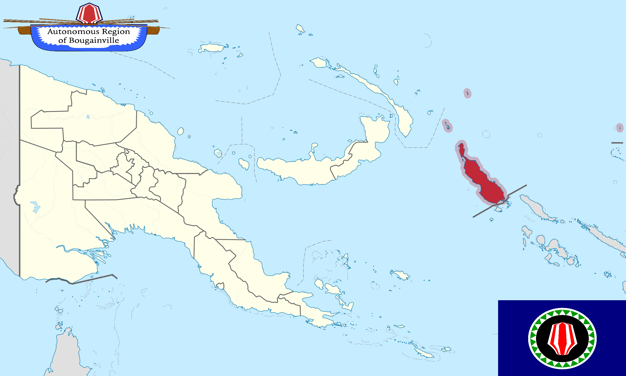
What This Map Shows
This map provides a detailed visualization of Bougainville, an autonomous region of Papua New Guinea, which is on the verge of becoming the newest nation in the world by September 2027. The map outlines Bougainville's geographical boundaries, significant locations, and highlights the administrative divisions within the region. It serves as a visual representation of the impending political change and the aspirations of the Bougainvillean people towards independence.
Deep Dive into Bougainville's Political Landscape
Bougainville is situated in the South Pacific Ocean, approximately 500 kilometers northeast of the Papua New Guinea mainland. This island is not only rich in natural resources, such as copper and gold, but also boasts a unique cultural heritage that has been shaped by its diverse indigenous communities. The journey towards independence began in the late 20th century, culminating in a referendum held in late 2019 where over 97% of the voters chose independence from Papua New Guinea.
What's fascinating is that Bougainville's desire for sovereignty is rooted in a history of conflict and struggle. The Bougainville Civil War, which lasted from 1988 to 1998, was a significant event that highlighted the local population's grievances against the central government. The war was primarily fueled by conflicts over land rights, environmental degradation from mining activities, and the desire for greater autonomy. Following the peace agreement in 2001, Bougainville was granted autonomous status, allowing it to govern many of its affairs independently.
The referendum's outcome was a historic moment for Bougainville, marking a significant step towards self-determination. However, independence is not simply about political autonomy. It raises questions about economic sustainability, governance, and social cohesion. Bougainville's economy heavily relies on agriculture and artisanal mining, but there are concerns about how an independent Bougainville will manage its economic resources and ensure the well-being of its citizens.
Moreover, the transition to nationhood will involve establishing a new government, legal frameworks, and public services. The map serves as a reminder of these challenges, showing not just the geographical contours of Bougainville but also the complexities of its political landscape.
Regional Analysis
The map delineates key regions within Bougainville, including the North, Central, and South Bougainville. Each of these areas has distinct characteristics and challenges. For instance, North Bougainville is more populated and urbanized, with Buka as its capital. It has seen significant infrastructure development compared to other regions. In contrast, Central Bougainville, which includes Arawa, is still recovering from the impacts of civil conflict but is rich in agriculture and potential for tourism.
Interestingly, South Bougainville is known for its rugged terrain and smaller population. This area has been less developed and faces challenges in terms of access to basic services. Comparing these regions reveals disparities in development, resource management, and access to education and healthcare. The map underscores these regional differences, prompting questions about how Bougainville will address these inequities as it moves towards independence.
Significance and Impact
The significance of Bougainville's move towards independence cannot be overstated. It represents a triumph of self-determination and a potential model for other indigenous movements worldwide. The implications of Bougainville's independence extend beyond its borders, as they could influence discussions on autonomy and governance in the Pacific and beyond.
Moreover, Bougainville's future will significantly impact its local communities. With the potential for independence, there is a need for robust economic planning and community engagement to ensure that development is inclusive and sustainable. Current trends indicate a growing emphasis on local governance and self-reliance, which could play a crucial role in shaping the nation’s identity and economic landscape.
As the world watches Bougainville's journey towards nationhood, it’s essential to consider the broader implications of such political changes. How will Bougainville balance its rich cultural heritage with the demands of modern governance? How will it navigate its relationships with neighboring countries and international entities? These questions will be pivotal as Bougainville prepares to take its place on the world stage in 2027.
In conclusion, this map not only highlights geographical details but also encapsulates the hopes, challenges, and aspirations of the Bougainvillean people as they embark on a new chapter towards independence.
Visualization Details
- Published
- September 6, 2025
- Views
- 102
Comments
Loading comments...