nmapa.org logo
nmapa.org
HomeGalleryTagsAboutPrivacyDisclaimer
Home›Tags›pacific islands

pacific islands Maps

3 geographic visualizations tagged with "pacific islands"
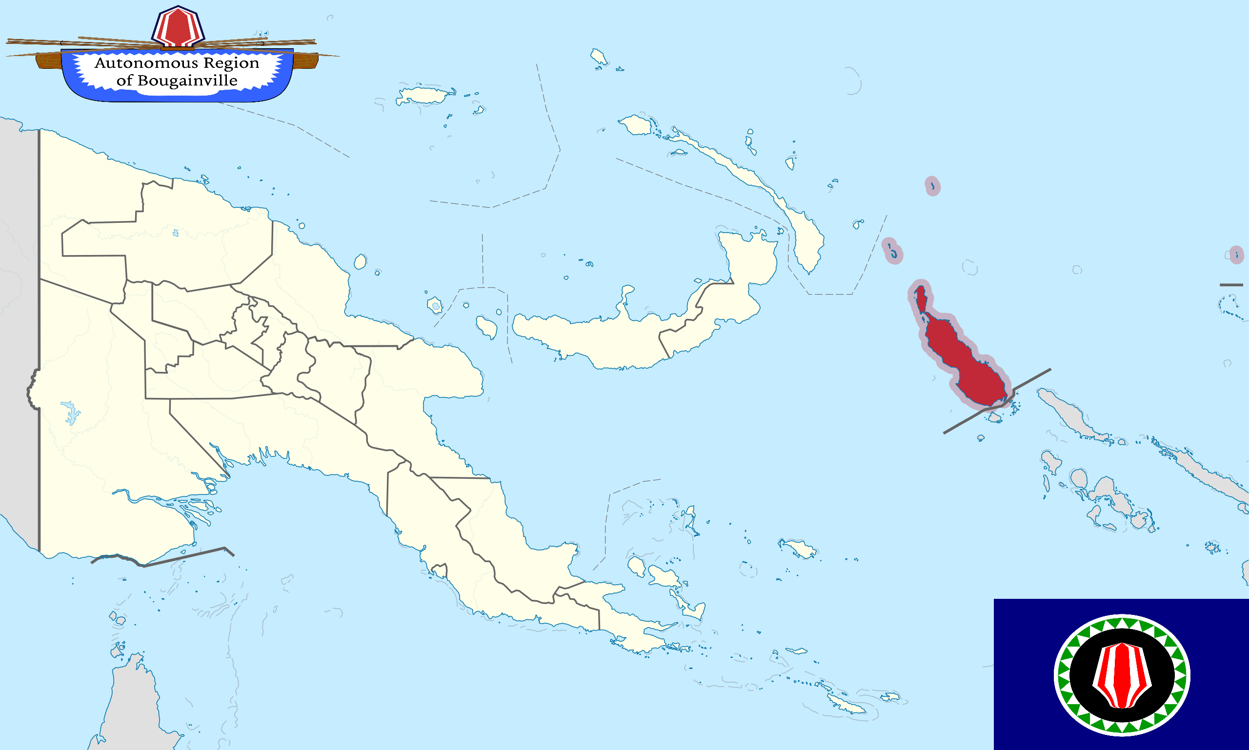
Bougainville Independence Map and Future Nation Status

Bougainville Independence Map and Future Nation Status

This map provides a detailed visualization of Bougainville, an autonomous region of Papua New Guinea, which is on the ve...

👁 104📅 9/6/2025
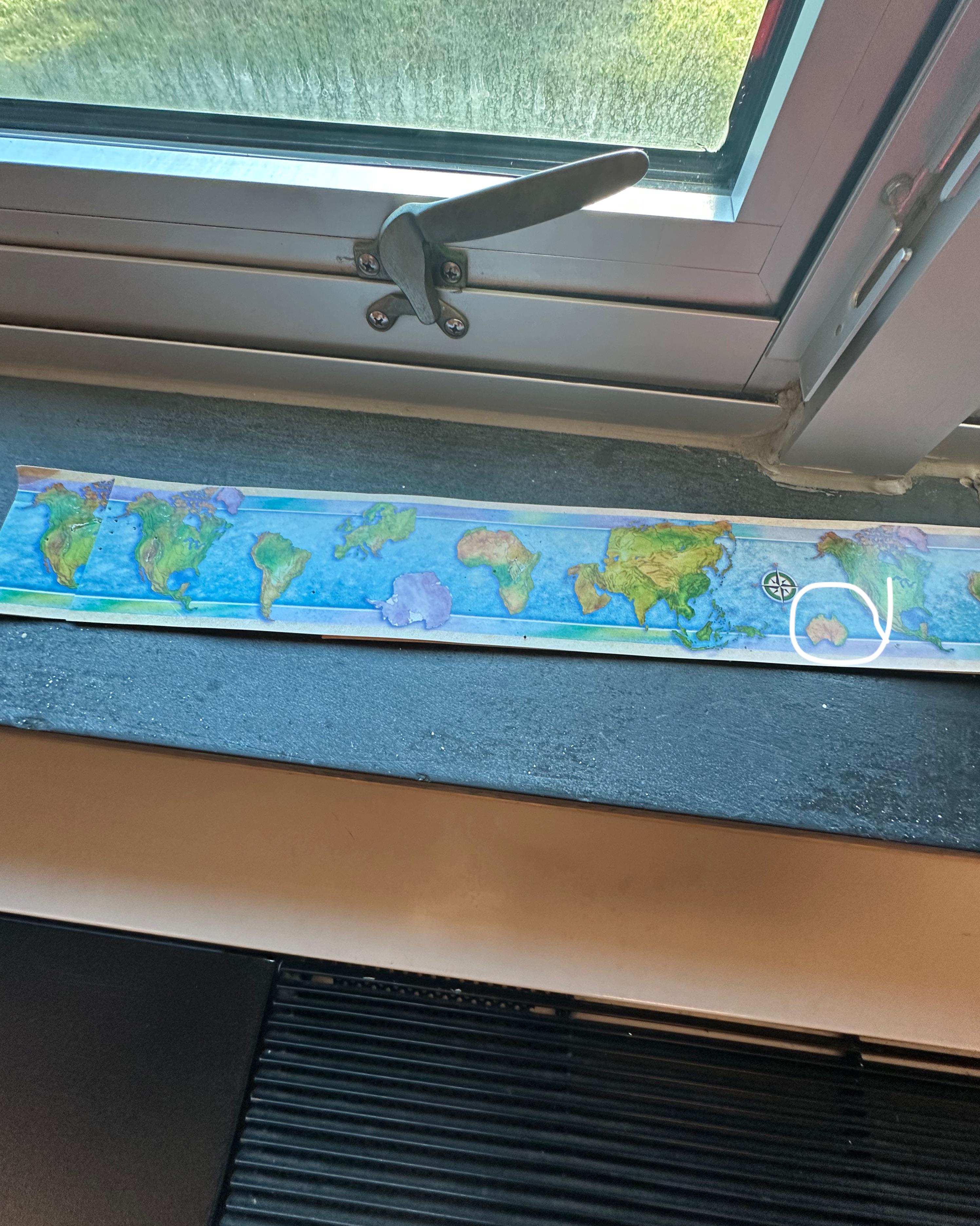
Map Showing Missing New Zealand

Map Showing Missing New Zealand

The visualization titled 'Map at school forgot New Zealand' highlights a curious omission in a geographical representati...

👁 52📅 10/5/2025
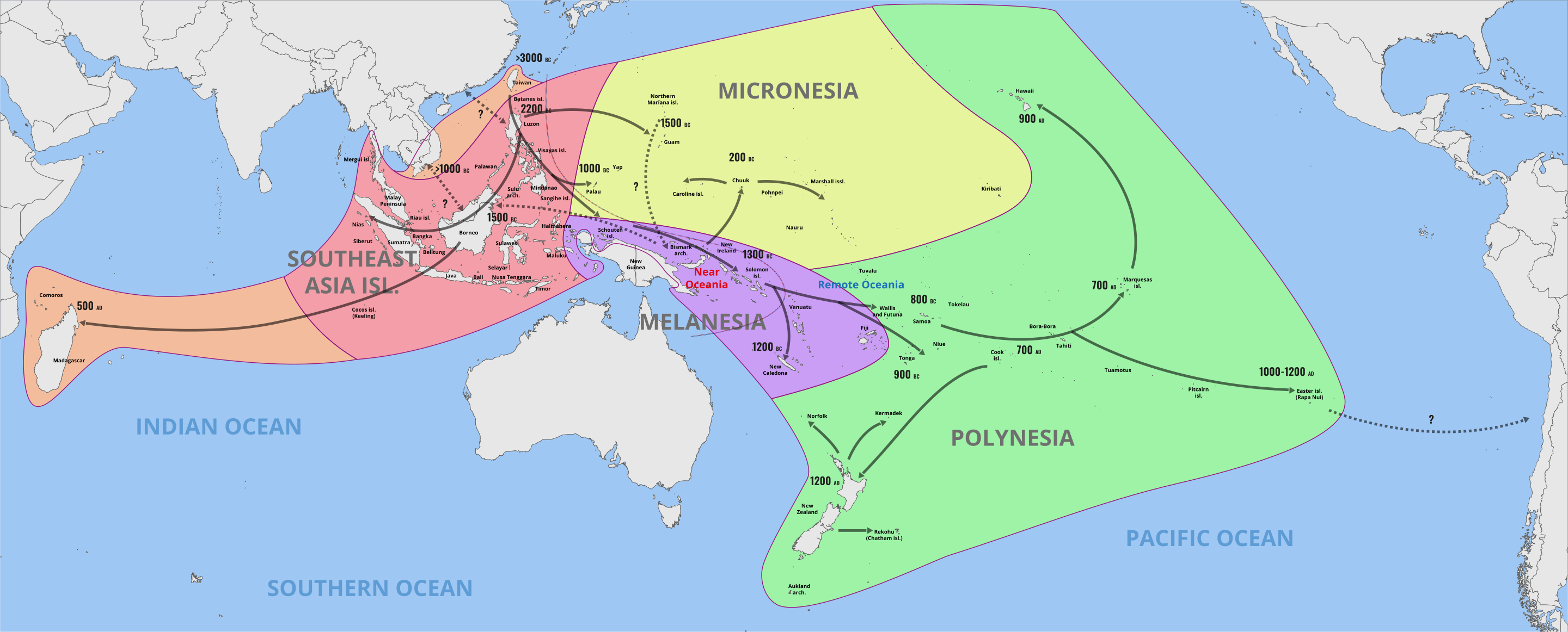
Austronesian Language Family Spread Map

Austronesian Language Family Spread Map

The "Austronesian Language Family Spread Map" illustrates the vast distribution of Austronesian languages across a diver...

👁 22📅 10/24/2025
← Browse All TagsBrowse All Maps
nmapa.org logo

nmapa.org

Your premium gateway to the world's most fascinating maps and geographical visualizations. Explore, discover, and understand our planet through the art of cartography.

Explore

  • Home
  • About
  • Gallery

Legal

  • Privacy Policy
  • Disclaimer
  • Terms of Service

© 2025 nmapa.org. All rights reserved. Made with ❤️ for geography enthusiasts worldwide.