europe Maps
220 geographic visualizations tagged with "europe"
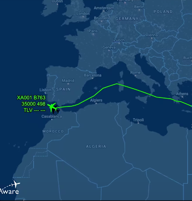
Netanyahu's Flight Path Avoidance Map
This map visualizes the flight path of Israeli Prime Minister Benjamin Netanyahu as he travels to the United States, hig...
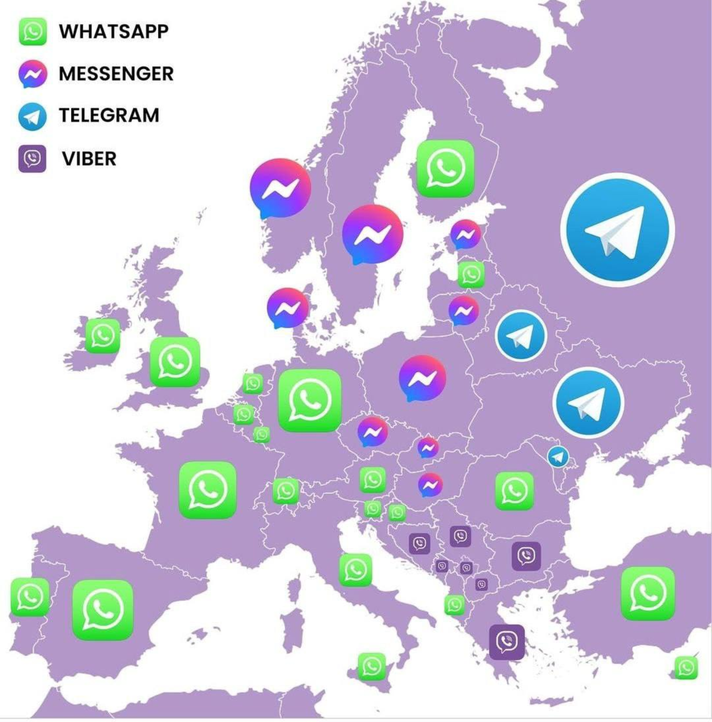
Most Popular Messenger Apps in European Countries Map
This map visualizes the most popular messaging applications used in various countries across Europe. By highlighting the...
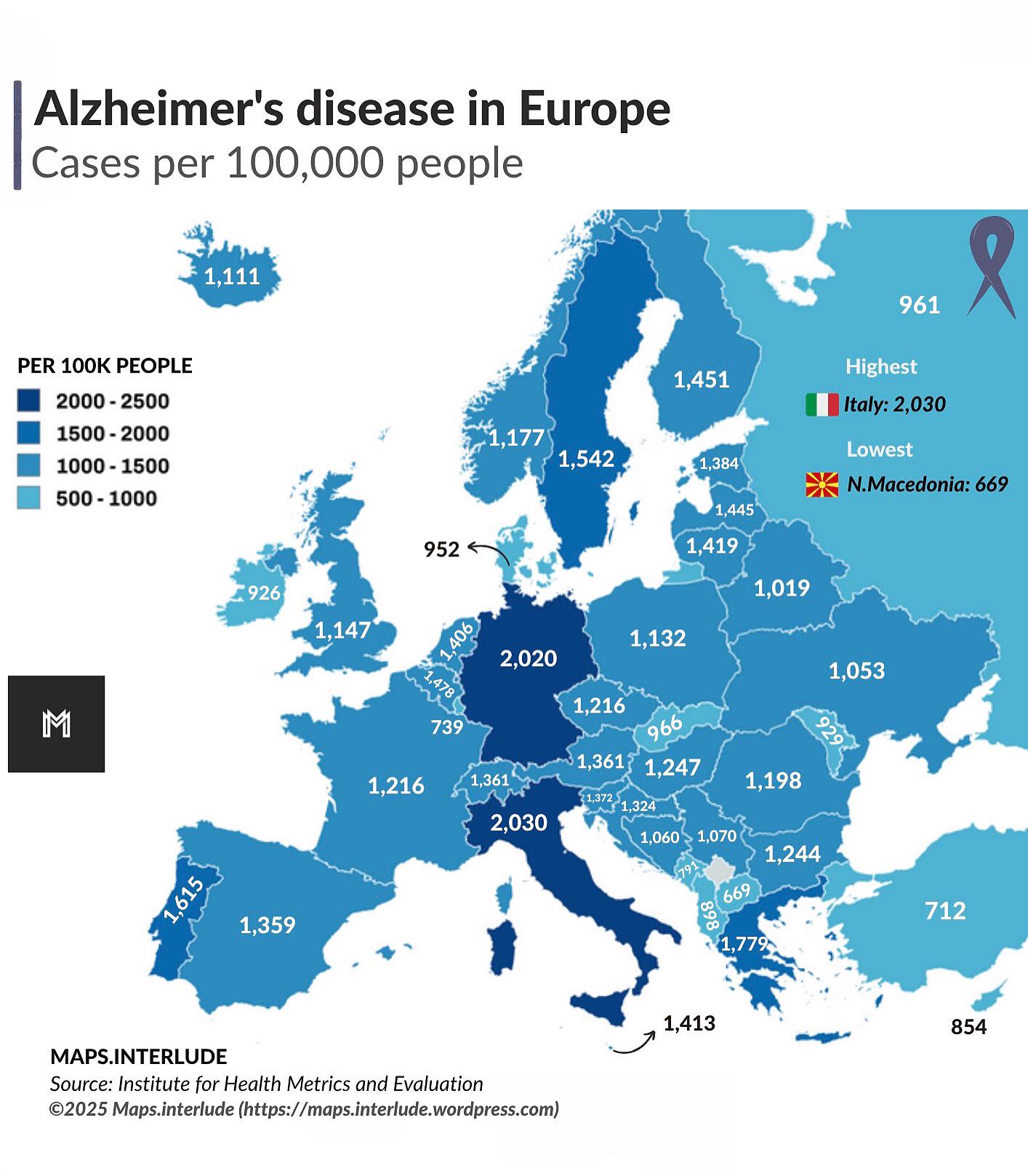
Alzheimer’s Disease Prevalence Map in Europe
The "Alzheimer’s Disease Prevalence Map in Europe" provides a visual representation of the distribution of Alzheimer’s d...
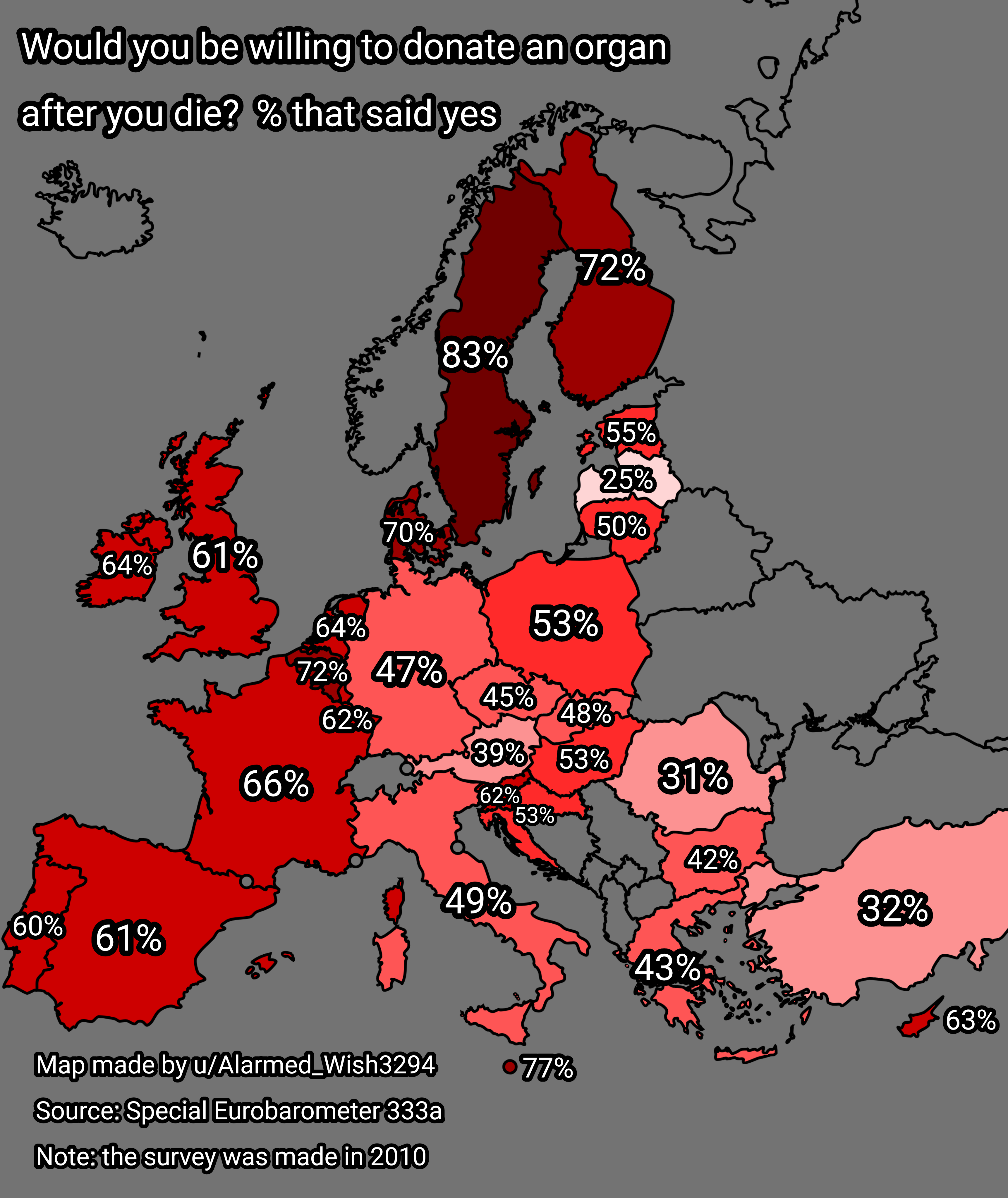
Organ Donation Willingness Map of Europe
The "Willingness to Donate an Organ After Death in Europe" map provides an insightful visualization of attitudes towards...
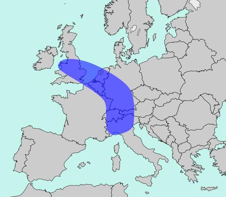
Population Density Map of Europe
The map titled "The Blue Banana" visualizes Europe’s most densely populated corridor, home to approximately 111 million ...
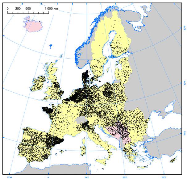
Pig Farm Density Map of Europe
The "Density of Pig Farms across Europe" map highlights the geographical distribution of pig farming throughout the cont...
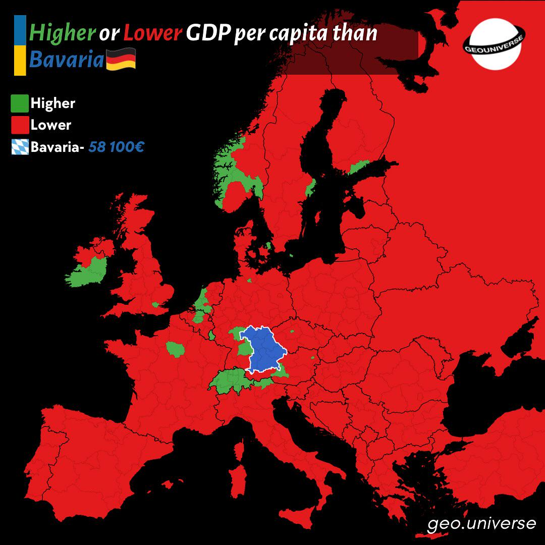
Bavaria Wealth Comparison Map to Europe
The "How Rich is Bavaria Compared to the Rest of Europe?" map provides a visual representation of the economic status of...
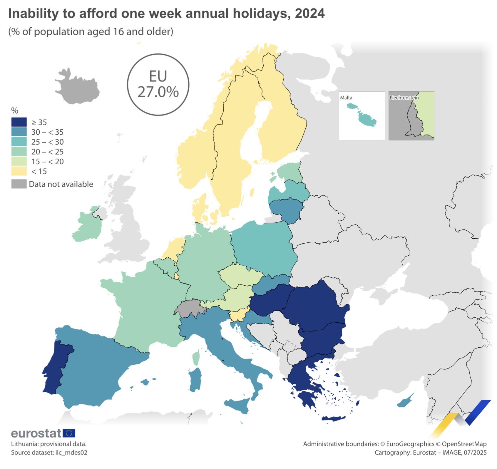
Map of Europeans Unable to Afford Holiday
The map titled "27% of Europeans could not afford a week-long holiday" visually represents the percentage of the populat...
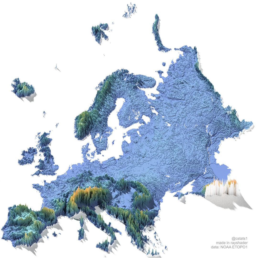
Elevation Map of Europe
The "Elevation Map of Europe" provides a visual representation of the varying altitudes across the continent. This map h...
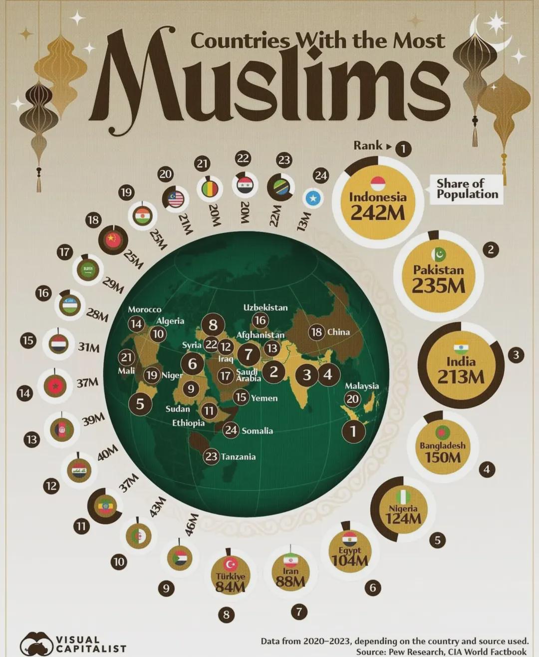
Countries With The Most Muslims Map
This map illustrates the distribution of Muslim populations across the globe, highlighting the countries with the larges...
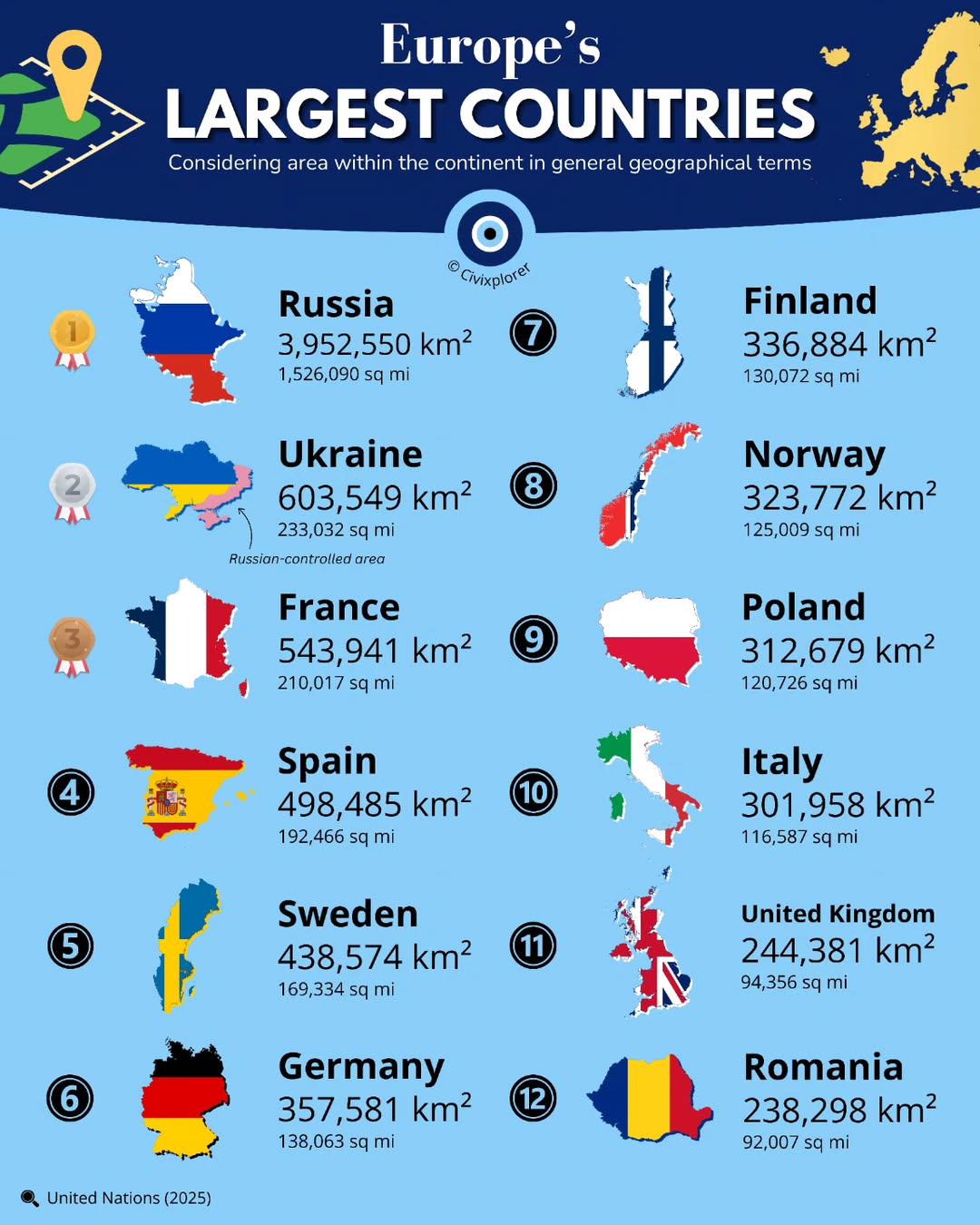
Largest Countries in Europe by Land Area Map
This map presents a clear visualization of the largest countries in Europe by land area, showcasing the vast differences...
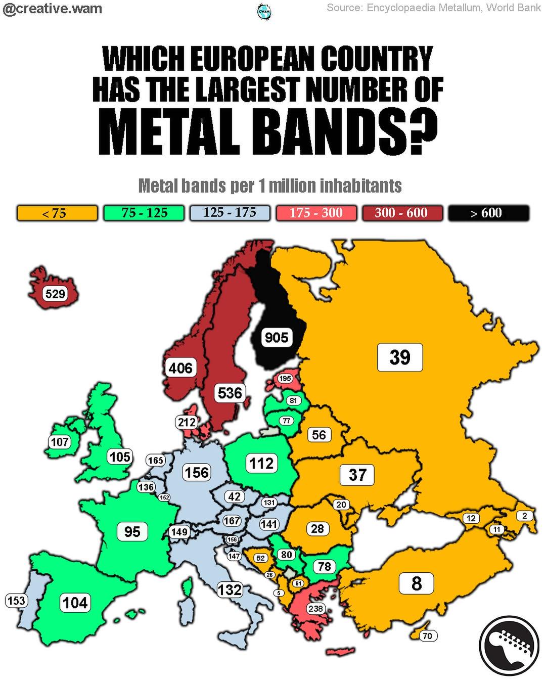
Map of Europe's Metal Production Centers
The visualization titled \...
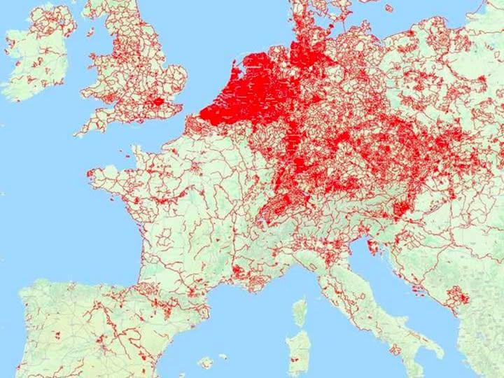
Cycle Paths Map of Europe
...
Life Expectancy in Europe Map
The "Life Expectancy in Europe Map" offers a visual representation of how life expectancy has evolved across different c...
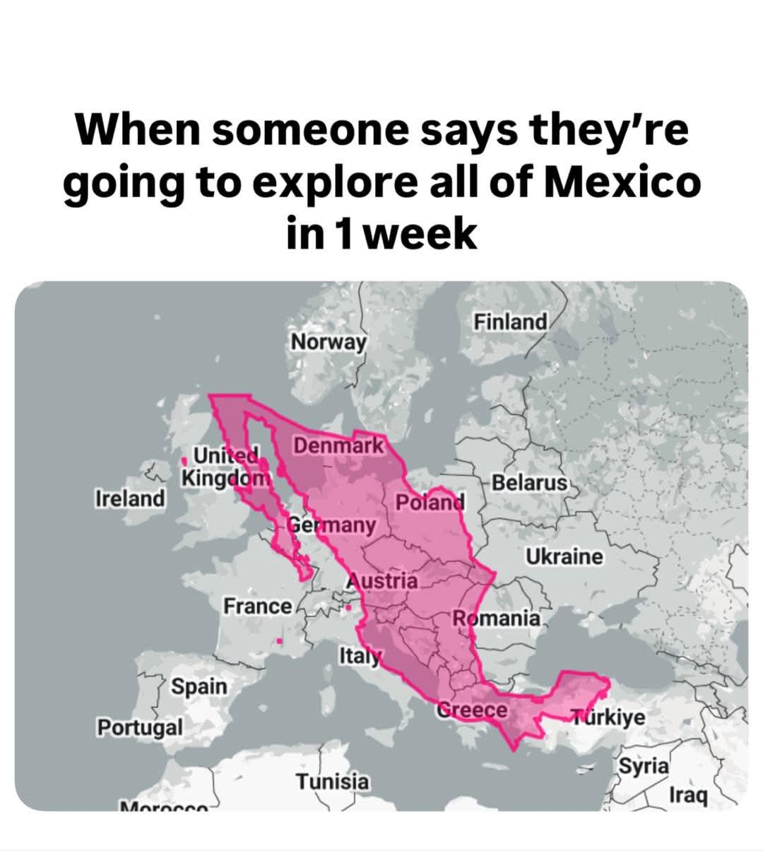
Mexico Size Comparison Map with Europe
This map provides a clear visual comparison between the size of Mexico and various European countries, illustrating the ...
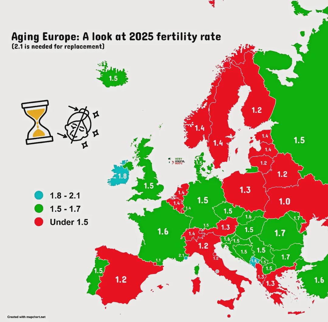
Ageing Population Map of Europe
The "Ageing Europe!" map provides a comprehensive visualization of the demographic shifts occurring across the continent...
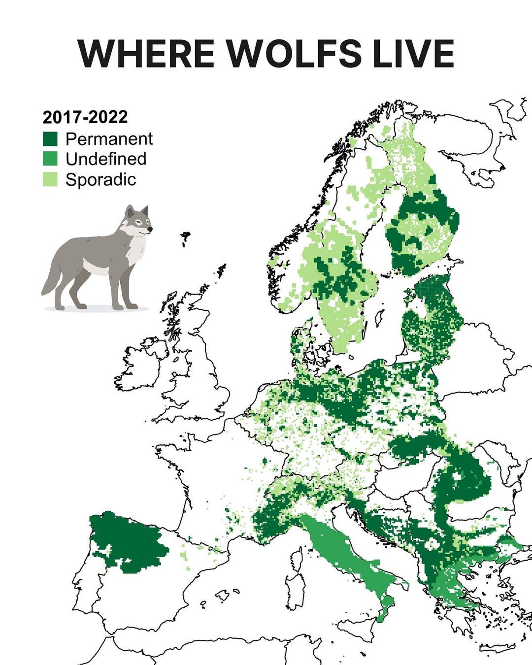
Wolf Distribution Map in Europe
The "Where Wolves Live in Europe" map provides a detailed visual representation of the current distribution of wolf popu...
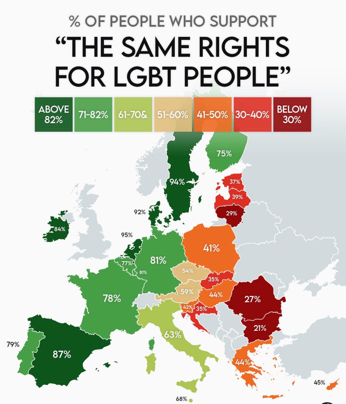
Support for LGBT People in the EU Map
This map provides a visual representation of support for LGBT individuals across various countries in the European Union...
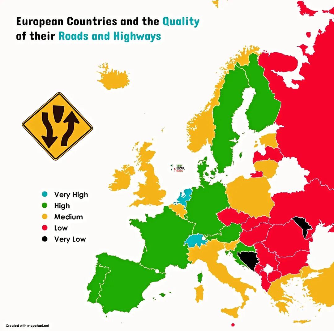
Road Quality by European Country Map
This map illustrates the quality of roads and highways across various European countries, highlighting the differences i...
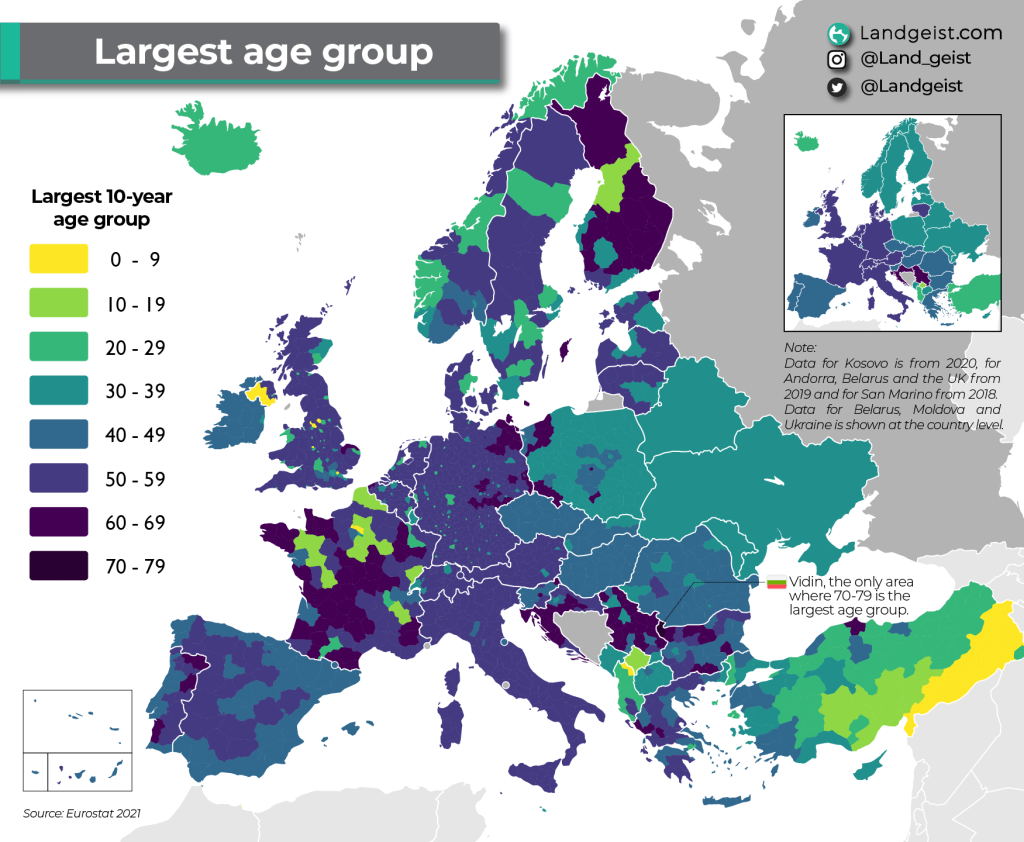
Europe Largest Age Groups Map
The "Europe Largest Age Groups Map" provides a visual representation of the demographic distribution of age groups acros...
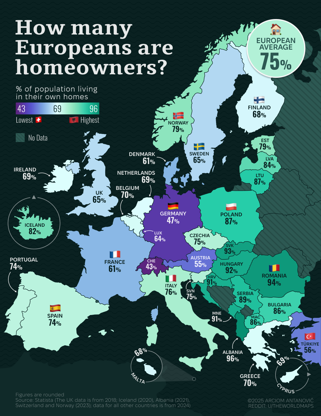
Map of European Homeownership Rates
This map illustrates the share of the European population living in their own homes, providing a clear visual representa...
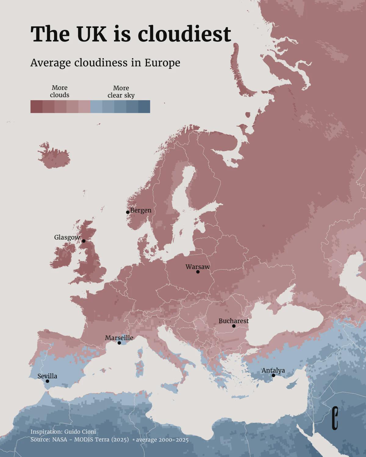
Average Cloudiness in Europe Map
...
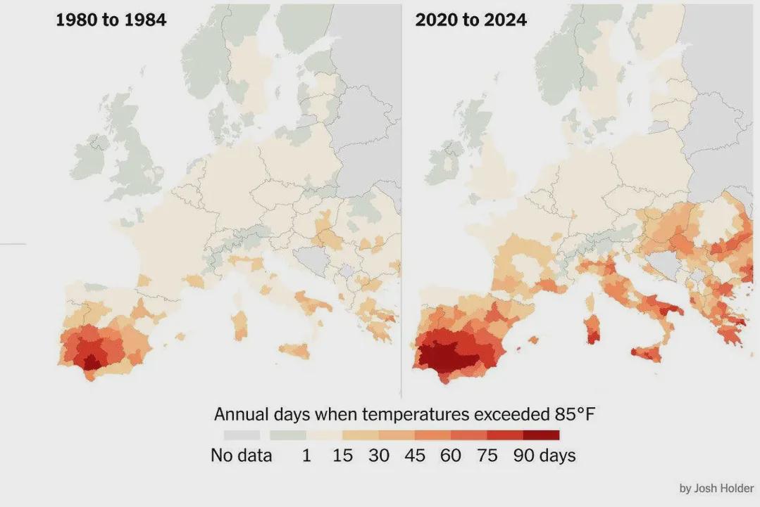
Days Over 30ºC in Europe Map
The visualization titled "Number of Days per Year When Temperatures Exceeded 30ºC (85°F) in Europe" provides a comprehen...

Time Zones in Europe During Winter Map
The "Time Zones in Europe During Winter" map provides a clear representation of the various time zones across European c...
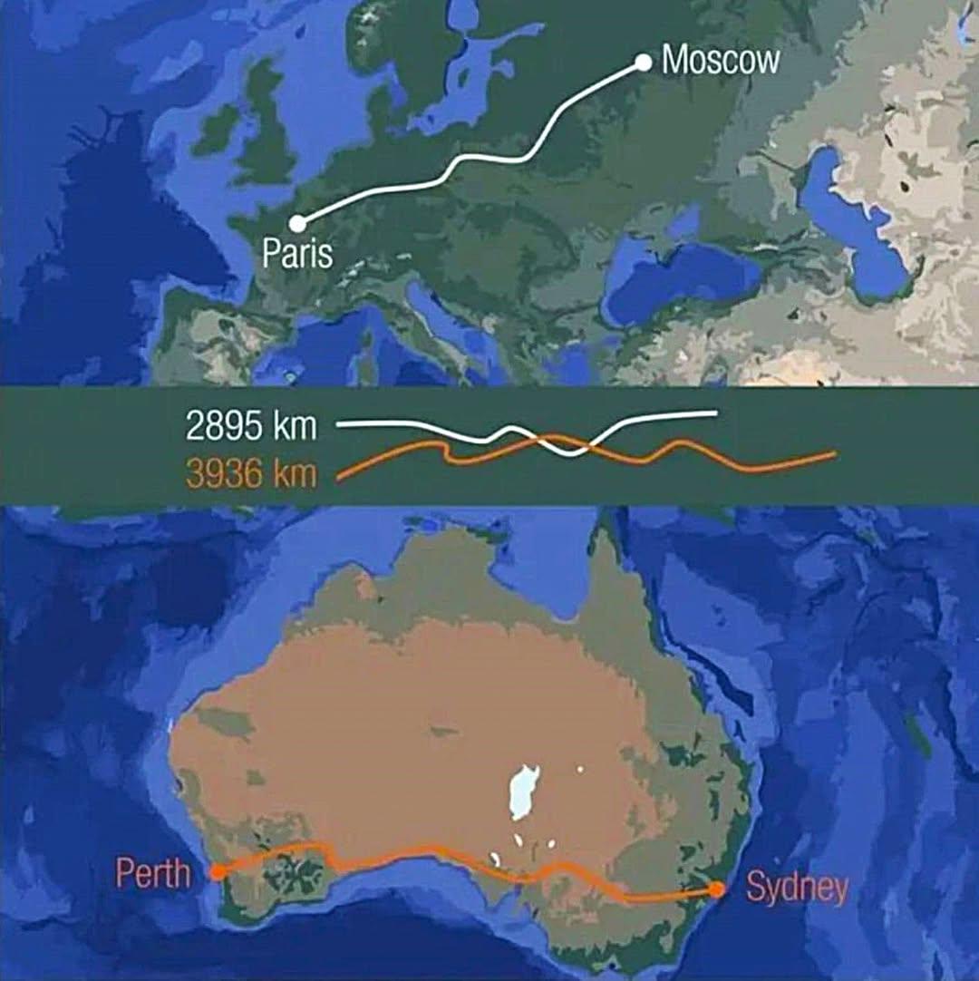
Distance Comparison Map: Australia and Europe
This visualization provides a striking comparison of distances by illustrating that crossing Australia from east to west...
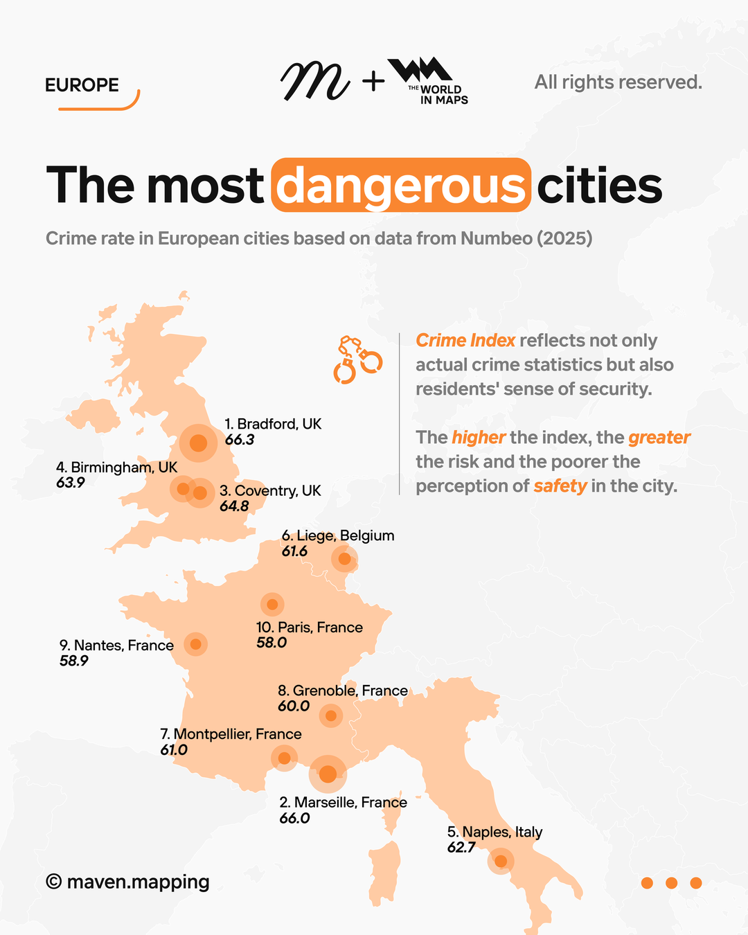
Crime Rate Map of Europe's Most Dangerous Cities
The visualization titled "The Most Dangerous Cities in Europe by Crime Rate" provides a comprehensive overview of urban ...
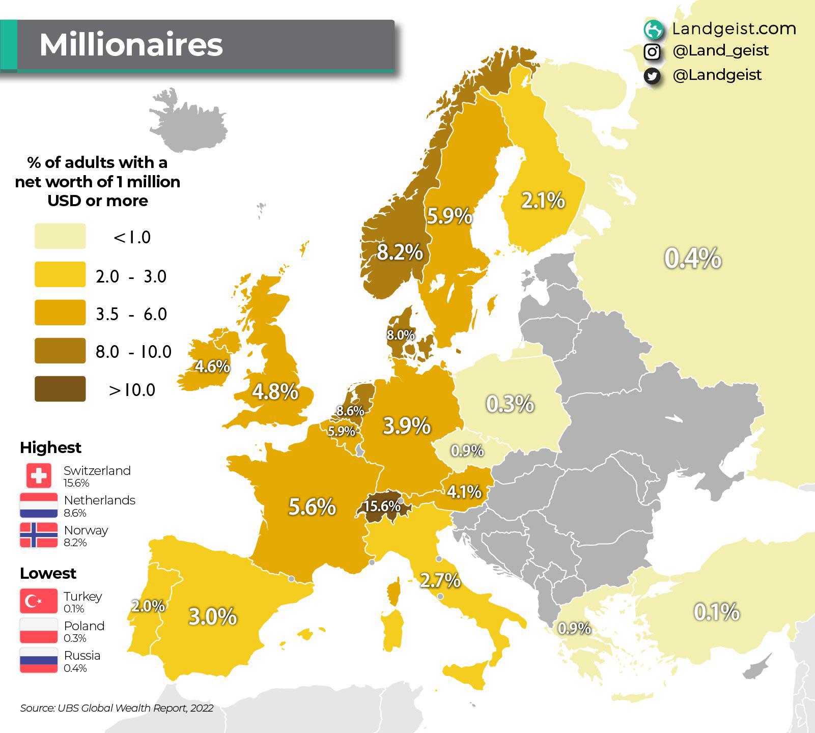
Millionaire Population Percentage Map of Europe
This map visualizes the percentage of millionaires within various European countries, offering a clear perspective on we...
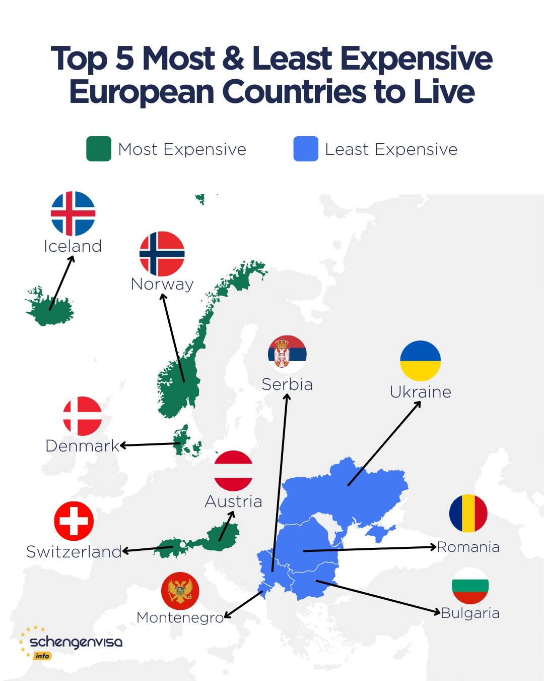
Most Expensive and Affordable Countries to Live in Europe Map
This map highlights the stark contrast between the most expensive and most affordable countries to live in Europe, prese...

Potato Consumption in Europe Map
...
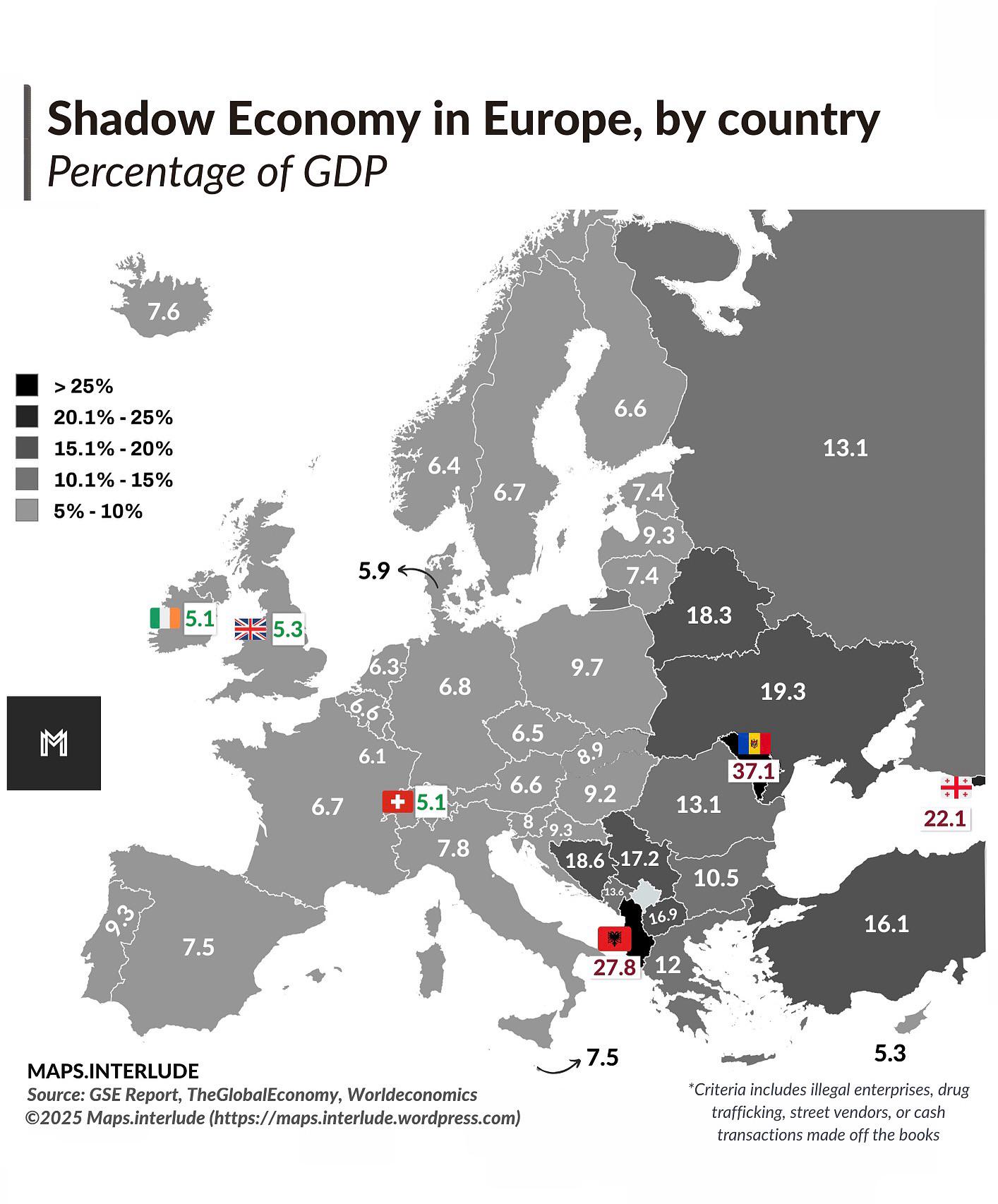
Shadow Economy in Europe by Country Map
The "Shadow Economy in Europe, by Country" map provides a revealing snapshot of the informal economy across various Euro...

November in Different European Languages Map
This map visually represents the name of the month 'November' translated into various European languages. It highlights ...
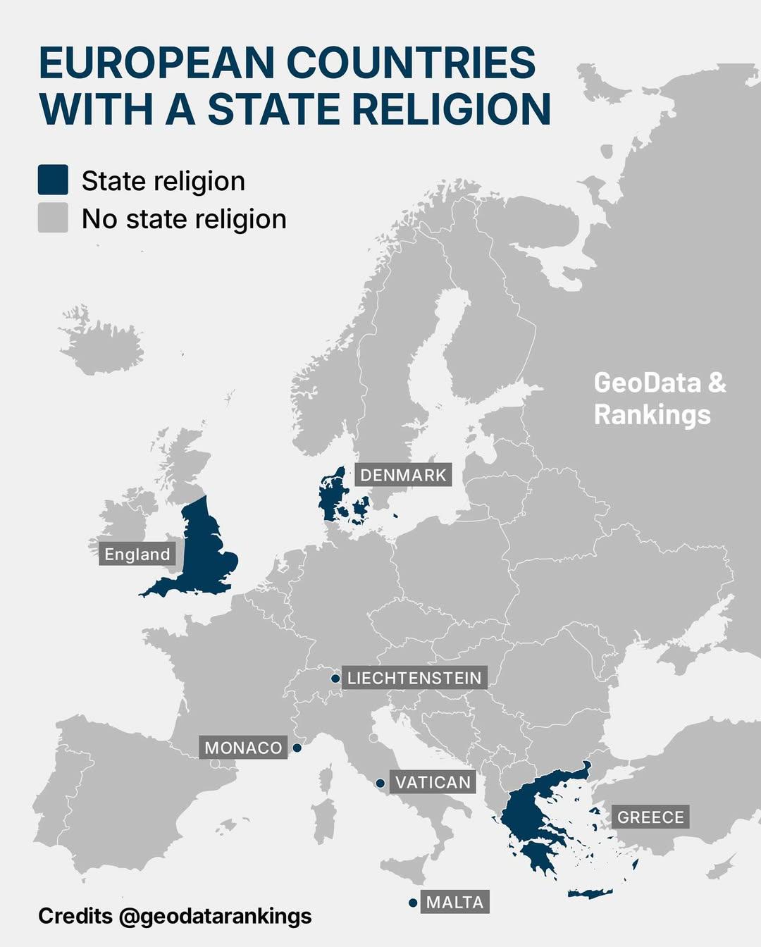
Map of European Countries with State Religion
This map illustrates the seven European countries that officially recognize a state religion. Each country is marked to ...
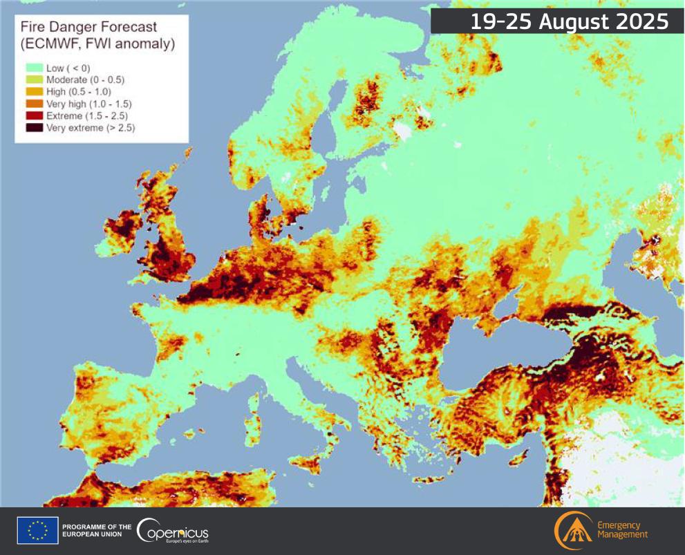
Fire Danger Map of Current Europe
The "Fire Danger Map of Current Europe" provides a crucial snapshot of fire risk levels across various regions in Europe...
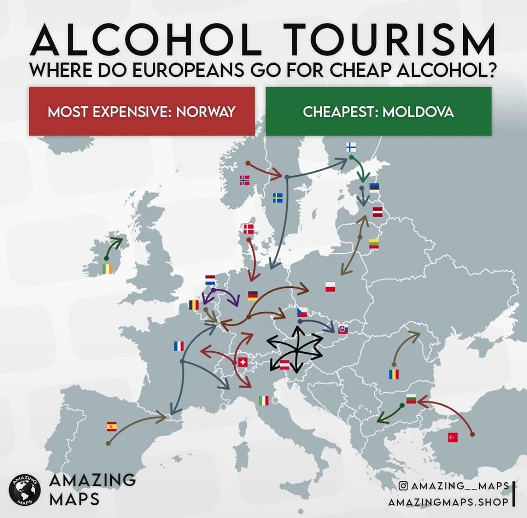
Alcohol Tourism in Europe Map
The "Alcohol Tourism in Europe Map" provides a visual representation of the various regions in Europe that are known for...
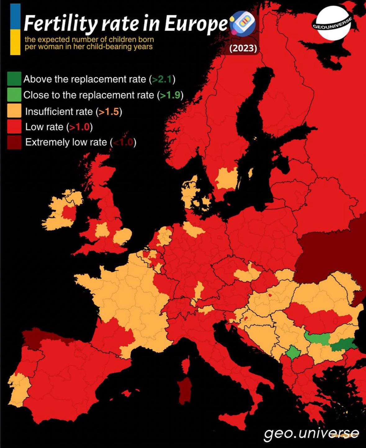
Fertility Rate in Europe Map
The "Fertility Rate in Europe Map" provides a visual representation of the average number of children born to a woman ov...
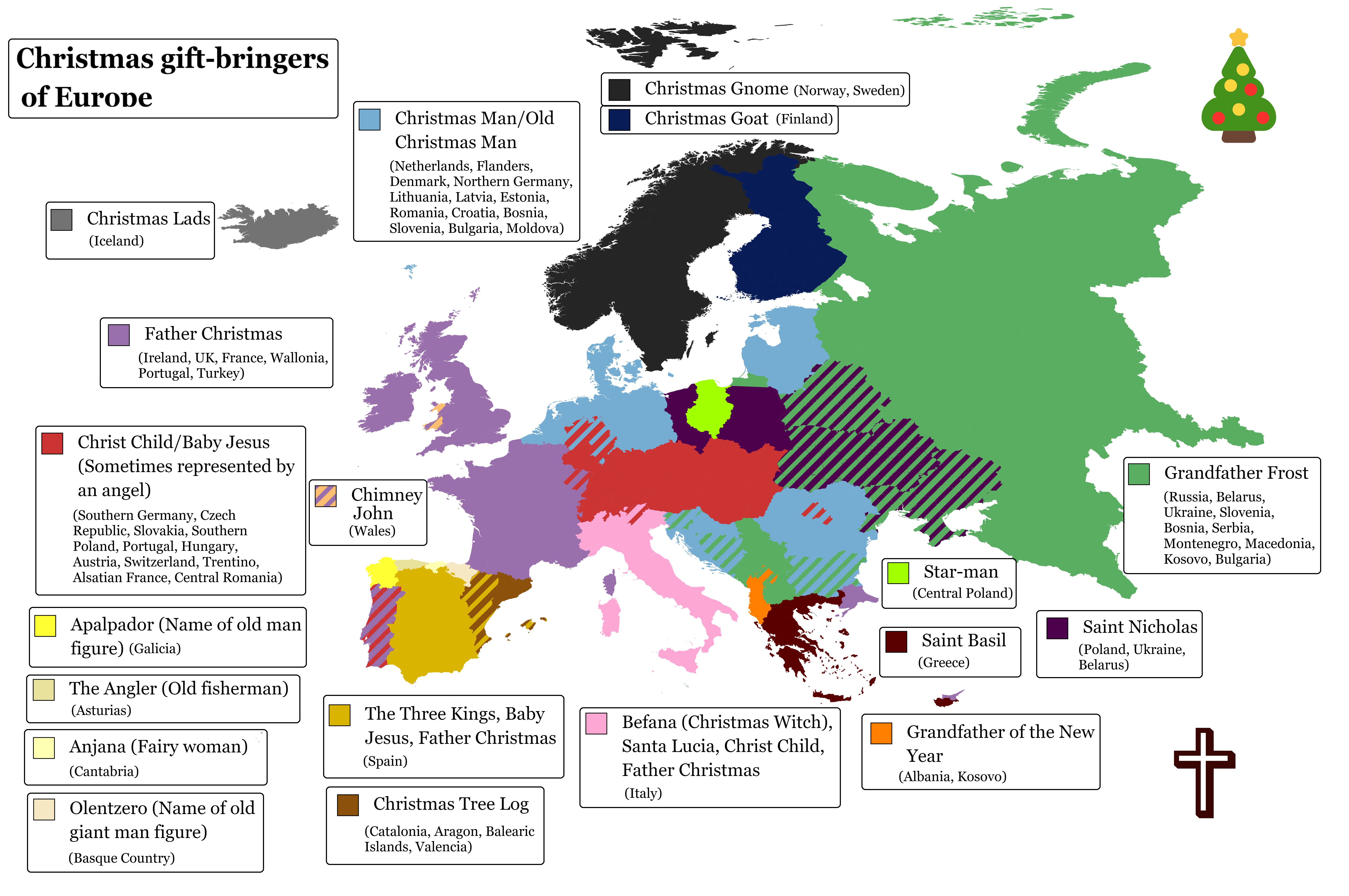
Christmas Gift-Bringers of Europe Map
This visualization highlights the various Christmas gift-bringers across Europe, showcasing regional traditions and cult...
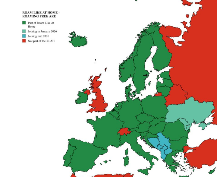
Roaming-free Zone Countries in Europe Map
This map illustrates the roaming-free zone countries in Europe, highlighting the nations where travelers can enjoy mobil...
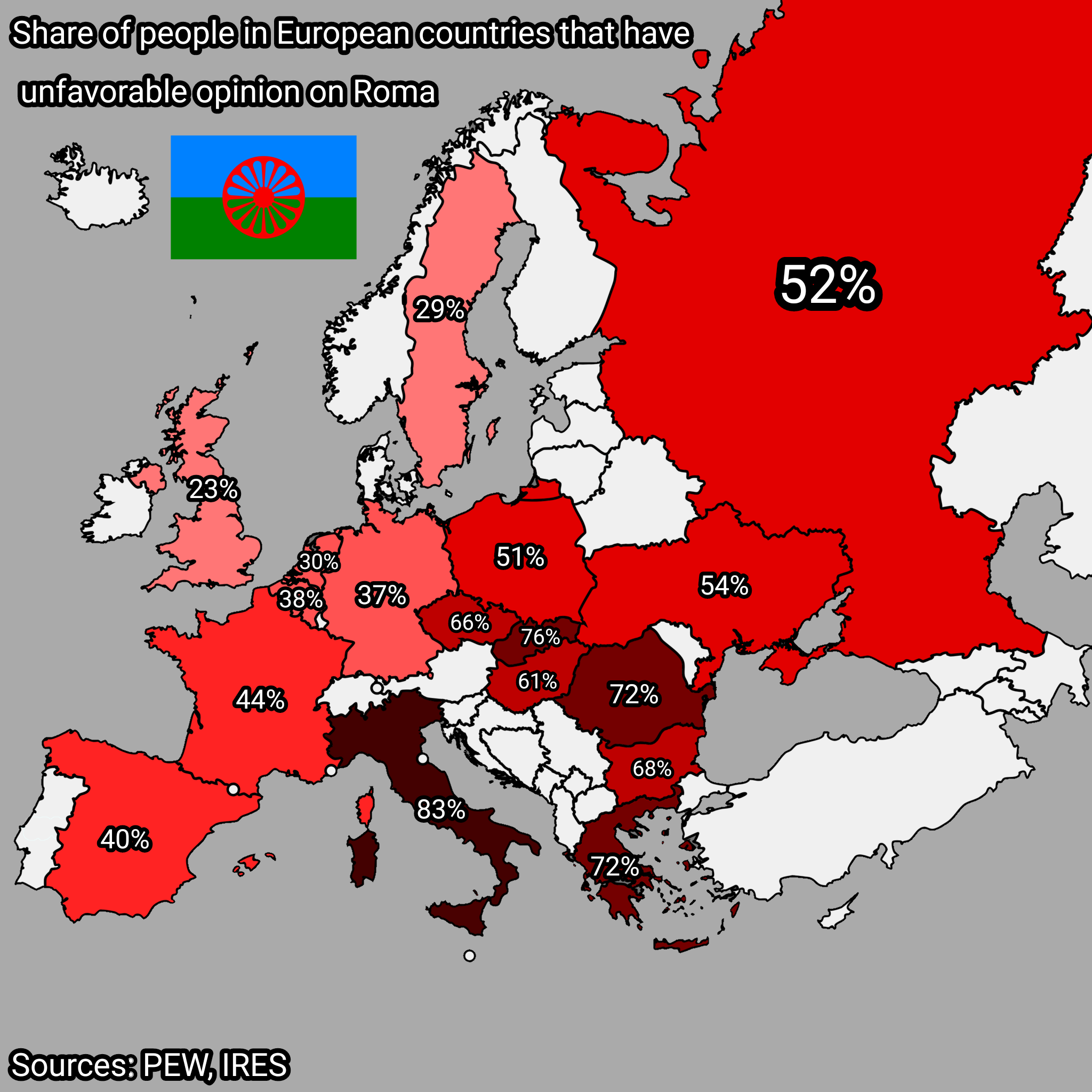
Map of Unfavorable Opinions on Roma People in Europe
Interestingly, the perceptions of the Roma vary widely across Europe. In some countries, such as Hungary and Slovakia, n...
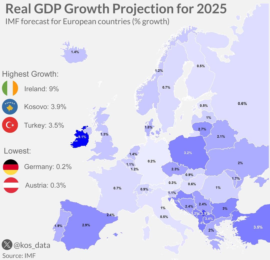
Real GDP Growth Projection Map for Europe 2025
The "Real GDP Growth Projection for 2025 - Europe" map visualizes the anticipated economic growth across various Europea...
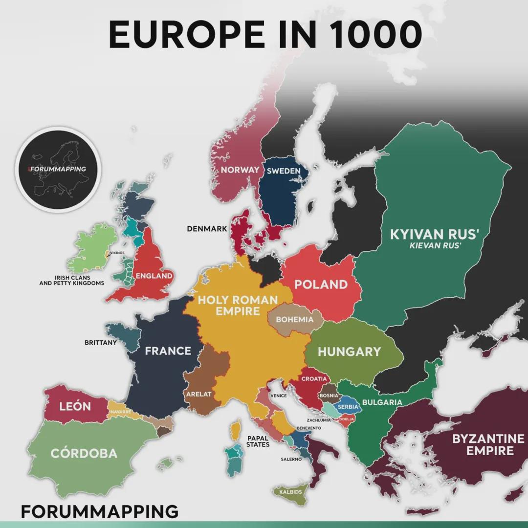
Map of Europe in 1000
The map titled "Europe in 1000" provides a fascinating glimpse into the political and cultural landscape of Europe at th...
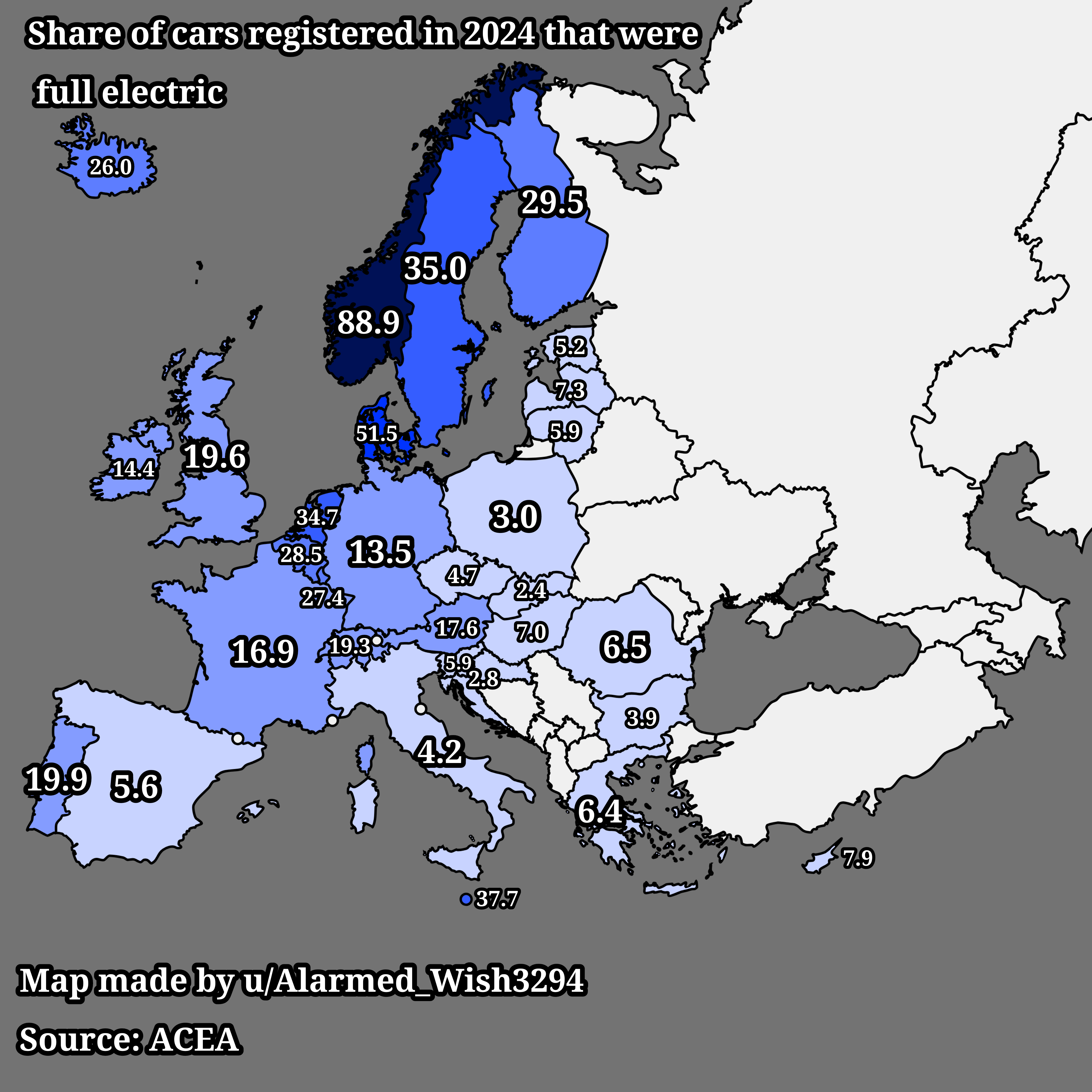
Map of Full Electric Car Registrations in Europe 2024
This map visualizes the share of cars registered in Europe in 2024 that are fully electric. It highlights the growing tr...
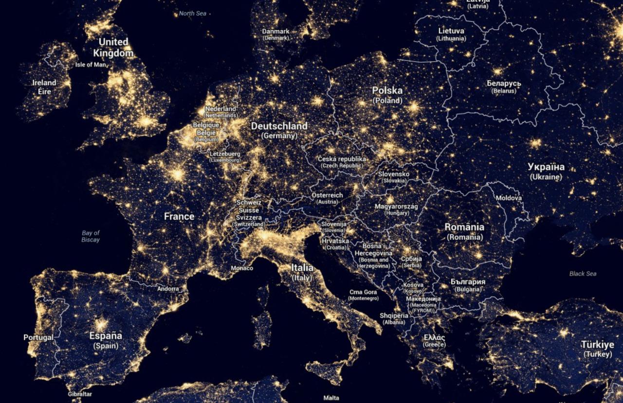
Light Map of Europe
The 'Light Map of Europe' provides a stunning visual representation of nighttime illumination levels across the continen...
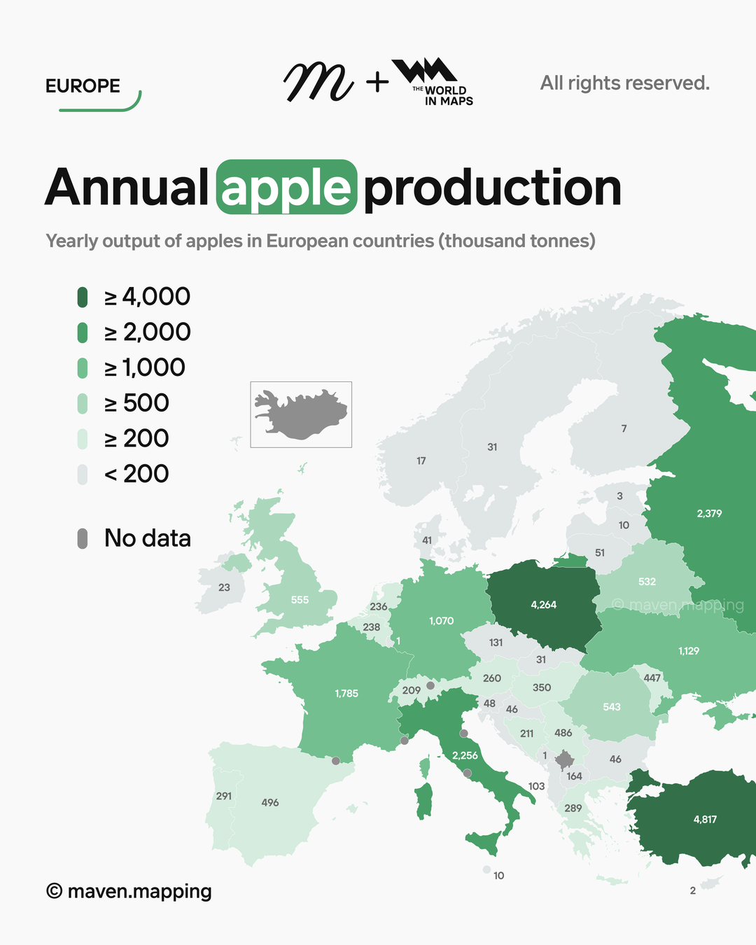
Annual Apple Production in Europe Map
Interestingly, in 2022, it was reported that Europe collectively produced over 10 million metric tons of apples, with no...
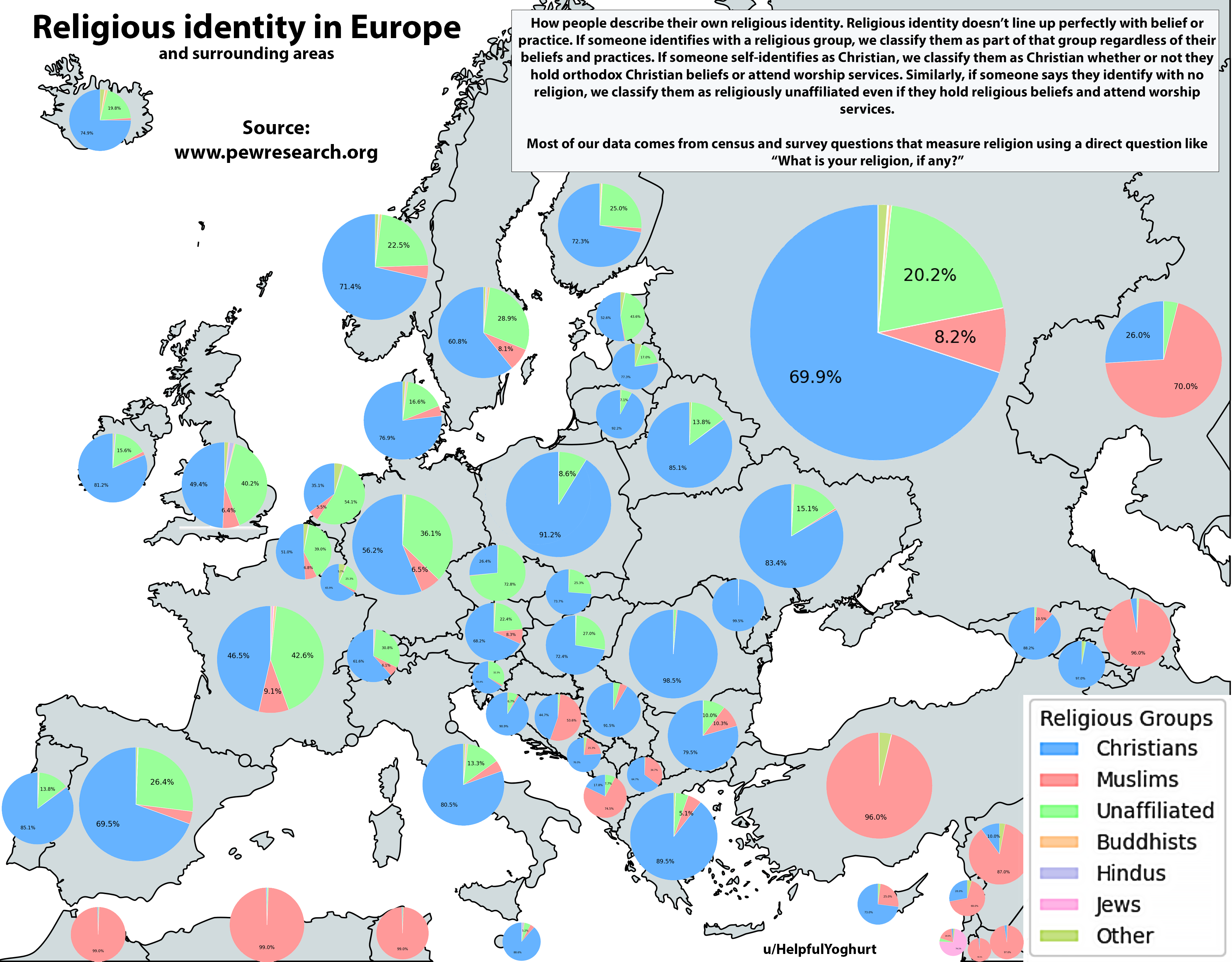
Religious Identity in Europe Map
The "Religious Identity in Europe Map" provides a comprehensive visualization of the religious landscape across the cont...
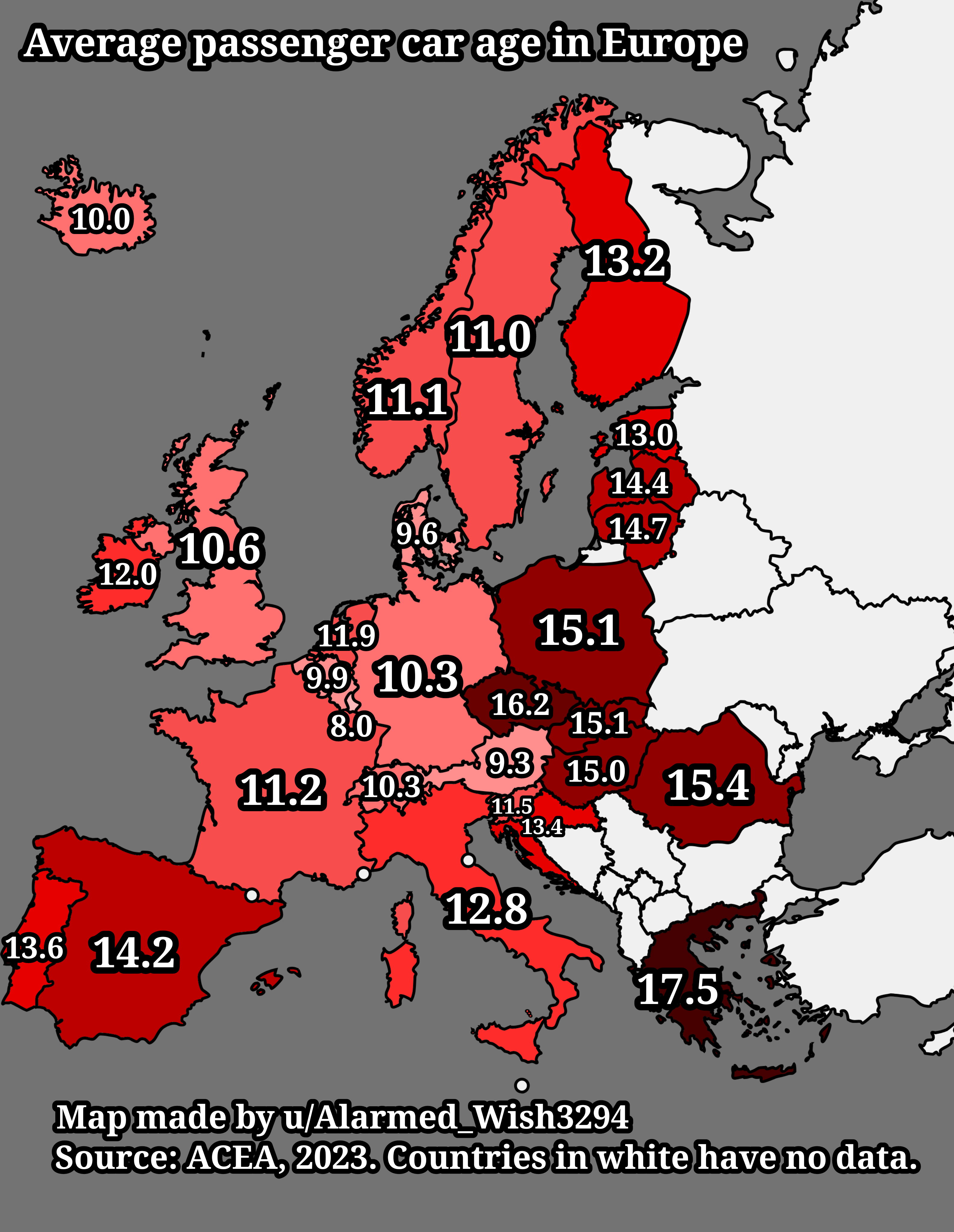
Average Passenger Car Age in Europe Map
The "Average Passenger Car Age in Europe Map" provides a visual representation of the average age of passenger vehicles ...
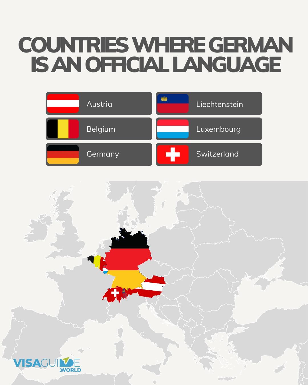
Countries Where German is an Official Language Map
The map titled "Countries Where German is an Official Language" visually represents the nations where German holds the s...
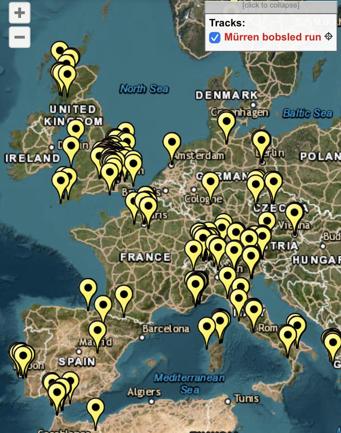
James Bond Filming Locations in Europe Map
This map provides a comprehensive overview of every filming location used in the James Bond film franchise throughout Eu...
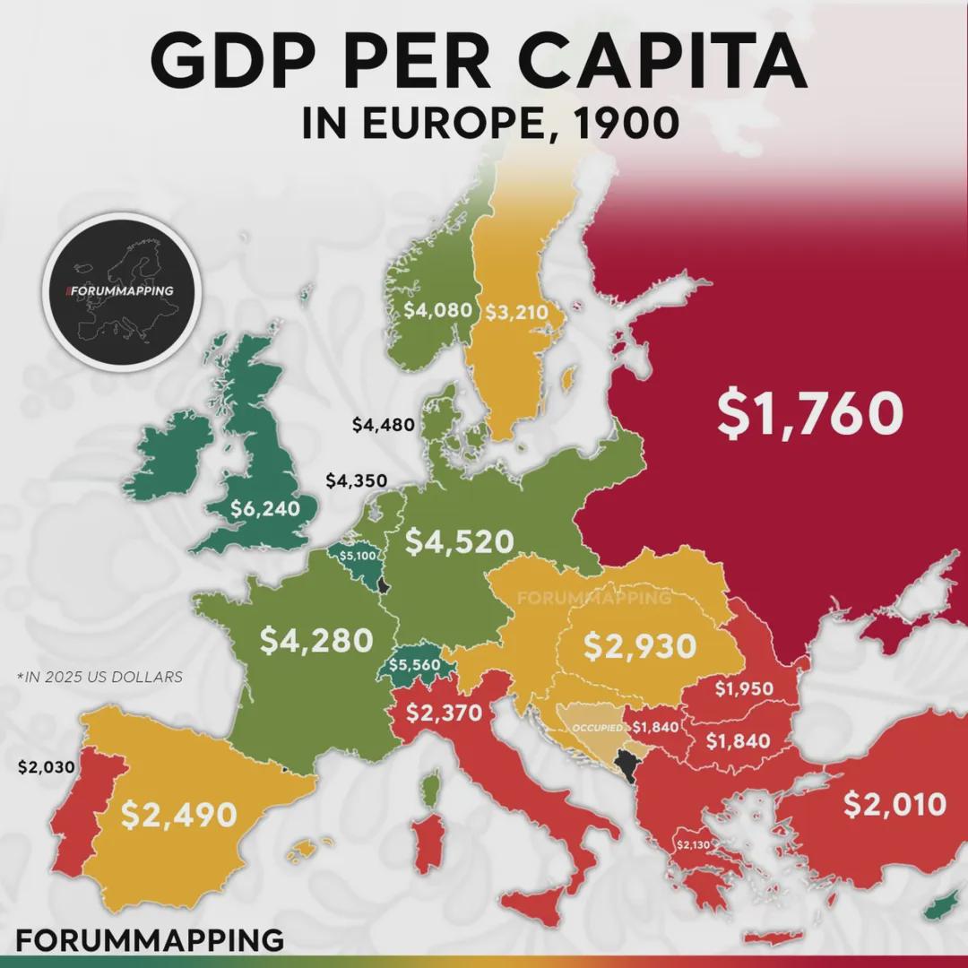
GDP Per Capita (PPP) in Europe Map
The map titled "GDP per Capita (PPP) in Europe (1900)" provides a compelling snapshot of economic disparities across the...
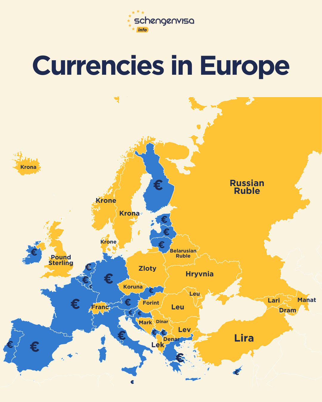
Currency Map of Europe 2025
The "Currencies in Europe (2025)" map visualizes the various currencies used across European countries, highlighting how...
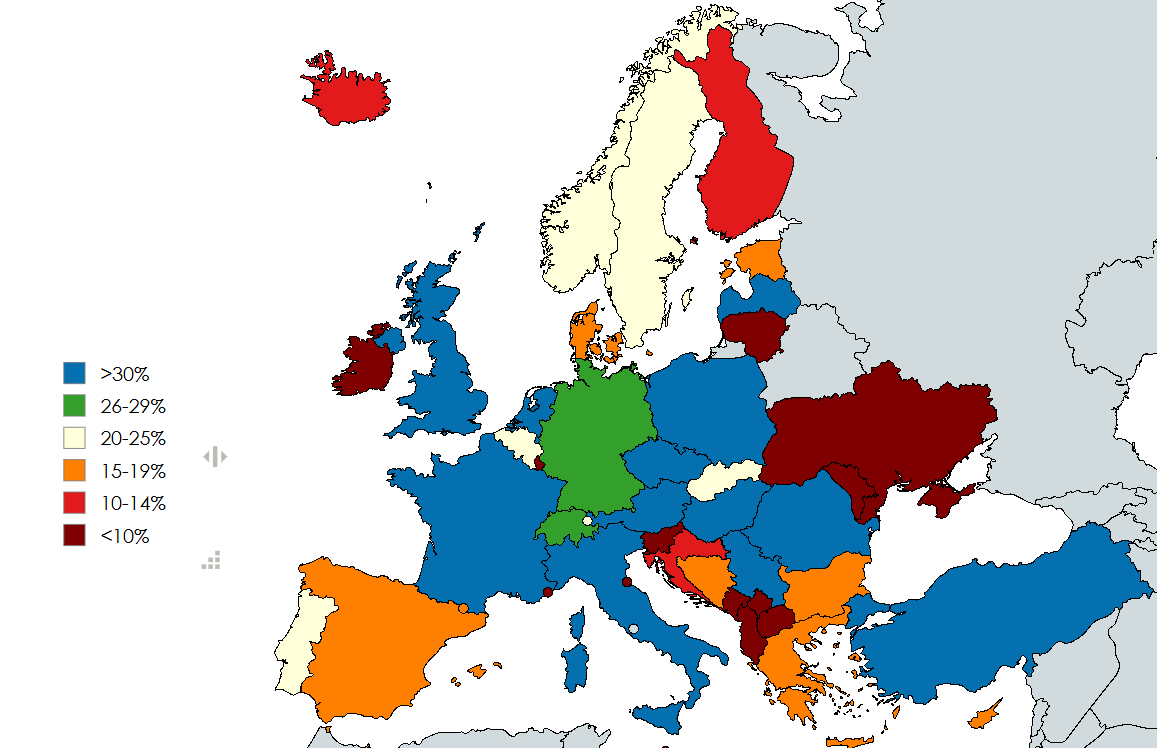
Right Wing Populist Parties Support Rate Map in Europe
This map visualizes the current collective support rate of right-wing populist parties across Europe, based on various p...