1861 Map of Korea Overview

David Chen
Data Visualization Specialist
David Chen is an expert in transforming complex geographic datasets into compelling visual narratives. He combines his background in computer science ...
Geographic Analysis
What This Map Shows
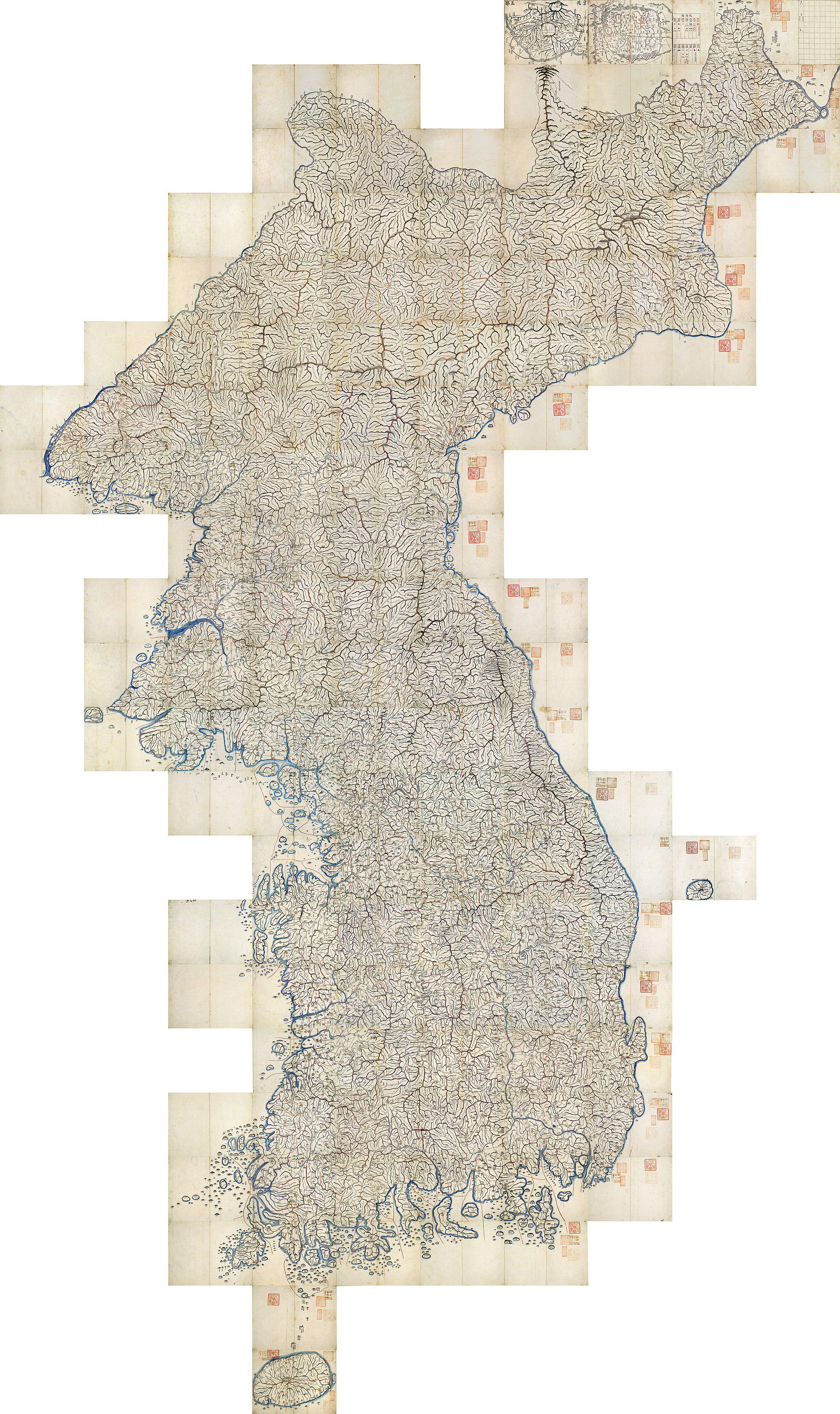
The 1861 map of Korea presents a snapshot of the Korean Peninsula during a pivotal time in its history, before the advent of modern mapping techniques. It illustrates various geographical features, administrative divisions, and cultural landmarks that were significant during that period. Interestingly, this map provides a window into how the Korean landscape was understood and represented by cartographers of the time, reflecting both the physical and socio-political realities of 19th-century Korea.
Deep Dive into Korea's Geography
As we delve deeper into what this map reveals about Korea, it's important to consider the geographical features that define the peninsula. Korea is characterized by its mountainous terrain, with the Taebaek Mountains running down the eastern side, forming a natural barrier between the east and west. This has influenced not only the climate but also human settlement patterns throughout history.
Ever wondered why certain areas of Korea developed into more populous regions? The map highlights major rivers such as the Han River and the Nakdong River, which have been vital for agriculture, transportation, and trade. The Han River, flowing through Seoul, has served as a crucial waterway that supported the growth of one of Asia's largest cities. Meanwhile, the Nakdong River, which traverses the southeastern part of the peninsula, has similarly nourished the surrounding plains, enabling agricultural activities that are still significant today.
The 1861 map also showcases the various regions of Korea, such as Gyeonggi-do, Jeolla-do, and Gyeongsang-do, each having distinct cultural and climatic characteristics. For instance, Gyeonggi-do, being close to the capital, experienced rapid urbanization, while Jeolla-do is known for its rich agricultural land and distinct culinary heritage. It's fascinating to note that these regional characteristics have persisted, influencing modern practices and cultural identities.
Regional Analysis
When breaking down the Korean Peninsula as illustrated in the 1861 map, we see clear distinctions between regions. The northern parts of Korea, often depicted as less populated, were heavily influenced by the harsh climate and rugged terrain. Areas like Pyongan-do and Hamgyeong-do were less developed compared to the more agriculturally rich areas in the south.
In contrast, the southern regions, especially Jeolla-do, are shown as areas of significant agricultural output, with fertile plains ideal for rice cultivation. This agricultural abundance played a crucial role in sustaining the local population and developing trade networks. Interestingly, the map also indicates key cities that served as hubs for economic activity; for instance, cities like Busan emerged as vital ports that connected Korea to international trade routes.
Moreover, the map reveals the administrative divisions of Korea at the time, which reflected the socio-political landscape. The divisions helped manage local governance, but they also laid the groundwork for the regional identities that continue to shape Korean society today. For example, the distinct dialects and cultural practices found in regions like Gyeongsang-do and Jeolla-do can be traced back to historical governance and settlement patterns established during this era.
Significance and Impact
Understanding the geographical context of Korea as represented in the 1861 map is crucial for grasping its historical development. This map serves not only as a representation of physical geography but also as a marker of cultural and political identity at a time when Korea was on the brink of significant change. The implications of the geographical divisions noted on the map can still be felt today, particularly in how regions compete for resources and influence.
What's especially relevant in today’s context is how modern development continues to be shaped by these historical patterns. Urbanization trends in South Korea are often concentrated in areas that were historically significant, like Seoul and Busan, while rural areas have seen population decline. This reflects an ongoing challenge for policymakers who must balance development with preserving cultural and regional identities.
As we look to the future, the insights derived from the 1861 map of Korea can inform sustainable development strategies that honor the rich geographical and cultural heritage of the peninsula. By understanding the past, we can better navigate the complexities of contemporary challenges in regional development and environmental sustainability.
Visualization Details
- Published
- September 25, 2025
- Views
- 60
Comments
Loading comments...