cultural exchange Maps
61 geographic visualizations tagged with "cultural exchange"
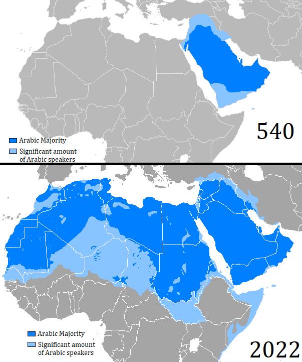
Map of Arabic Language Expansion from 540 to 2022
The map titled "Map of Arabic Language Expansion between 540 and 2022" visually illustrates the geographical spread of t...
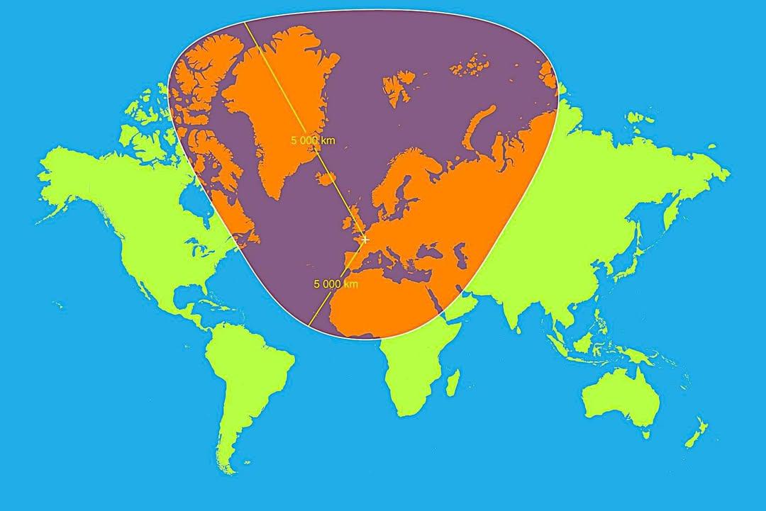
Map of 5,000km Radius from Paris
This map visualizes a circle with a 5,000 km radius centered on Paris, France. It highlights an extensive area that span...
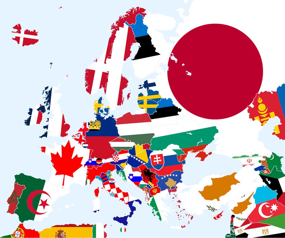
Closest Country That Doesn’t Share Land Border Map
The visualization titled \...
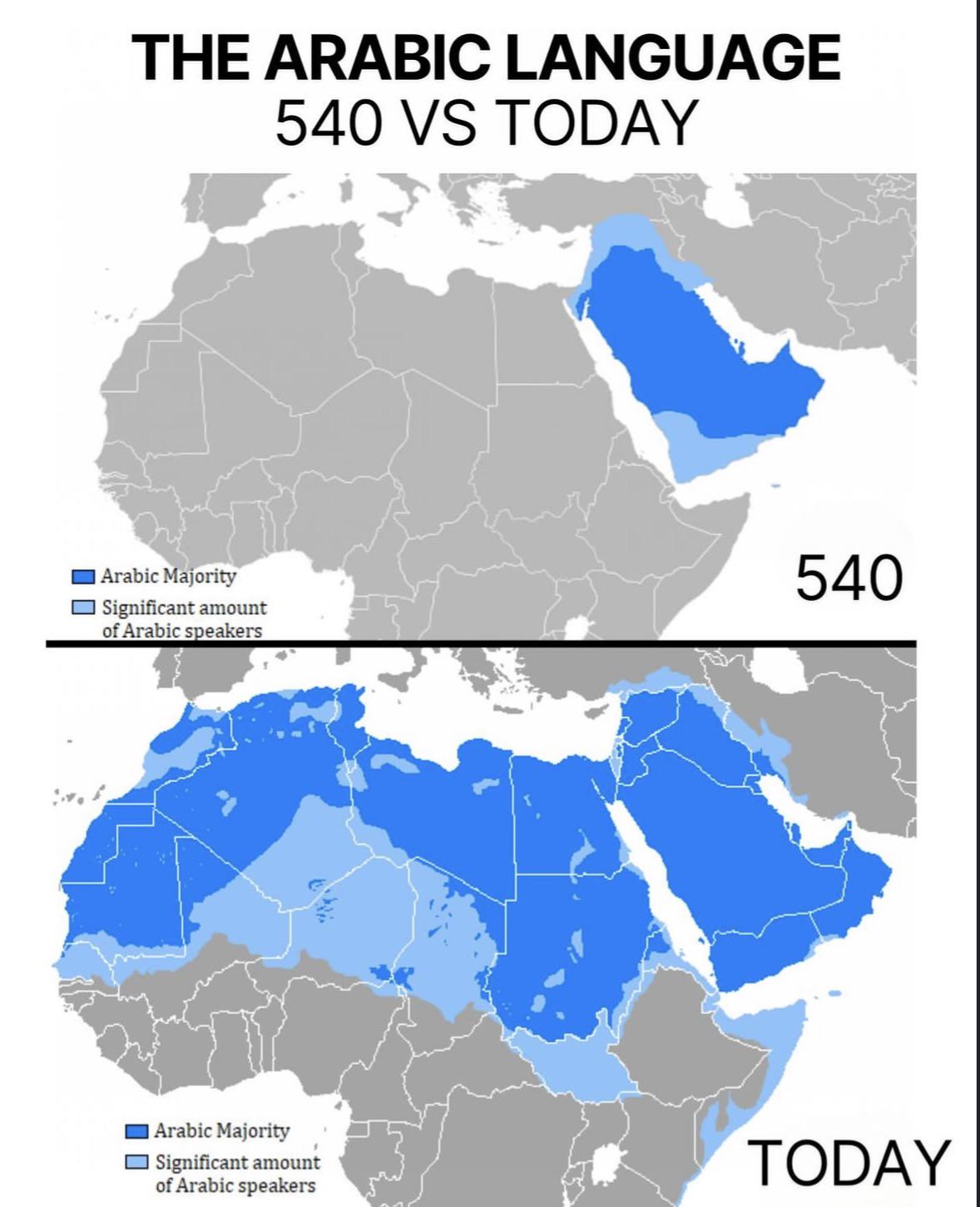
Arabic Language Distribution Map: 540 vs Today
The visualization titled "The Arabic Language: 540 vs Today" provides a compelling comparison of the geographical spread...
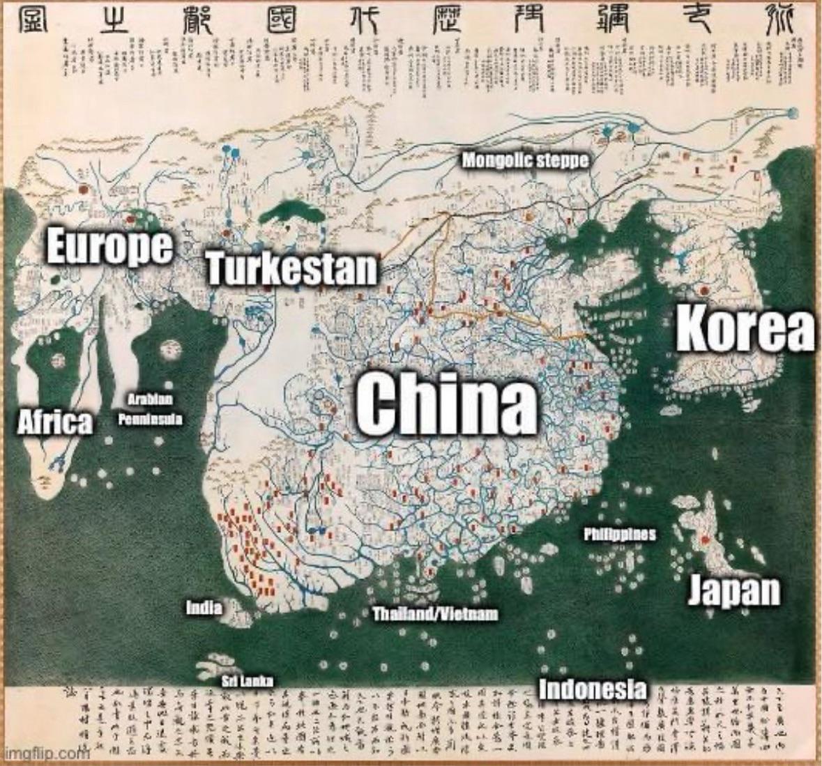
1402 World Map from Korea
...
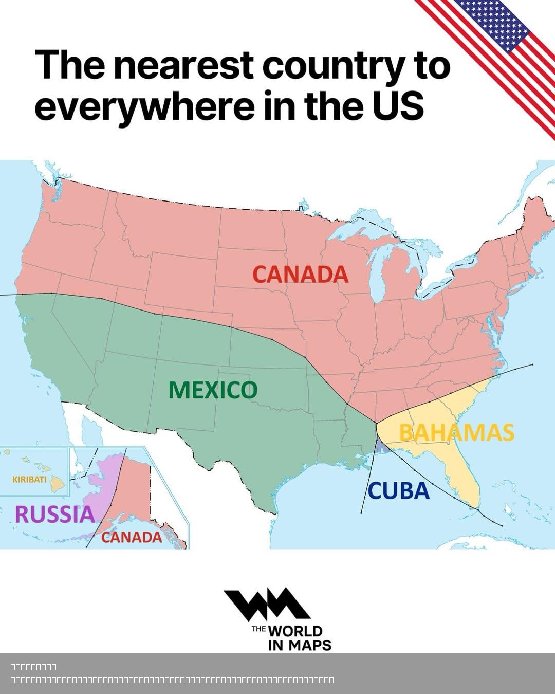
Nearest Foreign Country to Every Point in the United States Map
This map illustrates the nearest foreign country to every point in the United States, providing a compelling visual repr...
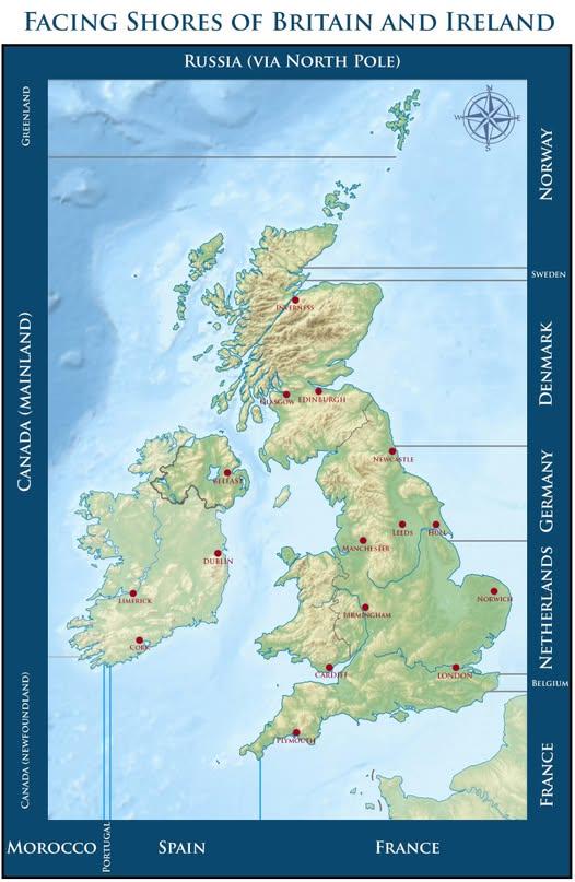
Map of Countries Across From Beaches in Britain and Ireland
This map visually represents which countries you would face if you were standing on a beach in Britain or Ireland, gazin...
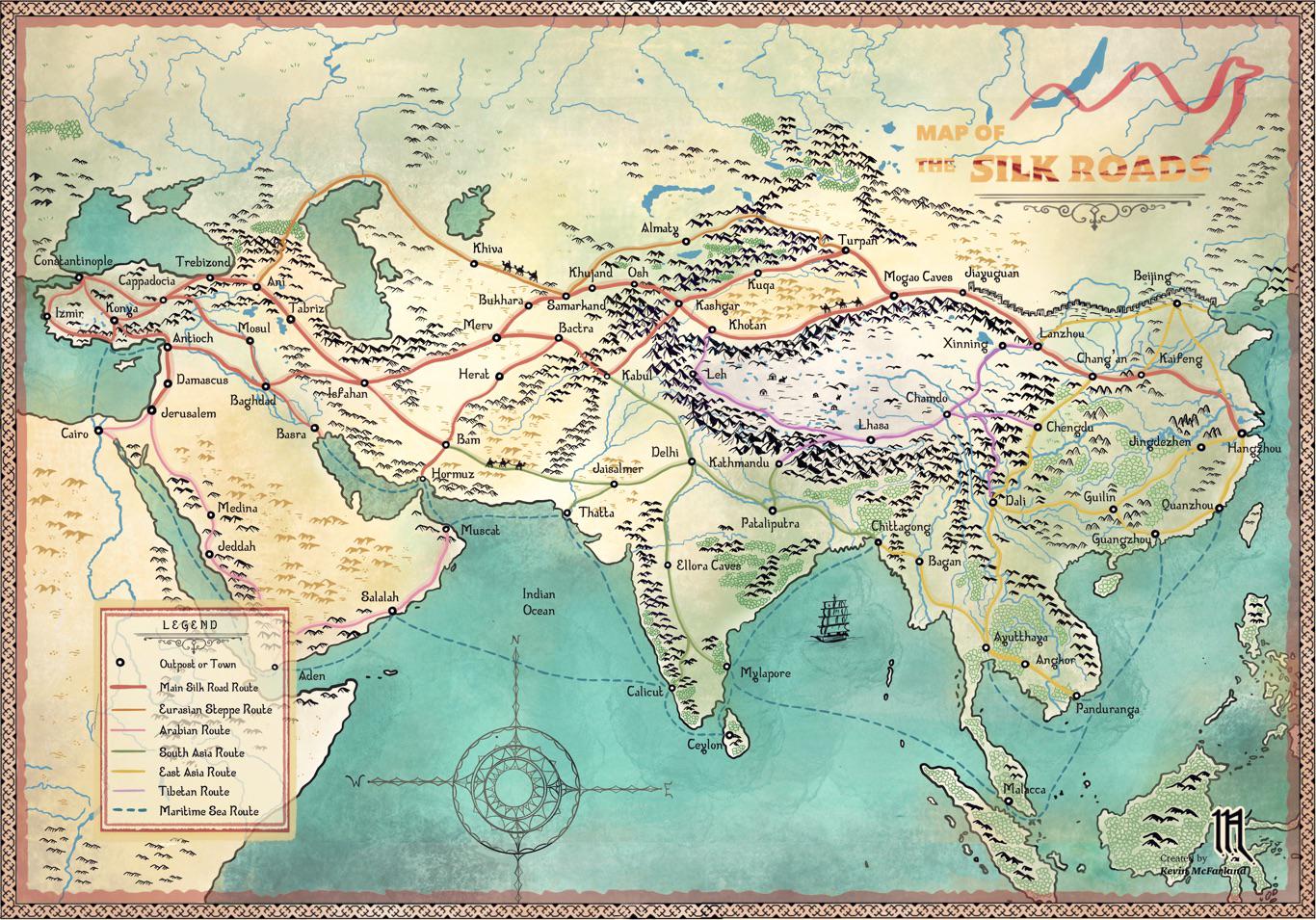
Silk Roads Trade Routes Map
...
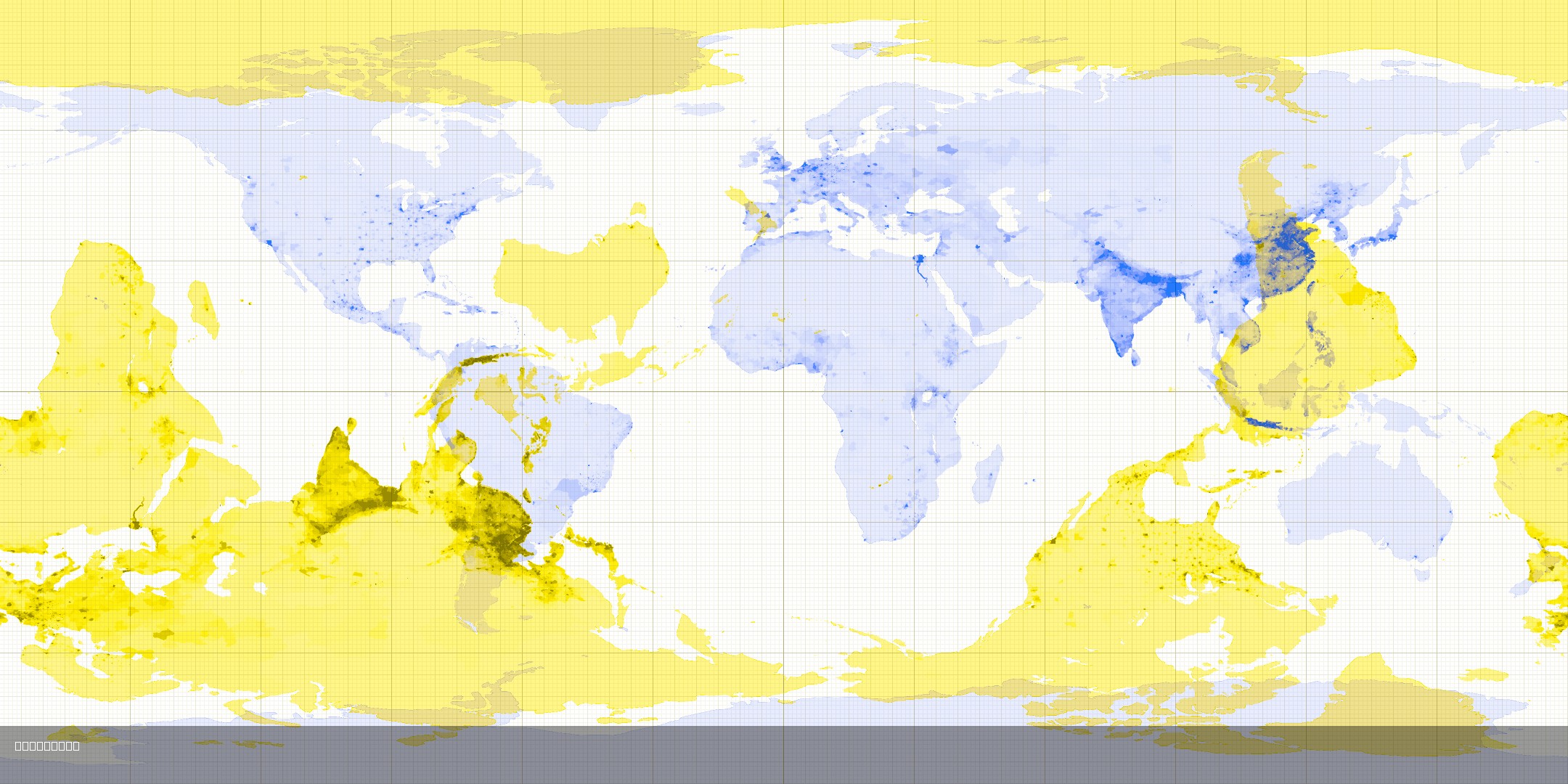
Antipode Map Showing Opposite Countries
This map visualizes the concept of antipodes, which are points that are diametrically opposite to each other on the Eart...
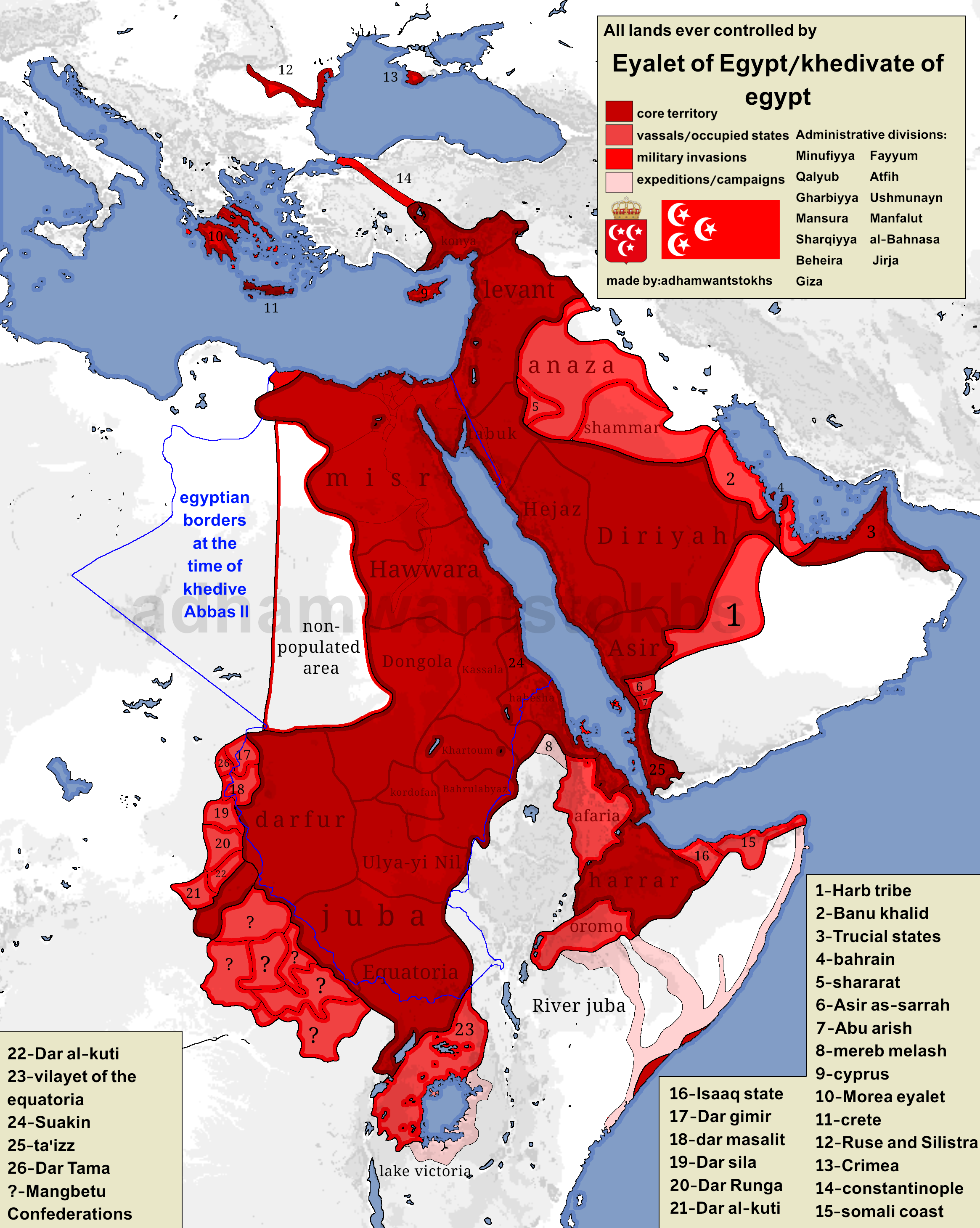
Map of Territories Ruled by Eyalet of Egypt
Egypt's colonial ambitions were pronounced, especially during the reign of Ismail Pasha, who ruled from 1863 to 1879. Un...
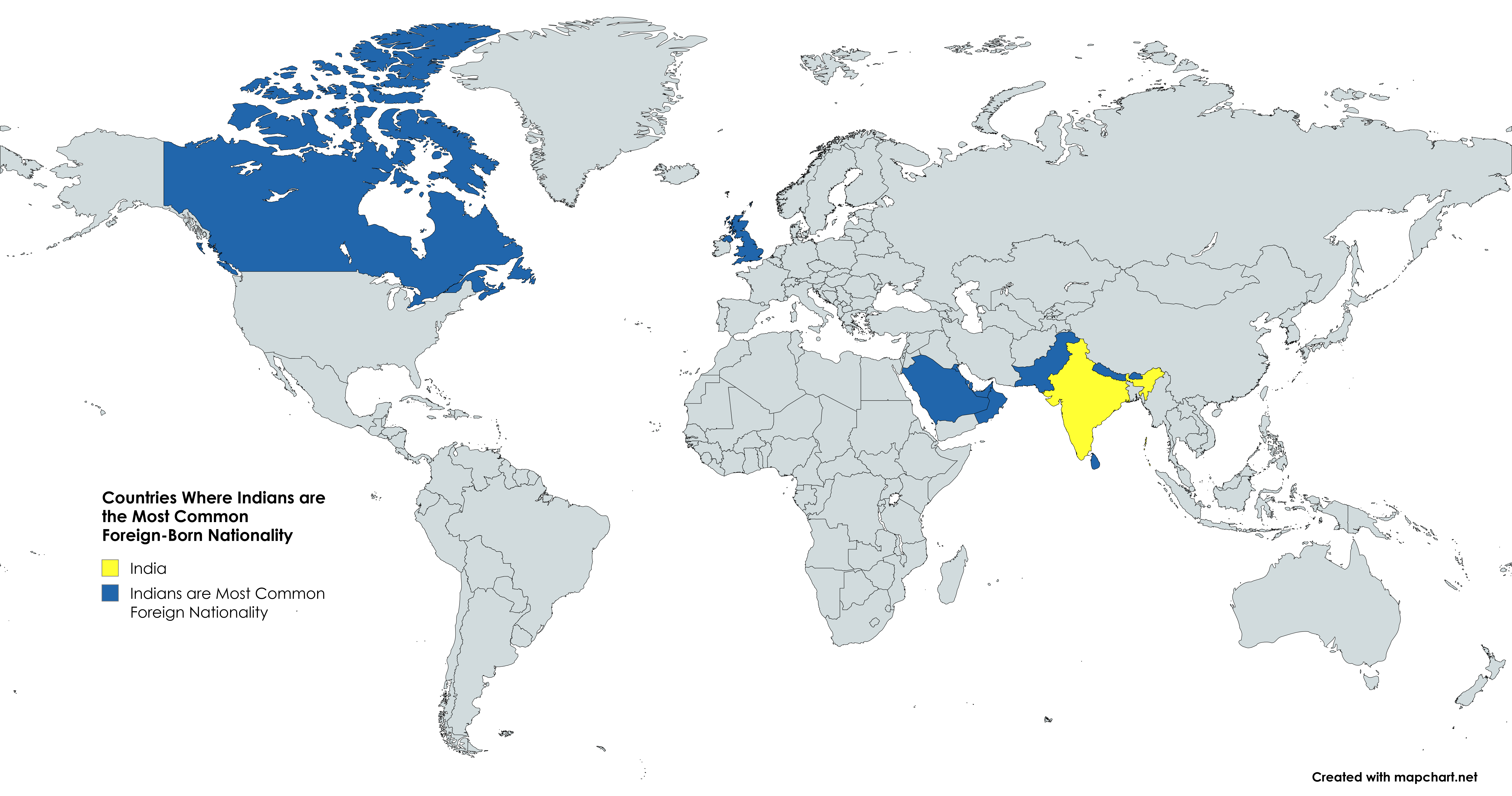
Countries Map Where Indians are the Most Common Foreign-Born Nationality
This map illustrates the countries where Indians constitute the largest segment of the foreign-born population. The visu...
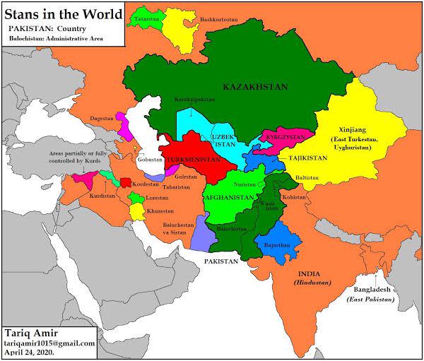
Uzbekistan Surrounded by Stans Map
This map illustrates an intriguing geographical fact: Uzbekistan is the only country in the world entirely surrounded by...
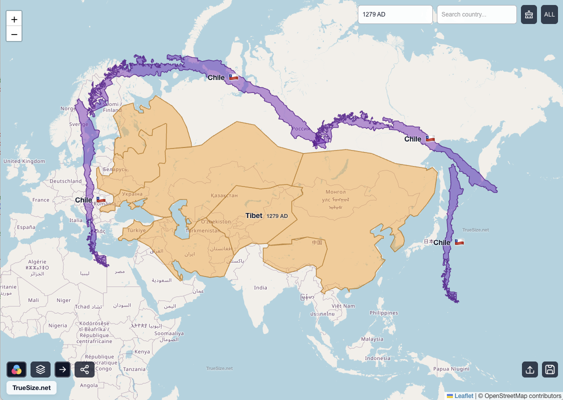
Mongol Empire Size Map in Square Chiles
This fascinating visualization illustrates the sheer size of the Mongol Empire by comparing it to a universally relatabl...
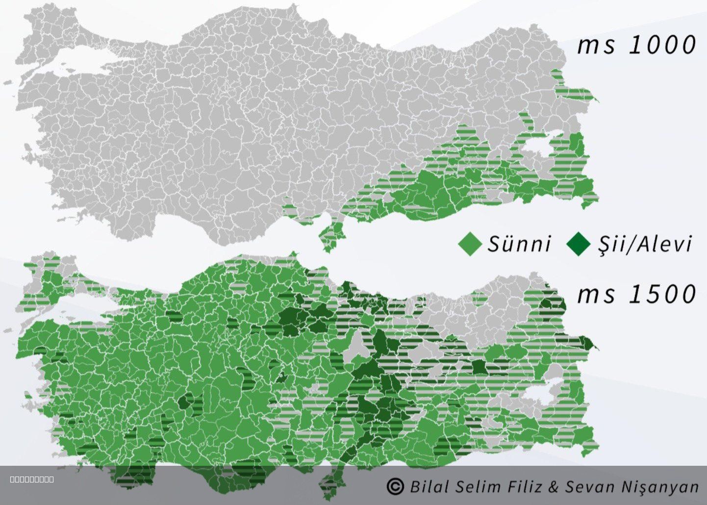
Islam in Turkey 1000 and 1500 Map
The "Islam in Turkey 1000 and 1500 Map" visually represents the spread and influence of Islam across the region of Turke...
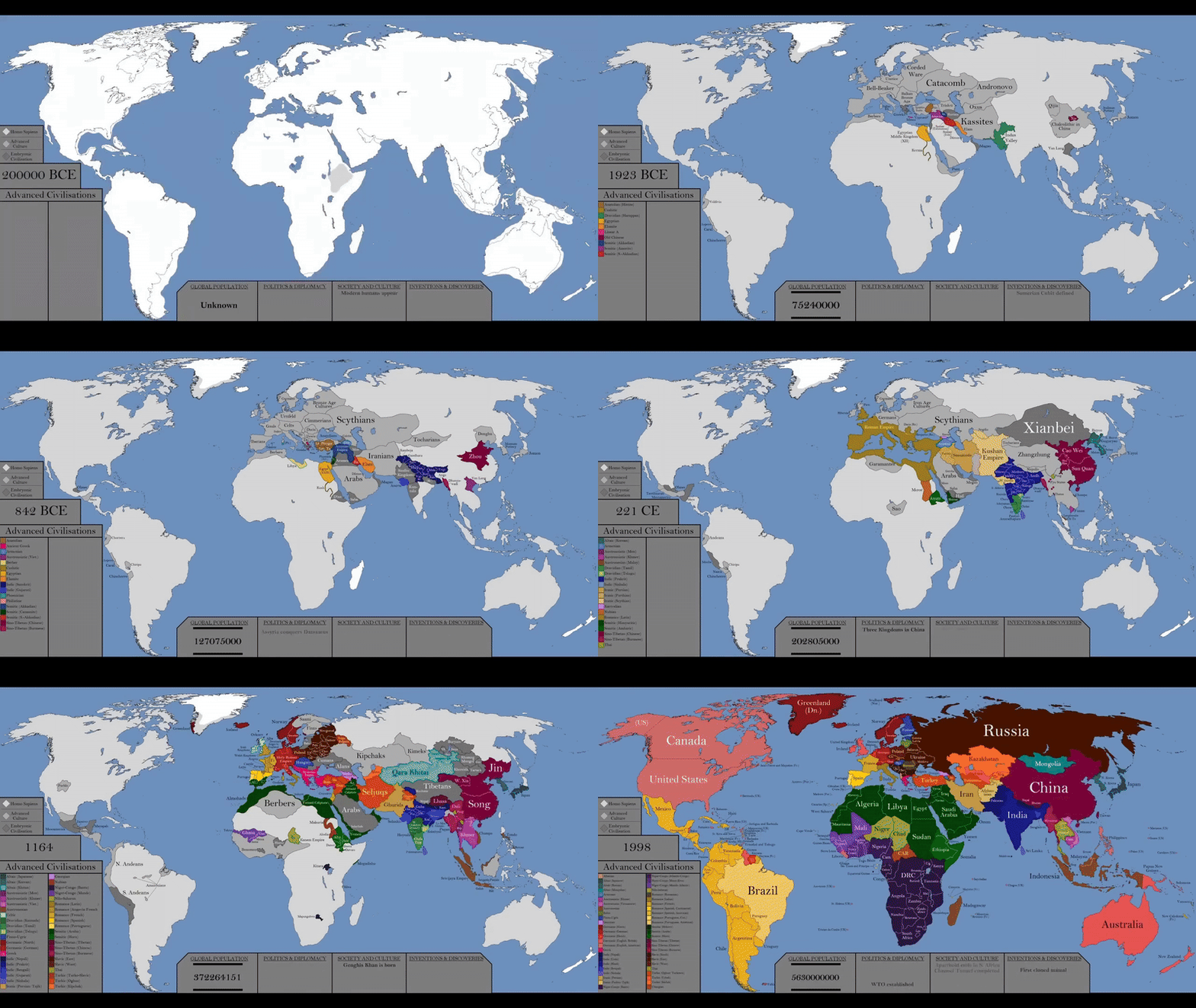
World History Timeline Map by Year
The visualization titled "The Entire History of the World Every Year In Just 30 Seconds" presents a remarkable timeline ...
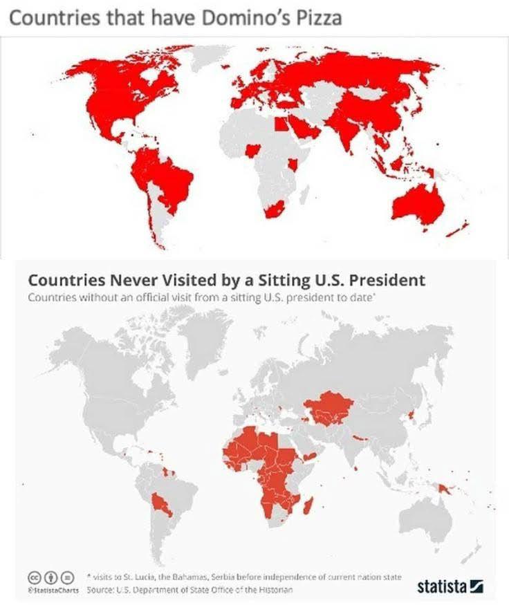
Countries with Domino's Pizza Locations Map
This visualization displays the global presence of Domino's Pizza, illustrating which countries have established locatio...
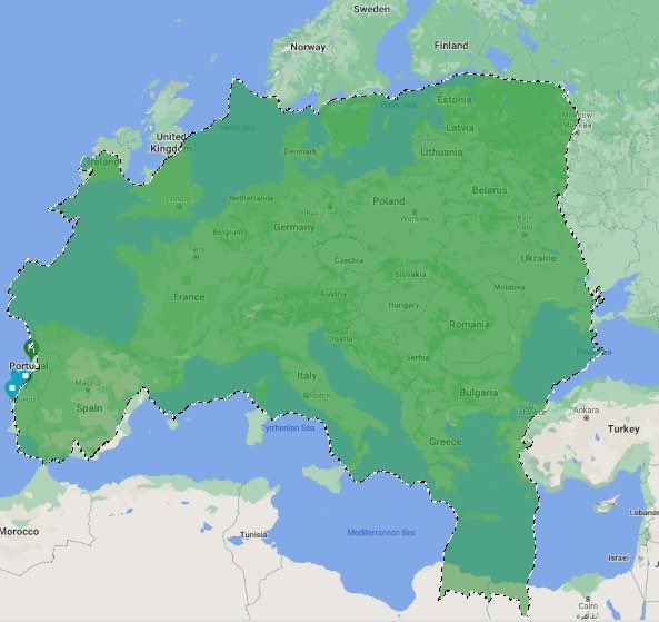
Geographical Map of Brazil in Europe
The "Brazil on Europe" map provides a unique visualization that illustrates how the land area of Brazil would fit within...
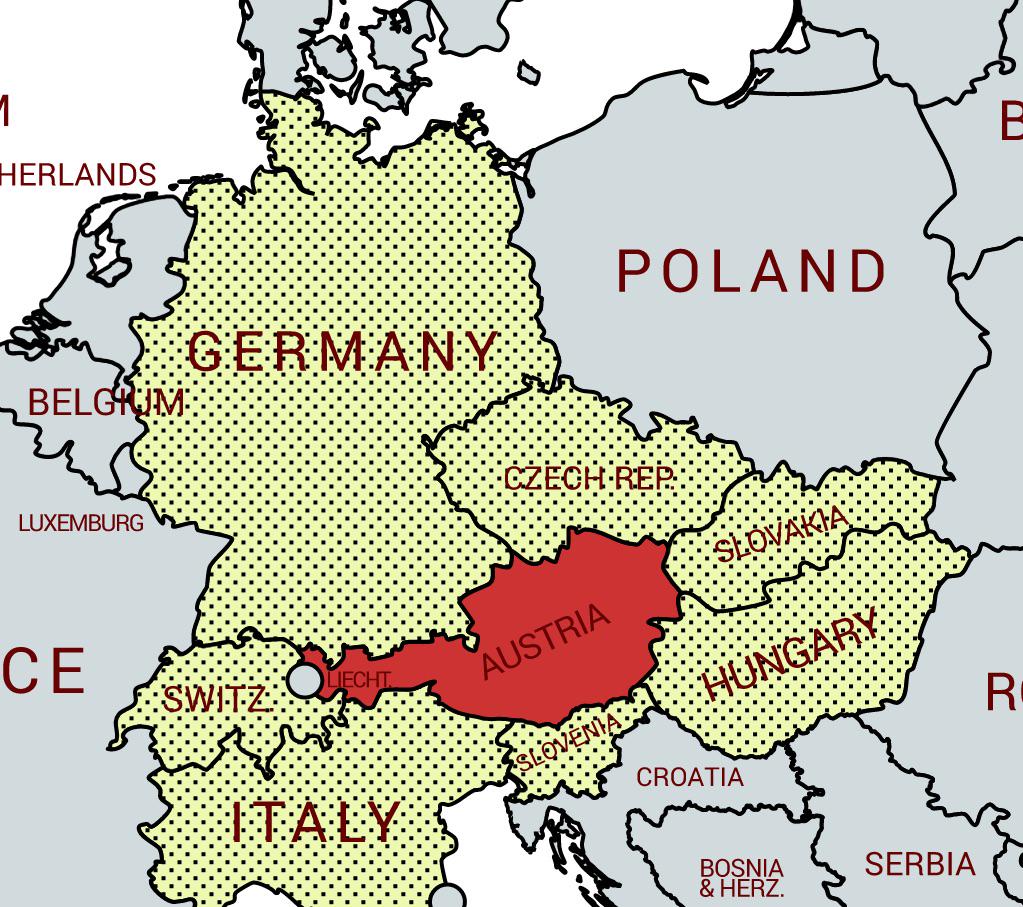
Austria Neighboring Countries Map
This map illustrates the unique geographical position of Austria as a landlocked country that shares borders with eight ...
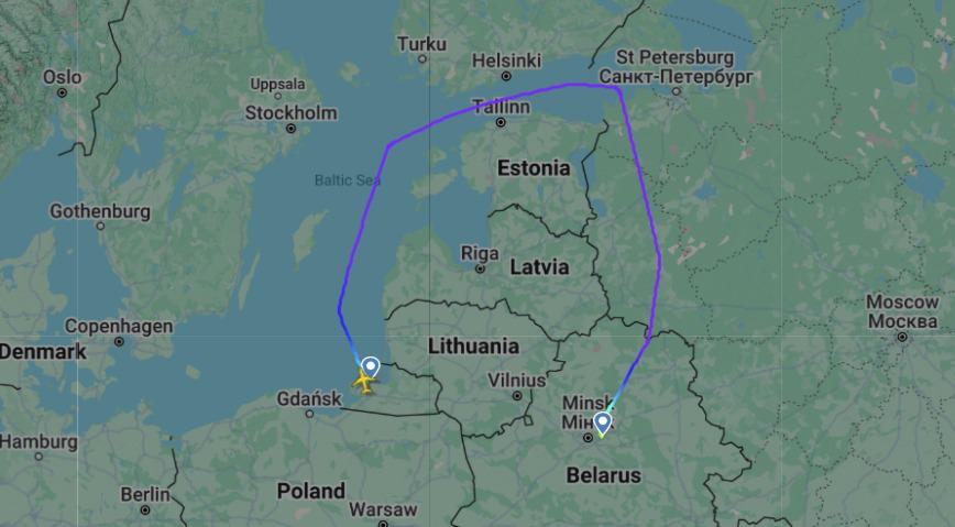
Flight Route Map Between Kaliningrad and Minsk Airports
This map illustrates the flight route between Kaliningrad (KGD) and Minsk (MSQ) airports, providing a clear visual repre...
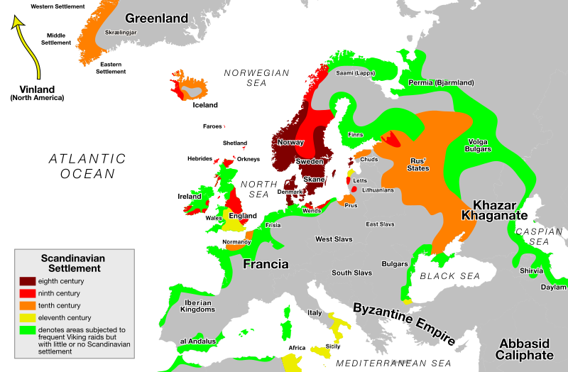
Viking Expansion Routes Map
The "Viking Expansion Routes Map" visually represents the vast territories explored and settled by the Norsemen, commonl...
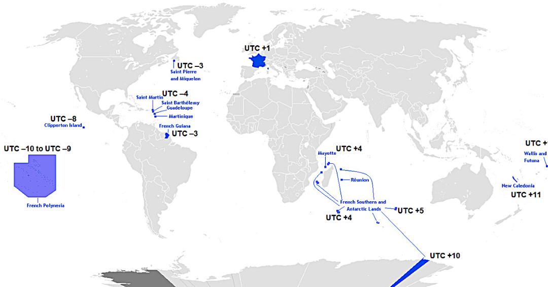
Map of France’s Twelve Time Zones
This map displays the unique and complex time zone structure of France, illustrating how the country spans twelve differ...
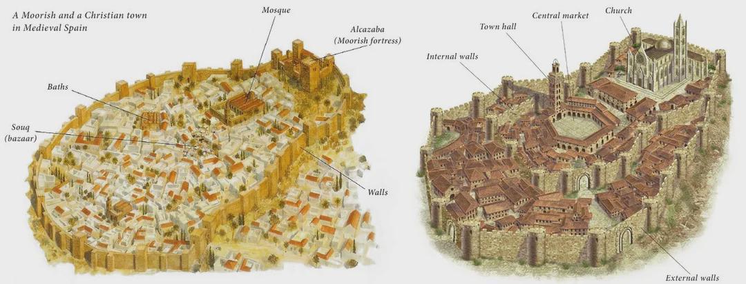
Moorish and Christian Towns in Medieval Spain Map
The map titled "A Moorish and a Christian Town in Medieval Spain" provides a visual representation of the geographic and...
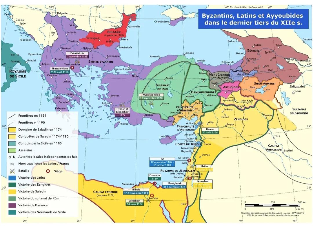
Byzantium and the Levant Map Before the Fourth Crusade
This map provides a detailed representation of the Byzantine Empire and the Levant region prior to the onset of the Four...
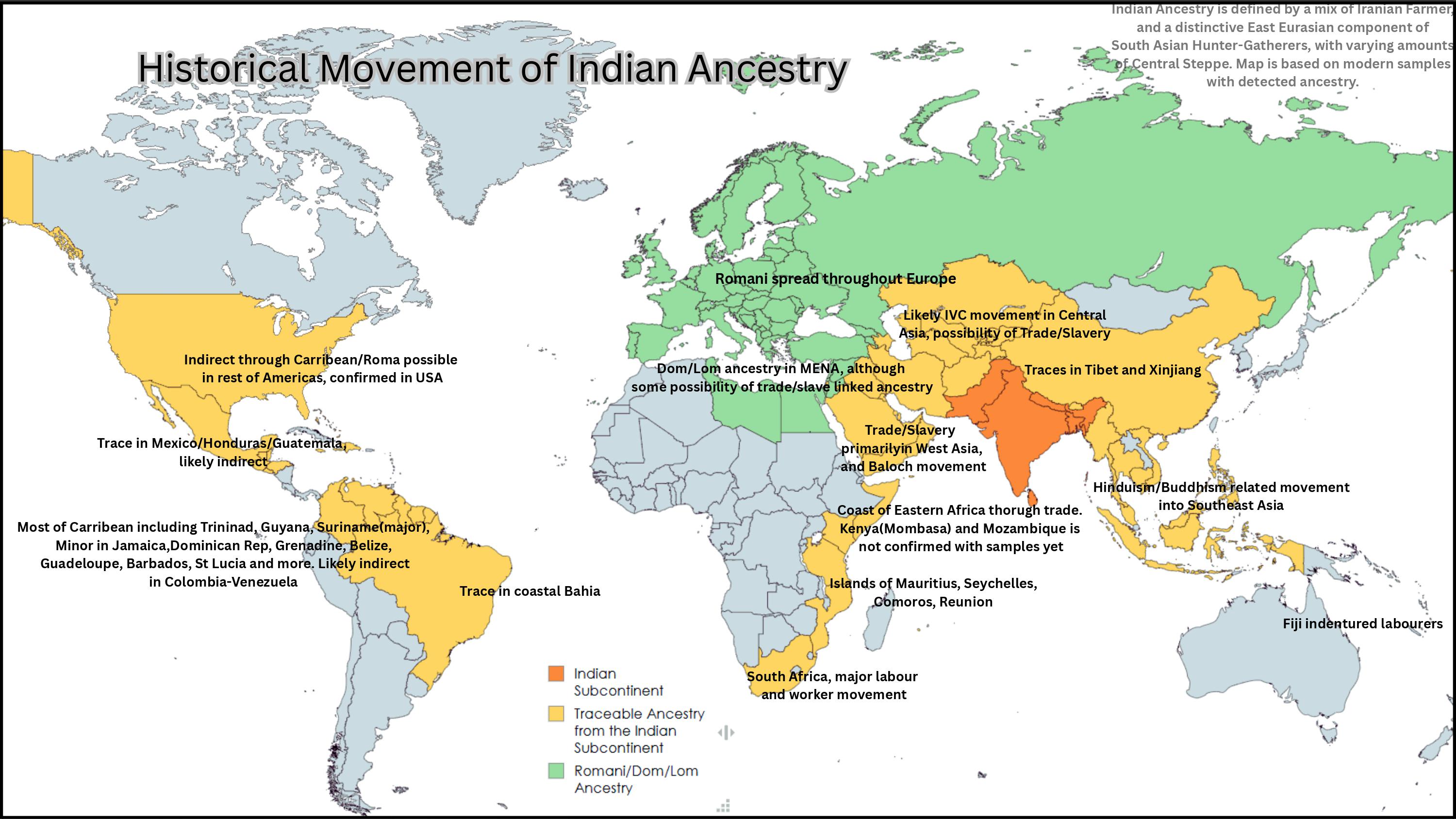
Historical Spread of Indian Ancestry Map
The "Historical Spread of Indian Ancestry Map" illustrates the geographic distribution of Indian ancestry across various...
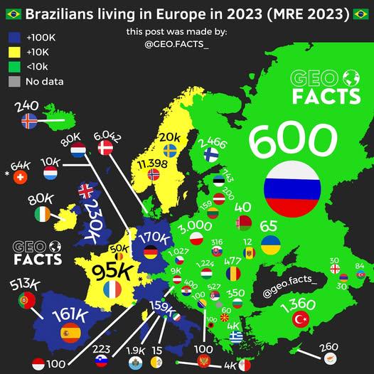
Map of Brazilians Living in Europe 2023
The map titled "Brazilians Living in Europe in 2023" provides a visual representation of the Brazilian diaspora across v...
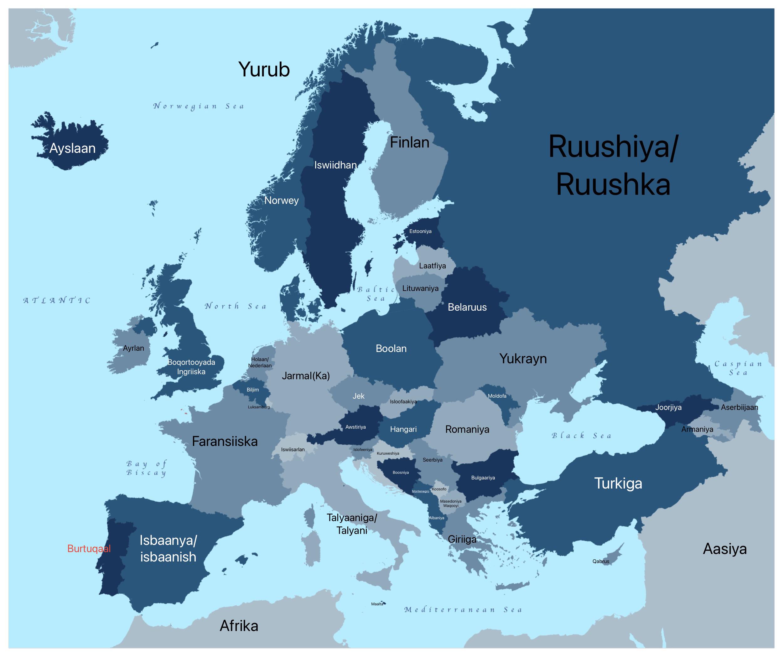
European Countries in AfSomali Map
The "European Countries in AfSomali Map" is an intriguing visualization that presents the names of European nations tran...
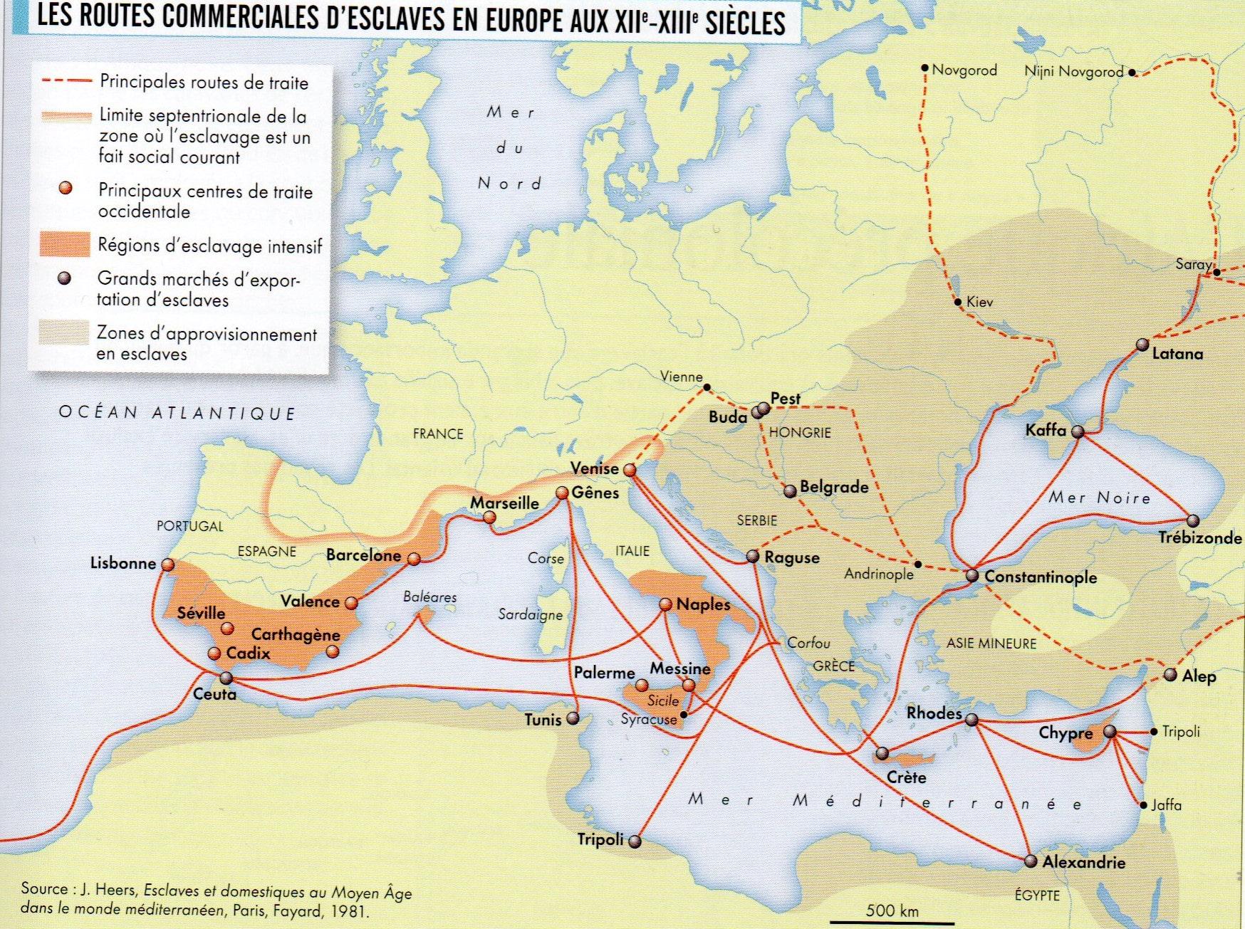
Map of the Slavic Slave Trade in Europe
This map presents a detailed overview of the Slavic slave trade that took place in Europe during the 12th and 13th centu...
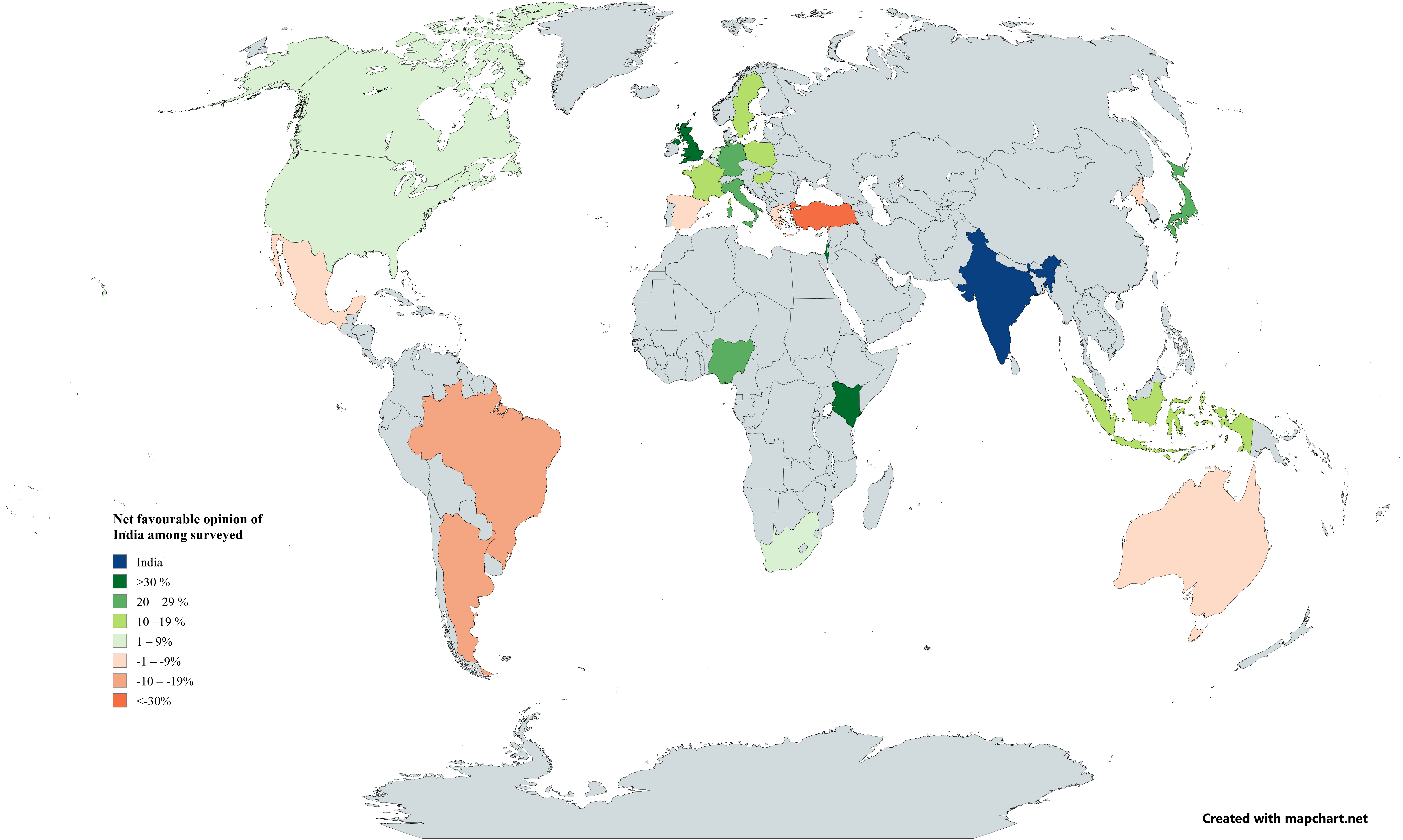
International Opinion of India Map 2025
The map titled "International Opinion of India among Countries Surveyed by Pew in Early 2025" visually represents the at...
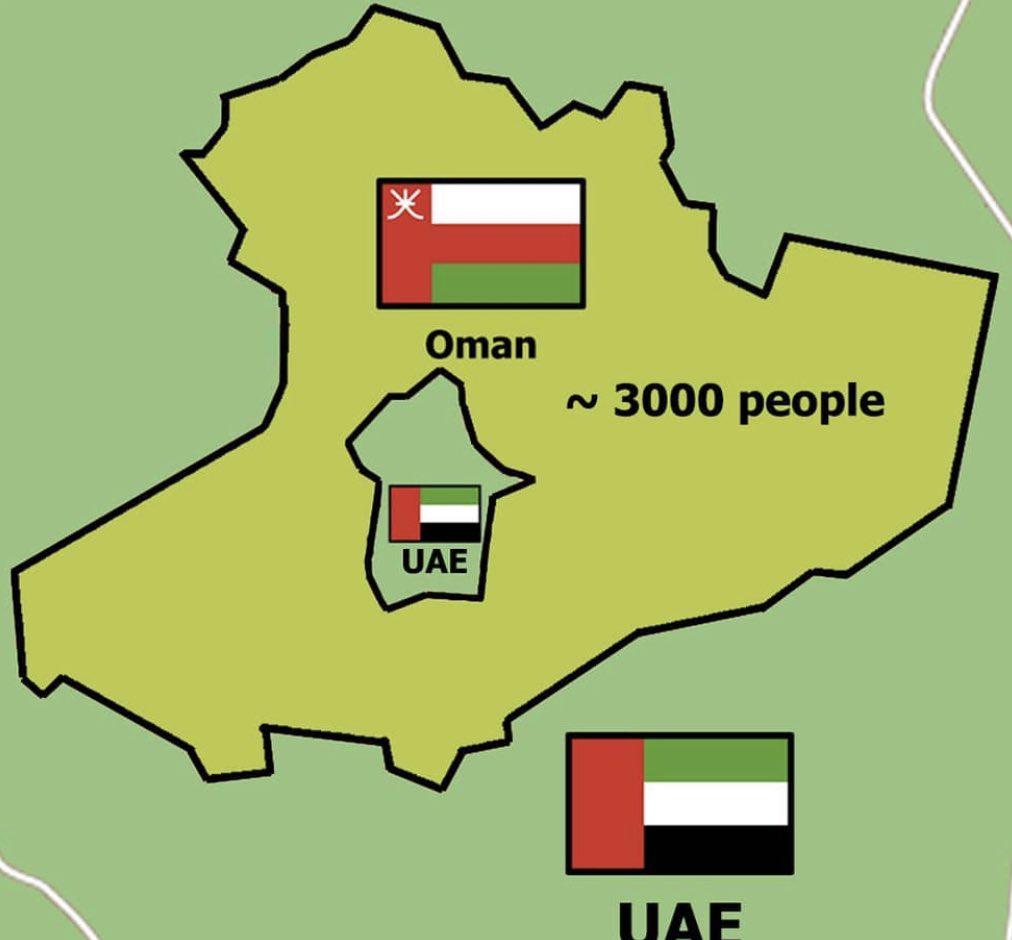
Map of UAE-Oman Donut-shaped Enclave
This map visualizes one of the most intriguing border anomalies in the world: the donut-shaped enclave formed by the Uni...
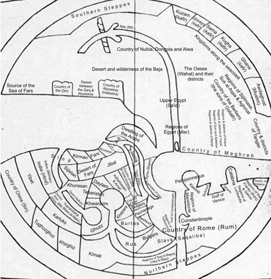
Ibn Howqal 10th Century World Map
The Ibn Howqal World Map, dating back to the 10th century, is a remarkable historical cartographic representation that p...
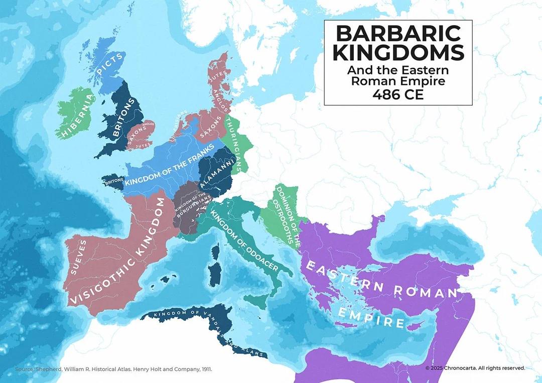
Map of Europe in 486 CE After Western Roman Empire
The map titled \...
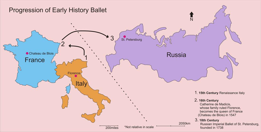
Early History of Ballet Map
This map illustrates the early history of ballet, tracing its origins from Italy to its eventual flourishing in France a...
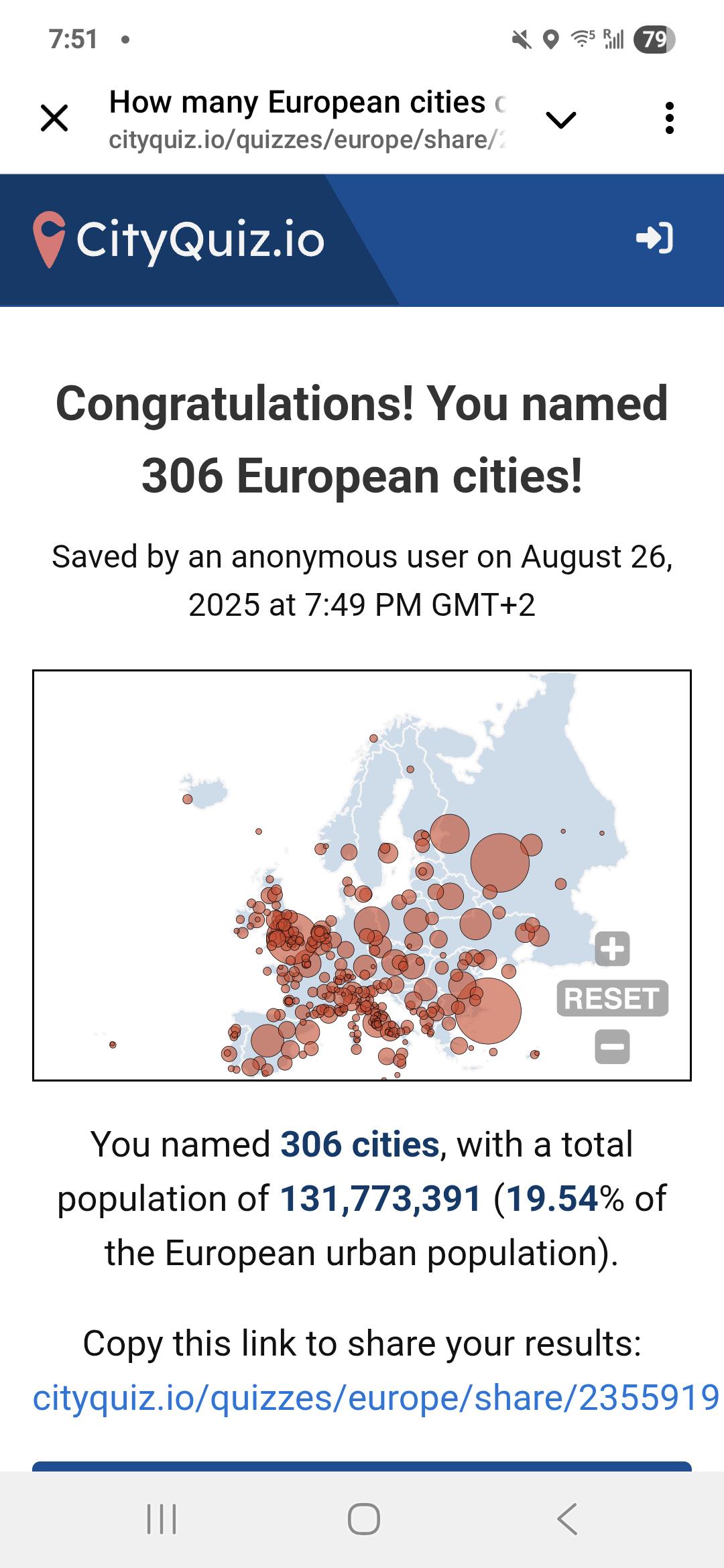
Travel Experience Map of Americans in Europe
This unique map illustrates the travel experiences of Americans living in Europe, shedding light on how these expatriate...
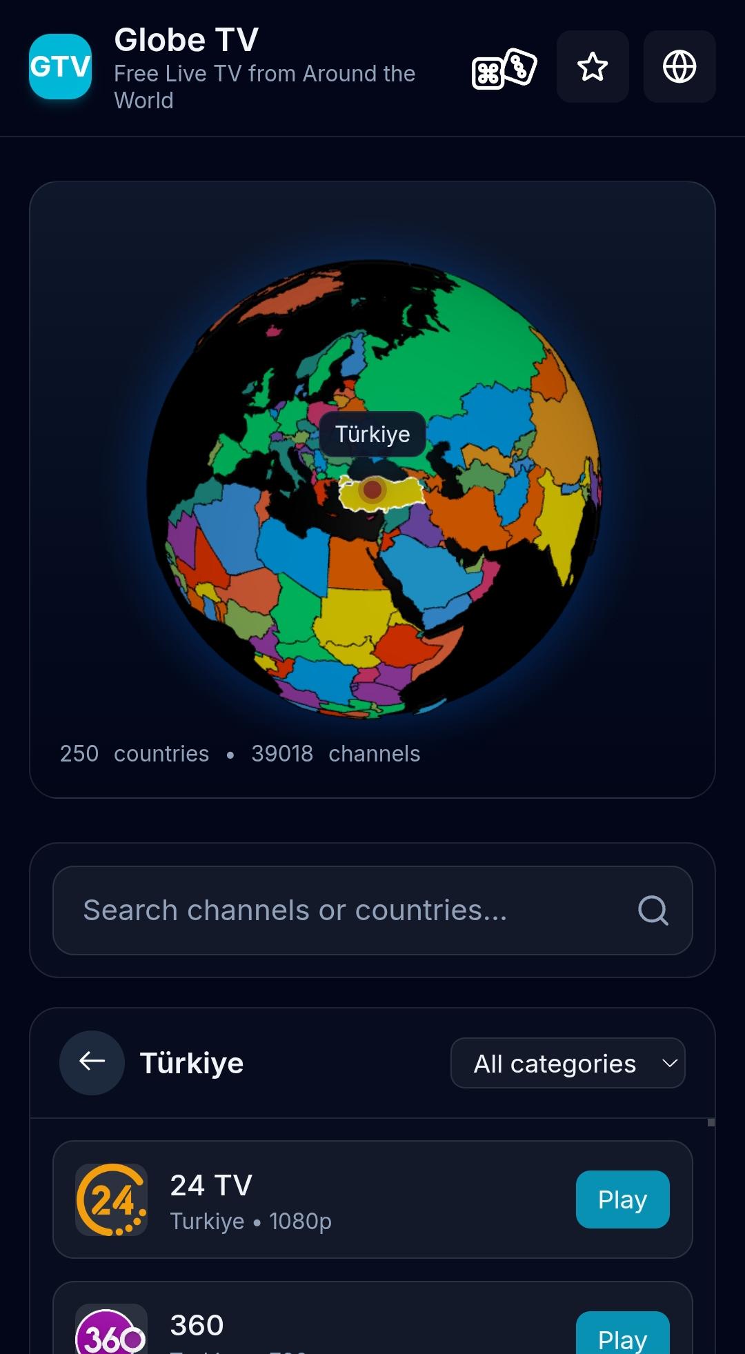
Free TV Channels by Country Map
Interestingly, countries with a strong commitment to public broadcasting often provide a wide range of free channels. Fo...
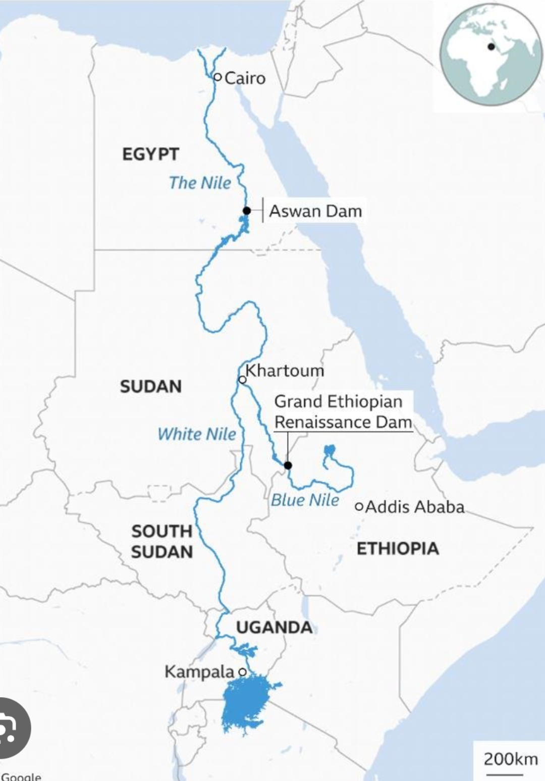
Map of the Blue Nile and Ancient Civilizations
This map illustrates the flow of the Blue Nile River and its historical connection to some of Africa's oldest civilizati...
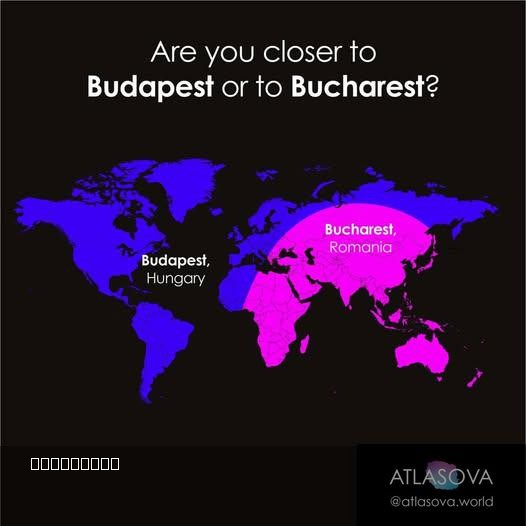
Proximity Map of Budapest and Bucharest
However, this isn't just about determining which city is nearer; it opens the door to a deeper understanding of the hist...
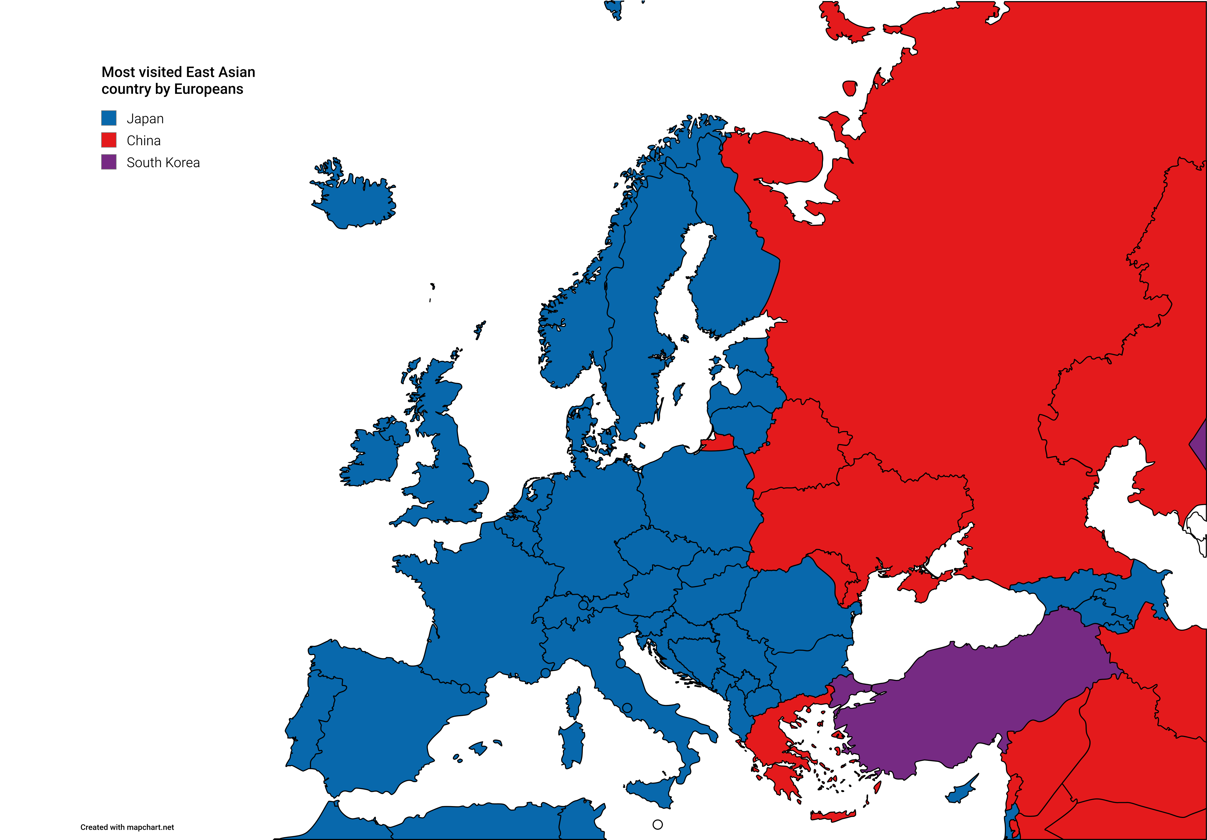
Map of Most Visited East Asian Countries by Europeans
The visualization titled 'Most Visited East Asian Countries by Europeans' presents an insightful look into travel patter...
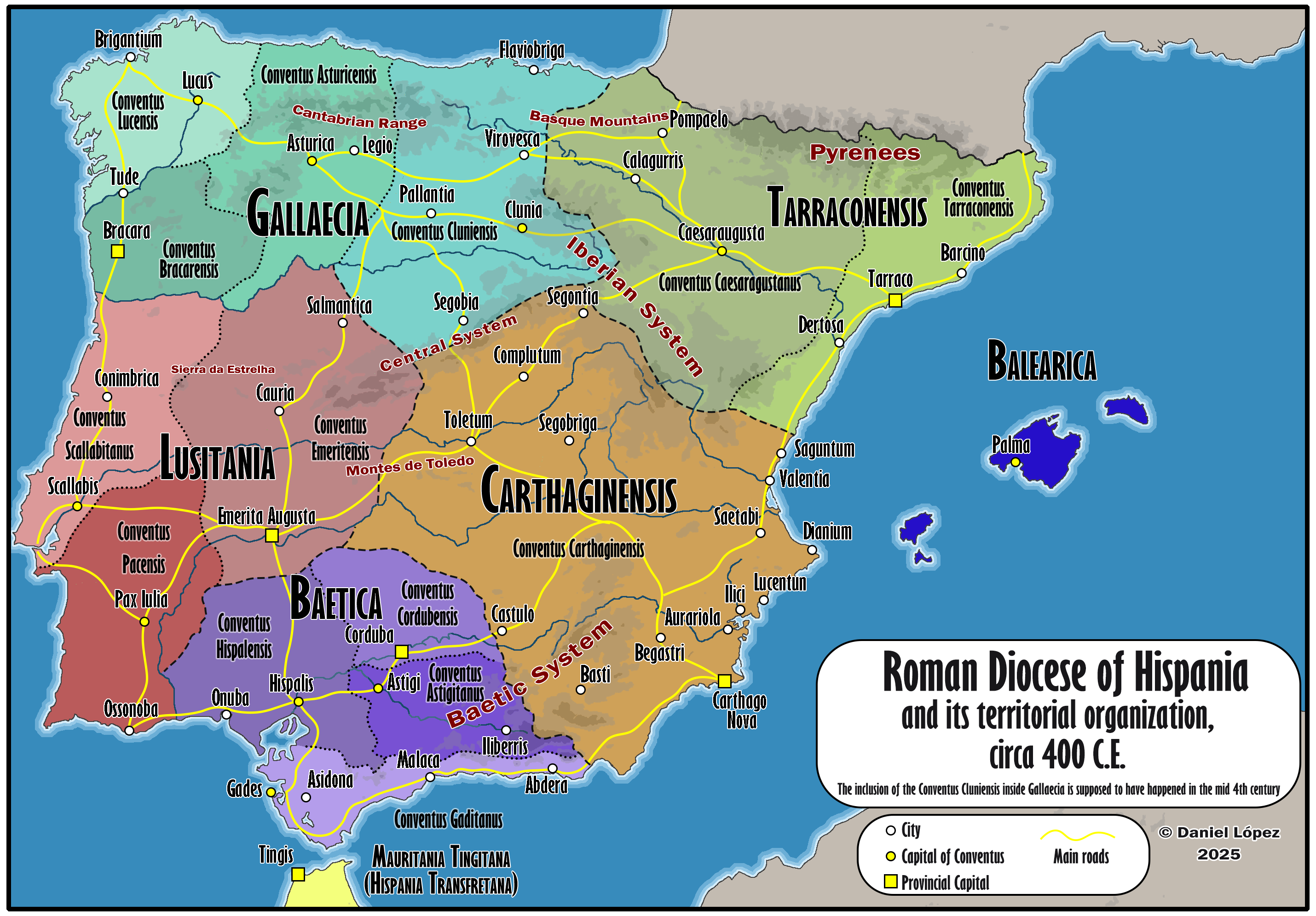
Map of Roman Hispania Circa 400
The 'Detailed Map of Roman Hispania (c. 400)' provides a rich visual representation of the Iberian Peninsula during a cr...
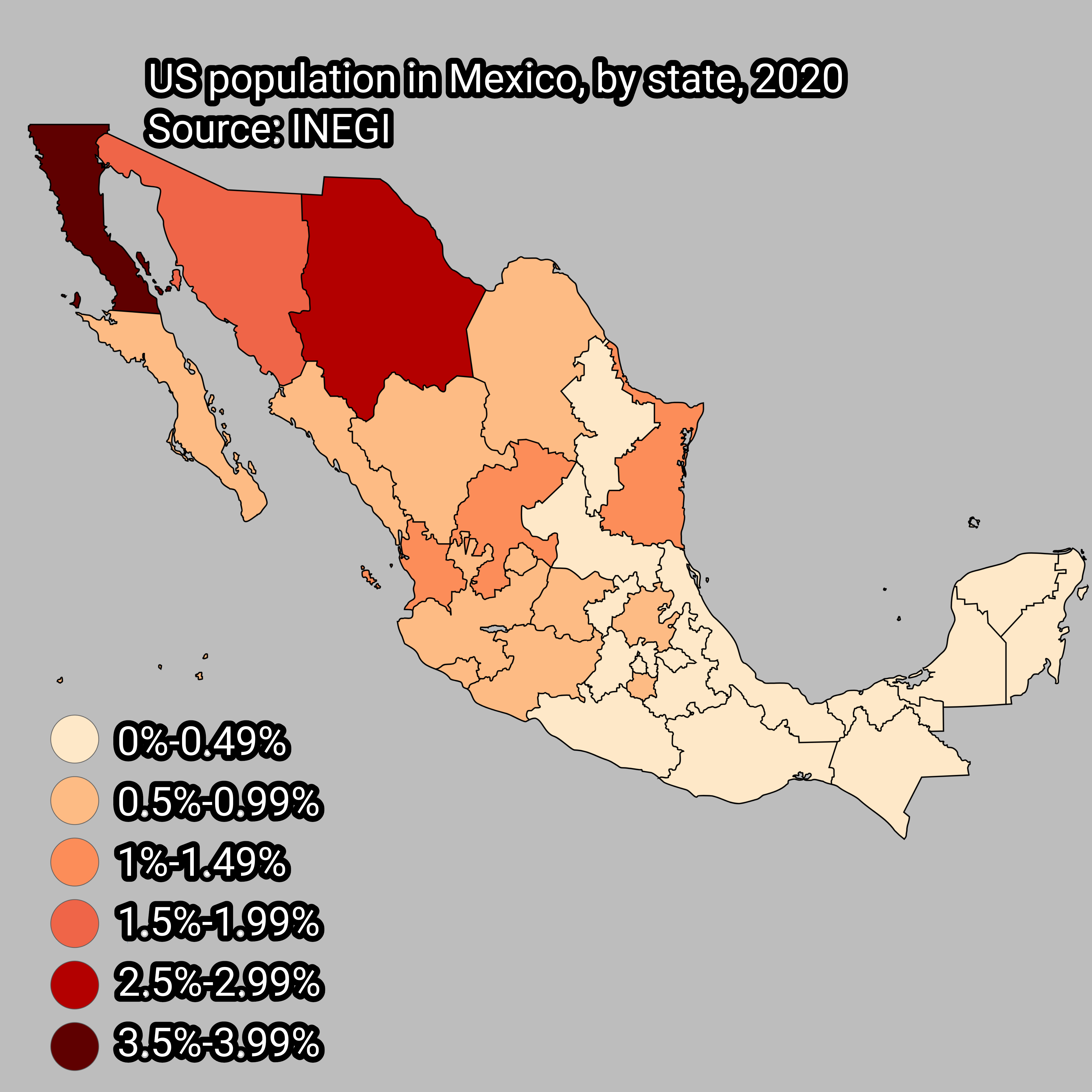
US Population in Mexico by State Map
...
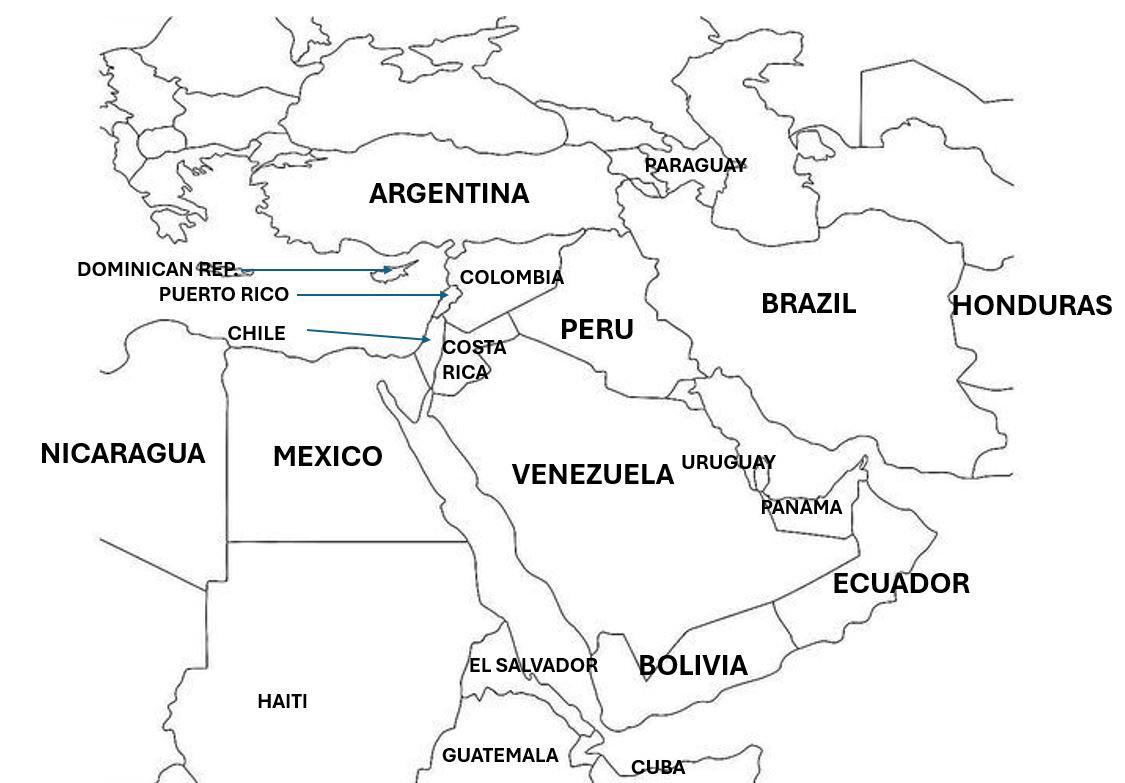
Cultural Perceptions Map of the Middle East
This map visualizes how Latin Americans perceive the Middle East through a cultural lens. It highlights various aspects ...
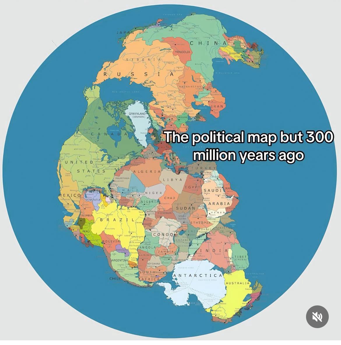
Supercontinent Map and Its Political Implications
The "Supercontinent" map visualizes a hypothetical world where all current continents have merged into a single landmass...
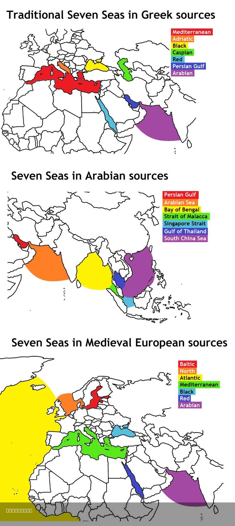
Seven Seas Map: Ancient Greek, Arabian & Medieval European Views
The map titled "The Seven Seas From The Ancient Greek, Arabian & Medieval European Points of View" is a fascinating repr...
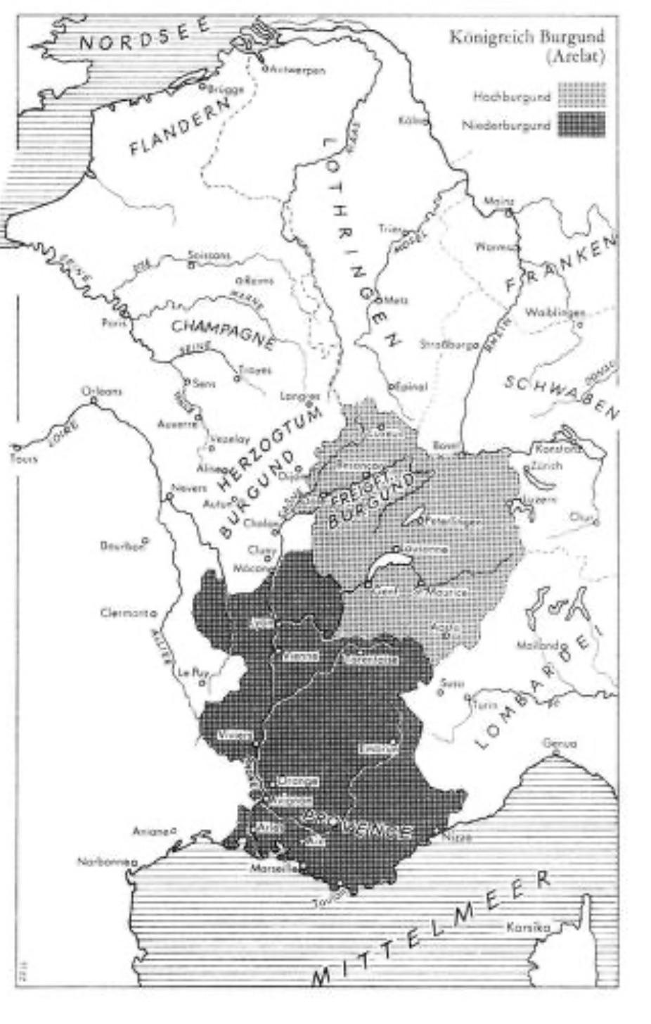
Map of the Kingdom of Burgundy Arelat, 10th–11th Century
This map provides a detailed representation of the Kingdom of Burgundy, known as Arelat, during the 10th and 11th centur...
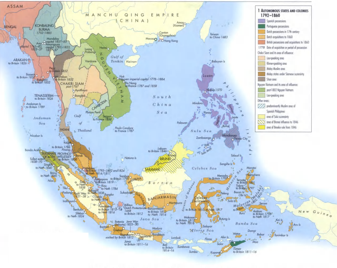
Southeast Asia Historical Map 1792-1860
The "Southeast Asia 1792-1860" map offers an intriguing glimpse into a region that has undergone significant transformat...
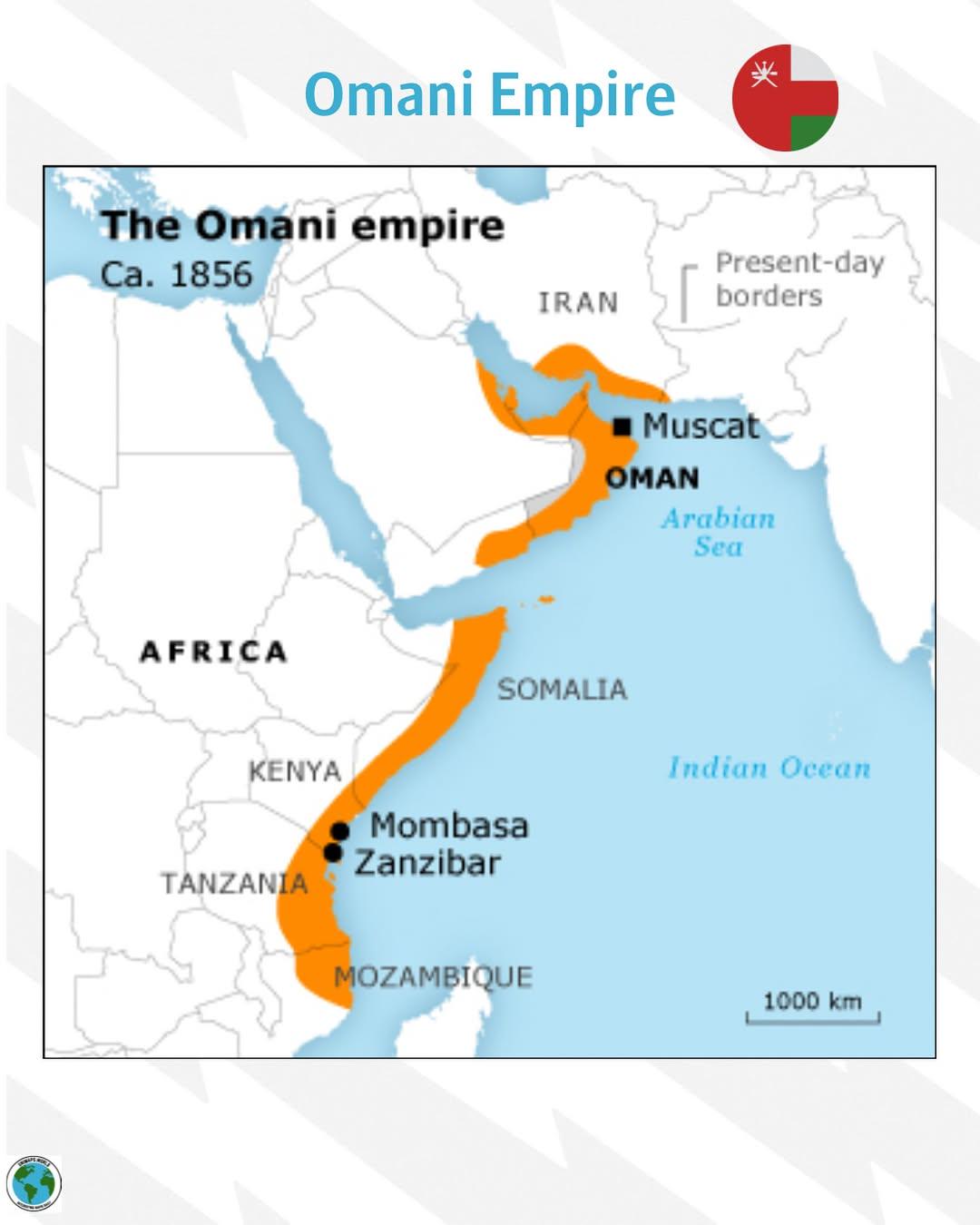
Omani Empire Map of 1856
The Omani Empire Map of 1856 provides a fascinating look into the vast territories controlled by Oman during this time p...
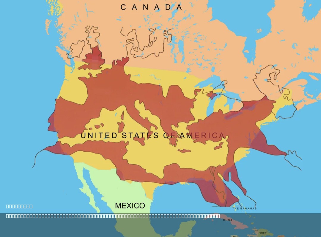
Roman Empire Size Comparison Map with USA
The map titled "The Size of the Roman Empire at Its Height Compared to the United States" visually compares the vast ter...
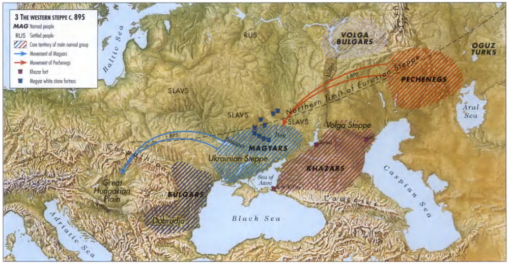
Nomad Empires of Europe Migration Routes Map
This map vividly illustrates the migration routes of various nomadic empires across Europe, highlighting their expansive...
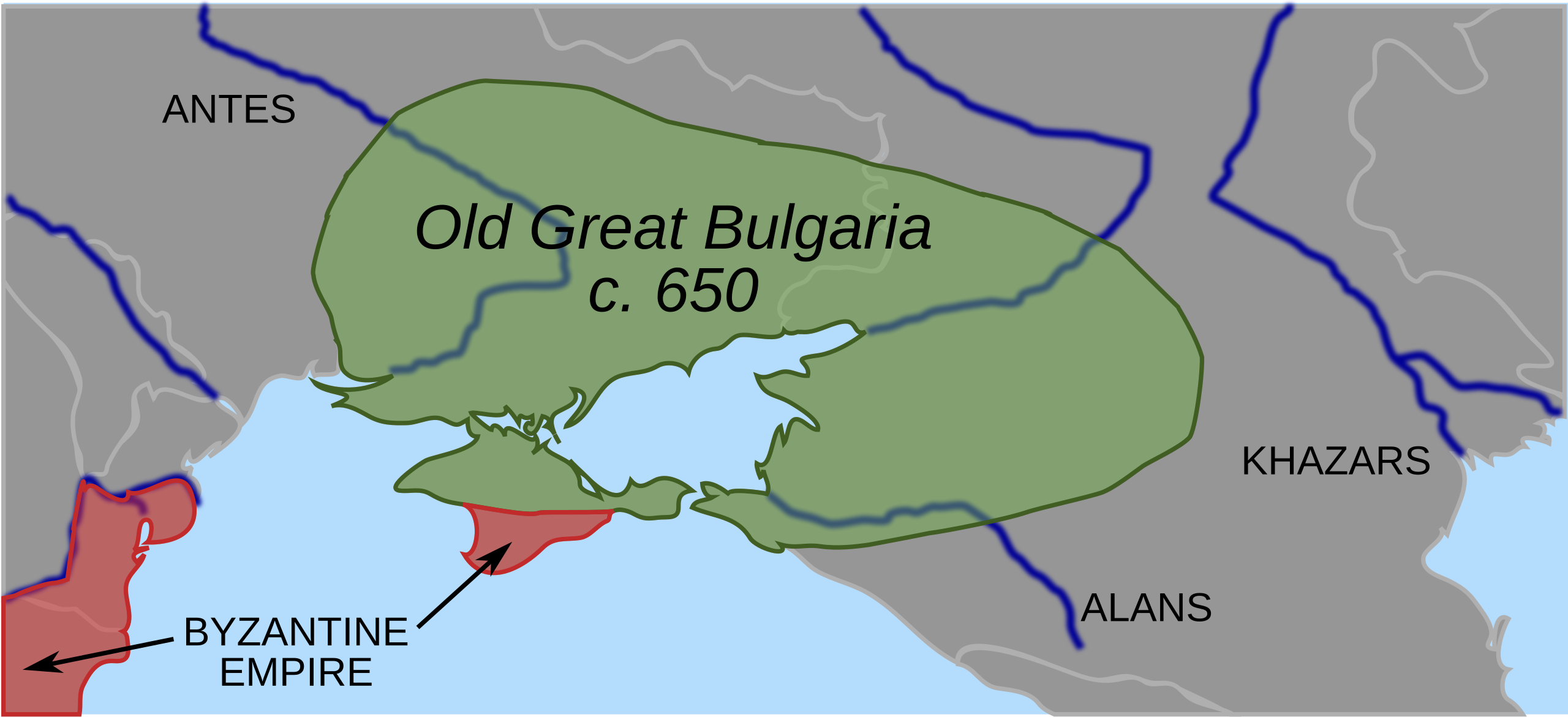
Map of Old Great Bulgaria and Surrounding Regions in 650 AD
The 'Map of Old Great Bulgaria, the first Bulgar state, and surrounding regions in 650 AD' provides a fascinating glimps...
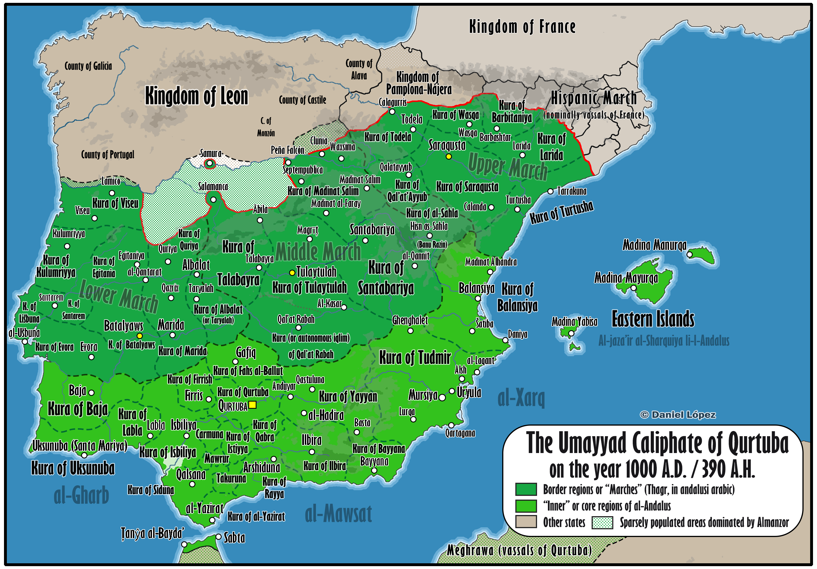
Map of the Caliphate of Qurtuba (Córdoba) at Its Greatest Extent
Interestingly, the caliphate served as a melting pot of cultures, where Muslims, Christians, and Jews coexisted, leading...
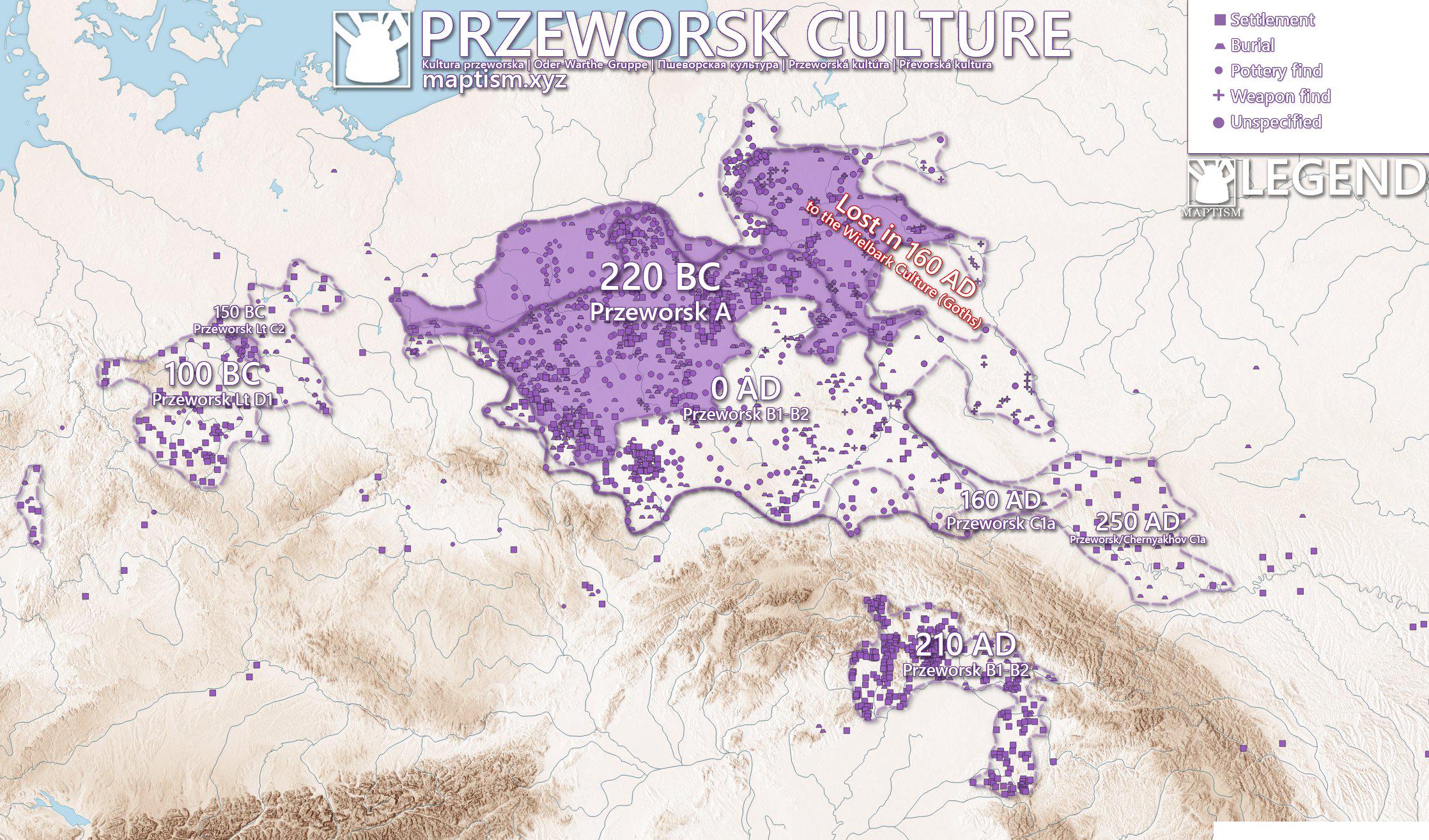
Przeworsk Culture Map of Poland
The Przeworsk Culture Map of Poland provides a visual representation of the archaeological sites and settlements associa...