Map of Old Great Bulgaria and Surrounding Regions in 650 AD

Marcus Rodriguez
Historical Geography Expert
Marcus Rodriguez specializes in historical cartography and geographic data analysis. With a background in both history and geography, he brings unique...
Geographic Analysis
What This Map Shows
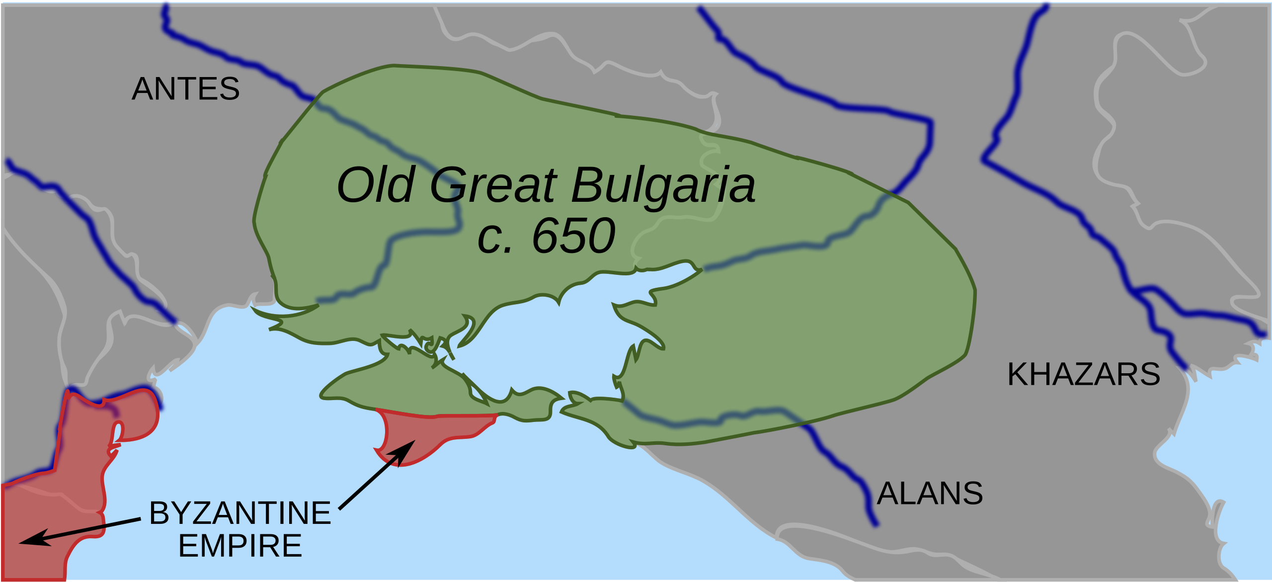
The 'Map of Old Great Bulgaria, the first Bulgar state, and surrounding regions in 650 AD' provides a fascinating glimpse into the geographical and cultural landscape of Eastern Europe during the early Middle Ages. This historical map outlines not only the expanse of Old Great Bulgaria but also highlights neighboring territories, showcasing the diverse groups and regions that interacted during this pivotal era. The map illustrates the extent of the Bulgar state, which encompassed parts of modern-day Bulgaria, Romania, Ukraine, and even sections of the Balkans.
Deep Dive into Old Great Bulgaria
Old Great Bulgaria, established in the 7th century, represents a significant chapter in the history of the Bulgarian people and their ancestors. This early Bulgar state emerged as a formidable power in the region, marked by a blend of cultures, languages, and traditions. The geographical coordinates depicted in the map indicate a territory rich in natural resources, which played a crucial role in the state’s development and its interactions with neighboring tribes and empires.
Interestingly, the Bulgars were originally a nomadic warrior people, migrating from Central Asia. They settled along the banks of the Volga and the Don rivers before moving into the territories that the map displays. In 650 AD, the Bulgars had begun to consolidate their power under Khan Asparuh, who is credited with unifying various tribes into a single political entity. The fertile plains and river valleys showcased in the visualization offered ample opportunities for agriculture and trade, which would ultimately support the burgeoning state.
The map also indicates the presence of significant rivers, such as the Danube and the Dniester, which served as vital trade routes and conduits for cultural exchange. These waterways facilitated the movement of goods, ideas, and people, connecting Old Great Bulgaria with other major centers of civilization, including the Byzantine Empire to the south and the Slavic tribes to the north.
Culturally, Old Great Bulgaria was characterized by a unique blend of Turkic, Slavic, and Byzantine influences. The Bulgar elite adopted Christianity later in the 9th century, but prior to this, paganism and shamanistic practices were prevalent. This religious transition would have profound implications for the region’s cultural and political landscape, establishing Bulgaria as a key player in the Christianization of the Balkans.
Regional Analysis
When we analyze the regions surrounding Old Great Bulgaria, we see a complex tapestry of interactions. To the west, the map reveals the territory of the Byzantine Empire, whose influence was significant during this period. The Byzantines viewed the Bulgars as both a threat and an opportunity, leading to frequent military confrontations as well as diplomatic engagements.
To the north, we find various Slavic tribes, whose migrations and settlements were reshaping the demographic landscape of Eastern Europe during the 7th century. The interactions between the Bulgars and Slavs were marked by both conflict and cooperation, as they navigated a rapidly changing political environment. Notably, the Slavic tribes later played a crucial role in the establishment of the First Bulgarian Empire, which emerged as a successor to Old Great Bulgaria.
What’s fascinating is the diversity of the regions depicted in the map. Each area had its own distinct cultural and political attributes, influenced by geographic factors like rivers and mountains. For example, the mountainous regions to the south posed natural barriers that shaped trade routes and military campaigns, while the expansive plains allowed for agricultural development.
Significance and Impact
Understanding the geography of Old Great Bulgaria is not just an academic exercise; it provides critical insights into the origins of modern Bulgaria and the geopolitical dynamics of Eastern Europe. The interactions between the Bulgars, Byzantines, and surrounding tribes set the stage for centuries of conflict and cooperation that would shape the region’s history. Furthermore, this period laid the groundwork for the cultural identity of the Bulgarian people, blending various traditions that continue to influence Bulgarian society today.
In contemporary discussions, the significance of Old Great Bulgaria can be seen in cultural celebrations, historical studies, and national identity. As we look to the future, recognizing these historical connections can foster a deeper appreciation for the rich tapestry of cultures that characterize Eastern Europe. Understanding this past can also highlight current trends in regional cooperation and cultural exchange among countries that were once divided by historical conflicts.
The map serves as a reminder of the interconnectedness of our histories, and how the geographical positioning of states can influence their development and relationships over the centuries. As we study these historical landscapes, we gain valuable perspectives on how geography shapes identity and governance, issues that remain relevant in our globalized world today.
Visualization Details
- Published
- September 23, 2025
- Views
- 54
Comments
Loading comments...