eastern europe Maps
28 geographic visualizations tagged with "eastern europe"
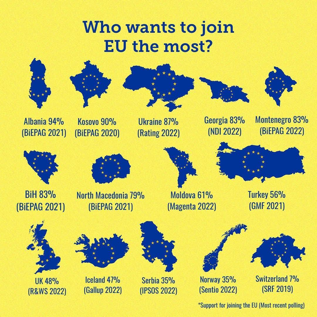
Map of European Countries Seeking EU Membership
This map provides a clear and informative visualization of European countries that are currently seeking to join the Eur...
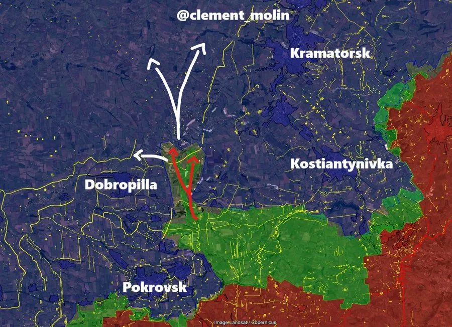
Map of Recent Russian Military Advances
This map provides a detailed overview of the recent military advances made by Russian forces within the last 48 hours. I...
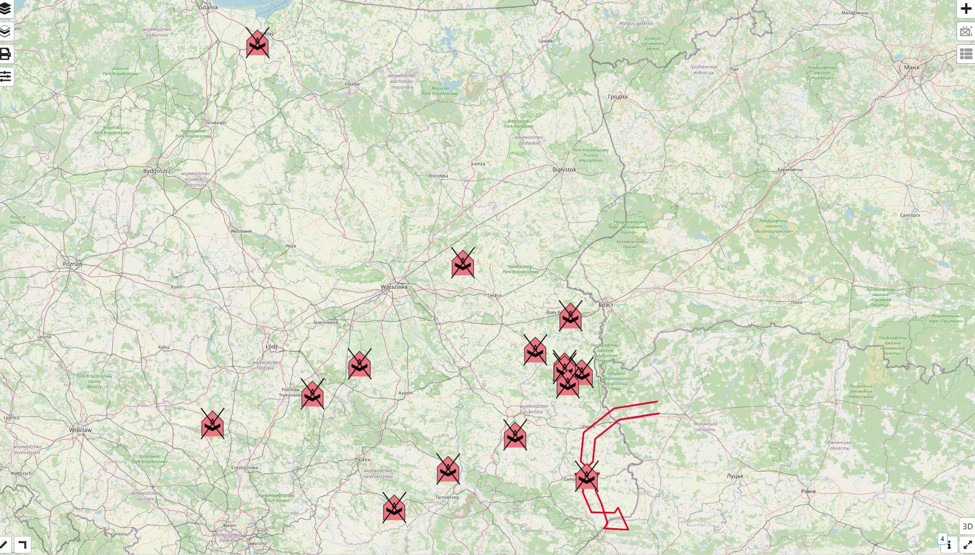
Map of Locations Where Poland Shot Down Russian Drones
This map provides a detailed visualization of the locations in Poland where Russian drones were shot down. Specifically,...
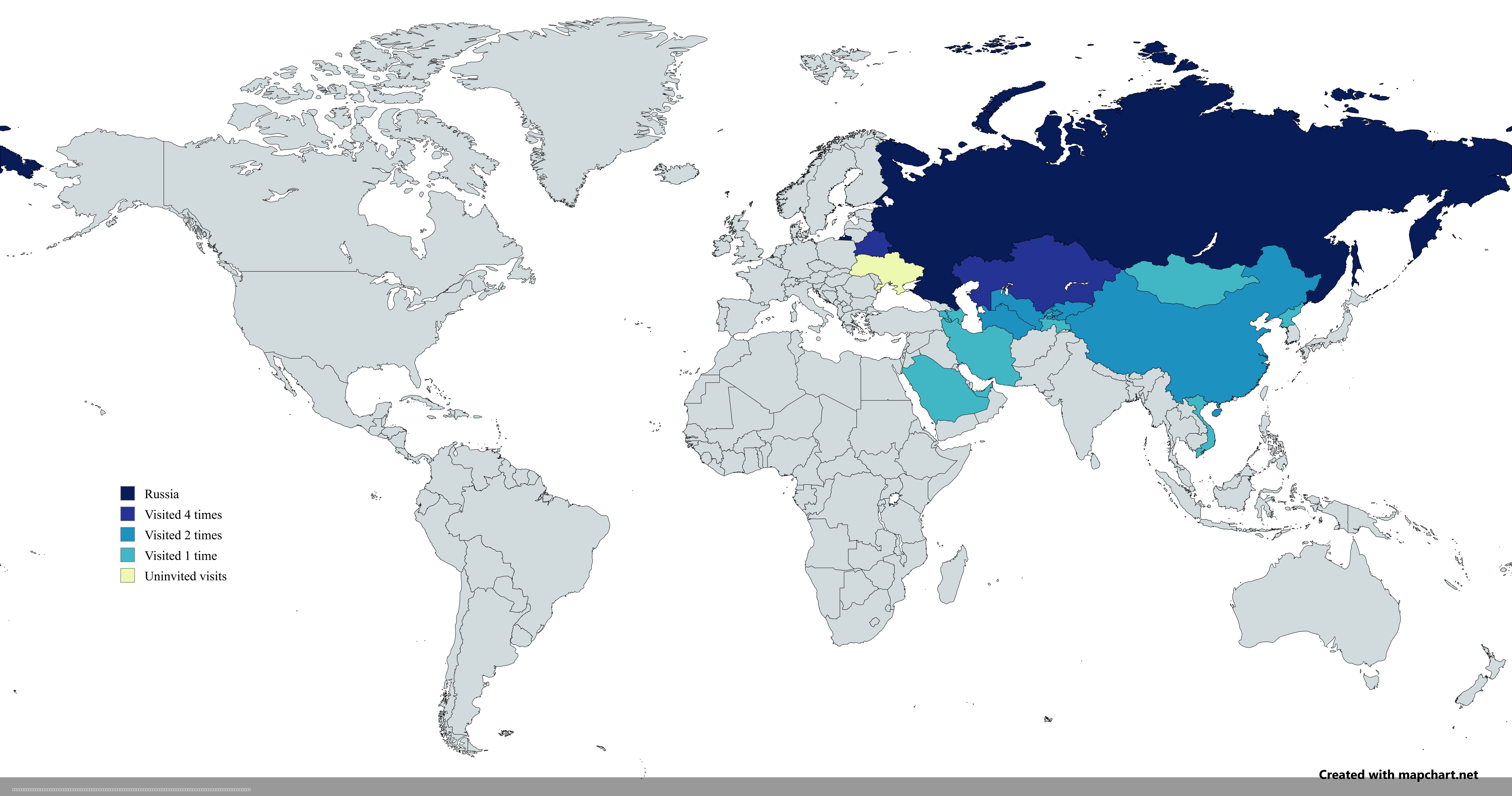
Map of Countries Visited by Vladimir Putin Post-2022 Invasion
The map titled "Countries Visited by Russian President Vladimir Putin After the 2022 Russian Invasion of Ukraine" provid...
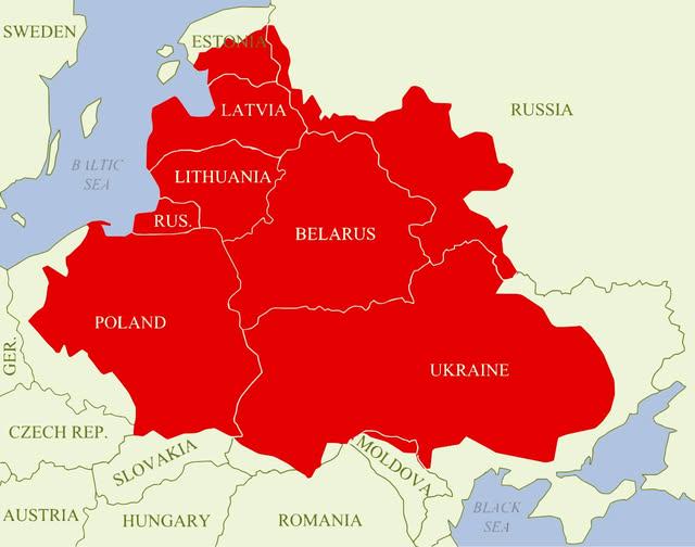
Polish–Lithuanian Commonwealth Maximum Extent Map
The visualization titled "Polish–Lithuanian Commonwealth at its maximum extent over modern borders" depicts the historic...
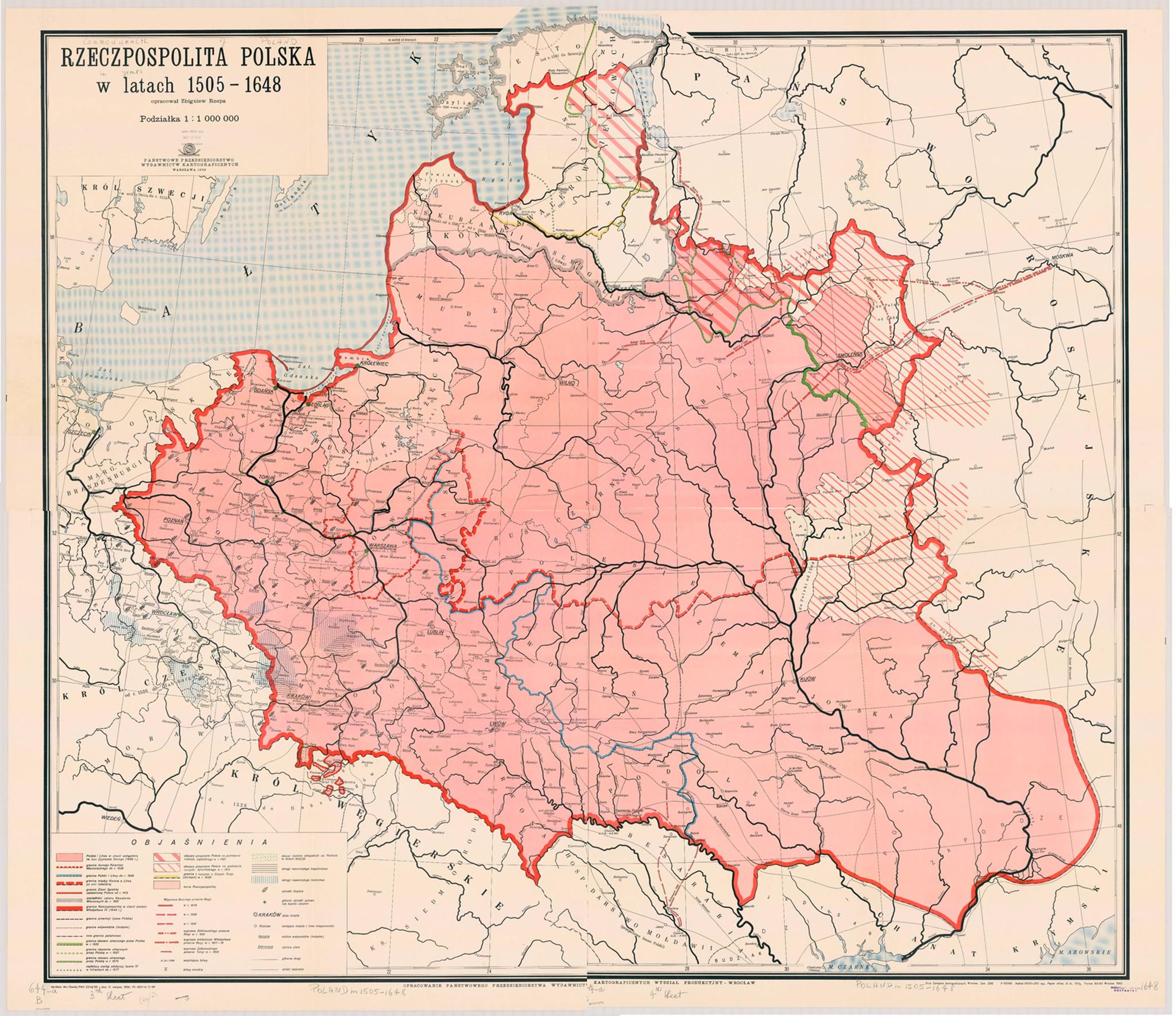
Map of the Commonwealth of Both Nations 1505-1648
The "Map of the Commonwealth of Both Nations 1505-1648" illustrates the geopolitical landscape of the Polish-Lithuanian ...
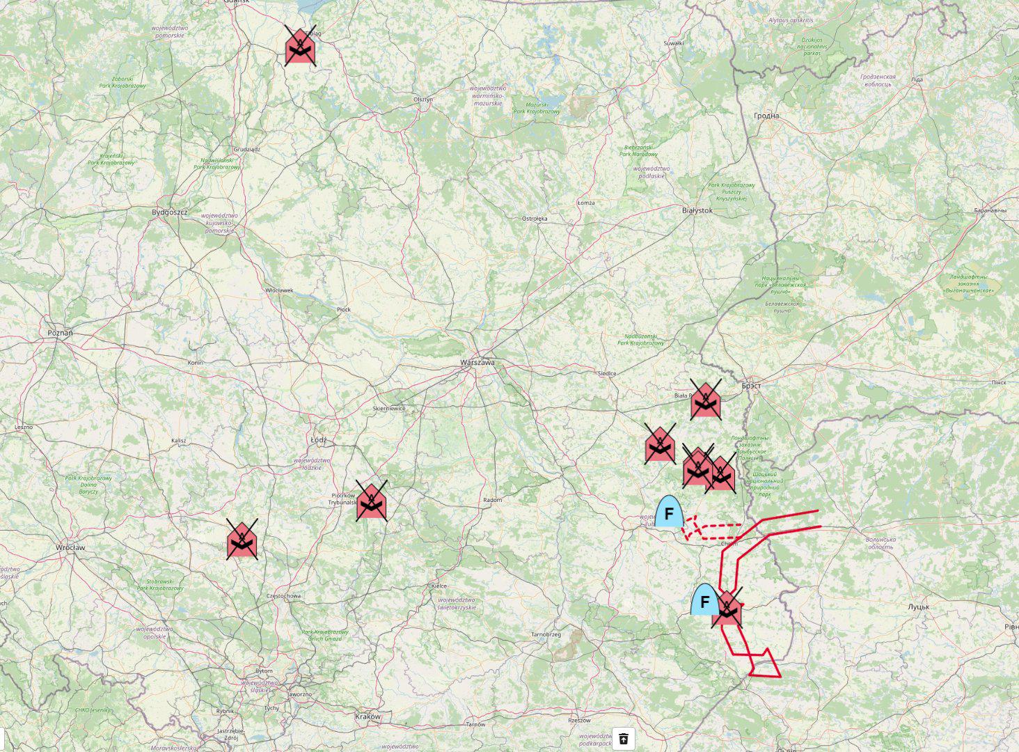
Map of Places Where Poland Shot Down Russian Drones
The map titled "Map of all places where Poland shot down Russian drones" provides a visual representation of the specifi...
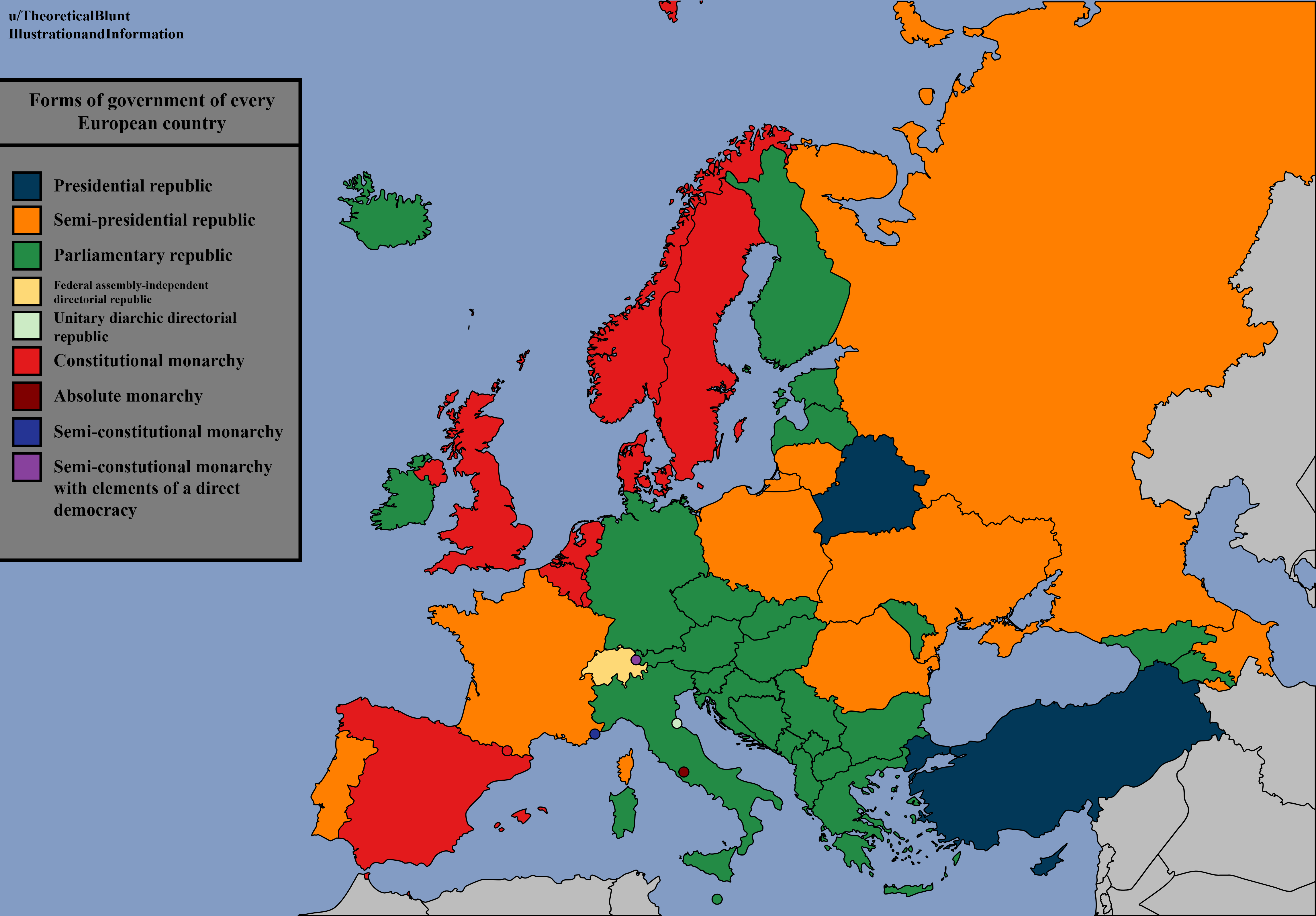
Forms of Government of Every European Country Map
The "Forms of Government of Every European Country Map" provides a comprehensive visual representation of the various po...
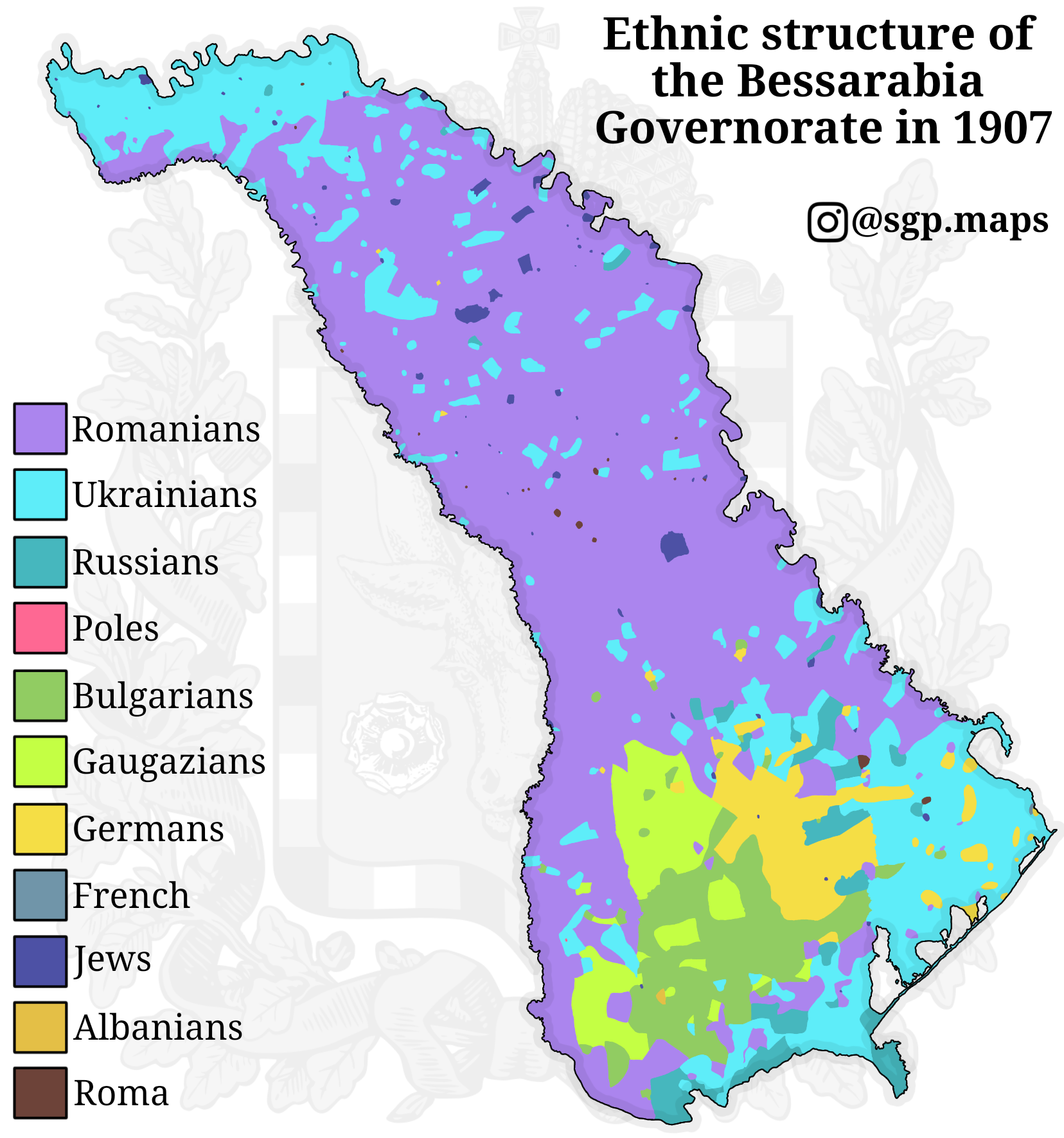
Ethnic Map of Bessarabia in 1907
The "Ethnic Map of Bessarabia in 1907" provides a detailed visualization of the ethnic composition of the Bessarabia Gov...
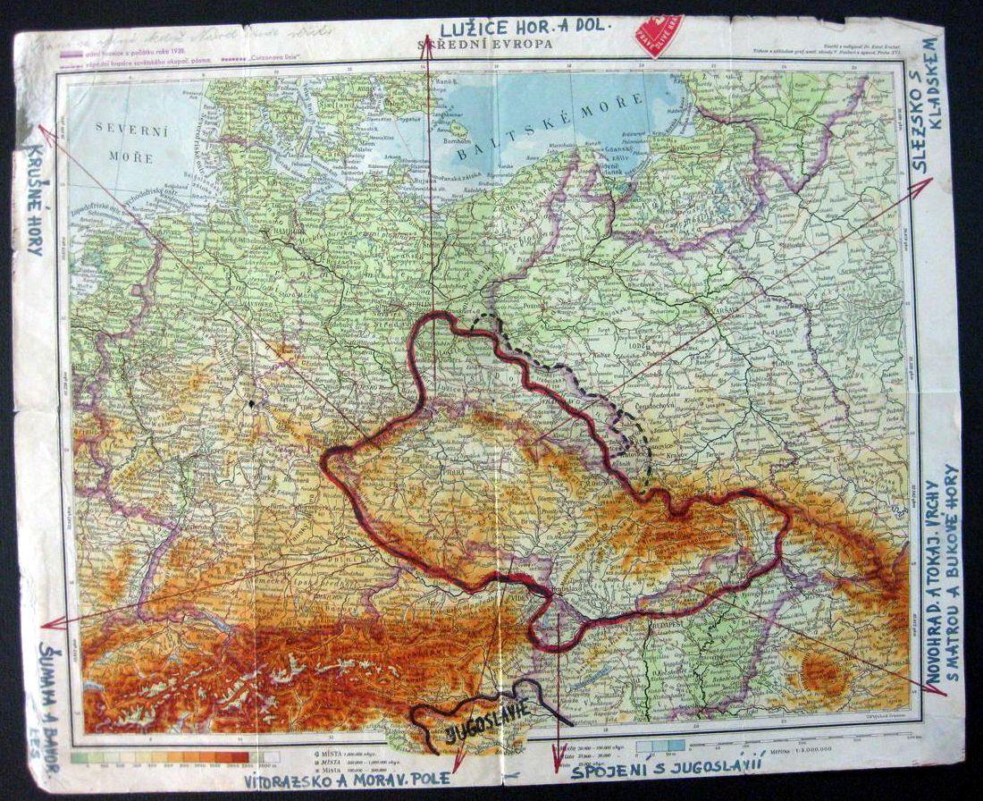
Czech Plans for Post-War Czechoslovakia Map
The \...
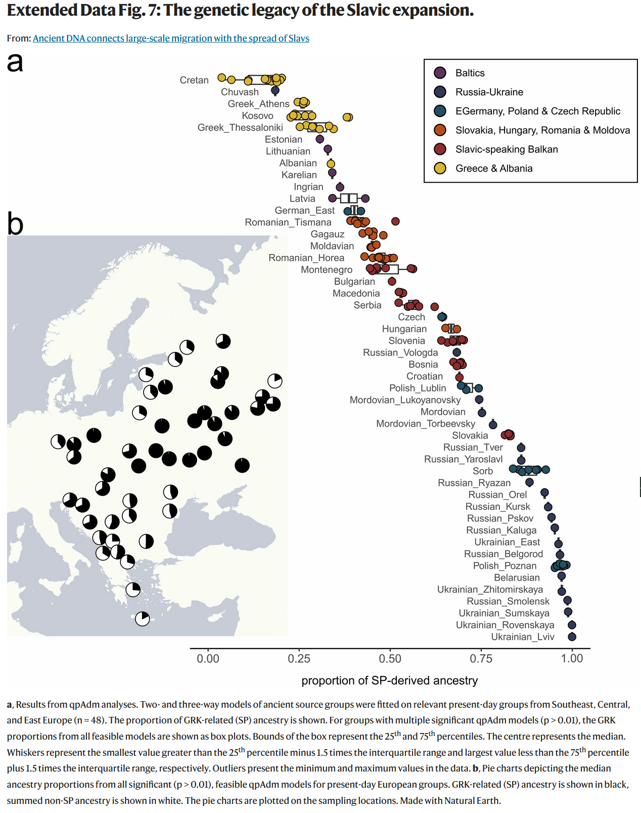
Genetic Legacy of Slavs Map
This map provides an intriguing glimpse into the genetic heritage of the Slavic people, illustrating the distribution of...
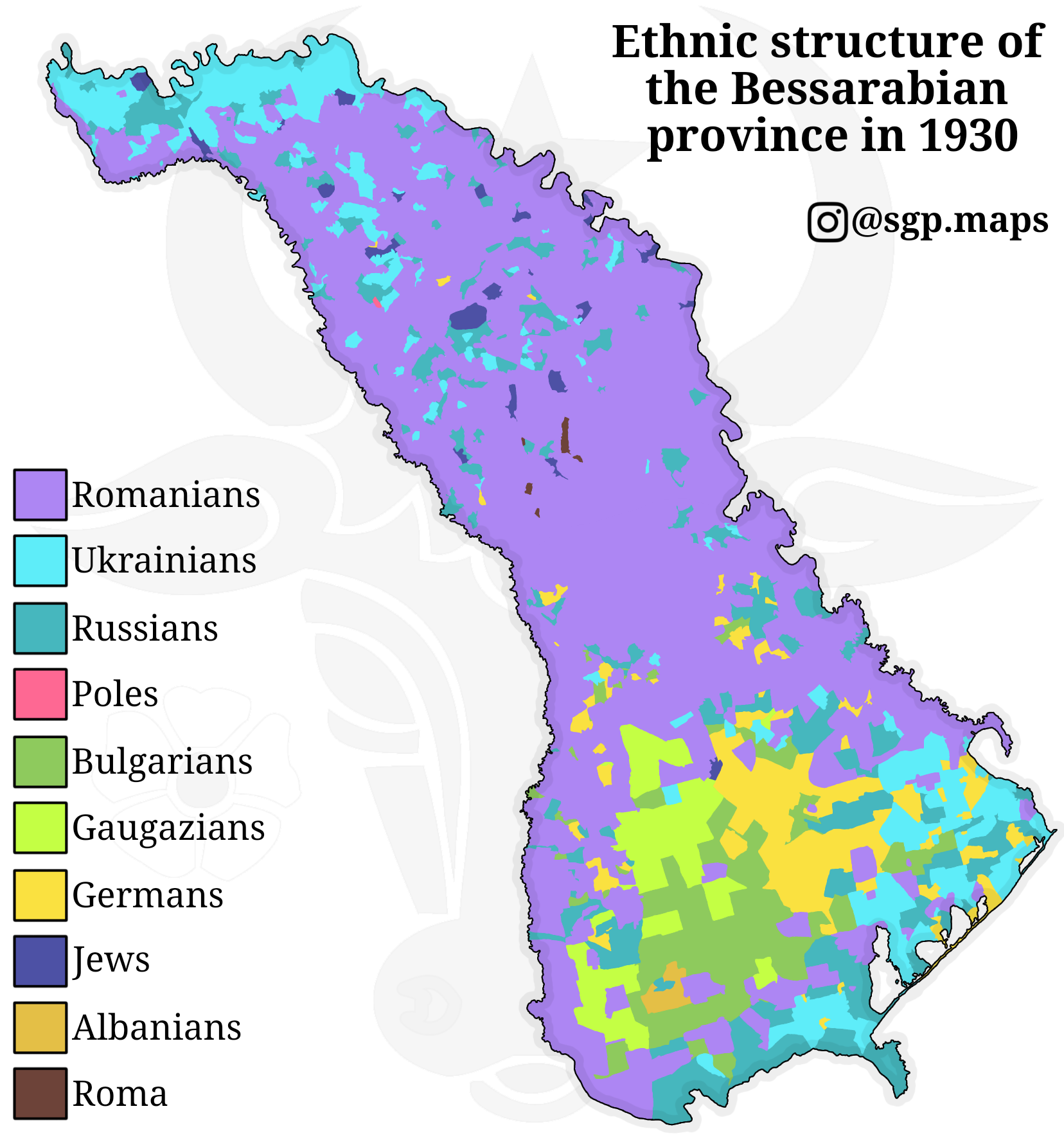
Ethnic Map of Bessarabia 1930
The 'Ethnic Map of Bessarabia 1930' provides a detailed visualization of the ethnic composition of the Bessarabian provi...
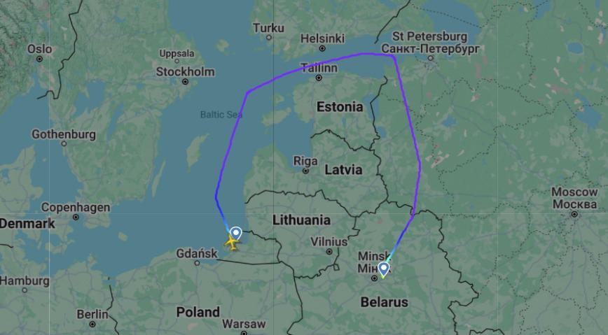
Flight Route Map Between Kaliningrad and Minsk Airports
This map illustrates the flight route between Kaliningrad (KGD) and Minsk (MSQ) airports, providing a clear visual repre...
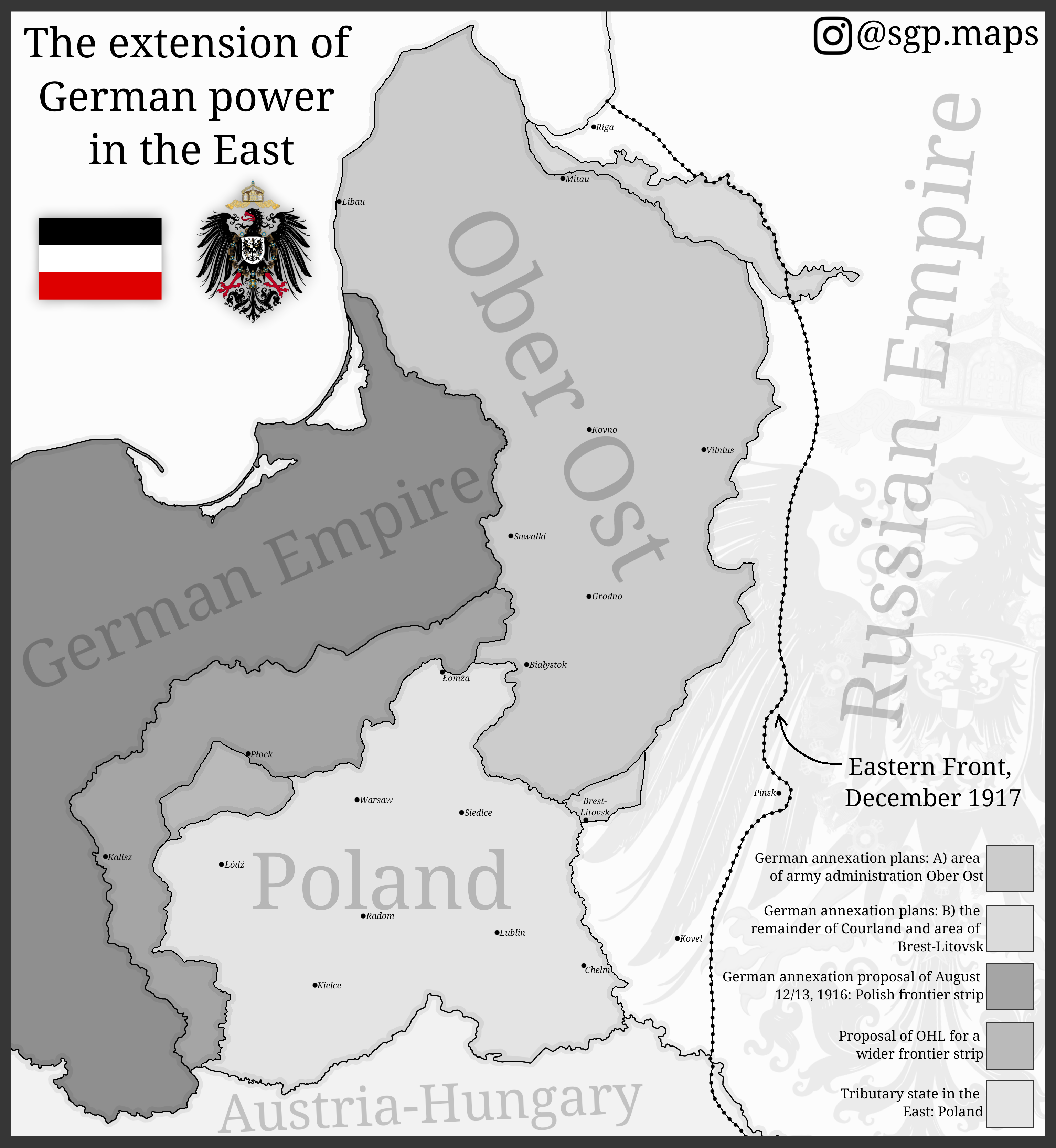
Map of German Expansion in Eastern Europe
The map titled "The Extension of German Power in the East" illustrates the territorial ambitions of Germany during World...
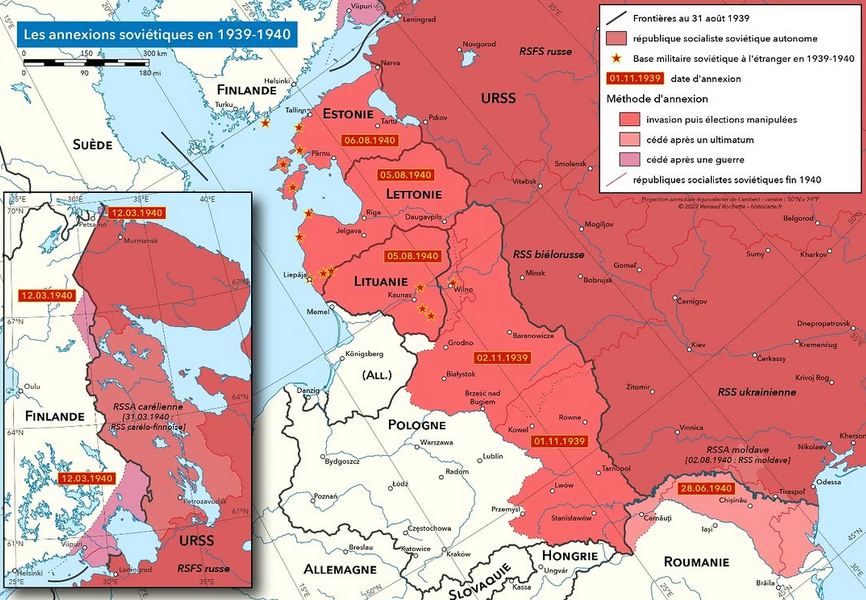
Soviet Annexations in 1939-1940 Map
One of the most significant events was the invasion of Poland in September 1939. The Soviet forces entered from the east...
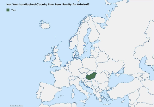
Map of Landlocked Countries Led by Admirals
This map visualizes an intriguing political intersection: the landlocked nations that have been led by admirals. While i...
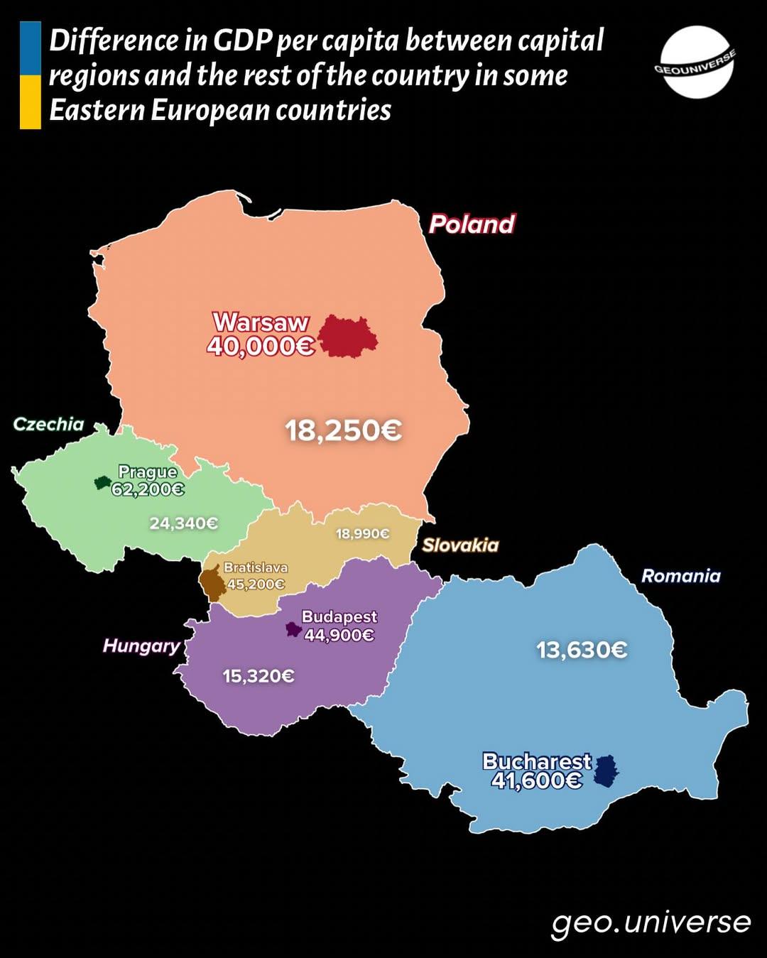
GDP Per Capita Gap Map in Eastern Europe
This map visually illustrates the disparities in GDP per capita between capital regions and the rest of their respective...
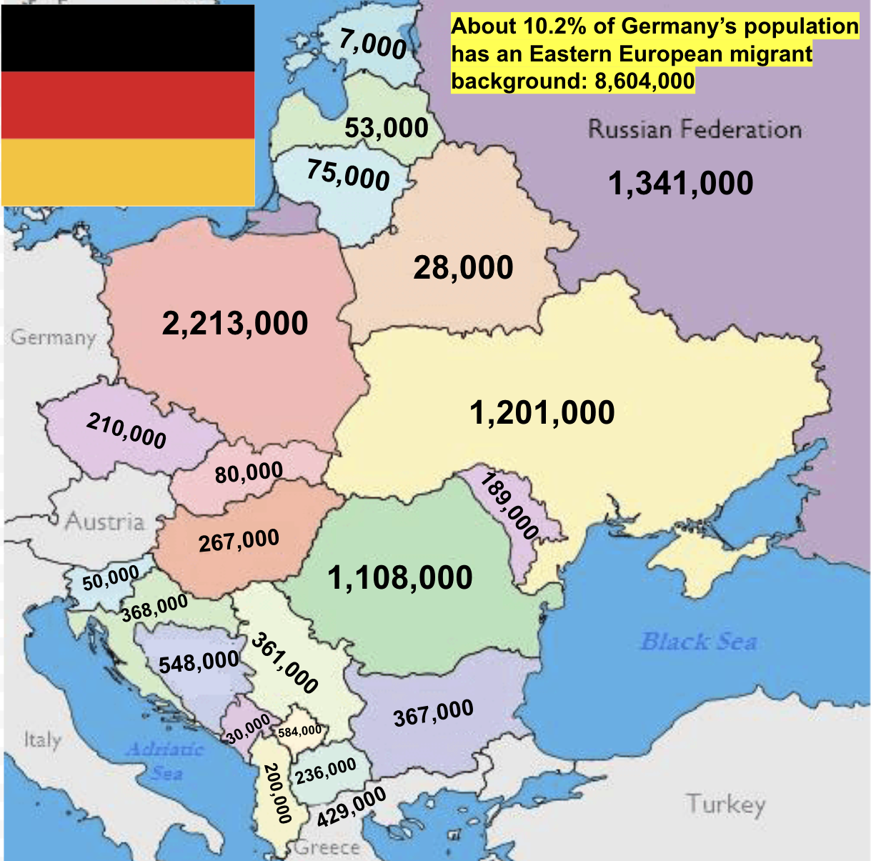
Eastern European Migrant Background in Germany Map
The map titled "Eastern European Migrant Background in Germany" illustrates a significant aspect of Germany's demographi...
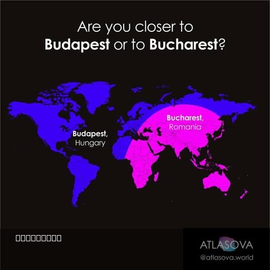
Proximity Map of Budapest and Bucharest
However, this isn't just about determining which city is nearer; it opens the door to a deeper understanding of the hist...
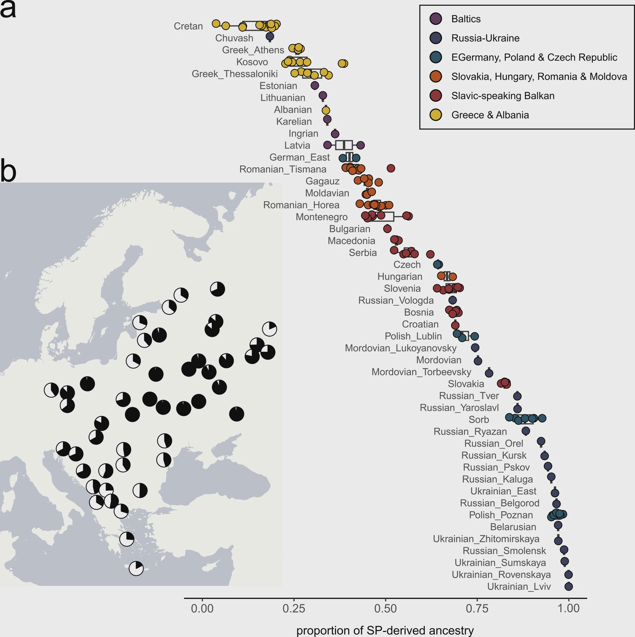
Genetic Legacy of Slavic Expansion Map
The map titled "The Genetic Legacy of the Slavic Expansion" by Gretzinger et al. (2025) visually represents the distribu...
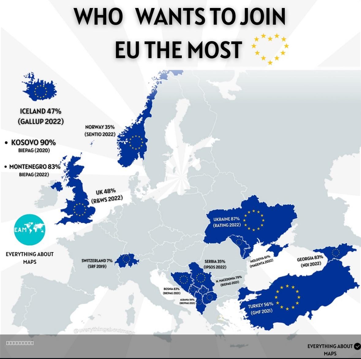
EU Membership Aspirations Map
This map provides a visual representation of the countries in Europe that are actively seeking membership in the Europea...
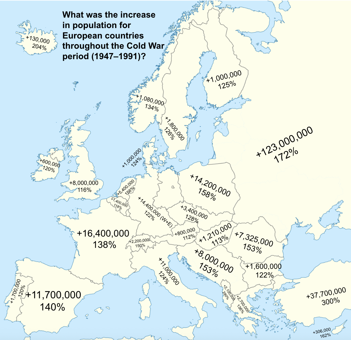
European Population Growth Map During Cold War
The map titled "What was the increase in population for European countries throughout the Cold War period (1947-1991)" v...
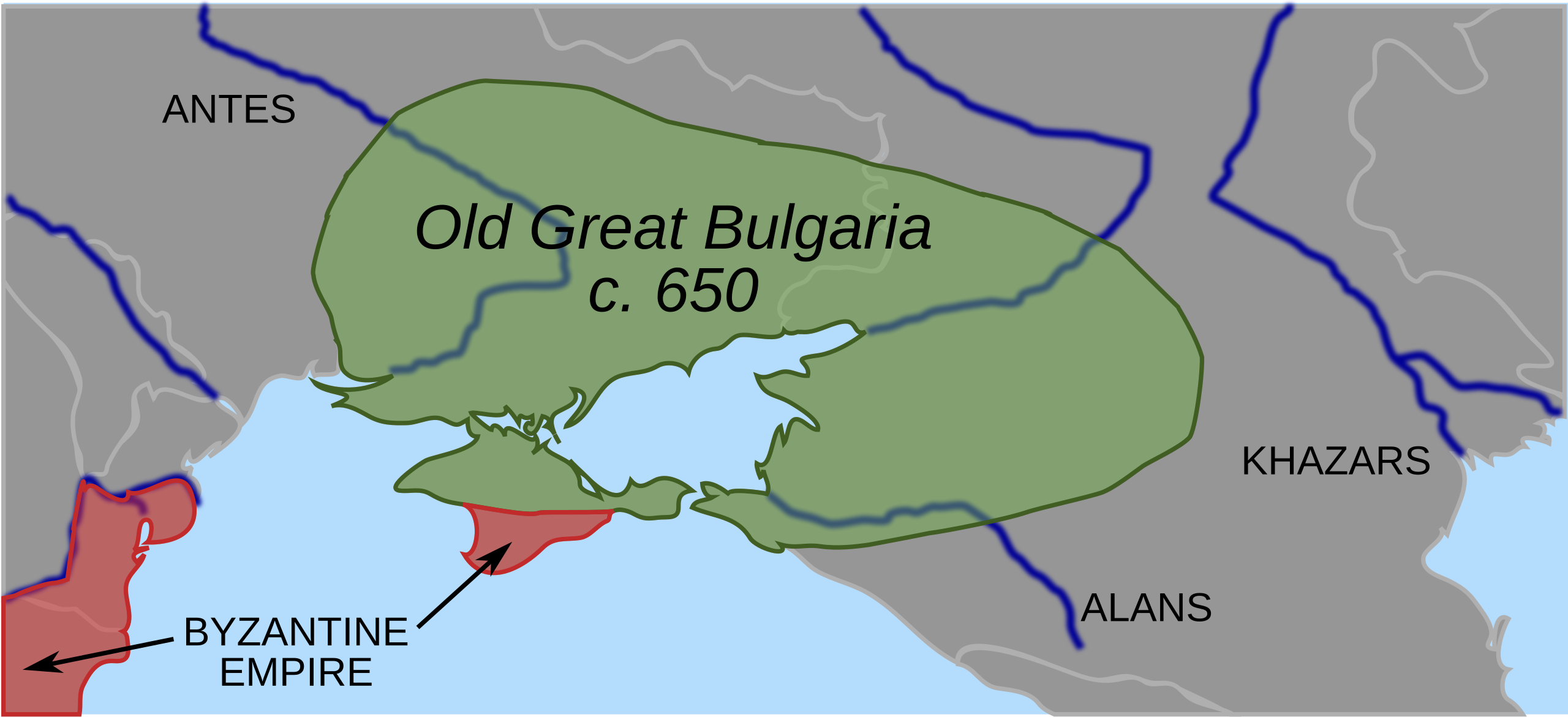
Map of Old Great Bulgaria and Surrounding Regions in 650 AD
The 'Map of Old Great Bulgaria, the first Bulgar state, and surrounding regions in 650 AD' provides a fascinating glimps...
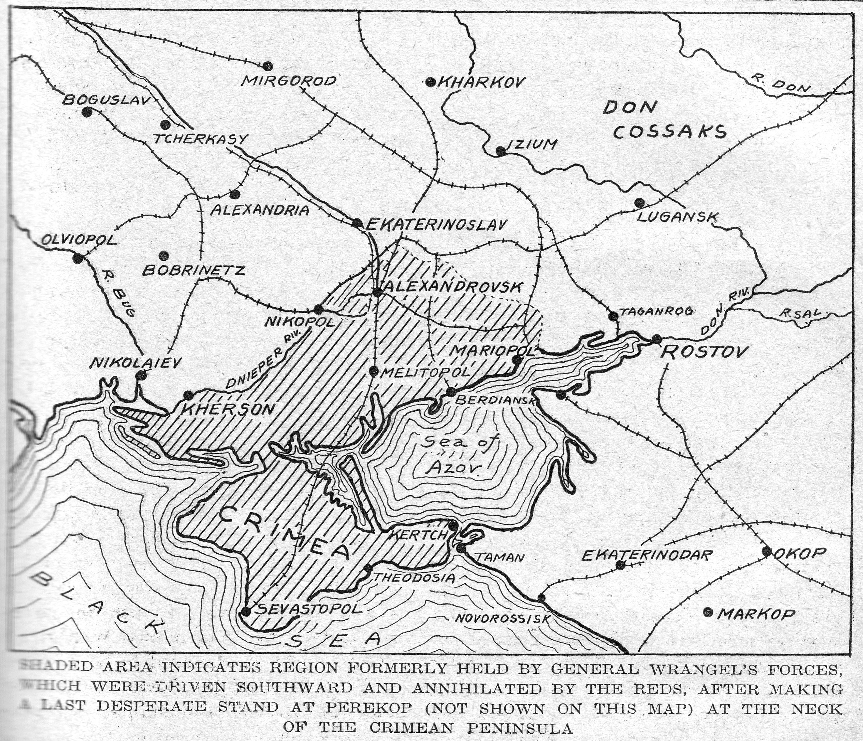
1920 Soviet Red Army Takes Crimea Map
The map titled "1920: Soviet Red Army Takes Crimea" visually represents the territorial advances of the Red Army during ...
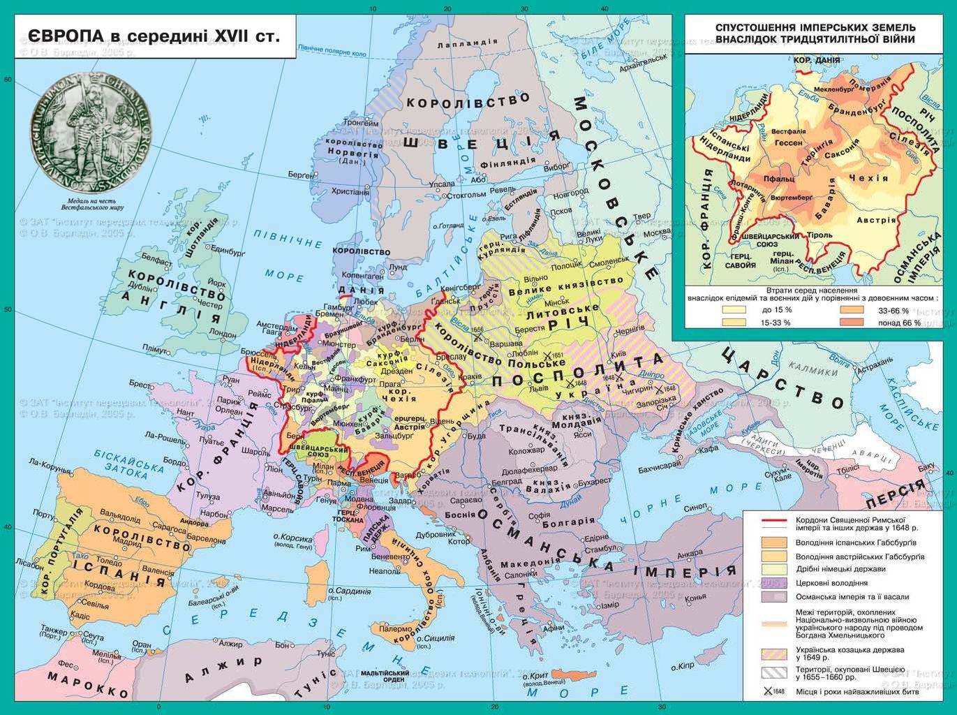
17th Century Ukrainian Map of Europe
The Ukrainian map of 17th century Europe provides a rich and intricate view of a tumultuous period in European history, ...
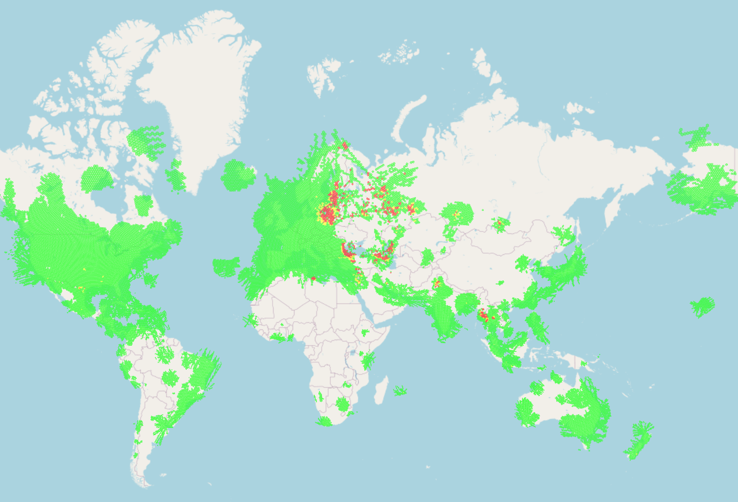
GPS Signal Jamming Map and Global Conflicts
...
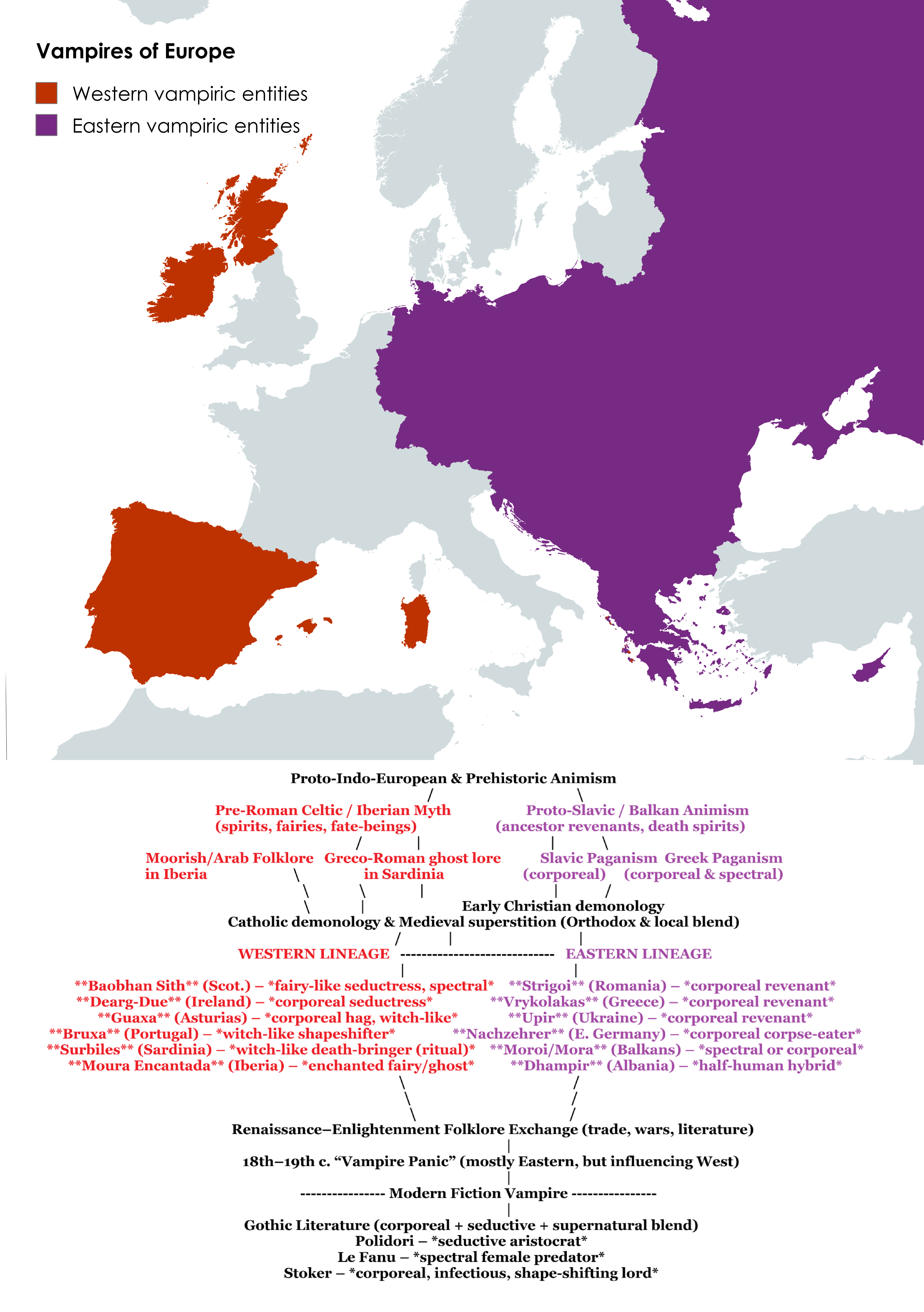
Vampire Folklore of Europe Map
The \...
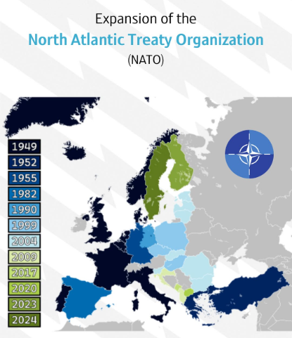
NATO Expansion over Time Map
This map provides a visual representation of the expansion of the North Atlantic Treaty Organization (NATO) over time, h...