1920 Soviet Red Army Takes Crimea Map

David Chen
Data Visualization Specialist
David Chen is an expert in transforming complex geographic datasets into compelling visual narratives. He combines his background in computer science ...
Geographic Analysis
What This Map Shows
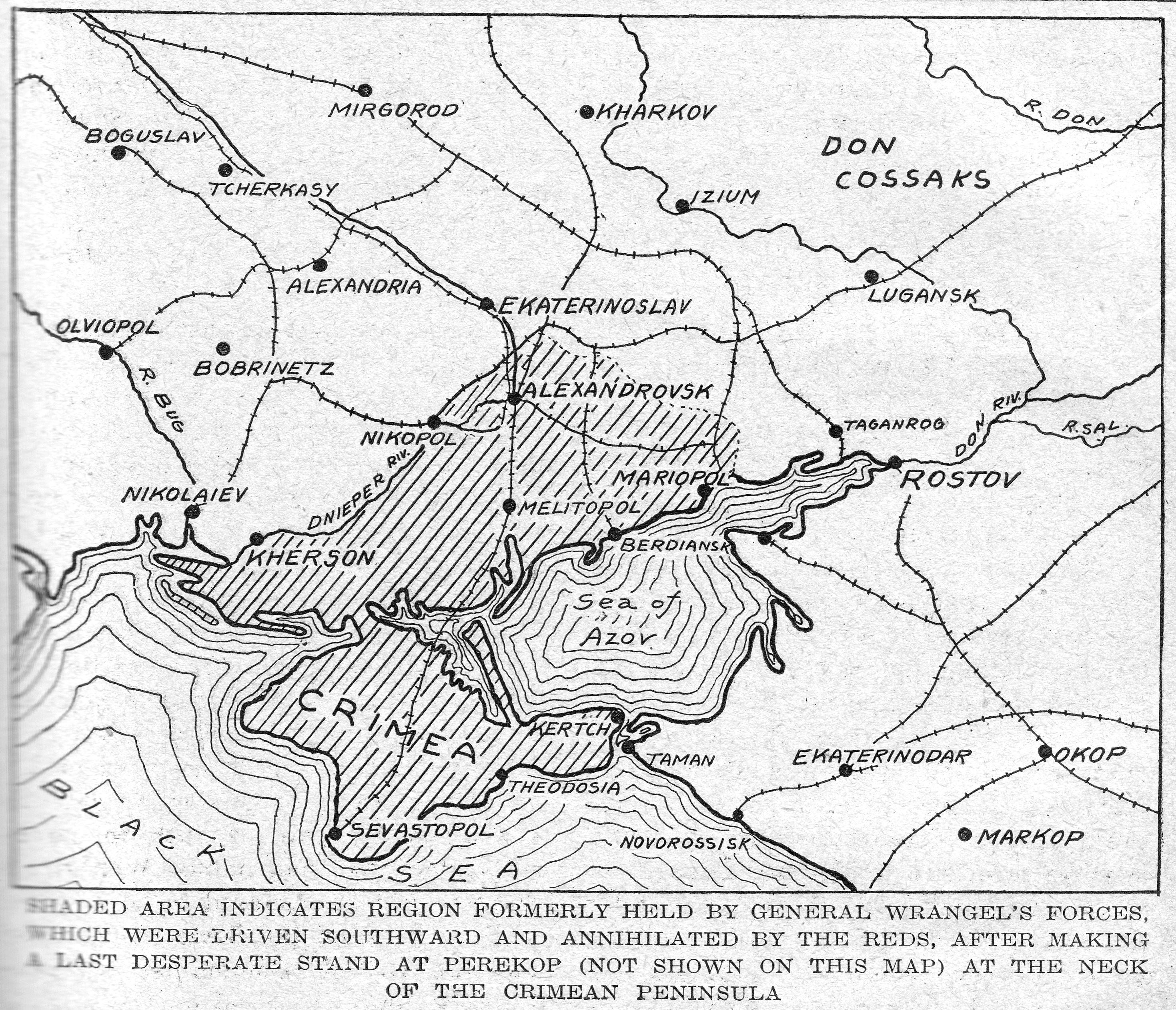
The map titled "1920: Soviet Red Army Takes Crimea" visually represents the territorial advances of the Red Army during the pivotal year of 1920, specifically focusing on their campaign in Crimea. After signing the armistice with Poland in October 1920, the Red Army redirected its military efforts towards defeating the last remnants of the White (Imperial) Army led by General Pyotr Wrangel. This visualization highlights the areas that were successfully overrun by the Red forces, marking a significant moment in the Russian Civil War and its aftermath.
Deep Dive into the Historical Context
The year 1920 was a tumultuous period in Eastern Europe, marked by the aftermath of World War I and the ensuing Russian Civil War. The Red Army, representing the Bolshevik government, was on a mission to consolidate power and eliminate opposition forces. Crimea, a strategically significant peninsula located on the northern coast of the Black Sea, was one of the last strongholds for the White Army, which had been fighting against the Bolsheviks for control of Russia.
Interestingly, the geography of Crimea played a crucial role in military operations. The peninsula is characterized by its mountainous terrain and coastal areas, which presented both challenges and opportunities for the advancing Red Army. The successful campaign in Crimea was not just a military triumph but also symbolized the Soviet regime's consolidation of power.
The Red Army’s campaign in Crimea was marked by fierce battles and strategic maneuvers. In late 1920, as the Red forces advanced, they faced limited resistance primarily from Wrangel’s troops, who were entrenched in the region. Moreover, there were pockets of guerrilla warfare led by figures such as General Symon Petliura, representing Ukrainian interests, and the Balakhovitch forces, which had previously cooperated with Poland. This multifaceted conflict revealed the complex tapestry of political and ethnic tensions in the region.
As the Red Army continued its push into Crimea, they implemented strategies that leveraged both their numerical superiority and the element of surprise. By December 1920, the last significant resistance was quelled, and the region fell under Bolshevik control. This marked a turning point, as Crimea would soon be integrated into the Soviet Union, impacting its political landscape for decades to come.
Regional Analysis
The map delineates various key locations and battles during the Red Army's campaign, which can be analyzed regionally. The northern part of Crimea, including cities like Simferopol and Sevastopol, was critical during the campaign due to its infrastructure and military significance. Sevastopol, a naval base, was particularly important for the defense of the Black Sea, and its capture by the Red Army was a strategic victory.
In contrast, other areas in Crimea, such as the southern coastal towns, experienced different dynamics. The population there was diverse, with a mix of ethnic Russians, Ukrainians, and Crimean Tatars, adding layers of complexity to the conflict. The local populace's reactions varied; some supported the Red Army in hopes of stability, while others resisted, fearing the implications of Bolshevik control.
Moreover, the geography of Crimea influenced military tactics. The mountainous regions provided natural defensive positions, while the coastline allowed for naval support and supply routes. The Red Army's ability to adapt to these geographic features was instrumental in their success.
Significance and Impact
Understanding the geography of Crimea and the military strategies employed during this period is vital to grasping the broader implications of the Red Army's success. The fall of Crimea to the Bolsheviks not only solidified their power in the region but also altered the geopolitical landscape of Eastern Europe. This event marked the beginning of an era of Soviet dominance that would last for much of the 20th century.
Furthermore, the events of 1920 set the stage for future conflicts in the region, highlighting how geographical and political factors intertwine. The legacy of these military campaigns can be seen in contemporary geopolitical tensions, especially in light of recent conflicts surrounding Crimea.
Interestingly, the repercussions of the Red Army's takeover continue to resonate today, with ongoing debates surrounding national identity, territorial integrity, and historical memory in Crimea. As we study this map and the events it represents, we're reminded of the ever-changing nature of borders and the profound impact of history on the present and future.
In conclusion, the 1920 campaign by the Soviet Red Army in Crimea is not just a historical footnote but a crucial chapter in understanding the complex interplay of geography, politics, and warfare in Eastern Europe. As we reflect on this map, we gain insight into how geographic factors shaped military strategies and influenced the course of history, leaving a lasting legacy that still shapes the region today.
Visualization Details
- Published
- September 16, 2025
- Views
- 76
Comments
Loading comments...