crimea Maps
6 geographic visualizations tagged with "crimea"
Map of Russian Occupied Territories
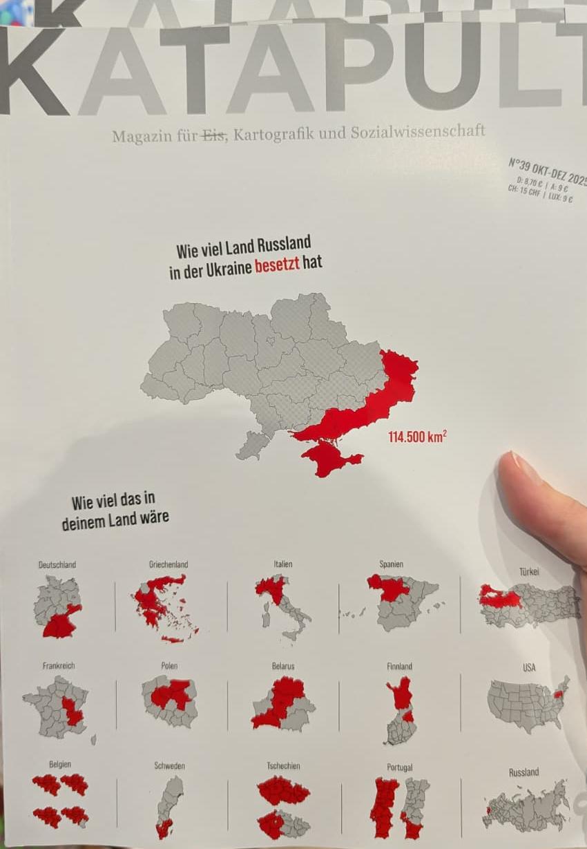
One of the most prominent examples in recent history is Crimea, annexed in 2014 following a controversial referendum. Th...
Map of Occupied Ukrainian Territories
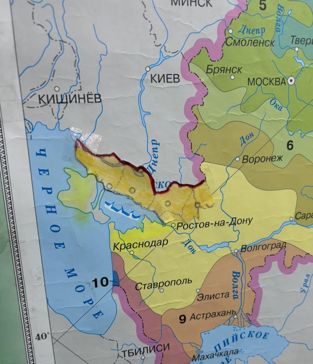
This map serves as a visual representation of the Ukrainian territories that have been illegally occupied. It clearly de...
Map of Russian Occupied Territories
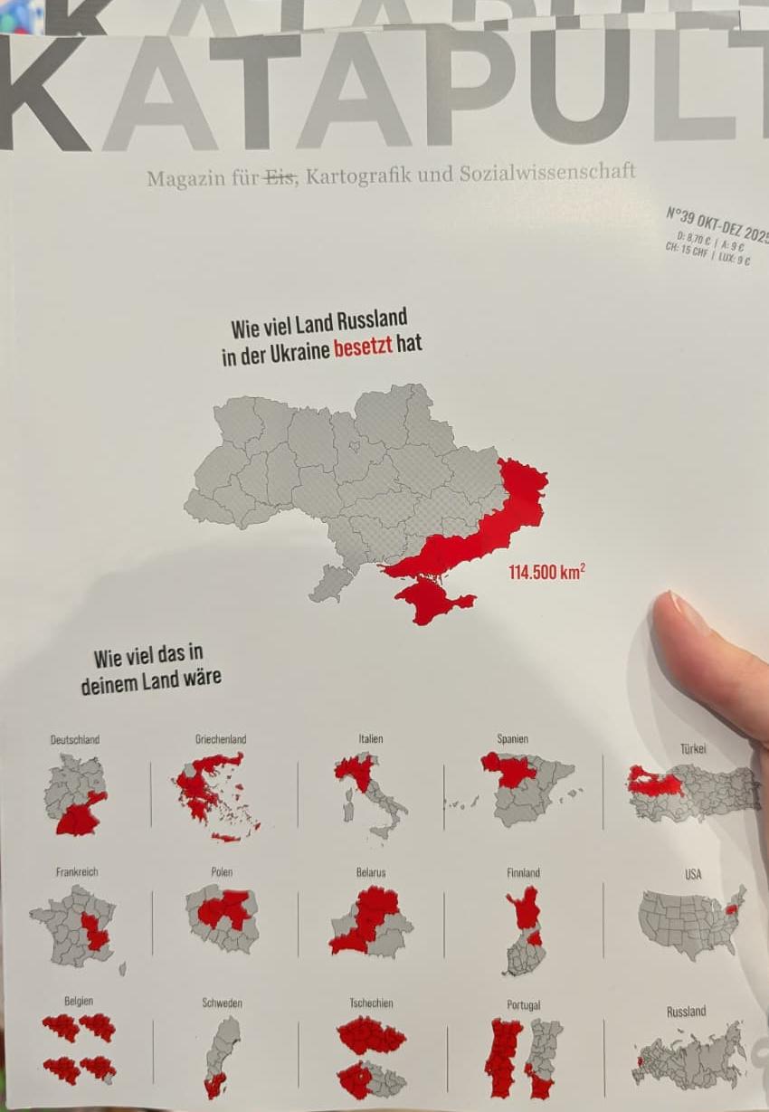
This visualization provides a clear overview of the territories that Russia has occupied over the years, particularly fo...
1920 Soviet Red Army Takes Crimea Map
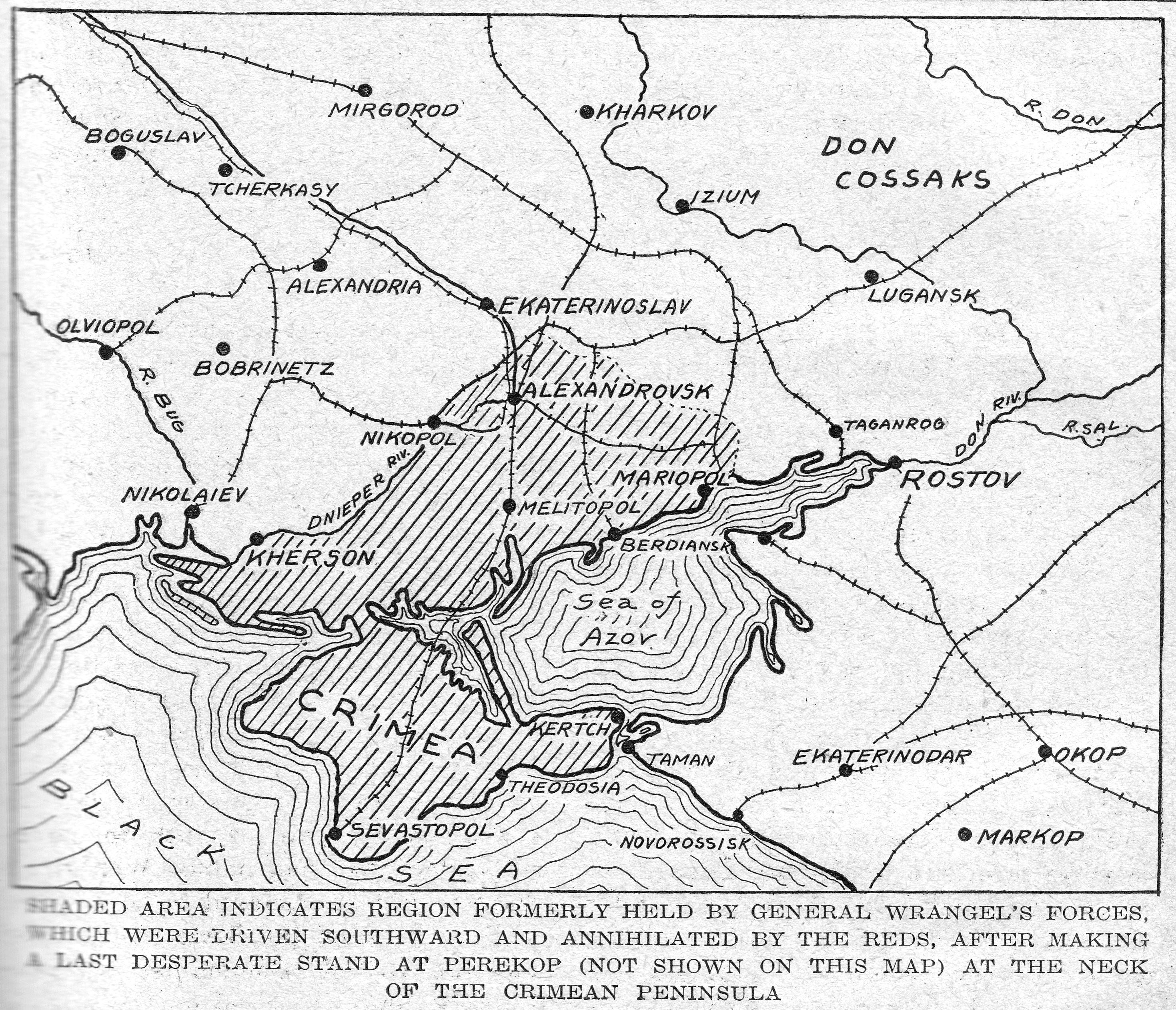
The map titled "1920: Soviet Red Army Takes Crimea" visually represents the territorial advances of the Red Army during ...
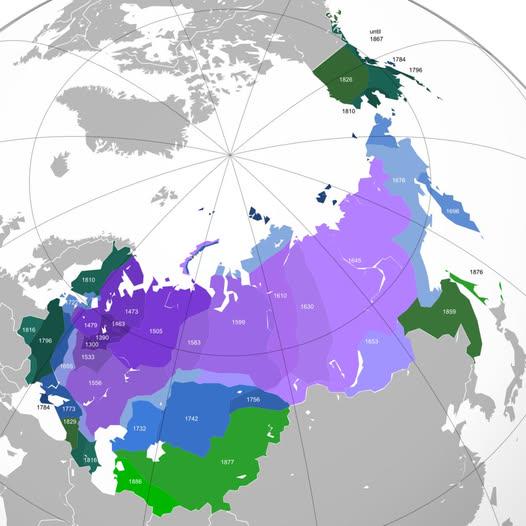
Territorial Expansion of Russia Over Time Map
The "Territorial Expansion of Russia Over Time" map visualizes the dramatic changes in Russia's land boundaries from its...
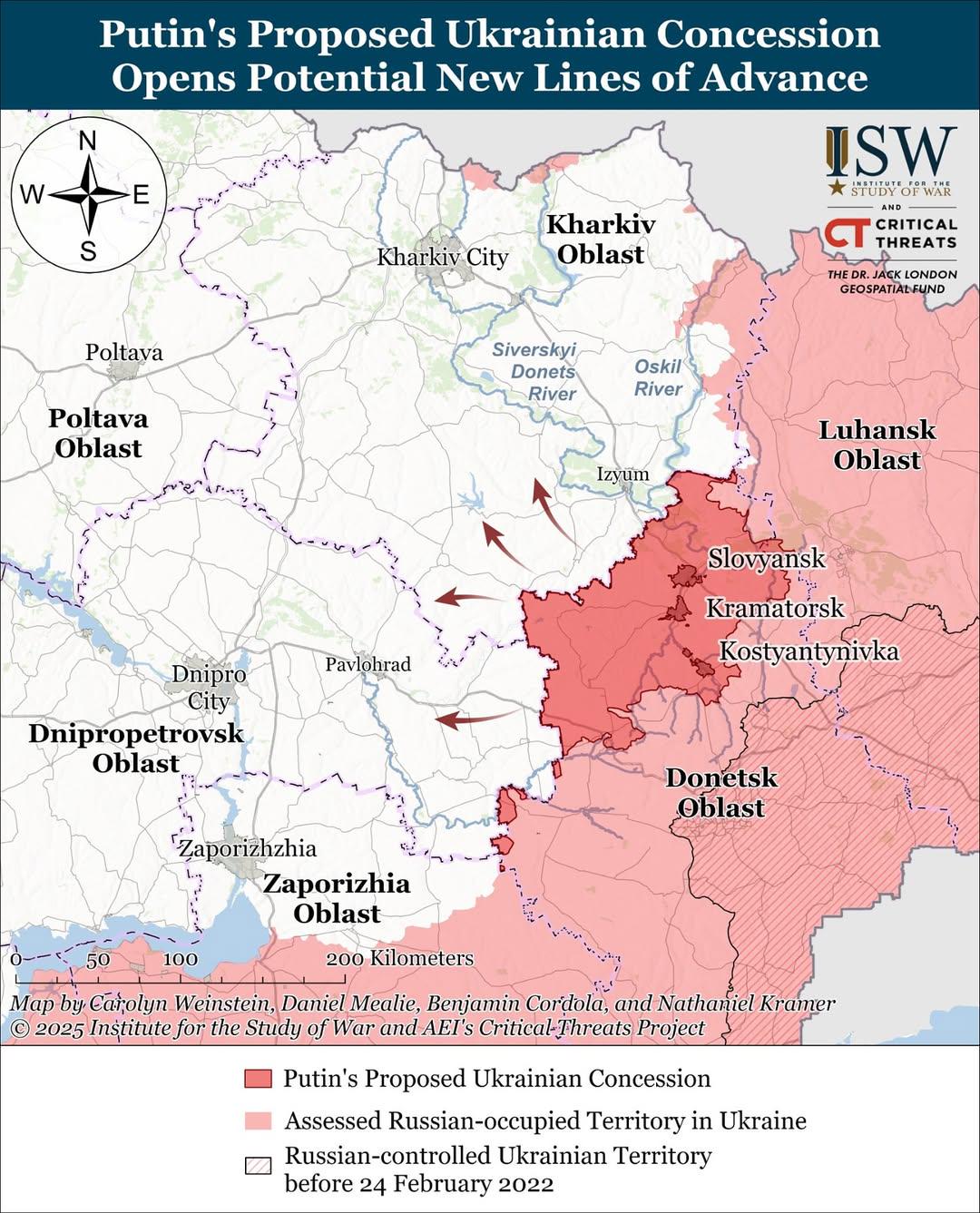
Putin's Proposed Ukrainian Concession Map
The map titled "Putin's Proposed Ukrainian Concession" illustrates the geographical areas in Ukraine that Russia has ind...