historical geography Maps
72 geographic visualizations tagged with "historical geography"
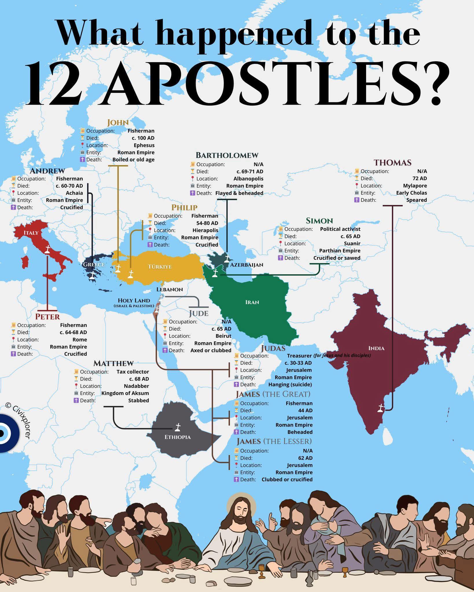
Map of the Journey of the 12 Apostles
The "Journey of the 12 Apostles" map visualizes the significant locations associated with the lives and missions of the ...
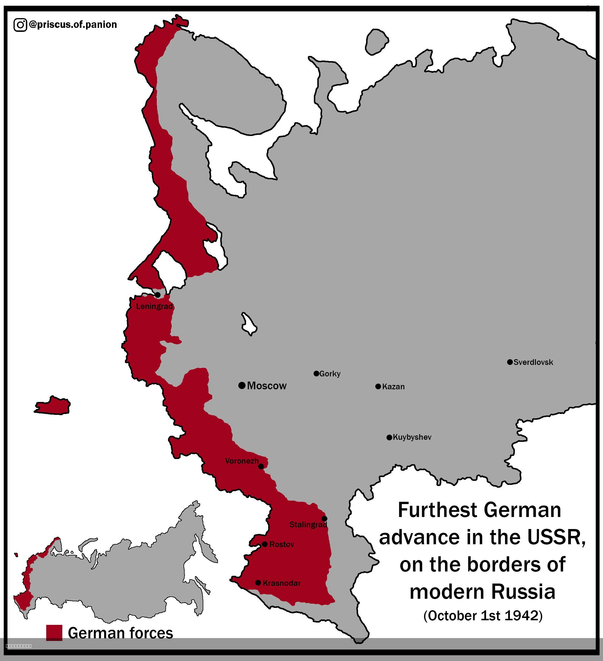
Map of the Furthest German Advance into the USSR
The visualization titled "Map of the Furthest German Advance into the USSR, on the Borders of Modern Russia (1st of Octo...
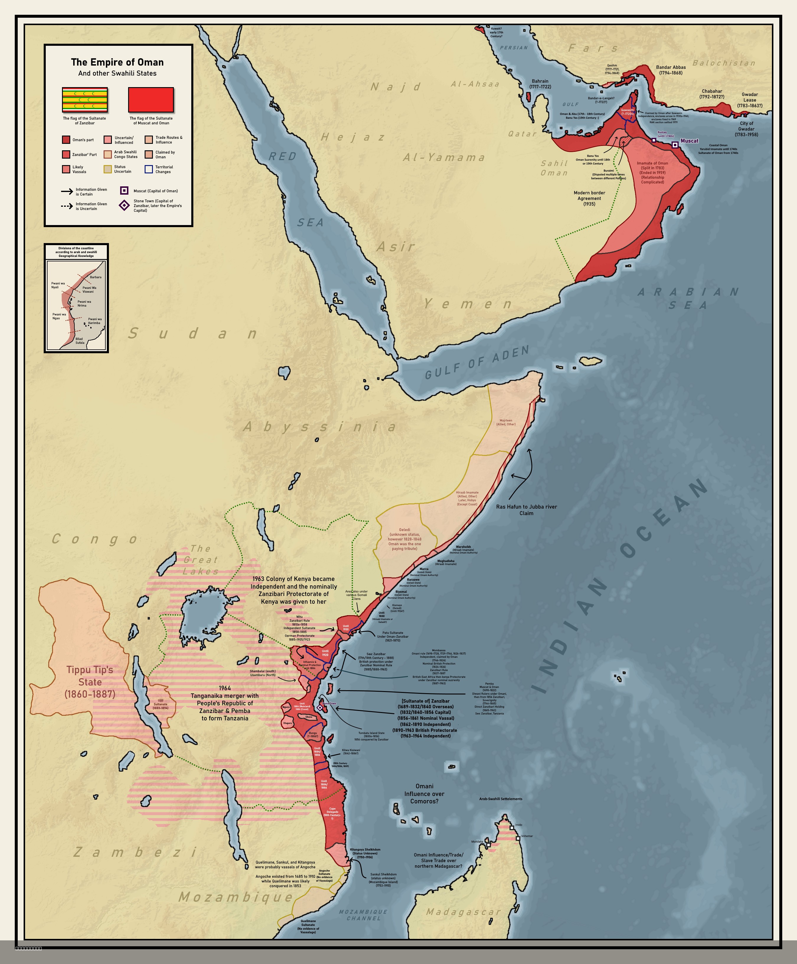
Colonial Empire of Oman Map 1696 to 1856
The map titled "Forgotten Colonial Empire of Oman from 1696 to 1856" illustrates the extensive territorial reach of the ...
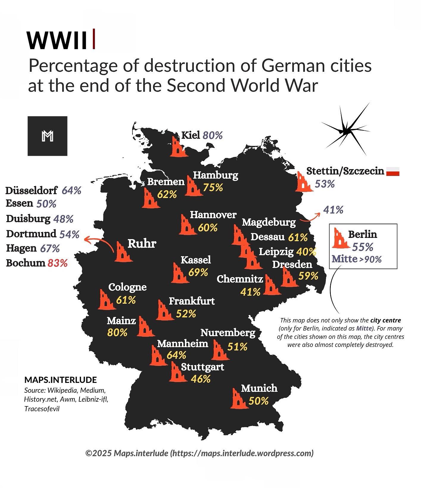
Map of Destruction of German Cities in WWII
The map titled "Percentage of Destruction of German Cities at the End of the Second World War" provides a striking visua...
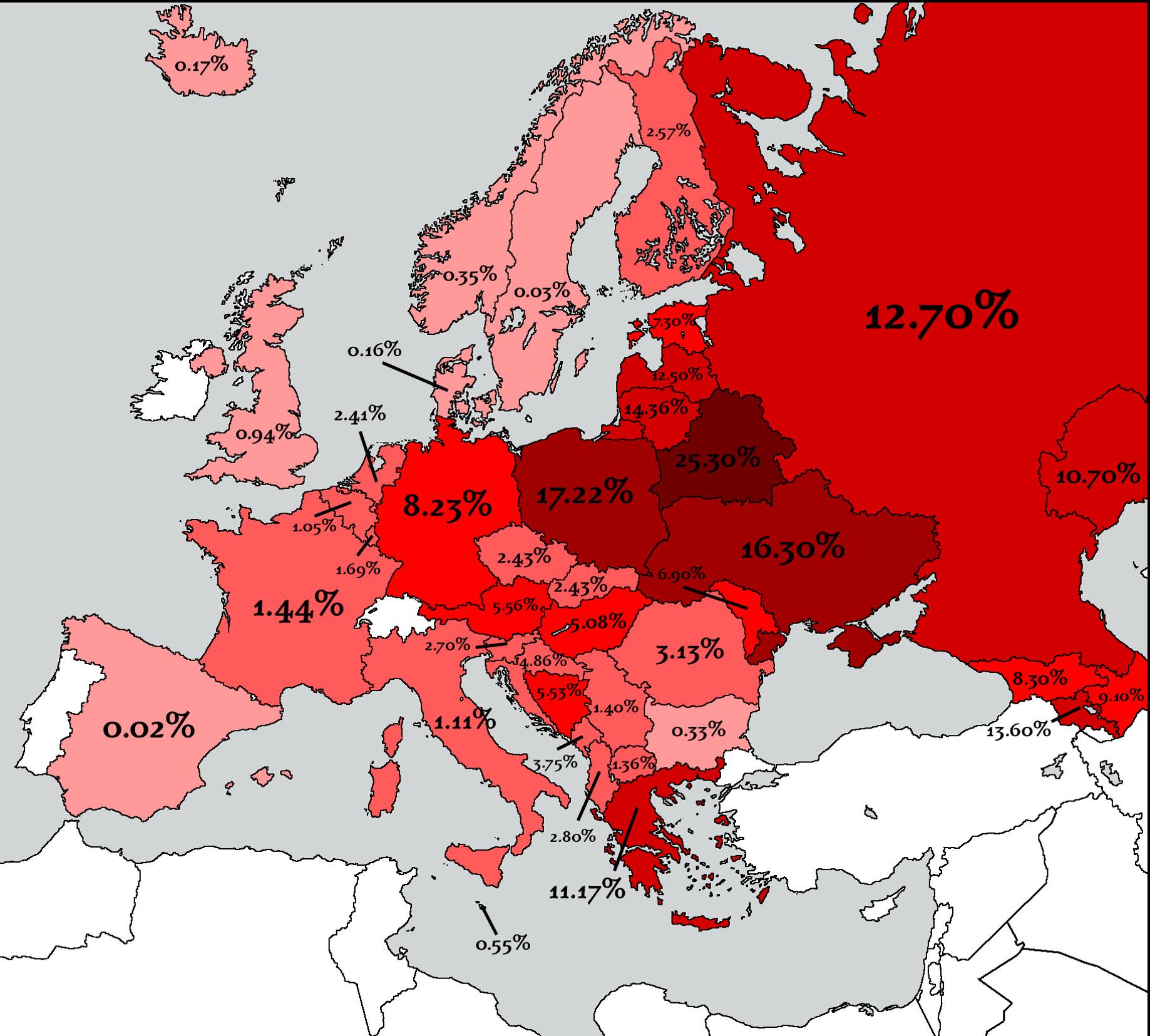
Countries That Lost the Most People in WW2 Map
The map titled "Countries That Lost the Most People in WW2" provides a stark visual representation of the human cost of ...
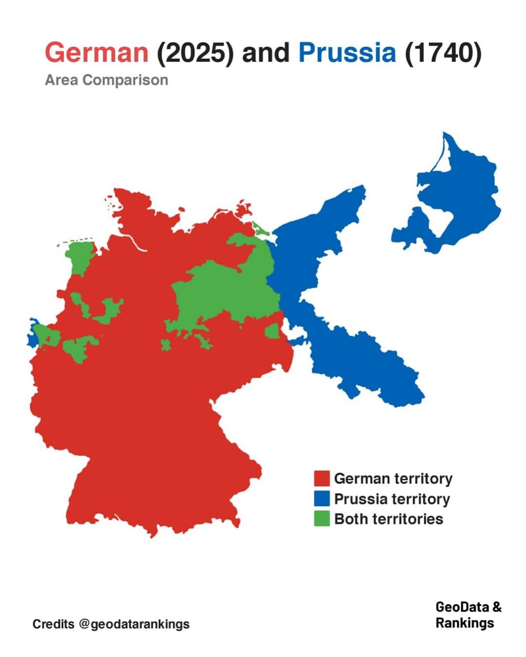
Germany and Prussia Area Comparison Map
The map titled "Germany in 2025 and Prussia in 1740 area comparison" visually represents the territorial extent of moder...
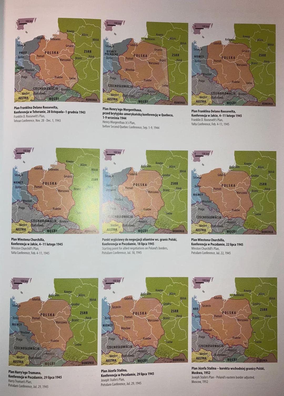
Post-War Border Proposals Map of Poland and Germany
...
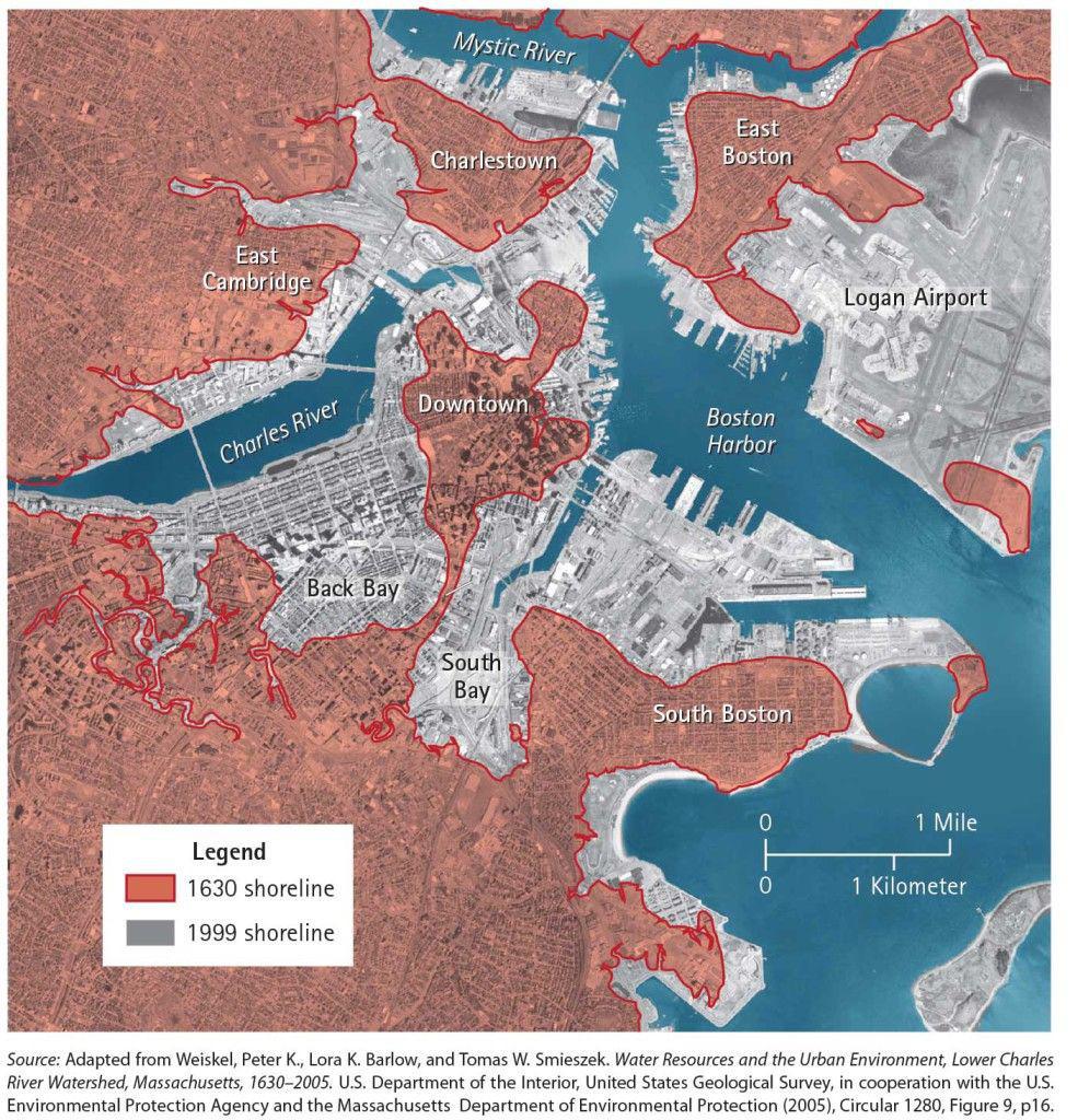
Land Reclamation Map of Boston Since 1630
This map vividly illustrates the remarkable transformation of Boston through land reclamation since 1630, an era when th...
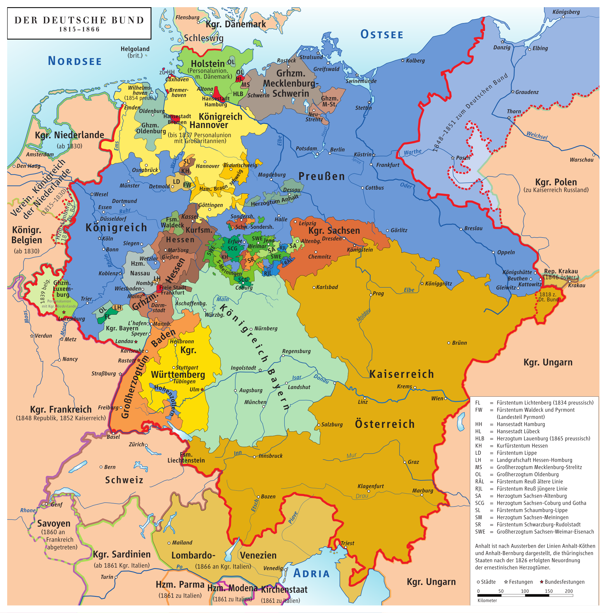
Map of Germany Before Unification (1815-1866)
This map titled "Germany Before Being Germany (1815-1866)" provides a detailed visualization of the political landscape ...
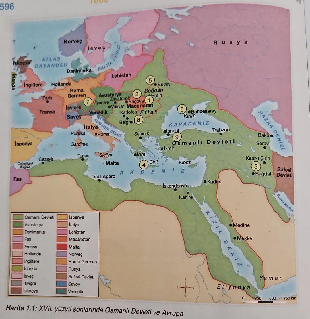
Historical Map of Turkey in Textbooks
This map, derived from a Turkish history textbook, offers a detailed portrayal of significant historical events, territo...
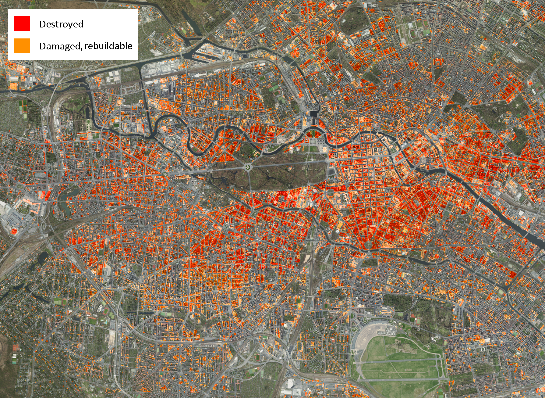
Damage to Buildings Map Berlin 1945
The "Damage to Buildings, Berlin 1945" map provides a stark visual representation of the destruction experienced in Berl...
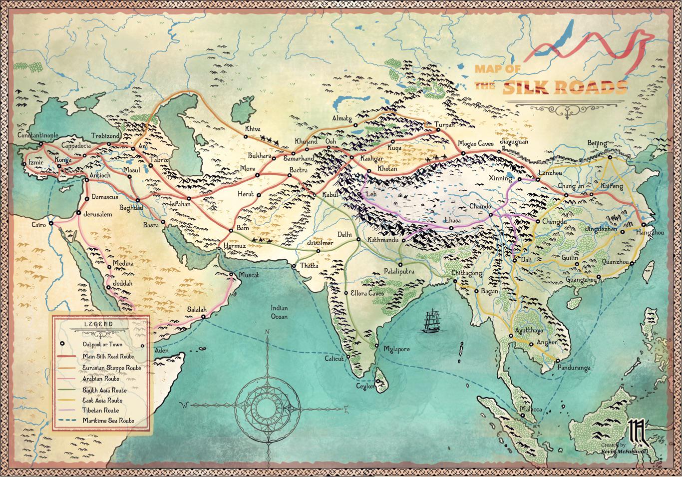
Silk Roads Trade Routes Map
...
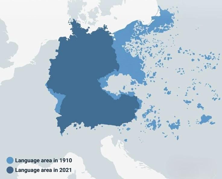
German Language Area Map Before and After World Wars
This map illustrates the distribution of the German language area before and after the world wars, highlighting signific...
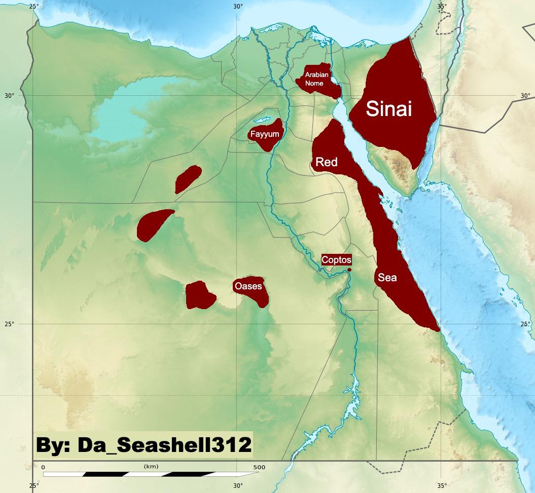
Map of Arab Presence in Pre-Islamic Egypt
The map titled "Arab Presence in Pre-Islamic Egypt" provides a detailed visualization of the geographic distribution of ...
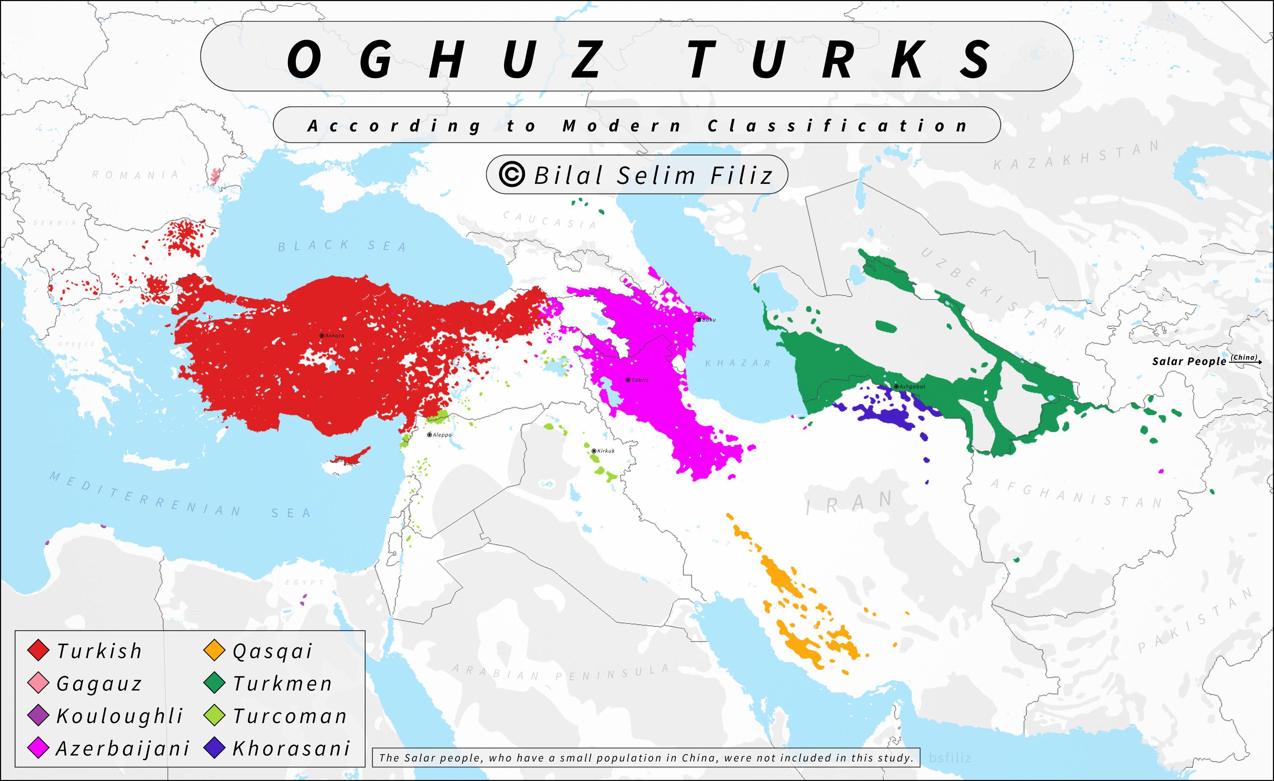
Oghuz Turks Historical Distribution Map
The "Oghuz Turks Historical Distribution Map" presents a visual representation of the historical movement and settlement...
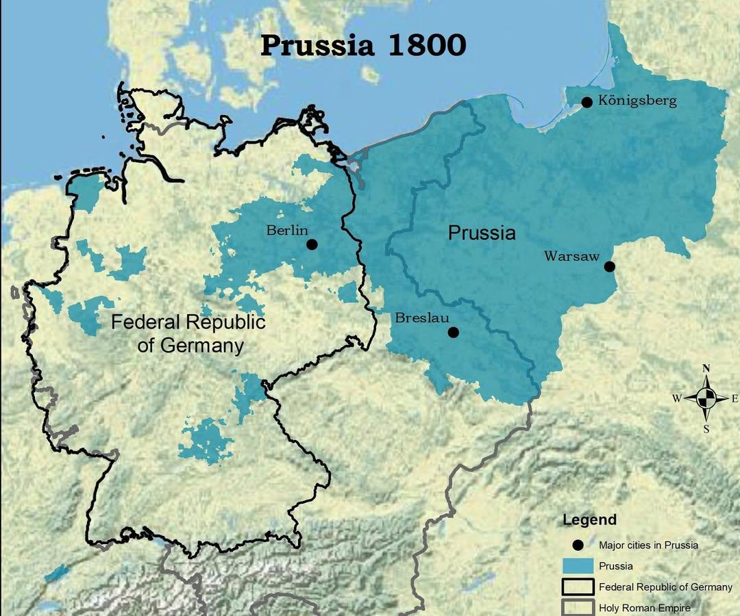
Map of Prussia in 1800 Compared to Modern Germany
The visualization titled "The Kingdom of Prussia in 1800 vs Modern Germany" presents a compelling juxtaposition of histo...
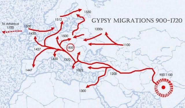
Gypsy Migrations Map 900-1720
The "Gypsy Migrations 900-1720" map visualizes the movement patterns of the Romani people across Europe from the early M...
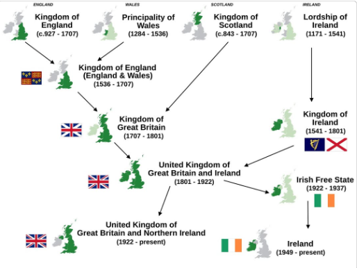
Simplified History Map of The British & Irish Isles
This visualization titled "Simplified History of The 4 Countries Of The British & Irish Isles" provides a clear overview...
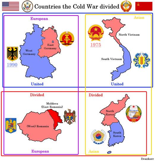
Map of Countries Divided by WW2 and Cold War
This map visually represents the geopolitical divisions of four countries—Germany, Korea, Vietnam, and Poland—resulting ...
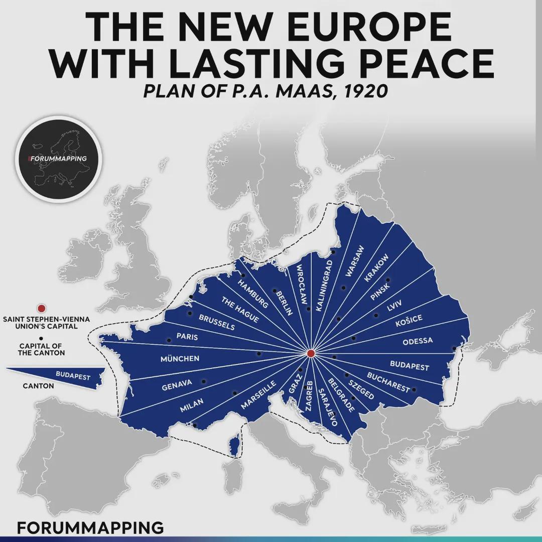
1920 Plan for a Central European Union Map
This map presents the ambitious blueprint from 1920 aimed at creating a Union of Central Europe. Spurred by the aftermat...
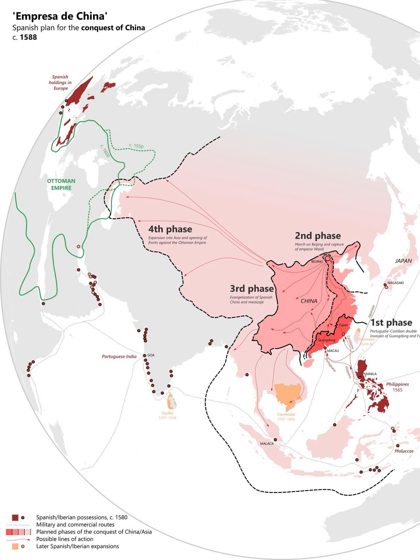
Historical Map of Spain's Strategy Against Ottomans
This map visualizes a remarkable moment in history, depicting Spain's strategic considerations regarding the Ottoman Emp...
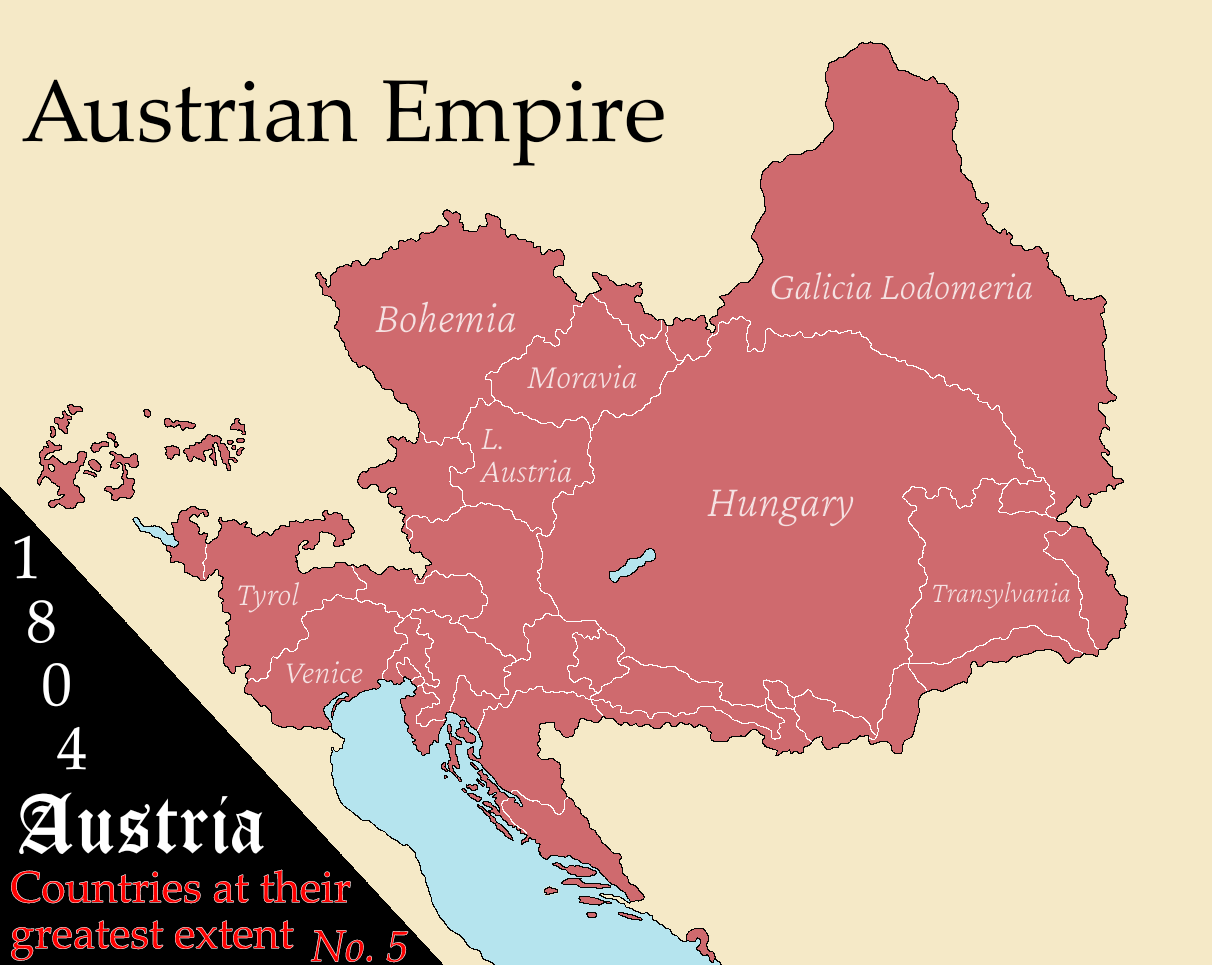
Austria's Greatest Extent Map
The "Austria at Its Greatest Extent" map provides a fascinating glimpse into the historical boundaries of Austria, showc...
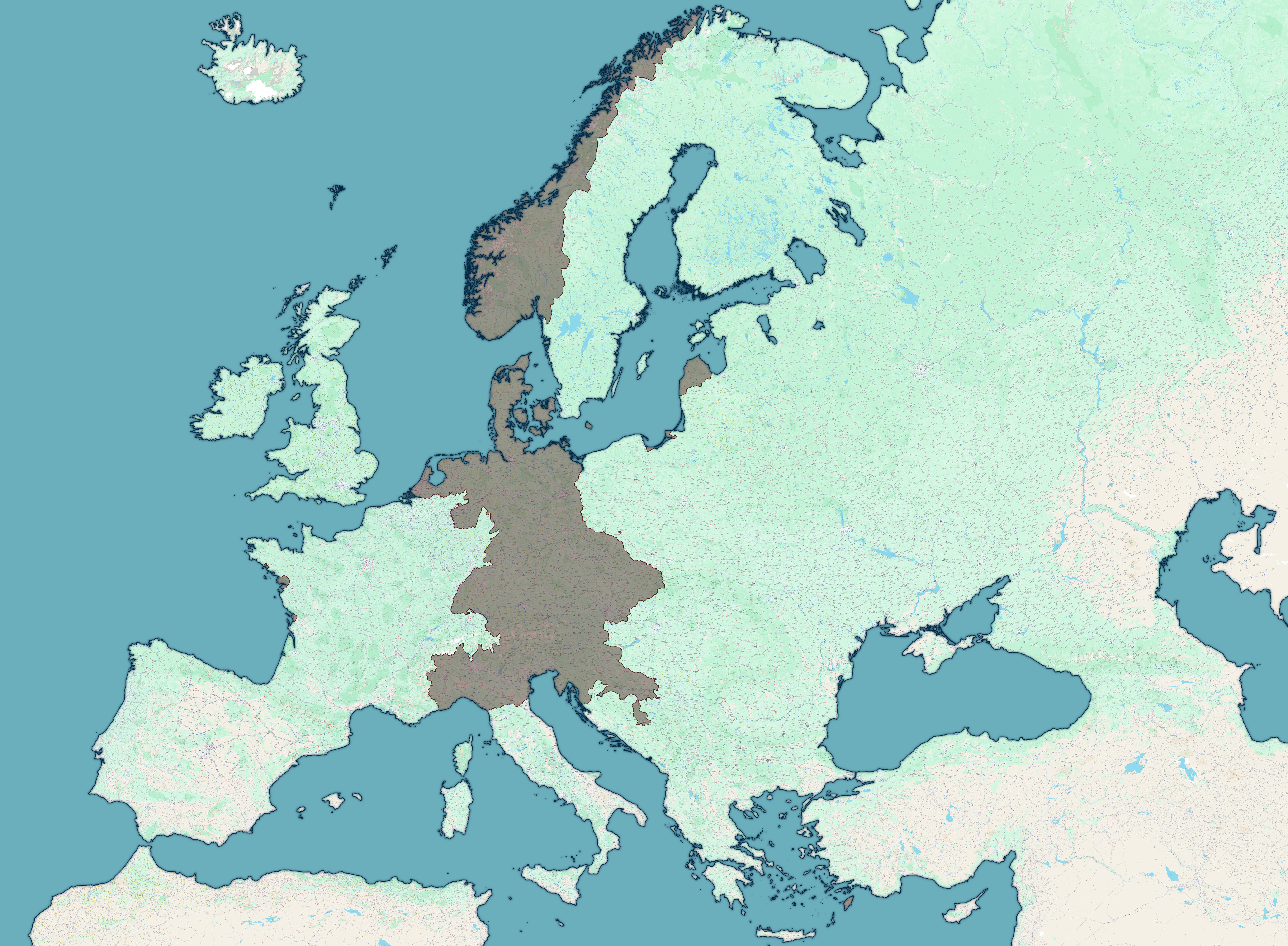
Map of Axis Forces April 1 1945
The "Map of all Axis forces, 1st of April 1945" provides a detailed geographical overview of the military positions and ...
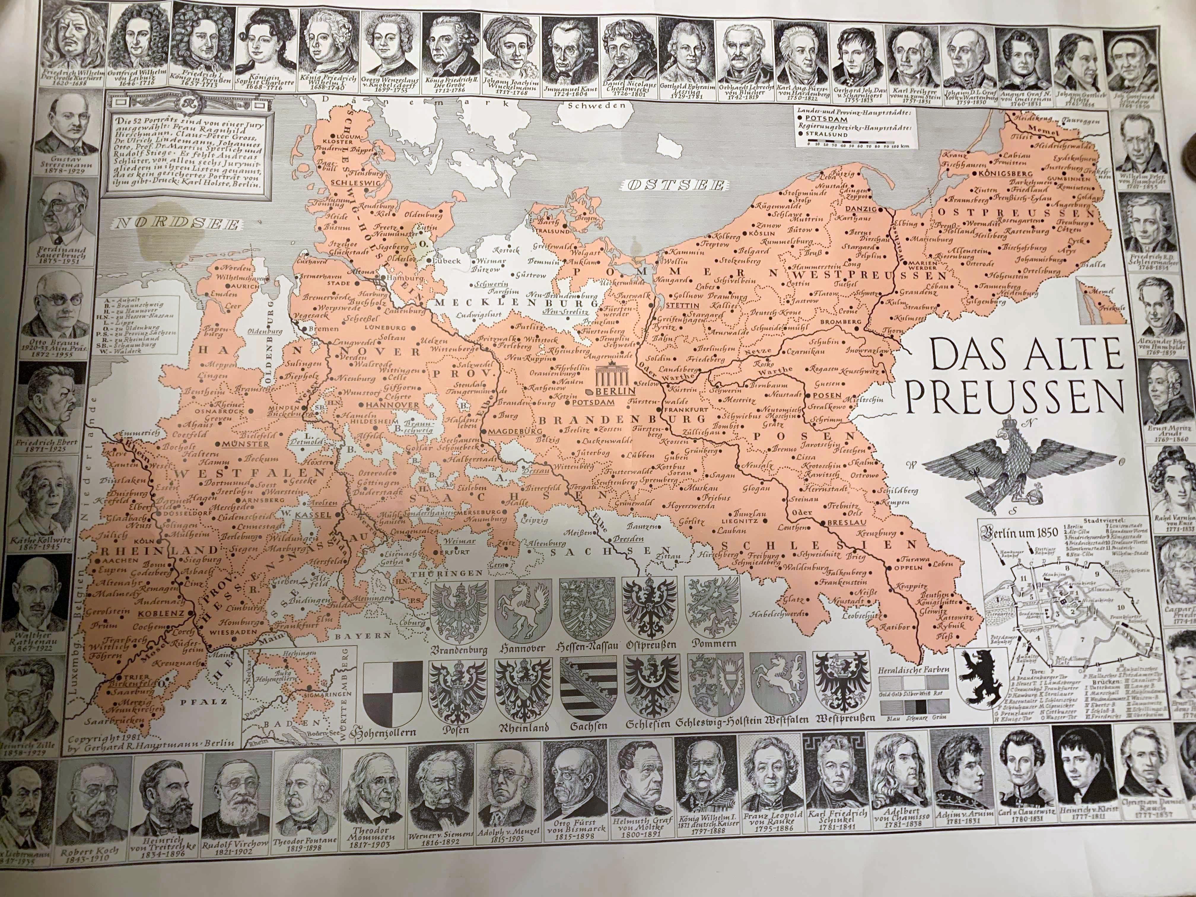
Map of Old Prussia Before World War I
This illustrated map of Prussia, created in the 1980s, depicts the historical boundaries and territories of Prussia befo...
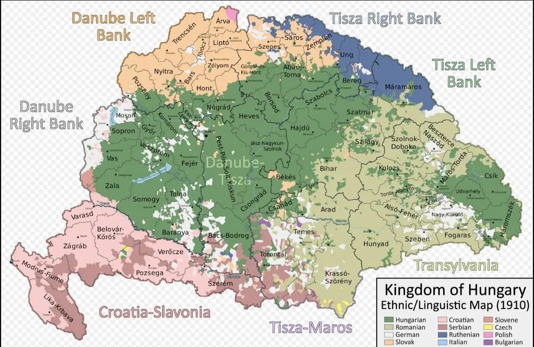
Ethnic Map of the Kingdom of Hungary in 1910
The "Ethnic Map of the Kingdom of Hungary in 1910" provides a vivid representation of the diverse ethnic landscape of Hu...
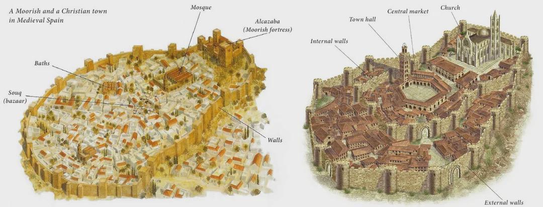
Moorish and Christian Towns in Medieval Spain Map
The map titled "A Moorish and a Christian Town in Medieval Spain" provides a visual representation of the geographic and...
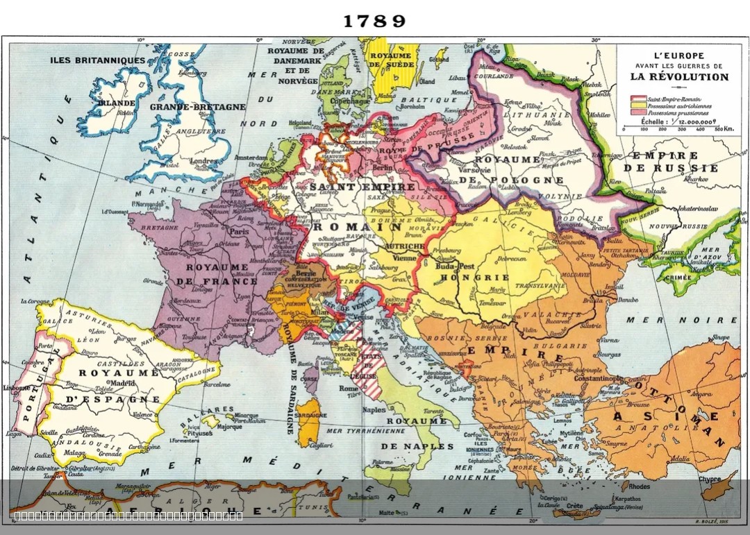
1915 French Map of Europe in 1789
The 1915 French map of Europe in 1789 offers a historical perspective on the political landscape of Europe just before t...
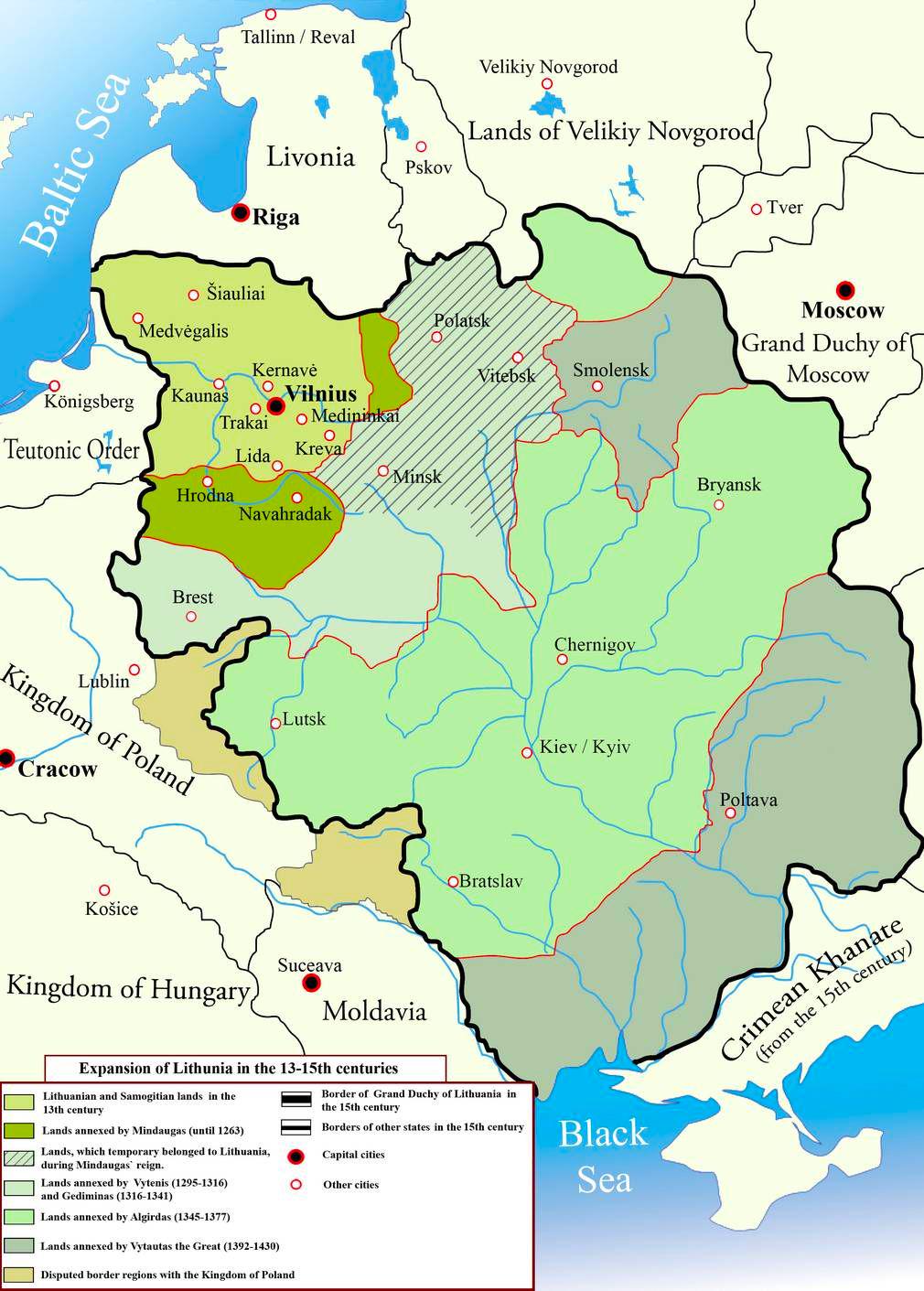
Expansion of the Grand Duchy of Lithuania Map
The map titled "The Expansion of the Grand Duchy of Lithuania, 13th–15th Centuries" visually illustrates the territorial...
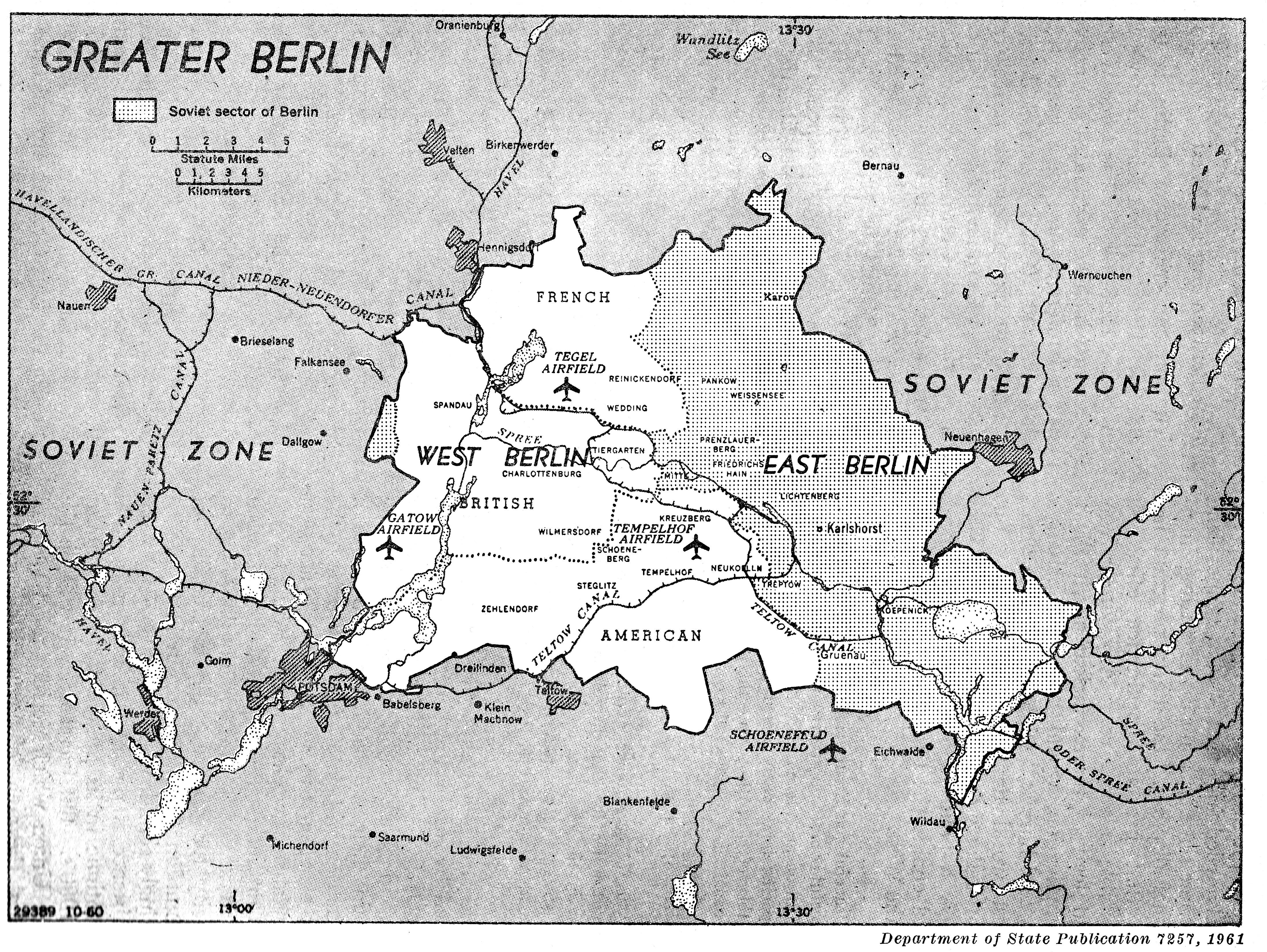
Berlin 1961 Political Map
The map titled "Berlin, 1961" vividly illustrates the political landscape of Berlin during a pivotal moment in Cold War ...
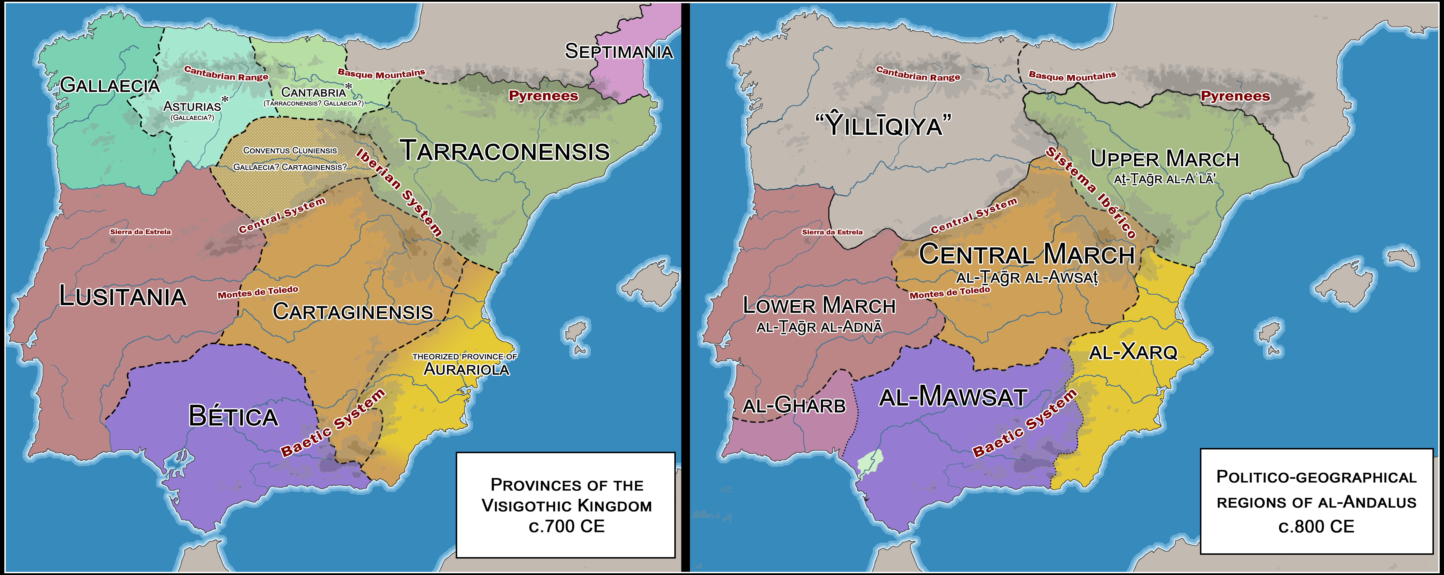
Map of Visigothic Kingdom and Early al-Andalus
This map presents a detailed comparison between the provinces of the latter Visigothic Kingdom and the territorial divis...
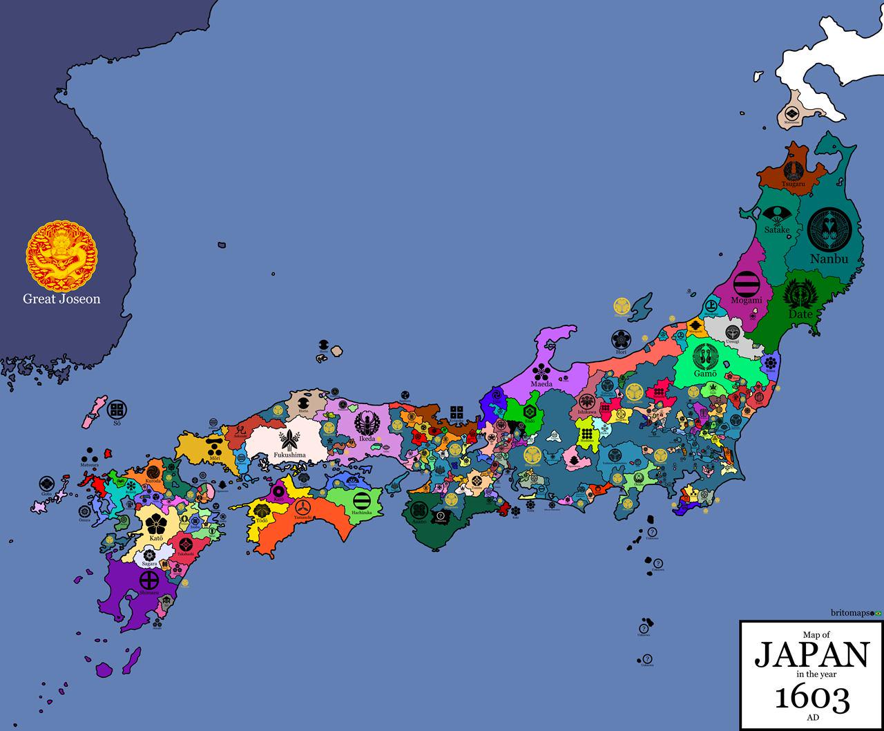
Clan Flag Map of Japan in 1603
...
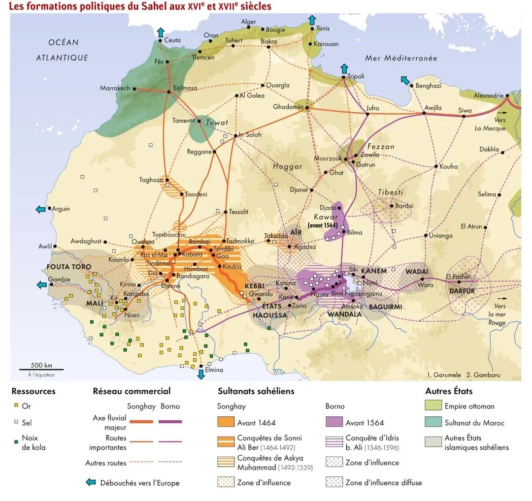
Sahelian Policies in the 16th and 17th Century Map
This map provides a detailed visualization of the policies that shaped the Sahel region during the 16th and 17th centuri...
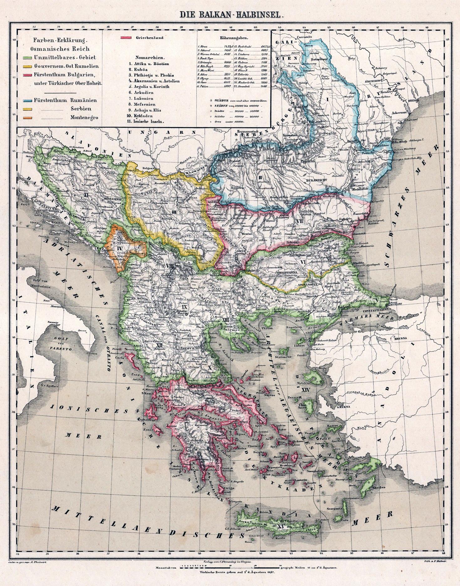
Balkans Geography Map from 1878
This geographical visualization from an 1878 German atlas provides a fascinating glimpse into the Balkans during a time ...
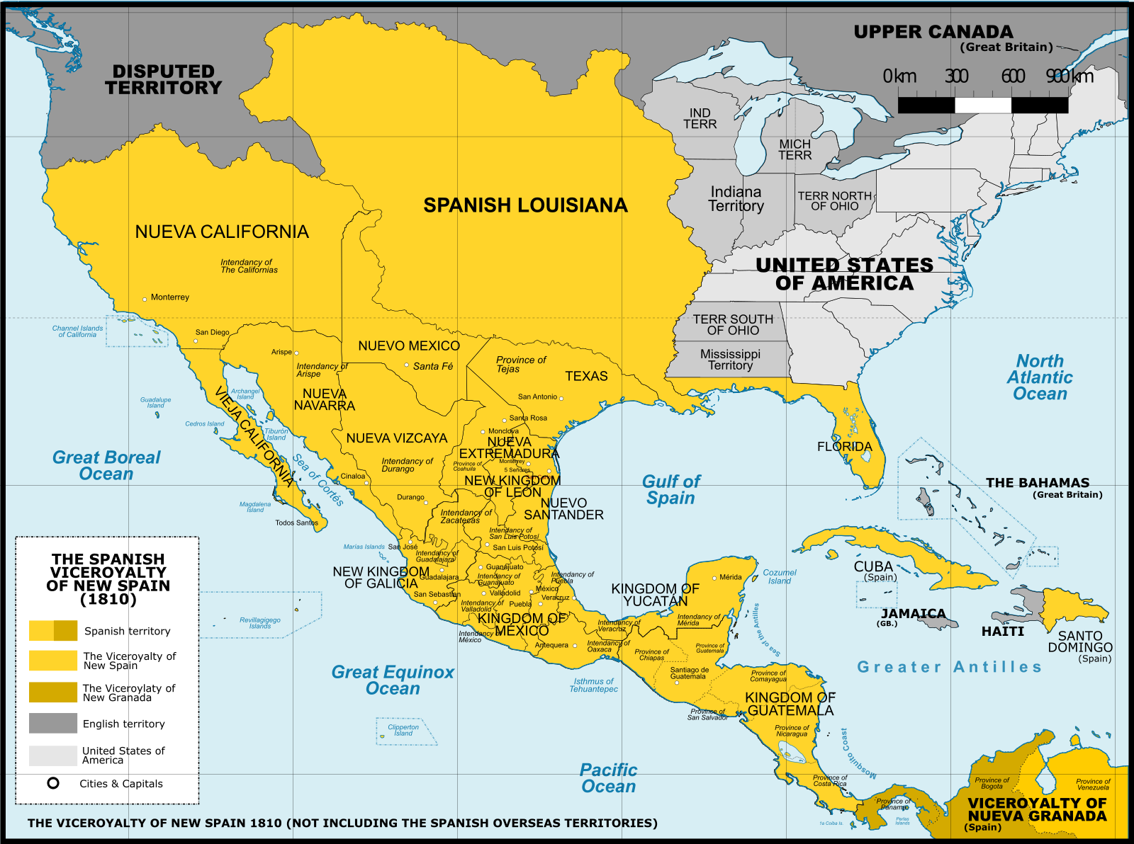
Maximum Territorial Extent of New Spain Map
The map titled "Maximum Territorial Extent of New Spain" vividly illustrates the vast geographical boundaries that defin...
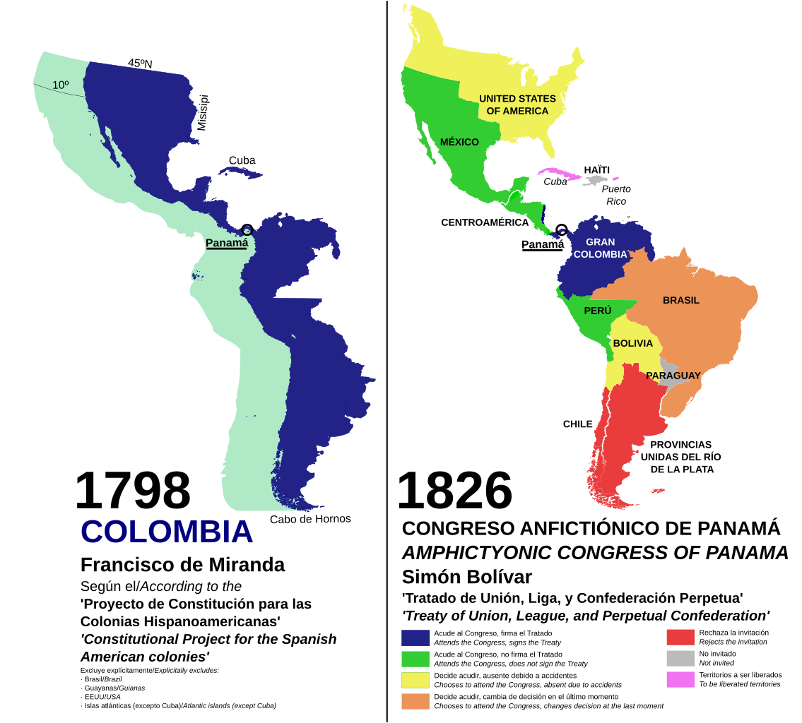
Countries' Stance on the Panamá Congress Map
This map visualizes the various positions taken by Latin American countries during the Congress of Panamá in 1826, an am...
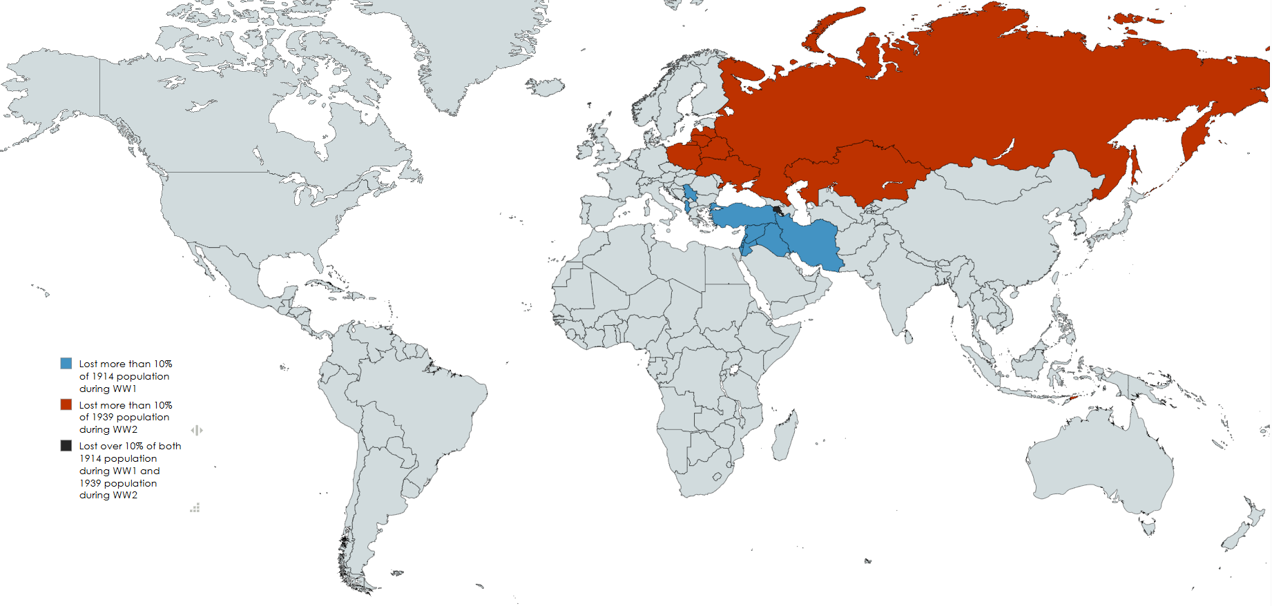
Map of Hardest Hit Countries by World Wars
This map provides a stark visualization of the countries that were hardest hit by the two World Wars, focusing specifica...
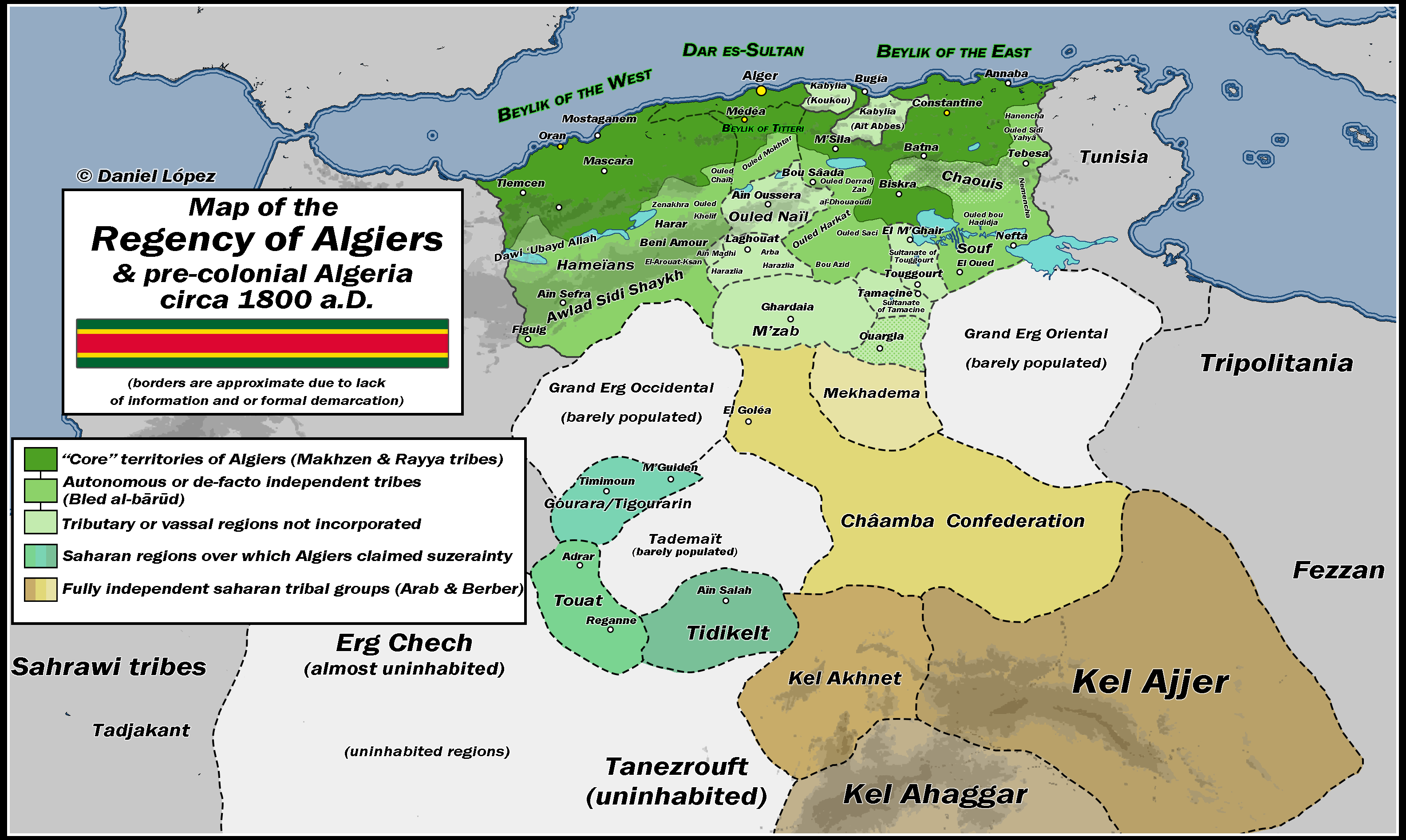
Map of the Regency of Algiers c.1800 A.D.
The "Map of the Regency of Algiers c.1800 A.D." provides a detailed depiction of the geographical and political landscap...
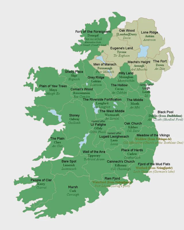
Map of 32 Counties of Ireland with English Translations
This map displays the 32 counties of Ireland alongside their literal English translations. Each county's name is steeped...
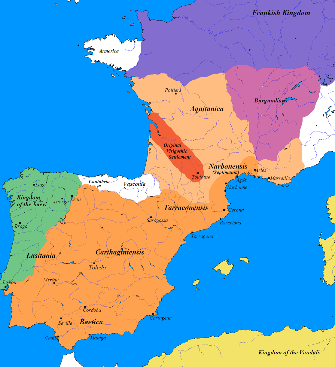
Germanic Tribes Map of France and Iberia (500 AD)
The map titled "Germanic France and Iberia (500 AD)" provides a fascinating glimpse into the landscape of post-Roman Eur...
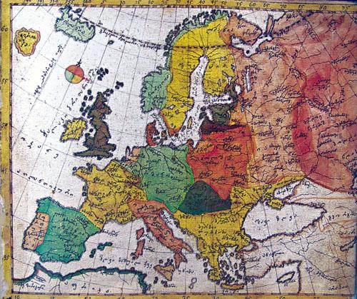
1752 Map of Europe by Vakhushti Bagrationi
The 1752 map of Europe by Georgian prince Vakhushti Bagrationi is a historical cartographic work that captures the geopo...
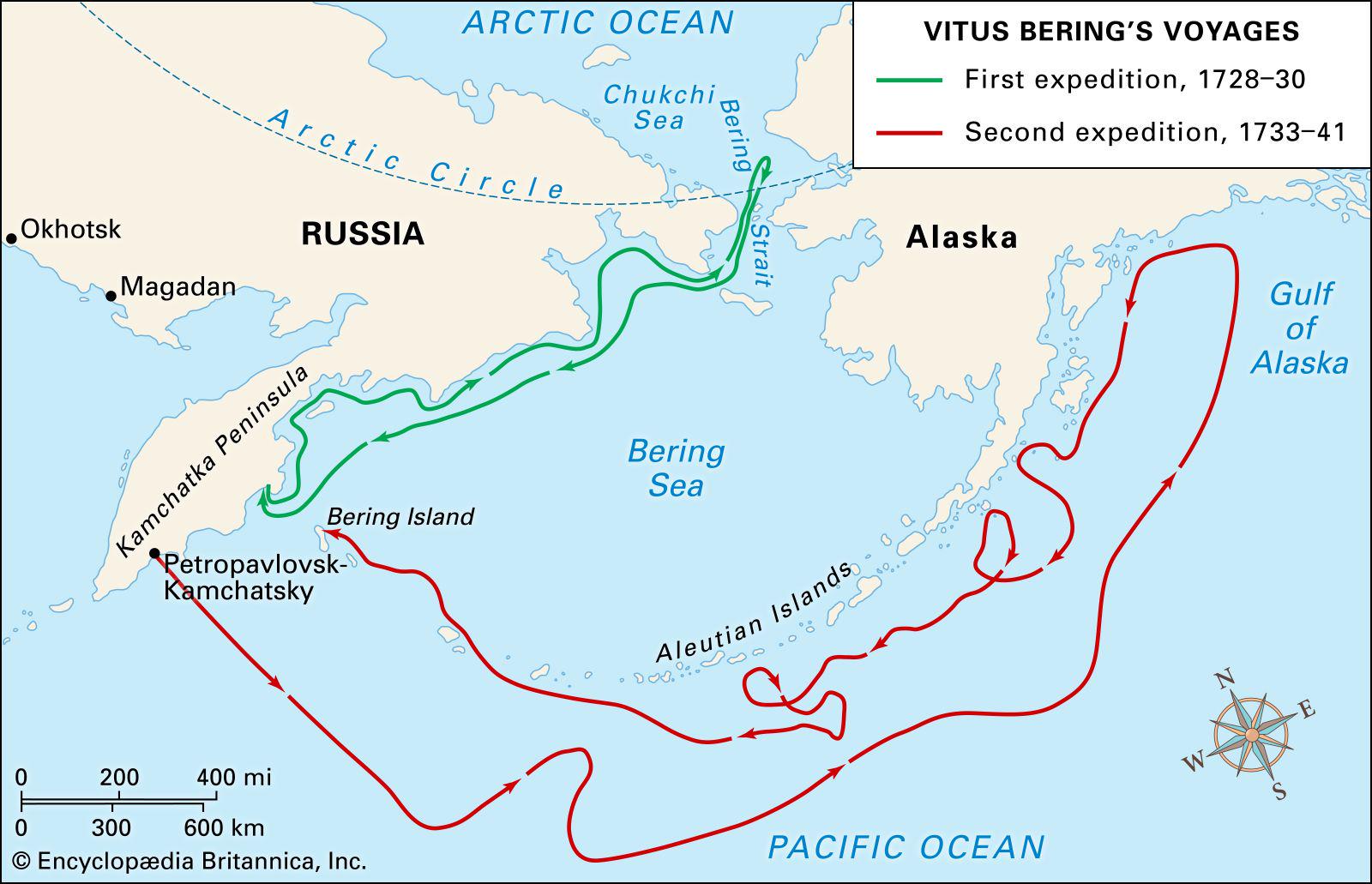
Vitus Bering's Expeditions Map for the Russian Empire
The visualization titled "Vitus Bering's Expeditions Map for the Russian Empire" intricately details the routes taken by...
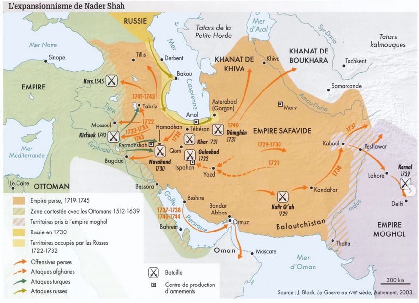
Persia under Nader Shah Map
The "Persia under Nader Shah Map" provides a detailed representation of the Persian Empire during the reign of Nader Sha...
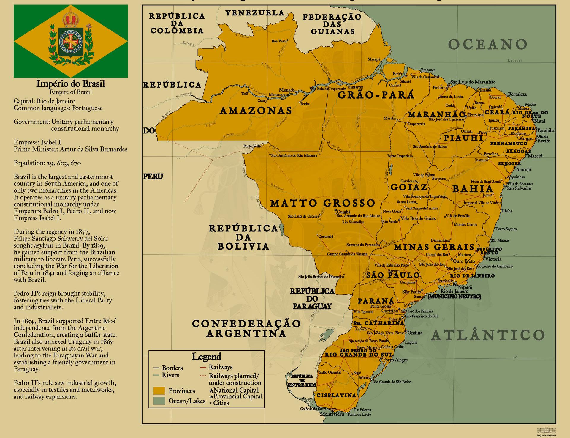
Empire of Brazil Map, Circa 1822
The "Empire of Brazil, circa 1822" map presents a comprehensive visualization of Brazil during a pivotal moment in its h...
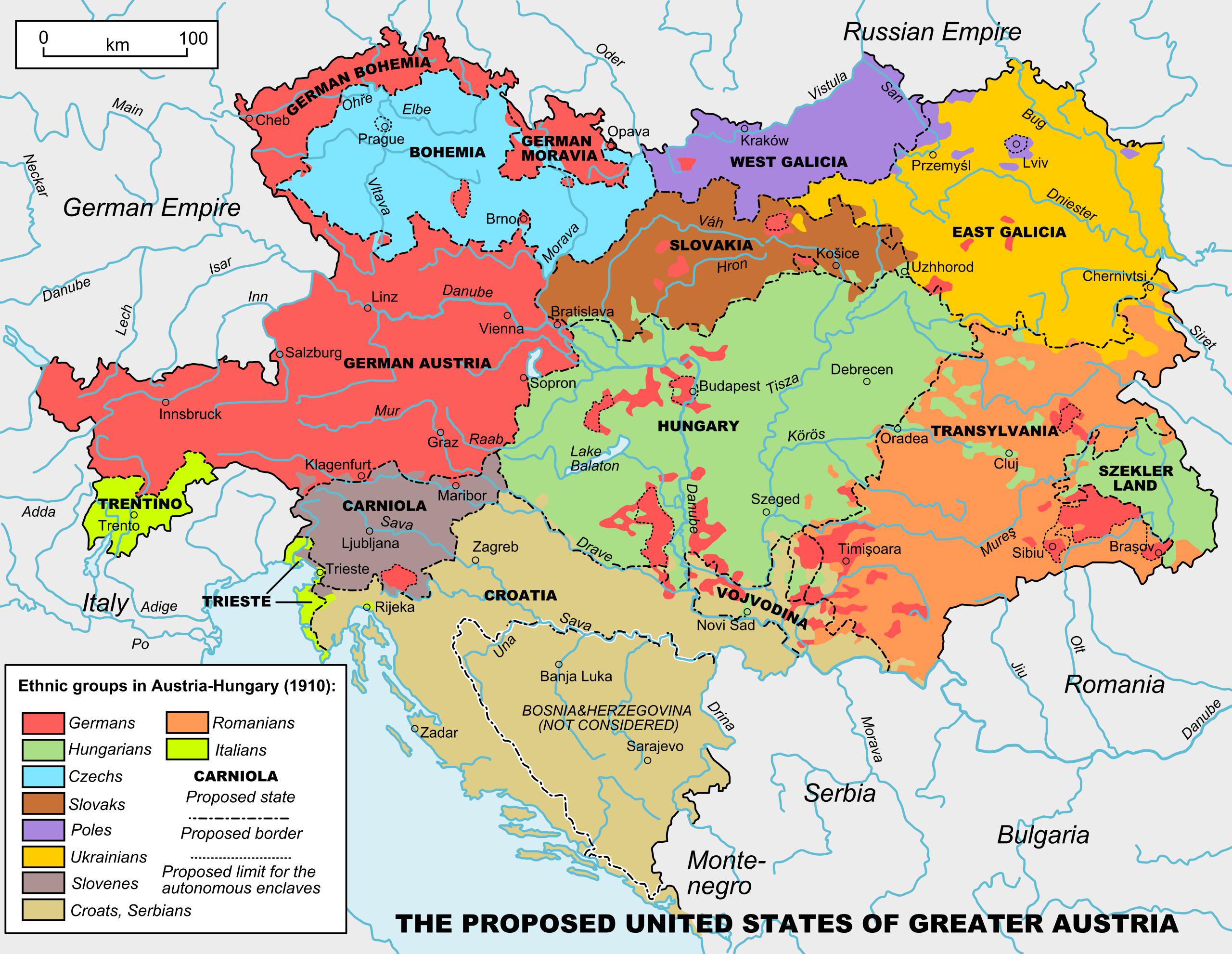
Map of United States of Greater Austria
...

Venetian Domains of the Adriatic Map
The "Venetian Domains of the Adriatic" map highlights the historical territories and maritime influence of the Republic ...
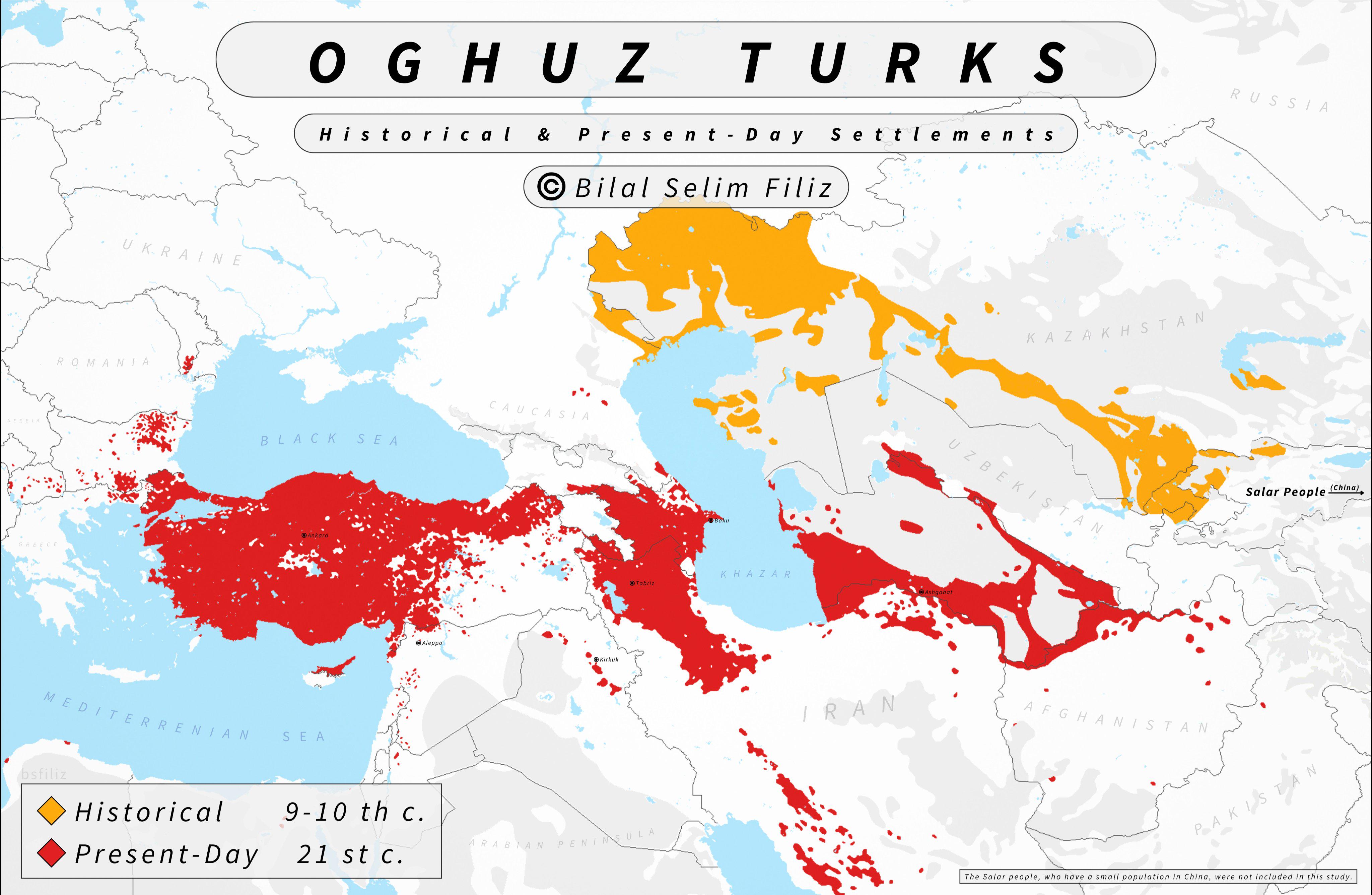
Oghuz Turks Historical and Present Day Settlements Map
The "Oghuz Turks Historical and Present Day Settlements Map" provides a comprehensive overview of the regions historical...
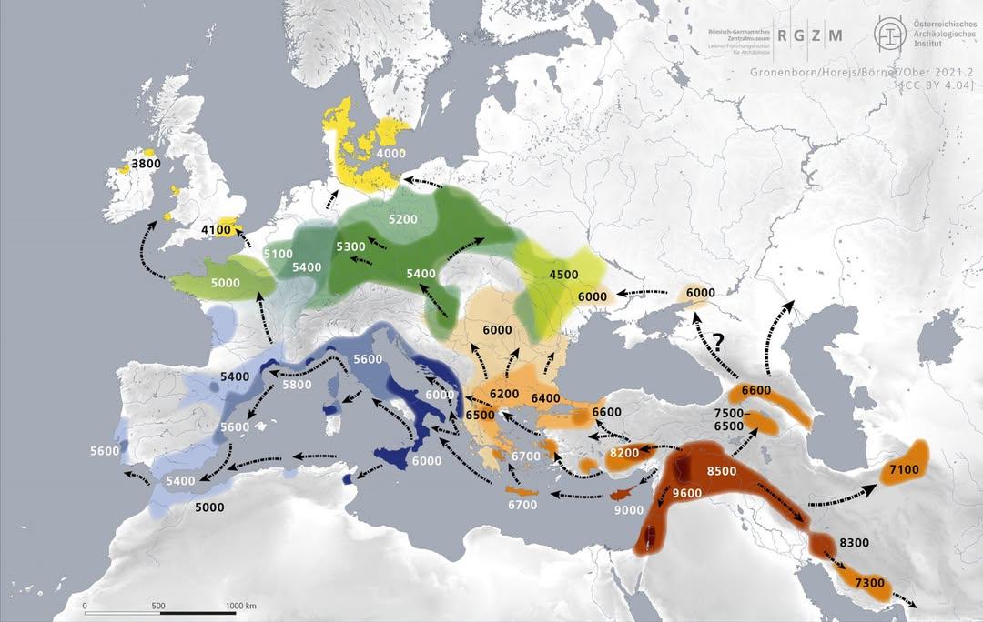
Map of Early Farming Spread in Europe (9000-3800 BC)
The map titled 'How Early Farming Spread into Europe from 9000 to 3800 BC' illustrates the gradual diffusion of agricult...
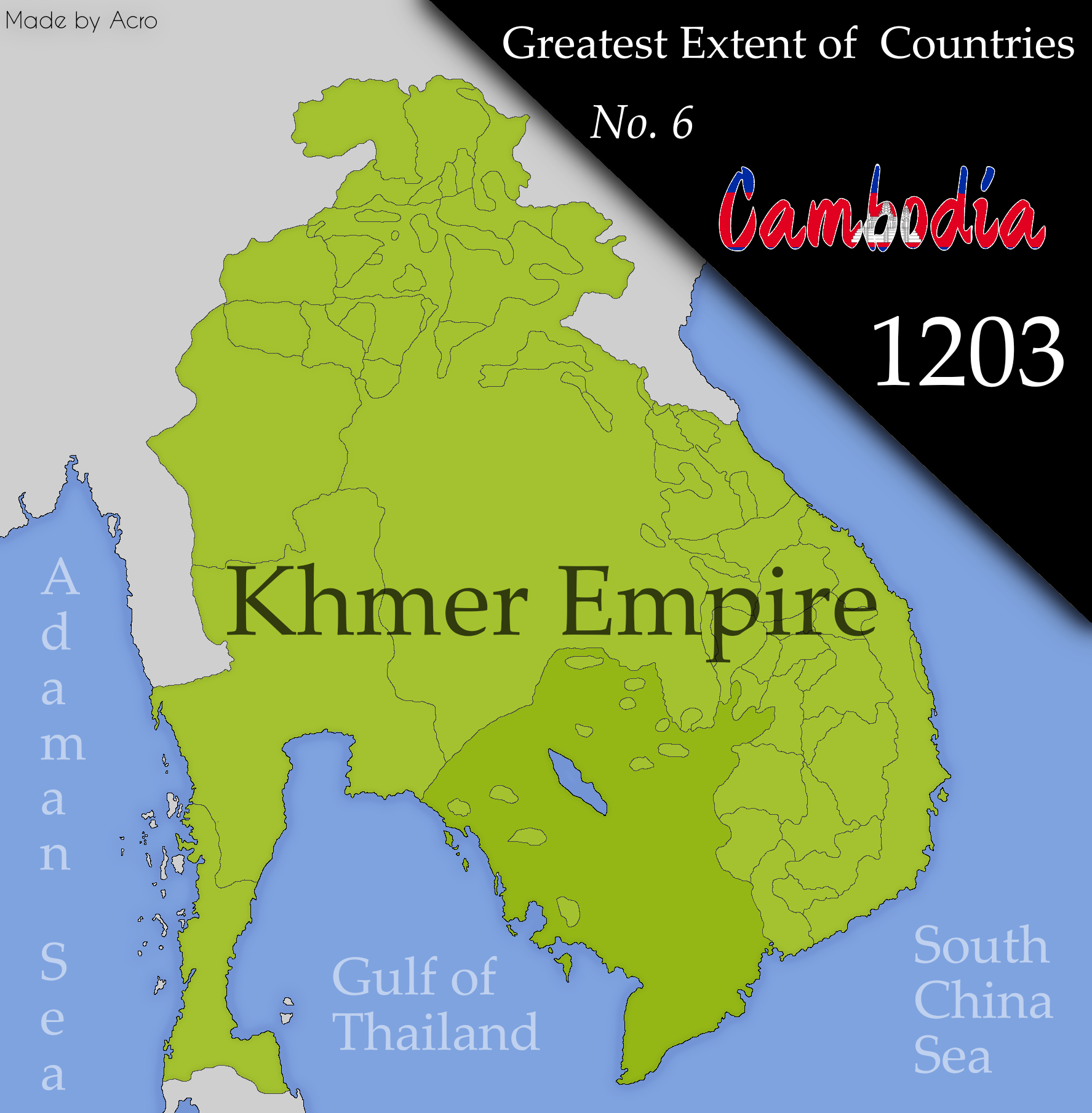
Cambodia Territorial Extent Map
The "Cambodia at its Greatest Extent" map visually represents the historical territorial boundaries of Cambodia, showcas...
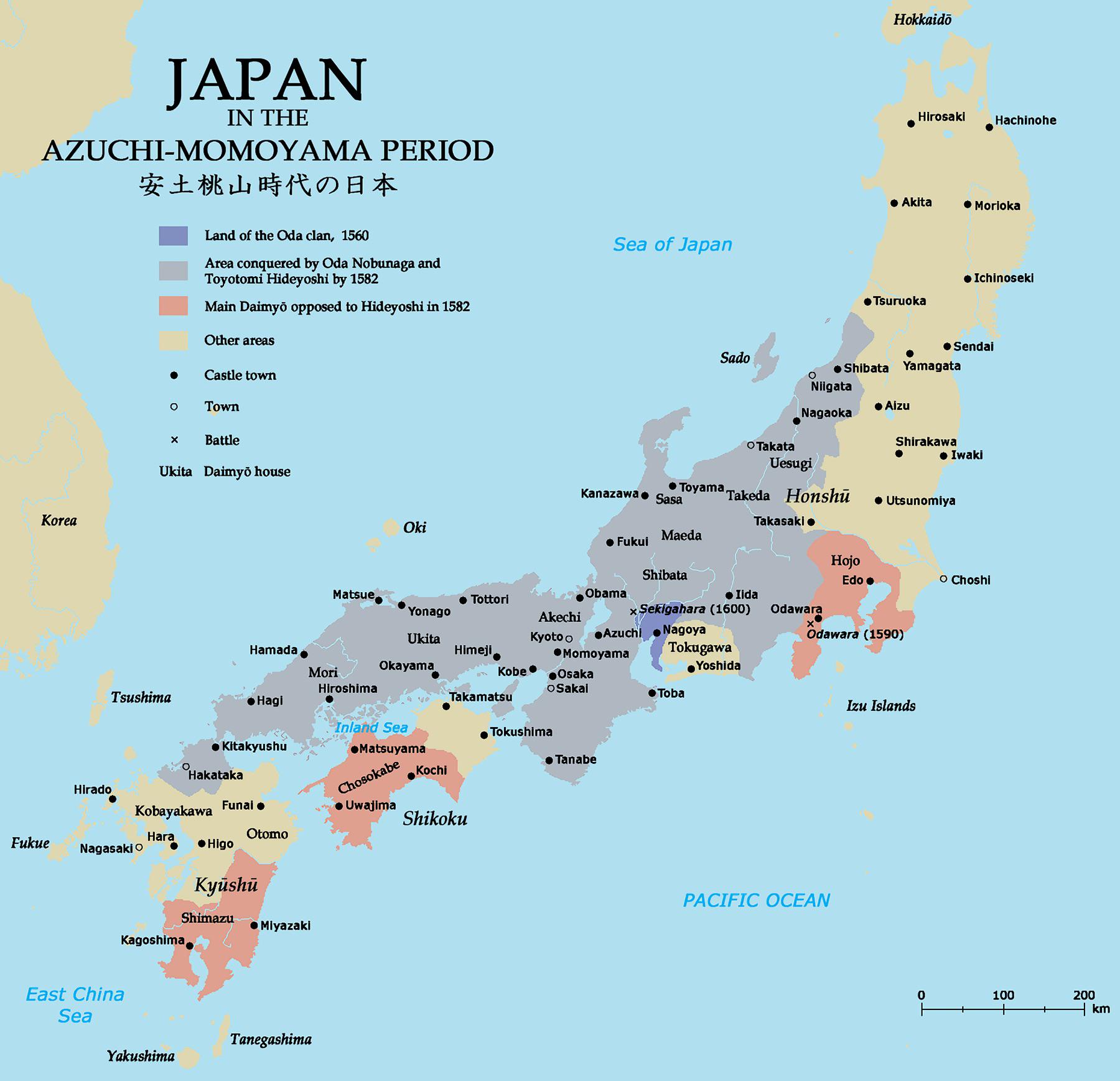
Japan during Azuchi-Momoyama Period Map
The map titled "Japan during Azuchi-Momoyama Period" provides a visual representation of the political and cultural land...
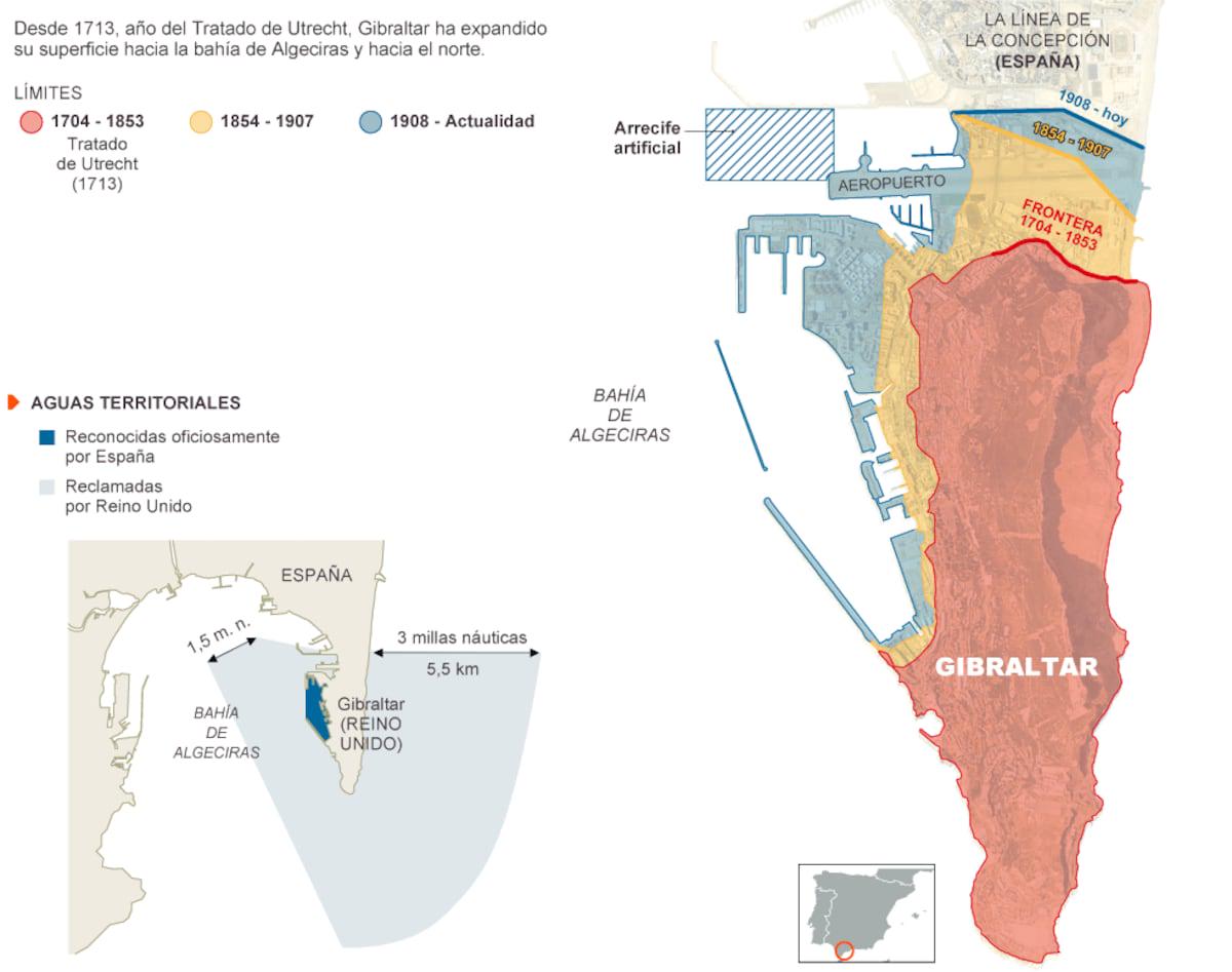
Colonization of Gibraltar Map
...