sustainability Maps
96 geographic visualizations tagged with "sustainability"
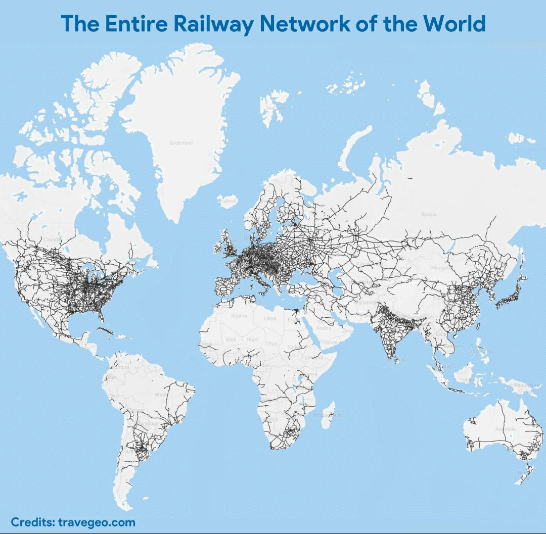
World Railway Network Map
The visualization titled "The Entire Railway Network of the World" offers a comprehensive look at the vast and intricate...
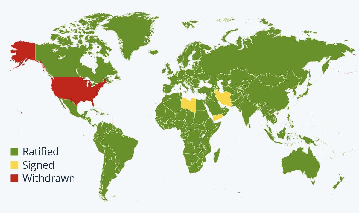
Map of Countries in the Paris Agreement
The visualization titled "A Map Of Every Country That Is In The Paris Agreement" succinctly illustrates the global commi...
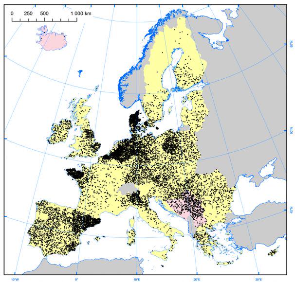
Pig Farm Density Map of Europe
The "Density of Pig Farms across Europe" map highlights the geographical distribution of pig farming throughout the cont...
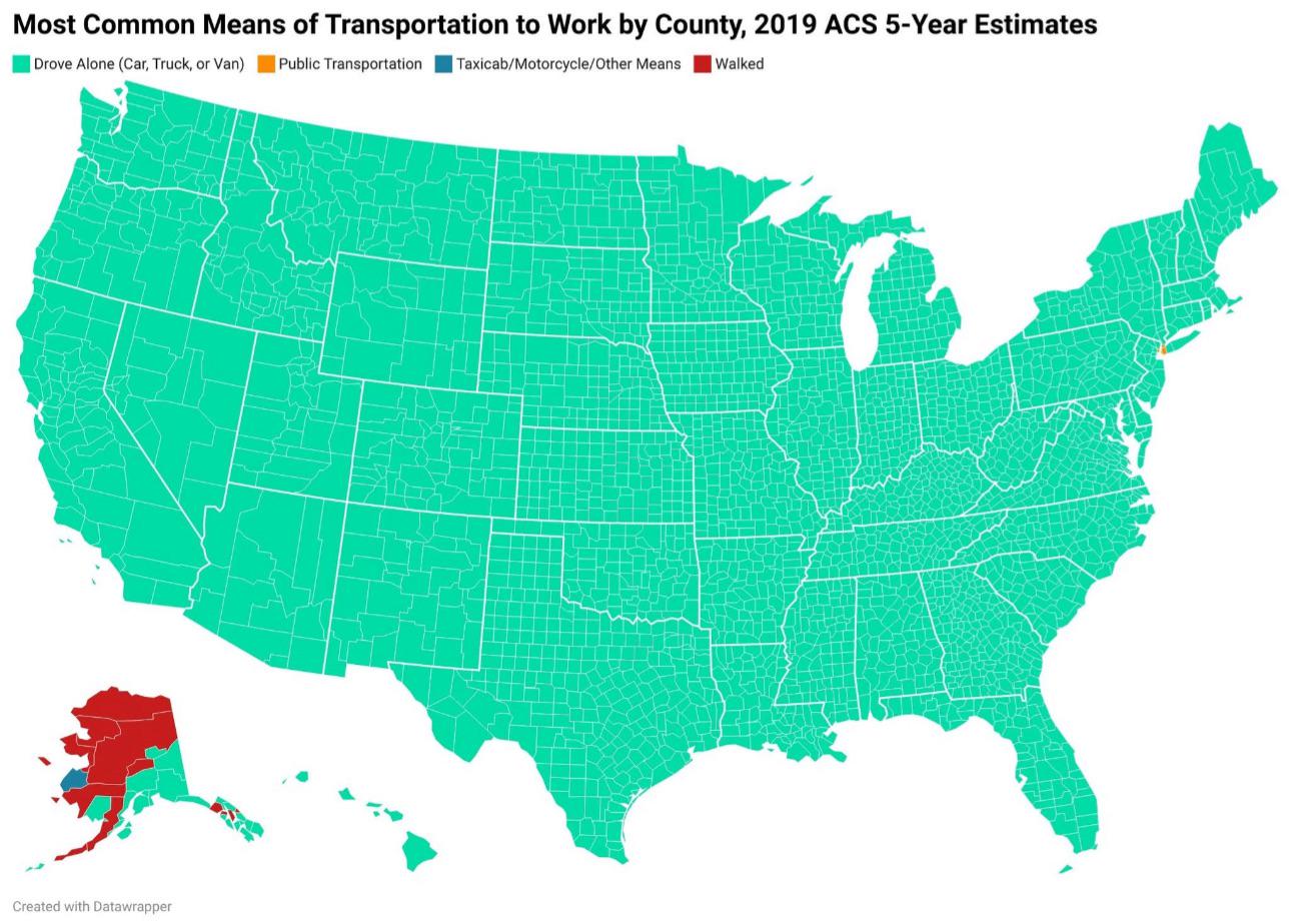
How Americans Get to Work Map
This map provides a visual representation of the various modes of transportation that Americans utilize to commute to wo...
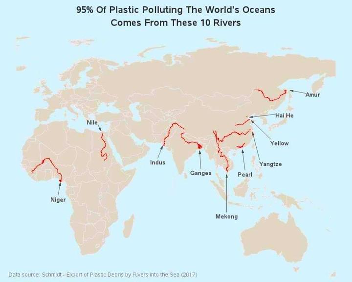
Map of Rivers Contributing to Ocean Plastic
The map titled "95% of Ocean Plastic Originates from These 10 Rivers" highlights the critical role that certain river sy...
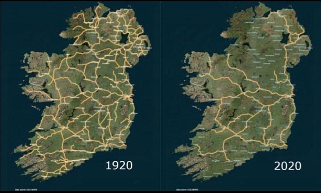
Irish Railway System Map 1920 to 2020
The map titled 'The Irish Railway System between 1920 and 2020' provides a comprehensive visualization of the railway in...
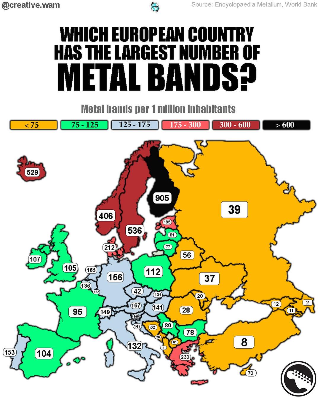
Map of Europe's Metal Production Centers
The visualization titled \...
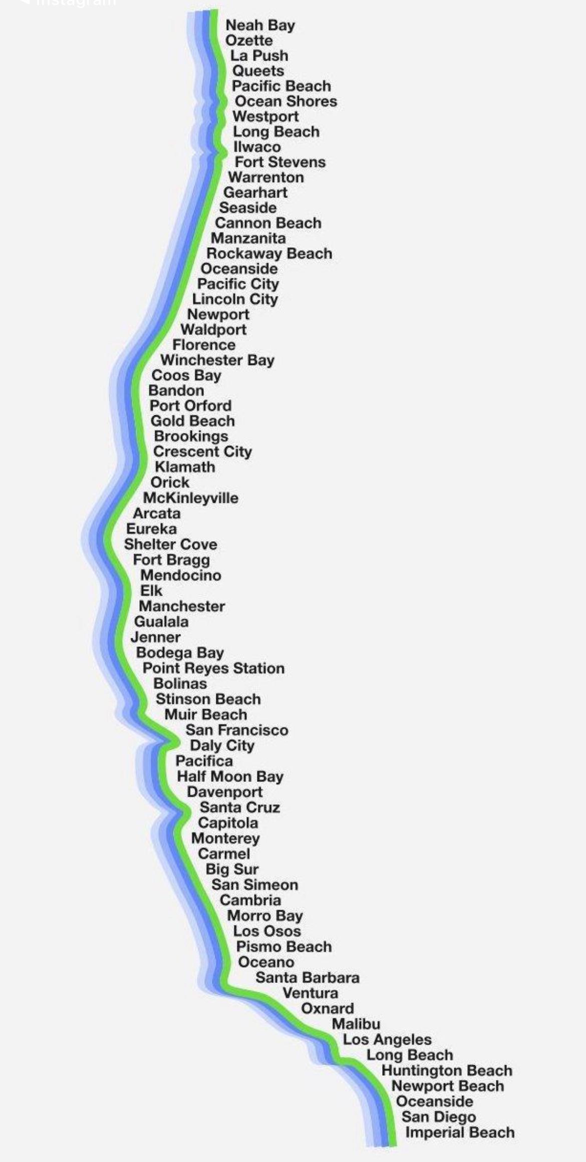
Map of US West Coast Cities (Not OC)
The "Map of the US West Coast Cities (Not OC)" provides a detailed visualization of major urban centers along the Pacifi...
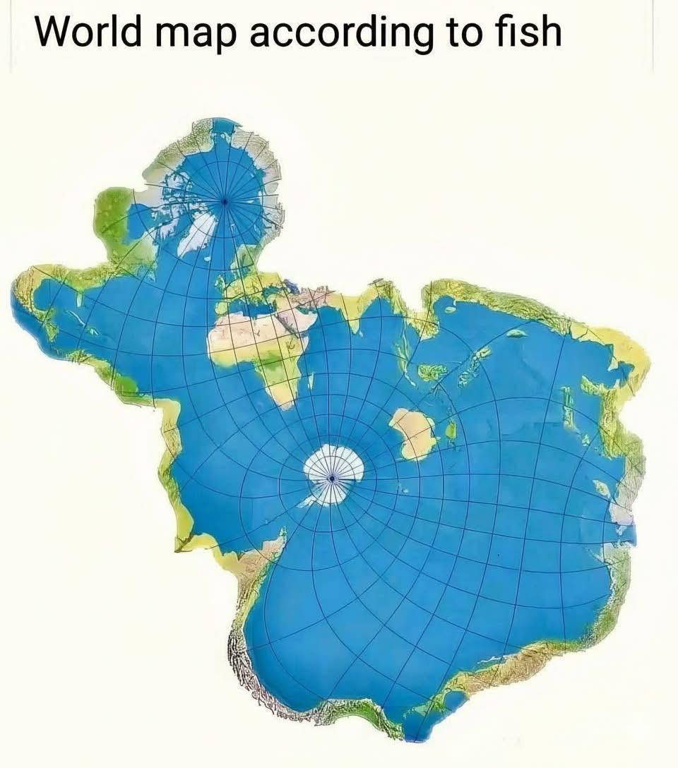
Global Fish Distribution Map
The visualization titled "The World Map If We Were Fish" creatively portrays the global distribution of fish species acr...
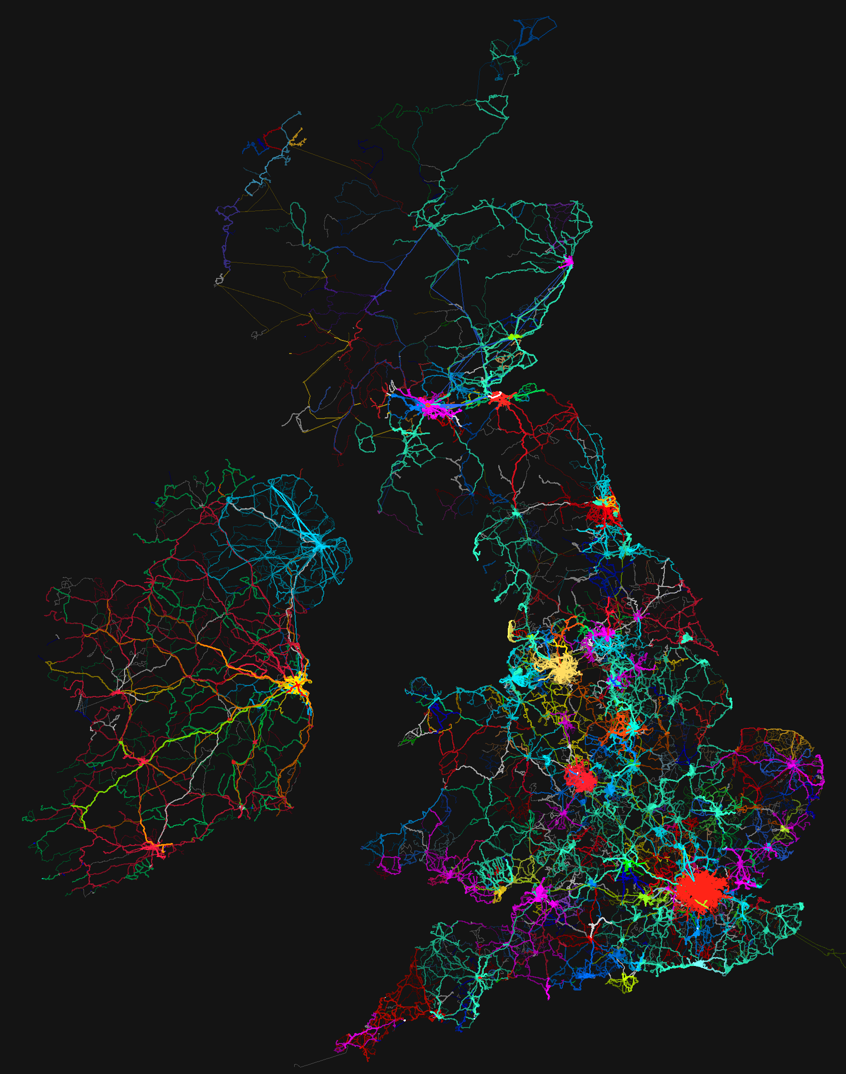
Bus Routes Map of the UK and Ireland
...
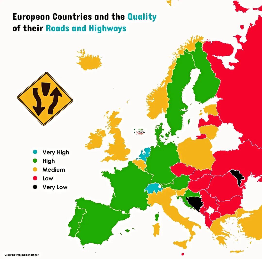
Road Quality by European Country Map
This map illustrates the quality of roads and highways across various European countries, highlighting the differences i...
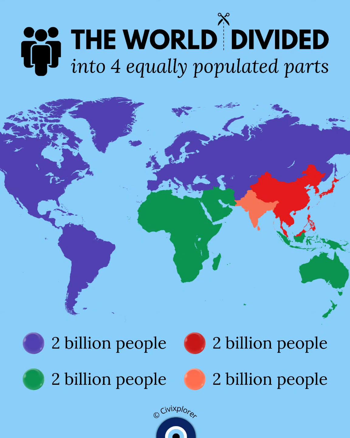
World Population Distribution Map
This map illustrates a fascinating concept: the world divided into four equally populated parts. It visualizes how Earth...
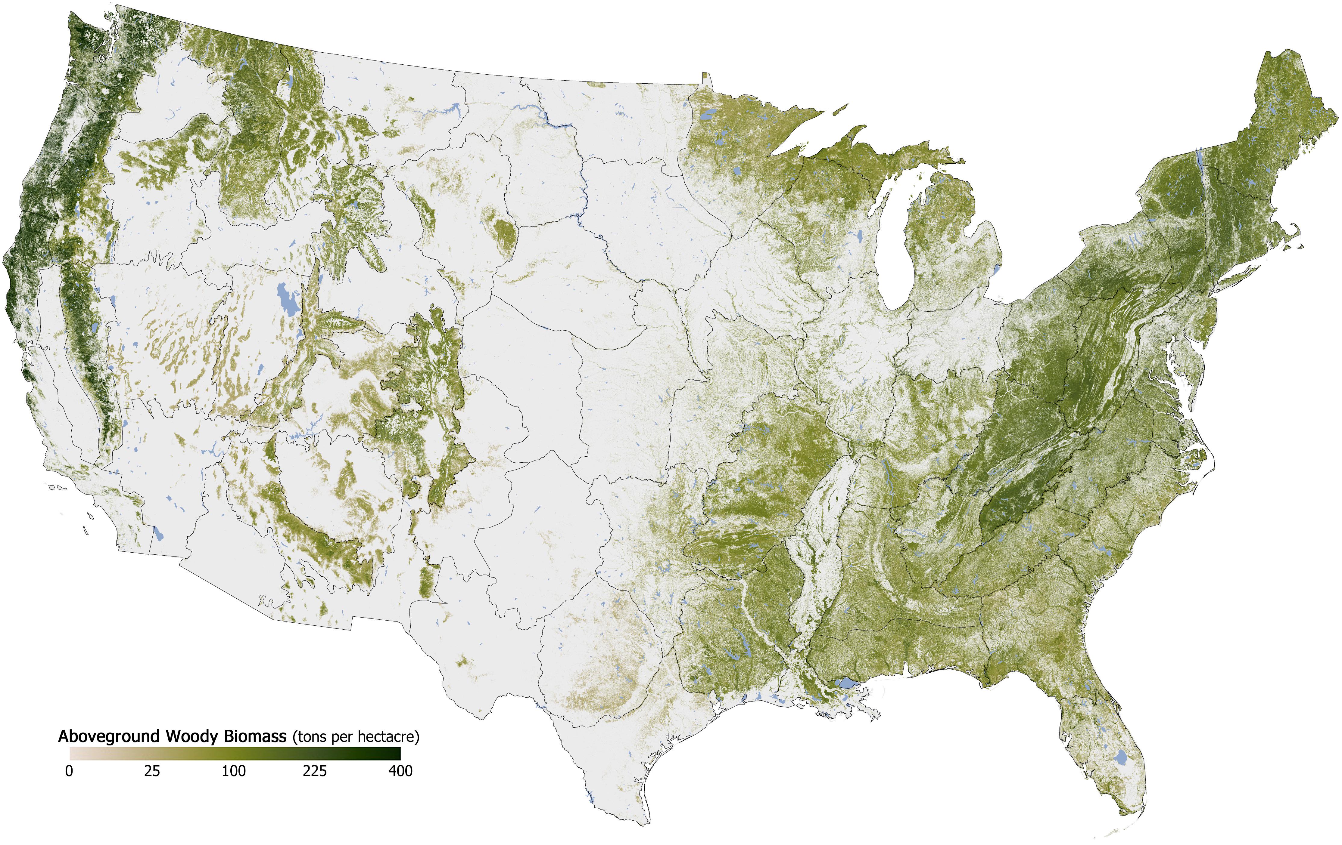
Forest Cover in the U.S. Map
The "Forest Cover in the U.S. Map" provides a detailed visualization of the distribution and density of forested areas a...
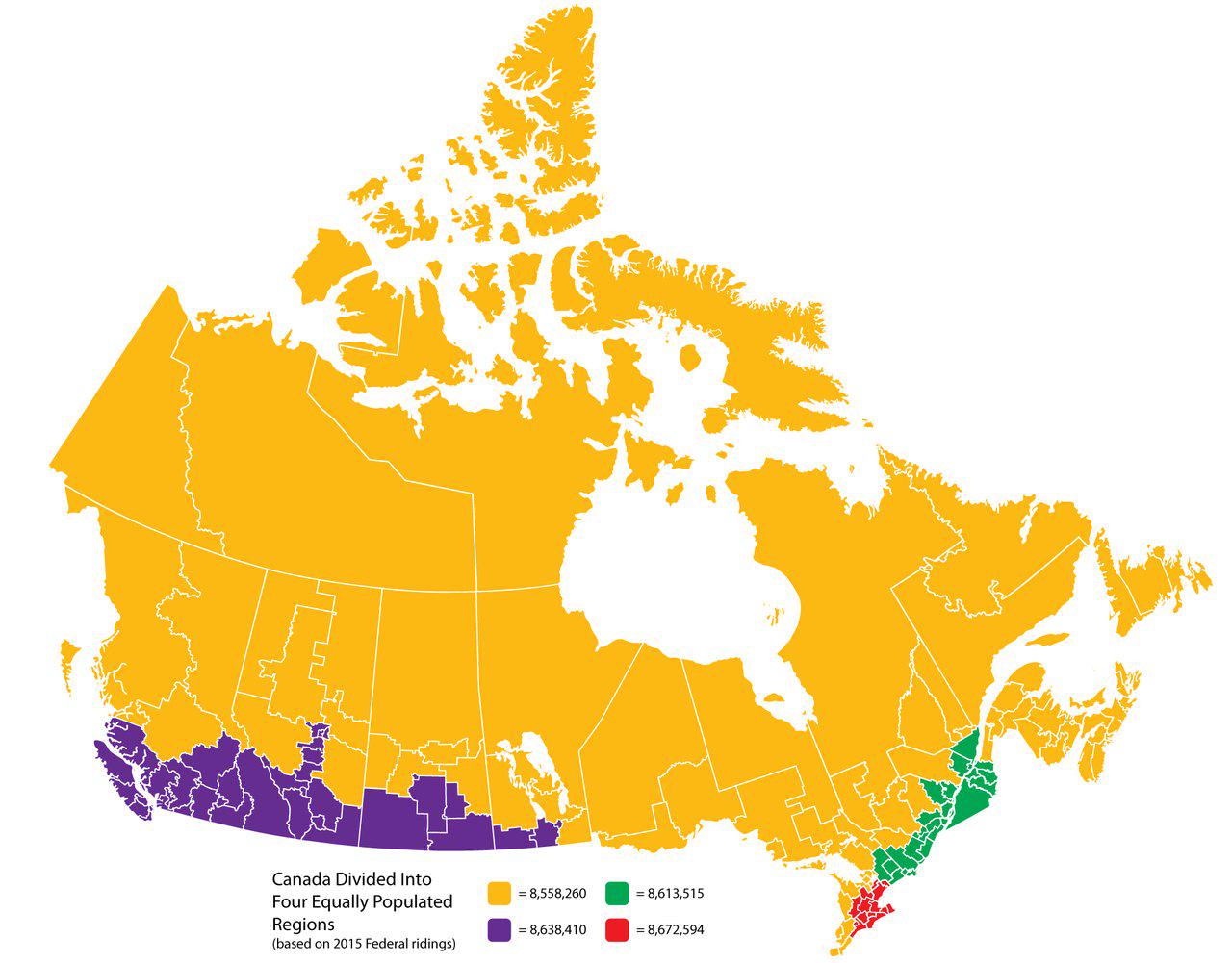
Canada Divided Into Four Equally Populated Regions Map
This map visualizes Canada divided into four equally populated regions, providing a unique perspective on the distributi...
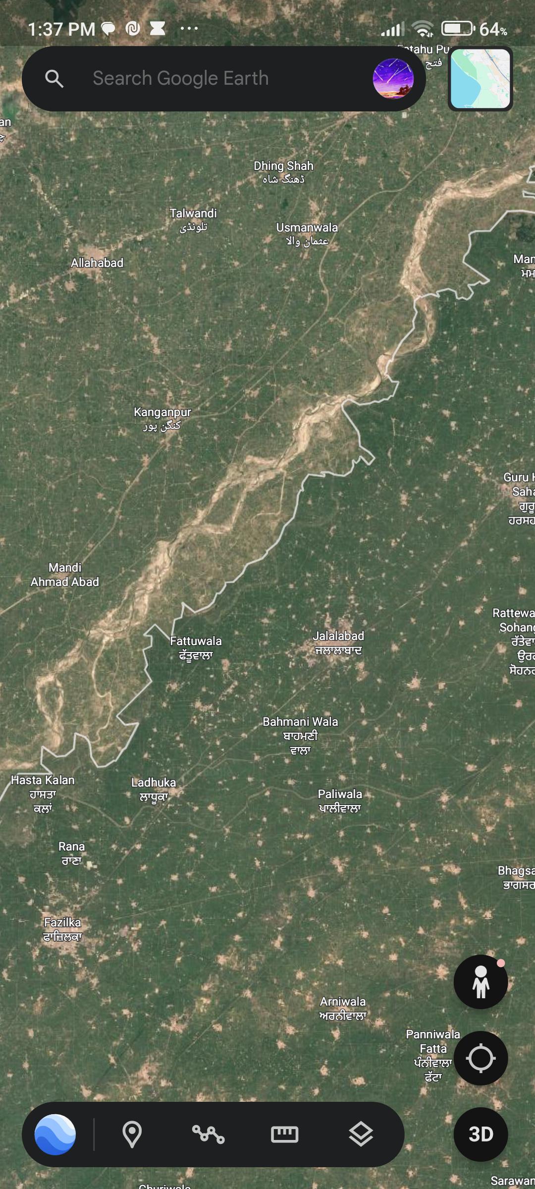
Greener Areas Near India-Pakistan Border Map
The visualization titled "Why is the grass greener on this side?" illustrates the stark contrast in vegetation along the...
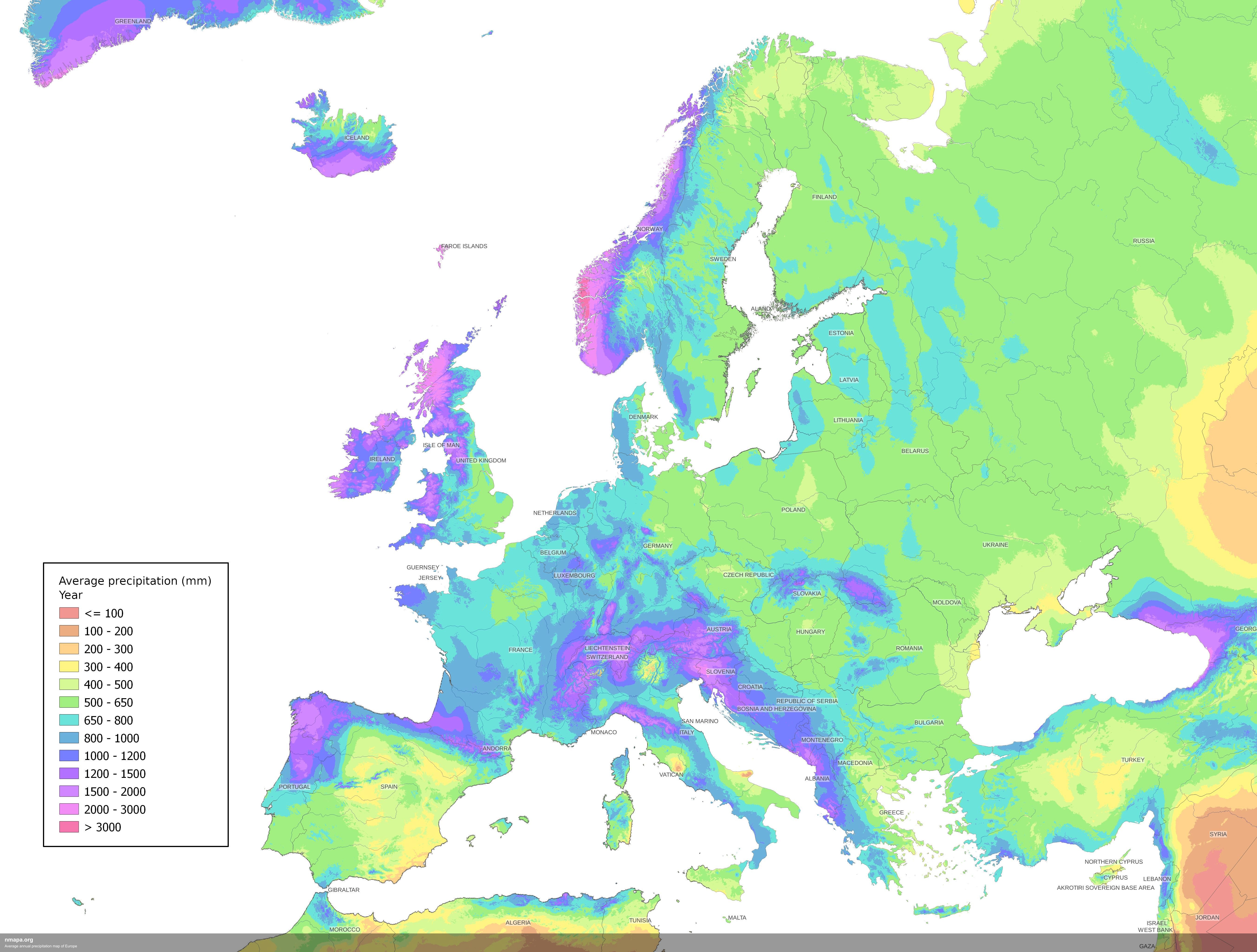
Average Annual Precipitation Map of Europe
The Average Annual Precipitation Map of Europe offers a detailed visualization of rainfall patterns across the continent...
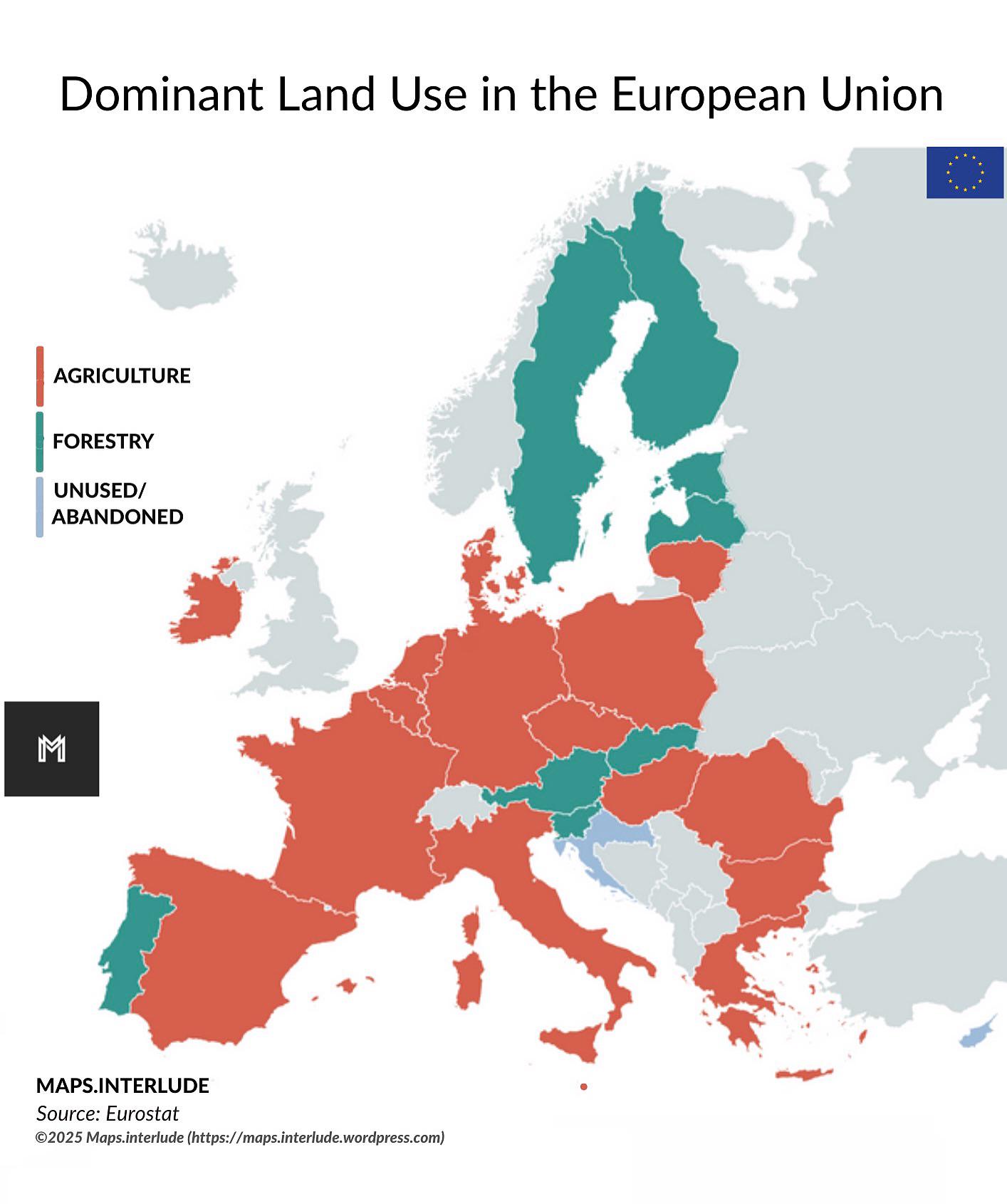
Dominant Land Use in the European Union Map
The "Dominant Land Use in the European Union" map provides a comprehensive visualization of how land is utilized across ...
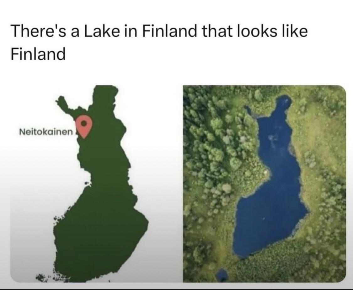
Finlake Water Quality Monitoring Map
The "Finlake Water Quality Monitoring Map" provides a detailed overview of water quality metrics across various sites in...
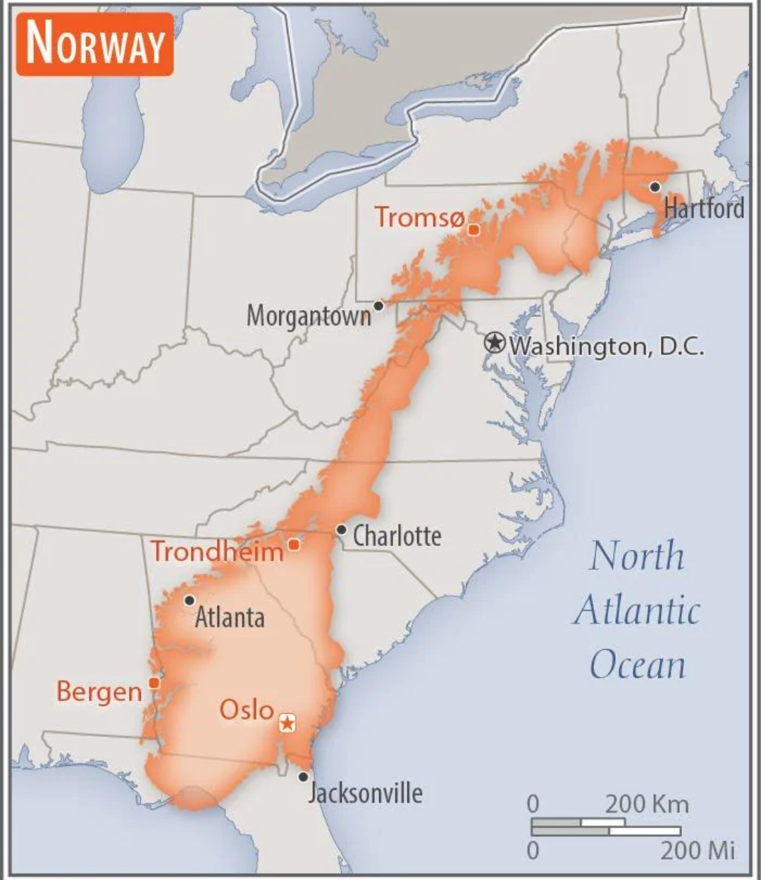
Norway Overlaid on the US Map
This intriguing map overlays the geographical boundaries of Norway onto the continental United States, providing a uniqu...
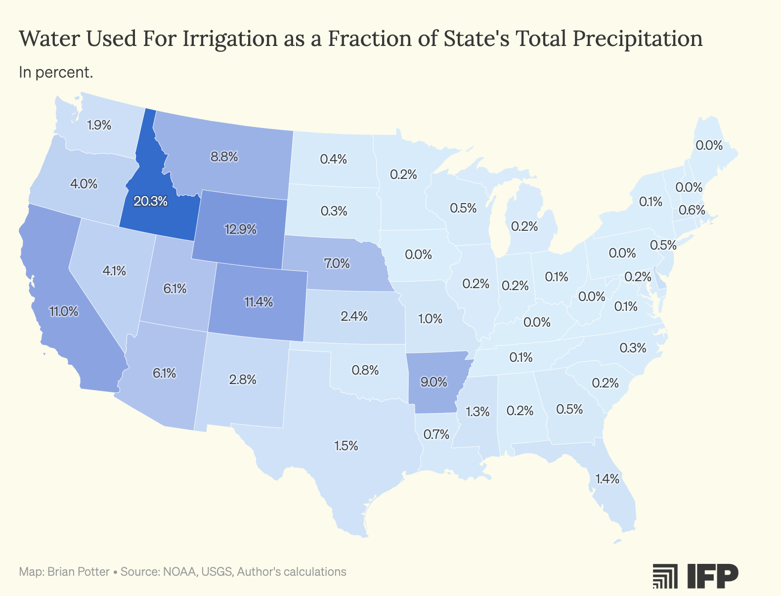
Water Used for Crop Irrigation Map by US States
The map titled "Water Used for Crop Irrigation as a Percentage of US States' Total Precipitation" provides a compelling ...
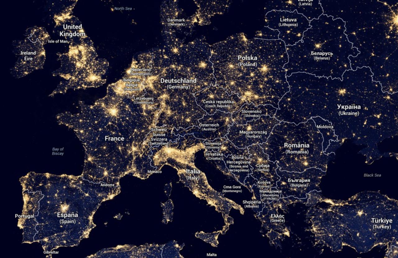
Light Map of Europe
The 'Light Map of Europe' provides a stunning visual representation of nighttime illumination levels across the continen...
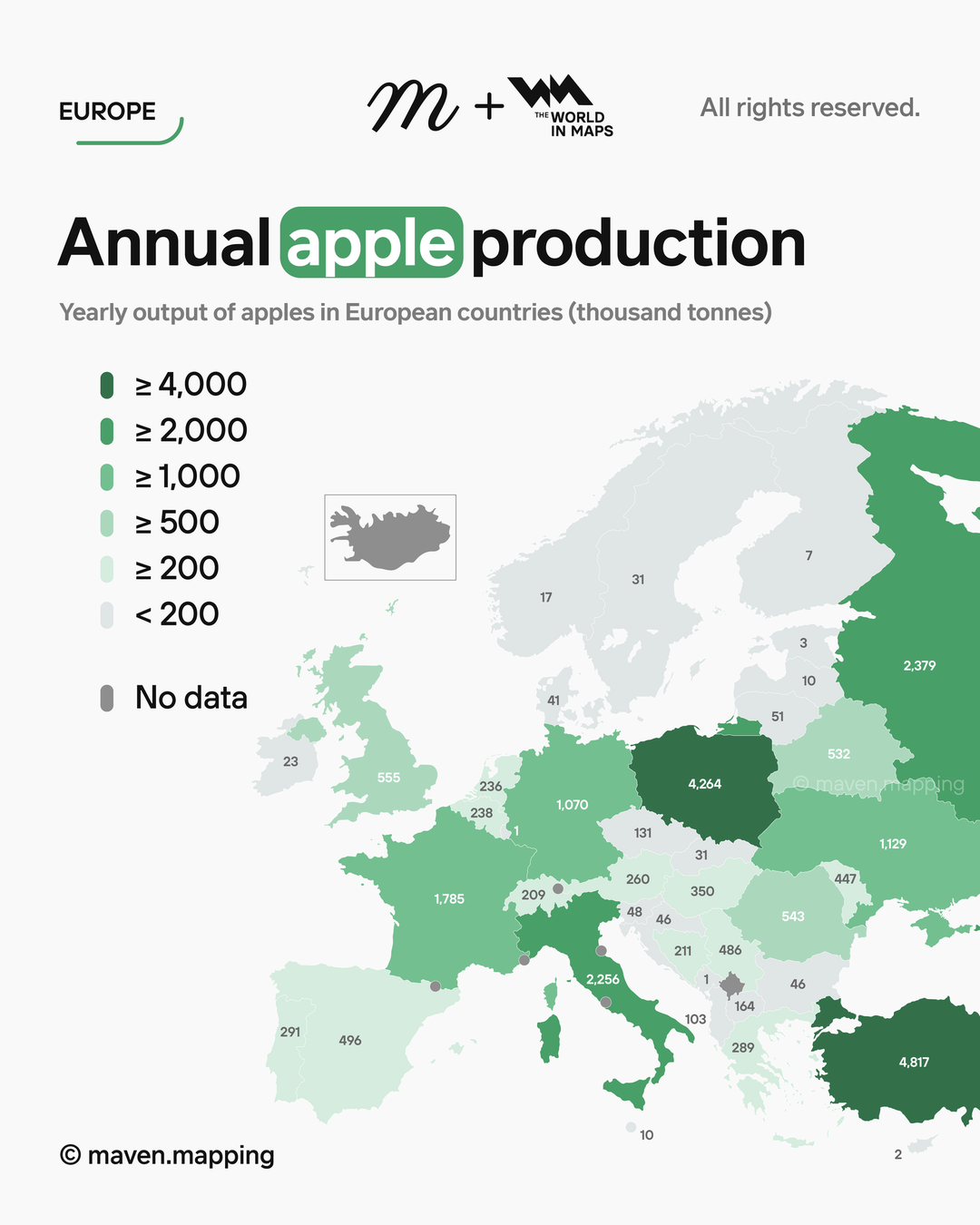
Annual Apple Production in Europe Map
Interestingly, in 2022, it was reported that Europe collectively produced over 10 million metric tons of apples, with no...
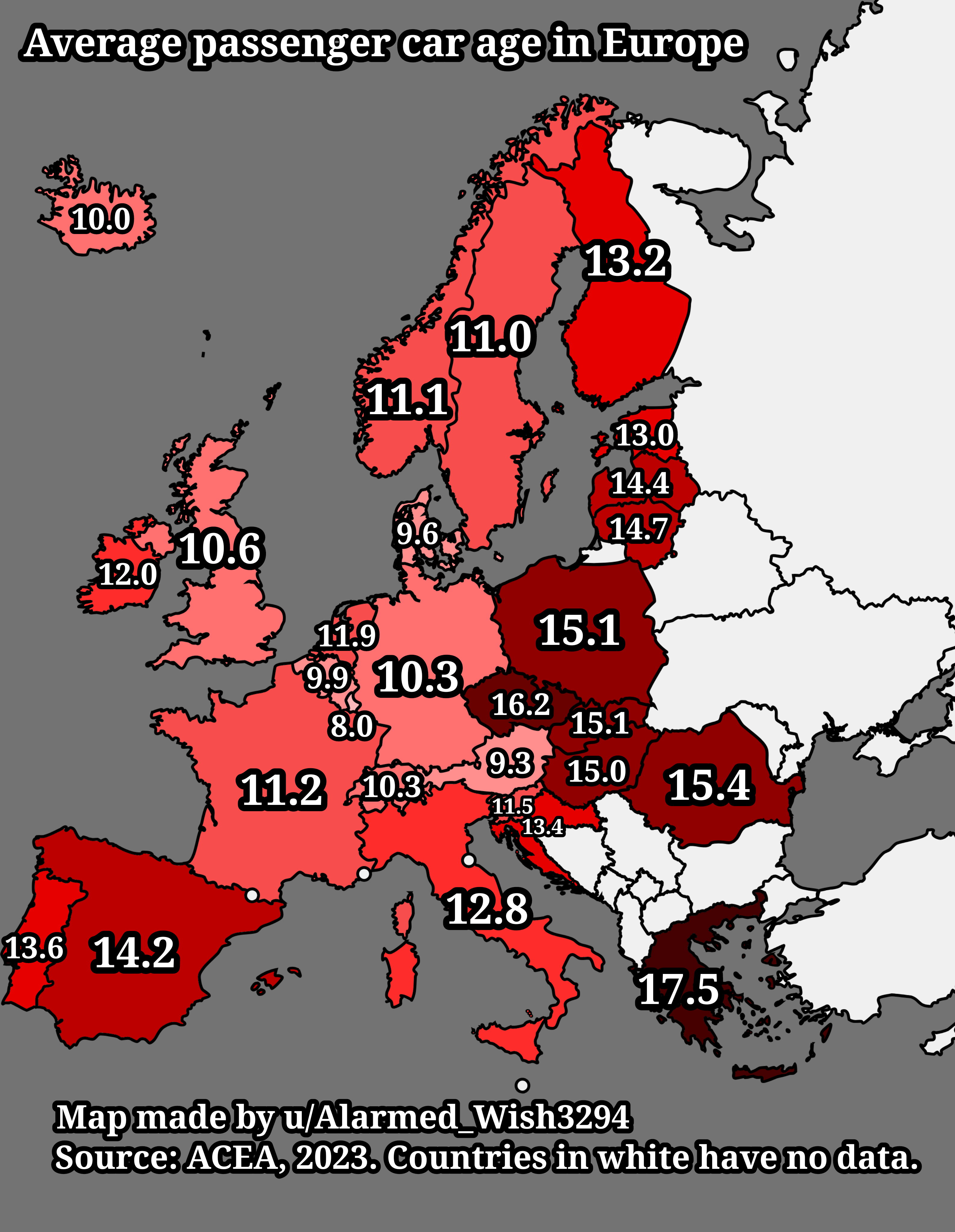
Average Passenger Car Age in Europe Map
The "Average Passenger Car Age in Europe Map" provides a visual representation of the average age of passenger vehicles ...
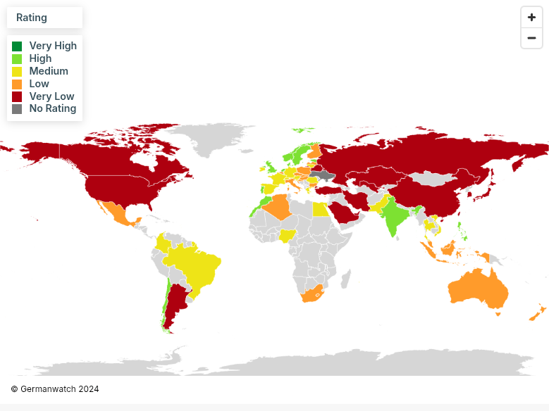
Climate Change Performance Index 2025 Map
The Climate Change Performance Index (CCPI) 2025 Map visualizes the performance of countries in combating climate change...
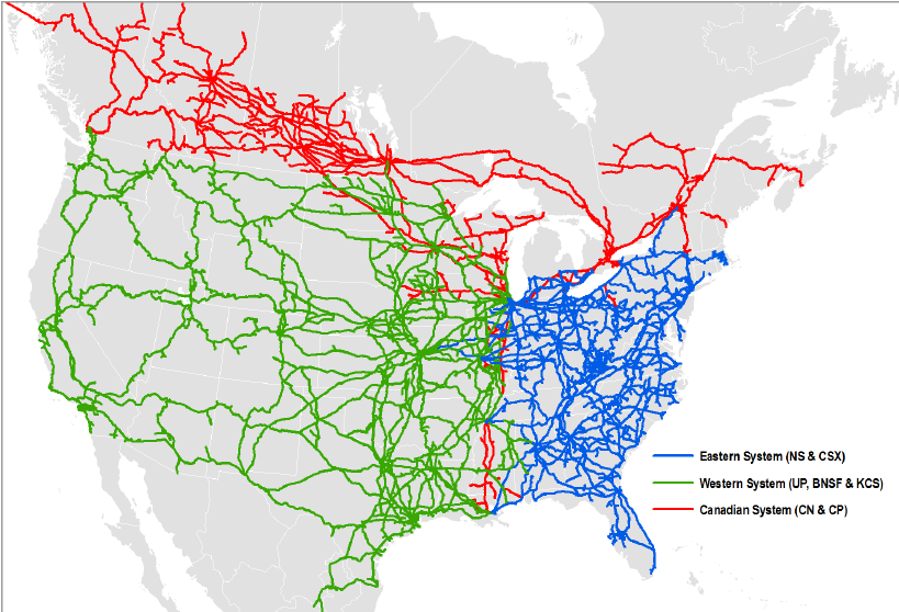
North American Rail System Map
The North American Rail System Map provides a comprehensive visualization of the extensive rail network that spans the U...
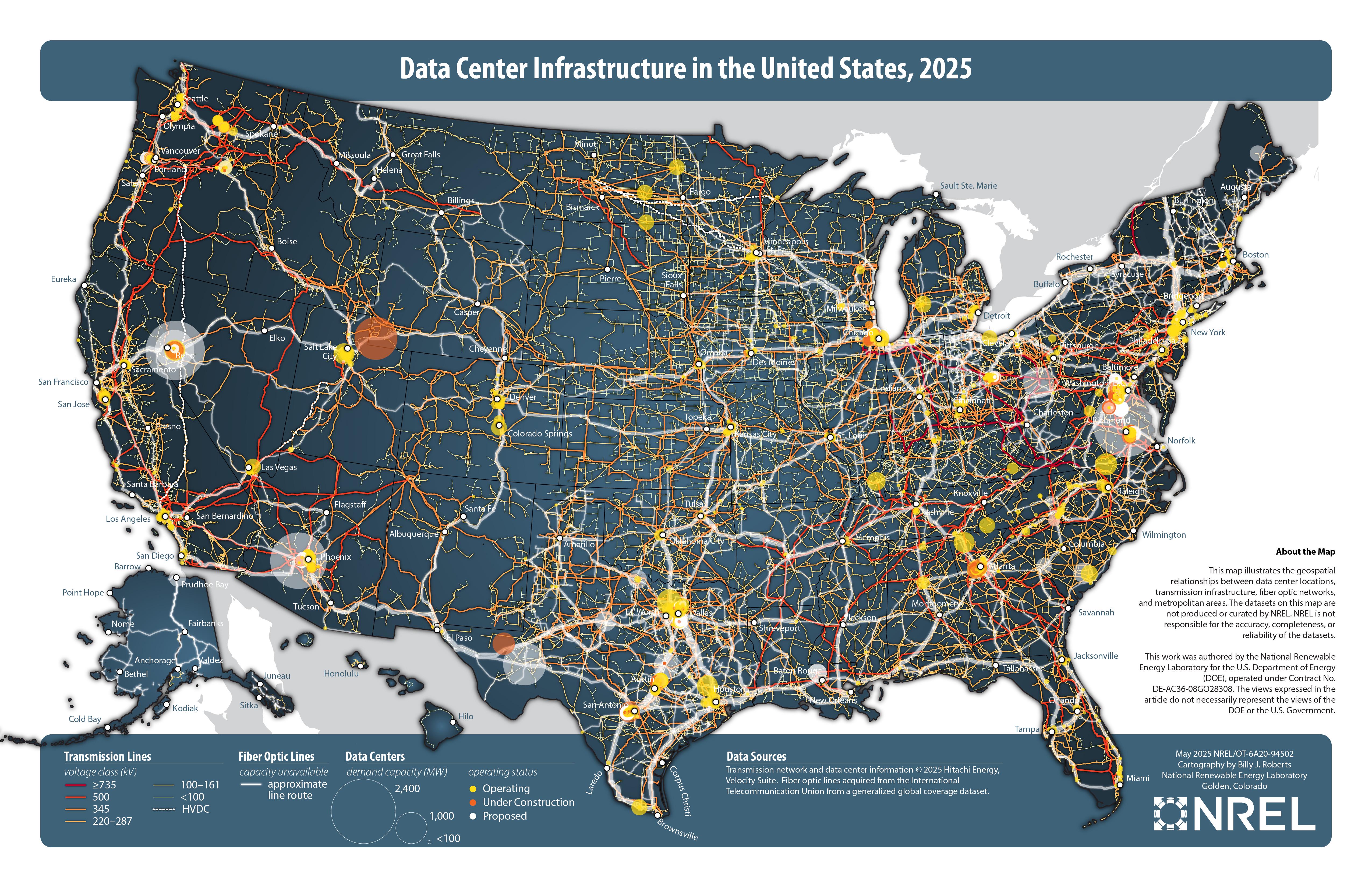
Data Center Infrastructure in the United States Map
The "Data Center Infrastructure in the United States, 2025" map visualizes the distribution and density of data centers ...
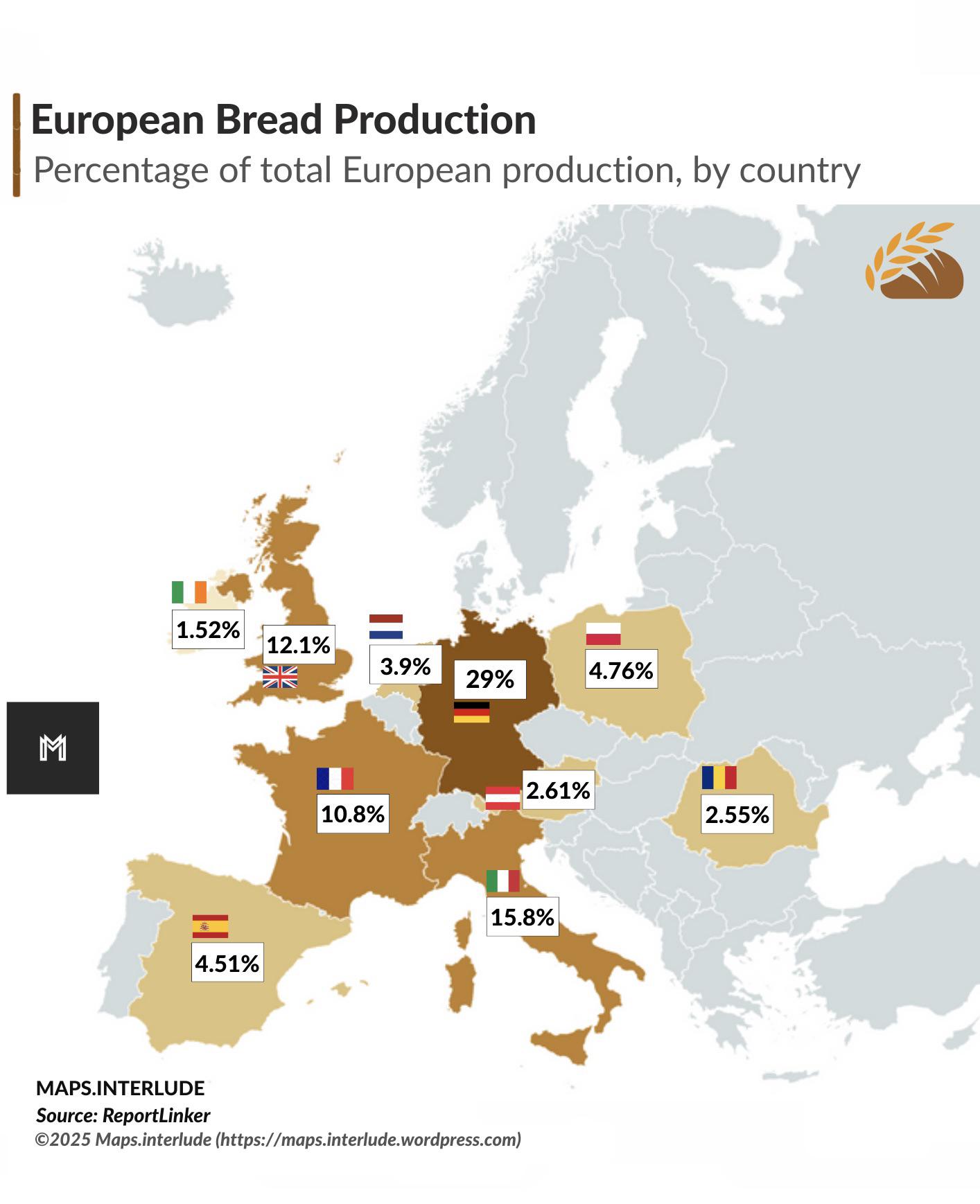
Largest European Bread Producers Map
This map illustrates the largest bread producers in Europe, highlighting the countries that play a pivotal role in the c...
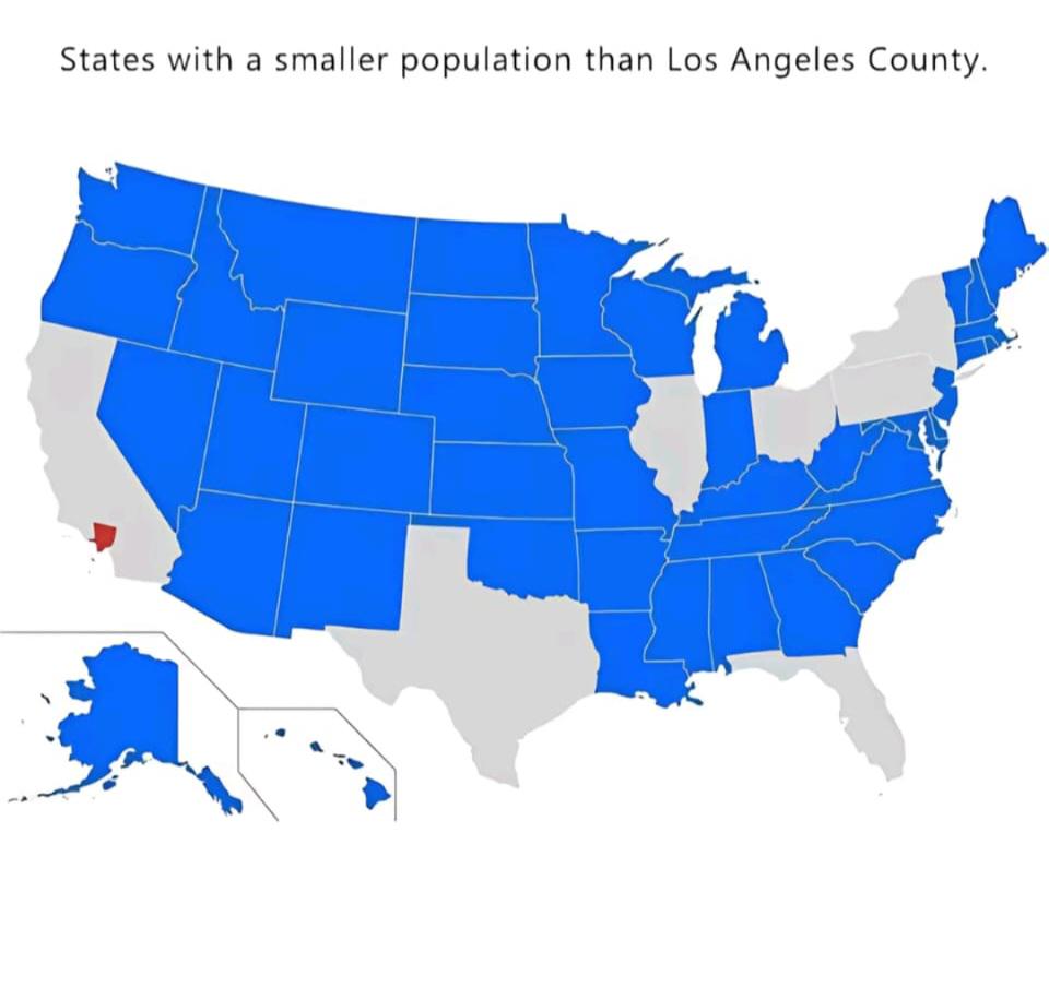
World Population Distribution Map
The "World Population Distribution Map" visualizes where people live across the globe, highlighting the density of popul...
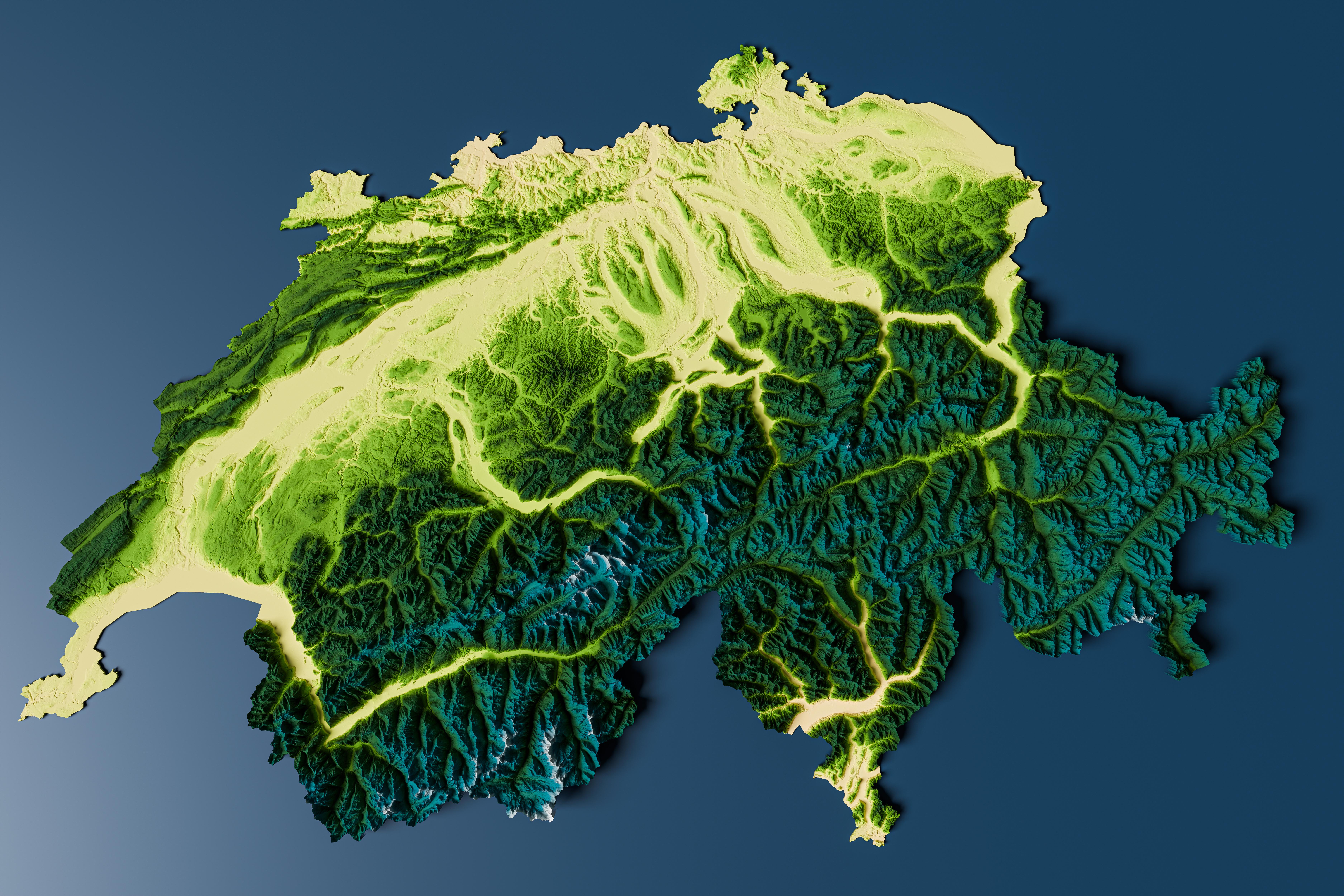
Topographic Relief Map of Switzerland
Interestingly, the topographical variation influences climate, biodiversity, and human settlement patterns. The highest ...
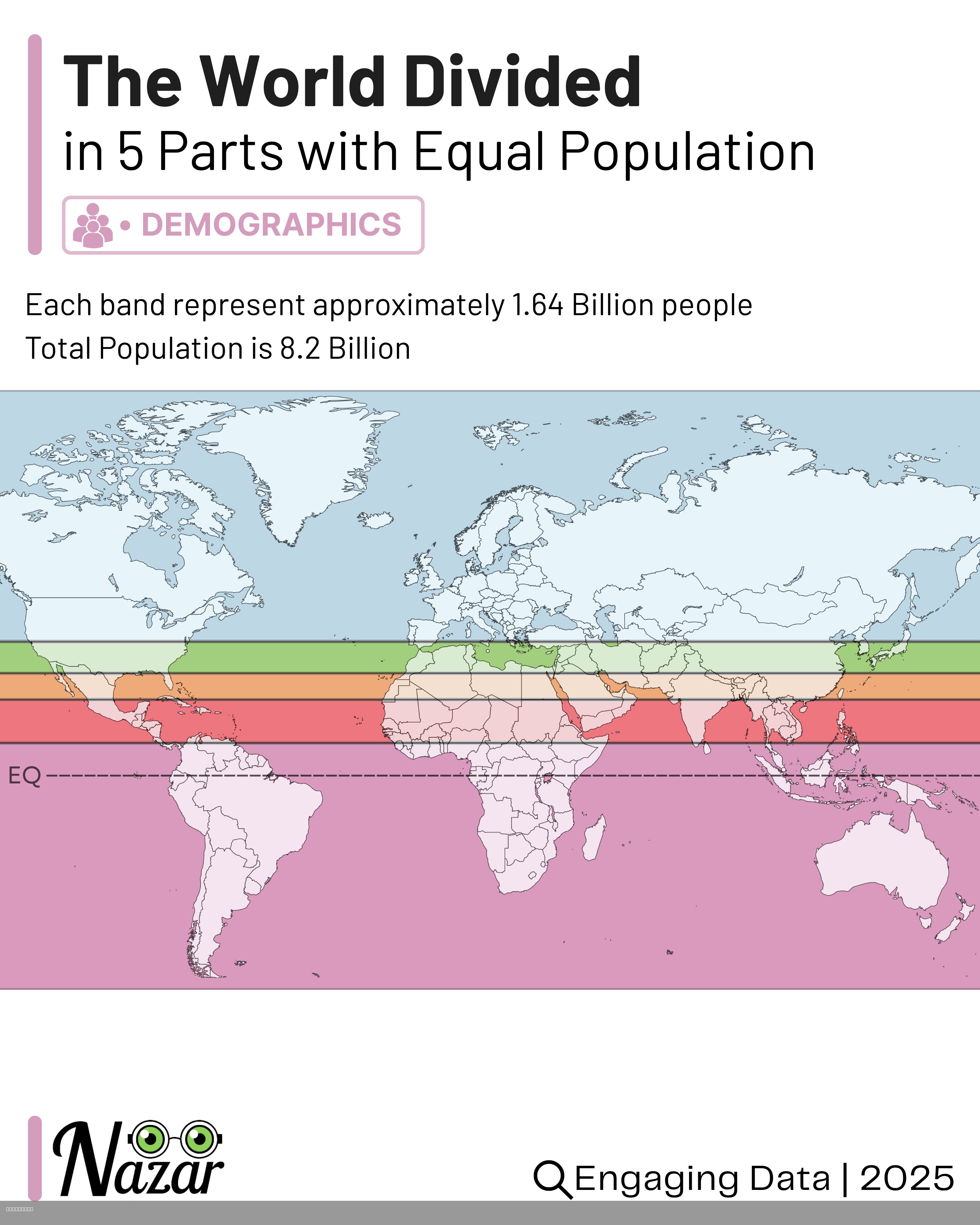
World Population Distribution Map by Equal Parts
This map visualizes the world’s population divided into five horizontal bands, each containing approximately 1.64 billio...
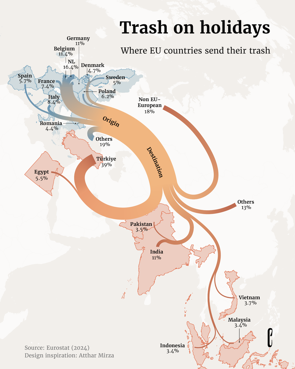
Map of Where EU Countries Send Their Trash
The map titled 'Where EU Countries Send Their Trash' provides a visual representation of the waste management practices ...
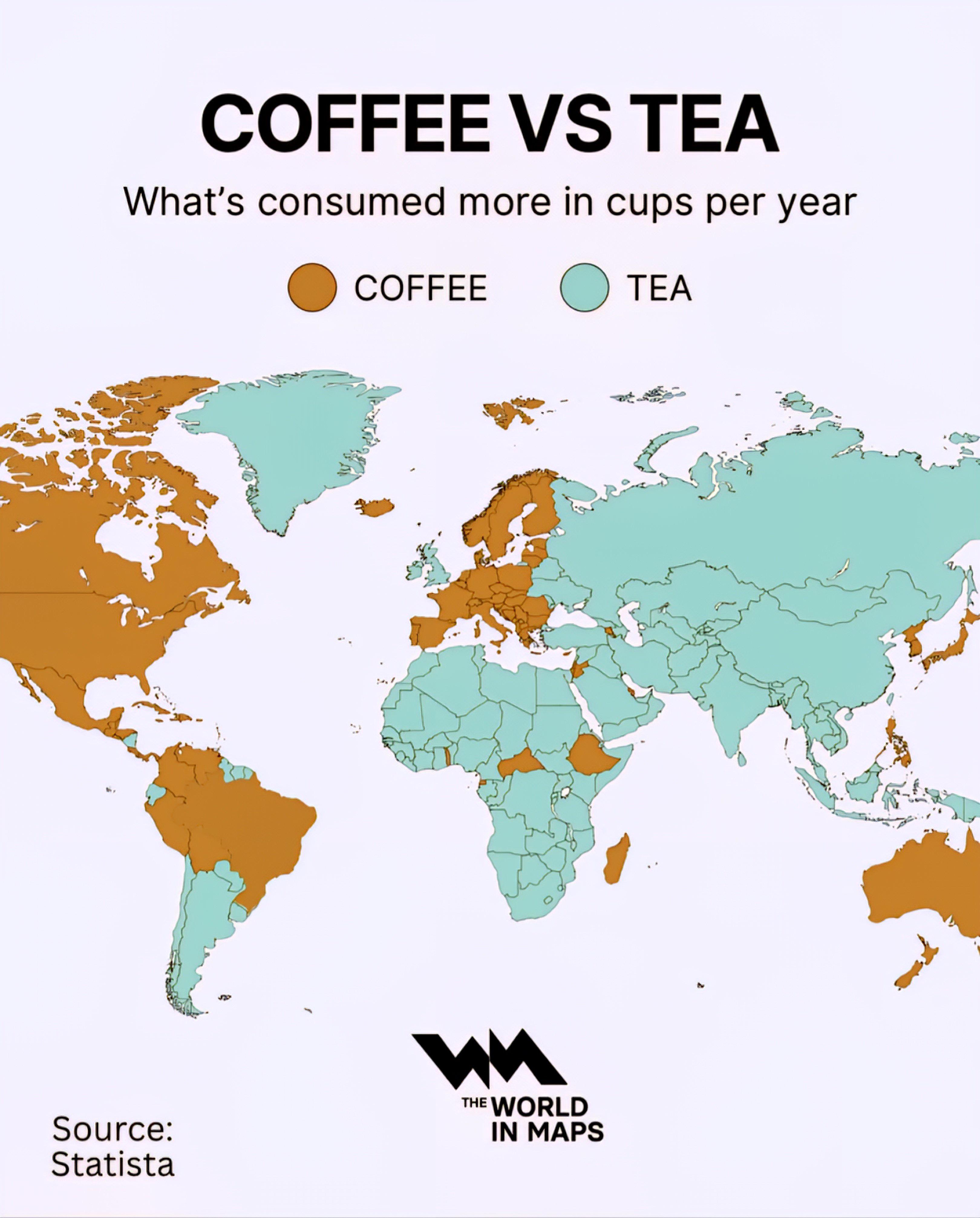
Coffee vs Tea Production Map
...
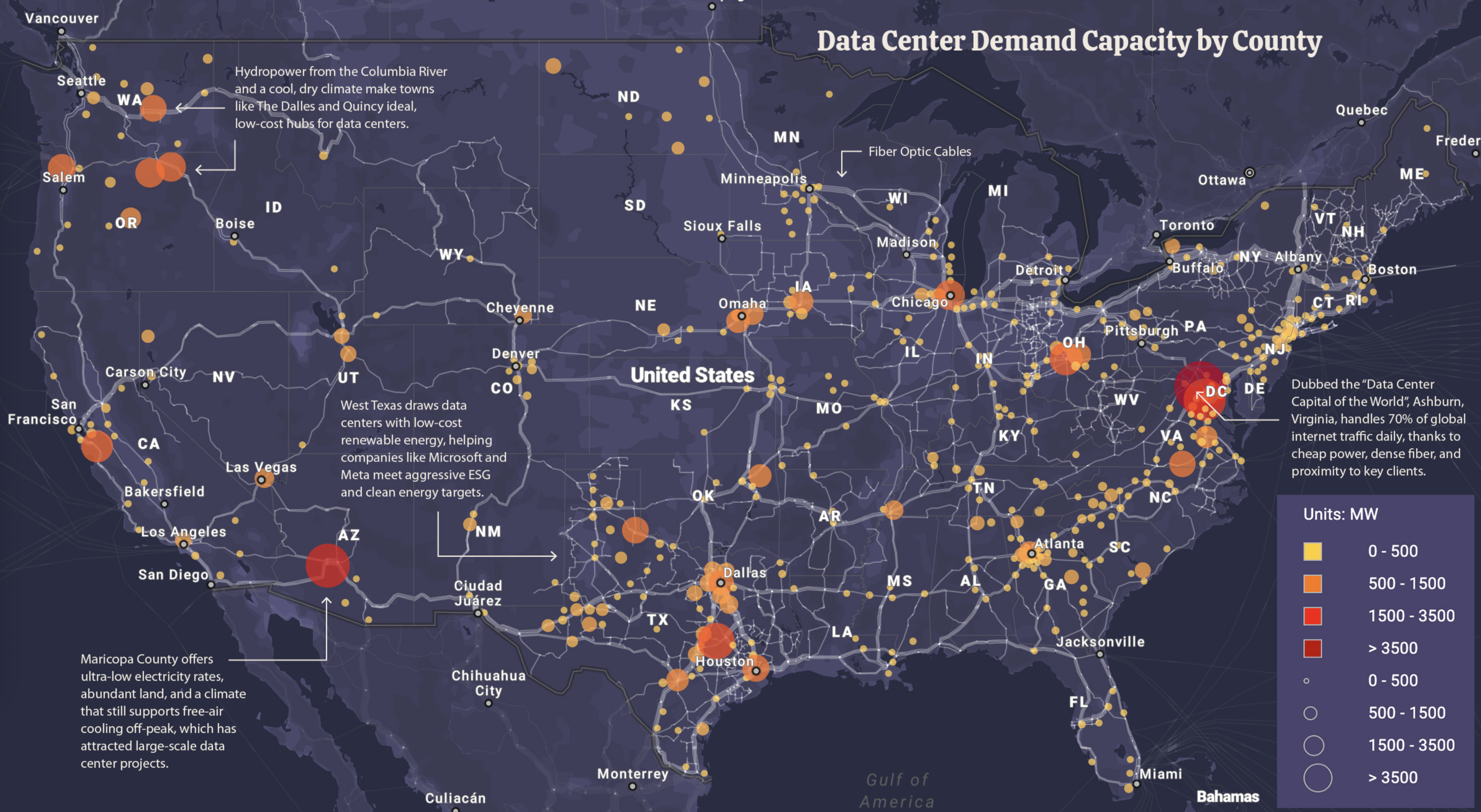
Data Center Power Demand Map
The "Data Center Power Demand Map" visualizes the power consumption of data centers across the United States, highlighti...
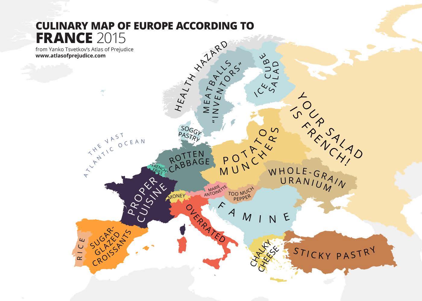
European Cuisine by Country Map
This map provides a detailed overview of the diverse culinary traditions across Europe, highlighting the unique dishes a...
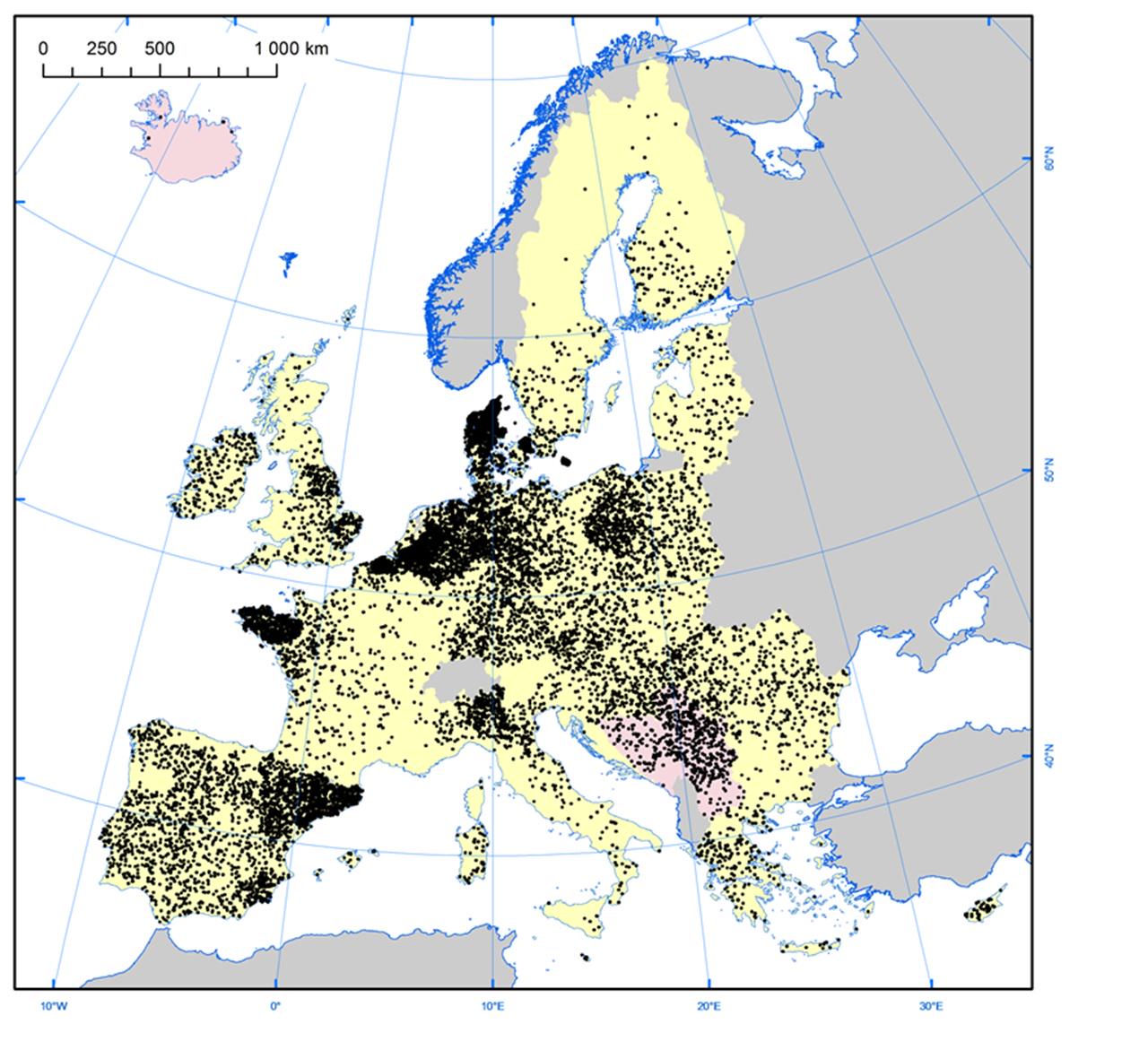
Pig Farms in Europe Map
The "Pig Farms in Europe Map" provides a comprehensive overview of pig farming locations across the continent, highlight...
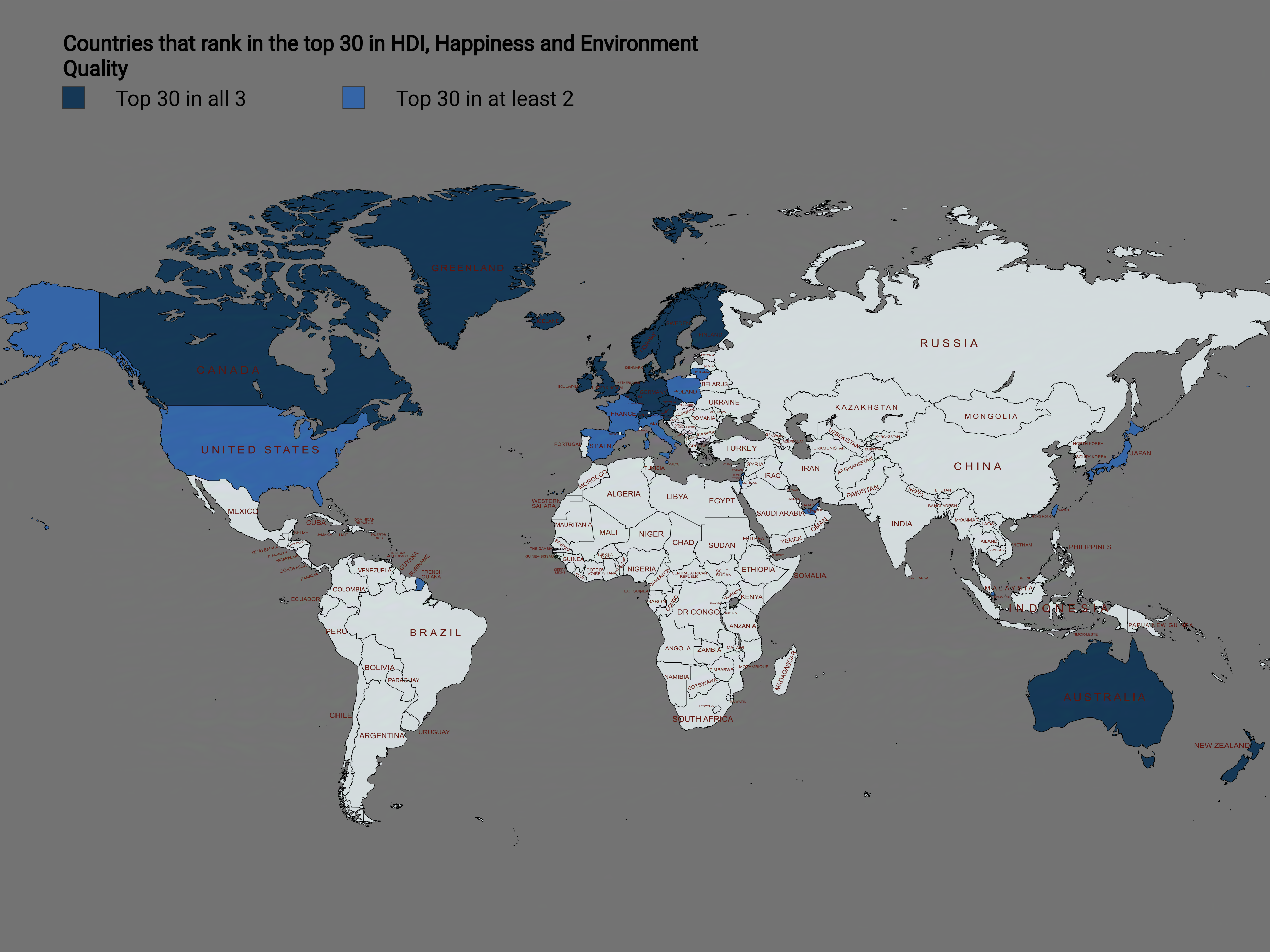
Map of Top 30 Countries in HDI, Happiness, and Environmental Quality
This map illustrates the countries that rank within the top 30 for Human Development Index (HDI), happiness, and environ...
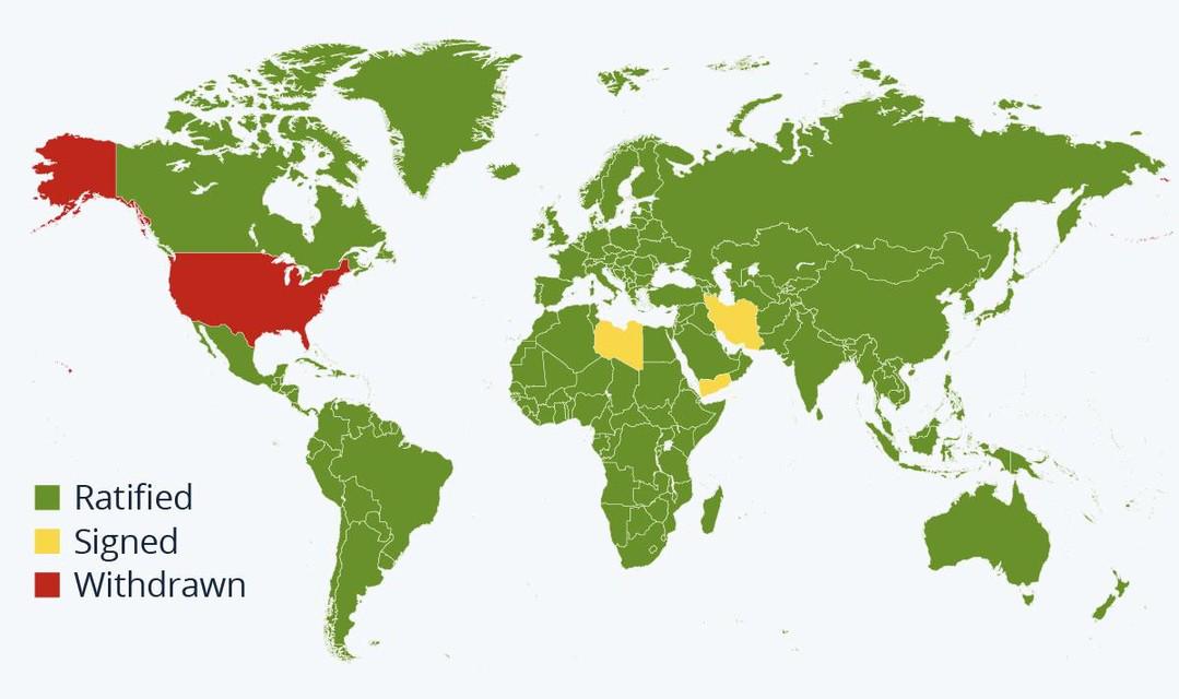
Paris Agreement Participation Status Map
This map provides a visual representation of countries that have ratified, signed, or withdrawn from the Paris Agreement...
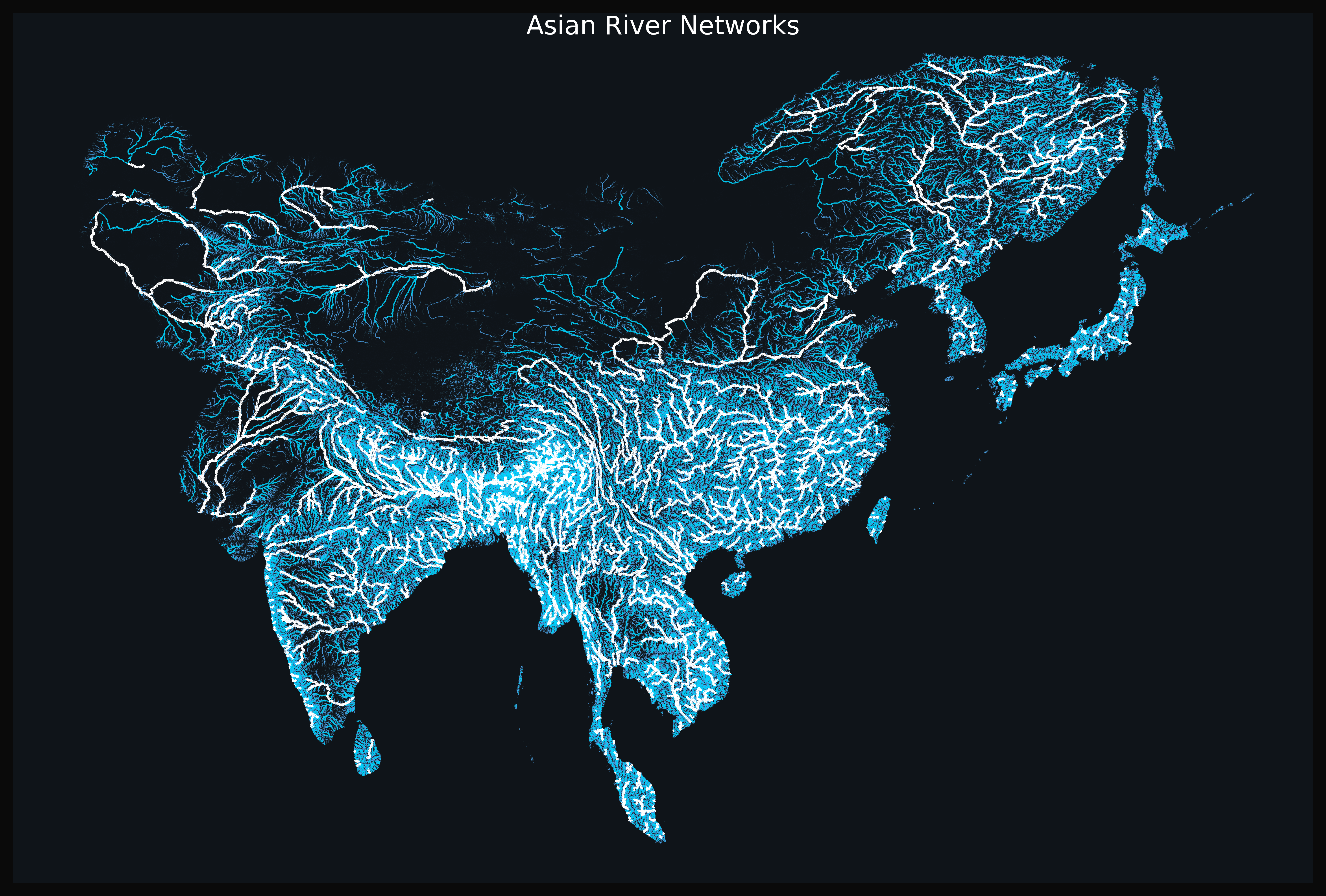
Asian River Networks Map
The "Asian River Networks Map" provides a detailed visualization of the intricate web of river systems across the contin...
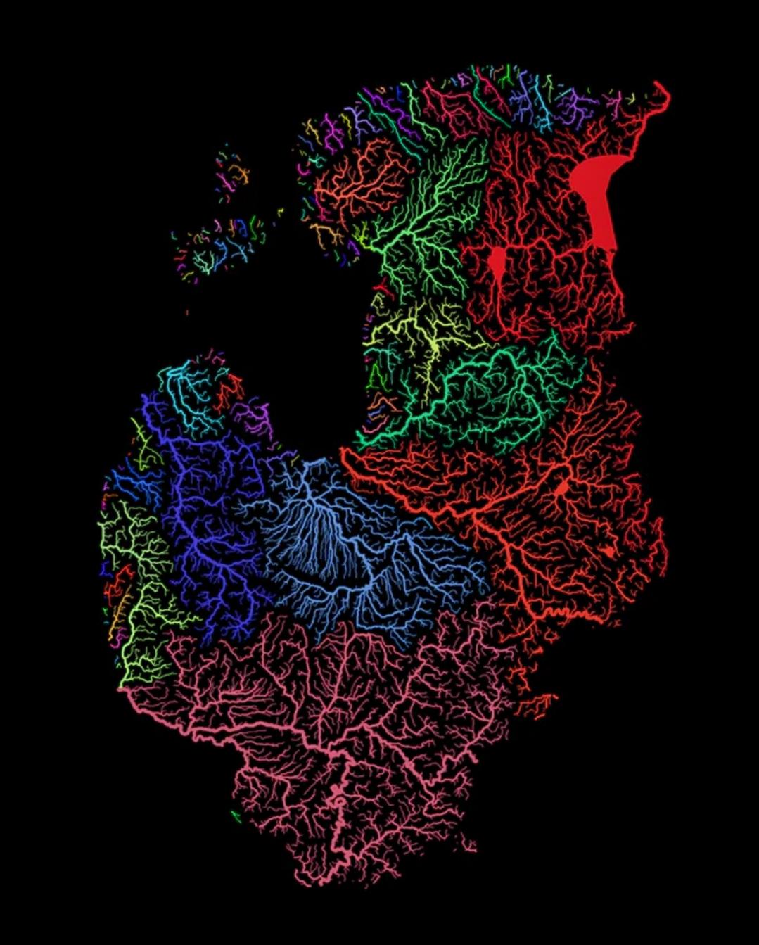
Rivers of the Baltic Nations Map
This map highlights the intricate network of rivers that flow through the Baltic nations of Estonia, Latvia, and Lithuan...
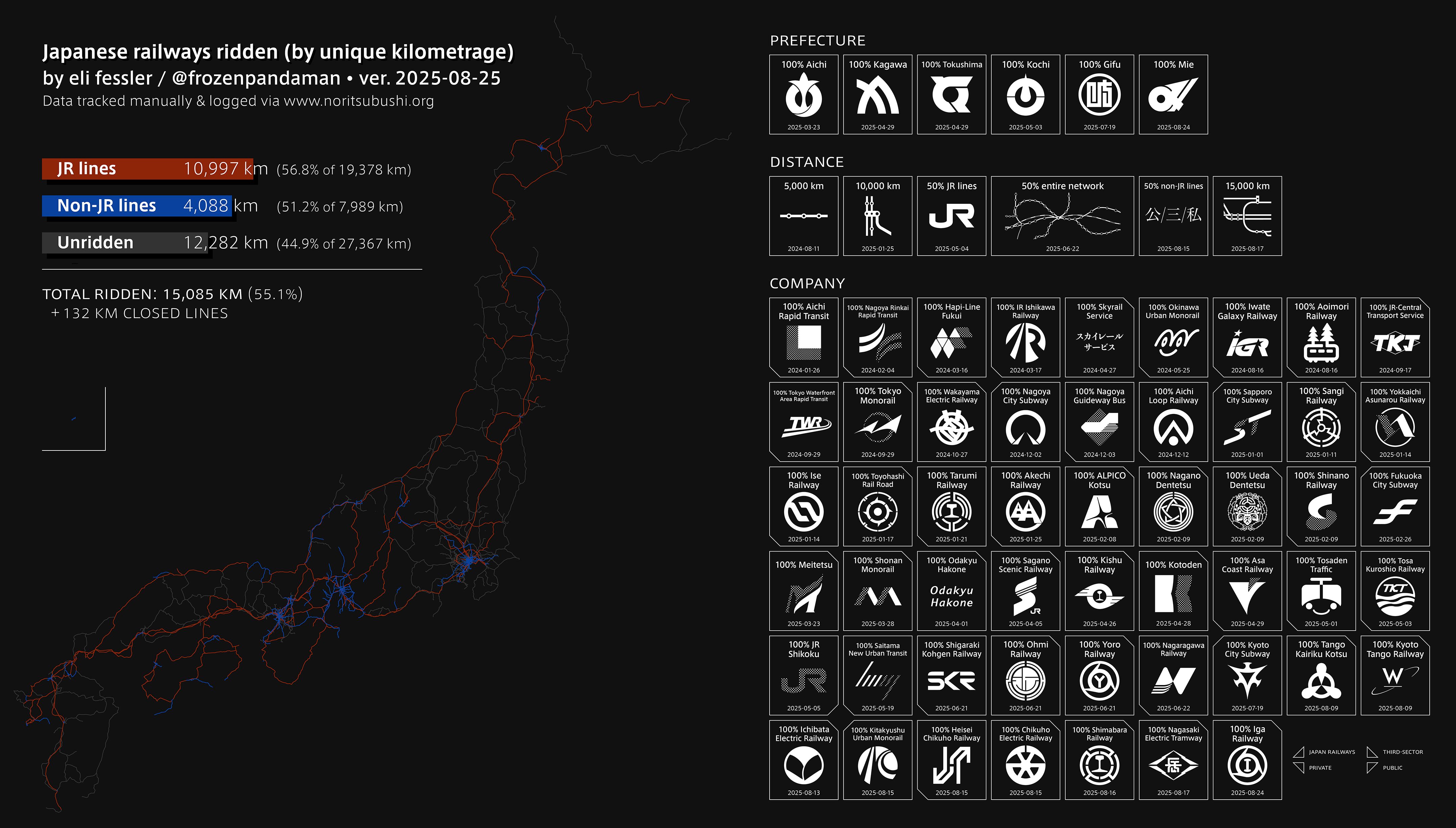
Railway Network Map of Japan
This engaging visualization highlights an impressive journey through Japan’s extensive railway network, showcasing a rem...
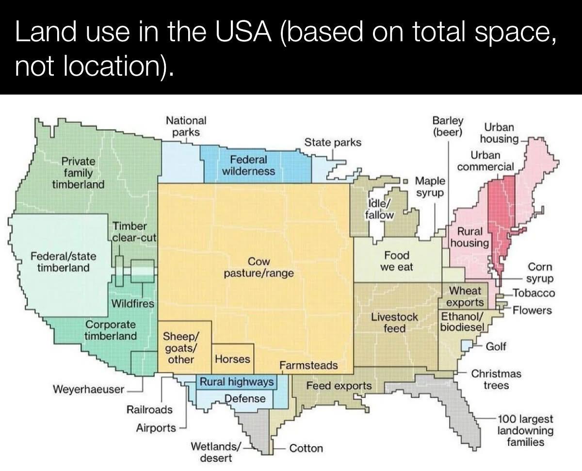
Land Use Map of the USA
The \...
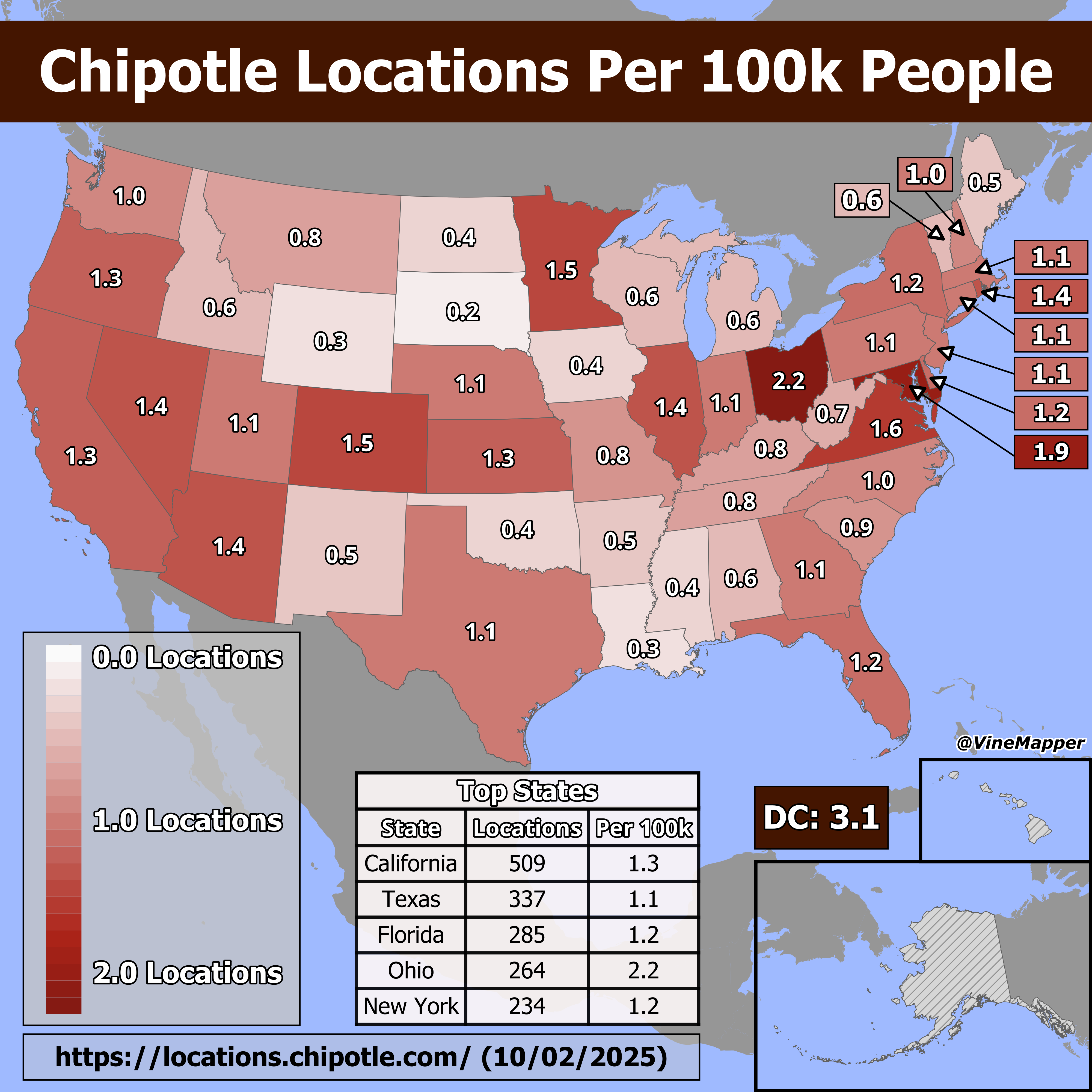
Chipotle Locations Per 100k People Map
The "Chipotle Locations Per 100k People" map provides a visual representation of how many Chipotle restaurants are avail...

Public Bathroom Locations Map in Finland
...
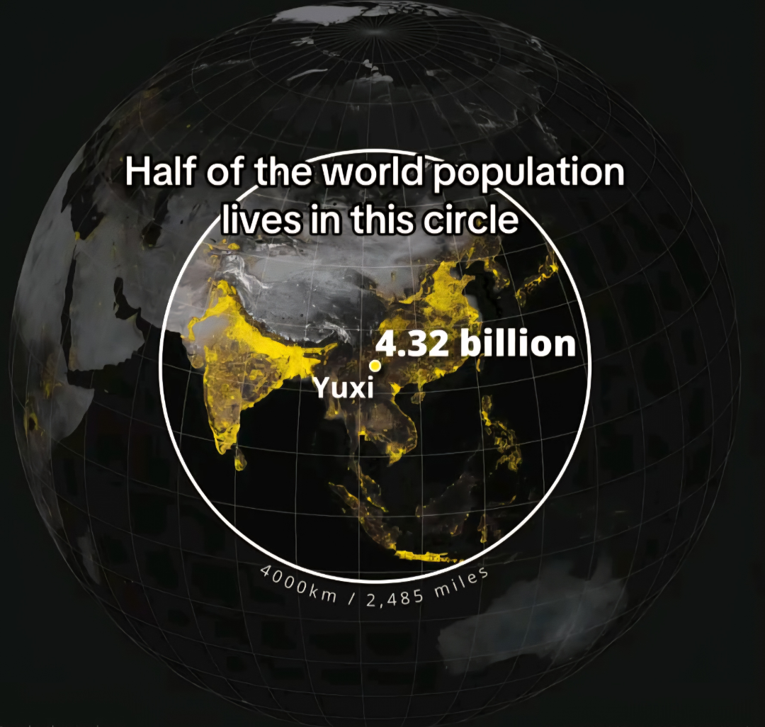
Population Distribution Map of the World
The \...
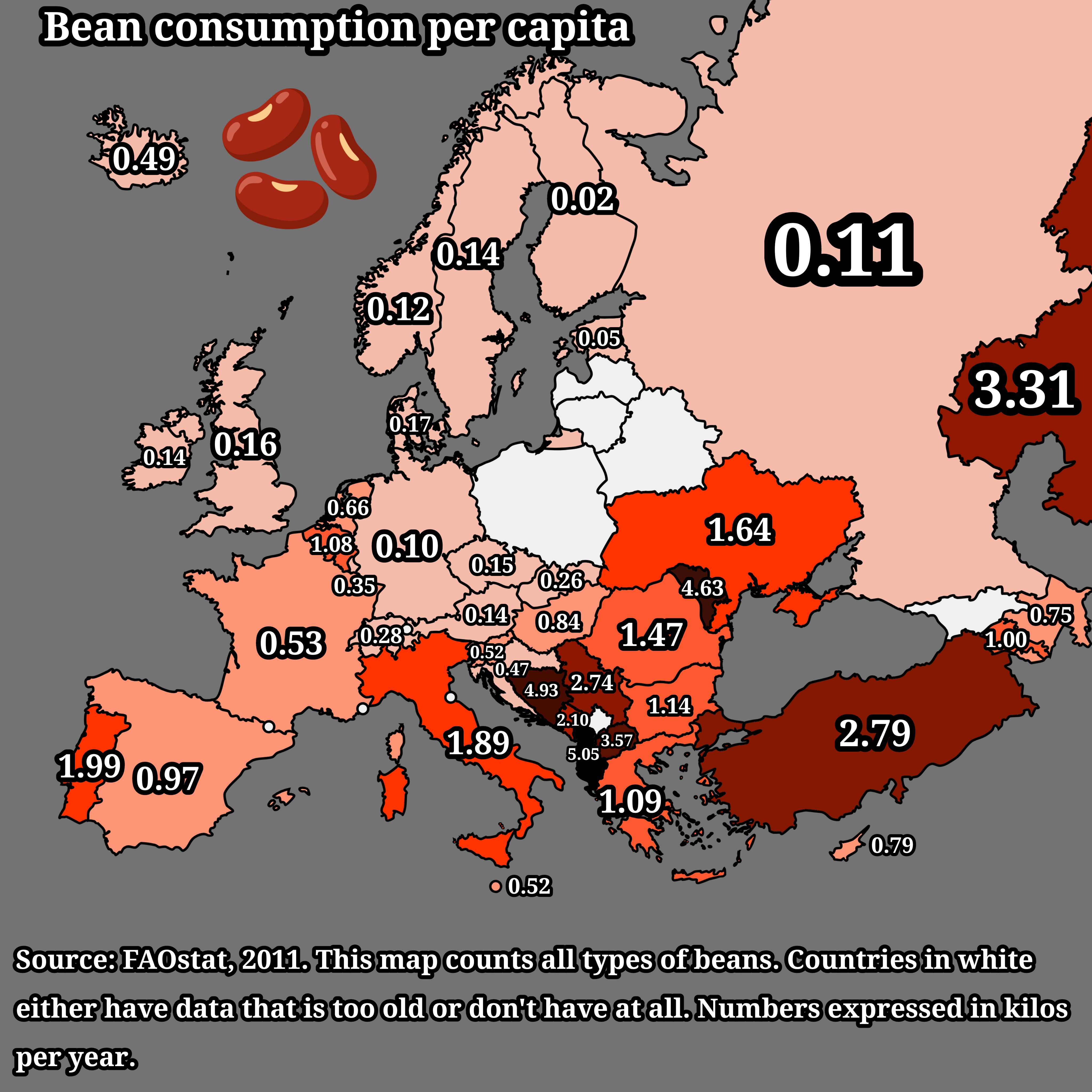
Bean Consumption Per Capita in Europe Map
The "Bean Consumption Per Capita in Europe Map" provides a detailed visualization of the average bean consumption across...
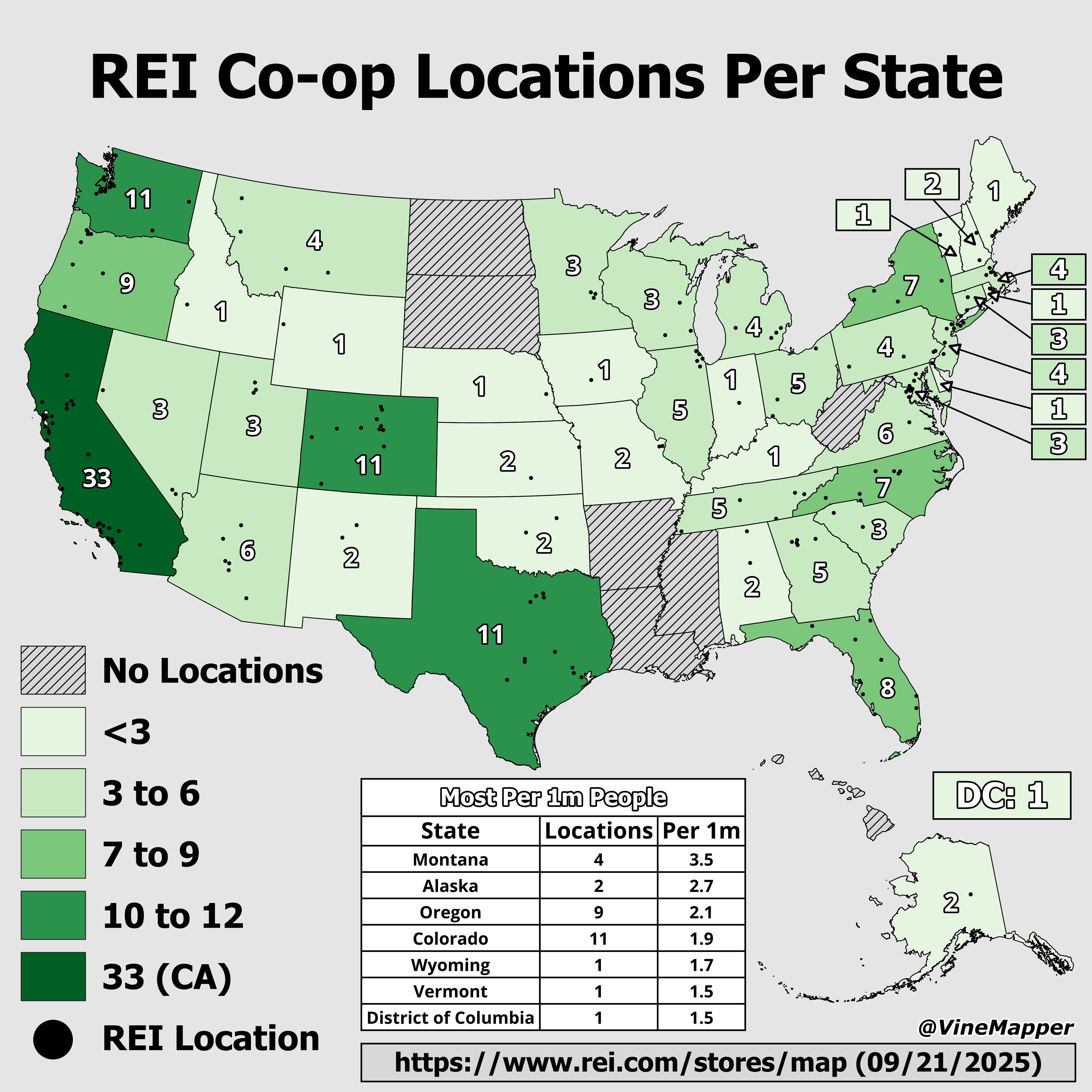
REI Co-op Locations by State Map
The "REI Co-op Locations by State Map" provides a clear visual representation of the distribution of REI retail location...
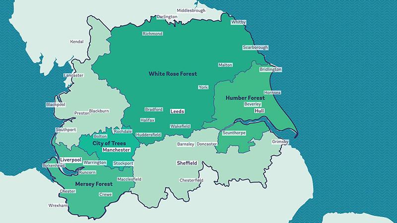
Reforesting Britain Map – The Northern Forest Map
The "Reforesting Britain Map – The Northern Forest" focuses on a significant environmental initiative launched in 2018. ...
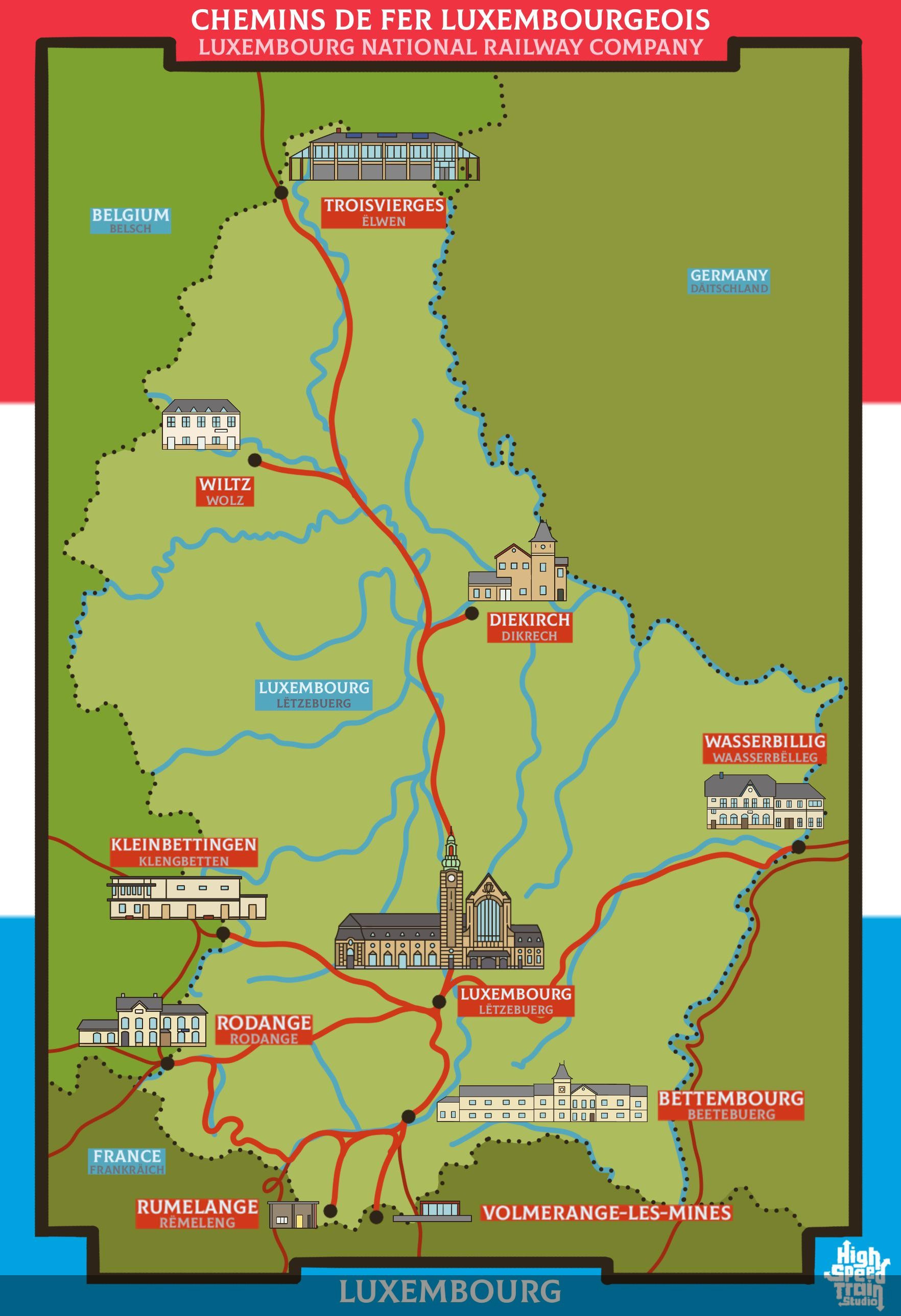
Rail Network Map of Luxembourg
The rail network map of Luxembourg provides a comprehensive view of the country's railway infrastructure, highlighting t...
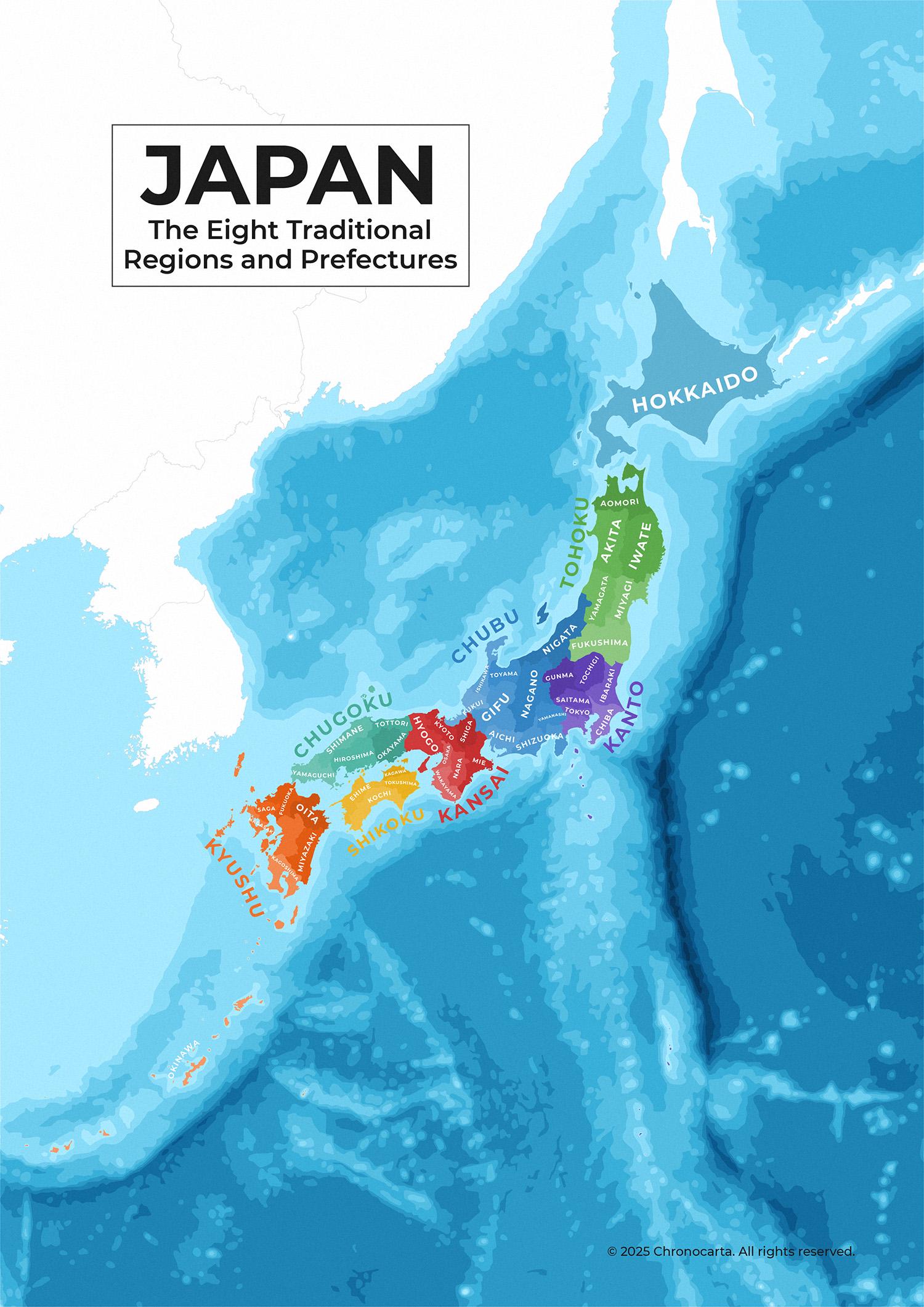
Japan’s Traditional Regions and Prefectures Map
This detailed administrative map of Japan illustrates the country's eight traditional regions and their corresponding pr...
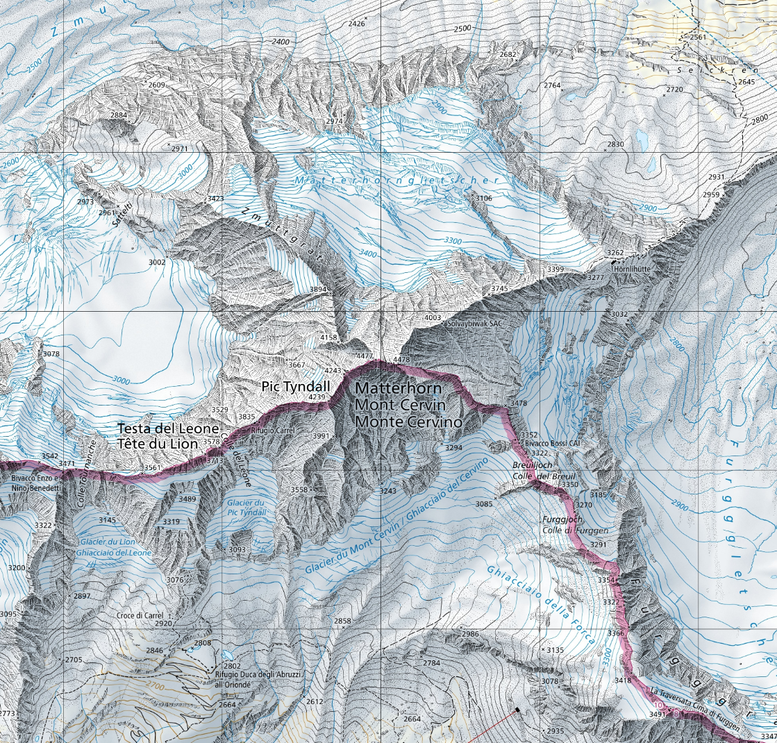
Matterhorn Location Map of Switzerland
The map titled \...