population Maps
74 geographic visualizations tagged with "population"
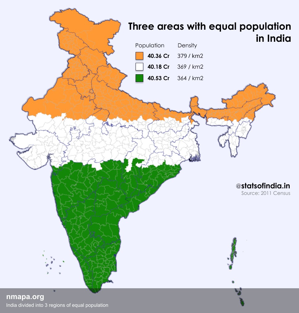
Population Map: India divided into 3 regions of equal population
This map displays "India divided into 3 regions of equal population" and provides a clear visual representation of the g...
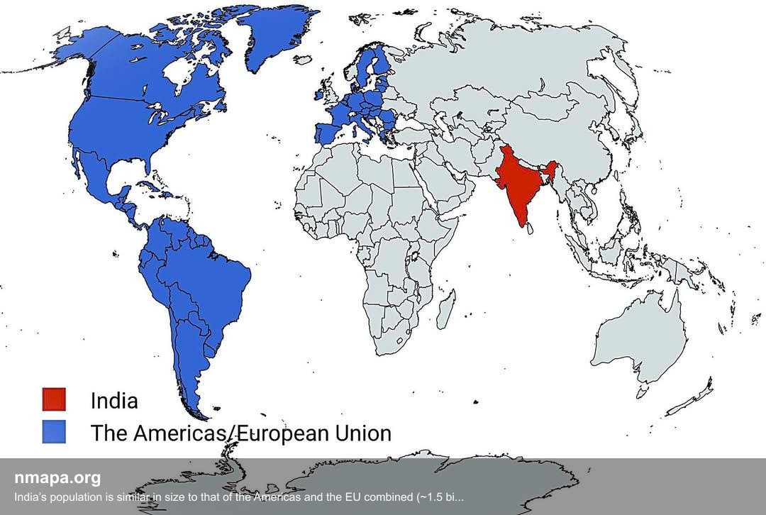
Population Map: India’s population is similar in size to that of the Americas and the EU combined (~1.5 billion)
This map displays "India’s population is similar in size to that of the Americas and the EU combined (~1.5 billion)" and...
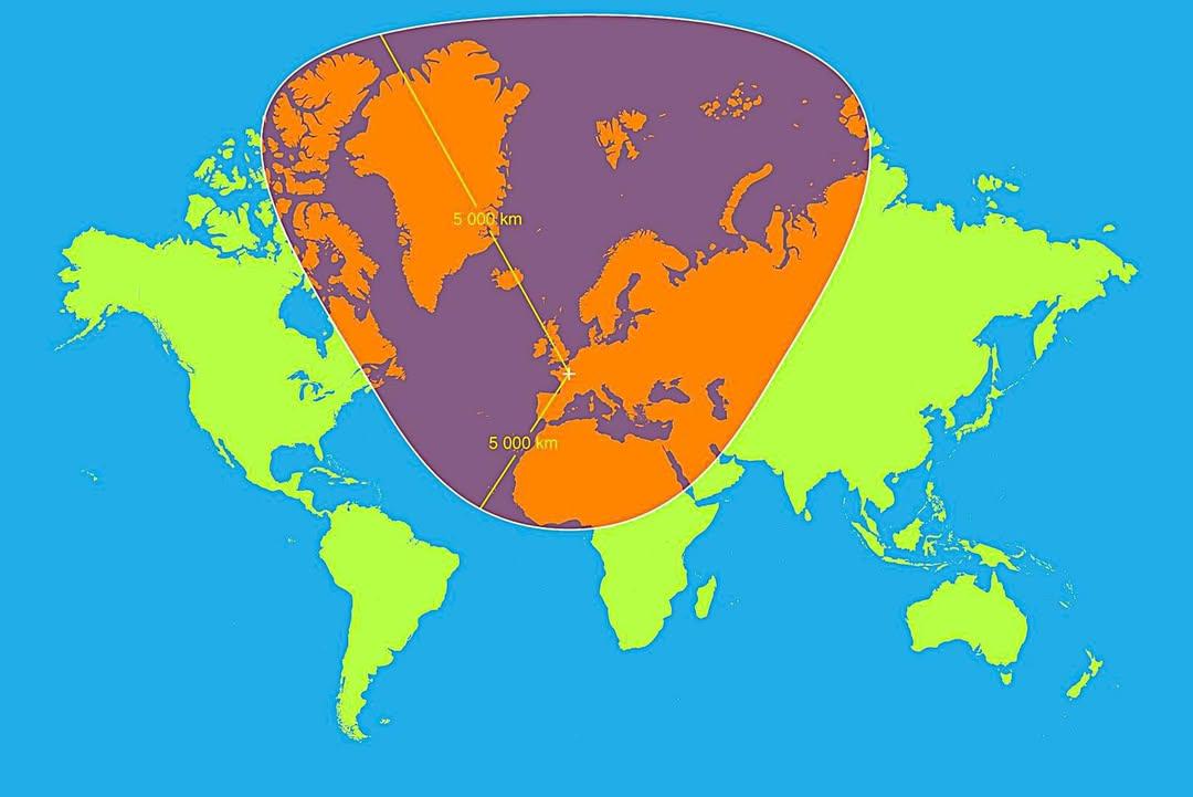
Map of 5,000km Radius from Paris
This map visualizes a circle with a 5,000 km radius centered on Paris, France. It highlights an extensive area that span...
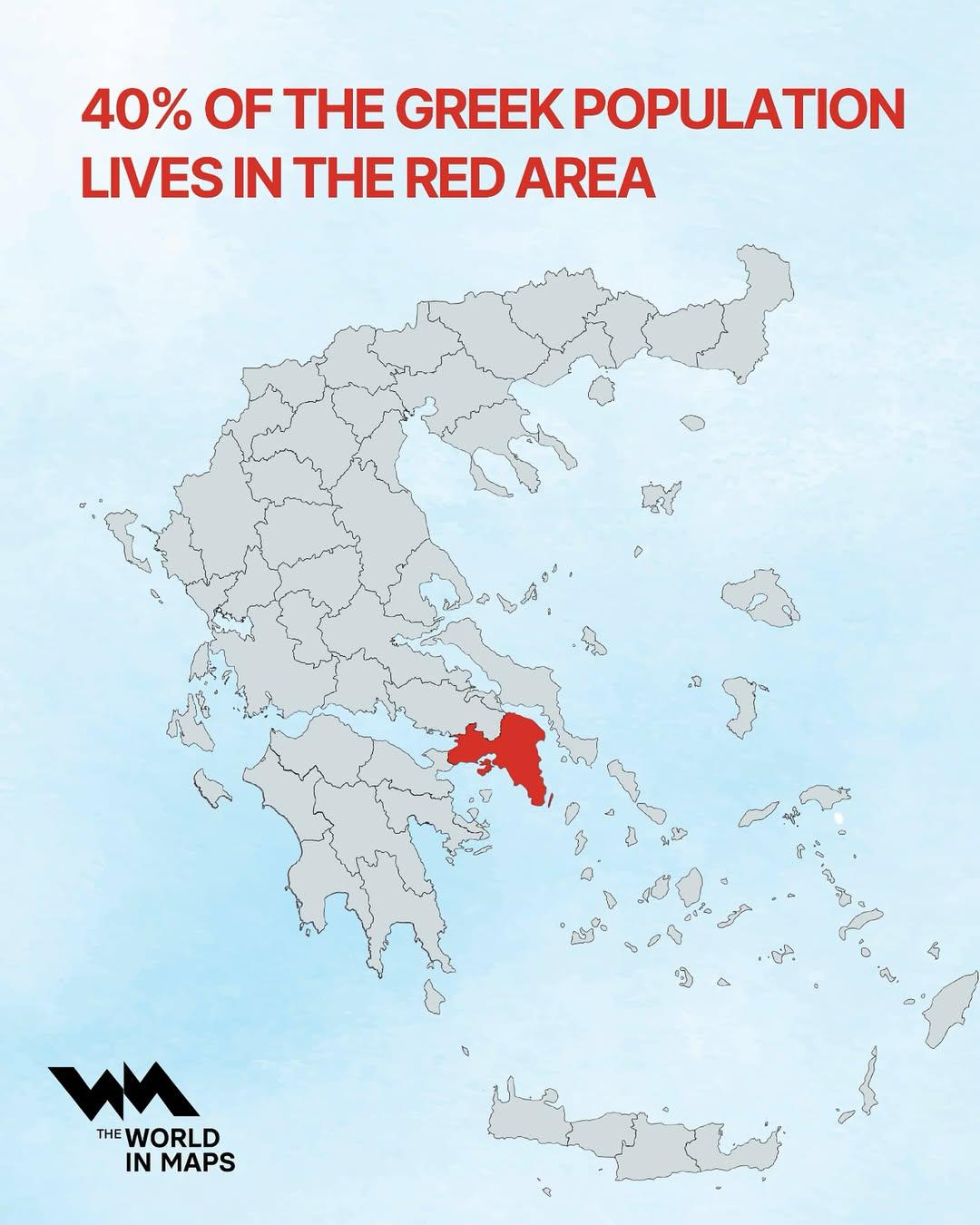
Population Distribution Map of Greece
This map illustrates a striking demographic trend in Greece: approximately 40% of the nation's population resides within...
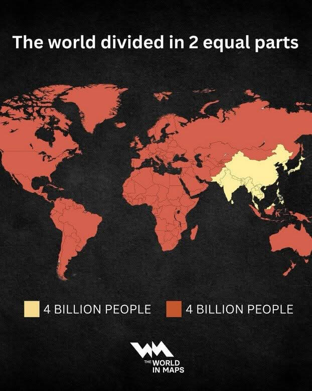
World Population Distribution Map
The 'World Population Distribution Map' effectively visualizes how the global population is divided into two equal parts...
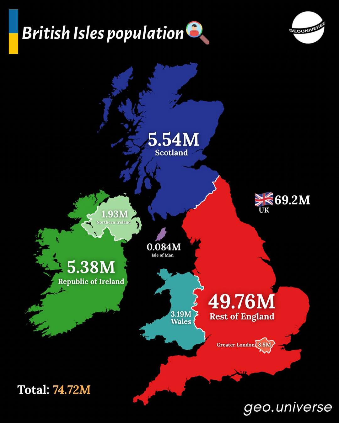
Population Distribution Map of the British Isles
The "British Isles by Population" map presents a detailed visualization of the population distribution across the Britis...
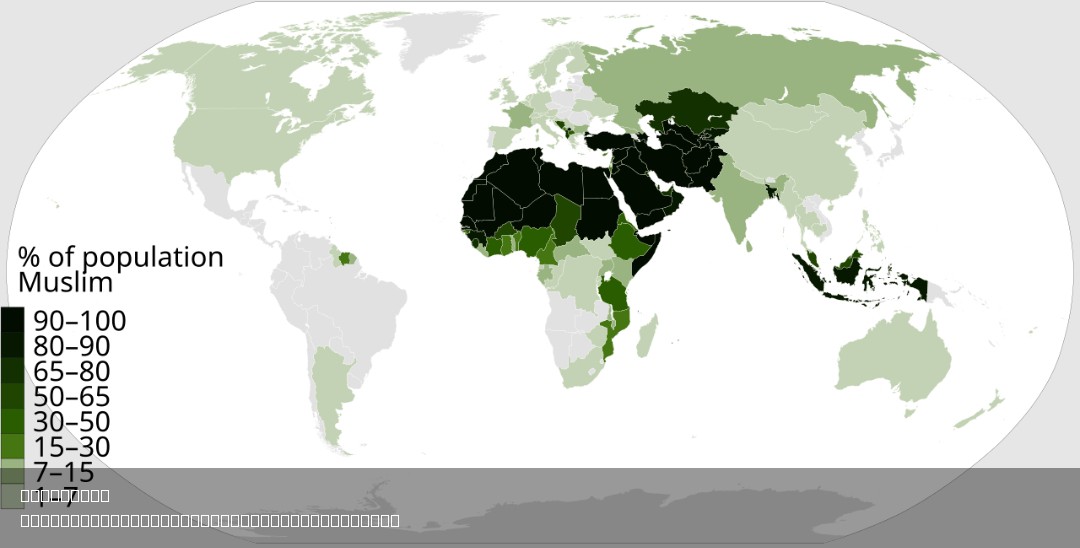
% of Muslim Population by Country Map
This map visually represents the percentage of the Muslim population in each country around the world. By highlighting t...
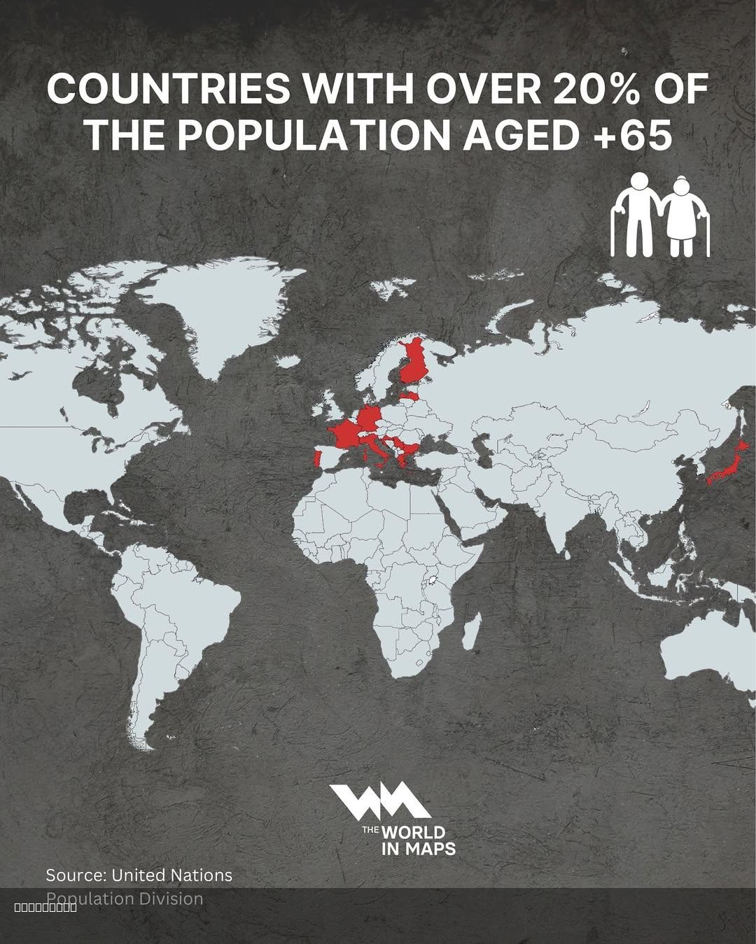
Countries with Over 20% Population Aged 65+ Map
This map illustrates the countries where over 20% of the population is aged 65 years and older. This demographic visuali...
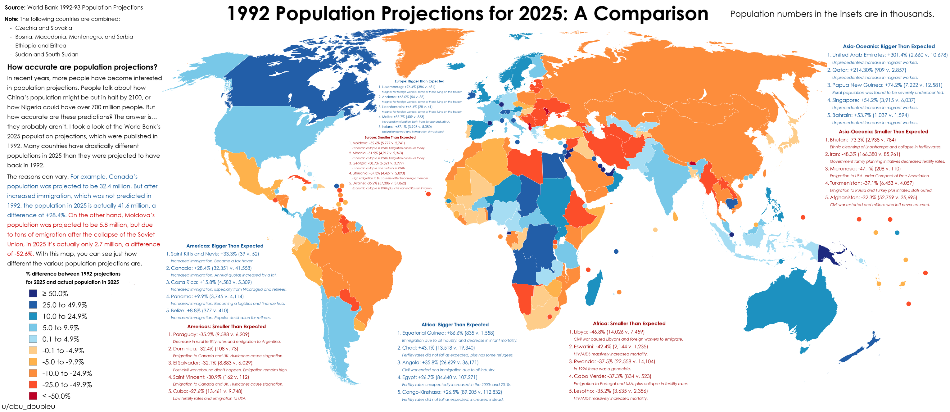
2025 Population Projections Accuracy Map
The map titled "How accurate were 2025 population projections from 1992?" provides a striking visual representation of t...
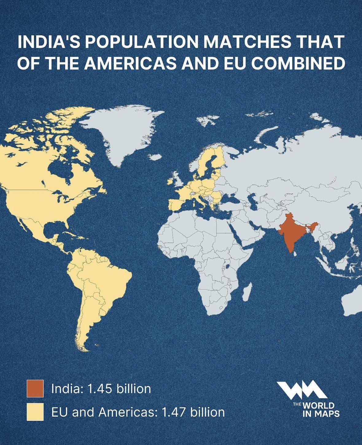
India Population Compared to Americas & EU Map
This map illustrates a striking demographic milestone: India’s population, standing at approximately 1.45 billion, now n...
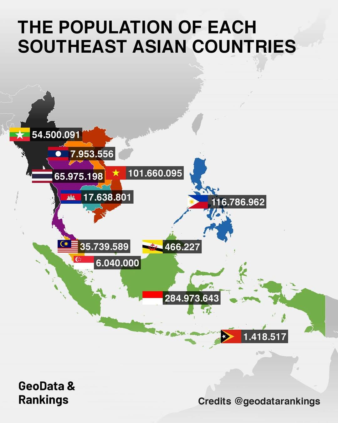
Population Map of Southeast Asian Countries
The "Population Map of Southeast Asian Countries" provides a clear visual representation of the population distribution ...
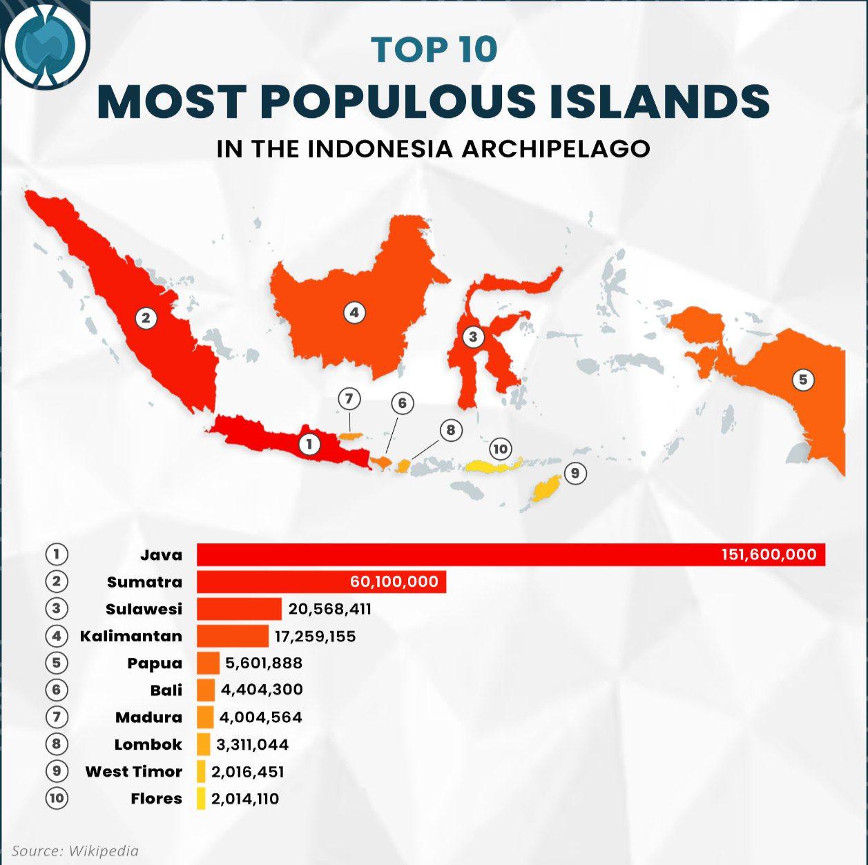
Population Map of Indonesia's Most Populous Islands
The visualization titled "Top 10 Most Populous Islands in the Indonesia Archipelago" provides a clear representation of ...
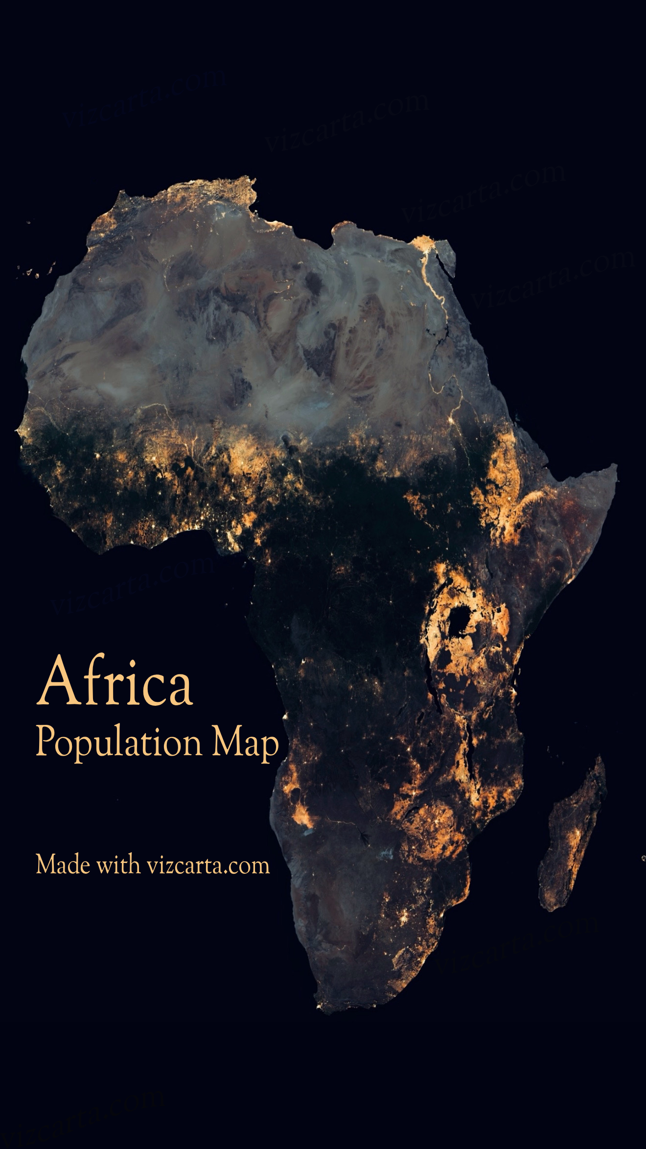
Africa Population Map
The Africa Population Map provides a visual representation of the demographic distribution across the continent. It illu...
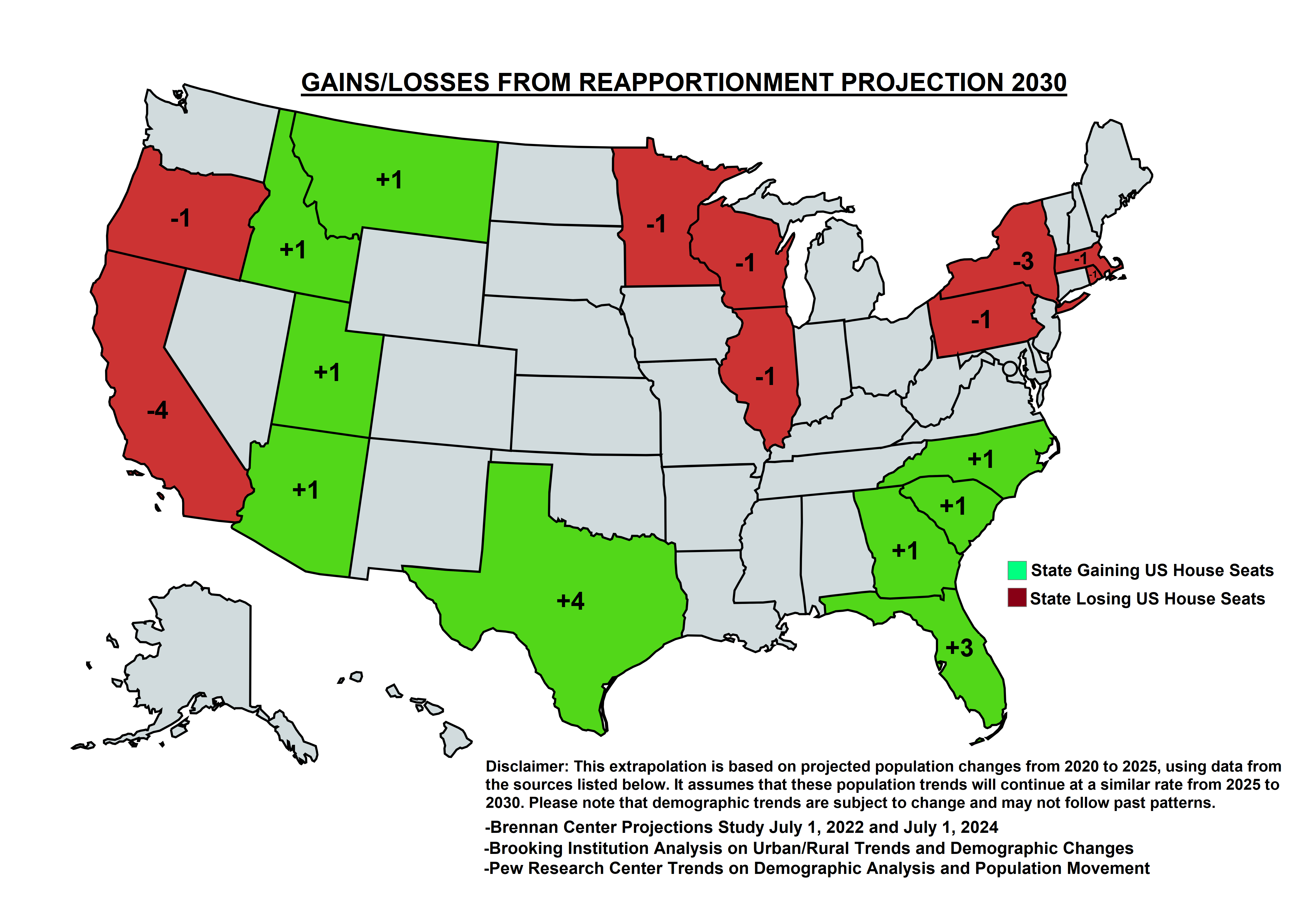
Projected Changes in US House Seats Map
The "Projected Changes in US House Seats from Reapportionment in 2030" map provides a visual representation of how congr...
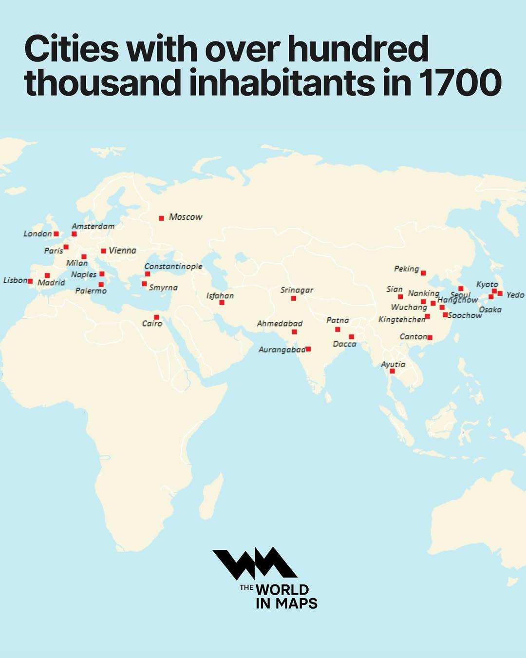
Cities with Over 100,000 Inhabitants in 1700 Map
The "Cities with Over 100,000 Inhabitants in 1700 Map" provides a fascinating glimpse into urbanization during the early...
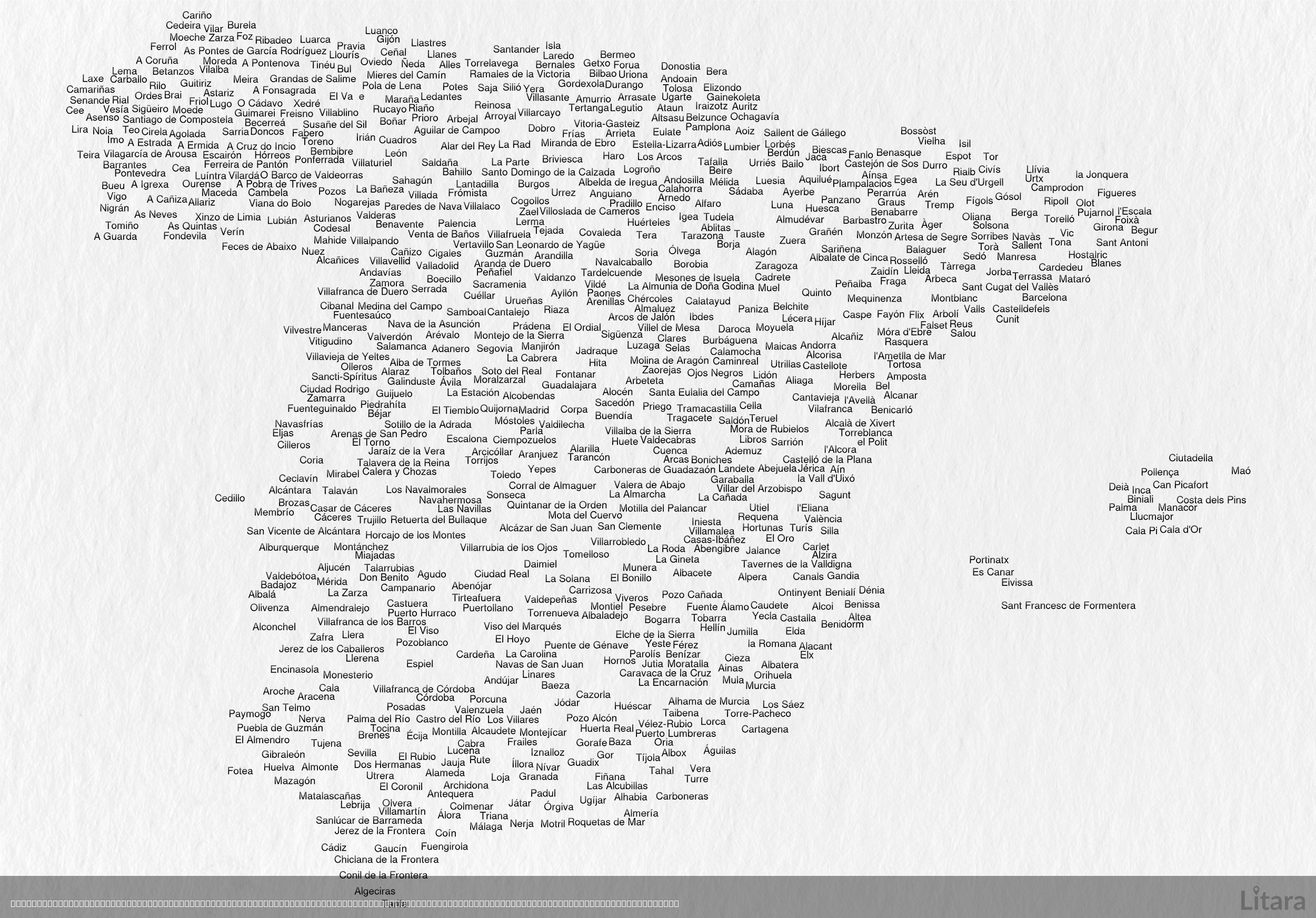
Typographic Map of Spain's Cities and Towns
This intriguing typographic map of Spain creatively illustrates the country's geographic shape using the names of hundre...
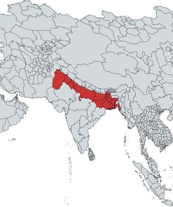
Global Population Distribution Map
The map highlights a significant area in red, representing approximately 890 million people, which is about 11% of the w...
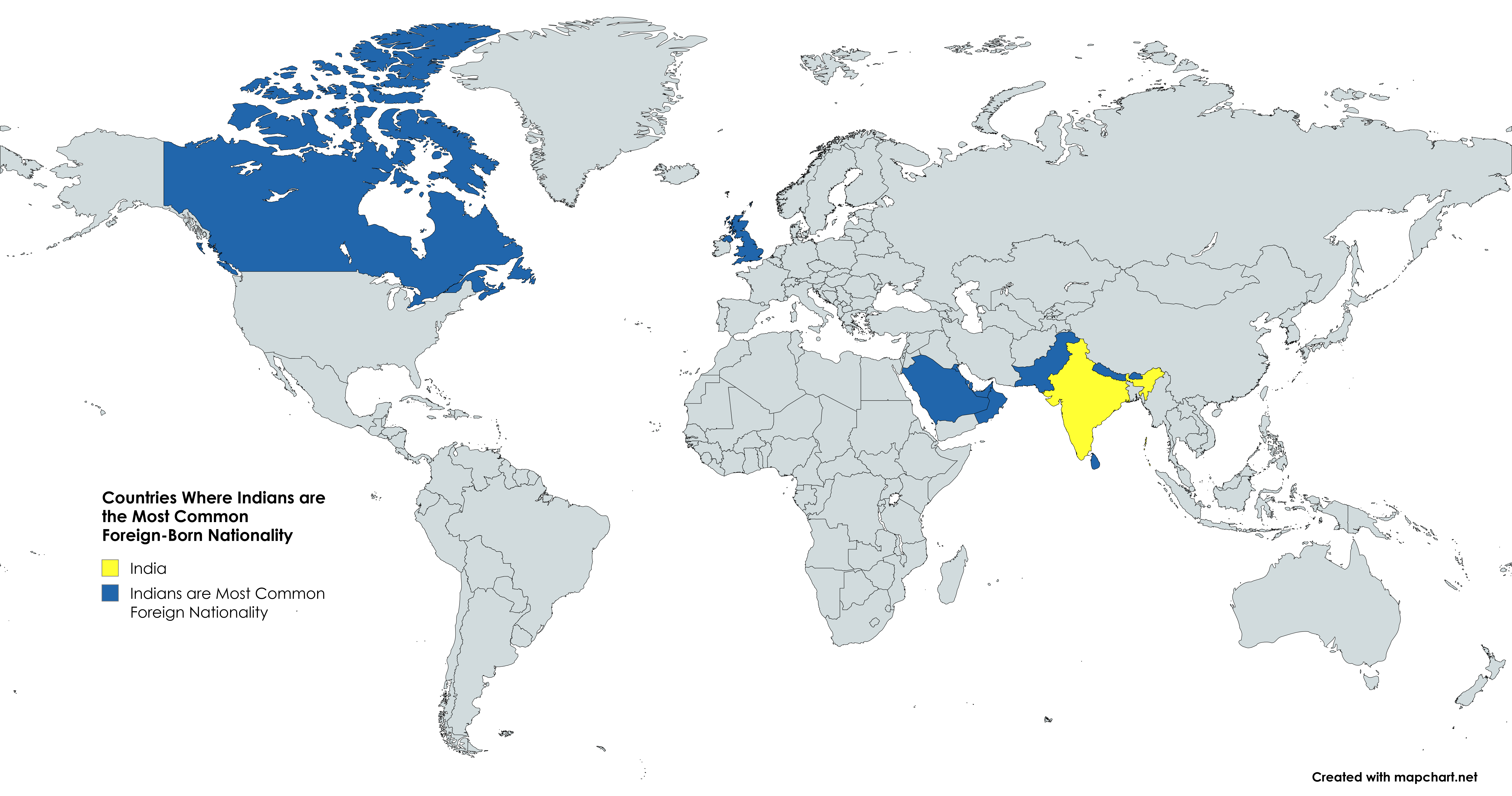
Countries Map Where Indians are the Most Common Foreign-Born Nationality
This map illustrates the countries where Indians constitute the largest segment of the foreign-born population. The visu...
World Population Distribution Map
The "World Population Distribution Map" visualizes where people live across the globe, highlighting the density of popul...
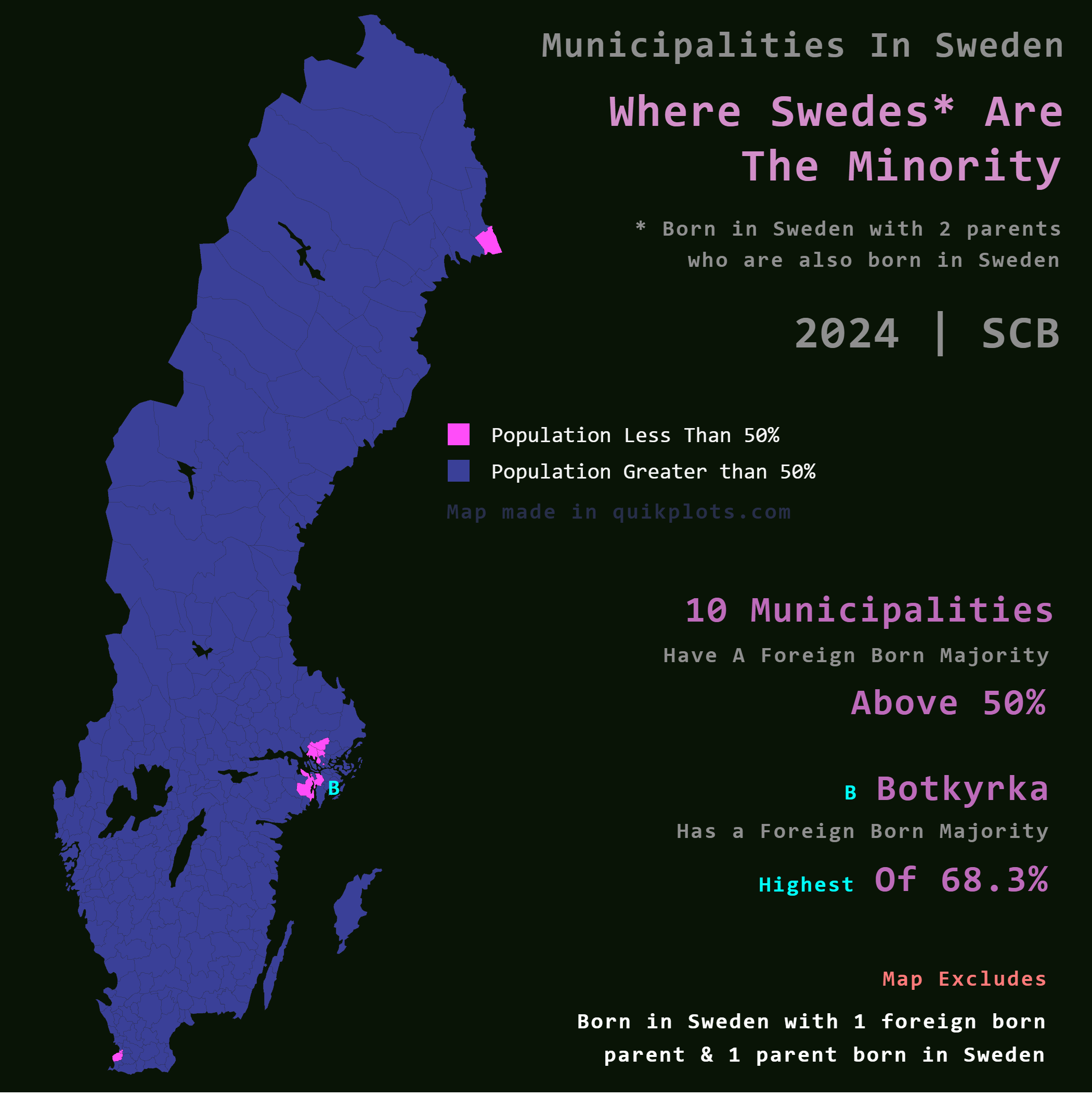
Map of Municipalities with Foreign Majority in Sweden
The map titled "Where Swedes are the Minority in Sweden" provides an intriguing look into the demographic landscape of t...
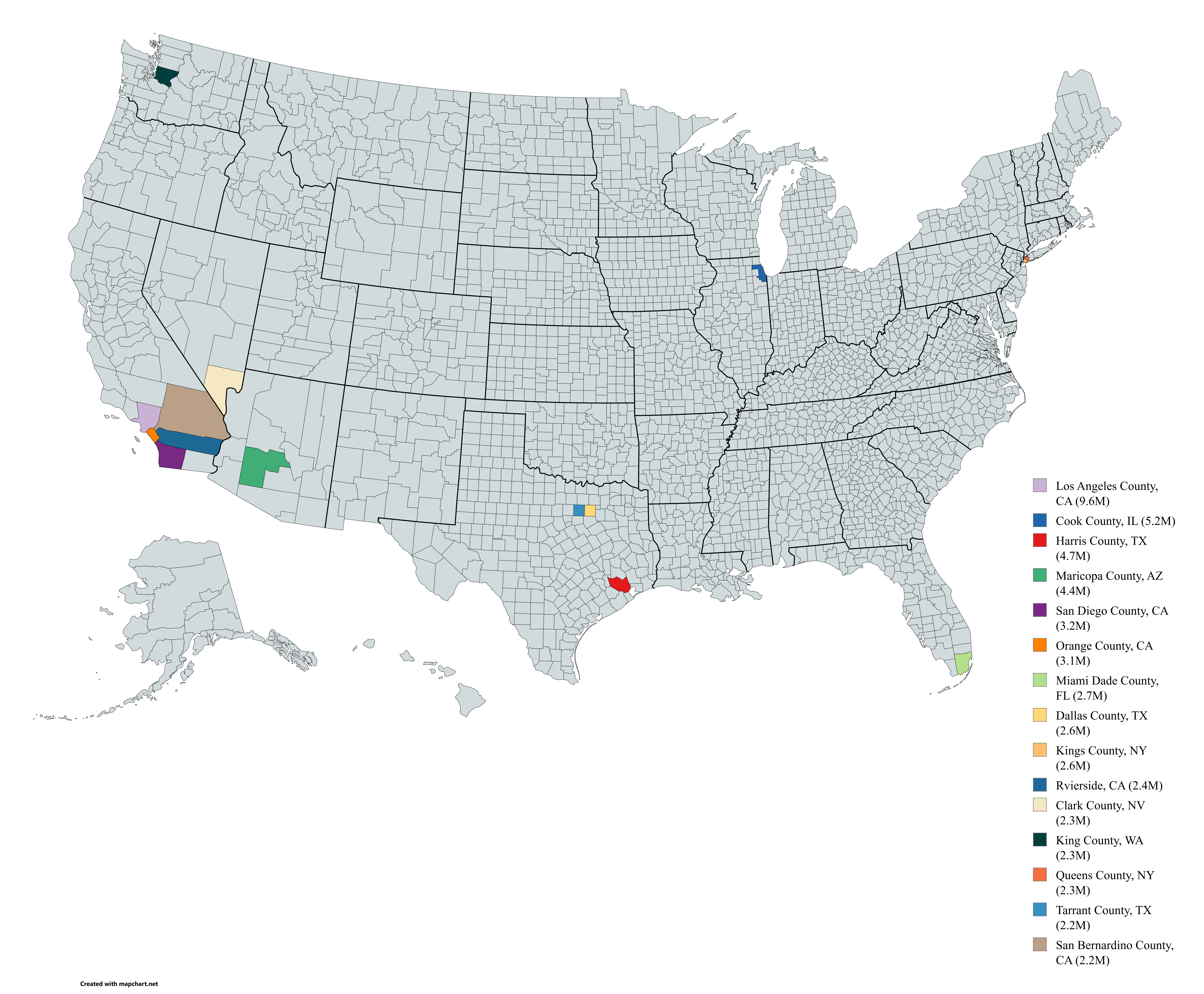
Most Populated US Counties Map
Interestingly, the top counties are often those that experience the highest rates of internal migration. In recent years...
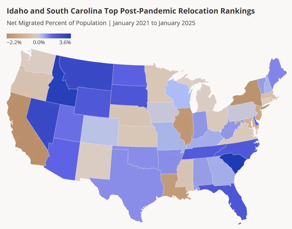
Net Migration Percent of US State Population Map
...
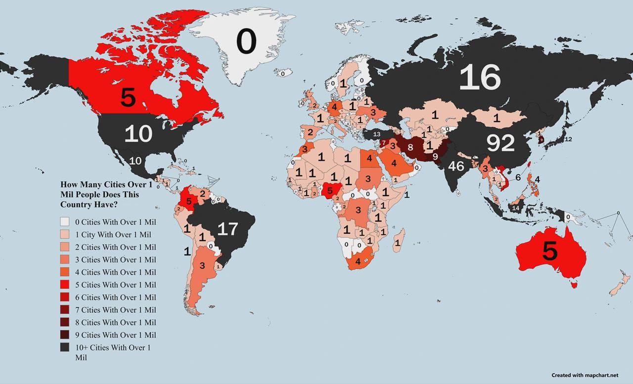
Countries Ranked by Cities with 1M+ Population Map
The visualization titled "Countries Ranked by Number of Cities with 1M+ Population Map" provides a clear representation ...
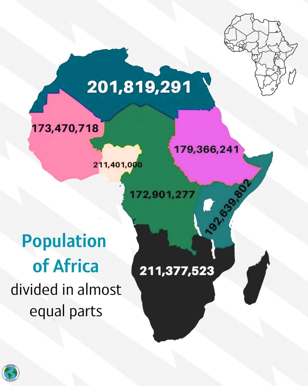
Population Distribution Map of Africa
The visualization titled \...
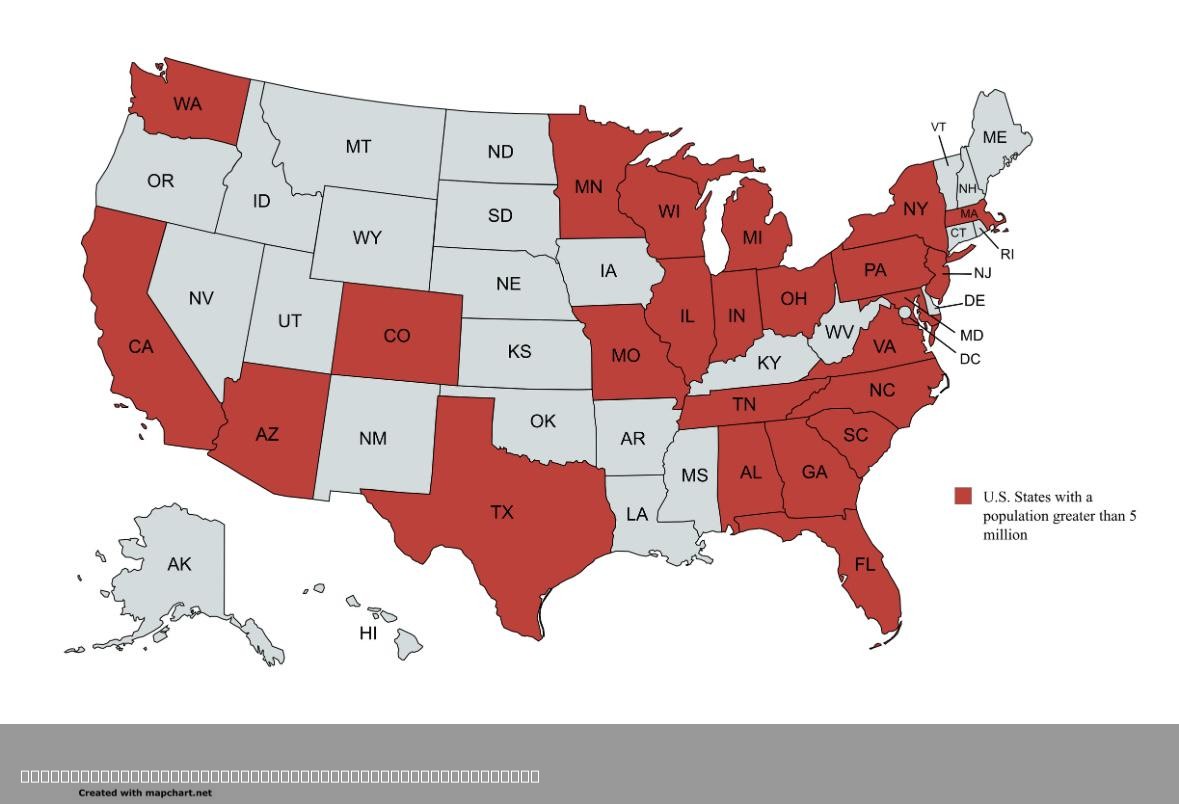
U.S. States with Population Greater than 5 Million Map
This map visualizes the U.S. states that have a population exceeding 5 million people. This population threshold highlig...
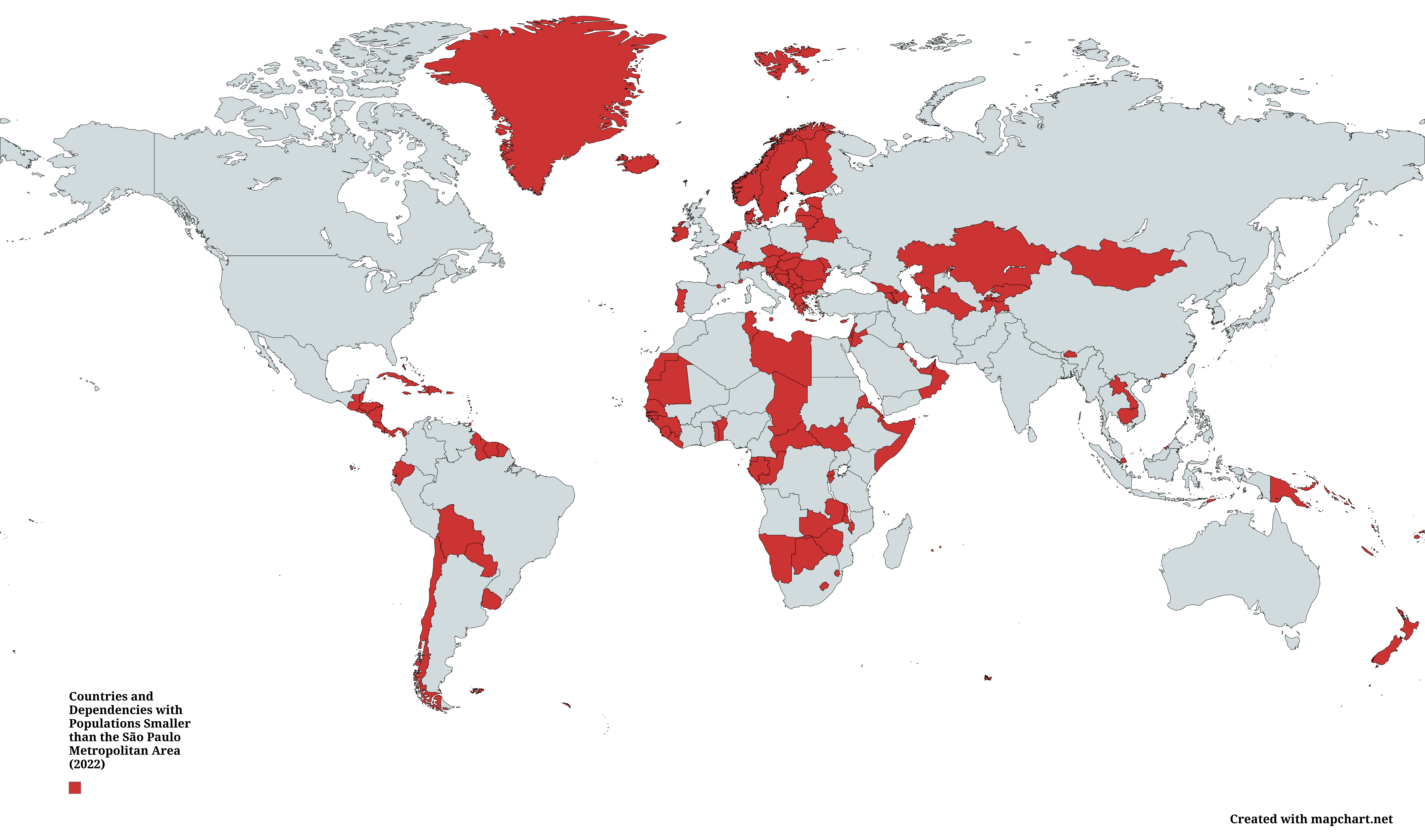
Countries with Populations Smaller than São Paulo Map
This map illustrates a fascinating comparison of countries and dependent territories whose total populations were smalle...
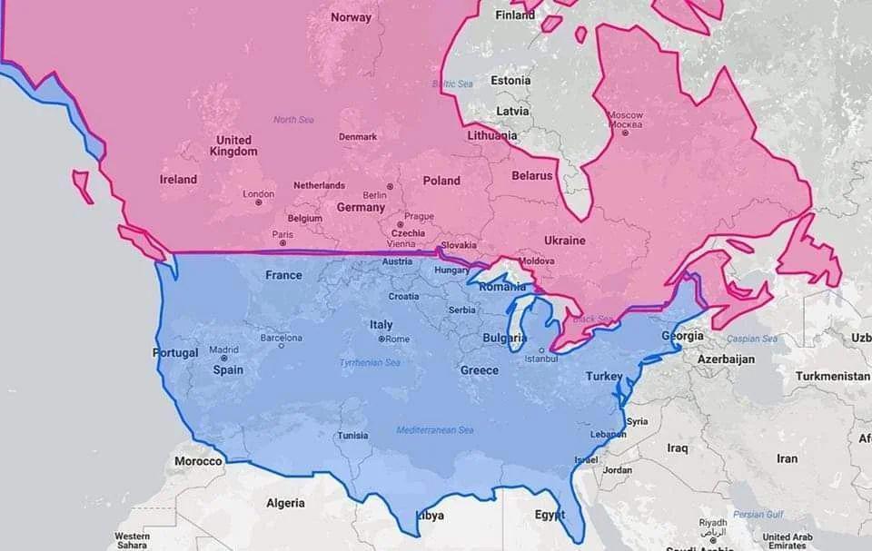
Latitude Map of United States, Canada, and Europe
The visualization titled "United States & Canada in same latitude w/ Europe" highlights the parallels of latitude that c...
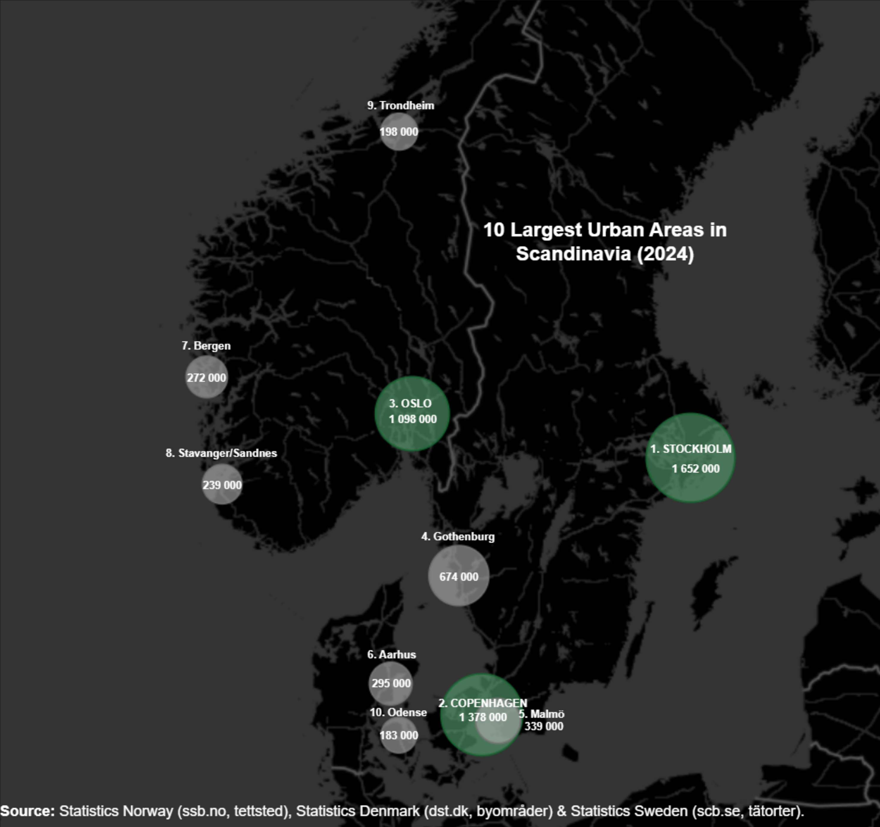
Largest Cities in Scandinavia Map
Scandinavia has experienced a steady increase in urban population over the past few decades. For instance, Stockholm, th...
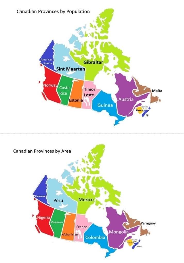
Canadian Provinces and Territories Size and Population Map
This map presents a fascinating comparison between the provinces and territories of Canada and various countries that sh...
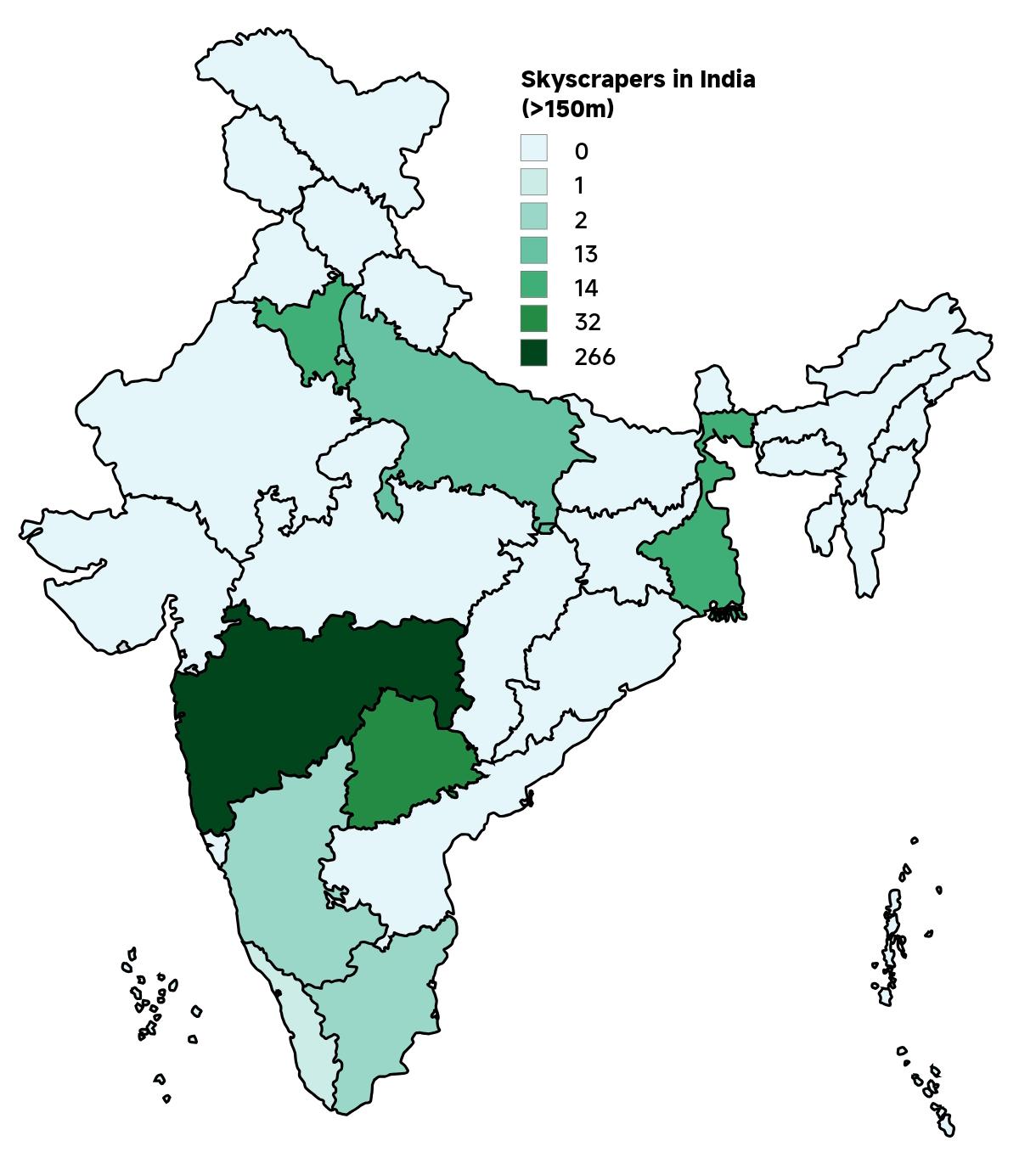
Skyscrapers in India Map 2025
The "Skyscrapers in India Map 2025" provides a comprehensive visualization of the country's towering architectural achie...
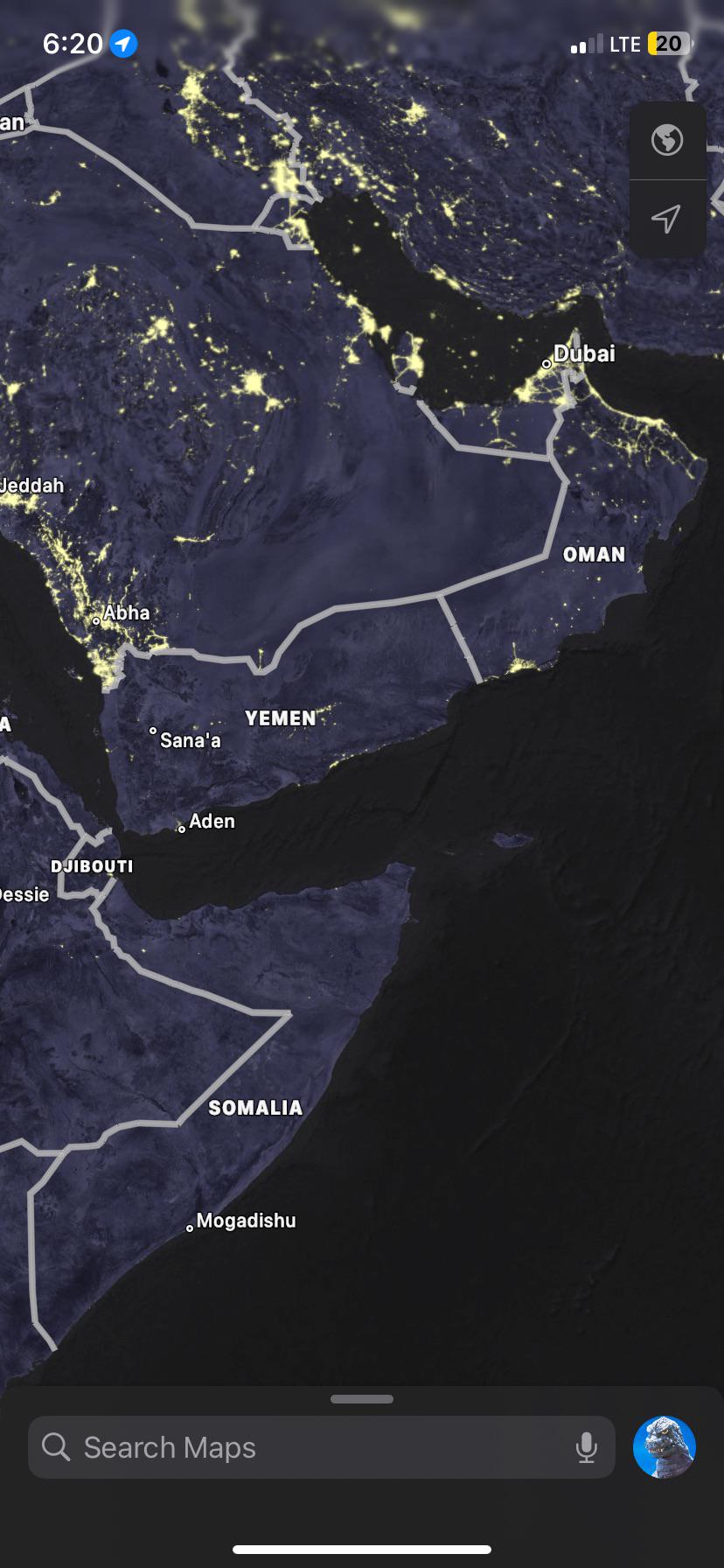
GDP and Population Comparison Map of Oman and Yemen
The visualization titled "Oman 100 Billion Dollar GDP and 5 Million Population vs Yemen 20 Billion GDP and 35 Million Po...
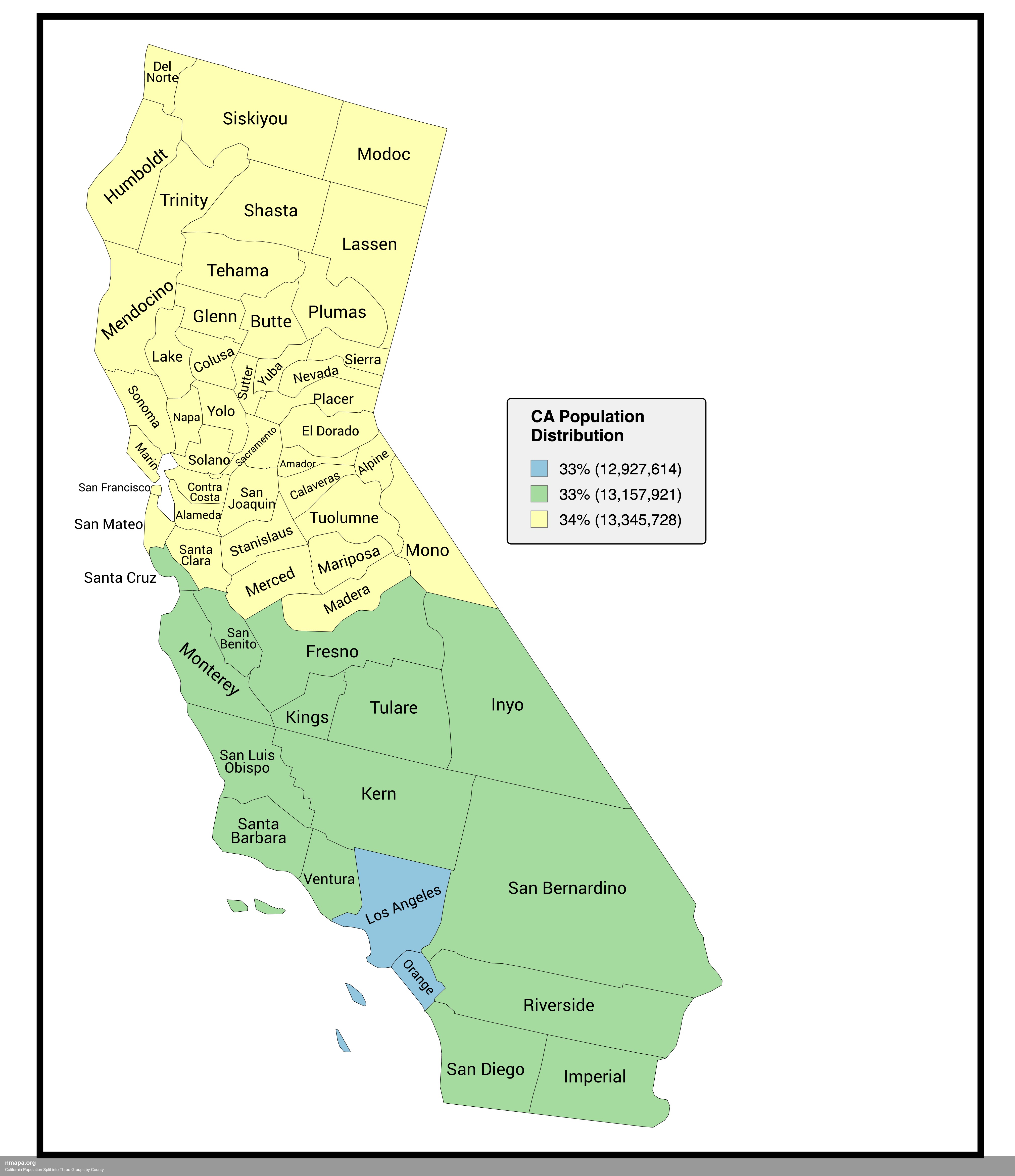
Explore the California Population Map: A County-Level Breakdown
The 'California Population Split into Three Groups by County' map offers a detailed visualization of the demographic lan...
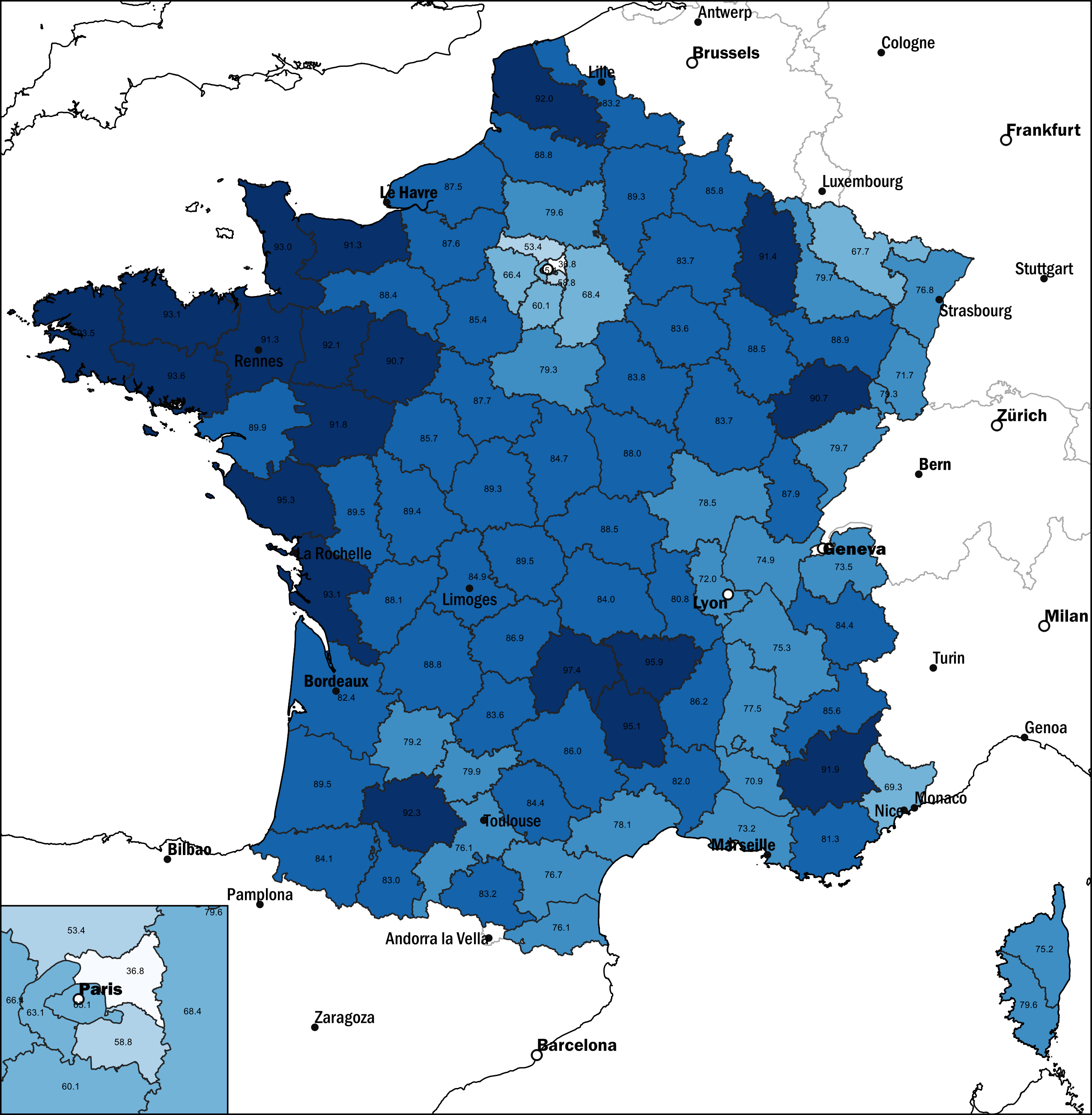
Map of French Population Without Migration Background, 2021
This map displays the percentage of the French population without a migration background as of 2021. It highlights the d...
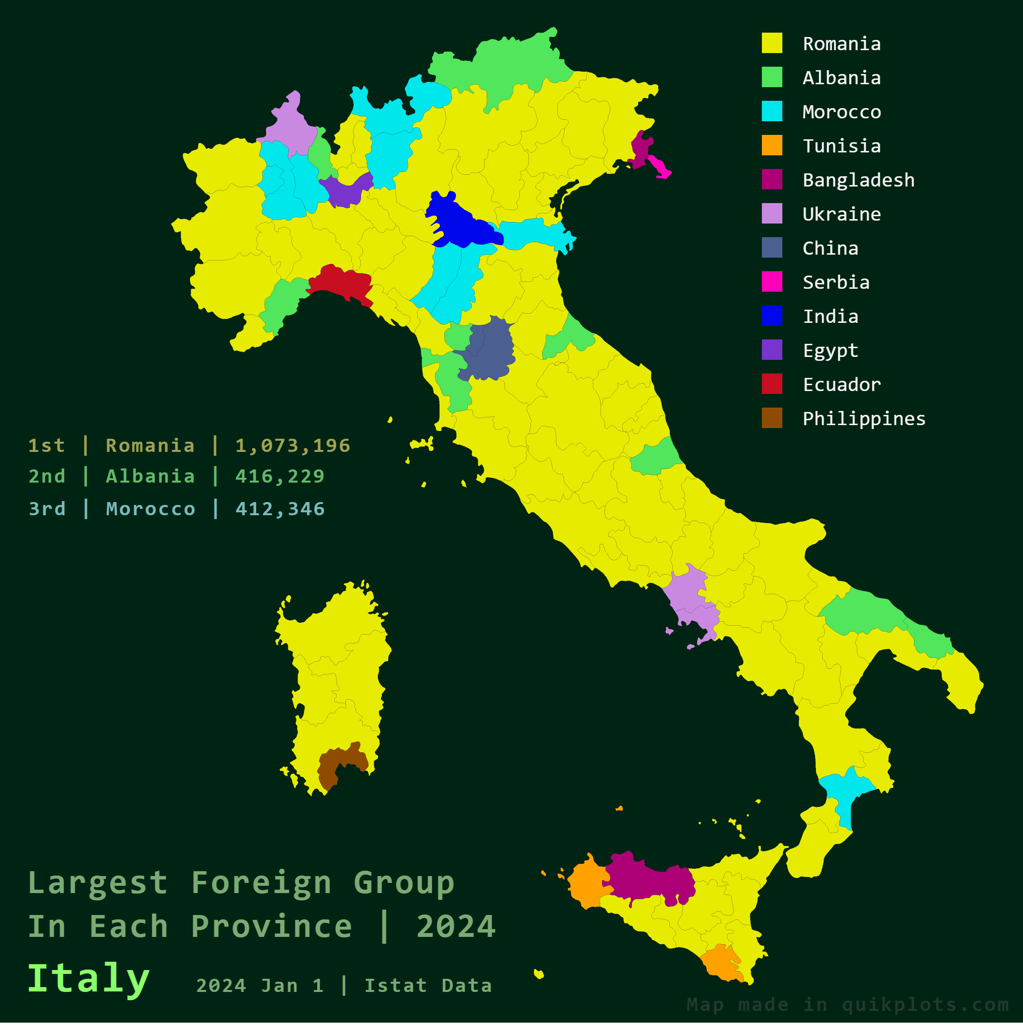
Largest Foreign Groups in Italy Map
The \...
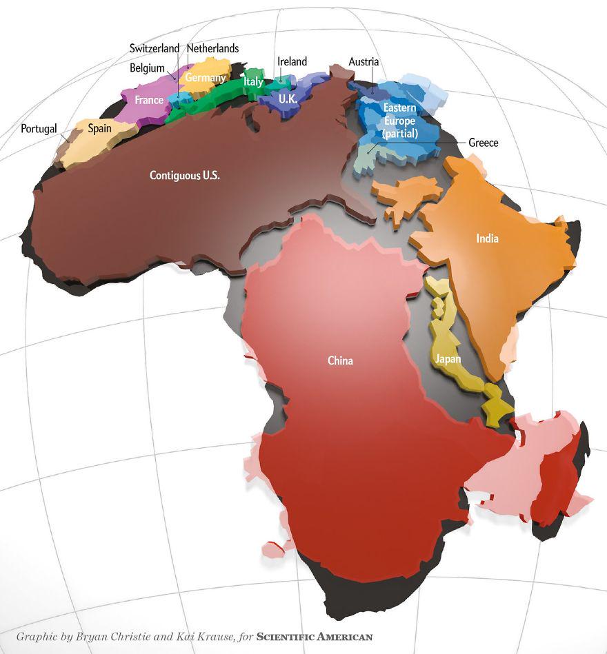
Actual Size of Africa Map
The 'Actual Size of Africa Map' presents a striking visual representation that highlights the continent’s true dimension...
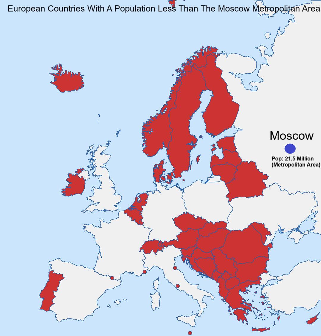
European Countries With Population Less Than Moscow Map
This map visualizes the European countries whose populations are smaller than that of the Moscow metropolitan area, whic...
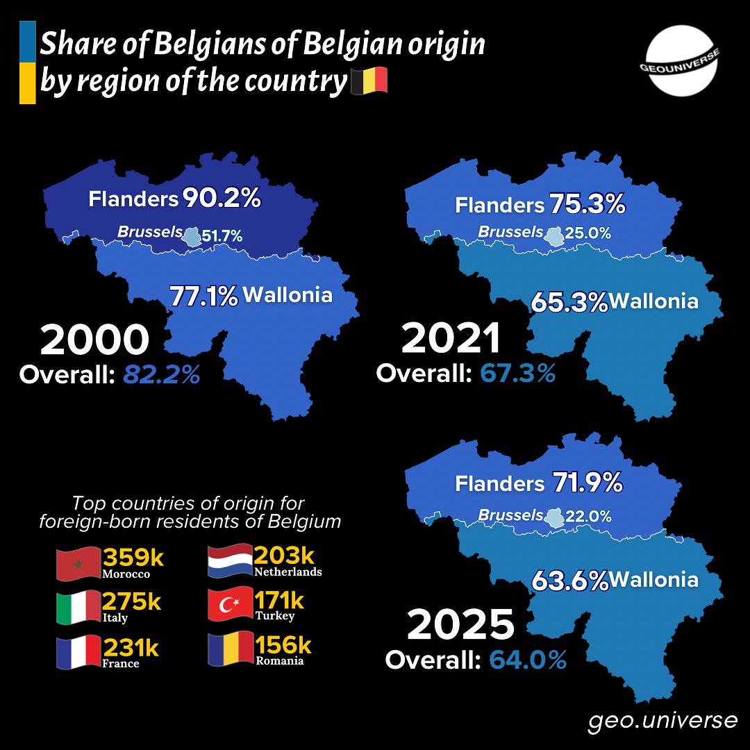
Belgium's Changing Demographics Over Time Map
The "Belgium's Changing Demographics Over Time Map" presents a detailed visualization of the shifts in population distri...
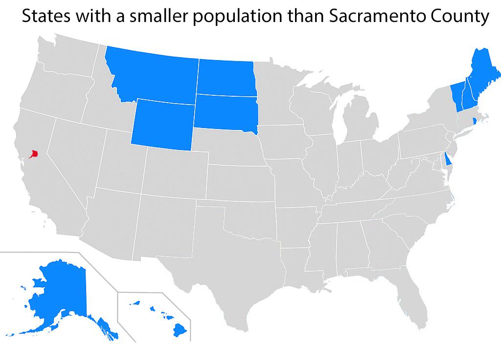
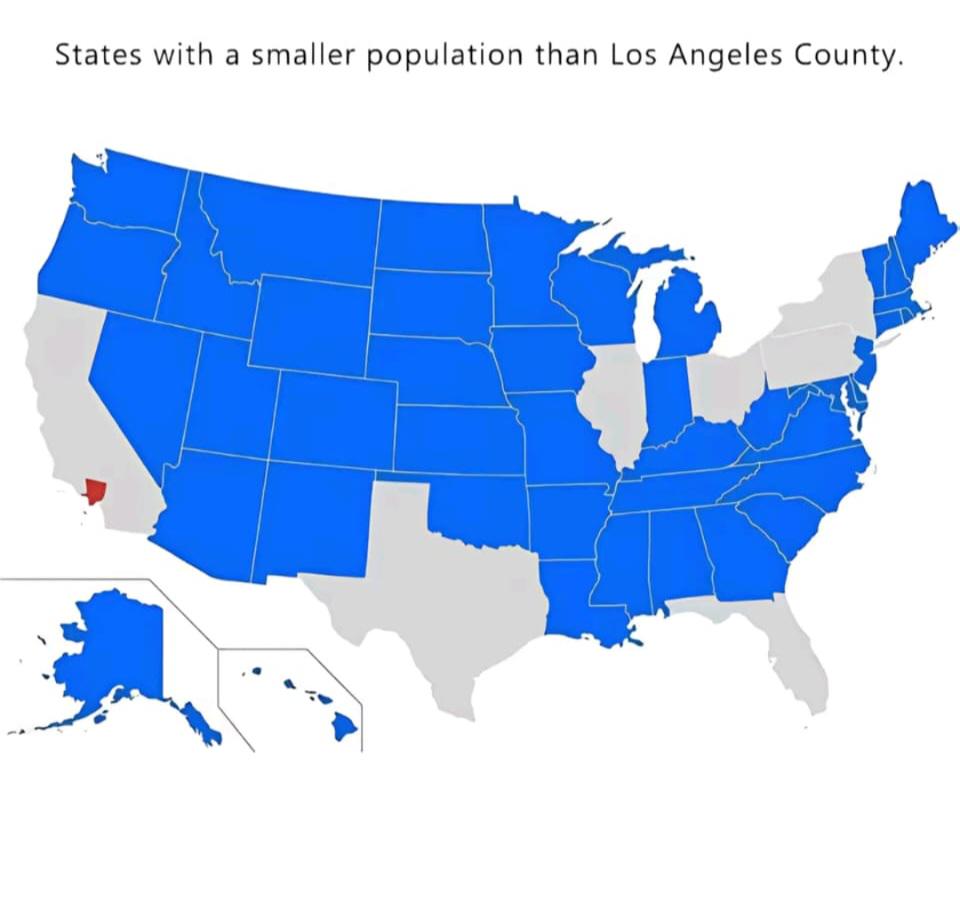
States with Smaller Populations than Sacramento County Map
This map highlights the states in the United States that have smaller populations than Sacramento County, California. Sa...
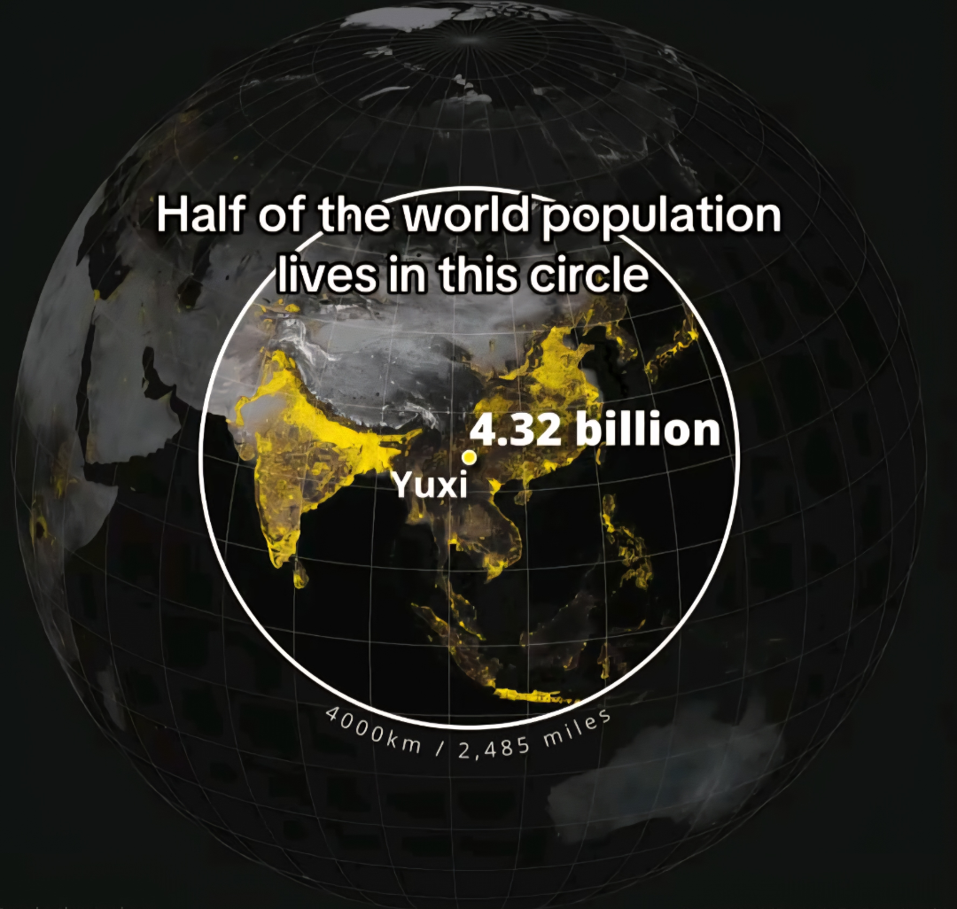
Population Distribution Map of the World
The \...
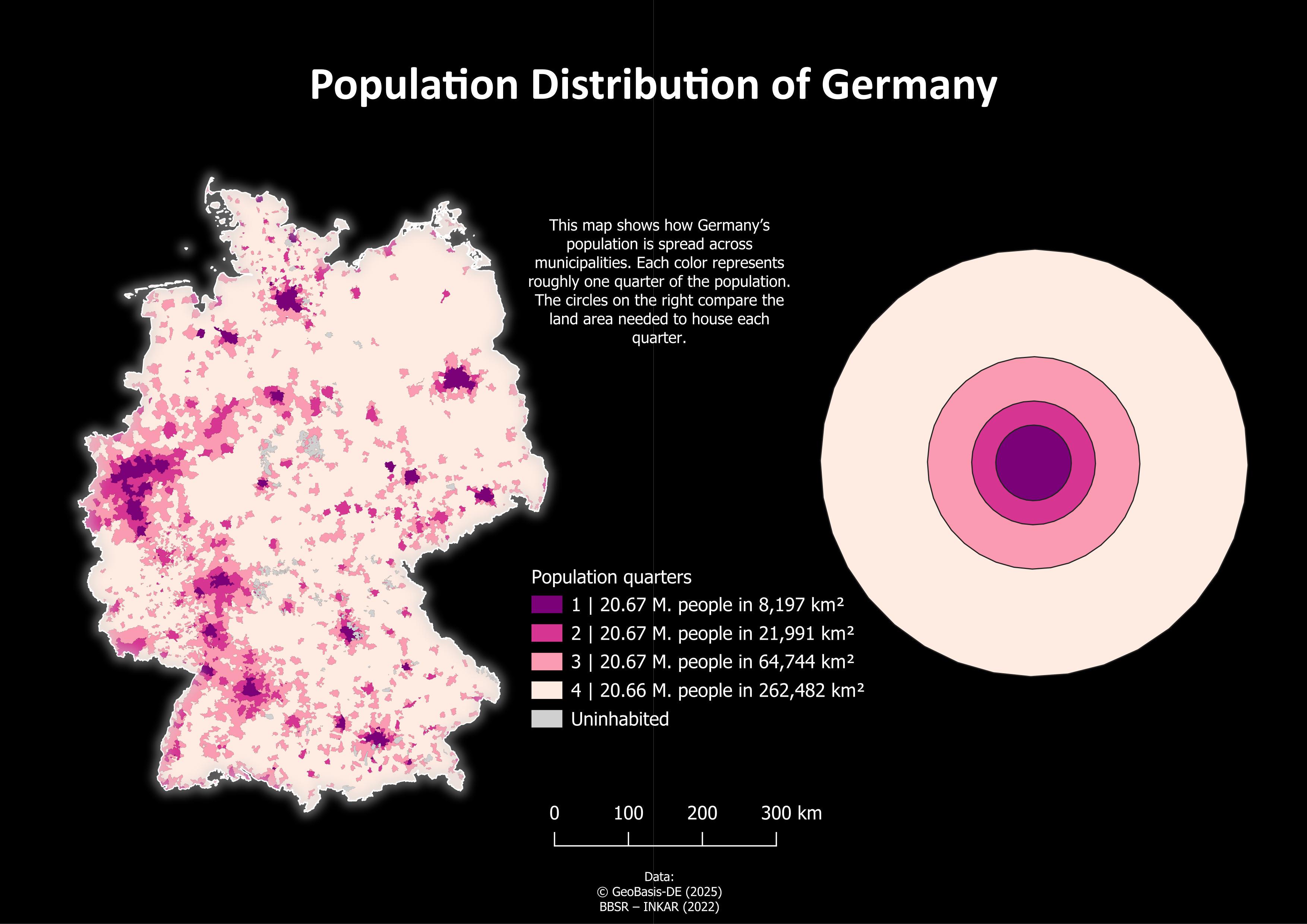
Population Distribution Map of Germany
The "Population Distribution of Germany" map provides a visual representation of how the population is spread across var...
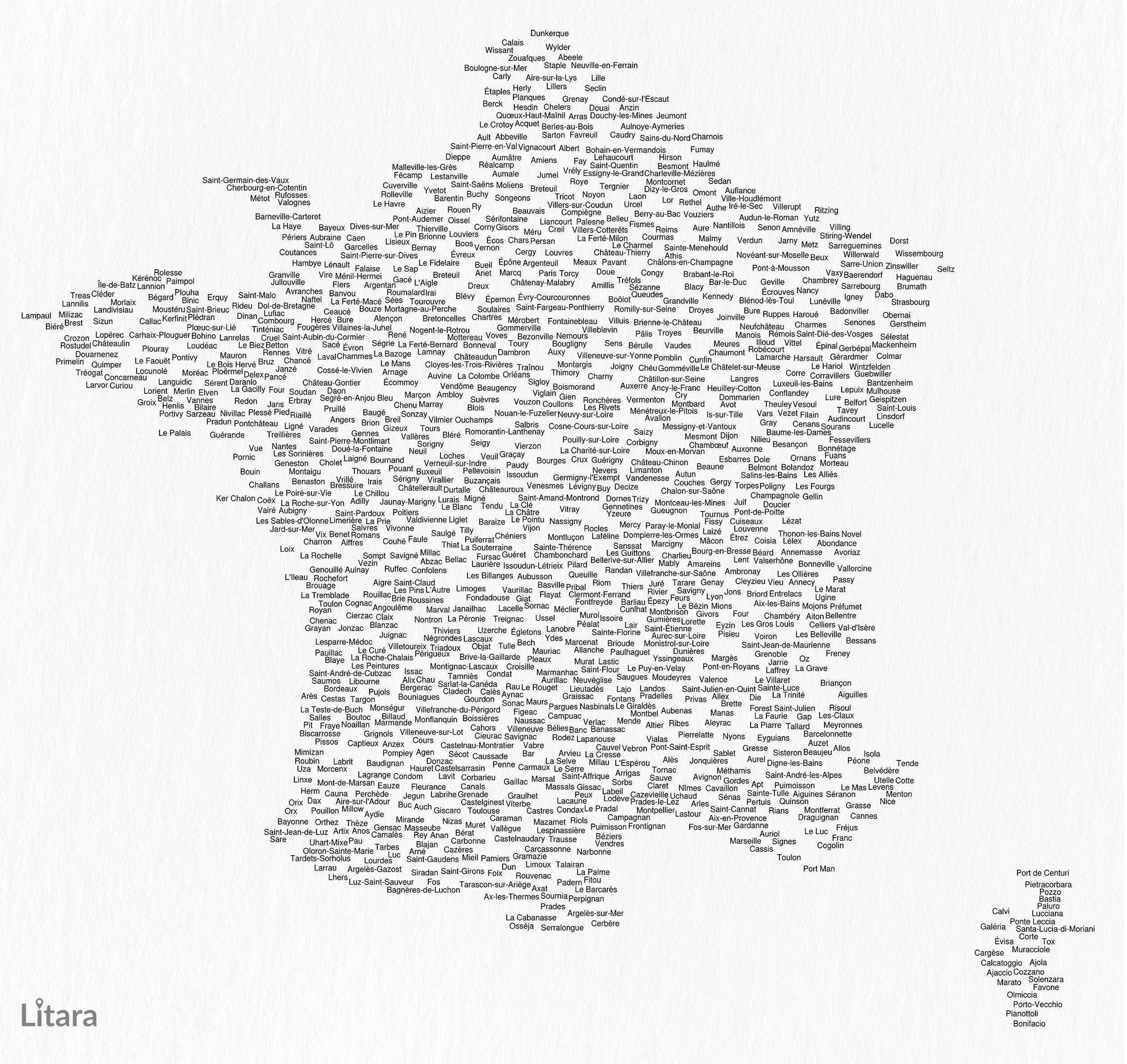
Typographic Map of France's Communes
This unique typographic map of France showcases the names of 1,156 communes, creating a captivating visual representatio...
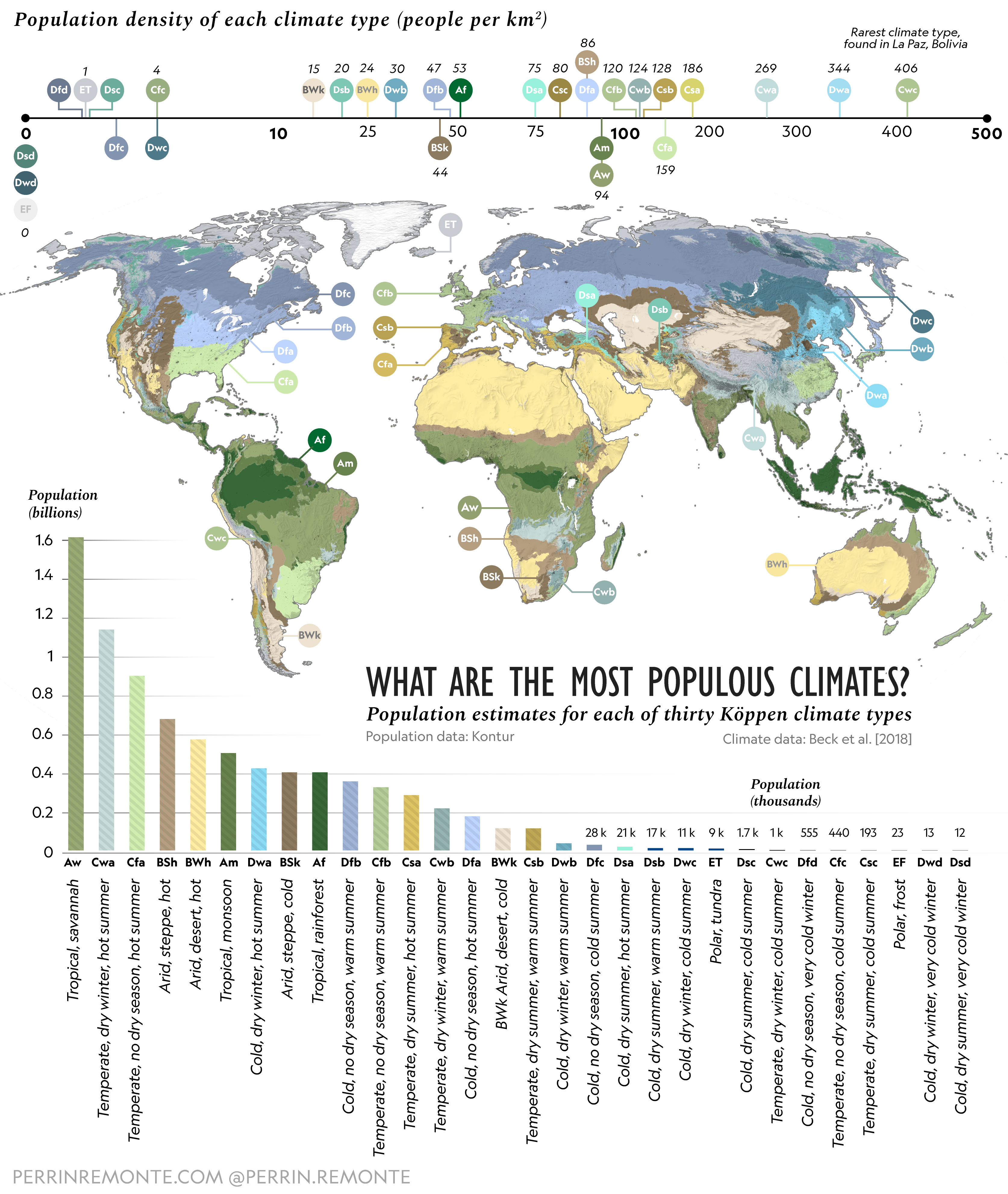
Most Populous Climates on Earth Map
This map provides an updated visualization of the most populous climates on Earth, highlighting the regions where human ...
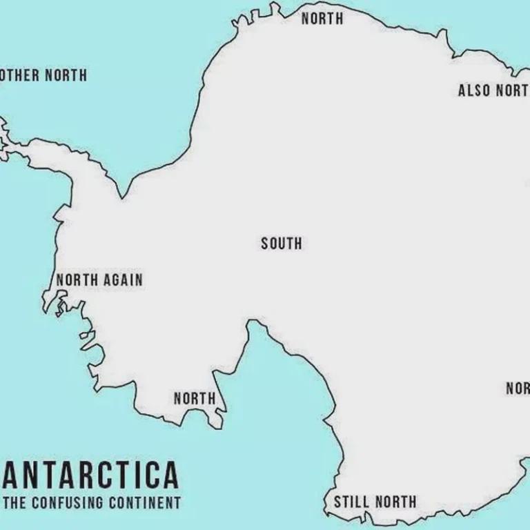
Map of Misleading Geographic Information
The visualization titled "Not so false?" reveals the prevalence of misleading geographic information across various regi...
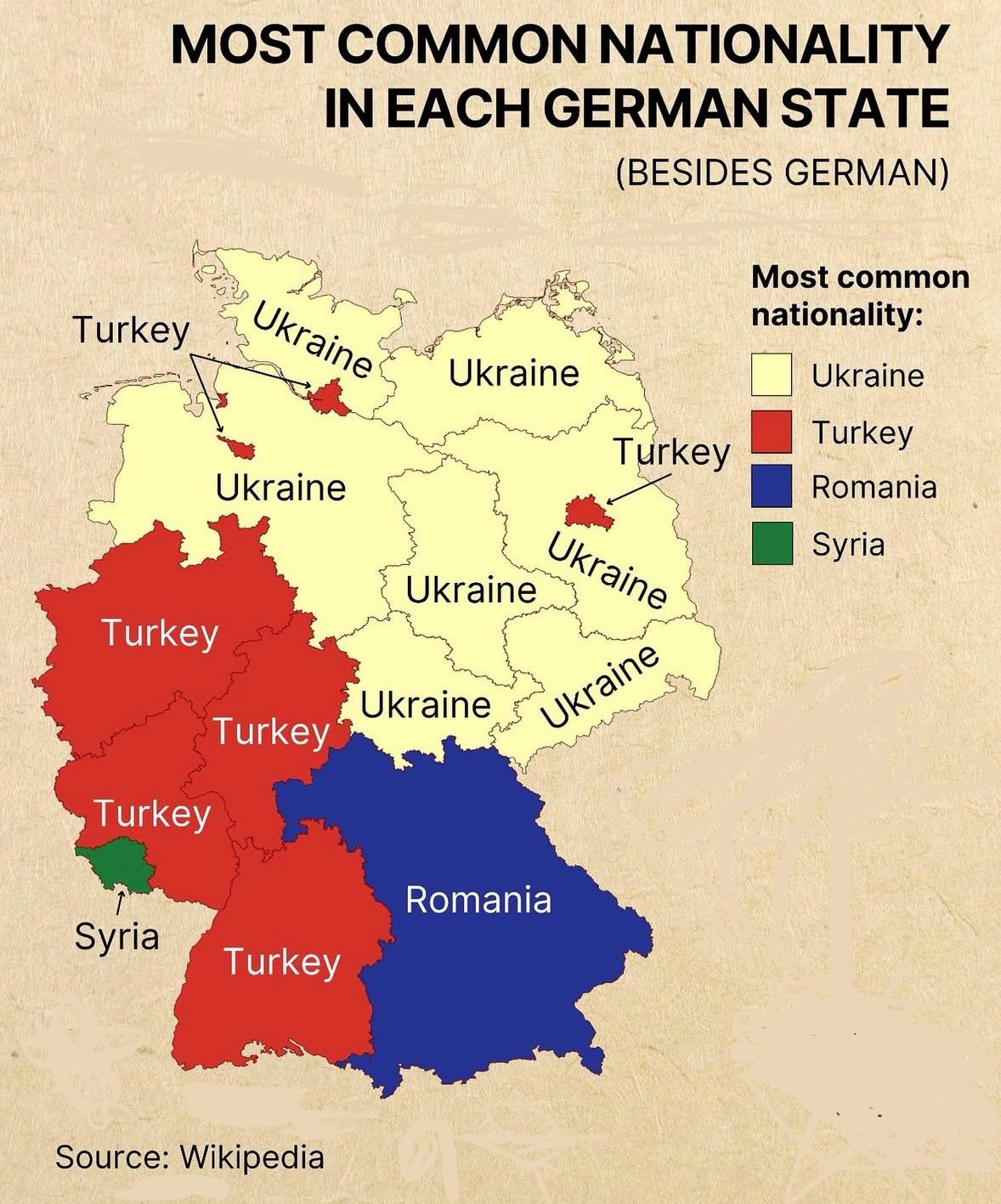
Most Common Nationality in Each German State Map
The "Most Common Nationality in Each German State" map provides a clear visual representation of the predominant foreign...
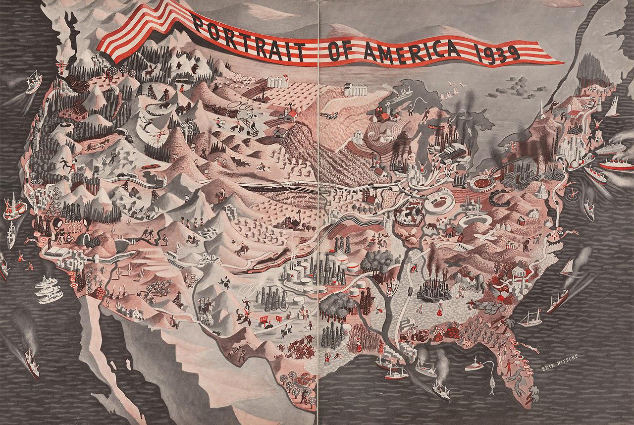
Demographics and Population Map of America 1939
The "Portrait of America (1939)" map provides a rich visual representation of the demographic landscape of the United St...
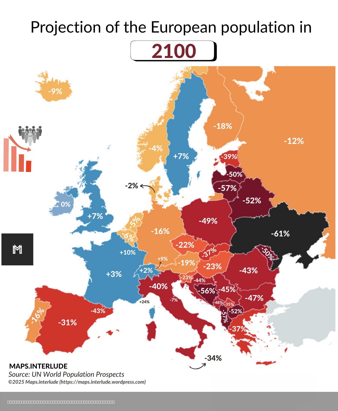
European Population Projection Map for 2100
...
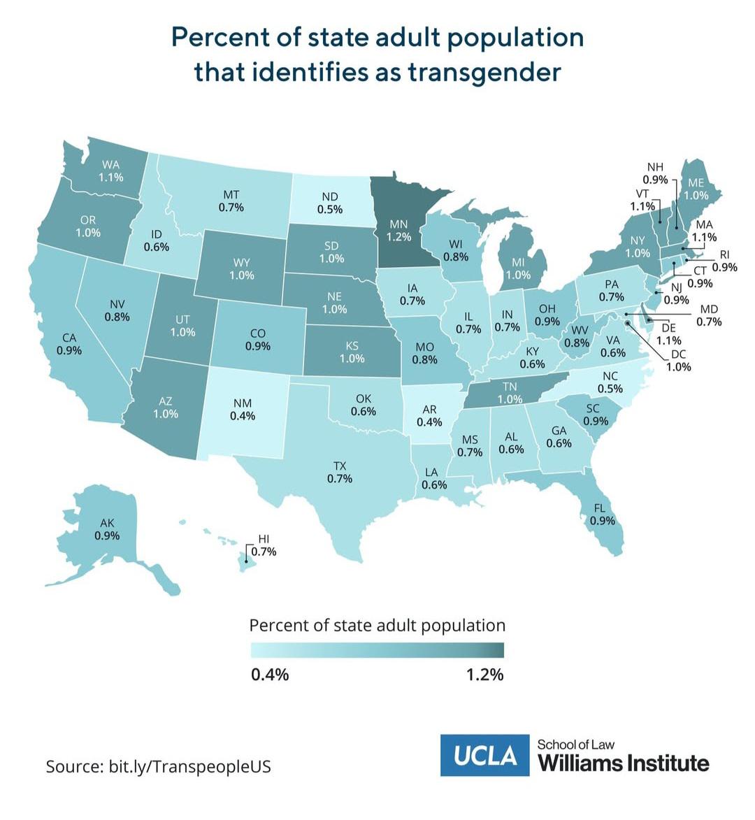
Trans Population by US State Map
This map visualizes the estimated transgender population across different states in the United States. It provides a cle...
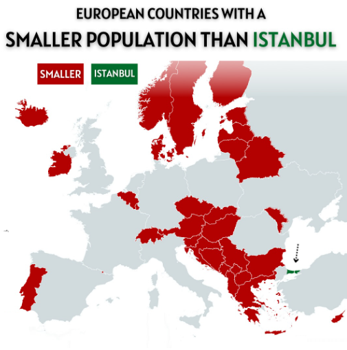
European Countries with Smaller Population than Istanbul Map
The visualization titled "European Countries with a Smaller Population than Istanbul" presents a striking comparison bet...
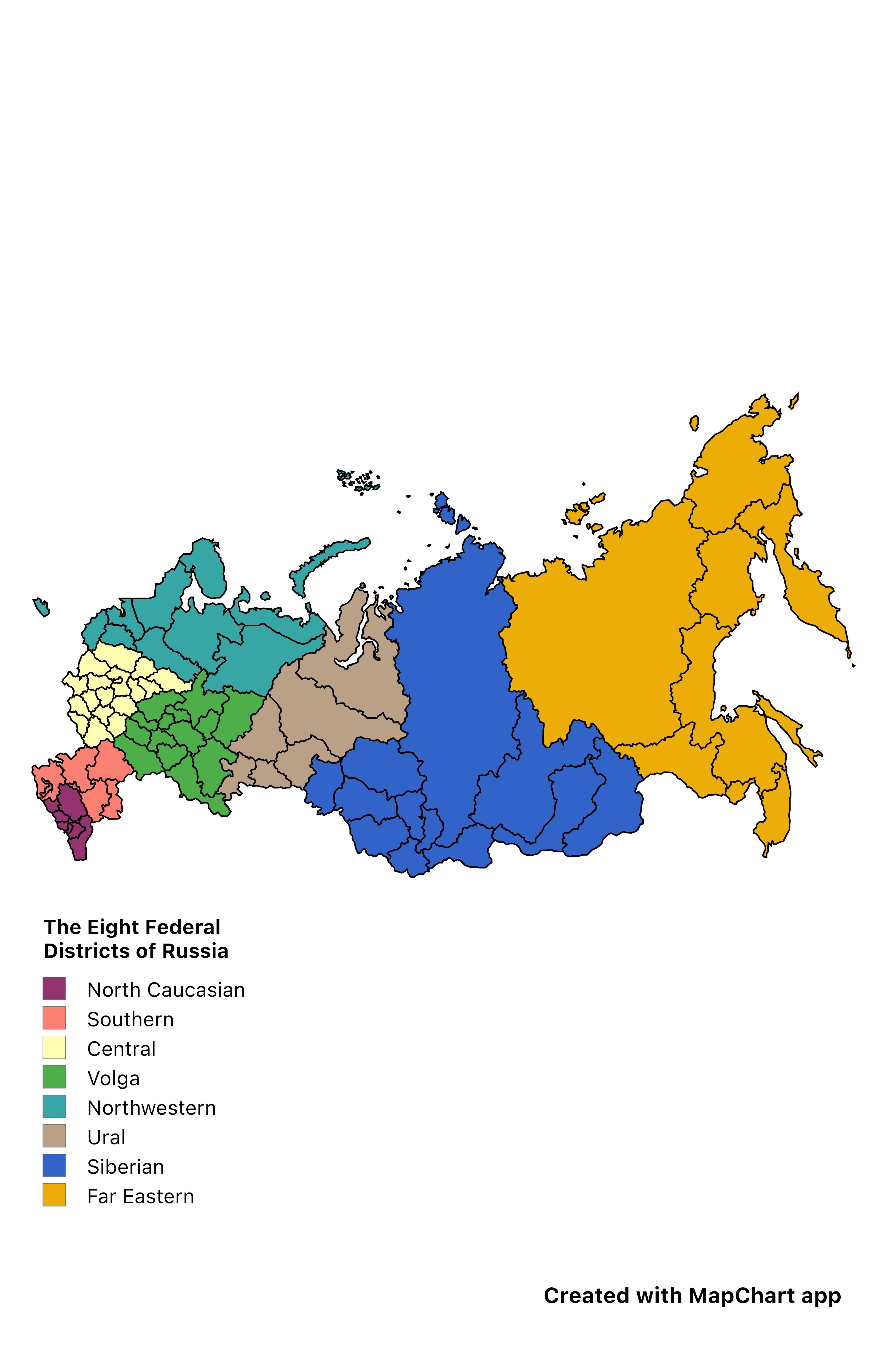
Eight Federal Districts of Russia Map
The "Eight Federal Districts of Russia" map provides a clear visual representation of the administrative divisions withi...
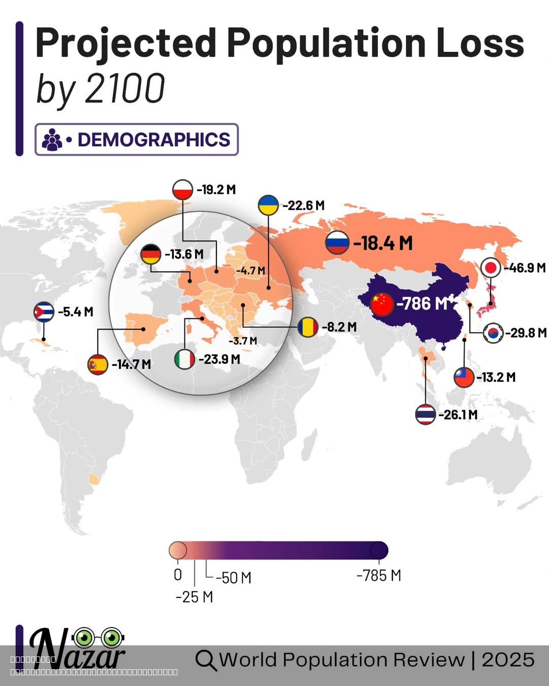
Projected Population Loss by 2100 Map
The "Projected Population Loss by 2100" map provides a visual representation of anticipated demographic changes across t...