regional analysis Maps
183 geographic visualizations tagged with "regional analysis"
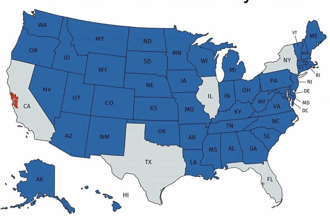
U.S. States with Smaller Economies than San Francisco Bay Area Map
This map provides a striking visualization of U.S. states whose economies are smaller than that of the San Francisco Bay...
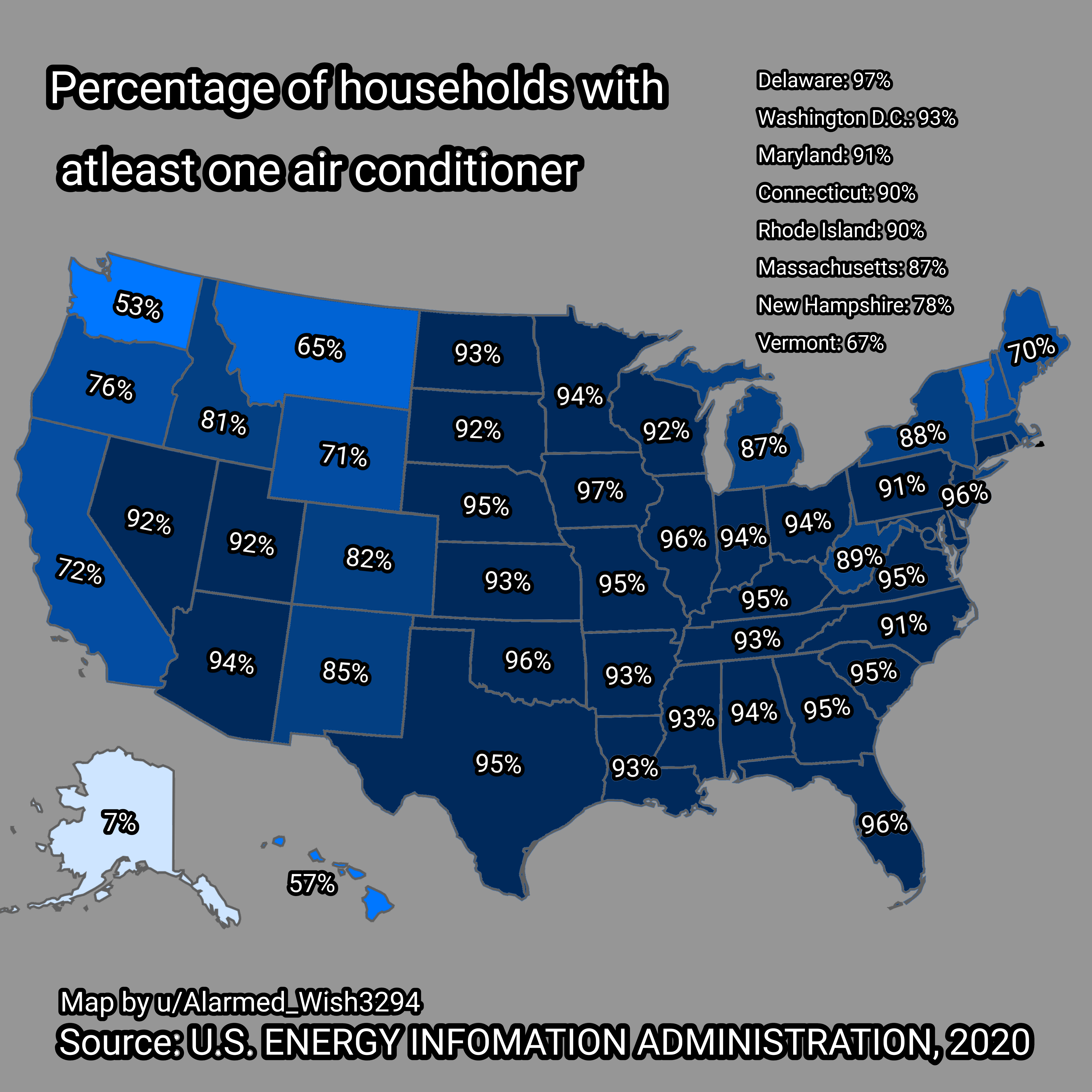
Map of Households in USA with Air Conditioners
The visualization titled "Percent of Households in USA with at least One Air Conditioner" provides a clear overview of t...
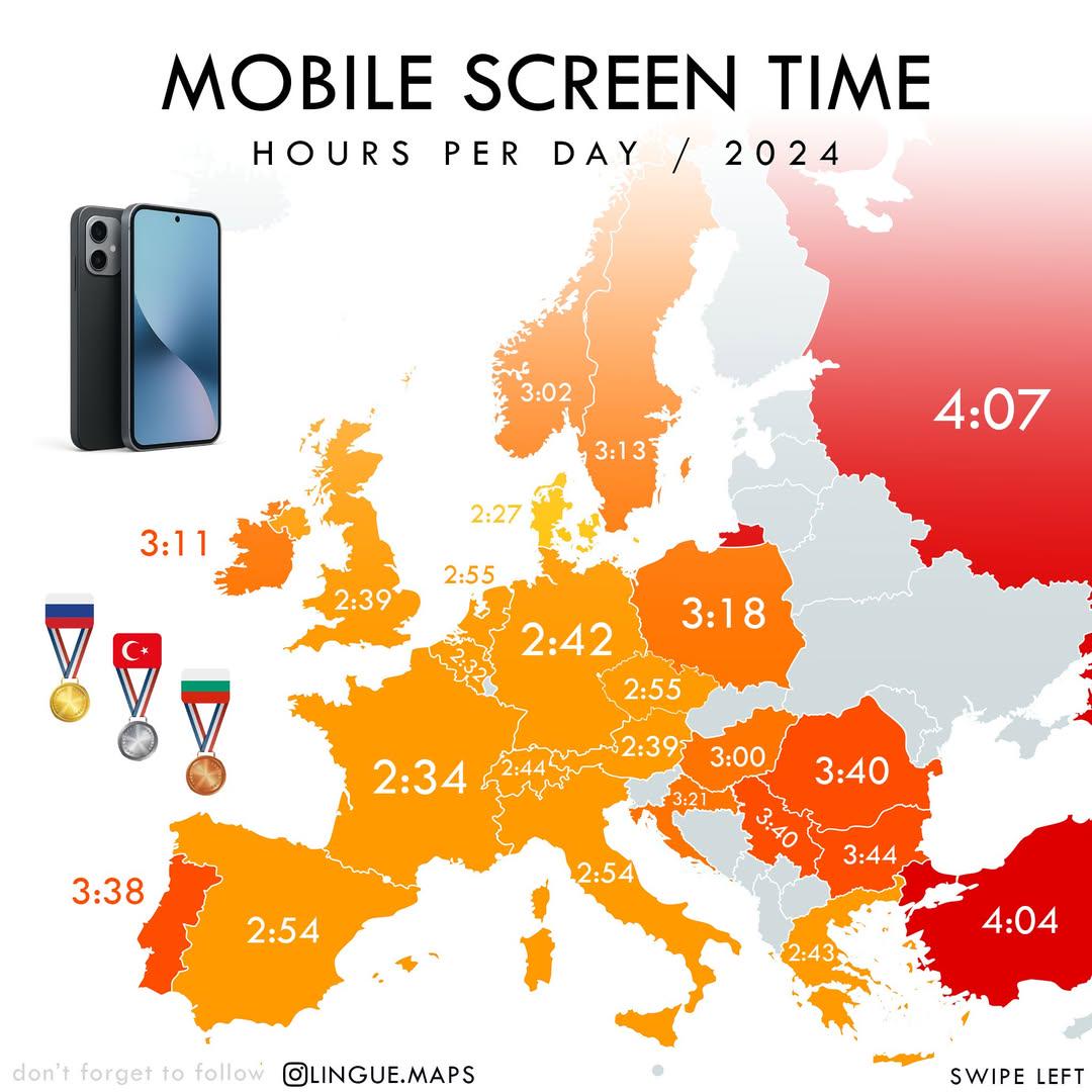
Mobile Screen Time in Hours per Day Map
The "Mobile Screen Time in Hours per Day (2024)" map visually represents the average daily hours individuals spend on th...
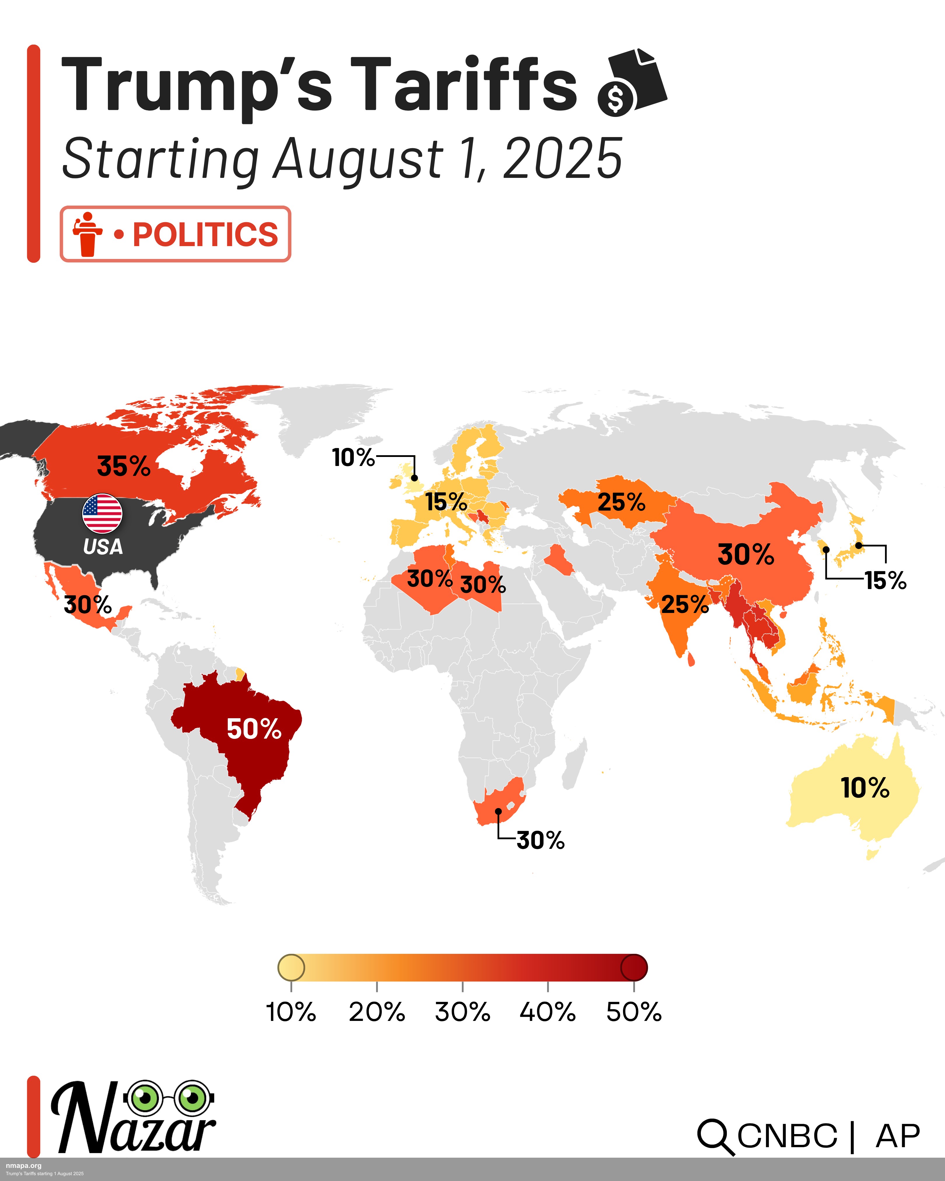
Trump's Tariffs starting 1 August 2025 Map
This map displays "Trump's Tariffs starting 1 August 2025" and provides a clear visual representation of the geographic ...
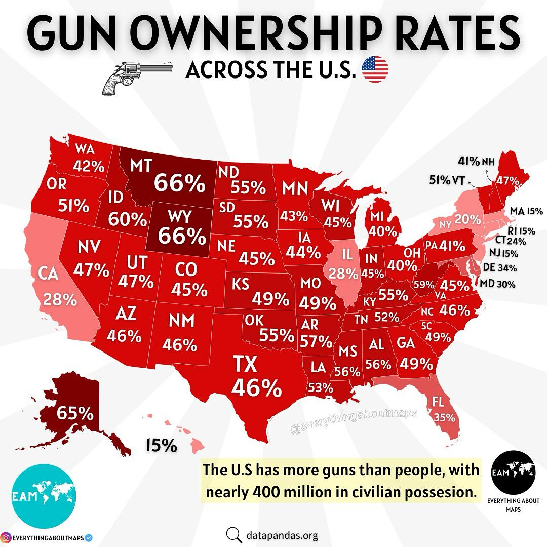
Gun Ownership in the U.S. Map
The "Gun Ownership in the U.S. Map" provides a compelling visual representation of firearm ownership across the United S...

Cultural Characteristics Map of New England
The map titled "New Englanders be New Englanding" presents a fascinating look at the unique cultural characteristics and...
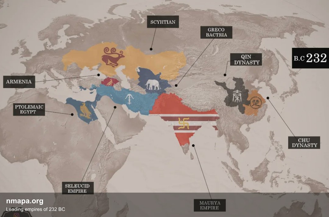
Leading empires of 232 BC Map
This geographical visualization presents "Leading empires of 232 BC" as a comprehensive map that displays spatial data p...
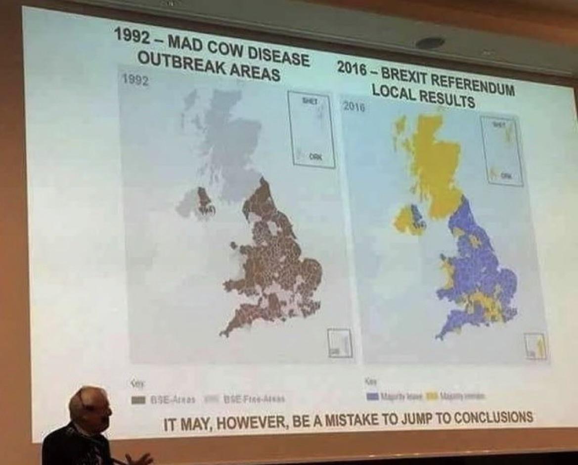
Correlation Map of Socioeconomic Factors
The "Correlation" map provides a visual representation of the relationships between various socioeconomic factors across...
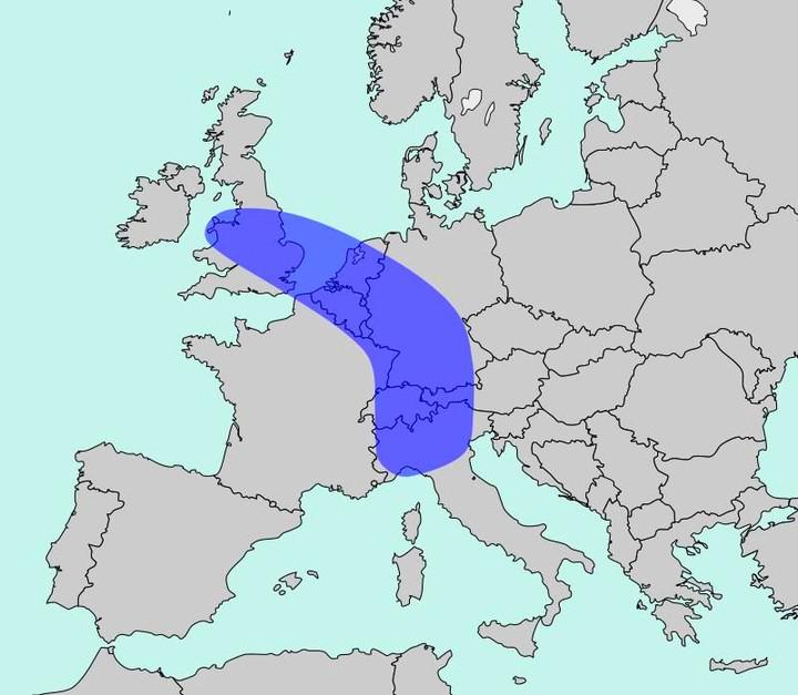
Population Density Map of Europe
The map titled "The Blue Banana" visualizes Europe’s most densely populated corridor, home to approximately 111 million ...
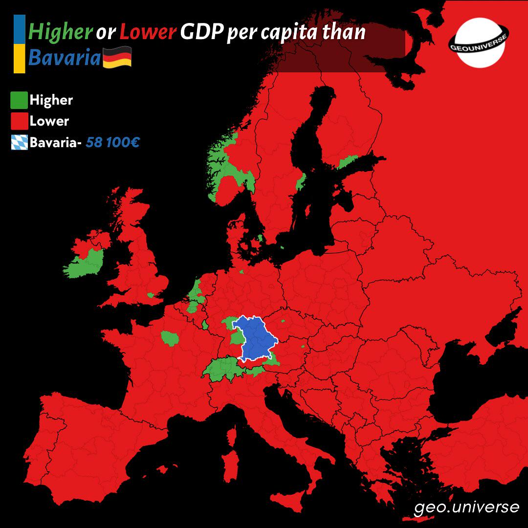
Bavaria Wealth Comparison Map to Europe
The "How Rich is Bavaria Compared to the Rest of Europe?" map provides a visual representation of the economic status of...
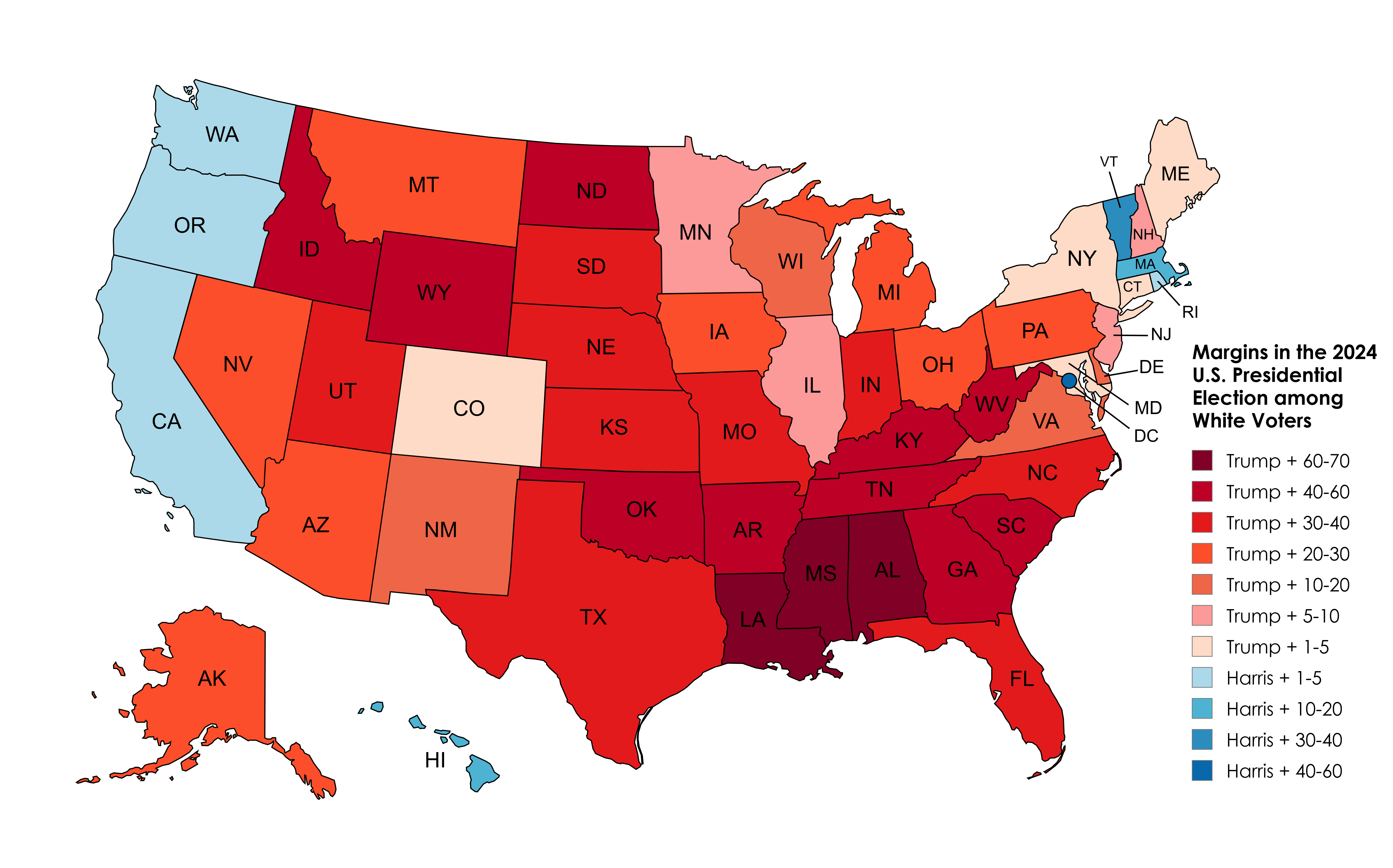
2024 Election Results Map Amongst White Voters
The 2024 Election Results Map Amongst White Voters offers a detailed representation of how this demographic voted across...
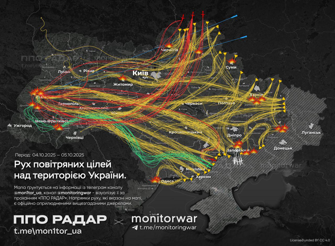
Air Attack on Ukraine Map
The map titled \...
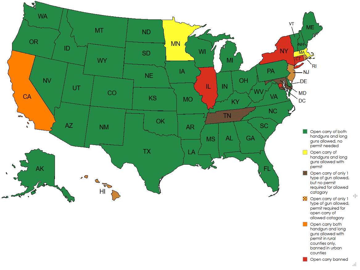
Current Open Carry Laws in the US by State Map
The "Current Open Carry Laws in the US by State Map" provides a comprehensive overview of the legal landscape regarding ...
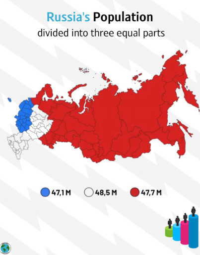
Equally Populated Areas of Russia Map
Russia’s overall population is approximately 144 million, but this number is not evenly spread. Much of the population i...
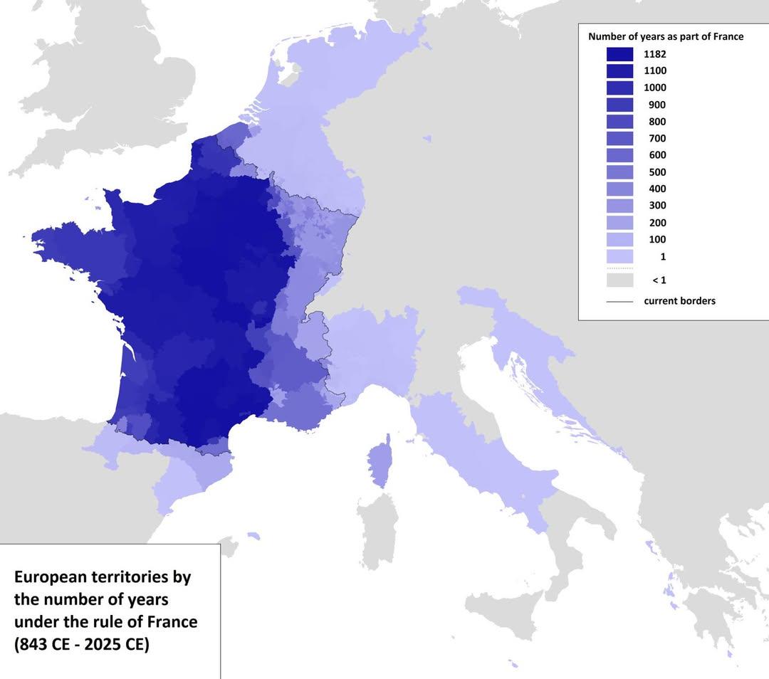
Map of European Territories By Years Under France
The visualization titled 'Map of European Territories By The Number of Years Spent Being Part of France' offers a compre...
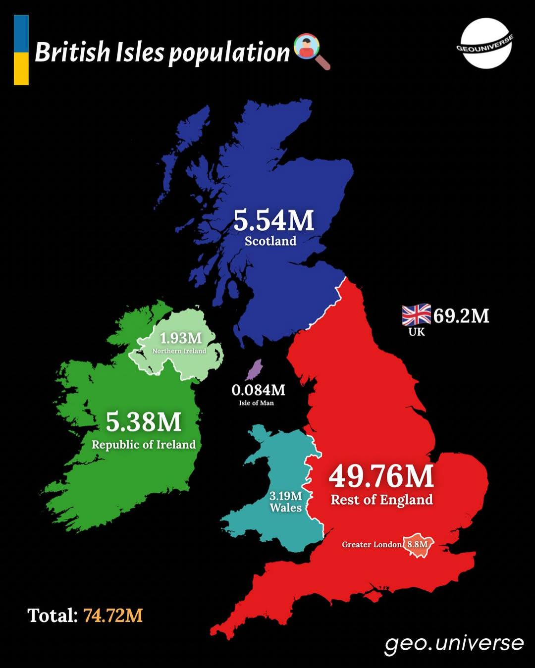
Population Distribution Map of the British Isles
The "British Isles by Population" map presents a detailed visualization of the population distribution across the Britis...
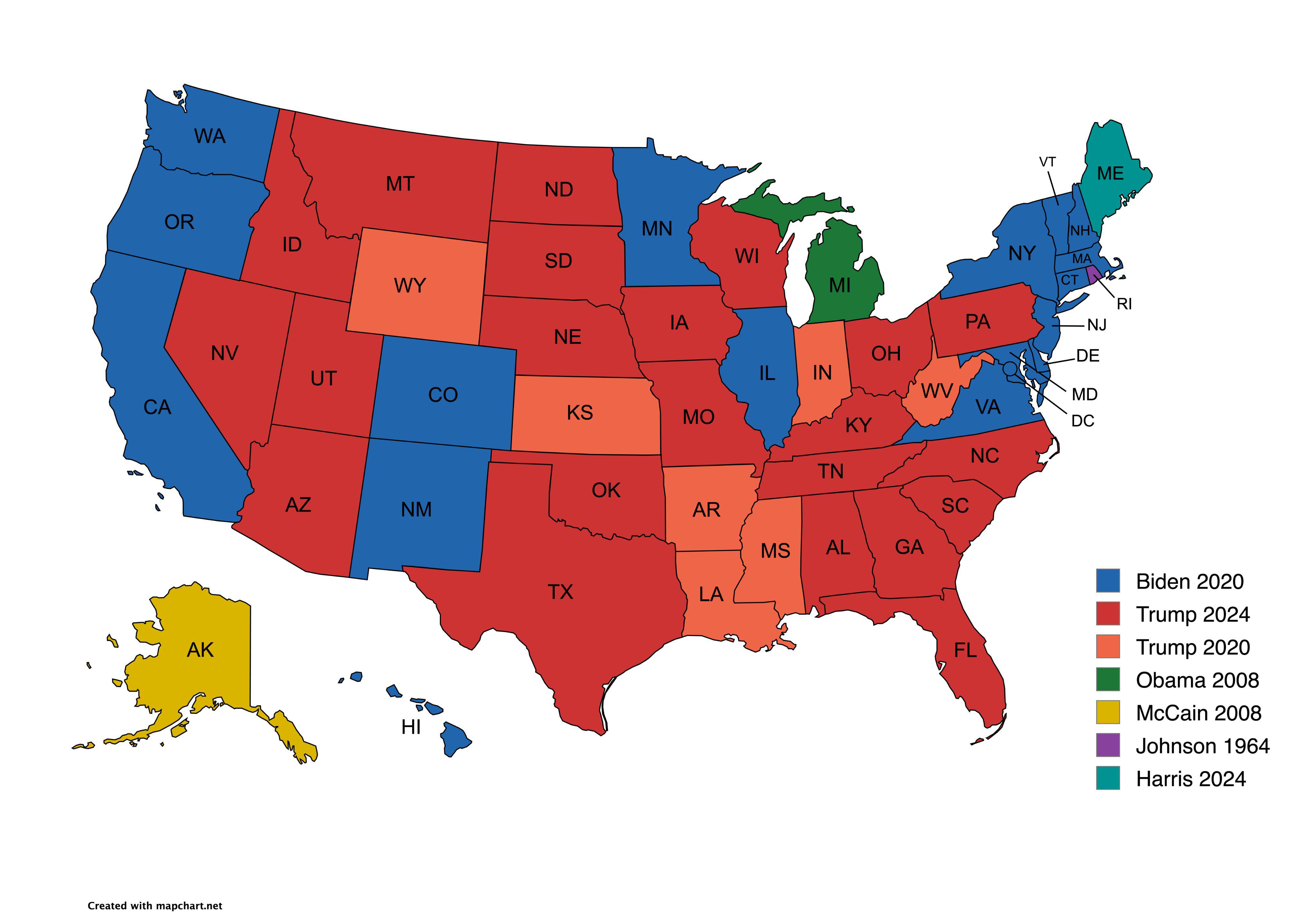
Presidential Candidate Vote Distribution by State Map
The map titled "Which Presidential Candidate Won The Largest Amount Of Votes In An Election By State" provides a visual ...
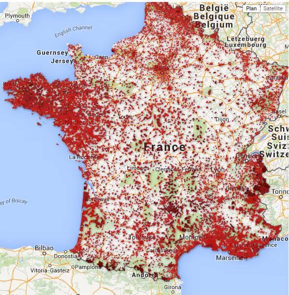
Map of Bars in France Serving Alcohol
This map provides a comprehensive overview of all bars across France that primarily serve alcohol. It visually represent...
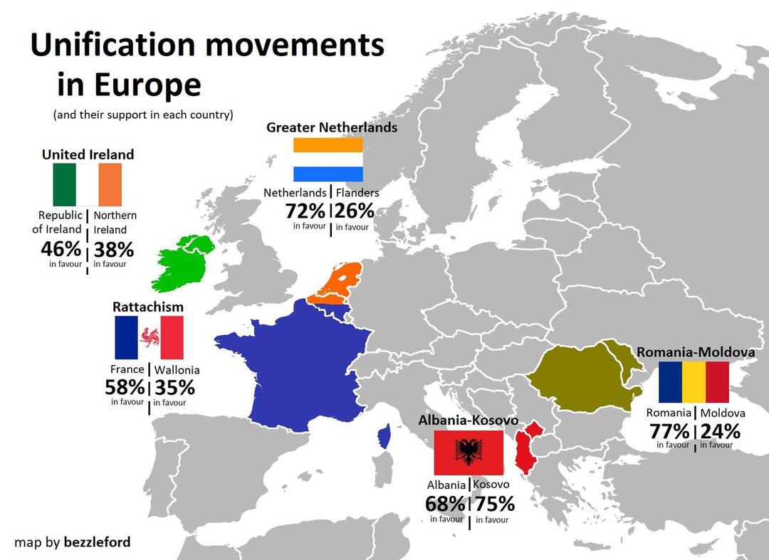
European Unification Movements Map
The "European Unification Movements Map" provides a visual representation of the various movements advocating for the po...
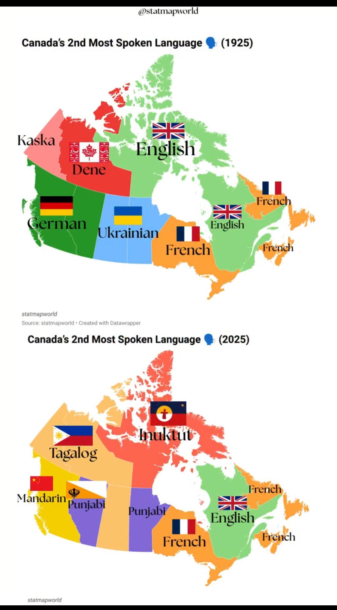
Canada's 2nd Most Spoken Language Map 1925 vs 2025
The visualization titled "Canada's 2nd Most Spoken Language 1925 vs 2025" illustrates the evolution of language demograp...
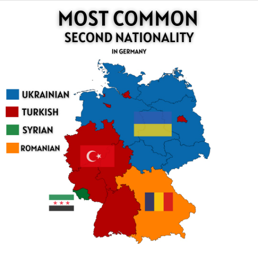
Most Common Second Nationality in Germany Map
The "Most Common Second Nationality in Germany" map provides a visual representation of the various nationalities that i...
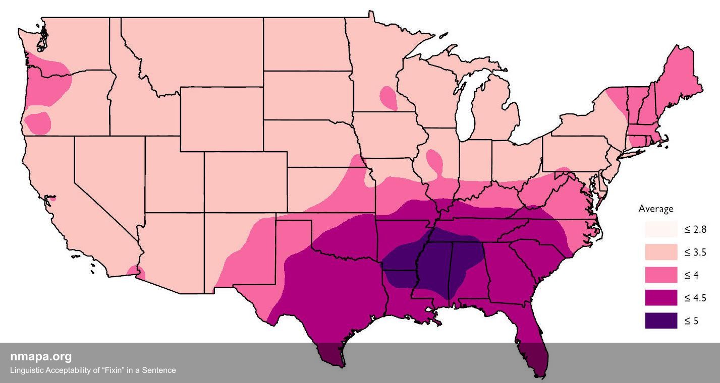
Linguistic Acceptability of “Fixin” in a Sentence Map
This comprehensive geographical visualization presents "Linguistic Acceptability of “Fixin” in a Sentence" in an accessi...
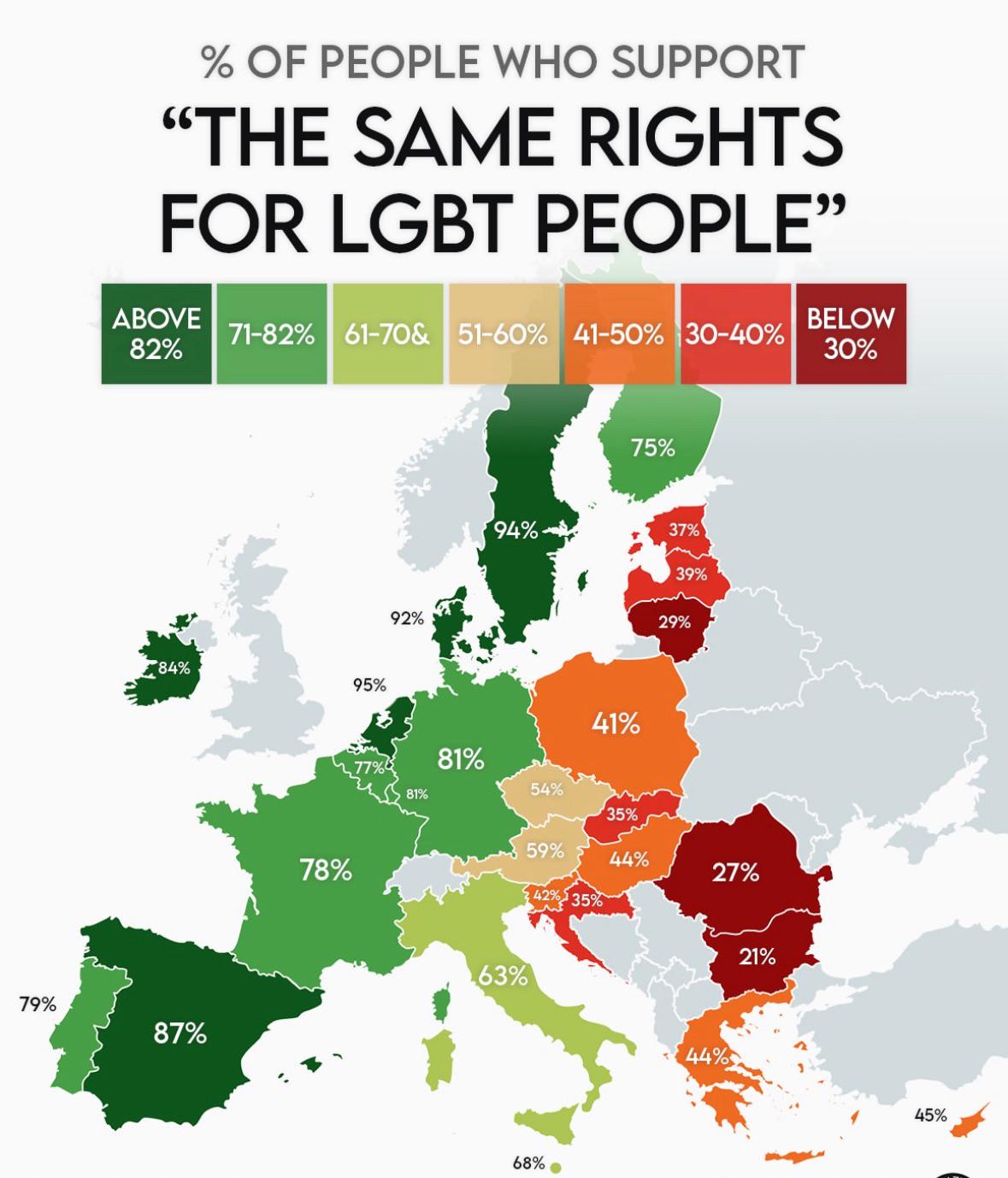
Support for LGBT People in the EU Map
This map provides a visual representation of support for LGBT individuals across various countries in the European Union...
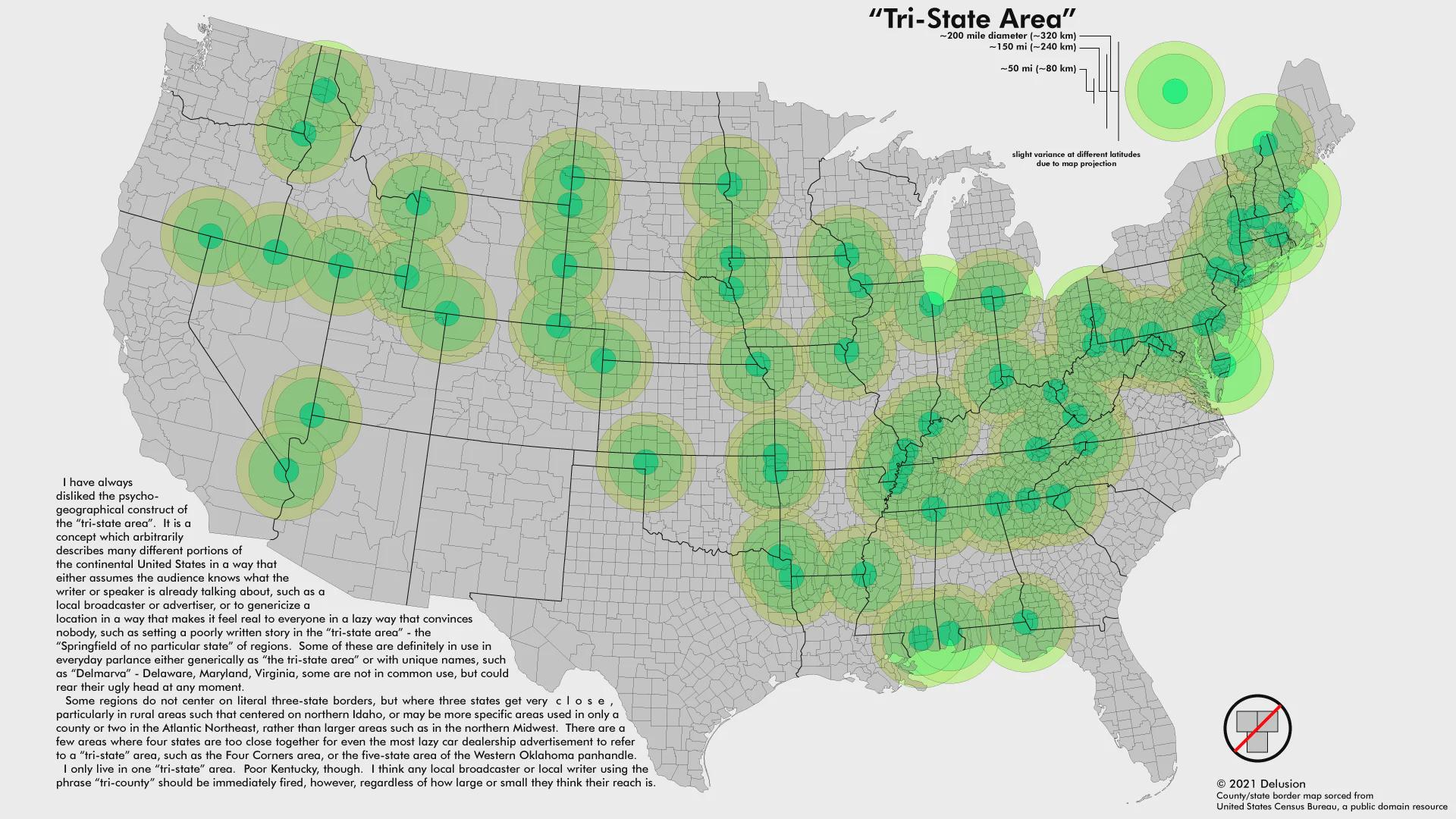
Tri-state Areas Map
The "Map of Tri-state Areas" provides a clear visual representation of the regions in the United States where three stat...
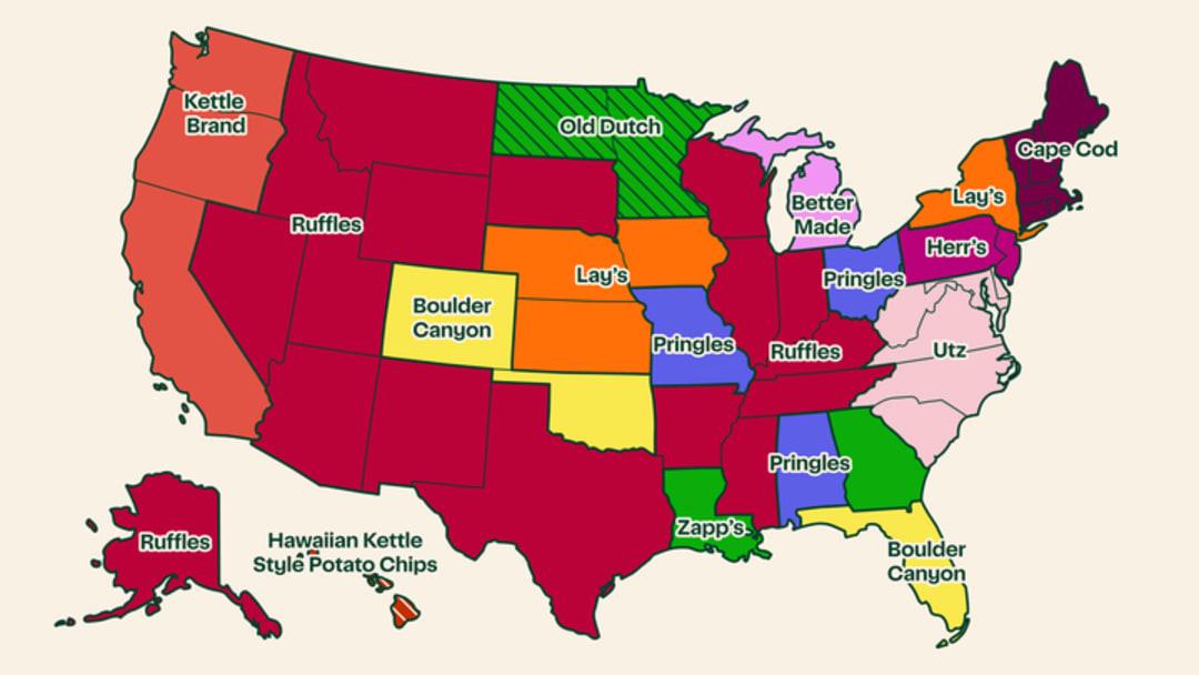
Most Popular Potato Chip Brand by State Map
The \...
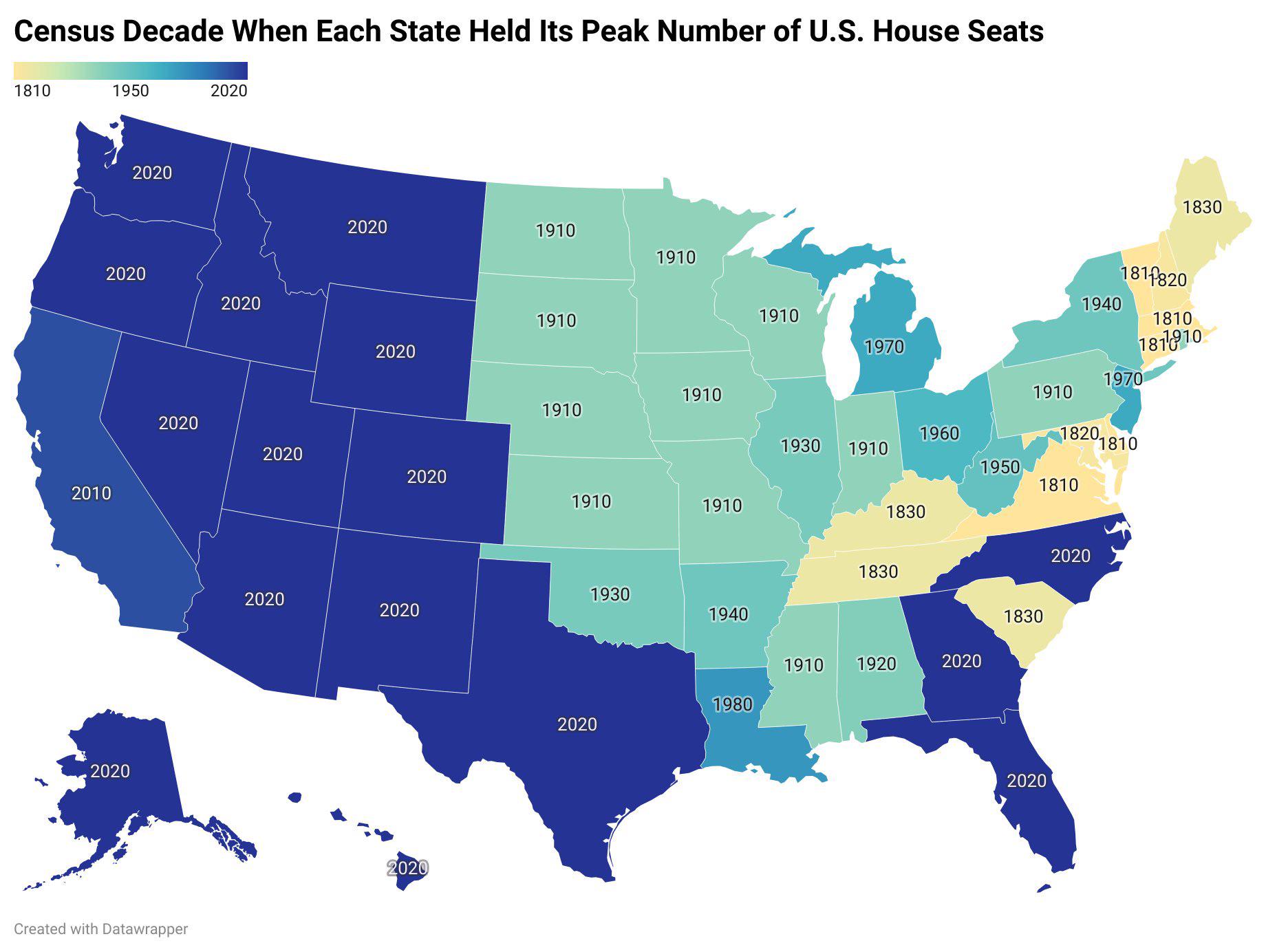
US States Peak House Seats Decade Map
This map visually represents the decade in which each U.S. state reached its maximum number of congressional House seats...
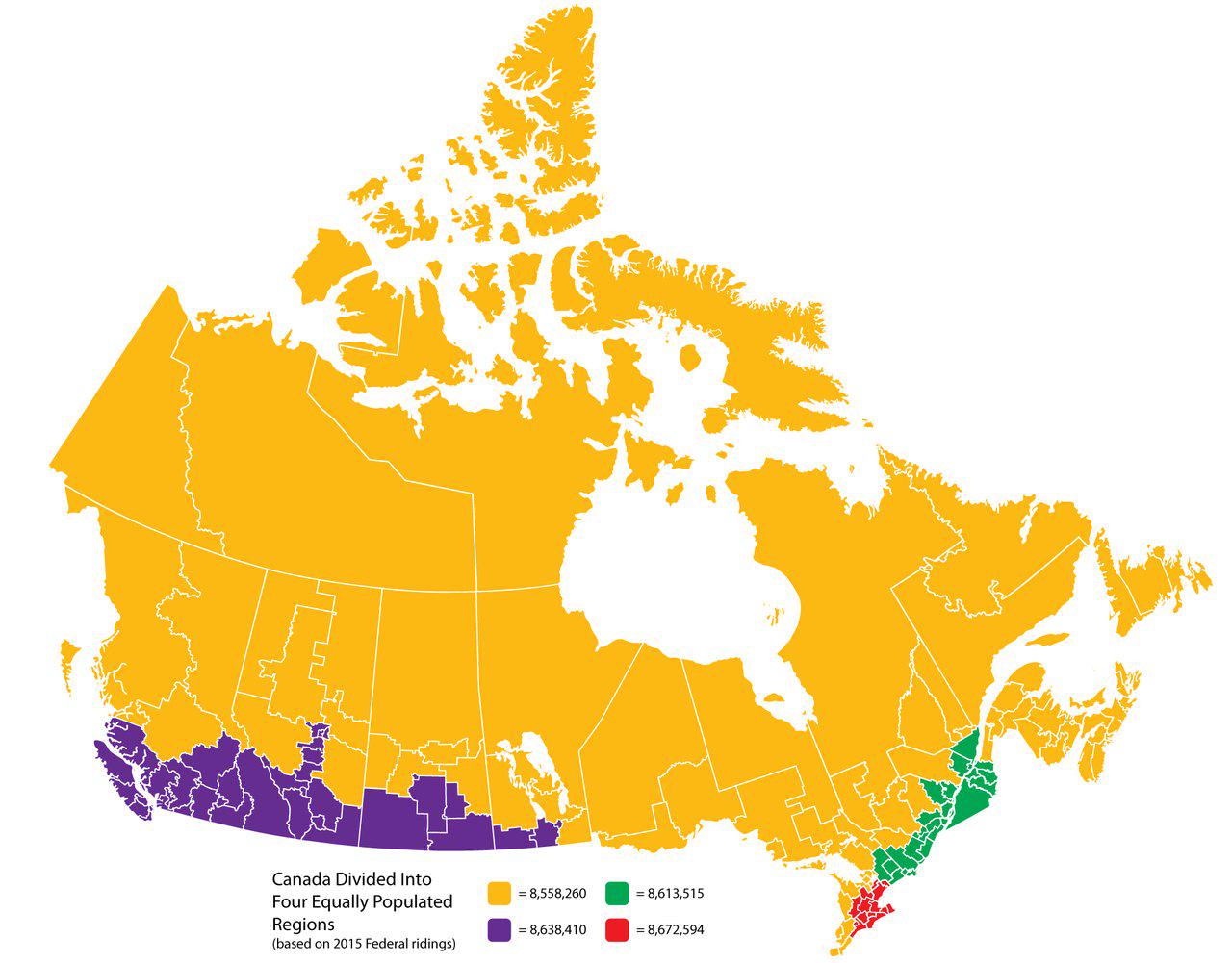
Canada Divided Into Four Equally Populated Regions Map
This map visualizes Canada divided into four equally populated regions, providing a unique perspective on the distributi...
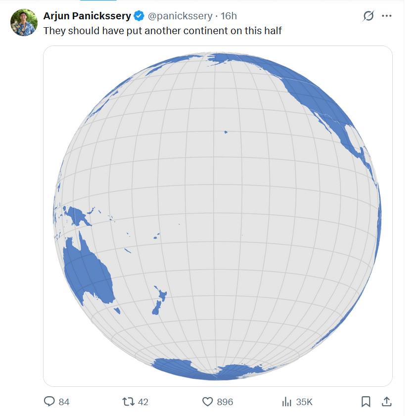
Continents Placement Map Analysis
Interestingly, the current configuration of the continents has been influenced by a myriad of factors, including plate t...
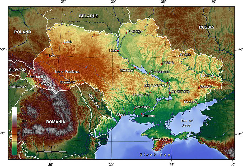
Topographic Map of Ukraine
The Topographic Map of Ukraine provides a detailed visualization of the country's diverse terrain, showcasing its elevat...
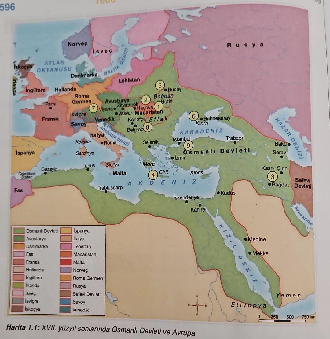
Historical Map of Turkey in Textbooks
This map, derived from a Turkish history textbook, offers a detailed portrayal of significant historical events, territo...
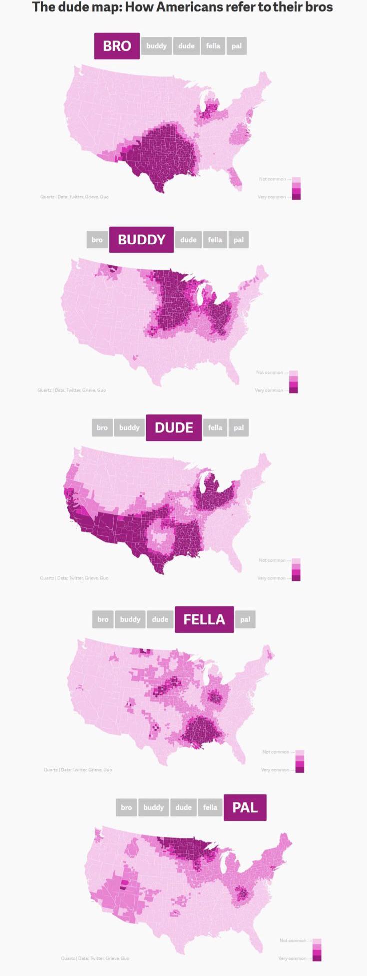
Bro Map of America Analysis
The "Bro Map of America" serves as a unique visualization that depicts cultural and social archetypes across different r...
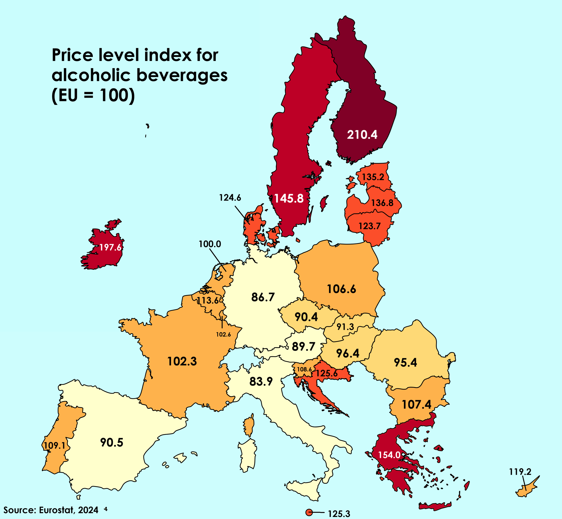
Alcohol Beverage Prices Compared to EU Average Map
This map visualizes the price of alcoholic beverages across various European countries in relation to the European Union...
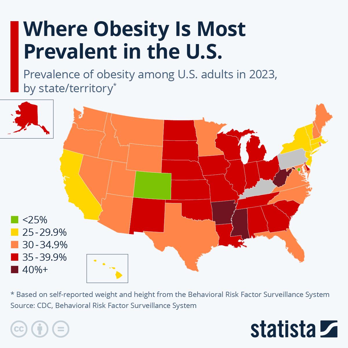
American Obesity Statistics Map
The American Obesity Statistics Map visually represents the prevalence of obesity across the United States. It highlight...
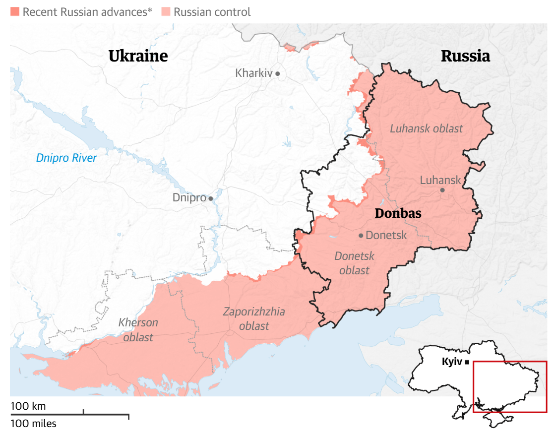
Map of Proposed Donbas Cessions by Putin
The map titled "Map of Proposed Donbas Cessions by Putin" visually represents the regions in eastern Ukraine that Russia...
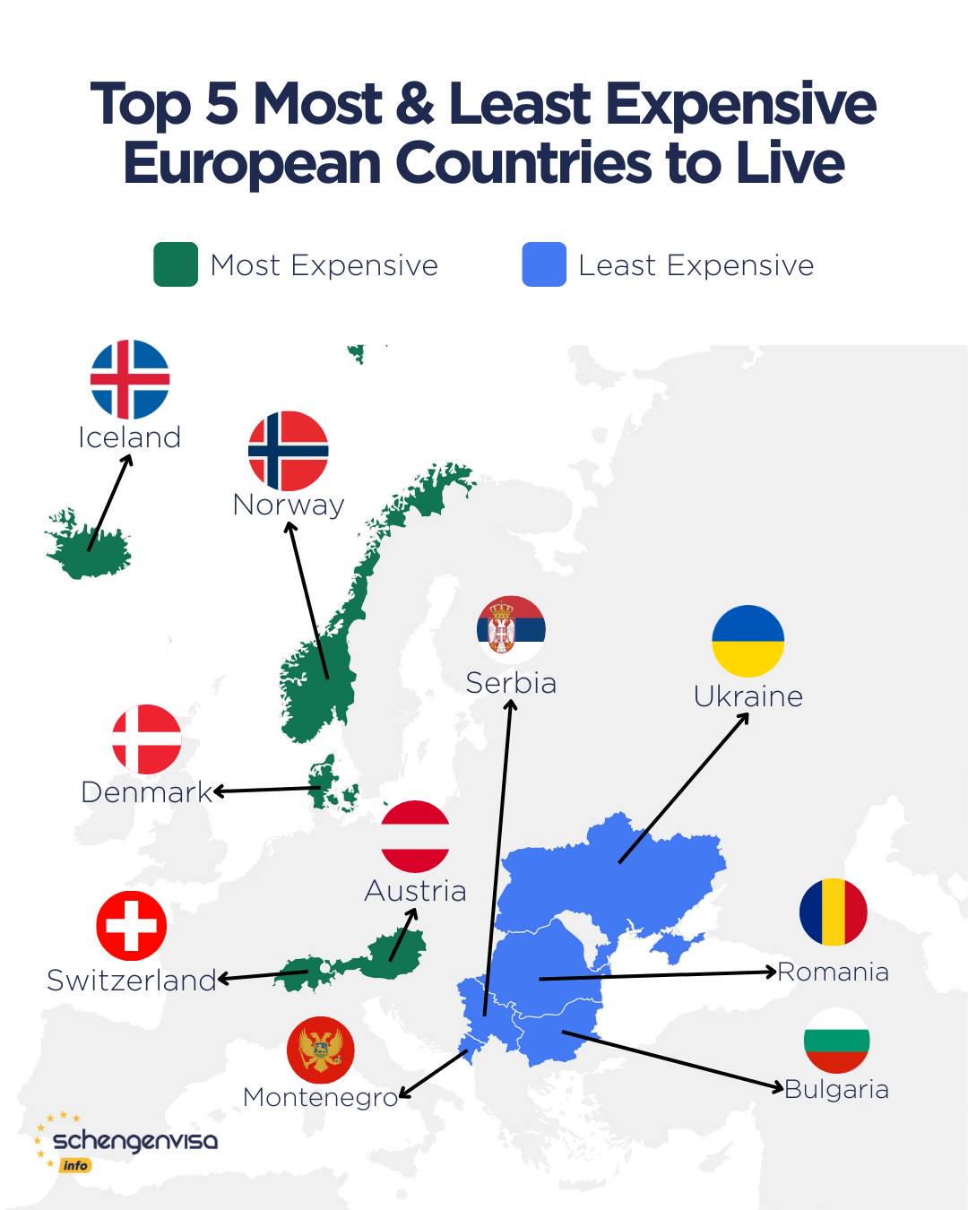
Most Expensive and Affordable Countries to Live in Europe Map
This map highlights the stark contrast between the most expensive and most affordable countries to live in Europe, prese...
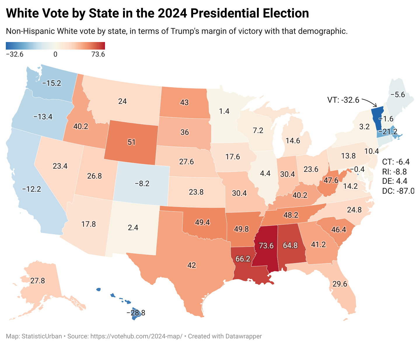
Voting Patterns Map of White Americans 2024
The map titled "How White Americans Voted in 2024" provides a detailed visual representation of voting behaviors among W...
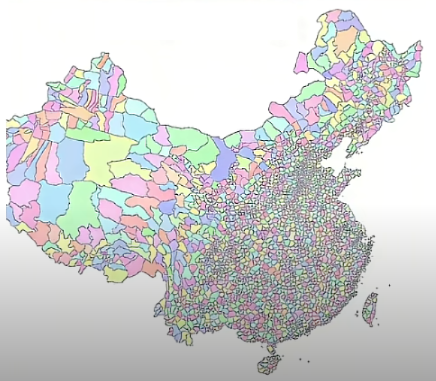
All Counties in China Map
The "All Counties in China Map" provides a comprehensive view of the administrative divisions within the country. It hig...
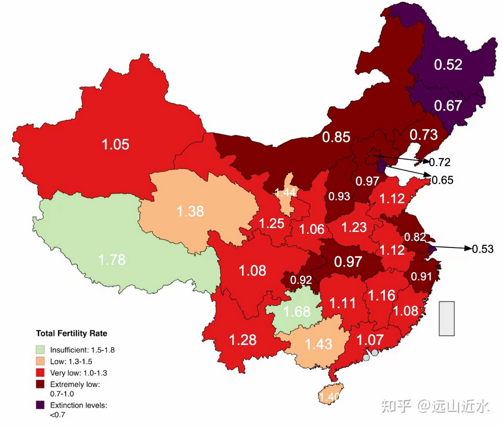
Children per Woman in Chinese Provinces Map
This map visualizes the average number of children born per woman across various provinces in China as of 2023. It provi...
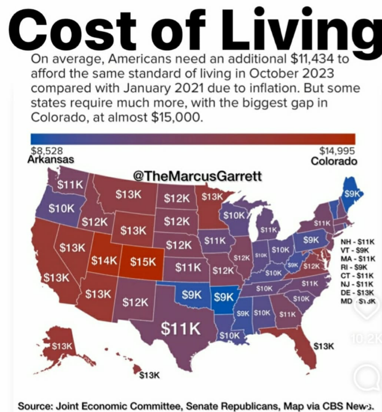
Cost of Living Increase by State Map
The visualization titled "The Shocking Difference in Cost of Living Increase Across U.S. States" effectively highlights ...
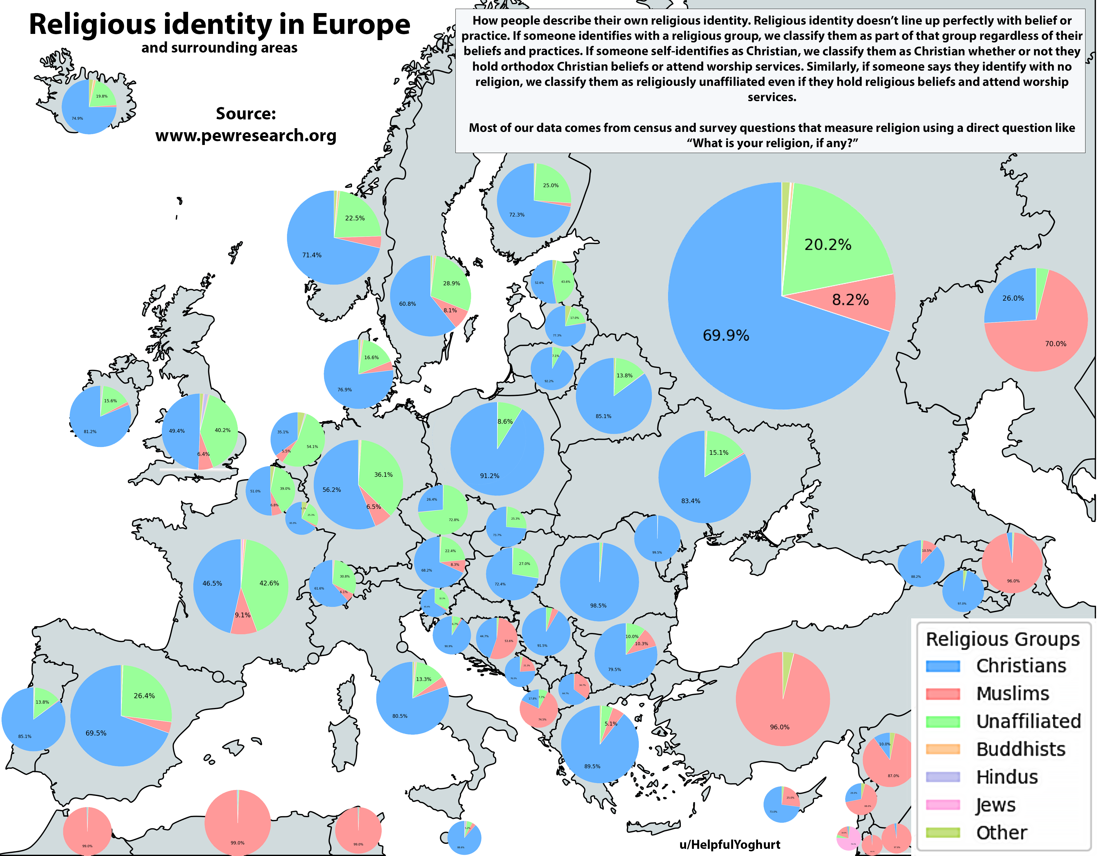
Religious Identity in Europe Map
The "Religious Identity in Europe Map" provides a comprehensive visualization of the religious landscape across the cont...
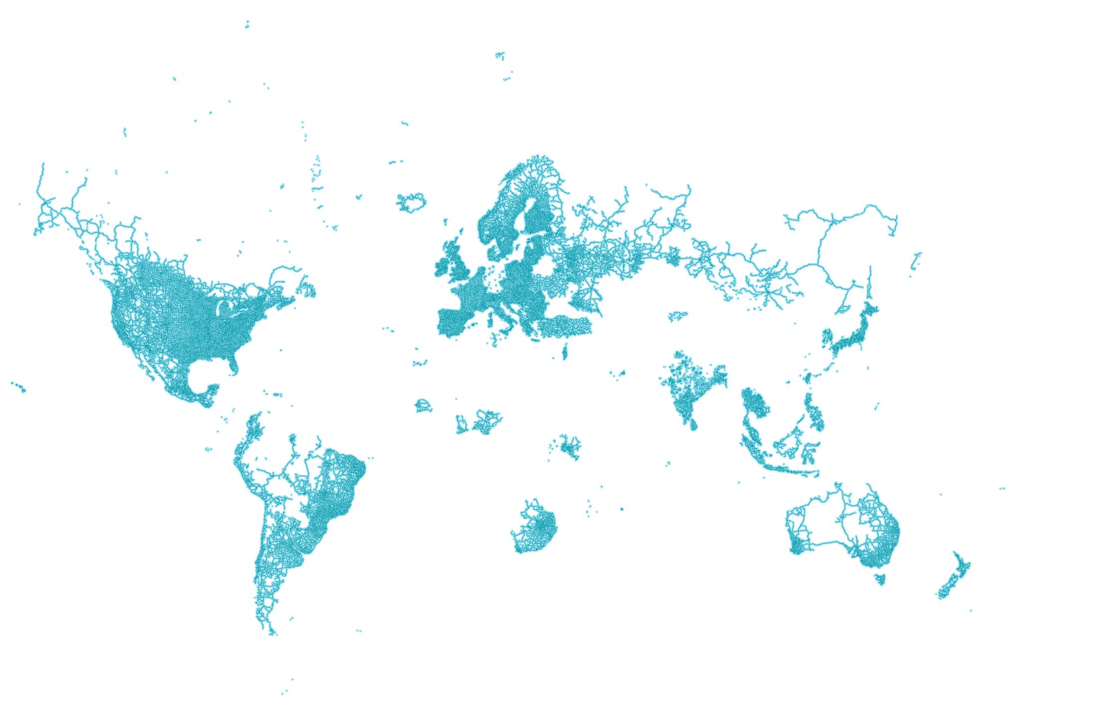
World Map According to Google Street View
The world map according to Google Street View offers a unique perspective on our planet by visualizing the locations tha...
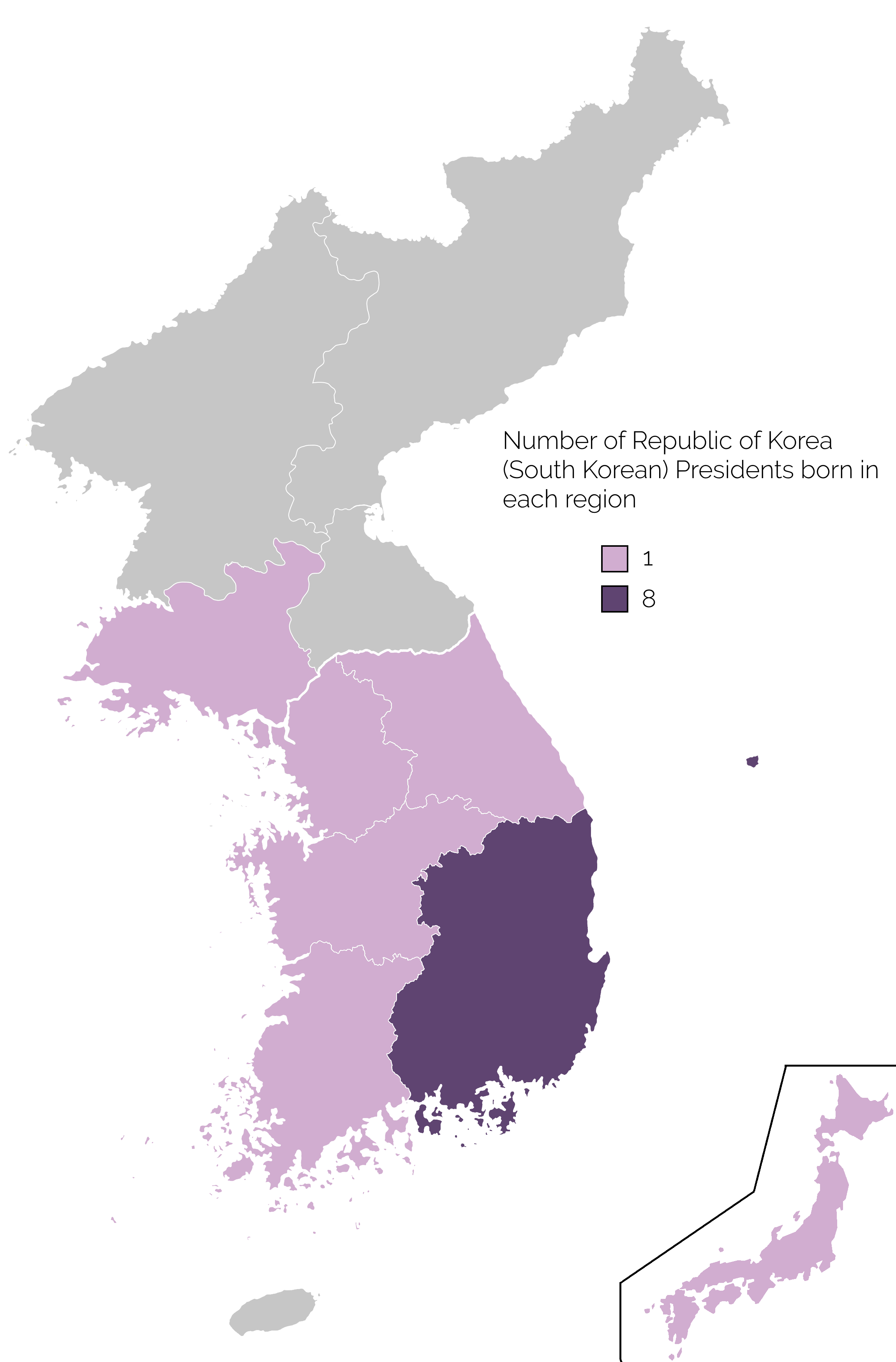
Map of Birthplaces of South Korean Presidents
The map titled 'Birthplace of South Korean Presidents' provides a visual representation of the geographic origins of the...
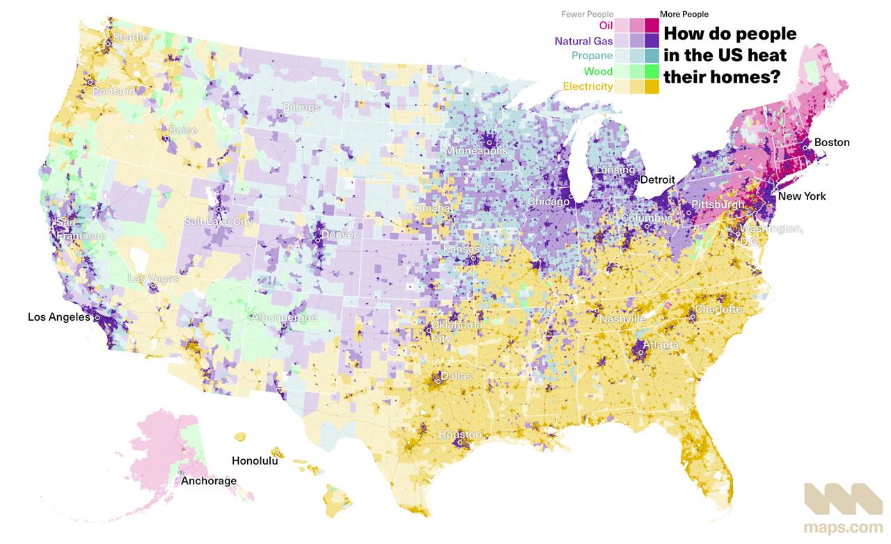
Home Heating Methods Across the United States Map
The visualization titled \...
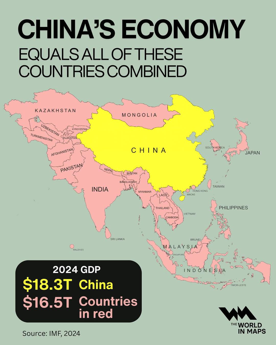
China's Economy vs Asian Countries Map
This map illustrates a striking economic reality: China's economy is larger than the combined economies of all the Asian...
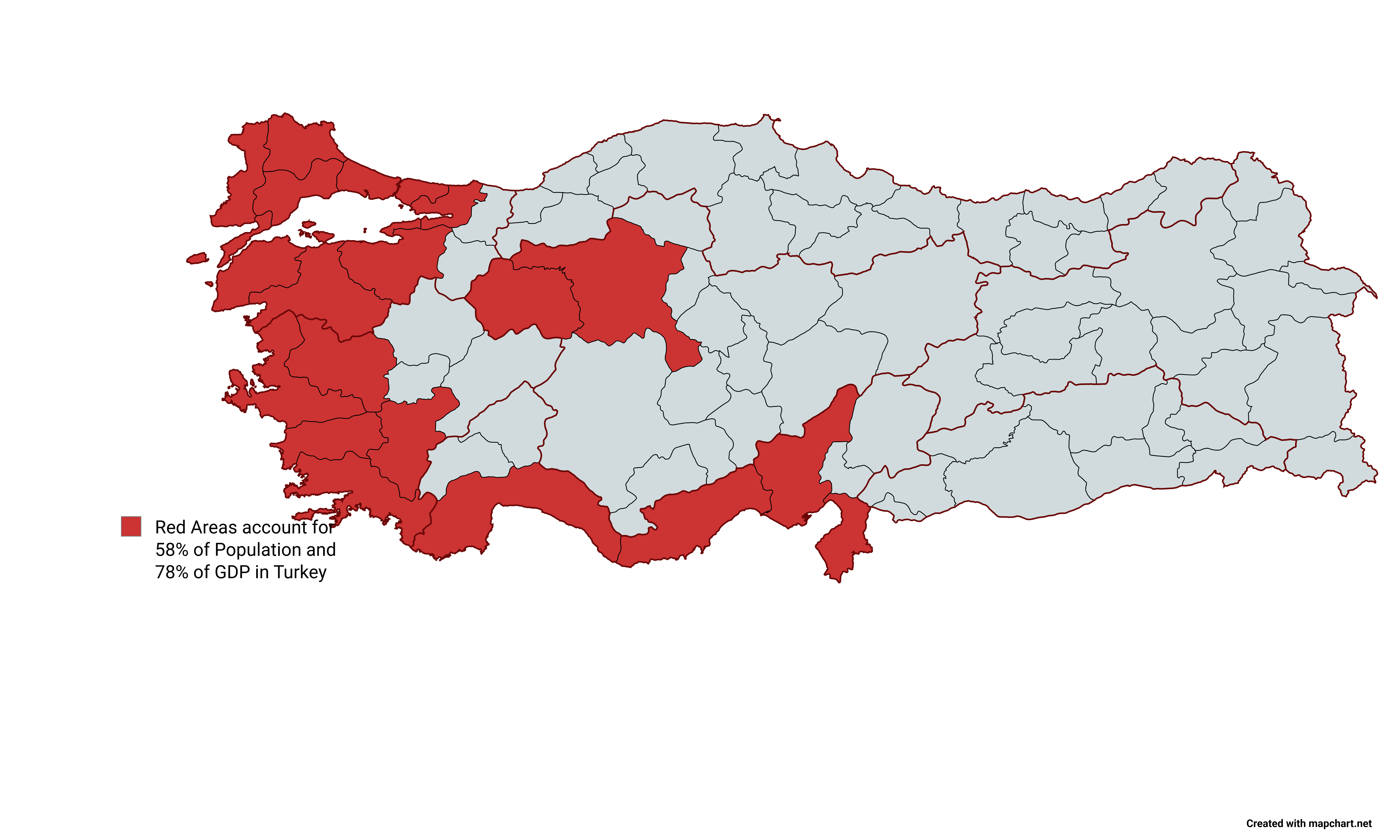
Turkey Population and GDP Distribution Map
The map titled "Red Areas Accounts for 58% of Population and 78% of GDP in Turkey" visually represents the distribution ...
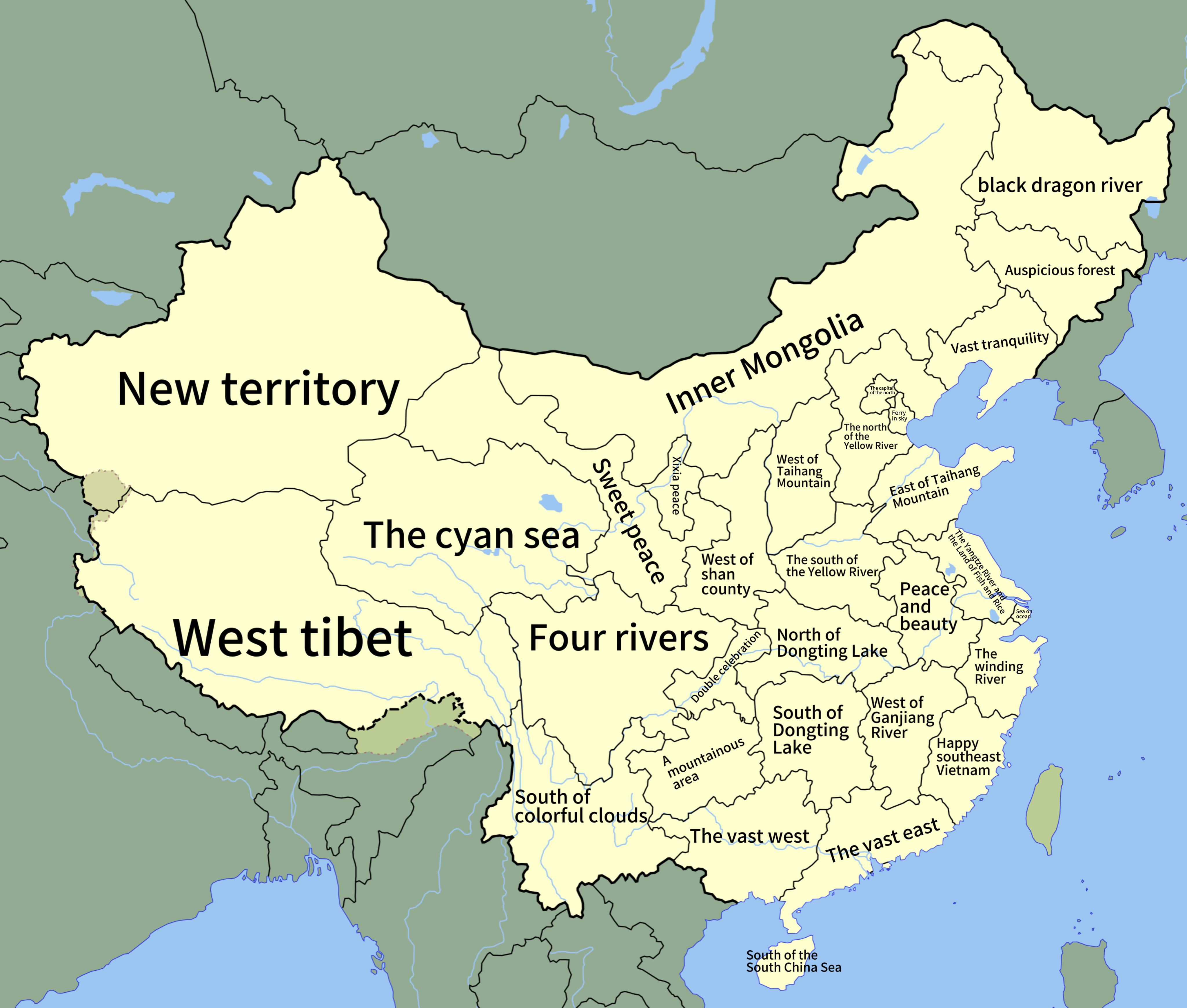
Literal Translations of Chinese Provinces Map
This map presents a fascinating look at the literal translations of the names of every province in China. From the spraw...
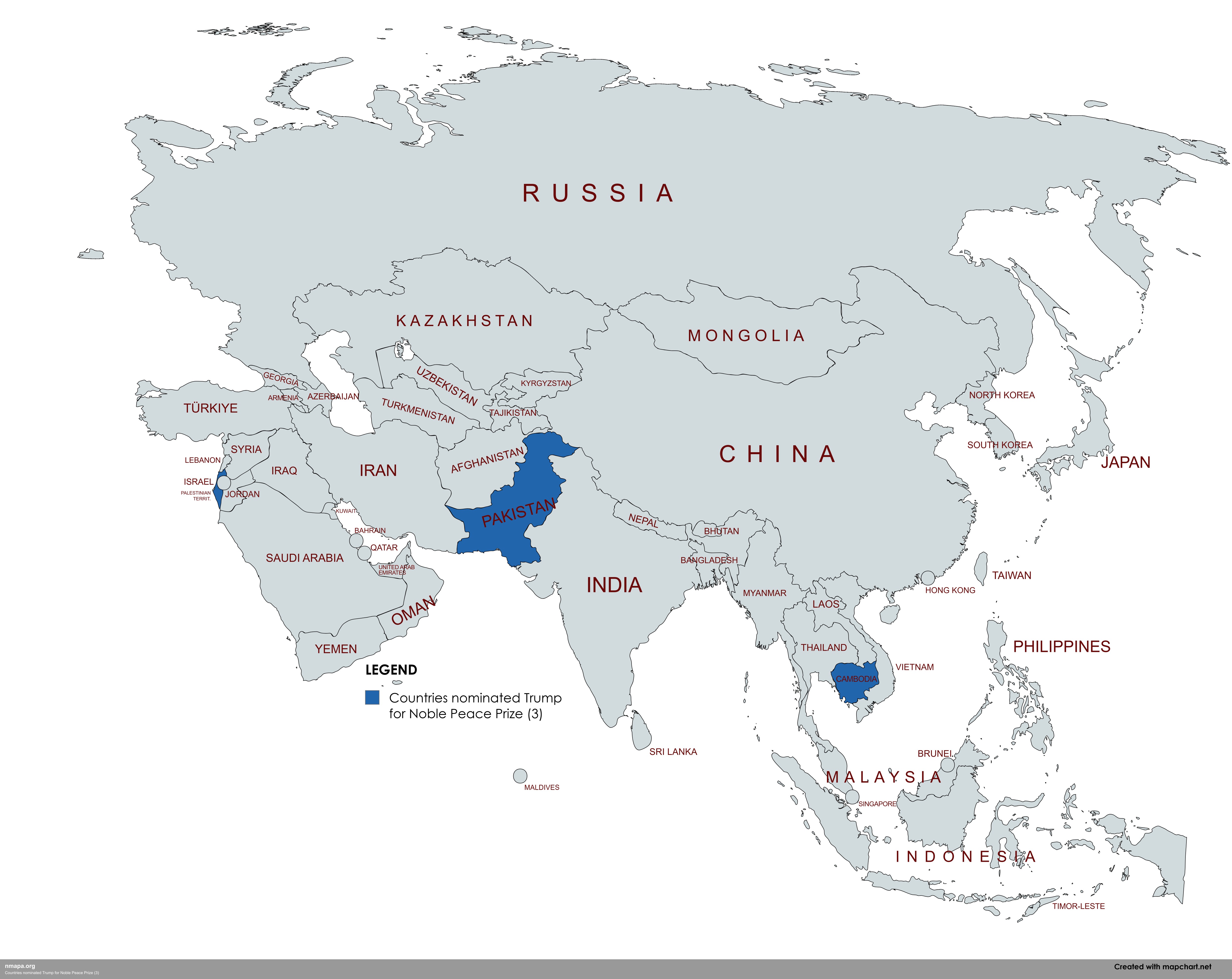
Countries nominated Trump for Noble Peace Prize (3) Map
This comprehensive geographical visualization presents "Countries nominated Trump for Noble Peace Prize (3)" in an acces...
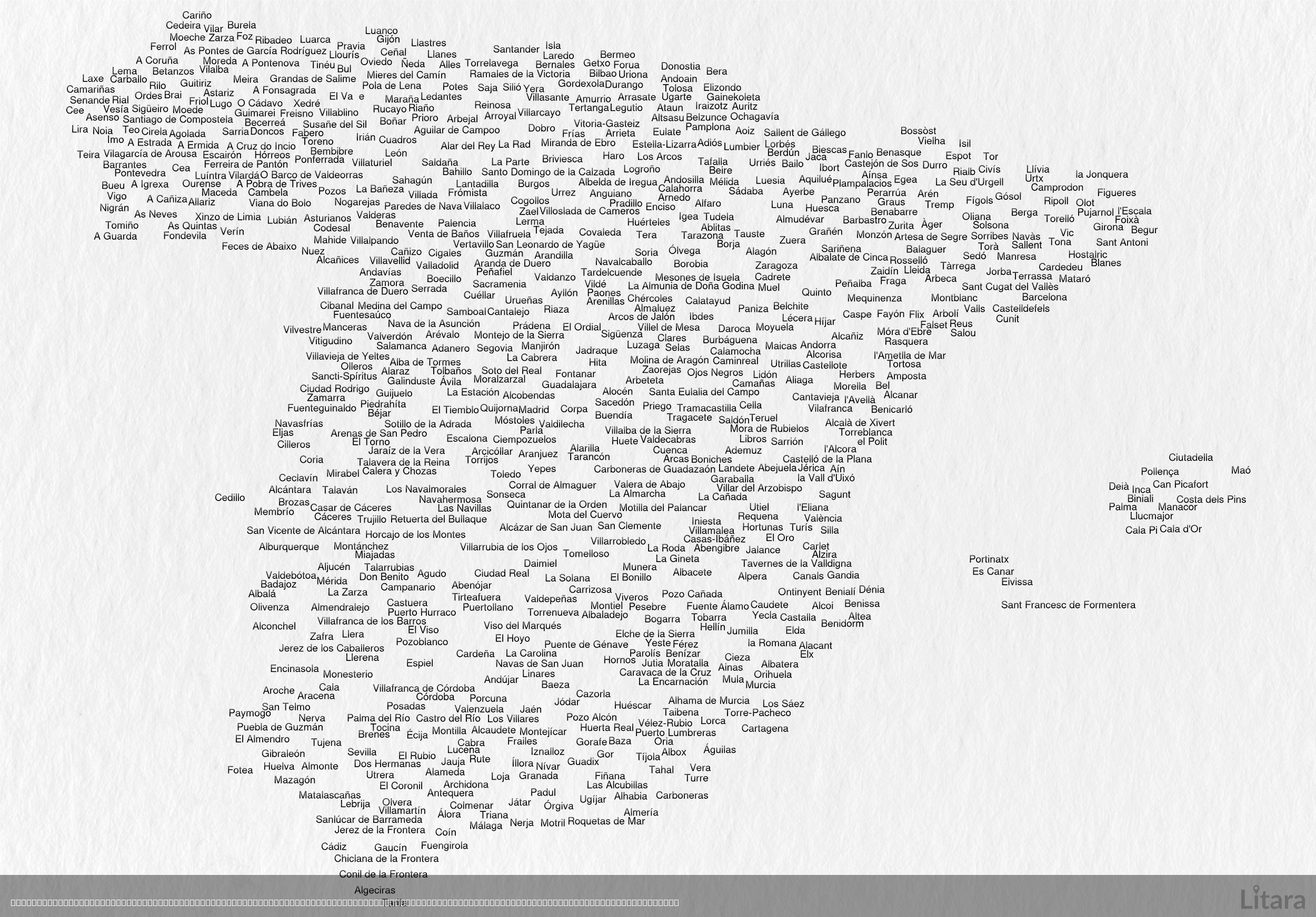
Typographic Map of Spain's Cities and Towns
This intriguing typographic map of Spain creatively illustrates the country's geographic shape using the names of hundre...
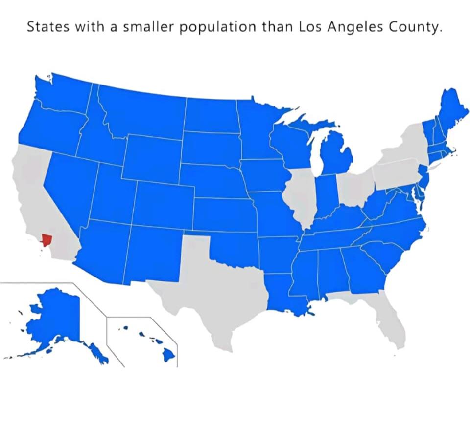
World Population Distribution Map
The "World Population Distribution Map" visualizes where people live across the globe, highlighting the density of popul...
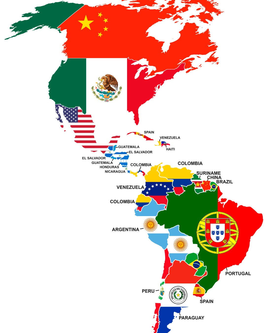
Largest Foreign Nationality in Each American Country Map
The visualization titled "Largest Foreign Nationality in Each American Country" provides a comprehensive view of the pre...