infrastructure Maps
56 geographic visualizations tagged with "infrastructure"
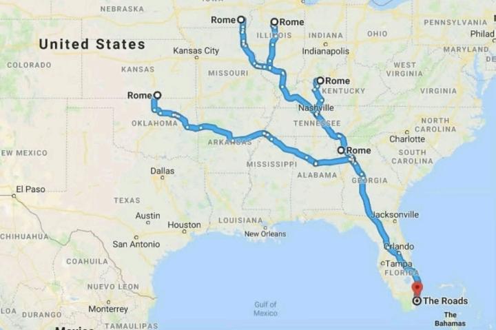
Road Networks Map of Ancient Rome
The visualization titled "All Roads Lead to Rome" illustrates the extensive network of roads constructed during the Roma...
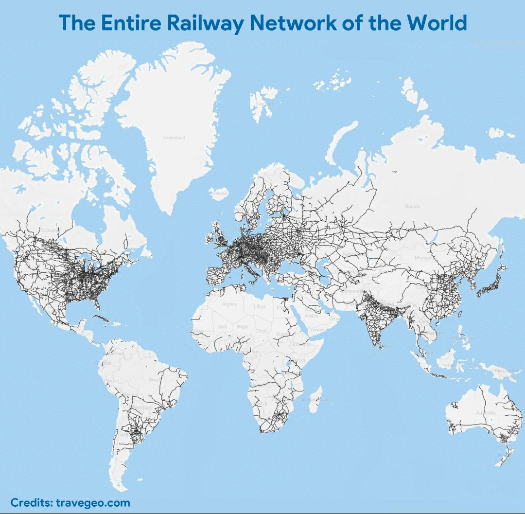
World Railway Network Map
The visualization titled "The Entire Railway Network of the World" offers a comprehensive look at the vast and intricate...
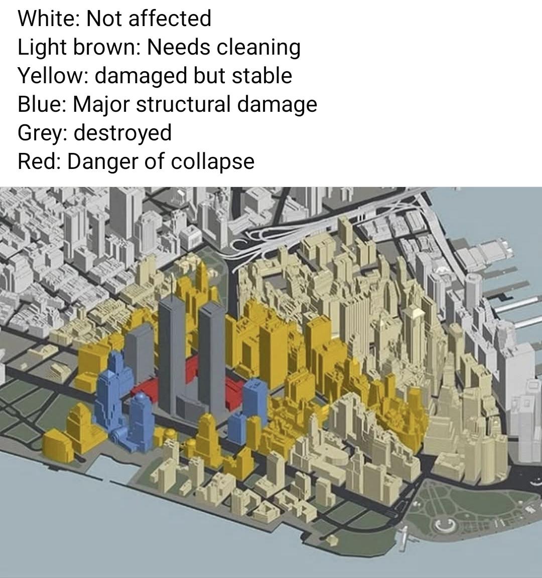
September 11 2001 Damage Map
The "September 11 2001 Damage Map" visually represents the extensive destruction that occurred during the terrorist atta...
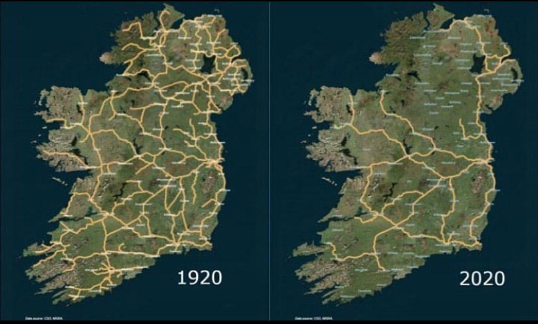
Irish Railway System Map 1920 to 2020
The map titled 'The Irish Railway System between 1920 and 2020' provides a comprehensive visualization of the railway in...
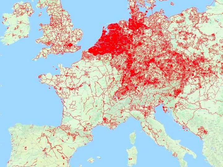
Cycle Paths Map of Europe
...
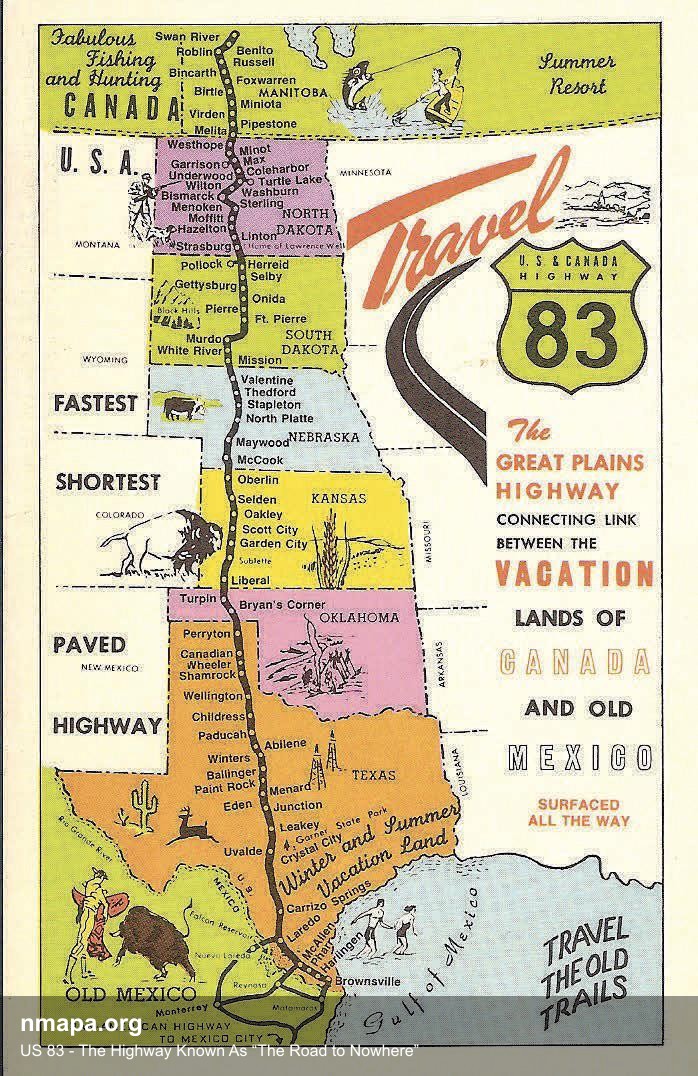
US 83 - The Highway Known As “The Road to Nowhere” Map
This geographical visualization presents "US 83 - The Highway Known As “The Road to Nowhere”" as a comprehensive map tha...
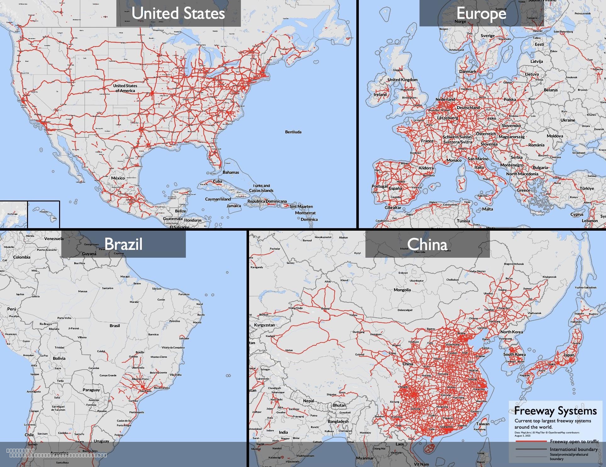
Largest Freeway Systems in 2025 Map
The "Largest Freeway Systems in 2025 Map" provides a comprehensive visualization of major freeway networks across the gl...
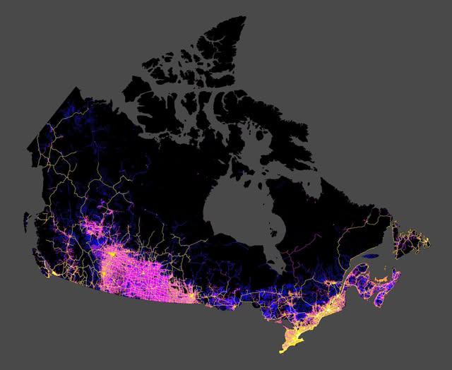
Roads in Canada Map
The map shared by Col. Chris Hadfield on Facebook provides a comprehensive visualization of all the roads in Canada. It ...
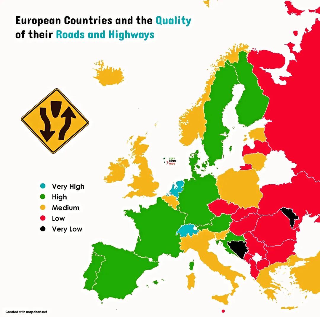
Road Quality by European Country Map
This map illustrates the quality of roads and highways across various European countries, highlighting the differences i...
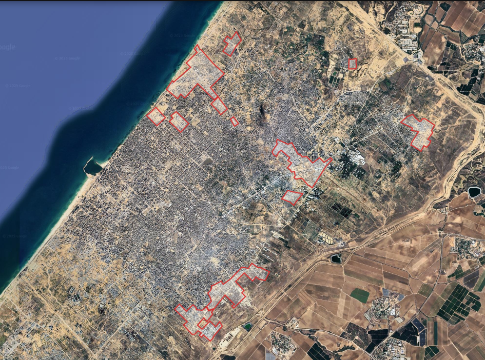
Gaza City Destruction Map of Completely Destroyed Areas
This map highlights the areas of Gaza City where buildings have been completely reduced to ashes, marked clearly by the ...
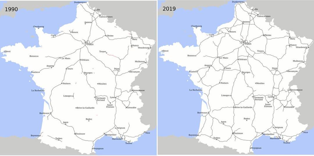
Motorway Construction Comparison Map: France vs. UK
This map effectively illustrates a striking statistic: over the last 25 years, France has constructed more miles of moto...
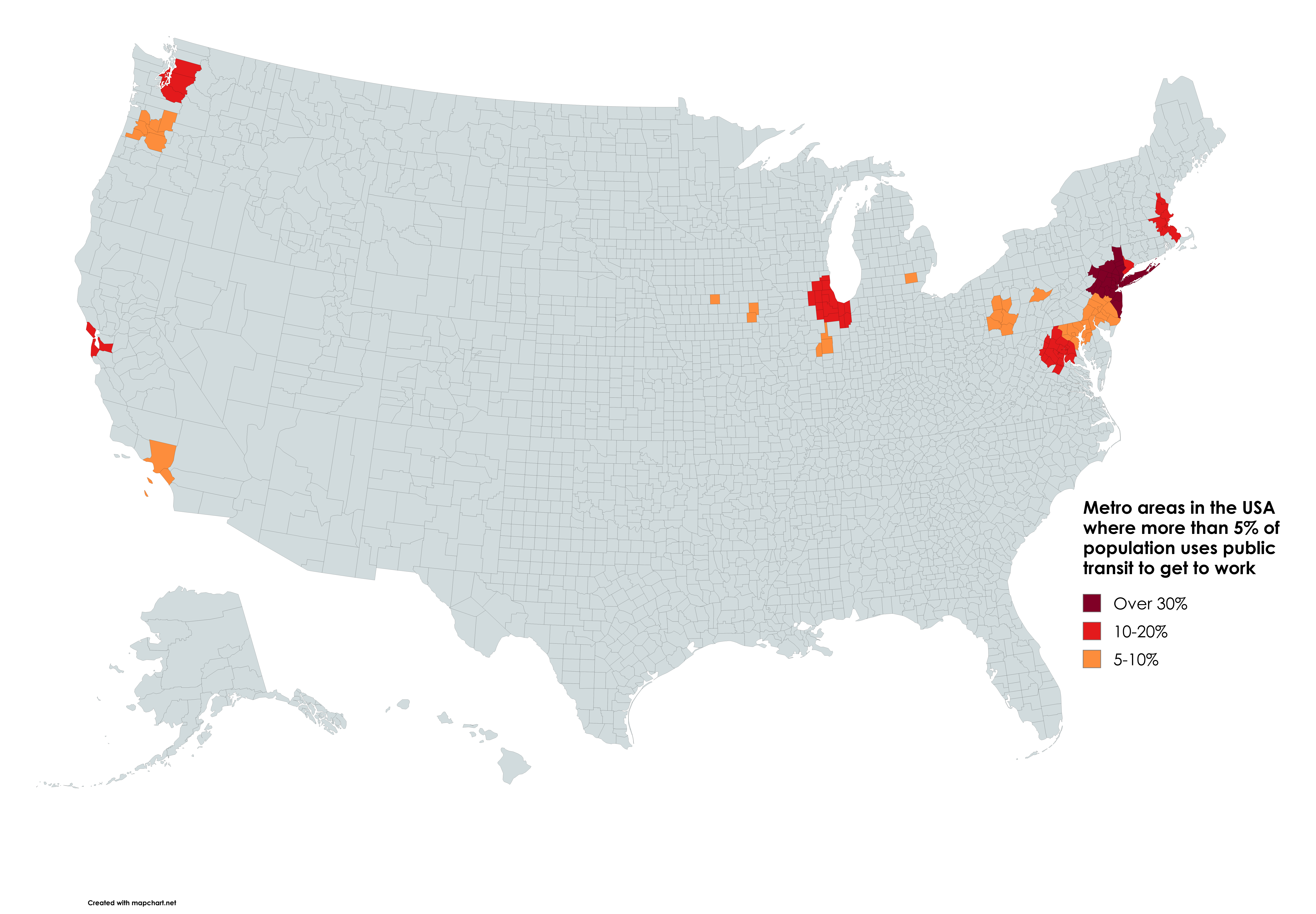
Public Transit Usage by Metro Area Map
According to the latest data from the U.S. Census Bureau, cities like New York, San Francisco, and Washington D.C. showc...
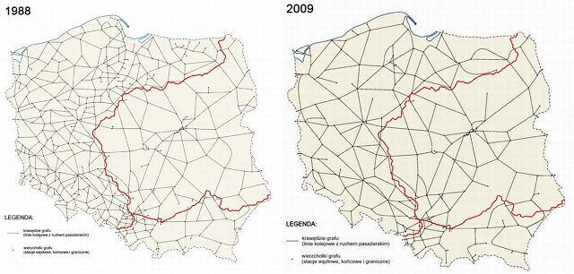
Downgrade of Polish Railway System Map
The "Downgrade of Polish Railway System Map" provides a stark visual representation of the decline in railway infrastruc...
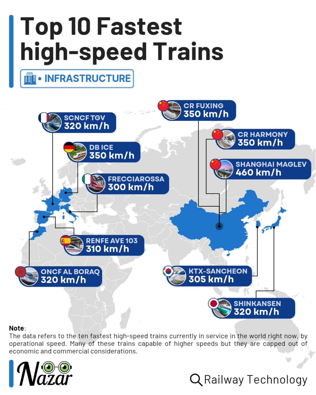
Top 10 Fastest High-Speed Trains Map
This map showcases the fastest high-speed trains in the world, ranking them based on their maximum operational speeds. F...
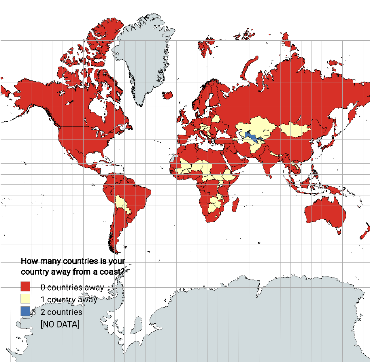
Distance from Coastline by Country Map
The "Distance from Coastline by Country Map" visually represents how far each country is from the nearest coastline. Thi...
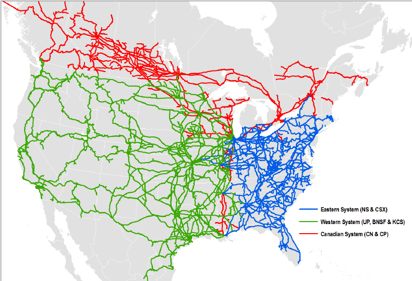
North American Rail System Map
The North American Rail System Map provides a comprehensive visualization of the extensive rail network that spans the U...
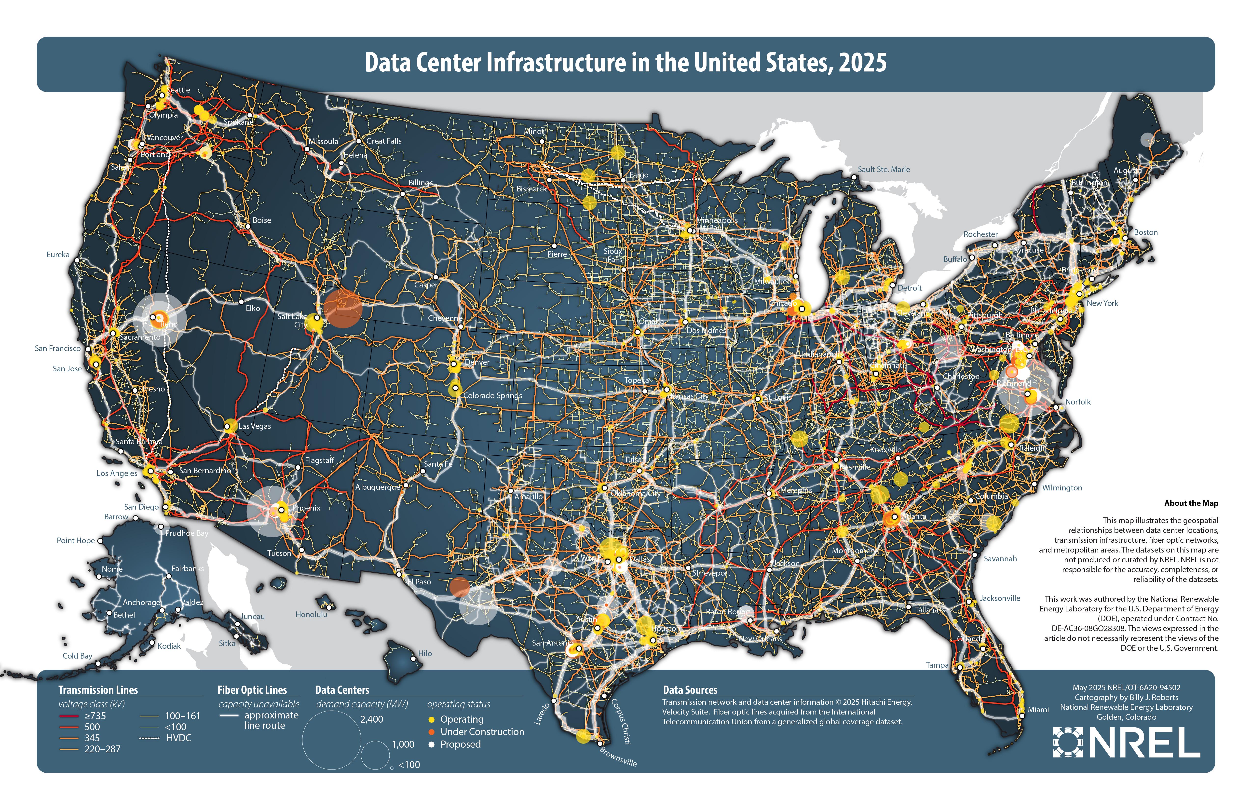
Data Center Infrastructure in the United States Map
The "Data Center Infrastructure in the United States, 2025" map visualizes the distribution and density of data centers ...
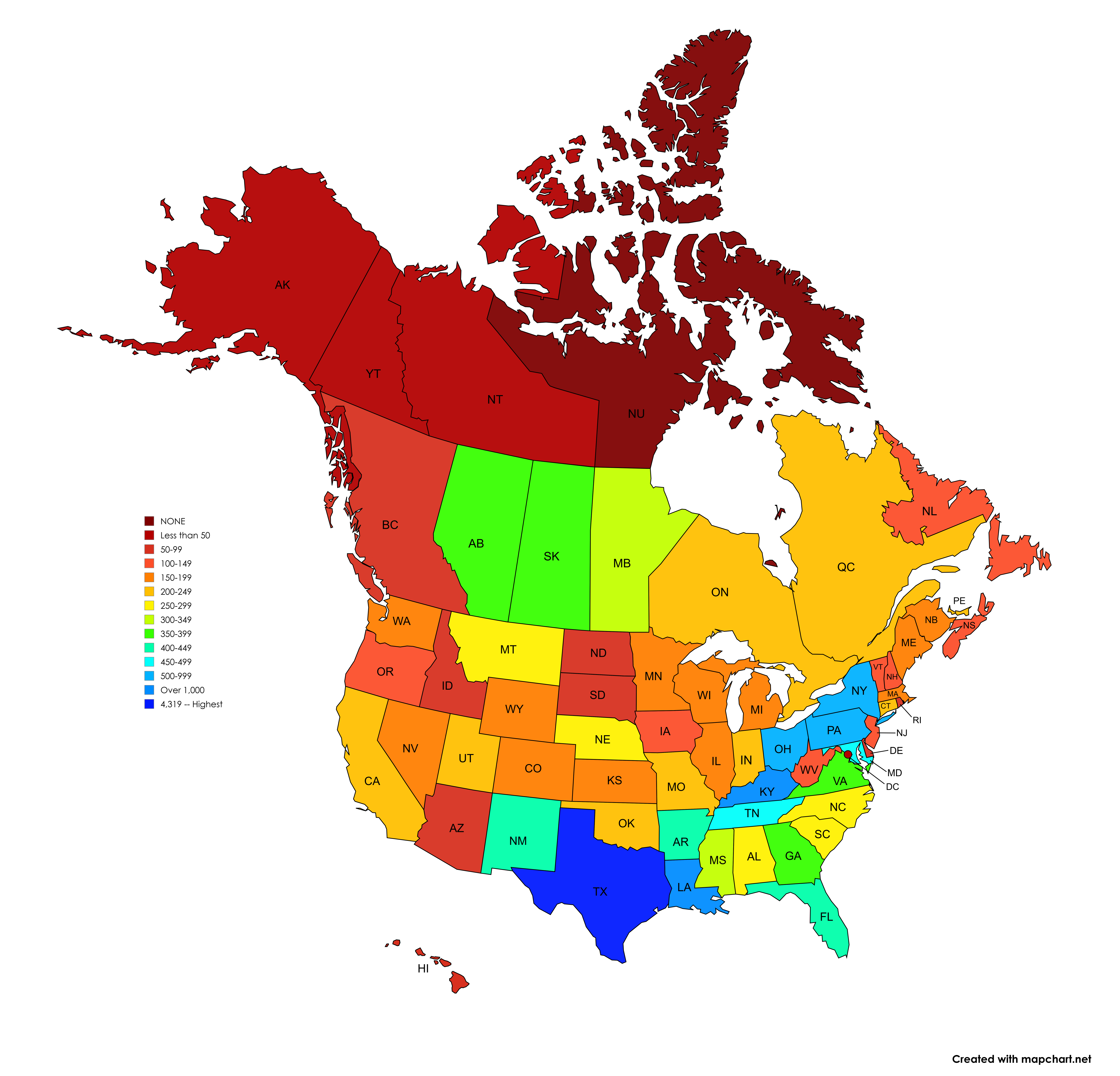
Number of Signed Highways Map by U.S. State and Canadian Province
The visualization titled 'Number of Signed Highways in each U.S. State and Canadian Province' presents a detailed count ...
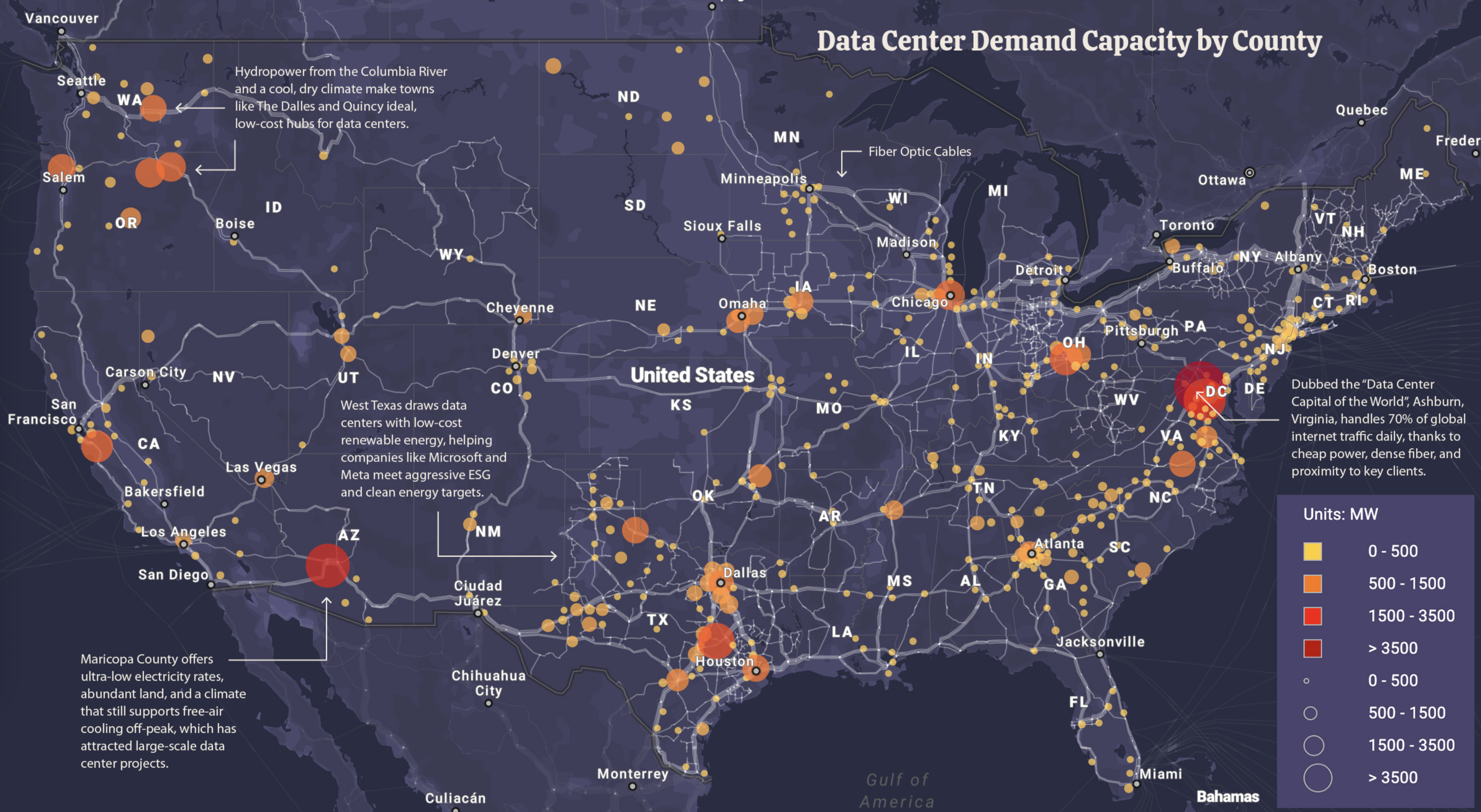
Data Center Power Demand Map
The "Data Center Power Demand Map" visualizes the power consumption of data centers across the United States, highlighti...
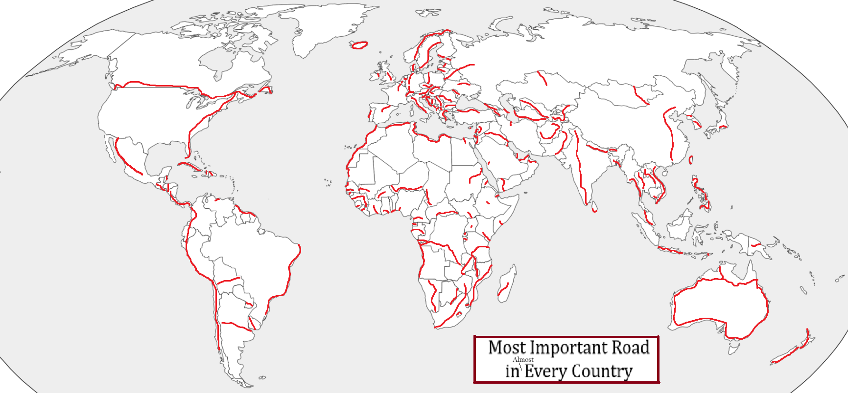
Most Important Road by Country Map
This intriguing map visualizes the most important road in nearly every country around the globe, evaluated through vario...
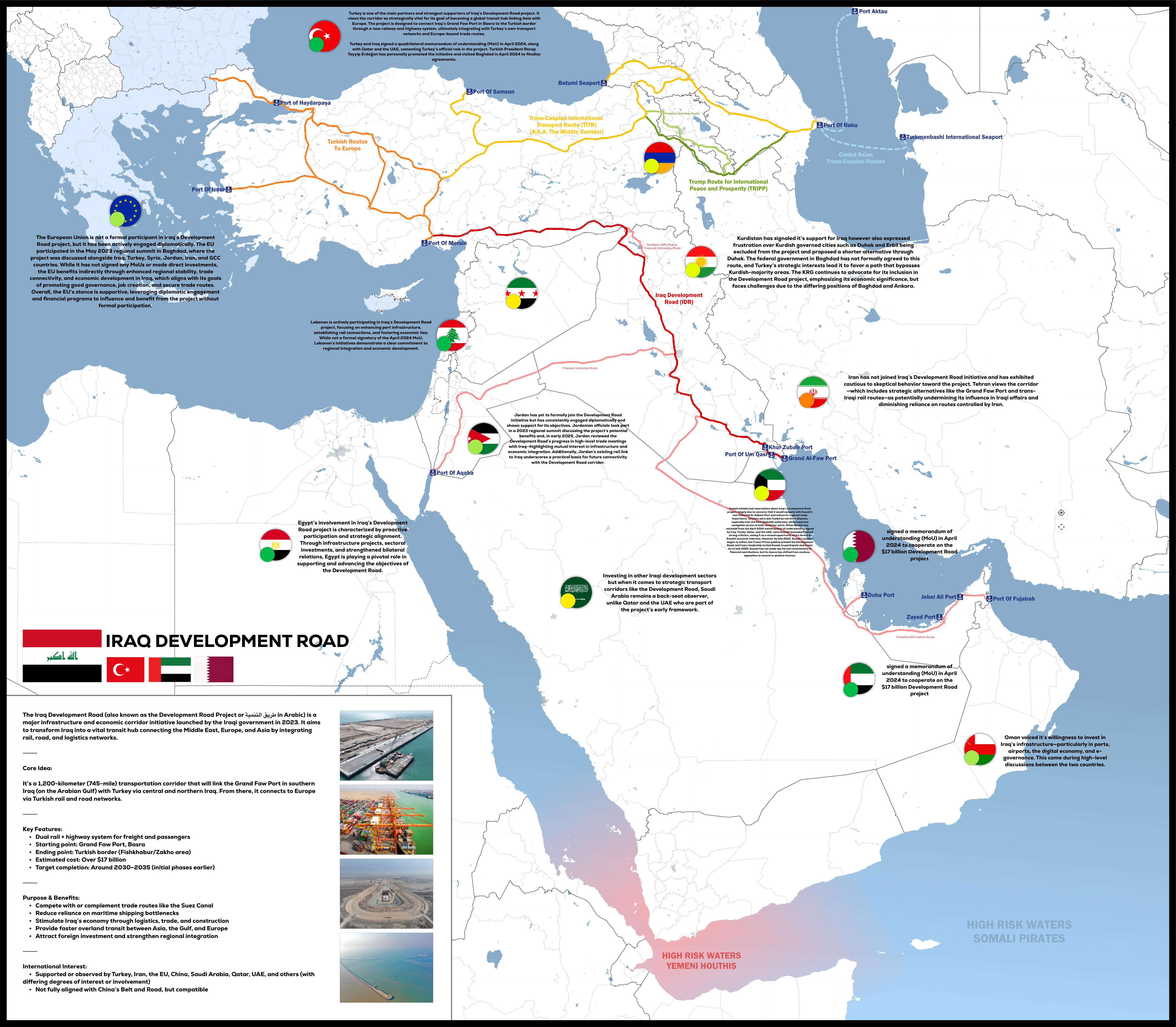
Iraq Development Road Project Map 2025
The "Iraq Development Road Project 2025" map provides a detailed visualization of the planned infrastructure development...
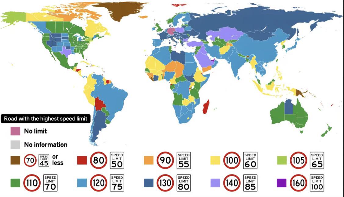
Max Speed Limit by Country Map
The "Max Speed Limit by Country Map" provides a visual representation of the maximum speed limits set across different n...
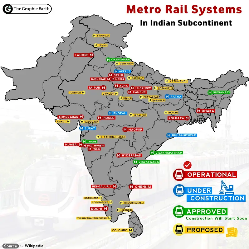
Metro Rail System in Indian Subcontinent Map
The "Metro Rail System in Indian Subcontinent Map" provides a comprehensive overview of the extensive metro rail network...
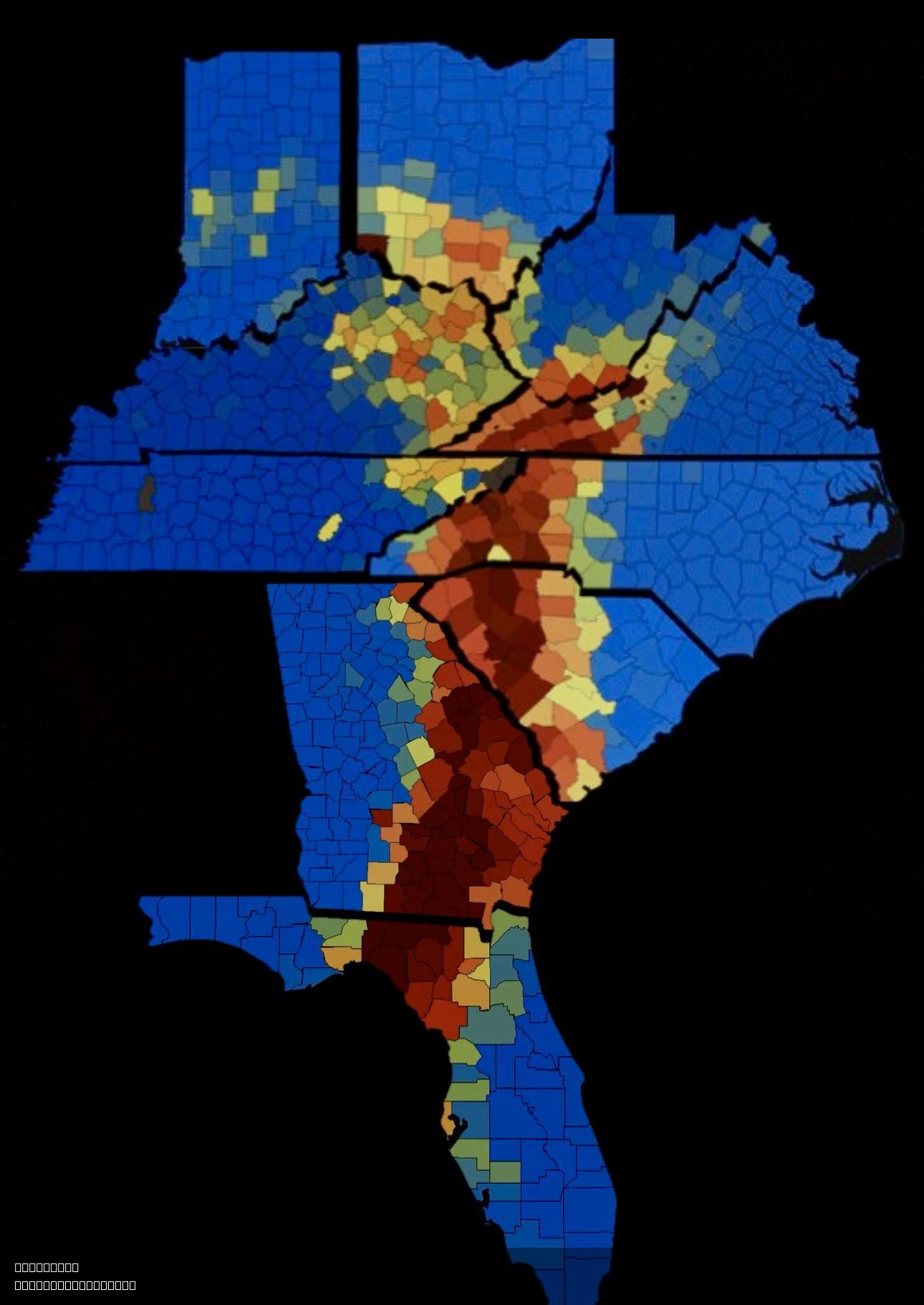
Hurricane Helene Power Outage Map
The "Hurricane Helene Power Outage Map" provides a visual representation of the widespread power outages experienced dur...

Public Bathroom Locations Map in Finland
...
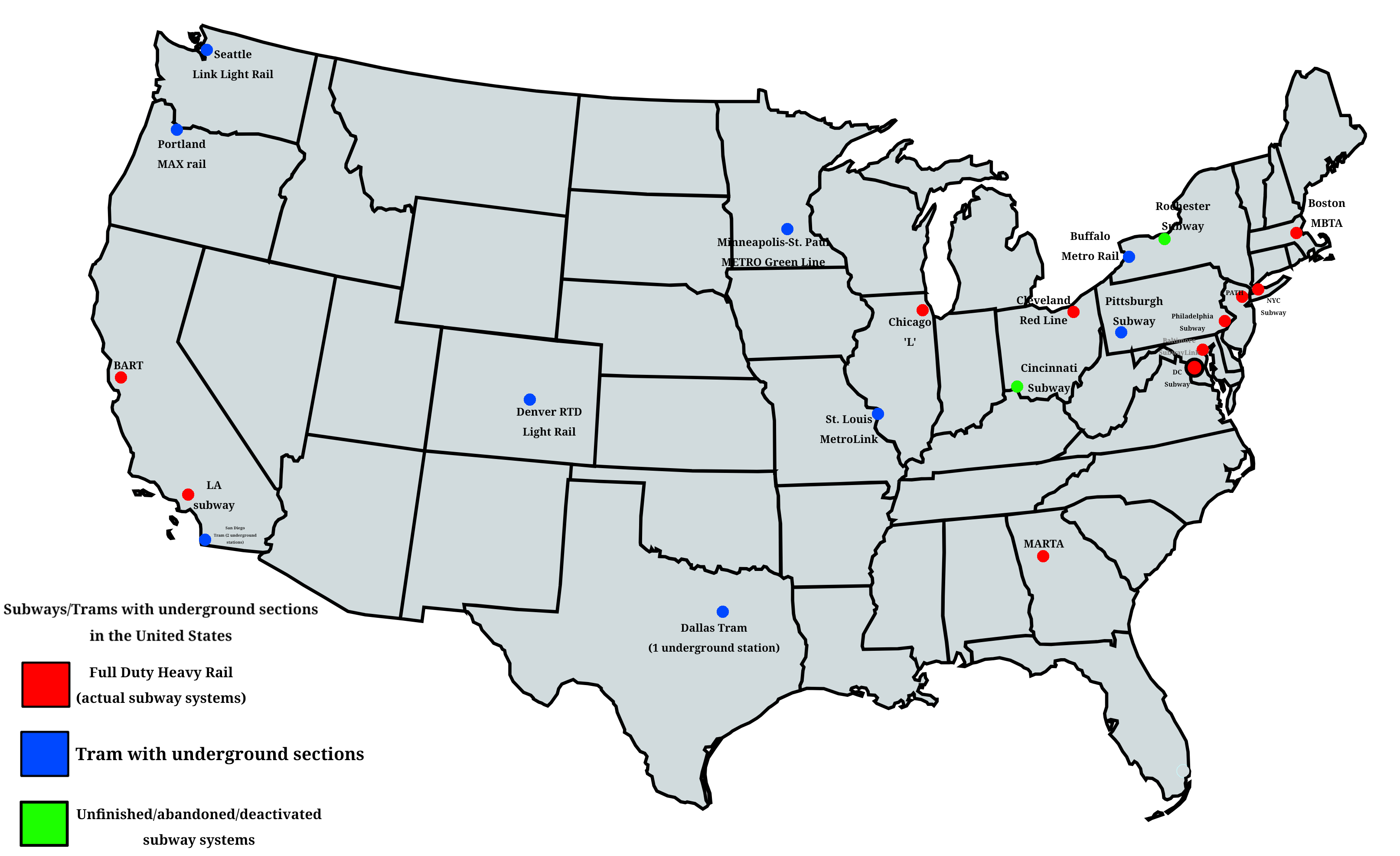
Subway and Tram Systems with Underground Sections Map
This comprehensive map provides a detailed overview of all subway and tram systems across the United States that feature...
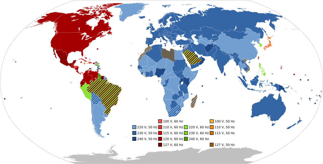
Frequency and Voltage Supplied by Country Map
The visualization titled "Most Common Frequency and Voltage Supplied in Each Country" provides a comprehensive overview ...
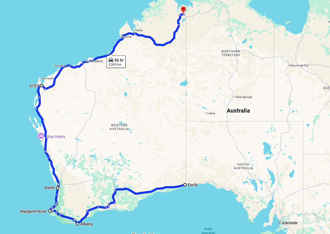
Longest One-Province Road Map
This map visualizes the longest one-province/state road in the world, stretching an impressive 5,363 kilometers and taki...

Rail Network Map of Luxembourg
The rail network map of Luxembourg provides a comprehensive view of the country's railway infrastructure, highlighting t...
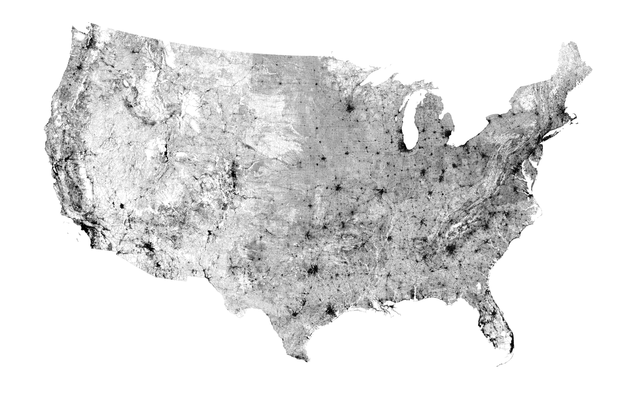
Public Road Map of the US (2018)
...
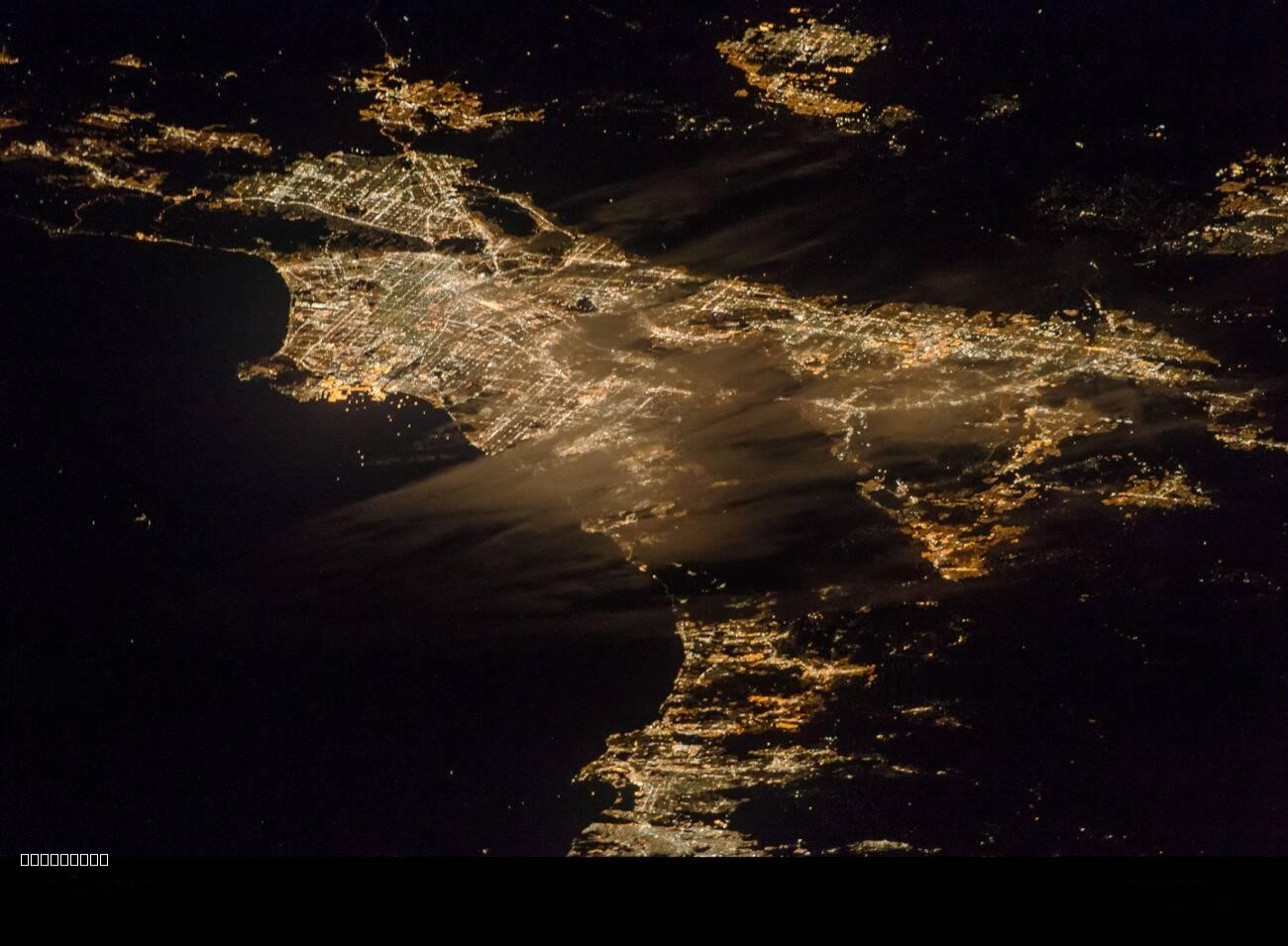
Southern California Urban Nightscape Map
The "Urban Expanse of Southern California at Night" map showcases the sprawling metropolitan areas of Southern Californi...
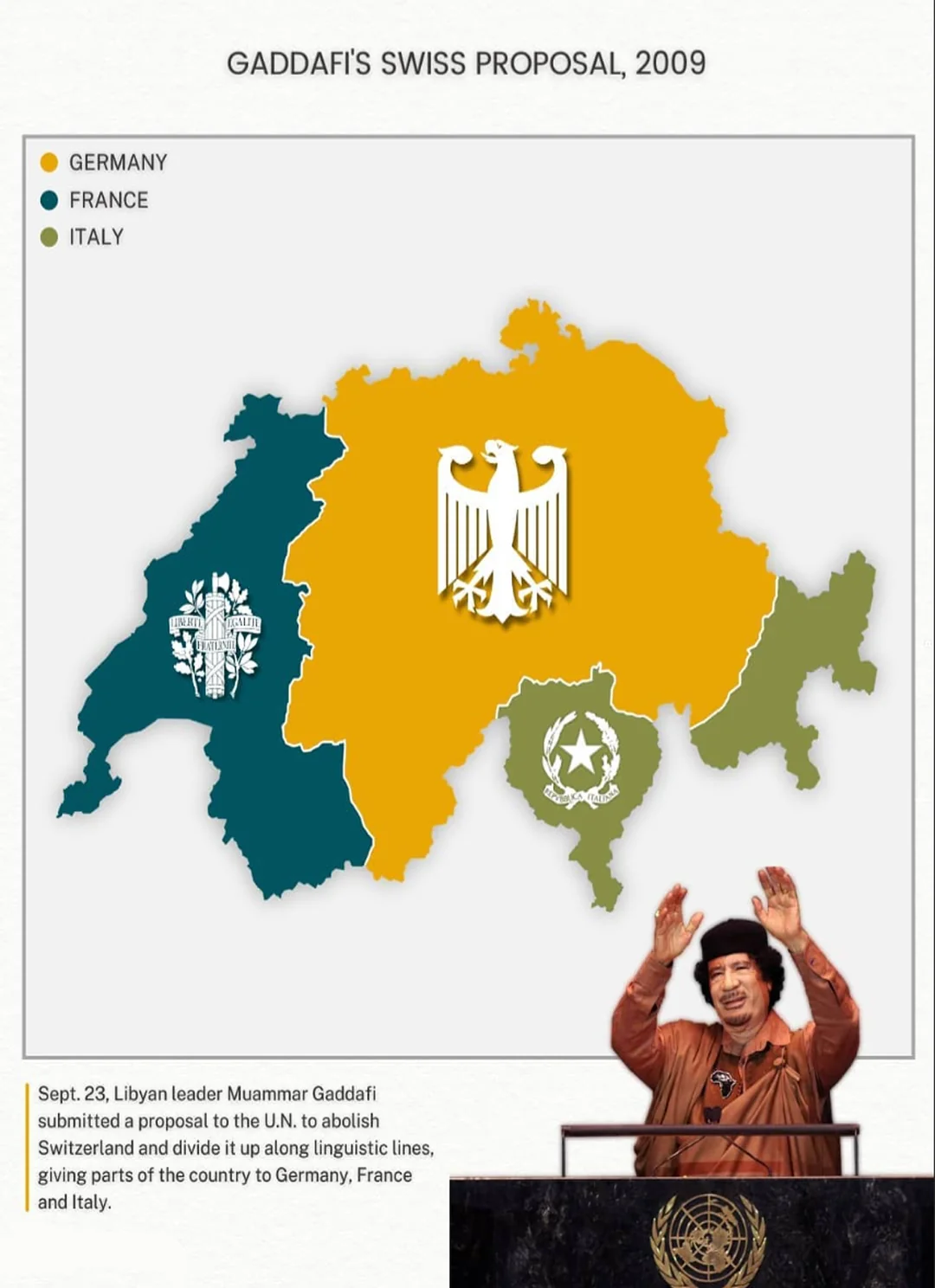
Muammar Gaddafi's Switzerland Plan Map
The visualization titled \...
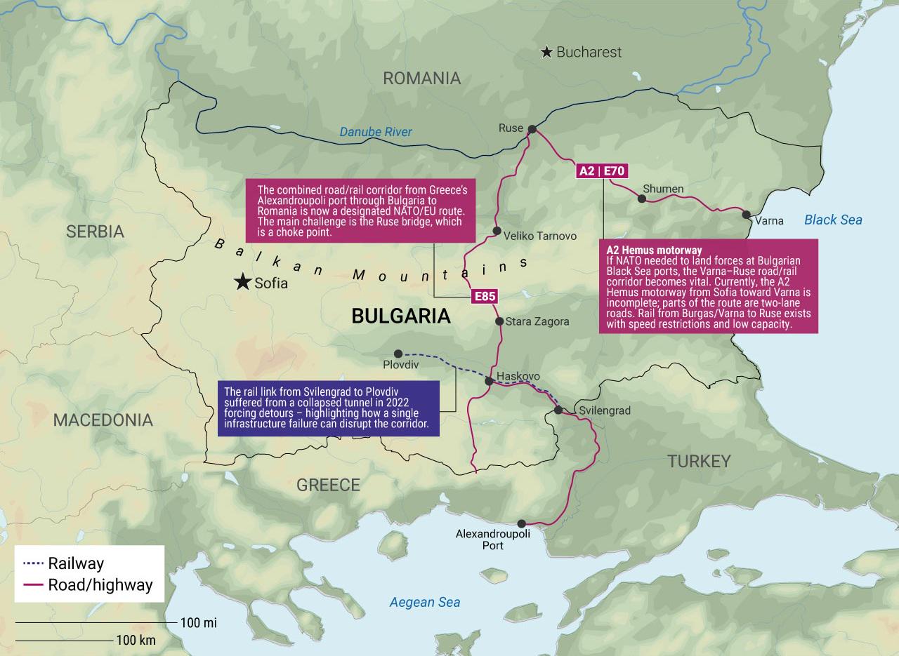
Bulgaria's Infrastructure Pain Points for NATO Map
The "Bulgaria's Infrastructure Pain Points for NATO Map" provides a visual representation of the critical areas within B...
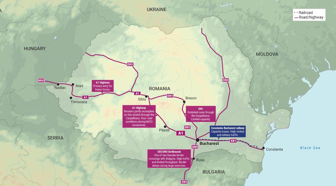
Romania Infrastructure Pain Points for NATO Map
The "Romania Infrastructure Pain Points for NATO Map" visualizes critical vulnerabilities in Romania's infrastructure th...
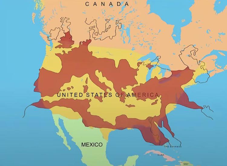
Map of the Roman Empire at its Peak Over the U.S.
This fascinating map overlays the boundaries of the Roman Empire at its zenith around 117 AD with the geographical layou...
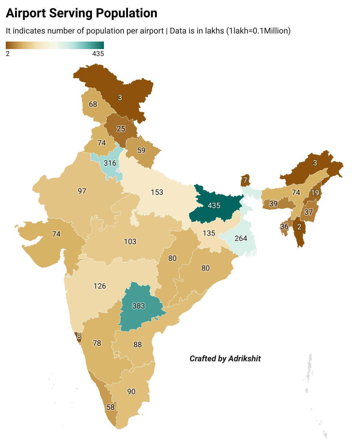
Airport Serving Population in India Map
This map displays the relationship between airports and the populations they serve across India. It highlights the acces...
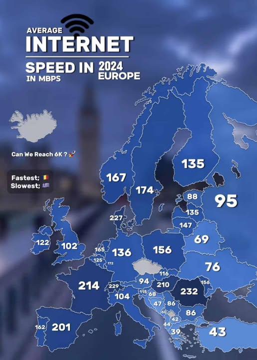
Average European Internet Speed By Country Map
Interestingly, these high speeds are linked to advanced telecommunications infrastructures, such as fiber-optic networks...
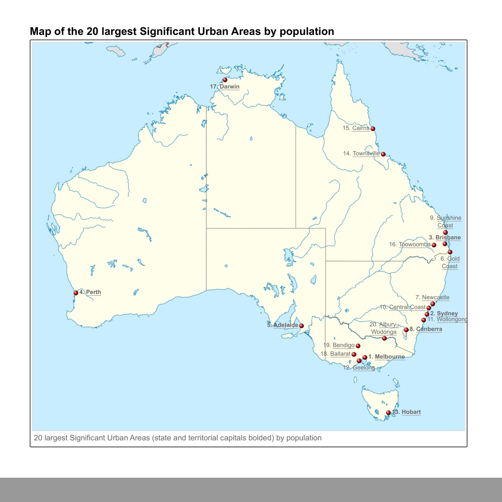
Twenty Largest Urban Areas in Australia Map
This map presents a visual representation of the twenty largest urban areas in Australia, highlighting population concen...
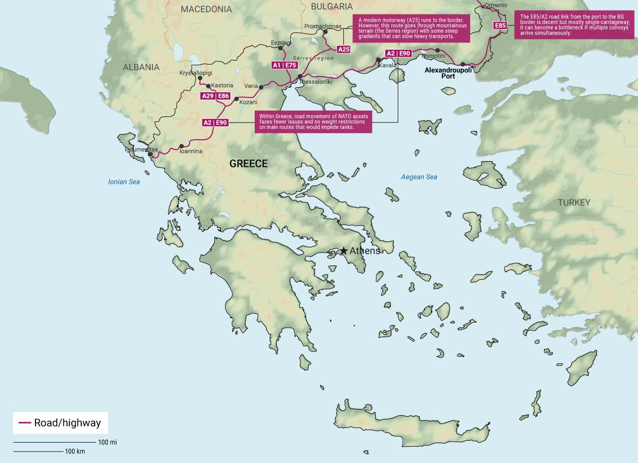
Greece's NATO Infrastructure Pain Points Map
The \...
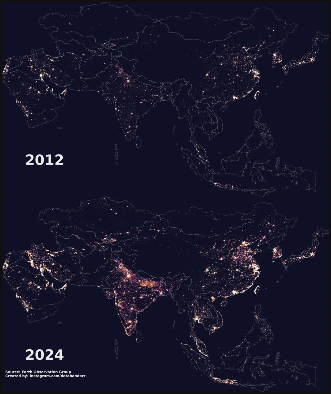
Night-time Light Map of Asia 2012 vs 2024
The "Night-time Light Map of Asia 2012 vs 2024" presents a compelling visual comparison of artificial light emissions ac...
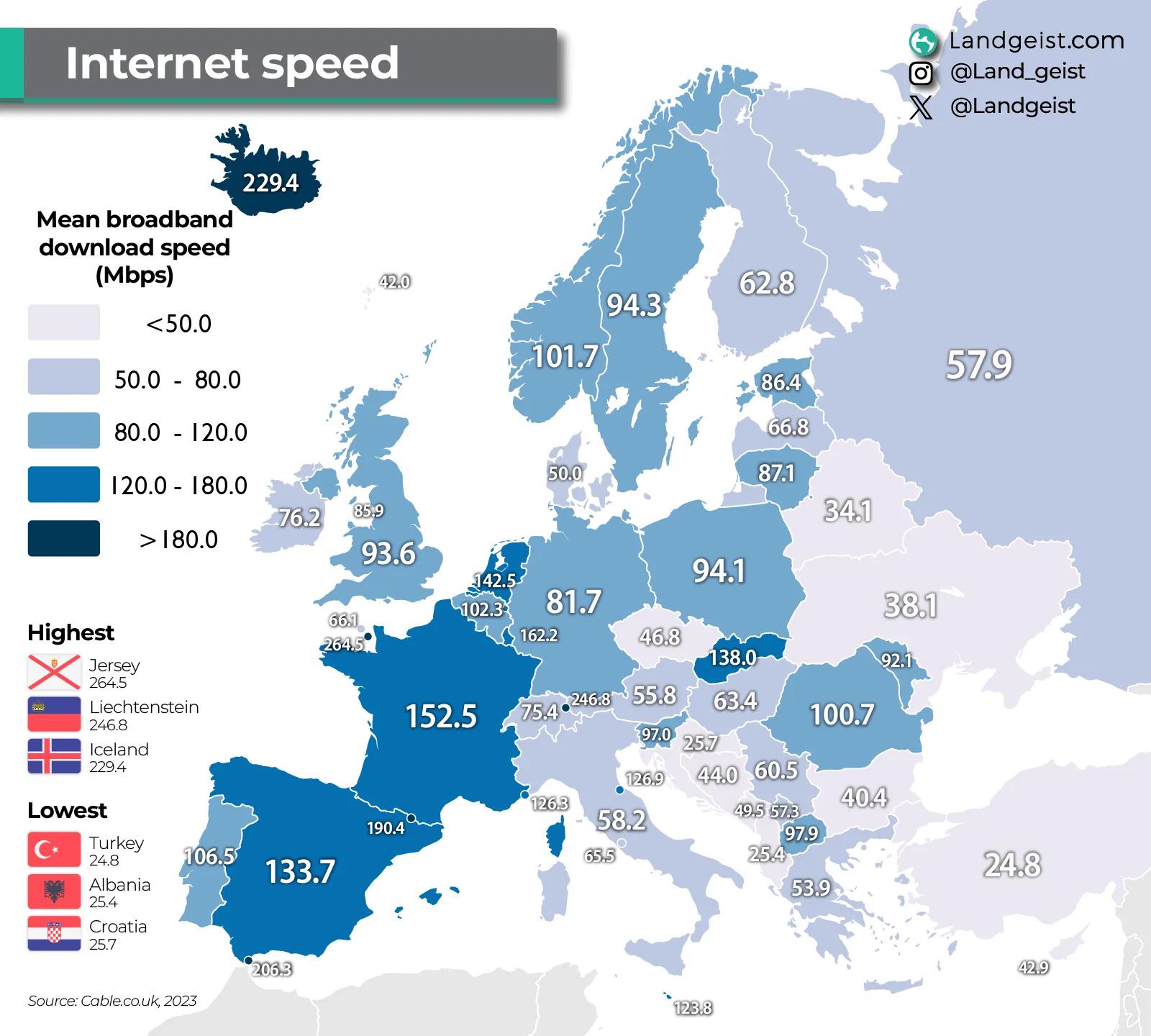
Internet Speeds in Europe Map
The "Internet Speeds in Europe Map" provides a comprehensive visualization of broadband speeds across various European c...
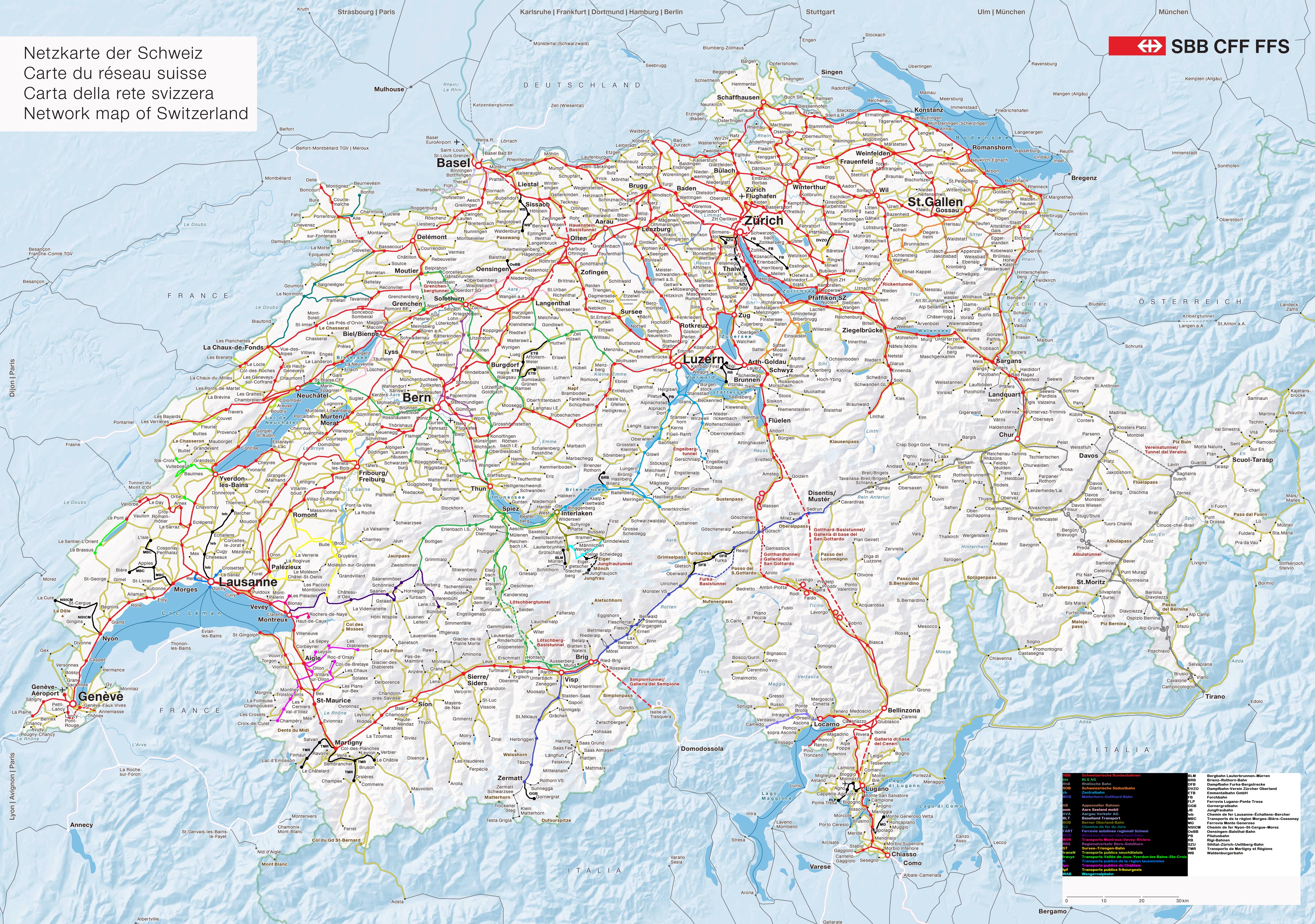
Railway Network of Switzerland by Company Map
The "Railway Network of Switzerland by Company Map" provides a detailed visualization of the various railway lines in Sw...
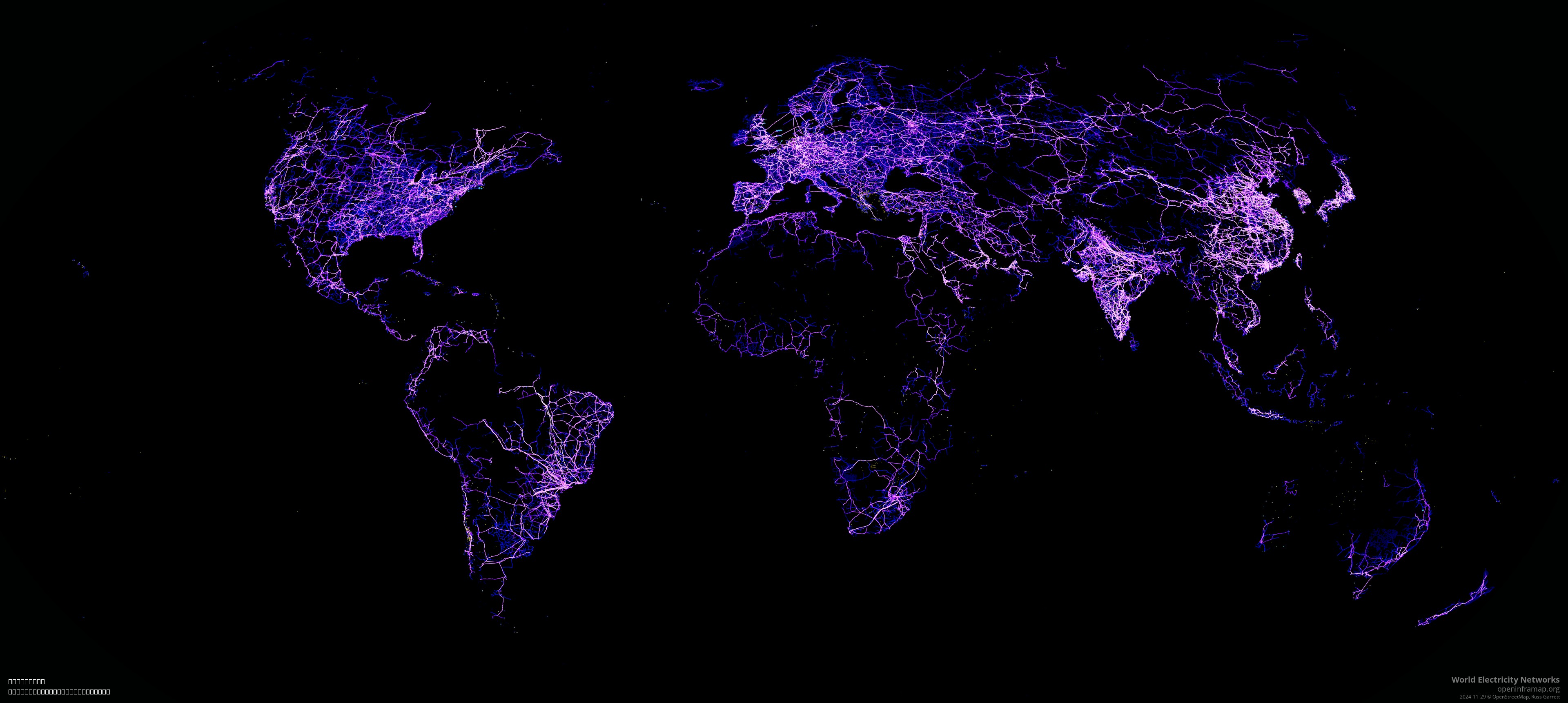
World Electricity Transmission Grid Map
Interestingly, the transmission grid operates at high voltages to reduce energy loss during transit. High-voltage lines ...
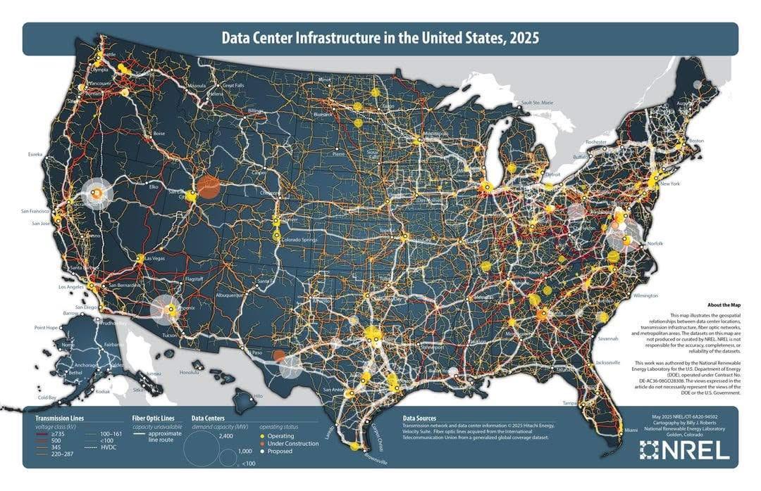
Data Center Infrastructure Map
The \...
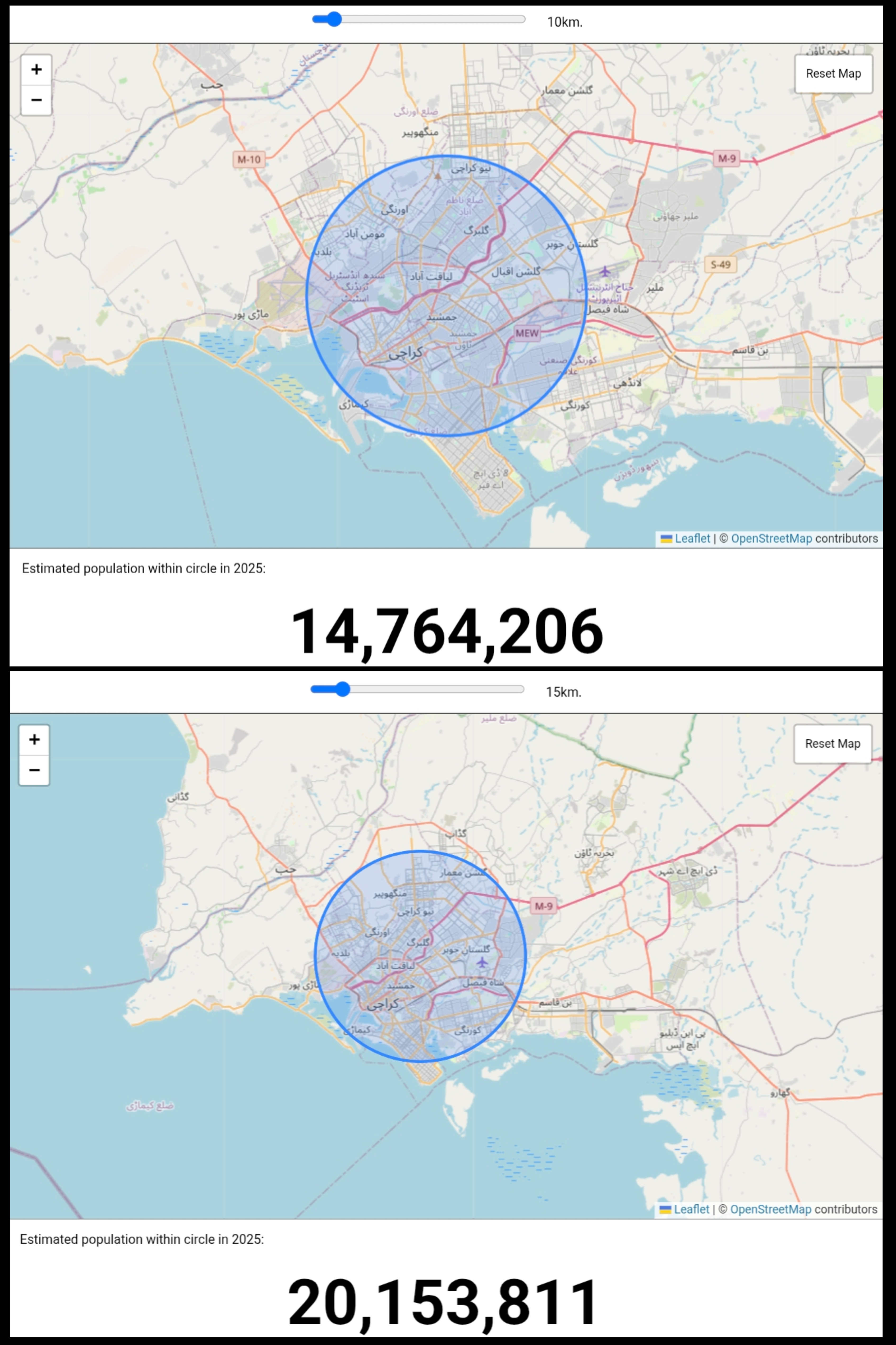
Karachi Population Density Map 2025
...
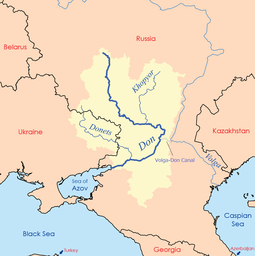
Volga-Don Canal Connection Map
The Volga-Don Canal Connection Map illustrates the crucial link between the Caspian Sea and the world’s oceans via the V...
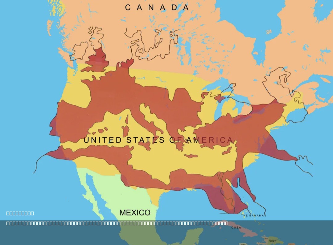
Roman Empire Size Comparison Map with USA
The map titled "The Size of the Roman Empire at Its Height Compared to the United States" visually compares the vast ter...
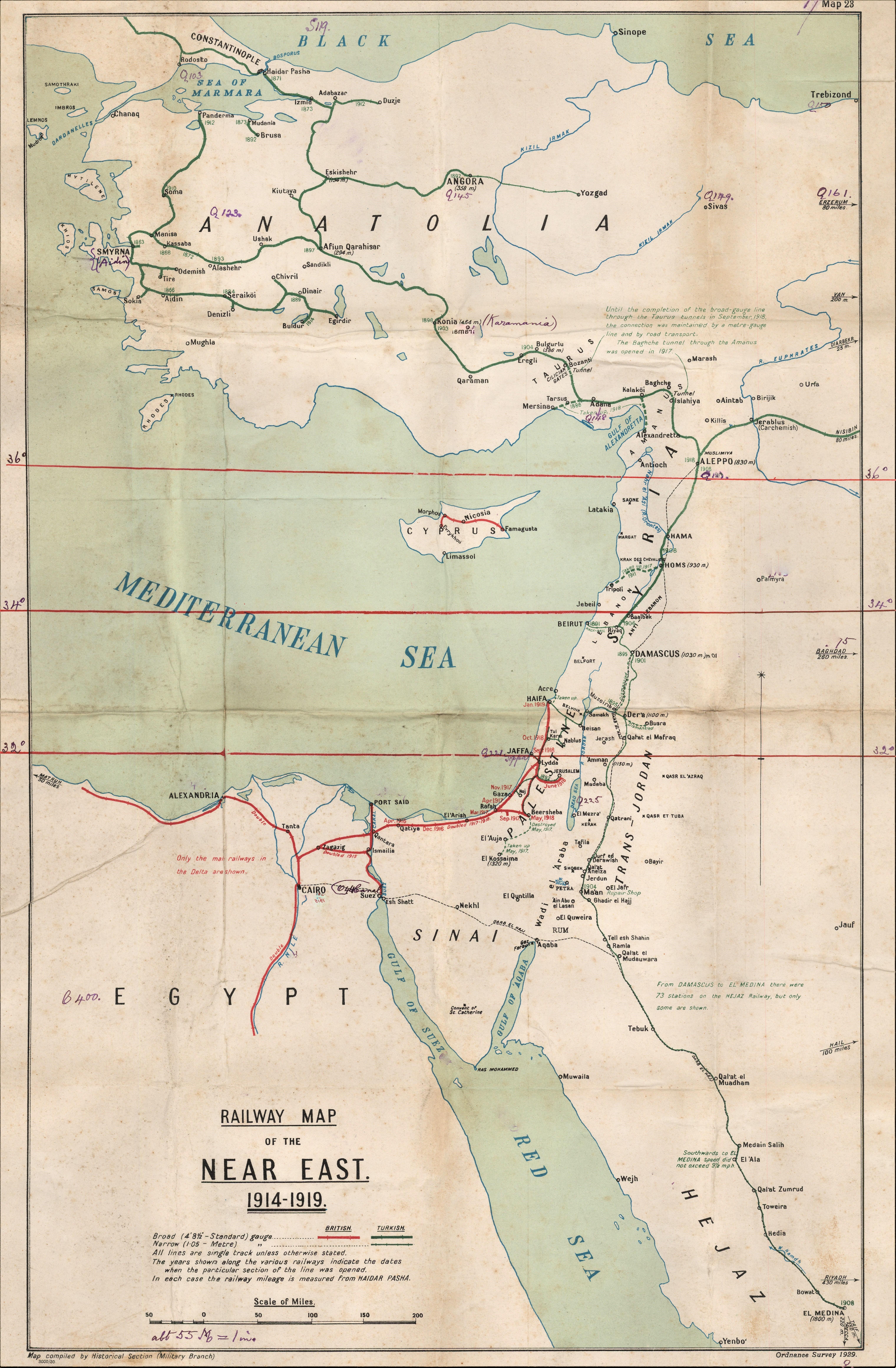
Railway Map of the Near East 1914-1919
...
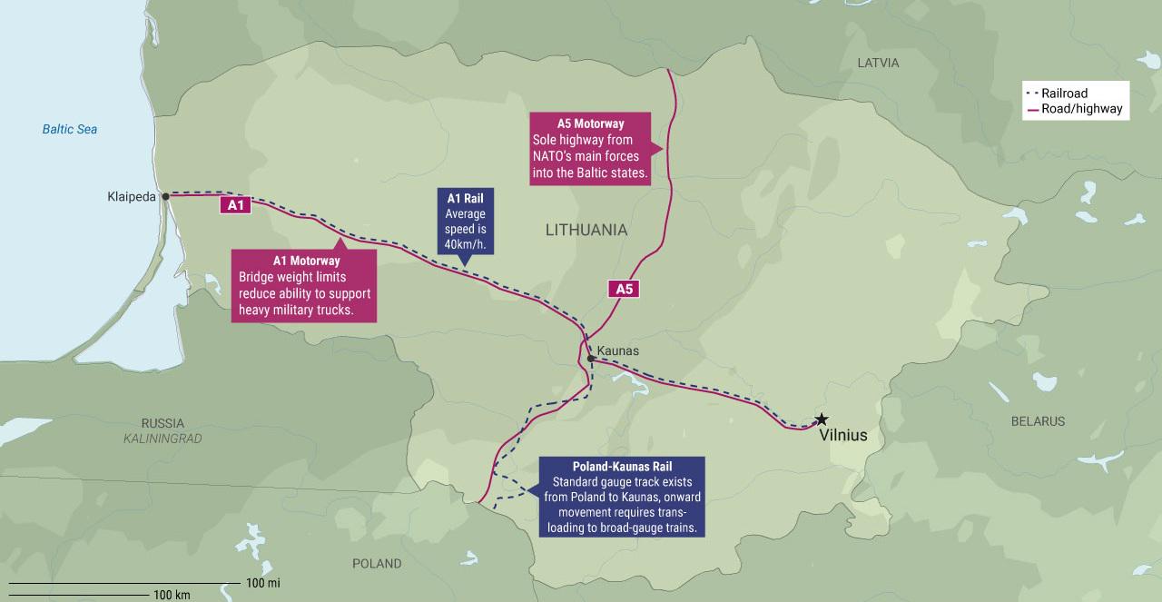
Lithuania's Infrastructure Pain Points for NATO Map
The "Lithuania's Infrastructure Pain Points for NATO Map" provides a detailed visualization of Lithuania's critical infr...

Union Canal Transportation Route Map Pennsylvania
This map illustrates Pennsylvania's Union Canal Transportation Route, a vital waterway that facilitated trade and transp...