Distance from Coastline by Country Map

Alex Cartwright
Senior Cartographer & GIS Specialist
Alex Cartwright is a renowned cartographer and geographic information systems specialist with over 15 years of experience in spatial analysis and data...
Geographic Analysis
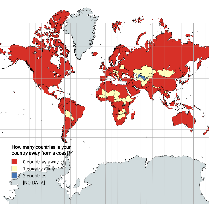
What This Map Shows
The "Distance from Coastline by Country Map" visually represents how far each country is from the nearest coastline. This intriguing map uses color gradients to indicate the varying distances, allowing viewers to quickly grasp how landlocked a nation is or how accessible it is to maritime trade and resources. From countries like Mongolia, which can be hundreds of miles from the sea, to coastal nations like Japan, this visualization provides a stark reminder of the geographical realities that shape human habitation and economic activities.
Deep Dive into Coastal Distances
Understanding the distance from coastlines is essential for several reasons, particularly concerning trade, transportation, and even climate. Coastal access is crucial for economies heavily reliant on maritime routes for importing and exporting goods. Countries with significant distances from the coast often have limited access to these vital trade networks, which can impact their economic growth and development.
Interestingly, many landlocked countries must navigate complex logistics to transport goods, often relying on neighboring nations with coastlines. Countries like Switzerland and Luxembourg, though centrally located in Europe, depend on surrounding states to facilitate trade. This reliance can lead to geopolitical tensions, especially if access routes become contested.
Moreover, the distance from the coast can influence climate patterns. Coastal areas typically experience milder temperatures and more moderate weather due to the ocean's role in temperature regulation. In contrast, countries further inland often experience more extreme weather conditions, which can affect agriculture, infrastructure, and even the health of residents. For instance, the vast distances from the sea mean that countries like Afghanistan face harsher climates, impacting farming yields and water availability.
Another critical consideration is the environmental aspect. Coastal areas often host unique ecosystems, such as wetlands and coral reefs, which play crucial roles in biodiversity. Countries with significant coastlines, like Brazil and Australia, are home to rich marine life, while those further inland might struggle with biodiversity conservation. Thus, the distance from the coast not only affects human activities but also environmental health and sustainability.
Regional Analysis
When examining the map on a regional basis, distinct patterns emerge. For example, in Africa, countries like Chad and Niger are notable for their considerable distance from the coast, which impacts trade and access to resources. In contrast, coastal nations such as Egypt and South Africa benefit from their proximity to trade routes, enhancing their economies.
In Europe, nations like Hungary and Austria are landlocked, which historically influenced their trade policies and relationships with their coastal neighbors. Meanwhile, coastal countries in Europe, like Spain and Italy, have developed robust economies, thanks to their access to the Mediterranean Sea.
North America showcases a different picture; while countries like the United States and Canada enjoy vast coastlines, landlocked states such as Colorado and Wyoming must consider how their distance from the ocean affects their economies. Interestingly, some landlocked countries have adapted by developing strong transportation networks, leveraging railroads and highways to connect with coastlines efficiently.
Significance and Impact
The significance of understanding how far a country is from the coast goes beyond mere geography; it touches on economics, climate resilience, and even security. As global trade continues to evolve, landlocked nations may face challenges in remaining competitive. Furthermore, with climate change threatening coastal regions through rising sea levels, countries reliant on coastal access must adapt to new realities, including potential displacement and environmental degradation.
Interestingly, as the world evolves, nations are increasingly focusing on improving their infrastructure to mitigate the disadvantages of being landlocked. Investments in rail and road networks aim to enhance connectivity to coastlines, fostering trade relationships and economic growth. This ongoing development is vital for nations far from the sea, as they look to integrate into global markets more efficiently.
In conclusion, the "Distance from Coastline by Country Map" serves as a critical tool for understanding geographical influences on economic and environmental factors. By recognizing the importance of proximity to coastlines, we can better appreciate the complexities of international relations and trade, as well as the ongoing challenges faced by landlocked nations in our interconnected world.
Visualization Details
- Published
- August 27, 2025
- Views
- 70
Comments
Loading comments...