landlocked countries Maps
5 geographic visualizations tagged with "landlocked countries"
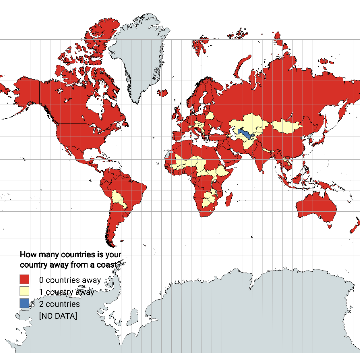
Distance from Coastline by Country Map
The "Distance from Coastline by Country Map" visually represents how far each country is from the nearest coastline. Thi...
👁 74📅 8/27/2025
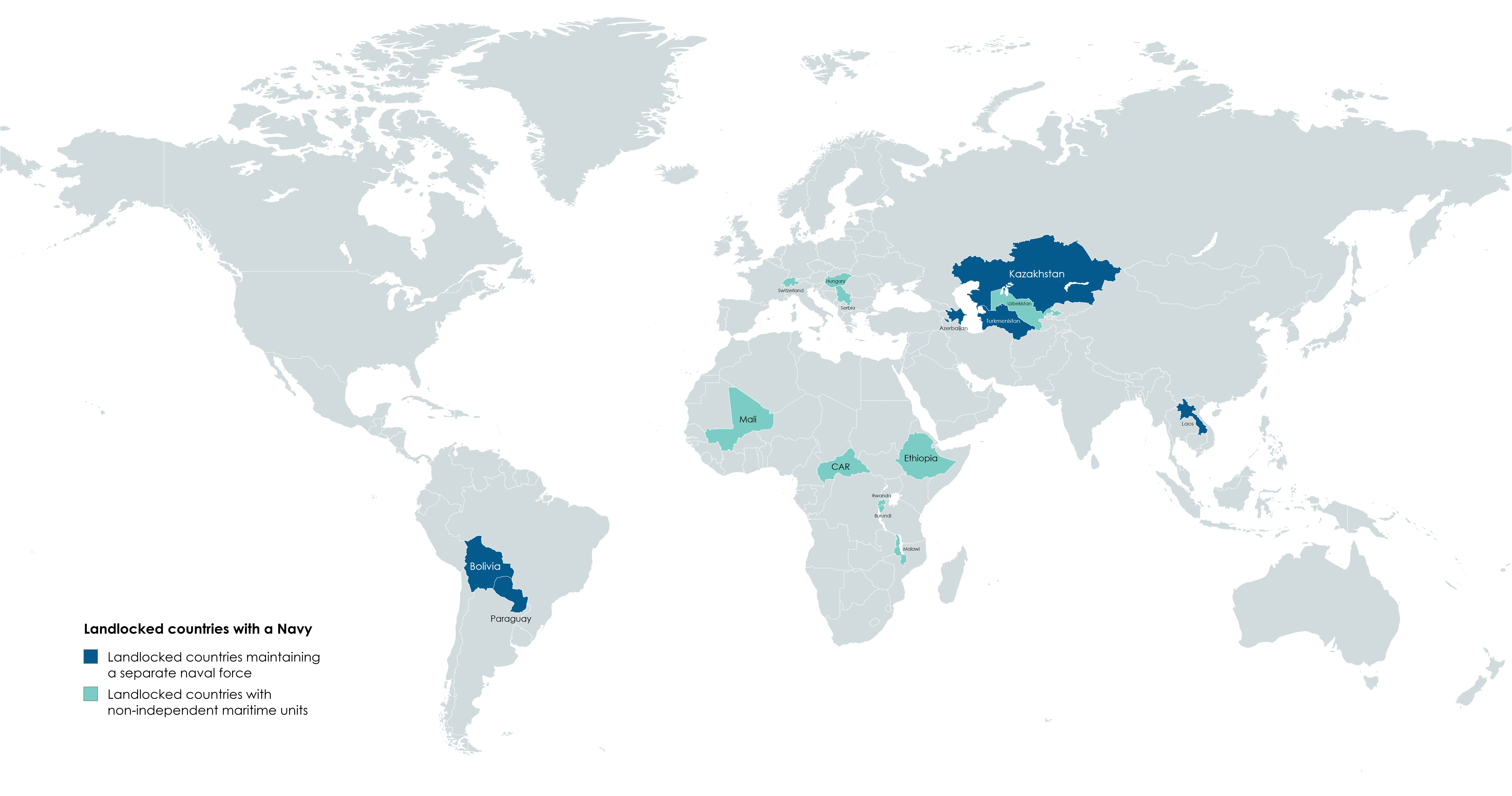
Landlocked Countries with a Navy Map
The "Landlocked Countries with a Navy Map" provides a unique perspective on a seemingly contradictory concept: nations w...
👁 98📅 9/6/2025
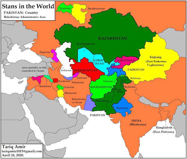
Uzbekistan Surrounded by Stans Map
This map illustrates an intriguing geographical fact: Uzbekistan is the only country in the world entirely surrounded by...
👁 78📅 9/2/2025
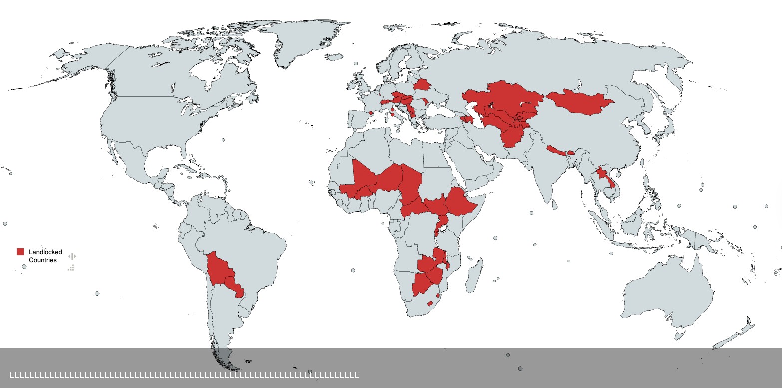
Map of All Landlocked Countries in the World
The visualization titled "All Landlocked Countries in the World" provides a clear representation of nations that do not ...
👁 122📅 8/5/2025
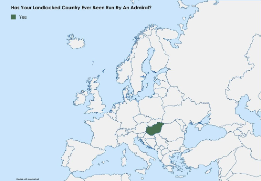
Map of Landlocked Countries Led by Admirals
This map visualizes an intriguing political intersection: the landlocked nations that have been led by admirals. While i...
👁 20📅 10/2/2025